Feb 082020


First published in: The Times Click here to view a map for this walk in a new window
picture picture picture picture picture picture picture picture picture picture picture picture picture
Facebook Link:

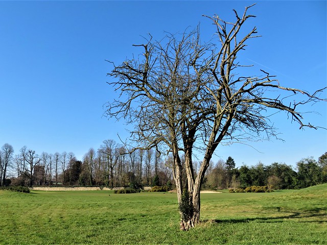
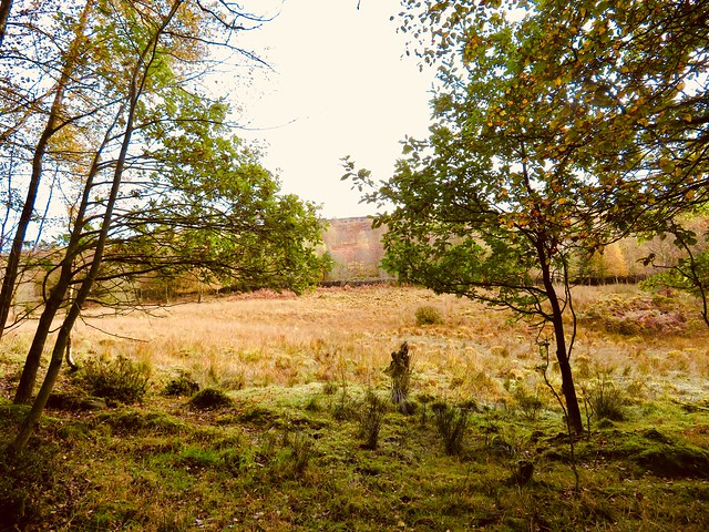
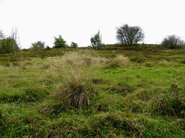
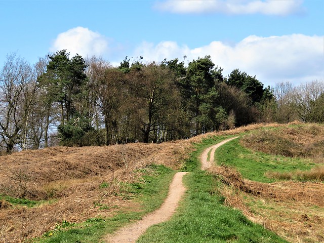
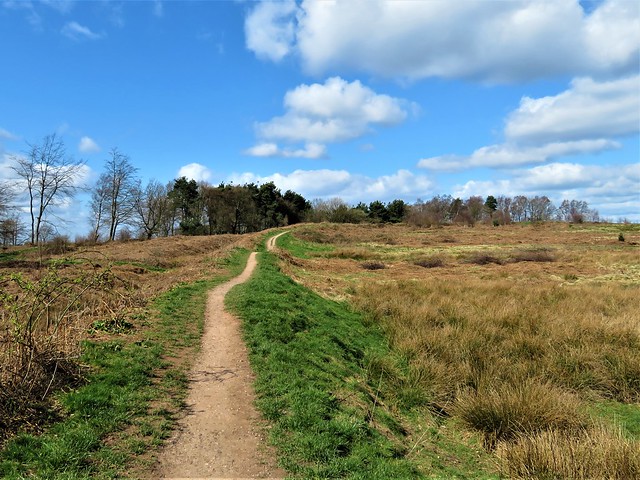
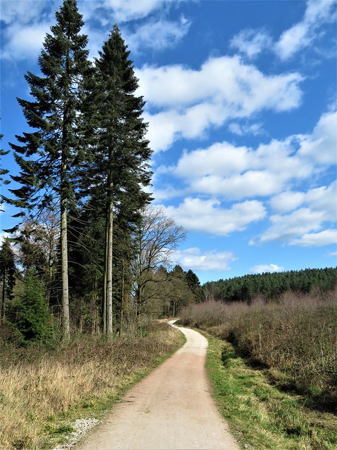
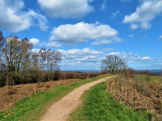
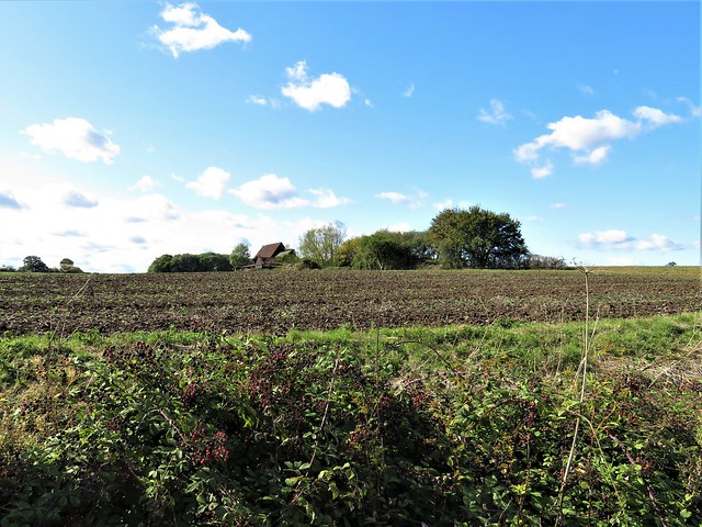
A cold blue morning over South Buckinghamshire, the train rattling away from Denham station, and the path across Bucks Golf Course frosted between its wooden fences. Clever landscaping of fairways and bunkers made the surroundings look like an undulating grassland, through which the golfers trundled their carts obediently from lie to lie.

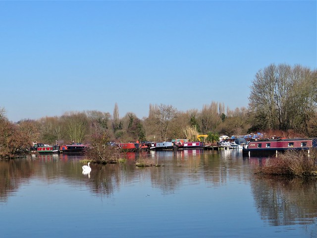
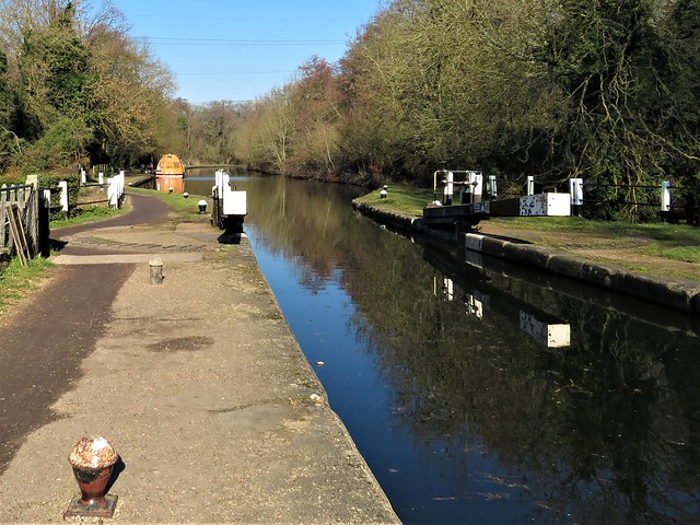
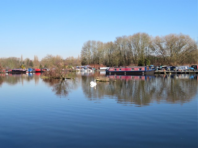
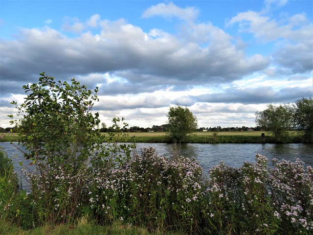
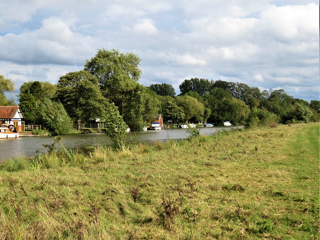
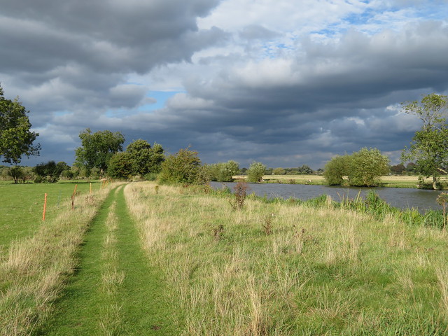
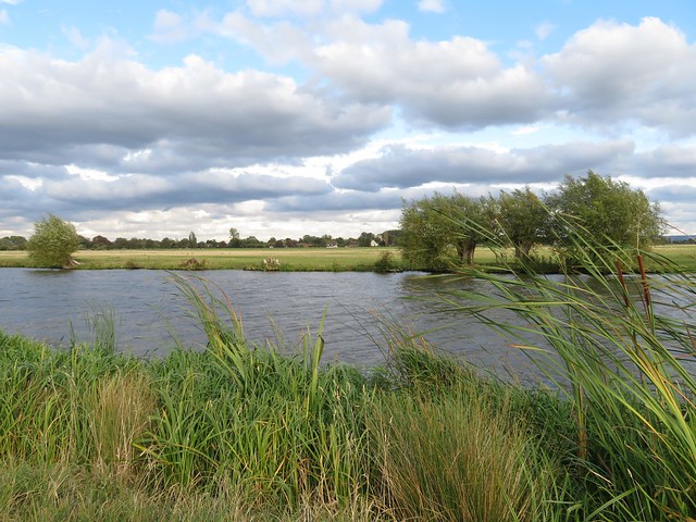
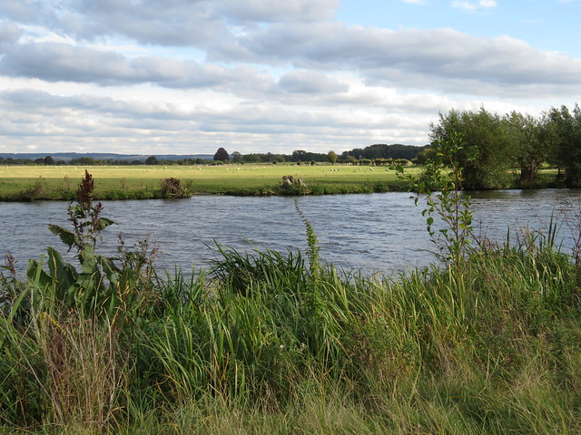
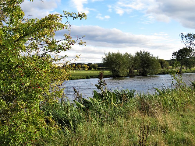
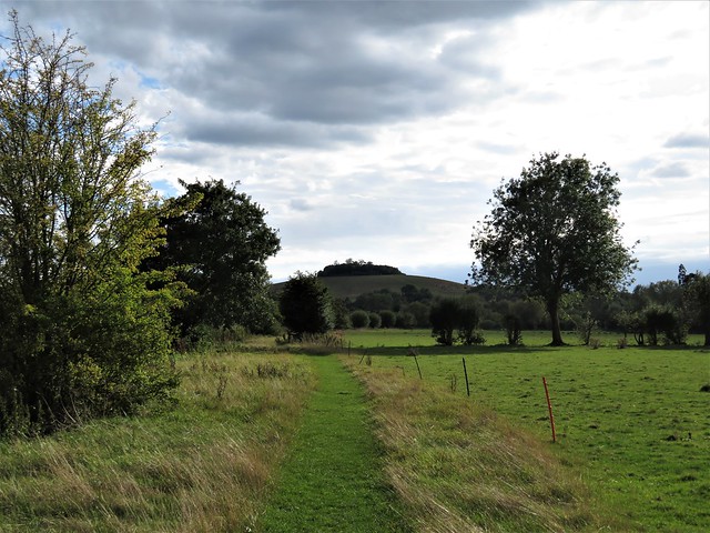
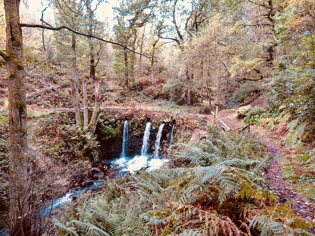
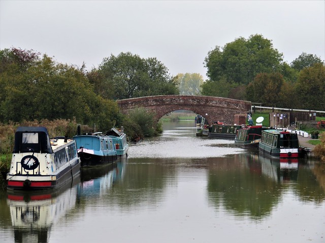
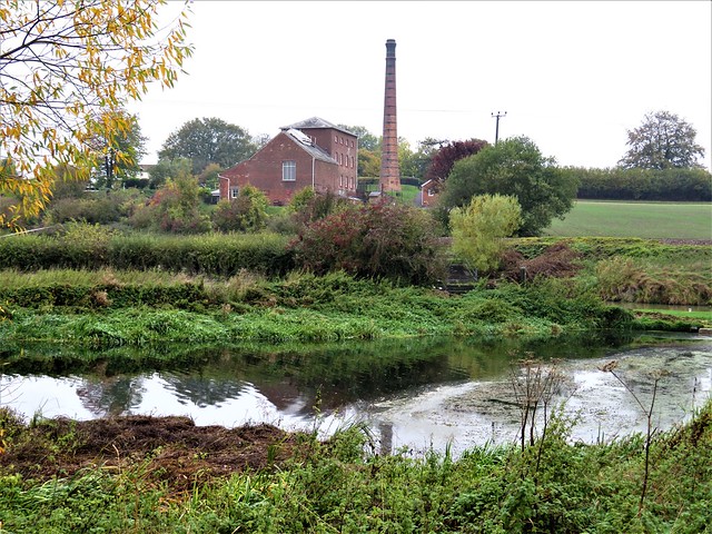
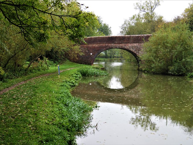
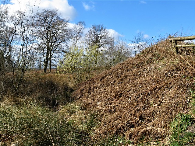
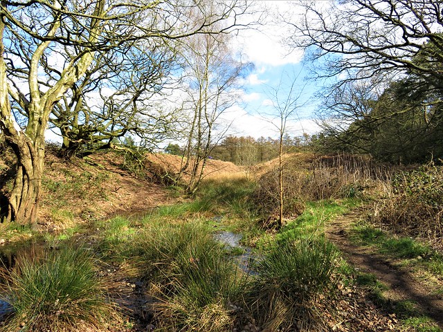
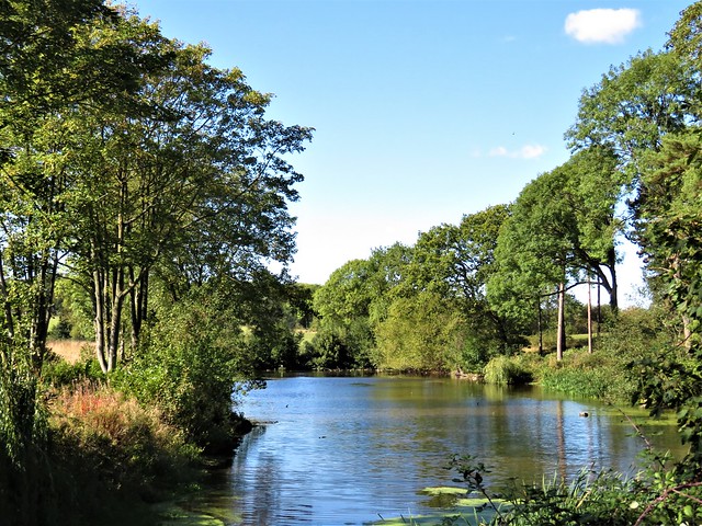
Beyond the clubhouse lay the tangle of rivers and canal that forms the backbone of the Colne Valley Country Park. We crossed the River Colne and headed north from Denham Lock up the broad, quiet waterway of the Grand Union Canal.

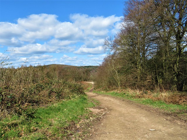
Walkers, runners, gongoozlers and strollers lapped up the winter sunshine like thirsty camels at an oasis well. ‘So lucky, aren’t we?’ was the greeting of the Hillingdon Heath Walkers who were stumping along thirty strong and very cheerful.

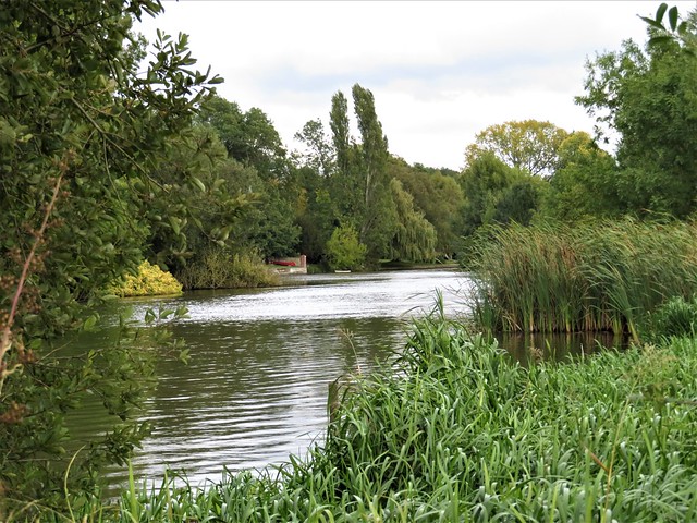
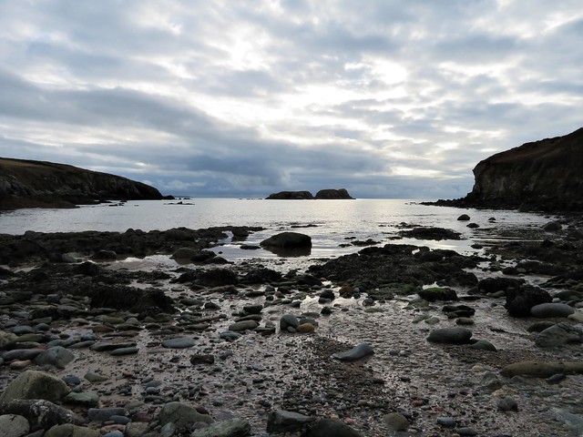
Moorhens flew across the canal, patting the dark water into sparkles with their long green toes. A swan came in from the flooded gravel pits alongside, skimming low, as white and dramatic as a Sunderland flying boat, with great clapping beats as its wingtips smacked the surface of the canal.

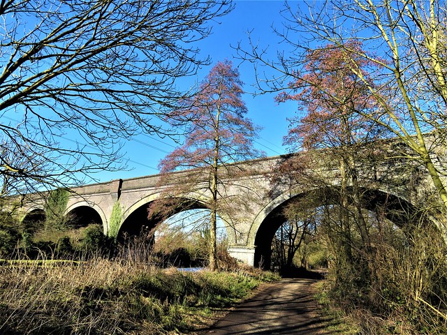
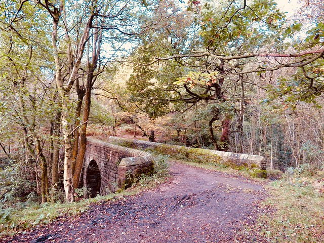
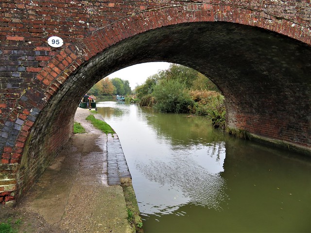
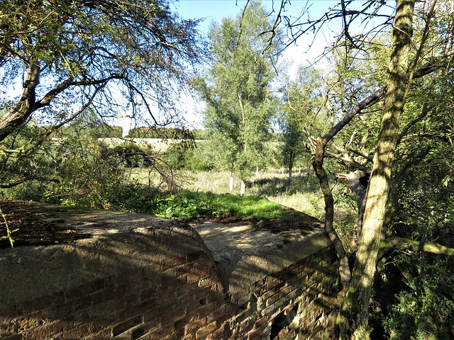
We passed below the flattened skew arches of Denham railway viaduct, a workaday structure, yet beautifully patterned by its Victorian designers, light brick contrasting with dark, a lip of raised beading emphasising the graceful shape of each arch.

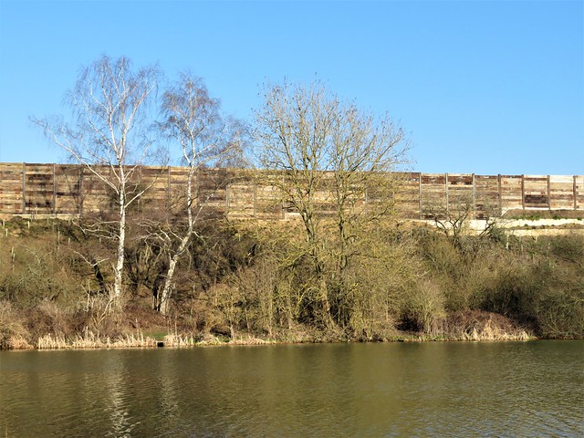
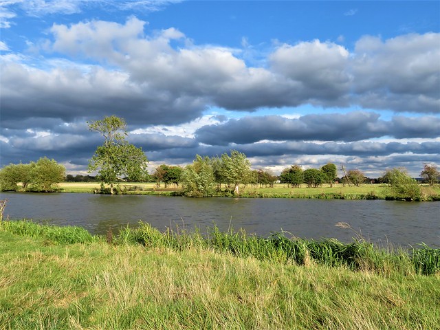
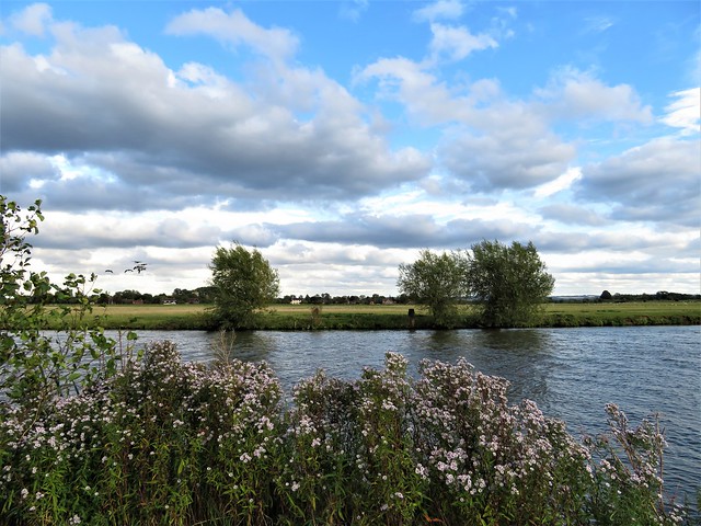
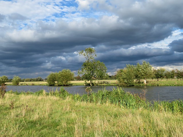
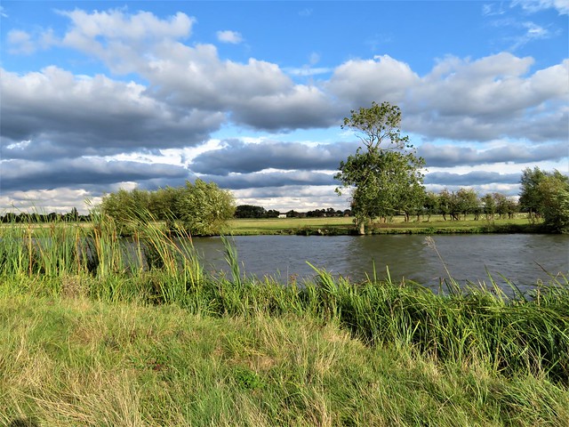
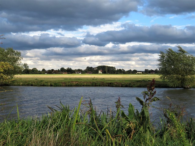
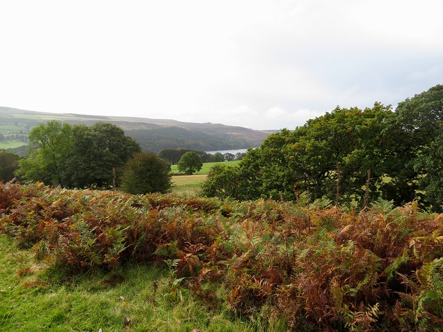
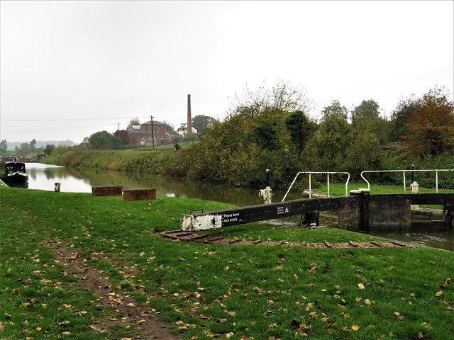
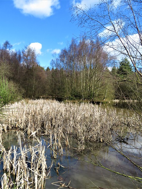
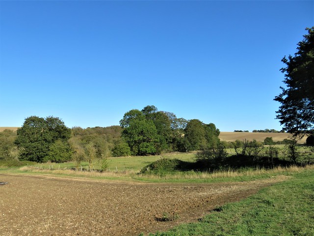
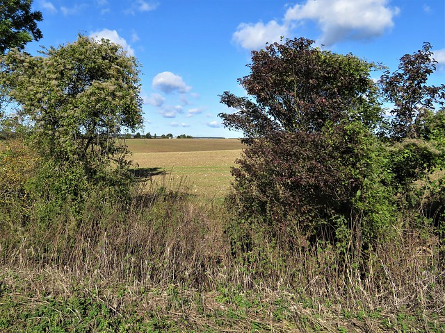
Up at Widenwater Lock we crossed the Grand Union and set back along a parallel path beside gravel-pit lakes where a pair of great crested grebes flirted beak to beak, shaking their heads at each other in a dream of courtship still a couple of months off.

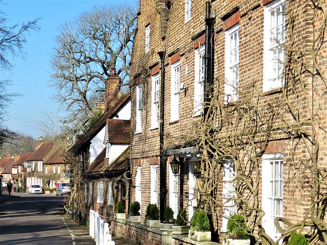
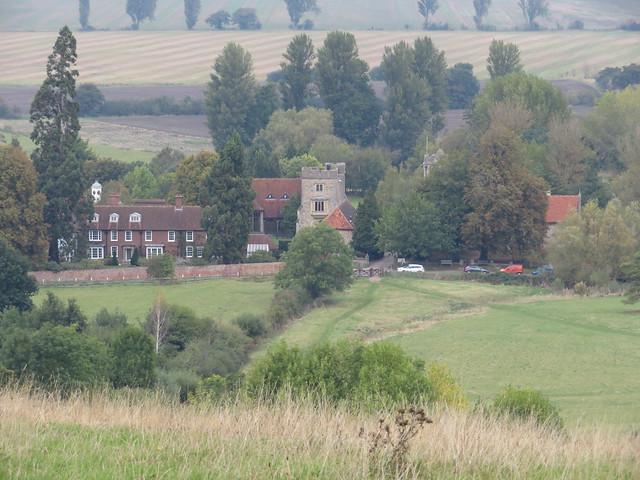
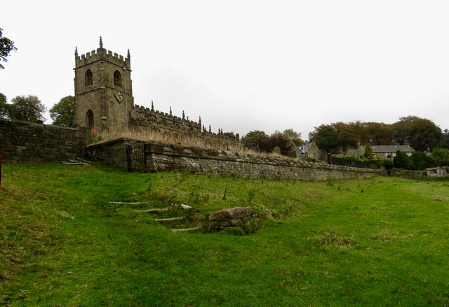
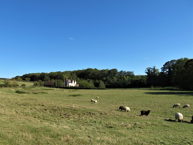
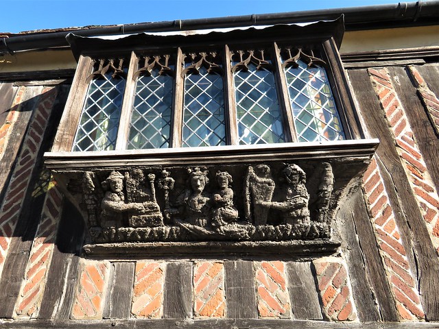
Back at Denham Lock we followed a grassy path towards Denham village. A couple of dogs dug enthusiastically for treasure in the bed of the shallow River Misbourne. In the village street, every prospect pleased. Curly Dutch gables, mellow brick walls, red pantiles, immaculate gardens – it was as though the judges for ‘Prettiest Village In Buckinghamshire’ were due at any moment.

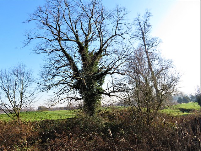
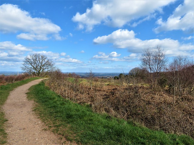
We followed the narrow lane intriguingly named The Pyghtle back to Denham Station. Green snowdrop spears were already pushing up along the verges, and under the flaky bark of sycamores a secret world slept the winter away – tiny beetles, immovable flies, and silk purses of spider eggs in waiting.

Start: Denham station, UB9 5ES (OS ref TQ 042877) or Colne Valley Country Park, UB9 5PG (048864)

Getting there: Rail to Denham. Road: Colne Valley/Denham Country Park is signed from A40, Jct 1.

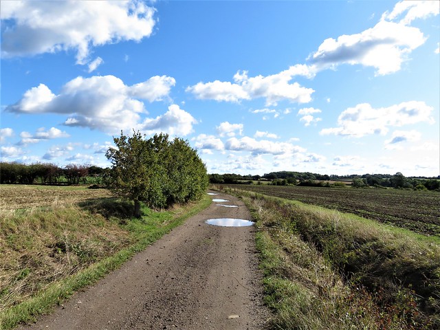
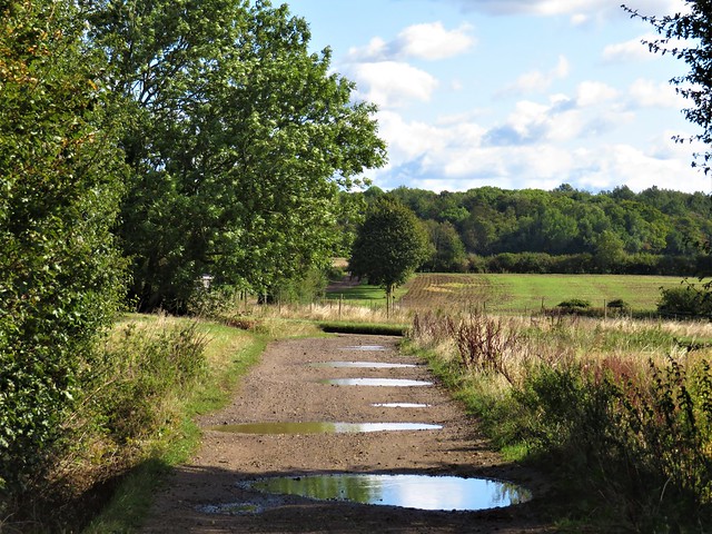
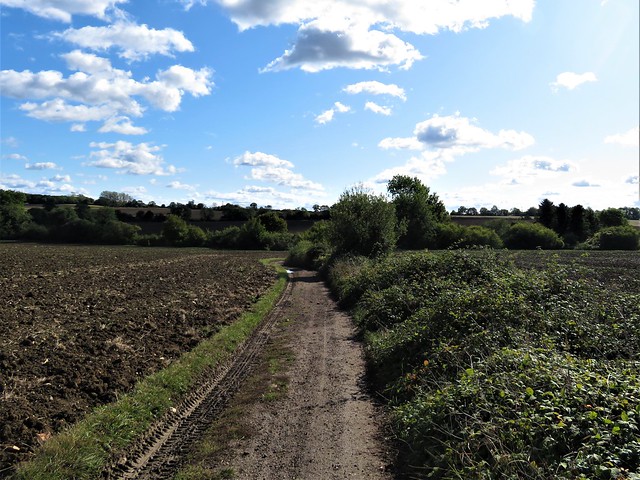
Walk (7 miles, easy, OS Explorer 172): Down steps by station ticket office; right through tunnel; in 100m ahead through kissing gate. Follow fenced path across golf course. Opposite church, left (045870) to club house (050868). Right down drive; through gates; left (049860, ‘Grand Union Canal’ fingerpost). In 400m cross footbridge (052862); left up canal for 1½ miles to Widenwater Lock (050887). Right across bridge; in 250m, right (051888, ‘Colne Valley Trail’/CVT, ‘London Loop’/LL), In 20m ignore barrier/path to right; ahead to turn right along CVT. In ¼ mile, right along road (054884); in 50m don’t fork left along LL, but follow road/CVT to right. In just over a mile, right across canal (053867); retrace steps to golf club drive near gates (049864). Ahead (‘Circular Walk’ fingerpost) past Colne Valley Country Park visitor centre, following ‘Denham Village’ and ‘South Bucks Way’ to road (043869). Right through Denham; at left bend, right (040871) along The Pyghtle to station.

Lunch/Accommodation: Falcon Inn, Denham UB9 5BE (01895-832125, falcondenham.com)

Info: Colne Valley Country Park (01895-833375, colnevalleypark.org.uk); satmap.com; ramblers.org.uk

 Posted by at 02:16
Feb 012020


First published in: The Times Click here to view a map for this walk in a new window
picture picture picture picture picture picture picture picture picture picture picture picture picture picture picture picture picture picture picture picture
Facebook Link:

A cold Oxfordshire day under a billowing sky. St Birinus looked pinched and chilly in his niche in the chapel wall at Dorchester-on-Thames. The folds of his carved stone face seemed full of disapproval as we passed him on our way down to the river.

It was Birinus, a missionary from Rome, who ducked King Cynegils of Wessex in the River Thames nearby in token of baptism in 634 AD. This act paid dividends; the newly christened king gave his baptist land on which to found a bishopric, a vast one that eventually stretched from Thames to Humber.

Beyond the neat houses and gardens of Dorchester we crossed the Dyke Hills, a curious Iron Age earthwork that raises a double seam across the fields. It was built to defend a settlement established by the river here long before the Romans came to Britain.

From Little Wittenham we climbed the short, steep path up the face of the Sinodun Hills, a double bulge of tree-topped chalk known locally as Wittenham Clumps. They draw the eye for many miles in the flat Thames-side country. On Round Hill a handy topograph picked out landmarks far and near, from the long ridge of the Chiltern Hills to Dorchester’s abbey church, the chimneys of Didcot power station, a glimpse of dreaming spires in far-off Oxford, and nearer at hand the tower and red brick frontage of Little Wittingham’s manor house below.

Among its many excellent ecological ventures, the locally based Earth Trust has established a wild flower sward on the Wittenham Clumps, and a network of permitted footpaths all round the area. We followed the paths across the hill fort ramparts on Castle Hill, then down towards Long Wittenham and the Thames through Earth Trust meadows and woodland.

The walk wheeled slowly around the fixed hub of Wittenham Clumps, away to our right across the fields. Paul Nash painted these hills again and again between the wars, trying to catch the movement of the crowning trees in the wind, the moods and changing colours of the chalk and turf.

‘A beautiful legendary country haunted by old gods long forgotten,’ was the artist’s perception of this understated but captivating corner of the Thames, and that’s as good an encapsulation as any.

Start: Bridge End car park, Dorchester-on-Thames OX10 7JT (OS ref 579940)

Getting there: Car park is signed off Henley Road by bridge at south end of town (off A4074, Wallingford-Oxford)

Walk (9 miles, easy, OS Explorer 170): Ahead past chapel; south down Wittenham Lane to Thames (578932). Right; in ¾ mile, left across 3 bridges (568935); opposite Little Wittenham church, left (566934, gate). Up hill path ahead to summit of Round Hill (566928). Around clump; on to summit of Castle Hill (569926). From poem stone on far side, descend grass path through ditch. In 150m, left (572926, gate) across valley. In 250m fork right (570928) through trees. In 250m at T-junction, left (570930); downhill to Little Wittenham. Left along road; in ¼ mile, right (564931, ‘Long Wittenham’). In 250m, left through gate; follow permitted path parallel to road for 1 mile to road in Long Wittenham (551940). Right by thatched house (‘No Through Road’). In ⅔ mile at Northfield Farm entrance (555949), left along green lane to Thames (553958). Right. In 2 miles, left across weir/Day’s Lock (568936). Half left on fenced path; cross Dyke Hills (572937); on to Dorchester.

Lunch/Accommodation: White Hart, High St, Dorchester OX10 7HN (01865-340074, white-hart-hotel-dorchester.co.uk)

Info: Wallingford TIC (01491-826972)

Earth Trust: earthtrust.org.uk; satmap.com; ramblers.org.uk

 Posted by at 02:13
Jan 252020


First published in: The Times Click here to view a map for this walk in a new window
picture picture picture picture picture picture picture picture picture picture picture picture picture picture picture picture
Facebook Link:

A still cold day in South Yorkshire, with a crack of blue over the western moors. From the graveyard of St Nicholas Church at High Bradfield we looked across the cleft of Dale Dike, up pasture slopes squared with black gritstone field walls.

Sheep cropped the churchyard grass and lay on the old inscribed gravestones that flagged the path. High on a bank stood a tall stone commemorating the deaths of James and Elizabeth Trickett and their four children on 12 March 1864. The Tricketts died, along with some 270 others, when the Dale Dike dam just up the valley burst in the middle of the night and released a roaring tsunami higher than the tallest mill building.

Gold tear-shaped leaves of silver birch lay underfoot as we followed a steep path downhill to Agden Reservoir. In the 19th century the city of Sheffield, a few miles down the dale, swelled like a frog in a fable as its steel and cutlery production rocketed. The population had quadrupled by mid-century, when a string of reservoirs was built in Bradfield Dale to cater for over 200,000 thirsty souls.

Today Agden Reservoir lay as flat and gleaming as Sheffield stainless steel, picture-pretty with hills and trees mirrored in the still water. We passed the sphagnum tuffets of Agden Bog, crossed the head of the reservoir and dropped down the fields to where Dale Dike Reservoir curved southwest among its trees.

The great sloping wall of the dam was flanked by a gracefully curved spillway, down whose steps white water came dancing. We followed a path, seamed with sinewy roots of ash and oak, along the north bank, until it turned across a footbridge at the head of the reservoir.

The homeward path ran along the southern slopes through pastures with tumbledown walls of dark gritstone. Looking down on Annet Bridge, we pictured the scene on that awful winter’s night when 700 million gallons of water came thundering through the dale.

Survivor Joseph Ibbotson of Bradfield reported: ‘It seemed as if … some unheard-of monster were rushing down the valley, lashing the hillsides with his scaly folds, crunching up buildings between his jaws, and filling all the air with his wrathful hiss. Trees snapped like pistols, mills and houses stood and staggered for a moment, and then disappeared in the boiling torrent.’

Start: Sands car park, Low Bradfield, near Sheffield S6 6LB (OS ref SK 262920)

Getting there: Bus 61, 62 from Sheffield
Road: Low Bradfield is signed off B6077 Loxley Road (A61, A6101 from Sheffield)

Walk (7¼ miles, field paths, OS Explorer OL1): From car park entrance, right along walled lane. At footbridge follow ‘High Bradfield’, keeping stream on right. At 2nd bridge, cross stream (262921); up steps, across road (264923, gate); on up (‘Sheffield Country Walk’/SCW). Through wicket gate (yellow arrow/YA); fork right on path, up to High Bradfield church (267926).

At church tower, left (west) on path with wall on right. In 200m, left downhill (265926) with wall on left to Smallfield Lane (262925). Right; in 350m, left (262928, ‘Permissive Path’/PP, ‘Run Routes’) along north bank of Agden Reservoir. In 1 mile at bench and bird feeders (250929), ahead on path (‘Windy Bank Wood’) to road at Wilkin Hill (249928). Right to Mortimer Road (245927). Left for 80m; left (‘bridleway’) down to Dale Road (247920). Right; in 100m, left (‘footpath’) on path. In 350m near dam, fork right (244919, PP); in 100m through 2 kissing gates by dam. Follow path along north bank of Dale Dike Reservoir for 1 mile.

At top of reservoir, left across footbridge (234906); left beside stream. In 150m fork right across wall stile (PP, green arrow); left along wall (SCW, stone stiles), then through plantation, for ¾ mile to Blindside Lane (244912). Left; in ¾ mile, just before Annet Bridge, right (255918, wall stile, SCW) on field path to Mill Lee Road (263916); left into Low Bradfield).

Lunch: Plough Inn, Low Bradfield (0114-285-1280, theploughinnlowbradfield.co.uk); Schoolrooms Café, Low Bradfield (0114-285-1920, theschoolrooms.co.uk)

Accommodation: Royal Hotel, Dungworth, Sheffield S6 6HF (0114-286-1213, royalhotel-dungworth.com)

Info: welcometosheffield.co.uk; satmap.com; ramblers.org.uk

 Posted by at 03:58
Jan 182020


First published in: The Times Click here to view a map for this walk in a new window
picture picture picture picture picture picture picture picture picture picture picture picture
Facebook Link:

A perfect Somerset winter’s day of sharp blue sky. Sunlight gilded the roofs of Rowberrow, nowadays a quiet little village, but in times past a rough mining centre where men dug calamine for the brass-making industry. Martha More, visiting in 1790, judged the locals ‘savage and depraved, brutal and ferocious.’

The long shape of Blackdown, highest point of Mendip, looms on the southern skyline. Today its slopes were trickling with water. With a hollow gushing a stream tumbled into the chilly depths of Read’s Cavern, one of dozens of water-burrowed caves in Mendip’s limestone massif. When Read’s was excavated in the 1920s, a set of Iron Age slave manacles was unearthed, their story untold but ripe for imagining.

A broad track rises up the flank of Blackdown. We climbed through fox-brown bracken where cattle grazed and thirty-five semi-wild ponies snorted and cantered away in a bunch. From the ridge the view was enormous, from the Quantock Hills and Exmoor down in the southwest to the steely grey Bristol Channel with its twin islands, pudding-shaped Steep Holm and sleeping-dog Flat Holm.

Along the foot of Blackdown the muddy Limestone Link footpath took us sliding and squelching past Burrington Combe. Wild goats were grazing the grey striped cliffs of the gorge, their white coats contrasting with the scarlet berries of cotoneaster.

On the slopes opposite the combe the Reverend Dr Thomas Sedgwick Whalley, rich through a ‘good marriage’ in mid-Georgian times, developed a humble cottage into the Italianate extravaganza of Mendip Lodge, a massive country house with a state bedroom, mile-long terraces and a verandah nearly a hundred feet wide.

Mendip Lodge, like the good doctor’s wealth, eventually fell into decline. All we found of the grand design was a huddle of ruins behind an archway in Mendip Lodge Woods, beside the winding path that was once a fine carriage drive.

High above on the limestone upland of Dolebury Warren the sloping ramparts of a massive Iron Age hill fort encircle the western end of the ridge. Here we sat to catch our breath and gaze across the channel to the far-off hills of Wales.
Start: Swan Inn, Rowberrow, Winscombe, Somerset BS25 1QL (OS ref ST451583)
Parking: please ask, and give pub your custom.

Getting there: Rowberrow is signed off A38 between Churchill and Winscombe

Walk (8 miles, easy, OS Explorer 141): Left down School Lane. Just after right bend, left down track (453583); in 300m at T-junction, right (454586). In ¾ mile, right (465586, ‘Bridleway, Ride’, waymark post); in 100m, left on path through bracken. In 250m detour left to Read’s Cavern (468584). Resume bracken path, uphill to ‘Rowberrow Warren’ sign (469581); left through gate; right uphill. In 200m fork left (469579), upwards for ¾ mile to track on Blackdown ridge (477573); left to Beacon Batch trig pillar (485573). Left downhill to foot of slope; left (490577, waymark post, Limestone Link /LL) for 1¼ miles. On open ground 350m after crossing West Twin Brook, at crossing of broad grassy tracks, right downhill (473583). In 700m, near Link hamlet, left (475590, fingerpost) on path through Mendip Lodge Wood. In ⅔ mile pass Mendip Lodge ruin (466591); in 150m, left up bridleway. Pass gate/’Dolebury Warren’ sign on right; in 100m right (gate, blue arrow, ‘National Trust’) across Dolebury Warren (LL) for 1¼ miles, down to T-junction by Walnut House (446591). Left (LL) for ¾ mile; right (454586) to Rowberrow.

Conditions: Can be very muddy.

Lunch: Swan Inn, Rowberrow (01934-852371, butcombe.com)

Accommodation: Woodborough Inn, Winscombe BS25 HD (01934-844167, woodborough-inn.co.uk)

Info: mendiphillsaonb.org.uk; satmap.com; ramblers.org.uk

 Posted by at 03:00
Jan 112020


First published in: The Times Click here to view a map for this walk in a new window
picture picture picture picture picture picture picture picture picture picture picture
Facebook Link:

From a viewpoint high above Lulworth Cove we got a Jurassic Coast geology lesson in a million. To the east lay the almost-perfect circle of the cove, where the sea has broken through the hard Portland limestone and is busy nibbling away the soft chalk at the back of the bay. To the west, Stair Hole opened at our feet, the sea sloshing through rock arches to devour the clay of the cliffs and expose strata of limestone fantastically folded and contorted by subterranean convulsions hundreds of millions of years ago.

We climbed away up the stone-paved coast path to the crest of Hambury Tout and another remarkable view, west along a Dorset coast of sheer white cliffs, walls of chalk and freestone sculpted by wind, weather, frost and the sea. Beyond these the Isle of Portland lay skirted by rainstorms, a grey wedge sloping south to a jumble of white tide races off the narrow snout of Portland Bill.

The next ‘big reveal’ stayed concealed until we were almost on top of it – the great rock arch of Durdle Door, tall enough to sail a ship through. The good old Dorset word ‘durdle’ has its origin in Old English: the arch is a door that the sea has ‘thirled’ or pierced out of the Purbeck stone of the cliff.

Just to the west, the promontory of Bat’s Head is being durdled, too, the nascent arch of Bat’s Hole showing as a tiny blob of pale luminescence where the rainy light shone through.

Down in Scratchy Bottom we turned inland up a green chalk cleft. Under a twisted old elder we sat to have our picnic in a spattering shower. A solitary walker traversed the ridge across the valley beneath a slate grey sky on which a brilliant double rainbow slowly shaped itself.

Up on the ridge we followed a puddled track east, then dropped down among the thatched roofs and pale stone cottages of West Lulworth. A trudge across the hill, a steep descent on slippery steps, and we were crunching round the pebbly curve of Lulworth Cove between the wave-burrowed cliffs and the circle of sea eternally reaching for them.

Start: Lulworth Cove car park, near Wareham, BH20 5RQ (OS ref SY 820801). £8 fee for 4-6 hours.

Getting there: Bus X54 (Weymouth-Poole)
Road: Lulworth Cove is signed from A352 (Wareham-Dorchester) at Wool.

Walk (8 miles, strenuous, OS Explorer OL15): Coast Path (CP) west, passing Durdle Door (806803). In another ¼ mile, opposite ‘Scratchy Bottom’ sign, right through gate (802804); follow fence on left; in 750m, through gate, then another (806809). Half left up field; left at top (809811) through gate. Follow path for ⅔ mile; right on bridleway (800811) for ¾ mile to Daggers Gate (811814). Cross road; follow track past West Down Farm (820815); in 400m, right (824816, yellow arrow/YA) on path to West Lulworth. Left at road (825807); left at bus shelter; opposite Castle Inn, right along School Lane (827808). In 100m, right (arrow) up paddock to upper path; right for 400m to T-junction (824805). Dog left/right (‘Coast Path’); fork right (‘Lulworth Cove’); follow path east above Lulworth Cove. On far side, right (828801, ‘Fossil Forest’) down steep steps to cove; right along shore to car park.

Conditions: Lulworth Cove shore path walkable except at very high tide (tidetimes.org.uk). Some steep steps.

Lunch/accommodation: Castle Inn, West Lulworth BH20 5RN (01929-400311, castleinn-lulworth.co.uk) – cosy, characterful village inn.

Info: Lulworth Visitor Centre (01929-400587, lulworth.com);
Tide times: https://www.tideschart.com/United-Kingdom/England/Dorset/Lulworth-Cove/
satmap.com; ramblers.org.uk

 Posted by at 03:31
Dec 212019


First published in: The Times Click here to view a map for this walk in a new window
picture picture picture picture picture picture picture picture picture picture picture picture
Facebook Link:

The village of Longtown straggles out a mile along its back country road in a quiet corner of western Herefordshire. On this murky morning the Norman castle on its modest mound seemed the most upstanding feature of the Olchon Valley. The great rampart of the Black Mountains, walling in the valley on west, stood all but invisible in thick grey mist.

We walked the round of the circular keep, under the projecting chute of Lord Gilbert de Lacy’s own private garderobe, and on down through the stubby curtain wall. It was hard to credit that the battered and much-quarried little ruin once dominated all this valley and its commerce by road or river.

Strolling out of Longtown and down the pastures towards the winding Olchon Brook, the mountainous scene came gradually into focus ahead. From the river bank the green fields sloped up past Cayo Farm to where they abruptly steepened into the bracken-brown mountainside.

A grassy trod, one of a whole skein of paths criss-crossing these Welsh Border hills, slanted up the slope and deposited us at the top onto the broad saddle of Hatterrall Ridge. Suddenly the view opened for miles westward, down into the long cleft of the Vale of Ewyas, over and across into the wild central massif of the Black Mountains. The great arches and monastery ruins of Llanthony Priory lay screened by trees and the slope of the lane, but we could see the old packhorse track to the abbey falling away into Ewyas as a hillside thread.

Offa, late 8th-century King of Mercia, ordered a mighty earthen wall and dyke or ditch to be built along the borders to keep the warlike Welsh in their place. Here along the high lookout of Hatterrall Ridge run the remnants of Offa’s Dyke. We followed it north with tremendous views on all sides, present-day lords of all we surveyed.

All too soon our homeward path appeared, a steep track sloping down the mountainside into the Olchon Valley and its sheep pastures once more. A familiar landmark beckoned us back across the fields to Longtown – the stumpy castle keep, still standing sentinel over valley, road and river.

Start: Longtown Castle, Longtown, near Abergavenny HR2 0LE (OS ref SO 321292)

Getting there: Longtown is signed off A465 (Abergavenny-Brecon).

Walk (5¾ miles, some steep ascents, OS Explorer OL13): From castle, right along road. Opposite Outdoor Learning Centre, right (322290). Path down to cross stile; down field to road (320288). Through gate, left of ford (‘permissive path’); in 50m, right across brook; left up field to Cayo Farm (317285). Through farmyard; on up 4 fields (fence on right), then bear left to stile (310280) and green lane.

At top of rise cross green track (309279, yellow arrow/YA); bear left along green track, sloping uphill for ½ mile. Near top, path forks; go right uphill to Offa’s Dyke Path (308270). Right along ridge following ODP. In 900m pass trig pillar (305279); in another 600m pass cairn (300283); in 250m, at second cairn at cross-paths, right (299285). Path soon bears left and slants downhill. In 200m ignore green track hairpin to right (300288); in another 350m, hairpin right at cross-tracks (300291). Follow path, keeping same line, downhill for 500m to cross stream at corner of fence (303287). Right downhill to track; left to road (304289); right.

Pass Great Turnant farm (306288). In 300m, at Lower Turnant, right along gravel driveway (308291, fingerpost). Follow white arrows to left, then through gate. Down field to cross holloway at bottom left corner (310292, gates, YA). On down field; through gate by pond (312293); across field, through right-hand of 2 gates (314293). In 100m, left (gate, stone stile); down to cross footbridge (315293). Across fields (gates, stiles), heading for Longtown Castle.

Lunch/Accommodation: Crown Inn, Longtown HR2 0LT (01873-860217, crowninnlongtown.co.uk

Info: Hay-on-Wye TIC (01497-820144); visitengland.com/herefordshire; satmap.com; ramblers.org.uk

 Posted by at 02:36
Dec 072019


First published in: The Times Click here to view a map for this walk in a new window
picture picture picture picture picture picture picture picture picture picture picture
Facebook Link:

It was cool and misty across the Wiltshire downs. I hung over the twin bridges at Great Bedwyn, first watching the train rattle away towards Newbury, then admiring the slender curves of the Kennet & Avon Canal.

The lacy stonework of the church tower rose among autumn trees – crimson, gold, lemon yellow, scarlet. Beyond the bridge lay narrowboats with cosily smoking chimneys, a wintering community of water gypsies that looked almost as settled as the village itself.

The towpath of the Kennet & Avon led south. The canal lay as still as a pond, its grey-brown water disturbed only by the gentle pat and ripple of falling willow leaves. A milky sheen glinted on chalky fields newly sown with spring wheat. Beside Lock 61 a tremendous grunting came from a pig palace of straw bales, where a massive ginger sow luxuriated in the mud.

The tall chimney of Crofton pumping station loomed ahead, softened by mist. Built in 1812 to pump water to the adjacent summit ponds of the Kennet & Avon, nowadays its preserved Boulton & Watt steam engine, a mighty monster, is the oldest working beam engine in the world.

Here I turned aside along the canal reservoir of Wilton Water, a rushy lake winding under willows. A young heron, disturbed at my approach, took off from its fishing stance and flapped away like an animated umbrella.

Above the brick-and-timber village of Wilton, larks sang over Dodsdown. The path led across a rain-pearled beet field into the neighbouring woods of Wilton Brail and Bedwyn Brail, deer parks in the long ago. An eerie half-light lingered among the enormous storm-shattered carcases of fallen beech trees. Long tailed tits passed in a twittering flock. Sweet chestnut husks littered the path, neatly split into quarters and robbed of their contents by squirrels.

At the summit of Bedwyn Brail I sat on a bench looking across the golden woods. Just southward along the ridge lay the earthworks of a grand mansion planned, but never completed, by Edward Seymour, Duke of Somerset and lord of Wolf Hall. At one time Seymour flew high as Lord Protector to his nephew, young Edward VI. But his flight ended in 1552, crashing Icarus-like to earth at the execution block.

When the foundations of Bedwyn Brail house were excavated a few years ago, the brick-built water system installed in 1549 by the royal Sergeant Plumber was found to be still working perfectly.

Start: Bedwyn railway station, Great Bedwyn, SN8 3PB (OS ref SU 280645)

Getting there: Train to Great Bedwyn; bus 22 (Marlborough-Hungerford)
Road – Great Bedwyn is signed from Froxfield on A4 east of Hungerford (M4, Jct 14).

Walk (6½ miles, easy, OS Explorer 157): South for 1¾ miles along Kennet & Avon Canal towpath. Opposite Crofton Lock pumping station, left (262623, ‘Wilton Windmill’); footpath to road in Wilton (267616). Left past Swan Inn (‘Great Bedwyn’); opposite Tidcombe turning, left (270617), ‘Crofton’ fingerpost). In 100m, right; follow yellow arrows into Wilton Brail wood (271622) and on. In ¾ mile cross road (278627); on into Bedwyn Brail wood. At benches on ridge (284625), left and follow ‘Great Bedwyn’ and ‘footpath’ for nearly 1 mile to north edge of wood (283638). Cross field to far right corner (281641, yellow arrows); right down path to road (281649); left to station.

Lunch: Three Tuns, Great Bedwyn (01672-870289; tunsfreehouse.com); Swan Inn, Wilton SN8 3SS (01672-870274, theswanwilton.com)

Accommodation: Pelican Inn, Bath Road, Froxfield, Marlborough SN8 3JY (01488-682479, pelicaninn.co.uk)

Info: Marlborough TIC (01672-512487); visitwiltshire.co.uk
Crofton Beam Engine opening and steam days: croftonbeamengines.org; satmap.com; ramblers.org.uk

 Posted by at 02:45
Nov 232019


First published in: The Times Click here to view a map for this walk in a new window
picture picture picture picture picture picture picture picture picture picture picture picture picture
Facebook Link:

Just when the Cornovi tribe built the polyhedral stronghold of Castle Ring is a matter of conjecture. Certainly it was with primitive hand tools and massed labour, long before the Romans arrived in Britain. Walking the ramparts on this bright cold morning at the southern edge of Cannock Chase, we looked out over the sunlit Staffordshire plain to crumpled hills rising far in the northeast.

The Heart of England Way trails north from Castle Ring through the depths of Cannock Chase, ‘green lung’ and recreational woodland for the cheek-by-jowl old manufacturing towns of the Black Country. None of that was even a twinkle in an industrialist’s eye when the Bishops of Lichfield and Coventry held this area as a hunting forest for their great palace at Beaudesert, the ‘beautiful wilderness’.

The wilderness looked well regulated today. Cyclists pedalled, dog walkers sauntered. The rasp of saws and rattle of mechanical grabs sounded from Stonepit Green, where piles of logs just harvested gave off a tarry, resinous whiff. Soon we’d turned aside, deeper into the forest, where the long lake of Horsepasture Pools lay ruffled by the wind.

The sun struck down through the trees, a touch of wintry warmth for the cheeks, the strong low light silvering the trunks of beech and birch and turning the dangling seed cones on the larch boughs to rows of golden lanterns. Long-tailed tits and siskins skipped in company among the cones, twittering with excitement over their treetop feasting.

A rutted track led away from Horsepasture, over Startley Hill and on west along Marquis’s Drive. After the Reformation the Paget family, Marquesses of Anglesey, replaced the Bishops of Lichfield as lords and masters of the forest, a role they sustained for 400 years until emptying coffers and the demands of the taxman drove them away.

We passed the silty streams and rushy ponds in the hollow of Seven Springs, and turned up a rubbly track over Rainbow Hill. The pebbles underfoot, as hard and cold as quartz, had been rounded and smoothed by some primordial flood through millennia of tumbling, something to conjure as we crunched this ancient stony carpet back to Castle Ring.

Start: Castle Ring car park, off Holly Hill Road, Cannock Wood WS15 4RN (OS ref SK 045126)

Getting there: Castle Ring is signposted from Cannock Wood (M6 Toll Jct T6; A5190, Burntwood).

Walk (6¼ miles, easy, OS Explorer 244): Circuit of Castle Ring hillfort, then Heart of England Way/HEW north. In ½ mile descend over crossing (040133); in 200m, at HEW/Two Saints Way marker post, bear right/east (040135) on forest road. In ¾ mile, bear left past Trout Lodge gates (050139); cross Horsepasture Pools; on for ¾ mile to road at Wandon (040146). From junction opposite (‘Rugeley’), fork left downhill (public bridleway, HEW). Follow HEW/Marquis Drive for 1 mile. Just before A460 at Moor’s Gorse, left off HEW past metal barrier (025151), up track. In 100m, right at 3-way split; in 100m, at 4-way split, follow 2nd on left, uphill/south through trees. In 1 mile pass golf clubhouse (027136); left along roadway; in 50m, right down drive. Cross road (029136). Pass barrier; left on path beside road, then follow forest road southeast for 1 mile, keeping ahead at all junctions, to HEW at Castle Ring (042128); right to car park.

Lunch: Park Gate Inn, Castle Ring WS15 4RN (01543-682742); friendly pub with bar snacks

Accommodation: The Lodge, B&B, 603 Littleworth Rd, Cannock WS12 1QQ (01543-428582, thelodgecannockchase.com)

Info: forestryengland.co.uk/cannockchase; satmap.com; ramblers.org.uk

 Posted by at 03:28
Nov 162019


First published in: The Times Click here to view a map for this walk in a new window
picture picture picture picture picture picture picture picture picture picture picture picture picture picture picture picture
Facebook Link:

Only the upperworks of St Davids Cathedral tower are visible as you enter the smallest city in Britain. First sight of the cathedral is so unexpected it takes your breath away. You step through the arch of Porth-y-Twr gatehouse, and there, filling a hollow far below, lies this magnificent and enormous church, with the ruin of a most spectacular 14th-century Bishop’s Palace just behind.

There’s hardly a sign of the modern world, just woods and fields beyond rising to knobbly, mountainous outcrops on the unseen coast. It’s a truly wondrous way to start this walk round one of the most spectacular sections of coastline in all of Wales.

Green lanes and country roads took us down to the southern corner of Whitesands Bay. On the far side of the tan-coloured strand the rocky promontory of St Davids Head ran a long finger westward into the sea. Wavelets creamed on the sands, and from a rock stack offshore came the querulous cries of a herring gull asserting its territorial rights.

The Pembrokeshire Coast Path leads along the coast at the very edge of green and purple cliffs whose dense sandstone has fractured into slanted faces as smooth as slate. The sea gasped hungrily at their feet, and from up ahead came the swish and thump of the tide race in Ramsey Sound.

Ramsey Island, long and low-slung with two humps of hill, lay square-on across a mile or so of very turbulent water. Sinews of tides pulled hard in opposite directions, whirlpools circled end to end, and a jabble of large waves rose north and south.

Ramsey is a RSPB reserve these days, but the old farmhouse where the Griffiths family once stuck out the tough island life still stands out against the green turf. From a tiny fingernail of beach at the southern end came a thin hooting. With binoculars we made out a little gathering of seal pups in white fur, nerving themselves for the short journey to the waves and their new lives as creatures of the sea.

Soon Ramsey Island was behind us. The path led in and out of tiny coves and beaches. We skirted the slit-like inlet of Porth Clais, and headed inland past the ancient chapel of St Non, mother of St David, with the last of the daylight transferring a silver sheen from the sea to the darkening sky above.

Start: St Davids Cathedral, Pembrokeshire SA62 6RD (OS ref SM 752254)

Getting there:
Bus 411 (Haverfordwest)
Road – A487 from Fishguard or Haverfordwest

Walk (10 miles, easy, lanes and cliff paths, OS Explorer OL35): From town centre follow Goat Street (‘St Justinian’s’). Bear left at ‘Merrivale’; on down Catherine Street. Opposite Ramsey Gardens, right (749252, blue arrow) down lane. In ½ mile at road, left (743252). In 200m, right (‘Ty Newydd Farm’). In 400m right at road (737250). In 500m, left at T-junction (736254, ‘St Justinian’). In 500m, right (731254, ‘Pencarnan’). At Pencarnan entrance, fork right (728258, ‘Public Path to Coast Path’). At coast, left on Pembrokeshire Coast Path/PCP for 6½ miles via St Justinian’s (724252). Porthlysgi Bay (731238) and Porth Clais (741242) to St Non’s Bay (750243). Inland off PCP at kissing gate (fingerpost) past St Non’s Chapel to road (752244); left for ¾ miles to St Davids.

Conditions: Coast path along unguarded cliffs

Lunch: Picnic; The Bishop’s Inn, Cross Square, St Davids SA62 6SL (01437-720422, thebish.co.uk)

Accommodation: 15 Tower Hill (Landmark Trust), St Davids SA62 6RD (01628-825920, landmarktrust.org.uk) – cosy cottage overlooking cathedral.

Information: St Davids Visitor Centre (01437-720392)

visitwales.com; satmap.com; ramblers.org.uk

 Posted by at 02:56
Nov 092019


First published in: The Times Click here to view a map for this walk in a new window
picture picture picture picture picture picture picture picture picture picture picture picture picture
Facebook Link:

A beautiful sunny morning in rural Essex, wintry but bright, with a blue sky mitigating the sharp northwest wind. There were puddles in the rough old road leading east from Newport Station, and a good solid crunch of flint underfoot.

South of the lane the big bowl of Chalk Farm Quarry has scooped away half a hill. Its roadways lay slick and glistening with the sheen of chalk compressed and polished by heavy tyres.

The lane ran as a holloway in a tunnel of goat willow and hawthorn. Hard green crab apples lined the ruts. The hedges were filled with brushy green heads of ivy berries, scarlet droplets of rosehips, and the plump pink fruits of spindle, about to burst to reveal their bright orange interiors.

Up in the open fields the feeling was a top-of-the-world one. The wind at our backs bowled dry beech leaves ahead of us along the track. Enormous fields of dark plough and tender green bean shoots stretched away to woods with intriguing names: Hop Wood, Cabbage Wood, Pig’s Parlour.

At Waldegrave’s Farm the barns were tight packed with the winter’s straw in neat square bales. At the farm fence three little spaniels did their best to give us a fierce send-off, their wagging tails belying every yap.

Down at Rook End we turned north beside the woods of Debden Park to reach the lonely church of St Mary the Virgin. The grand estate developed in Georgian times by well-to-do merchant Richard Chiswell is only a memory now, but St Mary’s retains a whiff of the family’s whims and wishes in the strange Moorish roof of the chancel and the exuberant monuments and stained glass armorial devices.

A snaking footpath runs the length of the Debden Water’s shallow valley, and we followed it back to Newport through coarse sheep pastures and whispery groves of poplar and willow.

I fell for the old trick pulled by sloes each autumn – look how plump and blue we are! How tasty we must be, don’t you think? Ugh! Nothing had changed. Still that old sensation of blotting paper and sour metal on the palate. Never mind – drowned in sugar and a Kilner jar of gin, they’ll sweeten my Christmas potations.

Start: Newport railway station, near Saffron Walden, Essex CB11 3PL (OS ref TL 522335)

Getting there: Rail to Newport. Bus 301 (Saffron Walden-Bishop’s Stortford).
Road: Newport is on B1383 (M11, Jct 9)

Walk (6½ miles, easy, OS Explorer 195): From Platform 1, right along Byway (‘Saffron Trail’). In 1 mile, ahead along road (536329); in 100m, right past Waldegrave’s Farm on track for 1 mile to road (550323). Left; just beyond Rook End cottage garden, left (552323) across field. Cross ditch; left up field edge. In ½ mile, path turns left through hedge (553332) across field to road. Left to Debden church (551332). From west end, path to kissing gate and on (‘Harcamlow Way’/HC). In 150m, right by stables (549333) to cross road at Newport Lodge (550340). On past Howe Barn. At corner of wood (547343), left along grass strip to pass Brick House Farm (545341, arrows). At road, right over stile (545339), following HC. In 600m fork left off HC (540339, yellow arrow) on path through meadows. In 1 mile at field corner, fork right (525342) into trees. Cross footbridge (524343); under railway (522343) to Newport High Street. Left to station.

Lunch: Picnic from Dorringtons Bakery, 24 High Street, Newport CB11 3PQ

Accommodation: The Cricketers, Clavering, Saffron Walden CB11 4QT (01799-550442, thecricketers.co.uk)

Info: Saffron Walden TIC (01799-524002); satmap.com; ramblers.org.uk

 Posted by at 02:30