Aug 032019


First published in: The Times Click here to view a map for this walk in a new window
picture picture picture picture picture picture picture picture picture picture
Facebook Link:

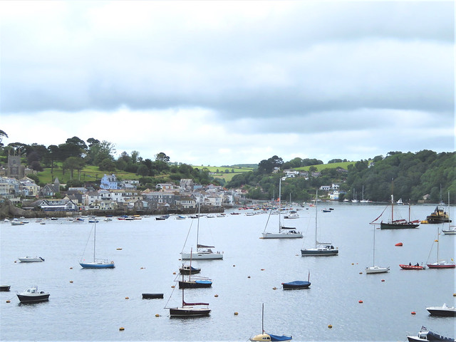
Polruan’s streets and houses fall steeply away to the narrow mouth of the Fowey estuary, mirroring the avalanche-like tumble of the grey and white houses of Fowey directly opposite. It’s an iconic Cornish prospect, and as we climbed the stepways and lanes of the village towards the cliff path we stopped often to look back and savour the view.

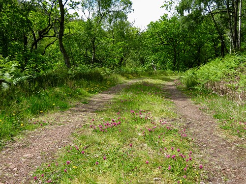
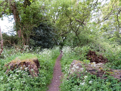
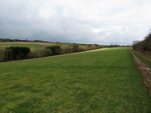
A young blackbird as yet uncertain of his flying powers squatted under a sprig of willowherb in Battery Lane, keeping stock still, hoping not to be noticed. We sidled round him and went on to where the village lanes gave way to a skein of narrow paths running east along the cliffs.

A kestrel streaked upriver, displaying its russet back and long slim tail. On the cliffs the wild grasses grew ungrazed, each seed-head darkened and weighted by the morning’s rain. A new shower came drifting through from the southwest in a flurry of milky air, lining every blade of grass with a row of pearls.

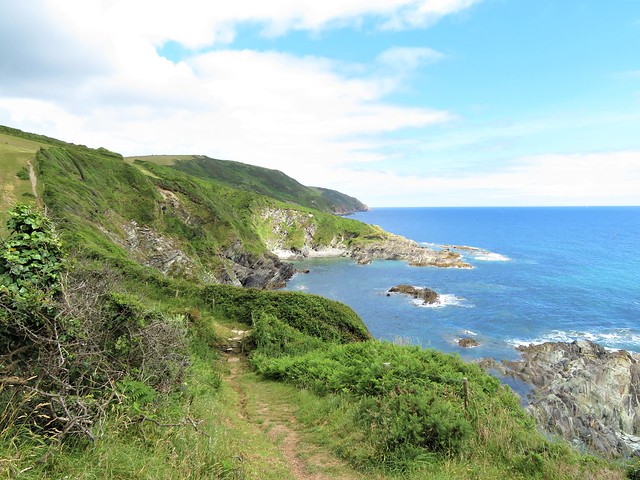
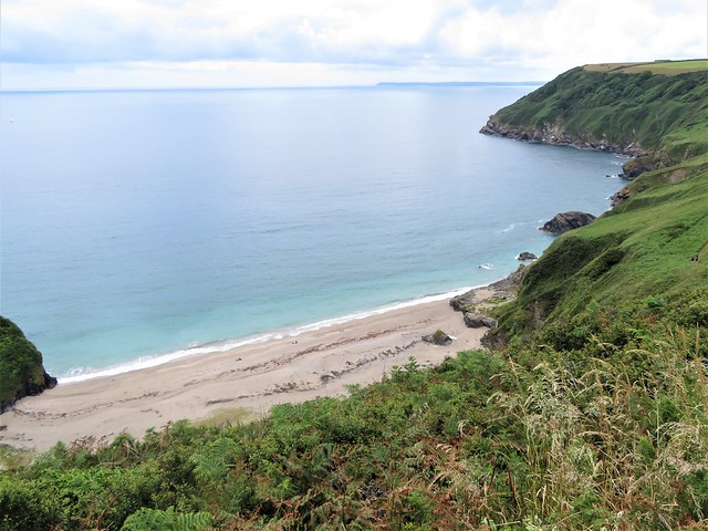
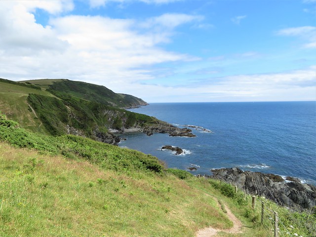
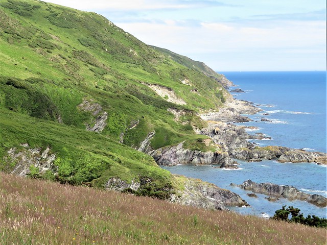
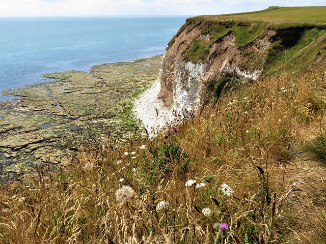
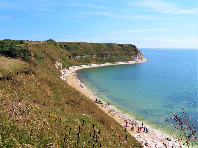
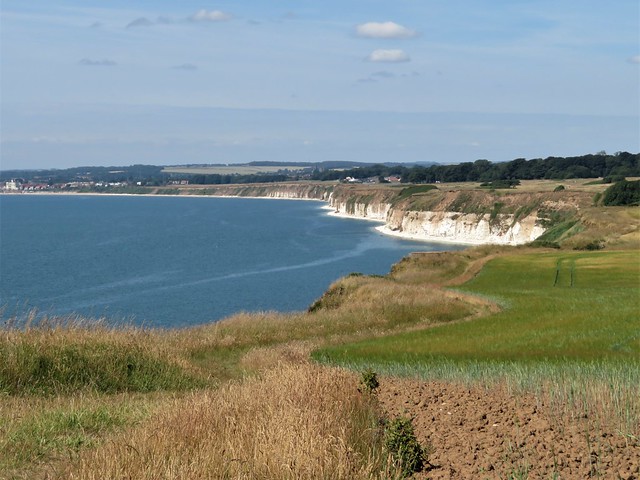
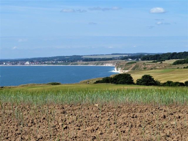
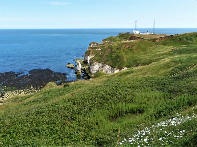
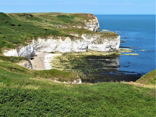
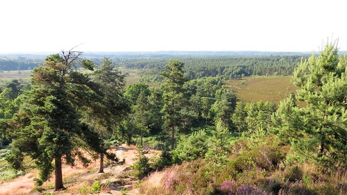
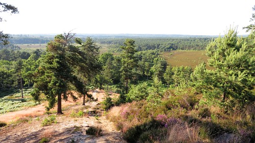
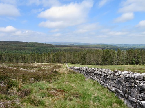
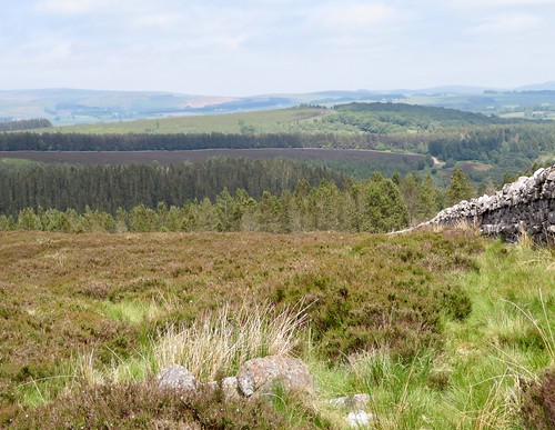
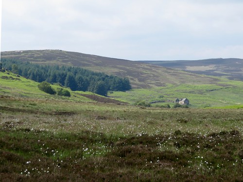
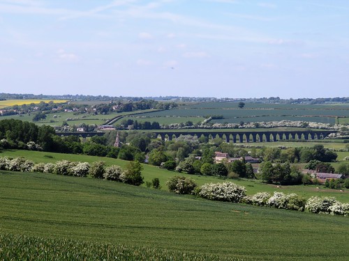
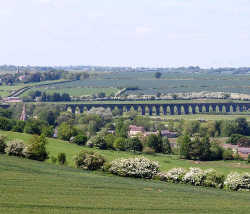
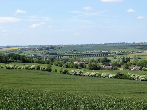
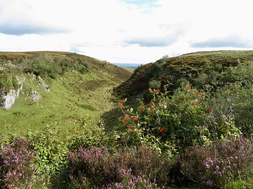
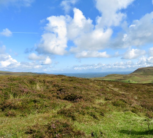
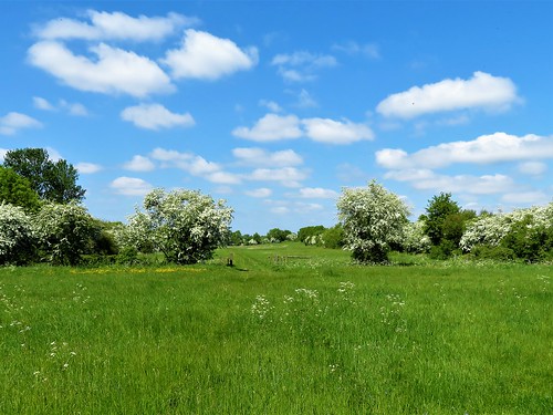
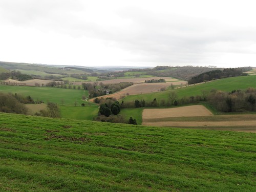
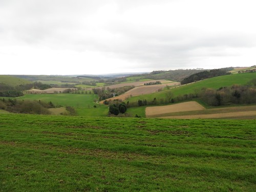
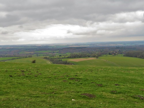
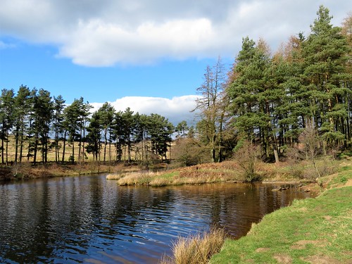
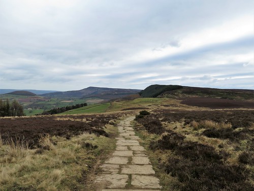
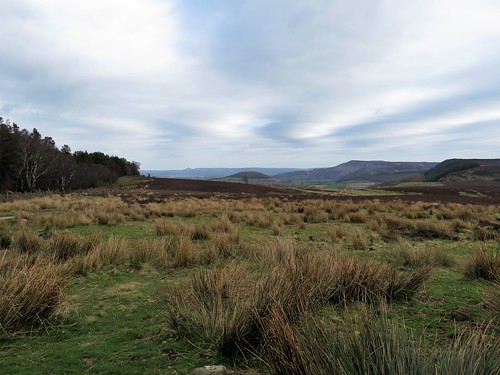
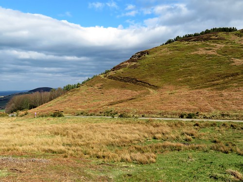
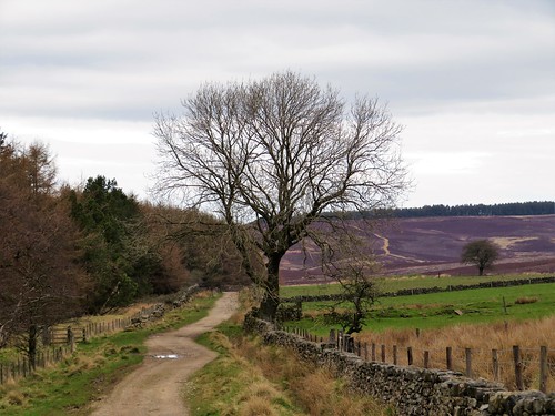
No matter how many times you walk these Cornish cliffs, the long views never fail to stun. Looking back into the west the bays curved away to the red and white striped tower on Gribbin Head, to the long dark arm of Dodman Point, and in the far distance a hint of the Lizard Peninsula. To the east the cliffs advanced seaward, lowering long grey arms of rock into lacy cuffs of white foam.

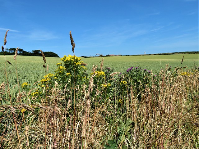
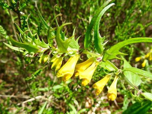
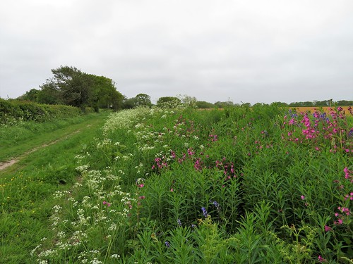
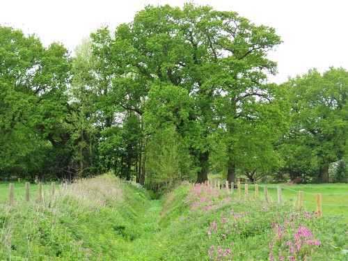
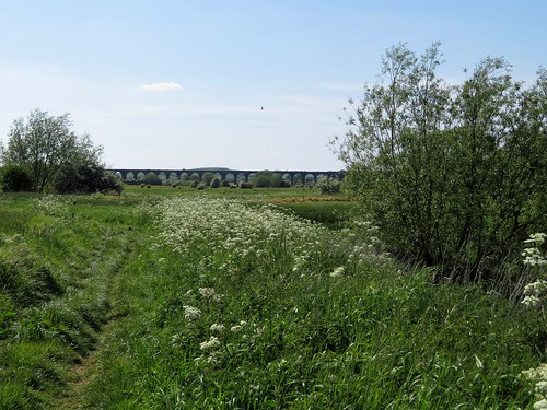
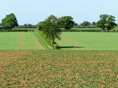
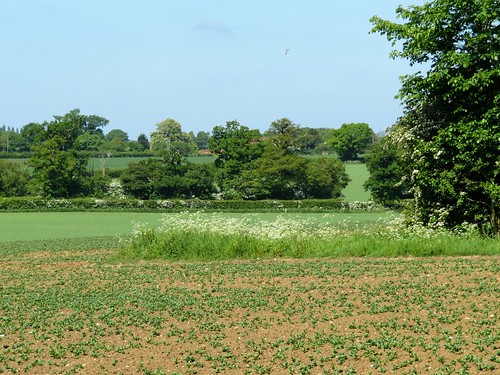
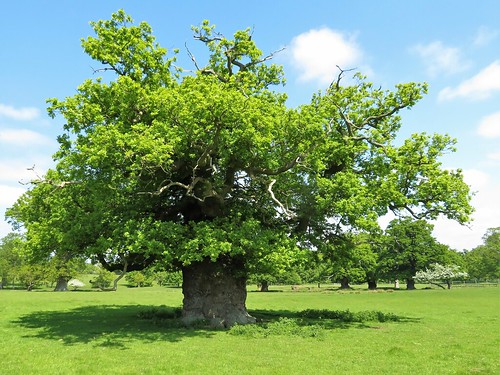
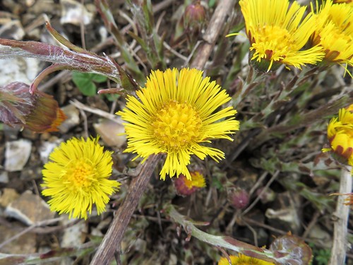
Every few steps we came to a halt, entranced by the wild flowers – yellow petals and crimson fruits of sweet amber, pale flax with a tiny brilliant blue stamen spot, buttery bird’s-foot trefoil, the soft pink of musk mallow’s large clustered flowers, the dusky pink bonnets of tuberous pea and little clumps of pungent-smelling wild thyme. Wrens chattered in the bracken, and stonechats with black caps and apricot chests perched on the highest sprigs of gorse they could find to give out their abrupt little calls: whist-tchik-tchik!

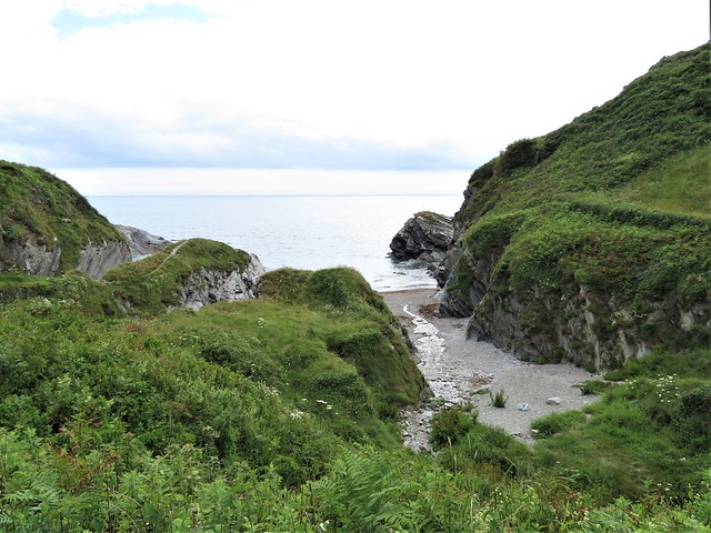
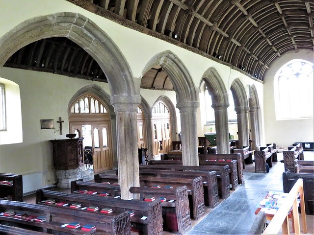
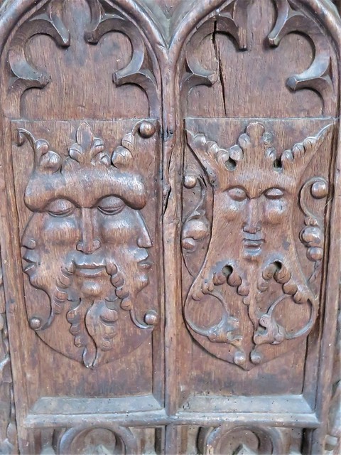
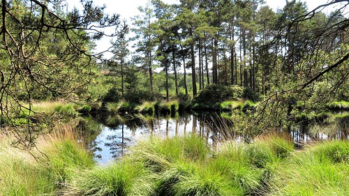
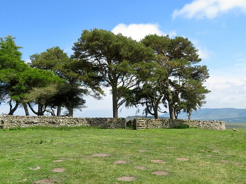
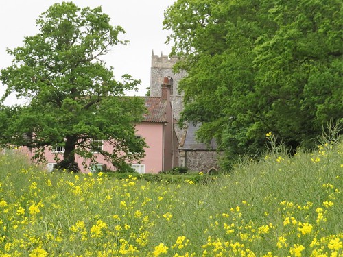
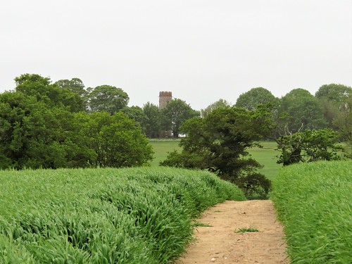
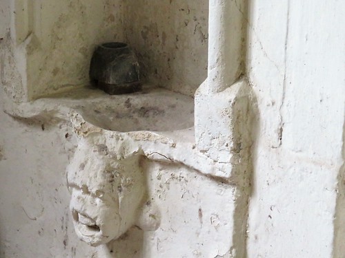
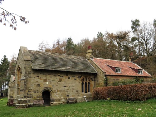
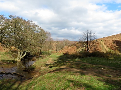
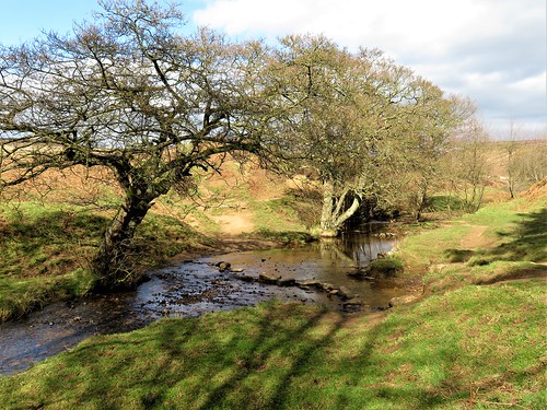
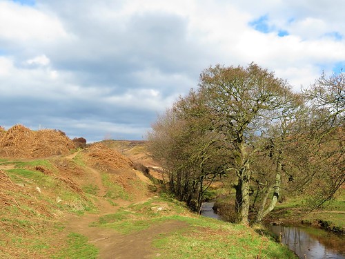
Beyond Sandheap Point we crossed a stream bouncing down the combe from Lansallos, and followed it uphill in a leafy dell to the church of St Ildierna, ‘of whom little is known’. Whomever he or she was, St Ildierna’s Church is as large as a rural cathedral, splendid both inside and out, and furnished with finely carved bench ends – a good place to linger after this lovely walk as you wait for the bus to Polruan.

Start: Polruan Quay, PL23 1PA (SX 126510) or Polruan main car park, St Saviours Hill PL23 1PZ

Getting there: Ferry from Fowey.
Polruan Bus from Looe (01726-870719, looe.org/polruanbus).
Road: Polruan is reached by minor road from A387 at Polperro, or B3359 at Pelynt or Lanreath.

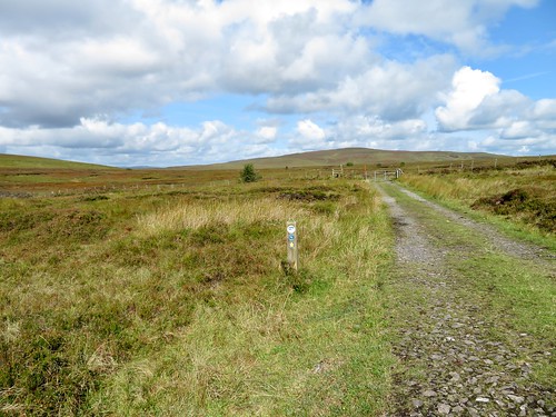
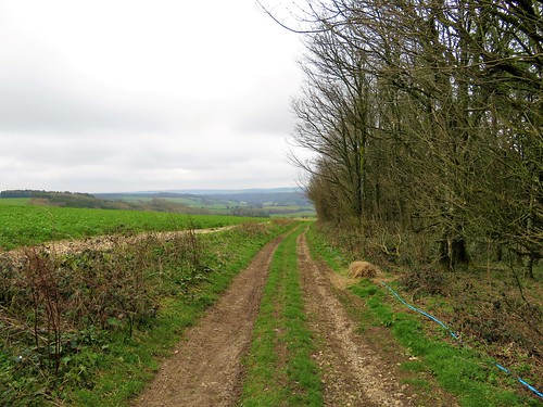
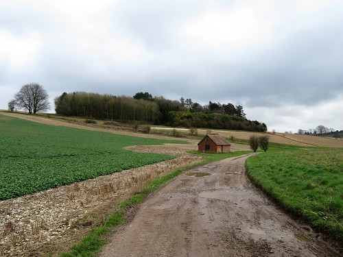
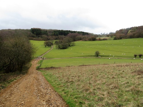
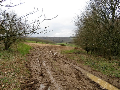
Walk (5 miles, strenuous, OS Explorer 107): From jetty, past Lugger Inn and climb Garrett Steps. Right at top. In 400m, left up Battery Lane (‘Coast Path’). Follow CP signs past main car park, coastguard lookout and Polruan Academy, to reach open cliffs at Furze Park (CP is poorly waymarked here – keep to lower path). Follow CP for 3½ miles. Beyond Sandheap Point, descend to cross stone stile, then stream from Lansallos at West Combe. In 50m, through next gate (pink arrow on reverse); left here (166513) up path. In 150m CP crosses (‘Polruan’, ‘Polperro’); but keep ahead through 2 gates, up woodland path (occasional yellow arrow) to Lansallos Church and bus stop (173516). Return by bus (see above), or taxi (07870-280114).

Lunch: Picnic

Accommodation: Hormond House, 55 Fore Street, Fowey PL23 1PH (01726-870853, hormondhouse.com)

Info: Fowey TIC (01726-833616); visitcornwall.com; satmap.com; ramblers.org.uk

 Posted by at 02:27
Jul 272019


First published in: The Times Click here to view a map for this walk in a new window
picture picture picture picture picture picture picture picture picture picture
Facebook Link:

Flamborough Head, a great chalk thumb poking out from the Yorkshire coast into the North Sea, is a windy and lonely place. The resident seabirds don’t mind; they swoop and wheel around the narrow cliff ledges of the headland, bringing food back to their precarious roosts and contributing a certain metallic fishy whiff to this walk.

St Oswald’s Church stands in the fishing village of Flamborough at the heart of the headland. It contains several memorials to fishermen and lifeboat men, and a wonderful carousel of paintings by local amateur artist Alfred Cracroft honouring the men and women of Flamborough whose work in services from the Home Guard and the WAAF to the Royal Observer Corps and nursing helped to win the Second World War.

Church Lane leads to a grassy path running to the southern cliffs of the headland. The view curved away south past Bridlington’s chalk cliffs and the fast-eroding East Yorkshire coastline to the faint double hummock of Spurn Head on the horizon.

We followed the cliff path past cornfields where skylarks spiralled and sang, through forests of grasses and thistles, with fishing boats cutting the glittering sea to our right. At South Landing the Flamborough lifeboat, a big orange rib, was away from its home shed for repairs. ‘Scraped its bottom rescuing a fellow stuck in a cave,’ explained the volunteer on duty.

Flamborough Head is a treacherous place, a magnet for swirling tides and cross currents that eat caves and arches out of the chalk cliffs. As we rounded the easterly nose of the headland a great shrieking and gibbering of seabirds, along with a fishy stench, arose from their favoured nesting cliffs on the north side.

It’s a staggering sight and sound, so many seabirds in one place. Cormorants and gulls occupied the lower rocks; sharp-billed guillemots and black-coated razorbills with smart white markings lined the middle ledges, and kittiwakes wheeled round the upper storeys of the cliffs with their incessant ‘ee-wake! ee-wake!’

Along at North Landing lay the cobles Prosperity and Summer Rose, fishing boats with pointed bows and stems, a designed unchanged for over 1,000 years. Just beyond we turned inland for Flamborough, blown by wind, burned by sun and with the echoing calls of the kittiwakes still in our ears.

Start: Two Brothers memorial, Tower Street, Flamborough, Nr Bridlington, N. Yorks YO15 1PD (OS ref TA 227706)

Getting there: Bus 14 from Bridlington
Road – Flamborough (B1255) is signposted from A165/A1038 in Bridlington.

Walk (9¼ miles, easy, OS Explorer 301): South down Tower Street to St Oswald’s Church (226702). Through churchyard to south gate; right along Church Lane; in 150m, round right bend. In 100m, left (226700) down Beacon Farm drive to cliffs (225693). Left, and follow cliff path/’Headland Way’ for 500m to South Landing (231693). At lighthouse sculpture 200m beyond (233693), fork right (‘Flamborough Head’, yellow arrow/YA) for 2½ miles to Flamborough Head. Pass in front of lighthouse (255706); pass green with benches; at cresset, follow path (YA) along cliff-tops. In 2½ miles pass Thornwick Bay café (232723); in another ½ mile, left on North Cliff (224726, fingerpost, YA) on path south for 1 mile to T-junction (226710). Left (‘Flamborough’) to road at Craikwell (227708); right to Two Brothers memorial.

Conditions: Several flights of uneven steps; unguarded cliff edges.

Lunch: Seabirds Inn, Tower Street, Flamborough (01262-850242, theseabirds.com)

Accommodation: Premier Inn, Albion Terrace, Bridlington YO15 2PJ (01262-411642; premierinn.com)

Info: Bridlington TIC (01482-391634); yorkshire.com; satmap.com; ramblers.org.uk

Yorkshire Coast Path by Andrew Vine (safehavenbooks.co.uk)

 Posted by at 01:01
Jul 132019


First published in: The Times Click here to view a map for this walk in a new window
picture picture picture picture picture picture
Facebook Link:

It’s rather amazing that Frensham Common has not sunk under the weight of its conservation titles. This thousand-acre sandy heath in south-west Surrey is a Special Protection Area, a Special Area for Conservation, a Site of Special Scientific Interest, an Area of Outstanding Natural Beauty. It’s full to the brim with butterflies, birds, insects and lizards. And it’s a beautiful place for a walk on a hot summer’s day.

Unbroken blue sky lay over the common. Our boots kicked up little puffs of sand as we followed a track over humps and through hollows. The sun brought rich resinous smells from the pine trees and scented the purple heather that ran in waves to the wooded horizon in all directions. There was the strange sensation of being enfolded by wild country in a Home Counties landscape.

The sandstone that underlies Frensham Common is a dark rock shot through with iron, rusted to burnt orange, warm to the touch today. We passed a pond tufted with tussocks of moor grass like pale green fright wigs. Dragonflies dodged across water as dark and still as oil. The aptly named Sandy Lane led west past a trickle of stream in the ford at Gray Walls, then out into open heath in a glassy shimmer of heat haze. No birds sang in the mid-afternoon sun. A solitary lizard ran across the path in a little flurry of sand, too quick for the eye to register.

At Frensham Great Pond the scene changed. This big pool, created in early medieval times to provide carp for the Bishop of Winchester’s table, is a great place to splash around on sandy beaches. Fishermen stalked the reeds. Kids sailed tiny boats. There was a cheerful atmosphere of holiday and outdoors fun.

The homeward path lay south of The Flashes ponds and heathland. A steep stony path led up to the summit of the Devil’s Jumps. These three ironstone hummocks were kicked up by Old Nick as he ran off with Mother Ludlam’s cauldron under his arm.

On the top we found the giant boulder that the great god Thor pitched at the Devil. Two young lovers were sitting on it, admiring the sunlit view and each other. We left them to it.

Start: Bel & The Dragon Inn, Jumps Road, Churt, Farnham, Surrey GU10 2 LD (OS ref SU 871393).

Getting there: Inn is at junction of Jumps Road and Hale House Lane, 2 miles east of Churt (A287 Hindhead-Farnham)

Walk (6½ miles, sandy tracks and paths, OS Explorer 133, 145): From Inn, left up Jumps Road. In 100m, right up fenced path. In 150m, ahead through woods. In another 150m, fork right uphill between trees to fork right at waymark post (870395, yellow arrow/YA) into valley. In 500m, fork left past gate (871400, YA) on wide permissive track. In 500m, through wire fence to cross ride (867402) with gate opposite. Left; immediately right across footbridge, follow fence on right (YAs).

In 400m, right through fence (864404, YA) up track to Sandy Lane (865405). Left; in 300m, over ford (862406); in another 100m fork right on tarmac. In 200m, ignore Byway on right (859407). At turning area by Lowicks houses, keep ahead (858407, blue arrow/BA) on sandy path west across Frensham Common for ½ mile to cross A287 (849410).

Pass barrier opposite and on. In 250m, fork left at post (847410, BA, ‘Surrey Hills Cycle’/SHC). Keep straight on for 500m to Frensham Common car park. Bear right to cross entrance road beside notice-board (844406). On among trees (SHC). In 450m descend steps; right (843402) along side of Frensham Great Pond. At road, left (841401, SHC); at Frensham Pond Hotel, fork left (841400) on Pond Lane (soon following path on left among trees, parallel with lane) for ½ mile to cross A287, 100m north of its junction with Pond Lane (849399).

Ahead (SHC, fingerpost) on track. In 300m, right at fork (852400, BA, SHC). In 150m, at 2-finger post, SHC continues ahead, but fork left downhill here on path, then road for 600m. Left (855394) up ‘Permissive Track’ on west edge of Churt Common, then along south edge of The Flashes. In ½ mile, wooden fence joins on right (865397); in another 300m, where fence turns sharp right, ahead over cross path and footbridge (868397). Ahead, then half right, steeply up to summit of easternmost Devil’s Jump (869395). Left down to junction (waymark post); right to return to inn.

Lunch/Accommodation: Bel & The Dragon Inn (01428-605799, belandthedragon-churt.co.uk) – stylish, comfortable stopover.

Info: Frensham Common – waverley.gov.uk
Guildford TIC 01483-444333; visitsurrey.com; satmap.com; ramblers.org.uk

 Posted by at 01:19
Jun 222019


First published in: The Times Click here to view a map for this walk in a new window
picture picture picture picture picture picture picture picture picture picture
Facebook Link:

The nuns of Holystone Priory must have been a tough and determined bunch, to have maintained their prayerful community through all the hard times, Border battles, reivers’ raids and lack of funds associated with the Northumbrian borderlands of the wild Middle Ages.

There is a faint whisper of their presence in the little 12th-century (but much restored) Church of St Mary, and a breath of their holy spirit on the still waters of Lady’s Well, just north of the hamlet of Holystone. Legend has St Ninian, stern pioneer of Christianity in these parts, baptising three thousand sinners in the well around 500 AD. Today the waters still dimple and run, and the brook below the well is lined with beautiful monkey flowers, gold with orange-spotted nether lips.

We followed a lane through forestry, looking for the red squirrels that inhabit these trees. Bog myrtle in the verges released a churchy incense smell as we crushed the leaves between finger and thumb.

A scramble of a path up through the pinewoods of Cat Law brought us out into the heather uplands of Daw’s Moss. Within the walls of a cross-shaped plantation stood the Pedlar’s Stone, mysteriously named and never explained.

At lonely Craig Farm in the valley below, the massively strong structure of a bastle formed part of the farm buildings. A bastle was a fortified farmhouse, its stone walls five feet thick. With the animals locked in the vaulted basement below, the ladder pulled up and the family barricaded behind tiny windows, a farmer living here four hundred years ago could hope to hold out against the reivers – buccaneers who made their own laws and rustled cattle as a day-to-day business.

From Craig Farm our way led east across trackless moor where curlews bubbled their melancholy warning cries. We passed the Five Kings, a line of rough and rugged standing stones (four in number – one’s now a gatepost elsewhere), and came down to Dueshill Farm.

The farmer went bouncing across the pastures on a quad painted up like a racing car. The sheep ran bleating towards the field gate, and an old hand of a sheepdog kept the whole show together, now bullying, now coaxing – a masterful display of crowd control.

Start: Forestry Commission car park, Holystone, near Rothbury NE65 7AX (OS ref NT 951026)

Getting there: Holystone is signed from B6341 between Elsdon and Thropton

Walk (7 miles, strenuous, OS Explorer OL16, OL42): Right along road. In ¾ mile, beside Forestry Commission ‘Holystone Common’ sign (941020), fork left past barrier along forest track. In 500m track curves left (purple arrow/PA) to cross Holystone Burn (934013). In 250m, hairpin back left up track (933012). In 200m pass PA post on left; in 100m, right (935011, unmarked) up bank, then rough path south through trees to stile and gate at top by MoD notice (935010). Ahead with wall on left for 500m to road at Pedlar’s Stone walled copse (934005).

Ahead down road to Craig Farm. At farm entrance, left (938999, fingerpost ‘Dueshill 2½’) over stile. Follow grassy track into valley, aiming for far right corner of field with conifer plantation beyond. Over gate (943995, waymark post/WP); in 100m right across Keenshaw Burn; in 100m recross (footbridge). Follow edge of plantation (WPs). In 400m leave corner of plantation (948995), bearing a little left away from fence on right for 700m over rough ground (faint track), aiming for right hand corner of plantation ahead.

At MoD notice at corner (954999), ahead, keeping close to fence and trees on left. In 200m, cross stile at angle of fence (956000, yellow arrow/YA). Keep same direction for 150m through wood, picking your way over fallen timber, to MoD notice at far side (957001, stile). Ahead, keeping uphill of Five Kings standing stones, to left corner of plantation wall (958002, YA). Half left to gate (959003, YA) and on. At WP bear half left and follow fence downhill, keeping it on your right, to left corner of plantation below (959006).

Through gate (YA); ahead (YAs) for 350m to join farm road (960009). Left to Dueshill Farm. At gates (960013), through gate, across dip, through next gate with shed ahead. Left; through field gate (YA); right up field edge. At top of plantation, right over stile (960016, YA); left down fence. In 100m at edge of trees, ahead for 700m, crossing 2 stiles (YAs) to road (958023). Left into Holystone.

Conditions: A tough walk, reasonably well waymarked on faint tracks. For experienced self-guiding ramblers, properly equipped and clad.

Refreshments: Picnic

Accommodation: Coquetvale Hotel, Station Road, Rothbury NE65 7QH (01669-622900, coquetvale.co.uk) – modernised former railway hotel
Info: visitnorthumberland.com; satmap.com; ramblers.org.uk

 Posted by at 07:50
Jun 152019


First published in: The Times Click here to view a map for this walk in a new window
picture picture picture picture picture picture picture picture
Facebook Link:

Met Office – hang your head in shame! Whatever happened to those balmy spring zephyrs and that blue sky you promised for North Norfolk? Whoever sent a grey sea fret to blur the sky and a cutting north wind to chill a walker’s marrow, you let them slip under your guard.

Disappointed, but nothing daunted, we donned the fleeces and thick trousers and set out across the parkland of Felbrigg Hall. The old Jacobean house, flint-built and packed ground to roof with windows, stood foursquare beyond its ha-ha, a solid block of country house in a park of magnificent trees.

Old oaks stood bowed by the years, knee-deep in their own fractured and barkless limbs. We measured the girth of one giant – thirty feet around the waist, its top hamper splinted by storms and truncated by the tree surgeon’s saw, still gamely putting forth ten thousand leaves each new spring.

Handsome black and tan cattle browsed the pastures where tiny calves bumped heads and matched high kicks with their siblings. A gaggle of greylag geese guarded four fluffy goslings in the rushy, marshy tail of Felbrigg pond.

All nature was about its business in the woods and fields around Felbrigg. Bluebells nodded in the wind, horse chestnut candles bobbed on their laden branches, and a heron flew up from the path, leaving behind a still-breathing frog with a neat crimson stab-hole at the base of its head.

South of Felbrigg Park we followed a green lane whose banks were spattered pink and white with campion and stitchwort. Now enormous prairie fields opened towards the round tower of Sustead Church, a monotonous dull green sea of corn with never a wild flower in it. But the indomitable skylarks still flew up from their nests hidden in the crop, singing as though all were all right with the world.

An aspen grove hissed in the wind at Glen Farm, where we turned for home through damp meadows of lush grass and sandy ploughlands where brown hares galloped the furrows. We stopped in at Metton’s little church of roughly knapped flint, and threaded more vast cornfields before the final stretch among incurious ewes and lambs at ease under the oaks of Felbrigg Park.

Start: Felbrigg Hall NT car park, near Cromer, Norfolk NR11 8PR (TG 195394)

Getting there: Felbrigg is signed off A148 Cromer-Fakenham road, just west of Cromer. Car park £3/day, NT members free.

Walk (6¾ miles, easy, OS Explorer 252): Follow track past Felbrigg Hall and on through park. At cattle grid (191395), left and follow Weavers Way/WW. In ¾ mile, right at road (186386); in 50m, left (WW) along byway. In ½ mile, left at road (180380). In 200m, left off WW across field. 150m short of far side, left (185375) on path to cross road (185376). Right (fingerpost) along field edges for ½ mile to road (194373). Right; in 250m, left (193371, WW) up farm drive. In ½ mile pass Glen Farm; in another 300m, yellow arrow/YA and WW on post point right (198362), but go LEFT here up grass path, north along fields for ¾ miles to Metton (199373). Cross road by church; ahead (stiles, YAs) across fields to north edge of Metton Carrs wood (198381). Ahead across fields to lane (199386, fingerpost). Ahead; in 450m, left (199390) past church to car park.

Lunch: NT café, Felbrigg Hall

Accommodation: Gunton Arms, Gunton Park, Thorpe Market, Norfolk NR11 8TZ (01263-832010, theguntonarms.co.uk)

Felbrigg Hall: 01263-837444; nationaltrust.org.uk

Info: Cromer TIC (01263-512497); visitnorfolk.co.uk; satmap.com; ramblers.org.uk

Ships of Heaven – The Private Life of Britain’s Cathedrals by Christopher Somerville (Doubleday) is now out.

 Posted by at 01:56
Jun 082019


First published in: The Times Click here to view a map for this walk in a new window
picture picture picture picture picture picture
Facebook Link:

It’s always a pleasure to walk with a dog, especially one as full of fizz as Ozzy the black retriever. Our friends Carry and Gordon had brought him along to enliven our 10-mile circuit of the woods and fields along the borders of Rutland and Northamptonshire, and Ozzy more than did his bit.

A hot, cloudless day, last in a brilliant spell of walking weather, had us setting out in good time from Barrowden, a village of creamy oolitic limestone, like a segment of the Cotswolds dropped by a benevolent djinn on the uplands of the River Welland’s wide, fertile valley.

Soon the pale stone spire of Barrowden church sank behind, and we were following the Jurassic Way long distance path through the cool rides and sun-splashed glades of Wakerley Great Wood. This swathe of ancient woodlands is now a playground for Sunday cyclists, rovers and family groups. In the meadows on the far side of the wood we found a golden road spread before us, a path strewn thickly with buttercups.

Inquisitive little black Dexter cattle snuffed cautiously at Ozzy, and he rolled off their scent in the half-grown hay meadows around Laxton Hall. A Polish picnic party was in full swing in the grounds of the hall, the chatter and laughter soon falling away under blackcap song in Town Wood.

Beyond Laxton we rejoined the Jurassic Way and headed north through green cornfields where Ozzy breasted the tides of leaves, only his head showing, like a cross-channel swimmer. Ahead opened a memorable view, the wide Welland Valley with may bushes laden white, church spires poking up among the fields, and the 80 arches of the Welland Viaduct striding majestically from one side to the other. It took 400-odd navvies three years to build this fantastic structure, opened in 1878 – they used thirty million bricks, camped out in the fields, and caused local consternation.

Our way home lay along the snaky curves of the River Welland. Ozzy swam after sticks, the buttercup fields were flooded with gold, and the slim silvery needle of Barrowden spire beckoned us on like a harbour light beyond the green seas of wheat.

Start: Exeter Arms, Main St, Barrowden, Rutland LE15 8EQ (01572-747365, exeterarmsbarrowden.co.uk) (OS ref SK 946001)

Getting there: Bus 47 (Uppingham-Peterborough); 12 (Stamford-Uppingham)
Road – Barrowden is signed off A43 (Corby-Stamford) and A47 (Peterborough-Leicester)

Walk (9½ miles, field and woodland paths, OS Explorer 224): From Exeter Arms cross green; left along road. At corner with 2 fingerposts/FPs (950000), fork right downhill, over field, under railway bridge to road in Wakerley (951996). Left; just beyond road on left, right up path on right of Exeter House (955994, ‘Jurassic Way’/JW). Follow JW to road (958991); right for 700m, then right (962986) onto JW with car park on right.

Follow JW waymarks through Great Wakerley Wood. In 700m past Post No 6 (965979, green with red ring). Right along ride; in 20m, left uphill into St Mary’s Wood. In 250m, leave wood; on over meadows. In 2nd meadow JW goes left through gate, but bear right here (968974) on bridleway (black arrows/BLA). In ½ mile arrive opposite Laxton Hall (959972); bear a little right to far corner of wood on your right. Into wood here (955971, gate, BLA).

Keep ahead; in 500m, left at ‘No Horse Riding’ notice (950970, BLAs) through Town Wood for 500m to leave wood (950968). Cross field and stile to track by house (951962); right to road; right through Laxton. In ½ mile, left (942961, stile, FP); half right across field; half left across next field (BLA) to gate and road (937958). Left; in 100m, right (FP) on track; after 3 fields, right on JW (930956) with wall on right, for ½ mile to road (928964).

Left; in 30m, right (stile, JW); left through hedge gap; half right across field and down to lane into road in Shotley. Forward to cross road (924974, FP); cross field to River Welland (923978); right on Jurassic Way. In ½ mile cross Turtle Bridge (928985); in 150m, just before old railway bridge, right through hedge (YA, JW). Half left to hedge beside old railway line; right along it. In ¾ mile, left across line (937993, stile, CPRE yellow arrow); right along far side of old railway. In 400m, half left (940995, CPRE arrow) across 3 fields to road (943001); right to crossroads; right down Main Street to Exeter Arms.

Lunch/Accommodation: Exeter Arms, Barrowden (01572-747365, exeterarmsbarrowden.co.uk) – friendly village pub with rooms.

Info: discover-rutland.co.uk; northamptonshiresurprise.com; satmap.com; ramblers.org.uk

 Posted by at 01:34
Jun 062019


First published in: The Times Click here to view a map for this walk in a new window
picture picture picture picture picture picture picture
Facebook Link:

Cuilcagh is an eye-catching mountain. It stands lone and proud, straddling the border of Northern Ireland and the Republic, a long table of a mountain, isolated in a vast expanse of blanket bog.

Jane and I had admired Cuilcagh’s upstanding ridge for years, a backdrop to dozens of walks in Counties Fermanagh and Cavan. But starting off from Gortalughany viewpoint on a morning of sun and cloud shadows, we had no idea of just what a wet and squelchy walk it would be to reach the mountain.

The blanket bog of peat that encompasses Cuilcagh, thousands of years old and ten feet thick, has trapped an awful lot of water. Some of it runs into swallow holes in the limestone pavements of the northern slopes, to reappear miles away and lower down – the Shannon, Ireland’s chief river, has its origin here in this manner. But on the sandstone and shale that underpin Cuilcagh itself and its surroundings, the bog lies sodden and juicy.

Driving up to Gortalughany, we spotted the small, dark cross shape of a merlin gliding out over the valley. A pause to look north and east across the shattered mirror of Upper Lough Erne and its thousand lakelets and drumlin islands, and we set off across the bog following the Cuilcagh Way marker posts that faithfully showed the way.

Orange spears of bog asphodel, brilliant purple buttons of devil’s bit scabious and the blue bonnets of insectivorous butterwort. A hum of bees busy in the heather, harsh cursing of ravens, and the sudden onrush of thousands of midges hungry for our blood. We leaped black bog streams, trudged the wet peaty path, and looked round to savour the absolute loneliness as the sun lit up great empty swathes of dun-coloured bogland, the green farmlands and blue Donegal mountains far beyond.

Arriving at last at the foot of Cuilcagh, we looked aloft up the route of the waymarkers, hardly able to believe our eyes. Really? Climb a grass slope as steep as that?

It was one hell of a scramble, by grass tuft and boulder, handhold and boot tip. But once up there at Cuilcagh’s summit cairn, burial place of some Bronze Age chieftain, we too were lords of a hundred miles of bog and mountain, field and forest in every direction. A might position in the sky, a reward for all our efforts.

Start: Gortalughany Viewpoint, near Swanlinbar, Co. Fermanagh BT92 (OS ref SA 257956)

Getting there: Signposted from A32 Enniskillen-Swanlinbar road, 2 miles north of Swanlinbar. Car park (free) at top of road.

Walk (8½ miles, strenuous moorland walk and short, very steep climb, OSNI Discoverer map 26; download map/instructions at walkni.com): From Gortalughany Viewpoint, ahead along road. In 300m, right over stile (‘Cuilcagh Way’/CW); follow stony track into Aghatirourke RSPB reserve (signed, CW). In ¾ mile, at top of Legacurragh Gap gully, at waymark post with many directions (248964), bear left across rough ground to CW post 100m away. From here follow CW waymark posts across bog for 2¾ miles to eastern foot of Cuilcagh Mt (214941). Follow CW markers up steep slope (grass, then scree and rocks) to summit cairn (212939). Carefully back down slope; follow CW markers back to Gortalughany.

Conditions: Very wet underfoot; take binoculars for spotting CW arrows (helpfully spaced).
A wild mountain walk and short, steep climb for experienced, fully equipped hill walkers – good weather only.

Lunch: Picnic

Accommodation: Lough Erne Resort, Belleck Road, Enniskillen, Co. Fermanagh BT93 7ED ()28-6632-3230; lougherneresort.com) – exceptionally comfortable, friendly, helpful hotel.

Info: walkni.com; discovernorthernireland.com; satmap.com; ramblers.org.uk

 Posted by at 10:43
May 182019


First published in: The Times Click here to view a map for this walk in a new window
picture picture picture picture picture picture picture picture picture picture picture picture picture picture picture picture
Facebook Link:

The young roe deer browsing the hawthorn hedge in the field behind the White Hart glanced casually over its shoulder at us, quite unafraid, then carried on nibbling the leaves. Finches and blackbirds chirped away under the blue sky and warm morning sunshine. A perfect day to walk the field margins and parklands of south Suffolk as spring made way for summer.

The dandelions were all gone to powder-puff cloaks, the hedges full of may blossom. Brilliant yellow oilseed rape gave out its sweet thick scent. A long red fox loped along a ditch and vanished, leaving the hare it had been stalking to continue nibbling bean shoots unmolested.

In the broad parkland of Helmingham Hall the fallow deer grazed as they have done for five hundred years, ever since the Tollemache family built their palatial country house of good red Tudor brick. The path meandered across the grass to The Mount, an obelisk-topped viewing mound from where we got a wonderful view eastward to the Hall, all chimneys and windows.

Strolling back along the rabbit-burrowed banks of a stream, we were watched by three tribes of deer – red, roe and fallow – each in their ear-flicking and tail-twitching segregated groups under giant old oaks. Some of these tremendous trees, storm-blasted and squat, could date back to the Norman Conquest.

Beyond the park and its church of flint and pale limestone, a path led alongside fields of young beet and corn. In the little flowery haven of Rectory Strip we picnicked among buttercups and lady’s bedstraw. A brown hare came lolloping through the hedge, stopped to inspect us from a few feet away, and lolloped away quite calmly.

The homeward path lay along arable field boundaries, punctuated by a swampy old horse-pond where trees had rooted, a miniature Everglades of Suffolk. A breath of earthy fragrance heralded a beanfield full of pink and white flowers with dark velvet eyes.

Beyond Hall Farm we finished the walk along a green lane hung with briars, waiting for a few more days in the sun to burst out in dog roses all over.

Start: White Hart PH, Helmingham Rd, Otley, Suffolk IP6 9NS (OS ref TM 202557)

Getting there: Bus 119, Framlingham-Ipswich. Road – White Hart is ½ mile north of Otley, on B1079 (off A12 Woodbridge bypass). Please ask permission to park, and please give pub your custom!

Walk (8 miles, easy, OS Explorer 211): From car park, right round field edge. In 500m, at T-junction (196557, fingerpost/FP), right on grassy track. In 400m at field corner, through hedge; dogleg right/left (194560, FP) under power lines and on with hedge on left. At 3-finger post, ahead; in 50m, right; in 20m, left over plank bridge and on along field edge. At end by Round Wood, left (192565); in 30m, hedge turns right, but keep ahead (west) over fields towards path by hedge in dip. Follow it to B1077 (187563).

Cross road (FP); across to corner of field; right with hedge on left. At next corner, through hedge (185566), across field to road (184569). Right past Mill Mount to B1077 (188572). Behind ‘Helmingham’ sign, cross 2 ladder stiles (FP). Follow yellow arrows/YAs across Helmingham Park. In 500m at corner of fence, left (184576, YAs) past The Mount and Obelisk (178577). Just before fence and deer gate, turn back right (175578), following YAs along stream. In ¾ mile, by ornamental bridge, right (186581, YA) to left of Helmingham Hall. Through deer gate (187579); along drive (YA); in 150m, left (YA) to cross brick bridge (189577) to church and B1077 (191576).

Left for 50m to B1079 (Grundisburgh) turning on right. Beyond central triangle, path (FP) across field with hedge on left. Across footbridge (194577, YA); up field edge; in 50m, left through hedge, right up narrow meadow and following field edge to east corner of Highrow Wood (201582). Right along field edges, heading south. In ⅔ mile, pass memorial bench to Rita Ling (203573); in another 3 fields/700m, look left for unmarked hedge gap and plank bridge (203566). Path crosses narrow field, then broad one, east to road (208566). Don’t go on to road; turn right along hedge, skirting Hall Farm’s embankment and cottage gardens beyond. At end of garden fences, through hedge, across plank bridge (FP) to green lane (206563). Right to return to White Hart PH.

Lunch: White Hart, Otley (01473-890312, thewhitehartotley.co.uk)

Accommodation: Premier Inn, Paper Mill Lane, Ipswich IP6 0BE (0333-003-1739; premierinn.com).

Info: visitsuffolk.co.uk
satmap.com; ramblers.org.uk

 Posted by at 01:02
May 112019


First published in: The Times Click here to view a map for this walk in a new window
picture picture picture picture picture picture picture picture picture picture picture
Facebook Link:

Chaffinches spurting out their stuttering song, a wren squeaking and trilling, blackbirds fluting, the throaty cooing of pigeons – Combe was a valley full of birdsong. White violets dotted the mossy lane banks, and a partridge scuttled brainlessly ahead of us before ducking at last gasp under a gate.

The broad field beyond Combe village was more flint than soil. Our boots clinked with every step, disturbing a sleek and handsome brown hare who cantered away across the young wheat like a miniature racehorse.

Steeply up the face of Sugglestone Down and we were up on the heights under a wide and blowy Berkshire sky. From the crest we looked back over the Combe valley, a patchwork of milky chalk soil and green wheat, all under the eye of a red kite riding the wind with exquisite balance as it scanned the fields two hundred feet below.

A long flinty holloway dropped through hazel copses where sheaves of wild garlic leaves rustled and long-tailed tits swung twittering on the topmost twigs. At the bottom under Cleve Hill Down we found the Test Way footpath, a guide through the quiet hollows and inlands of these downs.

Someone in a conifer plantation was whistling to the kites, a close imitation of their sharp descending wail of a call. Two of the birds were flapping and playing over the wood, swooping together, springing apart at the last moment, while much higher overhead a pair of buzzards performed the same springtime dance.

The Test Way tilted and steepened as it climbed to the roof of the downs once more. An ancient ridge-way on Inkpen Hill ran east past the tall stark T-shape of Combe Gibbet, at whose yard ends in 1676 murderers George Broomham and Dorothy Newman had swung. They had drowned Broomham’s wife Margaret in a pond after she had caught them in flagrante delicto on the downs nearby.

On the great Iron Age rampart of Walbury Camp hill fort we paused for a final stare out over a prospect of farmlands, villages, woods and hills, stretching away west, north and east for dozens of miles – one of the great high vistas of southern Britain.

Start: Walbury Hill easterly car park, near Inkpen, Berks RG17 9EH approx (OS ref SU 380616)

Getting there: Kintbury (signed from A4, Hungerford-Newbury); Kintbury Cross Ways, Rooksnest, Inkpen Common, Crown & Garter PH, then follow ‘Faccombe’ to car park.

Walk (8 miles, moderate, OS Explorers 158, 131): West up trackway. In 200m, left (378616, fingerpost/FP) down path to Combe. At memorial bench, left (373609, FP) past cottages; in 200m, left (373607), then across wide field. From old fencepost (378606) path goes half right, steeply up Sugglestone Down to stile (379604). Aim for mast; path curves right to road (384601). Right (red arrow/RA) on Byway. In 1¼ miles cross road (372587, ‘Linkenholt’). In 100m, right on track. In ½ mile pass Adventure Centre (364586; Test Way/TW joins from left). In 250m, TW forks left past barn (364588). In 1 mile, at west edge of Combe Wood (353598), TW turns right, steeply uphill. In 1 mile, right through gate (358613, TW, Buttermere Estate notice). In ¼ mile at hedge break (359617, 3-finger post), ahead (not right) to ridge track (358621); TW right to Combe Gibbet and Walbury Hill.

Conditions: 2 short steep climbs

Lunch/Accommodation: Crown & Garter, Great Common Rd, Inkpen RG17 9QR (01488-668325, crownandgarter.co.uk)

Info: West Berks Museum, Newbury (01635-519562)

satmap.com; ramblers.org.uk

Ships of Heaven – The Private Life of Britain’s Cathedrals by Christopher Somerville (Doubleday) out now

 Posted by at 01:28
May 042019


First published in: The Times Click here to view a map for this walk in a new window
picture picture picture picture picture picture picture picture picture picture picture picture picture picture picture picture
Facebook Link:

This year is the 50th anniversary of the Cleveland Way, the National Trail that runs round the rim of the North York Moors with vast, spectacular views from the great escarpment.

Early on a cold morning I followed the Cleveland Way north out of Osmotherley. Vague shapes of Pennine ranges lay out to the west on the edge of sight, under a sky ribbed with cloud that stretched in parallel bars from horizon to horizon, a remarkable sight.

A short detour through the trees of fetchingly named Summer Game Hill, on a path lined with simple wooden Stations of the Cross. This rustic via dolorosa led up to a lonely Lady Chapel, object of pilgrimage and still used for worship.

Back on the Cleveland Way I took another sidetrack down through the trees of Mount Grace wood among bluebells and wild garlic, to where the remarkably well-preserved Mount Grace Priory lay sheltered below the escarpment. In these two-storey cells the Carthusian monks of the priory led lives of prayer and contemplation, solitary and utterly silent.

I climbed back up to the Cleveland Way and resumed the walk, up through South Wood to where larch and firs gave way to silver birch and young green bilberries. The upland sheep pastures were divided by beautifully maintained stone walls. On the eastern skyline ran the hummocky dark spine of Osmotherley Moor, the sombre-coloured escarpment edge trending north to where the sharp breaking-wave profile of Roseberry Topping stood up against the sky.

Out on Scarth Wood Moor a paved path wound palely over the heather. Suddenly an intent dark shape scuttled across – a handsome male black grouse, his bright scarlet crest erect, his legs strutting like clockwork.

Here I left the Cleveland Way, cutting back south by way of Cod Beck Reservoir, as cold and still as a sheet of tin among its trees. Above the lake I found High Lane, a track perhaps dating back to Neolithic times, down which Scottish drovers in former days would drive trains of up to 300 cattle to markets in Thirsk and York. It was a great way to head towards Osmotherley, staring out over 50 miles of lowland country, picturing those hardy men and their charges slowly plodding south across these moody northern moors.
Start: North End, Osmotherley, N. Yorks DL6 3AA (OS ref SE 456972). More car parking at Cod Beck Reservoir, 1½ miles north.

Getting there: Bus 80, 89 (Stokesley-Northallerton); X89 (Northallerton-Middlesbrough)
Road – Osmotherley is signed off A19 (Thirsk-Middlesbrough)

Walk (6¾ miles; 8 miles including Mount Grace Priory detour; moderate, OS Explorer OL26): Cleveland Way (CW, white acorn & fingerpost waymarks) north out of Osmotherley. After ½ mile, at 453977, signposted detour loop on right to Lady Chapel (454982. Returning to CW at Chapel Wood Farm (452980), right along CW.

NB For Mount Grace Priory detour, cross CW at Chapel Wood Farm, left past farm buildings, through gate (yellow arrow/YA); follow YAs down field edges, to corner of wood (448980) then through wood to Priory (448985) and return.

Main walk: from Chapel Wood Farm, north on CW via South Wood and Scarth Wood Moor for 1¾ miles to road (473003). Right on path beside road for nearly 1 mile to 2nd of 2 car parks at head of Cod Beck Reservoir (468992). Left (kissing gate, footbridge) into trees. In 50m, left up left bank of stream; at edge of trees, left (470990, ladder stile, YA). Ahead on grass path curving right; in 200m, right along High Lane trackway (472991).

In nearly 1 mile, trees end (472978); in another 400m, right across chain (473974) on grassy track. In ½ mile cross horse gallop (465973); left down path; in 300m, right (465970, CW) on CW to Osmotherley.

Lunch/dinner: Golden Lion, Osmotherley (01609-883526, goldenlionosmotherley.co.uk) – superb cooking in pub setting

Accommodation: Woodlands Farm, Thimbleby DL6 3PY (01609-883524, woodlandsfarmthimbleby.com) – really delightful B&B; pickups and drop-offs part of the service.

Info: Cleveland Way 50th Anniversary, May 24th – many events planned all year.
(northyorkmoors.org.uk/clevelandway)
Mount Grace Priory: nationaltrust.org.uk/mount-grace-priory

satmap.com; ramblers.org.uk

 Posted by at 09:45