Feb 092019


First published in: The Times Click here to view a map for this walk in a new window

picture picture picture picture picture picture picture picture picture picture picture

Facebook Link:

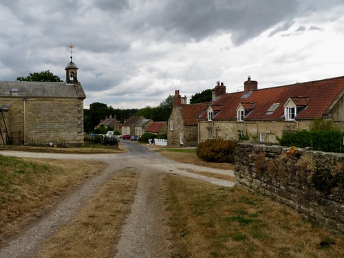
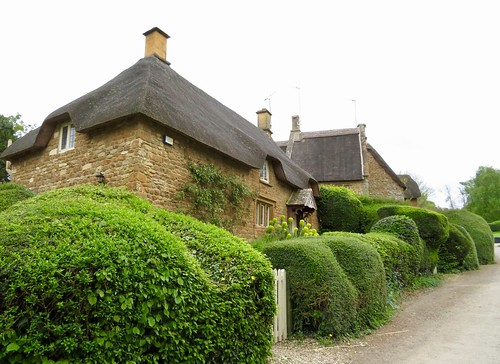
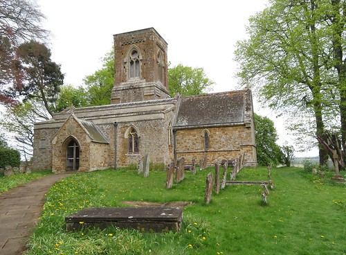
A crisp winter’s day, the sun in a clear sky over Warwickshire picking out the gold in the Cotswold stone houses of Ilmington. A whiff of applewood smoke came down on the breeze as we followed the footway of Middle Street past medieval fishponds to the cruciform Church of St Mary.

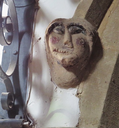
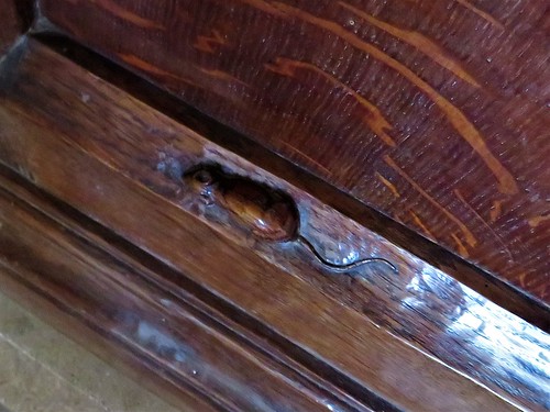
Among the oak pews of this beautiful Norman building scurry Arts & Crafts mice, the signature speciality of Yorkshire master carver Robert Thomson. The carpenter set these humorous little rodents in the pews and pulpit of St Mary’s in the 1930s, and they still raise a smile today.

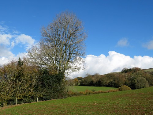
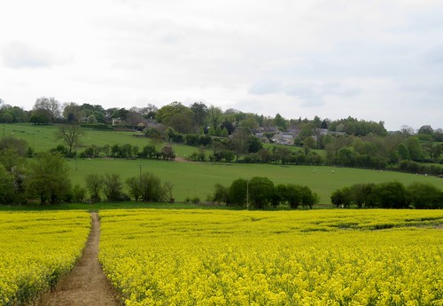
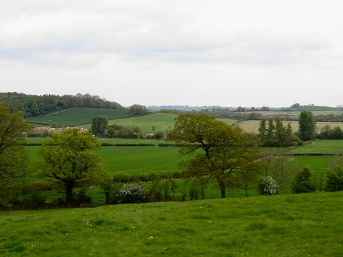
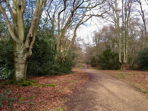
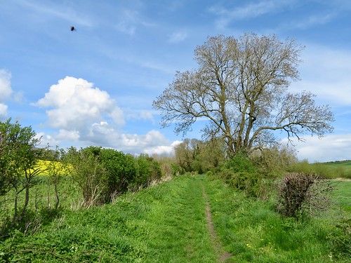
In the nave hangs a wonderful embroidered map of the orchards of Ilmington, its hem sewn with the names of apple varieties found here – Howgate Wonder, Laxton Superb, Siberian Crab. A green lane took us up the hill from Ilmington between the orchards, our boots wobbling among cookers and eaters long fallen to ground.

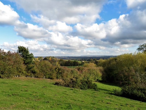
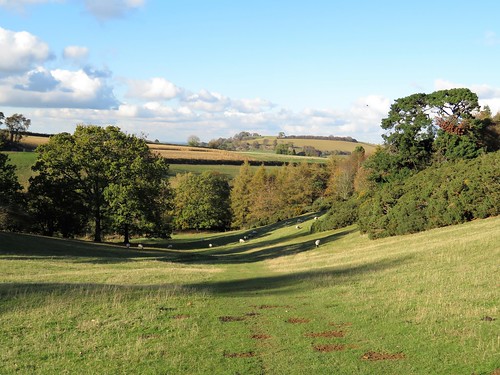
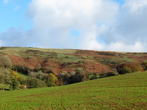
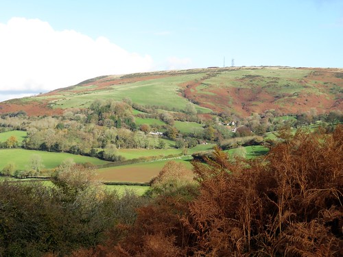
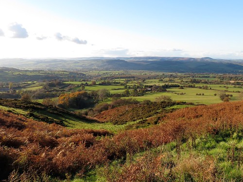
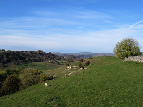
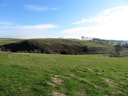
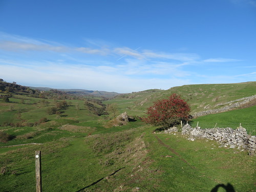
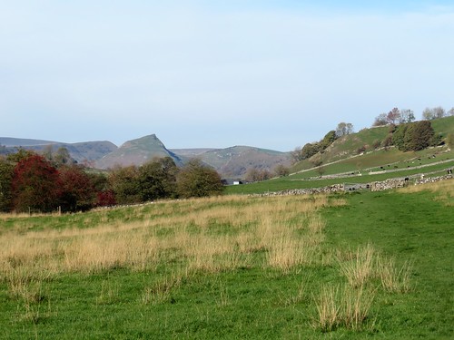
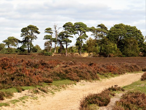
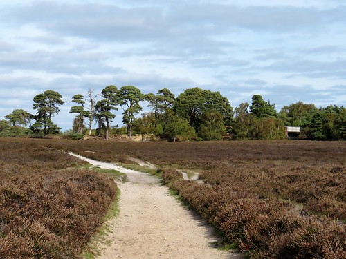
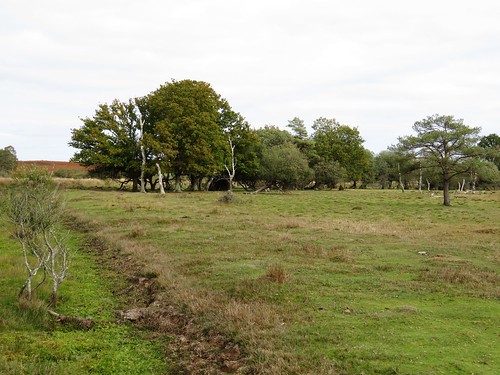
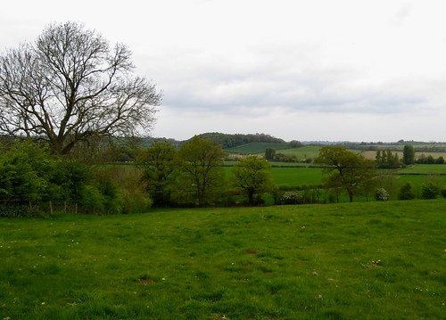
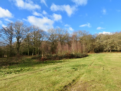
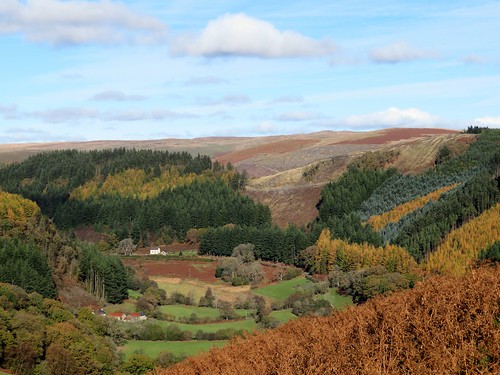
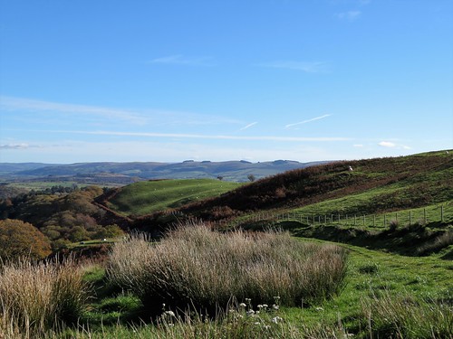
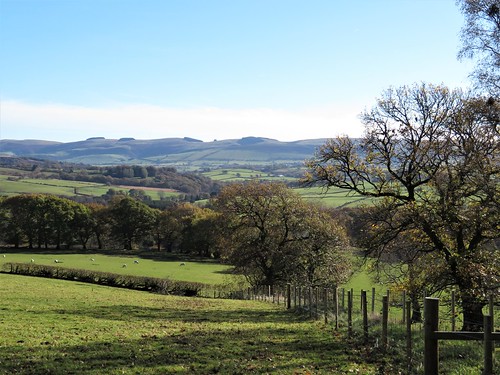
From the crest of the hill a glorious view opened, down slopes deeply indented with the ridge and furrow of Middle Ages strip farming, away over a low-lying vale of lush green meadows to the prominent hump of Meon Hill. The Devil created the hill when he missed his aim while chucking a sod of earth at Worcester Cathedral, and it’s well known that at the darkest hour of night you can catch the howling of the red-eared hounds of King Arawyn, Lord of the Dead, as he conducts his wild hunt around Meon Hill.

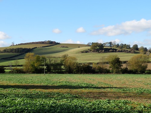
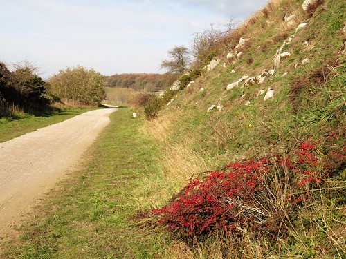
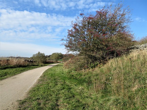
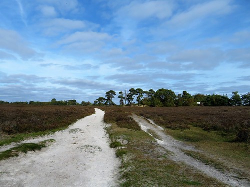
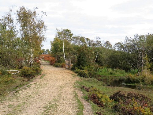
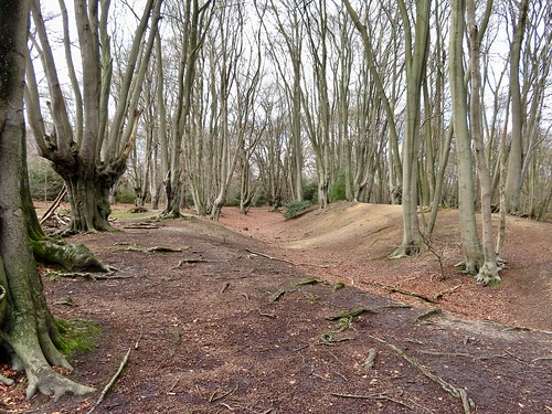
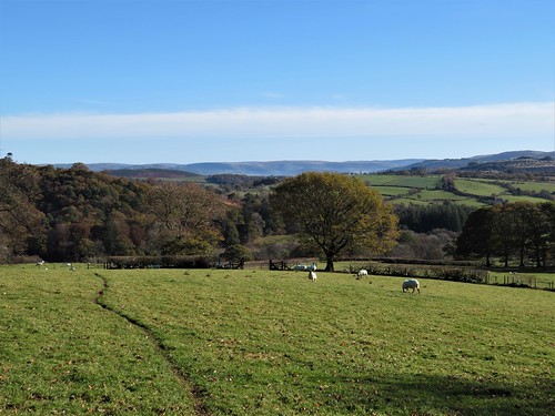
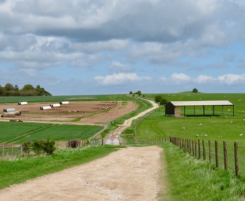
A stretch of road between hedges hung with scarlet necklaces of bryony, and we swung off south-west along the well-marked Monarch’s Way. Fat white sheep cropped the pastures around Hidcote Combe, the low winter sun backlighting their fleeces into spun gold and making dark trenches of the medieval furrows in the land.

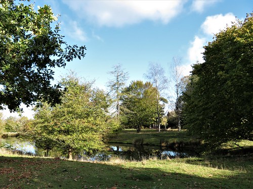
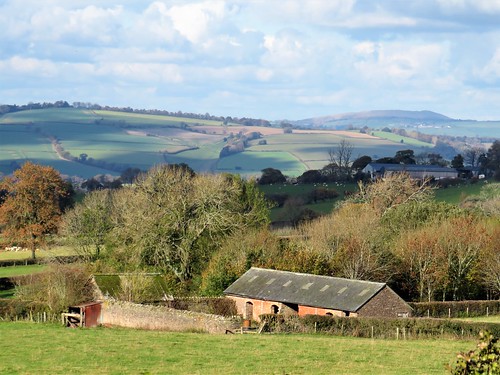
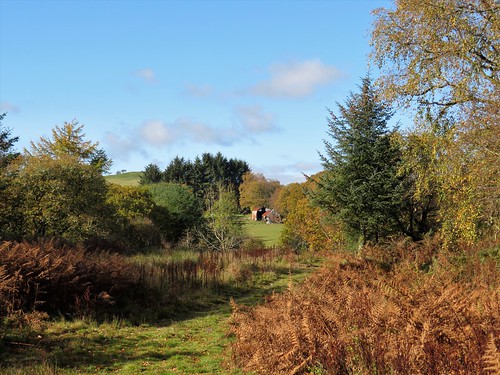
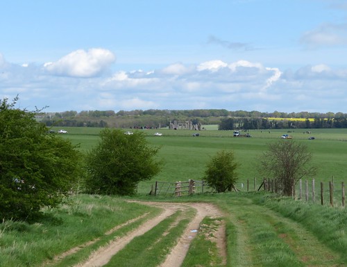
At the foot of the lane to Hidcote Bartrim we turned east for home, leaving the wonders of Hidcote Gardens – ‘outdoor rooms’ of rare beauty – for a spring visit some other day.

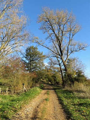
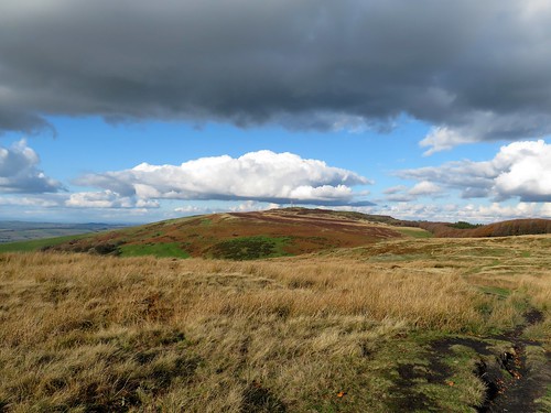
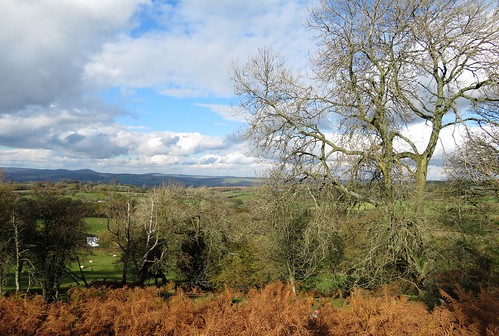
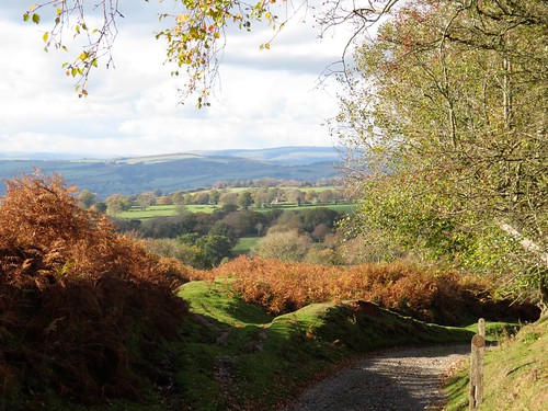
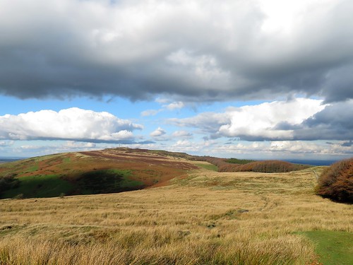
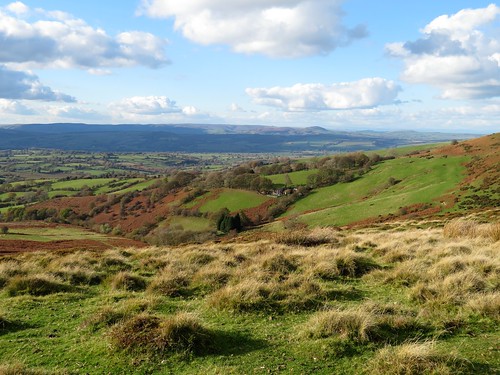
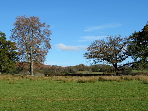
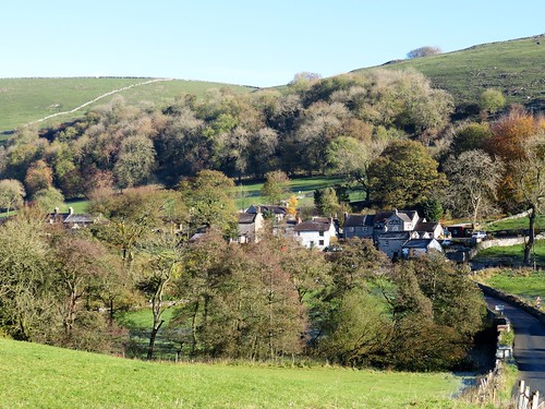
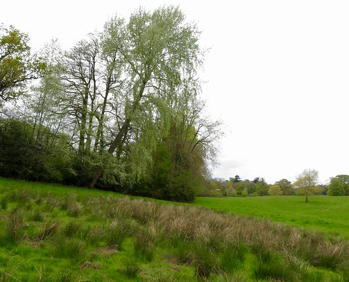
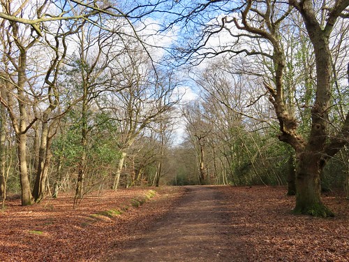
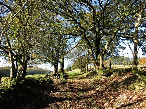
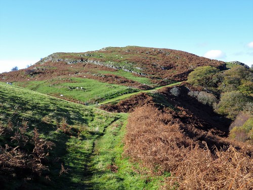
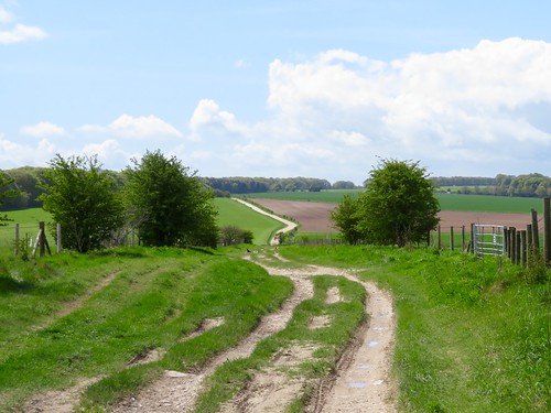
An ancient trackway climbs the slopes to the crest of the hills and a view west as far as the Malverns, Bredon, the Caradoc Hills and far into Wales. We follow this classic ridgeway, then descended through ribbed pastures to Ilmington, sunlit and sleepy in its cradle of trees below.

Start: Howard Arms, Ilmington, Warwicks CV36 4LT (OS ref SP 213437)

Getting there: Bus 3A (Banbury – Stratford-on-Avon)
Road – Ilmington is signed off A3400 between Shipston-on-Stour and Newbold-on-Stour.

Walk (7 miles, field paths, slippery in places, OS Explorer 205): From Howard Arms, right along Middle Street. At black-and-white cottage, right, passing church to road (209435). Right; in 30m, left and follow yellow arrows/YAs. Near top of rise (207436, stile on left), bear right; follow Centenary Way (yellow-topped posts). In 450m, at top of slope, through kissing gate/KG (204438); left along hedge to next KG, then YAs along field edges for 600m to road (197440).

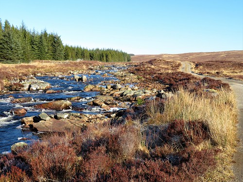
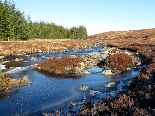
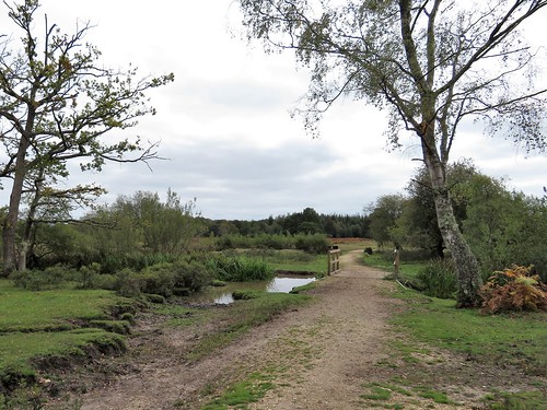
Right to road (198442, ‘Park Lane’ on map); left along road (walkable grass verge). In 500m pass lane to Admington on right (195446); in another ½ mile, left off road (187447, fingerpost, ‘Monarch’s Way’/MW). Immediately left over stile (MW); right along MW with stream on right. In 700m, right across ditch, to gate into wood (184440, MW). Through wood, then another (MWs); follow waymark posts up valley (180436) and on for ½ mile to foot of road to Hidcote (177430).

Left up lane (‘Restricted Byway’). In ¾ mile cross road at radar station (187426); on (‘Bridleway’) to cross next road (194426) and pass tall masts. In another ½ mile, at gate (204425), left off byway, downhill beside hedge. At foot of slope, right across stream (207431, KGs, YAs); left along stream, keeping straight ahead (YAs). At tarmac lane (208432), ahead to road (210433). Right, in 75m, left on path past church to Howard Arms.

Lunch/tea: Ilmington Community shop, Grump Street (café closed Mondays)

Dinner/Accommodation: Howard Arms, Ilmington (01608-682226, howardarms.com) – cheerful, characterful village inn; excellent food.

Hidcote Gardens: 01386-438333; nationaltrust.org.uk/hidcote Info: shakespeares-england.co.uk; ramblers.org.uk; satmap.com

 Posted by at 01:32
Feb 022019


First published in: The Times Click here to view a map for this walk in a new window

picture picture picture picture picture picture picture picture picture picture picture picture

Facebook Link:

Abdon’s little red church of St Margaret stands within the bank of a circular graveyard, the sign of a very old, probably pre-Christian site. People have been working and living for many millennia here in remote rural Shropshire below the Clee Hills – and on top of them too, in the steeply ramparted hill forts that crown their basalt peaks.

Looming at the back of Abdon is Brown Clee, at 1,770ft the highest peak in Shropshire, a great weighty whaleback of green, purple and red that rises in the east to blot out half the sky. On this bright winter morning big clouds came bustling across from the sunlit uplands of Wenlock Edge out to the west.

A field path led us from the straggling houses of Abdon down to Cockshutford where the cocks and dogs combined to give us a loud welcome. Clee Liberty Common beyond lay pitted with the hillocks and holes of former coal pits and quarries. Above stood the neat oval ramparts of Nordy Bank, rare among hill enclosures hereabouts in having been left undamaged by the quarrymen.

Twisted old silver birches flanked the sunken track that meandered up across the common to the radio mast at Clee Burf. From this great ringfort we had a fine view south to the stepped profile of much-quarried Titterstone Clee.

We sat in a rushy hollow out of the wind, eating tangerines and listening to the sigh and rustle of a beech hedge. Then we headed north on the Shropshire Way along the spine of Brown Clee, passing the poppy-strewn memorial to flyers, both Allied and German, killed nearby in plane crashes during the Second World War. Weather and conditions can be treacherous up here, and the Clee Hills claimed the lives of more flyers than any other hill range in these islands.

Up at the topograph on Brown Clee’s summit rampart we stood and marvelled at an incomparable prospect, 300 miles all round the circle of the horizon from Cader Idris and the Berwyns to the west and Brecon Beacons to the south, to the Peak District hills in the north-east and Birmingham’s towers in the east. The Wrekin, the Malverns, Cannock Chase and Wenlock Edge. All drenched in sun under a china blue sky, a once-in-a-lifetime view on such a winter’s day.

Start: Abdon Village Hall, Abdon, Craven Arms, Shropshire SY7 9HZ (OS 576868)

Getting there: B4368 (Craven Arms – Much Wenlock); at Beambridge, turn off for Tugford; from here, follow signs to Abdon.

Walk (7½ miles, moderate hill walk, OS Explorer 217) From village hall car park, left down road past church (575866). Left at junction (574863); in 600m, opposite last buildings on right, turn left off right bend (577862), and fork right along level track between hedges (yellow arrow/YA, blank fingerpost). Follow YAs through fields south for ¾ mile to cross lane at Cockshutford (579851).

Up steps opposite, through kissing gate; right (YA) with hedge on right for ½ mile (stiles, gates) to stile into green lane (573852, YA). Left to road, left past Clee Liberty Common notice on right. In another 150m, right through gate at another notice (573850); up gravelly track past Nordy Bank hillfort (577848) for 1½ miles to Clee Burf radio mast 593843).

Left along Shropshire Way/SW with wall on right. In Five Springs Hollow go through right-hand gate (596864, ‘SW main route’) and on past flyers’ memorial (596855). In ¾ mile, with gate on left, bear right (591863) to topograph on Abdon Burf (594866).

Back to go through gate (blue arrow); follow grassy trackway downhill; in 150m it turns right and descends for ½ mile to road (586869). Right to junction; left (‘Abdon Village Hall’). In 100m, left on bridleway (584870, fingerpost). Follow it across fields with hedge on left. In 400m pass Marsh Farm on your right; in another 200m, right to cross stile (578867). Up fence to stile into road beside car park.

Lunch: Tallyho Inn, Bouldon SY7 9DP (01584-841811, thetallyho.co.uk) – 3 miles.

Accommodation: The Crown, Munslow SY7 9ET (01584-841205, crowncountryinn.co.uk) – 5 miles.

Info: Ludlow TIC (01584-875053); shropshiretourism.co.uk; ramblers.org.uk; satmap.com

 Posted by at 02:43
Jan 262019


First published in: The Times Click here to view a map for this walk in a new window

picture picture picture picture picture picture picture picture picture picture picture picture picture

Facebook Link:

A peerless winter day in the north of Scotland, cold and clear. A cloudless blue sky, the lightest of winds. Snow on all the mountains, and none in the glens. Perfect weather for a walk up lonely Glen Fiag to even lonelier Loch Fiag, a remote mountain lake I’d often visited on wings of the imagination; one of those map walks you trace and hoard as soon as you spot it, saving it up like treasure for a beautiful day such as this. Ben Mor Assynt stood beyond Loch Shin, a white crumple of mountain reflected in the kingfisher-blue water. What a sight to turn your back on. But as soon as I’d rounded the corner of the broad stony track up the glen, there was the seductive shape of Ben Hee ahead to draw me on – a graceful pinnacle of dazzling white, with a humpy shoulder of rock half turned away on its flank as though repelling any thought of climbing. The River Fiag came rushing down between heather banks, a welter of indigo water among rocks, carrying miniature floes of ice that bumped and tussled over the rapids. Some of the rocks had grown lacy skirts of wafer-thin ice; others carried crests of old snow. I tracked the progress of a half-submerged floe through binoculars, mistaking its silvery-grey colour and spiny shape for the back and dorsal fin of some large fish. Loch Fiag has frustrated more than one attempt to stock it. Early in the 20th century one hopeful tenant put 10,000 rainbow trout in. They promptly escaped, fleeing downriver into Loch Shin where grateful anglers and herons had a field day. Glen Fiag lay silent. No birds stirred in the pine forests. The cottage of Fiag stood in ruins high on a bank, its lawn still green and grassy. Two sika deer were grazing there. Although 400 metres away, and with only a smidgeon of wind to carry my scent to them, they both sprang alert as soon as I appeared out of the trees, freezing stock still to watch the distant human figure pass by. The river was my constant companion today, a lively chatterbox, occasional veering away before hurrying back alongside. Another great mountain shape rose from behind the long brown shoulders of the glen’s moor tops – Beinn Leoid, a scoop of corries all dressed in snow. The track began a gentle climb, snaking over a mound to reveal long-imagined Loch Fiag. The lake lay steely grey today, entirely iced over save for a wriggle of royal blue where its water coursed out into the river. Beyond rose the pristine white slopes of Ben Hee. Fiag Lodge on the shore has been rebuilt from ruin in a futuristic style, like the hangout of a James Bond villain. Blofeld or no, what a truly sensational view the lucky occupants command. Start: Fiag Bridge, near Overscaig, Lairg, Sutherland IV27 4NY approx. (OS ref NC 468205) Getting there: Follow A838 Durness road from Lairg for 12 miles. 100m before Fiag Bridge, part at estate gate (‘Fiag’) on right. Room for 2 or 3 carefully parked cars – do not obstruct road or gate. Walk (10½ miles, easy, OS Explorer 440): Follow estate road for 5 miles north to Loch Fiag (455280). Return same way. Please respect privacy of Fiag Lodge. Lunch: Picnic at Loch Fiag. Accommodation: Oak Lodge B&B, Overscaig, near Lairg, Sutherland IV27 4NY (01549-431255, oaklodgebandb.co.uk) – lovely loch-side setting; excellent stopover.

Info: Inverness TIC (01463-252401); visitscotland.com; satmap.com

 Posted by at 01:29
Jan 192019


First published in: The Times Click here to view a map for this walk in a new window
picture picture picture picture picture picture picture picture picture picture picture picture picture picture picture picture
Facebook Link:

The trains of the Cromford & High Peak Railway – first drawn by horses, then by steam locomotives – ran through some of the most beautiful landscapes in the Derbyshire Peak District. Where horses once plodded with coal and limestone, and tank engines puffed with sparse numbers of passengers, cyclists and walkers now follow the narrow curves of the line, rechristened the High Peak Trail.

On a superb morning, crisp and cold, we joined the trail at Hurdlow. Either side the limestone landscape rolled away, intensely green under the low sun, an upland broken into sharp peaks and shadowy valleys.

At the vast open chasm of Dowlow Quarry we left the High Peak Trail for stone-walled lanes with wonderful high prospects south into a countryside so fractured it resembled a choppy sea. A knobbly path led us in the shadow of High Wheeldon, a conical knoll presented to the National Trust as a war memorial to men of Staffordshire and Derbyshire killed in World War Two.

Down in the lane to Crowdecote they were herding cattle between field and farm. Those in the lane bellowed and trumpeted, and those in the adjacent fields returned the compliment. ‘Bit lively,’ grinned the farmer waiting to turn them into the farmyard.

Crowdecote clung like a limpet to its steep, sunny hillside. Beyond the hamlet there was ice in the hoof pocks of the bridleway, and frost blanketing the fields on the shadowed side of the dale. Limestone outcrops scabbed the high slopes. Pale grey field walls striped the pastures, footed in their own black shadows, resembling giant claw scratches in the ground.

The path led past the crumpled hillocks where Pilsbury Castle once stood – a pair of baileys and a motte, built by the Normans shortly after the Conquest to levy tax on the traders that used the ancient packhorse route through the dale.

We followed the old way through uplands of sheep fields, past standing stones whose edges had been rubbed shiny by sheep easing their manifold itches. A dip and climb past Vincent House farm, another past the farmyard at Darley, and we were bowling along the High Peak Trail towards Hurdlow with sublime hill scenery unrolling on either hand.

Start: Hurdlow car park, Sparklow, Derbs SK17 9QJ (OS ref SK 128659).

Getting there: Bus 442 (Ashbourne) to Bull-i’-th’-Thorn (½ mile by footpath)
Road – Hurdlow car park is off A515 between Pomeroy and Parsley Hay.

Walk (9½ miles, cyclepath and well marked field paths, OS Explorer OL24): North-west along High Peak Trail for 1½ miles to end (111673); left on Cycleway 68. In ½ mile, right on lane (109665) to cross road at Wheeldon Trees (102662). Through gate (fingerpost) down to NT High Wheeldon notice; right downhill (yellow arrow/YA) to road. Left to Crowdecote. Just past Packhorse Inn, left along lane (101652, ‘South Peak Loop’ bridleway). Follow SPW (blue arrows) through fields. In 1 mile pass Pilsbury Castle mounds (115639); left through gate; fork left up footpath; follow YAs over hill, crossing one road (121634), then another at Vincent House farm (137632). Through farmyard (YAs); up right-hand of two parallel tracks. Follow ‘Parsley Hay’ and YAs to cross road at Darley Farm (142637). YAs through farmyard, up field edge to High Peak Trail (143639); left for 2 miles to Hurdlow car park.

Lunch: Royal Oak, Hurdlow SK17 9QJ (01298-83288, peakpub.co.uk) – busy, friendly pub near car park.

Accommodation: Ye Olde Cheshire Cheese, Longnor SK17 0NS (01298-83218; robinsonsbrewery.com)

Information: Ashbourne TIC (01335-343666); visitpeakdistrict.com; satmap.com; ramblers.org.uk

 Posted by at 01:13
Jan 122019


First published in: The Times Click here to view a map for this walk in a new window
picture picture picture picture picture picture picture picture picture picture picture
Facebook Link:

A crisp winter’s morning in the heart of the New Forest. A crowd of semi-wild ponies cropped a hoard of fallen crab apples with a snick and crunch of their strong teeth. We walked briskly north from Beaulieu Road station, then struck out west over a wide swathe of heather, the grey sky pressing down on the dark pines along the flat horizon.

Looking over the bridge rails of a gloopy stream at King’s Passage, we spied sprigs of bog myrtle. Plucked and rubbed between the fingers, they brought a spicy tang to the chilly air. All was as quiet as could be on this still wintry day, with only the clickety calls of stonechats and occasional snort of a pony for a soundtrack. Other walkers with scampering dogs passed on diverging tracks, without disturbing the illusion of solitude and silence so characteristic of the New Forest’s back country.

The lush grasslands of Longwater Lawn border the winding Beaulieu River, their herbage enriched by silt from winter floods. Five pones stood by the footbridge with an air of contemplating profundities. Their presence beside the slow flowing stream through the grassland would have graced the most delicate of Chinese silk paintings.

A wriggling track of pale flinty gravel is all that’s left of the ancient Salt Way, by which the precious commodity was brought inland on pack ponies from the salt pans on the Hampshire coast. The old track led on to the second half of this walk of contrasts, a network of forest rides among the trees of Denny Inclosure – ancient oaks, tall pines as straight as guardsmen, and beeches with enormously elongated limbs.

A glimpse of red-tiled Denny Lodge, once the residence of Groom Keeper and Head Forester, and we took the homeward path among bracken fronds so richly gold that we were tempted to stuff our pockets with them.

Start: Beaulieu Road Station, near Lyndhurst SO42 7YQ (OS ref SU 349063)

Getting there: Rail to Beaulieu Road station.
Road – M27 Jct 1, A337 to Lyndhurst, B3056 (‘Beaulieu’) to Shatterford car park, just before station.

Walk (8 miles; easy underfoot, but no waymarks; OS Explorer OL 22):
Rail – Platform 1, up steps, left along road; Platform 2, up steps, left across bridge. Opposite Shatterford car park, right.
Road: cross B3056.
Then: Follow gravel track north beside railway. In 300m, pass bridge on right (348067); in another 400m, fork left in dip (347071). In 50m, fork right; keep parallel with railway. In 500m, with Fulliford Passage bridge on right (345076), left along grass path. In 350m, right to cross King’s Passage bridge (342076). At 3-way fork beyond, take middle path ahead across grassland. In ½ mile, cross ridge (336084); aim to cross footbridge among trees (334086) and keep ahead.

In 300m, path bends right towards wooden fence (333088). Left here (west) on grassy, then gravel track, heading for distant Lyndhurst Church spire. In ¼ mile cross a track (329088); ahead for 500m to cross footbridge over Beaulieu River (323087). Ahead through line of trees; left (southwest) along track. Keep to left of line of trees, then aim for distant Lime Wood Hotel. In nearly 1 mile cross B3056 (317075); follow ‘Pondhead Farm’. In 350m, pass farm sheds/barns on left (318072); aim past telephone pole to cross footbridge (317070). Fork left on path into trees; bear left for 30m, then right to gate into wood (319067).

Ahead along forest ride. In 500m, left at T-junction on gravel track (324065); in 30m, right along grassy ride for ½ mile, across Little Holm Hill to go through gate (330060). Right to cycle track; left to barrier (334059); right (‘Access to Private Properties’). In 250m, at ‘Upper holding’ notice, fork left. Pass Denny Lodge on right; in 80m, just before Denny Cottage on left, turn left (334055) on woodland path with fence on right, then on in same southeast direction.

In 300m, leave trees; ahead across bridge (336053); fork left and ahead for 400m across next 2 bridges. After 2nd of these (340051), ahead and bear left on gravel path, then grass through trees. In 350m look for hollow on right beside path (344050); at cross tracks beyond with gate to right, go left. Cross bridge at Woodfidley Passage (346051); ahead, soon bearing north parallel with railway to return to car park/station.

NB: No waymarks – map, compass, Satmap very helpful!

Lunch: Drift Inn, Beaulieu Road station (02380-292342, thedrift.newforesthotels.co.uk)

Accommodation: Beaulieu Hotel, Beaulieu Road station SO42 7YQ
(0800-444441, newforesthotels.co.uk)

Info: New Forest Centre, Lyndhurst (023-8028-3444)
visitengland.com; satmap.com; ramblers.org.uk

 Posted by at 01:32
Jan 052019


First published in: The Times Click here to view a map for this walk in a new window
picture picture picture picture picture picture picture picture picture picture picture
Facebook Link:

On a cool bright morning we followed Water Lane out of Welburn and headed for the Howardian Hills. The jewel of the landscape hereabouts is the stately pile of Castle Howard, but from the cobbled field path leading north towards the hills we could only glimpse the tip of its crowning dome.

There were plenty of follies and architectural fancies to admire as we walked the parkland tracks – pyramids and obelisks, a wonderfully ornate Temple of the Four Winds high on an aeolian ridge, and peeping over the trees of Kirk Hill the tall colonnaded mausoleum of the Howards, Earls of Carlisle.

In an overgrown paddock beside the rusty barns of Low Gaterly a grey mare and her tiny companion horse, only as big as a dog, were browsing their thistle patch, delicately nipping off the remnant flower heads with lips curled back out of the way of the prickles.

Up on the ridge of the Howardian Hills an ancient earthwork shadowed the escarpment, a bank and ditch perhaps 4,000 years old. From here there were great open views to the smoothly flowing outline of the North York Moors, sombre and dark under a lively silver sky.

A mile along the ancient bank under quietly whispering larch and sycamores, and we descended a holloway into the parkland of Castle Howard. The great house stood on its ridge, a dream realised by the talented and bold amateur architect Sir John Vanbrugh at the turn of the 18th century. We found the parkland turf still corrugated by what underlay it – the ridge-and-furrow fields of the medieval village of Henderskelfe, swept away by command of the 3rd Earl of Carlisle in favour of the artful curves of his landscaped park.

The homeward path led across a steeply arched Palladian bridge over the New River lake. I glanced down as I crossed, to see a stone carving of a bearded river god, reeds in his hair, staring with bulging eyes and mouth agape along the artificial waterway at the giant house on the hill – whether in awe or horror was hard to say.
Start: Crown & Cushion PH, Welburn YO60 7DZ (OS ref SE 721680)

Getting there: Bus 183 (Malton-Castle Howard)
Road – Welburn is signed from A64 (York-Malton) at Whitwell on the Hill

Walk (9 miles, easy, OS Explorer 300): Left from Crown & Cushion; left down Water Lane. ‘Public Bridleway’ north for ¾ mile to turn right along Centenary Way/CW beyond East Moor Banks wood (723693). In ⅔ mile, left (732694, ‘Coneysthorpe, yellow arrow/YA); in 150m, left opposite Low Gaterly barn (YA). At Bog Hall dogleg left/right, then right on track (725709, ‘Easthorpe’). In 900m keep ahead (734713, ‘Park House’), zigzagging up to cross road (733715). Up Park House drive; in 50m left (gate, BA); follow wooded escarpment edge and ‘Slingsby Bank’ (BA). In 1¼ mile, left (714729, ‘Coneysthorpe’), for 1 mile to Coneysthorpe. Left along road; in 100m, right through wall (713713); follow drive (‘Welburn’). In ½ mile, at corner of Great Lake, fork left by gates; in 100m, right (719706, ‘Welburn’) through scrub to track (722705). Right into parkland; right (‘Welburn’) to Temple of Four Winds, New River Bridge (724698) and return path to Welburn.

Lunch: Crown & Cushion PH (01653-618777, thecrownandcushionwelburn.com); Leaf & Loaf Café (01653-618352), Welburn.

Accommodation: Talbot Hotel, Malton, N Yorks YO17 7AJ (01653-639096, talbotmalton.co.uk). Friendly, comfortable, long-established hotel.

Info: castlehoward.co.uk; howardianhills.org.uk; yorkshire.com
Ramblers Festival of Winter Walks, 21 December – 6 January:
ramblers.org.uk/winterwalks
visitengland.com; satmap.com; ramblers.org.uk

 Posted by at 01:51
Dec 222018


First published in: The Times Click here to view a map for this walk in a new window
picture picture picture picture picture picture picture picture picture picture picture
Facebook Link:

Set in a north Cotswold landscape of iron-rich stone the colour of dark honeycomb, Great Tew is a dream hive of mullioned cottages under thatch. It’s hard to credit this immaculate place as the tumbledown village it became in the 1970s, its houses neglected to the point of collapse, their roofs in holes.

The scandal of Great Tew’s decay had complex roots, and its recovery to picture postcard appearance has been a long process. All seemed right with the world on this brisk afternoon, though. We glanced in the open door of the Falkland Arms where cheerful county couples and horse whisperers crowded the dark bar under a canopy of beer mugs swinging by their handles from the ceiling.

Behind the pub a bridleway ran east away across the open pastures of Great Tew Park. A red kite skimmed the trees and circled the grassland, steadying itself a few inches above the ground before dropping to snatch at some morsel among the tussocks.

The park was dotted with fine old specimen trees – cedars and pines, oaks and chestnuts. Five horses at a gate nodded their long noses and accepted a handful of grass apiece. Away to the north the hills rolled like a breaking wave, more sharply defined than the pale limestone wolds of classic Cotswold country.

At Ledwell we found a dimpling well, the old cast-iron village pump standing alongside. The mossy roofs of Over Worton huddled in the trees near a tall war memorial. In the church lay Edmund Meese, who died ‘pious, chaste and sober’ in the reign of King James I. His effigy was discovered in 1967 under the church floor, minus toes, nose and hands – they had been cut off so that the sculpture could be squeezed into its hiding place. Edmund’s extremities were restored, but in darker stone than the rest of the effigy, giving him the appearance of being severe frostbitten.

On over the fields to Nether Worton, where church, schoolroom and cottage leaned companionably together in the shade of a large apple tree. On with a cold wind slapping our cheeks, to join Groveash Lane where it wound at the feet of the hills.

A broad old trackway led us back to Great Tew through damp woodland of willow and alder. The bare branches scratched at a sky growing ever greyer and more wintry, and the thought of the log fire at the Falkland Arms put springs in our boot heels.

Start: Great Tew village car park, Oxon OX7 4DB (OS ref SP 395293)

Getting there:
Road – Great Tew is signed off B4022 (A361, between Banbury and Chipping Norton)

Walk (6½ miles, easy, OS Explorer 191): Left from car park; left into village. Just past Falkland Arms, left (‘Bridleway, Ledwell 2’), following broad track of bridleway east through fields. In ¾ mile it bends right (408293); ahead here through gates (blue arrows) on fenced bridleway, forking right past Hobbshole Farm to road (413284). Left, then over crossroads (418283, ‘Ledwell’). At Manor Farmhouse bear left; left by well (‘Over Worton’, yellow arrow/YA). Keep left of fence over lawn; right at wall along path. In 150m, through gate (421282); half left (YA) to gateway; half right to footbridge (424284) and up field beyond to road (426285). Right; in 100m, left (‘Over Worton’) up drive. At house, right (arrow) across stile; half right across 2 fields to cross lane at Over Worton by war memorial (430291).

Up church path; past church; through gate at east end of churchyard. Follow fence on left down to gate (430295); cut corner and go through hedge; follow path north-west, then north across fields for ½ mile to road opposite Nether Worton church (426301). Left; at junction, left (‘Ledwell’); in 400m, round sharp left bend; in 50m, right through gate (421300). Fork right on bridleway.

In 250m fork right at gate gap (418300, arrow), across field. Cross footbridge (416302); aim half left for distant track going uphill on left of wood. Before you reach it, left on broad bridleway of Groveash Lane (415305). In 1 mile at T-junction (402302) left for ¾ mile to Great Tew.

Lunch/Accommodation: Falkland Arms, Great Tew OX7 4DB (01608-683653, falklandarms.co.uk) – warm, firelit, thriving village pub

Info: Banbury TIC (01295-753752)
visitengland.com; satmap.com; ramblers.org.uk

 Posted by at 01:51
Dec 152018


First published in: The Times Click here to view a map for this walk in a new window
picture picture picture picture picture picture picture picture picture picture picture picture picture
Facebook Link:

The wind nipped at our heels as we left the tube train at Loughton and climbed the hill behind the little Essex town. Handsome red brick villas lined the road, proclaiming this the Metroland that the railways brought into being for Edwardian commuters to the city.

At the crest of the rise a few steps plunged us back into the medieval England of great hunting forests and the footpad-haunted wilds that all travellers feared. Epping Forest today, 6,000 acres of tree-smothered uplands, is only a shadow remnant of the sprawling Royal Forest of Waltham that once stretched away from London. But walking the broad tracks under these old beeches and hornbeams with their green sinewy limbs, you still catch the silence and solitude of proper deep woodland.

Long-tailed tits flirted their tail feathers and squeaked in miniature voices among the bare boughs. There were goblin faces in the contorted trunks of beeches unpollarded for a century or more. The circular embankments of Loughton Camp, an Iron Age enclosure where Whitechapel highwayman Dick Turpin kept a hideout, lay screened among trees that spread their own witchy darkness around themselves.

If it hadn’t been for the lobbying of far-sighted Victorian campaigners, Epping Forest would have been nibbled away to nothing by smallholders, squatters and developers. The 1878 Epping Forest Act put a stop to all their encroachment, and today’s walkers, cyclists and runners are the beneficiaries.

The wind made a seashore roar in the treetops, but down at the roots of the forest hardly a breath stirred the leaf carpet. We followed the well-made path north-east, revelling in the silence and the earthy scent of millions of trees.

Beyond Jack’s Hill the landscape changed character. Heathy patches of birch scrub and bog appeared in wide clearings and the tree cover thinned as more blue sky spread overhead. The ramparts of Ambresbury Banks, another Iron Age ring fort, stood naked and tall, studded with smooth-trunked beeches.

The sigh of the wind gave way to the muted roar of the M25. We crossed the motorway, turned our backs on the massed trees of the forest, and dropped down to Epping tube station with wide views opening across the Essex ridges to the far blue hills of Kent across the unseen Thames.

Start: Loughton tube station (Central Line), IG10 4PD (OS ref TQ 423956). Finish Epping station, CM16 4HW.

Getting there: Underground rail to Loughton. Road – Loughton is off M11, Jct 5.

Walk (7½ miles, easy, OS Explorer 174): From Loughton station, to main road; left across bottom of Station Road; up Old Station Road with Sainsbury’s on left. Over roundabout; up Ollards Grove. At top at Forest View Road (418961), left along path. At road, right; in 200m, left (418963) through car park, past ‘The Stubbles’ sign. Across grassy hill; into trees; in 150m, right at Strawberry Hill Ponds (414965) along broad, flat Three Forests Way (3FW).

In 300m cross Earl’s Path (416967); take right fork. In ¾ mile, just past Loughton Camp, 3FW forks left (421977), but keep ahead along The Green Ride. In 1 mile cross A121 (429986); bear right through metal barrier, then follow path round to left and on. In 600m at Ditches Ride T-junction (434989), left to cross B172 at Jack’s Hill (435996). Keep same direction past Epping Forest sign, and on.

In nearly 1 mile at Epping Thicks, with tall post on left and short one with yellow arrow on right, keep ahead at fork (444004). In ½ mile, at Ivy Chimneys, left along road (450011). Fork right along Bell Common. At end of houses (454015), right; just before Hemnall House, left through hedge; right down grassy slope; left at bottom on green lane among trees (‘Centenary Walk’ on OS Explorer). At road (458013), left round Western Avenue. At T-junction, left along road. In 250m pass Woodland Grove on right; in 30m, right (460016, ‘station’ sign) to tube station (462016).

Lunch: Forest Gate Inn, Ivy Chimneys CM16 4DZ (01992-572312)

Accommodation: Premier Inn, The Grange, Sewardstone Rd, Waltham Abbey EN9 3QF (0333-321-9123)

Info: Epping Forest Visitor Centre, IG10 4AF (0208-508-0028)
visitengland.com; satmap.com; ramblers.org.uk

 Posted by at 02:41
Dec 082018


First published in: The Times Click here to view a map for this walk in a new window
picture picture picture picture picture picture picture picture picture picture picture
Facebook Link:

A winter day in a million. A gentle breeze out of a cloudless blue sky over mid-Wales, with the sheep pastures along the valley of Cwmannell sparkling in the sunlight as they sweated off last night’s sharp frost.

We followed the farm road from Beulah to the horse paddocks around Hafod-y-garreg, then a slippery hill path that descended through golden oaks to a water-splash pond below Erw-felin. Here a solemn tribe of shaggy-legged horses came to sniff at our hands. No biscuits, lads, sorry!

Up beyond Bwlchmawr the hills grew lumpy, their flanks patched with bracken glowing rusty red in the sun. A network of old green tracks crisscrosses these valleys, and we followed one that dipped in and out of the dingles of Nant Cwm-du and Nant Einon. A cottage stood in roofless solitude above the Einon stream, where a flock of grey-headed fieldfares flew off with sharp grating calls.

The three faces of Mynydd Epynt stared back at us on the southern skyline as we stopped for a breather at the crest above Bron-rhydd. Then it was steeply down to cross the Nant yr Annell stream, and steeply up to meet a broad ridge track. It led us west to a high pass and a sensational view from the nubby heights of Cribyn Bedw.

A seat on a prominent rock, and a good long stare round the wide bowl of hills that encircled the well-wooded farmland down along the Annell and away up the curved valley of the Afon Cammarch. Mynydd Epynt looked massive and solid from here, a crouching beast of a hill.

Far below lay a side valley that might have been modelled by Disney, so perfect were the proportions of its fields, hedges, farm, chapel and forested slopes. Yellowing larches stood up like rockets among the dark conifers, and the guns of invisible shooters went pop-pop-pop as a line of beaters drove pheasants out of cover.

At last we rose and started back down the broad green track to Beulah. Rams stood at the fences, nose-to-nose with ewes in adjacent pastures, and the winter sun poured down like cold honey over woods and fields.

Start: Trout Inn, Beulah, near Llanwrtyd Wells LD5 4UU (OS ref SN 920513)

Getting there: Bus 48 (Builth Wells – Llanwrtyd Wells)
Road: Beulah is on A483 between Builth Wells and Llanwrtyd Wells. Trout Inn car park is behind garage – please ask landlord’s permission!

Walk (6½ miles, moderate hill walk, some short overgrown stretches, OS Explorers 187, 188): Right along A483, in 100m, right (‘Abergwesyn’). In 300m, left (917515) on bridleway road past Aberannell and on for ¾ mile to Hafod-y-Garreg (905513). Pass sheds on left; in 150m, at entrance to Bron-rhudd drive, left down track. In 150m, right (905512, gate/stile) across field to stile (903511); ahead, parallel with Nant Einon stream on left. In 400m, fork left, descending to ford stream (900512, stile).

Up brambly bank opposite; up field to gate; up next field to gate into Erw-felin stableyard (899510). Ahead up lane for 700m to road (898504). Right to Bwlchmawr farm (893508); fork right between house and barns up green lane. In 400m at waymark post, right to cross Nant Cwm-du (889510); through gate; track past cottage (blue arrow), descending to cross Nant Einon by decorative bridge (891513). Right up fence to second gate (892513); right along grass track with fence on right for ½ mile, rising to summit (901515).

Same direction through 2 gates; track bears left (902516), descending to cross Nant yr Annell (899513), then bearing right and rising to gate (903519). Ahead for 50m to ridge track; left for ¾ mile to summit of Cribyn Bedw (891523) for sensational views. Return down track and on for 1½ miles to lane at Aberannell (915515); left to road; right to A483; left to Trout Inn.

Lunch: Trout Inn, Beulah (01591-620235, thetroutinn.net).

Accommodation: Lake Country House, Llangammarch Wells LD4 4BS (01591-620202, lakecountryhouse.co.uk) – friendly, comfortable former fishing lodge.

Info: Builth Wells TIC (01982-563307), visitwales.com; satmap.com; ramblers.org.uk

 Posted by at 01:30
Dec 012018


First published in: The Times Click here to view a map for this walk in a new window
picture picture picture picture picture picture picture picture
Facebook Link:

The River Avon went rushing under the mill bridge at Little Durnford, the water as grey as molten glass. We leaned on the bridge rail to admire it before setting off along a green lane that shadowed the course of the river up its shallow valley.

At Lake the flanks of the valley were scratched with strip lynchets and laneways, evidence of a vanished village. From the valley bottom Lake House stared out from multiple windows under five tall gables, a handsome old house in a beautiful setting sheltered among its trees.

A wide green track led north up the dry chalk valley of Lake Bottom, past the paddocks at Springbottom Farm where a ginger horse rolled ecstatically on the grass. Up on the skyline a row of ancient burial mounds made a grand introduction to a memorable view – Stonehenge in all its glory, the tall grey trilithons catching and holding the eye.

A trio of hippy caravans stood parked by the greenway. We turned off before the Stones and the rushing traffic of the A303 that so disfigures the prospect, and made for the braided trackway of the Harroway, the oldest and least regarded of England’s prehistoric roads.

The white chalky ribbon of the Harroway winds south over Normanton Down, a remarkable ritual landscape associated with Stonehenge, whose mysteries and meanings are only now beginning to be probed with modern ground-penetrating remote sensors.

Bowl barrows, long barrows, bell barrows lie scattered across the grassland. We passed Bush Barrow, a tree still growing out of it, excavated in 1808 to unearth a skeleton six feet tall and 4,000 years old, adorned with a golden breastplate. The Harroway ran between a pair of shallow disc barrows and descended past a field of cheerfully grunting pigs rooting in an Armageddon of mud.

At Druid’s Lodge we left the ancient road and turned back over the downs towards the Avon valley. Lapwings flickered in black and white over the fields, three hares scampered and stopped, scampered and stopped, and a big bird of prey (marsh harrier? hen harrier? – we couldn’t decide) suddenly sailed across our track, flapping its great wings with enormous lazy power as it scanned the ploughlands for unwary mice.
Start: Black Horse PH, Great Durnford, Wilts SP4 6AY (OS ref SU 135380)

Getting there: Bus 201 (Amesbury-Salisbury)
Road – Great Durnford is signposted off A345 (Amesbury-Salisbury) at Stock Bottom

Walk (8 miles, easy, OS Explorer 130): From Black Horse, right along road. In 100m, opposite Field House, right on gravel track. Cross millstream; follow path for ½ mile to cross road (132386). Stile opposite (‘Normanton Down’); path down to road (129389). Left up trackway. In 1 mile, track curves left by Springbottom Farm stables (122400); in 150m keep ahead (right) at fork on grassy track. In nearly 1 mile, at NT sign, left through kissing gate (120413); in 350m, left at next kissing gate along Harroway trackway (117415) for 1¾ miles to A360 (099392). Left along verge for 250m; left (‘Upper Woodford’) on track, then road for 1¾ miles to road at Upper Woodford (124373). Left; in 60m, right (fingerpost) on stony, then grassy lane. In ¾ mile, right (133379) across millstream bridge, back to Black Horse.

Lunch: Black Horse, Great Durnford (01722-782270) – NB closed Sun eve, all Mon.

Accommodation: Rollestone Manor, Shrewton, Wilts SP3 4HF (01980-620216, rollestonemanor.com) – very comfortable B&B + dinner in historic house

Info: Salisbury TIC (01722-342860); visitwiltshire.co.uk; satmap.com; ramblers.org.uk

 Posted by at 01:45