Nov 242018


First published in: The Times Click here to view a map for this walk in a new window
picture picture picture picture picture picture picture picture
Facebook Link:

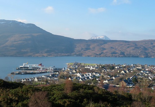
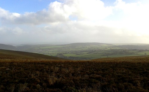
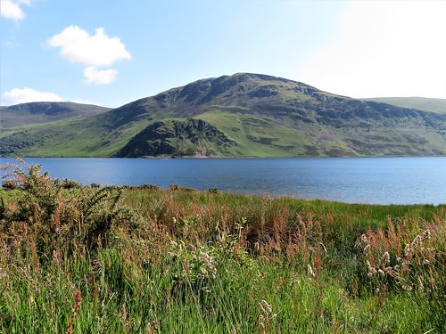
A midwinter day of cold, clear, sunny weather on Scotland’s West coast. I lingered on the braeside above Ullapool, looking down at the sunlit town and across the loch to snow-streaked mountains beyond.

From here you can appreciate why the British Fisheries Society chose the place in 1788 for development as a herring port. The little town huddles on its headland near the sea entrance to Loch Broom, sheltering the harbour with the fishing boats and big Calmac ferries. Millions of herrings made Ullapool’s fortune early in the 19th century; then again in the 1970s when Iron Curtain factory ships processed millions more and flooded the pubs with thirsty crew members.

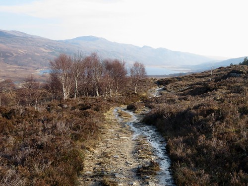
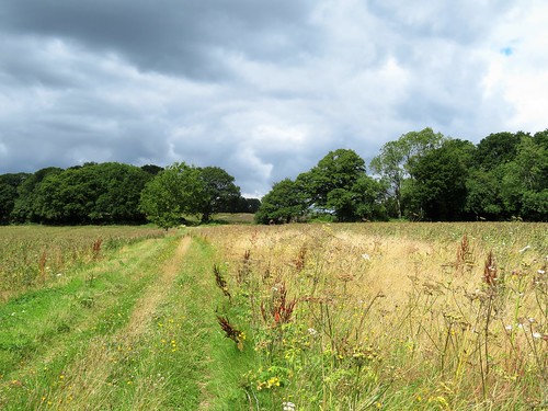
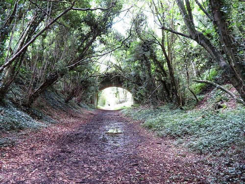
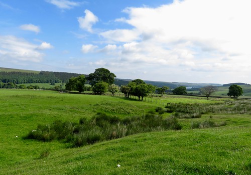
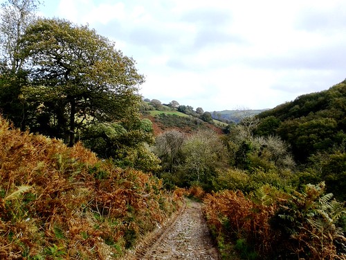
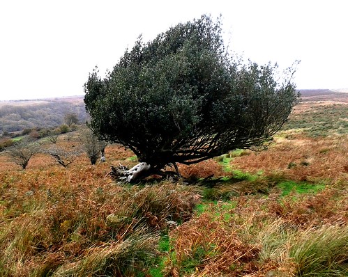
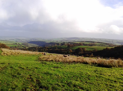
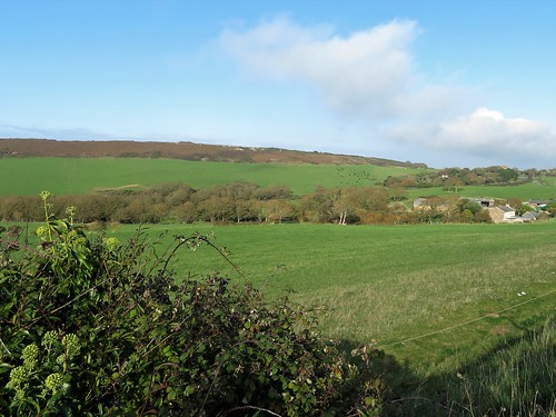
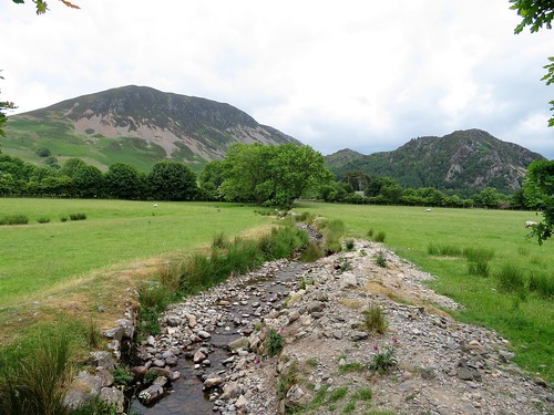
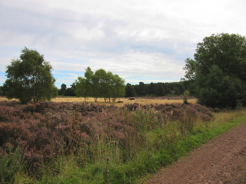
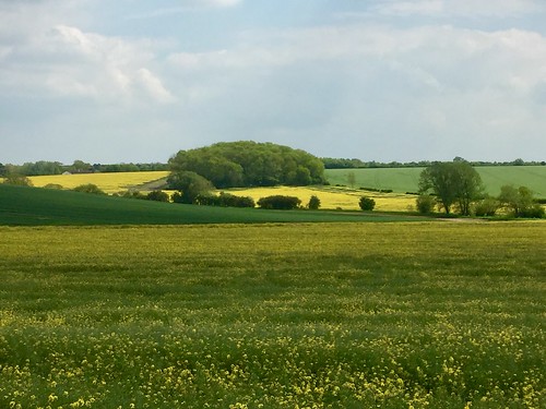
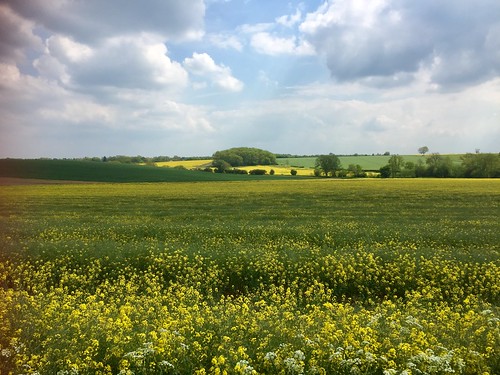
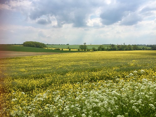
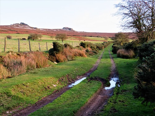
The stony path rose up the hillside through clumps of flowering gorse and winter-dried heather. Ahead the view opened out through the jaws of Loch Broom to the hummocky shapes of the Summer Isles, romantically named, hard as hell to scratch a living from, lying ten miles out to sea.

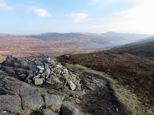
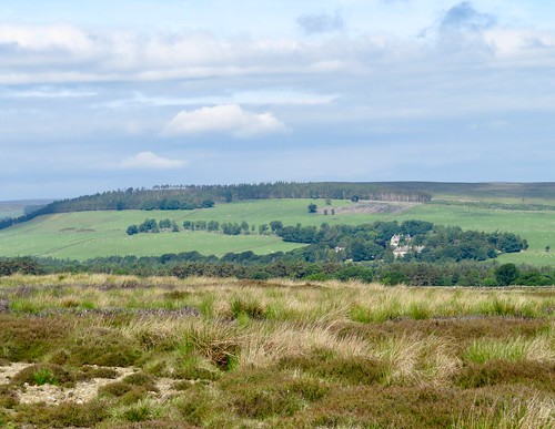
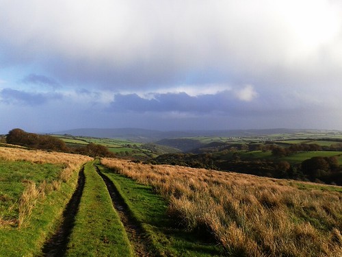
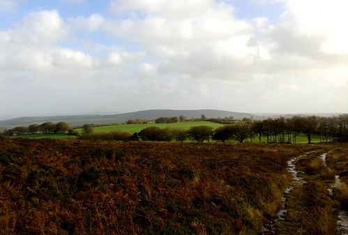
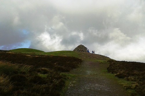
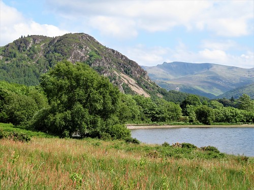
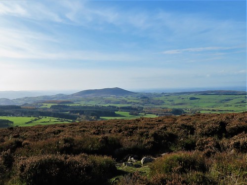
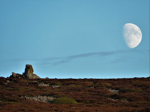
Soon the way forked at a bench. I climbed a tinkling granite path to the little cairn at the crest of Meall Mòr. A sensational mountain prospect to all quarters – Sàil Mòr blotched with snow, Beinn Ghobhlach like a khaki tent in the west; a jumble of peaks around the three-thousand-foot Beinn Dearg in the east; and the north closed by the snowy beast-back of Ben Mor Coigach.

* NB These variations on Beinn and Ben, Mòr and Mor are correct according to the map and online references.

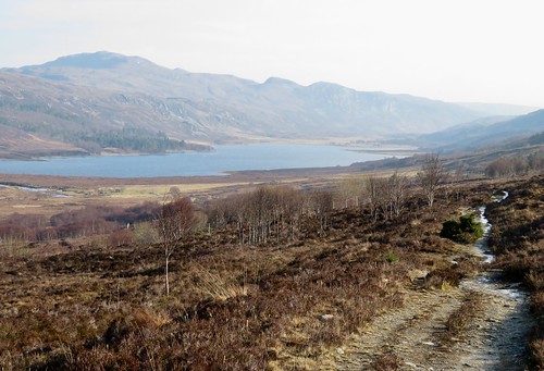
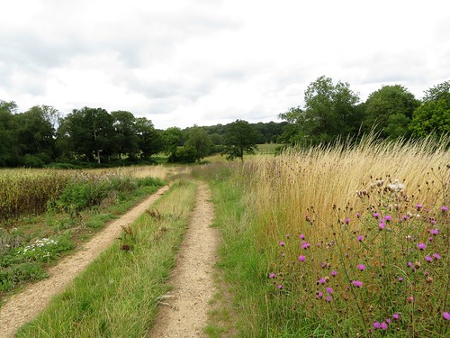
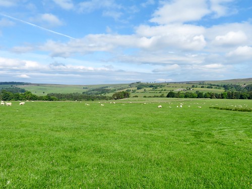
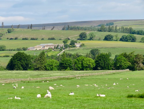
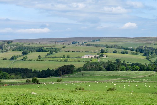
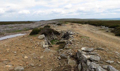
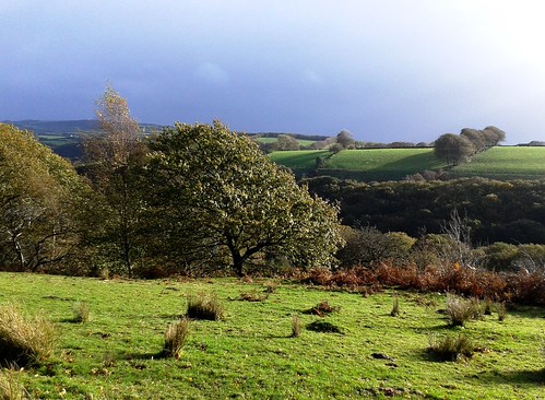
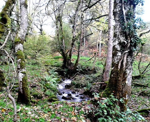
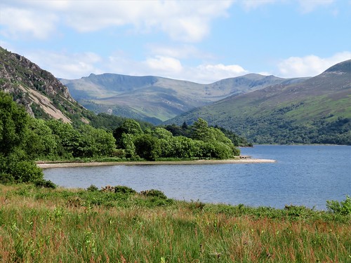
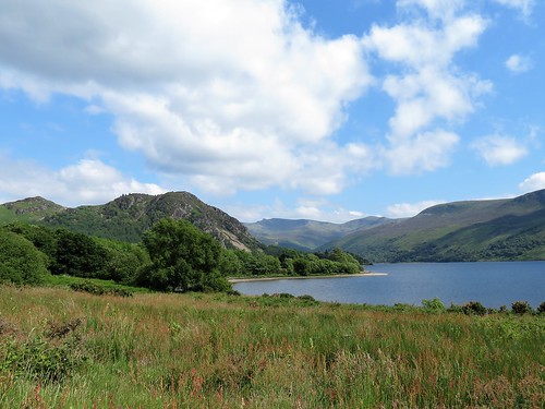
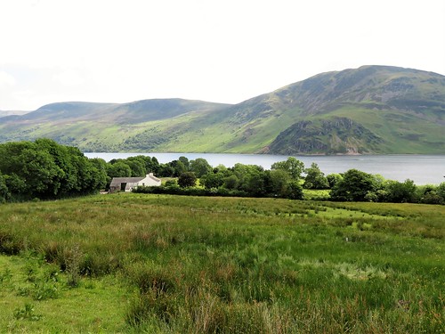
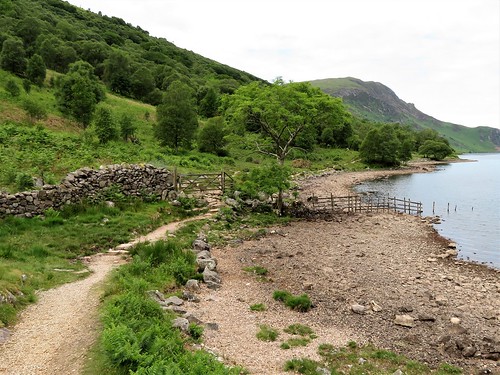
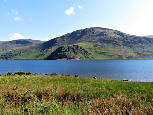
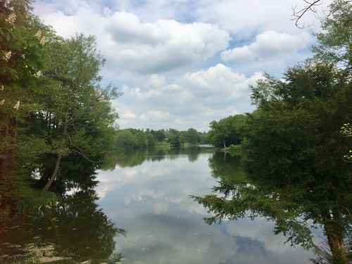
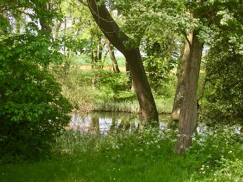
Back on the main path once more I skidded over icy rocks and through frozen puddles, descending to where Loch Achall lay in its lonely glen. The water shone a deep ice-blue. There was not a sound, not even from the dipper flirting its white breast among the stones of the Ullapool River. If there was a more beautiful spot in all Scotland to sit and stare just now, I couldn’t imagine it.

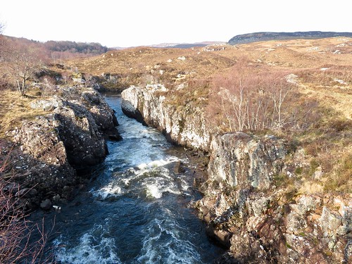
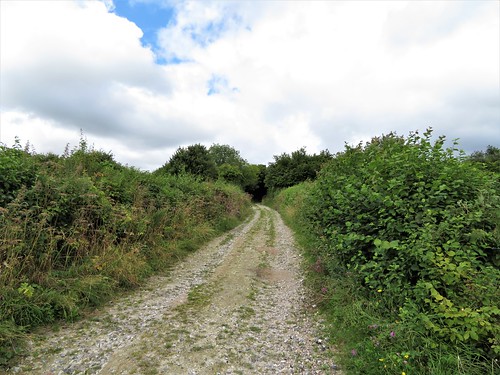
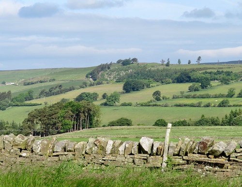
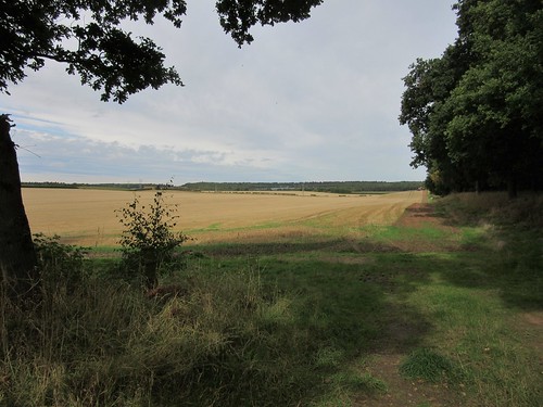
I crossed the river where it charged in glassy grey surges through the rocky narrows of Eas Dubh, and crunched back to Ullapool along the glen road with a pair of buzzards circling close overhead, mewing in courtship to one another like the first promise of spring.

Start: Ullapool car park, Ullapool, IV26 2XB (OS ref NH 125941)

Getting there: Bus 961 (Inverness-Ullapool)
Road – Ullapool is on A835, signed from Inverness. Car park (signed ‘Latheron Centre’ off Quay Street) is next to Tesco.

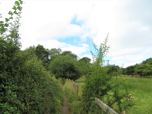
Walk (7½ miles, moderate hill walk, OS Explorer 439): Walk back to cross Quay Street. Down Market Street; left along A835 (131942). In 350m, take 2nd of 2 right turns into Broom Court (130945). Through kissing gate/KG ahead (orange arrow, ‘public footpath’). Path climbs steadily. In 450m, it bends left (134944); in 300m, right at bench (132946) up path (red/white post). In 350m pass topograph (136947); in another 400m fork left in hollow (139946, red post). In 100m, right at bench (red post) to climb Meall Mòr (143947) and return to bench. Right on path for 1 mile; at 2nd tall KG (154951), go through; left (white arrow) to track; left to road; right across bridge (155953) to Loch Achall outflow (163956). Right on riverbank track to road (157955); left for 1¾ miles. Pass working quarry on right; in another 200m, left by cattle grid (132951, ‘Ullapool Hill Walks’ fingerpost) on path (green post). In 350m, at fork with green post in middle (133948), right to bench (132946) and outward path to Ullapool.

Conditions: muddy and wet path in places

Lunch: Picnic

Accommodation: Tanglewood House, Ullapool, Highland IV26 2TB (01854-612059, tanglewoodhouse.co.uk) – immaculate, comfortable, superb loch-side position.

Info: walkhighlands.co.uk; visitscotland.com; satmap.com; ramblers.org.uk

 Posted by at 01:29
Nov 172018


First published in: The Times Click here to view a map for this walk in a new window
picture picture picture picture picture picture picture
Facebook Link:

Twenty four hours of solid rain over Bedfordshire had given way to a misty, moisty, mizzling day; not exactly raining, but the damp cold air pearled face and hands with gossamer-fine moisture. The thatched eaves of Old Warden’s cottages dripped, the village road rippled with runnels of water.

In Warden Wood I turned aside over a carpet of birch leaves as soft and yellow as butter, to find Queen Anne’s Summerhouse in its lonely clearing among the pines. It’s doubtful if the queen even knew of this bold brick folly’s existence, but Sir Samuel Ongley thought it wouldn’t hurt to honour his royal liege on the grand estate he’d bought in the 1690s with his East Indian Company profits.

A long green bridleway led north among beet fields, wet and whispering in the misty wind. Pheasant poults went scuttling ahead, then crouched motionless, camouflaged in a ditch. It was their mother who gave way to panic, exploding away right under my boots in a whirr of wings.

I passed the long hangers at Old Warden’s airfield where the wonderful old stringbags of the Shuttleworth Collection are housed. These historic aircraft and motor cars are not preserved as museum exhibits, but are restored to active life in the air and on the ground, living entities once more.

Deep in Home Wood beyond Ickwell Green, a Permissive Path looped round a remarkable monument – a complex of medieval fishponds squeezed inside a warren bank, providing fish and rabbits for the lord of Northill Manor. Bending and curving in and out of one another like a Chinese puzzle, these half-filled ditches, scattered with gold leaves, gave off a powerful atmosphere of mystery among the coppiced hazels along their banks.

Big open fields surrounded the handsome square brick house at Highlands Farm. Lapwings and starlings picked over the winter wheat fields, and a brown hare streaked for cover.

Coming back into Old Warden, the tower of St Lawrence’s Church floated disembodied above the mist. I turned into the church and stood amazed at the riot of fantastic wood carving that embellishes the dark interior – snakes, angels, swags of flowers, and a very tender depiction of the disciples, hooded and sombre, lowering the limp body of Jesus into the tomb.

Start: Hare & Hounds PH, Old Warden, Biggleswade, Beds SG18 9HQ (OS ref TL 138440)

Getting there: Old Warden is signed off B658 (A1 at Biggleswade)

Walk (9 miles, easy, OS Explorer 208): From Hare & Hounds, right along road. On left bend, right (fingerpost/FP, white posts) up path through Warden Warren (in ¼ mile, detour left to Queen Anne’s Summerhouse at 143438). At road, left (144433); in 600m, left (149430, bridleway FP) for nearly a mile to Shuttleworth College drive (157442). Right; in 150m, left (gate, black arrow/BLA, yellow top post/YTP) on bridleway for ½ mile to cross road (155448); on for ½ mile to Ickwell Green beside pre-school (150456).

Cross to continue along Northill Road (pavements). In ⅔ mile pass pond, then church; then left (149466, ‘Cople’) on Bedford Road. In 250m, left (147466, ‘Greensand Ridge Walk’/GRW). In 450m, detour left (143465) on Permissive Path circuit of medieval fishponds. Returning to GRW, left (YTP) through Home Wood. At western edge, left (138462, GRW) round field edges.

In 300m through kissing gate/KG (136462); left, and aim left of Highlands Farm house through KG (GRW). Cross paddock to KG left of sheds (GRW). Cross 2 paddocks (GRW), through trees (131460, YTP) and forward across 2 wide fields. At far side, left (126461, YTP). In ½ mile GRW turns right (123455, YTP), but keep ahead on bridleway (BLAs) through Palmer’s Wood. From Mount Pleasant Farm (136448) follow drive to road (138445). Right; in 200m, right to St Lawrence’s Church (137443), or keep ahead to Hare & Hounds.

Lunch: Hare & Hounds, Old Warden (01767-627225, hareandhoundsoldwarden.co.uk) – excellent village local

Accommodation: Old Warden Guest House, SG18 9HQ (01767-627201, oldwardenguesthouse.co.uk)

Info: Sandy TIC (01767-682728)

Shuttleworth Collection: shuttleworth.org

visitengland.com; satmap.com; ramblers.org.uk

 Posted by at 01:01
Nov 102018


First published in: The Times Click here to view a map for this walk in a new window
picture picture picture picture picture picture picture picture
Facebook Link:

For this Armistice centenary weekend, a walk of three lives to be remembered. The first two are intertwined – Hal Willoughby Sandham (1876-1920, an unsung Great War soldier, and the artist Stanley Spenser (1891-1951), whose murals in the Sandham Memorial Chapel near Newbury rank with his very finest work. The third life is that of Brenda Parker (1939-2008), Hampshire countryside campaigner, walker, wildlife enthusiast and maintainer of footpaths, a local hero unsung by the world at large. It was the countryside trail named in her honour, the Brenda Parker Way, that we followed out of Burghclere down a disused railway, a tunnel of trees and brambles with glimpses ahead of the long high spine of Watership Down.

Under a bridge festooned with trailers of ivy like jungle creepers, then up out of the ‘lost world’ of the abandoned railway cutting and off through arable fields on flinty tracks and green bridleways. Monster oaks with twenty-foot girths stood in the hedges like guardian giants, their twigs sprouting round brown galls.

A piercing silvery light smeared the sky over the downs. At Woodside Farm two ginger horses were having a tremendous game in their field, whinnying and snorting and dashing up and down with a great drumming of hooves. We heard their joyful neighing as we followed the Brenda Parker Way across the beanfields and along the old driftway called Ox Drove, back to Burghclere and the Sandham Memorial Chapel.

John and Mary Behrend of Burghclere were dedicated patrons of the arts. Mary’s brother Hal saw active service in Salonika during the Great War, and when he died of malaria in 1920 the Behrends had the chapel built in his memory and asked Stanley Spenser – a fellow Salonika veteran – to paint its interior in acknowledgement of all anonymous soldiers.

Here are men in camp hauling great tureens of blood-red soup. A kit inspection, with items laid out like body parts. Soldiers dressing themselves under shroud-like malaria nets. Exhausted men asleep around a mounted officer. And a tiny, distant Christ overwhelmed in a maze of white battlefield crosses.

Spenser’s genius was to discover spiritual glory in humble things and people, and he found its supreme expression in this remarkable memorial to the unregarded soldier.

Start: Sandham Memorial Chapel car park, Burghclere, Hants RG20 9JT (OS ref SU464608)

Getting there: Bus 7A from Newbury
Road – Sandham Memorial Chapel signposted off A34, 5 miles south of Newbury (M4, Jct 13)

Walk (6½ miles, easy, OS Explorers 158, 144): Right along road; first right (Spring Lane); in 400m, right (467605, ‘Brenda Parker Way’/BPW). Left along old railway for nearly 1 mile. Under bridge (473593); right up slope (BPW); right across railway to road (476593). Left; right (‘Ecchinswell’); beside next junction, left (‘Bridleway’). Follow blue arrows/BAs for ½ mile to junction (481598); left (BAs) up Earlstone Manor drive. At top of pond on right, bear right (fingerpost) along pond edge. Leave trees (481599); left along field path (yellow arrows) for ¾ mile to road beyond Woodside Farm (491604). Left; in 600m, left (493610, BPW) across fields for 1 mile. At Palmer’s Hill House (478612), follow drive past house on left, then on for 400m to road (475614). Right; in 600m, opposite Lakeview House gate, left (478619, fingerpost), descending through trees. At bottom, left (477620), following Ox Drove for just over 1 mile, crossing road at 473619, to junction by old railway (463610). Left to road; right to car park.

Lunch/Accommodation: Carpenter’s Arms, Burghclere RG20 9JY (01635-278251, carpentersarms-burghclere.co.uk)

Sandham Memorial Chapel: Open Fri, Sat, Sun (01635-278394, nationaltrust.org.uk/sandhamchapel-memorial-chapel); satmap.com; ramblers.org.uk

 Posted by at 01:09
Nov 032018


First published in: The Times Click here to view a map for this walk in a new window
picture picture picture picture picture picture picture picture picture picture picture
Facebook Link:

Nathaniel Crewe, Bishop of Durham, laid out Blanchland as an estate village in the early 18th century, basing it around the remnants of a medieval monastery whose lands extended far and wide across these borderlands of Northumberland and Durham.

From the slopes of Buckshott Fell we paused to look back. Blanchland had entirely disappeared. Monastic gatehouse, rambling old Lord Crewe Arms that was once the Abbot’s lodging, immaculate vegetable gardens and neat sandstone cottages – the deep cleft of the Derwent valley had swallowed them all. The northward view swept over the invisible village and on up rough pastures to the wild Northumbrian moorland of Cowbyers Fell.

All round us the sprigs of old burned heather formed silver-grey patches among the dark green of newer ling – essential food and shelter for grouse. We disturbed a female of the species who clattered off in a panicky whirr of stubby wings, calling ‘Go back-back-back!’

It’s not only grouse that benefit from the careful management of these moors and upland pastures. In spring they are favoured nesting sites for curlew and golden plover, whose sweet, haunting whistling is the signature tune of the Durham Dales.

Beyond the moor road from Blanchland rose two tall industrial chimneys, stark reminders of the lead mining industry that once steamed, smoked, roared and clanged across these moors. Beside Sikehead Dam’s wind-ruffled reservoir stood the broken-topped chimney which belched out deadly lead vapour, brought from Jeffrey’s smelting mill far below along a mile of stone-lined flues. Once a year some wretch would be detailed to climb the interior of the chimney and scrape off the ‘fume’ or condensed lead vapour for re-smelting.

Not far away we came to a sister chimney, elaborately capped, standing over disused shafts 400 feet deep. Employees of the Sikehead Mine laboured down there to hew the lead ore that kept the Industrial Revolution towns of Britain in water pipes and the army in bullets.

The homeward path lay among old spoil heaps, stone field walls and the steep rushy pastures of lonely daleside farms. A cold wind blew down the Bolt Burn’s valley, a pair of missel thrushes bounced and bobbed among the sedges, and a flock of fieldfares provided an aerial escort to see us off the Durham moors.
Start: Lord Crewe Arms, Blanchland, nr Consett DH8 9SP (OS ref: NY 967503)

Getting there: Bus 773 from Consett
Road – Blanchland (on B6306) is signed off A68 at Carterway Heads, 3 miles west of Consett.

Walk (6½ miles, rough moorland walking, OS Explorer 307): From Lord Crewe Arms, left along B6306, across bridge, uphill. In 200m, right by Blanchland sign (967502); up road for ⅓ mile; at right bend, ahead through gate (968496). Ahead with wall/fence on left, uphill for 1 mile. Where track begins descent, at gate on left, turn right across moor (970481) on track for ½ mile to road (964475).

Left; in 70m, right (fingerpost, yellow arrow/YA) on track across moor. In ¼ mile, left at T-junction (960473, YA). Just before Jeffrey’s Chimney (the left-hand of two), right over stile (958467, YA); left along dam wall. At far end, right, aiming for Sikehead Chimney (right-hand one). At fence by chimney, right (955464, YA) on grass track beside dry dam, then curving left down to angle of wall (953468).

Right through gate (YA); follow wall along hillside, keeping it on your left, for ½ mile. Cross wide right-angle of wall to a bent YA (958475); left downhill to gate into forestry (957476, YA). Boggy track downhill through trees (ducking under some boughs!) to exit kissing gate at bottom of trees (956477, YA). On down fenced path, over stile into wood (955478, YA). Down forest path to valley road (955479).

Right along road; in 500m on left bend, left off road (958482, YA, ‘Pennine Journey’/PJ) down path. In 150m, right (957483, YA, PJ), north through trees for 1 mile to road (958497). Left downhill; just before Bay Bridge, right (958499, PJ) through trees for 700m to Blanchland.

Lunch/Accommodation: Lord Crewe Arms, Blanchland (01434-677100, lordcrewearmsblanchland.co.uk) – wonderful village hotel, ancient, full of character.

Info: visitnorthumberland.com; satmap.com; ramblers.org.uk

 Posted by at 01:05
Oct 272018


First published in: The Times Click here to view a map for this walk in a new window
picture picture picture picture picture picture picture picture picture picture picture picture picture
Facebook Link:

A wild, blustery autumn day had marched in on Exmoor from the west. We waited in the car park at Dunkery Gate until the rain army had charged through and away, and set out in its heels to climb the path to the crest of Dunkery Beacon. A piglet-like squealing came down the wind from above, and when we came over the brow we found three children leaping and yelling for sheer glee round the summit cairn, their coats flying in the gale.

Up here on Exmoor’s highest point, standing by the cairn on the rocky tomb of some long-forgotten king, we drank in the view, as brisk and refreshing as a great gulp of cold water. Ninety wide and beautiful miles stretched out from the tiny tip of the Sugar Loaf, north across the Bristol Channel in Wales some 50 miles away, to Yes Tor’s hummock on Dartmoor nearly 40 miles to the south. Not that we could see those two distant landmarks in such conditions of wind and sun dazzle and rain curtains – it was enough to know they were out there, visible from Dunkery Beacon on the clearest of clear days. What we saw today were rolling ridges of moorland, humped green fields squared with tall hedge-banks, and a sunlit valley leading north to the bulky seaward slope of Hurlstone Point.

We turned east on the rocky ridge track, bowling along with the wind astern pushing us like a second-row rugby forward. The sun burst out across the hills, bringing the whitewashed farm houses far below into brilliant relief against their green meadows and woods. Suddenly a flight of twenty small birds went skimming across the path just ahead, cutting and turning like one creature, the sun flashing on their white breasts and sabre-blade wings – dunlin or plovers, they passed and vanished too quickly to be sure.

From the ridge, a squelchy river of a bridleway made a sloshy descent southward into the sheltered cleft of Mansley Combe. Down here, deep sunk in the valley bottom, the day fell suddenly calm. Gale-driven clouds tore over from rim to rim of the combe a hundred feet overhead, and the wind rushed and sighed in the beech canopy where leaves scattered horizontally in showers of gold.

We forded the River Avill, hurrying in bubbles and miniature rapids under a canopy of silver birches and luxuriant, rain-pearled ferns. As we followed the red mud track steeply up towards Dunkery Gate again, from the trees in the depths of the combe came a grinding, grating roar – a red stag bolving*, calling out a defiant rutting challenge to all comers, a wild voice to suit the wild day.
* Yes, that’s the word!

Start: Dunkery Gate car park, near Wheddon Cross, TA24 7AT approx (OS ref SS 896406)

Getting there: Dunkery Beacon is signed off B3224, 1 mile west of Wheddon Cross (A396 Dunster-Dulverton)

Walk (4½ miles, moderate, OS Explorer OL9): Cross Dunkery Bridge; in 100m, left (‘Public Bridleway Dunkery Beacon’) to summit cairn (892416). Right along main ridge track for nearly 1 mile. Cross road (904420) and continue; in 300m, right (907422, cairn) on bridleway through heather for nearly 1 mile. At hedge-bank (914410), don’t go through gate; turn right, keeping hedge-bank on left. In 450m, bear sharp left (910410); follow hedge-bank downhill, through gate (910407, ‘bridleway’), down to track in combe bottom. Right (‘Draper’s Way, Dunkery Gate’); uphill for 1 mile to Dunkery Gate.

Lunch/accommodation: White Horse, Exford, TA24 7PY (01643-831229; exmoor-whitehorse.co.uk)

Information: National Park Centre, Dulverton (01398-323841); visit-exmoor.co.uk
satmap.com; ramblers.org.uk

 Posted by at 02:22
Oct 202018


First published in: The Times Click here to view a map for this walk in a new window
picture picture picture picture picture picture picture picture picture picture picture
Facebook Link:

Approaching Farringford along the footpath from Tennyson Down, my first reaction was ‘What an ugly house!’ Farringford in its yellow brick bulk, all castellations and creepers, looks as forbiddingly Victorian as can be. It’s only when I was immersed in the dark red and blue rooms, the study and drawing room, the schoolroom and bedrooms where the Tennyson family led their intensely interwoven lives, that I began to appreciate what a haven this Gothic pile became for Alfred Lord Tennyson, Victorian England’s favourite celebrity Poet Laureate.

At Farringford, Alfred and his ailing wife Emma could put up the shutters on the clamorous outside world. They entertained a selection of the great and good; they dressed their beloved sons Hallam and Lionel in lace collars and long hair, and didn’t care if the boys would rather play the bugle or ride their rocking horse than do maths. Tennyson was a genial man, not at all inclined to stand on ceremony.

Above all, Tennyson in his great cloak and wideawake hat was a Poet, a very visible one. He came to the Isle of Wight to escape his celebrity, but became the island’s most famous figure, striding the long down beyond Farringford and mouthing half-created lines to the four winds at the edge of the great chalk cliffs.

Up on the back of Tennyson Down I strode, too, heading west past the big Celtic cross memorial to the poet, out to where the down narrows to a precarious blade of chalk.

A fenced eyrie overlooks a most tremendous view, a flint-scored wall of chalk nearly 400 feet high, the waves mumbling its feet, running out to where the three white blades of The Needles rise from the water. A salt-stained striped lighthouse clings to the outermost stack, and gulls wheel far below.

In Tennyson’s time they built a battery out here to ward off the threat of a French invasion. A century later, scientists and engineers used the promontory as a test ground for Black Knight and Black Arrow, rockets that tried and failed to make Britain a credible player in the Great Space Race.

Afternoon sun struck glowing colours – rose, peach, white, crimson and dove grey – out of the deeply fissured cliffs of Alum Bay. Beyond them I followed a field path back towards Farringford, glancing every now and then up at the skyline for a glimpse of a genial ghost in flowing cloak and broad-brimmed hat, still striding and declaiming to the winds.
Start: High Down Chalk Pit car park, 1 mile south of Totland, PO39 0HY approx. (OS ref SQ 324855)

Getting there: Red Funnel ferries (redfunnel.co.uk), Southampton-East Cowes. Bus 5 (East Cowes-Newport), 7 (Newport-Alum Bay).
Road – A3021, A3054 to Newport; B3401 Carisbrooke and Freshwater Bay. Follow ‘Needles, Alum Bay’; in 1¾ miles, left beside Highdown Inn to car park.

Walk (6½ miles; moderate, one short steep climb; OS Explorer OL29): From car park, east along foot of Tennyson Down. In 650m pass gate/path on left (331857) and leave trees. In another 150m, with chalk pit on right and drinking trough on left, path forks right (333858), but bear left and continue on path along lower hedge. Through gate; in 100m, left on fenced path. At 3-finger post (334861), right towards Farringford House and walled garden.

Ahead up Gate Lane (fingerpost). In 200m, at ‘Private’ garden door on left, turn right (338861) down Green Lane. In 300m through gate (337857); cross path; straight ahead, steeply up through trees. Cross summit of down to Tennyson Trail (337855); right (west) for 2½ miles to coastguard cottages (301848), Needles viewpoint (298847) and Old Battery (296849).

Back along lower roadway. In ¾ mile, at left bend to Alum Bay, keep ahead (308852, ‘Tennyson Down’) on field path. In ¾ mile at Nodes Beacon cresset (319853), fork left for 600m to car park.

Lunch/Accommodation: Highdown Inn, Highdown Lane, Totland PO39 0HY (01983-752450, highdowninn.com)

Farringford House: Guided tours, opening times etc – 01983-752500, farringford.co.uk

Tourist and walking info: visitisleofwight.com

Isle of Wight Walking Festival: 4-19 May 2019 (isleofwightwalkingfestival.co.uk)

satmap.com; ramblers.org.uk

 Posted by at 01:04
Oct 132018


First published in: The Times Click here to view a map for this walk in a new window
picture picture picture picture picture picture picture picture picture picture picture picture picture picture picture
Facebook Link:

Waking at Beckfoot Retreat, everything was absolutely quiet and still. With the nearest main road over the hills and far away, and the glittering wavelets of Ennerdale Lake at the feet of the fells for a view, we were drawn irresistibly outdoors.

Ennerdale Water is the most westerly lake in the Lake District, and the quietest of all those easily accessible. The only road beside it is the crunchy forestry track that we followed along the north shore.

Big tranches of forest clothe the lower slopes of Great Borne and Starling Dodd on the north side. We moved from shadow to sun splashes under silver birch, rowan, ash and larch, looking up and beyond the trees to see the pink splotchy shoulders of Red Pike and High Stile, two thousand feet above us against the cloudy sky.

Ennerdale is a shapely valley, scoured out by a glacier high on Great Gable to the east. The glacier pushed its moraine or rubbly foot down the valley towards the sea, piling up a long tongue of rocks where the River Liza runs into the lake. We turned down across this rough grassy hinterland, before setting back westwards along the steeper and stonier southern shore of Ennerdale Water.

It seems quiet incredible that a scheme should be currently afoot to bury nuclear waste in the granite rock below this lake. But that’s the situation. The lake is deep, dark and cold, a broad trench of water full of life – salmon and trout, and the rare Arctic char, a race of fish sealed into the valley when the glacier retreated. We teetered along the rocky path, watching our footing among the loose stones and tree roots, as white-faced Herdwick sheep watched us suspiciously from the bracken.

A sandpiper bobbed on a shoreline rock before uttering a silvery pipe of a warning, then taking off and flying low over the water. The white bar across its tail flashed in the sun as it turned and scooted for safety elsewhere.

A scramble up and down the slippery rocks of Angler’s Crag, polished to a shine of red and green by millions of boot soles. And a last section round the west end of Ennerdale Water, looking east to Pillar and the Pillar Rock, guarding the mountain approaches to Ennerdale as they have done for the past 400 million years.

Start: Bowness Knoll car park, Croasdale, Ennerdale Water LA23 3AU (OS ref NY 110153)

Getting there: A5086 from Cockermouth to Cleator Moor; left to Ennerdale Bridge; fork right at school to Croasdale, right to Bowness Knoll car park.

Walk (7½ miles, tricky underfoot, OS Explorer OL4): Left along track, clockwise round lake. In 1½ miles, pass modern bridge on right (131143); in another 350m, fork right (134142) down to cross 2 footbridges. Bear left through ruined wall; head across pasture for gate in plantation wall (131138). Go through; right along track; in 100m, right through gate. Left on the outside of plantation wall, and on along south lake shore. In 2 miles, scramble over outcrop of Angler’s Crag (103149); on clockwise round lake. In 2½ miles, path turns inland at Bowness to car park

Conditions: A mild rock scramble at Angler’s Crag; watch your footing! Stumbly path along south side of lake

Lunch: The Gather Café (01946-862453, thegatherennerdale.com); Fox & Hounds (01946-861373, foxandhoundsinn.org) or Shepherds Arms (01946-861249, shepherdsarms.com), all at Ennerdale Bridge.

Accommodation/evening meal: Beckfoot Retreat, Ennerdale (01946-748144, beckfootretreatennerdale.com) – peaceful, secluded and welcoming.

Info: The Gather Café (see above); golakes.co.uk; nationaltrust.org.uk/ennerdale; satmap.com; ramblers.org.uk

 Posted by at 08:20
Sep 292018


First published in: The Times Click here to view a map for this walk in a new window
picture picture picture picture picture picture picture picture picture picture picture picture picture picture picture picture
Facebook Link:

The two children came pelting out of the trees near the spanking new Sherwood Forest Visitor Centre, home-made bows in hand. ‘Look!’ shouted the girl in the green peaked hat, and sent her stick arrow flying across the clearing. ‘No, look at me!’ squealed the little boy behind her. He stopped to bend his bow, the string snapped, and his sister fell around in heartless laughter. Robin Hood would have had something to say to her on the subject of looking after the weak and misfortunate, I’m sure.

Whether bold Robyn Hode, the forest outlaw of the early medieval ballads, really existed or not is open to question. He certainly lives on in the imaginations of dozens of kids in Lincoln green hats who were dashing about and shooting the tree trunks in the outskirts of Sherwood. A fair number of them had made it as far as the Major Oak, a colossal veteran with a golden crown that could well be old enough to have dropped an acorn on Robin’s head as he sat at parliament with his Merry Men in its shelter – one of uncountable legends about the greenwood hero.

Once past the Major Oak, the clamour of young voices fell behind. The wide woodland track of Robin Hood Way took us west through the heart of Sherwood Forest, where immensely distorted and swollen old oaks raised arthritic limbs in the shadows. These tremendously characterful trees owe their survival to their imperfections. Had they stood straighter and taller, they would have been cut down for timber long ago. In the carpet of red and gold leaves at their feet grew clusters of fly agaric with white-spotted scarlet caps, fungi so potently psychotropic that even the most reckless outlaw would steer clear of them.

When fugitives from justice such as Robin Hood lived in Sherwood, the Forest was 100 times its current size and covered 150 square miles of country. Nowadays it all fits comfortable into two square miles. Somewhere toward the middle we found the Centre Tree and turned north along a grassy bridleway into Sherwood’s northerly neighbour, Budby Forest. Here the trees opened out into a broad heathland of golden bracken and purple heather.

The track swung south again through a stretch of wood pasture grazed by long-horned cattle with chocolate-brown coats and white streaks up their backs, a stylish combination. We stopped to admire their sleepy stolidity, and reckoned that the Merry Men would have been exceptionally pleased to encounter such slow-moving lunches on the hoof. Hollywood has dandified the doings of such as Robyn Hode, but the life of a Sherwood Forest outlaw must have been pretty tough. You had to take your chances when every man’s hand was against you.

Start: Sherwood Forest Visitor Centre, Edwinstowe, Notts NG21 9RN (OS ref SK 627677)
Getting there: Visitor Centre signed off B6034 just north of Edwinstowe (A6075).
Walk (5 miles, good forest tracks, OS Explorer 149. Online maps and more walks at christophersomerville.co.uk): From Visitor Centre, follow signposted Major Oak walk. Just beyond Major Oak, fork left (not through gate) and follow Robin Hood Way/RHW green arrows. In ¾ mile at Centre Tree, right (607676, ‘public bridleway’) on RHW for 1¼ miles. At crossing with 7-finger post, right (604695, ‘Budby’). In ¾ mile at crossing (616694), right through kissing gate; fork left on grassy bridleway, keeping ahead for 1½ miles to Visitor Centre.
Lunch/Accommodation: Forest Lodge, Edwinstowe, NG21 9QA (01623-824443, forestlodgehotel.co.uk) – friendly, comfortable village stopover
Info: Sherwood Forest Visitor Centre (01623-824643, visitsherwood.co.uk)
experiencenottinghamshire.com; satmap.com; ramblers.org.uk

 Posted by at 02:24
Sep 222018


First published in: The Times Click here to view a map for this walk in a new window
picture picture picture picture picture picture picture picture
Facebook Link:

A blackbird was giving us the best of his autumn repertoire from a cottage garden in Combrook. Not even the stone angels forming a guard of honour either side of the church door could have sung more celestially.

We sat on the churchyard wall to hear him out, then followed a grass path under heavy-laden horse chestnuts. The fallen conkers lay all around, their spiny green shells half split to reveal a wink of shiny brown nut within.

Greylag geese waddled complaining among the ewes in Park Field, where the long ornamental lake of Compton Pools glinted between trees just beginning to change their dress from green to gold. From the sheep pastures around Home Farm we looked back down a valley landscaped by Capability Brown in the 1770s for Baron Willoughby de Broke. Artfully shaped slopes and dells guided the eye from tree clumps and skyline down to the lake and its three-arched ornamental bridge, a brilliant trick of depth and perspective.

The parkland path and roads led north past stubble and pastures, between hedges crimson with hawthorn berries – peggles, as old countrymen used to call them. The land in its green and brown stripes billowed like a tarpaulin on a windy day.

The horses in the paddocks around Banisters Meadow Farm were too intent on loading grass into themselves to give us more than a glance. Just beyond, we turned back along the homeward path, skirting the osier beds at Poolfield where the knobbly old trees stood knee deep in dark carr swamp.

On the far side of a great trackless field of plough we found Compton Verney’s parkland opening its sculpted vistas again. The pillars and portico of the early Georgian mansion stood beyond the lake, every painter’s dream of peaceful Middle England.

The Verney family built Compton Verney and held it for 200 years. Soap king Joseph Watson, manufacturer of Nubolic disinfectant and Bumpo soap powder, bought the estate in 1921. The new owner exemplified the self-made man of the post-war world. He died a lord, chasing the fox with the Quorn – a paid-up member of the galloping classes.

Start: Combrook Church, Compton Verney, Warwicks CV35 9HP (OS ref SP 307517)

Getting there:
Bus 67A, 67B to Compton Verney house.
Road – Combrook is signed off B4086 at Compton Verney, between Kineton and Wellesbourne (M40, Jct 12)

Walk (7¼ miles, easy, OS Explorer 206): With church on right continue down ‘No Through Road’. In 200m, left by No 27 (307519, blue arrow/BA) down path, then beside Compton Pools. In 300m through gate (305521, BA), across Park Field. Gate to right of houses (305525, BA), right along drive to B4086 (307528). Left up Compton Hill; in 200m, right (‘Home Farm’, BA) along drive past Home Farm for 1¼ miles to cross road (318540).

Ahead for ½ mile; right (323545, ‘Hill Fields’) down farm road. In 400m, left along muddy lane (327543); at Banisters Meadow Farm (330545), left up drive to road (331549). Right; in 100m, right (stile, yellow arrow/YA) along field edge. At bottom, right; in 50m, left (333546) down field, across stream (334544) and on across large field. At corner of Poolfield Coppice, through gate (336537); right along fence; in 500m cross left end of Upper Pool (332535, BA). In 100m right across bridge (BA); follow field edge for 500m to Poolfield Cottages (328534).

Left up drive; in 150m, right (gate, BA). Aim a little right across paddock to hedge gap and deer gate (326534). On through wood; through another deer gate, across field, trending a little away from hedge on your right, for 500m to road (321536). Right; in 100m, left (kissing gate) into Compton Verney park. Follow path over meadow for ¾ mile to gate into car park (314527).

Cross in front of café; through gate; left on woodland path. Follow ‘Bird Hide’; pass hide, and follow woodland path to cross B4086 at bridge (311526 – take care!). Path across field (YA), into wood (310523, YA); straight ahead, no lefts or rights, to emerge in field (309519). Right, down to road by house (308518); left to church.

Lunch: Picnic, or Compton Verney Café (open 10-4:30)

Accommodation: Howard Arms, Ilmington, Warwicks CV36 4LT (01608-682226, howardarms.com) – cheerful, characterful village inn.

Compton Verney: 01926-645500; comptonverney.org.uk

Info: shakespeares-england.co.uk; satmap.com; ramblers.org.uk

 Posted by at 02:37
Sep 152018


First published in: The Times Click here to view a map for this walk in a new window
picture picture picture picture picture picture picture picture
Facebook Link:

Geologically, the Stiperstones are easy enough to explain – outcrops of quartzite some 500 million years old, spread along a mile or so of heathery Shropshire ridge on a westerly spur of the Long Mynd.

It’s their contrary aspect – jagged upthrusts of naked rock in the midst of smoothly rolling countryside – that has cloaked them in all manner of strange and demonic myths. And certainly, walking towards Cranberry Rock at the southern end of the line, it was disconcerting to find the harsh outline of the tor suddenly appearing between one minute and the next as though the ground had disgorged it all in a moment.

It was a beautiful autumn afternoon. The Long Mynd was a glowing green bar of dimpled slopes in the east, the Welsh borderlands a sunlit haze of woods and hills to the west. Cranberries spattered the heather with scarlet. A pair of ravens flew high overhead, one giving out deep croaks, the other emitting a strange, musical warble.

The path among the Stones, rocky and full of angular quartzite lumps, required careful watching. We followed it through the heather past Cranberry Rock and Manstone Rock to the Devil’s Chair – more like a giant and horrendously uncomfortable chaise longue of unforgiving stone.

Wild Edric the Saxon, Lady Godiva and all the witches and warlords of Shropshire have the Devil’s Chair as their trysting spot. Here Slashrags the Tailor got the better of the Evil One, once he’d spotted his cloven hooves.

And here the Devil reclines in stormy weather watching between the lightning bolts for the ruination of Old England. On that day, it’s said, the Stiperstones will sink back whence they sprang – into the bowels of Hell.

We descended a steep grassy path among old lead mine workings to the village of Stiperstones a thousand feet below. Down there, with the Stones shut away from sight by steep hillsides, it was hard to bring their otherworldly atmosphere to mind. But as we headed home along a track that skirted the ridge, we saw their ragged profiles lit by the setting sun and a spectral half-moon that sailed up out of the ridge. The Stiperstones stood sentinel, a ghostly guard above our homeward path.

Start: The Bog car park, near Stiperstones, Shropshire SY5 0NG (OS ref SO 358978)

Getting there: Shuttle Bus, weekends and BH Mon, May-end Sept; Bus 552 from Shrewsbury
Road: From A488 between Bishop’s Castle and Shrewsbury, follow ‘Shelve’, then ‘Stiperstones’.

Walk (5 miles, strenuous, OS Explorer 216): Follow Shropshire Way/SW signs to right of pond; follow path, up steps, through kissing gate (arrow). Ahead along gorsy bank to kissing gate; left to cross road (362976). Follow SW ‘main route’ for 1 mile along ridge past Cranberry Rock (365981), Manstone Rock (367986) to Devil’s Chair (369992). In another 600m, SW turns right (371996); keep ahead here. In 350m, at crossing and cairn by Shepherd’s Rock (373999, yellow arrow/YA, ‘Cross Britain Walk’) left down grassy path to road in Stiperstones village (363004). Left past Stiperstones Inn; in 400m, hairpin left (361002, fingerpost); cross stile; right, steeply up fence for 300m. Left at post (359999, arrow); cross stile, pass NNR notice; steeply up through trees to cross stile at top (361996). Half left across field; right (361994) on stony lane for 1 mile to road (359980) and car park.

Conditions: Rocky underfoot along Stiperstones ridge; steep climb from Stiperstones village

Lunch: Bog Centre (01743-792484, bogcentre.co.uk)

Accommodation: Stiperstones Inn, Stiperstones village SY5 0PD (01743-791327, stiperstonesinn.co.uk)

Info: Bog Centre, Stiperstones (see above); visitengland.com; satmap.com; ramblers.org.uk

 Posted by at 07:48