Sep 082018


First published in: The Times Click here to view a map for this walk in a new window
picture picture picture picture picture picture picture picture picture picture
Facebook Link:

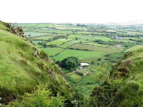
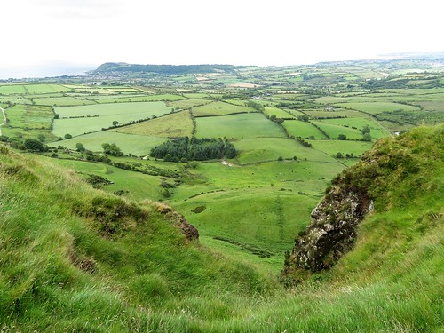
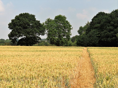
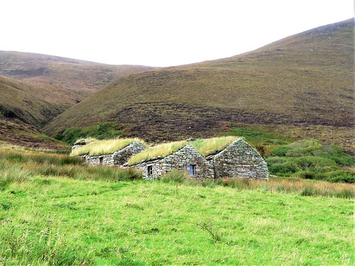
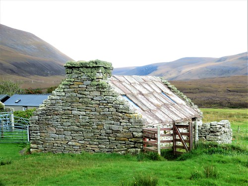
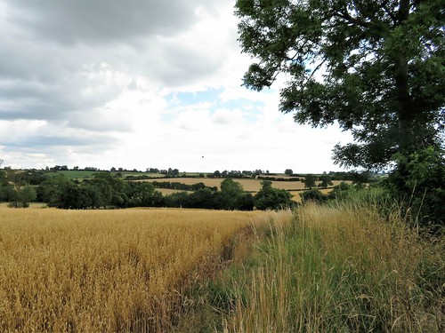
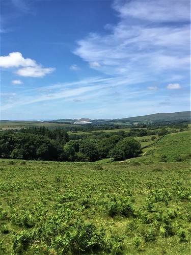
The Antrim Hills Way hurdles high countryside seldom seen by tourists who stick to County Antrim’s celebrated Causeway Coast. These green hills form a volcanic backbone that shadows the coastline a few miles inland and a thousand feet higher, a rugged spine with ribs of basalt cliffs that fall dramatically to patchwork farmlands between the heights and the sea.

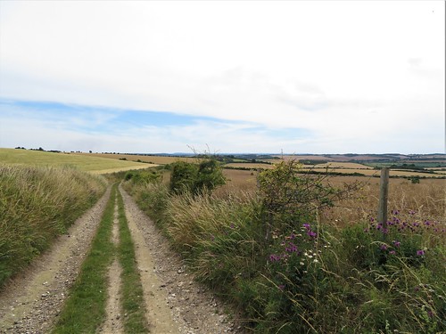
You could do the whole 22-mile path in a single long day, if you had time and stamina. But today we were aiming for some highlights of the route, the great arc of the Sallagh Braes cliffs and the high lookout of Scawt Hill. A blustery wind was sweeping the last of the night’s rain away in its skirts as we put on our boots in the ‘car park in the sky’, as locals call Linford car park with its tremendous seaward views.

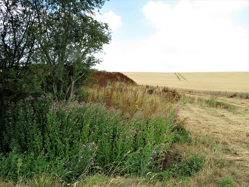
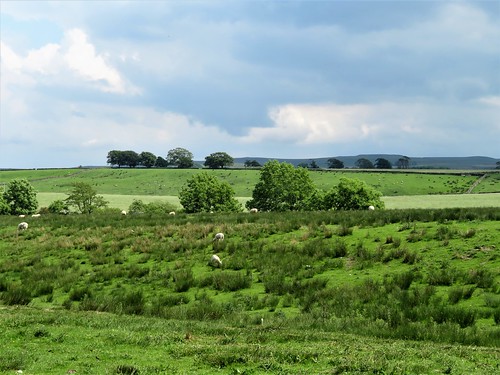
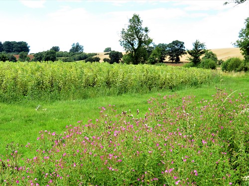
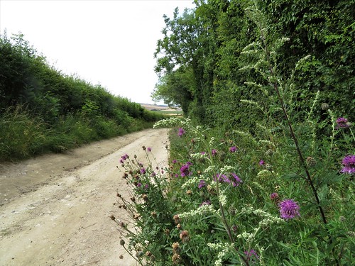
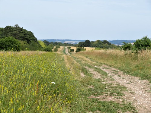
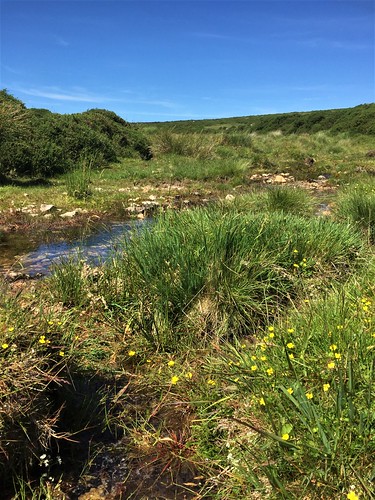
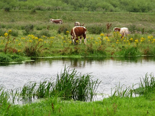
Up the lower slopes of Robin Young’s Hill we went, heading south through sedge clumps that hissed and bowed stiffly before the wind. A patch of plants resembling a beanfield in flower turned out on closer inspection to be thistles, stuck all over with white hanks of wool from the ragged mountain sheep that wandered among them.

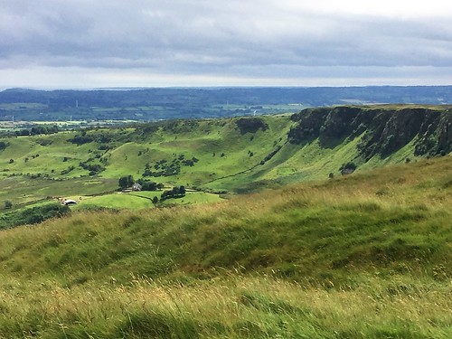
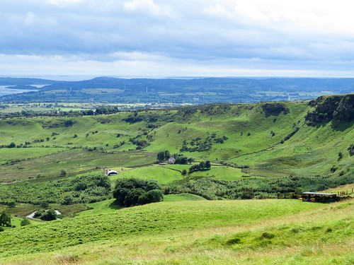
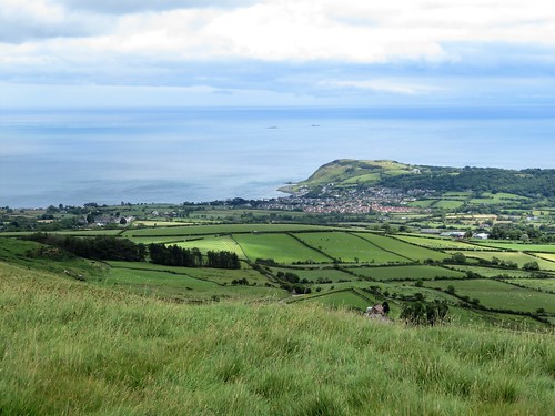
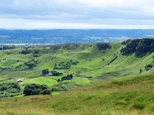
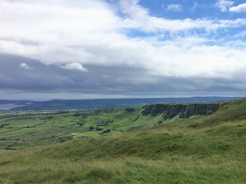
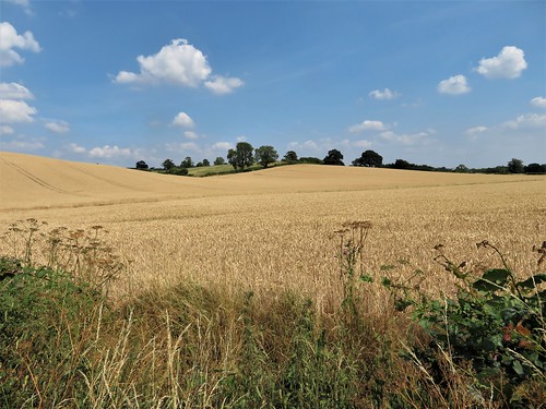
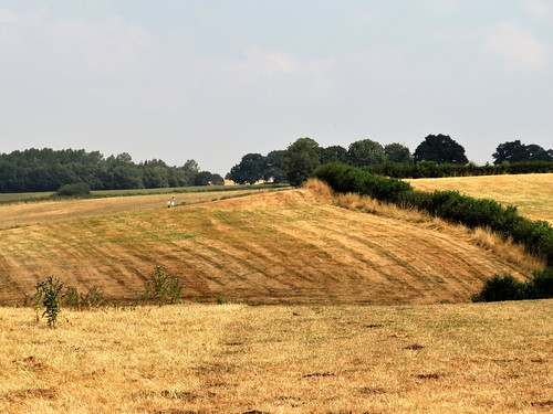
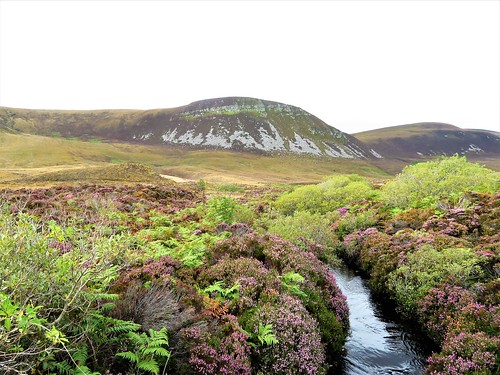
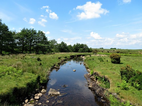
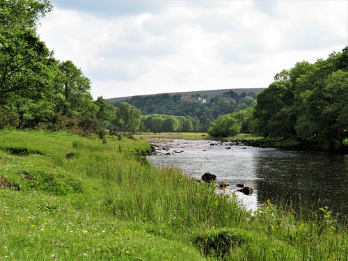
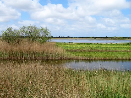
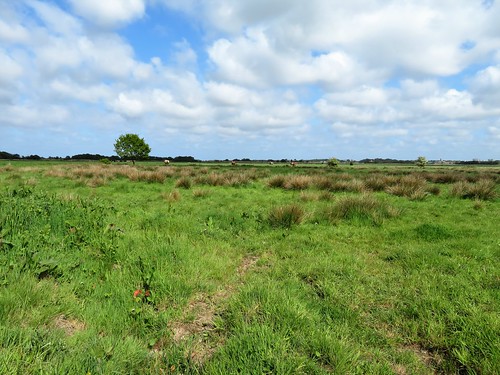
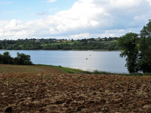
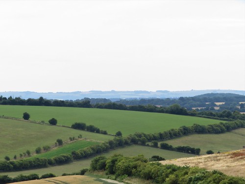
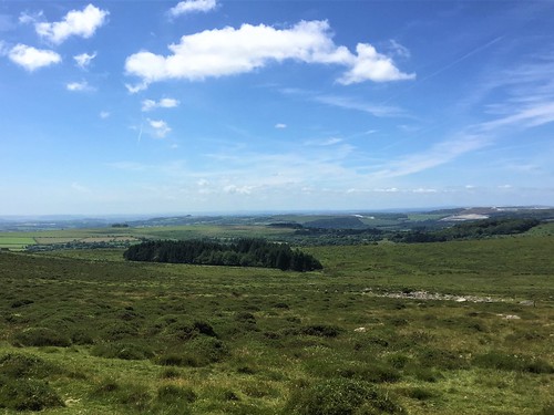
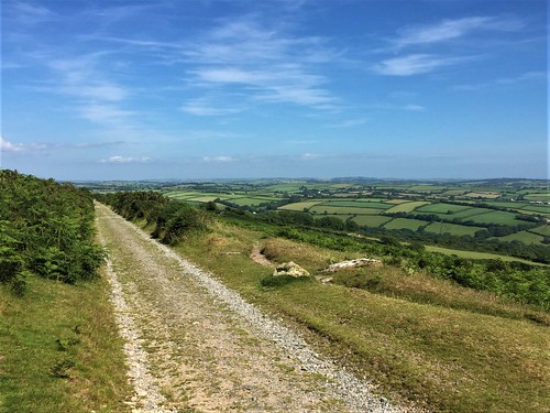
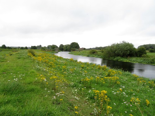
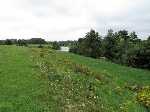
Ahead ran the bent bow of the Sallagh Braes, a wide amphitheatre of basalt ramparts, with fans of grassy scree sweeping down to crumpled country of green and yellow fields. Eastwards the sea lay in polished silver streaks, its far horizon crowned with the volcanic plug of Ailsa Craig, a thousand feet high. The hills of south-west Scotland were spread beyond – the Mull of Kintyre to the north, the Rhinns of Galloway in the south.

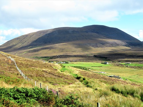
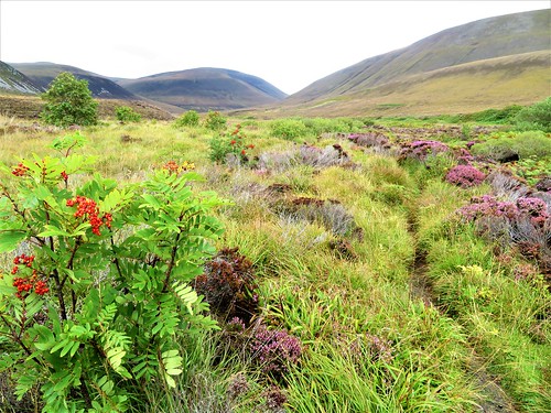
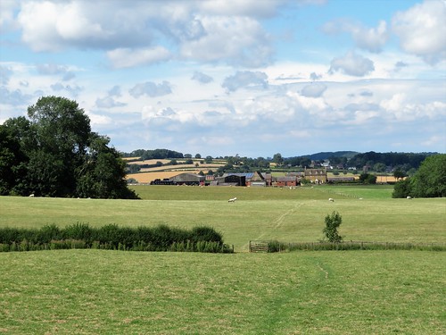
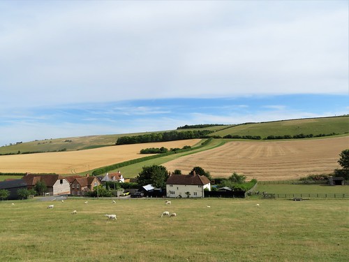
Topping the rise, we looked forward along the Sallagh Braes’ scoop of cliffs, with the long sea inlet of Larne Lough cradled in the arm of Islandmagee’s green peninsula. Inland, rolling hills led away to the black hedgehog-backed mountain of Slemish, southerly terminus of the Antrim Hills Way.

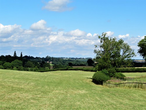
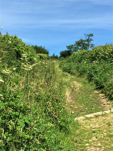
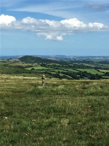
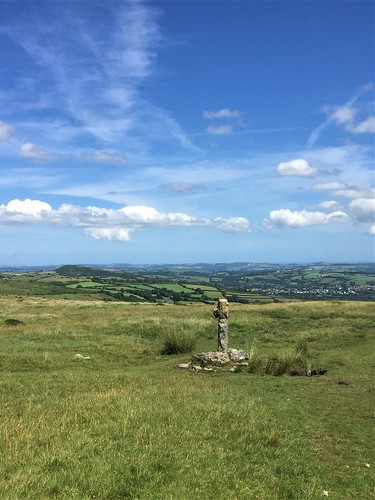
We skirted the rim of the Sallagh Braes, savouring these giant prospects, until the Way swung inland. Turning back along the cliffs, we crossed the road at the ‘car park in the sky’ and followed the path north for another exhilarating mile of high and mighty walking.

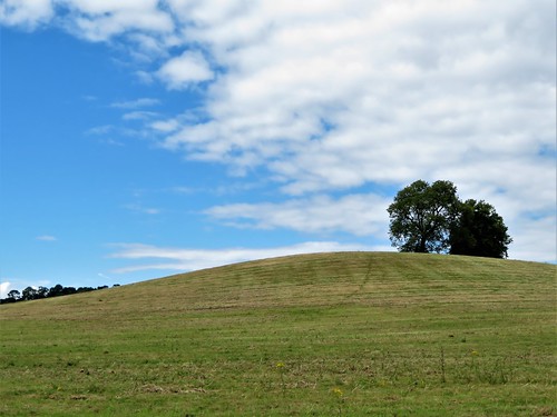
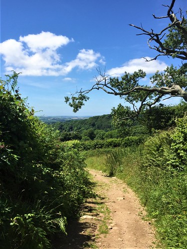
A stiff little climb up to Ballycoos Hill, and then an undulating stride to the top of Scawt Hill, another of the volcanic plugs so characteristic of this coast. The wind shoved us, our hair smacked our faces like a cat-o’-nine-tails, and we stared round over sea and land as the sky cleared, our eyes full of wind tears and belated sun dazzle.

Start: Linford car park, Feystown Road, near Ballygally, Larne BT44 0EA approx. (OSN1 ref 332072)

Getting there: Linford car park is 2 miles up Ballycoose Road/Feystown Road from Cairncastle on B148 (signed off A8 at Millbrook, just west of Larne).

Walk (5½ miles, rough moorland walking, OSN1 1:25,000 Activity Map ‘Glens of Antrim’): From car park cross ladder stile, head south uphill, following Antrim Hills Way white-topped posts (AHW) for nearly 2 miles to a notch in cliffs where AHW turns right/inland (344048). Return same way to car park. Cross road and stile opposite; follow AHW posts uphill, across Ballycoos Hill (335083) and on to Scawt Hill summit (337090). Return to car park.

Lunch: Picnic

Accommodation: Ballygally Castle Hotel, Ballygally BT40 2QZ (028-2858-1066, hastingshotels.com)

Antrim Hills Way: walkni.com/walks/51/antrim-hills-way

Info: Larne TIC (028-2826-2495); visitcausewaycoastandglens.com
discovernorthernireland.com; satmap.com; ufrc-online.co.uk

 Posted by at 01:25
Sep 012018


First published in: The Times Click here to view a map for this walk in a new window
picture picture picture picture picture picture picture picture picture picture
Facebook Link:

Six men bearing enormous reindeer horns cavort together, advancing and retiring, enticing and threatening. Lumpy-bumpy melodeon music accompanies their ritual, crowds of onlookers cheer them through the village streets. This is the ancient Abbots Bromley Horn Dance, performed every Wakes Monday in this Staffordshire village.

We start today’s walk in the village church of St Nicholas, and here on the wall behind the organ hang the venerable sets of reindeer horns, each a thousand years old, mounted on curious little wooden heads. Not long after sunrise on Wakes Monday the priest-in-charge blesses the horns before the dancers set out with them, a nice blend of the Christian and pagan.

The bells of St Nicholas ring out over Abbots Bromley as we walk away from the brick cottages and half-timbered old houses of the village. The hazy bloom of a hot summer’s morning lies over the steeply rolling countryside.

On the ridge near Spring Bank Farm, young cattle are sheltering from the heat in their shed. From here we look back to Abbots Bromley among trees on its hillside, and to the misty grey outlines of the great cooling towers at Rugeley, their waists nipped in like monstrous flamenco dancers.

At Beacon Bank Farm we get into a lane of hazel hedges between shady oaks, from whose upper leaves tiny caterpillars come abseiling down on glistening threads. At Hart’s Farm the young heifers blow through their nostrils as they stand in straw, emitting their characteristic warm, biscuit smell.

The royal hunting forest of Needwood once covered all this countryside. Now its fragments lie widely scattered. We sit on a medieval earthen bank in Hart’s Coppice, our feet among oak leaves, listening to blackbird and warblers making mid-afternoon music in the cool of the woodland canopy. Uncountable insects add a harmonic background hum.

Around Dun’s Field farm the stiles are choked with brambles and blackthorn. We clear a way at the cost of a few scratches, and follow a track across the broad acres of Bagot’s Park between fields of wheat and oilseed rape.

A wistful glance as we pass the silver silos of the Freedom Brewery, and we haul our thirsty throats and hot faces homeward along the Staffordshire Way. The fields shimmer in the sunshine, hoverflies hum their monotone refrain, and all colours are leached out in the heat of the afternoon to the dull gold of the crops and the green of trees so dark they look tar black against the pale blue sky.

Start: St Nicholas’s Church, Abbots Bromley, Staffs WS15 3DD (OS ref SK 079246)

Getting there: Bus 402A, 403, Uttoxeter to Burton-on-Trent
Road – Abbots Bromley is on B5014, signposted (B5013) from A51 at Rugeley.

Walk (7 miles, easy, OS Explorer 244): From church to village green at Buttercross. Right along High Street; left (084244) up Radmore Lane. In ½ mile pass Radmore farm; in 100m, right over stile (091249); fork left (fingerpost) across field to far corner (stile). Same line across next field to cross footbridge (094249). In 50m, right (stile, yellow arrow/YA). Straight uphill, then half left to shed (097250). Through gate; half left across field to gate. Ahead to 2 gates by The Clump wood (100242). Left through left-hand gate; along hedge (stiles) for 350m to lane at Beacon Bank Farm (099255).

Right; in 300m pass gates of Four Oaks (101257); in 240m, fork left (103259) to Hart’s Farm (103261). Between house and shed; on through farmyard between sheds; through gate at far side; follow farm track for 200m to go through gate (105264, YA). Bear left up flank of Hart’s Coppice to enter wood (106265, stile, YA). Ahead across track; on through trees with ditch on left for 200m to leave wood (107266, stile, YA).

Path across field; cross footbridge (100269, YA); on down field edge. In 200m at angle of field, right (101271, stiles, YAs, footbridges) across brook. Up field to shed; cross stile (110273); across following stile (YA); left with hedge on left to cross 2 adjacent stiles in corner of field (109274) at Dun’s Field farmhouse. Bear right past cattle grid; left along field roadway (108276) for 1 mile to pass Freedom Brewery (093270). In another 250m, left (090269) along field edge in valley bottom on Staffordshire Way (marked by YAs with ‘knot’ logo).

In 600m bear right round field edge (094264); ahead over stile (SW) through trees; up hill. In 500m, left through hedge (089263, SW, fingerpost). Follow hedge on right. In 200m, right through hedge (090261, YA) across field. Left along hedge on your left (YA), on path becoming green lane to road (087255). Ahead to Abbots Bromley.

Conditions: Some bramble-choked stiles near Dun’s Field Farm; secateurs/stick are useful!

Lunch: Café on the Green, Abbots Bromley (01283 840275) – excellent home cooking

Accommodation: Marsh Farm B&B, Uttoxeter Road, Abbots Bromley WS15 3EJ (01283-840323)

Abbots Bromley Horn Dance: Monday 10 Sept 2018; abbotsbromley.com/horn_dance

enjoystaffordshire.com; satmap.com; ramblers.org.uk

 Posted by at 01:22
Aug 252018


First published in: The Times Click here to view a map for this walk in a new window
picture picture picture picture picture picture picture picture picture picture picture
Facebook Link:

Among the Orkney islands, Hoy is the odd man out. The other isles of the archipelago lie low and green off the northern tip of mainland Scotland. But Hoy rises in a series of steep dark hills, culminating in the lowering 1500-ft bulk of Ward Hill.

From the pier at Moaness I bucketed along the rough road to Rackwick aboard the Hoy taxi. Once down there in the sparsely populated old fishing hamlet where big red and grey cliffs fall sheer into Rackwick Bay, I felt a long way from anywhere.

When young composer Peter Maxwell Davies met Orkney’s national poet George Mackay Brown at Rackwick in 1970, Brown pointed out a derelict house on the hillside, roofless, windowless and with decades of compacted sheep muck inside. Davies was delighted. The cottage was to be his home for the next 25 years, a harbour of peace as he composed and walked the hills of Hoy.

I set off up the grassy hillside track, crossing springs that glinted down over mats of moss and lichens. Soon the path became a well-paved route, the dusky pink granite sand sparkling between the stones. Turning the corner of the hill of Moor Fea, the sea ahead was a silken blue, the coast a dark red jumble of sandstone cliffs where fulmars planed on stiff wings.

The path ran north above the flat green and purple tableland of Rora Head, the Burn of Stourdale tumbling from the lip of slanted red cliffs in a grey mare’s tail of spray.

The Old Man of Hoy is a geological phenomenon, a slender sea stack of sandstone 450 feet high, rising from its footing on the rocky shore to a summit almost level with the cliffs. I saw it a mile away, its profile irresistibly reminiscent of General de Gaulle – receding chin, moustache, great prow of a nose and military kepi all present and correct.

The cliff path ran out to a viewing point. Fulmars, kittiwakes, herring gulls and guillemots lined the cracks and crevices of the Old Man. As I stood and stared, a horizontal prism formed in the air, bent in an arch and touched its seaward end to the foot of the stack, a once-in-a-lifetime rainbow.

The path from Rackwick back to Moaness led through a wild glen among the hills, a narrow cleft threaded by a boggy old road, as remote as could be. I came down to Moaness Pier as evening fell, the light going out of the day and a green flicker of the Northern Lights behind the hill of Cuilags to add the final touch of magic to the walk.

Start: Rackwick, Isle of Hoy, Orkney KW16 3NJ (OS ref ND 200997)

Finish: Moaness Pier, Isle of Hoy KW16 3NJ (HY 244040)

Getting there: Ferry (orkneyferries.co.uk), Stromness-Moaness, Isle of Hoy
Hoy taxi (01856-791315) to Rackwick

Walk (8½ miles, rough moorland walking, OS Explorer 461): From Rackwick follow ‘Old Man of Hoy’ signs past schoolhouse Folk Museum, uphill and along track for 2¼ miles to cliff viewpoint opposite Old Man of Hoy (HY 177007). Return to Rackwick. Back up road. In 400m cross Rackwick Burn (202001); follow path (‘Moaness 6.5 km’). In 2½ miles join road at Sandy Loch (219032); follow it down to Moaness Pier.

Conditions: Unguarded cliff-tops; Rackwick Glen track is boggy. Take midge repellent! – Avon Skin-so-Soft is effective.

Lunch: Picnic

Accommodation: Stromabank Hotel, Longhope, South Walls, Isle of Hoy KW16 3PA (01856-701494, stromabank.co.uk)

Orkney International Science Festival: 6-12 September; oisf.org

Info: visitorkney.com; hoyorkney.com; satmap.com; ramblers.org.uk

 Posted by at 01:57
Aug 182018


First published in: The Times Click here to view a map for this walk in a new window
picture picture picture picture picture picture picture picture picture picture picture picture picture picture picture picture picture picture picture
Facebook Link:

The steam trains of the South Tyne Valley Railway were slow enough by all accounts. But travellers in the slowest of them could never have had the leisure to spot all the wild flowers that Jane and I saw as we walked the footpath that now runs along the old railway. All this under a blue Northumbrian sky where white cumulus clouds 30,000 feet tall rolled with soundless majesty.

Along the farm lane to Lynnshield, black and brown heifers tittuped and snorted in pastures where oystercatchers circled above their nests, crying their sharp pik! pik! alarm calls. Beyond the farm we headed south at the rim of Park Burn’s deep canyon, where the burn rushed over rocky falls. Sphagnum was using the clumps of sedge as foundations for building its big pink and green cushions of moss, deep and damp enough to wet a finger thrust in among them.

We picnicked under the footbridge, watching sand martins popping in and out of their nest holes in the banks. Then it was on south by way of dusty spoil-heaps of old coal pits, and a tangle of dubious paths around the stone-built steading of West Stonehouse. Here we paused for a superb view north over many miles of moor and upland. Out there the landscape lumped up into the characteristic breaking-wave skyline of the Whin Sill’s volcanic ledge, where Hadrian’s Wall rode right at the edge of sight.

Down again through sheep pastures into the wide green valley of the River South Tyne. It was hard to equate the sluggish dark tideway through Newcastle-upon-Tyne with this young river of clear water, running fast round islets of pebbles piled up in winter floods. We followed it north to where the great grey bulk of Featherstone Castle raised its battlements and window arches.

Just upstream stood an abandoned clutch of stark red brick buildings, black-windowed and sinister – the remnants of Camp 18. Here after the Second World War, German officers were put through a process of ‘de-Nazification’, before being repatriated to help rebuild their ruined country. A humane, far-sighted initiative, the first step in the process of Anglo-German reconciliation.

Start: Featherstone Park car park, Featherstone Rowfoot, near Haltwhistle NE49 0JF (OS ref NY 683607)

Getting there: Car park is 1 mile east of Featherstone Castle (signed from A689 at Lambley)

Walk (8 miles, moorland and farm tracks, OS Explorer OL43): From car park cross road and on along old railway (South Tyne Trail, ‘Haltwhistle 3’). In ½ mile fork left at Park Village (687615); right across railway, to road. Right; in 150m, left (fingerpost/FP, ‘Broomhouse Common’) along farm drive to Lynnshield (695612). Skirt to right round buildings (arrows); on to gate. Beyond, fork right at waymark post (697613, yellow arrows/YA). Follow fence on right to wall gate (700613, YA). Right along gorge edge; in 600m fork right at post (702608, YA) to cross Park Burn on footbridge (700605).

Ahead to gate; green lane to road (690600); ahead for ¼ mile to larger road (696595). Left; in ⅔ mile at top of hill, right into Pinewood Grove chalet park (699587, FP ‘Yont the Cleugh’). In 10m, left through gate (YA); ahead to pass site office and farmhouse (697586). Through gate, down path to cross Christowell Burn; right up to gate. Half left across field to gate at West Stonehouse (695586).

Right; in 50m, left round end of barn; pass cottage on right, then between farmhouse on left and barn with steps on right. Through gate on right (YA); on to ladder stile (LS); on to gate, and cross farm track by Birch Trees house (694586). Half left and through gate (YA). Up field with fence on right to LS (691584); on to LS by corner of Beaconhill Plantation (689583). Right (stile, YA, FP) through plantation (occasional YAs), down to stile (687585). Forward to cross road (686586, LS).

In 150m at waymark post (YA), ahead downhill for 700m with fence on left, then across fields to farm at Coanwood (681590). Ahead through gate (YA); immediately left (stile, YA) along field edge to stile (YA) into lane (678589). Right between houses, and down to road. Sharp left, down through gate (FP, ‘Lambley Bridge’). At cottage (676589), right on path heading north beside River South Tyne for 1¾ miles. Just past Featherstone Castle, right up road (673612) for ¾ mile to car park.

Conditions: NB – poor waymarking around West Stonehouse.

Refreshments: Wallace Arms PH, Featherstone Rowfoot (NB no food); Blenkinsopp Castle Inn, Castel Home Park, Brampton CA8 7JS (01697-747757)

Accommodation: Kellah Farm, near Greenhead, Haltwhistle NE49 0JL (01434-320816, kellah.co.uk) – proper friendly farm B&B

Info: visitnorthumberland.com; satmap.com; ramblers.org.uk

 Posted by at 07:30
Aug 042018


First published in: The Times Click here to view a map for this walk in a new window
picture picture picture picture picture picture picture picture picture picture picture picture
Facebook Link:

The River Thurne went chuckling round the boats moored at Potter Heigham. We watched a beautifully restored Norfolk wherry, with mast folded flat, preparing to pass under the arch of the 14th-century bridge, now that the ebbing tide had left just enough squeeze room there.

The banks of the Thurne were lined with little dwellings, some smart, others weather-beaten old shacks. The sun shone on the white cap and tall brick tower of High’s Mill, one of dozens of windpumps built in times past along these waterways to drain the sodden fen fields for agriculture.

Reed buntings creaked and reed warblers chattered in the reedbeds. The feathered heads of the reeds tossed and whispered together in the wind. A big new area of reedbed is being planted and nurtured for wildlife here, a good example of farming and conservation in Fenland making easier bedfellows than in the past.

Two large birds sprang up beyond the water, black and white, slowly flapping their big wings – cranes, aliens until recently, now domiciled and breeding here.

The path passed through a gate, a portal into a different world, the sedgy fields left behind for damp oak woodland and the vast reedbeds of Hickling Broad. Remarkable noises came from the reeds, a mixture of chicken clucks and porker squeals – a water rail, skulking like a naughty child where it could be heard and not seen.

Hickling Broad, like the other Norfolk Broads, is a flooded medieval peat digging. The big inland fleet of water lay masked by reeds. Hugh clouds moved with stately gait across the windy blue sky, casting an elephantine calm over the landscape.

Potter Heigham’s church of St Nicholas is a flint-built chest of treasures – a magnificent hammer-beam roof, a rare medieval font of brick, a rood screen painted with saints, and a 14th-century wall painting showing the good deeds a charitable lady ought to perform – giving a loaf to a starving old man, handing coins to a fettered prisoner, spooning soup into the mouth of a sick man.

Our way back lay along farm tracks where larks went up singing over the pastures, a stolid bull eyed us across his ditch, and a great dark marsh harrier, a female with a golden head, went flapping along the hedges while every crow in Potter Heigham hopped and skipped and cursed her to hell.
Start: Latham’s car park, Potter Heigham Bridge, Great Yarmouth NR29 5JE (OS ref TG 419185) – £8.50 all day.

Getting there: Bus 6 (Great Yarmouth – North Walsham)
Road: Potter Heigham Bridge is signed off A149 between Stalham and Caistor-on-Sea.

Walk (6½ miles, easy, OS Explorer OL40); Walk towards old Potter Heigham bridge; just before, left along bank of River Thurne, then Candle Dyke, passing alongside Ground Plantation and Wagonhill Plantation. After 3½ miles, pass bird hide opposite Rush Hill lagoon (423209); in another 350m, left (421206, fingerpost) through Coll’s Plantation, then on south to T-junction of hedges (421201). Right (‘Weavers’ Way Circular Walk’, green arrow) to road; left to St Nicholas Church (419199). Retrace steps to edge of Coll’s Plantation (421204); right for 1 mile along south edge of wood, and past Glebe Farm (428197) to T-junction opposite High’s Drainage Mill (429193). Right (yellow arrow) along Middle Wall; cross A149 (419187) and on; in 200m, left to car park.

Lunch: BridgeStones* café, Potter Heigham Bridge (01692-671923, www.Wayfordbridge.co.uk)

* sic

Accommodation: Wayford Bridge Inn, Stalham, Norfolk NR12 9LL (01692-582414, norfolkbroadsinns.co.uk)

Hickling Broad NNR: 01692-598276, norfolkwildlifetrust.org.uk

Info: Great Yarmouth TIC (01493-846346); visitnorfolk.co.uk; satmap.com; ramblers.org.uk

 Posted by at 08:21
Jul 282018


First published in: The Times Click here to view a map for this walk in a new window
picture picture picture picture picture picture picture picture picture picture picture picture picture picture
Facebook Link:

A blustery grey morning was giving way gradually to a sky of scattered blue over the Northamptonshire farmlands. At East Haddon, Sunday lunchers clinked their glasses in the Red Lion, and somewhere near the recreation ground a children’s party was getting under way with tremendous music and megaphone announcements.

The building stone hereabouts is all honey-coloured ironstone. The rich, dark gold soil lay stiff with flints and water-smoothed pebbles. The farmers had left generous headlands around the fields, growing ground for thistles and white campion, yellow and purple vetches, tall rusty docks and pink spears of willowherb.

Slate grey clouds hung low above the northern skyline, where a strip of brilliant blue piled with whipped cream cumulo-nimbus inserted itself between heaven and earth. A church tower, peeping among trees, heralded Holdenby, a dream of an orderly estate village with handsome stone houses and high-gabled cottages around a broad oak-shaded green. Long gone is the great Elizabethan house with its 80,000 square feet of bulk and its 123 windows, where King Charles I endured a gilded captivity between the end of the Civil War and his eventual execution in 1649.

Beyond Holdenby the pastures rolled out northwards toward low hills. Medieval ridge-and-furrow undulated below the grass, more sensed than seen. We skirted Holdenby North Lodge, where two glossy horses in the absolute nick of health came up inquisitively to see what apples or mints we might be hiding in our pockets. They scorned my proffered handful of grass with snorts of aristocratic contempt.

The path crossed huge, hedgeless cornfields where the red brick barn of Tithe Farm lay half hidden in a fold of ground. A glimpse of the wind-furrowed grey lake of Ravensthorpe Reservoir, where fly fishermen rhythmically flogged the water from tiny boats, and we set back south along a well-found field path.

Oats, beans and barley grew, just as in the old nursery song. The ripe oat seeds hung like so many million silver bells, trembling in the breeze. Lime green shield bugs clung among the oats, and damselflies hovered, vanished and materialised a foot away, their electric blue bodies barred with black. Overhead, elephantine clouds moved massively across the sky, subtly backlit by a sun that never left their shelter all afternoon.

Start: Red Lion Inn, East Haddon, Northants NN6 8BU (OS ref SP 670682)

Getting there: Bus 96 (Rugby-Northampton)
East Haddon is signed off A428 between Rugby and Northampton

Walk (7 miles, easy, OS Explorer 223): Opposite Red Lion, up Mill Lane. At sports field, left (yellow arrow/YA) along field edges. Clockwise round three sides of 3rd field to gate (679677); left past Rowell Leyes barn. At foot of slope, left (678673) along field margin for 800m to bridleway (683668). Left (‘Holdenby’), following bridleway to road in Holdenby (695678).

Left to road (695680); cross, and follow Macmillan Way (black arrows/BLA) to Holdenby North Lodge. Cross stile into field to right of house (695687); left over next stile, and through farmyard. BLAs point west through paddock (stiles), then along field edge. In 400m (688686, gate on left), right across 2 fields. At foot of slope (687691), ahead with hedge on left; in 200m, left through hedge (687693, BLA, blue arrow/BA). Diagonally across field, over footbridge (686696); follow hedge on left to Teeton Road (680701).

Left; in 100m, left (NB – another 100m along road gives a view over Ravensthorpe Reservoir) at footpath fingerpost. Along field edge with hedge on right. In 300m, right through hedge (678698), across corner of field to footbridge. Half right across next field; through hedge in top right corner (677694); down field edge. In 150m right (stile); left along hedge (YA), then across open field to stile (676688). Half right in front of Rye Hill Farm; beyond ponds, right off drive (674687, YA). Follow hedge, then fenced path past sewage works (672685). Keep stream on right before bearing left to stile (arrow) and road (672682). Right to Red Lion.

Lunch: Red Lion, East Haddon (01604-770223, redlioneasthaddon.co.uk)

Accommodation: Murcott Mill, Long Buckby, Northants NN6 7QR (01327-842236, murcottmill.com)

Info: northamptonshiresurprise.com; satmap.com; ramblers.org.uk

 Posted by at 01:22
Jul 212018


First published in: The Times Click here to view a map for this walk in a new window
picture picture picture picture picture picture picture picture picture picture picture picture picture
Facebook Link:

Aldworth slumbered along its sunny lanes. A tiny cream-and-green car stood outside the bike shop. ‘An original Fiat 500, 1937,’ said the owner proudly. ‘They called it the Topolino, the Little Mouse – rather a good name.’

The long lane to the Berkshire Downs ran between hedges thick with the summer’s growth – angelica, cow parsley, pale pink blackberry flowers, docks brown and crisped by July heat. A comma butterfly with raggedly scalloped wings settled on a stinging nettle and opened its wings to catch the sun. At Starveall cottage a patch of wild ground was bright with flowers – purple mallows and knapweeds, blue powder-puff heads of scabious, a bubbly yellow froth of lady’s bedstraw.

Here the motor road expired as if it couldn’t be bothered to crawl any further. A stony lane took over, the dusty flints crunching and knobbling underfoot. We crossed the ancient Ridgeway track and took the road less travelled, a grassy way between cornfields where the fat ripe ears of wheat and barley drooped earthwards on their short stalks as though already bowing their necks for the harvester’s blades.

A marbled white butterfly went kettering over a bank of thistles in a tarry blur of wings. We passed Lowbury Hill, a slightly swelling dome amid the oilseed rape. Was it here that the future King Alfred dealt the Danes a terrible beating on a winter’s day in 871 at the Battle of Ashdown? Or was it on Kingstanding Hill, at the far end of the splendid old grass track called The Fair Mile that runs straight and true, west to east along the spine of the Berkshire Downs? There’s no telling the battle’s exact location now, but the views from Kingstanding across Berkshire into Oxfordshire are something to savour.

We dropped down above Starveall Farm – another Starveall! This must have been a grim area to farm in times past. After the heat and dust of the downland cornfields, the cool green light under the beeches of Unhill Wood was delightful. When we emerged to follow the flinty trackways back to Aldworth, a whitethroat in an elder bush sang us by as though in private raptures.

Start: Bell Inn, Aldworth, Streatley, Berks RG8 9SE (OS ref SU556796)

Getting there: Aldworth is on B4009, signposted from Streatley (M4 Jct 12, A340, A329)

Walk (8 miles, easy, OS Explorers 158, 170): From Bell Inn, right to junction; right on Ambury Road. In 1 mile pass Starveall cottage (546809); in another half mile, Ridgeway track crosses and forks left (540815), but take right fork (grassy central strip). In ¾ mile, just past ‘Ridgeway closed to motor vehicles’ notice, right (544826) along The Fair Mile for 2 miles. Just before A417, turn right through right-hand of 2 gates (573837). Half right down field slope to bottom right corner (571835). Right along drive; in 75m, left up roadway. In ¾ mile, at sharp left bend (564823), ahead on grass track (fingerpost), forking left into woods. Uphill; at start of next descent, right at pheasant feeder (564821) on grass path. In 150m, at pheasant pen (562821), left down to tarmac lane. Right; in ½ mile, at fork, ahead between waymark posts (555817). Path to stile onto driveway (553814); right to gate; right along trackway. In 200m, left (550812, ‘Byway’); in ½ mile, bend right (552805, ‘Byway’) to road (551804); left to Aldworth.

Lunch: Bell Inn, Aldworth (01635-578272) – a rural delight (NB closed Mondays)

Accommodation: Bull Inn, Streatley RG8 9JJ (01491-872392, bullinnpub.co.uk) – comfortable, friendly pub

visitthames.co.uk; satmap.com; ramblers.org.uk

 Posted by at 01:55
Jul 142018


First published in: The Times Click here to view a map for this walk in a new window
picture picture picture picture picture picture picture picture picture picture picture picture
Facebook Link:

As we crossed Stowford Bridge on the northern outskirts of Ivybridge in proper summer sunshine, the slopes of Dartmoor rose to the north under a blue sky. A stony lane brought us up there, climbing between hedges thick with bedstraw and foxgloves, among which the velvety wings of small heath butterflies flicked open and shut.

Out on the moor cattle and sheep grazed, muzzles all down. Two contrasting landscapes lay in view – harsh green and brown slopes of bare moorland ahead, with a white scab of china clay workings to the west, and the broad stretch of the South Hams of Devon behind us, a patchwork of hedges, woodland, green pastures and the yellow squares of meadows just cut for silage.

Extracting china clay was one of the most important Dartmoor industries in bygone times. In 1911 a narrow-gauge tramway was built from Ivybridge to the Redlake works in the middle of the moor. We followed its snaking course along the flanks of Weatherdon Hill, across stream trickles where dragonflies with biplane wings and electric blue bodies hunted the sodden green jungles of moss.

Beyond the piled granite boulders of Hangershell Rock a stone row crossed the old tramway. No-one knows when this monument of stubby, shin-high standing stones was erected – perhaps 4,000 years ago – but here it still stands, defying time and weather.

A harras* of moor ponies was gathered round a pond, their manes and tails streaming like the steeds of pre-Raphaelite knights. Nearby stood Spurrell’s Cross, weather-beaten and stumpy, a marker of pink granite sparkling with mica, raised by medieval monks to mark the meeting place of two of their routes across the moor. Here we sat, munching chocolate eggs (nutritious, no – delicious, yes) and gazing north-east over thirty miles of tumbled lowlands.

From Spurrell’s Cross we headed south towards Wrangaton along the old monks’ road, a groove in the heather and grass worn by countless boots and hooves. We dropped down to cross Lud Brook at a ford of pink granite rubble. At the foot of Western Beacon we found the old tramway once more, and turned along it for home with half of south Devon spread out gloriously before us in the late afternoon sun.

*Please retain this word – it’s the correct term for a group of these wild ponies!
Start: Stowford Bridge, Cole Road, Ivybridge, PL21 0EY approx. (OS ref SX 641567)

Getting there: Rail to Ivybridge (half mile footpath to Stowford Bridge)
Bus 20A (Plymouth – Macandrew Walk, Ivybridge)
Road – Ivybridge is signed off A38 Exeter-Plymouth. Parking spaces on Cole Road near Stowford Bridge.

Walk (7 miles, easy underfoot, OS Explorer OL28): Cross Stowford Bridge (‘Harford’). In 300m, right opposite Stowford Farm (642570, ‘2 Moors Way’/2MW) up lane. In ½ mile, through gate onto moor (645576); half right on 2MW. In ½ mile, left along tramway track (651583). In 1½ miles, right at pond (658599) for 150m to Spurrell’s Cross. From here, south on broad grass track, keeping Ugborough Beacon on left. In ⅔ mile (663589 approx), keep stream valley close on right, descending to ford Lud Brook (662587). Left along right bank; in 400m through gate (661583); down grass path to gate (661579, ‘Private Property’). Right along edge of Access Land; in 100m, through gate; bear left on grass path round lower slopes of Western Beacon. In ½ mile (658572), right along tramway track. In ¾ mile, left (649575) to moor gate; return to start.

Conditions: Best avoided in mist.

Lunch: Picnic

Accommodation: Anchor Inn, Ugborough, PL21 0NG (01752-690388, anchorinnugborough.co.uk) – excellent, comfortable village inn.

visitdartmoor.co.uk; satmap.com; ramblers.org.uk

 Posted by at 09:30
Jul 072018


First published in: The Times Click here to view a map for this walk in a new window
picture picture picture picture picture picture picture picture picture picture
Facebook Link:

A cool damp afternoon in the flat river country of the Norfolk/Suffolk border. Pale sprigs of mugwort and purple-flowered teasels grew with royal blue viper’s bugloss in the verges of Moor Drove East, and the banks of the Little Ouse River and its tributary drains were bright yellow with ragwort and lady’s bedstraw. This is not all soulless prairie farming country, but a complex maze of water channels and lush grassy banks.

Beyond the tall twin gates of Little Ouse sluices and a brief roaring strip of road, we turned aside into the ‘otherworld’ of the RSPB’s nature reserve at Lakenheath Fen. Ditches lay spread with waterweed, marsh woundwort raised stout pink flowerheads, and outside the picture window of the visitor centre a kingfisher perched in all its bronze and cerulean glory beside a pond that plopped with fish.

‘Used to be carrot fields,’ said the warden, ‘very intensively farmed. We dug it out, replanted it with fen species and let the water in – controlled it carefully. Now we’ve otters, bitterns, water voles, marsh orchids, even nesting cranes – just about everything that was here before the Dutch drained the Fens nearly 400 years ago. Isn’t that something special?’

Lakenheath Fen is special, all right. We followed the main trail west on paths of grass and gravel, ducking aside into strategically placed hides to watch great crested grebes preening themselves and swallows zipping low over the meres. With ping and a whistle a flock of bearded tits came skimming through the reed heads – endearing little birds with fine black Fu Manchu moustaches.

From the viewing point at Joist Fen we saw a male marsh harrier pounce into the reedbed in a flurry of large pale wings, while his dark-hued mate perched in an elder bush, turning her gold-crowned head from side to side.

Following the flood banks of the Little River Ouse back to Hockwold, we passed scattered herds of cattle, surely the most contented beasts in Fenland, up to their hocks in the green swamp and chewing lush grass with all the appreciative deliberation of connoisseurs.
Start: Red Lion, Hockwold-cum-Wilton, Norfolk IP26 4NB (OS ref TL 735880)

Getting there: Bus 40 (Thetford-King’s Lynn)
Road: Hockwold-cum-Wilton is on B1112 between Lakenheath and Feltwell (A11 to Mildenhall)

Walk (7¾ miles, easy, OS Explorer 228): Pass church; on down Church Lane. In 500m fork right (734876) along Moor Drove East. At river bank, left (729873); right across sluice (731870); bear right along riverbank to B1112 (724868). Left (grass verge – take care!); in 300m, right into Lakenheath Fen nature reserve (724866). Roadway to Visitor Centre (718863). Follow Main Circular Trail/MCT (white arrows/WA). In 900m fork right (712860, 2 WAs), following MCT. In 50m detour right to New Fen viewpoint and back; in 650m, left (704861) to Mere Hide and back. In 200m take left fork (702861) on gravel, not grassy path; in another 500m, right (697860) past Joist Fen viewpoint. At T-junction with fingerpost (698861), left for 100m; right up river bank, through kissing gate; right along river bank (Hereward Way) for 2 miles back to B1112 (724866). Left (take care!); retrace steps to Hockwold.

Conditions: Paths can be wet and muddy

Lunch: Red Lion, Hockwold-cum-Wilton (01842-829728) – decent village pub

Accommodation: Bridge Hotel, 79 High Street, Brandon, Suffolk IP27 0AX (01842-338228, bridgehotelbrandon.com)

Lakenheath Fen nature reserve, IP27 9AD (01842-863400, rspb.org.uk) – RSPB members park free, others £4. Very helpful staff

visitengland.com; satmap.com; ramblers.org.uk

The Times Britain’s Best Walks by Christopher Somerville (£16.99, HarperCollins) is now out in paperback

 Posted by at 01:27
Jun 302018


First published in: The Times Click here to view a map for this walk in a new window
picture picture picture picture picture picture picture picture picture picture picture
Facebook Link:

The Surrey Weald, a great thickly wooded lens of land, lies on a band of ironstone in the shadow of the North Downs. Once it was a smoky, noisy, clangorous industrial hub, part of the medieval iron-making centre of England. You’d never know it now, though, so snug and quiet lie the villages tucked into valley bottoms along the tortuously winding lanes that thread the woods.

Coldharbour is no more than a scatter of cottages loosely based on the Plough Inn. We started off north along Wolvens Lane, a sun-dappled holloway under sweet chestnuts and knobbly pollarded beeches whose roots hung at the rim of the lane, half in earth, and half in air. Flickers of grey and tan betrayed the movement of horse riders down parallel tracks, moving quietly and all but unseen through the woods.

A path dark with hollies and yews led west, down to the fast water race of the Tilling Bourne in its valley-bottom bed, and to the beautiful mill pond at Friday Street. In the quiet beech woods along Abinger Bottom the tree roots grasped the earth like many-knuckled grey fingers.

A quick sandwich in the Stephan Langton Inn, named after the former Archbishop of Canterbury – a local boy, he led the push to force King John to sign Magna Carta in 1215. Then on through quiet beech woods along Abinger Bottom where the tree roots grasped the earth like many-knuckled grey fingers.

On the slopes of Leith Hill, the highest point in Surrey, we broke clear of the trees and stood between pine trees looking out from the greensand ridge, many miles across the wooded Vale of Surrey and north Sussex, a smoky grey and blue prospect over the Wealden landscape. Up on the viewing platform at the top of nearby Leith Tower the panorama sprang outwards, further and further, south to the South Downs around Goodwood and the trees on Chanctonbury Ring 25 miles off, north to a pale grey smear that might have been the Dunstable Downs a full fifty miles away, and the dream-like spectral towers of the London skyline.

In 1765 Richard Hull of Leith Hill Place built the brick-and-ironstone tower sixty feet tall in order to claim a thousand-foot summit for Surrey. He lies buried here, not arrogantly at the apex of his creation, but humbly beneath its foundations, with the world climbing upon his back to enjoy the sensational view he opened for us all.

Start: Plough Inn, Coldharbour, near Dorking, Surrey RH5 6HD (OS ref TQ 151441)

Getting there: Bus service via Dorking railway station – 433 (Mon, Thur); 50 (Tue, Fri).
Road – Plough Inn is on Coldharbour Lane, 3½ miles south of A25 at Dorking.

Walk (6½ miles, easy, OS Explorer 146. NB: Detailed directions, online maps, more walks at christophersomerville.co.uk): From Plough Inn, cross road; take lane to right of bench (‘Byway’). In ¾ mile pass Wolven Cottage Stables on right (145452); in 100m, left past metal barrier; path inside edge of wood. In 250m, fork left at wooden barrier (142451) and on for 500m, descending to gravel bridleway at Tilling Springs (139449). Right; in 100m, right along Greensand Way/GW. In ½ mile at Mare’s Nest, right along road (135457); fork immediately right and continue on GW. In ½ miles pass entrance to Mandrake House (nameplate); in another 100m, left (135465, stile, yellow arrow/YA) across field, then Tilling Bourne stream.

Up slope, across road (131462) and on past Wotton Estate notice. In 150m, over path crossing (130462, fingerpost/FP) and on. In 400m, steep descent to kissing gate and path crossing with bridge ahead (126462). Don’t cross bridge; turn left with stream on right for 450m to cross road by pond at Friday Street (128458). Ahead to pass Stephan Langton Inn.

At end of road, ahead through barrier and on south (‘public bridleway’). In 700m, left along road (127449). In 100m, fork right and on. In ½ mile (127440) fork right. Cross road above house; follow woodland track to road. Left to bend; left (128438, ‘Broadmoor’); immediately right (‘Bridleway’) on woodland track for ¾ mile to Leith Hill Tower (139432). Follow ‘Coldharbour Common Walk’/CCW signs north-east, descending to go through gate (141433, CCW). In 200m go over crossing path and on (142434, blue arrow/BA). In 300m, at meeting of paths, bear right ahead (144437, BA); in 200m, through gate (146438); on past cricket field for ½ mile to Plough Inn.

Lunch: Plough Inn, Coldharbour (01306-711793; ploughinn.com) or Stephan Langton Inn, Friday Street (01306-730775; stephanlangton.pub). Tea: Leith Hill Tower kiosk (10am-3pm)

Accommodation: Plough Inn, Coldharbour; or Henman Bunkhouse, Broadmoor RH5 6JZ (01306-712711, https://www.nationaltrust.org.uk/holidays/bunkhouse-henman-surrey)

Leith Hill Tower: open daily, 10-3

visitengland.com; satmap.com; ramblers.org.uk

 Posted by at 01:24