Jun 232018


First published in: The Times Click here to view a map for this walk in a new window
picture picture picture picture picture picture picture picture picture picture picture
Facebook Link:

The little train from Belfast came clacking into Cultra station, not more than five minutes late. On such a beautiful sunny morning as this, though, we didn’t give a hoot about the railway timetable.

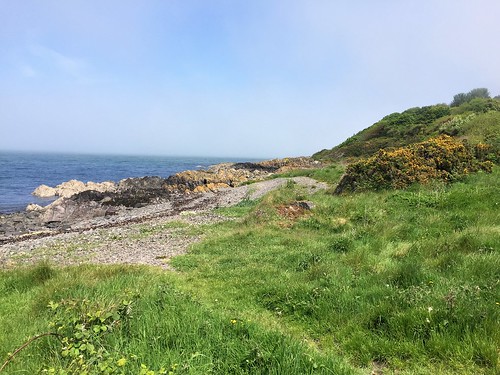
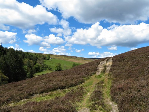
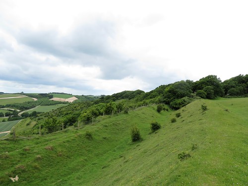
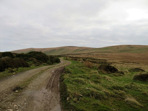
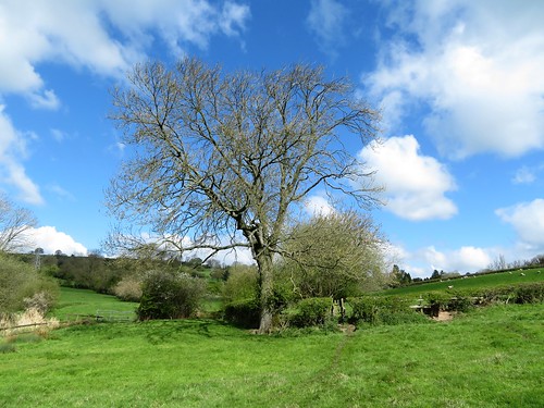
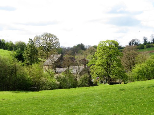
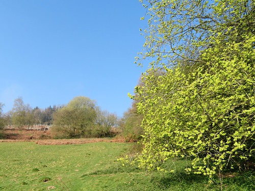
At Carnalea we disembarked along with dozens of Sunday folk intent on walking, picnicking and just mucking about beside the sea on the outer shore of Belfast Lough. The coast of County Down is built up with leafy estates of fine houses hereabouts, but there was hardly a sign of them as we followed the North Down Coastal Path west towards Belfast.

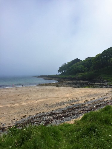
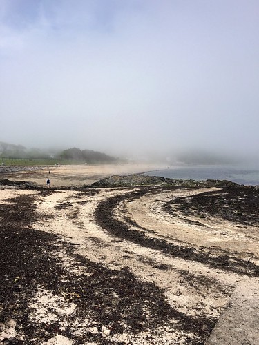
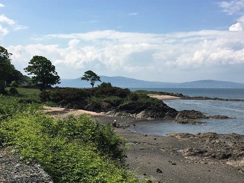
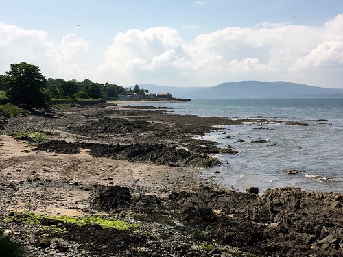
The city lay hidden round the curve of the coast ahead, and a thick sea fret veiled the hills across the lough. Nearer at hand were rocky little bays floored with flat grey pebbles where we crunched across cockles and limpets and streamers of green and white seaweed. The coast path was busy with dog walkers, cyclists and earnest runners. A semicircle of rocks and pale gold sand enclosed Swineley Bay, where a black dog leaped joyfully in the shallows while another rolled and wriggled on its back in the bladderwrack with lolling tongue and grinning jaws, the very picture of abandon.

Most of the day visitors had congregated around Helen’s Bay, a good stretch of swimming beach. Here we watched three dark-haired sisters holding hands at the edge of the sea and jumping over each wave as it came ashore – an old-school image of seaside frolics from a railway poster. Families played cricket and shuttlecock on a sward spattered with daisies, and toddlers staggered about on the sands.

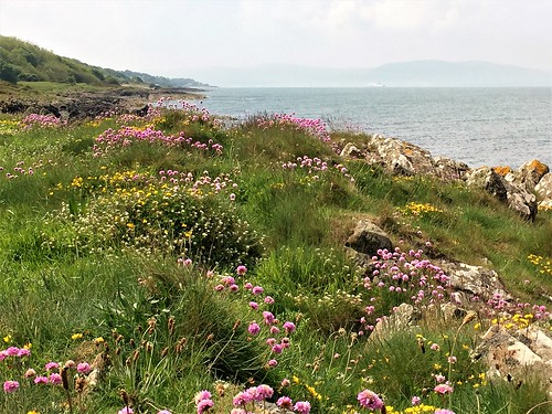
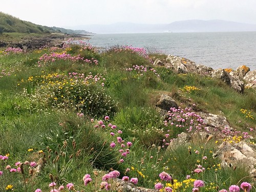
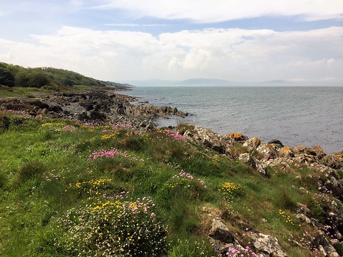
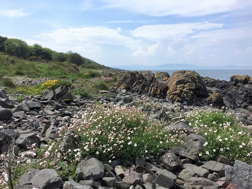
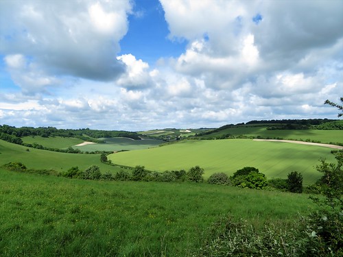
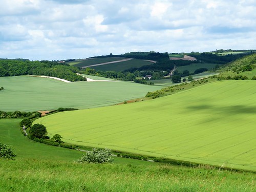
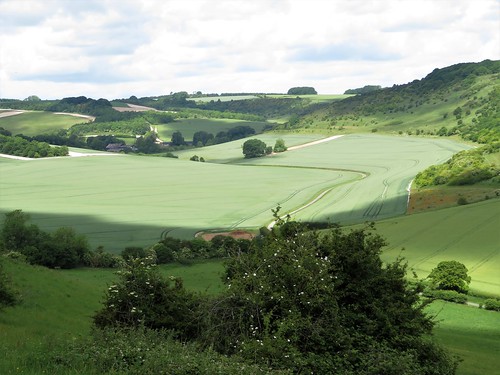
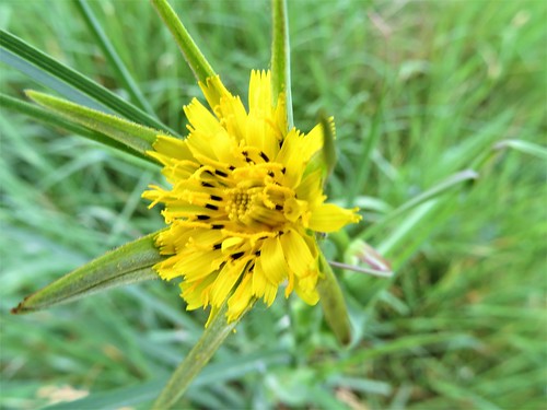
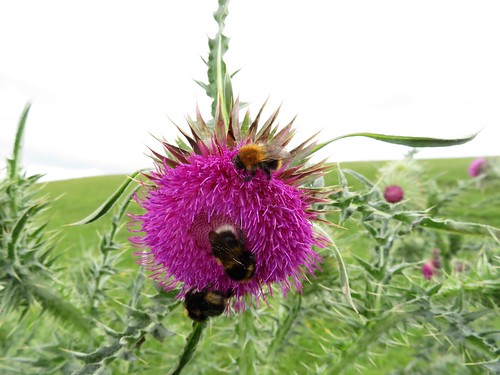
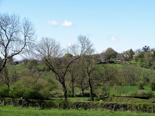
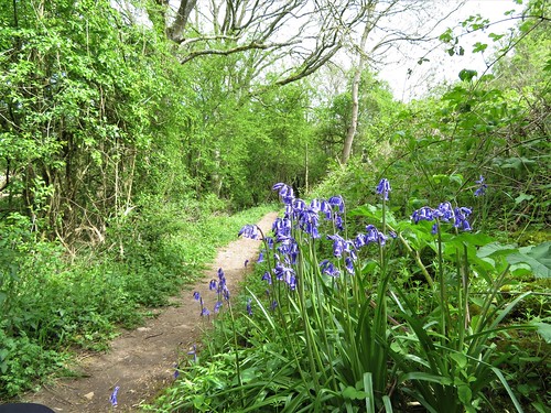
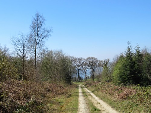
Beyond Grey Point the crowds thinned, and we had the coastal path almost to ourselves. Bird’s foot trefoil, scurvy grass, sea campion, scarlet pimpernel and thrift made a yellow, white, red and pink palette of the foreshore. A big Stena Line ferry slid free of the sea fret with a last moan of its foghorn. Within ten minutes the mist had dispersed, and we were staring across Belfast Lough at the grey block of Carrickfergus Castle and an undulating line of hills running south-west towards the city.

The gleaming black heads of two seals broke the surface of the lough. They touched their muzzles and rolled their gleaming bodies together in a private ecstasy. Rounding the last corner, we saw the cranes of Belfast’s docks ahead, and the sharply cut profiles of Divis Mountain and Cave Hill on guard above the city.
Start: Carnalea railway station, Bangor, Co. Down, BT19 1EZ (OS NI ref J 481823)

Finish: Cultra station, BT18 0BP (OS NI ref J 417805)

Getting there: Train from Belfast to Carnalea
Road: Cultra station and Ulster Folk & Transport Museum both signed from A2 Belfast-Bangor road.
Park at Transport Museum (NB: closes at 5 pm); signed footpath to Cultra station; train to Carnalea.

Walk (7 miles, easy, OS NI 1:50,000 Discoverer 15): From Carnalea station, right along lane; left down path between Springcarrie and Carnalea Golf Club; left/west along North Down Coastal Path/Ulster Way. In 6½ miles, at ‘Seafront Road’ sign on right where path joins road (413802), turn left uphill. At junction, left up Circular Road East to Cultra Station.

Lunch: Cultra Inn, next to Cultra station (028-9042-1066, hastingshotels.com)

Accommodation: Clayton Hotel, 22 Ormeau Avenue, Belfast BT2 8HS (028-9032-8511, claytonhotelbelfast.com) – large, comfortable city centre hotel.

Info: Bangor TIC (028-9127-0069)

discovernorthernireland.com; walkni.com; satmap.com

The Times Britain’s Best Walks by Christopher Somerville (£16.99, HarperCollins) is now out in paperback

 Posted by at 01:55
Jun 162018


First published in: The Times Click here to view a map for this walk in a new window
picture picture picture picture picture picture picture picture picture picture picture picture
Facebook Link:

Cyclists flocked round the Durham Dales Centre in Stanhope, and curious tourists took photos of the village’s famous 250 million-year-old fossil tree in the churchyard wall. When a beautiful day like this one arrives over the moors and valleys of West Durham, everyone wants to be out and about. The chatter and fuss of the selfie-takers were soon overlaid by the quiet chuckle of Stanhope Burn as we walked up its narrowing dale against the flow.

The hillsides north of the village wore the velvety nap and lumpy complexion that betokens a lead-mining landscape. In the throat of the valley we found the pitch-black levels and abandoned buildings of old workings where local miners earned their crusts through hard and health-shattering labour.

Nowadays Stanhope Burn runs clean and sparkling. Grey wagtails flirted their yellow underbellies on the stones, and a dipper bobbed its white shirtfront mid-stream under a bridge.

Above the mine buildings we left the valley track and followed a narrow path across hillsides where swallows cut low arcs across the heather and sand martins went scooting along a line of nestholes in the crumbling stream bank. We forded and re-forded the shallow burn, and headed south across trackless moorland where agitated grouse scuttled off, scolding us: Back! Back! G’back!

A line of wind-tattered conifers on the skyline formed a handy aiming point. When we had come up with them we found ourselves by Park Plantation with its long encircling wall and swathes of grey and brown stumps of recently harvested trees. The sun blazed and the wind blew fiercely in our faces as we followed the wall south, leaping over boggy sikes or streams that wound through the heather to join Stanhope Burn.

Snipe were displaying over the moors, extending their tail feathers as they dived to produce an eerie, tremulous hooting noise. We turned off along a farm track by Mount Pleasant and Pease Mires, and dropped down to Stanhope through woods where late bluebells and early purple orchids glowed under beech trunks striped with sunlight.

Start: Durham Dales Centre, Stanhope, Co Durham DL13 2FJ (OS ref NY 996393)

Getting there: Bus service 101 (Stanhope-Bishop Auckland).
Road – Stanhope is on A689 (Bishop Auckland – Alston)

Walk (8¼ miles, rugged moorland walking, OS Explorer 307): from Durham Dales Centre, right along A689. In 200m, right up Garden Close. Dogleg right/left to Chapel Street; left; right up path (fingerpost) beside allotments. Through kissing gate/KG at top of lane; on up with hedge on left to a track (995396). Left (KG); follow track to cross B6278 (991400, fingerpost).

In 100m fork left along Stanhope Grange fence. Follow lane for 1¼ miles to derelict mine. After shed on right, and before last one on left, fork right off main lane (987413). Don’t fork immediately left, but keep ahead up stony path which curves left. In 200m through gate; yellow arrow/YA points right, but keep ahead, with Stanhope Burn on left, for ⅔ mile to derelict old cottage. Ford burn near here (987425), and recross just beyond, after left bend in burn. In 500m, at Access Land notice and gate with YA, recross burn (983431).

On south side, grassy track climbs bank. Follow its indented course, then a pathless route SSW across moor, aiming for line of pine trees on skyline. In ⅔ mile, cross stony track (977423), make for right corner of Park Plantation wall (975421). Left along track for 1 mile, keeping parallel with wall, skirting quarry hole (970414) and crossing Reahope Burn, Deep Sike and Isaac Sike to cross Stoneby Sike (966408). 450m beyond Stoneby Sike, left through gate (970404) along farm track past Mount Pleasant (972405) and Pease Mires (979407) to road (982406).

Right; in 450m, left (982402) down drive to Widley Field (984402). Half right here across field to far right corner; over ladder stile (986401). Left; in 50m, left over stile; ahead through trees for 20m, then right along woodland path for ½ mile to A689. Left to car park.

Conditions: For confident walkers with map/compass/GPS. Inadvisable in mist.

Lunch: Durham Dales Centre tearoom.

Accommodation: Stanhope Old Hall, Stanhope DL13 2PF (01388-529036, stanhopeoldhall.co.uk)

Info: Durham Dales Centre (01388-527650, durhamdalescentre.co.uk); thisisdurham.com; satmap.com; ramblers.org.uk

 Posted by at 01:57
Jun 092018


First published in: The Times Click here to view a map for this walk in a new window
picture picture picture picture picture picture picture picture picture picture picture picture
Facebook Link:

The thatched and red-tiled roofs of Vernham Dean lie low in a billowing landscape of green and white, the slopes of the cornfields, pastures and copses chequerboarded with chalky patches of clay soil newly ploughed for seeding with pheasant-friendly plants.

We were heading up and away onto the roof of this hidden corner of the Hampshire/Wiltshire border. If it weren’t such a dreadful cliché, ‘best-kept secret’ would fit this secluded notch of countryside very well. The chalk is cut by dry valleys that swing and curve as though modelled by a sculptor. You rarely see anyone along the flinty old tracks crisscrossing the downs, or on the paths that plunge down slopes too steep ever to have been touched by arable farming.

At the rim of Conholt Hill we paused to look down along the sinuous valley that leads to lonely Hippenscombe Farm. Then we descended the narrow path into Conholt Bottom down a slope spattered with yellow rattle, horseshoe vetch, fat seedheads of cowslip, and the pink busby-shaped flowers of common spotted orchid.

During the ‘Swing Riots’ of 1830, a mob of three hundred poverty-stricken farm labourers, hungry and angry, marched to Hippenscombe Farm on 22 November. They were intent on smashing Farmer Fulbrook’s thrashing machine, one of the new labour-saving agricultural inventions that were putting such men out of work. Twenty of them broke into the barricaded house, and someone stole a tea caddy and a tablecloth.

When they were caught, the ringleaders were sentenced to transportation for life to New South Wales. They were lucky to escape with their necks intact, and some of them made good Down Under, once their crimes had been expiated.

From Hippenscombe and its hoarsely barking dogs we climbed again to the hilltops where the folded landscape wheeled off in green clefts to all quarters. On Fosbury Camp hill fort we saw no-one as we circled round the great Neolithic enclosure inside its Iron Age ramparts. Bumble bees investigated the velvety purple heads of musk thistle, and a kestrel hung dark and intent, head down in the wind.

We passed a giant old beech tree clamped by bulbous roots to the ramparts, and went bowling downhill toward the roofs of Vernham Dean, huddled under a racing grey sky in their hollow under the steep green downs.

Start: George Inn, Vernham Dean, near Andover, Hants SP11 0JY (OS ref SU 341566)

Getting there: A343 north from Andover; at Hurstbourne Tarrant, left to Ibthorpe, Upton and Vernham Dean.

Walk (6¼ miles, field paths, OS Explorer 131): From George Inn, right along road. In 200m, left (fingerpost) up flinty lane. In 150m, right (339564, ‘footpath’) up edge of Boats Copse. In ½ mile at top of slope, right (331558, ‘footpath’) into trees. Follow arrows through trees, out onto hillside; up hedge for 400m to road (327554).

Right; in 100m sharp right; in 100m, left (stile), slanting down hillside to valley bottom (321558). Left along road for ¾ mile to Hippenscombe Farm. Through road gate (311561); in 20m, right by cottage on farmyard road between barns. In 150m fork right beside last shed (breeze block) on flint track. In 100m keep ahead (ignore left fork). In 750m, at crossing at top of slope (309569), right on flint track to Fosbury Farm (314571).

Cross drive in front of gates; onward into woods for 800m to stile onto Knolls Down (320566). Bear right to trees; left (anticlockwise) round ramparts of Fosbury Camp hill fort. Just past giant beech tree, right at rampart gap (322565, pond on left) down field slope with trees on left for ⅔ mile to road at Woodside Cottages (332565). Right; in 30m, left (‘footpath’, kissing gate). At far end of field (kissing gate), right along road. In 300m, at entrance to Vernham Dean, fork left (338566) to George Inn.

Lunch: George Inn, Vernham Dean (01264-737279, thegeorgeatvernhamdean.co.uk) – excellent, unpretentious village pub.

Accommodation: Hatchet Inn, Lower Chute SP11 9DX (01264-730229, thehatchetinn.com) – 4 miles

Info: visitengland.com; satmap.com; ramblers.org.uk
Thanks to Henry Salmon for finding this walk for us!

 Posted by at 00:31
Jun 022018


First published in: The Times Click here to view a map for this walk in a new window
picture picture picture picture picture picture picture picture picture picture picture picture picture picture picture picture
Facebook Link:

A heavenly morning of warm sun and cooling breezes over the Yorkshire Dales. The soft blue sky was streaked with mare’s tails of cloud, betokening a change in the weather. But just now, setting out along the shores of Malham Tarn, we were living in the moment and the day.

The wind-rippled tarn was exactly the colour of blued steel. Beyond the water, Malham Tarn house sat handsomely among its trees under the long grey-white cliffs of Highfolds Scar. This is all prime limestone country, weathered into rugged cliffs or scars that fall to pastures of rough grazing.

The wide pastures of West Great Close and East Great Close were the site of a great fair in times past, where thousands of Scottish cattle would be sold and driven on south to be fattened for the markets of southern England. The old drover’s vocation is long gone, but black cattle still fatten in these grassy pastures.

Above Middle House Farm we came into an upland of eroded limestone pavement where the wind blustered and the sun picked out brilliant blobs of colour in the wind-bitten grasses – buttery yellow mountain pansies, stout early purple orchids, spatters of mountain violets, and the intense pink flowers of bird’s-eye primroses. Tucked down in the grykes or hollows of the limestone was a woodland flora, bizarrely flourishing in this open, treeless terrain – wood anemones, dog’s mercury and lush ferns.

From the watershed we dropped down a long hillside, looking forward to a grand sweep of fellside – Malham Moor and Fountains Fell cradling the long valley of Darnbrook Dale. Down at Darnbrook House the farmer and his son were busy in a farmyard loud with the yammering of ewes and lambs.

We followed the sinuating dale road past barns and pastures until the straight track of the Pennine Way cut across, leading us along a fellside of wide slopes, lonely barns, and a tangle of stone walls. Round the shore of Malham Tarn once more, through pastures where slow-moving cattle browsed the lake margins in the last of the afternoon’s sunshine.

Start: Water Sinks car park, Malham Tarn, N. Yorks BD23 4DJ (OS ref SD 894658)

Getting there: Malham Tarn Shuttle Bus 881 (dalesbus.org/malhamshuttle)
Road – Malham Tarn is signed from Malham (follow ‘Airton’, ‘Kirkby Malham’ from Gargrave on A65 Skipton-Settle road).

Walk (8½ miles, moderate, OS Explorer OL2): From car park follow Pennine Way/PW (signed) north, skirting shore of Malham Tarn. In 700m meet white stone track (897663); don’t go through gate, but bear right with a wall on left and a round walled plantation up on right. Pass Great Close Plantation, then left (904663, ‘Arncliffe’) up farm track. At entrance to Middle House Farm, left over stile (907676, ‘Arncliffe’), up to skyline gate. Follow stony track to pass Middle House ruin; fork left at fingerpost (907684); on for 1 mile over Middle House Hill, descending to go through wall gap (900696). Right to ruined wall; left along it, down to cross Cowside Beck (899701). Field path to road at Darnbrook House (898705); left along road; in 1¼ miles meet PW (884691). Left on well way-marked PW for 1¼ miles to road (888673); left on PW, clockwise round Malham Tarn to car park.

Lunch: Picnic

Accommodation: Malham Youth Hostel, Malham BD23 4DB (0345-371-9529, yha.org.uk/hostel/malham); also Lister Arms, Malham (01729-830444, thwaites.co.uk) and Buck Inn, Malham (01729-830317, thebuckmalham.co.uk)

Info: Malham National Park Centre (01729-833200; yorkshiredales.org.uk); yorkshire.com; satmap.com; ramblers.org.uk

The Times Britain’s Best Walks by Christopher Somerville (£16.99, HarperCollins) is now out in paperback

 Posted by at 01:26
May 262018


First published in: The Times Click here to view a map for this walk in a new window
picture picture picture picture picture
Facebook Link:

Mist was rolling high on the Dorset downs as we came down a steep green valley into Plush. The little collection of houses lay under mossy thatch along their lane. A few cheerful drinkers looked out of the windows at the Brace of Pheasants and shook their heads over the weather. ‘Going out walking? You won’t see a thing!’

In the chalky holloway that lifted us to the heights of Church Hill grew primroses and violets, bluebells and pink campion. All had burst out together last week at the first hint of spring warmth. Today the birds seemed subdued by the cold hand of the mist, but a blackcap suddenly produced a mellifluous solo among the oaks, short but sweet.

As we reached the gaunt old barn at the top of the climb a roe deer went bounding away, leaping high over crops and fences. We followed the rutted course of the Wessex Ridgeway, an ancient drove road running east-west along the nape of the hills. The old cottage at Folly was once a drover’s inn, where the hardy drovers in their felt hats, stocking feet soaped against blisters, would stop in for refreshment while their flocks cropped the wide verges of the ridgeway.

We passed through woods of oak and ash where bluebells made a hazy sky of the undergrowth, and dropped down a long flinty lane into Higher Melcombe. Lumps and bumps in the fields were all that remained of the medieval village deserted by its people after the Black Death deprived them of their feudal livings. But the handsome old manor house was still there, its chapel walls striped in stone and flint.

Blackbirds sang, and a tractor whined as it trimmed the first grass of the year. We climbed away up a hedge towards a wood, invisible in the hill mist, that roared softly and mightily, a sea-like cadence. Primroses and cowslips spattered the banks of the hollow lane, and among them a hybrid of the two plants raised its dark yellow multiform head on a slender talk.

We skirted the plunging slopes of Lyscombe Bottom, farmed with no pesticides or artificial fertilisers, and descended another deep-sunk old green road into Plush. ‘See anything?’ asked the regulars in the Brace of Pheasants. ‘No, not a thing,’ we replied.

Start: Brace of Pheasants Inn, Plush, Piddletrenthide, Dorset DT2 7RQ (OS ref ST714022)

Getting there: Plush is signposted from Piddletrenthide on B3143 (off A35 at Puddletown).

Walk (8 miles, trackways and farm paths, OS Explorer 117): From Brace of Pheasants, right along road; in 100m, right (‘Church Hill’ fingerpost/FP) up bridleway for 1 mile to Wessex Ridgeway/WR (707035). Right (east) along WR to cross road at Folly (728032). In 300m fork left uphill (733030, bridleway fingerpost/BFP); in 100m fork left (BFP). In 400m through gate, turn left (737028, BFP) across field.

Pass telephone pole, then breeze-block shed; ahead in same direction (WR) across field and through double gateway (740030, WR). Keep ahead; in 50m, fork right down grassy holloway, through gate into wood (741031). WR forks left, but keep ahead downhill (‘Higher Melcombe’) for ⅔ mile to road (751025). Right through Higher Melcombe.

In ¼ mile, just before Higher Melcombe Farm, left (747025, blue arrow/BA, FP in hedge) on track. In 70m, right (gate, BA) up field edge. In 250m through gate (745025, BA); left up hedge, then sunken lane. In 600m at top of rise, through gate; right on gravel track (742021, ‘Nettlecombe Tout’) with hedge on right. In 500m fork left (740025) across field to go through gate by Lyscombe Farm notice (739026).

Fork left away from fence, but keep it close on your right, following same contour across lumpy ground. In 900m at 4-finger post on right (730024), right through gate; left (‘Doles Ash Farm’) along hedge. In 300m at end of trees, left across fence (728021); right past trig pillar. On beside fence, then across field, for ½ mile to corner of triangular copse (721018). Bear right (WNW) across open field (perhaps through crops) for 300m to hedge gap with arrow (718019). Ahead to stile (717020); downhill to road (717022); left into Plush.

Lunch/Accommodation: Brace of Pheasants, Plush (01300-348357, braceofpheasants.co.uk) – cosy, friendly village inn.

Info: Dorchester TIC (01305-267992); visit-dorset.com; satmap.com; ramblers.org.uk

 Posted by at 01:09
May 192018


First published in: The Times Click here to view a map for this walk in a new window
picture picture picture picture picture picture picture picture picture picture picture picture picture picture picture
Facebook Link:

The Preseli Hills march east to west across the heart of West Pembrokeshire, and the Golden Road marches with them – an ancient drove road and highway that hurdles their peaks. Out at the western end of the range the Golden Road climbs gently up the flanks of Foel Eryr, the Eagle’s Peak, and we climbed with it, peat and soakwater squelching underfoot.

By the summit cairn a topograph specified places in view and their distances, but these cold facts and figures could never catch the splendours of this extraordinary view. Lundy lying like a sleeping sea-dog 50 miles off in the south, with a faint hint of the North Devon coast beyond Exmoor’s long spine; the shadowy shapes of the Cambrian mountains far to the north; west to Skomer and Ramsey islands; and in the east the dragon humps of Worm’s Head promontory.

We stood and marvelled, while the mountain ponies of Foel Eryr cropped the grass nearby and nibbled the itches out of one another’s necks. Then it was down over sedgy ground to the lonely farm of Pen-lan-wynt, where wind-bent thorn trees lined the hedges.

This is the land of small farms and smallholdings – Pentrisil, where the fine rich savour of a freshly opened silage clamp wafted across the lane; the stone cottage of Gernos Fawr in a watery dell full of runner ducks; the hillside farm of Gernos Fach, where a young sheepdog leaped gymnastically between the high bars of a gate to fawn on us and lick our hands in welcome.

Beyond the farm a moorland track led away, the cold cloudy sky reflected in its peaty pools. A little way off the track, standing stones stood in the heather – a hip-high pair sloping close together, and a short distance away a fine solo stone of man height, crusted with lichens, upright in a little circular moat of water. A posy of wild flowers had been laid at its foot.

We crossed the road and climbed a boggy old path that snaked up the wet hillside of Rhwngyddwyffordd. Ponies with tangled manes moved reluctantly off the track as we followed it to the saddle. Here we turned for a final stare over bog and hillside, coasts, islands and distant mountains, before a last homeward stretch along the miry ridgeway of the Golden Road.

Start: Bwlch-gwynt car park, near Tafarn-y-Bwlch, Pembrokeshire SA66 7RB approx. (OS ref SN 075322)

Getting there: Bwlch-gwynt car park is on B4329 (Cardigan-Haverfordwest), between Tafarn-y-bwlch and Tufton

Walk (6½ miles, moderate, OS Explorer OL35): Cross B4329; path to Foel Eryr summit (066321). Keep same line descending. At fingerpost with arrow (061321), right on path. In 300m at another fingerpost with arrow (061324) fork left, soon bearing downhill to wall. Right to 4-finger post (060327); follow wall to Pen-lan-wynt farm (058330). Follow blue arrows/BA to track (057333), then road (055337). Right; 250m beyond Pentrisil, right (062342, ‘Tafarn Bwlch, Pembrokeshire Trail’). Follow track past Gernos-Fawr (069341, BAs); up green lane to gate (069344); right (bridleway fingerpost) to Gernos Fach (075343). Right (fingerpost) on track to B4329 (084337). Right; in 350m, fork left (082333, BA) up hill track for ¾ mile to fence at Bwlch Pennant (085321). Don’t go through gate; turn right along fence to car park.

Conditions: Very wet and boggy in parts

Lunch: Tafarn Sinc, Rosebush SA66 7QU (01437-532214, tafarnsinc.co.uk) – 3 miles

Accommodation: The Harp Inn, Letterston SA62 5UA (01348-840061, theharpatletterston.co.uk)

Info: Fishguard TIC (01437-776636), visitwales.com; satmap.com; ramblers.org.uk

 Posted by at 01:10
May 122018


First published in: The Times Click here to view a map for this walk in a new window
picture picture picture picture picture picture picture picture picture picture picture picture picture
Facebook Link:

A beautiful, bitterly cold late spring morning of blue sky in the southern skirts of the Peak District. Carsington Water lay glittering in the sunshine, early joggers already limbering up by the Visitor Centre. Once we’d crossed the Wirksworth road, though, we met no-one on the field paths except sheep.

Young lambs with wriggling tails dived under their mothers’ fleeces to butt and tug at the maternal udder. Around Overtown Farm the corrugations of ancient ridge-and-furrow undulated beneath the grass, a sign that these dandelion-spattered fields have remained unploughed pasture since medieval times.

Hedge roots were lost in a blue blur of forget-me-nots, and trees still scarcely in leaf rang with spring bird calls, chiffchaffs in blurting phrases and lesser whitethroats in ecstatic scribbles of song.

At the Church of St Bartholomew at Hognaston we came across a sign from even more distant ancestors – an 800-year-old image, carved in the tympanum over the south door, of a shepherd, crook in hand, guarding the Lamb of God from the attentions of a wolf, a wild boar and a bushy-tailed fox. Overhead an eagle, having seized its chance, is making off with a long-beaked fowl in its clutches.

Silver-bellied clouds were beginning to sail across the blue sky as we climbed the lane to Atlow Winn. A Jacob ewe with four horns and a fleece of white and tarry brown stared flintily at the two trespassers in its pastures. Four tiny lambs squirmed out of their pen to sniff my hands, attracted by the woolly texture of my fingerless mittens.

As we climbed the steep pastures the backward view widened over the gunmetal grey sheet of Carsington Water in its cradle of hills. At the ridge of Madge Hill a superb forward prospect opened westward across a billowing green landscape to the sharply peaked cliffs of The Roaches, rising above the Staffordshire moorlands fifteen miles off.

A wintry shower rushed out of the west, blowing pellets of snow around us. Winter was not quite done with this countryside, it seemed. We headed back towards Hognaston over fields thick with dandelions, every golden head still turned towards where the sun had been pouring out its springtime warmth and light only moments before.

Start: Carsington Water Visitor Centre, near Wirksworth, Derbyshire DE6 1ST (OS ref SK 241517)

Getting there: Bus 111 (Ashbourne-Matlock). Road: signposted off B5035 (Ashbourne-Wirksworth).

Walk (5¾ miles, easy, OS Explorers OL24, 259): Return to car park entrance; left along cycle/footpath (red trail marker, ‘Carsington Water Circular Route’). In 150m, right (fingerpost) through trees to cross B5035 (239515). Up hedge; in 80m, left through wicket gate/WG. Cross fields through successive gates (yellow arrows/YA). In 2nd field, aim for bottom left corner and squeeze stile (SS) into green lane (237512). Left; in 200m, right through 2 WGs (YA) into field. Left along hedge to SS and on to Green Cottage (WGs) and road (236507).

Ahead up road; left at Hognaston church (235506). In 100m, right at bus shelter through drive gate of Old Hall (footpath post). Follow right-hand wall, through 2 WGs (YA). In field beyond house, follow middle of 3 paths, half left down to WG/SS in bottom left corner (234502). At 2nd WG/SS, keep ahead to cross footbridge, then duckboards (SS, white arrow/WA). Keep same line through succession of SS (WAs). Approach mill buildings, bear left across stream to cross lane (232495). On along left bank to lane at Highfields Farm (232490).

Right; in 100m, right up Winn Lane (‘Unsuitable for Motors’). In 100m fork right (‘The Shaws’). In 600m through ‘Shaws’ entrance gate (224493, WA). Before house, right through gate; half left to cross stile on skyline. Right (WA), heading half left to gate into Atlow Winn farmyard (222494). Left between house and barn; through gate (YA); ahead to stile (YA); half left across field to waymark post by wall gap (221497). Cross step stile; up field edge with wall on right; in 100m, right (YA), bearing half right across ridge to step stile into lane (219498).

Right. In 400m, opposite old metal WG on left, turn right up steps (219503, YA), through trees to cross drive. Through metal WG (fingerpost); half left across field, aiming not for WG, but for metal gate to its left (222504, YA). Descend across fields for 500m to gravel track (228505). Left; in 400m, approaching Hognaston, fork right, descending to village street (234507). Right to church; retrace outward route to car park.

Lunch: Red Lion, Hognaston (01335-370396, redlionhognaston.uk)

Accommodation: Breach Farm, Carsington DE4 4DD (01629-540265, breachfarm.co.uk) – immaculate, delightful B&B

Carsington Water Visitor Centre: 01629-540696, visitcarsington.co.uk
Info: visitpeakdistrict.com; satmap.com; ramblers.org.uk

 Posted by at 01:30
May 052018


First published in: The Times Click here to view a map for this walk in a new window
picture picture picture picture picture picture picture picture picture picture picture picture picture
Facebook Link:

CS Forester once had his fictitious naval hero, Captain Horatio Hornblower, RN, legging a canal barge through the Sapperton Tunnel. Even Hornblower, victor of a dozen desperate sea battles in Nelson’s navy, would be hard put to force passage today – roof falls have blocked the tunnel and severed the Thames & Severn Canal, a through route between London and the west coast of Britain in former times.

These days the wonderfully ornate southern portal of the Sapperton Tunnel looks out on a silent waterway, weed-grown and melancholy in its shadowy cutting. We passed a strange little round stone tower, once the abode of a canal maintenance man, and turned down a side path fringed with cowslips to Trewsbury Mead and the source of the River Thames.

Old Father Thames in infant form whelms from a little circle of greenish stones near an ancient ash tree. At least he does in wet seasons – today in Trewsbury Mead not a trickle disturbed the grass. Strange to think that, 180 miles to the east, this modest nothing of a river would be coursing through London before broadening out to meet the North Sea.

St Matthew’s Church in nearby Coates lay quiet and cool. From a memorial display a rather severe face looked out under a military cap. Lt Col Bernard Vann, raised as a boy in Coates Rectory, was the only C of E clergyman to win a VC as a combatant in the Great War. His decoration, for leading a charge against German positions under heavy fire, was a posthumous one. His wife was one month pregnant at the time of the attack, but neither she nor Bernard was aware of that, when a sniper killed him four days later – five short weeks before the end of the war.

A flood of bluebells splashed the floor of Hailey Wood. We turned down a broad ride between log stacks. Badger highways had been beaten out by leathery pads through the undergrowth.

Beyond the wood we climbed through a bright gold sea of oilseed rape to the great barn and chapel at Tarlton Manor, a dream of mellow perfection in Cotswold stone, before dropping down across a green and gold valley to the Tunnel House Inn and the ornate portal on the old canal once more.

Start: Tunnel House Inn, near Coates, Glos GL7 6PW (OS ref SD 966006)

Getting there: Coates is signed from A419 (Stroud-Cirencester). In village, 1st left (‘Canal Tunnel & Inn’). In ½ mile, right to Tunnel House Inn.

Walk (6 miles, easy, OS Explorer 168): Down steps into cutting; right along canal for 1 mile. At 3rd bridge (979000) right through gate; right (‘Thames & Severn’) for 500m to source of Thames (980995). Return to cross canal; ahead to road (979005). Left; first right; just before war memorial, left (978008). Go through gate; across fields to cross road (975011); on to pass church. In 50m, right up green lane (972010) for 700m to gate into Hailey Wood (966014).

Right (Country Landowners Association/CLA arrow) up path. In 100m, left (CLA); in 200m, right at junction (CLA) to turn left (south-west) just before sawmill on right (965015). Follow broad track for 450m to cross railway (961013); fork right on track for ½ mile to The Star junction (954009). Counting from left, take 3rd exit, with fence and young forestry on left.

In 100m, left (CLA) on public right of way. In 450m cross track in valley bottom (956005, CLA) and in 200m leave wood by gate (957004). Ahead along field edge; through successive gates on ridge; at Manor Farm, left along stony road (956999) between buildings. At T-junction, left (959999); right through gate (‘Macmillan Way’).

Follow Macmillan Way/Monarch’s Way; through gate on left, and half right across field to cross stone stile. Down to gate at wood edge (962002); fork right out of trees and up across fields to Tunnel House Inn.

Lunch: Tunnel House Inn, Coates (01285-770280, tunnelhouse.com)

Accommodation: Crown Inn, Frampton Mansell, Stroud GL6 8JG (01285-760601, thecrowninn-cotswolds.co.uk) – pretty Cotswold village pub-with-rooms

Info: Stroud TIC (01453-760992); cotswolds.com; visitengland.com; satmap.com; ramblers.org.uk

 Posted by at 01:21
Apr 282018


First published in: The Times Click here to view a map for this walk in a new window
picture picture picture picture picture picture picture picture picture picture
Facebook Link:

A brisk spring day in the southern folds of the Lincolnshire Wolds offered us a walk of two very distinct flavours. The first half snaked through the steep green valleys of Snipe Dales; the second strode across broad uplands with mighty views.

Snipe Dales Nature Reserve is beautifully tended by Lincolnshire Wildlife Trust. This is a damp, deep bowl of country full of birdsong, where many springs rise. A shallow stream meanders and bubbles between flowery banks, artfully shaped to slow the flow and nurture a richer palette of wildlife.

A crowd of crows a hundred strong strutted in the furrows of a newly harrowed field, snatching up leatherjackets in their sharp black beaks. We crossed a road where a shallow ford ran sparkling in wrinkles across the way. Then we turned west on a broad trackway that led over the hills and between a brace of recently erected stone circles, before diving down once more into the damp wooded depths of Snipe Dales.

Beyond the tall brick block of Winceby House on its ridge road, the scene changed as though one backdrop had been snatched away and another substituted. Wild flowers and birdsong vanished, as did the lush intimacy of the deep green dale. Up here the landscape seemed to widen all in an instant, shooting off south and west across low-lying countryside, out to the towers of Lincoln Cathedral standing tiny and sharp-cut against the rainy sky nearly thirty miles away.

We walked the margins of enormous silent ploughlands under a great bowl of sky. Field shapes were geometric, colours flat and simple – brown for ploughed earth, green for corn, yellow for oil-seed rape. It was easy striding through a top-of-the-world landscape.

Down below the uplands, in the ominously named Slash Hollow, a troop of Cavalier horsemen were hacked to death by their Roundhead pursuers at the start of the Civil War. They had become trapped at a country gate they couldn’t open. Such horrors seemed an age and a world away as we descended from the broad sweep of the arable uplands into Snipe Dales, with all the intimate details of nature close at hand once more.

Start: Snipe Dales Country Park car park, near Hagworthingham, Lincs PE23 4JB (OS ref TF 331682)

Getting there: Signed from A158 (Skegness-Lincoln] and B1195 (Horncastle-Spilsby)

Walk (5 miles, easy, OS Explorer 273. Snipe Dales trail leaflet from dispenser in car park): Pass office/toilets. Follow broad track downhill. In 400m, at path crossing (335685; pine tree waymark to left; ‘Path to Pond’ to right) keep ahead (‘Bolingbroke Way’). In 400m at T-junction, right (338687, ‘Hagworthingham’) on fenced path to road (346689). Don’t cross ford; cross road and keep ahead (fingerpost, stile, yellow arrow/YA, ‘Furze Hill’) up field. 2 stiles to gravel path; left to road (346697). Left; at lower road, left; in 70m, right (344691, fingerpost), following track across wolds.

In ¾ mile, between 2 stone circles, fork half left through hedge (333689, white arrow). In 300m through gate (YA), along path into Snipe Dales Nature Reserve. Cross stream (331687); at 2-finger post, right (YA). In 200m, left fork through gate; in 200m, don’t cross footbridge on left (326686) but keep ahead on right bank of stream. Path crosses stream at hydraulic ram (323686), and rises to go through gate (‘Nature Reserve Car Park’). Path to ruined graveyard (321684); through gate, left over stile (YA). Cross field to stile (YA); driveway to B1195 at Winceby (321682).

Right; in 150m, left (fingerpost) through trees, then fence (YA). Ahead down field edge with hedge on left. At bottom of field bear right round field edge; in 150m, left over stile (314677, YA). Half left across field to fingerpost and lane at Old Ash (313676). Left; in 400m, just before right turn (‘Hameringham’), left through hedge (312672, fingerpost, YA) on track eastwards across fields (YAs). Approaching Asgarby in 1 mile, cross stile (327668) and keep to right of pond. Stiles, YAs to drive (330670); right to road. Left for nearly 1 mile to cross B1195 at Winceby (322682).

Stile, YA, ‘Greenwich Meridian Trail’; ahead to YA post; right across field to stile (324684, fingerpost). Grass path into Snipe Dales Nature Reserve; then follow red square markers on right bank of stream for ½ mile back to car park.

Lunch: Picnic

Accommodation: Admiral Rodney Hotel, Horncastle LN9 5DX (01507-523131, admiralrodney.com)

Snipe Dales Nature Reserve: 01507-588401, lincstrust.co.uk

Info: visitlincolnshire.com; satmap.com; ramblers.org.uk

 Posted by at 14:24
Apr 212018


First published in: The Times Click here to view a map for this walk in a new window
picture picture picture picture picture picture picture picture picture picture picture picture
Facebook Link:

The first swallow of the year came dipping through the arches of Aymestry Bridge, flitting low over the River Lugg. We watched it draw a line through the still air as we sat pulling on our boots and looking forward to a long day’s hike in the Herefordshire hills.

Looking back from the slopes under Beechenbank Wood, we saw the early morning mist lying as thick as bonfire smoke along the Lugg Valley. Overhead the milky blue sky gave promise of beautiful warm weather. The pigeons on the ploughed field near Mental Cottage seemed as lazy as the day, until we came closer and saw that they were decoys. Two fresh-faced lads grinned out of the hedge nearby where they knelt and waited for the real thing, shotguns at the ready.

We dipped down to Covenhope Farm by its reservoir lake to pick up the Mortimer Trail long-distance path. It lifted us up and over the long spine of Shobdon Hill among conifers and oak glades. Holly blue butterflies flashed their brilliant blue underwings as they hunted moisture in the boot ruts of the path. A flash of movement drew Jane’s attention to a clearing, where a lesser spotted woodpecker swooped from tree to tree.

The view was enormous and hazy, out over the hills of the Welsh borders. We skirted the precipitous bank of Byton Common, and came down to St Mary’s Church at Byton. Built in the south wall we found a semi-circular stone, carved almost a thousand years ago, depicting the Lamb of God holding a cross, and interlaced carving either side that remarkably resembled the Woolmark logo.

An orange and a sip of water apiece, and we took the road to Lower Kinsham. A muddy bridleway shadowed the Lugg in its sinuous windings among damp meadows awash with cuckoo flowers. At Lower Yeld a small boy was riding his tricycle in the ford, absorbed by the splash and sparkle of the water. If it hadn’t been for the four miles or so we still had to go, we’d have sat for hours and watched the ford ourselves.

Start: Riverside Inn, Aymestry, Herefordshire HR6 9ST (OS ref SO 425654)

Getting there: Aymestry is on A4110 (Hereford-Leintwardine). Park at Riverside Inn (please ask permission, and please give inn your custom!)

Walk (12¼ miles, long but easy underfoot, OS Explorers 203, 201): From car park, right up A4110. Right up side of Riverside Inn (gate, fingerpost). Up garden slope to gate (yellow arrow/YA). Uphill with hedge on right to gate (423654, YA). Left, and follow YAs through plantation to top of rise; left (422653) along field edge. Below Mental Cottage (421650) cross drive; through gate (YA); right, round field edge to stile (419650, YA).

Cross field to top left corner; ahead to left of shed (417650). Through metal gate; half left to top left corner of field (415649, stile, YA). On along field edge (stile); follow hedge into Church Wood (412647). Fork left down slope to forest track (412646); left for ½ mile to road (413638). Right to Covenhope Farm (408642). Opposite farm, left by barn; fork right up track; in 100m, left along forest track (Mortimer Trail/MT; 406643).

In 350m, track forks left (403645); keep ahead here uphill on grassy track. In 350m track forks right at bench (400647); keep ahead here (left branch) uphill and on across Shobdon Hill. In 1½ miles descend to left bend (380640); right here (MT waymark post). In 200m, left (MT) through kissing gate. Don’t fork right downhill on track, but cross it and keep on path at top of steep slope of Byton Common. In ½ mile at fingerpost (372636, MT), right downhill. At bottom of Park Wood pass cottage on right (372639); right up steps to stile (MT). Cross field to road; right to St Mary’s Church car park and path to church (371642).

Just beyond church car park, right down green lane to road. Right for ¾ mile to cross River Lugg at Lower Kinsham (363646). At left bend, right (east) on path by river for 1¼ miles. Nearing Lower Yeld, track curves away uphill from river; follow it to hedge, and bear right along hedge to gate (378654, blue arrow). Left into lane, right through gate; ahead to ford and road at Lower Yeld.

Bear right; round left bend; follow road for 1 mile to Lye Corner (395658). Right (‘Covenhope’) down lane to Lyepole Bridge (398654). Just before bridge, left (MT) along lower edge of Sned Wood. In ½ mile, round left bend (414661), in another 350m, right over stile (MT); cross field to road (414664, MT). Right for 1 mile to A4110 (426656); right to Riverside Inn.

Conditions: Path along Byton Common is narrow, with steep slope.

Lunch: Picnic

Accommodation: Riverside Inn, Aymestry (01568-708440, riversideaymestry.co.uk)

Info: Leominster TIC (01568-616460)
visitengland.com; satmap.com; ramblers.org.uk

 Posted by at 09:28