Apr 142018


First published in: The Times Click here to view a map for this walk in a new window
picture picture picture picture picture picture picture picture picture picture picture picture picture
Facebook Link:

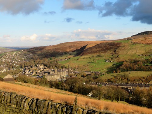
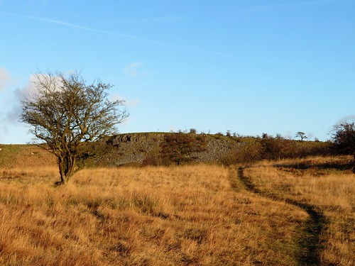
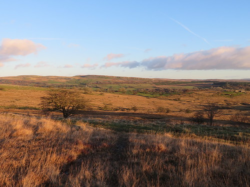
Walking south from Market Bosworth under the horse chestnuts along Sutton Lane, we saw ahead the tump of Ambion Hill, twin banners streaming from its summit. One showed a rampant lion, the other a rampaging dragon – England against Wales, Richard of York versus Henry Tudor, in a famous clash of arms hereabouts on a summer’s day in 1485.

For centuries historians believed that the Battle of Bosworth took place in the fields around Ambion Hill. That’s why there is a visitor centre with all the trimmings up here. But recent discoveries of lead shot, hacked-about armour and a badge of a silver boar – King Richard III’s emblem – place the battle in low-lying fields a mile or so away.

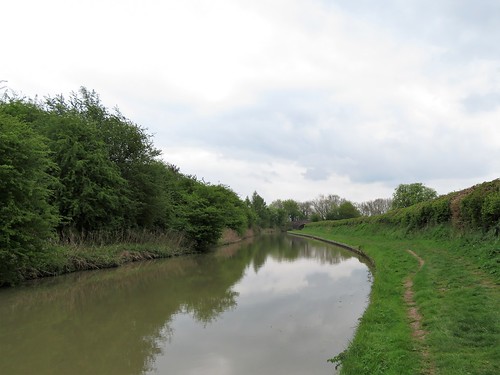
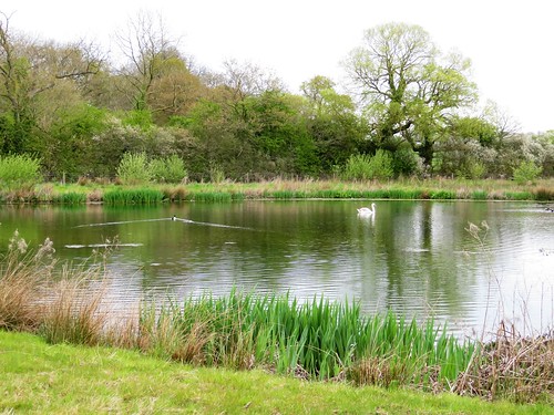
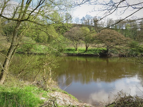
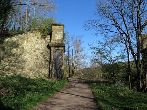
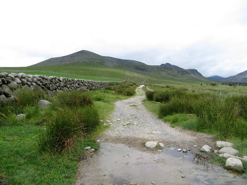
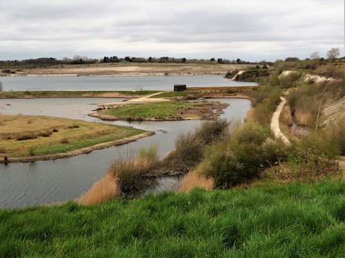
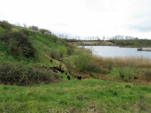
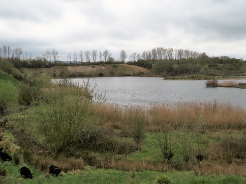
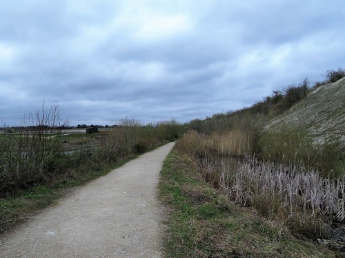
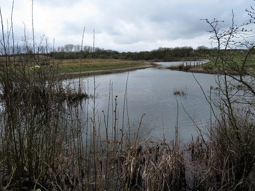
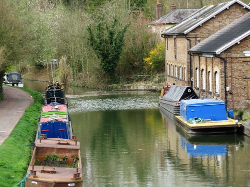
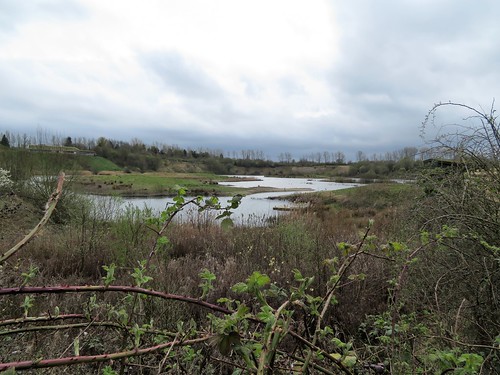
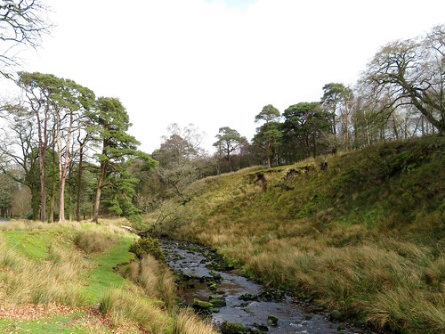
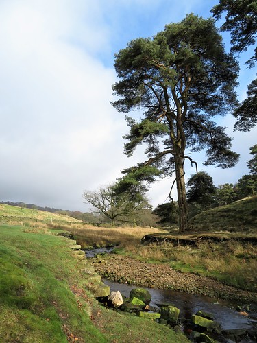
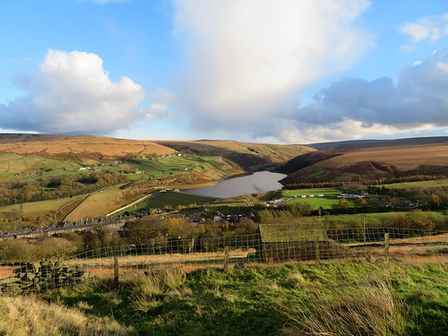
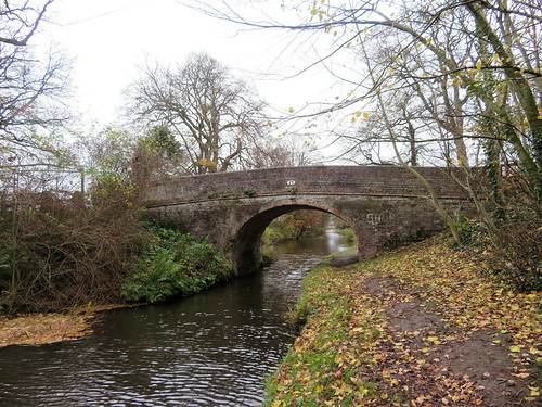
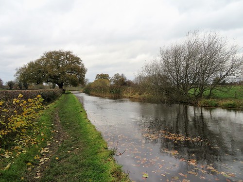
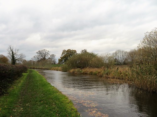
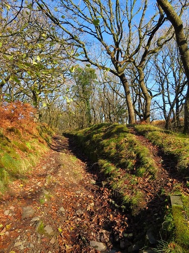
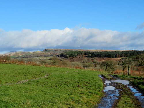
The former marshland where Crookback Dick lost crown and life lay today in a steamy grey light. We gazed our fill from Ambion Hill, then went down to where the Ashby-de-le-Zouch Canal snaked its way under alders and willows. At Sutton Warf narrowboats lay moored, Danny Boy and Doris stem to stem, Black Pearl a little distant, festooned in macabre style with gargoyles, ghosties and a skeleton clambering out of a coffin.

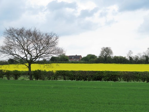
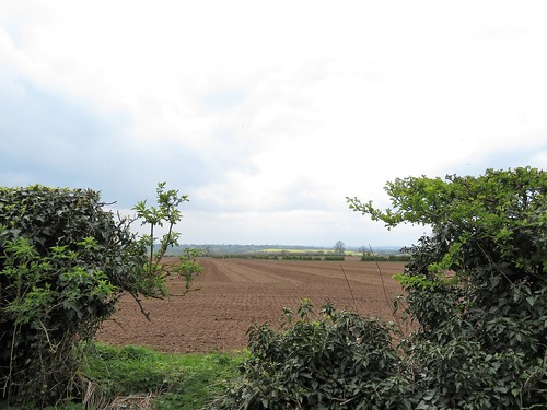
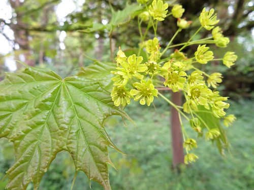
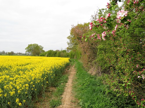
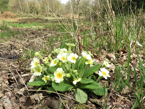
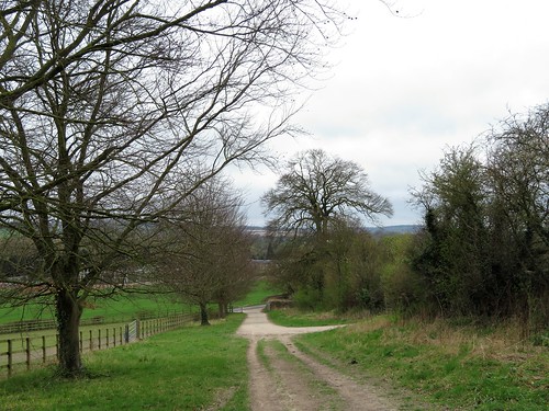
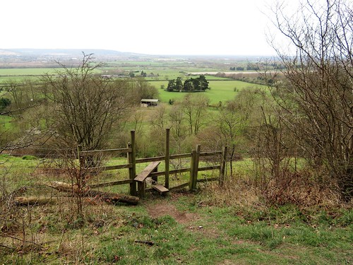
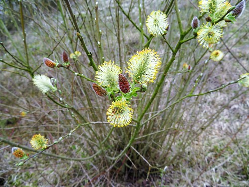
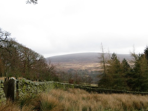
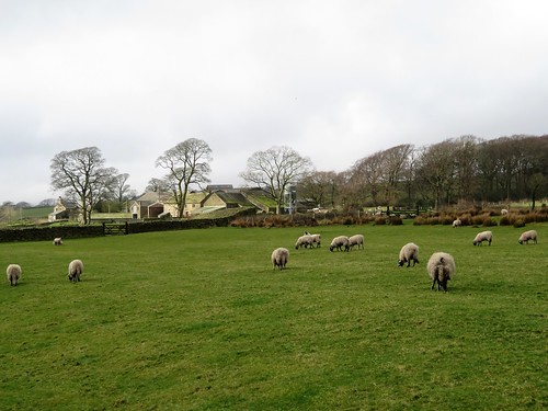
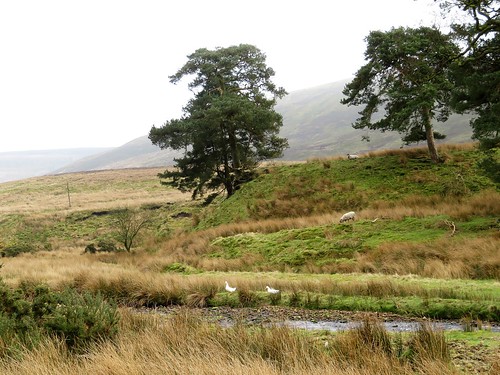
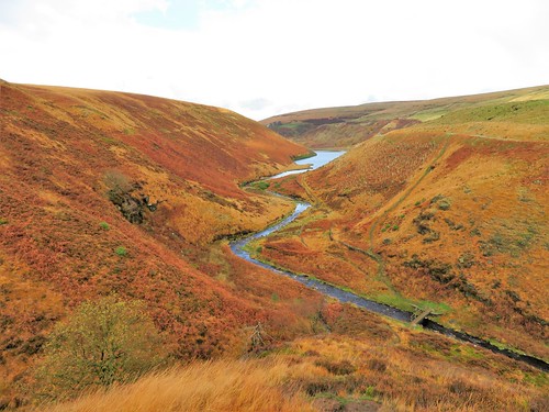
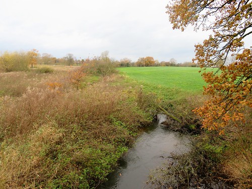
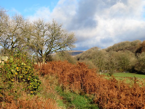
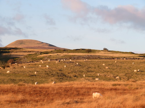
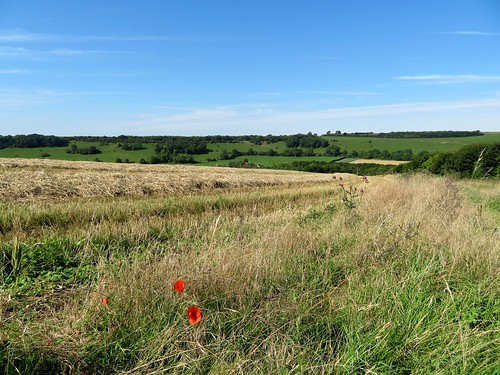
At a humpbacked bridge we left the old coal canal for pastures where fat red cattle sat the day stolidly away and stout ewes attended to the toilet of their tiny lambs. In cornfields under lark song the crumbly Leicestershire soil was scattered with pebbles smoothed and rounded by some unremembered river aeons ago.

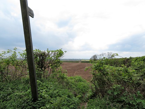
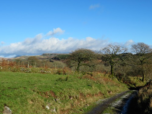
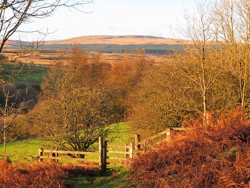
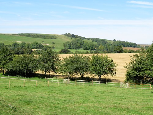
A brown hare jumped up and pelted away as we crossed newly harrowed ploughlands into Sutton Cheney. A pint in the Hercules Revived pub, and we were on the homeward path through the broad acres of Bosworth Park.

Through binoculars we made out a distant statue of Hercules himself, rising heroically out of a beanfield. The statue was ‘acquired’ on the Grand Tour of Europe – a common enough practice in Georgian times – by Sir Wolstan Dixie, 4th Baronet of Bosworth. By all accounts Sir Wolstan was an angry, litigious bully, famed for his ignorance and ready to knock anyone who crossed him into the middle of next week. Back then a squire could do just what he damn well liked on his own estate – and Sir Wolstan Dixie certainly did.

Start: Market Place, Market Bosworth, Leics CV13 0LF (OS ref SK 405031)

Getting there: Bus 153 from Leicester.
Road – Market Bosworth is signed off A447 (Hinckley-Coalville)

Walk (8¾ miles, easy, OS Explorers 232, 233):

South down Market Place. From corner of Rectory Lane, follow Sutton Lane south out of town. In ¾ mile, right (fingerpost) across footbridge (406019); left along field edges. In 2nd field, right at bottom corner; in 100m, left through hedge (405016). Follow yellow arrows and yellow-topped posts/YTP across fields to road (404006). Ahead uphill to Bosworth Battlefield Visitor Centre (403000). Follow waymarked Leicestershire Round/LR south through Ambion Wood to Ashby Canal (406995). Left along canal to Sutton Wharf (411994) and Bridge 33 (412986). From here, follow LR across fields; left along Stapleton Lane (413982). 200m past St George’s Farm, left over stile (418984); follow YTPs north for just over 1 mile to Sutton Cheney (417003). Right along Main Street. Beside Royal Arms Inn, left (419008, LR) and follow LR through Bosworth Park for 1½ miles to Market Bosworth.

Lunch: Hercules Revived PH, Sutton Cheney (01455-699336, herculesrevived.co.uk)

Accommodation: Softleys, Market Place, Market Bosworth CV13 0LE (01455-290464, softleys.com) – excellent restaurant-with-rooms

Bosworth Battlefield Heritage Centre; 01455-290429, bosworthbattlefield.org.uk

Info: visitleicestershire.com
visitengland.com; satmap.com; ramblers.org.uk

 Posted by at 01:41
Apr 072018


First published in: The Times Click here to view a map for this walk in a new window
picture picture picture picture picture picture picture picture picture picture picture picture picture picture picture picture
Facebook Link:

‘Att rising of the sunne,’ said antiquary John Leland, regarding Bewdley at dawn nearly 500 years ago, ‘frome the este the hole towne glittereth, being all of nuy buyldings, as it were of gold.’

Those ‘nuy buyldings’ are venerable now, half-timbered and crooked, leaning along the River Severn like familiar neighbours. There are few signs of old Bewdley, the rough and prosperous river port whose bargemen were so famous for their strength and skill on the water that Nelson’s press gangs frequently invaded the town to march them away for the Navy.

A swan with four cygnets in tow sailed down the bronze-brown Severn and under Bewdley’s graceful old bridge. Cherry blossom was out along the banks as we walked upriver; violets and wood anemones under the trees as we followed rutted woodland paths through the Wyre Forest.

Beside the chuckling thread of Dowles Brook stood long-redundant Knowles Mill, its iron and wooden milling machinery still in situ. A lonely site for a corn mill, but a beautiful one today, with chiffchaffs singing up the spring in the oak tops, and the pink buds of bilberry coming into blossom in the heathery banks of the wood.

I stopped and stared to see a rare duck swimming in the brook – a mandarin, all in ginger and scarlet and white. What was he doing here? Ah – out from the banks swam his steel-blue mate, both birds bobbing their heads as they hunted for a nesting site.

We passed Lodge Hill Farm and headed south among old orchards in blossom, then through woodland cut and coppiced by the Wyre Community Land Trust. The Trust is intent on restoring 300 acres of neglected forest to their former richness of wildlife and of timber production, essential work that goes largely unsung.

At Ribbesford Church the ancient tympanum over the north door showed a huntsman discharging his bow at a ravening mythic beast of the forest. Inside, a bristle-backed boar in medieval stained glass wrinkled his long snout in swinish mirth. We stopped to admire him; then walked the Severn path back to Bewdley, with mergansers pairing off under the river banks, and anemones starring the grasses along the way.

Start: Dog Lane car park, Bewdley, Worcs DY12 2EF (OS ref: SO 785755)

Getting there: Severn Valley Railway (svr.co.uk) from Bridgnorth or Kidderminster
Bus service 2 (Kidderminster)
Road – Bewdley is on A456 (Kidderminster – Tenbury Wells).

Walk (9 miles, easy underfoot, OS Explorer 218.): Left upriver along riverbank footpath. In ½ mile, at bridge abutments (780764), left on path to B4194. Right through former bridge, immediately left (‘Geopark Way’) on path beside old railway. At road (772764) right on minor road for ¾ mile to Knowles Mill (762766).

Left across footbridge (fingerpost/FP). Path goes between mill and cottage, then bend right round end of mill. Don’t cross stile on left, but keep ahead up path above Dowles Brook (yellow arrows/YAs). In 500m, opposite nesting box no. 18 and Lodge Hill Farm, right (760766), down through kissing gate/KG. Bear left up to cross drive (KGs, YA), then old railway. On along path across tussocky ground, then KG (YA) to grassy track (758764). Bear left; over track crossing, keeping pond on left.

In 350m cross forest road (757760); on through trees (YA post). Pass corner of St George’s Farm grounds (756759). In 400m, left at T-junction (755755) past old FP (YAs) and on, soon guided by fence on left. Follow YAs for ¾ mile to pass succession of houses and reach A456 (757742).

Left for 100m (take care!); right (FP) down driveway past water tower. Through gate; bear right along hedge. Stile (YA). In 2nd field, don’t cross stile on right (757738), but continue downhill with hedge on right, over stile, down hedge to enter wood. At far side of wood with house on right (759735, waymark post), turn left; in 40m, fork right (YA) inside edge of wood. In 200m at gate (761735, ‘Keep Out’ notice), bear left (blue arrow/BA) and follow BAs. In 500m, at golf club notice (764739), right (BA). In ¼ mile, at corner of playing field at Park End, left along road (768736, YA).

At Horse Hill Farm (777736), follow road to left; in 300m, fork right off road (780738, YA) and follow waymarked Worcestershire Way/WW for ½ mile to Ribbesford. At lower gate of churchyard, right (787740, BA, ‘Ribbesford Circular Walk’). Left at road (789739); at next corner, right (FP) to river bank; left to Bewdley.

Lunch/Accommodation: Mug House Inn, Severn Side, Bewdley DY12 2EE (01299-402543, mughousebewdley.co.uk) – right on the river

Wyre Community Land Trust: www.wyreclt.org.uk

Info: Bewdley TIC (0845-607-7819); visitwyreforest.co.uk
visitengland.com; satmap.com; ramblers.org.uk

 Posted by at 01:57
Mar 172018


First published in: The Times Click here to view a map for this walk in a new window
picture picture picture picture picture picture picture picture picture picture picture picture picture picture picture picture
Facebook Link:

A cool, blowy morning on the coast of County Down, with the clouds rolling back off the Mourne Mountains and skylarks beginning to sing out their claims to territory in the stony fields at the feet of Slieve Binnian. From an ancient droving route in the Annalong Valley, bounded by walls of giant granite stones, we looked up to see Binnian’s rocky head outlined against a dark sky.

The old track forged north to its crossing place through the granite barrier of the Mourne Wall. The local men who built this great 22-mile ring early last century around the catchment area of the Mourne reservoirs certainly knew their business. The Mourne Wall hurdles the highest mountain tops as though they are of no account. Today it made a fine trustworthy companion as we turned west and followed it up the mountainside.

The climb soon steepened, and there were plenty of pauses to look back around the bowl of hills that centres on rocky-faced Slievelamagan and the tall cone of Slieve Donard, daddy of the Mourne range at 853m.

Up ahead a line of granite tors crowned Slieve Binnian’s ridge, black and jagged like the turrets of a bad man’s castle. ‘Bit windy up there,’ grinned a pair of girls leaping lightly down the rocks. They were right about that, but the view that burst on us from the top was worth climbing the tors for – the long steel-blue triangle of Silent Valley reservoir two thousand feet below, the coires* of Slieve Muck beyond, and in the distance the hills of the Cooley Peninsula and the broad spread of Dublin Bay towards the distant Wicklow Mountains.

A path of skiddy granite rubble led us north past the Back Castles, wind-smoothed tors of elephantine grey, to drop steeply down to a saddle of ground under Slievelamagan. A last look across Ben Crom reservoir’s dark waters, northwards to the steeples of rock that crown Slieve Bernagh. Then we followed the rubbly old drove road back down the Annalong Valley, past the shores of Blue Lough where whitecaps ruffled the water, on down to Carrick Cottage Café and a thoroughly earned pot of tea to toast St Patrick’s Day.

* Sub-editor: coire = Irish term for the Scottish ‘corrie’ – bowl-shaped hollow in a mountainside

Start: Carrick Little car park, Head Road, near Annalong, BT34 4RW approx. (OS ref 345259)

Getting there: Bus – Mournes Shuttle Service (peter.magowan@hotmail.co.uk, 07516-4712076).
Road – Moneydarragh Road, then Oldtown Road from Annalong (on A2 Newcastle-Kilkeel road)

Walk (7 miles, strenuous, OSN1 1:25,000 Activity Map ‘The Mournes’): From car park, left up stony lane. In 900m go through gate (345228); in 300m fork left and climb path with Mourne Wall on left, soon steepening. Near top, pass (but don’t cross) ladder stile on left at wall; aim a little right between two tors to reach ridge (321235) and Slieve Binnian summit. Right on ridge path past the Back Castles for ¾ mile to pass to left of North Tor (319246). Path descends, soon steeply, for ⅔ mile to path crossing on saddle between North Tor and Slievelamagan (321256). Right on rubbly path for 3¼ miles, passing Blue Lough, then along right side of Annalong Wood, back to car park.

Conditions: Mountain walk – dress appropriately. Steep, rough ascent to Slieve Binnian. Ridge path, descent and valley track are stony and slippery. Watch your step!

Tea: Carrick Cottage Café, near car park (07595-929-307)

Dinner: Brunels Restaurant, Newcastle (028-4372-3951, brunelsrestaurant.co.uk)

Accommodation: Slieve Donard Resort, Downs Road, Newcastle BT33 0AH (028-4372-1066, hastingshotels.com/slieve-donard-resort-and-spa)

Info: Newcastle TIC (028-4372-2222, mourne-mountains.com)

walkni.com; visitmournemountains.co.uk; www.discovernorthernireland.com

 Posted by at 01:29
Mar 102018


First published in: The Times Click here to view a map for this walk in a new window
picture picture picture picture picture picture picture picture picture picture picture picture picture picture picture picture
Facebook Link:

A huge wind from the north-west and a racing, bracing blue sky to greet us as our train came into Margate. The old Kentish seaside resort, once elegant, then raffishly ramshackle, now trendifying itself once more, hangs on the outermost lip of the River Thames where London’s river finally yields sovereignty to the North Sea.

Kite surfers leaped and twirled joyfully in the breakers, and dogs in ecstasies galloped the crescent of tan-coloured sand in front of the town. The wind giants had pummelled everything into life and motion. We bowled along the sea-level promenade under low chalk cliffs with faces fractured by wind and weather.

The sea boomed and shot up spray, each wave slapping back on its successor in rearing white horses. A flock of tiny, white-breasted sanderlings pattered this way and that, out to the tide-line after every wave to snatch whatever edible had been tossed ashore, back to the safety of the promenade wall as the next surge of foam hissed after them up the sand.

Out beyond all this activity and noise, big ships silently trudged the sea horizon, garishly lit in scarlet and white by shafts of intense sunlight. Already paired for the oncoming nesting season, a couple of fulmars contemplated the scene from a crevice high in the cliffs, while others planed the wind on wings stiffly out-held.

In Palm Bay a woman strode towards us, a length of green fishing net trailing from her fingers. ‘Beach-combed it,’ she said with pride, ‘I’ll train my runner beans up it. Recycling, you know!’

At Foreness Point the coast path swung more southerly, and the wind pushed at our backs. On the cliffs of Kingsgate Bay an enormous flint-built mock castle filled the headland, the cliffs below braced and buttressed to prevent them collapsing under its weight. The castle was built in Georgian times by Lord Holland for use as his stables. The only horses there today were the white ones that the jade-coloured sea sent prancing along the feet of the cliffs below.

We passed North Foreland’s stubbly white lighthouse, threaded a maze of fabulous clifftop villas, and came down into Broadstairs windblown, salt-spattered and ruddy-cheeked, our ears still full of the roar of wind and sea.

Start: Margate Station, Kent CT9 5AD (OS ref 347705)

Getting there: Rail to Margate. Road – Margate is on A28 (Canterbury)

Walk (7½ miles, easy, OS Explorer 150): From Margate station, walk to seafront; turn right along Viking Coastal Trail/VCT. In 2¾ miles, turn up slipway at Foreness Point (384716); follow VCT along cliffs. In 1¼ miles join B2052 at Kingsgate Bay (3957707). In 350m, take cycle-path on right of road. At Elmwood Avenue cross Joss Gap Road (399701); follow VCT along cliffs. In 500m VCT turns inland towards North Foreland lighthouse, but keep ahead here along Cliff Promenade. In ½ mile turn inland along Cliff Road (401690); left along North Foreland Road. In 250m, opposite Bishops Avenue, left down alley (397689, fingerpost); right along shore promenade to Viking Bay at Broadstairs (399678). Inland past Old Curiosity Shop; left along VCT. In 250m VCT turns inland (398677); right along Buckingham Road, left up High Street for 600m to Broadstairs station (391680). Rail to Margate.

Conditions: Some shore sections may be inaccessible at very high tide. Check tides at visitthanet.co.uk/weather

Lunch: Many cafés and pubs in Broadstairs.

Accommodation: Sands Hotel, 16 Marine Drive, Margate CT9 1DH (01843-228228; sandshotelmargate.co.uk) – stylish, comfortable seafront hotel.
‘The independently-owned Sands hotel in Margate has been included in the Sunday Times 8 Best UK Seaside Hotels for the past three years (No.1 in 2016). It sits on the Prom, overlooking the beach and arching bay, retro-theme park Dreamland and the Turner Contemporary (Turner painted more canvasses in Margate than anywhere else). Margate has taken the mantle as the coolest place to be seen by weekending Londoners and the boutique hotel is also just a two-minute stroll from the bijoux art galleries and quirky artisan shops in the revitalised old town, You might even be able to catch one of those fiery Turner sunsets with a cocktail from the open-terrace roof bar.  A double room with breakfast costs from £130 per night.’ – (thanks to Paul Gogarty for these details)

Info: Margate TIC (01843-577577; visitthanet.co.uk)
visitengland.com; satmap.com; ramblers.org.uk

 Posted by at 01:58
Mar 032018


First published in: The Times Click here to view a map for this walk in a new window
picture picture picture picture picture picture picture picture picture picture picture picture
Facebook Link:

As soon as we walked out of Tring station, the Chilterns beckoned us on and upward – the humpbacked green downland of Aldbury Nowers looking down on the railway, studded with beechwoods and lined with ancient earthworks and trackways.
 
It’s not until you’re up there with your boots in the crumbly white clay of the 5,000-year-old Ridgeway that you properly appreciate the wildlife treasures of these chalk grassland slopes. The wild marjoram and thyme, the harebells and rockroses that carpet the steep grassy banks from spring onwards are carefully nurtured by the Berks, Bucks and Oxon Wildlife Trust (BBOWT), not least for the sake of the butterflies that are drawn to such delicate and increasingly uncommon plants – marbled whites and small blues, grizzled and dingy skippers (rather more beautiful than their names suggest), the brown argus and the green hairstreak with its strikingly leaf-green underwings.
 
We followed the Ridgeway as it undulated north along the hillsides in company with the old Saxon earthwork of Grim’s Ditch. Gaps between the trees gave a far prospect north and west over the green wooded plains of outer Buckinghamshire to a dip of distant blue hills that might have been the north-easternmost Cotswolds. Deep in the trees wrens chattered in full flow, and a black-and-white great spotted woodpecker cocked his red-capped head as he prepared to give a beech crown a good hammering.
 
High on Pitstone Hill we left the Ridgeway for a bridleway that tipped back down into the valley. Here the navvies dug deep to carve out great cuttings for the railway and the Grand Union Canal. Well-tended paths led us through horse pastures to the flooded chalk quarry of College Lake.
 
This very family-friendly and well-run nature reserve is looked after by BBOWT. Dawn chorus strolls, workshops, bird-watching, kids’ activities, guided walks – you’ll find them all here. We walked a long circuit of the lake, looking for nesting redshank and lapwing, while birdwatchers passed tantalising news of a visiting osprey that might be in the vicinity.
 
We saw neither hide nor hair of the osprey. That didn’t matter – not with the sun deciding to put in an afternoon appearance. We walked slowly back to Tring in the depths of the cutting beside the motionless, olive-green waters of the Grand Union Canal.
Start: Tring station, Herts, HP23 5QR (OS ref SP 951122)
 
Getting there: Rail to Tring; bus service 387 (Aldbury-Tring).
Road – Tring station is 1 mile east of Tring on Aldbury road.
 
Walk (7½ miles, easy underfoot, OS Explorer 181): Cross road; right; 100m beyond right bend, left (953124, ‘Ridgeway’/RW) up driveway. In 50m, ahead, to turn left along RW. In 600m fork right (951129, ‘RW footpath’, yellow arrows/YA, acorn waymarks). In ¾ mile, left at kissing gate (950139, ‘Bridleway’) down to road (945137). Left for 250m; right (946134, fingerpost) past Park Hill and Marshcroft farms to Grand Union Canal (939129). Right (YA) on path along east bank of canal, then past Bulbourne Farm (938135). At railway, left to B488 (938140). Left for 250m; right into College Lake Nature Reserve (935139). Walk Reserve Trail circuit. Back at Visitor Centre, right along path parallel to B488. In 250m (934137), right along road. Cross canal bridge; left along towpath for 1¼ miles to road at 2nd bridge (948121); left to Tring station.
 
Lunch: Badger Café, College Lake Visitor Centre
 
Accommodation: Pendley Manor, Cow Lane, Tring HP23 5QY (01442-891891, pendley-manor.co.uk)
 
College Lake Visitor Centre: (01442-826774, bbowt.org.uk) – open 9.30 – 5.00

visitengland.com; satmap.com; ramblers.org.uk

 Posted by at 01:41
Feb 242018


First published in: The Times Click here to view a map for this walk in a new window
picture picture picture picture picture picture picture picture picture picture picture picture picture picture picture picture
Facebook Link:

Mist on the moor tops of the Forest of Bowland, and cool grey weather down in the long green valley of the River Wyre. Abbeystead lay sheltered along its tree-lined road, an immaculate Victorian estate village built in mock-medieval style by the 4th Earl of Sefton, all stone mullions, gables and thick chimney stacks.

We breathed the scent of resin from the roadside pines as we set out from the village across sedgy pastures. Rain-sodden ewes with red raddled rumps went flouncing away. Top o’ Emmetts farmhouse sat on its ridge among stark stone byres and barns. A bleak late winter scene, the kind that drives you on over the wet fields and across stone walls green with algae, following the white exhalations of your own breath.

Twin rivers flow through this high valley, the Tarnbrook Wyre to the north and the Marshaw Wyre in the south, snaking west on converging courses to meet and mingle at Abbeystead Reservoir. We crossed the northern branch at Tarnbrook, where the farm dogs barked us out of the tight-huddled hamlet and on through the lonely farmsteads of Gilberton and Speight Clough.

No-one came and no-one went among the sturdy old buildings. We had the whole world entirely to ourselves – the leafless straggle of Harry Wood, the moors lifting their skirts of mist coquettishly, the snipe already paired for mating and zigzagging frantically away as we swished through the rushes.

Down at Tower Lodge we walk west along the valley road past Marshaw Farm with its fat white sheep. Here the Marshaw Wyre ran deep and powerful, cutting great bends in the soft sandy banks. We floundered and squelched through the bogs, nosing out the way, to arrive opposite the serried gables and windows of Abbeystead House. From where we stood, the 4th Earl of Sefton’s ‘shooting lodge’ looked large enough to accommodate all the King’s horses and all the King’s men.

If there is a muddier path in Lancashire than the one that skirts the swamps of Abbeystead Reservoir, I never wish to walk it. But perseverance had its reward – the remarkably beautiful spectacle of the conjoined Wyre rivers sliding gracefully with a mesmeric hiss down their cunningly sloped weir, in a great lacy fan of water ripples that held one’s gaze in thrall.

Start: Car park, Stoops Bridge, Abbeystead, Nr Lancaster LA2 9BQ (OS ref. SD 564542)

Getting there: M6 Jct 33; A6 south; immediately left (Hampson Lane) across motorway, follow ‘Dolphinholme’, then ‘Abbeystead’. Drive through village; cross Tarnbrook Wyre river bridge; immediately left to car park.

Walk (8½ miles, moderate, OS Explorer OL41): From road junction by car park, right uphill; at left bend, ahead through garden gate (567546, ‘Wyre Way’/WW, yellow arrow/YA). On across field, aiming for far left corner. Stile (YA) to cross road (575547, WW, ‘Tarnbrook’). Up Top o’ Emmetts drive; right over ladder stile/LS; follow hedge on left to top left corner of field (578549). Cross footbridge and LS, then stile and footbridge (WW). Follow YAs across sedgy fields. In 500m pass right-hand end of barn (582552); follow fence/hedge on right towards farm sheds below. Follow WW past Ouzel Thorn (585555) to cross bridge at Tarnbrook (588556).

Right on tarmac road through hamlet. Farm road continues over moor. In 500m, fork right (595556, WW) over cattle grid. At Gilberton farm, cross cattle grid (595554); left to cross footbridge; left along wall to cross stone bridge; cart track to Speight Clough (597553). Through gate; YA on tree; follow wall up cleft for 500m, past Harry Wood. At top of wood, through gate (598547, WW, ‘sheep folds’ marked on OS Explorer). DON’T cross first LS on left (with blue waymarked fingerpost); take 2nd LS, 100m further along, beside gate (599546). Across field corner to cross LS; half left to next LS (601544). Keep same direction down to stony road (603543); right downhill to turn right on valley road at Tower Lodge (604539).

In ½ mile pass turning at Rakehouse Brow (585537); keep ahead (‘Abbeystead 2’) for 150m, then on right bend go through gate ahead (WW). Keep ahead with fence/hedge on left. At angle of wall, ahead to corner of wood on right (581538). DO NOT descend to cross unwaymarked footbridge below, but bear right round the corner, along wood edge, to footbridge (580539, ‘WW’). Follow right bank of river. In 200m it bends left; leave it here, cross ridge ahead, descending to cross footbridge (578540, WW).

Continue above left bank of river. In 300m, nearing a footbridge, look left for WW waymark post in a boggy patch (576542) pointing half left to steps. Climb these; over stile at top (WW); follow fence on right. In ½ mile opposite Abbeystead House, descend to cross footbridge (567543). On to road and car park at Stoops Bridge (564542).

For a circuit of Abbeystead Reservoir, turn left to cross Marshaw Wyre river (565542). Immediately right (YA) on path through woods (extremely muddy!). In 200m cross bridge and bear right along left bank of River Wyre to reach Abbeystead Reservoir weir (557538). Cross river below weir; right up path, then reservoir road. Cross cattle grid; in 100m, opposite farmyard, right (557542, WW). Through gate; across field to road by house (559542); ahead to Abbeystead.

Conditions: many wet places; reservoir circuit is extremely muddy!

Lunch/Accommodation: Fleece Inn, Dolphinholme LA2 9AQ (01524-791233, fleeceinn.co.uk): cheerful, friendly village inn

Info: Lancaster TIC (01524-582394)
visitengland.com; satmap.com; ramblers.org.uk

 Posted by at 01:13
Feb 172018


First published in: The Times Click here to view a map for this walk in a new window
picture picture picture picture picture picture picture picture picture picture picture picture picture picture picture picture
Facebook Link:

Mighty clouds of elephant grey came sailing over the high slopes of Black Edge and Binn Moor, and on across the Colne Valley. Among them, blue streaks gave promise of a better, if brisker, afternoon.

It’s a long time since the buzzer at Bank Bottom Mill summoned half the working population of Marsden to its carding machines and looms. The weather-stained old mill stands redundant at the bottom of the town, as big as a cathedral, acres of windows and grey slate roofs round a central tower and a slender octagonal chimney.

We followed a laneway among these haunting ruins, then on to where a great grass bank filled half the skyline. The dam of Butterley Reservoir is a really impressive sight, even when floodwater is not cascading in white ripples down its spillway.

Blakeley Reservoir, high above, is smaller and wilder. Local volunteers were planting young oaks along the banks of Wessenden Brook. Here we stood and looked back along the twisting valley with its man-made lakes, insinuated among the hills at the turn of the 20th century to feed the mills and wells of industrial Huddersfield.

Walking the Pennine Way across these moors used to be a purgatorial flounder among bogs and peat hags. Nowadays, thousands of old mill flagstones give dry passage across the morass. This afternoon’s westward walk beside Blakeley Clough was a pure pleasure, striding firm-footed as the sun burst from behind the clouds and turned the moor grass to a sea of wind-ruffled gold.

The moor top reservoirs of Black Moss and Swellands lay side by side in modest beds, their water the polished indigo of a lobster’s shell. On the shore of Redbrook Reservoir the Pennine Way met the Standedge Trail, whose stony path we followed, chased by an icy wind. It carried us down from the hills and back to Marsden by way of a narrow old walled lane, from which we looked down over the terraced houses along the valley, and the tall black chimney of the great mill complex still standing silent at the foot of the town.
Start: Marsden railway station, Marsden, W. Yorks HD7 6AX (OS ref SE 047118)

Getting there: Bus 185 from Huddersfield. Road – Marsden is on A62 (Huddersfield-Oldham)

Walk (7 miles, moderate, OS Explorers OL21, OL1): Cross canal, walk downhill. At left bend, right across river, past church. Cross Towngate; along weir side. Cross Mount Road; up Binn Road. In 100m, fork left by Marsden Industrial Society between Bank Bottom Mill buildings (048111); on along lane to Butterley Reservoir dam. Up steps on left (049106); at top, right on Kirklees Way (fingerpost) for 1 mile to top of Blakeley Reservoir. Right on Pennine Way (054091, fingerpost) over Marsden Moor for 2 miles. Just before Redbrook Reservoir, right (027094) along Standedge Trail (unmarked, broad track). In ¾ mile cross Mount Road (037101). Up Old Mount Road; in 50m fork left (‘Hades Farm’). In 900m, right (042110, ‘Marsden Heritage Trail’, Point 15) down walled lane to track (044111). Left past house; walled lane for 300m to gate on left of farmhouse (044113). Right along house wall; ahead through 2 gates (yellow arrow); down sloping field, following gully to bottom left corner (046115). Cross stile; right down lane to road; left across A62; return to station.

Conditions: Some short, steep ascents/descents; some muddy parts

Lunch: The Railway, Marsden (01484-841541, railwaymarsdenhuddersfield.co.uk)

Accommodation: The Carriage House, Manchester Rd, Standedge, Marsden HD7 6NL (01484-844419, thecarriage-house.co.uk)

Info: yorkshire.com/places/west-yorkshire; satmap.com; ramblers.org.uk

 Posted by at 01:59
Feb 102018


First published in: The Times Click here to view a map for this walk in a new window
picture picture picture picture picture picture picture picture picture picture picture picture
Facebook Link:

‘Heavy, persistent rain – gale force winds – weather warnings issued!’

The forecast for south Cheshire sounded dire. This was nothing new, however. Last time we’d stayed at the Cholmondeley Arms, fallen trees had blocked all the roads and a power cut had necessitated a candle-lit, rug-wrapped evening in the old schoolroom-turned-pub.

We glanced outside. A racing sky and scurrying clouds, but no downpours on the horizon. Shall we? Shan’t we? Oh, come on, let’s give it a go.

The wind blustered round Wrenbury’s old sandstone church of St Margaret. Inside were wide arcades, a maze of box pews, and a fine memorial to Stapleton Cotton, Viscount Combermere, Governor of Barbados, C-in-C of the Leeward Islands, Ireland and the East Indies. Also a box pew for the parish dog whipper, a post sadly in abeyance these days. The dog whipper kept canine upstarts in order during services with a 3-foot rod and a pair of dog tongs. It must have been quite a challenge.

Out in the fields lay glinting pools, witness to the impermeability of the glacial clay spread across this gently undulating landscape. The wind hissed in the leafless hedges and tossed parcels of rooks about the sky. Ashes and oaks roared as we trudged by.

In Aston we passed the Bhurtpore Inn, named for a victorious siege conducted by Lord Combermere in 1825. Old wars of empire seemed very far away, though, as we crossed Paradise Bridge in a dell of restless oaks, and forged north across beet fields and clover pastures.

A sweet treacly smell blew after us from a feed mill downwind. At the half-timbered old farmhouse of Sound Oak young cattle munched hay in their sheds. A last stretch across squelchy fields and we were following the grassy towpath of the Llangollen Canal back towards Wrenbury. At Baddiley Lock water chuckled down the spillway and ran rippling and flirting with the wind under bare boughs of oak and aspen.

If we’d taken heed of that portentous forecast, we would have missed out on a wonderful blowy walk, the canal waters spattered gold with oak leaves, and this stretch of winter country, green and quiet, under its racing sky.

Start: Wrenbury station, near Nantwich, Cheshire CW5 8EX (OS ref SJ 601471); or Wrenbury village, CW5 8HW (OS ref SJ 593477)

Getting there: Rail to Wrenbury station; bus 72 from Whitchurch
Road: Wrenbury is signed off A590 (Nantwich-Whitchurch)

Walk (7¼ miles, easy, OS Explorer 257): From station, follow Wrenbury Road past industrial estate on left. In 100m, left (stile, ‘South Cheshire Way’/SCW) diagonally across field to road (604469). Left; in 300m, right (607470, kissing gate, SCW) across field, paddock, plantation to road in Aston (610469). Left past Bhurtpore Inn. On left bend, right up Woodcotthill Lane (609472). In 20m, right (SCW); in 300m, in 3rd field, fork left off SCW (612472, kissing gate, yellow arrow/YA).

Half right across field to hedge (614473); left along it to cross Paradise Bridge (614475). Field edge path north for 700m to road at Sound Hall (614481). Right; in 100m, left (YA) across field. Through gate; aim across field, and follow hedge on right (617484), then railway on left (618486) to road (619489). Left; in 240m, left (618491) up Sound Oak Farm drive. Pass to right of house; on across fields for ½ mile to road (608495). Left to steps down to canal; left along towpath for 2 miles to Wrenbury Bridge (590480).

Left along road to Wrenbury (NB Alternative Start). Right opposite church down New Road (593477, ‘Marbury, Whitchurch’). In 700m, opposite Smeaton Hall drive, left (590471, gate, SCW) across fields. Aim left of battery sheds (593470); stile, then 2 fields to Wrenbury station.

Conditions: Fields can be very wet!

Lunch: Dusty Miller, Wrenbury Bridge CW5 8HG (01270-780537)

Accommodation: Cholmondeley Arms, Wrenbury Rd, Malpas SY14 8HN (01829-720300, cholmondeleyarms.co.uk) – fabulous, candle-lit pub-in-a-schoolroom, friendly and comfortable.

Info: visitcheshire.com; satmap.com; ramblers.org.uk

 Posted by at 01:22
Feb 032018


First published in: The Times Click here to view a map for this walk in a new window
picture picture picture picture picture picture picture picture picture picture picture picture
Facebook Link:

‘Oh, we have people here all the year round to visit the waterfalls,’ said the landlord of the New Inn at Ystradfellte, ‘and a nice Sunday carvery, and that’s how we keep going.’

The New Inn, as warm and welcoming as you’d like every village pub to be, is at the heart of tiny but thriving Ystradfellte, in a cleft of the Brecon Beacons country. It takes a good positive community to keep a pub, post office, church and village hall going these days in such a small and out-of-the-way place.

Brooks trickled and field ditches chuckled with water after last night’s rain. Down at Porth-yr-Og, unearthly groans and roars issued from a cave in which the Afon Mellte went churning and twisting invisibly through subterranean narrows. A file of youngsters in hard hats and caving overalls came up the path, grinning their heads off with excitement at what they’d seen down there.

A narrow, stony laneway, all mud and moss, led us over a green hillside and down into a parallel valley where the Nedd Fechan river rushed beneath Pont Rhyd-y-Cnau, ‘bridge at the ford of the nuts’. Hazels still overhung the water, but squirrels had gathered all the nuts for winter.

We walked upriver beside the Nedd Fechan, feeling its cold breath on our cheeks. The rain-swollen water hurried over rapids, fed by tributaries that tumbled down through the woods in stepped waterfalls. Pwll Du, the black pool, lay quiet, a dark silver disc in a cave mouth at the foot of a crag. We scrambled up a steep little path and teetered along at the rim of the gorge, ducking under silver birch boughs crusty with white and green lichens.

A farm track across the river led up to Cefn-ucheldref, the ‘back homestead’, a lonely clutch of mossy ruins on the hillside. A final crossing of the Nedd Fechan, and we followed an old bridleway eastward over a sedgy upland until the neat white houses of Ystradfellte appeared below in a twinkle of lights through the dusk.

Start: Ystradfellte car park, Brecon Beacons, CF44 9JE (OS ref: SN 930134)

Getting there: Ystradfellte is signed from A4059, 4 miles north of Hirwaun

Walk (6 miles, strenuous in parts, OS Explorer OL12): Right by New Inn, past church; cross river; in 200m, right (932130, stile, yellow arrow/YA). Follow path for 600m to car park (928124). Detour right down zigzag path, then left over stiles to see Porth-yr-ogof cave. At road beyond car park, right; just past ‘Cwmporth’ sign, left (blue arrow, ‘bridleway’) south-west along narrow walled lane.

In 900m at T-junction (921117, blue post), right to road. Left; first right (919117, ‘Nedd Valley’). In 200m, left through gate (unmarked); down steep lane to river at Pont Rhyd-y-Cnau (912116). Don’t cross bridge; turn right (north) on riverbank path. In 500m, at Pwll Du pool and cave (912121), climb narrow path above pool. Follow narrow path, close to fence on right at top of gorge, north for 500m to cross river on bridge below Dyffryn-Nedd (912126).

Up track (YAs) to field (911128); follow track, keeping same height above river. In 500m aim a little left for ruins of Cefn-ucheldref (909135, stile, YA). Right along lane above; in 350m, right on track (908139, unmarked), descending to cross river (911140). Left at road above; in 200m, right (913141, gate, ‘Ystradfellte’ fingerpost).

Half right across field, through gate; follow track. From next gate (914140) follow grassy track; in 150m, fork right. Follow path past occasional posts across open ground. In 300m pass rocky outcrops on left (917139); aim east across big open area, passing left of enclosure with poles (920139), then aiming for gate in angle of walls at far left corner of field (924138). Follow green lane south-west for ½ mile to Ystradfellte.

Conditions: muddy bridleways, narrow path on steep slope from Pwll Du northwards. Boots, sticks, mud-proof legwear!

Lunch: New Inn, Ystradfellte (01639-720211; waterfallways.co.uk) – excellent, friendly pub

Accommodation: Nant-Ddu Lodge, Cwm Taf, Merthyr Tydfil CF48 2HY (01685-379111, nant-ddu-lodge.co.uk)

Info: breconbeacons.org; visitwales.com; satmap.com; ramblers.org.uk

 Posted by at 01:38
Jan 272018


First published in: The Times Click here to view a map for this walk in a new window
picture picture picture picture picture picture picture picture
Facebook Link:

It’s hard to haul yourself out of bed on a chilly morning at sunrise, no matter what the weatherman has prophesied for that day. But there were rewards for our early-birdery. The commuters of West Sussex were still scowling their way to work as we set out from Kithurst Hill along the nape of the South Downs, under a blue sky and with a view that stopped our yawns in their tracks.

To the south-west the slender walls of Arundel Castle rose sunlit above their encircling trees, like a stronghold in a fairy tale. The plastic pavilions of Bognor Regis caught the sun, too, and beyond them a bright white ferry crawled past the grey snout of the Isle of Wight over a pale blue sea.

Nearer at hand, the chalk billows of the downs pitched and rolled. Old trackways and bridlepaths drew green seams through the pale ploughlands and stubble. We picked one running south past a windwhistle copse of beech and sycamore towards Harrow Hill’s green hummocky profile.

Harrow Hill might be, as some local stories say, the last place in England the fairies were seen dancing. It’s certainly a remarkable piece of chalk downland, pierced and riddled with the deep shafts and subterranean galleries of Neolithic flint mines. The northern flank is hollowed by a giant chalk pit, its sides as cleanly cut as though they’d been cored out with a scalpel.

We followed a grassy bridleway that skirted Harrow Hill and ran north beside a hedge of handsomely pollarded old beeches. As so often when walking these Sussex downs, we were struck by the immaculate fettle of the land.

A red kit quartered the roadless valley that opened below us, the sun catching the burnt orange of its wings as it swung this way and that on the wind. Incredible to think that these lovely creatures were all but extinct in Britain only 30 years ago.

A long straight climb to the South Downs Way at the crest, and time before the homeward trudge to lean on a gate and study the view, fifty miles in sunshine, from the wooded weald of Sussex in the north to the glinting sea far down in the south.

Start: Kithurst Hill car park, RH20 4HW approx (OS ref TQ 070125)

Getting there: Kithurst Hill car park is signed at entrance to lane on B2139, 2 miles east of Amberley towards Storrington.

Walk (6½ miles, easy, OS Explorer 121): Beside ‘Kithurst Hill Car Park’ sign by car park entrance, go through metal gate, and wooden gate opposite (‘Public Bridleway’, blue arrow/BA). Half left across field; aim right of water tank to fingerpost/FP (073121). Cross path; follow FPs and BAs for 1 mile to Lee Farm (076104). Left; where drive swings right, ahead through gate (078103, BA). Right across field, through gateway (078099), up rising track. Gate (BA); grass track; in 150m fork left across field for ½ mile to gate (082093). Ahead down drive; in 250m, left through gate (084090, BA). Half right across pasture; at KG and FP, left (086090) on gravel track. In 400m fork left (087092) on fenced grass bridleway. In 500m fork right through gateway (089098); ahead across pastures. In ⅔ mile, through gate (090105); in 100m, right (gate, FP) on bridleway. In 300m, left (093109, BA) for ½ mile to SDW (093117); left to car park.

Lunch/Accommodation: Sportsman Inn, Amberley BN18 9NR (01798-831787, thesportsmanamberley.co.uk)

Info: Chichester TIC (01243-775888)
visitengland.com; satmap.com; ramblers.org.uk

 Posted by at 01:27