Jan 202018


First published in: The Times Click here to view a map for this walk in a new window
picture picture picture picture picture picture picture picture picture picture picture picture picture picture picture picture
Facebook Link:

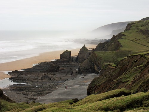
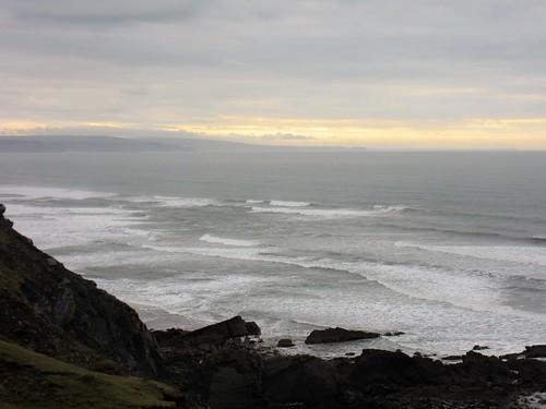
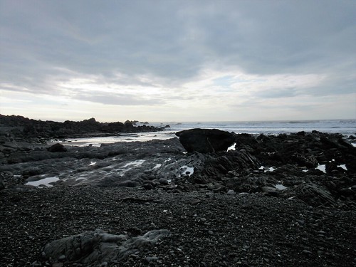
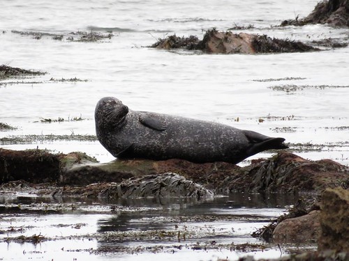
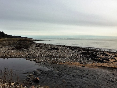
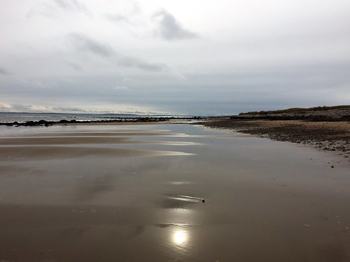
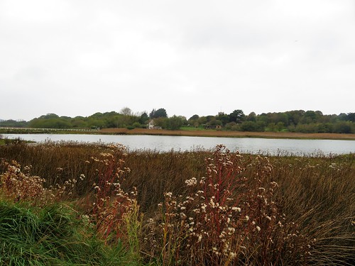
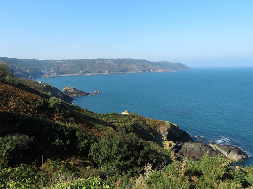
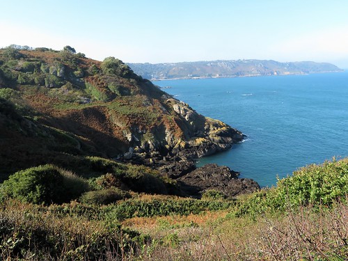
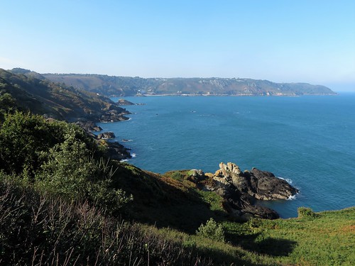
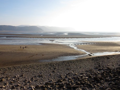
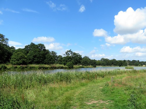
A slip of tan sand, a jumble of sharp black rocks and a welter of surf at Northcott Mouth. We stood and watched the waves leaping up at the feet of the cliffs and falling back in a hissing collar of spray – a sombre, elemental scene to set the mood for this unforgiving stretch of the North Cornwall coast.

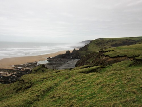
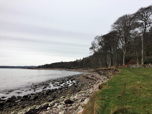
From the cliff path we looked down on dark scars that seamed across the beach under Menachurch Point, each narrow ridge an individual rock layer tilted on end by subterranean upheavals, then ground down level with the beach through the inexorable power of the sea. Sections of the clifftop had cracked and fallen away, leaving grassy bowers hanging over space where sheep grazed as nonchalantly as though in some cosy paddock.

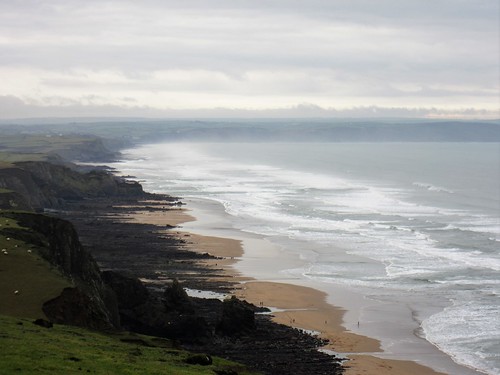
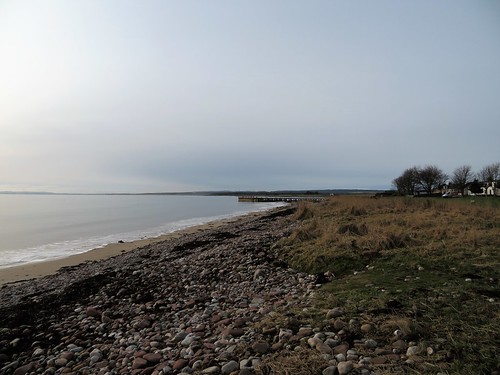
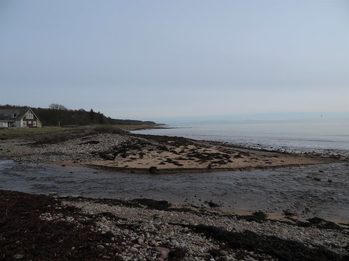
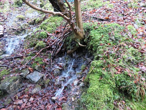
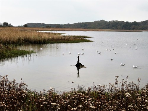
Down into Sandy Mouth where a jet of water spouted out of the cliff; up, over and down again into the tumbled wasteland of Warren Gutter, the path so black and greasy it looked more like coal-mining country than the Cornish shore. A slippery haul up Warren Point and over to Duckpool’s tiny strand, a pause to look back along thirty miles of thundering grey surf, and we turned inland into the peaceful cleft of the Coombe Valley.

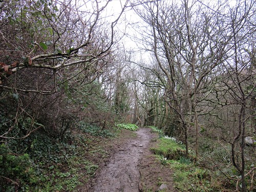
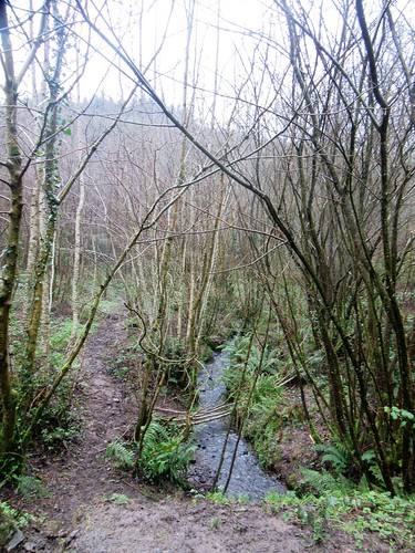
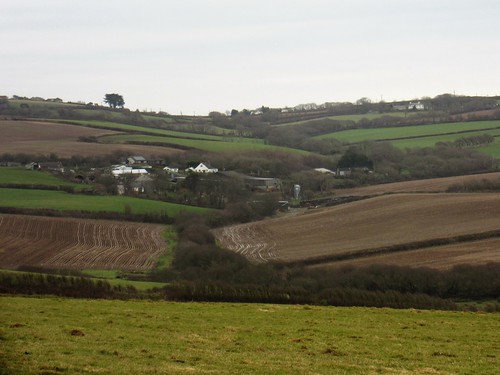
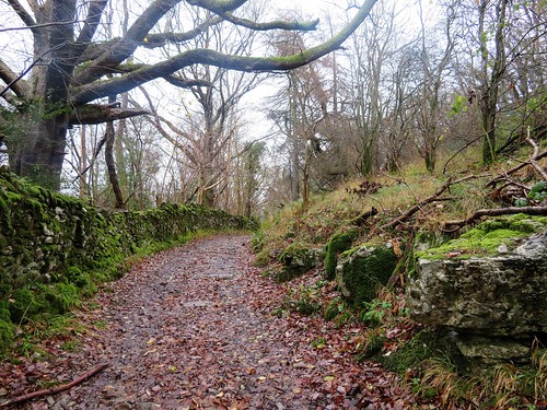
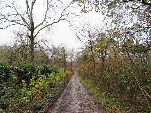
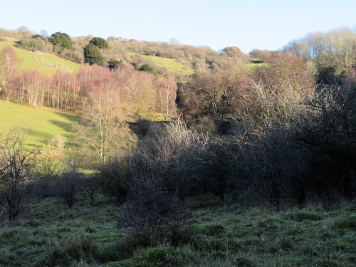
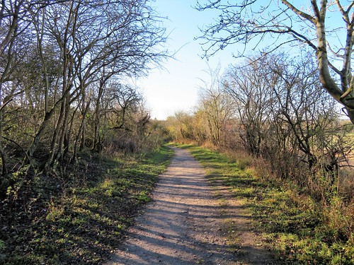
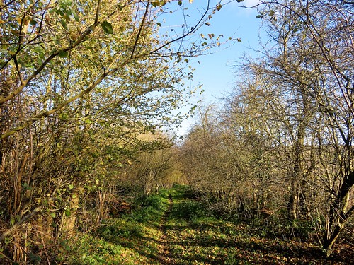
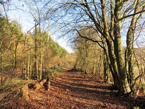
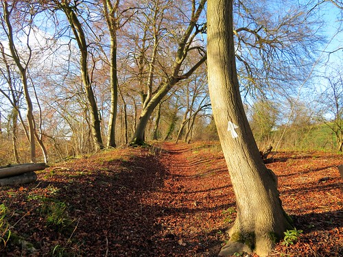
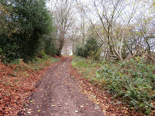
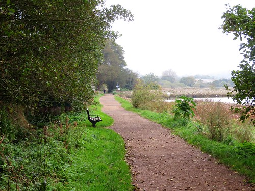
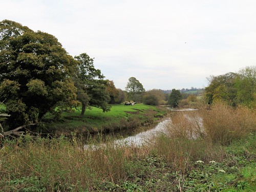
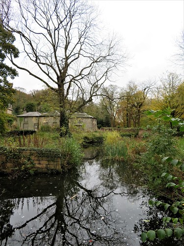
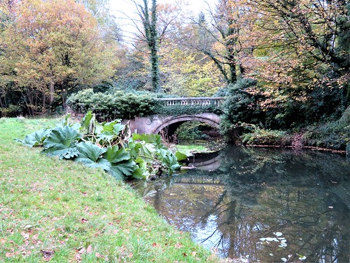
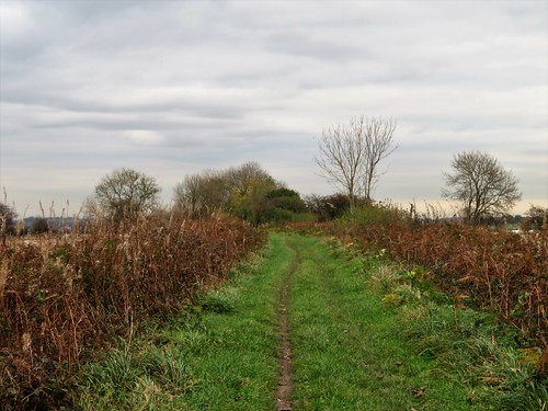
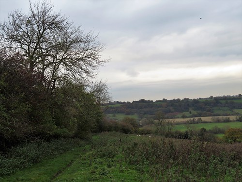
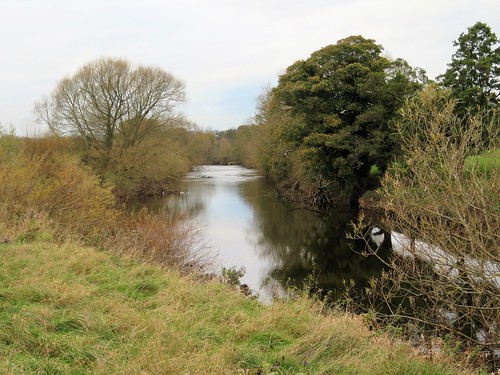
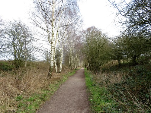
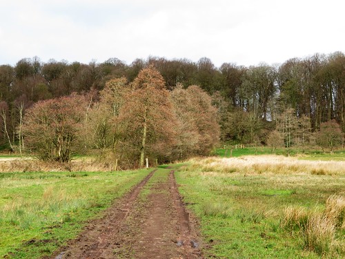
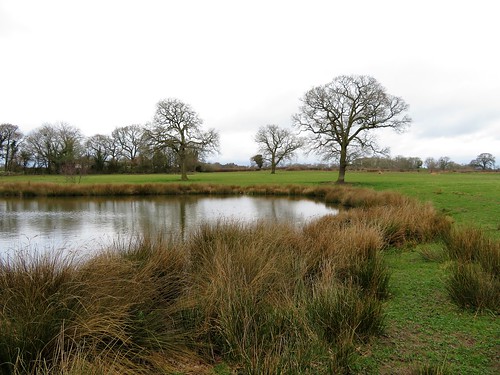
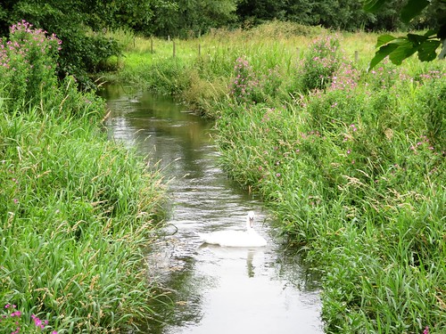
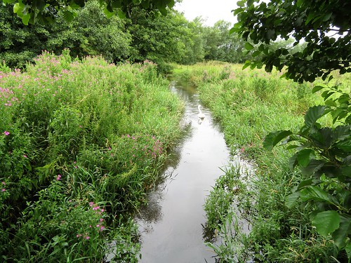
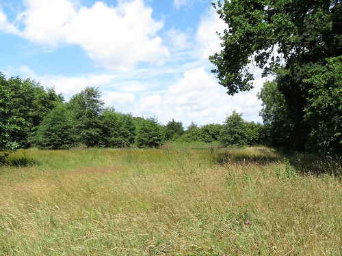
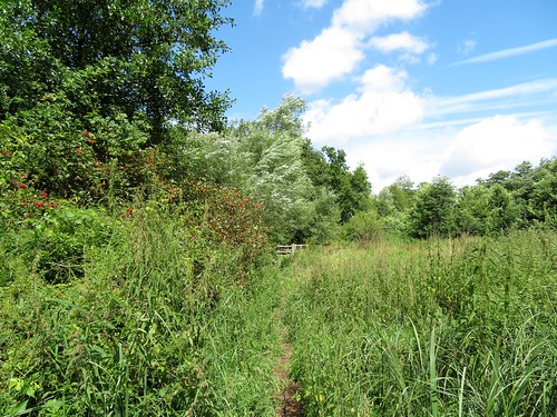
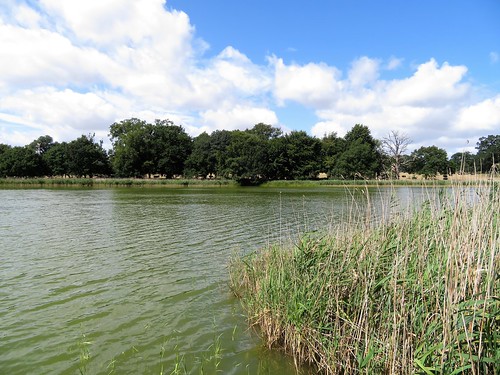
Two thatched houses guarded the ford at Coombe. Beyond lay deep woods of sweet chestnut, hazel and oak under a sky mottled in grey and airforce blue. Sedgy strips of meadowland formed the valley floor, where a stream twisted in snake bends as it sought out a way to the sea. This is the most perfect Swallows-and-Amazons setting for children staying in the cottages at Coombe, and we saw them paddling and yelling in the stream as we followed a parallel path back through Stowe Woods and up a lumpy bank to Stowe Barton.

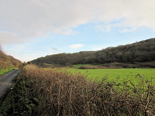
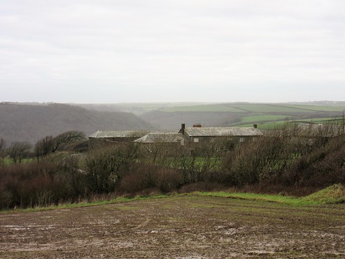
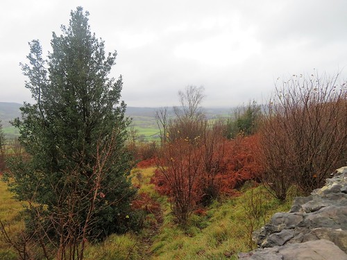
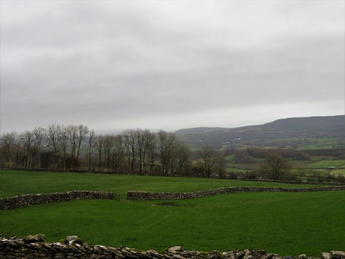
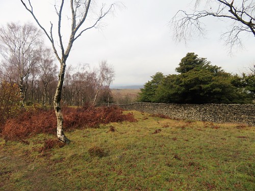
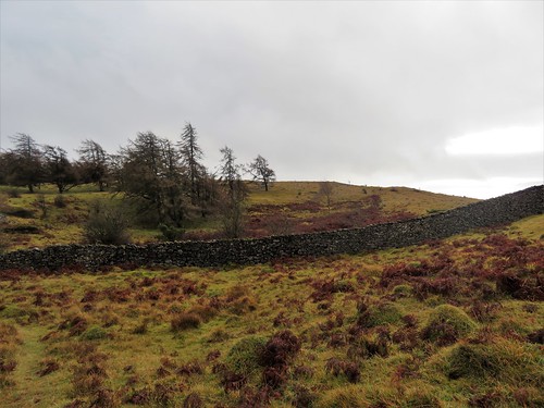
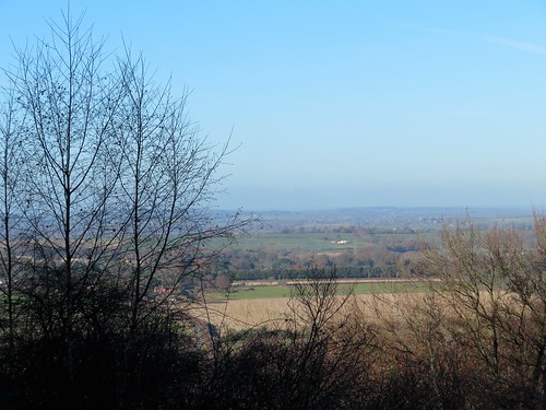
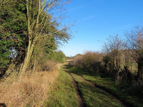
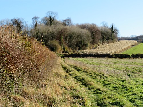
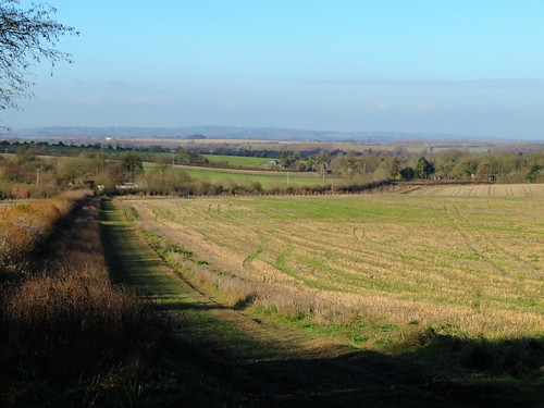
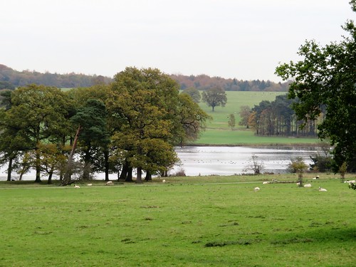
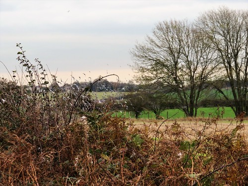
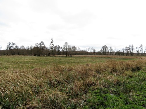
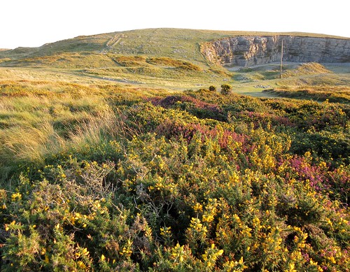
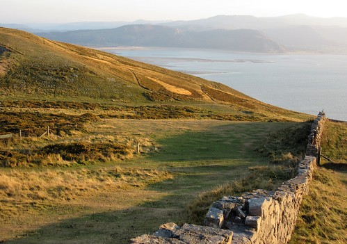
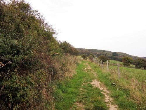
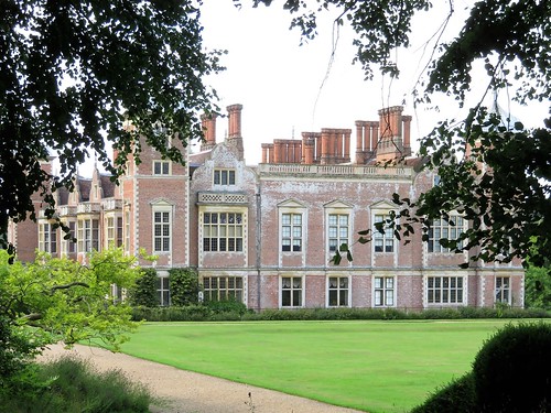
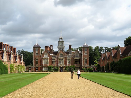
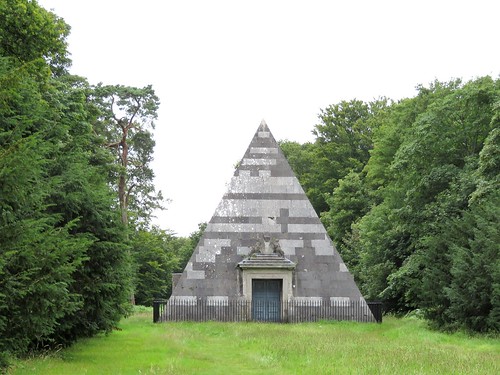
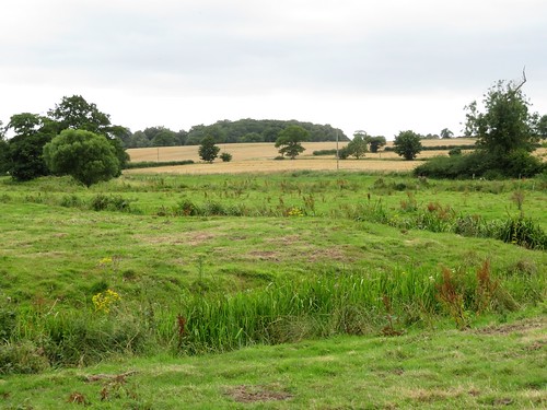
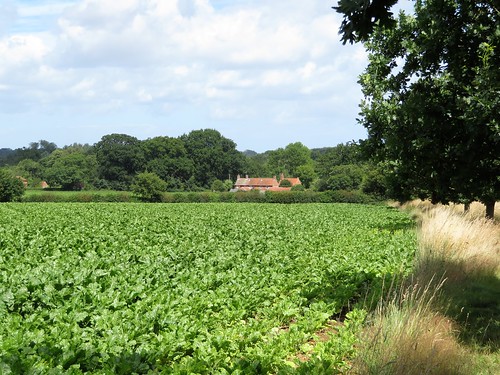
The National Trust looks after this complex of granite buildings, a classic ridge-top farmstead of Cornwall, its roofs low and slated, its lane flanked by extravagantly wind-sculpted trees. Beyond Stowe Barton a good broad bridleway ran south across whaleback fields. This is not cream tea Cornwall – it is hard, stony land to farm and a dangerous coast to fish. Stone walls are built thick and strong, lanes burrow between windbreak hedgebanks and the land slopes westward to plunge off the scalloped cliff edge into the sea.

Start: Northcott Mouth, near Bude EX23 9EL (OS ref SS 203085)

Getting there: From Stratton on A39 (Bideford-Bude) follow ‘Poughill’; from Poughill, follow ‘Northcott Mouth’. Park neatly at end of road.

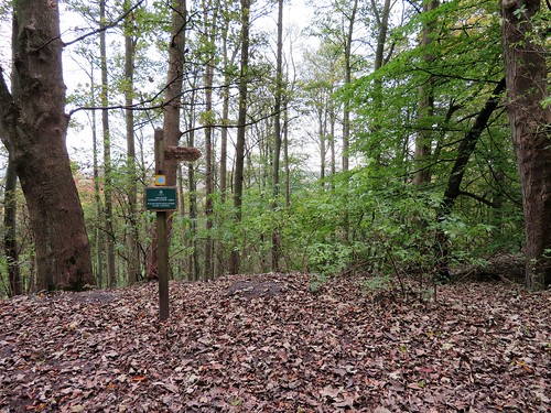
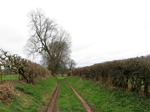
Walk (6 ¾ miles, strenuous on coastal section, OS Explorer 126): Coastal path north for 2 miles to Duckpool (202117). Road inland; at junction, left; in 100m, right through Coombe to cross ford (210117). Ahead (‘Coombe Valley’) on woodland track. In ⅔ mile fork right (221116, fingerpost) across stream. In 150m, fork right (220114); cross stream; left and follow path westward for ⅔ mile through Stowe Wood and on to cross road at Stowe Barton (212112). Follow lane opposite (‘Northcott Mouth 1.8 miles’, blue arrow/BA). In 350m, left (209110, BA); follow bridleway south. In 700m cross road (209103) and on, following BAs. In ⅔ mile go through gate (206094); bear right (unmarked), and keep to left-hand hedge. Ahead for ⅔ mile to Northcott Mouth.

Lunch: Preston Gate Inn, Poughill (01288-354017, prestongateinn.co.uk) – warm, friendly village pub

Accommodation: Landmark Trust cottages around ford at Coombe (01628-825925; landmarktrust.org.uk) – beautifully kept, classy self-catering

Info: Bude TIC (01288-354240)
visitengland.com; satmap.com; ramblers.org.uk

 Posted by at 01:20
Jan 132018


First published in: The Times Click here to view a map for this walk in a new window
picture picture picture picture picture picture picture picture picture picture picture picture picture picture picture picture
Facebook Link:

The two-car train rattled and squeaked its way out of Golspie, heading north-east to Brora along the outer edge of the Moray Firth. The woods and fields of the Sutherland coast flickered past the windows in bright morning sunshine, the winter sun casting a silver track across a sea as thick and slow-wrinkling as oil.

Setting off to walk back from Brora’s neat little station, we passed the village’s barrel-roofed ice house, and the tiny fishing pier laden with crabbing creels. Down on the shore we headed south-west along a pebbly strand that soon turned rocky, with slabs of pale ochre sandstone moulded into sculptural shapes by the sea. A pair of black-tailed godwits with bills like slender broadswords stalked the tideline, and a flight of oystercatchers took off in a scrabble of piping and wailing.

The pebbles of the shore were wonderfully coloured – orange and jet, speckly grey and jade green. Among them our boots scraped and tinkled, the noise drawing the round-eyed stares of a coven of grey seals. They lay as fat and glistening as slugs, their hind flippers twitched up like bluetit tails, waiting out the falling tide, each on its chosen slab of rock.

We crossed a skein of fords below Sputie, whose double waterfall cascaded down the cliff into a smoking pool. Beyond the fall the coast took a more westerly curve, opening up a handsome prospect of snowy mountains beyond the long east-trending arm of the lower Moray coast.

Above the shore stood a thick circle of stone walls, the remnant of the 2,000-year-old broch or Pictish tower known as Carn Liath, ‘the grey stone-heap’. Beyond again, the roofs and turrets of Dunrobin Castle rose above the treetops, a fairytale castle fit for a sleeping princess. This classic Scottish Baronial mansion was built for the 1st Duke of Sutherland. The Duke gained immortal notoriety for the harshness with which his orders of eviction were carried out on the hill herders and subsistence farmers of his enormous estates early in the 19th century.

Many of those clearance victims ended up on the coast at Golspie, forced to adopt new lives as fisherfolk. The 1st Duke stands in gigantic statue form at the summit of Ben Bhraggie behind the village, still dominant over the coasts and hills he once controlled with an iron hand.
Start: Brora railway station, KW98 6PY (OS ref 907041).

Getting there: Rail to Brora. Bus: service X99 (Inverness-Thurso). Road – Brora is on A9 between Golspie and Helmsdale.

Walk (8 miles, easy, OS Explorer 441): From Brora station, left along A9; 2nd left down Harbour Road. In 300m, bear left and follow ‘Back Shore & Beach Car Park’ to slipway down to shore (909035). Right along shore for 3¼ miles to Carn Liath broch (870014). Continue along shore for 1¼ miles. Opposite Dunrobin Castle walled garden, right inland (852006) up inclined road. Near top, opposite castle, left (850008, waymark post) on path through castle woodlands (occasional ‘village’ signs) for ¾ mile to cross Golspie Burn footbridge by Tower Lodge (839002). Left along shore path for 1 mile; 200m beyond pier, right inland up roadway (828995) to Ferry Road (825996). In 200m, left at B&B sign up laneway; right to Golspie station (824998). Return to Brora by train.

Conditions: Best done on a falling tide; some slippery rocks on shore

Lunch/Accommodation: Royal Marine Hotel, 7 Golf Road, Brora KW9 6QS (01408-621252; royalmarinebrora.com)

Info: Inverness TIC (01463-252401)
visitscotland.com; satmap.com; ramblers.org.uk

 Posted by at 01:00
Jan 062018


First published in: The Times Click here to view a map for this walk in a new window
picture picture picture picture picture picture picture picture picture picture picture picture picture picture picture picture
Facebook Link:

The Lyth Valley was seething with moisture, in the air and on the meadows. The River Lyth ran within the confines of its banks, but only just. The hills were wet and misted. There had been rain over South Cumbria – a lot of it – and there was going to be a lot more.

It wasn’t really the morning to leave the light and warmth of the Lyth Valley Inn, if any morning ever is. But we thought we saw a chink of better weather in the offing, and plunged out waterproofed to the nines.

The upland of Whitbarrow, walled with ramparts of pale grey crags, rises between the valleys of Lyth and Winster. You can get up there from the cart road that curves round the northern snout of Whitbarrow. The limestone cobbles of the old track were skiddy this morning, and carpeted with black and gold hazel leaves. The view over the stone walls was of lumpy green sheep pastures patched with bracken the colour of damp fox fur.

Past Fell Edge Farm the track began to rise, snaking to and fro among the outcrops until it slipped over the top by way of a wall stile. Up here the wind blew strong and cold from the north-west. A patch of sea in Morecambe Bay gleamed like tarnished silver under a momentary smear of sunlight.

Whitbarrow’s broad back was dotted with clumps of low-growing juniper. A pinch of the hard green berries released savours of gin that clung to the fingers. We sniffed the damp wind and the harsh chalky smell of wet limestone. There was a sense of freedom and exhilaration up here on our own, the landscape veiled, the Lakeland mountains shut away from sight in the north but rising like waves in the mind’s eye.

At the cairn on Lord’s Seat we had a wind-whipped moment or two, watching the rain draw a milky sheet across the sea. Off the crags and down a slippery path into the stone-walled pastures at Row, where the ewes all stared as though they had never seen a human being before.

It was just beginning to freckle with rain as we descended the path to the Lyth Valley Inn. That chink of opportunity for a walk had proved just exactly wide enough.

Start: Lyth Valley Inn, Lyth, Kendal, Cumbria LA8 8DB (OS ref SD 453896)

Getting there: M6, Jct 36; A6 towards Kendal; A590 towards Barrow; in 2½ miles, left on A5074 for 3 miles to Lyth Valley Inn. Please park opposite.

Walk (5½ miles, moderate, OS Explorer OL7): Up track opposite Lyth Valley Inn. In 150m fork right; in 250m, right at junction (449895, ‘Whitbarrow’). Follow byway for 1 mile to gate (436895) where byway turns right; keep ahead here (blue arrow). Past Fell Edge Farm path begins to climb, zigzagging up crags to wall at top.

Cross step stile (438886, yellow arrow/YA) onto Whitbarrow upland. Follow discernible path south past silver birch trees, aiming for large round boulder on skyline (437883), then for three conical cairns. Path bears left here (SE) to reach plantation wall (440879). Left along wall for 100m; right over ladder stile; ahead with wall on left for 450m to wall stile (443875; don’t cross yet!), where path trends away right past notice board to reach cairn on Lord’s Seat (442870).

Return to cross wall stile; follow path through trees. In 150m, left (YA) for 700m to gate (448880, YA). Left to go through small wall gate; on for 400m through Township Plantation to go over path crossing (450885, YA). Follow main track through wood, ignoring side turnings, curving gradually left for 300m to meet wall (449888). Follow it left to gate into fields (448888). Follow wall on right down to Row. Through gate (450893); lane down to road; turn right. In 150m, left (452892) up lane to return to Lyth Valley Inn.

Conditions: Paths can be slippery after rain

Lunch/Accommodation: Lyth Valley Inn (01539-568295; lythvalley.com) – really comfortable and friendly; lovely food

Info: Kendal TIC (01539-735891); golakes.co.uk.

visitengland.com; satmap.com; ramblers.org.uk

 Posted by at 14:46
Dec 232017


First published in: The Times Click here to view a map for this walk in a new window
picture picture picture picture picture picture picture picture picture picture picture picture picture picture picture
Facebook Link:

A jaunt to Christmas Common with the festive season just around the corner, on the coldest and brightest morning of the year. Ice in the puddles, our breath like smoke on the still air, and a high-flying jet soundless ploughing quadruple furrows of pure white across the blue field of the sky.

From the edge of the escarpment we got one of those views that makes you want to come and live right here, right now – the steep wooded slope dropping away to run out into mile after mile of sunlit Oxfordshire plain, a wide world dressed in the pale colours of winter.

A green woodpecker emitted its sharp, quacking alarm call as it saw off two unwanted intruders, a buzzard and a red kite. The buzzard dived sulkily back into the trees, but the kite sideslipped and climbed to resume its graceful balancing on the cold air above the hills.

At the foot of the escarpment we turned along the stony track known variously as Ridgeway, or Icknield Way, or simply and accurately, the Old Road. Old man’s beard and scarlet bryony berries made witches necklaces in its hedges, fieldfares and mistle thrushes flew straight and level out of the scrubby trees, and the low sun laid stripes of green and gold across the ancient ruts and flints.

By Dame Alice Farm (named after Alice de la Pole, Duchess of Suffolk and Geoffrey Chaucer’s grand-daughter) and Dumble Dore (possibly not named after the Hogwarts headmaster) we made our way into the Chiltern woods that so thickly blanket these chalky hills. Fallen leaves of poplar and beech made a silver and gold carpet to shuffle through.

A winter silence fell over the afternoon. The chill air in the damp hollows of the woods nipped our fingers and noses. Long-tailed tits swung and squeaked from tree to tree, the only singers in these sunlit woods.

As the day began to darken into dusk we turned along Hollandridge Lane, an ancient packhorse route across the Chilterns, for a last brisk mile to Christmas Common, with thoughts of a Christmas noggin at the Fox and Hounds to spur us on.

Start: NT car park, Christmas Common, Watlington, Oxon OX49 5HS (OS ref SU710936)

Getting there: Car park is on Hill Road, 2 miles east of Watlington.

Walk: (8¼ miles, easy with some short steep climbs, OS Explorer 171): Right along Hill Road (please take care). At junction turn left; in 50m, left (‘Oxfordshire Way’/OW). In 2nd field, don’t turn left through kissing gate (712937); keep ahead downhill to turn left on OW. In ¾ mile, left along Ridgeway (703945). In 1¼ miles left off Ridgeway at Lys Farmhouse (690929) up driveway. Pass Dame Alice Farm; in another 250m, left (692922); ‘W11’ and white arrow/WA on tree) to B480 at Dumble Dore (698926).

Right; in 50m, left (stile) on field path with hedge on right. In 500m through gate (702923, WA, yellow arrow/YA); on through woods. In 500m ahead through 2 gates (705920, blue arrow/BA). In 100m fork left (‘W15, No Riding’). In 400m cross road at Greenfield (711919). Pass barn (BA) and on. Follow BA for 700m to valley bottom. Left here (713911, ‘W19’, WA). In 400m, left at path crossing onto Chiltern Way/CW (717910, BA).

In 150m fork right (bent WA) and follow WA and CW through trees. In 550m cross valley floor (722913); climb far slope (‘PS8’, CW, WA), keeping gully close on left, to leave wood by stile (725915). Forward to Hollandridge Lane (726916); left for 1 mile. At houses on left opposite Prior’s Grove, left (717929, Oxfordshire Way). In 30m fork right just inside wood (OW); follow WAs to road (714930). Right past Fox and Hounds PH; in 300m, left (714934, ‘Watlington’) along Hill Road to car park.

Lunch: Fox and Hounds, Christmas Common (01491-612599, topfoxpub.co.uk)

Accommodation: Fat Fox Inn, 13 Shirburn Street, Watlington OX49 5BU
(01491-613040; thefatfoxinn.co.uk)

Info: Henley-on-Thames TIC (01491-578034); chilternsaonb.org, chilternsociety.org.uk
visitengland.com; satmap.com; ramblers.org.uk

 Posted by at 01:57
Dec 092017


First published in: The Times Click here to view a map for this walk in a new window
picture picture picture picture picture picture picture picture picture picture picture picture picture picture picture picture
Facebook Link:

The red squirrel sat on the garden wall at The Medlars B&B, nibbling nuts, his tail like a puff of ginger smoke held tightly to the curve of his back. The Isle of Wight is full of red squirrels (it has no grey intruders to out-compete and infect our native species), but I’d never seen one so bold and so willing to hold a charming pose for my delight.

We could have crouched all morning at the window watching the squirrel, but the early morning held the promise of a walk inland from the salty old port of Yarmouth. First, though, a wander along the sandy narrows of Norton Spit among prickly leaves of sea holly and fleshy spears of glasswort, out to the harbour pontoon where moored yachts bobbed.

The Yar estuary curves north through tremendous reedbeds to Yarmouth, a brackish tideway that all but isolates Wight’s western tip into an island of its own. Isle of Wight footpaths are beautifully waymarked and maintained, an exemplary network. The Freshwater Way carried us unerringly south through Saltern Wood and up to a wonderful view, east across reedbeds and river to folded downlands muted by the wintry light to shades of apricot and grey.

Along the margins of thick clay ploughland, oak leaves were beginning to turn brown and crisp. At King’s Manor Farm a donkey grazed the paddocks, gulping and chewing with noisy relish. Birds were forming the flocks that herald winter – pigeons busily pecking in the newly sprung wheat, crows reducing the farmers’ insect enemies as fast as they could gobble them.

In All Saints Church at Freshwater, morning service had just come to an end. ‘Ah, walkers! Come in, welcome! A cup of coffee? Yes, the church is a bit of a Saxon-Norman mishmash, but we love it!’

Beyond All Saints we crossed a broad bridge over the River Yar and followed an old railway path as it curved back to Yarmouth. Black-tailed godwit and ringed plover stalked the river shallows above their own rippled reflections.

Back on the north coast we made our way down to the shore and followed a sea-stained promenade back into town. A Lymington-bound ferry rumbled away out of Yarmouth, red and white sails scudded in the Solent, and the mainland lay grey and misty on the horizon, no more than a cloudy dream on the edge of sight.

Start: River Road car park, Yarmouth, Isle of Wight PO41 0RA (SZ 354895)
Getting there: Red Funnel Ferries (redfunnel.co.uk), Southampton-East Cowes. Bus 5, Cowes-Newport; bus 7, Newport-Yarmouth.
Road – A3021, A3054 to Newport and Yarmouth.
Walk: (6 miles, easy, OS Explorer OL29): From car park, A3054 to cross bridge. On left bend, right (347896, ‘Coastal Path, Fort Victoria’). At seafront, right along Norton Spit, then along pontoons to end. Return to coast road; left towards bridge; in 50m, right and follow ‘Freshwater Way/FW’. In 400m bear right (348892) through Saltern Wood. In another 1¼ miles, left at All Saints Church (347873) along road. Cross River Yar; left (349871) along railway path. In 1½ miles pass ‘Off the Rails’ café (358894); in another ½ mile, left (364896) along B3401 to cross A3054 (363898). Down steps (‘Yarmouth’ fingerpost) to shore; left into Yarmouth.
Lunch: Off the Rails Café, Yarmouth PO41 0QX (01983-761600, offtherailsyarmouth.co.uk) – bright and quirky; or Red Lion Inn, Freshwater PO40 9BP (01983-754925; redlion-freshwater.co.uk)
Accommodation: Medlars B&B, Halletts Shute, Yarmouth PO41 0RH (01983-761541, medlars-bnb.com) – immaculate B&B
Info: visitisleofwight.co.uk
Isle of Wight Walking Festival 2018: 28 April – 13 May
visitengland.com; satmap.com; ramblers.org.uk

 Posted by at 01:17
Dec 022017


First published in: The Times Click here to view a map for this walk in a new window
picture picture picture picture picture picture picture picture picture picture picture picture picture picture picture picture
Facebook Link:

Half a dozen red kites were wheeling over the village hall car park at Harewood. They swooped down on their crooked wings, seeming almost close enough to touch, wailing as they showed off their colours of russet and cream. ‘Lady in the village feeds them,’ said Keith at the Muddy Boots café. ‘They know it’s nearly lunchtime.’

It was an auspicious start to our walk through the broad acres of Harewood Park, landscaped in the 1770s with a sculptor’s eye by Capability Brown.

‘The pleasure grounds and gardens rare
Laid out, by Mr Brown, with utmost care…
Though both, which now such beauty yield,
Were lately but a furrow’d field.’

Thus the author of ‘The Tourist’s Companion,’ surveying Harewood Park fifty years after Brown first started work. On this cold afternoon, two centuries later, we saw the great landscaper’s vision matured to perfection – magnificent oaks, Spanish chestnuts and limes shading the artful slopes and folds of ground where red stags grazed together like contented clubmen.

Beyond Harewood the manipulated landscape gave way to a ridged countryside of pastures where weather-stained sheep cropped the grass. Birds flocked together, obedient to the winter imperative to keep close and survive – giant clouds of pigeons across the sky, rooks in the stubble, and a marvellous congregation of 200 lapwings, stabbing for worms in the rain-softened furrows of a field among imperturbable ewes.

We climbed a zigzag lane to a ridge with a northward view towards the far distant fells of the Yorkshire Dales. At our feet rolled the River Wharfe – not the noisy young river familiar to us from walks in Upper Wharfedale, skittish over a shallow stony bed, but a slow-flowing adult river through these lowland fields. Uprooted willows and tangles of twigs caught in the bankside branches told of the Wharfe’s capacity for springtime flooding even here, far down the dale.

We turned west towards Harewood along the Wharfe, past Netherby Deep with its hidden whirlpool and reputed thirty foot drop in the river bed. On the bronze-brown surface there was no hint of such subaqueous drama – just the eddy of a turning fish, and the patter of the last willow leaves of the year as they dropped into the river.

Start: Village Hall car park, Church Lane, Harewood, W Yorks LS17 9LJ (OS ref SE 321453) – £2 all day

Getting there: Bus 36 (Leeds-Harrogate)
Road – A1(M), Jct 45; A 659 Otley road, west to Harewood.

Walk: (10¼ miles, parkland, green lanes, field paths; Explorer 289). From car park, right past lodge (fingerpost), following Ebor Way. In nearly 1 mile, left at 4-finger post (307450). Pass Home Farm (306447). Beyond brick garden wall and cattle grid, right (307441), ‘bridleway’). Pass Carr House; into woods; in 250m, by telegraph pole on right, left (303438) up sunken trackway (unmarked) to join waymarked Leeds Country Way/LCW. Follow LCW for 1½ miles to cross A61 (325431). Follow road (‘Wike’); in 650m, left (331428, fingerpost) on green lane. Follow LCW for 1½ miles, passing Biggin Farm (342430). Pass Gateon House Farm; in another 200m, left (352436, ‘bridleway’ fingerpost) off LCW. Green lane north to road (353442); left to cross A659 (346451); driveway past Fairfield Farm house and barns, then field path descending to River Wharfe (346462). Left on Ebor Way for 2¼ miles back to Harewood.

Lunch: Muddy Boots Café, Harewood Village Hall (07742-248916) – open daily.

Accommodation: Wood Hall Hotel and Spa, Trip Lane, Linton, Wetherby, W Yorks LS22 4JA (01937-587271, handpickedhotels.co.uk) – The setting of this hotel, in broad grounds and with a fabulous view, makes it ideal for a winter weekend break. It’s warm and welcoming, a touch of luxury for a special occasion. Plenty of walks nearby to sharpen an appetite for some excellent cooking, too.

Info: harewood.org; visitengland.com; satmap.com; ramblers.org.uk

 Posted by at 01:24
Nov 252017


First published in: The Times Click here to view a map for this walk in a new window
picture picture picture picture picture picture picture picture picture picture picture picture picture picture
Facebook Link:

John O’Dreams lay slumbering under the willows. Hills on the Water stretched out flat above her own reflection, and the crooked chimney atop Tranquillity puffed a lazy trail of coal smoke across the quiet waters of the Shropshire Union Canal. Downbeat names for hibernating narrowboats and their crews of water gypsies, moored up for winter at Norbury Junction.

What a fuss and a furore the canals caused as they burrowed across the face of England two hundred years ago. When Thomas Telford masterminded the route of the Shropshire Union canal to link up the port of Liverpool with the industrial Black Country, Lord Anson refused to let the newfangled thing through his estate at Norbury Park lest it frighten the pheasants. So the navvies mounded a gigantic embankment to bypass the place, a mile long and sixty feet up in the air.

The Great Bank gave us a fine grandstand view over the Staffordshire woods and fields as we followed the canal down to Gnosall Heath. Here the Stafford & Shrewsbury railway line cuts east-west across the route of the canal. We turned west along its trackbed, nowadays a landscaped cycle path in a tunnel of trees. Cleverly engineered bridges crossed the old line, their rustic stone buttresses supporting arches of brick skewed with an ingenious barley-sugar twist to take the road slantwise across the railway.

We passed Wilbrighton Hall standing tall and handsome on its ridge, and turned north into the mires and marshes of the Coley Brook. Every footfall produced a squelch and squirt of water as we trod the sedgy fields to the brink of Aqualate Mere.

This mile-long natural lake, hollowed by the retreating glaciers 10,000 years ago, is only waist-deep. Its encircling reedbeds shelter huge numbers of birds. We sat at a hide window and watched a great crested grebe bobbing on the water, then diving below with a wriggle and snaky bend of the neck. Nearby a tufted duck paddled itself round in circles as it preened, nibbling and prodding its back feathers into proper shape.

Beyond the mere the homeward path zigzagged and side-stepped across fields of winter wheat, aiming for the line of the Great Bank above the treetops. Up there a narrowboat passed slowly across the skyline, its skipper leaning back at the tiller, oblivious of us below or of anything else but water, trees and the blue sky above.

Start: Junction Inn, Norbury Junction, nr Newport, Staffs ST20 0PN (OS ref SJ 793229)

Getting there: Norbury Junction is signed from A519 Newcastle-Newport road between Sutton and Woodseaves.

Walk (8½ miles, easy, OS Explorers 243, 242): Right along canal towpath for 2¼ miles. At Bridge 35A (817205), right along railway cyclepath. In 2½ miles, left down steps (785186, ‘Outwoods, Moreton’); right under bridge; cross A518 at Coley Mill (781194). Bridleway north past east end of Aqualate Mere for ¾ mile to road (782207). Right; in 300m on right bend, left (785207, ‘bridleway’) on green lane north to Radmore Lane (785214). Right; in 350m cross Wood Brook (788214); in another 150m, left (stile, fingerpost) across fields (stiles, yellow arrows/YA). At end of 2nd field, take right-hand of 2 waymarked exits (791218); follow hedge on left for 650m to Norbury Road (794224, stile). Left; right under canal; road to Norbury Junction.

Conditions: wet, muddy fields near Aqualate Mere

Lunch: Junction Inn (01785-284288, norburyjunction.com) or Norbury Wharf tearoom (01785-784292), both at Norbury Junction.

Accommodation: Premier Inn, Newport, Staffs TF10 9BY (0333-321-1352)

Info: Telford VIC (01952-291723)

visitengland.com; satmap.com; ramblers.org.uk

 Posted by at 01:24
Nov 182017


First published in: The Times Click here to view a map for this walk in a new window
picture picture picture picture picture picture picture picture picture picture picture picture
Facebook Link:

Wall-to-wall blue sky over the north coast of Jersey – and an icy east wind, too, cutting across the rocky bay of Rozel. We leaned on the kiosk counter of the Hungry Man, munching bacon baps, fuel for a wintry walk along the cliffs.

Up on the coast path the wind snatched at the tree tops and shoved us brusquely along. A pale mauve haze hung in the north, softening the outlines of Alderney and Sark. A tangle of tide rips cut across the kingfisher-blue sea, a winter view in a million.

In Bouley Bay the gale tore at the sycamores and ilex trees overhanging the rubbly coast path, and the restless sea sucked at the granite cliffs with a curious jingling roar. Credulous folk once believed it was the sound of the Black Dog of Bouley, a monstrous mythic hound with eyes like cartwheels, dragging his chain around the Bouley cliffs. Better to stay indoors by night and not risk meeting the Black Dog – so said the smugglers, and the locals were happy to obey.

The Victorian fort of L’Etaquerel lay in a dramatic cliff-edge location. It was built in the 1830s to keep out the French. They never came, but a hundred years later the Germans invaded the Channel Islands. Round the far side of Bouley Bay, down in the sheltered cleft of Le Petit Port, we found a simple granite monument recorded the death of Captain Philip Ayton, a British commando killed during an Allied raid on the occupied island at Christmas 1943.

From the rock pinnacles on the headland of La Belle Hougue we looked back to see the haze lifting from Alderney. Soon we made out, far to the east, the lonely reef of Les Écréhous, studded with tiny fishermen’s huts, white cubes that seemed to float unsupported on the intense blue of the sea.

On a rock in the bay of Le Havre Giffard a cormorant stretched its neck skyward, attempting to gobble down a fish before a marauding black-backed gull could snatch it away. We passed the pepperpot turret of the promontory fort of La Crête, and headed downhill towards the sprinkled houses and grey cliffs of Bonne Nuit Bay. Here a merman once turned himself into a white stallion for love of a beautiful Jersey maid. So local stories say – and they never lie, do they?

Start: Hungry Man Kiosk, Rozel Bay, Jersey JE3 5BN (OS ref 696545)

Getting there: From St Helier – Bus 3, St Helier-Apple Cottage bus stop (5 mins walk to Rozel). Return: Bus 4 Bonne Nuit-St Helier.
Road: From St Helier, A6 to Maufant; B46 to Durrell Wildlife Park; left on B31; in 150m, right on Rue du Pot du Rocher, then La Route du Cotes du Nord to Rozel. Return, Bonne Nuit-Rozel – Bus 4 and 3, as above.

Walk (6½ miles; rugged coast path, many steps; Jersey Leisure 1:25,000 map): Head back along Rozel harbour. Up road. At Rozel Tea Room (694544), right up Rue du Câtel. In 600m, fork right (691545) to car park. Bear left (west) along coast path (690548). In 4 miles, below La Belle Hougue headland, path splits (656562); both paths leads to La Crête Fort (647560) and Bonne Nuit harbour (641561).

Lunch: Hungry Man Kiosk, Rozel Bay (01534-863227, facebook.com/thehungrymanjersey; NB closed Mondays in winter); Bonne Nuit Beach Café (01534-861656, bonnenuitbeachcafe.co.uk)

Accommodation: Atlantic Hotel, St Brelade, Jersey JE3 8HE (01534-744101, theatlantichotel.com) – extremely comfortable hotel with wonderful food.

Info: Jersey TIC (01534-859000); jersey.com; satmap.com; ramblers.org.uk

 Posted by at 01:58
Nov 112017


First published in: The Times Click here to view a map for this walk in a new window
picture picture picture picture picture picture picture picture picture picture picture picture picture picture picture
Facebook Link:

Llandudno is a great traditional seaside resort, and proud of it. Giciante Ferrari and his Performing Birds and high diver Walter Beaumont share equal billing with Sir Malcolm Sargent and Matthew Arnold on a ‘Notable People Who’ve Stayed Here’ plaque on the promenade. The high Victorian hotels stand draw up in a long line around the curve of the bay, buttressed by the two bulbous headlands of Great and Little Orme and backed by the distant mountains of Snowdonia. It all made a fine setting for our walk to explore the rugged charms of Great Orme, where the National Trust own a major piece of land, Parc Farm, at the heart of the Great Orme Country Park.

The peace of a cold, cloudy morning lay over Happy Valley gardens as we climbed their pathways, then on up steps to the crest of a natural limestone amphitheatre. How proud those Victorian holidaymakers must have felt of their civilisation as they wandered the gardens among Scots pine, palm trees, rockeries and flower borders, looking down over the pier to the sparkling white arc of the town, and up to the mountainous Orme above, all ‘savage nature wild and rude’.

Great Orme is a giant lump of limestone, in profile like a barking dog with muzzle raised to the northwest. Paths and tracks crisscross it, legacy of leisure walking and of the quarrymen and copper miners who dug it for stone and ore since back in the Bronze Age. We set out on an anticlockwise circuit of the top in the teeth of a strengthening wind, past the farmhouse of Penmynydd Isa and Powell’s Well, down to St Tudno’s church perched above the sea. In the sprawling graveyard the names of Jones and Davies, Williams, Roberts and Evans adorn black slate slabs. Inside we found intricate medieval Celtic stonework, and a fine dragon snarling in the shadows above the chancel window.

We headed west from St Tudno’s towards the Orme’s seaward snout over a moor patched with limestone pavement and scattered with big erratic boulders left there by the retreating glaciers ten thousand years ago. The fat sheep of Parc Farm stood munching heads down in a walled beanfield. The wild goats of the headland were keeping out of sight today, but close under the cable car station at the summit we caught their pungent whiff.

On over the brow of Bishop’s Quarry where hundreds of lovers, rogues and wanderers have spelt out their names in white limestone fragments. A sensational view over the Conwy estuary to the packed mountains of Snowdonia, stamped on a stormy sky in flat grey-blue silhouettes as though cut in profile from the lead and slate they are founded on. And then the skeltering path of the Zig Zag Trail, steeply down through windblown heather, rocks and cliffs to the gentle pathways of Haulfre Gardens and Llandudno’s promenade once more.
Start: Happy Valley Road, Llandudno Promenade, LL30 2LR (OS ref SH 782828)

Getting there: Rail to Llandudno.
Road – Llandudno is signposted off A55 between Colwyn Bay and Conwy

Walk (6 miles, moderate, OS Explorer OL17): Opposite Grand Hotel front door (782828), up Alex Munro Way to Happy Valley Gardens. Path up left side of lawns; follow Happy Valley Summit Trail (‘To Summit’/TS arrows, blue-ringed posts/BP) to top of gardens (780831). Up steps beside ski slope area; on across heath to Penmynydd Isa farmhouse (774834). On to St Tudno’s Church (770838). Up road towards summit; 100m beyond top of graveyard, fork right (TS, BP). In 150m (768836) right along gravel track, then grassy path, keeping wall on your left, for 1½ miles anti-clockwise to SE corner of wall (765831), just below summit station. Bear left to see pebble signatures and Bishop’s Quarry; return to wall corner; follow track past yellow-ringed post to brow of hill. Bear half right over ridge; aim half left for post near erratic boulder (769828). From here follow Zig Zag Trail (‘To Town’, black-ringed posts) steeply down to tarmac path by shelter near sea level (772823). Left via Haulfre Gardens to Promenade.

Lunch: Haulfre Tearooms, Haulfre Gardens LL30 2HT (01492-876731)

Accommodation: St George’s Hotel, The Promenade, Llandudno LL30 2LG (01492-877544, stgeorgeswales.co.uk) – welcoming, traditional seafront hotel.

Parc Farm: nationaltrust.org.uk/projects/wildlife-and-farming-on-the-great-orme

Great Orme: greatorme.org.uk; conwy.gov.uk/thegreatorme

Info: visitllandudno.org.uk; satmap.com; ramblers.org.uk

 Posted by at 02:45
Nov 042017


First published in: The Times Click here to view a map for this walk in a new window
picture picture picture picture picture picture picture picture picture picture picture picture picture picture
Facebook Link:

Ill-fated, black-eyed little Anne Boleyn lived as a child in the north Norfolk countryside at Blickling Hall. But the Tudor mansion she knew is not the one we admired as we crunched down the grave drive – these pepper-pot turrets and huge central clock belong to the following century, as do the curly Dutch gables.

Blickling Hall is magnificent, and so are its widespread grounds. We followed a waymarked walk which skirted the inverted comma of the ornamental lake. Storm-splintered cedars spread their wide dark skirts in the pastures, and the carcases of dead oaks lay as pale and massive as elephant corpses among the long grasses.

We passed a signature beech, its smooth grey bark incised with lovers’ names and initials – SDF & Di, AW loves BW, Olly hearts Dolly. A cold west wind drove wavelets against the northern shoreline of the lake, where we took to well-trodden tracks among fields full of the glinting leaves of sugar beet.

Boardwalks spanned the squelching woodland of Moorgate Carrs. We crossed the dimpling water of the River Bure where whorled mint gave out a savour half minty, half sharp. The blackberries in the green lane hedge were sharp on the tongue, too.

In the corner of a field by a margin planted to please the palates of pheasants with goldenrod, mayweed and purple brassicas, we lay on our backs for half an hour for the pure pleasure of watching the sky. Then it was up and on, heading south through pastures grown tufty and lumpen. We recrossed the Bure, a skein of rushy watercourses dried to trickles in the grass where tangled curls of water plantain pushed up their flowers, each with its three pale blue petals.

From the southern skirts of Itteringham a dusty lane ran east between stubble fields. Pheasant poults went scurrying away up the rows, too flustered to feed, too young to fly. The wind rose and shoved at our backs, and we were glad to get into the shelter of Blickling Park’s Great Wood.

On a grassy ride in the middle of the wood we came on a bizarre structure, a sharply pointed pyramid as tall as a house. Over the eastern portal posed a fine stone stag, brandishing real antlers. Within this eccentric mausoleum John Hobart, 2nd Earl of Buckingham, lies alongside his two wives.

The plaque on the western face of the pyramid, topped by a great bull, seemed to suggest that the Earl had married his own daughter. Perhaps I misunderstood it. In any case, I can report that the north- and south-facing openings of the tomb make great echo chambers. They allow one to sing harmonies with oneself, to truly eerie effect.

Start: NT car park, Blickling Hall, Aylsham, Norfolk NR11 6NF (OS ref TG 176286)

Getting there: Blickling Hall is on B1354 Saxthorpe road, signed from Aylsham (A140 Norwich-Cromer)

Walk (7 miles, easy, OS Explorer 252): From car park walk down road to Blickling Hall. Down drive towards house; just before buildings on right, turn right through hedge, up steps. Keep right of Courtyard Bookshop; half right to map notice; from here follow waymarked Estate Walk (blue arrows). At top of lake (179295), left along gravel path. In 150m fork right (orange arrows). In 400m, right at 3-finger post (174295, ‘public footpath’).

In 500m, right on road at Moorgate (174300); in 100m, left (yellow arrow/YA). Boardwalk crosses Moorgate Carrs and River Bure (175301). In 250m path turns left along field edges (YA), and on to road at Fring Wood (174308). Left, in 700m, fork right (167308) up drive past White House Farm; on along field edge tracks westward for ½ mile. Descend through gate to broad green strip at The Rookery (152309). Don’t go through gate with YA opposite; bear left along wood edge; in 100m through gate, follow hedge on left southward for 2 long fields / ½ mile to cross several channels of River Bure and reach road opposite Orchard Farm (154299).

Left, in ½ mile on left bend (161297), ahead through Woodgate car park; past 5-bar gate, follow stony track on outskirts of wood (orange arrow). In 600m, sandy track on left (165292) leads to mausoleum (166295).

Lunch/Accommodation: Buckinghamshire Arms, Blickling NR11 6NF (01263-732133, bucksarms.co.uk)

Blickling Hall: nationaltrust.org.uk/blickling-estate

visitnorthnorfolk.com; satmap.com; ramblers.org.uk

 Posted by at 01:24