May 272017


First published in: The Times Click here to view a map for this walk in a new window
picture picture picture picture picture picture picture picture picture picture picture picture picture picture picture picture
Facebook Link:

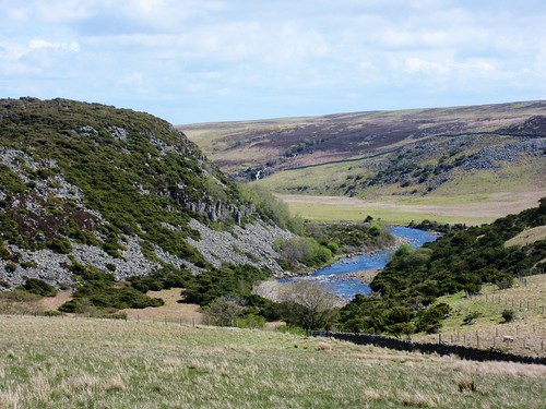
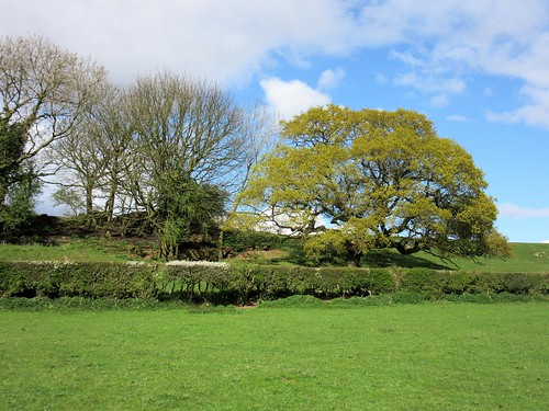
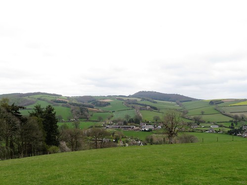
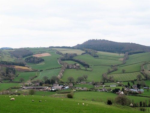
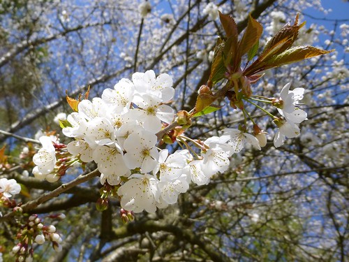
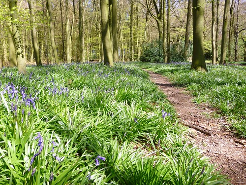
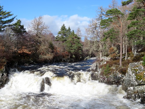
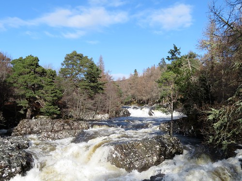
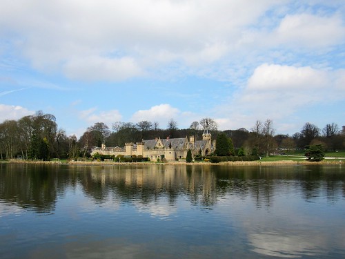
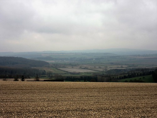
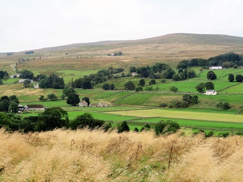
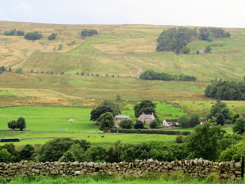
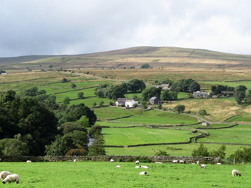
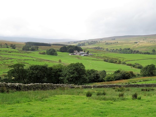
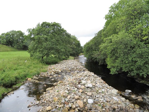
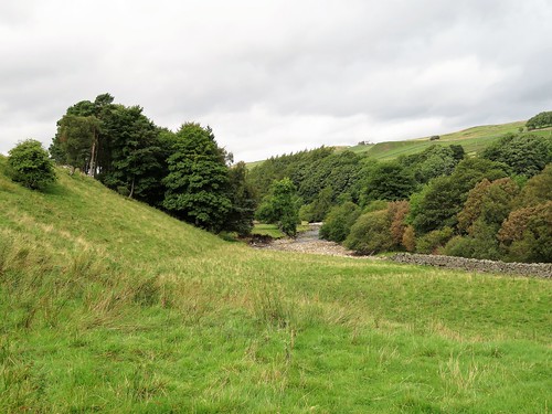
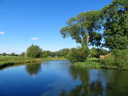
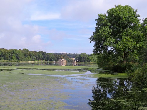
If I could wrap up in one package my ideal place for a walk in spring, it would be these few miles beside the River Tees. There’s something complete, something absolutely perfect about the blend of sights and sounds here in this twisting cleft in the Pennine Hills – the rumble and chatter of the young Tees in its rocky bed, the high volcanic cliffs between which it snakes, the poignant cries of curlew and lapwing nesting in the sedgy fields, and above all the brilliant colours of the exquisite little flowers that bloom for a short, unpredictable season across the craggy back of Cronkley Fell.

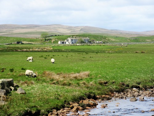
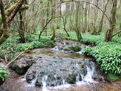
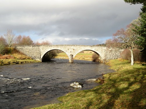
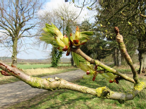
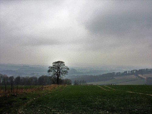
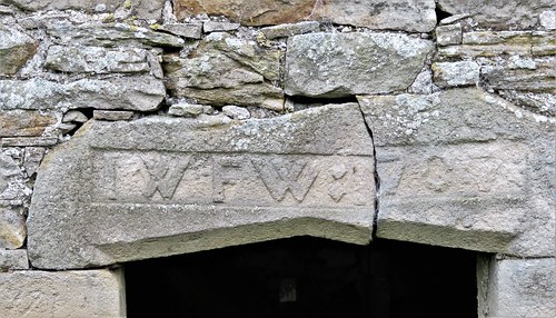
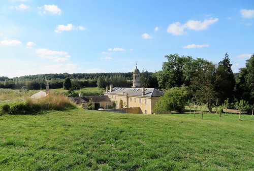
Setting out on a cold, wind-buffeted morning in mid May, we had no idea whether the flowers would be out or not; their brief blooming depends so greatly on what kind of winter, what kind of spring Upper Teesdale has had. It felt more like a February morning as we crossed the racing Tees near Cronkley Farm. But in a damp bank beside the farm, sunk among masses of marsh marigolds, we spotted the pale yellow orbs of globe flowers, a signal that spring was at least attempting to elbow winter out of the way.

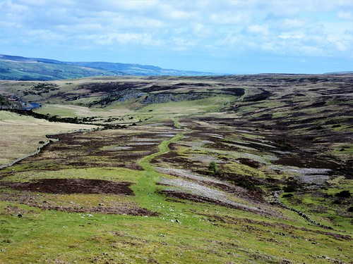
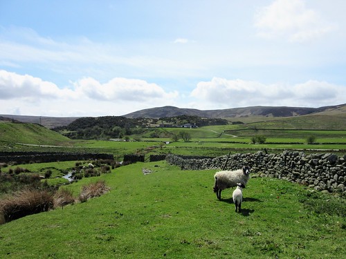
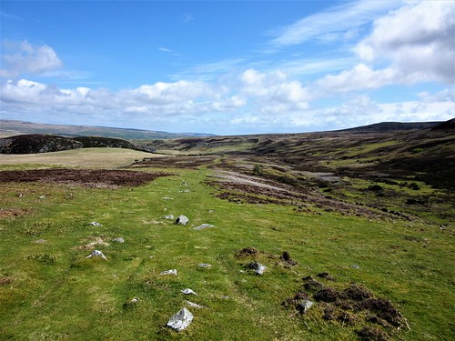
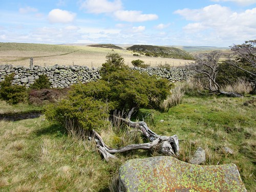
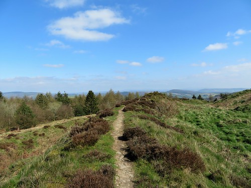
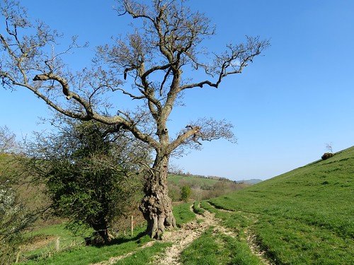
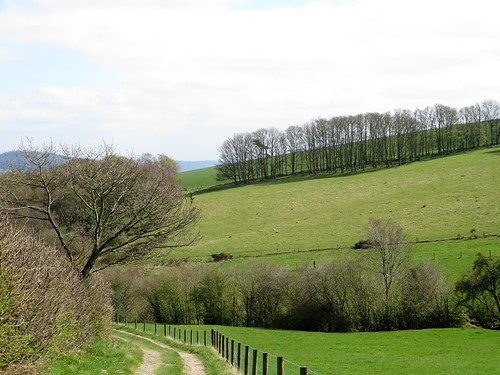
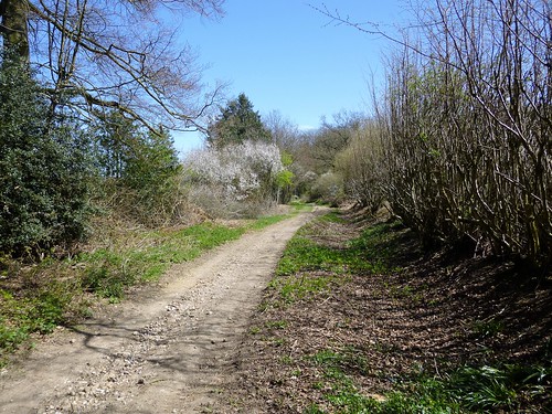
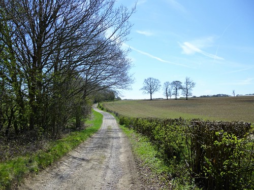
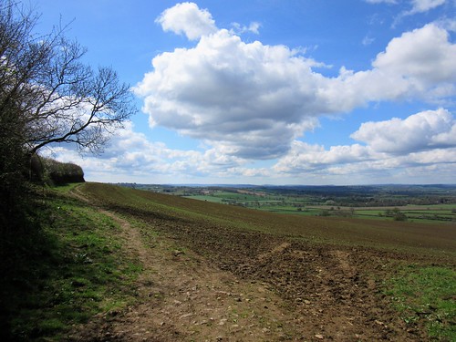
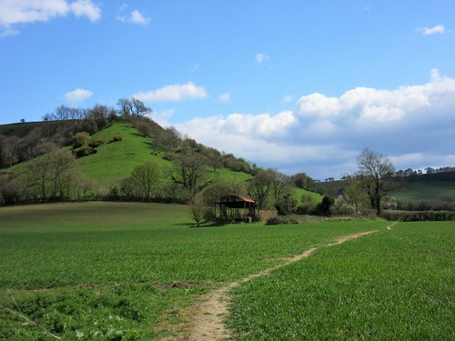
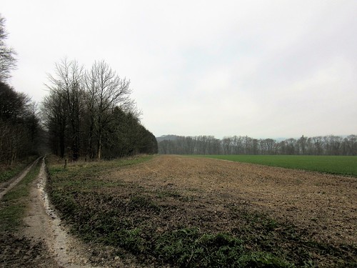
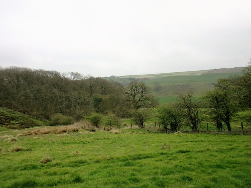
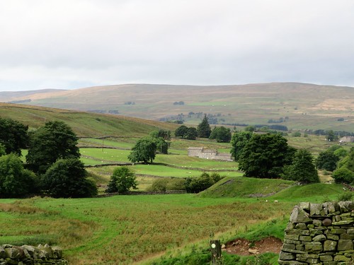
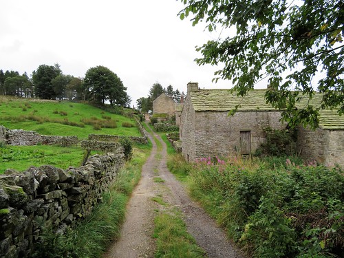
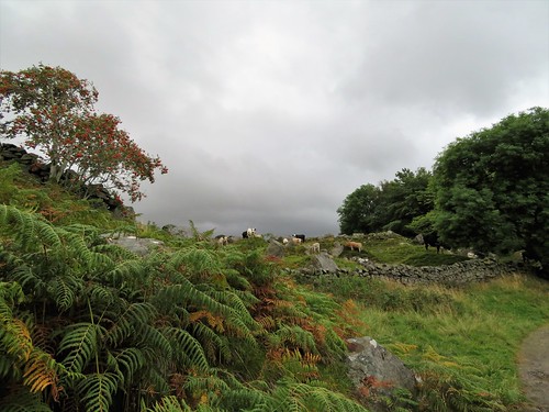
Behind Cronkley Farm we climbed between the juniper thickets of High Crag, up into the grassy uplands where the old droving track called the Green Trod runs up the nape of Cronkley Fell. The wind did its best to push us back, but we put our heads down and fought it to the summit.

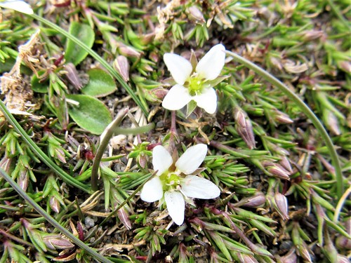
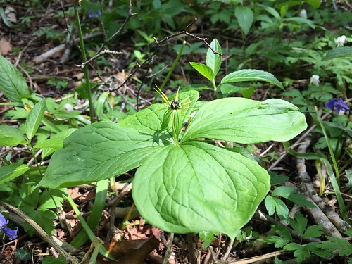
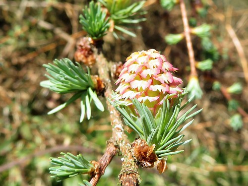
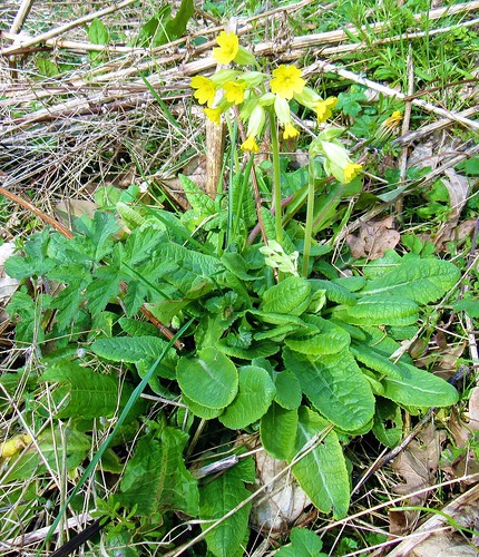
A succession of ‘exclosures’ up here, wired off to make them impenetrable to the nibbling sheep and rabbits, harbours the rarest of Upper Teesdale’s spring flowers, delicate survivors of a post-Ice Age flora that has vanished from the rest of upland England. We knelt on the stony ground to take in these miniature beauties at eye level – deep pink bird’s-eye primroses, tiny white stars of spring sandwort, and the intensely, royally blue trumpets of spring gentians.

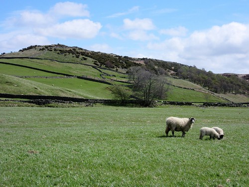
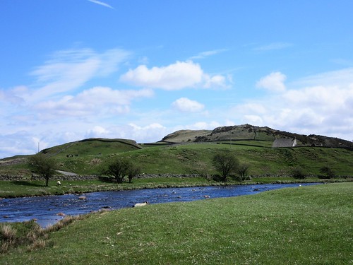
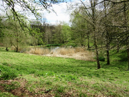
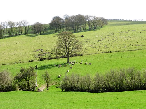
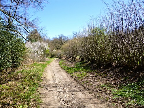
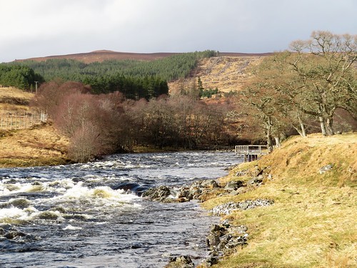
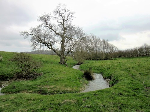
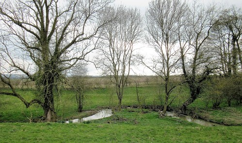
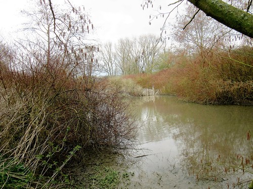
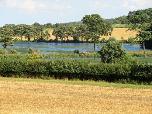
At last we tore ourselves away, frozen and entranced. We descended to the Tees and returned along the brawling river, where lapwings flew up and curlew skimmed overhead, intent on shepherding these human intruders away from their nests and unhatched eggs.

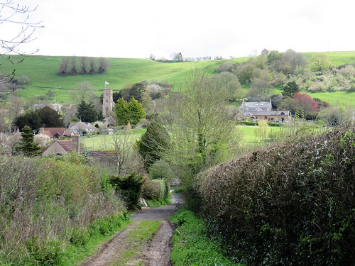
Start: Forest-in-Teesdale car park, near Langdon Beck, Co. Durham DL12 0HA (OS ref NY 867298)

Getting there: On B6277 (Middleton-in-Teesdale – Alston), 1½ miles beyond High Force car park.

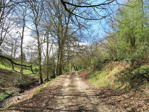
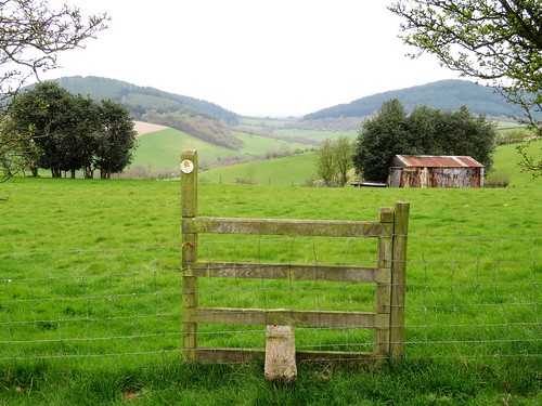
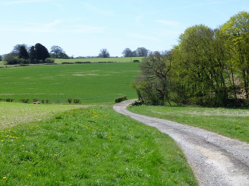
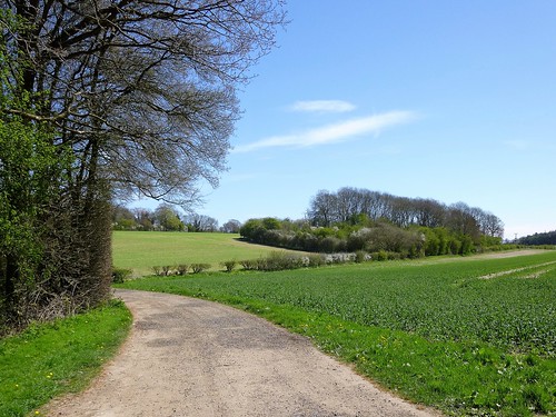
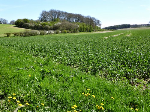
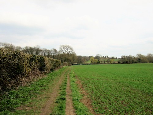
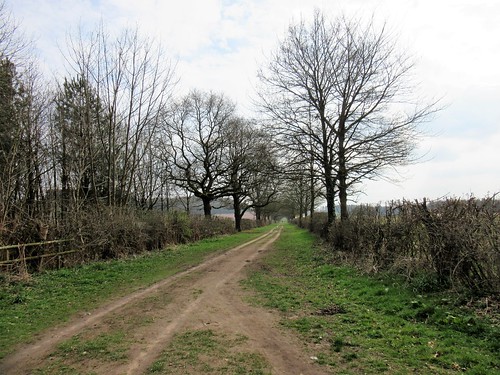
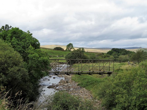
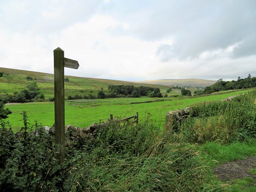
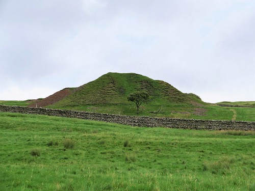
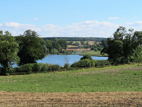
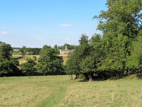
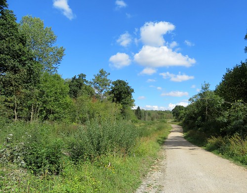
Walk (7 miles, moderate, OS Explorer OL31. NB: online map, more walks at christophersomerville.co.uk): Right along B6277; in 100m, left down farm track. Skirt right of first house (864296); down to wicket gate (yellow arrow/YA); on, keeping right of Wat Garth, to track. Join Pennine Way (PW) and cross River Tees by Cronkley Bridge (862294). Follow PW and YAs past Cronkley Farm, into dip (862288), up rocky slope of High Crag, and on along paved track. In 500m, left across stile (861283). PW bears left here, but continue ahead uphill by fence. Through kissing gate (861281); in 100m, turn right along wide grassy Green Trod trackway. Follow it for 2 miles west across Cronkley Fell (occasional cairns). Descend at Man Gate to River Tees (830283); right along river for 2½ miles. At High House barn (857294) aim half left across pasture for Cronkley Bridge; return to car park.

Lunch: Picnic

Accommodation: Rose & Crown, Romaldkirk, Barnard Castle DL12 9EB (01833-650213, rose-and-crown.co.uk) – wonderful village inn, comfortable and welcoming

Moor House NNR: 01833-622374; northpennines.org.uk

Peak District Boundary Walk (friendsofthepeak.org.uk/boundary-walk): Launch Day, Buxton – Sat 17 June

satmap.com, ramblers.org.uk; thisisdurham.com

The January Man – A Year of Walking Britain by Christopher Somerville (Doubleday, £14.99).

 Posted by at 02:56
May 202017


First published in: The Times Click here to view a map for this walk in a new window
picture picture picture picture picture picture picture picture picture picture picture
Facebook Link:

Take your umbrella if you visit St Briavels on Whitsunday evening, because it’ll be raining bread and cheese. Those humble comestibles are hurled from the top of the Pound Wall opposite St Briavels Castle, while the townsfolk hold upturned brollies aloft to catch as many morsels as they can for good luck.

St Briavels stands on the eastern fringe of the Forest of Dean. Legend, myth and arcane customs hang thickly about this ancient slice of forest where Gloucestershire meets Monmouthshire and England stares at Wales across the beautiful valley of the River Wye.

Below St Briavels Castle we found a field path running along a side cleft of the Wye Valley where ewes with lambs at foot stood staring as we went by. Through the bluebell woods of Slade Bottom ran the Slade Brook, a stream laden with calcium, depositing thick layers of the stuff in miniature dams and pool rims over which the water sparkled.

This is all steep green countryside, heavily wooded and set with scattered farms. At Great Hoggins a chestnut horse and its Shetland pony sidekick came up to look us over. Willsbury Farm sat well down on its slope, all white walls, tall chimneys and tiny windows. Forest of Dean locals have always been inclined to plough their own furrows without so much as a by-your-leave; and when the Reeve of St Briavels decided to build himself a fine house at Willsbury back in 1230, he did so without permission. The Reeve’s illegal farmstead has stood unchallenged for almost 800 years. So much for respect for the law around here.

In Rodmore Grove below the house the brook ran red with mud through clumps of brilliant gold marsh marigolds. A glimpse opened out across the trees of Pickethill Wood to where the grey River Severn broadened between hills to its estuary under a sky of giant white puffed clouds, trampolines for angels.

We left the trees and walk up the long meadow to Highgrove Farm where lambs went kicking the itches out of their heels. A last climb up a hedge of may blossom, and we were cresting the ridge towards St Briavels in the first low sunbursts of a beautiful spring evening.

Start: George Inn, St Briavels, Glos GL15 6TA (OS ref SO 559046)

Getting there: Bus 701 (Coleford), 707 (Coleford-Chepstow)
Road – St Briavels is signposted from A48 (Chepstow-Lydney)

Walk (7½ miles, woodland and field paths, OS Explorer OL14): Opposite St Briavels Castle, down Mork Road beside church (‘Bigsweir’). At left bend, ahead (557049, ‘Mork Lane’). In 40m, right down drive of Tyltham’s Tump (yellow arrow/YA on telegraph pole). Follow YAs down garden to cross stile; ahead, contouring hillside for 500m to enter wood (561053). Follow path above Slade Bottom and through woods for ¾ mile to cross B4228 at Bearse Farm (572051).

Up drive opposite (fingerpost). Fork left along drive (‘Little Hoggins’); over stile; at field end, left (573049) and follow hedge on right. At top corner, right through kissing gate/KG; aim 50m left of gate opposite. Through KG (575046); half right across field to KG; stiles in paddocks to road near Great Hoggins Farm (578045). Left along road; in 300m, fork right off road (581045, fingerpost) along field edge with hedge on left. At far end, over stile; half right over brow of field, aiming right of Willsbury Farm, to cross 2 stiles (585044, YAs). Bear right to skirt pond anticlockwise. Cross south end of pond (586042); right over stile (YA); follow path through Rodmore Grove and other woods for 1 mile to road (588028).

Right along road; pass drive to Clanna Lodge, then footpath crossing road. In another 100m on right bend, fork left downhill on stony lane (582028). In 150m, where lane forks and bends left and downhill, keep ahead on woodland path. In 300m, round sharp left bend (580032), returning southward down west side of valley for 500m to stile out of woods (578028). Keep ahead for ⅔ mile through three long fields to pass below Highgrove Farm. After crossing last stile (570033), bear left in front of rock outcrop with fence/hedge on left. In 150m, left across stile (568035); up field edge; right along top of field. At next corner, left over stile (565034); on with hedge on left. Through gateway (563034); right with hedge on right for ½ mile to stile on right into lane (561041). Left to cross B4228; down roadway opposite; in 50m, right down Pystol Lane to George Inn.

Lunch: George Inn, St Briavels (01594-530228, georgeinnstbriavels.co.uk)

Accommodation: St Briavels Castle YHA (0345-371-9041, yha.org.uk/hostel/st-briavels)

Info: Coleford TIC (01594-837135, wyedeantourism.co.uk)
visitengland.com; satmap.com; ramblers.org.uk

St Briavels Bread & Cheese Scramble: 4 June, 7.30pm (calendarcustoms.com/articles/st-briavels-bread-cheese-scramble)

 Posted by at 02:05
May 132017


First published in: The Times Click here to view a map for this walk in a new window
picture picture picture picture picture picture picture picture picture picture picture picture
Facebook Link:

On this cool spring morning Clunton lay as quiet as anywhere under the sun. Green slopes rose steeply on all sides, crowned with dark conifer woods, cradling the little village in a fold of the Shropshire hills. Looking back from the side of Clunton Hill, it might have been an Alpine rather than an English scene.

A field path led steeply up to the tangled ways of Merryhill Plantation. A quick phone call confirmed that its forbidding forestry notices were long out of date. We swung down the track and out into lambing fields where the northward view made us gasp, a painter’s ideal of hill country with patchwork fields, snaking lanes and artfully placed spinneys. This was the Walcot Estate bought by soldier-of-fortune Robert Clive (‘Clive of India’) in 1763, with the vast riches he acquired during colonial service with the East India Company.

Down in the valley we joined the Shropshire Way, a dusty white road running west between banks of violets, bluebells and star-like wood anemones. Giant old oaks, contorted and massive, stood on the banks of Walcot Wood, survivors of storms and the woodman’s axe, nowadays individually tended by the National Trust.

Up on Sunnyhill we came to Bury Ditches, a great oval hill fort built 3,500 years ago with four concentric rings of ramparts and ditches. Uncountable slaves and prisoners-of-war lived and died while mounding these prodigious earthworks. We walked a circuit of the ramparts, taking in the mighty view – the long whaleback of the Clee Hills, Long Mynd and Wenlock Edge in the east, the quartzite upthrust of the Stiperstones like a black excrescence on the northern skyline, and Corndon Hill looming bulkily over the huddled houses of Bishop’s Castle.

High in the sky a raven fought for mastery with a peregrine, black against silver, a scribble of swoops, sideslips and angry screams. We watched the battle until the birds had circled out of sight, and then dropped down the woodland tracks and out in brilliant sunlight over the long slopes back to Clunton.

Start: Crown Inn, Clunton, Shropshire SY7 0HU (OS ref SO 335814)

Getting there: Clunton is on B4368 between Craven Arms and Clun. Park at Crown Inn (please ask permission, and give the pub your custom!)

Walk (7½ miles, moderate, OS Explorers 201, 216): From Crown Inn car park, left up road (‘Bury Ditches’). At No. 5, Gunridge, fork right up lane (353817). Through kissing gate on left, over stile, uphill beside fence to stile (yellow arrow/YA) into wood. In 150m, right over stile; uphill beside fence to cross stile under tree at top left corner of field (337819). Right with hedge on right for 2 fields (stiles); half left to cross stile (341821); follow hedge on right uphill. Near the top, right over stile (343823, YA); left up hedge and through strip of woodland.

Exit over stile (345827, YA); right to cross stile into Merryhill Wood; track down to gate (350828, YA). Half left down field, aiming for dark treetops, then stile (354830, YA). Down to stile near corner of wood; down to stile/gate (356832, YA); left along valley road. Following Shropshire Way/SW for 1¼ miles past Lodge Farm (346838) to Stanley Cottage (335839). Through garden gate (SW) to pass in front of cottage; leave garden through another gate, and up drive to road. Right; left into Bury Ditches car park; take first path on right past Bury Ditches info board, and follow track (red, blue trail marks) uphill to Bury Ditches hill fort (328838).

At far (west) side, follow path down to gate (326836). Bear right on track parallel with hill fort. In ¼ mile, at junction, bear left (325840, red marker, SW); in 100m, left (red marker, YA); in 50m, right (red marker, YA). Descend into valley, cross wide forest road (322836), and descend grassy track (red marker, YA).

In 200m, red route turns left across stream, but bear right here (321834) on boggy, grassy track, keeping stream on left. In 200m, fork left down forest road (YA). At sharp right bend, go left through kissing gate (324831, ‘Walking With Offa’ arrow). Right along hedge, descending to turn right along farm road. At Stepple farm, keep to left of buildings (325826); pass between wooden gate posts, and fork right off drive through gate (YA). Track descends to gate (326823, YA); cross stream, and bear left with stream on left, through fields for ¾ mile back to Clunton.

Lunch: Crown Inn, Clunton (01588-660265, crowninnclunton.co.uk) – phone for opening times.

Accommodation: School House B&B, Chapel Lawn, Bucknell, Salop SY7 0BW (01547-530836, theschoolhousebandb.co.uk) – excellent, friendly place

Bishop’s Castle Walking Festival, 13-17 May: bcwalkingfest@gmail.com; walkingfestival.co.uk

Info: visitshropshirehills.co.uk; visitengland.com; satmap.com; ramblers.org.uk

 Posted by at 01:03
May 062017


First published in: The Times Click here to view a map for this walk in a new window
picture picture picture picture picture picture picture picture picture picture picture
Facebook Link:

Flamstead sits in the gently undulating clay-and-flint country where Hertfordshire slips over into Bedfordshire. On this spring morning bright sunlight played on the tile-hung houses, and lit the pleasing jumble of brick, flint and thin old tiles that composes the church of St Leonard at the heart of the village.

It was a day in a thousand, woods and fields all bursting into life under the warm sun. Central London lay less than an hour away – how could that possibly be? Luton-bound aeroplanes passed silently like silver fish across the blue pool of the sky; but down here, walking through the spring wheat with flints jingling under our boots, we felt as remote from them as could be.

Beyond the busy main street of Markyate we came into more rolling ploughlands where beans were beginning to push up dark green leaves in neatly drilled rows. A faint heat ripple shimmered above the sun-warmed clay. In the woods around Roe End the beeches were just coming into leaf, their upper works a froth of tender translucent green, a contrast to the sombre density of the storm-tattered cedars in the former parkland of Beechwood House.

Some of the ancient oaks standing barkless like dry ghosts might be old enough to have sheltered the wicked Lady of Cell Park, Markyate. The legend that attaches to Lady Katherine Ferrers is well known hereabouts – her marriage in 1648 at the age of fourteen to the heir of Beechwood, the robbing expeditions she embarked on with her highwayman lover, their hideout in Beechwood Park, and the bullet that ended her life at twenty-six. Are the youngsters who attend school in the great mansion nowadays taught that racy tale? Let’s hope so.

Beyond Beechwood Park we followed the stony old trackway of Dean Lane, where two blackcaps were conducting a song battle from the hedges. Dean Wood is a magical sort of place, sun-silvered and wren-haunted. We drifted on in a daze of sunlight, past the duck pond at The Lane House, a tumbling old cottage of many corners and nooks, and back toward Flamstead through woods hazed with bluebells, where wild cherry trees lifted a froth of pink blossom against the deep blue sky.
Start: Three Blackbirds PH, Flamstead, Herts, AL3 8BS (OS ref TL 078146).

Getting there: Bus service 34 (St Albans-Dunstable), 46 (Hemel Hempstead-Luton)
Road – Flamstead is signed off A5 Dunstable road, just west of M1 Jct 9.

Walk (8½ miles, easy, OS Explorer 182): Right along Chapel Road, left down Friendless Lane. At fork with Mill Lane, right; in 200m, right (073146, Hertfordshire Way/HW). Follow HW waymarks to Markyate. At road, right to village street (662164). Left for 50m; left along Buckwood Road. By last house on left, left (057164, HW); follow HW waymarks for 3 miles to Jockey End via Roe End (048156), Kennels Lodge (040149), Beechwood House (046145) and Dean Lane (048141 – 042140). In Jockey End, left along road (041137); in 150m, right past allotments. At gate, leave HW and turn left (041134, yellow arrow). Fenced path through paddocks, across road (044131); field, paddocks, white arrow to The Lane House drive (048128).

Left here on Chiltern Way/CW; follow CW waymarks to Flamstead via road at Prior’s Spring (055136), Little Woodend Cottages (058136), Wood End Lane (067137) and Pietley Hill (073142).

Lunch: Three Blackbirds (01582-840330, threeblackbirdsflamstead.co.uk) or Spotted Dog (01582-841004, thespotteddog.co.uk), Flamstead.

Info: St Albans TIC (01727-864511)
Online maps, more walks at christophersomerville.co.uk

Dawn Chorus Walk, 7 May: College Lakes Nature Reserve, Tring, Herts – bbowt.org.uk/events/2017/05/07/dawn-chorus-0

visitengland.com; satmap.com; ramblers.org.uk

 Posted by at 02:21
Apr 292017


First published in: The Times Click here to view a map for this walk in a new window
picture picture picture picture picture picture picture picture
Facebook Link:

A glorious day of sun and wind, with cotton-wool clouds chasing each other across the deep blue sky over Corton Denham. Aubretia glowed in purple and pink along the garden walls of the South Somerset village, sprawled along its lanes at the foot of the long green down of Corton Hill.

Out in the fields skylarks sprang up singing from the chocolate-brown plough furrows, where chunks of pale limestone lay scattered. We headed north along the Monarch’s Way with an enormous prospect spread on our left hand, a wooded vale leading to Glastonbury Tor, the summit tower a tiny pimple at the apex of its steadily rising, beast-like back. The long line of the Mendip Hills closed the view, running off westward to the green wedge of Brent Knoll 25 miles away.

On the slopes under Parrock Hill a flock of sheep ran frantically bleating after the farmer as she puttered by on her quad to refill the feeder. One of the ewes came cautiously up to sniff my fingers. Her lamb peeped out shyly from the shelter of its mother’s flank, the sun shining shell-pink through its outsize propeller-shaped ears.

From the mellow stone houses of Sutton Montis the old greenway of Folly Lane brought us across the medieval ridge-and-furrow to South Cadbury, tucked in the lee of Cadbury Castle’s great ramparted hill fort. A look round the excellent archaeological display in the Camelot Inn, a glance at the 700-year-old figure of Thomas à Becket painted on a window arch in the village church, and we were climbing a stony cart track through the Iron Age ramparts to the wide, sloping summit of the hill.

Did King Arthur, the ‘once-and-future King’, ever feast here with his warriors and his treacherous queen? Undoubtedly not as Tennyson and Hollywood depict him, all in shining armour in many-towered Camelot. But a major excavation in 1966-70 brought to light the foundations of a great aisled feasting hall, built in the early Dark Ages at the crown of Cadbury Castle. And spectral riders still sally forth from the fort at midnight, local stories say, their horses shod with silver that flashes in the starlight.

Start: Queen’s Arms, Corton Denham, Somerset DT9 4LR (OS ref ST 635225)

Getting there: Corton Denham is signposted from South Cadbury (A303 between Wincanton and Sparkford)

Walk (7½ miles, lanes and field paths, OS Explorer 129): From Queen’s Arms, left. Opposite church, left along Middle Ridge Lane. Round left bend; in 30m, right (633224, ‘Woodhouse’) up lane. At top, over stile; west across 3 fields, then cross 2 stiles and turn right (625224, ‘Monarch’s Way’/MW). MW north for 1 mile; descend from Parrock Hill to road (629241).

Up road opposite (‘South Cadbury’); in 150m, left up stony lane to road (626246). Left to T-junction; right (‘Little Weston’) out of Sutton Montis. In ½ mile on left bend, right on footpath (620252, ‘Leland Trail’/LT, ‘South Cadbury’). In 100m (626256), left over stile (LT); right along hedge. Stiles, LT for 600m to Folly Lane; left to South Cadbury. At Camelot pub, right (632256); 100m past church, right up lane (632254, ‘Cadbury Camelot’) to Cadbury Castle hill fort.

Make circuit of ramparts; return to road. Right; in 500m pass Crang’s Lane on left. In 100m, left (633249, fingerpost, yellow arrow/YA), down across field, across brook (YA) and on ahead across field and past barn. At entrance to green lane (633246), right over stile; left along hedge, then line of trees, then bank on left. In ½ mile, right (637240, YA) down fenced path, then lane past Whitcombe Farm and on to road junction (631237). Left; pass road on left; in 100m, left up steps and over stile (‘Corton Denham’). Follow path up through hedges, on with hedge/fence on right for ⅔ mile. Through gate (635229); down green lane to road; left to Queen’s Arms.

Lunch: The Camelot, South Cadbury (01963-441685, camelotpub.co.uk) – features Cadbury Castle exhibition

Accommodation: Queen’s Arms, Corton Denham (01963-220317, thequeensarms.com) – stylish, comfortable village inn.

Info: Yeovil TIC (01935-462781)

Walk The Wight: Sponsored charity walk across the Isle of Wight, Sunday 14 May –
iwhospice.org/page/walk-the-wight.html

visitengland.com; satmap.com; ramblers.org.uk

 Posted by at 05:37
Apr 222017


First published in: The Times Click here to view a map for this walk in a new window
picture picture picture picture picture picture picture picture picture picture picture picture picture
Facebook Link:

The old house of Rosehall drooped on its mossy terrace like a faded socialite the morning after the night before. Standing on the driveway looking out over the tussocky parkland and along the beautiful wild strath of the River Oykel, we pictured the grand heyday of Rosehall in the 1920s as the Highland love-nest of the Duke of Westminster and his glamorous paramour, Coco Chanel. The French couturière and designer, by the way, was no drooping lily. She walked, rode and fished as hard as anyone.

We strolled the carriage driveway under great beech, their trunks as pale and smooth as chalk. The brawling and rushing River Cassley, a tributary of the Oykel, winds through the park, and we walked upstream against its rain-swollen flow.

A crook of the river, barred across with enormous rocks and ledges, swung in a tight roaring curve below a little mossy graveyard spattered with snowdrops, its stone wall beautifully mended and maintained. Here landlord Neil Walter Graesser lies buried with his beloved fly rod. Nearby lies William Munro, the Rosehall gardener who died in 1821 at the not inconsiderable age of one hundred and four.

Above the graveyard a handy bench overlooked the thundering chaos of the River Cassley’s falls, the river foaming and jumping, vibrating the rocks under our boots, the water rearing back on itself in glass-grey surges around submerged snags in the riverbed.

We tore ourselves away at last, following a sedgy path that threaded the pines and birches of Rosehall Forest, rising steadily uphill in snaking curves between banks of ferns and mosses. These forest paths don’t look after themselves; it takes the sharp eyes and constant attention of many willing locals to keep them clear and passable.

Walkers are the beneficiaries. From the waymarked trail we looked out across the valley, over the roofs of Rosehall and away to a high ridge of hills over which peeped the snow-streaked peaks of the Sutherland mountains.

We descended towards the Achness Hotel, promising ourselves one of their piping hot bowls of cullen skink and a mighty session of music. It’s doubtful whether Coco and her Duke ever looked forward to their champagne and foie gras at Rosehall with keener relish.

Start: Rosehall Forest car park, near Lairg, IV27 4BD approx. (OS ref NC 479019)

Getting there: Car park is on A837 Rosehall-Ullapool road, ¼ of a mile before Achness Hotel, Rosehall

Walk (5 miles, easy, OS Explorer 440): From car park cross A837, through lodge gates opposite, down gorsy path to bridge and carriage drive (478015). Right; in 250m fork left past Rosehall House and follow drive. In 500m, at small stone bridge, fork sharp left (473020) and bear right along River Cassley to A837 bridge (472023). Cross road; down steps, cross footbridge and continue along river bank. In 600m, at graveyard (468028), pass entrance gate and follow wall, then path up to falls viewpoint of the River Cassley. Cross footbridge; on along river bank. In 200m, bear right at wooden gate (469029) with fence on right to road (470028). Right; in 50m, left through gate; path uphill (blue stripe posts). In 550m reach lookout bench and forest road (474030). Left; follow Deerpark & Wildwood Trail (yellow stripe posts). In ¾ of a mile, bear left up Achness Burn Trail (479030, brown stripes) for 250m to viewpoint (483031) and return to Deerpark & Wildwood Trail. Left to return to car park.

Lunch/Accommodation: Achness Hotel, Rosehall, Lairg IV27 4BD (01549-441239, achnesshotel.co.uk) – friendly, informal hotel with music sessions.

Info: scotland.forestry.gov.uk/visit/rosehall

visitscotland.com; satmap.com; ramblers.org.uk
The January Man – A Year of Walking Britain by Christopher Somerville (Doubleday, £14.99).

 Posted by at 01:21
Apr 152017


First published in: The Times Click here to view a map for this walk in a new window
picture picture picture picture picture picture picture picture picture picture picture
Facebook Link:

Linby stands at the edge of the Nottinghamshire coalfield: a neat, solid, stone-built village, handsome and comfortable. A yellow froth of daffodils lapped up against the stepped preaching cross on the village green, an earnest of spring as we stepped out along the old railway cycle path on the outskirts of the village.

The old line has been sensitively landscaped, the track snaking back and forth to relieve its geometric straightness. Blackthorns in the hedge were dusted white with blossom. A wren chattered manically inside the beetroot-purple leaves of a bramble bush. At the top of an ash sapling a newly arrived chiffchaff sang his two-tone territorial song, fluffing out his pale breast feathers and bobbing his neat olive-coloured cap.

Over the silver birch and oak trees of Freckland Wood a buzzard circled, giving out its cat-like wail. It’s hard to credit that this mature-seeming woodland conceals what was, until a few years ago, a raw hill of colliery slag. The contrast seemed more acute when we turned north-east past a little cottage-ornée lodge and headed into the broad parkland of Newstead Abbey, a world away from the brick-built pit villages nearby.

A fine long avenue of horse chestnuts led us on, each upturned bough end bursting out in a pale green bud of leaves as sticky as glue to the touch. At the top of the drive a wide lake and noisy sluice separated a battlemented and turreted extravaganza known as The Fort from the massive frontage of Newstead Abbey, half monastic ruin and half-Jacobean mansion.

When the poet George Gordon, 6th Baron Byron, managed to sell house and estate for £94,000 in 1818 he thought himself well rid of it. Byron loved Newstead Abbey in a romantic way, but it had cost him dear. He’d inherited the estate from his great-uncle, the 5th Baron Byron, a.k.a. “The Wicked Lord”, who had deliberately run everything down and ruined the great house and the woodlands just to spite his own son during a family feud.

Just beyond the house and lake we turned south along the Robin Hood Way. There were glimpses of the walled gardens and lakes of Newstead Abbey, and a wonderful oak avenue that led us homeward by way of Papplewick church. Here Robin Hood saved fair maid Ellen from her marriage to a rich old man and delivered her all a-blush to his merrie man Alan-a-Dale, who’d loved her all along – a tale swoonsome enough for Lord Byron at his most romantic.

Start: Horse & Groom Inn, Linby, Notts NG15 8AE (OS ref SK 535511)

Getting there: Bus 141 (Mansfield-Hucknall)

Road – Linby is signed off A611 between Mansfield and Hucknall

Walk (6¼ miles, easy, OS Explorer 270): From Horse & Groom, right up road. Right at roundabout; in 30m, right (‘public footpath’) along Cycle Trail No 6. In 1¼ miles, at Linby Trail sign (525528), bear right and continue on Cycle Trail 6. In 1¼ go between The Fort and Newstead Abbey (541538); continue up drive, and in ⅓ of a mile, turn right (544541) along Robin Hood Way for 1¼ miles. At B683 (549519) right along pavement. At left bend in Papplewick (549514), right (‘Path to Linby’). In 200m, just before metal gates, left through wooden gate (547514). Follow field path to B6011 (539512); right into Linby.

Lunch: Horse & Groom, Linby (0115-963-3334, thehorseandgroom-linby.co.uk)

Newstead Abbey: 01623-455900, newsteadabbey.org.uk

Nottingham TIC: 08444-775-678

visitengland.com; satmap.com; ramblers.org.uk
The January Man – A Year of Walking Britain by Christopher Somerville (Doubleday, £14.99).

 Posted by at 01:58
Apr 012017


First published in: The Times Click here to view a map for this walk in a new window
picture picture picture picture picture picture picture picture picture picture picture picture picture picture picture
Facebook Link:

Daffodils were out along the zigzag road through North Grimston. From the cellar of the Middleton Arms, a hollow clanging announced the racking of a fresh consignment of good Yorkshire ale – a nice promise to myself for the end of the walk. Just now I was for the wolds, those deep valleys seamed into the chalky landscape of East Yorkshire that you never suspect are there at all until you suddenly come on them.

The farm track of the Centenary Way carried me away from North Grimston, up a green cleft whose curves and sinuations held unemphatic colours on this early spring morning – milky greens and greys against the dark stripes of leafless woodland. The slopes around Wood House Farm and High Bellmanear called for the bold palette of David Hockney, who cut his landscape teeth among the geometric shapes and quarter-tones of the Yorkshire Wolds.

Curlew cries came up from the sedgy meadows below, along with cock crows and the pop! pop! of shotguns from the woods. The white chalk and flint track led north through fields of spring wheat to Settrington Beacon where the Romans once maintained a signal station, one in a line of warning flares between their harbour at Filey Brigg and the garrison town of Eboracum/York.

A hare leaped up and pelted away as I trudged the ridge road towards Settrington. Folded fields and old orchards, a plopping frog pond, and then the steep lane that separates Settrington House from its lake. A final wriggle of road, and I was walking south beside the extravagantly snaking Settrington Beck in sodden fields where a flock of greylag geese waddled away from the stranger, piping hoarsely in their anxiety.

Watching the wold ridges sliding by, listening to the trumpeting of the geese and the quiet gurgle of the beck, I almost forgot to peep into St Nicholas’s Church when I got back to North Grimston. I’d have kicked myself if I hadn’t, because the church contains a rare treasure, a massive Norman tub font carved with tableaux in a remarkable naïve style.

In the most striking scene a wide-eyed Christ with a broad grin presides over the Last Supper. There are fish and hot-cross buns on the table. The disciples bless themselves and smile out at the world. Some nameless carver made this work of art and faith, perhaps in the 12th century AD, or maybe earlier still.

Start: Middleton Arms, North Grimston, Nr Malton, E. Yorks YO17 8AX (OS ref SE 844677)

Getting there: Bus 190 (Foxholes-Malton)
Road – From A64 (York-Malton) follow Kirkham Abbey, Langton, North Grimston.

Walk (7½ miles, easy, OS Explorer 300): Left along road; on first right bend, left across cattle grid and follow farm track (soon marked ‘Centenary Way’) for 2¾ miles to road at Settrington Beacon (867706). Left; in ¾ of a mile, left (856709, ‘Wold House’). Just before house, right over stile (yellow arrow/YA). Ahead down field; through gate (855705, YA); down to go through gate (YA). Left by pond; follow fence by trees (YA) to stile (YA), then Wardale drive (850702). Ahead to road (846703); left downhill past lake. At T-junction, left (838700, ‘North Grimston’); in a ¼ of a mile, left (‘Kirkhill’). Right at Kirk Hill farm (841697, YA) and follow YAs south across Settrington Beck and on for 1¼ miles to North Grimston.

Lunch: Middleton Arms, North Grimston (01944-768255)

Accommodation: Talbot Hotel, Yorkersgate, Malton YO17 7AJ (01653-639096, talbotmalton.co.uk) – very comfortable, stylish hotel.

Info: visitryedale.co.uk; yorkshire.com

Yorkshire Wolds Walking Festival: 9-17 September (the yorkshirewolds.com)
satmap.com, ramblers.org.uk

The January Man – A Year of Walking Britain by Christopher Somerville (Doubleday, £14.99).

 Posted by at 01:04
Mar 252017


First published in: The Times Click here to view a map for this walk in a new window
picture picture picture picture picture picture picture picture picture picture picture picture picture picture
Facebook Link:

The little sloping market town of Alston lies among the North Pennine hills. Stone-walled lanes lead away from the town across the fells, and I found one to follow southwards along the eastern flank of the River South Tyne.

In front of me jolted the postie in his red van, delivering letters to a string of farmsteads. At Fairhill, farmyard ducks waddled among superannuated tractors. The immensely solid walls of the house and byre at Annat Walls betrayed their origins as a pair of bastles, fortified farmhouses built when this was a lawless countryside where folk lived in fear of robbery and murder. The view today was a sublime Pennine prospect, down sheep pasture to the river, up the green inbye fields of the far slopes, squared off with a wriggle of stone walls, then further up to rough moor slopes with the dimples and velvet nap of former lead mining sites.

Big grey rain clouds were jostling up from the west. They sat fatly on the hilltops and glowered down, threatening an afternoon deluge. I got a hustle on, hurrying across the mossy cleft of Nattrass Gill and past Bleagate and Low Sillyhall, where the fellsides had been newly planted with thousands of trees – oak, rowan, hawthorn and alder. By contrast, conical lead-mine heaps stood like miniature alps above the empty house and byres of Low Craig.

The tiny settlement of Garrigill, tucked in round its village green, was once a loud and lively lead mining centre. Later it became a hub for walkers on the Pennine Way National Trail. Last time I was in Garrigill, the George and Dragon Inn had been bursting at the seams with wet, hungry and peat-plastered hikers. I was one myself, having got horribly lost in a pea-soup mist on the heights of Cross Fell.

Today, hardly a bird stirred in beautiful little Garrigill. The pub had given up the ghost. So where were all the walkers? ‘Too many trails to choose from nowadays,’ said the village postmaster. ‘The old Pennine Way’s a bit rough for most of ’em, you see.’

I fancied a bit of rough, as it happened. So I followed the old Pennine Way through quiet sheep pastures beside the River South Tyne back to Alston, with wind and rain and sunbursts competing to chase me all the way.

Start: Alston Market Place, Alston, Cumbria CA9 3HS (OS ref NY 719465)

Getting there: Bus 681 (Hexham-Haltwhistle-Alston).
Road – Alston is at junction of A686 and A689, signed from A69 (Newcastle-Carlisle)

Walk (8¾ miles, easy underfoot, OS Explorer OL31): Downhill, and follow A686 (Penrith). Just before river bridge, left (717462, ‘Pennine Way’/PW) through stile, up steps. Right (PW); in 200m, left (green arrow) up through cemetery and walled lane. Right at top (720460) along lane for 1 mile, following yellow arrows/YA past Fairhill (720456) and Annat Walls (720451) to High Nest drive (720444). Left to road; right to Bleagate (717437). Left through gate (PW); along wall; in next field aim for Low Sillyhall. At PW fingerpost (720433) fork left through gate (‘footpath to Garrigill’). Follow YAs. After 2nd stile, in 3rd field YA points right through wall (722432); don’t follow this, but keep wall on right. Follow YAs for 1¼ miles by Low Craig (727428) and burn crossing (737423) to road (740422). Right to Garrigill; right at village green; follow minor road out of Garrigill. In 500m, right (740418, PW); follow well-marked PW for 3¾ miles back to Alston.

Lunch: Picnic and flask

Accommodation: Alston House Hotel, Townfoot, Alston CA9 3RN (01434-382200, alstonhousehotel.co.uk)

Info: Alston TIC (01434-382244)

The January Man – A Year of Walking Britain by Christopher Somerville (Doubleday, £14.99).

visitengland.com; satmap.com; ramblers.org.uk

 Posted by at 01:38
Mar 112017


First published in: The Times Click here to view a map for this walk in a new window
picture picture picture picture picture picture picture picture picture picture picture
Facebook Link:

In the west window of All Saints’ Church at King’s Cliffe, an upside-down angel plays the lute with spatulate fingers. Whoever re-assembled these fragments of medieval glass got some sly fun out of the job. Opposite the lutanist, another angel strums a dulcimer – an angel with the head of a pompous-looking eagle.

The streets and narrow alleys of King’s Cliffe are lined with handsome houses of creamy limestone, very characteristic of this north-eastern corner of Northamptonshire. Under today’s blue sky they glowed with a light as soft and silvery as moonshine.

Up on the slope above the village we followed the Jurassic Way, a broad track that snakes through the ancient woodland of Westhay and Fineshade Woods, a remnant of what was once the great sprawl of Rockingham Forest. These days forestry and leisure go together here. Families strolled and walked the dog, runners thudded by, and coveys of kids on bikes competed to ‘do a Wiggins’ up the slopes and down the dips.

We ducked aside among the trees to peer over the edge of a precipitous jungly ravine, the deep cutting where the goods trains of the London & North Western Railway once rattled immense loads of limestone through the woods and away to the outside world. A cup of tea at a table outside the Top Lodge Forest Café, and we turned south along the Jurassic Way into a green valley. A striking set of Palladian stables lay in a fold of ground, all that remains of the grand Georgian house that was built on the site of Fineshade Abbey. Up across a ridge of sheep grazing, and down again towards the wide valley of the Willow Brook where Blatherwycke Lake turned its polished steel face to the blue sky.

Blatherwycke’s 19th-century estate houses lead down to a beautiful zigzag bridge over a neck of the lake. As at Fineshade, a great country house stood here until a post-war decline in fortunes saw it demolished. We passed the Norman church under horse chestnuts and beeches, and followed a broad path planted with young trees – chestnut-leaved oak, black mulberry, tulip tree – through rolling parkland and cornfields. The sun shone, shadows lengthened, and the Willow Brook chuckled and sparkled as it guided us on towards King’s Cliffe.

Start: Cross Keys Inn, King’s Cliffe, Northants, PE8 6XA (OS ref TL 007971)

Getting there: Bus – CallConnect service (0845-263-8153)
Road – King’s Cliffe is signed from A47 between Duddington and Wansford

Walk (7½ miles, easy, OS Explorer 224): From Cross Keys, right along West Street. At edge of village, right (001972) up Wood Lane. In 500m, left at barrier (SP 998976). Follow waymarked Jurassic Way/JW through Westhay and Fineshade Woods for 1½ miles to Top Lodge café (979983).

Bear left along road; just past railway bridge, left and follow JW southwest. Just past Fineshade Abbey stables, JW goes right across concrete footbridge (972975); but keep ahead here. Cross stile; bear left up field, then aim for gateway on ridge at left end of hedge (972972). Follow fence on right to far end of field; right across stile (973970). Half left across field, aiming for Blatherwycke Lake; field path for 800m to road junction (971962); right (‘Blatherwycke’). In 600m cross bridge; in another 200m, left (973955, ‘Historic Church’) up drive to Blatherwycke Church (974958).

Continue along drive (black arrows/BLA, then yellow arrows/YA). In ¾ mile, just before ‘Private: No Right of Way’ notice, left through hedge (984964, BLA). Continue with hedge on right to pass through Alders Farm (989966). On through fields (YAs, BLAs, stiles); in ⅔ mile, left across footbridge (998968, BLA); on across fields and past allotments to King’s Cliffe. Ahead along Church Walk (002971) for 600m to church; left to Cross Keys Inn.

Lunch: Cross Keys Inn, King’s Cliffe (crosskeyskingscliffe.uk; 01780-470276), or Top Lodge Café, Fineshade Wood.

Accommodation: Old White Hart, Lyddington, Oakham, Rutland LE15 9LR (01572-821703, oldwhitehart.co.uk) – friendly and cheerful village inn.

Info: Stamford TIC (01780-755611)

Kempley Daffodil Weekend walks, Glos: 18, 19 March (daffs.org.uk)

visitengland.com; satmap.com; ramblers.org.uk

 Posted by at 01:31