Dec 102016


First published in: The Times Click here to view a map for this walk in a new window
picture picture picture picture picture picture picture picture
Facebook Link:

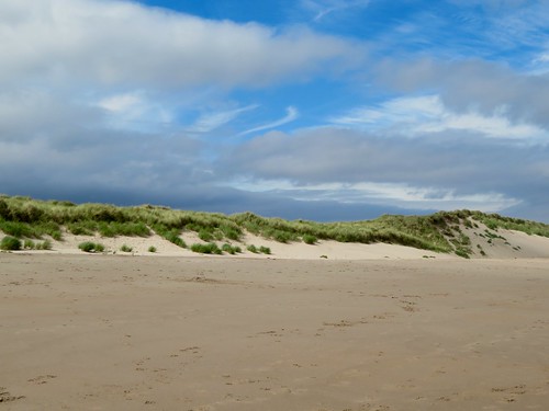
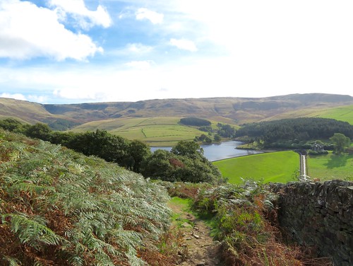
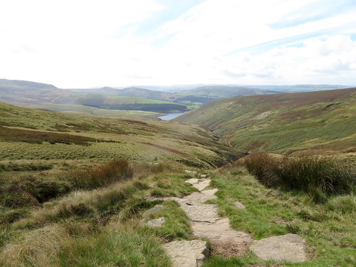
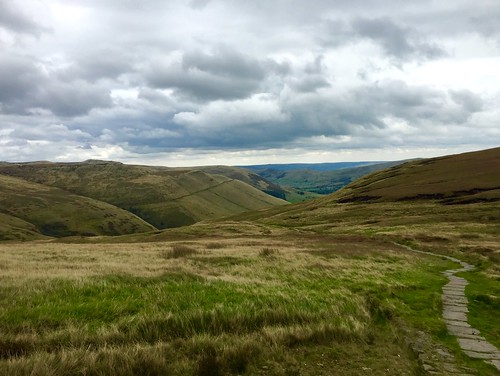
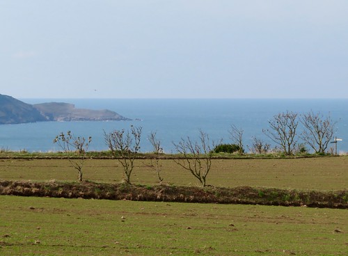
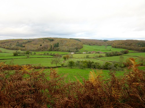
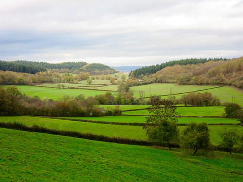
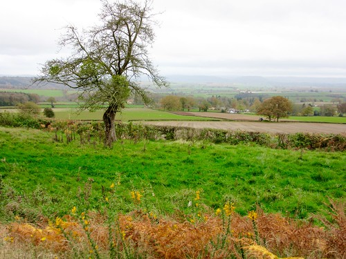
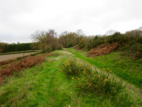
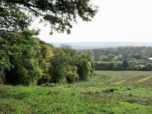
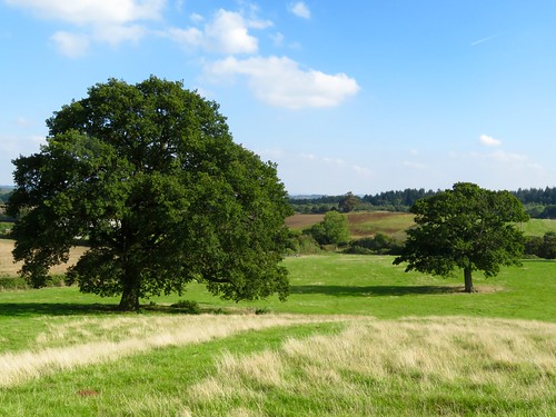
At first acquaintance, Bedfordshire seems a rather nondescript county to walk in. It’s hard to get a grasp on the character of this low-rolling region with its large arable fields. But once you develop a taste for the many old copses and hedgerows, the slow-flowing brooks and sudden, unexpected viewpoints from ridges you hadn’t thought were there, Bedfordshire’s a place you find yourself looking forward to revisiting on foot.

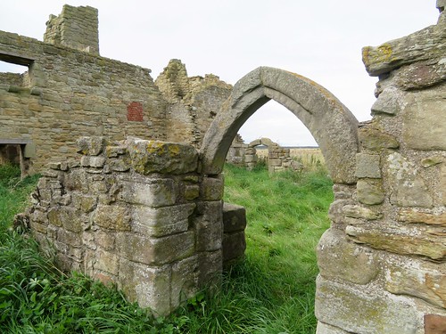
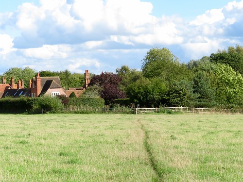
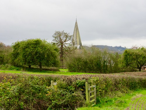
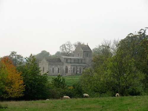
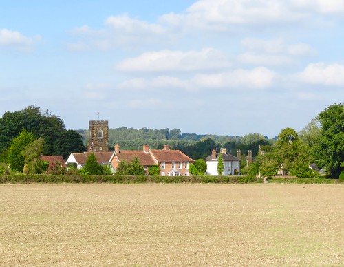
An absolutely glorious afternoon helps, of course. The sun blazed down out of a clear blue sky on the cottages and dark ironstone church at Church End, the southerly node of the scattered village of Eversholt, on the eastern doorstep of Woburn Park. To balance the wintry nip in the air there were pictures of springtime in the village phone box, featuring improbably shaped lambs and unfeasibly yellow daffodils painted by the pupils of Eversholt Lower School.

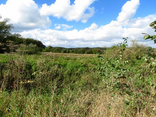
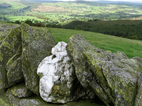
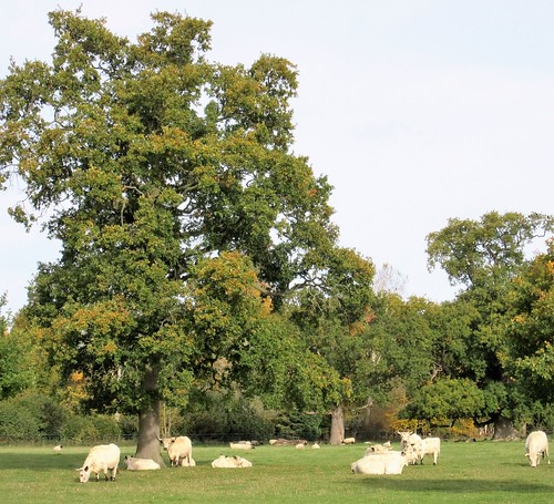
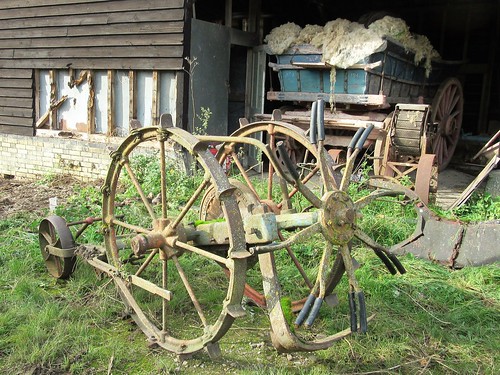
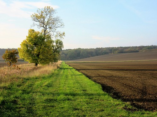
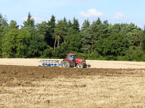
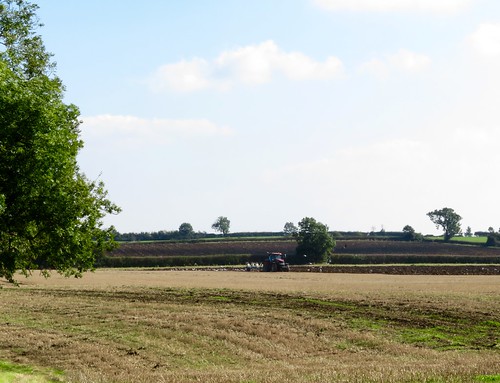
We set out across a wide field of ploughland where we picked up shards of ancient pottery and a nacreous fragment of Roman glass. At Herne Green Farm a tractor ground along the furrows, turning dark soil like roughly broken chocolate and drawing a long white wake of gulls behind it.

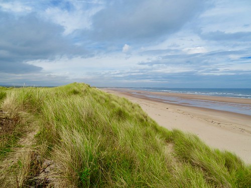
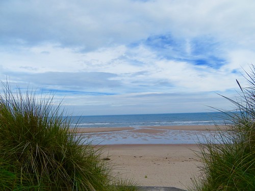
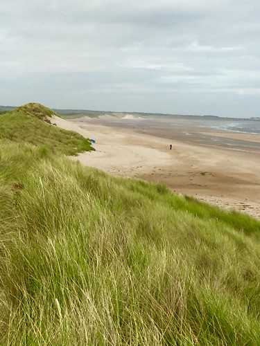
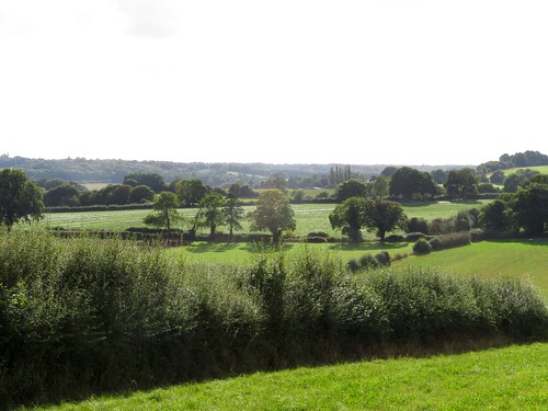
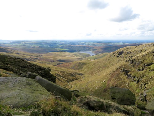
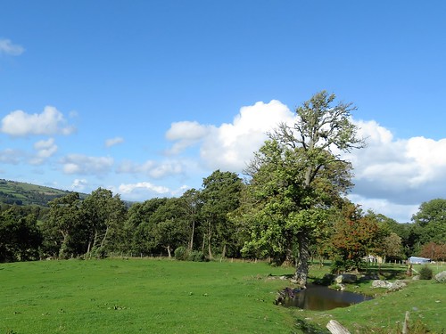
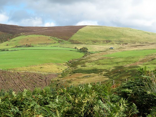
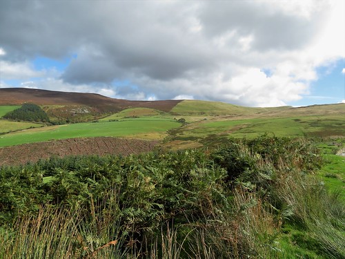
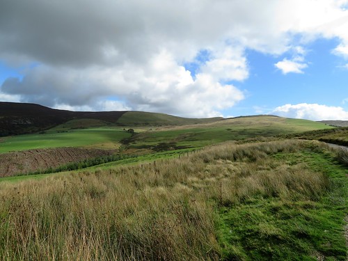
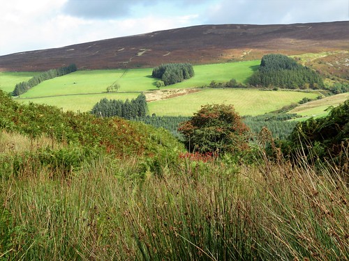
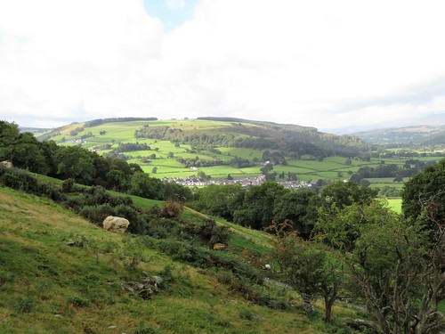
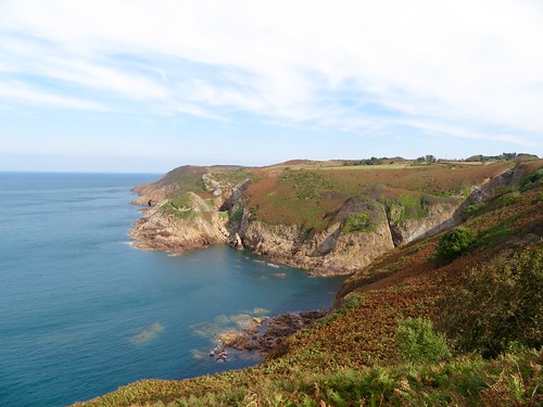
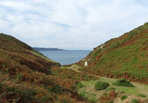
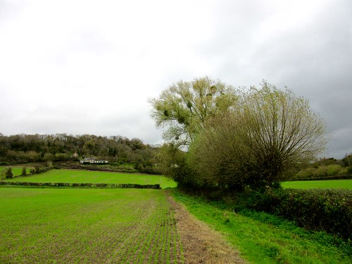
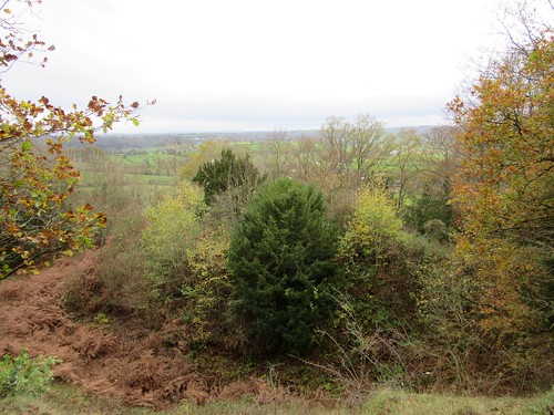
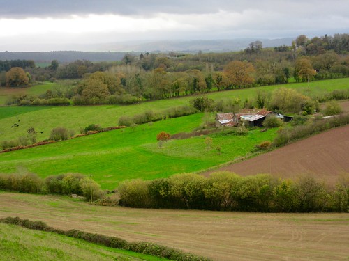
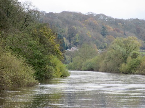
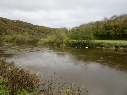
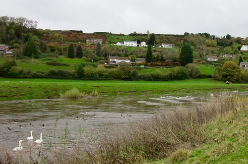
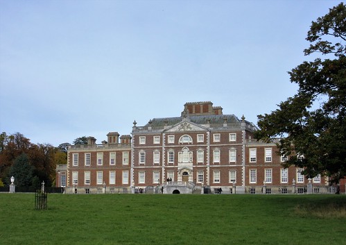
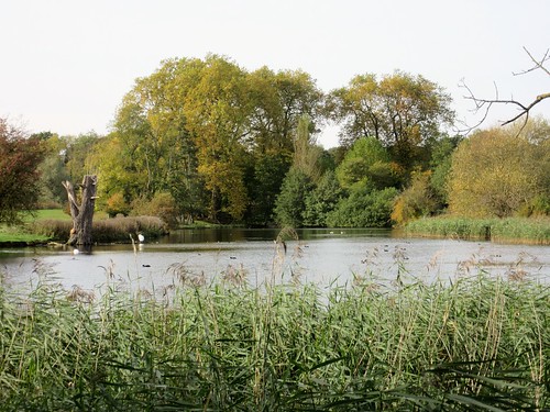
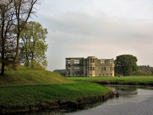
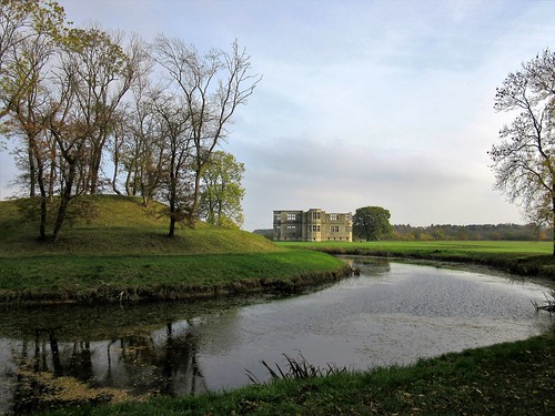
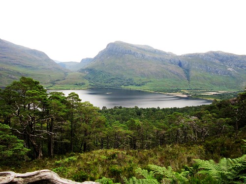
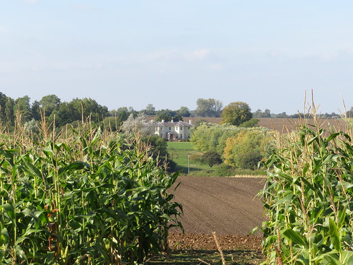
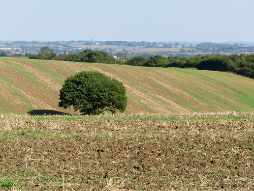
An easterly wind began to rise, thrashing and hissing in the sycamores around Herne Green. A red kite circled the newly cut fields, looking for small creatures exposed by the plough. One of those unforeseen Bedfordshire views opened across a rolling plain to the north-east as we stumbled across crusty ploughlands down to the trees and half glimpsed house of Toddington Park.

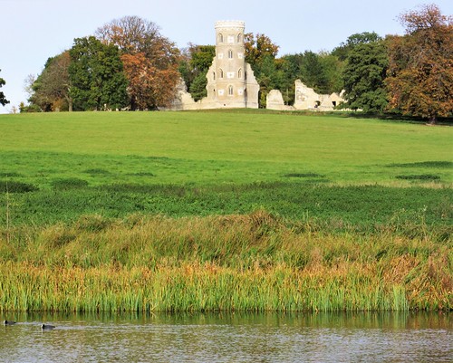
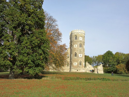
Here handsome James Scott, Duke of Monmouth and by-blow of King Charles II, lived with his young lover Henrietta Wentworth, heiress to Toddington estate. Stories say they sold her property and jewels to fund the rebellion in 1685 that attempted to put Monmouth on the throne after the death of his father. It ended badly, with Charles’ brother James installed as King, and Monmouth himself sent ignominiously to the block.

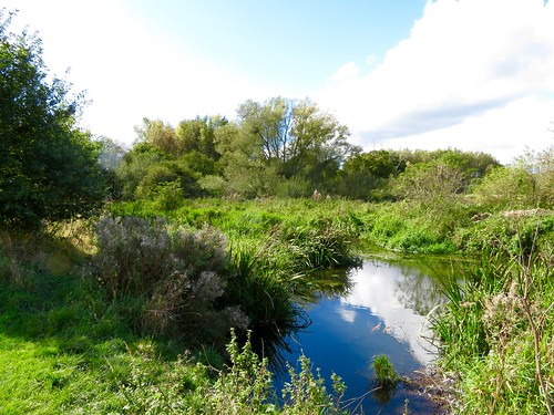
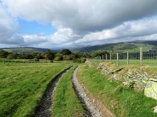
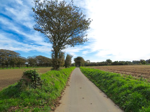
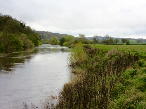
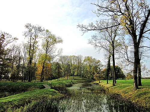
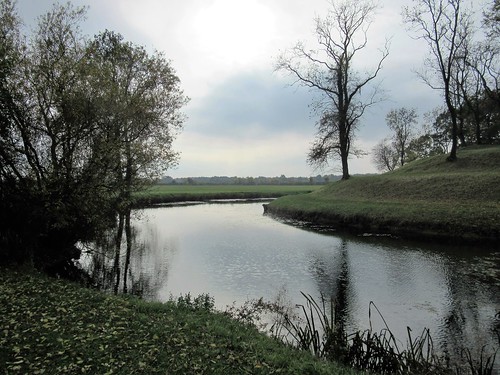
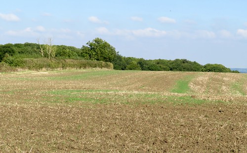
Our homeward path lay across a succession of enormous fields, mostly of thick dark plough. There were old hedges of hips and haws, and a thread of a brook winding under elder bushes. The lichens that scabbed the elders glowed so incredibly yellow in the evening sun that it looked as though the young artists of Eversholt Lower School had been that way with their paint-boxes.

Start: Green Man PH, Church End, Eversholt, Beds, MK17 9DU (OS ref SP 983325)

Getting there: M1 Jct 12; A5120 into Toddington. Opposite church, right to Milton Bryan and Church End.

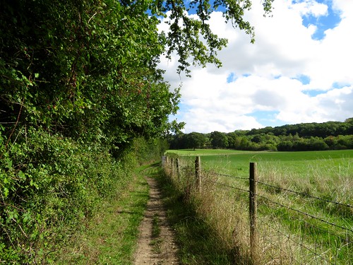
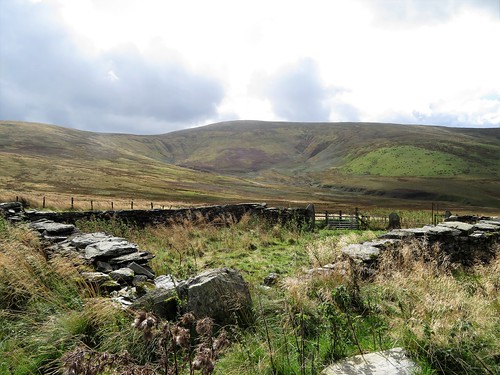
Walk (5½ miles, easy, OS Explorer): From Green Man, left along road. At crossroads, ahead through kissing gate/KG. Cross field to KG (984320, black arrow/BLA); up slope, to KG in a dip at far top corner of field (986317). Across rushy patch; through KG, then right through another KG into wood.

Bear left (yellow-topped post/YTP). In 100m cross grazing ride; in 100m cross another (BLA); leave wood at YTP (988314). Half left across field to hedge corner; ahead with hedge on left to stile (992309, BLA). Aim left of Herne Green Farm to double KG. Half right to stile; in 20m, left over stile, right along hedge, following ‘Monmouth Way’/MW signs. In ¼ mile, at farm drive (995302), aim across field towards double roof in valley below. Through gate by buildings (997299; YTP, MW); half right to KG (MW); half right across paddock to KG. Half right across drive to railing gap (998297, BLA). Cross large field, aiming between two electricity poles, to road on far side (003293, fingerpost/FP).

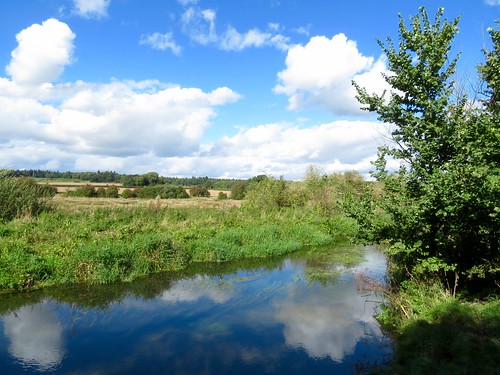
Right for 200m; left along track (FP); in 70m, right (BLA) across field, aiming for rails of footbridge (997293). Cross; aim to right of lone oak to cross Herne Grange drive (994295). Through gate (FP); across field to gate (BLA); across next field to gate under trees (989297). Follow right-hand hedge downhill for 2 fields to cross footbridge in valley bottom (984298, YTP). Right through KG; keep brook on right for 3 fields (YTP, BLA) to cross Park Road (984303).

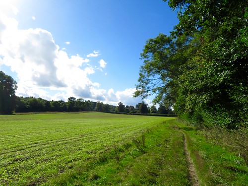
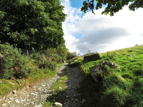
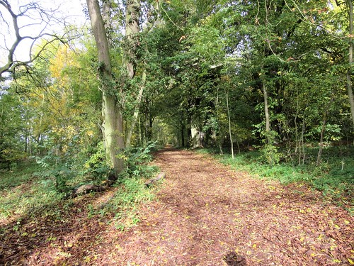
Ahead with hedge on right. In 300m (985306), level with large oak at hedge end on opposite side of field, fork left and aim half right across field to hedge gap (BLA). Across next field to far corner (984310). Through hedge gap (YTP, BLA); follow path through plantation. In 250m fork left across field to post beside Palmer’s Shrubs wood (983313, BLA). Ahead through wood to KG (983317). Ahead across field past oak tree; down to KG (984320); cross field to Church End.

NB: Many arable fields to cross; lots of mud!

Lunch: Green Man, Church End (01525-288111, greenmaneversholt.com) – closed Mondays

Accommodation: Long’s Inn, Bedford St, Woburn MK17 9QB (01525-290219, longsinn.co.uk)

Info: Dunstable TIC (01582-891420); visitengland.com; satmap.com; ramblers.org.uk

Britain’s Best Walks: 200 Classic Walks from The Times by Christopher Somerville (HarperCollins, £30). To receive 30 per cent off plus free p&p visit harpercollins.co.uk and enter code TIMES30, or call 0844 5768122

 Posted by at 01:45
Dec 032016


First published in: The Times Click here to view a map for this walk in a new window
picture picture picture picture picture picture picture picture picture picture picture picture picture picture picture picture
Facebook Link:

Walking through the pine trees towards the sandhills of Hadston Links, we could hear the sea pounding the sands of Druridge Bay. A big roaring wind was building in the south, and once we were through the dunes and heading down the beach we had a half gale in our faces and the whole enormous bay – give or take a handful of dog ball throwers – to ourselves.

Druridge Bay is designated a Heritage Coast and a Site of Special Scientific Interest. This seven-mile curve of beach from Amble to Cresswell is totally unspoiled, a simple and grand arc of dull gold sand backed by flowery dunes, with crashing steel-grey waves coming in off the North Sea under huge overarching skies.

This is a beach for runners and kite-fliers, joggers and diggers, idlers and strollers. Black matchstick figures of men, women and dogs pushed hard into the wind. The sea rolled in, roaring softly on the sand and hissing up the beach in diminishing flounces of white foam. The air over the bay was laced with spray, lending a diffused pearly glow to the sky.

A flight of ringed plover went twinkling in black and white across the ribbed pools that had collected in the sands. On the landward side of each sandy ridge in every pool, a skin of gritty black had collected – tiny flecks of coal, sifted out of the low-lying hinterland behind the beach and filtered through the dunes by the trickling flow of tiny burns. The richness of the bird and flower life here, the windy solitude of the beach, make it easy to forget that this is coal-bearing country.

A couple of miles along the beach we cut inland through the dunes and past the wetlands and wildfowl lakes of Druridge Pools. Isolated in the fields beyond stands the lonely ruin of Low Chibburn Preceptory, a medieval chapel and hospital of the Knights of St John built on the ancient pilgrim route to Holy Island. The Hospitallers’ refuge has done duty in its time as a grand dower house, a cattle shed and a Second World War pillbox.

Before setting back for the beach and the return walk, we wandered slowly round the ruin, admiring its finely carved piscina, its arched windows and handsome stonework, survivors of changing fortunes over the course of seven hundred years in this remote corner of the Northumbrian coast.

Start: Druridge Bay Visitor Centre, near Amble, Northumberland NE61 5BX (OS ref NZ 272998)

Getting there: Visitor Centre signed off A1068, 2 miles south of Amble

Walk (6½ miles, easy, OS Explorer 325. Online maps, more walks at christophersomerville.co.uk): From car park, follow ‘Beach’. Path through trees, then dunes; down steps onto beach (273996). Turn right/south for 1½ miles. Where the dunes dip to a pool and Dunbar Burn, pass a pipe (broken in two) across the beach (277972). Continue along beach for 500m, then turn inland between tank blocks through gap in dunes (277965), past concrete blockhouse. Through fence gap (North Sea Trail ‘N’ waymark); right along road; in 200m, left between boulders (275966) on path (yellow arrow/YA) past Druridge Pools and on across 2 fields (YAs) to Low Chibburn Preceptory ruin (266965). Return same way. Nearing Visitor Centre, look for wooden steps up through dunes.

Lunch: Snacks at Visitor Centre café (open daily summer, weekends winter)

Accommodation: The Bridges B&B, 3 Togston Crescent, North Broomhill, near Amble NE65 9TP (01670-761989).

Druridge Info: northumberland.gov.uk, 01670-760968

visitengland.com; satmap.com; ramblers.org.uk

Britain’s Best Walks: 200 Classic Walks from The Times by Christopher Somerville (HarperCollins, £30). To receive 30 per cent off plus free p&p visit harpercollins.co.uk and enter code TIMES30, or call 0844 5768122

 Posted by at 01:20
Nov 262016


First published in: The Times Click here to view a map for this walk in a new window
picture picture picture picture picture picture picture picture
Facebook Link:

The blowy blue afternoon sky over Berkshire was patchworked with vast silvery clouds backlit by the sun. Along the hedges in the broad valley of the River Pang wind-dried umbellifers stood as tall as a man, each papery seedpod holding the blood-red streak of a single seed.

This is understated countryside, with a faint dip and roll to it. The sun put a glossy green polish on the wooded ridges of the valley. A jay, disturbed by our passing, swore like a trooper from its hideout in a thicket, and high overhead a stunting plane growled among the clouds.

We trod a carpet of gold and silver willow leaves beside the slow-flowing Pang. The water rippled as clear as gin over a gravelly bed. An angler had snagged his line in an elder bush; with great patience and dexterity he freed it and drew a flapping brown trout from the water. Then he lay prone, cradling the fish in a wetted palm, and slipped it very carefully back into the river.

Bradfield was a gorgeous dream of mellow red brick houses, the shaven playing fields of its college still smelling faintly of cut grass. Here we crossed the Pang and climbed the gentle slope to the north, into woods where horse chestnuts shone a rich mahogany in the leaf litter, as though freshly polished.

At a point where the sigh of wind in the treetops was overlaid by the seashore roar of the M4, we turned away through the silver birch and tall pines of The Gravels. This is sand and gravel country, a place of old heathy commons now overgrown with woodland, from which we looked out across the Pang valley to a rainstorm gathering in the south.

A tawny owl hooted among the hazels at Nightingale Green as we dropped down to recross the Pang and take the path through sedgy pastures back to Stanford Dingley. In St Denys’s Church we found red ochre frescoes 800 years old, and a medieval tile on which the Lamb of God gambolled with shaggy legs as unco-ordinated as a puppy’s – an image that bridged the centuries with charm and humour.

Start: Bull Inn, Stanford Dingley, Berks RG7 6LS (OS ref SU 576716)

Getting there: Stanford Dingley is 2 miles north of Chapel Row, west of Theale (between Jcts 12 and 13, M4)

Walk (7½ miles, easy, OS Explorer 159): From Bull Inn, left along road. At junction, left (fingerpost) on footpath (yellow arrows/YA) for nearly 1 mile to road (591719). Dogleg right/left across, and on (YAs) for 1 mile to road in Bradfield (604727).

Left; in 200m, left past ‘Private Road’ notice (603728; white arrow/WA; ‘Recreational Route’/RR). In 150m, right through gate (fingerpost). Aim half left across field to corner of hedge (599728); same line to gate through hedge, and on to cross road (596728). Up Greathouse Walk track (‘Bridleway’/BW). In ½ mile pass entrance to Great House Cottages (590734); in another 150m, at crossing of tracks, follow main track round to left (BW). In ⅓ mile, halfway up slope, left (585736, YA, RR) through ‘The Gravels’ wood. In 700m leave wood; forward to cross Scratchface Lane (577733).

Take path opposite (WA, RR); in 100m, right (WA, ‘Permitted Footpath’). Follow this path, ignoring side turnings. In 350m, at T-junction by post, left (574732, YA). Follow path (YAs) for ¼ mile; at wood bottom bear right (YA) to cross stile (574728). Down long field to lane (571727). Right; in 200m, opposite Mazelands Farm, left up track. In ¼ mile at 3 gates, right (567725; WA, RR, BW). In 200m, left through KG (YA), up fence and into House Leas wood (563725). Left (WA, RR), following wood edge south (‘Restrictive Byway’/RB) for ½ mile to Pangfield Farm (564719).

Skirt clockwise round buildings on marked ‘Preferred Pathway’, before turning left down drive. Cross road (566716); down track opposite. In ¼ mile, left at gate (569713, RB). Immediately left through gate (YA); half left across field to gate (571713, YA). Through trees; aim across field for St Denys’s Church; at road (575717), right to Bull Inn.

Lunch/Accommodation: Bull Inn, Stanford Dingley (0118-974-4582, thebullinnstanforddingley.co.uk) – cosy, stylish and friendly

Info: Newbury TIC (01635-30267);
visitengland.com; satmap.com; ramblers.org.uk

Britain’s Best Walks: 200 Classic Walks from The Times by Christopher Somerville (HarperCollins, £30). To receive 30 per cent off plus free p&p visit harpercollins.co.uk and enter code TIMES30, or call 0844 5768122

 Posted by at 01:51
Nov 192016


First published in: The Times Click here to view a map for this walk in a new window
picture picture picture picture picture picture picture picture picture picture picture
Facebook Link:

On a lovely crisp morning we went up the narrow road from Bowden Bridge with Kinder Edge in our sights and old heroes on our minds. It was up this road that the Mass Trespassers came on an April morning in 1932, a righteous crowd of left-wing youngsters from Manchester and places around. Kinder was their aiming point, too, the great moorland plateau and its gritstone crags that had become symbols of exclusive privilege and the closing of upland country to ordinary folk.

The long path up to the moor led us above Kinder Reservoir through the heather and bilberries of White Brow, then steeply up the rocky cleft of William Clough where a beck came sluicing down over its boulders. The full sweep of Kinder Edge stood out to the east, a sharply cut skyline of dark rock outcrops traversed by diminutive figures of walkers. The flanks of William Clough opened out to shoulders of hillside, where in 1932 a line of keepers had waited with sticks to beat the trespassers back where they belonged.

These young men and women, many of them Communists, had had enough of staring up from the depression-hit, dirty and poverty-ridden cities of Manchester and Sheffield to the high open moors where grouse-shooting and water board interests forbade them to ramble. When they reached the higher slopes of William Clough the singing and chattering turned to angry shouting as they closed with the keepers. No heads were broken: some bumps and bruises were exchanged, and the trespassers broke through to rejoice as they reached the top at Ashop Head.

We pictured that excited, flush-faced crowd as we turned across the peat bog of Ashop Head and climbed to the start of the long escarpment of Kinder Edge. From here it was a question of following the edge for mile after mile, the wind nudging us, the gritstone crunching under our boots, looking out over a magnificent view to Manchester and the far hills of Wales. The rock outcrops had been cut and smoothed by wind and weather into multiple grotesques: chef hats, shark fins, dog heads, ogre noses.

We picnicked on a rock beside the trickling river at the head of the cleft of Kinder Downfall, and went on to where the Pennine Way fell away east towards its starting point at Edale. A good long stare down the delectable green Vale of Edale, and we were trudging westward down an endless lane home, thankful to those hearty lads and lasses from long ago whose bold law-breaking laid the foundations for today’s Right to Roam over all these high moorlands and mountains.

Start: Bowden Bridge car park, Hayfield, Derbyshire, SK22 2LH approx (OS ref SK 049870)

Getting there: Hayfield is at junction of A6015 from New Mills and A624 (Chapel-en-le-Frith to Glossop). Beside Packhorse PH, take Kinder Road; car park is 1 mile on left (£4.50 all day).

Walk: (9 miles, strenuous, OS Explorer OL1): Continue up road. At Booth Sheepwash cross river (051876); in 100m, ahead up path (yellow arrow, YA). In 250m, left across river; at reservoir gate, take cobbled bridleway on left (‘White Brow’). In 300m, by stone gateway, hairpin left (054882, metal ‘bridleway’ sign). Climb to gate; right (‘Snake Inn’, YA). Follow path for 1½ miles via White Brow and William Clough (steep near top) to meet Pennine Way/PW at Ashop Head (065900). Right along PW, following Kinder Edge, for 3½ miles. Beyond large outcrop of Edale Rocks (079867), descend to cairn at junction. Right on flagstone path; 150m short of junction on wide saddle, fork right off PW onto dirt track to junction (081861). Right through gate; follow lane for 2¾ miles down to Kinder Road and car park.

Conditions: Rugged hill walk, tricky underfoot – wear good boots!

Lunch/Accommodation: Sportsman Inn, Kinder Road SK22 2LE (01663-741565)

Kinder Scout mass trespass walk: nationaltrust.org.uk

visitengland.com; satmap.com; ramblers.org.uk

 Posted by at 01:38
Nov 122016


First published in: The Times Click here to view a map for this walk in a new window
picture picture picture picture picture picture picture picture picture picture picture picture picture picture picture picture
Facebook Link:

The weatherman had threatened rainstorms over Wales, but enormous clouds of grey and silver were sailing in a patchy blue sky as we set off from Llandrillo up the old drover’s route into the heart of the Berwyn hills. This lonely range of high country sprawls across the borderlands of northern Wales, little walked and seldom ridden these days, but in times past crossed by a network of rough roads and tracks that brought mountain cattle and sheep east to the markets of the Welsh Marches.

The old drovers’ road from Llandrillo rose steadily eastwards, floored with rock, flanked by walls of slender split stones. Every so often, big lumps of quartz had been positioned among the dull green wall stones, their white glimmer a useful waymark for a benighted drover or late-working shepherd. Gradually the views opened out, north across the lush valley of the River Dee, ahead to where the great olive-coloured shoulders of Moel Pearce and Cadair Bronwen began to loom across the south-east skyline.

The wind rushed in the sycamore leaves and tossed the bright orange rowan berries around. A bunch of jackdaws went skeltering down the wind above the old road, whose numerous sheep gates separated the various flocks along these hillsides. Each barrier had its own ingenious home-made closing mechanism, slung with heavy weights – a cast-iron cylinder head, a baulk of timber, a necklace of heavy old ploughshares that clinked together as the gate swung to behind us.

From the little stone bridge of Pont Rhyd-yr-hŷdd the drove road snaked about to wind itself up for the last mile’s climb to the pass of Bwlch Nant Rhyd Wilym, where it tipped up and wriggled away through sombre moorlands towards the valley of the Afon Ceiriog. A shiny metal memorial lay beside the pass, inscribed to the memory of ‘Wayfarer’ – Walter Robinson, a cycling writer of the 1920s who enticed off-roaders in their thousands to explore these wild uplands of Wales.

We sat by the cairn, watching sun-splashes chase cloud shadows across the flanks of Cadair Bronwen and telling ourselves we’d come back one day, better equipped and with more time in hand, to tackle the whole glorious ridge. Then we turned back down the old road and along a quiet forest track, wind and rain showers in our faces and a prospect of sunlit mountains far in the west to lift the heart and the weary legs.

Start: Village car park, Llandrillo, near Corwen, Denbighshire LL21 0TG (OS ref SJ 035372)

Getting there: Bus – service T3 (Lloyds Coaches) from Wrexham.
Road: Llandrillo is on B4401 between Corwen and Bala.

Walk (9 miles; a long, steady climb; OS Explorer 255. Online map, more walks at christophersomerville.co.uk): From car park, left along B4401; right at chapel; climb country lane (‘Tegid Way’/TW’) for 3½ miles. At sheepfold (083366) TW turns left, but keep ahead to Wayfarer’s Memorial at saddle (091366). Return down lane. In 1¼ miles, at TW post just before Pont Rhyd-yr-hŷdd, right (073368) on hillside path, to gate onto forest track (069375). Follow track for 1¾ miles to cross bridge; up to road at Melyn y Glyn (046382). Cross road; down lane to Ty Uchaf. Down left side of barn; stile beyond (yellow arrow/YA); along fence to gate (044378) above Ty-Nant. Cross footbridge and stile beyond. Follow succession of gates, stiles and YAs past Moel-is-y-goedwig-isaf to reach drive at Ty’n-y-cae-mawr (041373). Right to lane; right to Llandrillo.

Lunch: Picnic

Accommodation: Tyddyn Llan, Llandrillo LL21 0ST (01490-440264, tyddynllan.co.uk) – comfortable restaurant-with-rooms.

Info: Llangollen TIC (01978-860828)

Britain’s Best Walks: 200 Classic Walks from The Times by Christopher Somerville (HarperCollins, £30). To receive 30 per cent off plus free p&p visit harpercollins.co.uk and enter code TIMES30, or call 0844 5768122
visitwales.co.uk; satmap.com; ramblers.org.uk

 Posted by at 01:59
Nov 052016


First published in: The Times Click here to view a map for this walk in a new window
picture picture picture picture picture picture picture picture picture picture picture picture picture picture picture picture
Facebook Link:

For a little island Jersey packs a big punch. Its north coast might have been designed specifically to illustrate the word ‘rugged’. The coves, headlands, cliffs and sea-stacks are of granite that is sometimes dark, sometimes pink and quartz-studded. They fold in on each other in a series of bays carved out by the storms and racing tides of the English Channel. This is a coast made for walkers, its well-signposted cliff path opening up one remarkable prospect after another.

Under high milky cloud we set out from the village of St Mary along a succession of ‘green lanes’ – roadways hardly wide enough for a car, leading us between hedgebanks overhung with oaks, sycamore, sweet chestnuts and beech, all pruned low by the constant wind. The lanes were walled with stout pink granite blocks, and the houses were of granite, too, solid and dignified. The small square fields of wonderfully fertile soil had been tilled for winter, and as everywhere in Jersey there was the sense of a settled, well-to-do community not too fussed by the world beyond the waters.

Jersey cattle cropped the pastures, their large dark eyes as beautiful as those of a Bollywood star. In the lush green cleft of La Vallée des Mouriers a stream went dancing and sparkling beside the path, and we followed it down towards the sea.

Out on the cliffs we set our backs to the blasting east wind and were buffeted along the coast path that rounded a deeply scooped bay and ran out towards the distant rocky neb of La Tête de Plémont. Views on this clear, cold day were astonishing – north-west to the Channel Islands of Sark and Guernsey, the green hump of Herm between them; north-east to the long flat reef of Les Écréhous with its fishermen’s cottages apparently perching in the sea, and beyond them the white beaches of the French coast fifteen miles away.

The Devil’s Hole made a fine spectacle from the cliffside viewing platform, with the sea hissed angrily between its jaws. Whether the Father of Evil ever did inhabit that dark, echoing cave is open to question, but the band of early Christian monks who built their retreat on the perilous rock of L’Île Agois just beyond were real enough. We carried away a vivid impression of the harshness of their lives, sustained by faith and a diet of shellfish, as we took the homeward path to St Mary.

Start: St Mary’s Country Inn, St Mary, Jersey JE3 3DS (map ref 603542)

Getting there: Bus 7 (St Helier–Devil’s Hole). Road – St Mary’s Country Inn is on B53 between St Ouen and St John.

Walk (7½ miles, moderate, Jersey 1:25,000 Official Leisure Map): Left from inn car park; cross B53; ahead down La Rue de la Vallée. In 300m pass ‘Jardin De Haut’ sign on left; left up path to cross B26 (605539). Continue on ‘Green Lane’; in 300m, left at archway. In 400m, right at T-junction to cross B39 (612542). On to T-junction; left, then first right to B33 (610544, ‘La Route de St Jean’).

Right, then first left (‘La Rue Es Abbès’). In 700m, left at junction (613552); in 100m, right. In 50m fork left up lane, soon becoming green lane. At road beside La Vue du Pré house, turn right, then fork right downhill. At ‘Le Hurel’ sign, fork right. In 200m, bend right across stream (613556); left along Le Chemin Des Hougues. In 300m, opposite lamp post by Les Hougues house, fork right along gravel lane down La Vallée des Mouriers. At bottom, through gate by reservoir pump house (608561). Just beyond, fork left/west along coastal path.

Follow ‘Cliff Path’ signs for 700m to road at Priory Inn (606558). Follow ‘Footpath’ signs; then from car park ‘follow ‘Devil’s Hole’ signs for 500m down to Devil’s Hole viewing platform (602561) and back to car park. Sharp right and follow ‘Footpath’ and blue signs for 1½ miles to road just south of Crabbe Farm (592551). Right for ⅔ mile if you want to visit La Grève de Lecq harbour; otherwise left for ½ mile to T-junction (600547). In 150m fork right past Le Ronvillais house; in 600m, left on B33 (602543); in 150m, right to St Mary’s Country Inn.

Lunch: St Mary’s Country Inn (01534-482897, liberationgroup.com)

Accommodation: Atlantic Hotel, St Brelade, Jersey JE3 8HE (01534-744101, theatlantichotel.com) – extremely comfortable and helpful; wonderful food.

Info: Jersey TIC (01534-859000); jersey.com

Britain’s Best Walks: 200 Classic Walks from The Times by Christopher Somerville (HarperCollins, £30). To receive 30 per cent off plus free p&p visit harpercollins.co.uk and enter code TIMES30, or call 0844 5768122
visitengland.com; satmap.com; ramblers.org.uk

 Posted by at 01:04
Oct 292016


First published in: The Times Click here to view a map for this walk in a new window
picture picture picture picture picture picture picture picture picture picture picture picture picture picture picture picture picture picture picture picture
Facebook Link:

Clouds were pushing briskly north over Herefordshire in layers of slate grey and silver. The steeply folded countryside of the Wye Valley had settled in for the cold season with strings of scarlet bryony berries festooning the leafless hedges and the cattle gone from the pastures to their winter sheds.

Up in the trees above Fownhope the Wye Valley Walk traced the long ridge of Common Hill, looking south over steep quarrying ground – now thickly wooded – towards the rainy hills of the Forest of Dean. Fieldfares newly arrived from Scandinavia were pillaging the windfalls in long-abandoned cider orchards, their pale spotted breasts and smoky grey heads bobbing among the brown and yellow fruit.

‘We used to send all our cider apples to Bulmers,’ said the farmer who stopped for a chat. ‘But then they said, ”Tisn’t enough, don’t bother.” So now we just leaves ’em for the birds and the deer, and they go through ’em like nobody’s business!’

Through the ancient woodland of Lea and Paget’s Woods went the Wye Valley Walk, past old limekilns half buried among the tree roots. On the grassy slope beyond the woods a potbellied pig was champing the greenery with splayed tusks and plenty of squelching, his sagging stomach trailing along the ground.

A short, sharp climb to the elliptical rampart of Capler Camp, an Iron Age hill fort commanding a wonderful southward view across the Wye Valley. Down through pines and larches and we were finally at close quarters with the Wye itself, walking the bankside footpath round the wide bends of the river. The water raced by, swirling and bubbling, carrying a flock of Canada geese who trumpeted to one another as the river swept them away round a bend.

Back at Fownhope, the crooked broach spire of St Mary’s Church beckoned us. The 12th-century tympanum of the Virgin and Child inside the church displays all the idiosyncratic brilliance of the style known as the Herefordshire School of Sculpture. The wide-eyed Virgin delicately balances a mysterious fruit between thumb and forefinger. A Wye Valley cider apple? I’d like to think so.

Start: Greenman Inn, Fownhope, Herefordshire HR1 4PE (OS ref SO 578345)

Getting there: Bus 453 from Hereford
Road: M50, Jct 4; A449 (‘Ledbury’); in 1¾ miles, Fownhope signed to left on B4224.

Walk (6½ miles, moderate, OS Explorer 189. NB: Detailed directions are strongly recommended. Download them, along with online maps, more walks at christophersomerville.co.uk): From Greenman Inn, right along street. At church, left up Common Hill Lane. Pass Fownhope Medical Centre; in 200m, left through gate (584345). Dogleg right-left-right round 2 field edges (yellow arrows/YAs); up to cross stile and lane (585347) and on up bank (YA). In 50m, left (YA); in 30m fork right uphill (YA). In 150m, right by electricity pole (YA); in 100m, on ridge, right along Wye Valley Walk/WVW (586348).

Follow waymarked WVW east for ¾ mile to cross road on Common Hill (595346). Continue on WVW through Lea and Paget’s Woods for 600m to junction of paths at waymark post (599342). Blue and yellow arrows point ahead; but fork right, following WVW and ‘This Way to Ross’/TWTR. In 200m leave trees (599340); in another 250m, with Middle Green house on your left, bear right (601339), descending through successive gates with distinctive curly ironwork. Follow WVW down hedge on right into valley bottom (601337), then aim across field for kissing gate on skyline, 50m left of farm buildings at Overdine (600336). Ahead across field to B4224 (598334).

Left (WVW); in 100m, right down lane (‘Caplor’). In 150m, left into yard (597332). In 100m, right; follow WVW up fields, then steeply up steps to Capler Camp hill fort (596329). Bear right to barn; pass right end of barn; right along southern ramparts of fort. In 350m, enter trees (WVW); in another 70m, fork left (592329, TWTR) down through pines to road at Capler Lodge (591324). Left for 100m to viewpoint; then back along road and steeply downhill. At foot of hill, sharp left on path (587328); in 30m, fork right, steeply down past YA. At foot of slope, right along River Wye.

In ¾ mile, cross garden of Mancell’s Ferry cottage. At far side of garden, cross stile (576328).

If riverbank route clear:
Continue along riverbank for 1¼ miles. At entrance to wood (572337), don’t be tempted to continue beside river – the path is dangerously eroded in the wood. Instead, bear right away from river and follow southern edge of wood. In 300m descend to riverbank beside Leabrink house (575339). Follow path between house and river; continue on riverbank for 300m, then bear right inland (575342). Left through belt of willow; across field and through gate. Cross footbridge (576346); ahead (YA); in 50m, bear right up green lane past houses to B4224 (577346). Right into village.

If riverbank route flooded:
Keep ahead from Mancell’s Ferry cottage (NW) across field, soon with a bank on right, to metal gate, then kissing gate (YA). Cross farm track (573330) and keep ahead with bank on right. In 300m, right over stile (571333, YA); uphill with hedge on right. In 150m, at tree with YA, cross field to barn (573335). Pass to left of barn, cross 2 stiles (no waymarks) and field to kissing gate (574338, YA). Bear right down slope to stile (YA) on left of gate above Leabrink (575339). Follow hedge on left to cross lane by sewage works (577340, YA). Follow footpath (YA) back to Fownhope.

Conditions:
1. Wye riverbank path can flood in winter – ring Greenman Inn to check.
2. Don’t follow riverbank path through the wood near Leabrink – it’s slippery, eroded and dangerous!

Lunch/Accommodation: Greenman, Fownhope (01432-860243, thegreenman.co) – very smart, stylish place

Info: Hereford TIC (01432-268430)
visitengland.com; satmap.com; ramblers.org.uk

 Posted by at 01:50
Oct 222016


First published in: The Times Click here to view a map for this walk in a new window
picture picture picture picture picture picture picture picture picture picture picture
Facebook Link:

When the National Trust do something really well, it’s an absolute treat to be there. The Wimpole Estate in western Cambridgeshire is a good example. On this soft autumn morning the beautifully kept lime avenues stretched away in gold and green and the formal gardens of Wimpole Hall lay immaculately groomed. Cyclists cycled, runners ran, and families sauntered along the parkland walks or conveyed children to sessions of pumpkin lantern carving.

We passed the handsome square-faced bulk of Wimpole Hall, all red brick and pale stone facings, with its fierce statue of Samson slaying his foe with the jawbone of an ass. Up on the hill beyond, the views down broad avenues to south and east caused us to stop and stare – exactly as Capability Brown (whose bicentenary occurs this year) intended when he ‘naturalised’ the low-lying landscape more than two centuries ago.

Subtly sloped ridges rose, cunningly fashioned valleys fell away, artfully leading the eye past spinneys and hillsides to the castellated towers of a ruined castle on a tump. Sanderson Miller, supremo of 18th-century folly architects, perched it there to add a pinch of Gothic melancholy to the scene.

We found a path threading the belt of woodland that girdles the northern half of the estate. It was a classic autumn walk, a soft shoe shuffle through fallen leaves under oak, ash, beech, lime and chestnut, the hedgerow blackthorn sprays heavy with ripe black sloes.

Estate walks map in hand, we puzzled our way out of the trees and down to where the mock castle stood with round towers, arched windows and artistically crumbling walls. A path led down across the wooden lattice of the Chinese Bridge that spans a long artificial lake. Beyond the bridge, fat white sheep with kohl-black eyes cropped the parkland grass, even-tempered enough to allow passing little girls to pat their dewy fleeces.

We climbed the ridge once more for a final stretch inside the woodland belt, then came down to Cobb’s Wood Farm along a grassy track hedged with bright gold hazels. In the farmyard a row of amateur wood turners was hard at work at their primitive, treadle-operated pole lathes under the eye of a National Trust expert. ‘It was supposed to be a Christmas tree,’ murmured one of the turners, ruefully contemplating his wonky creation, ‘but now – I don’t know… maybe a leg for a very short chair?’

Start: Wimpole Hall car park, Arrington, Royston, Cambs, SG8 0BW (OS ref TL 337509). £2 – NT members free

Getting there: Wimpole Estate is signposted from A603, 10 miles south-west of Cambridge.

Walk (5¼ miles, easy, OS Explorer 209. Estate walks map available at Wimpole ticket office): Leaving stable block (ticket office, shop, café), aim ahead on path past front of Wimpole Hall. Through gate beyond; follow fence round to right; opposite wrestling nymphs statue, left (west) up broad grassy avenue (‘Woodland Walk’/WW on Estate map). At top of rise, right (330510) towards folly. In 300m, where trees on your left bend left, turn left over stile (331513, ‘Wimpole Way’). Turn right past info board and follow WW through woodland belt for 1¼ miles to top of rise where woodland ends (331526).

Turn right here and continue on WW through belt of trees. In ¼ mile, turn right on Folly Walk (FW), past info board and over footbridge (335525), following path out of trees and along field edge with hedge on right. Through gate, and follow path to folly (334520). Head downhill between 2 lakes, to cross Chinese Bridge (334517). Left along lakeside; in 300m, left across east end of lake (337516). Aim half right to meet track descending eastwards from folly (337519). Right; just before road, left up grassy field headland. At top of rise, right onto road (338524).

Left for 50m; right along WW in woodland belt. In 400m pass info board on right (‘viewpoint’ symbol on OS map); in another 200m, at well-defined crossroads of tracks (344523), turn right on track out of woods. Follow track to Cobb’s Wood Farm (345517). Right along driveway, over bridge, past lodge to road at Home Farm (341514). Left, then right up Wimpole Estate driveway to car park.

Lunch: Old Rectory Restaurant, Wimpole Estate

Accommodation: Sheene Mill, Melbourn, Royston, Cambs SG8 6DX (01763-261393, sheenemill.com)

Info: nationaltrust.org.uk/wimpole-estate

visitengland.com; satmap.com; ramblers.org.uk

*’The Times Britain’s Best Walks’ by Christopher Somerville (Harper Collins) – 200 walks from the ‘A Good Walk’ column – is published 6 October.

 Posted by at 01:13
Oct 152016


First published in: The Times Click here to view a map for this walk in a new window
picture picture picture picture picture picture picture picture picture picture picture picture picture picture
Facebook Link:

Another chance to walk with our artist friend Carry Akroyd through the Northamptonshire countryside that inspires her. A beautiful day of soft autumn light showed off these understated fields and woods in all the colour and detail she catches so strikingly in her East Anglian landscapes.

We left the pale limestone walls and thatched roofs of Wadenhoe, climbing gently from the valley of the River Nene into pastures of medieval ridge-and-furrow cropped by fat ginger-coated bullocks. A pair of red kites circled overhead, and Carry let out a perfect imitation of a kite’s shrill whistle to bring them lower. Along an old trackway we fingered the pink leaves of blackthorn bushes whose sloes hung in thick dark clusters, ripe for the gin bottle.

Through Lilford Wood on a speckled carpet of brown-and-yellow elm leaves, to a view at the far end across a ploughed field to the stone shell of Lyveden New Bield, Sir Thomas Tresham’s never-completed dream of a country lodge. Tresham, a staunch and devout Catholic, died in 1605, shortly before his son Francis became embroiled in the Gunpowder Plot. Disgrace and financial ruin followed for the family, and the unfinished lodge (a mansion in all but name) and its adjacent pleasure gardens were left to fall into decay.

Lyveden New Bield has been preserved and its grounds restored by the National Trust. We explored the eerie hollow skeleton of the lodge with its fine carvings of discreetly placed Catholic symbols, and climbed the moated mound behind for a view over the whole fantasy landscape. Then we took the homeward path through Lady Wood where the oak trees held up a canopy of quince-coloured leaves with wonderfully distorted limbs.

Long-tailed tits and siskins thronged the trees down by the River Nene, feasting among the seed cones of alders. Carry spotted a marsh tit, a rare sighting that made her exclaim with delight. And in the recesses of Wadenhoe’s box-backed church I found an old friend of ours – the Green Man, carved by some anonymous medieval mason, hiding in the shadows with a secret smile seven centuries old.

Start: Village hall car park, Wadenhoe, Northants, PE8 5ST (OS ref TL 011833)

Getting there: Wadenhoe is signed off A605 between Thrapston and Oundle

Walk (8½ miles, easy field and woodland paths, OS Explorer 224): Walk back up village street (‘Lyveden Way’/LW). Left at top (LW); in 30m, left through gate (LW). Aim a little right of church; in 200m, further right to kissing gate (009835, LW). Aim ahead through trees and across next field to far left corner to cross road (008836, LW). Cross next field to far left corner; right along road.

In 150m, left down track (006838, ‘Wadenhoe Lodge’). In ½ mile pass Wadenhoe Lodge; continue following LW. In another 500m pass track on left (994845, ‘No Footpath’); in100 m, left through gate, across 2 fields to path into Lilford Wood (992847, LW). Follow LW through wood, across fields to Lyveden New Bield (984853).

Returning from house, retrace steps to edge of field; right (LW) on path which curves to meet Lady Wood (980850). Right (LW); in 100m, left into wood, past picnic tables, across 2 duckboard footbridges and on south along path. In 300m, right at cross-path to observation tower (978848). Left down ride to bottom of wood (978844); left along LW. In 250m bear left (981843, LW); in 300m, at wood edge, right at T-junction (984842, LW).

In ½ mile, leave trees (989835) and continue on field path (LW). In 650m pass a brambly, iron-fenced pond on your left (993930); through next kissing gate (LW); on across next field to go through kissing gate (996827). LW goes left here; but turn right along green lane. In 300m, just past gate across lane, left (994825) along field edges with ditch on left. In 4th field, angle slightly right, following line of trees to cross stile to right of house (002821).

Ahead to Cross Lane; left to road in Aldwincle (004820). Right; in 200m, at junction, left (‘Nene Way’ fingerpost) across paddock and down path. In 200m, left at field edge (007820), and follow waymarked Nene Way for 1 mile to Wadenhoe.

Conditions: Lyveden Way signs are badly faded, but visible as white rectangles.

Lunch: NT café at Lyveden New Bield, or King’s Head PH, Wadenhoe (01832-720024, wadenhoekingshead.co.uk)

Accommodation: Talbot Hotel, Oundle PE8 4EA (01832-273621, thetalbot-oundle.com) – comfortable, long-established hotel.

Lyveden New Bield: 01832-205358, nationaltrust.org.uk/lyveden

Carry Akroyd: carryakroyd.co.uk

www.visitengland.com; satmap.com; ramblers.org.uk

*’The Times Britain’s Best Walks’ by Christopher Somerville (Harper Collins) – 200 walks from the ‘A Good Walk’ column – published 6 October.

 Posted by at 01:47
Oct 012016


First published in: The Times Click here to view a map for this walk in a new window
picture picture picture picture picture picture picture
Facebook Link:

Beinn Eighe is a mighty mountain. It rises over 1,000 metres at its highest point, and presents an uncompromising assortment of cliffs, screes, corries and buttresses to anyone who ventures high into the range. Scottish Natural Heritage has laid out a very clear and well-marked Mountain Trail to guide walkers who don’t mind a steep and slithery ascent, on a circuit that takes in the top of one of the mountain’s eastern peaks. This isn’t a stroll in the park, though, and you need to be properly equipped for a mountain walk before you tackle it.

Our path from the shore of Loch Maree rose beside a rushing stream through banks of bracken and bilberry. The forest here is of Scots pines, some three hundred years old or more, their upper limbs bright orange in contrast with the ashen grey of their scaly trunks. We crossed the burn over a footbridge with a fine view back over the silty channels at the head of Loch Maree and the hump of Slioch mountain across the water.

Above the tree line the track climbed steep slides of marbly rock, crunchy with shattered shards of quartzite, to reach the cairn on the summit of Leathad Buidhe, ‘the broad yellow ridge’. The views made us gasp – back over the loch to the hills in the north-east, south-west to three enormous peaks of pale rock like the storm waves of a petrified sea – the northerly aspect of Beinn Eighe’s out-thrust fingers. The cairn stood sentinel over an upland of bog and lochan, shiny black crowberries and shell-burst clumps of orange-tipped deergrass – a place where the only sounds were the cheeping of meadow pipits, the raspy sigh of wind among rocks, and a faint subterranean chatter of running water.

A quick, cool dip in the peaty waters of Loch Allt an Daraich under the black-browed hummock of Meall a’ Ghiuthais, ‘pine-tree hill’. Then we followed the white twisting scar of the path across the moor to where it dropped steeply downhill beside the tumbling water of Allt na h’Airighe. The stream fell down into a dark, deep cleft, a fault torn open by giant convulsions hundreds of millions of years ago. We stopped at the rim to gaze down this crack in the face of Beinn Eighe, before descending among resin-scented pines already beginning to drip with the afternoon’s shower.

Start: Glas Leitir car park on A832 Gairloch road, 4 miles north-west of Kinlochewe (OS ref NH 001650)

Getting there: Bus twice daily, Kinlochewe-Gairloch (rome2rio.com/s/Gairloch/Kinlochewe). Road: Car park is on A832 Kinlochewe-Gairloch road, 1¾ miles beyond Beinn Eighe Visitor Centre.

Walk (4 miles, strenuous with 550m of climb, OS Explorer 433. Online maps, more walks at christophersomerville.co.uk): Cross under road and fork left (‘Mountain Trail’). Then simply follow the clearly marked trail (cairns and mountain symbol waymarks) very steeply up to cairn on Leathad Buidhe (993633). Right (north-west) past Loch Allt an Daraich, and follow trail very steeply down, along rim of Cnoc na Gaoithe above gorge, and down through woods of Coille na Glas-Leitire*. At post marked ‘6’, where Mountain Trail waymark points left along Woodland Trail, turn right down path to car park.
* (the map version has an ‘e’ on the end, though the car park is named ‘Glas Leitir car park’)

Conditions: Steep rocky paths, many steps, some rubbly stretches. Wear hillwalking clothes and boots.

Refreshments: Whistle Stop Café, Kinlochewe (01445-760423)

Accommodation: Kinlochewe Hotel, By Achnasheen, Ross-shire IV22 2PA (01445-760253, kinlochewehotel.co.uk)

Beinn Eighe Visitor Centre: 01445-760258 (open March-Oct)

Info: Mountain Trail booklet guide available from Scottish Natural Heritage’s Kinlochewe Office (01445-760254); also downloadable at snh.org.uk/publications

*’The Times Britain’s Best Walks’ by Christopher Somerville (Harper Collins) – 200 walks from the ‘A Good Walk’ column – published 6 October.

www.visitscotland.com; satmap.com; ramblers.org.uk

 Posted by at 01:58