Sep 242016


First published in: The Times Click here to view a map for this walk in a new window
picture picture picture picture picture picture picture picture
Facebook Link:

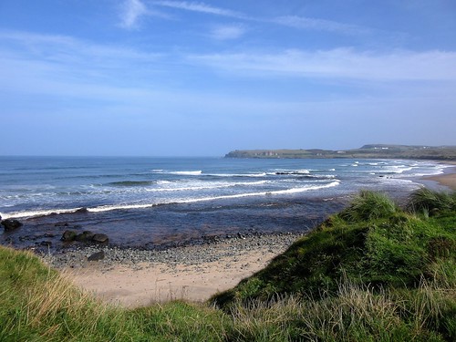
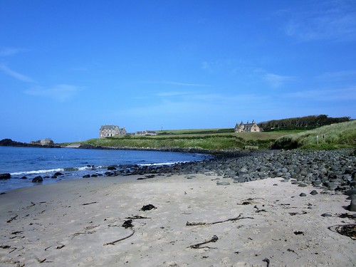
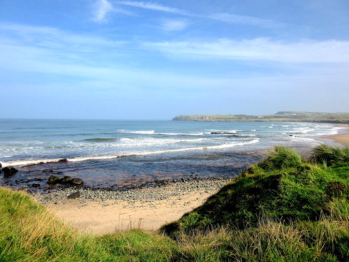
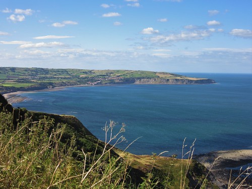
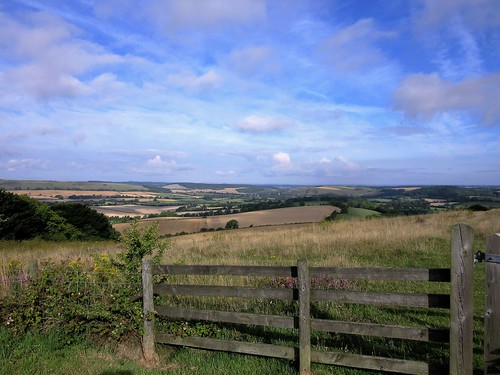
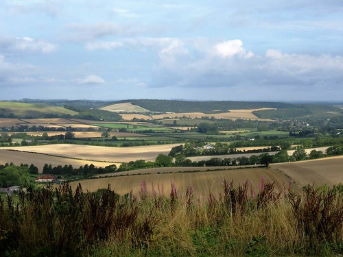
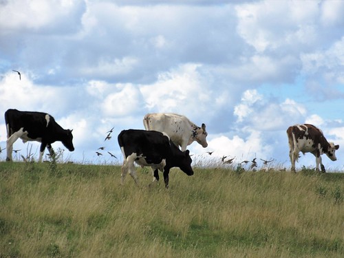
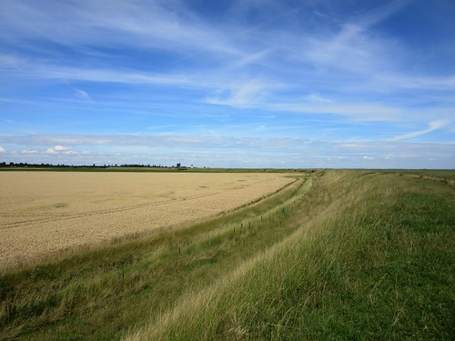
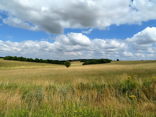
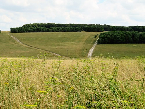
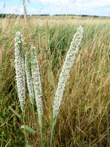
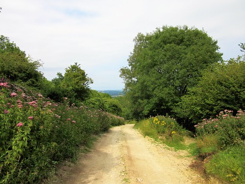
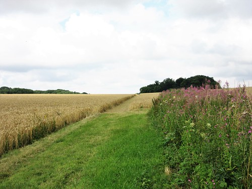
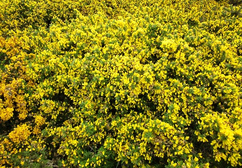
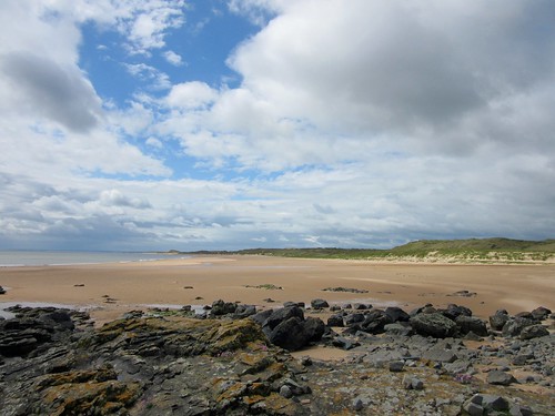
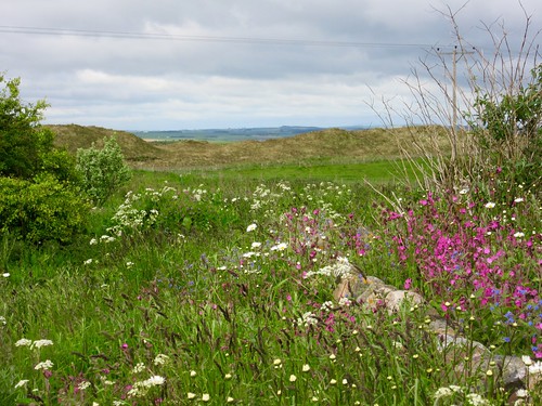
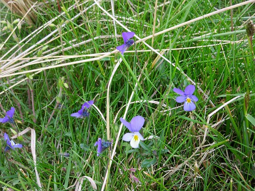
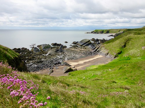
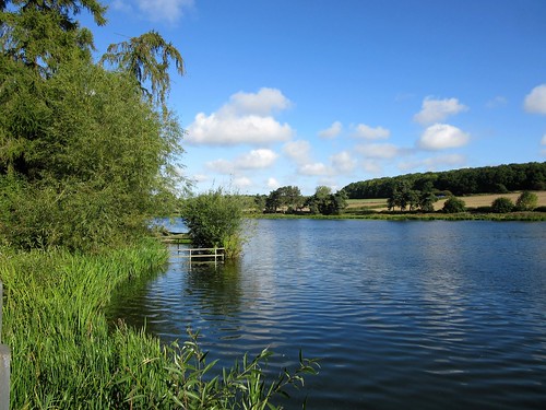
Thornton Reservoir is shaped like the tail of a dolphin in the act of plunging headfirst into the coal-bearing country to the west of Leicester. Tucked into a bowl of shallow hills, it’s a lovely stretch of water on a sunny morning with dog-walkers, runners, cyclists and walkers exchanging the musical ‘How-do’ greeting of the area as they follow the circuit path through the resinous pines around the reservoir.

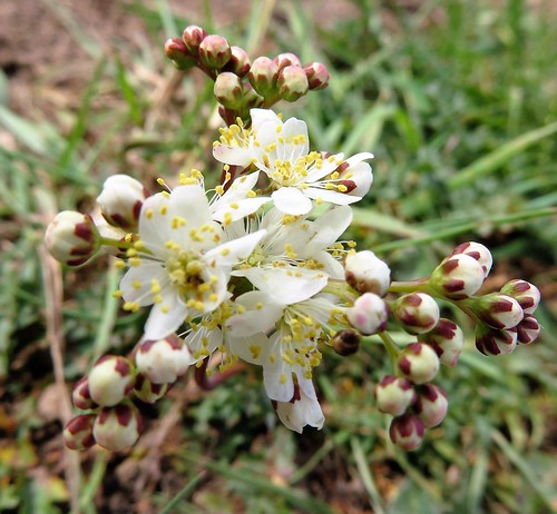
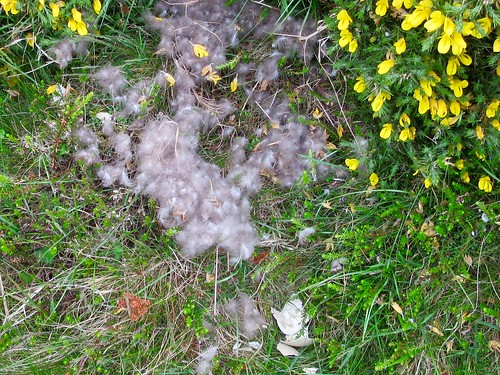
We took our time, watching fishermen in their small boats casting and tying flies with monumental patience. Great crested grebes sailed the reeds with snow-white cheeks and breasts, and a pair of half-grown cygnets sat tight on a dome-shaped nest padded out with the downy white feathers their parents had plucked and laid there.

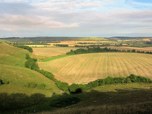
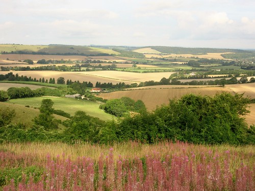
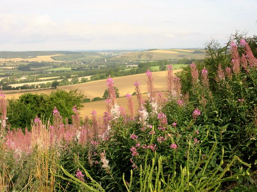
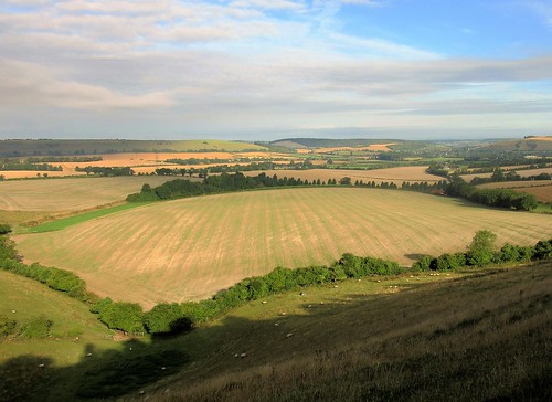
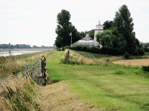
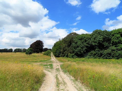
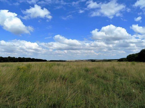
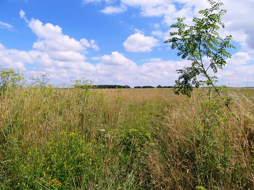
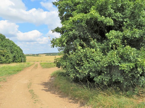
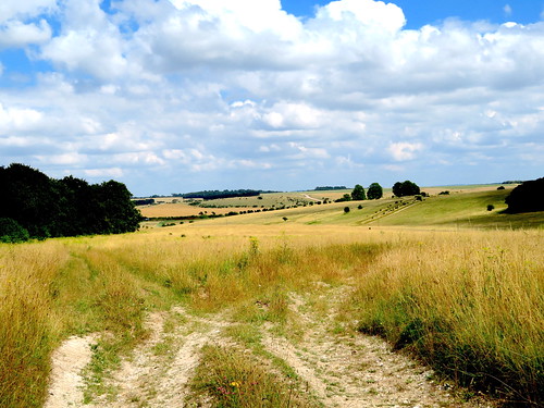
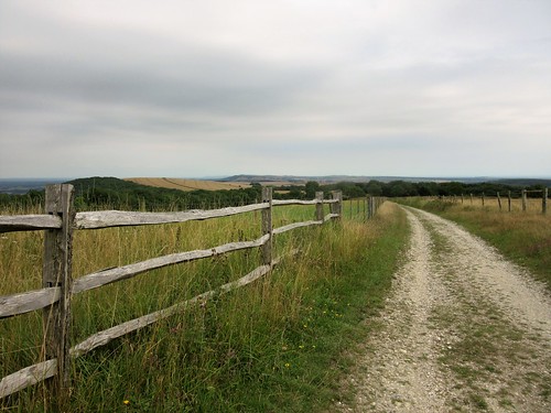
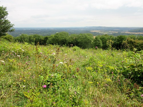
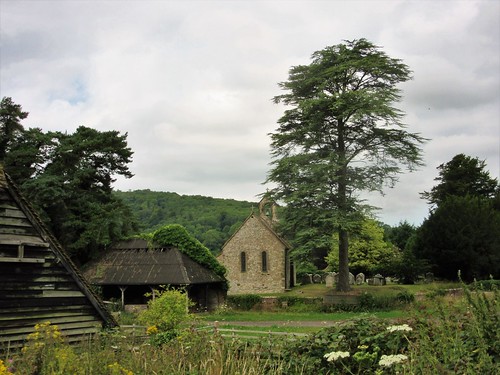
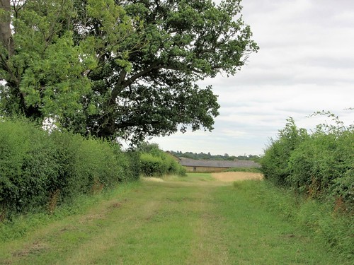
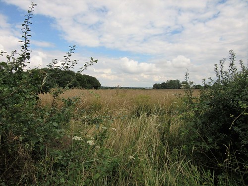
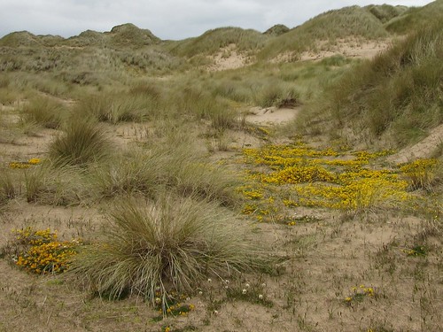
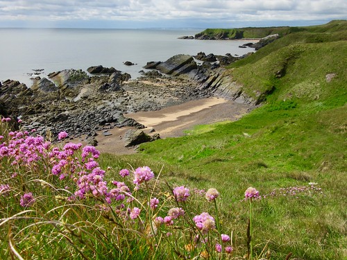
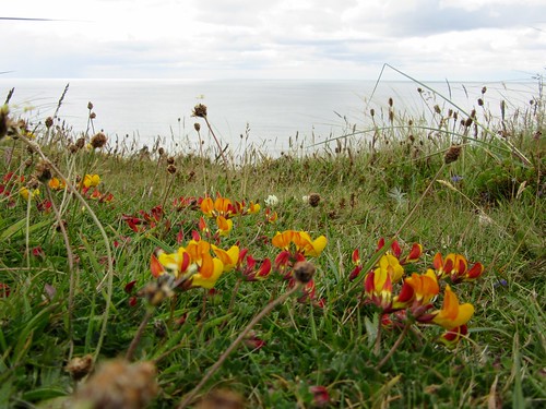
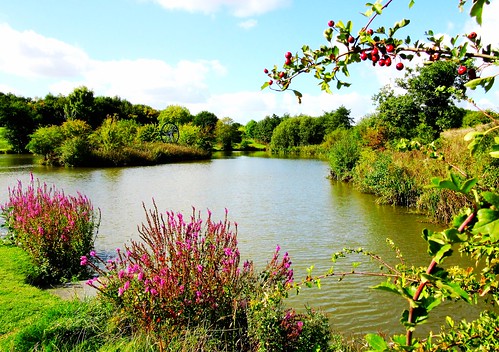
From the north-western tail tip of the reservoir we climbed the ridge where Thornton village straggled on either side of the church spire. Down on the western side, young woodland has grown tall and graceful in the twenty years since it was planted – Manor Wood and Bagworth Heath Wood, component parts of the inspiring enterprise that is the National Forest, 200 square miles of planting to green up and beautify a great swathe of the post-industrial Midlands.

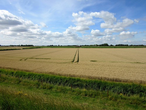
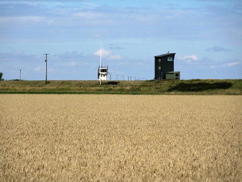
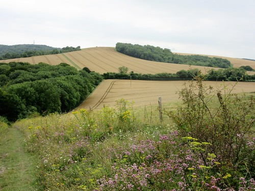
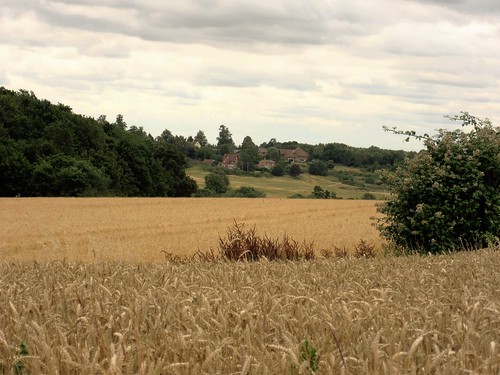
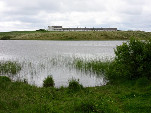
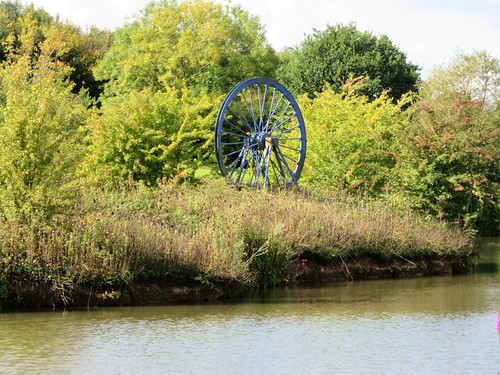
Where the lakes and meadows, the woods and commons of Bagworth Heath now lie, the pit wheels and slag heaps of Desford Colliery stood until its closure in 1984, the year of the miners’ strike. Many of the 700 miners who lost their jobs have joined their children and grandchildren in planting the millions of oak, ash, silver birch and rowan trees that compose today’s woodlands. A single pit wheel installed on an islet in one of the lakes is the only reminder of the pit and its hard realities.

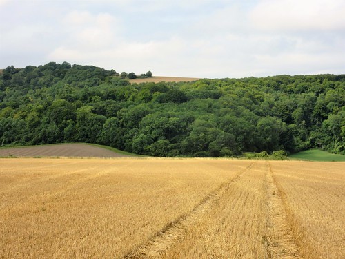
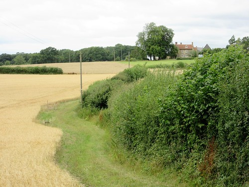
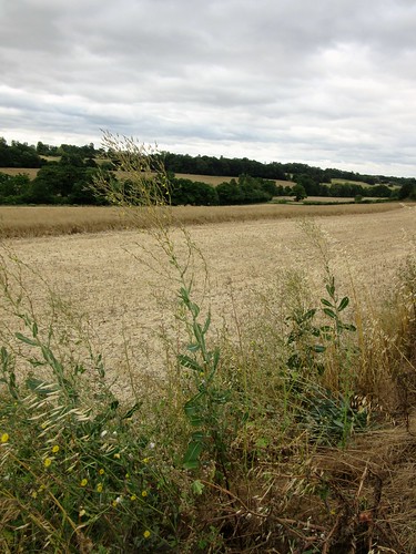
We followed the path through Desford Brickworks Wood, looking out between the fresh young trees onto a vast red bank of spoil burrowed into thousands of corrugations by the digging machines. Then we turned away and made for the homeward path.

Start: Thornton Reservoir car park, Thornton, Leics LE67 1AR (OS ref SK 470074).

Getting there: Bus 26 from Leicester.
Road M1 Jct 22; from Markfield follow ‘Thornton’; car park is on Reservoir Road in village.

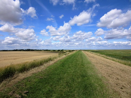
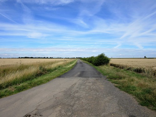
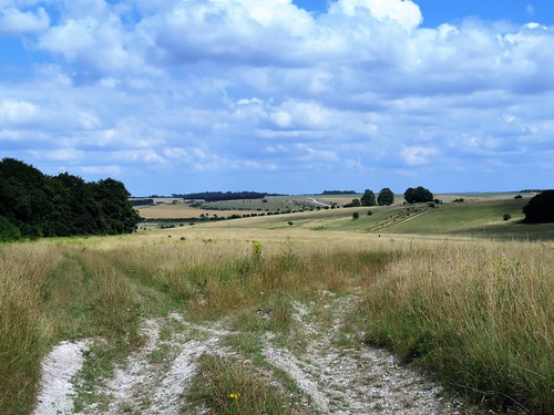
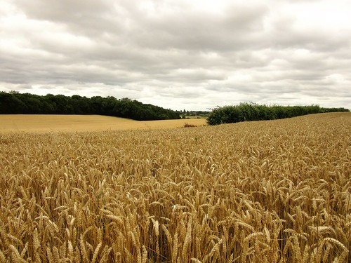
Walk (5½ miles, firm trails, field and woodland paths, OS Explorer 233):
From car park walk anticlockwise circuit of Thornton Reservoir. In 2 miles, just before Visitor Centre, cross weir at NW tip of reservoir (466081); right through kissing gate; follow ‘Leicester Round’/LR up bank to Thornton. Cross road (465079); down Hawthorne Drive opposite (LR). In 250m on left bend, ahead (LR, ‘Bagworth’) across paddock. Left down lane, following LR past Thornton Mill and up to cross railway (459079). LR through Manor Wood for 550m; at yellow-topped post/YTP (454076) left off LR on gravel cycle path to reach lake at Desford Colliery site (458068).

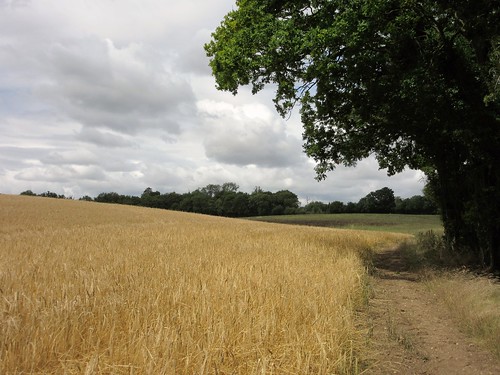
At roadway with car park opposite, right to T-junction. Left along road; in 150m, left through kissing gate (457066, fingerpost); up grass track. Half left to kissing gate (YTP; yellow arrow/YA); path through young woodland. Cross a grass ride (YTP); in 100m, right at T-junction (459065, YA). In 100m, left over stile (‘Permissive Path’/PP arrow); follow PP through Desford Brickworks Wood to recross fence. Left on grass path, which turns left (459062) beside road.

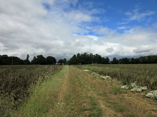
Follow this path for ⅔ mile, parallel with Heath Road and then Merrylees Road, to south-west corner of industrial estate at Merrylees (467058). Left (north) along bottom edge of field, following YAs and YTPs. In ½ mile, right down steps (464066) through industrial area. Ahead (YAs, YTPs) to pass fishing lake, then cross railway and river (465067). Up across a field; in following field, don’t turn left (466069), but keep ahead uphill with hedge on left, following YTP/YA to road (469072). Left past garage; first right to reservoir car park.

Lunch: Reservoir Inn, Thornton (01530-382433, thereservoirinnthornton.co.uk)

Accommodation: Curtain Cottage, 92 Main St, Woodhouse Eaves, Leics LE12 8RZ (01509-891361, curtaincottage.co.uk) – immaculate B&B

Info: Leicester TIC (0116-299-4444); nationalforest.org

www.goleicestershire.com; satmap.com; ramblers.org.uk

 Posted by at 01:08
Sep 172016


First published in: The Times Click here to view a map for this walk in a new window
picture picture picture picture picture picture picture picture picture picture picture picture picture picture picture picture
Facebook Link:

A balmy day on Bushfoot Strand, a day of sun and smoky autumn light. Atlantic breakers curved inshore in three lines of creamy foam, and surfers were defying the ‘Don’t Swim’ notices to catch themselves a wave to remember. Runkerry House sprawled under the far headland with outflung wings and twin towers, its hedges thick with gleaming scarlet rosehips the size of cherry tomatoes.

At the outer tip of Runkerry Point, where a welter of black basalt lay like a spilt brain at the feet of the cliffs, we looked back round the pristine arc of Bushfoot Strand and on along the jutting green cliffs, westward to the distant hills of Donegal. Then we turned east and followed the cliff tops through drifts of harebells and the white rococo trumpets of convolvulus. The path skirted Leckilroy Cove with its dark slit of a cave and toy slipway, and led across the flat grass-grown roof of the futuristic Giant’s Causeway Visitor Centre. We tiptoed gingerly over the skylight windows like cat burglars, and joined the people thronging down the roadway to the Causeway itself.

The Giant’s Causeway, so heavily promoted in tourist literature, is a bird’s-beak of basalt dipping into the sea. It can seem an awful disappointment if you come on it from the wrong angle. ‘Where are the pipes?’ an American visitor was asking everyone in sight. ‘I thought there were enormous pipes rising up…’ and he flung up a hand to indicate a sky-high phenomenon.

If he’d walked beyond the crowded Causeway and on along the mountain path round the next bay, he’d have seen natural wonders to make him gasp – mighty basalt columns fifty feet high, packed together like organ pipes or fossilised monster teeth in a landslip coast of rugged magnificence. Seen from this steep cliffside path, the Giant’s Causeway lay revealed in all its proper enormity, backed by a Dante-esque headland.

We couldn’t resist a ride in the rattletrap old Causeway tram, trundling tick-tack! tick-tack! along its grassy track through the dunes to Bushmills at not many miles an hour, emitting banshee wails as it went. A crunchy return path beside the track, a saunter through the dunes, and we were back on the broad sands of Bushfoot Strand once more.
Start: Beach Road car park (free), Portballintrae, BT57 8RT (OSNI ref C929424)

Getting there: Bus service 172 (Coleraine-Ballycastle); 252 (Belfast-Coleraine)
Road – A2 to Bushmills, B145 to Portballintrae

Walk (6½ miles, easy/moderate, OSNI Discoverer 1:50,000 Sheet 4; ‘Portballintrae Causeway Loop’ instructions/map at walkni.com; online map, more walks at christophersomerville.co.uk): Path to beach; cross footbridge; along beach to path below Runkerry House and on to Causeway Hotel and Visitor Centre (944438). Down steps; road to Giant’s Causeway (947447). Follow Blue Trail past Causeway, under ‘The Organ’ formation (952449), round next corner to path’s end in The Amphitheatre (952452). Back to fingerpost; fork left uphill (‘Red Trail’). Up steep Shepherd’s Steps to top (951445). Return to Visitor Centre and tramway station below. Option 1: Follow path beside tramway; fork right just before river bridge (937426) on dunes boardwalk back to Portballintrae. Option 2: Tramway to Bushmills; path returns beside tramway for 1 mile to cross river (937425); in 100m, left on dunes boardwalk back to Portballintrae.

Lunch: Picnic; Causeway Hotel (028-2073-1210, thecausewayhotel.com) or Giants Causeway Visitor Centre.

Accommodation: Bayview Hotel, Portballintrae, Co. Antrim BT57 8RZ (028-2073-4100; bayviewhotelni.com)

Giant’s Causeway Visitor Centre: 028-2073-1855, nationaltrust.org.uk/giants-causeway

Giant’s Causeway & Bushmills Railway: 028-2073-2844; freewebs.com/giantscausewayrailway. £5 fare. Weekends, BH April-June; daily July, Aug; weekends Sept, Oct.

Northern Ireland’s Year of Food:
discovernorthernireland.com/yearoffoodanddrink2016

www.discovernorthernireland.com; satmap.com

 Posted by at 01:29
Sep 102016


First published in: The Times Click here to view a map for this walk in a new window
picture picture picture picture picture picture picture picture picture picture picture
Facebook Link:

I hadn’t visited Scarborough for 20 years, and my daughter Ruth had never been there in her life. But she’d often pictured the town, a classic among North Yorkshire’s seaside resorts, and on this lovely morning it was more than fulfilling her fantasies. Regency crescents, sweeping sands, the cliffside tumble of the old town, donkey rides, tacky fun palaces and elegant cast-iron arcades, all lay bathed in clear sunshine.

We climbed the many steps to St Mary’s Church on its ridge. Poor Anne Brontë, dead at 29 of the consumption that had already claimed her sister Emily, lies buried here in a flower-strewn plot. The prospect from the cliff railings just above the church must be one of the best on this coast of wonderful views – the big crescent of North Bay rimmed with elegant Victorian hotels and houses, headlands of many-coloured cliffs reaching into the ice-blue sea beyond.

From the northern end of the strand we looked back to the gaunt ruin of Scarborough Castle silhouetted high on the dark ship-like promontory that divides the town’s two sandy bays. From here northwards the bays have a harder edge; they are floored with ‘scars’ or parallel ribs of rock, remnants of strata turned on edge through subterranean upheavals, then ground down by the sea.

The well signposted Cleveland Way took us unerringly north at the very edge of the crumbly cliffs. This is a mineral coast, a working place where alum, jet, iron and coal were dug with pick and shovel out of the cliff faces. We passed headlands delved and eroded by diggings, bays with tiny rough jetties and tramways. Inland it was all gently undulating cornfields and old farms with pale stone walls and red roofs.

The miles flew by. I was amazed to see the great bulk of Ravenscar promontory loom ahead, a signifier that we’d walked a dozen miles at least. A quick cuppa in the tearoom on the headland and we were striding along the curved coastline towards the red roofs of Robin Hood’s Bay, a shovelful of houses thrown down a cleft by some careless giant.

We trod the steep streets of the village on feet that were beginning to feel the miles. Every crooked corner and flight of narrow steps called for the camera; but we had only baths, beers and beds on our minds just now.

Start: South Bay Underground car park, Foreshore Road, Scarborough, YO11 2HD (OS ref TA 045877)

Getting there: Rail to Scarborough. Bus 93 from Whitby. Road – A171 (Whitby), A170 (Pickering), A64 (York), A165 (Bridlington).

Walk (15 miles, easy, OS Explorer OL27. Online maps, more walks at christophersomerville.co.uk): North up South Bay promenade. At NW corner of Old Harbour (047888), left up West Sandgate Terrace; on up steps to church and Anne Brontë’s grave (047891). Up snicket opposite church to railings; left round North Bay to Old Scalby Mills PH (036909). From here, follow well-waymarked Cleveland Way National Trail to Robin Hood’s Bay.
Return: Bus 93 from Thorpe Lane, Robin Hood’s Bay.

Conditions: Some steep flights of steps; unguarded cliff edges.

Refreshments: Hayburn Wyke Inn YO13 0AU, 1½ miles north of Cloughton, ½ a mile off Cleveland Way (01723-870202, hayburnwykeinn.co.uk); Raven Hall Hotel, Ravenscar (01723-870353, ravenhall.co.uk)

Accommodation: 17 West Street, Scarborough, YO11 2QN (01723-361914, 17weststreet.co.uk) – stylish and welcoming stopover.
Victoria Hotel, Station Rd, Robin Hood’s Bay YO22 4RL (01947-880205, victoriarhb.com) – very friendly and full of character.

Information: Scarborough TIC (01723-383636)

www.visitengland.com; satmap.com; ramblers.org.uk

 Posted by at 01:05
Sep 032016


First published in: The Times Click here to view a map for this walk in a new window
picture picture picture picture picture picture picture picture picture picture
Facebook Link:

On this bright windy day the view from the triangulation pillar on Butser Hill was at its very best – the South Downs billowing east and west, Portsmouth and Southampton sprawled far in the south, while out to sea the matt blue bar of the Isle of Wight stretched along the horizon. To the north-east the great hollow of the Devil’s Punchbowl took a bite out of the shoulder of the Surrey Hills.

Dog walkers trotted by, one couple watching their six sheepdogs fan out across the grass. The hilltop was bright with golden bird’s-foot trefoil, sky-blue harebells, bright yellow heads of wild parsnip, and tall plants of marjoram whose flowerheads we crushed between our fingers to savour their pungent smell.

This southwest corner of Hampshire is a tangle of quiet lanes. At the foot of the hill we followed a white chalk holloway, the breathy roar of a harvester percolating through the trees from the cornfields beyond. Oxenbourne Lane was spattered with fallen hazelnuts, their flesh pale green and milky. The scarlet berry clusters of lords-and-ladies grew along Cumber’s Lane, a favourite with off-road drivers. A temporary ban on their activities had resulted in the smoothing out of boggy tyre ruts and a thickening of greenery along the smashed-up verges.

The bald head of Butser Hill loomed on the eastern skyline as we crossed the infant River Meon, dried to nothing in a pebbly bed. Lower Farm and South Farm lay silent, all thatched sheds, flint walls and Dutch barns packed with round straw bales. We passed a run of olive brown ponds, the source of the Meon, and leaned on the bridge to savour twin smells – the tang of mint flourishing in the trickling water, and the sweet aroma of jam in the making that wafted seductively from the open windows of Springhole Cottage.

A flinty track shaded by a magnificent avenue of beech trees brought us south to Tegdown Bottom, where sheep and lambs were crying to one another. At the crest the South Downs Way made east for Butser Hill. The broad old track flickered with the shadows of low-flying swallows fuelling up for their long flight south to Africa – a tiny frisson from the oncoming autumn.
Start: Butser Hill car park, near Clanfield, Hants GU31 5SP (OS ref SU 712201)

Getting there: Butser Hill is signed from A3 between Horndean and Petersfield.

Walk (6¾ miles, easy, field paths and lanes; OS Explorer 120. Detailed directions are downloadable with online maps, more walks at christophersomerville.co.uk). Pass kiosk hut; through metal gate; follow grass path past radio station to pass trig pillar at summit of Butser Hill (717203). Keep ahead down far slope till you meet wide grass track; left along it (717204; occasional red-topped marker posts), through gate and on, keeping fence close below you. In ¼ mile pass a group of tumuli (714208); go through a belt of scrub and begin descending a ridge. Halfway down fork right, aiming for distant church spire. At foot of slope, into trees; in 50m fork left downhill to kissing gate at bottom (706212). Right along chalk holloway lane to Oxenbourne Lane (706217).

Left along lane; in 200m, right; in 175m, left along trackway. In ½ mile, at junction of six lanes in a grassy circle, turn left (696220) along Cumber’s Lane to cross road (696214). Take lane opposite past Fishpond Cottages to road (694211). Right for ⅔ mile past Parsonage Farm to T-junction; left (685210, ‘Clanfield, Horndean’) past Lower Farm. In 250m, left over stile (fingerpost); across paddock, through gate (yellow arrow/YA); left up South Farm drive. Bear right through farmyard and on along lane to cross bridge over ponds (685205; source of River Meon). Follow drive to Upper Barnes (685196); on up green track (YA, fingerpost) for ½ mile to meet South Downs Way/SDW (693190). Left on SDW to road (706191); left to car park.

Lunch: Rising Sun PH, North Lane, Clanfield, PO8 0RN (023-9259-6975, therisingsunclanfield.co.uk)

Accommodation: Upper Parsonage Farm, Harvesting Lane, East Meon, Petersfield GU32 1QR (01730-823490, upperparsonagefarm.co.uk)

Info: Petersfield TIC (01730-268829)

www.visitengland.com; satmap.com; ramblers.org.uk

 Posted by at 01:40
Aug 272016


First published in: The Times Click here to view a map for this walk in a new window
picture picture picture picture picture picture picture picture picture picture picture picture picture picture
Facebook Link:

Gedney Drove End lies at the end of five miles of lonely road, out on the shores of the Wash estuary under the enormous skies of the South Lincolnshire flatlands. It’s a salty, strong-flavoured place, and so are born-and-bred Drove Enders.

From the sea bank beyond Gedney Drove End there must be forty miles of land and sea in view, all of it in narrow parallels of green and purple salt marsh, olive and brown sand and mud flats, ice blue sea and the black distant shores of Norfolk and Lincolnshire shimmering like a mirage. Within the three-sided cup of land that holds the Wash live hundreds of thousands of birds, and countless millions of lugworms, crustacea and other invertebrates that feed them. From the top of the sea wall we watched a lonely figure bending over a spade out on the mud flats, digging lugworms for bass fishing.

We walked the sea bank south, with the great estuary spread out on our left hand and massed fields of peas, kale, wheat and potatoes on our right – the soil here, reclaimed from the sea by the building of the parallel banks, is the richest and most productive in Britain. Down at the wide mouth of the River Nene we stopped to admire the twin white lighthouses that mark the channel.

Peter Scott, founder of the Wildfowl & Wetlands Trust, lived in the lighthouse on the east bank in the 1930s. It was on these marshes that he shot and wounded a goose, and saw it fall on inaccessible ground where it took three days to die. The experience haunted him, and was the catalyst for his conversion from wildfowler to dedicated conservationist.

Before turning back along the Old Sea Bank through the arable fields to Gedney Drove End, we dropped down the outer slope of the sea wall and followed a muddy path through boot-high thickets of samphire to the edge of the marsh. Redshank cried, the wind hummed and brought smells of salt and mud, and up on the sea bank a flock of starlings squabbled for insects brushed out of the grass by a herd of slowly lumbering bullocks. I could cheerfully have stayed there all day.
Start: Village Hall car park, Gedney Drove End, Lincs, PE12 9NW (OS ref TF 461295)

Getting there: Bus – Long Sutton Call Connect (0345-234-3344; book in advance)
Road – Gedney Drove End is on B1359 signed off A17 between Long Sutton and Holbeach. At T-junction in village, left to car park in 200m.

Walk (7½ miles there-and-back; easy, OS Explorer 249 – NB: online maps, more walks: christophersomerville.co.uk): Back towards T-junction; in 200m, left (fingerpost) to Old Sea Bank (464296). Right for 250m; left up road to cross T-junction (469296). Ahead up path to sea wall (472298). Right for 2¾ miles to gate at River Nene mouth (492264). NB Old Sea Bank (see below) can be overgrown approaching Marsh. To avoid this stretch, return along sea wall from Nene mouth to Gedney Drove End. To continue round walk from gate, turn right along bank to road (486263); right for 600m; at left bend, keep ahead (482268, fingerpost) along Old Sea Bank (can be overgrown) for ¾ of a mile to road at Marsh (477279). Right; at left bend (478283), right to sea wall (481285). Left to Gedney Drove End.

Lunch: Rising Sun PH, Gedney Drove End (01406-550734)

Accommodation: Woodlands Hotel, 80 Pinchbeck Road, Spalding, Lincs PE11 1QF (01775-769933; woodlandshotelspalding.com) – comfortable, very friendly.

Info: Spalding TIC (01775-764551)

Yorkshire Wolds Walking & Outdoors Festival: 10-18 September; theyorkshirewolds.com

www.visitlincolnshire.com; satmap.com; ramblers.org.uk

 Posted by at 01:16
Aug 242016


First published in: The Times Click here to view a map for this walk in a new window
picture picture picture picture picture picture picture picture picture picture picture picture picture picture picture picture picture picture picture picture picture
Facebook Link:

The Royal Geographical Society has just launched its ‘Discovering Britain’ project (discoveringbritain.org), exploring dozens of landscapes through walks great and small. On a gorgeous summer’s afternoon we set out from the Wiltshire village of Tilshead to follow one of the RGS walks through the heart of Salisbury Plain.

Stepping off the road into the vast Ministry of Defence preserve of Salisbury Plain feels like slipping through the screen of time into the pages of a book by Edward Thomas or W.H. Hudson. The past hundred years might never have existed. Here are no motor roads, no housing developments, no industry. These dense, flower-rich, unimproved chalk grasslands, Europe’s most extensive tract, have never known modern ploughing or farm chemicals. They have remained in this pristine, prelapsarian state thanks to the activities of the MoD, which uses the plain for military training to the exclusion of all other activity.

A mile or so down the white-dusted chalk track we passed the enormous Old Ditch long barrow, one of the longest in UK, over 400ft from end to end. These ancient monuments, too, have escaped the plough and the developer’s JCB – though one or two have occasionally collided with a tank.

The richness of the chalk grassland flora had us exclaiming out loud – a palette of colour and variety really astonishing to walkers accustomed to the thin pickings of England’s 21st century landscapes. Vivid royal blue of viper’s bugloss, round lacy powder-puffs of field scabious, buttery sprigs of yellow rattle, sanfoin’s convex pink petals like stripy Shakespearean breeches. Butterflies kettered and zigzagged over the grasses – clouded yellows, small skippers, marbled whites, chalkhill blues. Over all lay the soporific hum of bees and hoverflies busy among the flowers.

There were one or two soldiers, of course – cheerful, courteous men who stopped their bouncing carriers to enquire whether we were having a nice day before roaring off into the ‘German village’. This mock-up of a Bavarian township was built for Cold War practice against imaginary Russian invaders on the plains of Germany, and is still in use for training soldiers in fighting techniques in built-up areas.

We left the eerie, hollow-eyed dummy houses behind and took the homeward track across the flowery grasslands among pink mallows and great purple knapweed blooms. There are hidden hazards for the unwary in this timeless paradise, though. One of us stepped onto an innocuous-looking mud patch, went in up to the hips, and had to be hauled squelchingly out. It wasn’t me, that’s all I have to say on the matter.

Start: Rose & Crown PH, Tilshead, Wilts SP3 4RZ (OS ref SU 033480)

Getting there: Bus service 2, Devizes-Salisbury. Road – Tilshead is on A360 between West Lavington and Shrewton.

Walk (7 miles, easy, OS Explorer 130): From Rose & Crown, left along A360. In 150m, right beside Ash Tree House gateway. Follow this lane (‘Restricted Byway’) for 500m to A360 (030479). Left; in 100m, on right bend, ahead up minor road (‘Chitterne’). At top of hill, left (024476, ‘No access for civilian vehicles’). Pass water tower on right; in 50m, fork right along main track. Into dip; ahead uphill to go through trees. In 100m, right (026469) with beech belt, then Long Barrow on right. In ⅔ mile, left (017465) on gravel road. Into dip; at top of rise beyond, right (019456, ‘Byway’) through trees. At 3-way fork just beyond, take right-hand track, passing mock village on your left.

In ½ mile cross gravel road (012455); in 150m, left up dirt road. In ½ mile at 6-finger post (013448) take 2nd track on left (‘Permissive Byway’), passing to right of mock village. In ½ mile, at crossroads with Byway signs pointing behind and ahead (021452), left between hedges. In 200m at ‘village gates’, right (020455, ‘Byway’). In 300m, ten metres before T-junction, left (023455, green ‘Byway’ sign/GB) up rutted, grassy track.

In ½ mile pass trig pillar on right, then cross gravel road (028462, GB). On along grassy track, with Westdown Camp ahead. In ¼ mile join gravel road (031467, GB) and continue past White Barrow (033469). In another ¼ mile, just short of A360, left (035471, ‘Imber Range Path’) on grassy track. In 700m, right (‘Restricted Byway’) to A360; left to Rose & Crown.

Lunch: Rose & Crown, Tilshead (01980-621062, roseandcrowntilshead.com)

Accommodation: Rollestone Manor, Shrewton SP3 4HF (01980-620216, rollestonemanor.com)

Info: Salisbury TIC (01793-530328 or 466454)

www.visitengland.com; satmap.com; ramblers.org.uk

 Posted by at 13:30
Aug 062016


First published in: The Times Click here to view a map for this walk in a new window
picture picture picture picture picture picture picture picture
Facebook Link:

A breezy, hazy summer’s day on the West Sussex downs, with the stubbles of the recently harvested wheat crop crunching beneath our boots as we crossed the fields from Sutton’s old White Horse Inn to Barlavington Farm. Behind the weatherboarded barns we found St Mary’s Church, plain and graceful under its rafters. A plaque inside commemorated Amy Louisa Bragg, ‘a pioneer in the backblocks of New Zealand,’ and another in the churchyard was marked simply: ‘Stan Mayes, 1917-2014 – A Countryman.’

It was Sussex countrymen, generations of them, who coppiced the ash trees by the sunken holloway up the wooded slopes of Barlavington Hanger; and countrymen who ploughed up the sheep pasture across the heights of Barlavington Down for wartime crops. Gold tides of wheat and barley still roll across the downs. Up there we found a sloping haven of old-fashioned flowery sward grown long and ungrazed – field scabious, yellow-wort, eyebright and harebells, yellow rattle and agrimony. Common blue butterflies flickered among the yellow plants, the males all a dusty blue, the females with orange and black scallops to the edge of their wings.

We sat down to admire the view along the downs, perching on a stone inscribed in memory of Sir Ian Anstruther of that Ilk, local squire, writer and splendid gentleman (he drove an Aston Martin DB5, was once stopped by the police for driving too slowly, and always dressed for dinner in velvet slippers with bells on the toes). Then we followed flinty tracks that dipped and rose to Bignor Hill before wriggling away down the holloways to West Burton and the field path to Bignor.

‘When my great-great-great-great grandfather George Tupper struck a large stone whilst ploughing on the 18th of July 1811…’ begins the foreword of the guidebook to Bignor Roman villa. The Tupper family owns the site today, as they did two centuries ago when the villa with its tiles and statues, its lead water pipes and wonderful mosaic floors was unearthed at the clang of George Tupper’s horse plough.

It was the mosaics, so skilfully and sensitively crafted, that caused us to linger in the villa until closing time. Ganymede in the embrace of an eagle, child-like gladiators tumbling and sparring, a bathing beauty naked to the waist – and as a chill corrective to the luxurious life, a cameo of Winter with pinched white cheeks and hollow eyes, clutching a leafless twig. The Romans, too, had intimations of mortality.

Start: White Horse Inn, Sutton, West Sussex RH20 1PS (OS ref SU 979152)

Getting there: Bus 99 (Chichester-Petworth).
Road – Sutton is on minor road between A29 at Bury and A285 near Duncton.

Walk (8½ miles, moderate, OS Explorer 121): Up path beside White Horse car park. At ‘Private’ gate sign, right through adjacent gate. Up steps; right (yellow arrow/YA) past barn and on through garden into field. Half left across field; cross bridleway (976155, fingerpost/FP) and on to cross footbridge (975158). Half right across field, up to cross stile; left up hedge, then green lane to Barlavington Farm. Opposite barn, left (973161, FP) to chapel.

Follow path through churchyard to far corner; left (YA) along lane. In 100m (971161), right up gravel path and on (YA) along green lane to cross road (970162, FP). Up steps, along field edge; cross stile beside gate; on to cross road (968164). Through pedestrian gate, up green lane into woods of Barlavington Hanger (966162). In 400m, at fork of bridleways (963160, 3-finger FP) keep ahead uphill. Path rises, then falls to cross green lane at corner of Northcomb Wood in valley (963152). On south up path across field; on through Access Land. Through gate at south end of Access Land (963144); on in tunnel of trees. In 450m, at T-junction (962140, 3-finger FP), bear right; in 20m, arrow points uphill along chalk track. In ½ mile, pass NT ‘Bignor Hill’ sign (966133) and keep ahead along track for 900m to car park (974129).

Cross road; on up hedged track over Bignor Hill along South Downs Way (SDW). In ⅔ mile pass Toby’s Stone (983132); in another 400m, left (SDW), descending for 400m to T-junction of tracks at 3-finger FP (989132). Left (SDW) to another T-junction with barns to your right; left here; immediately right; then immediately fork left on grassy path through trees. Descend for ⅔ mile to road junction in West Burton (996139). Left (‘West Sussex Literary Trail’/WSLT); path beside stream, then along field edges, following YAs for ¾ mile to road (986144). Right for 100m; left to Bignor Roman Villa (988147).

Back at Roman Villa car park entrance, turn right through tall deer gate (unwaymarked) along path to road in Bignor (984146). Right (WSLT); round left bend; opposite church, left (982146). In 100m, right through gate (WSLT); on across a lawn; on along grassy path, then beside stream to Bignor millpond. At T-junction of paths (981148, FP), right to cross footbridge; cross 3 fields to Sutton.

NB: Detailed directions are recommended. Download them with online maps, more walks at christophersomerville.co.uk.

Lunch/accommodation: White Horse Inn, Sutton (01798-869221, whitehorse-sutton.co.uk) – smart, well-run inn.

Bignor Roman Villa: Open 10-5, March-Oct; 01798-869259, bignorromanvilla.co.uk

Info: Chichester TIC (01243-775888)

www.visitengland.com; satmap.com; ramblers.org.uk

 Posted by at 01:09
Jul 302016


First published in: The Times Click here to view a map for this walk in a new window
picture picture picture picture picture picture picture picture picture picture picture
Facebook Link:

A village shop with a café in the back, spick, span and cheerful; a redundant phone box stuffed with leaflets on walks from the local pubs; barbecues, community hall hops, walking clubs – the twin Hertfordshire villages of Thundridge and Wadesmill are in rude good fettle, and proud of it. We stayed at the Feathers in Wadesmill, and set out full of bacon and bonhomie into a cold summer’s morning.

Grey clouds scudding horizontally from the west had persuaded the local farmers to halt the harvest temporarily. We walked the flinty margins of half-gathered fields of barley and oilseed rape. It was the time of year when wayside plants are drying up – docks the colour of rusty iron, mallows hanging limp. A fine patch of dandelion-headed bristly ox-tongue showed pale green leaves peppered with white pimples like a teenager’s morning-after complexion. Great willowherb stood tall and pink in soldierly ranks in the hedges, and bindweed opened white trumpets along the verges.

We came to Bengeo Temple Farm, the name an invitation to speculate. Back in early medieval times the farm belonged to the Knights Templar, and there have been persistent rumours of a great treasure buried there by the order on their dissolution. Today we had the flashing silver of oat seeds and the dull gold of heavy wheat as treasure of another kind to enjoy as we walked on towards Sacombe Park. The big yellow brick house stands among trees in broad parkland where truncated oaks sprout their limbs from tub-shaped trunks.

From Sacombe Green a Roman road under the name of Lowgate Lane runs east, and we followed it through the blackening bean-fields. There’s something irresistible about marching a Roman road, imagining the dusty sandals of the soldiers rising and falling in step. We turned off Lowgate Lane reluctantly, but the southward path to Wadesmill proved an absolute beauty in its own right. It clings to the rim of The Bourne, an extraordinarily deep seasonal stream, dry as a bone at this time of year as a ravine at least forty feet deep in places, with flood-sculpted promontories and the pale skeletons of fallen trees jammed across it like primitive bridges.

The sun came out from behind the clouds, the barley heads drooped and waited for the harvester, and the woods stood along the ridge as thick and black as pitch. It all added up to a perfect picture of a corn-filled land at harvest time.

Start: Feathers Hotel, Wadesmill, Herts SG12 0TN (OS ref TL 360176)

Getting there: Bus 331 (Hertford-Royston).
Road: Wadesmill is on A10, 2 miles north of Ware

Walk (6 miles, easy, OS Explorer 194): Left along A10; right at Anchor PH down B158. In 200m, right (‘Public bridleway 35, Sacombe 2’) up field edge. At top (356177, yellow arrow/YA), left; in 200m, right (YA) up line of telephone posts. Ahead along field edges. Keep left of Chelsing Farm; cross drive (350178, YA); cross field and keep ahead along field edges. Down steps in Bourne Wood; at bottom, right (342178, YAs), then left up gravel track. In 100m, right through hedge (YA); ahead with hedge on left. At end of brick barn at Bengeo Temple Farm, left through kissing gate (340179). In 30m, right (YA) up gravel track (NB not farm drive!), which becomes green lane along field edges.

In ½ mile pass reservoir and turn right along driveway (333184, white arrow). In 500m at cattle grid and lodge house, fork left (336189, ‘Sacombe House’, blue arrow/BA). In 100m, fork right along driveway. In 350m, just past Sacombe House, left at crossing of tracks (339191, BA). In 200m, fork left by The Red House (BA). In 500m, right at road in Sacombe Green (342196); fork immediately right (‘High Cross’). In 100m, left (‘Footpath, Lowgate Lane’); continue with hedge, then tree nursery on right for 300m to road (345198). Right; at next corner, keep ahead along Lowgate Lane. In ½ mile, opposite Lowgate Lodge, right (353202, BA) on bridleway beside The Bourne stream. In just over a mile cross a road (358187); continue (‘Wadesmill ¾’) on path to Wadesmill.

Lunch/Accommodation: Feathers Hotel, Wadesmill (01920-462606, www.oldenglishinns.co.uk/feathers-wadesmill) – very cheerful, friendly and welcoming village inn.

Info: Hertford TIC (01992-584322)

www.hertfordshirelep.com/enjoy/; satmap.com; ramblers.org.uk

 Posted by at 01:23
Jul 232016


First published in: The Times Click here to view a map for this walk in a new window
picture picture picture picture picture picture picture picture picture picture picture picture
Facebook Link:

Crooked houses, colour-washed in apricot and cream, pink and burnt orange, line Kersey’s single village street that slopes from the high-perched church to the water-splash in the valley bottom. Suffolk has dozens of beautiful villages, enriched through medieval wool wealth and dignified through age, but none matches Kersey for sheer eye-catching perfection. The rippling water-splash reflected a blue sky as Jane and I set out up the street with our long-term friend Patsie for company.

On the outskirts of Kersey we noticed a gathering of wasps, questing round a hollow in a hedge root. Looking in, we saw their nest – a wall of papery fibre, the colours of white and milk chocolate. A cleanly cut footpath led us away across an enormous prairie field, a mile of hedgeless upland where oak spinneys stood marooned. At first sight the field seemed bereft of all wild flowers, but a closer look showed scarlet pimpernel, speedwell and tiny pink cranesbills in the cracked soil, while stands of great willow-herb grew in strips where the ditches used to be.

A sea-urchin fossil lay half smothered in the mud among flints and pebbles. I dug it out and held it up to admire the tiny rows of sockets where the urchin’s spines had grown. When it lived and died, perhaps 200 million years ago, warm tropical seas had stretched where we now stood – a concept that never fails to strike wonder in the imagination.

A tangle of quiet lanes led us to the chapel of St James. Back in medieval times, the tiny church and its priest lay under the control of the lords of Lindsey Castle. The proud castle is now a tumbled heap in an adjacent field; the humble chapel, built of roughly knapped flints nearly 800 years ago, stands renovated under its wooden Tudor roof. This simple prayer room was restored after centuries of use as a barn.

Our way ran on south over arable country. Down by the stream in Kersey Vale we sheltered in a hazel grove while rain pattered on the leaves and thunder groaned in the distance. The shower hissed away, the insects flew out of hiding to sun themselves, and flights of swallows swooped after them along the homeward path.
Start: Bell Inn, Kersey, Suffolk, IP7 6DY (OS ref TM 000442)

Getting there: Bus 112 from Hadleigh. Road – Kersey is signed off A1141, 2 miles north of Hadleigh

Walk (6¼ miles, easy, OS Explorer 196): From Bell Inn, uphill away from water-splash. At right bend, ahead up path to road (TL999443). Left; at left bend, right (997444) through hedge gap; north along field edge. In 500m, at hedge corner, left/west (995450, yellow arrow/YA) across field, past spinney (991450, arrow) and on to reach trees (985452). Into trees; in 15m, left through thicket into field (984452). Ahead with hedge on right to road (982450). Left; in 400m at T-junction, left (980447, ‘Kersey’) to T-junction (9814444). Right for 350m to St James’s Chapel (978444).

Return to T-junction (981444); ahead for 150m; right (982444, fingerpost) on path through trees. On across fields (yellow arrows) for ¾ mile to road (986433). Right to T-junction in Kersey Tye (985431). Left round left bend and continue (‘Kersey’) for 450m to T-junction. Left (90430, ‘Kersey’); in 100m, in Kersey Upland, right (‘Polstead’). In 200m, fork left off road beside Harts Cottage (992428) down gravel lane. In ¼ mile, where tree tunnel ends, left (995425) along field edge. In 100m, keep ahead with hedge on left, descending to stream (001427). Left (YA). In ¼ mile pass Vale Cottage (003430); in 100m at wood edge, left, then right down drive (fingerpost). Drive becomes tarmac lane; follow it for ½ mile past houses to road with Kersey church seen ahead (002437). Right; in 100m, left (‘Kersey St.’) into Kersey.

Lunch: Bell Inn, Kersey (01473-823229, kerseybell.co.uk)

Accommodation: The Gables, Hadleigh IP7 5EL (01473-828126, thegableshadleigh.co.uk) – everything just right, and very welcoming. Dinner at The Ram, Hadleigh (01473-822880, thehadleighram.co.uk) – upmarket cooking.

Info: Lavenham TIC (01787-248207)

http://visithadleighsuffolk.co.uk/; visitsuffolk.com; satmap.com; ramblers.org.uk

 Posted by at 01:25
Jul 162016


First published in: The Times Click here to view a map for this walk in a new window
picture picture picture picture picture picture picture picture picture picture picture picture picture picture picture picture picture picture picture picture picture picture picture picture
Facebook Link:

Forvie National Nature Reserve lies on the Scottish coast north of Aberdeen. This spectacular reserve contains nearly two thousand acres of sandy beaches, open moorland, estuarine mudflats and a great wilderness of ancient green sandhills that stretch away south from the Visitor Centre at Collieston.

On a brisk, windy day with a cloudy sky hurrying rain showers out to sea, the dunes looked dun and drab as we followed the coast path among their shaggy camel humps. But that first dull impression gave way to astonishment at the richness of their flora – spatters of white heath bedstraw, stout northern marsh orchids with richly purple flower heads, pink streamers of ragged robin, wild pansies with lower lips of cream and yellow. Lichens, mosses and heather combined to lay a subtly-coloured foundation for these floral glories of the sandhills.

At North Broad Haven a sour fishy whiff heralded a teeming colony of kittiwakes. We lay on the cliff edge above a guano-whitened sea stack where a row of cormorants sat on a line of untidy nests. The nestlings craned their heads up to rub the throats of their parents, stimulating them to regurgitate the fish they’d brought back in their crops.

Down on the beach at Rockend we strode south on firm sand to the boundary of the ternery. Here sandwich, common and little terns have their summer breeding ground; and once we had crossed the dunes and were perched looking down on the Ythan Estuary, we could see them lined up head to wind in hundreds on the mud flats. Beside our homeward path along the river a great congregation of eider ducks lay moulting, the males with green neck flashes and black toupés with centre-partings like 1920s cabaret cads.

Eiders flock to Forvie in their thousands in spring to nest on the moors behind the dunes. These handsome, bulky birds gobble the estuary’s mussels whole, grinding them small in their gizzards. Forvie NNR offers the eider a place of safety, as it does the terns, the wild flowers and the dunes that have been growing and shifting along this coast since Stone Age man came hunting here.

Start: Forvie NNR Visitor Centre, Collieston AB41 8RU (OS ref NK 034289)

Getting there: Bus 63 (Aberdeen-Peterhead) to Collieston Cross (1½ miles).
Road: Forvie NNR is signed off B9003 Collieston road (from A975 between Newburgh and Cruden Bay).

Walk (8½ miles, easy, OS Explorer 421. Online maps, more walks at christophersomerville.co.uk): From Visitor Centre follow ‘To The Reserve.’ Through gate; turn left along gravel track towards line of cottages (Red Route or Heath Trail, with occasional waymark posts). Along right side of Sand Loch to coast (036281); right along dune path above sea. In 1½ miles, descend to beach at Rockend (023265). Continue along beach for ¾ of a mile to rope barrier at ternery (014253). Turn right into dunes past tern sign on pole; follow Dune Trail to Ythan Estuary (009254). Right up estuary path for 1 mile. Opposite info shelter, turn right (005269). Follow Dune Trail posts for 1 mile to Forvie Kirk ruin (021266); then follow ‘Hackley Bay’ to coast (023265). Left up coast for 1¼ miles. At Red Route post (033276), left inland on Heath Trail. At marker post at far side of small loch, don’t turn right; keep ahead. At ‘Shortcut’ post bear left; at next post, fork left (032284) to return to Visitor Centre.

Lunch: Picnic

Accommodation: Thistle Aberdeen Airport, AB21 0AF (01224-725252; thistle.com)

Forvie NNR: Visitor Centre, 01358-751330, nnr-scotland.org.uk

visitscotland.com; satmap.com; visitaberdeen.com

 Posted by at 01:39