Jul 092016


First published in: The Times Click here to view a map for this walk in a new window
picture picture picture picture picture picture picture picture picture picture picture picture picture picture
Facebook Link:

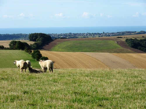
The shepherd came bouncing up the long flank of Home Bottom on his quad bike, three frisky sheepdogs in attendance. ‘The sheep? Oh, they’re doing all right. Off to be shown soon, and then we’ll sell ’em, all the black-faced ewes. That old red Sussex bull down there? That’s Del-Boy; you can walk right up to him and he won’t say a word. Cold wind today? Hah! This is warm! You should be up here on top of the downs in winter time, in the snow and a north wind – then it does bite a bit!’

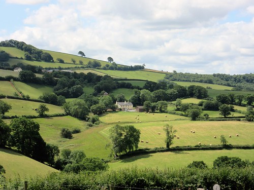
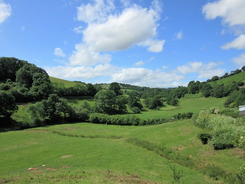
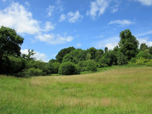
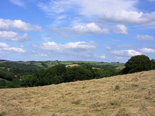
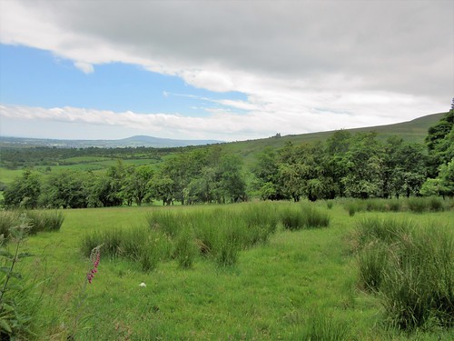
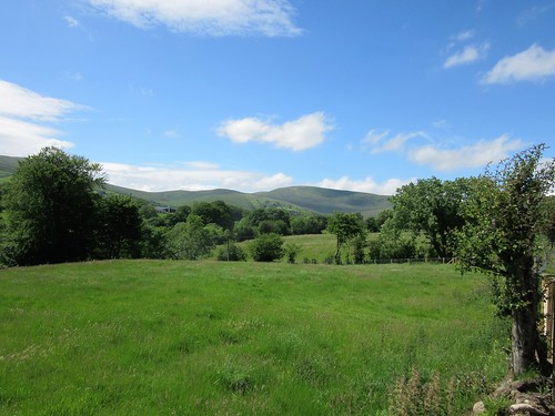
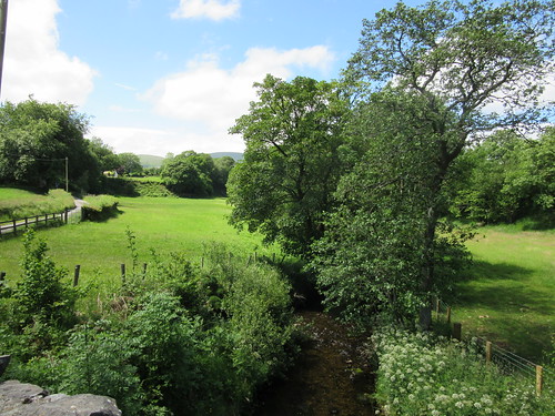
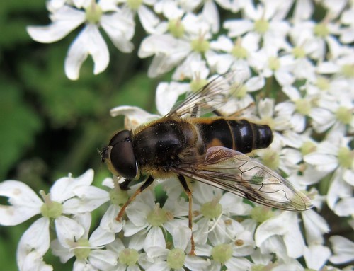
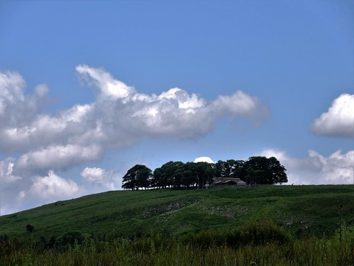
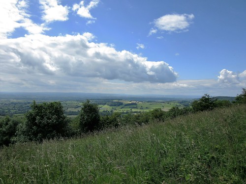
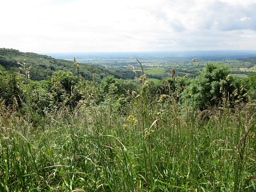
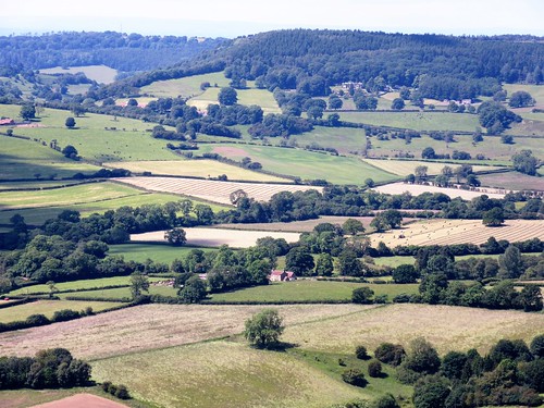
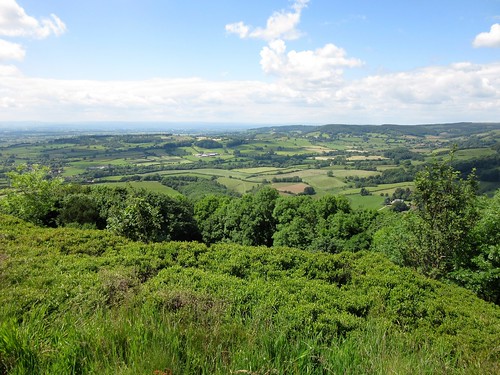
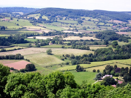
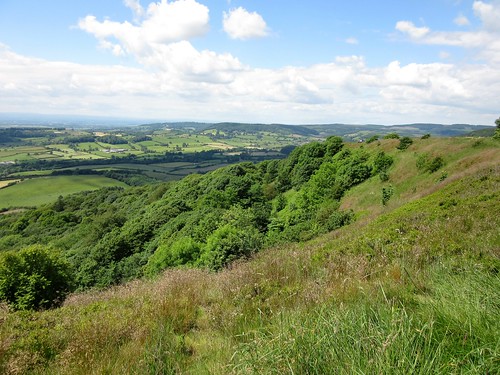
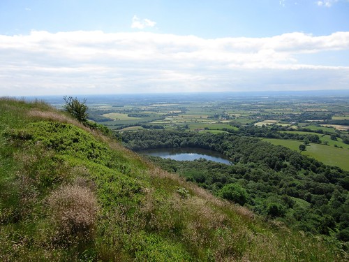
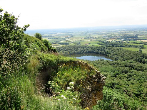
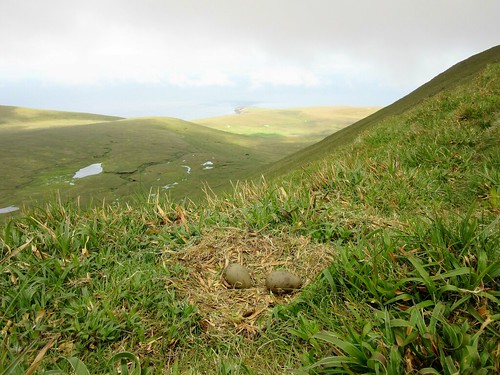
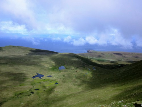
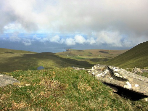
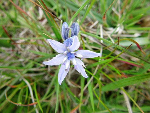
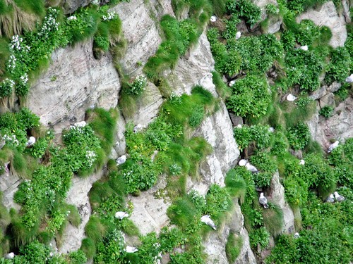
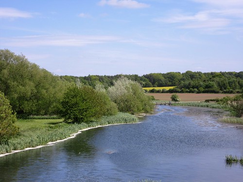
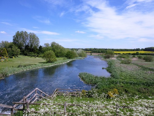
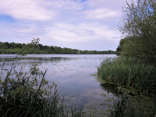
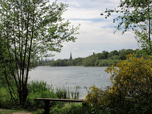
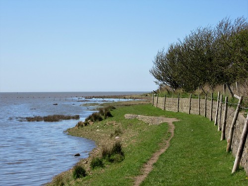
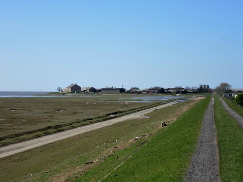
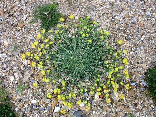
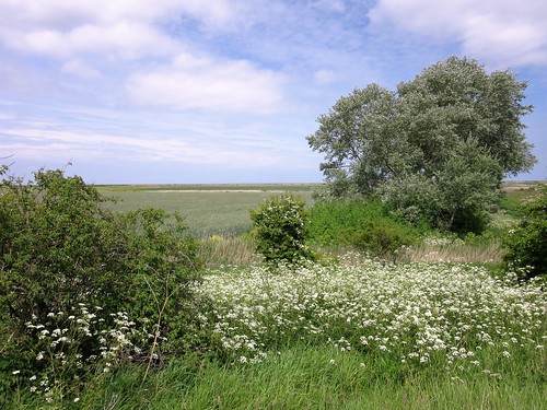
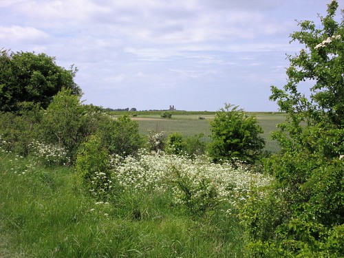
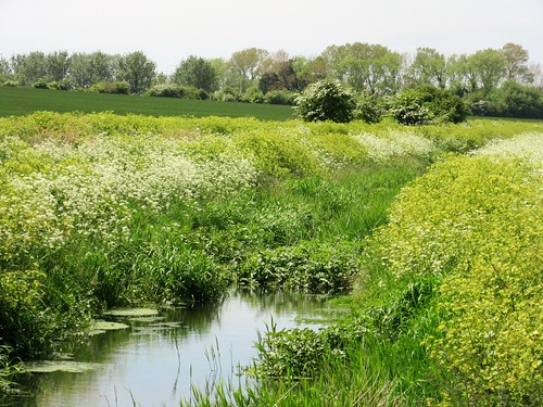
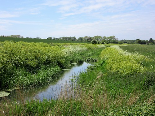
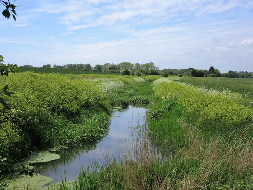
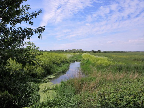
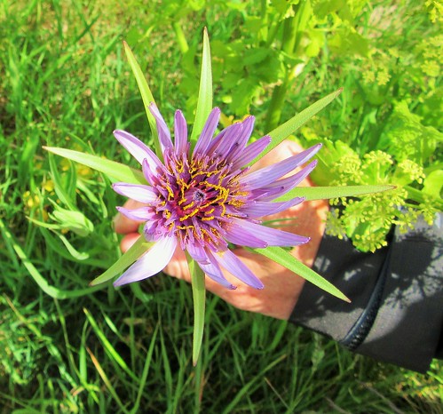
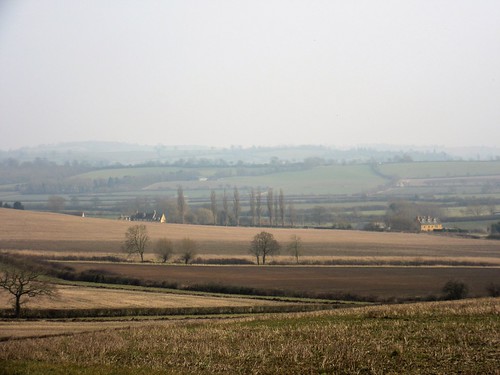
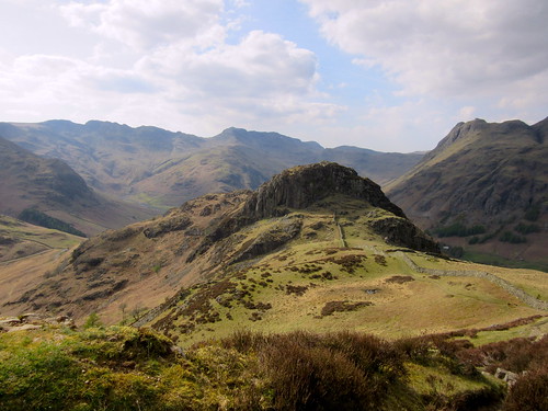
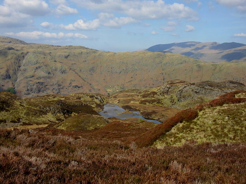
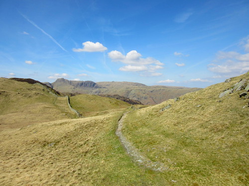
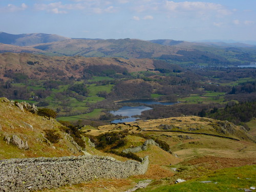
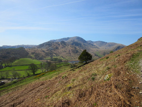
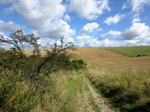
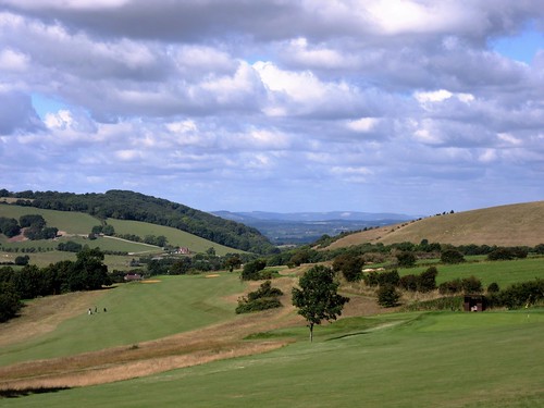
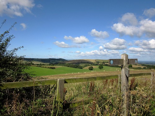
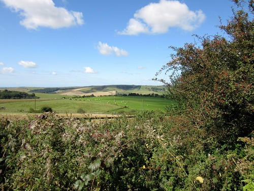
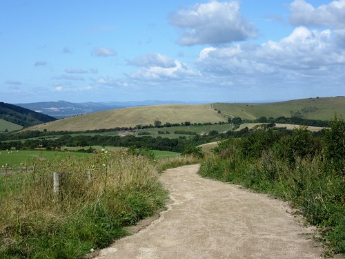
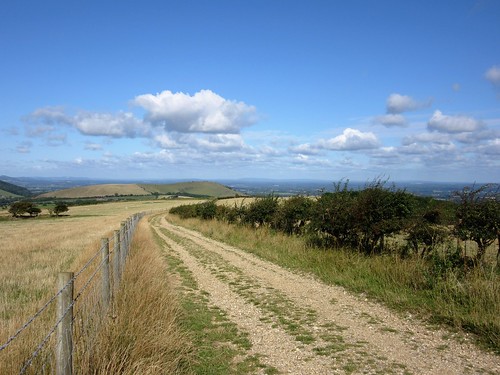
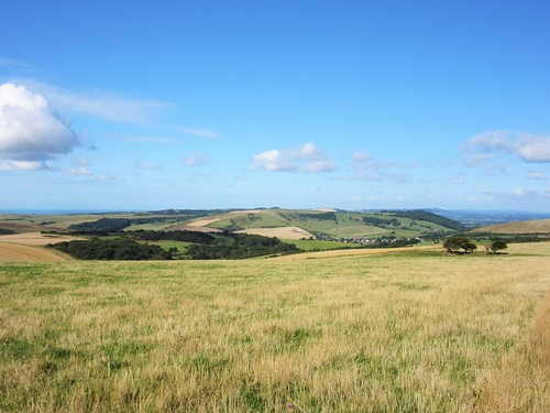
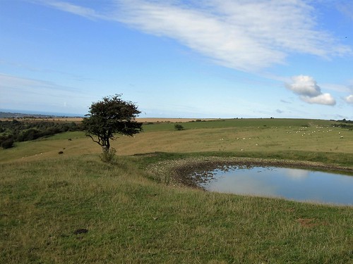
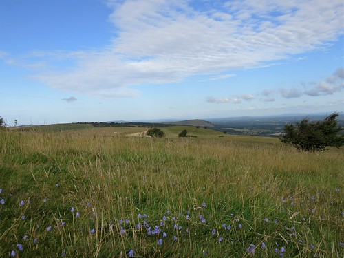
These are the sort of things you never learn unless you stop and chat a while. We bade shepherd and sheepdogs goodbye and walked on past circular dewponds and Bronze Age tumuli. Up here above Brighton the South Downs National Park boasts some of its most spectacular scenery, a great circle of East and West Sussex, north for fifteen or twenty wooded miles, south through the dips of Hogtrough Bottom and Home Bottom across the massed roof of Brighton to the sea. In Ditchling Beacon nature reserve, the wild flowers provided us in their close-focus way with as dramatic a spectacle as the view – harebells thickly sprinkled, mauve feathery bartsia, purple knapweed and sky-blue chicory, bright yellow froths of lady’s bedstraw and fragrant pink thickets of wild marjoram.

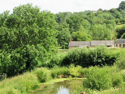
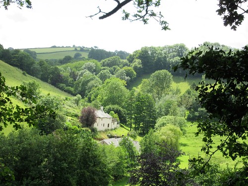
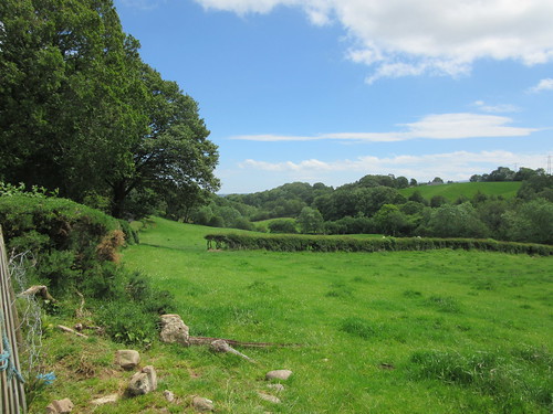
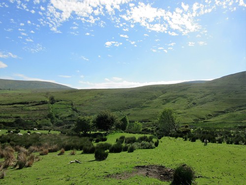
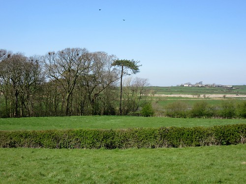
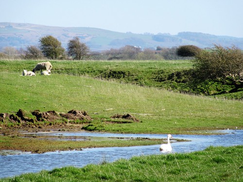
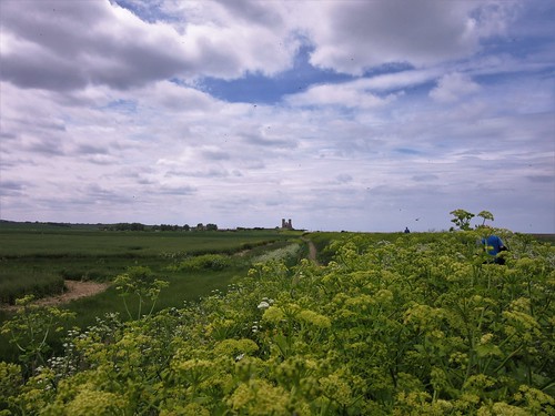
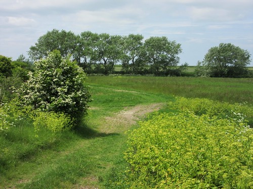
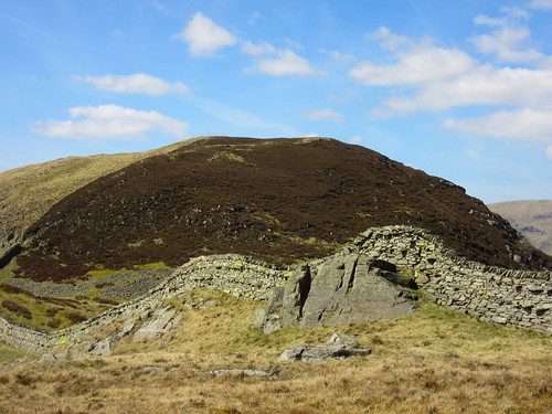
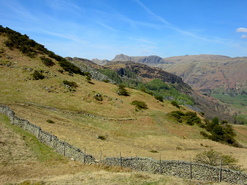
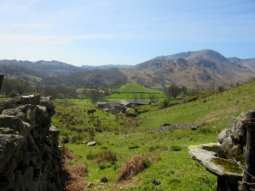
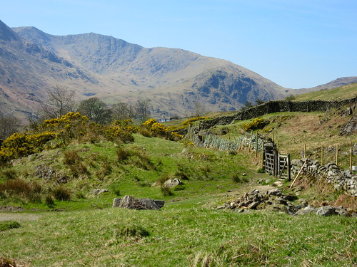
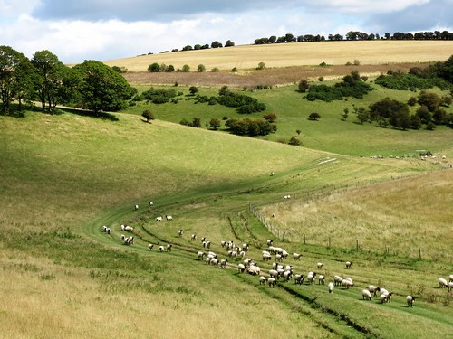
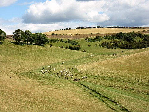
The Clayton windmills stood breasting the north wind on their ridge, Jill in her white weather-boarded smock, black capless Jack skulking in the trees behind. Here we left the South Downs Way and the panoramic ridge, plunging south into the sheltered bottoms or steep dry valleys that seam these chalk downs. Beyond deep-sunk Lower Standean farm we found another shepherd working his sheep in the pastures of North Bottom, the man flying up and down the slopes on his puttering quad, the dogs racing round behind the flock, the sheep on the canter, every lamb and ewe bleating so that their panicky voices filled the valley, high and low. When all were corralled and their wobbly laments stilled, the three dogs took a leap into a drinking trough and splashed about there luxuriously.

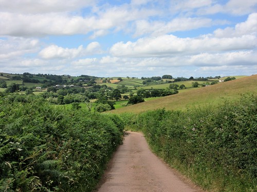
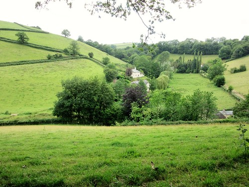
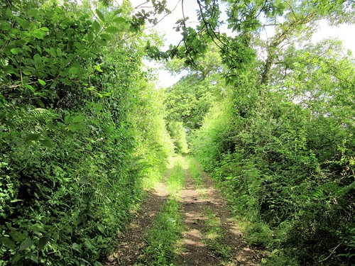
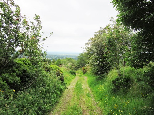
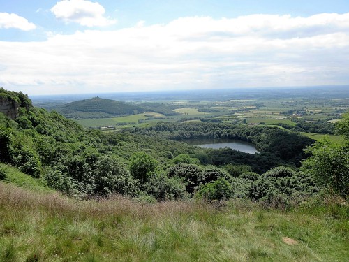
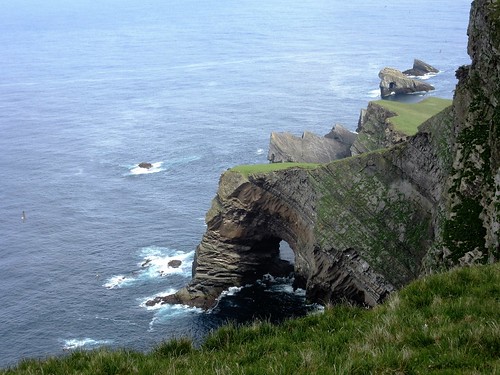
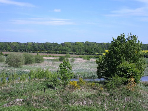
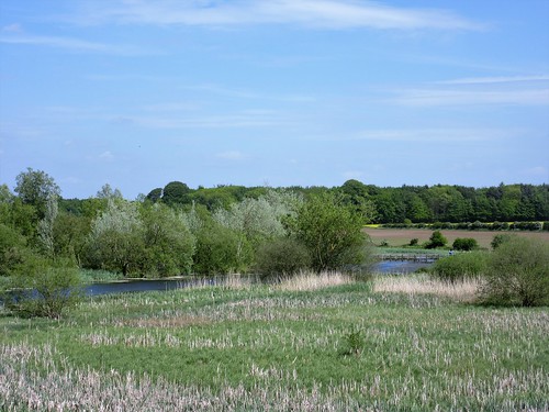
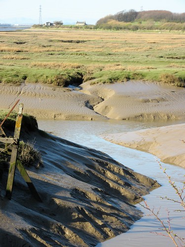
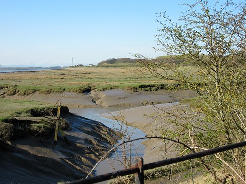
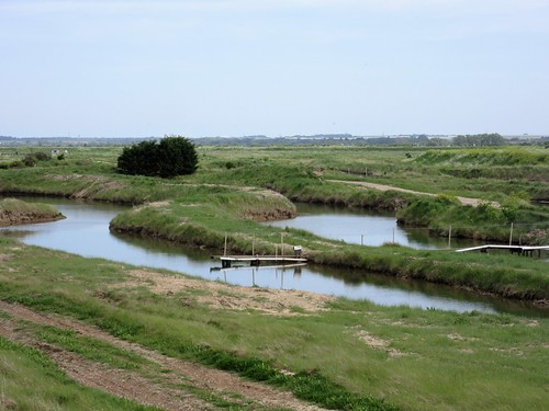
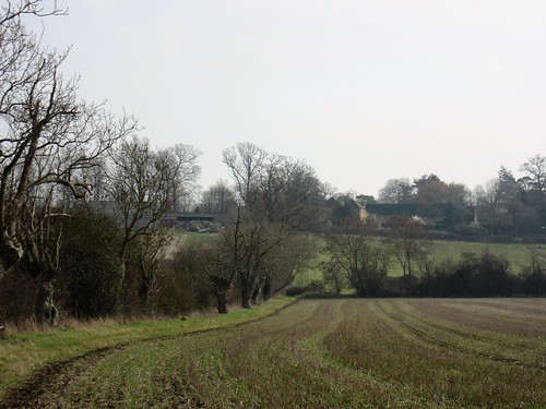
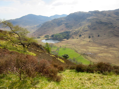
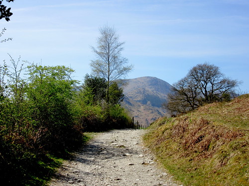
We swung north for the homeward stretch up a nameless bottom, opening on a far view of brilliant white cliffs, the scuff of our boots in the chalk and flint of the path the only sound in this secluded and now silent hollow of the downs.
Start: Ditchling Beacon car park, near Brighton, East Sussex, BN6 8RJ (OS ref TQ 333130) – £2/day (NT members free)

Getting there: Bus 79 from Brighton. Road – Ditchling Beacon signed from Underhill Lane near Ditchling (B2112 from Clayton on A273 Brighton-Burgess Hill road).

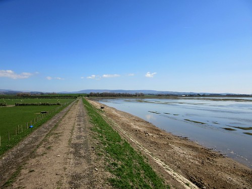
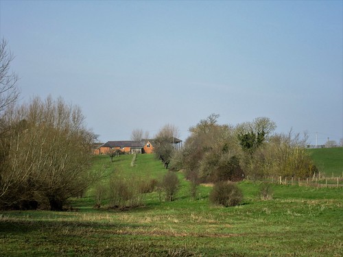
Walk (8½ miles, easy/moderate, OS Explorer 122): Head west from car park along South Downs Way/SDW; through gate into nature reserve. In 100m pass boundary stone; in another 50m, fork right off SDW on grassy path through top edge of Ditchling Beacon Nature Reserve, then back onto SDW. On for 1¾ miles to Jack and Jill Windmills (303133). Right across car park; at far side, right on bridleway (blue arrow/BA) to rejoin SDW. Left for 150m; fork right (305132, SDW, ‘Devil’s Dyke’). 100m beyond New Barn Farm, SDW turns right, but keep ahead (306129, BA, ‘Chattri War Memorial)’. In ½ mile, left at 3-finger post (307121); at gate, right (BAs); in 200m, left through gate (308119, waymark arrow 44). In 150m, at gate on right, cross Sussex Border Path (309117); keep ahead, down to Lower Standean farm.

Pass sheds; 100m before house, left (316115) and pass to left of pond. Bear right along lower edge of trees, following path as it curves left to meet pebbly track (318116). Right along track. In 400m, just before cross fence, right through gate (321118); left with fence on your left through North Bottom. Through gate in valley bottom (326118); in 350m, before next gate, right along fence (328121) to cross Ditchling Road (327116).

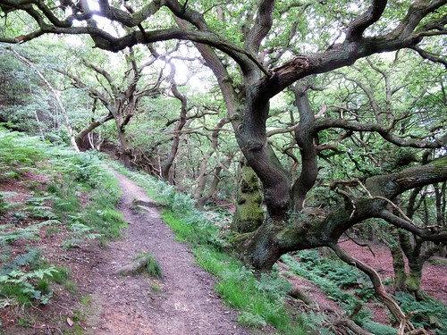
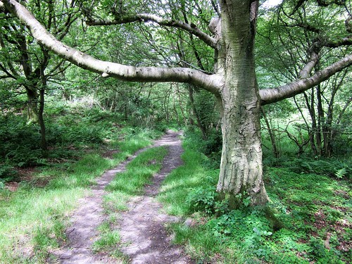
Fork left, following BA/’Bridleway’ through Highpark Wood for 1 mile. At crossroads of tracks under power cables (337108), hairpin left (no waymark) down through wood to bottom gate (337112). Ahead (BA) with wood on left. In 200m fork right through gate (339113); on with fence on left. In 600m, through gate (343117); left (BA). Through next two gates (344119, 343121); up across wide field for ½ mile to SDW (339128); left to Ditchling Beacon car park.

Lunch: Half Moon Inn, Plumpton BN7 3AF (01273-890253; halfmoonplumpton.com) – well-run, characterful pub.

National Parks Week 2016: 25-31 July (nationalparks.gov.uk)

Info: Brighton TIC (01273-770115)

visitengland.com; satmap.com; ramblers.org.uk

 Posted by at 01:33
Jul 022016


First published in: The Times Click here to view a map for this walk in a new window
picture picture picture picture picture picture picture picture picture picture picture picture picture picture
Facebook Link:

Under a blue sky patched with summer clouds we set out from the hilltop village of Cadeleigh, across grazing meadows and hayfields where the grass lay cut but not yet gathered. A heady scent arose as our boots crushed clover and sweet vernal grass. It was perfect weather for summer walking – warm but not too hot, breezy but not too chill.

The fields plunged high and low. This mid-Devon farming country is steep with tree-crowned hills, the fields conforming their shapes to the roll of the land. The far perspectives were all tumbled between green grazing, yellow cut hayfields and the dense milky pink of ploughland. In a coop at Little Century smallholding, fifteen ducklings seethed around two old hens, their foster-mothers. At Well Town, Tommy the black-and-white terrier came out to bark us off his patch – and quite right, too.

Up at Kingdom’s Corner we found a wonderful old green lane of the kind that has threaded these valleys and hills since men began to move beasts across the land. Overhung with oak, ash, hazel and blackthorn, floored with stones and fallen bird cherries, it swooped and swung above the bends of the River Dart in its thickly wooded valley. A barn beside the lane was footed with stone, with upper works of cob – mud, stones and straw sun-baked into hardness. Rain, wind, mice and martins had burrowed it into a tissue of holes across which spider gossamer glittered in tightly drawn threads.

We reached the valley road near Burn Bridge, and turned along a field lane towards Cadeleigh. The green track skirted East Court, where wooden farm carts shared the hedge with an ancient crimson Commer lorry like great-gran’fer used to drive.

The path led between hedges of horehound, wood sage and flesh-pink centaury. We found ourselves passing through flickering clouds of meadow brown butterflies. They had all hatched at once, drawn out of their chrysalises by the sun’s warmth. The new butterflies blundered about the grasses and danced along the lane before us, whirling giddily round and round one another as though for sheer joy of the summer’s day.

Start: Cadeleigh Parish Hall car park, Cadeleigh, Devon EX16 8HW (OS ref SS 915081)

Getting there: M5 Jct 27, A361 to Tiverton, A396 to Bickleigh Bridge, A3072 (‘Crediton’); in ¼ mile, right (‘Cadeleigh’) to village. Pass Cadeleigh Arms PH on right; immediately right (‘Little Silver’). In 200m, Parish Hall on right; park opposite.

Walk (7 miles, strenuous, OS Explorer 114): Turn up Glebelands drive (‘footpath’). Through farmyard and on, following yellow arrows/YA along field edges. In 3rd field, go steeply downhill with trees on left, then bear right along bottom of field to driveway (911087, YA). Left; in 40m, left over stile (YA). Up track, then cross to right-hand hedge (YA). Continue, to go through hedge gap (YA). Down to cross stile under trees; over 2nd stile and cross stream (911088, YA).

Steeply up right-hand hedge to cross stile into Round Wood; left and follow YAs/red blobs through wood, to cross stream by stile (908091). Half left, steeply up field; through hedge (YA); up field with hedge on left. Half left across next field (YA) to cross farm road (906094). On through gate (YA); half left across field to skirt to right of house and garden at Well Town. Through gate (YA) onto drive; right for 350m to road at Kingdom’s Corner (905099).

Right along road, immediately right (‘Bridleway’). Follow green lane east for ¾ mile to tarmac lane; ahead for 100m to road (917096). Right; in 50m, fork left up stony lane. In 500m, descend through gate by barn (blue arrow/BA); right in front of cottage to road (921092). Left; in 50 m, right (‘Bridleway’) along lane. In ⅔ mile pass Dart Cottages (928085); at ford beyond, fork right (BA) along right bank of River Dart. Ignore YAs and continue along stony lane for ⅓ mile to road (931079).

Right; in 200m, opposite steps of The Coach House, fork left (‘footpath’) along lane. In ¼ mile, beyond barns, take right or upper fork (927077, YA; diversion notice on gatepost) past East Court. In another 150m take lower fork (‘footpath’) past barn and follow green lane. At gate into field before reaching Cadeleigh Court (922075, YA) aim half right across field to gate (hidden at first, soon in view, YA). On along track that skirts anticlockwise round farm. At T-junction by Manor House garden wall, right (919074, YA) on lane for ½ mile to road (911073). Right uphill for ½ mile into Cadeleigh.

Lunch: Cadeleigh Arms, Cadeleigh (01884-855238, cadeleigh.com) – excellent community-owned pub

Accommodation: East Dunster Deer Farm, Cadeleigh, EX16 8HR (01884-855386, airbnb.co.uk)

Info: Tiverton TIC (01884-230878); Cadeleigh village website, cadeleigh.com

visitengland.com; satmap.com; ramblers.org.uk

 Posted by at 02:52
Jun 252016


First published in: The Times Click here to view a map for this walk in a new window
picture picture picture picture picture picture picture picture picture picture picture
Facebook Link:

Drumderg Road runs west out of Moneyneany, shedding tarmac and houses as it gains height, with the eastern fells of the Sperrin Hills rising ahead. On this muggy midsummer day the verges were bright with vetches, foxgloves, speedwell and buttercups. The sharp yellow of tormentil and a white froth of heath bedstraw heralded the switch from rushy lowland sheep pastures to peat moors as the road lifted into a dark, wild upland of blanket bog under heavy grey clouds.

We reached the saddle between Crockmore (‘The Big Hill’, in actuality a flattened dome) and Crockbrack (‘The Speckled Hill’, a dun-coloured ridge). The far views were tremendous – Slieve Gallion lumping up in the south-east, Benbradagh raising a snub snout in the north-west, and all round a rollcall of Sperrin heights – Craigagh and Spelhoagh, Slievavaddy with its winking eye of a lough, Sawel Mountain’s dominant 678 m cone.

These rolling, peat-blanketed hills seem wilder than any other range in Northern Ireland, because you rarely see another walker up here. So Jane and I were saying to each other as we descended from Crockbrack, muffled against wind and rain, towards the deep cleft where the Drumderg River springs. Then a vision in T-shirt and shorts shot by. Noel Johnston from Belfast was doing a sponsored expedition to raise money for a charity bringing divided communities together. He’d tramped a long way, sleeping rough, and had a long way to go – another of those admirable youngsters putting their time and energy into making a better post-Troubles Northern Ireland.

By the time we’d got down into the dell, Noel was long gone over the horizon. We sat there on two picnic rocks, munching wheaten bread and chocolate mints like lords, savouring lark song and the soft hushing whisper of wind in rushes. Then we went steeply and boggily up to our third summit, Craigbane (‘The White Hill’, a sombre swelling) and found the long road home, a mountain track that fell gently away towards Moneyneany. The plains of Antrim lay spread in sunshine at our feet, cradled by the slopes of Craigagh and Crockmore, with a silvery gleam of Lough Neagh to beckon us down from the hills.

Start: Trailhead info board at Mulligan’s pub, Moneyneany, Co. Derry BT45 7DU (OS ref H 754965)

Getting there: A6, A31 to Magherafelt; B40 to Draperstown and Moneyneany.

Walk (7½ miles; moderate hillwalk, sometimes boggy, well waymarked; OSNI Activity 1:25,000 ‘Sperrins’ map. Walk downloadable at walkni.com. Online map, more walks at christophersomerville.co.uk): From pub car park, right along B40; in 30m, left up Drumderg Road (occasional yellow arrows/YAs, and ‘Crockbrack Way’/CW waymarks) for 2½ miles. At first cattle grid, tarmac changes to stones; at 2nd one, keep ahead; at 3rd one, at Crockmore summit, ignore stile on right and keep ahead (725956, CW, YA). In 100m at T-junction, right (YA) on bog road towards Crockbrack. In ½ a mile, right (717955, YA) up grassy track. In 200m, left (YA) to cross stile. Descend beside fence on left for 600m to fence running right (712959, YA). Follow it to right, steeply down to cross Drumderg River’s headwaters. Continue up fence on far side (sloppy, boggy!) to cross stile at top (711970). Right (CW, YA) down stony road, then tarmac, for 3¼ miles to B40 (749974). Right to Mulligan’s pub.

Lunch: Picnic; or Apparo Hotel, Draperstown (4 miles) – 028-7962-8100, apparorestaurant.com

Accommodation: Laurel Villa, Magherafelt, Co. Derry postcode (028-7930-1459, laurel-villa.com) – homely, helpful, spick-and-span B&B.

Info: Magherafelt TIC (028-7963-1510)

Northern Ireland’s Year of Food and Drink 2016: discovernorthernireland.com satmap.com; ramblers.org.uk

 Posted by at 01:42
Jun 182016


First published in: The Times Click here to view a map for this walk in a new window
picture picture picture picture picture picture picture picture picture picture picture picture picture picture picture
Facebook Link:

A glider was circling perilously near the cliffs on Sutton Bank, but no-one on the Cleveland Way had eyes for it – not with the signposts proclaiming ‘The Finest View in England – 50 metres’. That might be a bit of an eyebrow raiser as a claim, but the prospect over the Vale of York from the sharply-cut crags of Sutton Brow is certainly a stunning one. I looked out south and west over a giant plain, patched with cloud and sun, green and pale gold, rolling away to splendid blue hills on the edge of sight.

‘The Yorkshire Dales, them are,’ said a man at my side. ‘See Great Whernside there?’ He pointed out a diminutive hump on the skyline. ‘Thirty mile off, that is. Entrance to Wensleydale’s that great dark cliff you see there. Damned if it isn’t a hundred mile or more, this view.’ He inhaled as though he were drawing the scene inside to hold it deep down.

The Cleveland Way National Trail shadows Sutton Brow and the long south-north escarpment of the Hambleton Hills, so walkers get the full effect of the sensational view for mile after mile. I chose a side turning, and plunged down a path edged with pale pink dog roses through the ancient woodland of Garbutt Wood. Bluebell pods as fat as peas stood among the star-like flowers of yellow pimpernel. Gaps in the silver birch and oaks gave snatches of the view over the plain.

Young coots and moorhens were squeaking in the reeds of Gormire Lake when I got down to it at the foot of the bluff. At the pretty cottage of Southwoods Lodge I found a north-running bridleway between hedges thick with lacy umbellifers. A bee landed on one of the flat plant heads and slid its hair-thin proboscis into each tiny white flower in turn, drawing out sweetness and carrying pollen away to fertilize the next host in its round of feeding.

At Midge Holm I walked fields of coarse grass round a lake, remnants of a landscaped park now subsiding back into the landscape. On through uncut hayfields, the ripe grass heads hazing the meadows with a wash of pale purple as they released steamy warmth I could feel on my cheeks and arms.

‘I’m 82 tomorrow,’ said a slim and upright gentleman in walking boots whom I met on the homeward track to Sutton Bank, ‘and I’m lucky. Nothing ever ails me.’ He indicated the wonderful view to the distant hills. ‘Take a hold of this and put it away in the memory banks for a dark winter day. You can’t beat it, eh? Summer with its best coat on.’

Start: Sutton Bank car park, YO7 2EH (OS ref SE 517831)

Getting there: Car park is at top of Sutton Bank on A170 (Thirsk-Helmsley)

Walk (6 miles, moderate, OS Explorer OL26): Follow tarmac path up left side of Sutton Bank Bikes shop. At ‘White Horse 1¼” fingerpost, ahead through car park; follow gravel path on right of A170 to cross side road (515830); ahead along Cleveland Way/CW (‘Sneck Yate’). In 400m, left off CW (511833; ‘Footpath, Nature Trail’) steeply down through Garbutt Wood, passing numbered posts. At Post 9 (505833) ignore ‘Southwoods’ sign to right; bear left downhill to Gormire Lake. Right (504833, ‘Bridleway, Southwoods’). At Southwoods Lodge cottage (502838), right along bridleway (blue arrow/BA).

At Midge Holm Gate (502843), cross road; through gate to left of Southwoods Hall gates (‘Tang Hall, Southwoods’ fingerpost); curve anti-clockwise round field edge and on (bridleway fingerposts, BAs) to road at Tang Hall (496851). Right over cattle grid; track to Greendale farm. Through gate to left of farmyard (499854, BA); up field, through gate; left (‘bridleway’) through skirts of wood. In 350m, at 3-finger post, right (499857; ‘Bridleway, Little Moor’) up woodland track, across Little Moor, up forestry track (BAs) for ⅔ mile. At top (507853), right along CW (‘Sutton Bank’) for 2 miles to car park.

Refreshments: Sutton Bank visitor centre café (01845-597962)

Info: North York Moors Visitor Centre, Sutton Bank (01845-597426; northyorkmoors.org.uk)

Yorkshire Wolds Walking & Outdoor Festival 2016 (10-18 September) – theyorkshirewolds.com

visitengland.com; satmap.com; ramblers.org.uk

 Posted by at 02:24
Jun 112016


First published in: The Times Click here to view a map for this walk in a new window
picture picture picture picture picture picture picture picture picture picture picture picture picture picture picture picture
Facebook Link:

Foula, the Isle of Birds, lies twenty miles west of Shetland’s main island. If you want remote, this is it – a hilly green Atlantic isle of some 30 inhabitants, served by occasional planes and ferries, where thousand-foot cliffs screaming with seabirds fall sheer into the sea.

‘Soft rush,’ said our guide, islander Sheila Gear, stripping out a length of pith from a rush stem on the hillside above North Harrier. ‘This was the wick the islanders would use in their lamps of fish oil or seal blubber.’

A long rising upland, bright with sphagnum moss and star-like blue flowers of spring squill, led up to the green promontory of Summons Head. A herd of tiny pot-bellied ponies grazed there. We sat and gazed in wonder at the cliff face of Da Kame, 1200 feet of drop, seamed with nesting ledges round which fulmars were drifting like snowflakes.

On our way up the steep hillside to the crest of Da Kame we came under attack by great skuas – ‘bonxies’ to Shetlanders – fierce and piratical seabirds that dive-bomb any intruders in their nesting territory. The summit peak towers over the ocean, but the great cliff itself is out of sight beneath one’s feet. ‘We’ll go down to Wasta Hoevdi,’ Sheila decided, pointing south to where a green tongue of land licked out into space. ‘That’s where they’d pasture the cattle for the summer in the old days.’

The view from Wasta Hoevdi to the cliffs of Nebbifield was mind-blowing, too, a giant leg of rock standing in the sea. Guillemots perched upright and shoulder to shoulder along the ledge like commuters on a platform, with puffins peeping from burrows at the cliff edge. ‘That’s where I’d go and sit with my dog when I was young,’ said Sheila, laughing with glee at her defiant teenage self. She indicated a narrow, precarious tongue of rock thirty feet below us, a seat in the void. ‘My parents never knew!’

Our homeward path slanted down the Oxna Gaets, the ancient track by which the grass-fattened cattle were driven down from the ridge to lower grazing for the winter. ‘See the Sand Loch?’ Sheila pointed out an upland loch far below. ‘That’s where the red-throated divers are nesting – I don’t know if they’ve any chicks yet.’

They did – we saw them for ourselves. But that was on another day in this mesmerizingly wild and beautiful Isle of Birds.
Start: North Harrier, Isle of Foula, Shetland, ZE2 9PN (OS ref HT 957406)

Getting there: Fly Aberdeen-Sumburgh (flybe.com)
Ferry (07781-823732) from Walls (2 hrs), or fly from Tingwall (SIC Directflight, 01595-840246). North Harrier is at northern end of Foula’s road.

Walk (4 miles, variable, strenuous; OS Explorer 467. NB: online map, more walks at christophersomerville.co.uk): Just before last house, keep ahead (west) uphill with Blobers Burn on left for three quarters of a mile to Summons Head promontory (947407) for view of Da Kame cliffs (danger! See below). Left (SW) along cliffs. Zig-zag steeply up to summit of Da Kame (940400). Continue down along cliffs to Nebbifield (939397) and Waster Hoevdi (939391) for cliff views. Return to saddle between Da Kame and Da Sneug (945397). Diagonally right, steeply down Oxna Gates slope. Cross Da Burn o Da Craig (952401). NE to North Harrier.

Conditions: Some steep ascents/descents. Unguarded cliff edges, unpredictable gusts of wind – keep well back! Guided walk – contact Foula Ranger Service (01595-753236).

Lunch: Picnic

Accommodation: Ristie self-catering (01595-753207, fran.dysonsutton@googlemail.com); Leraback B&B, evening meals (01595-753226).

Info: Foula Heritage (foulaheritage.org.uk).

shetland.org; satmap.com; visitscotland.com

 Posted by at 01:28
Jun 042016


First published in: The Times Click here to view a map for this walk in a new window
picture picture picture picture picture picture picture picture picture picture picture picture
Facebook Link:

‘There’d be 40 gardeners here back in Victorian times,’ said the National Trust volunteer, digging the rhododendron verges at Clumber Park, ‘and not one of them was to be seen by the lords and ladies. They’d hide in the bushes and creep out with the shears – snip, snip! – when the fine folk had gone.’

Henry Douglas, 7th Duke of Newcastle-under-Lyme, founded the Chapel of St Mary the Virgin by the lake at his family seat of Clumber in 1889. The church of deep pink sandstone stands as tall and elegant as many a cathedral, full of glorious stained glass by Charles Kempe, delicate wood carving, and enough stone demons to keep the Devil good company.

It was the 2nd Duke, handsome Henry Pelham-Clinton, who poured out his money on landscaping Clumber Park and creating its great serpentine lake in the mid 18th-century. We walked the lake as far as the dock where the 4th Duke once kept a miniature frigate, with a sailor employed full-time to tend it. The path looped inland and back to the water, where tufted duck sailed with brilliant white flanks and intense golden eyes. A mother coot scooped seeds from the lake surface to feed her tiny scarlet-faced chick, beak tip to beak tip.

Beyond the lake we turned off across a belt of heather, broom and silver birch – a wild contrast to the neatly contrived artificiality of the landscaped park. A bridleway led through the birch and pine of Hardwick Wood to the outskirts of Hardwick, built as an estate village for the park, its cottages with steep ornamental gables and giant chimney stacks. In the E-shaped yard of the model farm, a peep through a chink in a barn door disclosed a collection of beautiful old agricultural wagons in the gloom.

A long stretch by the southern shore of the lake, looking across to the chapel spire, and we were crossing the Palladian arches of Clumber Bridge. Coot sat tight on their domed nests in the shallows, and a duck of mixed parentage ducked its head ecstatically in the lake, sending showers of diamond droplets flying in all directions.

Start: Clumber Park main car park, near Worksop, Notts, S80 3AZ (OS ref SK625746)

Getting there: Clumber Park is signed from B6034, off A616 between Ollerton and Cuckney.

Walk (6 miles, easy, OS Explorer 270. NB: online maps, more walks at christophersomerville.co.uk): From car park follow ‘Chapel’. From chapel (627746), left along lakeside path. At Boat House dock, left (632748), heading north close to fence. In 150m, right through stone gateway; pass gate on right; at pair of stone gateposts, right on gravel path. At ‘In The Wood’ info board (633755) right across neck of lake, then left along causeway road. In 300m, beyond lake, right off road (631756, ’16’ marker on left side of turning) on gravel path. In 400m, right along road (630759); in 200m, right (‘Bridleway’) on bridleway. At road (634760), right into and through Hardwick. At T-junction, right (639754); opposite farmyard, left past log barrier and NT ‘No Parking’ sign (‘Route 5’). In 50m, left across water (639752); follow path along south side of Clumber Lake. In 1¼ miles, meet road at a car park (623740); continue along road. In 300m, right across Clumber Bridge (621738). Fork right along road. In 150m, right past log barrier on woodland path. At road with barrier, right to car park.

Lunch: Clumber Park tea rooms

Accommodation: Forest Lodge Hotel, Edwinstowe, Notts NG21 9QA (01623-824443, forestlodgehotel.co.uk)

Clumber Park: 01909-544917, nationaltrust.org.uk/clumber-park

experiencenottinghamshire.com; satmap.com; ramblers.org.uk

 Posted by at 01:42
May 282016


First published in: The Times Click here to view a map for this walk in a new window
picture picture picture picture picture picture picture picture picture picture picture picture picture picture picture picture
Facebook Link:

A glorious afternoon on the west Lancashire coast under wall-to-wall blue sky. We walked the green fields of Cockerham with the Bowland moors rising in the east, Blackpool Tower tiny and familiar down in the southwest, and the Lake District fells around Helvellyn and Scafell Pike standing as if cut from pale blue card on the northern horizon.

Down at the sea wall a great flat apron of saltmarsh lay spread at the edge of Cockerham Sands, cut with wriggling channels. Brackish pools winked in the sun like a thousand bright eyes. The tide was on the make, advancing along the shore road and up the creeks in a frothy mini-tsunami, driving flights of loudly piping dunlin, oystercatchers and redshank shoreward in agitation. Further out on a vanishing sandbank, geese babbled together, a musical chiming across the water, reminiscent of sheep bells in Alpine pastures.

The seawall path ran past Bank End and Bank Houses, remote farmsteads among flat green pastures out at the edge of the land. As the coast turned north we came to Cockersand Abbey, or what remains of it – a curious semi-rectagonal chapter house among angles of walls, its soft red sandstone rubbed into dimples and hollows by 800 years of wind and weather.

Cockersand Abbey was founded on this lonely shore as a leper hospital. When the site was excavated in the 1920s, archaeologists found fragments of lead and coloured glass from the windows that were smashed at the Dissolution of the Monasteries. The abbey ruin became a source of ready-worked building stone. Only the chapter house survived, because the local landowners wanted it for their family mausoleum.

From Cockersand Abbey we followed the windy coast path north to Crook Farm, with Heysham Power Station looming massively ahead like a 1950s suburban house designed by an ogre. Soon it was behind us, and we followed the grassy imprint of Marsh Lane over sheep pastures to Glasson Dock, a rare survival of a small working port. A dip into the cornucopia of goodies in the Port of Lancaster Smokehouse here, and a last stretch on a railway path into Conder Green above the golden marshes of the Lune Estuary.

Start: Manor Inn, Cockerham, near Lancaster, LA2 0EF (OS ref SD 465522)

Getting there: Bus 89, 89H (Lancaster-Knott End)
Road – Cockerham is on A588 between Conder Green and Pilling (M6, Jct 33)

Walk (7 miles, flat and easy, OS Explorer 296. Online map, more walks at christophersomerville.co.uk): South from Manor Inn down A588; in 50m, right beside Old Mill House. Follow lane; through garden at top; through kissing gate at end of garden (464524, yellow arrow/YA). Follow fence on right downhill; follow YAs along field edges, round cottage (462529). Leave cottage garden over stile; ahead over field and footbridge (YA); follow ditch/fence on right for ½ mile to Hillam Lane (455531). Left past Hillam Farm; in ½ mile, right (449528) along sea wall. Follow Lancaster Coastal Path/LCP north for 3¾ miles via Bank End (441528), Cockersand Abbey chapter house (427537), Crook Farm (431550) and Marsh Lane to road at Glasson (443556). Left, then right to Glasson Dock. Cross swing bridge (445561); cross road by Victoria Inn; right along LCP. In ¾ of a mile, cross bridge (456560); right to Conder Green. Bus 89/89H or taxi (01995-607777; £6.50) to Cockerham.

Lunch: Picnic – provisions from Port of Lancaster Smokehouse, Glasson – 01524-751493, lancastersmokehouse.co.uk

Accommodation: The Mill at Conder Green, Lancs, LA2 0BD (01524-752852; themillatcondergreen.co.uk) – really comfortable, superbly positioned.

Information: Lancaster TIC (01524-582394), visitlancashire.com

visitengland.com; satmap.com; ramblers.org.uk

 Posted by at 01:05
May 142016


First published in: The Times Click here to view a map for this walk in a new window
picture picture picture picture picture picture picture picture picture picture picture picture picture picture picture picture
Facebook Link:

‘Bond motored slowly over to Reculver, savouring the evening and the drink inside him and the quiet bubble of the twin exhausts. This was going to be an interesting dinner party.’ Of course it was – Bond was driving his battleship grey DBIII with its ‘extras’ (battering ram bumper, radar set, long-barrelled Colt .45 in a trick compartment) towards a fight to the death with evil Auric Goldfinger and inscrutable henchman Oddjob.

The old village of St Nicholas-at-Wade lies hidden in plain view in the flat farmlands near the Kentish coast, its flint church tower rising among the red brick houses. The royal blue flowers of green alkanet brightened the dusty clay verges of the track I followed from the village through fields of barley and rape towards the distant twin towers of Reculver.

A sparrowhawk and a little egret crossed aerial pathways, the raptor flying at twice the speed of the bright white wader. Skylarks sang incessantly, and a reed bunting gave out its scratchy wheedle from a ditch where frogs were croaking, ‘Brexit! Brexit!’

Up on Rushbourne Sea Wall the path grew thick and jungly with alexanders. I shoved my way through, aiming for Reculver’s twin towers, with the rectangular pans of a shellfish hatchery – some dry, some glinting with water – stretching away to the low cliffs along the Thames. Sea wall met shore beside the towers, relics of the monastic Church of St Mary. Saxon monks founded the monastery on the ruins of a Roman shore fort to offer a beacon of civilization on a wild and lonely coast.

Out where the Thames Estuary dissolves into the open sea, I could just distinguish among the whirling arms of a giant offshore wind farm the Star Wars shapes of abandoned Second World War forts. It was a strange image to take with me along the coast path towards Margate among cyclists, strollers, scampering kids and dog walkers.

At Plumpudding Island a terrier with a coiffured hairdo like Little Richard’s pompadour came up barking. I gave him a pat, and took the homeward path along Wade Marsh. If that was 007 in disguise, he certainly fooled me.
Start: Bell Inn, St Nicholas-at-Wade, Kent CT7 0NT (OS ref TR266666)

Getting there: Bus 36 from Margate, 38a from Ramsgate
Road – M25 Jct 2; A2, M2, A299; past Herne Bay, St Nicholas-at-Wade is signposted.

Walk (8¼ miles, easy, OS Explorer 150. NB: online maps, more walks at christophersomerville.co.uk): From Bell Inn, left along road past church; over A299; left at junction (260674). At Chambers Wall, on left bend, right along field track (254676, fingerpost). In 700m track bends right; in 150m, left across ditch (250683). Follow concrete track to cross railway (248686); left along grassy bank. In 600m, opposite farm railway crossing, path bends right (242685); in 400m fork left (242689); in 100m track bends right (seaward), but keep ahead up bank (241689) and on (NB: can be rather overgrown) with shellfish hatchery on right, aiming for Reculver towers. At coast, (230694), left for St Mary’s Church. To continue walk, right along Thanet Coastal Path. In 3 miles at Plumpudding Island, opposite big grey shed on right, turn right down steps (273694). Follow path along embankment; in ¼ mile, cross railway (270690); follow path to Shuart (269678); right along lane to St Nicholas-at-Wade.

Lunch: Bell Inn (01843-847250, thebellstnicholas.co.uk) or Sun Inn (01843-841646), St Nicholas-at-Wade

Reculver Towers: 0370-333-1181, english-heritage.org.uk

Goldfinger by Ian Fleming (Penguin)

Info: Margate TIC (01843-577577)

visitengland.com; satmap.com; ramblers.org.uk

 Posted by at 01:44
May 072016


First published in: The Times Click here to view a map for this walk in a new window
picture picture picture picture picture picture picture picture picture picture picture picture picture picture picture
Facebook Link:

I don’t know whether William Shakespeare ever travelled much of the long-distance footpath from Stratford-upon-Avon to London that bears his name. But several of the gorgeous houses in the Warwickshire village of Honington look as though they’ve been there since the Bard was a lad. It was a day to do them justice as we set out along ‘Shakespeare’s Way’ – a tender blue sky, a cool breeze, and a hazy spring sun to bring out the mellow silver and gold of the local building stone.

Parkland stretched away beside the road that led north out of Honington. Sparrows, chaffinches, rooks and wrens all loudly proclaimed the spring from greening hedges and treetops. A jackdaw was pulling strands of nesting hay from the bales in a red-roofed barn, and a great spotted woodpecker drummed a hollow proclamation of ownership from its patch of woodland beyond Wagtail Spinney.

In a boggy dell we parted company from Shakespeare’s Way. We got across the fast-running stream, and stopped in the damp hollow beyond to clear a tangle of sticks that had dammed a spring. Watching the water bursting away from its confines in a wet sparkle took both Jane and me straight back to our muddy-booted childhoods.

Walking up the field boundaries to Idlicote on its ridge, we paused to admire the superb old trees that formed the margin of the path – giant crack willows burst apart and fallen, ancient coppice stools of field maples, and an ash tree split open to expose a heart of writhing tendrils more like those of an animal than a tree.

Up at Idlicote a scarecrow sat on a bench – a smooth customer in a grey homburg hat, with a pink silk kerchief in his breast pocket. Rooks had built a ragged township in the nearby trees, and they challenged our passing with reedy quacks and phlegmy belches. Sticky paths led us up from Idlicote to a high ridge where the long views melted into mist. Before dropping down the slope into Honington there was time for a sit and stare across the plain, where the slender spire of Tredington Church rose skywards from the heart of Shakespeare’s countryside.

Start: All Saints Church, Honington, Warwicks, CV36 4NH (OS ref SP 261427)

Getting there: Honington is signed off A3400, 1 mile north of Shipston-on-Stour. Left off village street (signed) to church parking spaces.

Walk (6¼ miles, easy but muddy, OS Explorer 221): Walk to village street; turn left. Opposite turning to Barcheston, left (‘Old Post Office’). In 40m, ahead through metal mesh gate. Through woodland strip (kissing gate, yellow arrow/YA); half right across field to kissing gate (YA) and road (268427). Left along road. In 1 mile, cross bridge in Wagtail Copse; immediately right through gate (267443, ‘Shakespeare’s Way’/SW). Follow path on left of stream, then between stream and wood.

In 800m, right over footbridge (273448, blue arrow/BA); follow right bank of tributary stream up through trees (BAs), then along field edges to barns near Whitehouse Farm (277446). Cross track; ahead (BA) up field edges to Idlicote. At top of rise, ahead through gate (281443); ahead to road. Pass tower and kitchen garden; round left bend; immediately right between white gateposts (283442, BA). On to cross road (284440).

On up field with hedge on right. In 600m at top of ridge, right at waymark post (288435, ‘Centenary Way’/CW). At Idlicote Hill Farm, left, then right (288433, CW). Follow hedge on right to corner (post with YA, CW); bear right along hedge. In 70m pass yellow-topped post (CW); on with hedge on left. In ⅔ mile pass pond on right (278426); in 100m, bear right round corner of Hill Clumps Wood; in 30m, left (CW, YA) across strip of ground, then right (CW) and follow CW down to road. Right, then left into Honington.

Lunch: Picnic

Accommodation: White Bear, Shipston-on-Stour CV36 4AJ (01608 664199, whitebearin.com)

Information: Stratford-on-Avon TIC (01789 264293)

visitengland.com; satmap.com; ramblers.org.uk

 Posted by at 01:07
Apr 302016


First published in: The Times Click here to view a map for this walk in a new window
picture picture picture picture picture picture picture picture picture picture picture picture picture picture picture picture picture picture picture picture picture picture picture picture
Facebook Link:

A beautiful day of blue sky over the Lake District, and Elterwater was already stirring with walkers as we climbed away up the stony old cart track that goes over from Great to Little Langdale. A big old pine by the track held out its branches like a cormorant drying its wings. Ahead the fells over Little Langdale Tarn rose as crinkled as old men’s faces, an ancient landscape looking sharp in the sunlight.

We turned off up a steep fellside path, snaking up the rocks of Bield Crag. A holly and a juniper clung together to a crack in the rocks, blown back on themselves by the winds of a century into a graceful concavity. At the top a stone wall rode the crest boldly and purposefully, a Lakeland Hadrian’s Wall that roller-coastered over crags and into gullies, leading us westward unerringly.

We sat on the short turf of Lingmoor to savour the absolute silence – absolute except for bee hum and wind whistle, the snick! snick! of a Herdwick ewe’s teeth in the grass, and the rattle and rush of a raven’s wings overhead as it flipped upside down and upright again in a joyful display.

At the cairn on Brown How a breath-stopping view opened northwards across the cleft of Mickleden to the Langdale Pikes, three-headed and magnificent, with the tiny crescent of a paraglider swooping round Loft Crag. Down beyond the summit we found the faintest of sheep paths running back east, suddenly cresting a shoulder to deposit us on the shore of lonely Lingmoor Tarn. The stems of horsetails and water lilies pimpled the surface of this beautiful little lake, and three tiny silver birches grew out of one of the flat circular islets.

A place to linger all afternoon, really. But shadows were beginning to lengthen. Back on the ridge path we scrambled down beside the dark cliffs of Side Pike, and got down to the Old Dungeon Ghyll Hotel just in time to catch the bus back to Elterwater in a crowd of reeking, tired but happy hikers.

Start: Elterwater car park, Elterwater, near Grasmere, Cumbria, LA22 9HP (OS ref NY 328048)

Getting there: Bus 516 (Ambleside-Dungeon Ghyll)
Road – B5343 from Skelwith Bridge (A593, Ambleside-Coniston)

Walk (5½ miles, strenuous, OS Explorers OL6, OL7. NB: online maps, more walks at christophersomerville.co.uk): Left across bridge. In 200m, opposite Eltermere Hotel, right (327045, ‘Coniston, Cycle Route 37’). In 200m, fork left (‘Little Langdale’ fingerpost) up stony track. In ½ mile, pass public bridleway on right, then through gate (321041). In ¼ mile, pass reservoir on right; in 100m, right through gate (318039) up fellside path. After nearly ½ mile, reach a col with little cairn (314041). Don’t turn left or right; keep ahead over col (cairns). Bear left on path parallel with wall, sometimes 100m away. In about half a mile wall bends right and becomes fence – follow it to summit of Brown How (302046).

Continue along ridge beside fence/wall. In 500m fence turns left and stops (299050); but continue on path beside wall parallel with ridge for ¼ mile to angle of two walls (297052). Detour – a faint path runs right from here and curves ESE for 500m to Lingmoor Tarn. Main walk: At angle of walls, left over stile; continue with wall on right. Just before wall meets cliff face of Side Pike, turn left (294053) and descend. Near road, right over stile/fence. Path runs parallel with road; then (288052) down fellside; through successive belts of trees to campsite car park (286058). Left to road; right to bus stop on B5343 (286060) with Old Dungeon Ghyll Hotel beyond.

Return to Elterwater by Bus 516.

Conditions: Rough and rocky underfoot, some short steep climbs – hill-walking clothing and boots.

Lunch: Picnic; or Old Dungeon Ghyll Hotel (01539-437272, odg.co.uk)

Accommodation: Eltermere Inn, Elterwater, Ambleside, Cumbria, Postcode (01539-437207, eltermere.co.uk) – comfortable hotel, fantastic views.

Information: Ambleside TIC (01539-432582)

visitengland.com; satmap.com; ramblers.org.uk

 Posted by at 07:22