Apr 232016


First published in: The Times Click here to view a map for this walk in a new window
picture picture picture picture picture picture picture picture
Facebook Link:

The Teesdale town of Barnard Castle on a busy weekday, bustling, friendly, and packed with local shops. Some of these were not entirely traditional in produce, however; goat curry pasties were wowing the shoppers at the Moody Baker. William Peat, Master Butcher (or one of his representatives) came haring out into the street after a departing customer with: ‘Sausages, Missus! You forgot your sausages!’

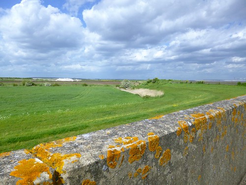
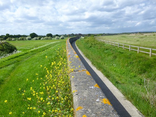
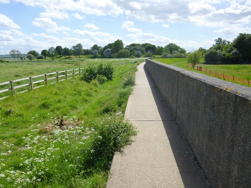
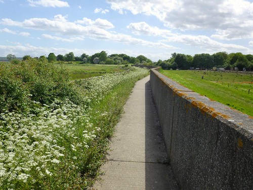
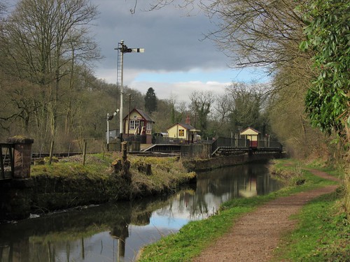
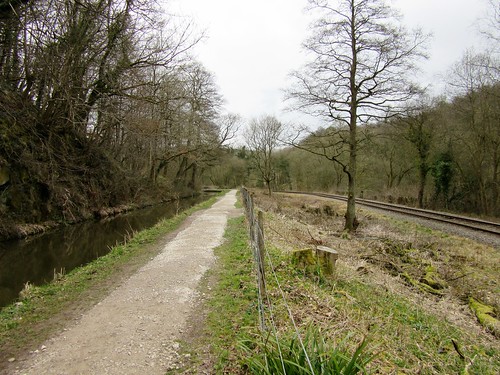
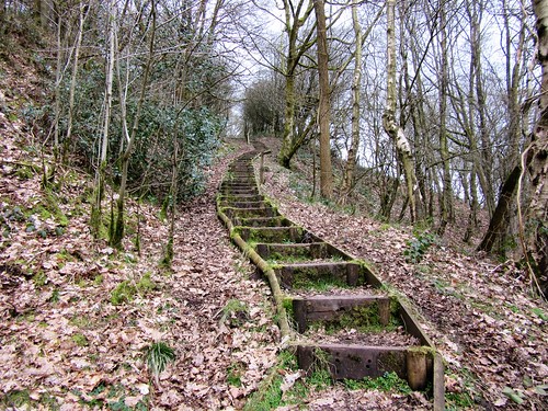
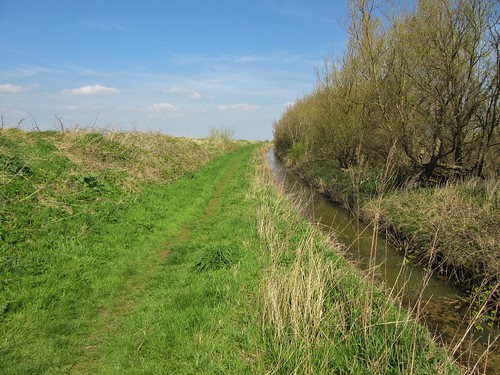
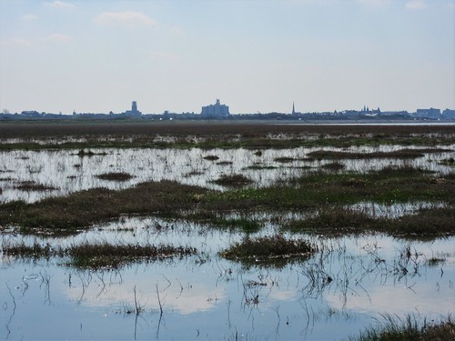
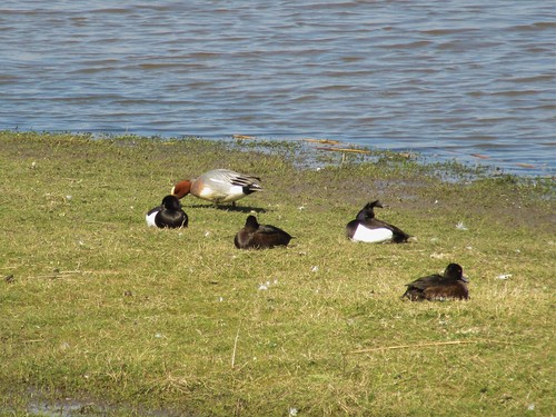
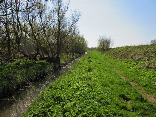
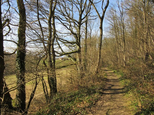
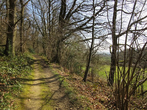
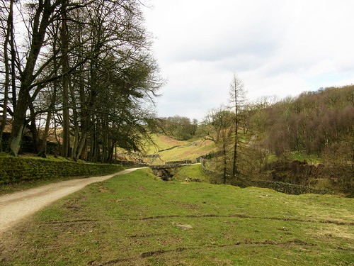
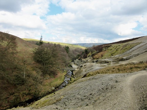
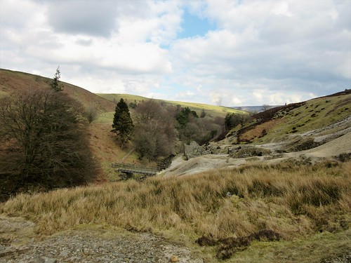
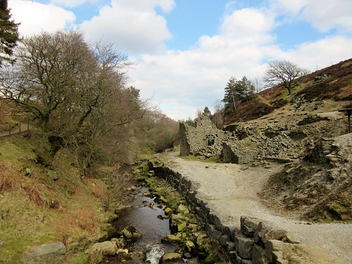
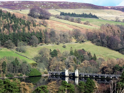
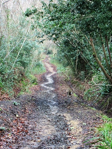
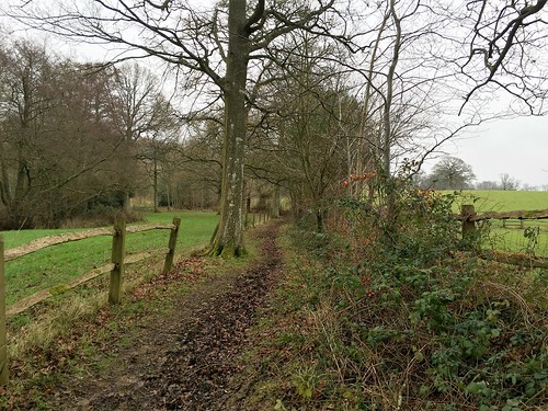
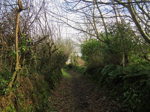
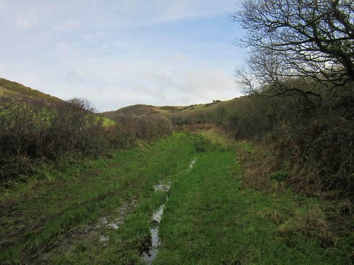
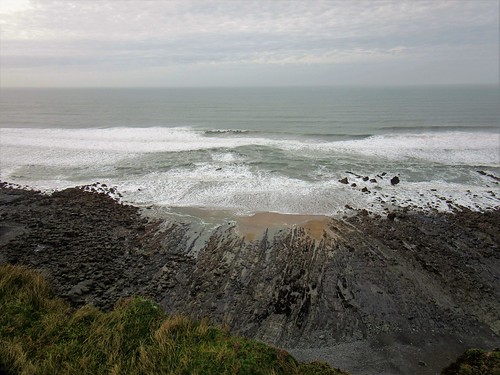
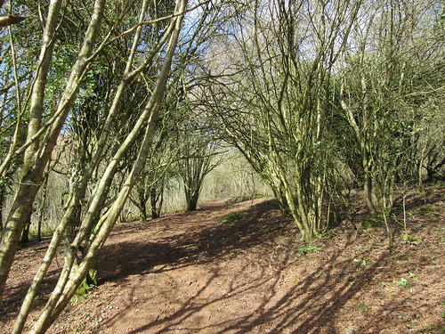
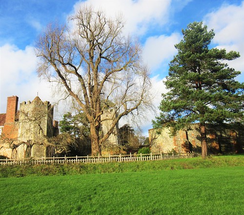
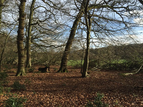
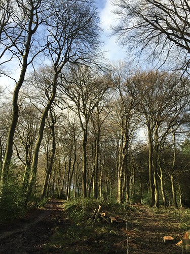
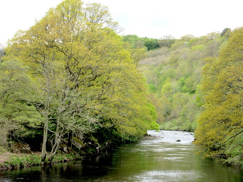
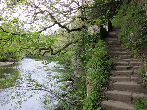
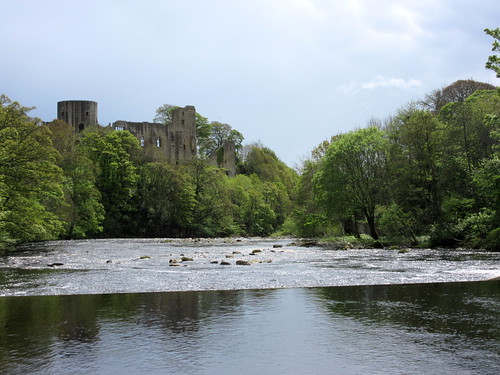
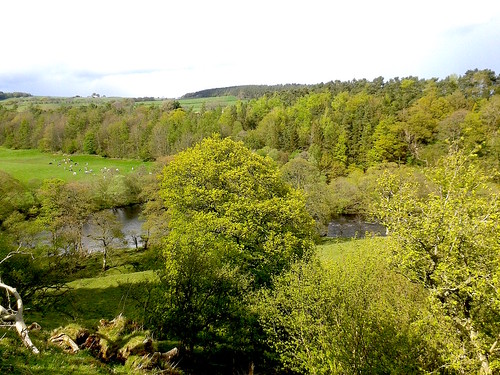
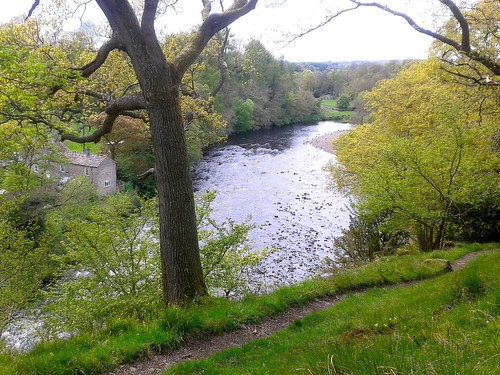
We passed the gaunt, broken walls of the castle that overhangs the Tees. Down by the river we stopped beside the rushing white bar of the weir just in time to catch sight of a dipper alighting there. It bobbed its white shirt front energetically up and down before skimming off upriver in flight as straight as an arrow. We followed it along the Teesdale Way, an undulating path now rocky, now muddy, that shadowed the river through beautiful woods of young limes and beeches.

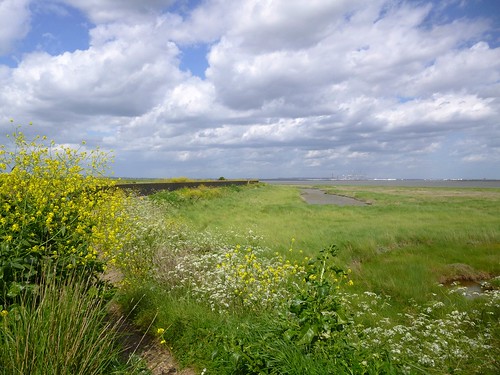
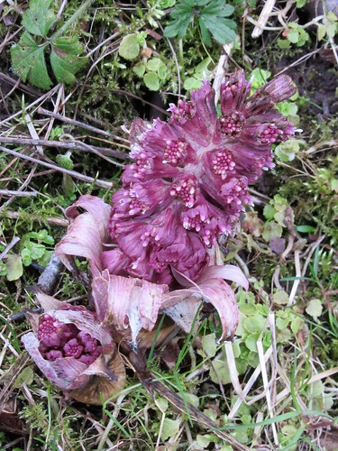
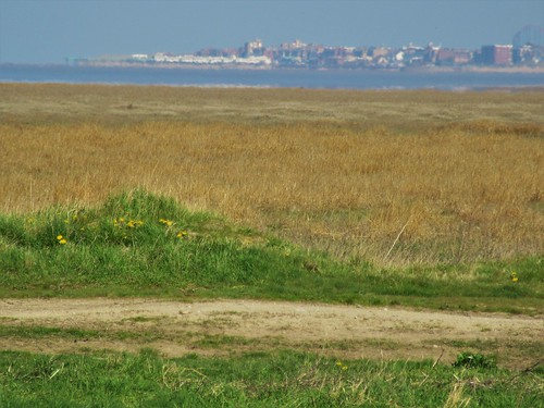
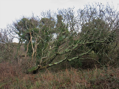
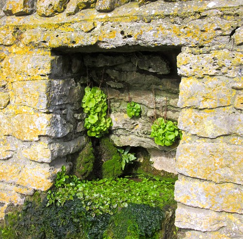
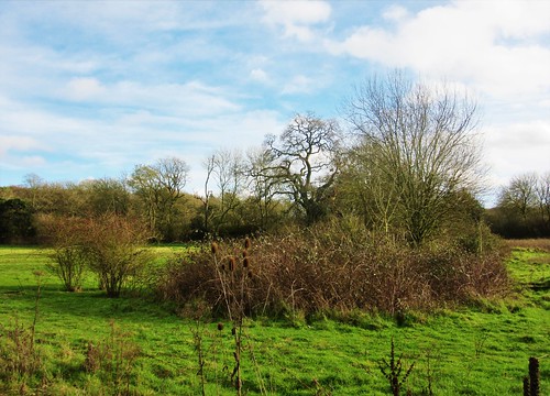
There’s always an element of uncertainty about the wild flowers you might find on a springtime walk in this northern part of England, where the colder and more upland situation squeezes the flowering season into a shorter and more intense timeframe than further south. But on this woodland walk today, everything had popped out and was displaying ensemble – wood anemones white and purple, bluebells and stitchwort, primroses side by side with red campion. Wild garlic and celandine, violets next to wild strawberries, forget-me-not, speedwell and water avens – it was altogether an astonishing display, with drifts of red, white and blue flooding the shadows under the trees.

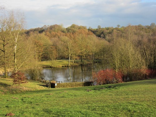
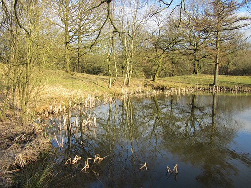
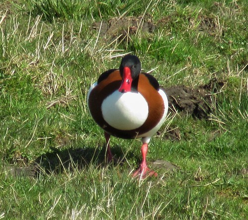
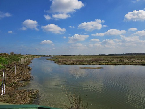
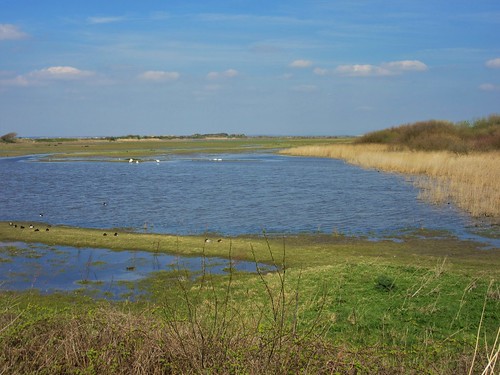
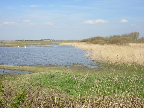
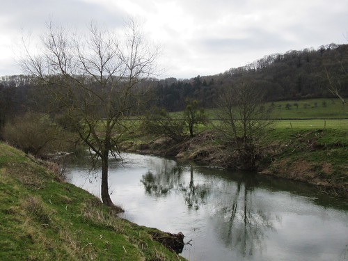
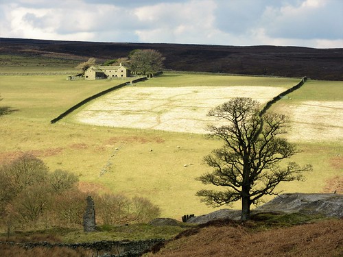
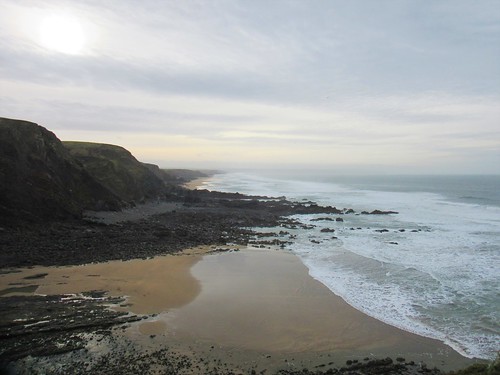
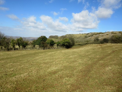
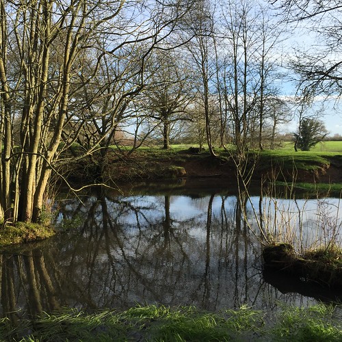
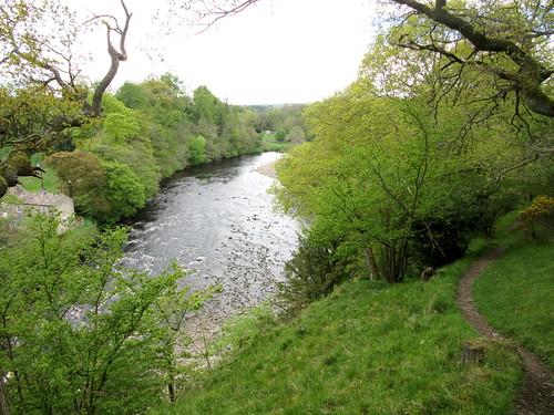
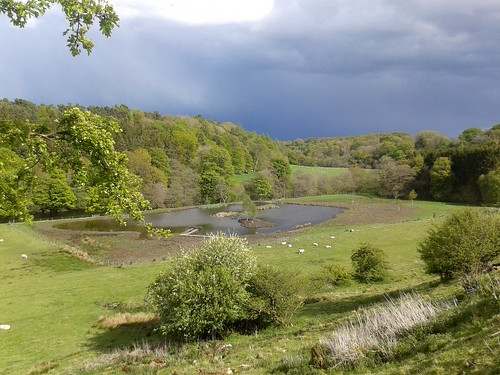
Opposite Cotherstone we found the most perfect picnic spot in Teesdale, a primrose bank from which we looked down through young ash leaves on the river snaking noisily round a bend. Pied wagtails curtsied on the rocks, swallows skimmed the water, and a fisherman stood knee-deep and cast for a trout.

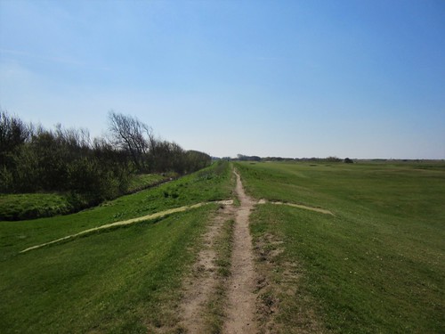
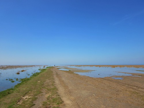
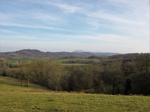
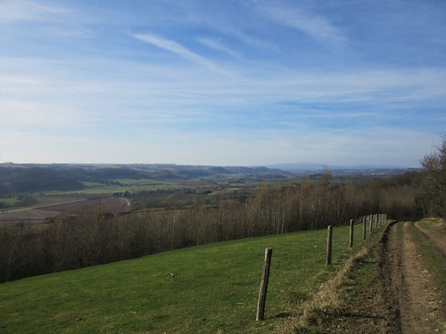
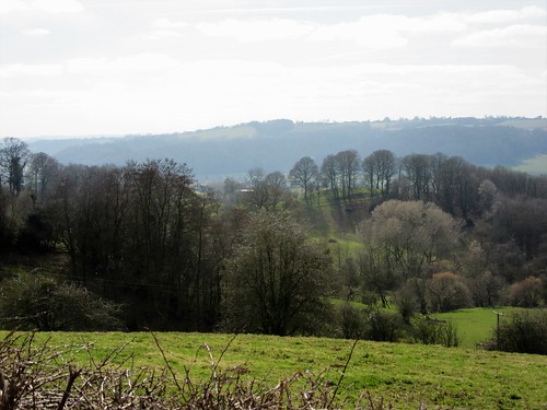
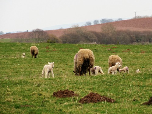
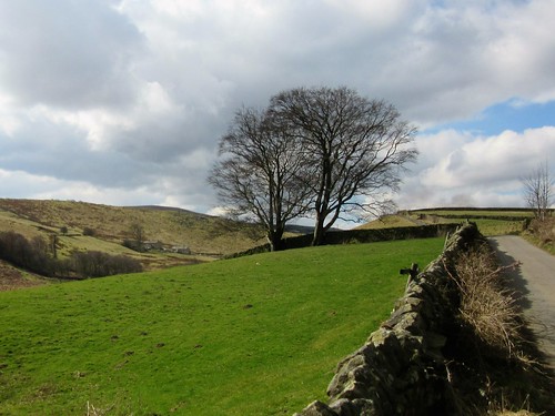
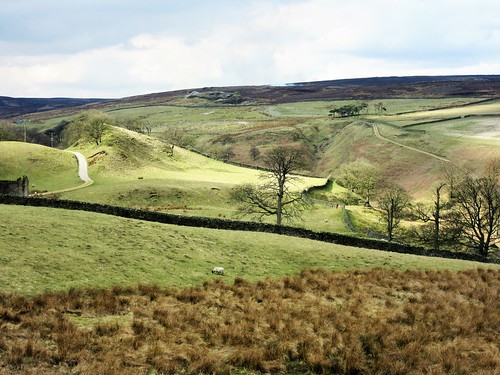
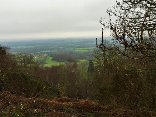
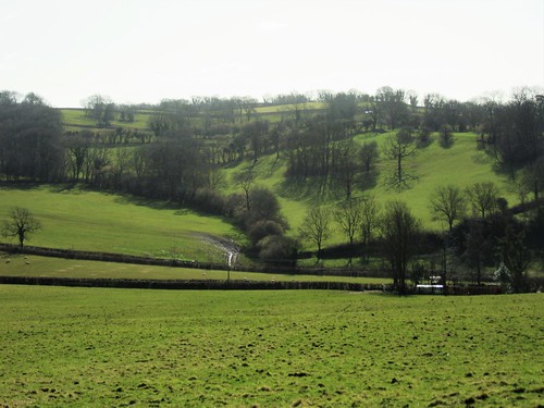
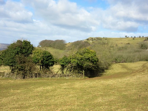
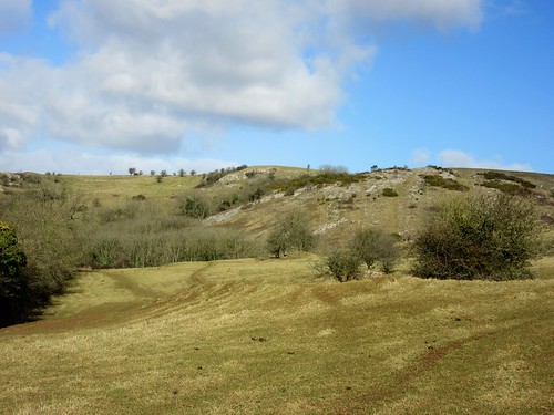
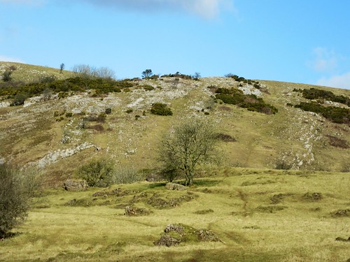
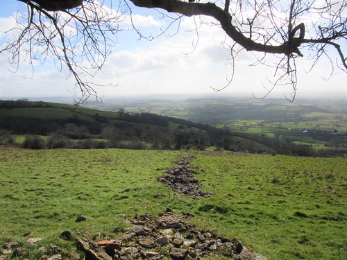
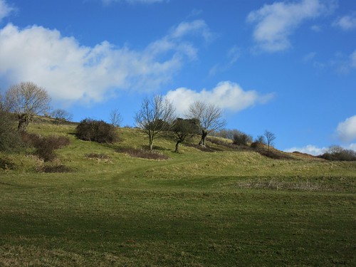
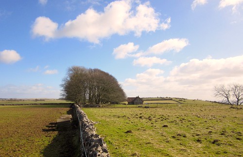
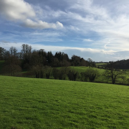
We descended to cross the Tees, then climbed to the return path along the rim of the dale. The sky turned slate grey behind us in the west. A bolt of rain, a whistle of wind, a crash of thunder and a spatter of hail like buckshot on our backs. Then brilliant spring sunshine spreading like butter across the pastures at Cooper House where plump lambs grazed and a brown hare sat tight in the wet grass, ears flattened along his damp furry back, delicately grooming each paw in turn.

Start: Barnard Castle long-stay car park, DL12 8GB (OS ref NZ 051163)

Getting there: Bus X75, X76, 84, 85, 95, 96 (Darlington),
Road – Barnard Castle is signed off A66, between Greta Bridge and Bowes (A1M, Scotch Corner junction).

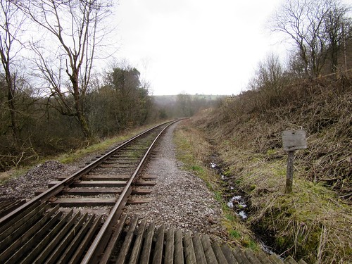
Walk (8½ miles, moderate, OS Explorer OL31): Right to Market Cross; right up main street. At right bend, left by Methodist Church (‘Castle’). Follow ‘Riverside Walk and Cotherstone’ down to riverside (047166); bear right and follow ‘Teesdale Way’/TW through woods, close beside river. In 1¾ miles, through gate into field (033183). In 100m right through gate (TW), steeply up to gate at top. Left along upper wood edge.

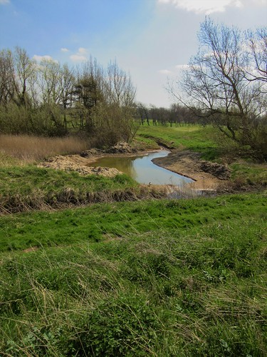
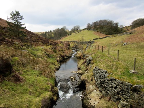
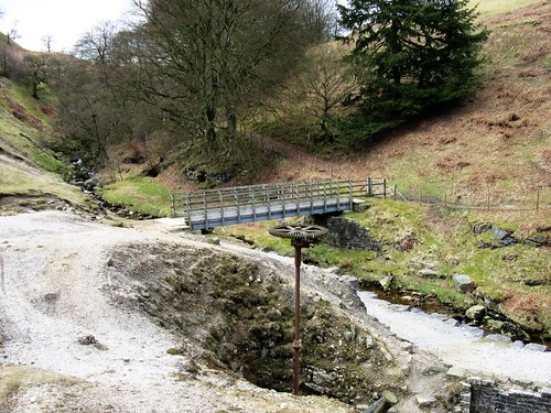
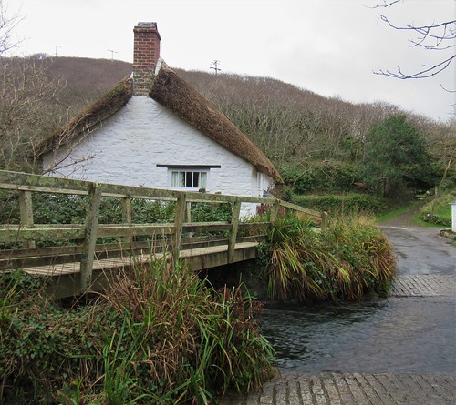
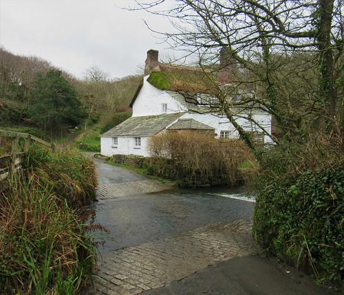
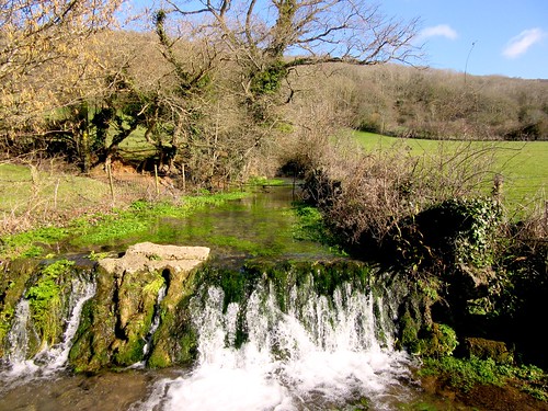
500m beyond West Holme House, cross stream on footbridge by waterfall (025195); bear half right up bank (yellow arrow/YA) and curve round left to cross wall stile (YA). Cross next field, aiming for corner of wood straight ahead of you. Follow it with wall on left. In ½ mile, left (017201, TW) to descend through trees to cross gorsy meadow. At 2-finger TW post (014202), left across Tees; on far side, left to cross tributary (013201).

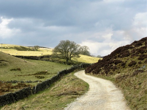
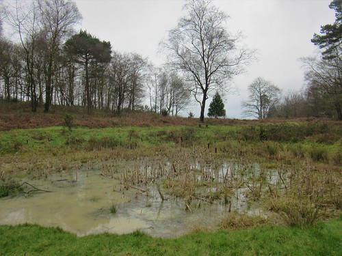
To visit Cotherstone, turn right here; to continue walk, climb steep bank opposite; up steps and along top of bank, following TW. In 1 mile pass Cooper House (023192); in 100m, left through kissing gate (TW) and bear right along lower wall. In ½ mile, descend to 2-finger TW post opposite pool (027186); right across stone footbridge and on. In 2 miles meet B6277 (045167); left across Tees footbridge (‘Cycle Route 70’); right to Barnard Castle.

Conditions: Some sections rocky and stumbly; a couple of short sharp climbs

Lunch: Picnic; or Fox & Hounds, Cotherstone (01833-650241, cotherstonefox.co.uk)

Accommodation: Three Horseshoes Inn, 5-7 Galgate, Barnard Castle, Durham (01833-631777; three-horse-shoes.co.uk) – smart, tidy and welcoming.

Info: Barnard Castle TIC (03000-262626), thisisdurham.com

visitengland.com; satmap.com; ramblers.org.uk

 Posted by at 09:15
Apr 162016


First published in: The Times Click here to view a map for this walk in a new window
picture picture picture picture picture picture picture picture picture picture picture
Facebook Link:

Coalhouse Fort lay low and ominous under a grey, rain-speckled sky. Any damned Frenchie coming up the Thames to burn London would be blown out of the water before he’d even spotted the bastion at the bend of the river; that was what General Gordon of Khartoum surmised when he built the fort out here in the marshy wastelands east of the capital. The French never came; it was the Dutch, 200 years before, who had burned East Tilbury church tower in a daring raid, and they were the last foes to get so far upriver until the German airmen of the 20th century.

We passed the grim old stronghold and set out north along the seawall path where large lilac-coloured flowers of salsify bloomed among the grasses. Across the river lay the ghostly outline of Cliffe Fort, where Charles Dickens sent poor little Pip in ‘Great Expectations’ on a foggy Christmas morning with stolen ‘wittles’ and a file for escaped convict Magwitch. This is all moody country hereabouts, looking downriver over bird-haunted marshes and mudflats to the giant skeleton cranes at the new container port of London Gateway.

All the marshes hereabouts have for centuries been the dumping ground for London’s rubbish. Now they’ve finished land-filling the giant tip on the appropriately named Mucking Marshes, and a phoenix from the ashes is arising there – Thurrock Thamesside Nature Park, a big reserve of reedbeds and grasslands, woods and lakes, already up and running even as it expands and consolidates.

The senior warden gave up some precious time to show us around. Reed buntings chattered, invisible among ten thousand stems, a cuckoo called, shelduck hoovered the mud flats, a brown hare scampered off. We mounted the spiral ramp to the roof of the Visitor Centre and had a wonderful 360o view over the sullen grey river, the cranes like giraffes at a waterhole, the greened-over hills of the landfill, and floating on the western skyline the towers and spires of London, as strange and distant as a dream.

Start: Coalhouse Fort, Princess Margaret Road, East Tilbury, Essex RM18 8PB (OS ref TQ 690769)

Getting there: Train/bus – train to East Tilbury; bus 374 to Coalhouse Fort. Walk ends at Stanford-le-Hope station; return to East Tilbury by rail.
Road (2 cars) – A13, A1013, minor road to Mucking; follow signs to Thames Thurrock Nature Park/visitor centre. Leave 1 car here, drive other to Coalhouse Fort (‘East Tilbury’, then ‘Coalhouse Fort’).

Walk (5½ miles, Coalhouse Fort to Stanford-le-Hope station; 5 miles, car to car; easy, OS Explorer 163. Online maps, more walks at christophersomerville.co.uk): Follow seawall path north from Coalhouse Fort for 1½ miles till fence blocks path (695792). Left along fence for 1 mile. Through metal gate (684793); right through kissing gate (‘Essex Wildlife Trust/TTNP’) into Thurrock Thamesside Nature Park. Left along path for ½ mile to lakes; right (679799) along path beside railway. In ¾ of a mile, path bends right just before Mucking road (683810); in 400m, bear right by Warden’s house (687810, ‘Visitor Centre’ fingerpost). If doing 2-car walk, follow roadway to Visitor Centre. If station-to-station, left at roadway in 100m (arrow) along path; in 350m, left through gate; cross sluice (691808). In 200m, fork left past metal gate (694809) to road (693812); left for 1 mile to Stanford-le-Hope station (682823).

Lunch: Inn on the Green, Stanford-le-Hope SS17 0ER (01375 400010, innonthegreen-stanfordlehope.co.uk); TTNP Visitor Centre café

Accommodation: Bell Inn, Horndon-on-the-Hill (01375-642463; bell-inn.co.uk) – friendly, well-run stopover

Thames Thurrock Nature Park: 01375 643342, essexwt.org.uk/reserves/thurrock-thameside

Coalhouse Fort: 01375 844203, coalhousefort.co.uk

visitengland.com; satmap.com; ramblers.org.uk

 Posted by at 01:46
Apr 092016


First published in: The Times Click here to view a map for this walk in a new window
picture picture picture picture picture picture picture picture picture picture picture picture picture picture picture
Facebook Link:

Consall Nature Park is a truly fantastic resource for nearby Stoke-on-Trent – a network of colour-coded paths in a proper wild tangle of steep woods and stream canyons.

On a cold spring morning we set out to explore. A duckboard path took us down over stodgy black bog to cross a stream in a dell shaggy with moss. Steps rose and steps fell over the shoulders of wooded promontories as we followed the white and purple trails through the Nature Park. A bench perched high on a west-facing ledge of Far Kingsley Banks gave a view across massed treetops of smoky green and milky purple, a subtle touch of spring’s finger on these awakening woods.

On past distorted oaks throwing swollen arms in all directions, down a long flight of knee-cracking steps, and out into the bottom of the Churnet Valley. We crossed the River Churnet tumbling over its sandstone ledges, then the track of the Churnet Valley Railway, and the silver strip of the Caldon Canal whose barges once shifted locally mined ironstone to Froghall.

We followed the canal as far as the gothic arch of Cherryeye Bridge, then climbed steeply up through forestry into upland fields walled with stone and open to the wind. Great puffing gouts of blue-brown coal smoke from the valley bottom showed where the steam engines of the Churnet Valley Railway were getting their spring blow-through.

A plunge down through Booth’s Wood, a zigzag of steps up to Booth’s Hall Farm in a sea of old tyres and hay bales. Down again to the railway and canal, and a towpath stroll to the Black Lion at Consall Forge. A quick stop for a drink in the company of a local humorist and his glossy labrador – the latter a complete fool for pork scratchings – and we were back in Consall Nature Park on the homeward trail.

Start: Consall Nature Park Visitor Centre car park, near Leek, Staffs ST9 0AF (OS ref SJ 994484)

Getting there: ‘Consall Hall Gardens’ signed off A52 (Stoke-on-Trent – Ashbourne) between Kingsley and Cellarhead.

Walk (5½ miles, moderate-strenuous, OS Explorers 258, 259; download trail map at staffordshire.gov.uk): From car park, pass ‘Follow the coloured posts’ notice. Path downhill; at Heron Pool, fork right downhill (Red Walk, White Walk). Opposite ‘Lower Lady Park Wood’ sign on right, go left down steps. Duckboard path across stream; up steps to post with yellow arrows/YA (996481). Left down to stream (don’t cross!); up again (many steps!) and follow White Walk. In 300m pass bench; in another 150m, fork right on Purple Walk (999483, ‘Far Kingsley Banks’ notice, purple post). In 250m (001483) descend long flight of steps. At bottom, cross stream; in 30m, by ‘Consall Nature Park’ notice (003484), Purple Walk forks right; but you fork left down steps to cross River Churnet, Churnet Valley Railway and Caldon Canal.

Turn right (004484) along canal towpath for ¾ mile to pass under Bridge 53/Cherryeye Bridge (014482). Right over stile (‘Moorlands Walk/MW’); cross bridge; follow MW directly up little slope; steeply on up to valley top and stile into field (017483, MW). Ahead to far wall; left along it. In 200m, wall turns right; keep ahead here into wood (017486, MW). Down to footbridge; up steep steps to field (015488). Follow MW to Booth’s Hall Farm. Aim right of barn (MW), then house; pass Orchard View; follow fence on left to field corner (011490). Left through kissing gate (MW); right along fence/hedge. Where it bends away right, keep ahead past telephone pole (YA) through gap with bank (008489) to Glenwood House.

Follow YAs to left, and on into field (006488). Follow right-hand hedge to stile (004488, MW) into wood. Down to road and canal (001487). Right under Bridge 50B; towpath past Consall station to Black Lion PH (000492). Go under railway bridge; left across canal bridge 50 and river bridge. Left along riverside track past Consall station; on past ‘Consall Nature Park’ sign to cross road (000486); follow white posts back to Visitor Centre.

Conditions: many short, steep ascents, descents and steps

Lunch: Black Lion, Consall Forge (01782-550294; blacklionpub.co.uk)

Accommodation: The Manor, Cheadle ST10 1NZ (01538-753450, themanorcheadle.co.uk)

Consall Nature Park: 01782-550939 or 302030; staffordshire.gov.uk. Visitor Centre open 2-4, weekends, BH.

Info: Leek TIC (01538-483741)

visitengland.com; satmap.com; ramblers.org.uk

 Posted by at 01:32
Apr 022016


First published in: The Times Click here to view a map for this walk in a new window
picture picture picture picture picture picture picture picture picture picture picture picture picture picture picture picture
Facebook Link:

‘Oh! There’s a pair of Mediterranean gulls!’ exclaimed RSPB warden Nick Godden, pointing skyward. The gulls drifted across the binocular lenses, big black heads with scarlet bills, bodies and wings of a white so intense as to be almost translucent. ‘They were mating last weekend, and we think they’re going to nest at Marshside. It’ll be the first time ever!’

The RSPB’s coastal reserve at Marshside sits just north of Southport on the southern tip of the Ribble estuary. It’s ideally placed to catch the attention of birds with its sheltered and food-laden mixture of freshwater marshes, mud-banks, pools, islets and a huge apron of saltmarsh across which the sea slides and withdraws with every tide. Spring is the perfect time for walking with binoculars here as tens of thousands of geese, ducks, waders and songbirds with mating on their minds move through, using Marshside as a pit-stop on their incredible journeys north to nesting grounds thousands of miles away in Scandinavia, Russia, Iceland and Greenland.

Some don’t move on, but stay and breed right here. At the big picture windows in the Visitor Centre hide we stood and watched a black-and-white avocet sitting tight on her four-egg clutch on an islet of pebbles, while her mate stepped delicately through the shallows on long, spindly blue legs as he looked for food. Beyond the islet a cormorant struggled to swallow a wildly writhing eel, shaking its head to try and quell the mad squirming of its victim. Eventually it forced the eel down its gullet and swam off, sipping water to help the turbulent dinner down.

Nick Godden accompanied us out along Redshank Road, an old sand-dredger’s track that curls out through the saltmarsh to the water’s edge. As the tide swirled in along the marsh channels, through white drifts of flowering scurvy grass, we watched ringed plover huddling together on the stones, dunlin flickering low over the water like a thousand fragments of silver foil, and the solitary stance of redshank, ‘the Warden of the Marshes’ as Nick calls them, with their piping alarm calls warning the other birds as soon as danger threatens – be it fox, peregrine or man.

Back on the coast road we walked a leisurely circuit of the Reserve’s perimeter among joggers, dog walkers and birders. On the grasslands, lapwings tended tiny chicks, and a brown hare sat motionless with flattened ears rippling in the wind. South lay Southport, and distant across the sands rose Blackpool’s Tower and giant rollercoaster. But the inhabitants of the world we were walking through knew nothing of them, and cared even less.

Start: Marshside RSPB car park, Marine Drive, Southport, Merseyside PR9 9PB (OS ref SD 352205)

Getting there: Bus 44 (Southport-Crossens) to Elswick Road junction.
Road: From Southport Pier follow Marine Drive north; car park is on left in 2 miles.

Walk (6 miles, easy, OS Explorer 285. Reserve map from Visitor Centre. Online map, more walks at christophersomerville.co.uk): Cross Marine Drive; left on path to Visitor Centre in Sandgrounders Hide (354207). Return to Marine Drive, and walk clockwise round the two halves of the Reserve, Sutton’s Marsh and Rimmers Marsh; then from car park out along Redshank Road to tideline and back.

Conditions: Can be very windy. Bring binoculars. Walking Redshank Road, keep an eye on the tide! Tide times posted at Visitor Centre.

Lunch: Picnic

Accommodation: Ramada Plaza Hotel, The Promenade, Southport PR9 0DZ (01704-516220; ramadaplazasouthporth.co.uk) – large, comfortable hotel on Southport’s Marine Lake. World-beating fish’n’chips!

RSPB Marshside: 01704-226190; rspb.org.uk/marshside

Information: Southport TIC (01704-533333).

visitengland.com; satmap.com; ramblers.org.uk

 Posted by at 07:44
Mar 192016


First published in: The Times Click here to view a map for this walk in a new window
picture picture picture picture picture picture picture picture picture picture picture
Facebook Link:

A cold, still day of early spring, with the clouds layered in motionless lines over the Worcestershire hills. The low whine of an organ from the red sandstone Church of St Kenelm heralded the end of Matins as we left Clifton-upon-Teme and headed out over pale pink ploughland. Down in the steep wooded cleft of Witchery Hole, dog’s mercury had taken over the world, a brief flush of tiny green flowers at the crack of spring before the primroses and wood anemones had got properly into their stride.

The Teme is a beautiful river. A.E. Housman called its landscape ‘the country for easy living, the quietest under the sun’, and there’s something leisurely and seductive about the slow green flow of the river, the miniature red cliffs of its steep banks and the winding valley it has smoothed out under high ridges of hard limestone. We walked upstream along the river to Brockhill Court with its stumpy old oasts (this was hop-growing country once upon a time) and red brick barns where a tawny owl was softly hooting.

A series of shallow billowing valleys led up to a little wood. We sat to eat our buns and cheese, watching a pair of tree creepers scuttling up an ash trunk, their neckless heads tucked down into their shoulders as they picked insects from winter shelter in the cracks of the bark.

On up past Hillside Farm with its three architectural eras all jammed improbably together; a steep little burst up to the ridge, and then three glorious south-going miles along the Worcestershire Way, hurdling the dips and striding along the crests with a broad plain stretching out eastward, and the Teme to the west running unseen in its lumpy green valley far below. We saw frogspawn in thick clumps in a pond at Woodbury Old Farm, smelt a whiff of wild garlic on the rim of a petrol-blue flooded quarry, and heard the first chiffchaff of the year in the woods on Pudford Hill.

Down in the valley we recrossed the dully glinting Teme and went up a long bridleway towards Clifton-on-Teme, with the pocket mountain range of the Malvern Hills rising in the south, smoky grey and insubstantial in the last sunlight of the March evening.
Start: Lion Inn, Clifton-upon-Teme, Worcs, WR6 6DH (OS ref SO 714616)

Getting there: Bus 308, 310 from Worcester
Road – Clifton-upon-Teme is on B4204 between Martley and Broadheath (M5, Jct 7; A44 west)

Walk (9 miles, strenuous, OS Explorer 204): Take signed footpath between Lion Inn and church. Follow yellow arrows (YA) into field. On far side, over left-hand of 2 stiles (716617). Ahead with hedge on left. At field end, left over stile (718619); follow hedge on right. In 50m, right over stile (YA); on to cross lower stile (YA). Aim across field to right-hand corner of Harrisfield house (719621); bear left around house, and on down to cross stile into woodland (720623). Right along waymarked track, steeply down Witchery Hole for ½ mile to road (728624). Right, then left across New Mill Bridge. Left (729625) along east bank of River Teme for ¾ mile to road at Brockhill Court (728635).

Right at foot of drive (YA) through gate. Up and through next gate; right (YA) into shallow valley. Bear half right to gate (731639, faded YA). Follow valley bottom NE to stile into wood (735642). Follow path clockwise to cross stream (736642); 50m up the far bank, bear right to leave wood over stile (737643). Aim for far top corner of field (738644); over stile, and follow fence on left. Just past Hillside Farm house, left through gate (739645) onto drive; right to road (741646).

Cross road onto waymarked Worcestershire Way/WW; follow it south for 3 miles to B4204 (743608). Right (take care!) for half a mile to cross River Teme by Ham Bridge (737611). First right after bridge (‘Shelsleys’); pass 2 houses, then left (736611) up bridleway. Climb through wood; in 400m, at top of first rise, dogleg left/right through gate (732612, blue arrow, ‘Sabrina Way’). Continue uphill with fence on right for 1 mile to Church House Farm. Left to road (717615); right to Lion Inn.
Conditions: Strenuous walking, plenty of up-and-down. Steep, slippery, and many steps in Witchery Hole wood.

Lunch/Accommodation: Lion Inn, Clifton-upon-Teme (01886-812975) – friendly, clean village inn.

Information: www.temetriangle.net

visitengland.com; satmap.com; ramblers.org.uk

 Posted by at 01:38
Mar 122016


First published in: The Times Click here to view a map for this walk in a new window
picture picture picture picture picture picture picture picture picture picture picture picture picture picture picture picture
Facebook Link:

Business-like bunches of walkers were assembling in Pateley Bridge car park in a clatter of boots and sticks. Nidderdale is a favourite spot for walkers in North Yorkshire, and everyone wants to grab hold of a day like this, with enormous white clouds slowly drifting in a blue sky across the dale. We lost sight of everyone as soon as we’d left the little market town. This sort of steep, rolling country has a mysterious way of swallowing its walkers, and true to form we scarcely saw another soul all day.

The spring wind came down from the moors, full of the baby cries of new-born lambs and cold enough to prickle the nose. We followed the waymarked Nidderdale Way west along a narrow farm road between carefully maintained stone walls that sparkled with minute, intense winks of sunlight. Farms lay along the higher contours of the green inbye land. The steep fields were striped with walls that wriggled like snakes up the undulations of the daleside and vanished over the top into sombre-coloured moorland, where heather-burning operations were sending up slowly curling towers of oily-coloured smoke.

We sat to eat our snack on a fallen stone lintel opposite the bankside cottage of Throstle Nest. A gang of ewes still heavy with unborn lambs came up bleating for crisps. They soon settled to cropping the grass with short, decisive jerks of their greenish teeth – gentle company, and a peaceful sound to picnic by.

We followed the lane down to Ashfold Side Beck through a tremendous slump of old lead mine workings. Below the ashen tips a cluster of tumbledown buildings and a great rusty cogwheel and shaft showed where 19th-century miners had processed the precious and poisonous ore. Cornishmen, Irishmen, Scots and Welsh all laboured here for the Prosperous and Providence Lead Mining Company, working the Wonderful and Perseverance Levels – names that say everything about the triumph of hope over experience.

Back along the beck and up over the fields to Stripe Head Farm, where the farmer in cap and gumboots was helping a ewe newly delivered of twins. ‘I’m out at eleven at night to check on them this time of year,’ he said, ‘and out at 5.30 am, too.’ The newborn lambs staggered about and cried until they found what they were looking for under their mother’s shaggy pelmet of wool stained dark by the winter. Then you couldn’t hear a sound out of them.
Start: Showground car park, Pateley Bridge HG3 5HW (OS ref SE 157654)

Getting there: Bus – 24 from Harrogate
Road – Pateley Bridge is on B6265 between Grassington and Ripon.

Walk (7 miles, easy/moderate, OS Explorer 298): From car park, left along B6265. Pass turning to Ramsgill; in 50m, right (fingerpost, yellow arrow) up laneway to road (155654). Dogleg right/left (‘Ladies Rigg’), and follow path through fields past Eagle Hall, following left-hand hedge/fence to meet Nidderdale Way/NiW at corner of wood (147655). Turn right along road, following NiW.

In 1 mile, fork right at Hillend along lower lane (131653, ‘Ashfold Side, Cockhill’; NiW). In 700m cross Brandstone Dub Bridge (124655); follow stony lane to left. In ½ mile follow path down through ruin of Providence Lead Mine workings to cross Ashfold Side Beck (119611). Follow NiW downstream for 1¼ miles. Beyond Low Wood, left off lane (138664, NiW, ‘Heathfield’). Up field edge, through Spring House farmyard (138665); half right across next field to gate; on along track by wall. In 500m pass Highfield Farm; on down to Heathfield and Grange Lane (138673).

Left along road. In 250m, 100m before Pie Gill drive, right through gate (137676, fingerpost). Follow left-hand wall; cross stile; half right between garage and wall. Keep wall on left till it bends left; aim half right for gate below (139679). Down track to Stripe Head Farm; through gate to right of buildings; down to road (141680). Right; in 500m, left (‘Wath’) across bridge (145677); right on NiW along River Nidd for 1¾ miles to Pateley Bridge.

Lunch: Sportsman’s Arms, Wath (01423-711306; sportsmans-arms.co.uk)

Accommodation: High Green Farm, Wath, Pateley bridge HG3 5PJ (01423-715958; highgreen-nidderdale.co.uk) – first class B&B or self-catering.

Info: Pateley Bridge Museum, King Street, Pateley Bridge (01423-711255; nidderdalemuseum.com); Pateley Bridge TIC (01423-711147); visitharrogate.co.uk; nidderdaleaonb.org.uk

visitengland.com; satmap.com; ramblers.org.uk

 Posted by at 01:36
Mar 052016


First published in: The Times Click here to view a map for this walk in a new window
picture picture picture picture picture picture picture picture
Facebook Link:

It was a chilly February morning in the lee of the Surrey hills, but the sparrows of Ewhurst were chirping all round the village nonetheless. Cold fresh air stung our nostrils in Wykehurst Lane, where the sharp, sweet song of a solitary robin laid the archetypal soundtrack for a wintry walk in the woods.

Snowdrop clumps were still full and white down in the sheltered hollow of Coneyhurst Gill. We followed a muddy path up towards the tree-hung escarpment of the great greensand ridge that cradles the lowlands of the Surrey Weald. This was all loud and smoky ironworking country in the late Middle Ages, but these days the fine large houses of the stockbroker belt look out from their hillside eyries onto paddocks and pastures that lie silent and unblemished. Under a hazel by the path we passed a modest plaque: ‘Tony sleeps here. Good dog.’

Signs of spring were already infiltrating the closed doors of winter – lambs-tail catkins and tiny scarlet flowers on hazel twigs, rushy spears of bluebell leaves under the oaks, and an insistent bubbling of birdsong up in the high woods along the ridge. A stream stained orange by iron leachings had cut deeply into the greensand, and the golden ball of a crab apple bobbed endlessly in a back eddy where the brook had trapped it for a plaything.

The Greensand Way trail strings together the promontories and heights of the escarpment, and we followed its knobbly yellow track up through the woods to Holmbury Hill. In the century before the Romans invaded Kent, a Belgic tribe built a mighty fort here with ramparts and ditches as tall as three men. From its southern lip a wonderful view opens out across the Weald and away towards the South Downs some 20 miles off. On clear days, walkers on Holmbury Hill can spot the semaphore flashes of the sea at Shoreham on the Sussex coast. But today all was muted and misty down there.

Using gorse branches as banisters we groped our way down a precipitous slope below the hill fort. At the foot of the escarpment the mud-squelching track of Sherborne Lane led us back through the fields towards Ewhurst, between hedges where primroses were already beginning to cluster among the hawthorn roots.

Start & finish: Bull’s Head PH, Ewhurst, Surrey GU6 7QD (OS ref TQ 090408)
Getting there: Bus 53 (Horsham-Guildford)
Road: Ewhurst is on B2127 between Forest Green and Cranleigh

Walk (6 miles, moderate grade, OS Explorer 145, 146): From Bull’s Head cross B2127; follow Wykehurst Lane (fingerpost/FP). In ½ mile cross bridge over Coneyhurst Gill (082407); in 50m, right (FP, stile) on path through trees. In 600m, left along road (081413); in 50m, right (‘Rapsley’) up drive. Pass Rapsley Farm; on up path on edge of wood. At road, right (081422); in 100m, left up Moon Hall Road.

In 200m, opposite gates of Folly Hill, fork left up bridleway (084422, FP) for 400m to turn right along Greensand Way/GW (085425). In 300m fork right past wooden barrier (086428, GW), downhill and through grounds of Duke of Kent School. Cross Ewhurst Road (090430); on along GW for ¾ mile to car park on Holmbury Hill (098431). Leave car park at far right corner. In 150m, just past pond on right, fork right on path (not broad track) among trees, past wooden barrier (‘Footpath Only’). At edge of escarpment bear left; in 200m turn right along GW (101430). Follow GW to trig pillar on Holmbury Hill fort (104429), and on for 100m into hollow. Right here (105429) down slope past notice ‘Bridleway 193 – Caution, steep slope ahead’. Very steep, rubbly slope down to road (105428).

Right; in 200m, left off road, and follow fenced path to left of gate marked ‘Wayfarers’ (FP). In 100m cross road (103426); ahead along drive with staddle stones (FP). By pond, fork left (‘Bridleway’ FP) along Sherborne Lane bridleway. In ½ mile pass drive to Radnor Place Farm on left (095419). Continue along Sherborne Lane. In 300m, at stile and yellow arrow on right, turn left onto driveway (093418). Right; in 50m, left (FP) along fenced path across Path Four Acres field and into wood (094414). Right (FP) to road in Ewhurst (090409); left to Bull’s Head.

Conditions: Muddy/wet paths; very steep slope down from Holmbury Hill fort.

Lunch/accommodation: Bull’s Head, Ewhurst (01483-277447, bullsheadewhurst.co.uk) – lovely pub, lovely grub
More info: Guildford TIC (01483-444333)
visitengland.com; satmap.com; ramblers.org.uk

 Posted by at 01:05
Feb 202016


First published in: The Times Click here to view a map for this walk in a new window
picture picture picture picture picture picture picture picture picture picture picture picture picture picture
Facebook Link:

Big waves, driven in by a strong west wind, were smashing on the rocks all along the North Cornwall coast. From Steeple Point high over Duckpool’s sandy scrap of beach we watched thirty jackdaws wheeling in a tight bunch on the buffeting wind, chakking excitedly to one another. White teeth of surf glinted far below in the mouth of the Duckpool valley.

The waves made wrinkled lines in the grey-brown Atlantic as far out as the eye could see. They moved ponderously inshore, topped with quiffs of spray, to crash among the black stumps of rocks and reefs with a dull thunder that made the air quiver. Under a mackerel sky the deep Duckpool valley ran back inland, its massed oaks murmurous with the half-gale. It was all we’d hoped for on a Cornish coast walk in midwinter – sound, fury, drama, and the elation of a stiff wind to beat our cheeks red and shove us along the cliff path.

Down on Wren Beach the sea surged across the shallows in delicate pulses, like a fine lace shawl swept rhythmically to and fro. The stark white dishes and domes of a GCHQ tracking station came peeking up over a rise of ground like an exhibition of Bauhaus architecture. Then they fell away behind as we dipped down into the cleft of Stanbury Mouth. A seat on a tuffet of sea pink leaves gave us a grandstand view of the waves running in, bursting on the rocks of Rane Point and flinging up lazy tails of spray with a hiss you could feel, rather than hear.

A boggy green lane led inland from Stanbury Mouth. If the flowers along here could be believed, spring was already nudging winter out of bed – primroses, campion, tender young nettles, alexanders and a brace of half-emerged dandelions.

Out across sedgy upland fields where starlings flocked fifty strong in a skeleton oak tree. By a lovely old wall of cob and slate at Eastaway Manor a bunch of sheep trotted away like affronted dowagers bundled into fur coats. We followed an old green lane down the slope of the fields and onto the homeward path through Hollygrove Wood. The sense of peace was profound down here – just the low roar of wind in the oak tops, and the throaty chuckle of the stream meandering down to Duckpool.

Start: Duckpool car park, Coombe, near Kilkhampton EX23 9JN approx. (OS ref SS 202117)

Getting there: A39 to Kilkhampton; minor road to Stibb; follow ‘Coombe’; at Coombe, follow ‘Duckpool’ to car park.

Walk (5¼ miles, moderate, OS Explorer 126): Follow South West Coast Path north for 1¾ miles. At Stanbury Mouth (200135) follow path, then green lane, inland (yellow arrows/YA). In 500m lane bends left (206135); ahead through kissing gate/KG (YA). Path across slopes (KG, YA); in 200m, right across footbridge (208136) and stile. Cross 2 fields (stiles, YAs) to cross road (212138). Green lane (YA) past Eastaway Manor; on across field to double stile (215136, YA).

Half left across field; over stile (YA); follow right-hand hedge. In 200m, right through hedge (218136, YA). Don’t go through metal gate ahead, but turn left along path to road in Woodford (219135). Right; in 100m, right down lane. Pass Shears Farm; in 100m, right at top of rise (218133, YA, green dot) down stony lane. In 500m go through gate across track (217129); bear left down grassy track (YA) into wood. In 200m, hairpin right (YA) to bottom of wood (216128); left across footbridge and following stile. Right along track for ¾ mile to road (210118). Ahead downhill across ford; in 200m left, then right (208117, ‘Duckpool’) to car park.

Conditions: Windy on cliffs (unguarded edges); muddy in lanes and fields

Lunch: Picnic

Accommodation: Several Landmark Trust properties at Coombe (01628-825925; landmarktrust.org.uk) – unfussy, beautifully maintained cottages in a quiet dell

Info: Bude TIC (01288-354240)
visitengland.com; satmap.com; ramblers.org.uk

 Posted by at 01:24
Feb 132016


First published in: The Times Click here to view a map for this walk in a new window
picture picture picture picture picture picture picture picture picture picture picture picture picture picture picture picture
Facebook Link:

A brisk wind over the Mendip Hills scoured the sky to a delicate china blue as we set out from Rodney Stoke on the valley road to Cheddar. Daffodils were struggling out by the stream in Scaddens Lane, half their buds still hard and waxy. Scarlet elf-cap fungi lay like chucked-away orange peel among the frosted leaves in Stoke Woods, where the steep path was a stodge of dark red mud. The tips of the silver birches were just beginning to flush a milky pink, but otherwise the woods were still caught fast in their long hibernation.

At the top of the ridge we found craggy outcrops of limestone, very pale in the late winter sun, and one of those giant West Mendip views over the Somerset Levels that took in the low ridge of the Polden Hills, the Blackdowns beyond, the Quantocks further west, Exmoor in ghostly grey, and the Welsh hills beyond a broad chink of sea in the Bristol Channel. The long, canted back of Glastonbury Tor with its pimple of a tower lay at the heart of this truly remarkable prospect.

The West Mendip Way led east, an upland path through big square fields enclosed by drystone walls. Each wall contained its stile, a solid slab of limestone with steps up and down, some of the stiles three or four feet tall.

On the outskirts of Priddy, the only settlement on Mendip’s broad plateau, we turned back on a path slanting south-west down the long slope of the escarpment. The thickening light of afternoon gave the enormous view the quality of a watercolour painting, the colours blurred and melting together.

In Cook’s Fields Nature Reserve the path ran over limestone sheathed in aeolian soil, a pleasing name for the soil that blew down here 10,000 years ago on Arctic winds from the retreating glaciers to the north. Horseshoe vetch, carline thistles and autumn lady’s tresses grow in Cook’s Fields, chalkhill blue butterflies disport themselves on wild thyme – but not on a cold winter’s day such as this.

We descended over strip lynchets made by ox ploughs a thousand years ago. Lambs sprang and bleated at Kites Croft, and six jolly porkers looked over their stye wall and grunted us back to civilization down at Old Ditch.

Start: Rodney Stoke Inn, near Cheddar, Somerset BS27 3XB (OS ref 484502)
Getting there: Bus 26, 126 (Wells-Cheddar)
Road – Rodney Stoke is on A371 (Wells-Cheddar).

Walk (7 miles; moderate – one steepish climb, many stiles; OS Explorer 141. Online maps, more walks at christophersomerville.co.uk): From Rodney Stoke Inn, right along A372. In 250m, left (486501) up Scaddens Lane. In 400m, left (490502) on path climbing north up field, through Stoke Woods (yellow arrows/YA). At top, over stile (487510, YA). Half right; cross stile at left end of hedge on skyline (489513). East along West Mendip Way/WMW for 1½ miles to road (512513). Lane opposite; in 250m (514514), right on WMW. Just before Coxton End Lane, right on path for 1¾ miles, south, then south-west over Cook’s Fields Nature Reserve to gate below barn (506493). Track to Stancombe Lane; left; in 50m, right down field to stile into lane; fork right to road (502493). Right; in 200m pass ‘Martins’ house on right; in 150m, left (499495, fingerpost) up Westclose Hill. At top, right for 700m to road (492497). Left to cross A371 (489497); Millway to T-junction (483499). Left; in 100m, right up Butts Lane to A371; right to inn.

Lunch: Rodney Stoke Inn (01749-870209; rodneystokeinn.co.uk) – cheerful, bustling pub
Info: Wells TIC (01749-671770)
visitengland.com; satmap.com; ramblers.org.uk

 Posted by at 02:47
Feb 062016


First published in: The Times Click here to view a map for this walk in a new window
picture picture picture picture picture picture picture picture
Facebook Link:

The sweet, rich scent of log fires came wafting from the Rising Sun as we set off from the green at Witheridge Hill. A cold and sunny afternoon lay across the south-eastern corner of Oxfordshire where the Chiltern Hills make their last southward dip towards the River Thames.

It’s all about the woods here, and we were soon in among them – Holly Grove Wood where the sun silvered the oak trunks, Padnell’s Wood where the first bluebell leaves, ridiculously early, were poking their green spearheads up among the beech roots. This is well-kept, well-walked country, the woodland tracks carpeted with leaves blackened and trodden flat, the field paths sticky with mud where flint chips and water-smoothed glacial pebbles rolled under our boots.

We threaded the village greens of Shepherd’s Green and Grey’s Green, delectable villages of mellow brick and flint. Volunteers from the admirable Chiltern Society have built kissing gates and waymarked the paths, and have also compiled a new book, ’50 Great Walks in the Chilterns’. Its instructions led us unerringly to Grey’s Court and the remarkable old house there, where the rather naughty Knollys family held sway and misbehaved in Tudor and Jacobean times.

Adultery, multiple illegitimacies, and rumours of murder swirled around Grey’s Court and its inhabitants. Sir William Knollys’s sister-in-law Frances Howard was clapped into the Tower of London in 1615 for poisoning a friend of her husband’s. But the most outré stories concern the previous occupants of the great house, the Lovell family. One Lovell lady, playing hide-and-seek at her marriage celebration, locked herself by mistake into a trunk and was discovered there years later, a skeleton in a wedding dress.

Heads a-buzz with these macabre tales, we took the homeward path through the woods. Red kites swung and swept over the meadows, the rooks of Tartary Wood cawed the day to a close, Be-aaar! Be-aaar!, and a pearlescent cloud crept slowly west to blur the sunset in scarlet and gold.

Start: Rising Sun PH, Witheridge Hill, Highmoor Cross, near Henley-on-Thames, Oxon RG9 5PF (OS ref SU 697841)

Getting there: Rising Sun is signposted off B481 just south of Highmoor Cross

Walk (8 miles, easy, OS Explorer 171): From Rising Sun, right through car park; path through trees to road. Path beside house opposite (fingerpost/FP). Up field edge (kissing gate/KG, yellow arrow/YA), then track. At left bend (700841), ahead (KG/YA) past shed end and on along field edge. Half left across sports field to cross B481 (703840, KG, FP) onto path through trees. In 200m pass waymark post; in another 100m, right (705842, YA) into field. Take right fork across field to cross Rocky Lane (707840, FP) and on through Padnell’s Wood.

In 200m, left (707838, YA) out of wood (KG). Across pasture, through another wood, on along field edges (KG, YA) for ½ mile. Along left edge of village green at Shepherd’s Green; on (KG) along fenced path. Entering Sam’s Wood (716832), take right fork along wood edge, then left edge of village green at Grey’s Green. Pass pavilion and bear left (720830, ‘Chiltern Way Extension’/CW) into trees, with wall, then laurel hedge on right. Through wood; down across valley (CW) and across road (723832) into Grey’s Court estate.

Follow roadway for 400m past house to entrance kiosk (727834). Half left (YA) along edge of car park; in 100m, through gate; on with iron fence on left. Through Johnnie’s Gate (named); in 40m, left through gate; across footbridge, and left (728837, YA) through trees, across pasture and driveway (729839, CW, KG) into Famous Copse (728841). Bear left (red arrow/RA) and follow RAs and white arrows on trees through wood. In a little over ½ mile, RA route turns left through gate (720839); but keep ahead downhill (blue arrow/BA). At foot of slope, right (BA) on fenced bridleway. In 300m, left (719841, YA) within edge of Tartary Wood.

In ½ mile cross stile to leave wood (711845, YA). Cross field with deep hollow on right, then cross drive into wood (711846, KG, YA). Bear left on path. In 400m, at path crossing (707847), YA points ahead; but turn right here on bridleway. In 350m pass cottage on left; in 100m, at crossroads (704851), keep ahead on tarmac driveway which curves to right through Highmoor Common Wood. In ½ mile cross B481 (702857) into Deadman’s Lane (‘Nuffield 3’, ‘Merrimoles Farm’). In 50m, with gates on right, keep ahead on bridleway along edge of trees (BAs). In ⅔ mile, left (693860) along tarmac lane up Devil’s Hill. In 500m, left at T-junction (690856) on track through Notts Wood (BAs). In ½ mile, out of wood (691850) and on along lane for 600m, descending to road at Newnhamhill Bottom (690843). Left; in 400m, at crossroads, left (693842, ‘Witheridge Hill’) to Rising Sun.

Conditions: Can be very muddy in fields and woods

Lunch: Rising Sun, Witheridge Hill (01491-640856, risingsunwitheridgehill.com) – cosy, welcoming village pub

Accommodation: Cherry Tree Inn, Stoke Row, Oxon RG9 5QA (01491-680430, thecherrytreeinn.co.uk)

50 Great Walks in the Chilterns (£14.95, Chiltern Society, 01494-771250, chilternsociety.org.uk) features this walk with full directions.
visitengland.com; satmap.com; ramblers.org.uk

 Posted by at 01:04