Nov 142015


First published in: The Times Click here to view a map for this walk in a new window
picture picture picture picture picture picture picture picture
Facebook Link:

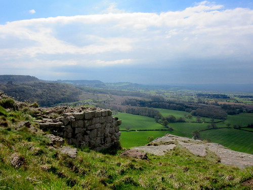
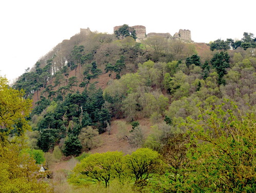
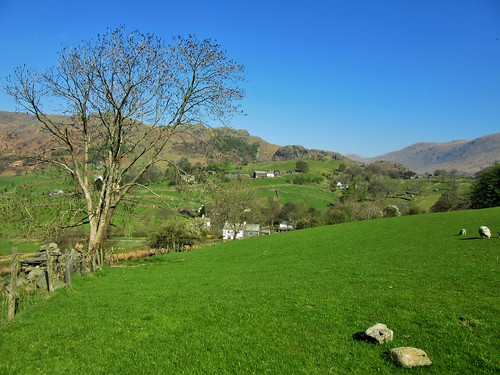
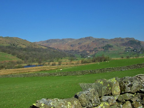
Upper Hambleton stood high and handsome on its green ridge this autumn morning, its rosy stone houses glowing in clear sunshine under a china blue sky. It was the village’s hilltop position that saved it when the Gwash Valley was flooded in the 1970s to create the giant man-made lake of Rutland Water.

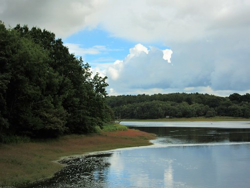
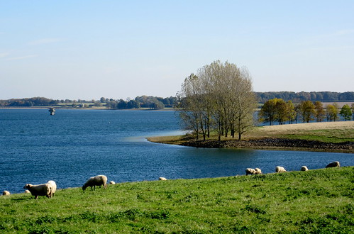
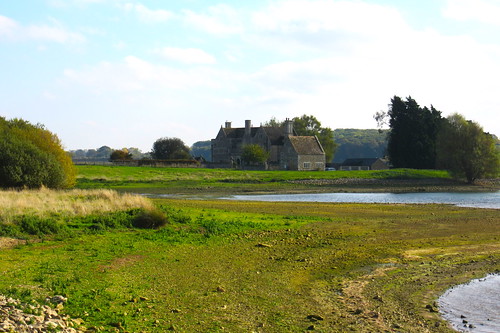
Ever-expanding Peterborough’s thirst for fresh water saw the villages of Middle and Nether Hambleton drowned beneath the reservoir’s rising waters, but their elevated neighbour escaped the tide. Now Upper Hambleton sits in solo splendour across the neck of a long peninsula extending into the great sheet of water that lies at the heart of Britain’s smallest county.

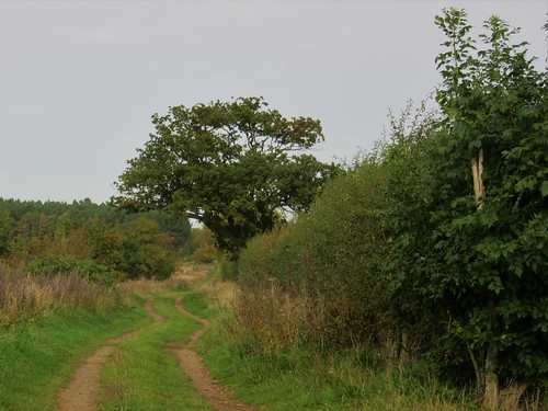
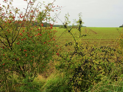
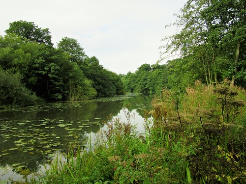
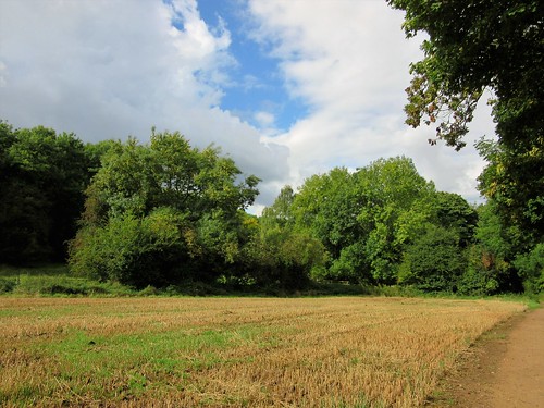
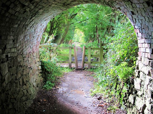
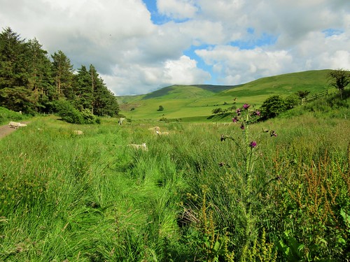
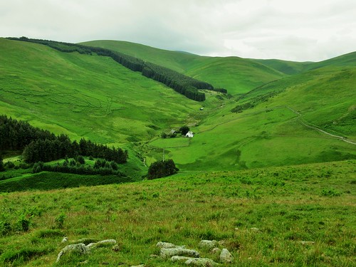
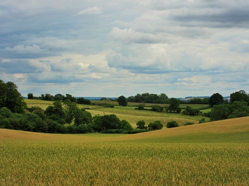
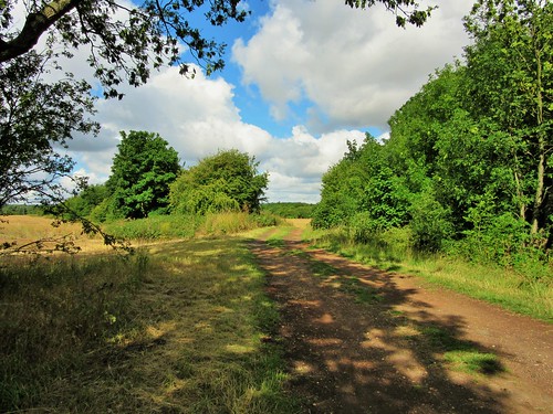
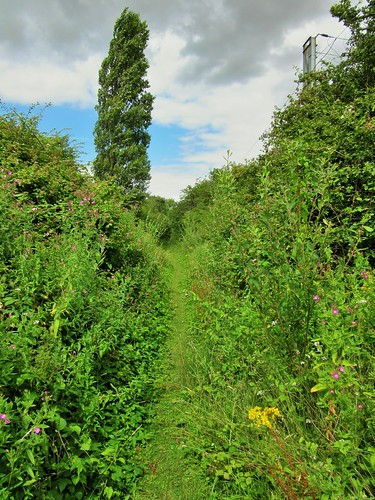
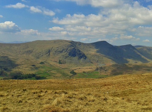
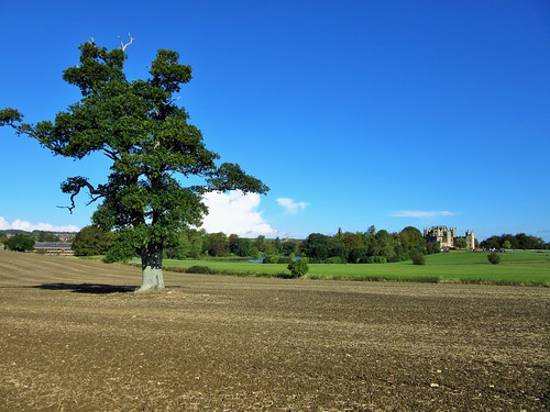
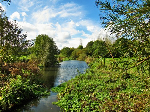
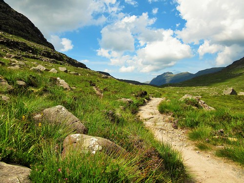
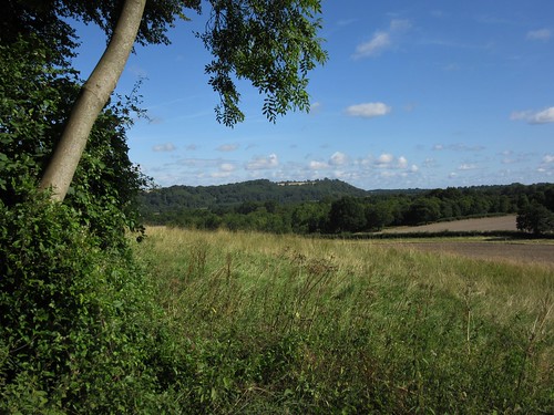
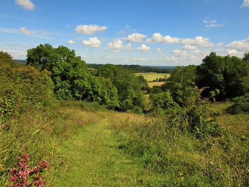
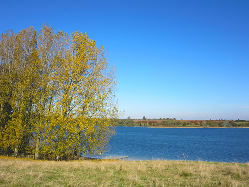
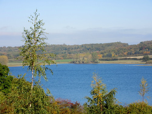
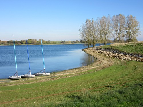
We found a pathway down to the water’s edge below the village, and followed a gravel-surfaced shared access track (cyclists and pedestrians, a sometimes uneasy mix) along the northern shore of this peninsula. The far shore, a smother of trees, was splashed beautifully in scarlet, gold and green.

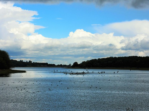
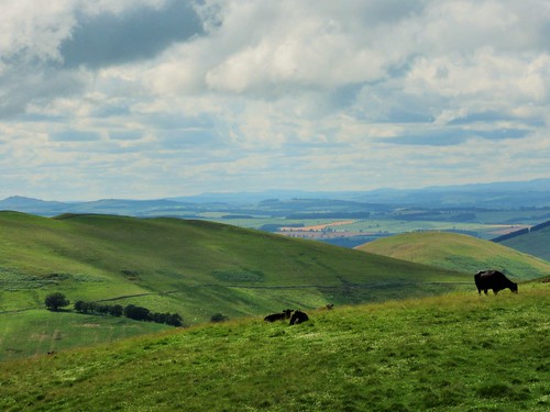
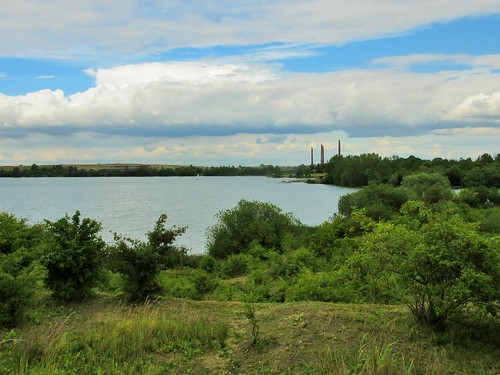
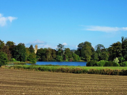
Rutland Water is famous for the number and variety of birds that spend the winter here. We watched great crested grebe ducking and diving in the steel-blue water. A flight of tufted duck, a couple of hundred strong, went beating across the lake in black-and-white flickers. Chestnut-headed pochard coasted close to the shore, and a little further out bobbed a group of goldeneye with glossy green heads and brilliant gold eyes. Everyday birds made marvellous by the power of binoculars and the clarity of so much autumn light over such vast stretches of water.

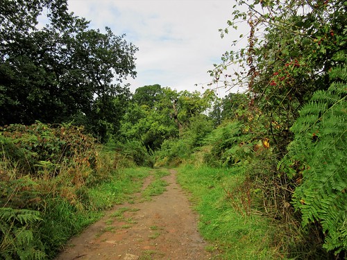
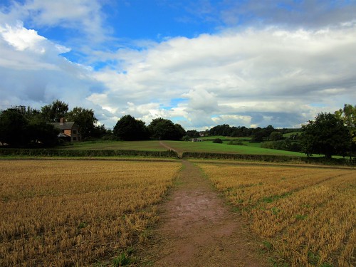
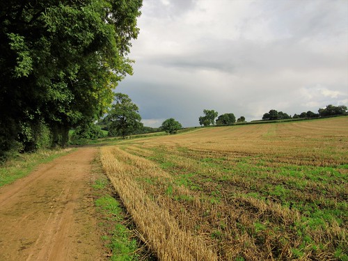
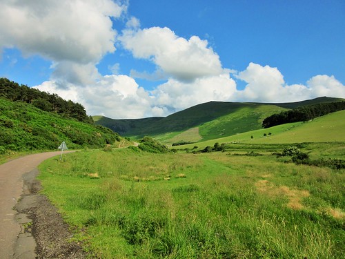
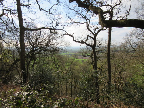
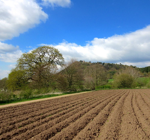
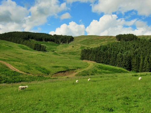
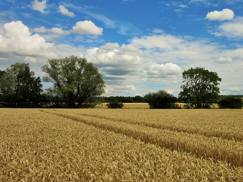
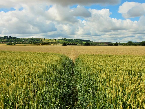
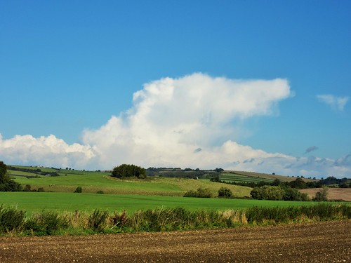
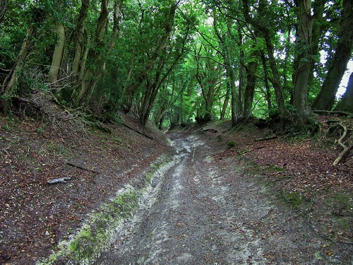
The track wound along the lake shore through the skirts of Armley Wood, where ash, oak and hazel leaves filtered the sunlight into translucent shards of lime and lemon. ‘Just coming up behind you… slowly,’ came the quiet voice of a cyclist – a thoughtful warning, less jarring than a bicycle bell. Beyond the wood the path rose among fields all a-clatter with a tractor and harvester reaping a crop of maize.

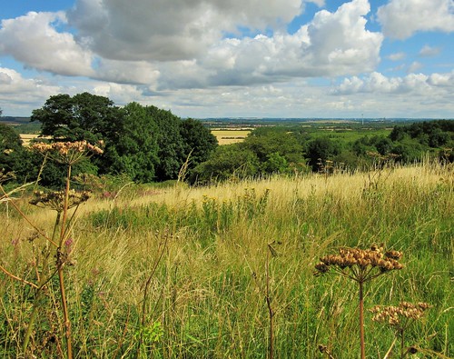
The Hambleton peninsula is great family day out territory. A bunch of children went squealing and skittering by. ‘I’ve got a wobbly tooth,’ confided one lad. ‘And I’m seven already!’

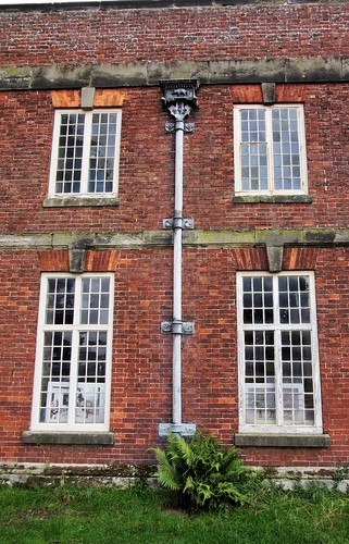
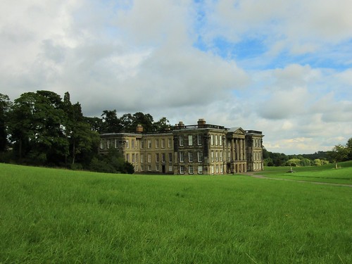
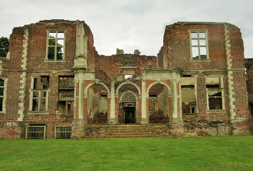
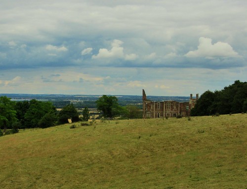
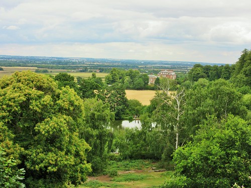
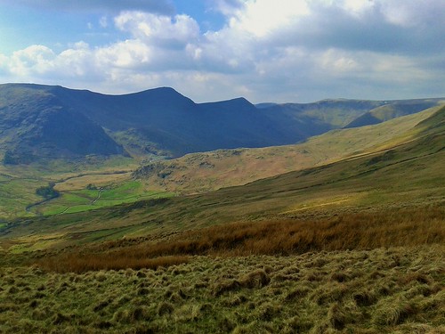
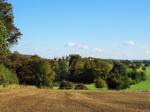
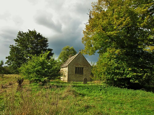
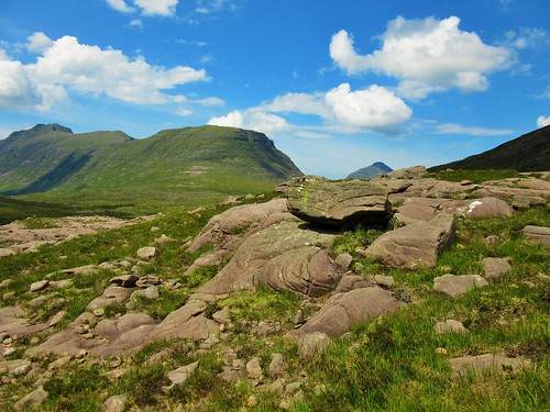
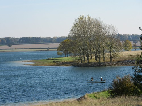
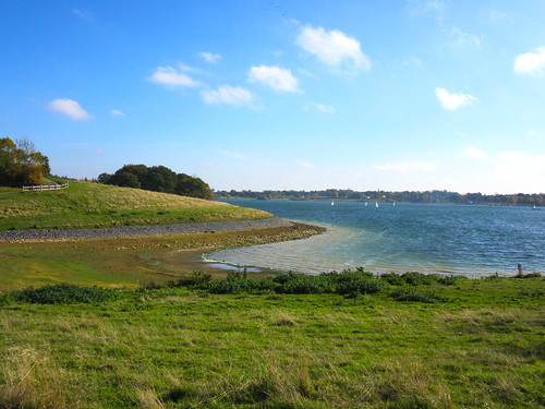
At the tip of the peninsula we turned back along the south shore, looking across to Edith Weston’s spire. Pairs of teenagers were scudding about in sailing dinghies, chivvied by instructors yelling from a rubber boat. On an isolated ness stood the Jacobean mansion of Old Hall, gabled and mullioned, sole survivor of the two drowned villages, marooned on the shore beside the water that swallowed them.

Start: Finch’s Arms PH, Upper Hambleton, Rutland, LE15 8TL (OS ref SK 900076)

Getting there: Road – from A6003 roundabout just east of Oakham, follow A606 (‘North Rutland Water’). In ½ mile, right to Upper Hambleton.

Walk (5 miles, easy, OS Explorer 234. Online map, more walks at christophersomerville.co.uk): From Finch’s Arms, left along village street. In 150, opposite pillar box, left down drive (fingerpost) to lake shore. Right along shared access trail, clockwise round peninsula. In 4½ miles, pass driveway to Old Hall (899071); in another 500m, right over stile (895075, yellow arrow). Up field to top corner (898076); cross successive stiles; narrow fenced path to Upper Hambleton.

NB: The shared access track is very popular with cyclists at weekends, so keep your eyes and ears peeled!

Lunch/Accommodation: Finch’s Arms, Upper Hambleton (01572-756575, finchsarms.co.uk) – smart and comfortable.

Birdwatching: Anglian Water Birdwatching Centre, Egleton, Oakham LE15 8BT (01572-770651, rutlandwater.org.uk)

Info: Rutland Water Visitor Centre (01780-686800), discover-rutland.co.uk visitengland.com satmap.com; ramblers.org.uk

 Posted by at 01:58
Nov 072015


First published in: The Times Click here to view a map for this walk in a new window
picture picture picture picture picture picture picture picture
Facebook Link:

The wolfman of Great Bircham stared down from his vantage point high above the chancel arch in St Mary’s Church. With his pointed ears, blank eyes and thick-lipped oval mouth he looked altogether too malevolent to be the resident spirit of such a gloriously light and airy building. Not for the first time I found myself wondering what was in the minds of the medieval masons who carved such vivid and disturbing creatures in the parish churches of these islands.

I wandered through the churchyard where ranks of Second World War airmen, Allied and German alike, lie buried. Then I set out into the cold, bright light of a North Norfolk morning, following an old green lane through the sugar beet fields. Partridges skimmed away with hoarse squeaks over the leathery green leaves, and a golden-brown hare went lolloping along the rows of a stubble field at a slow canter.

Soon the lane met the ancient trackway of Peddar’s Way, arrowing north-west across the low-rolling landscape. I stepped out along the wide grassy trackway, with a view eastward to Bircham’s tall windmill on its ridge. The iconic East Anglian hell-hound known as Black Shuck haunts Peddar’s Way, and I wondered whether the mason of St Mary’s had had that demon dog in mind when he did his chancel arch carving.

I was strolling along, singing The Darkness’s tender ballad about Black Shuck to myself (‘Black Shuck! That dog don’t give a … tinker’s cuss!’) when a tremendous commotion in a stubble field beside the track made me jump. A couple of hundred pinkfooted geese, gobbling the grain left behind after harvest, had been panicked by my hollering. With a tremendous honking and complaining, and a roar of wings, they took off and wheeled away with flashing white rumps to find less disturbed feeding a few fields away.

I left Peddar’s Way and came down into the hamlet of Fring, all brick and flint under red pantiled roofs. Along the lane the beet harvesters were roaring in the fields, stacking giant mounds of roots for the lorries. Bircham Windmill stood proud, its fantail revolving to keep the ladder-shaped sails to the wind.

There was no sign of Black Shuck on the way back to Bircham, but I did meet a dog at the entrance to the village – a soppy old Labrador, who was only too pleased to be chucked under the chin.
Start: Great Bircham Social Club car park, Church Lane, Great Bircham, Norfolk, PE31 6QW (OS ref TF 769325)

Getting there: Great Bircham is signed from Snettisham, off A149 between King’s Lynn and Hunstanton.

Walk (8¾ miles, easy, OS Explorer 250. NB: online map, more walks at christophersomerville.co.uk): Right along Church Lane to St Mary’s Church. Return past car park to B1153; left along pavement past Bircham Country Stores and King’s Head Hotel. Opposite village sign, right (767321) along lane. In 1¼ miles, right along Peddar’s Way (748309, signposted). In 2½ miles, at 3rd road crossing (733345), right into Fring. Ahead across bridge (‘Docking’). In 350m, right up track (739350, ‘Ringstead Rides’). In 1¼ miles, right (756342) on footpath to road (754337). Left; in ⅔ of a mile, turn right (760330) past Bircham Windmill. Cross road beyond (761324); green lane to junction (765320); left to King’s Head on B1153; left to return to car park.

Refreshments: Bircham Country Stores; King’s Head, Bircham (01485-578265; the-kings-head-bircham.co.uk)

Dinner/Accommodation: Rose & Crown, Snettisham, postcode (01485-541382, roseandcrownsnettisham.co.uk) – wholly delightful, friendly village inn.

Info: Hunstanton TIC (01485-532610)
visitengland.com satmap.com; ramblers.org.uk

 Posted by at 01:35
Oct 312015


First published in: The Times Click here to view a map for this walk in a new window
picture picture picture picture picture picture picture picture picture picture picture picture picture picture picture picture
Facebook Link:

Soft autumn sunlight lay over south-west Derbyshire, tipping the hedges with scarlet berries and showing up the medieval ridge-and-furrow in the fields around Ticknall. Once across the old limestone tramway and into the broad acres of Calke Park, it was all a gentleman’s idealised landscape of graceful old oaks and chestnuts, in whose shade fat white sheep grazed the parkland meadows.

Acres of land and quarries of limestone made the Harpur family’s fortune, and the park they laid out around their Palladian house of Calke Abbey in the 18th century is a dream-like place to wander on a soft autumn day. We followed the National Forest Way as it wound past enormous gold-crowned oaks, bulbous with age, and the long ponds below the house and stables.

The Harpurs (later Harpur-Crewe) were famous for their love of racehorses, their lack of impact when they tried their luck in the political world, and their almost pathological craving for solitude. All they wanted was to be left alone in their great park and house.

When the National Trust acquired the property in 1985 in lieu of death duties, it was as a time capsule, perfectly illustrating the decline of the English country house in the 20th century. There’s no Downton Abbey glamour or polish to Calke Abbey. This is a family house where spending trickled to a stop. Low-wattage bulbs dimly light the mounted heads of favourite cattle, caskets of mineral collections and ancient cartoons pasted onto the wallpaper. It’s all tremendously subfusc and poignant.

From the great house in its hollow we found our way along a back road to the shores of Staunton Harold reservoir, a lion-shaped sheet of water where hundreds of greylag geese trumpeted to the cloudy heavens. In Calke Abbey’s deer enclosure a couple of magnificently antlered fallow bucks were restlessly pawing the ground in anticipation of the rutting season.

Out across stubble fields, and in among the iridescent grey ponds, the steep hummocks and canyons of Calke Limeyards, where limeburners once slaved at the kilns for the Harpur-Crewe family. We ducked through a tramway tunnel towards a chink of green and gold light at the far end, and came out into fields around Ticknall where medieval peasants ploughed the ridge-and-furrow when monks still sang their vespers at Calke Abbey, long centuries before the Harpurs had ever been heard of.

Start: Staff of Life PH, Ticknall, Derbyshire, DE73 7JH (OS ref SK351238)

Getting there: Bus service 61, Derby-Swadlincote
Road – Ticknall is on A514 between Derby and Swadlincote.
Staff of Life PH is on corner of A514 and B5006 road (‘Smisby’).

Walk (6 miles, easy, OS Explorer 245): From Staff of Life PH, left along B5006. In 100m, left (fingerpost) across 2 fields (yellow arrows/YA) to cross tramway path (353235). Cross next field; turn right along gravelled cyclepath. In 250m, opposite Middle Lodge, through gate (357232, ‘National Trust’ sign): emerge from woodland; bear right down left side of driveway. In 200m, pass yellow-topped post/YTP (359229, ‘National Forest Way’/NFW); follow path through trees. In 400m, just before Betty’s Pond, hairpin back on your left at YTP (363228; yellow, blue, pink arrows) up path and steps. At top, right for 100m to ‘Old Man of Calke’ oak (363229).

Return to pass east end of Betty’s Pond. Through gate; bear left on narrow path beside long pond. In 250m, bear right at gate (365228) up steps. In 100m, hairpin left, through gate and car park to Calke Abbey.

Follow path down right side of stable block (NB shop, restaurant). Through gate (367226); on down drive with wall on left; pass church (369223) and on to road (373223). Left; in 450m, at end of road, ahead through wall gap (375226, ‘Maroon Walk’, NFW), down to Staunton Harold reservoir. Left along shore; right across weir (372228). Follow path anticlockwise round edge of deer enclosure. In 700m, through gate; ahead past info board (368233); in 50m, right through gate (YA); left over stile.

Half-right across fields past White Leys house. At far side of second field, path enters hedge. Follow path to right; continue with hedge on left. Over stile (YA) and on with hedge on right. In 300m, path bends right into trees (362236). In 200m look left for gate and stile down a slope. Through gate (NT); follow trail (NT markers) through Calke Limeyards. In 400m, through arch; continue along trail to go through Ticknall Tramway Tunnel (356237). In 200m, right through gate (353235); retrace steps to Ticknall.

Lunch/Accommodation: Staff of Life, Ticknall (01332-862479, thestaffoflife.co.uk) – excellent village pub with rooms

Calke Abbey (NT): 01332-863822, nationaltrust.org.uk. House open mid Feb-end Oct; park, restaurant, shop open all year.

Info: Swadlincote TIC (01283-222848)

visitengland.com satmap.com; ramblers.org.uk

 Posted by at 01:51
Oct 242015


First published in: The Times Click here to view a map for this walk in a new window
picture picture picture picture picture picture picture picture picture picture picture picture picture picture
Facebook Link:

As we left the Pheasant Inn at Higher Burwardsley, a Sunday cavalcade of veteran tractors was spluttering up the hill – red, blue, orange, green and yellow; Fordson, Ferguson and Field Marshall. It was a salutary reminder that here is working farming country. Walkers exploring this beautifully kept, beautifully ordered corner of Cheshire have a great wooded ridge at their elbow, sheltering a scatter of lovely old half-timbered farmhouses, and a view sweeping west into Wales and the distant blue line of the Clwydian Mountains.

The cattle at Wood Farm were frisking in their pastures. Bull calves shoved their blunt little heads together in play-fights, then kicked up heels and tails as they went bucketing away at the gallop.

Walking the walled lane at the foot of the Peckforton Hills, we found crinkle-edged harts’-tongue ferns sprouting from chinks between the sandstone blocks. It’s sandstone that shapes this landscape, particularly the great ridge that undulates north to its outermost crag where Beeston Castle stands. The castle occupies one of the most sensational sites in England, right at the lip of a 330-ft crag, with a superb prospect across 30 miles of country in all directions.

We looked round the exhibition down at the castle gateway (bronze axe heads, stone spinning weights, Normans and Plantagenets, Civil War bullets and drinking flagons), then climbed through the massive sandstone gatehouse and wall towers of the outer ward, and on up through pine trees to the inner ward gatehouse and the tiny, lumpy stronghold at the peak. Pennine and Welsh hills, Liverpool Cathedral, the Wrekin and Chester – all lay there in open view, with the Victorian folly of Peckforton Castle rising on its crag a mile away southward.

It’s claimed that in December 1643 eight royalist desperadoes forced the surrender of the Roundhead garrison after they climbed the western crags. Some say the treasure of King Richard II lies at the bottom of the castle’s 330-ft-deep well. Whatever about all that, it’s certainly a hauntingly beautiful spot. Walking back to Burwardsley I kept turning round to gaze at the castle on the crag, an image to fix in the inner eye and carry away with me.

Start: Pheasant Inn, Upper Burwardsley, nr Tattenhall, Cheshire CH3 9PF (OS ref SJ 523566)

Getting there: Burwardsley is signed from A534 between Ridley (A49 junction) and Broxton (A41 junction)

Walk (6½ miles, moderate, OS Explorer 257. NB: online map, more walks at christophersomerville.co.uk): Right out of Pheasant car park; along lane. In 300m, left down field (524568, fingerpost, yellow arrow/YA) with hedge on left. Over stile (‘Eddisbury Way’/EW); down to road (522571). Right; follow EW round Outlanes Farm; on across fields. Approaching Wood Farm, cross double stile (519577, EW); half left across stile by gate; right along field edge. Over stile at far end (522578); half left across field, through boggy dell (YAs). Half left across field beyond, to fingerpost at far top left corner (527580). Follow lane to join Sandstone Trail/ST (533583). Ahead on ST for 1 mile, crossing road (539588), to reach next road (540590). Ahead to Beeston Castle (537593). Return along ST for 2¼ miles to road just east of Higher Burwardsley (529567). Right to Pheasant Inn.

Snack: Sandstone Café near Beeston Castle gatehouse

Lunch/accommodation: Pheasant Inn, Upper Burwardsley (01829-770434, thepheasantinn.co.uk) – efficient, comfortable, very popular inn.

Beeston Castle (EH): 01829-260464, english-heritage.org.uk/beeston

Walking Cheshire’s Sandstone Trail by Tony Bowerman (Northern Eye Books); sandstonetrail.com

Information: Chester TIC (01244-405340); visitcheshire.com
satmap.com; ramblers.org.uk

 Posted by at 01:18
Oct 172015


First published in: The Times Click here to view a map for this walk in a new window
picture picture picture picture picture picture picture picture picture picture picture picture picture picture
Facebook Link:

Our friend and walking companion Dave Richardson had only just taken delivery of his new concertina from Wiltshire master maker Colin Dipper after a decade of waiting, and had brought it down with him to Northumberland to play us a few tunes. But first some inspiration, in the form of a walk in the Cheviot Hills.

On a morning of smoking cloud and pearly light we set off along the College Valley with Dave and his wife Lucy, and their chum Liz Anderson, for company. This deep, sheltered cleft in the northern flank of the Cheviots held several sheep farms not so long ago. These days, just two farms account for some 12,000 acres of hill grazing.

It was a stiff pull up the slope of Great Hetha to the Iron Age fort at the summit. We walked a circuit of the double ramparts of stone, looking out at hills folding to the south in steamy grey waves. Below us lay the lonely farmhouse of Trowupburn. ‘Burn of the Trolls?’ queried Dave. Past generations of Cheviot dwellers lived with legends of these grumpy giants who would snatch unwary musicians to entertain them in their caves.

Near the farm we crossed the Trowup Burn – the only way for a mortal to escape the trolls, who dared not go over running water. On the far bank a splendid bull in a cream-coloured coat was swinging his tail and murmuring in the ear of a young heifer. We left them to it and climbed the bracken slopes beside the Wideopen Burn where whinchats were singing wee-chit-chit!

Up beyond Wideopen Head we found the Stob Stones, a pair of stumpy porphyry boulders where the local gypsies once crowned their kings. Here we had a breathtaking view northwards over thirty miles of low-rolling border country. A long moment to stand and stare; then we cut east along the upland track of St Cuthbert’s Way to the College Valley.

That night we feasted on wonderful music. The new concertina might have been made within sight of the Wiltshire downs, but it was pure Cheviot that Dave brought forth from it – the hornpipes, reels and jigs of these hills, while we sat and dreamed back over the day.

Start & finish: College Valley car park, Hethpool, near Kirknewton NE71 6TW approx. (OS ref NT 894280)
Getting there: A69 (Wooler-Coldstream); B6351 to Kirknewton; Hethpool signed just beyond, at Westnewton.
Walk (8 miles, moderate/strenuous, OS Explorer OL16): From car park, left along road (detour to stone circle on right, 893278). In ½ mile, fork right (891275, ‘Great Hetha’) up left side of plantation. At top of wood (888277), left up to Great Hetha summit fort (886274). Don’t turn right off summit towards Elsdonburn, but keep ahead (south-west) along green ridge (white arrow) till you look down on a white house. Half right here down grass track to stile (877269, ‘Hilltop Trail’); left down farm track to Trowupburn (876265).

Past house, bear right through gate and up grassy lane with fence on left. In 600m, left across Trowup Burn (871262); in 500m, recross burn and a stile (867261), and turn left to continue through bracken. In 200m bear right at circular sheepfold into valley of Wideopen Burn. Follow path through bracken up right side of valley to Wideopen Head. Meet a fence here, and go through a gate (861265). Keep ahead on grass track for half a mile to meet Pennine Way (854269). Right along PW for 500m (detour left to see Stob Stones, 851270), to 3-finger post (850272). Right here (‘Elsdonburn 1½’), and follow waymarked St Cuthbert’s Way for 3½ miles back to Hethpool.

Accommodation: Tankerville Arms, Wooler NE71 6AD (0168-281581, tankervillehotel.co.uk).
More info: Cheviot Centre, Wooler (01668-282123)

visitnorthumberland.com; satmap.com; ramblers.org.uk

 Posted by at 01:41
Oct 102015


First published in: The Times Click here to view a map for this walk in a new window
picture picture picture picture picture picture picture picture picture picture picture picture picture picture picture picture
Facebook Link:

In Pilgrim’s Progress, John Bunyan modelled his sinner-snaring ‘Slough of Despond’ on the Bedfordshire morass of Marston Vale. All through the 20th century the Vale was still a waste landscape, though of an industrial nature – its sticky clay expanses encompassed the world’s most active brickfields, and thousands of acres were stripped and dug for the raw material of brickmaking. Since the 2008 closure of the Stewartby brickworks, though, a green transformation has been wrought in these unpromising flatlands.

We set off from Marston Vale Forest Centre, at 9 am already lively with youngsters gathering for a wet and mucky day out. The Centre is the hub of the Forest of Marston Vale, a community forest that has already seen a million trees planted across the old brickmaking wasteland. There are lakes, ponds, trails and woods where the clay was dug, and fantastic enthusiasm for their use among local people.

The 13-mile Marston Vale Timberland Trail leads across enormous cornfields towards the undulating greensand ridge that Bunyan used as the template for his ‘Delectable Hills’. The path switchbacked through the woods on the ridge slope. From behind a leylandii screen rose ominous noises – howls, screeches, rumblings and whinings fit for one of Bunyan’s demons. They came from experimental vehicles speeding up the gradients and round the circuits of Millbrook’s huge proving ground, tucked away from prying eyes among the trees.

Up on the open heights of Ampthill Park stands a memorial cross to Katherine of Aragon, wronged wife of King Henry VIII – she was incarcerated here while Henry wrangled to divorce her. We stood looking out north across many sunlit miles of the Bedfordshire plain, before skirting the tall and haunted ruin of Houghton House – Bunyan’s ‘House Beautiful’. From here the cornfield paths returned us to the model village of Stewartby, flagged by the four mighty chimneys that remain at its redundant brickworks.

In their 1930s heyday the works produced 500 million bricks a year for the London Brick Company. Now the grey brickfields are going back to green once more, and Stewartby’s chimneys stand smokeless and gaunt over a beautiful lake where the giant clay pits once lay in all their desolation.
Start: Marston Vale Forest Centre, Marston Moretaine, Beds MK43 0PR (OS ref TL 004418)

Getting there: Train to Millbrook or Stewartby (1 mile on foot). Bus 68 from Bedford.
Road: M1 Jct 13; A421 towards Bedford. In 5 miles, ‘Marston Moretaine, Sports Centre’ signed to right. At T-junction in Marston, left; right at Co-op and follow ‘Forest Centre.’

Walk (12½ miles, easy but long; OS Explorers 192, 193, 208. NB: Online maps, more walks at christophersomerville.co.uk): Outside Forest Centre, fingerpost points to Marston Vale Timberland Trail (TT). Follow excellently waymarked TT for 5½ miles to Katherine’s Cross, Ampthill Park (025384). To visit Ampthill village, continue on TT. To bypass village – 250m past cross, fork left off TT by dog bin (028385). Follow Greensand Ridge Way through Laurel Wood to B530 (032387). Left for 100m; right (cross with care!) on farm track, passing top of drive to Houghton House ruin (040393). Continue to gates of Houghton Park House; right over stile; footpath down 3 fields to plank footbridge (039401). Don’t cross; turn left on TT and follow it for 4¼ miles back to Forest Centre.

NB sticky clay underfoot – mucky after rain.

Lunch: picnic; café at Forest Centre

Accommodation: Black Horse, Ireland, Shefford, Beds SG17 5QL (01462-811398; blackhorseireland.com) – excellent restaurant with rooms

Info: Forest Centre, Marston Moretaine (01234-767037; marstonvale.org); experiencebedfordshire.co.uk

satmap.com; ramblers.org.uk; visitengland.com

 Posted by at 01:38
Oct 032015


First published in: The Times Click here to view a map for this walk in a new window
picture picture picture picture picture picture picture picture picture picture picture picture picture picture picture picture
Facebook Link:

Looking back from the old fell path from Kentmere over to Long Sleddale, the Kentmere Valley on this gorgeous clear morning looked almost too good to be true. Church, houses and scattered farms lay in a dale bottom so richly and uniformly green it might have been stroked there with a painter’s brush.

A farmer went bouncing down the fields on her quad, shouting ‘C’m-aan!’ to the madly bleating sheep chasing her trailer with its load of feed. Near the crest of the path we were following, a tiny just-born black Herdwick lamb wobbled on splayed legs, sniffing along its mother’s blue-grey body to locate the bulging udder that awaited it.

We found the steep upward path to Wray Crag and set our boots to it, pushing upwards under lark song that poured out from invisible singers overhead. Wray Crag came and went. Up on Shipman Knotts beyond we sat to catch our breath, looking east to the long back of Sleddale Fell and a gleam of Windermere down in the south-west.

Now the rocks and crags gave way to a smooth saddle of moor grass, the dark stain of the path leading on and up the long nape of Kentmere Pike to the summit cairn at 730 metres. Up here the wind blew strong and cold. We huddled down and gazed our fill at the westward view – Coniston Old Man and Windermere, Great End and Bowfell beyond the breaking wave of Ill Bell – just about level with us now – and a shoulder of Helvellyn crusted with snow.

A long descent over bogs and crags, down to Hallow Bank and the walled and cobbled lane back to Green Quarter. We chatted with a farmer looking over the wall at his sheep – tales of winter storms, lost lambs, and ewes completely covered by snowdrifts. ‘We’d 40 lambs indoors being bottle fed,’ he said, ‘and 40 ewes looking for ’em once the snow went! But we got ’em all matched,’ and he smiled with satisfaction as though it had only happened yesterday.

Start: Green Quarter, Kentmere, near Staveley, Cumbria postcode (OS ref NY 461040)

Getting there: Staveley is signed off A591 (Windermere-Kendal). Follow road to Kentmere. Just before village, right (‘Hallow Bank, Green Quarter’). Limited parking at Green Quarter (4-car space on left just before triangular green). If none available, park in Kentmere and walk to Green Quarter.

Walk (6½ miles, strenuous, OS Explorer OL7): From triangular green, right up lane (‘Longsleddale’). At Old Forge gate, right through gate (yellow arrow, ‘Longsleddale’). Bear left; through gate at wall angle; follow track (public right of way) across fields NE for 1 mile. Through kissing gate (476050) onto Hallow Bank-Sadgill track. Left through gate; right up track, following wall on right steeply uphill northwards for 1¼ miles over Wray Crag (473054) and Shipman Knotts (472062) to ladder stile across wall (472067). From here, clear path up Kentmere Pike (fence soon coming in on right) to summit cairn (465078).

Return in poor weather/mist – back the way you came. Otherwise – return to where wall meets fence on left (468075). Fork a little right away from ascent path, following clear path. Cross ladder stile 250m NW of ascent stile (470069). Follow path (sometimes faint, but well trodden) SSW downhill for 1 mile to farm lane gate at Hallow Bank (466055). Through gate, down track; in 50m, left through gateway beside parking area; fork right down stony track. In 200m cross stream; next right (465052, ‘Mardale’), down road, through gate, and on to where farm buildings are in front of you. Bear left (not sharp left) past barn and on downhill. Track bends left; don’t bear right through gate (463053), but keep ahead along Low Lane. In ⅔ mile join road (461044); right to Green Quarter.

Conditions: A moderately hard fell walk; appropriate clothing and boots recommended.

Lunch: Picnic

Wainwright Book 2 – The Far Eastern Fells (Frances Lincoln)

Accommodation: Eagle & Child, Staveley, LA8 9LP (01539-821320; eaglechildinn.co.uk) – very cheerful, walker-friendly inn.

Information: Kendal TIC (01539-735891); golakes.co.uk

satmap.com; ramblers.org.uk; visitengland.com

 Posted by at 01:34
Sep 262015


First published in: The Times Click here to view a map for this walk in a new window
picture picture picture picture picture picture picture picture picture picture picture picture picture
Facebook Link:

Sherborne, one of Dorset’s most beautiful towns, is full of buildings made of that very distinctive, iron-rich golden limestone called ‘hamstone’. Medieval masons worked it to sublime effect in the delicately constructed chapels and lacy fan vaulting of the abbey church that stands at the heart of the town.

From the slopes of Sherborne Park I looked across the meadows to Sherborne’s twin castles – an old Norman stronghold in picturesque ruin beyond the trees, its Tudor counterpart beside the long lake. The original lodge, built in brick by Sir Walter Raleigh in 1594 after Queen Elizabeth I had gifted him the land, was enfolded by grand wings added later. Lit by today’s strong sunshine and framed in fat white cumulus clouds, it looked altogether splendid in its setting of broad parkland studded with magnificent specimen oaks. I imagined Raleigh’s ghost sitting smoking, as it is apparently in the habit of doing, in the stone seat that Sir Walter installed by the lake, puffing out an extra cloud of Virginia-scented satisfaction on this lovely morning.

Two young women walked ahead on the broad path through the park, their babies on their backs. I followed them over the heathy common where homeless Poles were housed after the Second World War as Displaced Persons in the cramped, cold and very basic Nissen huts of a former field hospital. ‘People were all in the same circumstances,’ writes Teresa Stolarczyk-Marshall, who lived there as a child (website – see below), ‘in a strange country where they could not speak the language. So they rallied round helping one another. People were very patriotic, observing their traditions and bringing their children up in a Polish spirit. Haydon Park become Little Poland.’
I turned north through the parkland trees, looking over the cottage at Pinfold Farm towards the green cap of Crackmore Wood. A quiet moment in a golden stone chancel by the roaring A30, all that’s left of the 16th-century Church of St Cuthbert (one of the very last churches built before the Reformation); and then a saunter through Oborne village between hedges netted with pungent-smelling hop bines. The old green road of Underdown Lane dropped me back into the outskirts of Sherborne, and a path through the sunlit meadows by the River Yeo led easily back to the station once more.

Start & finish: Sherborne railway station DT9 3NB (OS ref ST 641162)
Getting there: Train to Sherborne; Bus 57, 58 from Yeovil. Road: A30 from Yeovil or Shaftesbury; park at railway station.

Walk (6 miles, easy grade, OS Explorer 129): Cross railway; at T-junction, cross B3145; through kissing gate opposite; left on path/track through Sherborne Park. From thatched lodge in 1¼ miles (660161), follow yellow arrows/YAs to pass The Camp depot (665161). In another 400m, at YA (669160), left across field to stile (668162, YA). Through Deer Park wood and on (YAs) to track at Pinford Farm (664172). Left (YA); in 150m, right (YA) to go between ornate gateposts (662173). In 15m, left (YA) into wood. In 30m, right (YA), north inside wood edge. In 300m, left to leave wood through kissing gate (661176); across 3 fields (YAs), under railway (654178) to St Cuthbert’s Church chancel (653178). Cross A30 (take care!); up road to Oborne. In 600m, left (655185) past Oborne church; on along green lane, then Underdown Lane for nearly a mile to cross A30 (647174). Keep ahead (‘Bridleway’) to farmyard and road (646170). Ahead to crossroads; right along B3145; in 300m, left (644168, ‘Dorchester, Blandford’) along New Road. Cross railway and river; right (645166, fingerpost) on field path to station.

Lunch: Oliver’s Coffee House, Cheap Street, Sherborne (01935-815005); or the excellent Station Café (01935-814111) – fry-up heaven!

Haydon Park Polish camp: www.polishresettlementcampsintheuk.co.uk/haydonpark1.htm

More info: Sherborne TIC (01935-815341)

satmap.com; ramblers.org.uk;

 Posted by at 01:30
Sep 192015


First published in: The Times Click here to view a map for this walk in a new window
picture picture picture picture picture picture picture picture
Facebook Link:

Beinn Eighe, pride of the Torridon region of western Scotland, is a noble mountain – or is it a series of mountains? The map shows it rising over the tumbled country between the sea lochs of Maree and Torridon in a ghostly swirl like a four-fingered hand, the contours so tightly bunched to indicate the steepness of its crags and promontories that it looks impenetrable to an ordinary walker. But Peter Barton in his excellent guide Walking In Torridon points out a path that reaches the core of Beinn Eighe without any trials or terrors.

It was a beautiful warm morning when we set off from the car park on the Torridon-Kinlochewe road. The stony path led up between the white screes of Còinneach Mhòr and the blocky grey cliffs of Stùc a’ Choire Dhuibh Bhig. We crossed a mountain torrent by way of stepping stones, to reach in an other-worldly upland. Great rugged tents of mountains stood pitched on a green plateau where a constellation of steely lochans lay glinting. This is the heart of Wester Ross, a roadless wilderness whose eagles and otters outnumber its human inhabitants.

A rush-chocked lochan quivering with waterboatmen and dragonflies showed where we were to turn off for the climb round the dark bulk of Sail Mhòr, the most westerly ‘finger’ or buttress of Beinn Eighe. The path rose steadily, with enormous views of sea-like waves of hills, till we came in sight of the waterfall sluicing down the rock wall that underlies the hanging corrie in the palm of Beinn Eighe.

A last upward scramble, and we were looking into a giant geological crucible. On the left, the pale shattered rock of Rhuadh Stac Mhòr; in the centre at the back of the horseshoe, three great grey buttresses in the face of Còinneach Mhòr; and on the right, Sail Mhòr’s purple-black wall of pinnacles and columns. At their feet, the long dark lake of Loch Coire Mhic Fhearchair, reflecting the peaks that hung more than a thousand feet above. It’s a view to give anyone a proper sense of their own insignificance in the scale of time and change, as these mountains experience such things.

We stripped off and crept into the shallows of the loch, cold and refreshing after the long hot climb, as smooth as olive oil on the skin. Among the rocks we found delicate white saxifrages, bulky spiders with tiny scarlet parasites attached, mountain frogs as motionless as stones, glossy black crowberries and red bearberries. A world of wonders, to be savoured in ecstatic gulps.

Start: Car park on A896, 6 miles SW of Kinlochewe (OS ref NS 959568).

Getting there: A896 Torridon road from Kinlochewe; car park is on right beside a bridge, half a mile after passing ‘Torridon Estate’.

Walk (7 map miles, about 9 miles actually walked; strenuous; OS Explorer 433. NB: online map, more walks at christophersomerville.co.uk): Start of path is marked ‘Public Footpath to Coire Mhic Nobaill’. Follow this well-maintained path. In 1¾ miles, cross stepping stones (947589). In another ¾ mile, at the far end of a rushy lochan, fork right at a cairn (935594) and follow path for 1¾ miles up to Loch Coire Mhic Fhearchair (940611). Return same way.

Conditions: Rocky, uneven path climbs 500m (1,650ft approx). Wear good walking boots, hill-walking gear.

Refreshments: Picnic

Accommodation: Kinlochewe Hotel, By Achnasheen, Ross-shire IV22 2PA (01445-760253, kinlochewehotel.co.uk) – cheerful stopover, handy for Beinn Eighe NNR.

Walking in Torridon by Peter Barton (Cicerone) – see Walk W1

satmap.com; ramblers.org.uk; visitscotland.com

 Posted by at 01:10
Sep 122015


First published in: The Times Click here to view a map for this walk in a new window
picture picture picture picture picture picture picture picture
Facebook Link:

A sunny morning, windy along the south coast, still and warm here in the Hawkley valley under the great hangers of East Hampshire. Those hangers – steep-sided slopes of chalk and greensand covered in thick woodland – have enchanted poets and artists, writers and walkers since people first began to look on the landscape as something wonderful and uplifting, rather than as an adversary to be wrestled with and overcome.

The sun cast long black shadows from the woods clinging to the scarp of Hawkley Hanger. Raspberries and blackberries hung in the margins of the field paths we walked, along with ropes of heart-shaped bryony leaves, and umbellifer heads full of seed ready to be scattered at the brush of a hare’s flanks or a walker’s trouser leg. Hollow old Standfast Lane snaked deeply sunk in the greensand, overhung with coppiced hazel sprays and floored with flinty cobbles of malmstone. Hazelnuts had already fallen and lay scattered along the laneways and the road through Empshott Green where we picked up the long-distance Hangers Way.

The Way wound southward through the skirts of Hawkley Hanger. We walked in and out of shadows and sunsplashes, the deep pink shade of a grove of old yews, a translucent green window of beech leaves giving a glimpse of the tower of Hawkley church with its cap like a jousting helmet rising from trees. We turned through the outskirts of the village into a tangle of greenery around the multiple threads of the Oakshott Stream, then a stony lane that climbed steeply up from Middle Oakshott. A cherry plum tree overhung the path; we scooped up a few of the plump wine-coloured windfalls and sucked the sweet flesh from the bitter skins as we went on steadily up to the crest of the hanger at the Shoulder of Mutton.

Edward Thomas, early 20th-century poet and mighty walker, lived in Steep village at the foot of the Shoulder of Mutton. These were the views he loved – south over Steep to the rising country beyond, north to Hawkley’s church and houses in a slanting patchwork of corn and pasture, woods and hanger slopes. We stared our fill, then went slipping and sliding down an ancient flinty holloway on the homeward stretch to Hawkley.
Start: Hawkley Inn, near Petersfield, Hants GU33 6NE (OS ref SU 747291)

Getting there:
A3 (Petersfield-Haslemere); B3006 to Liss; Hawkley is signed from Spread Eagle PH in West Liss.

Walk (8½ miles, moderate, OS Explorer 133): Leaving Hawkley Inn, left (east) up road. Across T-junction (749291) on fenced footpath (yellow arrow/YA). Left at lane (752294) past Uplands Farm; at next left bend, right (750295, Bridleway fingerpost, anticlockwise round field edge. In far right corner (751299, fingerpost) right down lane. At Mabbotts house (752300), take middle of 3 tracks (‘Byway’). In 600m, leave trees and follow field edge; in 100m, left (755305, kissing gate), and fork right on path along bottom edge of wood. In 450m, just after crossing stile and before reaching a house (750306), YA on telegraph pole points right over stile, across footbridge and up to Mill Lane (750307).

Right; in 100m, left up sunken wooded lane to road at Quarry House (746310). Left; in 300m on right bend, left over stile (743310; ‘Hangers Way’/HW). Follow HW across fields; at lane, left (740308); past Vann House and pond, right (stile, HW) up hedge. Anti-clockwise round 2nd field; on south (738302, HW) in tunnel of trees. In 1 mile, left out of trees (741290, HW) along field edge into Hawkley.

Left at road (745290); fork right at village green; right again along Cheesecombe Farm Lane (HW). In 200m, fork right up ramp (746288, HW, ‘Steep’). Fork left by gate (HW). In 200m, cross stile (747286); bear right (HW fingerpost by fence on left, 30m down) round slope of field, keeping lower edge of wood on right. In 200m, right across stile (746285); follow path round to left (HW) and on. Cross Oakshott Stream by footbridges (742283, HW). At Middle Oakshott cross road (741279, HW) and on up stony lane. In 150m, left over stile by house (740277, HW); follow path, steeply up through Access Land (740275); over stile, through wood and on up to wood at crest (739271).

Right along Old Litten Lane (HW); in 150m, left (738270, ‘Shoulder of Mutton’) to bench and viewpoint. Return to Ashford Hangers NNR notice; right along woodland path. In 150m, just before wooden barrier, fork left (740270) and follow red horseshoe waymarks up to Old Litten Lane (742272) Left for 100m; just beyond ‘car and motorcycle’ sign, right (741272) down stony lane for ⅔ mile. At road (745278), ahead; in 100m, left along stony lane for 1 mile back to Hawkley.

Conditions: Some steep slopes; holloways can be sticky and slippery after rain.

Refreshments/Accommodation: Hawkley Inn (01730-827205; hawkleyinn.co.uk) – a lovely welcoming country pub; great beer choice!

Info: Petersfield TIC (01730-268829); visit-hampshire.co.uk
satmap.com; ramblers.org.uk;

 Posted by at 01:54