Sep 052015


First published in: The Times Click here to view a map for this walk in a new window
picture picture picture picture picture picture picture picture picture picture picture picture picture picture picture picture
Facebook Link:

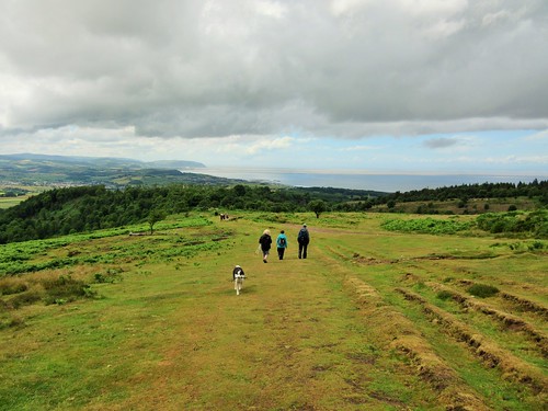
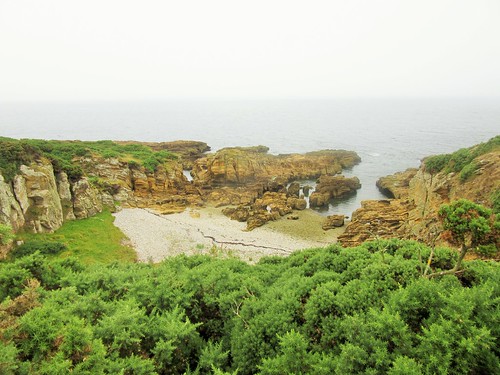
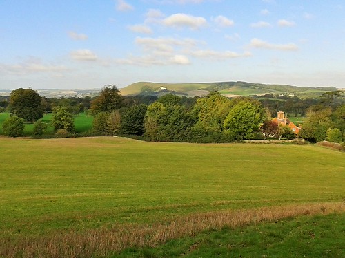
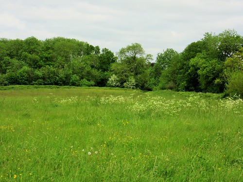
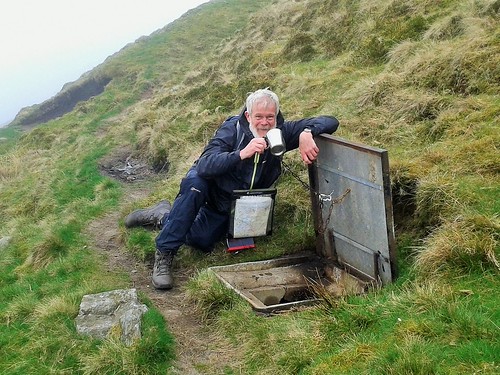
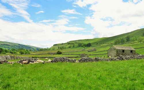
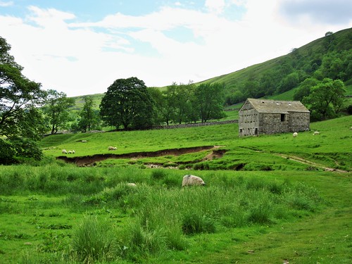
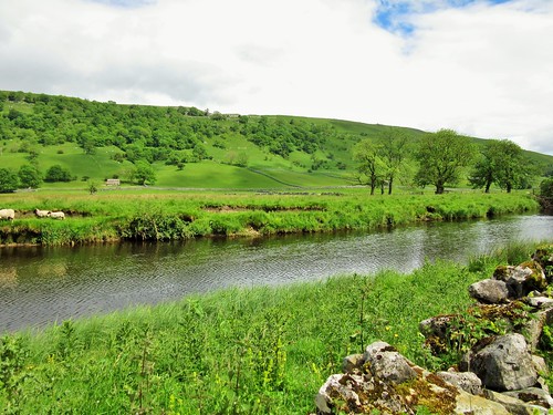
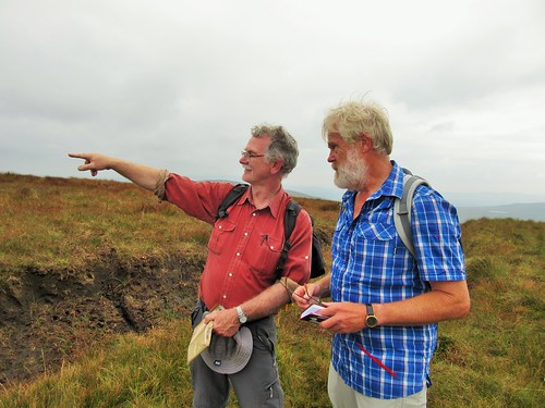
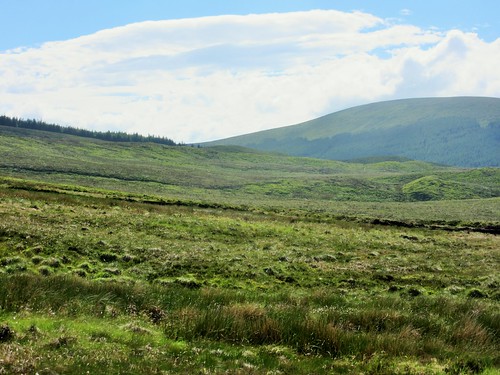
The Sperrin Mountains straddle the long border between Counties Tyrone and Derry. As shapely as a school of porpoises, they entice walkers with their softly rounded summits and gentle-seeming slopes. Meandering lanes and low-level paths curl round their feet. We were delighted to have an old friend, Martin Bradley, walking with us today. Exploring the Sperrins with a local man and expert guide like Martin is the best way to see the hidden corners of these wild uplands.

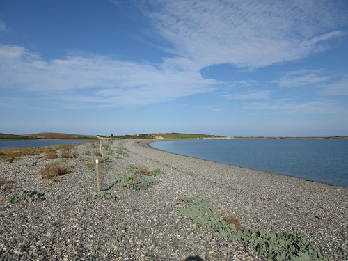
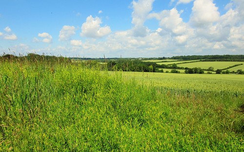
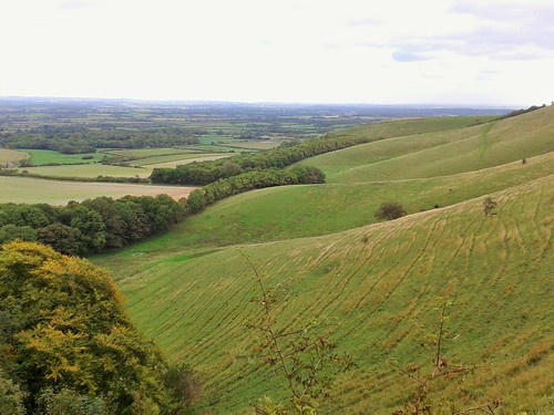
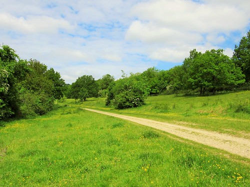
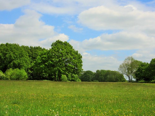
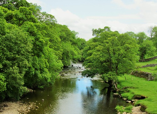
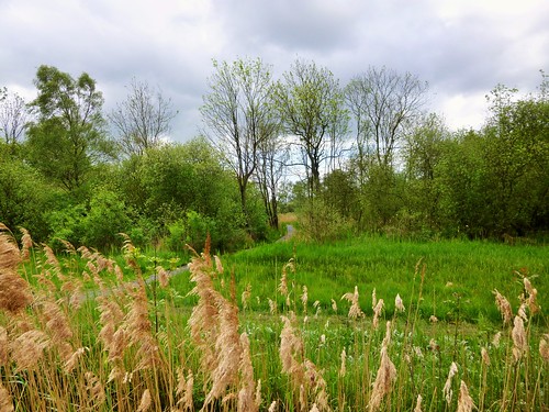
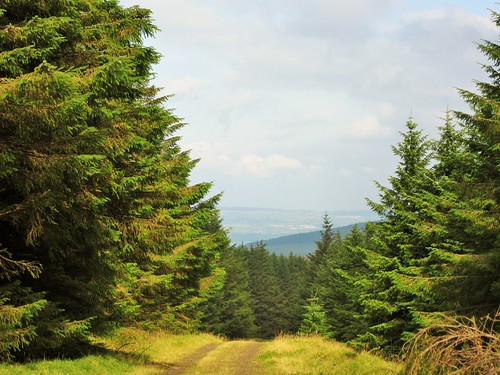
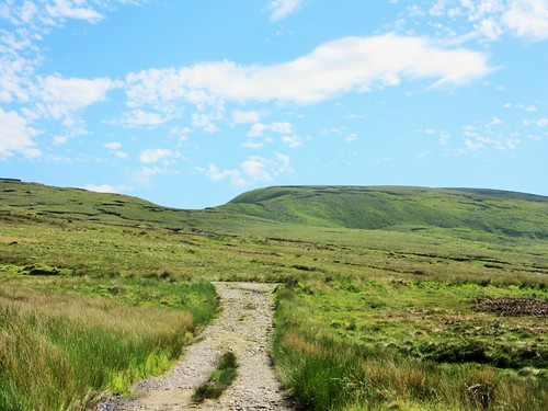
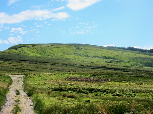
Under a milky grey sky we climbed the stony road through Altbritain Forest, its spruce and firs footed in the dense blanket bog that has grown to enwrap these hills over the past two thousand years. Waves of lime green sphagnum flowed over the dark peat under the trees, to be replaced by tuffets of green and orange deer grass as we left the cold shadow of the conifers and climbed the long flank of Mullaghaneany.

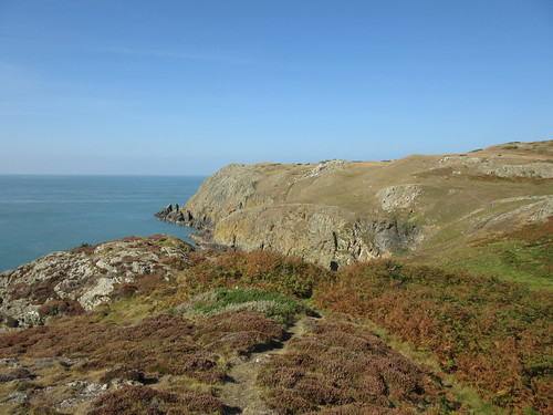
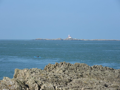
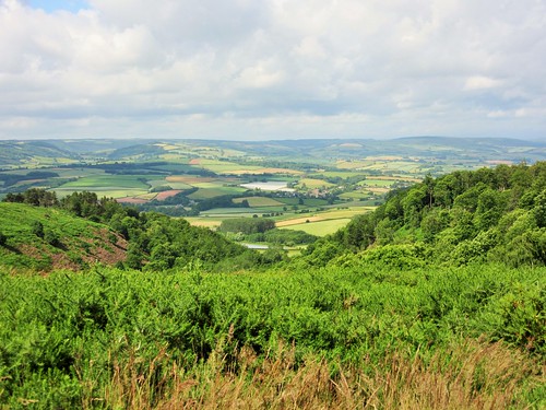
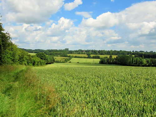
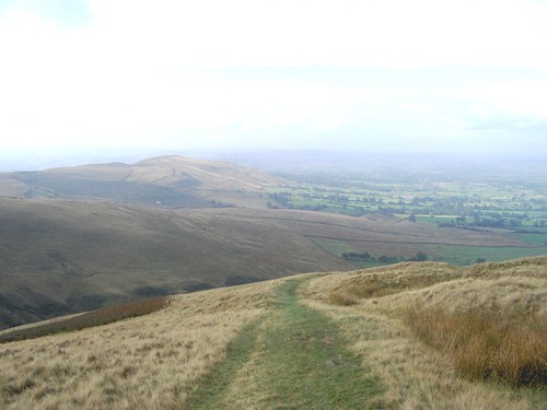
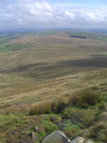
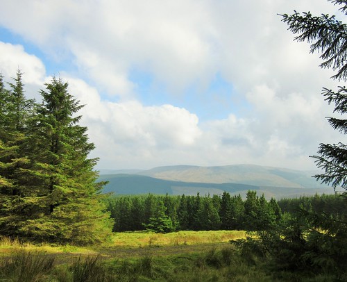
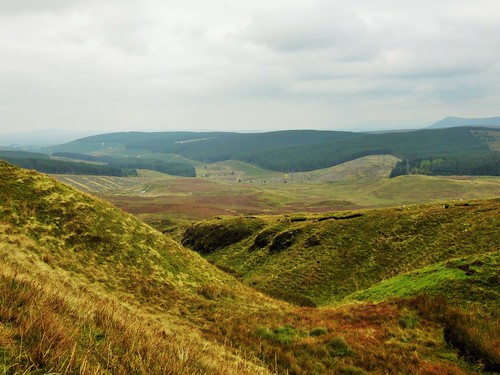
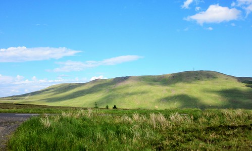
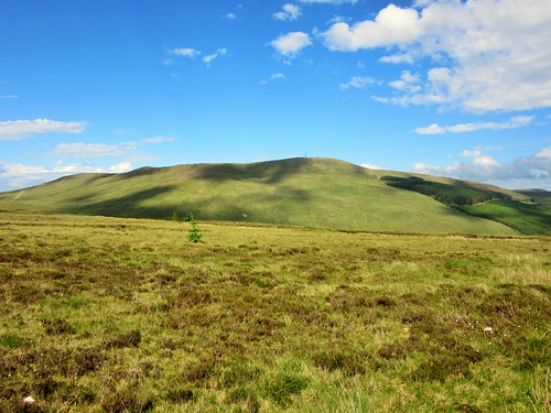
Up on the summit we paused by the fence that would guide us all way round the mountains today. To every point of the compass a superb prospect of hilly country unrolled, the names chiming in a cumbersome poetry – the Sperrin high points of Sawel and Meenard to the west, Mullaghearn hanging long and mighty over Omagh, the hummocks of Carnanelly and Slieveavaddy rolling in the south, and to the north-west the tilted peak of Benbradagh with a misted Lough Foyle at its foot and the hills of Donegal more imagined than seen in the cloudy haze beyond.

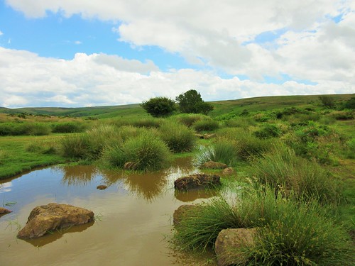
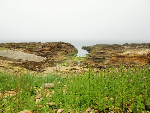
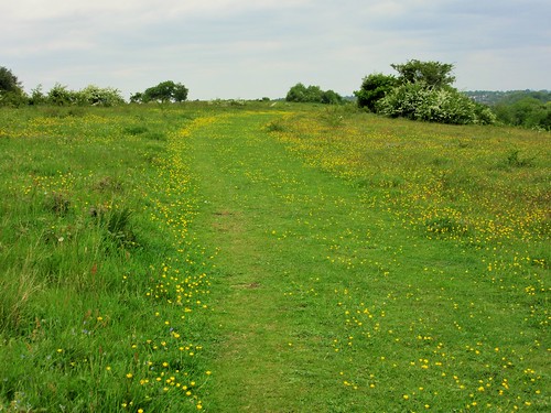
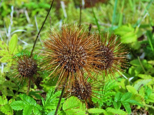
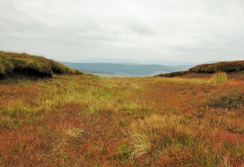
Shiny black fruit of crowberry glinted among bright green leaves against the chocolate-black peat. Twenty years ago, said Martin, over-grazing had reduced this place to a dismal slough. Now the bog is healing over with a haze of beautiful moor grasses, russet, emerald and cream.

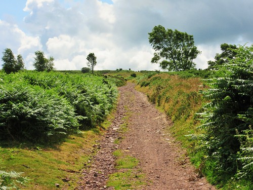
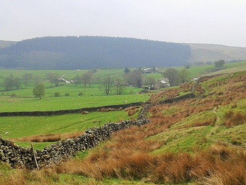
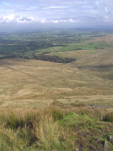
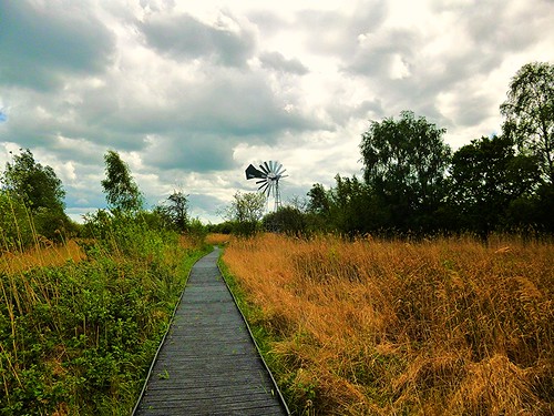
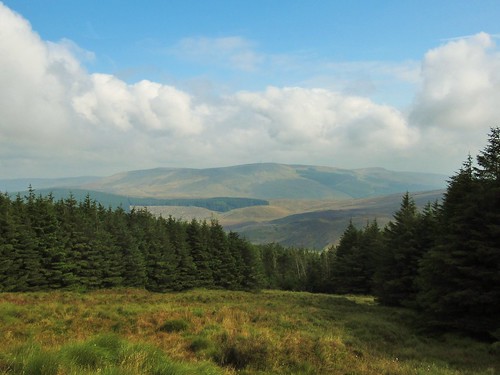
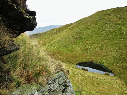
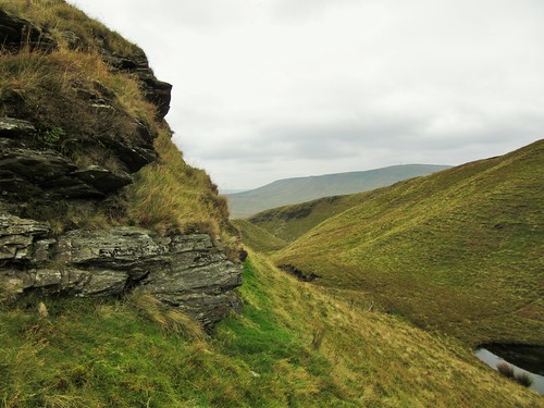
We tramped the high tops from Mullaghaneany to Oughtmore and on to Spelhoagh, the hills all round us melting away into infinite shades of grey. A dreamy walk over the squelching turf, descending at last into a steep cleft where dragonflies circled a treacle-black bog pool. A last sharp scramble up the neck of Craigagh Hill, and we were crunching with Martin down a rocky bog road on the homeward path.

Start: Foot of forest road, Altbritain Forest, on B40 Draperstown-Feeny road (OS of Northern Ireland ref C 705003)

Getting there: From Draperstown, B40 (‘Moneyneaney’). 1 mile beyond Moneyneany, fork left (Moneyneany Road). In 3 miles cross bridge; in 100m, at ruined cottage on left, park carefully on right in gateway.

Walk (7 miles, strenuous, 1:25,000 Activity map ‘The Sperrins’. NB: online maps, more walks at christophersomerville.co.uk): Over stile/gate by ruined cottage; up forest road. In ½ mile, at left bend, (H 700997), keep ahead up green track. In ½ mile at T-junction (693993), left. In 200m, right up break in trees; across fence; up open hillside; left along fence at top. Keep to fence, crossing any side fences, for 3 miles over Mullagheany, Oughtmore and Spelhoagh summits. On Craigagh Hill fence descends steeply to turn left by pool (715988); leave fence, steeply up opposite slope to rough track on top; left along track for 1¼ miles down to B40 (719998). Left along road for 1 mile to car.

Conditions: Rough, boggy upland walking, some steep bits; best done in fine dry weather.

Lunch: Picnic; or Market Inn, Draperstown (028-7962-8250).

Accommodation: Laurel Villa, Magherafelt, Co. Derry postcode (028-7930-1459, laurel-villa.com) – immaculate, welcoming, helpful B&B. Dinner at excellent Church Street Restaurant, Magherafelt (028-7932-8083; churchstreetrestaurant.co.uk)

Guided walking: Martin Bradley, 028-7131-8473; mob 079-2678-5706; martin839@binternet.com
satmap.com; ramblers.org.uk;

 Posted by at 01:20
Aug 222015


First published in: The Times Click here to view a map for this walk in a new window
picture picture picture picture picture picture picture picture picture picture picture picture picture picture picture picture
Facebook Link:

Out in the remote north-west corner of the Isle of Anglesey, the shingle bank of Esgair Gemlyn runs west in a shapely curve, guarding a brackish lagoon where hundreds of sandwich terns raise their young each year. Under our boots crunched smooth flat pebbles – grey and crimson, jade-green, apricot and snow white, enough shapes and colours to gladden the heart of any princess who might peep over the castle-like walls of Bryn Aber.

Bryn Aber lies low beyond the beach, a house in a brambly demesne surrounded by sturdy double walls of sun-paled brick. The walls were built in the 1930s by Captain Vivian Hewitt, flying ace (he made a pioneering flight from Anglesey to Dublin in 1912) and passionate ornithologist. Hewitt planned to conceal himself in the space between the walls, to observe without scaring the terns, gulls and waders breeding in the lagoon he created for their benefit and his own pleasure.

Sea kale’s leathery pale leaves and the big crinkled flowers of yellow-horned poppy shivered in the breeze along the shingle. The slim shapes of grey mullet flickered through the gaps of the causeway below Bryn Aber. We crossed the inlet and made west along the coast path, looking forward to the prominent seamarks of the White Ladies on Carmel Head and the squat red and white lighthouse out on the long reef of the Skerries a couple of miles offshore.

Up close the White Ladies proved an angular pair, tall and thin, their triangular buttresses like grey cloaks held out to catch the wind. Below them the point of Carmel Head was a jumble of quartz and rusty iron rock, and of ancient gneiss pushed up and over the underlying rocks – the oldest exposed rock in Wales. Out at sea a pair of porpoises were hunting the agitated waters of the tide-ripped sound, and we sat to watch their curving backs and thorn-shaped fins breaking the sea.

On past a series of deep, dark coves, the path narrow and vertiginous round their unguarded edges. By the rock stack islet of Ynys y Fydlyn with its black wave-cut arches we turned inland between fields of sheep and cattle, a landscape rolling south to the crumpled peak of Mynydd y Garn. Over the pastures to Tyn Llan and its little chapel tucked behind a field wall, and down again to Bryn Aber and the bird cries in Captain Hewitt’s lagoon.

Start: Cemlyn Bay car park (east side), near Cemaes, Anglesey, LL67 0DY approx. (OS ref 336932)

Getting there: Cemlyn is signed from A5025 Holyhead-Cemaes road between Llanrhyddlad and Tregele.

Walk (9½ miles, moderate, OS Explorer 262. NB: online maps, more walks at christophersomerville.co.uk): Walk Esgair Gemlyn shingle bank to west end at Bryn Aber (329936); follow coast path for 4 miles via Carmel Head to beach at Ynys y Fydlyn (292917). NB closures – see below. From beach, head inland (yellow arrow) with trees on left; over open land for ½ mile to car park (303914). Left along road. In ½ mile, at right bend (308918), keep ahead (‘Mynachdy, Private Road’). At Mynachdy, through gate (309923); right along wall by barns; on along stony track, past derelict lodge on left, to gate/stile (314925). Ahead to gate into road (317926). Immediately left through iron kissing gate (‘NT’); path to coast (319929). Right on coast path round Hen Borth, through gate at far end and on to next gate (321931). Half right to gate near chapel (322932); across field to kissing gate to left of Tyn Llan farmhouse (323933). Ahead down lane; in 500m, left (328932) across causeway and past Bryn Aber; across Esgair Gemlyn to car park.

Conditions: Esgair Gemlyn shingle bank, April-August – please walk seaward of wooden posts to avoid disturbing nesting birds.
NB Coast Path immediately north of Ynys y Fydlyn is narrow, slippery and vertiginous, with sheer drops. Walk this section at your own risk. It is a permissive path, courtesy of the landowner, and is closed between September 15 and 31 January. Alternative return route from Carmel Head – footpath SE to Mynachdy; then as detailed above.

Lunch: Picnic

Accommodation: Harbour Hotel, Cemaes Bay LL67 0LN (01407-710273, angleseyharbour.co.uk)

Info: Llandudno TIC (01492-577577)
satmap.com; ramblers.org.uk; visitwales.com

 Posted by at 09:00
Aug 152015


First published in: The Times Click here to view a map for this walk in a new window
picture picture picture picture picture picture picture picture
Facebook Link:

It’s not every day you celebrate your 300th ‘A Good Walk’ for The Times, and Jane and I wanted to make it something really special. Our good friend Alan came up with a tempting-looking route through the deep leafy combes and over the brackeny brows of the Quantock Hills – Wordsworth and Coleridge country. A sight of the sea, a proper draught of moorland air. That was just the ticket.

We set off from Beacon Hill, nine walking buddies talking nineteen to the dozen as we dropped steeply down under sweet chestnut trees to Weacombe. From there a long track led south under scrubby banks flushed purple by the overnight emergence of thousands of foxgloves. From the depths of Bicknoller Combe we looked up to see the western sky a slaty blur of rain. Soon it hit, and soon it passed, leaving us shaking off water like so many dogs in a pond.

Up on Black Ball Hill a faint sharp hooting carried to us on the wind. A steam train on the West Somerset Railway was panting its way down the valley towards Minehead, but locomotive and carriages stayed hidden from sight in the steep green countryside.

We sat on the heather among Bronze Age burial mounds to eat our sandwiches with an imperial view all round, north over the Severn Sea to Wales, east to the camel hump of Brent Knoll, west into Exmoor’s heights. By the time we’d brushed away the crumbs, serenaded the skylarks with mouth organ tunes and descended among the trees of Slaughterhouse Combe, the sun was backlighting oak leaves and pooling on bracken banks where bilberries and star mosses winked with raindrops.

Thunder ripped across the sky, a last sulk of the weather gods, as we walked west up Shepherd’s Combe – a favourite ramble of William and Dorothy Wordsworth and their friend and fellow poet Samuel Coleridge. A bank of sundews lay pearled with rain, their tiny pale flowers upraised on long stalks above sticky scarlet leaves. One minuscule blob of a sundew’s insect-trapping mucilage is capable of stretching up to a million times its own length. Biomedical researchers are looking for ways to exploit that remarkable property as a platform for healthy cells in the regrowth of damaged human tissue. This is the sort of thing Jane knows.

We climbed to Bicknoller Post on its wide upland with a wonderful prospect north-west to the stepped flank of Porlock Hill and a sea full of shadows and streaks of light. Our steps quickened along the homeward path – not to unload nine souls full of immortal verse, but to beat the clock into Holcombe for the cream tea we suddenly knew we’d earned.

Start: Beacon Hill car park, Staple Plain, Hill Lane, West Quantoxhead, Somerset TA4 4DQ approx. (ST 117411)

Getting there: Jct 27; A39 (Bridgwater-Minehead); at West Quantoxhead, just past Windmill Inn, left (‘Bicknoller’). In 350m, left up Hill Lane (‘Staple Plain’). Continue for ⅔ mile to car park at end of track.

Walk (5½ miles, moderate, OS Explorer 140): From NT Staple Plain info board walk back through car park. Don’t go through gate of left-hand fork of tracks, but turn left downhill beside it (green NT arrow), steeply down through trees. At bottom (117408), right on grassy track. Continue to descend, keeping downhill at junctions, for 500m to cottage beside track (111408). Left (‘Quantock Greenway’, arrow with quill), through gate and up track. In 200m, through gate; in another 150m, go over cross-track (113404) and continue SSE beside Haslett Plantation.

In 500m, arrow post points right (115399); but go left here (east) and continue up Bicknoller Combe, keeping ahead over all crossing tracks. In 1 mile, reach top of ascent at crossing of tracks from Bicknoller Post, Paradise Combe, Bicknoller Combe and Slaughterhouse Combe (130398 – just west of ‘302’ on map). Keep ahead on stony track towards Slaughterhouse Combe. In 200m, just past low wooden post on left, fork left onto less obvious grassy track with some ‘kerb’ stones at its entrance (131397) – as a marker, look half right to see two trees, one on either side of the stony track you have just left.

Follow this grassy track east over brow of Black Ball Hill, past tumulus (134396) and descend. After 600m, look for fork; take right-hand path. In 100m it swings 180o to the right (138397), descends SW for 250m to meet stream (137395) and bends left to descend for ½ mile to bottom of Slaughterhouse Combe (143401). Left along bridleway WNW under Lady’s Edge and up Sheppard’s Combe for 1 mile, ascending to Bicknoller Post (128403). Right (north) along broad stony track; in 200m, fork left; in 50m, left again to meet The Great Road track (126407). Left, descending to car park.

Lunch: Picnic

Accommodation: Rising Sun, West Bagborough, TA4 3EF (01823-432575, risingsuninn.info) – excellent, well-run pub

Info: Taunton TIC (01823-336344)

satmap.com; ramblers.org.uk; visitengland.com

 Posted by at 01:19
Aug 082015


First published in: The Times Click here to view a map for this walk in a new window
picture picture picture picture picture picture picture picture
Facebook Link:

A gloriously sunny morning in late June, with the low-rolling cornlands of north Essex looking an absolute picture. Just the day for 18-month-old Bertie to bring his dad Justin and his granny Patsie (long-term friend of Jane and me) out for a walk.

A mighty prospect into Cambridgeshire opened ahead as we walked the field path from Chrishall to Elmdon, a gradual landscape quilted in black and cream under the sun. This is wheat and horse country, the cornfields just flushing from pale green to pale gold. A pair of beautiful chestnut colts, skittish as schoolchildren, teased each other in a paddock under the red brick garden wall at Lofts Hall.

The hedges hung heavy with hard green fruit – plump bullace and sloes, vestigial cherries and hazelnuts. ‘Aaaaahh!’ said Bertie in his buggy, by way of approval. On the well-mown lawn of the Hamlet Church at Duddenhoe End we let him out to teeter across the grass. This thatch-roofed church is a modest wonder, a barn converted to a chapel by a mid-Victorian squire parson, Rev Robert Wilkes of Lofts Hall. Simple beams, an alabaster font, sturdy pews of oak and pine, the whole atmosphere very peaceful and still in the midday sunshine.

Bertie collected all the coins we had and clattered them into the offertory box. He ate our lunch for us, redistributed a couple of molehills, and gave the church wall mosses a thorough scrub before being removed by dad to enjoy a well-earned nap. Patsie, Jane and I went through the ripening wheat, and turned along the old Roman road now known as Beard’s Lane between hedges of frothy meadowsweet. The level sunlight had reduced all far-off things to a simple palette of colours – milky green corn, green-black woods, burnt orange pantile roofs, washed blue sky, tarnished silver clouds – the unemphatic beauty of an English summer’s day.

In a puddled dip we left the old lane and turned north again along field paths, past Chiswick Hall where the driveway lay lined with big blue heads of scabious, yellow and purple vetches and hard-packed globular seedheads of wild alium. Chrishall’s isolated Holy Trinity Church stood ahead on a ridge, knapped flints in its walls, chequerboard flushwork round its tower top. We sat a while in the cool of the church porch, looking forward to a cup of tea, yet reluctant to close the circle of this lovely walk through the Essex cornfields.

Start: Red Cow PH, Chrishall, Essex SG8 8RN (OS ref TL 446393)

Getting there: Buses from Cambridge, Saffron Walden, Bishops Stortford, Royston – see chrishallpc.org.uk
Road – Chrishall is signed off B1039 Wendens Ambo to Royston road (M11, Jct 9)

Walk (9½ miles, easy, OS Explorer 194):

Right to crossroads; down Loveday Close (‘Icknield Way’/IW, yellow arrow/YA). Pass Marchpayne House on right, turn right (IW, YA) down alley, and follow footpath east through fields for ½ mile into wood (454397). At multiple arrow post, right; at T-junction (455395), left to road (458397); right into Elmdon. Follow village street south (‘Wendens Ambo’); right through gate (462392, ‘footpath’/FP) along side of recreation field. On south (YAs) for ½ mile to B1039 (462379). Dogleg right/left; on in tunnel of trees (FP) to cross School Lane (463372 – NB Hamlet Church is 100m to right). On south for 600m to road at Duddenhoe End (463367).

Left and over crossroad (‘Bridleway’). In 100m, just beyond house on right, bear left (465367, blue arrow/BA) between paddocks. In 250m, ahead through hedge (467367), right along hedge for 300m to road (470364). Left to T-junction; right along lane. In 500m, at Cooper’s End (465360), ahead (‘Cosh Farm Only’). In ½ mile, at drive to Cosh Farm (461354), keep ahead (‘Byway’, red arrow/RA). In another 300m, pass footpath on left (459351, arrow). Keep ahead (RA); in another 50m, turn right along hedge (YA), following Harcamlow Way (unmarked on ground, marked on Explorer map). In 600m, at crossing of hedges (452350), bear right (YA) round hedge end, left through hedge gap, and right (YA) with hedge on right for 500m to road in Langley (448353).

Left for 100m; right past ‘The Gables’ along right side of village green. In top right corner of green, bear right along green lane (446353). In 20m fork left (YA) and on along field edges. In 500m, at three-arrow post, right (443356) along field edge, following YAs. In 500m, bear right through thicket (443362, YA – ignore ‘CLA Welcome’ arrow pointing ahead here). Head NNE for almost 1 mile to Chiswick Hall (450375). Dogleg left/right round house (YAs); follow path between paddock fence and hedge, then on down drive to B1039 (451382). Left for 20m; right across footbridge (FP), up field path to church gate (452386). Diagonally across churchyard; through kissing gate by tower; on to cross Bury Lane (450387). On (FP) between paddocks and on, following field edge path (YAs) to cross Chalky Lane (448389). On (FP) along field edge. In 400m, at top left/NW corner (446391), right through hedge (FP) along lane to road at Red Cow PH.

Lunch: Red Cow PH, Chrishall (01763-838792, theredcow.com). NB Closed Mondays

Accommodation: Crown House, Great Chesterford, Saffron Walden (01799-530515, crownhousehotel.com)

Info: Saffron Walden TIC (01799-524002)

satmap.com; ramblers.org.uk; visitengland.com

 Posted by at 01:09
Aug 012015


First published in: The Times Click here to view a map for this walk in a new window
picture picture picture picture picture picture picture picture
Facebook Link:

The Tarbat Peninsula juts out north-east into the North Sea in the throat of the Moray Firth. just north of Inverness. The Picts, those mysterious and tantalising Scots of the first millennium AD, were very active around this small tongue of land. They carved most beautiful and enigmatic figures and symbols to embellish the early Christian monastery on the outskirts of what is now the remote little fishing village of Portmahomack.

We lingered in Tarbat Old Church on the monastery site, admiring its exhibition of Pictish sculpture; and when we emerged, it was into the soft grey blanket of a proper Easter Ross haa or sea mist. Portmahomack’s crescent of sandy beach, its neat strip of fishermen’s cottages and stumpy pier, lay wreathed in cold vapour. Walking the grassy path northwards towards Tarbat Ness, we passed a trawler’s nets hung out to dry on tall poles, and entered a misty world of low gorsy cliffs, sea-sculpted sandstone rocks in whorls and sandwich layers, and a grey wrinkled sea whispering on a shore now pebbly, now sandy.

Young herring gulls in shabby brown plumage, not quite mature enough to fend for themselves, wheezed sulkily on the shore rocks like resentful teenagers in hoodies. Mum! Mum! Gimme something to eat! A great herd of bullocks came blowing and sighing out of the mist to inspect us. One word of admonition and they all plunged aside and went cantering off together.

The red-and-white striped lighthouse at the point of Tarbat Ness was hidden in the haa till we were almost upon it. Beyond the tower the uneasy sea seethed in out of the fog to burst against the rocks of the headland. It’s extraordinary to think that any plant community could survive in such an environment of salt spray, wind and exposure, but the maritime heath, the ragwort and fireweed, harebells and marsh orchids of Tarbat Ness seem to thrive in adversity.

Our homeward path down the east coast of the peninsula skirted a succession of bays under crumbling sandstone cliffs. There was something truly magical about this walk with the evening closing in, oystercatchers and curlew piping from the shoreline, and the lonely little bays emerging one after the other from the other-worldly driftings of the haa and the unseen pulsings of the tide.

Start: Tarbat Discovery Centre, Portmahomack, near Tain, IV20 1YA (OS ref NH 916845)

Getting there: Bus service 24 from Tain
Road: Portmahomack is at the end of B9165 (signed from A9 between Invergordon and Tain)

Walk (8½ miles, easy/moderate, OS Explorer . NB: online map, more walks at christophersomerville.co.uk): North along west coast path for 1¾ miles. 200m beyond fishing bothy and anchors, right up gorsy bank (925870), through gate, on along cliffs. In 1½ miles, near lighthouse, where fence crosses path into sea, right through gate (942876). Up fence past plantation to wall; right to road (943872); left to lighthouse and Tarbat Ness. Return past lighthouse and car park; left to Wilkhaven Pier (945871). Right through gate (‘Rockfield 5 km’); follow shore path south. In half a mile, right up waymarked diversion (945864) over Tigh na Creige headland; back to shore. Continue along shore for 2½ miles to Rockfield (924832); right along road to Portmahomack.

Conditions: Frisky cattle may be about.

Refreshments: Oystercatcher restaurant/B&B, Portmahomack IV20 1YB (01862-871560, the-oystercatcher.co.uk): Wed-Sun, April-Oct. Book ahead!

Accommodation: Ross Villa, Knockbreck Road, Tain IV19 1BN (01862-894746, rossvilla.co.uk) – beautifully kept.

Tarbat Discovery Centre, Portmahomack: (01862-871351, tarbat-discovery.co.uk) – daily, April-Oct

Info: Dornoch TIC (01862-810400)
satmap.com; ramblers.org.uk; visitengland.com

 Posted by at 01:42
Jul 252015


First published in: The Times Click here to view a map for this walk in a new window
picture picture picture picture picture picture picture picture
Facebook Link:

In 1913 Vanessa Bell and Duncan Grant came to live at Charleston farmhouse in the shadow of the Sussex downs. This bohemian London couple (well, scarcely a couple, my dear – it’s said that he prefers men!) decorated the farmhouse walls and furniture with primitive designs. Charleston soon became a magnet for such Bloomsbury Group illuminati as Virginia Woolf, David Garnett, Maynard Keynes and E.M. Forster.

Walking over to Charleston, I was expecting a chocolate-box house in a picture-book setting. Instead there were grunting tractors, workaday sheds, and ordure-spattered dung spreaders busy in the fields around what is still a working farm. It was strange to be guided around the little rooms with their vividly daubed walls and tables, Grant’s nudes and acrobats, Bell’s drooping flowers and dotted circle motifs, and then to step out into such a practical farming landscape.

What shapes the scene is the long green arm of the downs behind, enclosing the southern skyline in a simple and perfect undulation. Two young buzzards were riding low across the slopes, to pull up and hang with cat-like cries a couple of feet above the turf as they scanned for small life cowering there.

Up on the spine of the downs a cold wind came rushing in from the north, hammering at my face and tugging my beard like an impatient child. It was quite a prospect, north for many miles over the wooded hollows of the Sussex Weald, south to the spindly arms of Newhaven Harbour embracing the sea.

I pushed on into the wind to the dimpled hummock of the long barrow on Firle Beacon, and then found a steep chalk track that descended a slope seamed with pale wrinkles of erosion lines like the forehead of an old elephant. A fine flint wall accompanied me back to Firle, one of those well-kept estate villages where all seems right with the world.

Peter Owen Jones, Vicar of Firle, writes lyrically of his downland walks. Outside St Peter’s Church I found a tree festooned in prayer ribbons; inside, a Tree of Life window by John Piper. Its vivid pinks and yellows lit the cloud-shadowed vestry more brightly than any painted room in the Bloomsbury farmhouse across the fields.

Start: Firle village car park, East Sussex, BN8 6NS approx. (OS ref TQ 469074)

Getting there: Bus service 125 (compass-travel.co.uk), Lewes-Alfriston
Road – Firle is signposted off A27 between Lewes and Eastbourne.

Walk (5 miles, moderate, OS Explorer 123. NB: online map, more walks at christophersomerville.co.uk): From car park walk through to Ram Inn. Left along street; left at post office (470071) down lane, through gate. Follow track across parkland. In 200m, right up tarmac roadway; in 50m, left at post, aiming for flint house halfway along edge of wood ahead. Cross road at cottage (478073); through iron gate opposite; follow bridleway through shank of wood (480071), on over fields to pass Charleston Farm (491069). In 200m, right (493068) along concrete track. At barns (494067), bear right, following track towards downs. In 550m, cross track (492062); on in tunnel of trees; through gate (490060, BA). Bear left up rising track to top of downs. Right (490054) along South Downs Way to trig pillar on Firle Beacon (485059). In 300m, through gate (482059); in 150m, fork right off SDW, descending path for ¾ mile to T-junction (475068); left beside wall to Firle.

Lunch/Accommodation: Ram Inn, Firle (01273-858222; raminn.co.uk)

Charleston Farmhouse: 01323-811626; charleston.org.uk; open till 1 November; book your tour!

Peter Owen Jones: Pathlands – Tranquil Walks through Britain (Rider Publishing)
satmap.com; ramblers.org.uk; visitengland.com

 Posted by at 08:00
Jul 182015


First published in: The Times Click here to view a map for this walk in a new window
picture picture picture picture picture picture picture picture
Facebook Link:

Riddlesdown rises opposite Kenley railway station, a steep slope of rough grassland dotted with buttercups and speedwell, and scrub woods thick with yew, oak and ash. Wrens whirr, blackcaps flute, squirrels scuttle up the tree trunks. A rutted chalk track winds up the slope and vanishes over the crest. Walkers stride the grassy paths of Riddlesdown as though they own the place – and in effect, that’s just what they do.

If the Corporation of the City of London hadn’t bought the ‘Coulsdon Commons’ – Riddlesdown and its neighbouring ‘wastes’ of Kenley Common, Coulsdon Common and Farthing Downs – for £7,000 in 1883 (nearly £1 million today), there’s little doubt what would have happened. All four high green open spaces would have been gobbled up in London’s inexorable southward expansion. As it was, the City of London dedicated the 350 acres of Coulsdon Commons, ‘fine, open, breezy downs, already largely used for purposes of recreation by the public, and now for all time secured for those purposes.’

Along the crest of Riddlesdown I followed a flinty track among dog walkers, strollers and kids dashing hither and yon. It was a shock to descend from the open countryside to find the A22 snarling and stinking in the valley bottom. A minute’s wrestling with this monster and I had left the houses behind, climbing up through woods again to the yellow buttercups and blue speedwell drifts of Kenley Common. The occasional rattle of a train came up from the valley, but the birds in the woods along the common were far louder.

A pint of Lancaster Bomber in the Wattenden Arms, whose panelled walls were hung with wartime photographs of fresh-faced fighter aces from nearby Kenley aerodrome who used to drink here in between aerial duels with their German counterparts. Then I moved on, dipping down into suburbia at Old Coulsdon, rising again to the tangled woodland paths on Coulsdon Common.

The local landowner’s enclosure of portions of Coulsdon Common in the 1870s provoked two brothers into taking him to court. Lobbying and legal advice from the newly formed Commons Preservation Society helped the pair to win their case, and pressurised the Corporation of London into making its philanthropic move. The CPS (now called OSS, the Open Spaces Society), is 150 years old this year, and still working to preserve our open green spaces. What would we do without campaigners like these?

I crossed the steep-sided combes of Happy Valley where children were running and yelling through the hay meadows – a sight that would have gladdened the hearts of those public-spirited Victorian aldermen. Then a last long descent through the buttercups and fairy flax of Farthing Downs with the outlandish monoliths of 21st-century London rising on the northern skyline like a nightmare warning of what might have been done with our green spaces – what could still be done – without the vigilance of the OSS and others like them.

Start: Kenley station, Kenley Lane, Surrey, CR8 5JA (OS ref TQ 324601)

Getting there: Rail to Kenley.
Bus 434 (Coulsdon-Whyteleafe)
Road – Kenley station signposted off A22 between Purley and Whyteleafe (M25, Jct 6)

Walk (7 miles, moderate, some steep steps. OS Explorer 161. NB: Detailed directions, online maps, more walks at christophersomerville.co.uk): Down station approach; right to cross A22; up steps and hill path opposite. In ¼ mile, at clearing with 4 gates (327603), go through uppermost gate. Bear right on grass path to join main gravel track, Riddlesdown Road. In ½ mile London Loop path (‘LL’) joins, before track crosses railway and descends to A22 (336593). Left along road; in 50m, right across A22 (LL), across railway, and up New Barn Lane, then up steps through wood (LL, ‘Hayes Lane’). By Kenley Common notice at top (333590) ahead with wood edge on right.

In 150m, into wood (332589). Ahead over path crossing, past Kenley Common notice, on through wood. In 250m, main path bends right (330588); but keep ahead on lesser path to reach open field. Diagonally left across field to fenceless gate and fingerpost in far corner (329585). Ahead (‘Hayes Lane’) past bench; follow path through wood. In 100m, right along lane (LL, ‘Hayes Lane’) for 300m to road (325583). Right (LL); in 150m, left (LL, ‘Old Lodge Lane’) and follow LL signs through corner of Betts Mead and on to road (323582).

To visit Wattenden Arms PH, turn left for 100m. To continue walk, cross road; bear left (LL) along left edge of field. Across next paddock to stile (LL); ahead along lane (‘Waterhouse Lane’ fingerpost). At T-junction, right (323578, LL). Descend to cross Caterham Drive (323576); on up Rydons Lane for 500m to cross road (321571). Ahead (LL, ‘Coulsdon Road’) to cross B2030 (319569). Ahead down Fox Lane. At Fox Inn, bear right round sports field and past Happy Valley notice (317568, LL, ‘Farthing Downs’).

Follow lane along right side of field. In 400m pass bench at corner (313566); on through woodland. Bear right along side of next grassland valley; through neck of woodland; descend slope of next open valley (‘Happy Valley’) diagonally right to bottom (308568). Keep same direction up far slope to top right corner (306569; LL, ‘Farthing Downs’). Ahead on track through Devilsden Wood (LL) to emerge by notice on Farthing Down (302572). Bear right; follow path parallel with road north for 1 mile towards Coulsdon. Where it joins B276, turn left along Reddown Road (300590). In 150m, right across railway to Coulsdon South station.

Return to Kenley by rail via Purley station; or District Cars taxi from Coulsdon South station (0208-668-9000; £7 approx).

Lunch: Wattenden Arms, Kenley (0208-660-4926; thewattendenarmskenley.co.uk) – cheerful place with wartime memorabilia

London Loop: Download leaflet guides at https://tfl.gov.uk/modes/walking/loop-walk; or follow directions in ‘The London Loop’ by David Sharp with Colin Saunders (Aurum Press).

Open Spaces Society: oss.org.uk, 01491-573535

satmap.com; ramblers.org.uk; visitengland.com

 Posted by at 07:11
Jul 112015


First published in: The Times Click here to view a map for this walk in a new window
picture picture picture picture picture picture picture picture picture picture picture picture
Facebook Link:

We found a witch – albeit a stuffed one – sitting at a table outside the Barley Mow, and witches riding broomsticks on the footpath signs out of Barley village. One can scarcely avoid the pointy-hatted personages in this part of the world. Pendle Hill, the great whaleback that looms over Barley from the west, is the witchiest hill in England – mostly, but not entirely, on account of the notorious trials of 1612 when ten local men and women were hanged at Lancaster for practising the Dark Arts.

Pendle Hill is a massive presence in the landscape. It seems always to have had an ominous reputation, probably because of the way it attracts dramatic weather. Today it rode under a great breaking wave of cloud. As we climbed the steep, stone-pitched path to the summit, skeins of mist came drifting across, turning Pendle House farm below into a washy watercolour. A kestrel came swooping out of the cloud and cut down across the path with backswept wings, vanishing into the mist.

Runners, dog walkers and hill climbers materialised, passed us and were swallowed up in cloud. At the top we followed a grassy track to find George Fox’s Well, a modest, urban-looking trapdoor in the hillside. Raising it revealed a silver tankard chained to the lid, ready to be lowered into the well. I drank a scooped handful from the spring below – ice cold, glass-clear and sweet. George Fox, young and full of spiritual zeal, refreshed himself here in 1652. He had just experienced the epiphanic revelation on Pendle’s summit that drove him forth to preach mightily and to found the Quaker movement.

We forged south through the mist along the crest of Pendle, on a cairned track that soon turned and plunged down out of the murk. Big views opened eastward as we followed a rutted bridleway at the foot of the hill, down to where the Ogden Water’s shallow flow wound out of steep-sided Ogden Clough to fill the twin reservoirs that lie above Barley.

Coming back into the village we passed the site of Malkin Tower, lair of the Pendle witches – according to their persecutors. What Alizon Device, Chattox, Old Demdike and Mouldheels were really up to, who knows? Probably no more than a few home cures and a bit of unwise chanting. Whatever it was, their shadows still lie long across this beautiful valley and the hill that overhangs it.

Start: Car park, Barley Picnic Site, Nr Nelson, Lancs, BB12 9JX (OS ref SD 823403)

Getting there: Bus 7 (Clitheroe-Nelson)
Road – M65, Jct 13; A682 (‘Kendal’); in ¾ mile, left (‘Roughlee’). From Roughlee, follow ‘Barley’.

Walk (6¼ miles, moderate/hard, OS Explorer OL41. NB: Detailed description, online map, more walks: christophersomerville.co.uk). Turn right through village. Left by Meadow Bank Farm (‘Pendle Way’/PW) along stream. Follow ‘Pendle Hill’ signs through fields for 1 mile to Pendle House farm (809412). Follow steep, stepped path diagonally right to top of Pendle Hill. Right over stile (806418) and follow path for 200m to George Fox’s Well (hatch cover by path, 805420). Return over stile; right for 100m; left/south on sandy/stony path to Big End trig pillar (805414). On south along track past big cairns; at the last big cairn, fork slightly right on a path marked with smaller cairns. 600m beyond trig pillar, PW forks right (804409); but keep ahead, following grassy track in groove that bends left to rim of escarpment (805408).

Descend to Pendle House farm. Bear right along bridleway, leaving farm below on left. Keep wall on left and follow bridleway south for ¾ mile, passing above Under Pendle (808404). Near top of narrow gully, bridleway turns left (807401); but keep ahead through kissing gate, on and down to Ogden Water (801397). Left through gate (PW). Follow PW past Upper Ogden Reservoir. Join road (807397) past Lower Ogden Reservoir, and on to Barley.

Conditions: Sharp, steep climb from Pendle House to summit. Pendle Hill often windy, rainy, misty – hill-walking gear advised.

Lunch/accommodation: Barley Mow, Barley, Pendle BB12 9JX (01282-690868, barleymowpendle.co.uk) – welcoming, walker-friendly pub with rooms.

Info: The Cabin Café and Information Centre, Barley Picnic Site (01282-696937); Clitheroe TIC (01200-425566); visitlancashire.com

Pendle Walking Festival:
15-23 August, www.visitpendle.com/countryside/walking-festival

satmap.com; ramblers.org.uk; visitengland.com

 Posted by at 01:45
Jun 272015


First published in: The Times Click here to view a map for this walk in a new window
picture picture picture picture picture picture picture picture
Facebook Link:
Littondale lies tucked away, a secluded cleft running away to the north-west from its parent valley of Wharfedale. If people venture to Littondale, it’s usually to get a sight of Arncliffe, the gorgeous little stone-built village where the first few series of ‘Emmerdale’ were filmed. Arncliffe’s houses line its expansive green, presided over by the creeper-hung Falcon Inn where beer is still served from barrel to jug to glass, the proper way.

The steep hillside I climbed out of Arncliffe was a mass of wild flowers – milkwort, bird’s-foot trefoil, lady’s bedstraw, hawkbit, rockrose, a litany of lovely jewel-like plants growing on the slopes. Every step left a pungency of crushed wild thyme as I went on up into a far bleaker moor landscape of black peat and sombre dark green heather. I passed pale stony heaps of lead mine spoil, and deep shake holes where subterranean caverns had subsided directly underneath.

A gate in the summit wall led to the downward track into Wensleydale, the valley spread out at my feet in patchy sunshine with the clustered stone houses of Starbotton and Kettlewell under the long back of Cam Pastures, and miniature dots of sheep feeding in a maze of meadows boxed in by drystone walls, each field with its own handsome stone-built barn.

Down at Starbotton I followed the Dales Way beside the River Wharfe through flat pastures glinting gold with buttercups in the pale sun. The Wharfe ran slow and darkly viscous round its many meanders. This seemingly tame river can grow fierce in spate. Starbotton was wrecked in one terrible flood in 1686. ‘The rain descended with great violence for one hour and a half; at the same time the hill opening, and casting up water to a prodigious height, demolished several houses, and filled others with gravel to the chamber windows. The affrighted inhabitants fled for their lives.’

At Kettlewell I turned steeply back up the daleside, scrambling up through limestone crags to the top of the moor. Then it was down over sedgy grass, precipitously down the rocky sides of Park Scar Wood, and over the little humpy bridge into Arncliffe in the last of the sunshine.

Start: Village green, Arncliffe, N. Yorks, BD23 5QE (OS ref SD 931718)

Getting there: A59 (Skipton – Harrogate) to Bolton Bridge; B6160 through Grassington; past Kilnsey, left on minor road to Arncliffe.

Walk (7½ miles, strenuous, OS Explorer OL30. Online maps, more walks at christophersomerville.co.uk): Take laneway opposite water trough; cross river; at bend (932721) up steps, through gate, up fellside to cart track bridleway (932723). Turn right along it for 1 mile to go through gate at crest (941730). Down for ½ mile to circular sheep pen ruin near gate in wall (951736, 3-finger post). Left down to bridge over Wharfe (951745), Don’t cross; turn right along Dales Way for 1¾ miles to Kettlewell. At bridge (967722), hairpin back right up stony track, through gate. In 50m, left (‘Arncliffe’), steeply up fields. Rocky ‘staircase’ through outcrops (964723); on up grassy path. In 600m, right over ladder stile (958723); on up to 2 ladder stiles in quick succession at crest (952722). Down for 1 mile to gate into Park Scar Wood (938721). Steeply down to road (934721). Right, then left into Arncliffe.

Conditions: Very steep, slippery descent in Park Scar Wood.

Lunch: Plenty of places in Kettlewell.

Accommodation: Queen’s Arms, Litton, BD23 5QJ (01756-770096) – smart rooms, cheerful air. Also Falcon Hotel, Arncliffe, BD23 5QE (01756-770205, thefalconinn.com).

Info: Yorkshire Dales National Park Centre, Grassington (01756-751690); yorkshire.com

satmap.com; ramblers.org.uk; visitengland.com

 Posted by at 01:40
Jun 202015


First published in: The Times Click here to view a map for this walk in a new window
picture picture picture picture picture picture picture picture picture picture picture picture picture picture picture
Facebook Link:
A cuckoo was calling, faint and far, across Wicken Fen National Nature Reserve. Unlike the rest of these Cambridgeshire flatlands, Wicken Fen has never been drained for agriculture. Under the National Trust’s expert care for the past hundred years, it remains a juicy, sodden, teeming green jungle, supporting wildlife that has died out or greatly diminished everywhere else.

In front of one hide greenfinches cavorted, vivid in their spring jackets of intense green; from another we watched a beautiful chocolate and red marsh harrier swooping and quartering the reedbeds on long, feather-fingered wings. Then we set out to follow a cycleway across Adventurers’ Fen. What a contrast! On the east of the path, intensive agriculture in drilled green rows to the flat horizon; to the west, the lush pastures of the reserve where Highland cattle and springy little muntjac deer grazed, sedgy pools stood full of geese and egrets, and swallows and hobbies zipped about the sky.

We crossed the long silver finger of Burwell Lode, a manmade drainage channel, and followed Reach Lode west to Upware on a high green embankment with grandstand views across both wild fen and intensively farmed fields. The National Trust’s hundred-year plan, stirringly named ‘Wicken Fen Vision’, would see the nature reserve stretch all the way from Wicken to Cambridge – a restoration of the landscape so beloved of Richard Fielder, King of Upware and copper-bottomed eccentric, who ruled this fenland realm with his fists and foul (but classically trained) tongue in the 1860s.

Fielder, a Cambridge undergraduate and black sheep of a well-heeled family, would smoke, drink, rhyme and fight with anyone who came to his ‘court’ at Upware’s riverside pub, the charmingly titled ‘Five Miles From Anywhere – No Hurry!’ He pitched bargees into the river, blackened friends’ eyes and dispensed punch from his private seven-gallon gotch, a giant jug.

When the railways brought the outside world to Fenland, Fielder and his wild courtiers melted away into oblivion. But at Wicken Fen – these days extending across Adventurers’ Fen and beyond – a corner of the ancient fenland environment in which the King of Upware once reigned as Lord of Misrule has survived, and is prospering.

Start: Wicken Fen NNR, Wicken, Cambs CB7 5XP (OS ref TL 565706)

Getting there: National Cycle Route 11 from Ely.
Road – Wicken Fen is signed from Wicken village, on A1123 between A142 (Newmarket) and A10 (Cambridge). Park in NT car park (£2.50/day, NT members free)

Walk (8 miles – 7 excluding NT Wicken Fen; easy; OS Explorer 226.
Walk circuit of Wicken Fen NNR Boardwalk Trail (optional). From Visitor Centre, right along left bank of Wicken Lode. In 500m bear left, then right across footbridge (560701, ‘Adventurers’ Fen’); left along right bank of Monk’s Lode. In ½ mile, right (539700, Cycleway post 11). Pass Priory Farm (565693) and cross Burwell Lode (564690); left along south bank of lode. Track bends south to cross Cycleway 51 (564684); on to cross Reach Lode (557678). Right along its left bank for 1¾ miles to turn right across lode at Upware sluice (537699). Back along north bank of lode. In 600m cross mouth of Wicken Lode (542696); left (yellow arrow, ‘Wicken Fen’) up its south bank for over a mile. Left across Monk’s Lode footbridge (560701); return to car park.

Lunch: Wicken Fen NNR café; Maid’s Head, Wicken (01353-720727, maidsheadwicken.com); Five Miles From Anywhere PH, Upware (01353-721654; fivemilesinn.com)

Wicken Fen NNR (NT): 01353-720274, nationaltrust.org.uk/wickenfen. £6.80 adult, NT member free.
satmap.com; ramblers.org.uk; visitengland.com

 Posted by at 01:53