Jun 132015


First published in: The Times Click here to view a map for this walk in a new window
picture picture picture picture picture picture picture picture
Facebook Link:
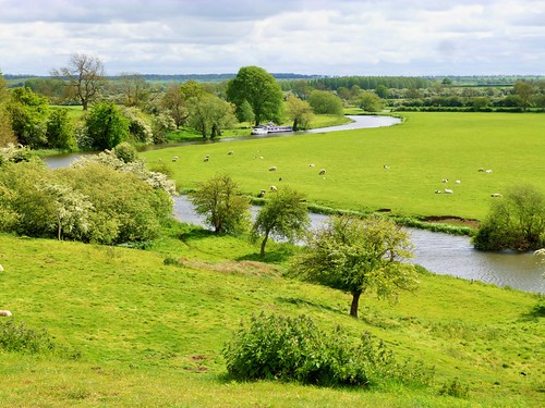
The most famous meadow in the world lies modestly beside the River Thames, just downstream from Windsor. When a sulky King John met his angry and defiant barons at Runnymede on 15 June 1215, the king was broke and facing a full-scale rebellion. The barons demanded his agreement to a ‘Great Charter’, guaranteeing no taxation without representation, freedom of worship, justice for all and a limit on the king’s absolute right to command. John squirmed and writhed; he sealed the document, then reneged. Magna Carta was a sickly seed when first planted in the soil of Runnymede. But from it grew the worldwide principles of democratic government.

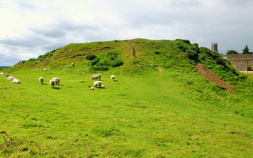
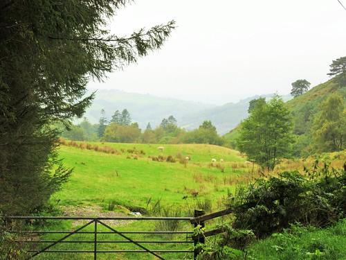
To get a sense of Runnymede’s place in history, I wanted to see its setting from Cooper’s Hill, the wooded height that bounds the meadow on the south. I followed Cooper’s Hill Lane up to the brow of the hill, where a splendid WWII Air Forces Memorial looks out over Runnymede.

Behan, Belasco, Chander and Cherala; Bardichev, Smik and Gnanamuthu – they came from Canada, Jamaica, Poland, India and New Zealand, and, in the words of the memorial’s inscription, ‘they died for freedom in raid and sortie over the British Isles and the land and seas of northern and western Europe.’

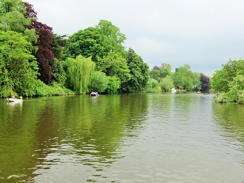
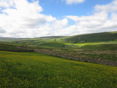
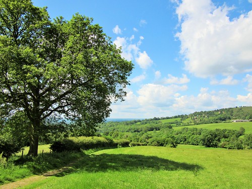
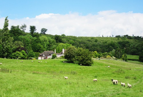
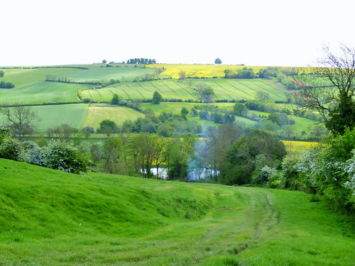
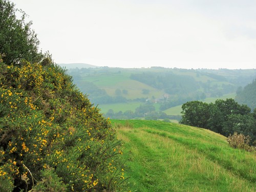
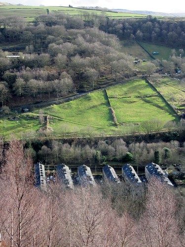
I climbed to the roof of the memorial and stood looking north across Runnymede. West beyond the trees lay Windsor, seat of the monarch. To the east sprawled London, capital of the realm. It’s plain to see how the big, flat meadow by the river offered a good place for a parley on neutral ground.

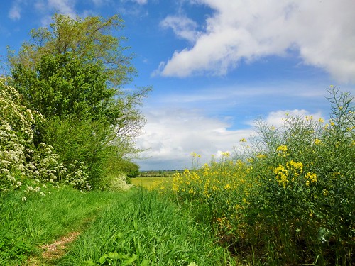
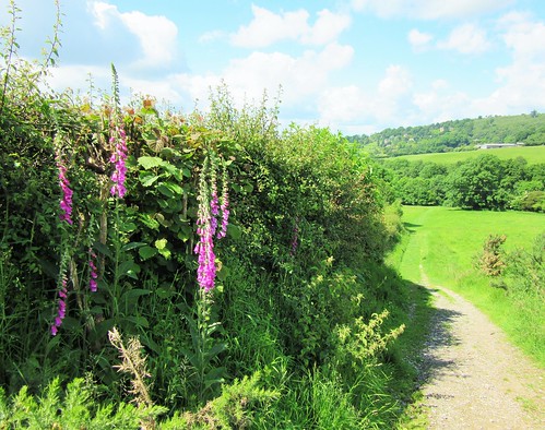
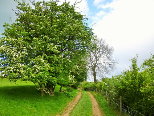
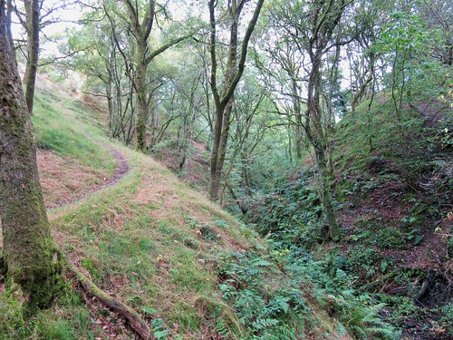
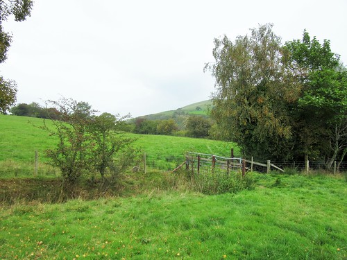
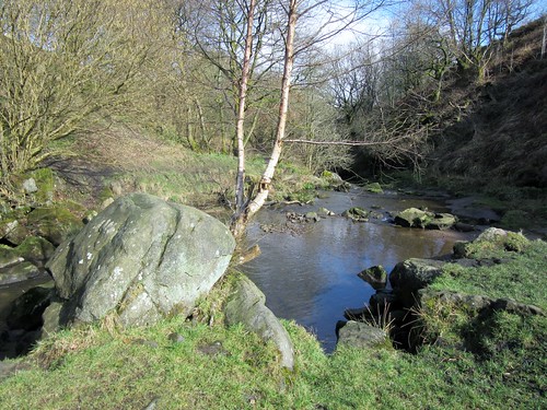
I descended through the sun-dappled trees of Cooper’s Hill Wood and crossed the fields towards Runnymede. Above the meadow stands the domed colonnade of the Magna Carta Monument (erected in 1957 by the American Bar Association), and the great blunt monolith of the John F Kennedy Memorial. It’s not so strange that both have transatlantic resonances – the American Constitution is founded on the principles of Magna Carta.

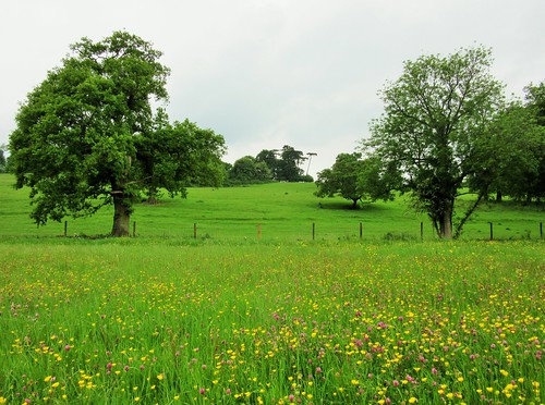
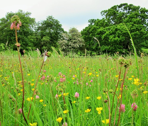
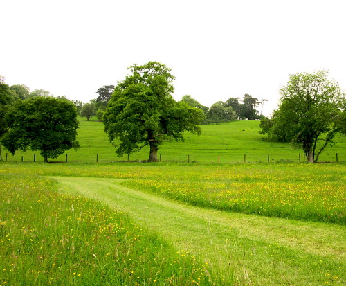
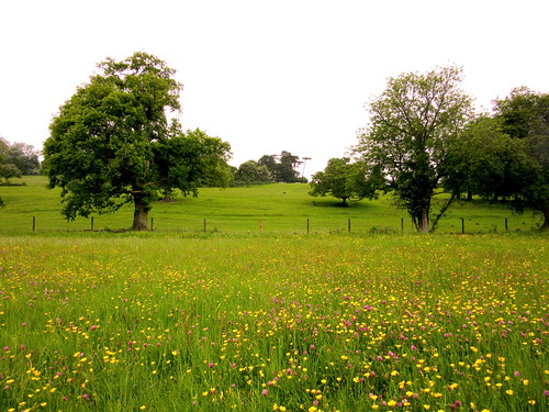
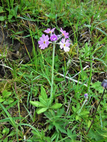
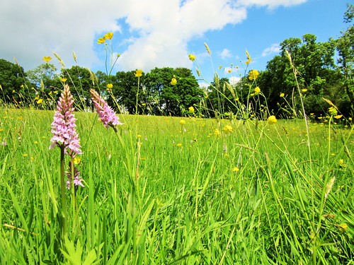
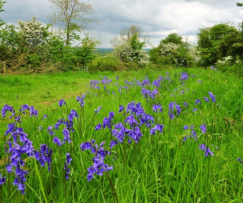
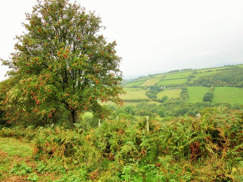
Wandering back east through the buttercups and tall grasses of Runnymede, it was easy to picture the pavilions and pennants of 1215, the stern-faced barons sweating in their mail coats, and wretched King John wriggling like an eel as history caught him inescapably in its net.

Start & finish: Egham station, TW20 9LB (OS ref TQ 011710)

Getting there: Train to Egham. Bus 566, 567 (Knowle Hill-Staines). Road – M25 Jct 13, A30, B3407 to Egham.

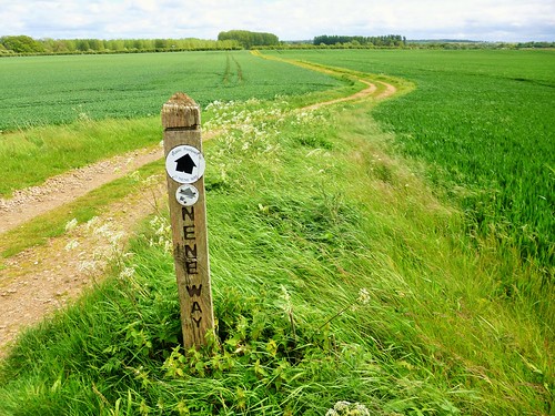
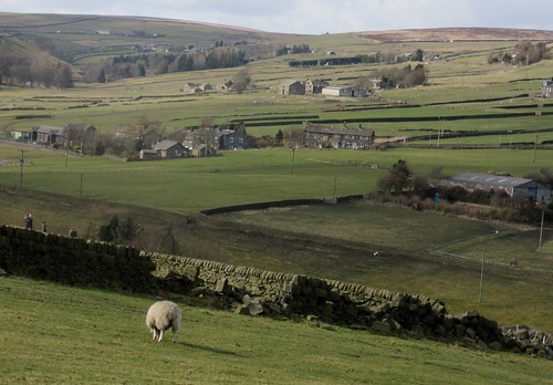
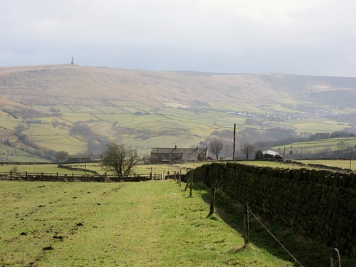
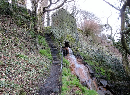
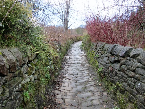
Walk (5 miles, easy, OS Explorer 160. NB Online maps, more walks: christophersomerville.co.uk): Right along Station Road; follow ‘A30’ to roundabout. Right past car showroom; in 150m, left (007715) along Cooper’s Hill Lane for ¾ mile to Air Forces Memorial (998718). Retrace steps for 200m; on right bend, left through kissing gate (000719); descend steps through Cooper’s Hill Wood (yellow arrows, purple striped posts). At bottom, left across meadow slope to Magna Carta Monument (998727). Half right downhill to cross stile into Runnymede meadow; left for 50m; left up steps to John F Kennedy Memorial. Back in meadow, bear left to pavilion with Magna Carta tearoom (996731). Return to Egham by footpaths through Runnymede meadow.

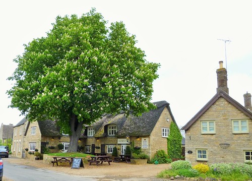
Lunch: Magna Carta tearoom in pavilion on A308, beside Runnymede NT car park – open 9-5).

Accommodation: Runnymede-on-Thames Hotel, Windsor Road, Egham TW20 0AG (01784-220960; runnymedehotel.com) – large, comfortable, cheerful hotel beside Runnymede.

Big Camp Weekend: Camp out in Runnymede. 4 pm, 18 July to 10 am, 19 July. Ranger-led activities, camp fire, BBQs. Adult £30, child £15. Booking essential: 01784-432891

Magna Carta Celebrations, Runnymede – 15 June 2015

More info: 01784-432891; nationaltrust.org.uk/runnymede; facebook.com/NTrunnymede
satmap.com; ramblers.org.uk; LogMyTrip.co.uk

 Posted by at 01:04
May 302015


First published in: The Times Click here to view a map for this walk in a new window
picture picture picture picture picture picture picture picture picture picture picture picture picture
Facebook Link:
We’ve seen the dipper,’ enthused the woman we met under Falcon Clints, ‘and a black grouse in the rocks just along there.’ ‘And a grey shrike,’ put in her husband. ‘And you’ve seen the peregrine, have you? And the ring ouzel … Ooh, thanks, we’ll keep our eyes peeled.’

How can one begin to list, let alone express, the richness of bird life in the breeding season around the meadows and moors of Upper Teesdale? And that’s to say nothing of the wonderful Ice Age relict flora sprinkled across the limestone grassland and the bogs and heaths of this lonely cleft in the hills where the young River Tees comes tumbling down its volcanic steps to sinuate through the dale.

Jane and I set off from Langdon Beck, taking the track through the pastures by Widdy Bank Farm and on upstream along the Tees. Redshank, lapwings and oystercatchers flew round us, piping and bubbling their anxious calls as we skirted their nests and young hidden in the sedges. Mountain pansies with purple and yellow petals, northern marsh orchids of royal purple, lipstick-pink lousewort and buttery gold kingcups spotted the grass and damp bog patches.

On through the narrowing throat of the dale, with the dolerite cliffs of Falcon Clints standing dark and hard-edged overhead. A slate-backed peregrine went darting out across the river from the crags, twisting like an acrobat before hanging in the sky on an invisible step. The sun picked out the black and white plumage of an oystercatcher, the orange-pink of a redshank’s trailing legs. The only sounds were bird cries, wind rustle and the mumble of the shallow Tees in its bouldery bed. It was like lingering in some private corner of heaven.

The rush and roar of Caldron Snout came to us round the corner of the crags. The peat-charged waterfall came bouncing down its rock staircase in a series of foaming cataracts as brown as bottle glass. We scrambled up the rocks, and found ourselves in another reality – wide uplands, heathy moors and the great wind-ruffled lake of Cow Green Reservoir.

The homeward way lay across the pathless hillside of Cow Rake Rigg, then back through the wide valley of Harwood Beck. Tiny, exquisite pink bird’s-eye primroses grew on the banks of the tributary sikes*, and the creaking complaints of lapwings and the alarm calls of redshanks piped us out of their territory and on down the valley.

* sikes – local name for tiny streams

Start: Langdon Beck Hotel, Co Durham, DL12 0XP (OS ref NY 853312)

Getting there: B6277 from Middleton-in-Teesdale. Park in lay-by down side road opposite Langdon Beck Hotel (‘Cow Green’).

Walk (10 miles, moderate, OS Explorer OL31): On down Cow Green road. 250m after crossing Harwood Beck, left (847309, ‘Moor House NNR’) on stony track to Widdy Bank Farm (837298) and on under Falcon Clints. Scramble up crags to right of Cauldron Snout waterfall (815286) to road at top. Right to road at The Knott (817309); turn right. Either follow road back to Langdon Beck (2½ miles), or pass cottage on left and bear left (‘footpath’ fingerpost) north-east across Cow Rake Rigg (no track). Over first crest; aim right of fenced shaft; then aim for wall running uphill, a little to left of prominent white house on distant hillside ahead. In ½ mile, come over crest; head for Binks House below. Cross stone stile; skirt Binks House (825320); cross stile (yellow arrow/YA) in bottom left corner of field. Follow stream on left for 100m; left to cross it, then stile (YA); half left to ladder stile (YA); down through gate and through Marshes Gill farmyard to road (825324). Ahead over Harwood Beck.

On left bend at Lingy Hill farm (828320), right along field track for 1 mile to Greenhills (838320). Up drive to road (841319); right over stile. NB fingerpost points straight downhill, but bear half left down to wall stile (842316, YA). On in same direction to bottom left corner of next field (845313). Ladder stile; follow Harwood Beck to bridge (850304); left to Langdon Beck.

Conditions: Tricky underfoot across boulders below Falcon Clints; rock scramble beside Cauldron Snout

Refreshments: Picnic, or Langdon Beck Hotel (01833-622267, langdonbeckhotel.com)

Accommodation: The Old Barn, Middleton-in-Teesdale, DL12 0QG (01833-640258, theoldbarn-teesdale.co.uk) – lovely warm and welcoming B&B

Upper Teesdale NNR: northpennines.org.uk

Info: Middleton-in-Teesdale TIC (01833-641001)
satmap.com; ramblers.org.uk; LogMyTrip.co.uk

 Posted by at 01:30
May 232015


First published in: The Times Click here to view a map for this walk in a new window
picture picture picture picture picture picture picture picture
Facebook Link:
A cloudy, blustering, boisterous day on the Cambridgeshire/Northamptonshire border. The wind roared in the trees and spat in my face as I walked out of Elton. Even in weather like this, Elton is a postcard picture of an English village with its cottages of creamy limestone packed with fossils, sturdy and enduring under heavy brows of thatch.

In the fields, dandelion clocks by the million, wrens and chaffinches loud and persistent in the willows along the broad and slow-flowing River Nene. By the river I met a flock of cheerful youngsters on a Duke of Edinburgh Award trudge, wrapped like small parcels against the wind and rain.

Low-rolling countryside like this catches plenty of weather – one moment a bright blaze of sunlight bringing skylarks out in full voice over the barley, the next a slash of rain and a burst of wind to silence the birds and turn the field paths sticky. I went on, whistling, towards Nassington’s graceful church spire. King Cnut dined and played chess at Nassington in a great wooden hall a thousand years ago. The Time Team discovered remnants of the structure in 2003, under and around the ancient stone-built manor house opposite the church.

History lies thick on this corner of the countryside. It was at Fotheringhay, a couple of miles to the south, that Mary Queen of Scots met her end in 1587 in the castle by the River Nene. Mired in Catholic plots, real or imaginary, Mary was too much of a threat to her cousin, Queen Elizabeth I, to be permitted to live.

I came into Fotheringhay along the Nene Way, a beautiful pathway across yellow rape fields and between hedges laden thickly with may blossom. The bare castle mound, innocent of all masonry, lay isolated in a field beyond the village’s mellow stone houses and the grand and stately church. I climbed to the top of the mound and found it thick with self-heal and scotch thistles – a poignant flora; for here in the early morning above the sinuating bends of the Nene, the pale and self-controlled Queen of the Scots knelt for the two axe blows that severed her head.

Walking back to Elton across the fields, a flash of red and white stopped me in my tracks. A magnificent red kite hung in the wind on elbow-crooked wings as it searched the barley for prey, utterly indifferent to my existence – a lordly presence above the rain-pearled land.

Start: Elton, Cambs, PE8 6RQ (OS ref TL 086940)

Getting there: Bus service 24 (Oundle-Peterborough)
Road: Elton is signed off A605 (Oundle-Peterborough). Park (neatly!) on village green.

Walk (8½ miles, easy, OS Explorer 227): From village green walk north up Duck Street passing Crown Inn on your right (pavement along road). In 450m, fork right on left bend (086945; Yarwell Mill, Sibson’). Follow this track north for 1 and a half miles; then left (081968) for 700m to meet Nene Way (076969). Left to meet Fotheringay Road in Nassington (068961).

Right to pass Black Horse Inn; left along Nassington village street. Opposite church, and just short of Nassington Manor, left (064961, fingerpost) down path and on over field. In 400m, right along Nene Way/NW (065958). Follow NW (BLAs) for 4 miles via Model Cottages (052937), Falcon Inn (059933) and castle mound (062930) at Fotheringhay, and mill at Eaglethorpe (074916) to go under A605 and on to road at Eaglethorpe sign (076915). Left round right bend; in 100m, left (fingerpost) through kissing gate/KG; right over stile; left between fence and polytunnels. In 300m, left through KG to cross A605 (077918 – please take care!).

Right; in 50m, left through KG; then another. Right up slope; in 50m, left through KG (079919). Follow path north for 1⅓ miles, past quarry heaps, then across Elton Park (occasional BLA) to road in Elton (085939). Left to reach village centre.

Lunch: Black Horse, Nassington (01780-784835, blackhorsenassington.co.uk); Falcon, Fotheringhay (01832-226254, thefalcon-inn.co.uk)

Accommodation: Crown Inn, Elton (01832-280232, thecrowninn.org)

Information: Oundle TIC (01832-274333)
satmap.com; ramblers.org.uk; LogMyTrip.co.uk

 Posted by at 01:27
May 172015


First published in: The Times Click here to view a map for this walk in a new window
picture picture picture picture picture picture
Facebook Link:
Late spring bursting across the Kentish Weald out of a blue sky, its drifting grey and silver clouds backlit by the first honest sunshine of the year. Ide Hill woods were a mass of bluebells already in seed. Wildly overshot stems of sweet chestnut coppice brushed their saw-edged leaves across the sky and threw dappled shadows along the muddy track of the Greensand Way.
‘To the honoured memory of Octavia Hill,’ read the inscription on a strategically place bench, ‘who, loving nature with a great love, secured this view for the enjoyment of those who came after her.’ The bench looked out on a ten-mile view across woods and pastures, over the pale blue waters of Bough Beech Reservoir and on to the long ridges of the Wealden Hills.
The Greensand Way led us out of the woods, down through hay meadows in a shallow valley below Toy’s Hill where fat bees were bumbling their way into the bell-like flowers of foxgloves. Two blackcaps challenged each other in a contest of liquid melody from opposing hedgerow oaks. Railed paddocks, duckponds, meadows, mellow red pantile roofs, a pigeon cooing in an ash bough – an English summer idyll that would have any Romantic poet reaching for the rhyming dictionary.
Below Toy’s Hill we crossed a meadow flooded with gold buttercups and dotted with clumps of common spotted orchid, their pale pink lips streaked with splashes of dark purple. On the other side of the hedge stretched fields of intensively managed new grass, a uniform green with not one flower head to be seen.
A rough field road led us past half-timbered old Henden Manor. A green ride led east to the conical-capped oast house where Bough Beech Reservoir’s nature reserve has its visitor centre. Nightingales, hen harrier, breeding mandarin duck, the occasional osprey on migration – the reservoir is birdwatching heaven.
The afternoon was slipping away as we turned north for the sharp climb to Stubb’s Wood and Ide Hill. ‘I’ve lived here 52 years,’ said a lady at the garden gate of a cottage, ‘and every day is different, every season is lovely,’ and she gestured out across her daily prospect – woods, water, flowery fields, and distant hills blue and hazy under the sun.

Start: Ide Hill car park, on B2042, 1 mile SW of Goathurst Common, TN14 6JG (OS ref. TQ 488517)
Getting there: M25 jct 5, A21, A25 (‘Sevenoaks, Riverhead’). In ½ mile, right at King’s Head PH; in 350m, right on B2042. Through Goathurst Common; in 1 mile, car park on right (WC, shop)
Walk (6½ miles, easy, OS Explorer 147): Cross Ide Hill road on west of car park, into Ide Hill wood; turn left and follow Greensand Way (GW) for 1¾ miles via Cock Inn at Ide Hill village, Scords Wood and Toy’s Hill woods. At T-jct of tracks just NW of Toy’s Hill village (468514), turn left off GW, down to crossroads in Toy’s Hill (470513). Ahead down road for 400m. On right bend, left (472510, fingerpost/FP) along green lane. In 150m, right through kissing gate/KG; half right across field (yellow arrows/YA). Through KG (476509); across 2 fields (YA); bear right along wood edge to KG (478507) and on along track (YAs) past Henden Manor and south on tarmac to B2042 (481495).
Ahead for 200m; on right bend, left on path (FP). In 50m, don’t turn left; keep ahead to cross stile on left (YA). Follow fence on right; stile (482493, YA); through trees; stile. Right along fence. In 150m (483493) bear left along green ride for 450m to cross road at Winkhurst Farm (488492). On ahead down green lane. In 350m, at gateway with multiple YAs on left (491493), aim half right across field to waymark post by trees (493492). Left (YA) along hedge. In 100m, right through hedge (YA); across field and into wood (494491). In 70m, left up path through wood, then meadow; at top of meadow, right through gate to Bough Beech Nature Reserve visitor centre (494494).
Ahead between oast house centre and outbuilding, to road (495494). Right to view Bough Beech Reservoir; return up road for ½ mile. At T-junction (495501), cross road; through gate, up gravelled drive, then green lane, then field edges, heading north. In 400m, cross railed footbridge; in another 100m turn right (495506, unmarked) across footbridge on path through trees. Out into field; right up hedge for 700m to Boarhill Cottage (493513). Left up lane; at left bend (493514) bear right, then left (FP) into Stubbs Wood, climbing many steps. In 150m, meet a wide, obvious woodland track (492515); right for 250m to crossroads of tracks at waymark post (494517). Left (blue arrow/BA) on Greensand Way. In 450m, hairpin back left (490516, BA). At turning circle by house, right (BA) to B2042 and car park.
Lunch: Community Shop, Ide Hill car park (tea, snacks, picnic ingredients); Cock Inn, Ide Hill (01732-750310)
Bough Beech Nature Reserve: Visitor Centre (01732-750624, kentwildlifetrust.org.uk) open Wed, Sat, Sun, BH Mon, 10-5
Chiltern Society Golden Jubilee 2015: Book of 50 Chiltern walks, available from 29 May from chilternsociety.org.uk
Information: Sevenoaks TIC (01732-450305)
satmap.com; ramblers.org.uk; LogMyTrip.co.uk

 Posted by at 21:00
May 092015


First published in: The Times Click here to view a map for this walk in a new window
picture picture picture picture picture picture picture picture
Facebook Link:
All the birds in Warwickshire were singing their little heads off as we climbed away from Upper Brailes up Gilletts Hill. Ben the black labrador barked an unavailing plea from behind his gate to be taken walkies: ‘Oh come on, have a heart…!’ But his owner shouted him down and waved us through with a smile.

On top of Gilletts Hill a great swathe of green bearded barley glistened in the sunlight. Silver and dove-grey clouds were gathering on the western skyline, but we paid them no heed as we dropped down through Ashen Coppice to a wonderful westward view – cornfields, rape fields, hedges, pastures and red roofed farms stretching away for 15 miles or more. Cloud shadow darkened the nearer ground, but a single pale church spire rose to the north-west, brilliantly lit in a ray of sun.

Chiffchaffs, whitethroats and blackbirds warbled fit to beat the band. We skirted above handsome old Famington Farm and climbed the wooded south-westerly flank of Brailes Hill. On the hill’s upper slope an old cart track ran by pastures full of bouncing black and white lambs. We followed it down to Lower Brailes, looking out between veteran sycamores towards the church tower and its zigzag backdrop of green and yellow fields rising to the long ridge of Mine Hill.

St George’s Church in Lower Brailes is a glorious confection of dark gold limestone, its cathedral-like interior dim and scented with age. The 14th-century masons had massive fun with the grotesques they fashioned under the eaves – a mad nun, a bearded demon, a man with three faces, a wolfman with pricked-up ears – some of them blurred with weathering as though breaking half-born through the stone. Inside, overlooking the nave, I found an old friend, the Green Man, with tendrils sprouting from his mouth and bursting into leaf around his cheeks.

Out in the fields north of St George’s we climbed Lower Brailes’s famed ’99 steps’, shallow stone treads in a bank, some of them formed of recycled grave slabs. On across medieval ridge-and-furrow farmland, a circuit of the ramparted mound of Castle Hill, and we were threading our way back into Upper Brailes between neat allotments of beans, peas, radishes, cabbages, onions, showy globe artichokes and humble spuds.

Start: Gate Inn, Upper Brailes, Warwickshire, OX15 5AX (OS ref SP 305398)

Getting there: Bus service 50A (stagecoachbus.com), Stratford-on-Avon to Banbury.
Road – Upper Brailes is on B4035, 3 miles east of Shipston-on-Stour.

Walk (6 miles, moderate, OS Explorer 191): From bus stop outside Gate Inn, left down road. In 100m, right up Gilletts Lane (‘Gillett Hill’). Through gate; between house and garage; beyond, through gate; bear right (303397, yellow arrow/YA) up grassy bank, then up steps. At top, at T-junction, right; in 50m, fork left on path 58b. In 100m cross grass track, then stile (300398); follow path 58 across field, down through Ashen Coppice. At foot of steps, diagonally left (298399, YA) down slope; at bottom left corner of wood, left (296399, blue arrow/BA) along lower edge of wood. In 150m, right along gravel roadway (path 57a) and follow BAs.

In 300m, at gate (292396, ‘Private’), fork right (BA, yellow-topped post/YTP) along field edge and down, aiming for Farmington Farm. At bottom of slope, left along hedge (285393, YA). Pass through cross-hedge; in 100m, left (295389, YTP, YA) across field to go through gate (288387). Diagonally right uphill through trees (YTP, YA). Near top, bear right at YTP (289386, YA), anticlockwise round the upper hill (YAs). Go through 2 gates; after 2nd one, left through side gate (292382, BA) on bridleway for 1 mile (BAs), passing New House Barn (301383) to road at Grove End (306390). Left; in 20m, right over stile (YA); over next stile, and follow path 60 (YAs) to road (310391). Across into Jeffs Close; left at end; follow road round to right, to B4035 in Lower Brailes (312393).

Right along road. Opposite George Inn (314393), left up Butcher’s Lane. In 100m, left through gate; fork left on path 52. Cross footbridge (314396, YTP, ’52’); keep ahead up The 99 Steps; on across 2 fields. In 3rd field, diagonally left; halfway across, fork right (310397) to cross Castle Hill Lane (309398). Through kissing gate/KG; fork right (’52g’) and follow path across field and over stile (’52g’) to Castle Hill. Return over stile; right along hedge; in 70m, through KG (307399) and follow path (’51’). Dogleg right/left through allotments (YAs) to road; left to The Gate PH.

Lunch: The George, Lower Brailes (01608-685223; georgeinnbrailes.com)

Accommodation: The Gate, Upper Brailes (01608-685212; thegateatbrailes.co.uk) – clean and friendly village B&B.

Information: Warwick TIC (01926-492212);
satmap.com; ramblers.org.uk; LogMyTrip.co.uk

 Posted by at 01:58
May 022015


First published in: The Times Click here to view a map for this walk in a new window
picture picture picture picture picture picture picture picture picture picture picture picture picture picture picture picture
Facebook Link:
There’s no shortage of plumed helmets, dragon-roaring shields, coats of mail, crossbows and swords – some of these real enough to cleave a foe in twain – in English Heritage’s child-friendly shop at the gates of Tintagel Castle.

I crossed the footbridge slung over the chasm that separates the mainland from the castle on its massive, rock-like promontory, known as The Island. Here, protected by sheer cliffs on all sides, a prosperous community traded tin for Mediterranean pottery and glassware in post-Roman times. And here, if the ancient chroniclers and poets can be believed, Arthur the Once and Future King was conceived of an adulterous union (magically facilitated by the wizard Merlin) between the British King Uther Pendragon and the Duke of Cornwall’s wife, beautiful Igraine.

Was Arthur born at Tintagel? Or was he washed up there on a tempest-driven wave, to be raised by Merlin in the cave that still underpins The Island? And what of the ancient stone inscribed with Arthur’s name, unearthed at Tintagel in 1998? I pondered these signs and wonders as I explored the tiny Dark Ages dwellings and the stark castle ruins on the promontory. Then I set out north along the coast path with the sun on my back and the wind in my face.

It was a springtime day in a thousand, under a sky of unbroken blue. The path wound into and out of hidden valleys, swung up flights of steps and slithered down over slaty rocks. Primroses, white sea campion and pink tuffets of thrift trembled in the strong sea breeze. Herring gulls wheeled and wailed above a sea of milky turquoise two hundred feet below. Ahead, the cliffs crinkled around tiny rock coves, leading the eye forward to a great curve of coast where Cornwall ran north into Devon.

In the gorse banks above Smith’s Cliff, tiny Dartmoor ponies galloped skittishly to and fro. I walked out to the spectacular sheer-sided promontory of Willapark, one among dozens of sections of this precious piece of coastline bought by the National Trust with funds raised through their Neptune Coastline Campaign – 50 years old this very month. Beyond Benoath Cove’s perfect fingernail of dull gold sand lay Rocky Valley, where the Trevillet River jumps down towards the sea over a series of rock steps. I crossed a little grassy saddle near Firebeacon Hill, brilliant with violets and shiny yellow stars of celandine.

Under the white tower of a coastguard lookout, the coal-black cliffs of Western Blackapit stood twisted, contorted and streaked with splashes of quartzite as though a painter had flicked his brush across them. Beyond the promontory, the white houses of Boscastle lay hidden in their deep narrow cleft, appearing in sight only at the last moment as I turned the corner by the harbour wall – a magical revelation of which Merlin himself might have been proud

Start: Tintagel Castle, near Camelford, Cornwall, PL34 0HE (OS ref SX 052889)

Getting there: A30, A395, B3266; or A39, B3263 to Boscastle. Park in village car park (PL35 0HE) – about £5 in coins. Then take bus 595, or taxi (£10, Boscars, tel 07790-983911, boscars.co.uk) to Tintagel. Walk down to castle entrance.

Walk (6 miles, strenuous, OS Explorer 111. NB: online maps, more walks at HYPERLINK “http://www.christophersomerville.co.uk” christophersomerville.co.uk): Follow South West Coast Path to Boscastle.

Conditions: Many steps and short steep sections

Lunch/Tea: Harbour Lights Tea Garden, Boscastle (01840-250953)

Accommodation: Mill House, Trebarwith, near Tintagel, PL34 0HD (01840-770200, themillhouseinn.co.uk)

Tintagel Castle (English Heritage): 01840-770328; english-heritage.org.uk

NT South West Coastal Festival 2015: nationaltrust.org.uk/visit/south-west

Info: Boscastle TIC (01840-250010)
satmap.com; ramblers.org.uk; LogMyTrip.co.uk

 Posted by at 02:13
Apr 252015


First published in: The Times Click here to view a map for this walk in a new window
picture picture picture picture picture picture picture picture picture picture picture picture picture picture picture
Facebook Link:
They were setting up market stalls around the handsome half-timbered Tudor market hall in the centre of Llanidloes. We stopped in Long Bridge Street to buy Welsh cakes in Talerddig Bakery (‘Oh, our cakes are sturdy enough to withstand the rigours of a rucksack!’) and some Black Bomber cheese from Darren Tonks’s fine food emporium. Llanidloes is that sort of town – long-settled, neat, well-provisioned and a little bit rarified in flavour, with the River Severn on its doorstep and the mid-Wales hills cradling it in isolation.

Up in Allt Goch Wood, dream-catchers of twigs and feathers turned in the wind, suspended in the framework of an ash-bough bender. Wooden shelters and a stout earth closet hinted at alternative lifestyles being enacted among the trees. Beyond the woods the bathing goddess symbol of the Severn Way beckoned us east along old-fashioned country lanes floored with shaly rock and grass.

This is sheep-farming country. At Cefnmawr a flock of black-faced ewes jostled round the farmer, anxiously eyeing the feed sacks on his trailer. The views were opening out, steeply down into the Severn Valley 500 feet below where Llanidloes lay tucked into the foot of the wooded slopes of Allt Goch.

A long lane led us down across the Severn to the Newtown road, where bearded bikers drank great mugs of tea outside the Riverside Café. We took the lane running steeply up the hill towards Newchapel, before turning off up a green lane that rose steadily into the open country around the humped hill of Moelfre. A moment in the cold wind to stand and admire the prospect across lumpy fields, woods, farms and the white church at Newchapel, before turning west along the upland trail of Glyndŵr’s Way.

Under a big old silver birch we sat to enjoy our Welsh cakes and Black Bomber. Then we found the twisty lane down to Llanidloes, with a pair of red kites wheeling and mewing above us among the low grey clouds.
Start: Llanidloes town centre, Powys SY18 6HU approx. (OS ref SN954845).

Getting there: Bus service X75, Shrewsbury-Rhayader
Road – Llanidloes is on A470 (Rhayader-Newtown)

Walk (11 miles, moderate, OS Explorer 214): From Market Hall down Long Bridge Street. At bottom, left across River Severn. Left up Westgate Street (955849, Glyndŵr’s Way/GW). Just past Tan-yr-Allt, right (953849; GW, ‘Severn Way/SW’) up through trees. In ½ mile, beside organic toilet on right (100m beyond junction of tracks), fork left (956856, GW, SW). Follow GW/SW through and out of woods; left along golf course edge to clubhouse (954859). Right (GW) down drive; in 100m left (GW, SW) along stony lane. In 250m GW turns left (955863), but continue along SW (‘goddess’ waymark symbol) to cross B4569 (962864).

On along lane. In ½ mile pass Cefnmawr (969867); right to road (972866); turn left. In 400m fork right (974867); in 300m, right (978868) down stony lane. Ahead along next field edge, over brow to gate in far left corner (980864). Ahead along left-hand hedge (not track by right-hand fence!), with bank steepening on right. Keep hedge on left and descend through gates for 600m to rough lane (982855), soon becoming surfaced. Left for ½ mile, passing Pentre, to road (988863). Right for 1 mile to A470 (997851).

Right past Riverside Café; in 100m, left (‘Newchapel’). In 600m fork right by house (997845); in 150m, by next house, fork left off road up green lane (996843). Down to cross stream (994840); bear left up track. Through gate (blue arrow/BA) to barns at Celyn (995839). Left to pass in front of them, then right (BA) up their left side. Through next gate and fork left (995837). Follow left hedge uphill. In 200m bear left through hedge and clockwise round field; left through gate (995834) and up open hillside. Aim half right for upper edge of bracken patch and follow it past thorn tree and on south to gate (994829, BA). Ahead into dip to meet GW (997825); right to cross stony driveway at Blaen-y-Cwm (992825). Follow GW down field, through hedge (989824); right (GW) to gate (GW); into dell, across footbridge (987824); over fields to Ashfield (985825).

Along lane to road (985831). Right; in 400m, left at Newchapel (987834), passing side lane and chapel on right. In 450m, left (983836, GW) down drive to gate in front of large shed (GW). Down field to stile (GW); steeply down through wood to cross Nant y Bradnant stream (982836). Up (GW) along woodland track for 400m to gate (978838). Half left across field to road (978838). Right (GW) for 1½ miles into Llanidloes.

Lunch: Riverside Café, Dolwen layby on A470, SY18 6LL

Accommodation: Lloyds Hotel, Llanidloes, SY18 6BX (01686-412284, lloydshotel.co.uk) – welcoming and comfortable.

Information: Llandrindod Wells TIC (01597-822600)
satmap.com; ramblers.org.uk; LogMyTrip.co.uk

 Posted by at 02:18
Apr 182015


First published in: The Times Click here to view a map for this walk in a new window
picture picture picture picture picture picture picture picture picture picture picture picture picture picture picture picture
Facebook Link:
Fifty years ago next week Britain’s first National Trail, the Pennine Way, was officially opened. It wound through some steep and beautiful landscape in industrial West Yorkshire, but it gave a wide berth to Hebden Bridge – back then a stinking, roaring, smoking mill town, famous for its fustians and corduroys, but nobody’s idea of a pleasant stopover for holiday makers.

Times have changed, and so has the town after a big smartening-up. A new detour route, the Hebden Bridge Loop, is being opened to coincide with the Pennine Way’s anniversary, beckoning walkers aside to savour the organic cafes, artisan bakers and boutique shops of the newly sparkling gritstone town down there in the depths of Calderdale.

On a brisk day with newborn lambs jumping in the fields I climbed the cobbled lane to Horsehold Farm, where the new Loop path led me along the edge of a steep beechwood. A strong, cold wind blew in from the west with a spatter of snowflakes in its skirts. I dropped down through the tender new green leaves of Callis Wood to where road, railway canal and river ran squashed close together by the tight geography of the Calder Valley.

The Hebden Bridge Loop rose very steeply up the northern flank of Calderdale by way of narrow cobbled laneways between green gritstone walls footed in daffodils. Up in the fields 600 feet above the valley bottom, nesting curlews and golden plover flew away with wild bubbling cries, the haunting sound of spring in the northern dales. Back across Calderdale the slim finger of the monument on Stoodley Pike stood high, pointing into a sky swirling with snow and sun.

From the ridge I descended with a superb view north over Golden Clough to far moors painted chocolate and cream. Down through fields of heavily pregnant ewes to Hebble Hole and the little ancient stone footbridge over the Golden Water, a perfect picnic spot on some warm summer’s day. But today it was up and on with the wind at my back to high-perched Heptonstall on the edge of its cleft, and a vertiginous path all the way back down through Mytholm Woods to Hebden Bridge.

Start: Hebden Bridge Station, W. Yorks HX7 6JE (OS ref SD 996268)

Getting there: Rail to Hebden Bridge. Bus – 500 (Keighley), 590, 592 (Halifax-Todmorden), 900 (Huddersfield). Road – M62, Jct 20; A58, A6033 to Todmorden; A46 to Hebden Bridge

Walk: (7 miles, strenuous, OS Explorer OL21): From station entrance, right under railway; right up Palace Hill Road. Down across railway; first left (989271, ‘Horsehold’) up road. Just before Horsehold Farm (982267), follow red circles and white arrows of Hebden Bridge Loop /HBL. In third of a mile, at fingerpost ‘Mankinholes 3¼ miles’, turn right across stream (980261; ‘Collis Bridge’, HBL) In100m, right down gravelled track (‘Pennine Bridleway’). In 450m, with house in sight through trees to left, cross over broad track and take path (978265, ‘Pennine Way’/PW) down to track; on down to cross canal, river and A646 (971264)

Right (PW); in 50m, left (PW, ‘Hebble Hole’) under railway. Very steeply up cobbled laneway. At second pair of yellow arrows/YA, fork left uphill; on up past Higher Underbank Farm. In 100m, hairpin back right by board marked ‘Wainwright Route/ Official Route’ (968266). Follow Official Route over stile, along path. In 300m, fork left uphill at 2-arrow post (970268); steeply up to The Cludgie (ancient WC) and house on road (971269). Left (PW); in 200m, right (PW) north up field edges. In ⅓ mile, cross Badger Lane (967274); on past Badger Fields Farm, over crest, down to cross Golden Water in Hebble Hole on footbridge (968282). In 30m, fork left (YA); in another 100m fork right and keep parallel with river. In 150m, left up steps (970282), through gate (HBL) onto paved field path. Follow this (HBL, YAs) for ¾ mile to Windy Harbour Farm (982283). Right off lane here; immediately left through squeeze stile; follow HBL to road (983283). Right into Heptonstall.

Pass Cross Inn; first right into Hepton Drive (HBL on road name plate); first right into Church Lane; follow HBL past church, then steeply down vertiginous path through woods to road in Hebden Bridge (989273). Right (HBL); in 100m, left (HBL) down steps. Left along A646 at bottom; at traffic lights (991272) right to cross canal; left along towpath. Pass under bridge No. 16 (995270); hairpin back right to road; left to station.

NB – Some short, steep climbs; many steps; vertiginous path from Heptonstall to Hebden Bridge.

Lunch: Cross Inn, Heptonstall (01422-843284).

Accommodation: Hare and Hounds, Old Town, Hebden Bridge HX7 8TN (01422-842671, hareandhounds.me.uk) – very friendly, cosy country pub.

Pennine Way 50th Anniversary celebrations: nationaltrail.co.uk/pennine-way
Hebden Bridge Loop Launch Day, 25th April. Info, map etc – hbwalksersaction.org.uk/pennine-way.html

Info: Hebden Bridge TIC (01422-843831); yorkshire.com
satmap.com; ramblers.org.uk; LogMyTrip.co.uk

 Posted by at 01:54