Apr 112015


First published in: The Times Click here to view a map for this walk in a new window
picture picture picture picture picture picture picture picture picture picture picture picture picture picture picture picture
Facebook Link:
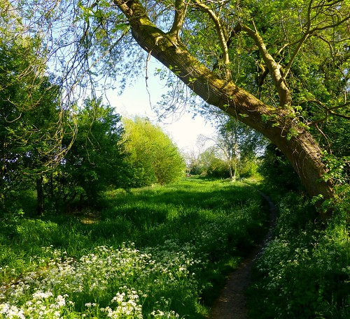
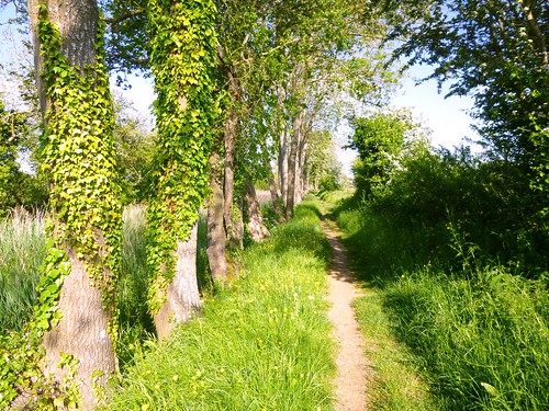
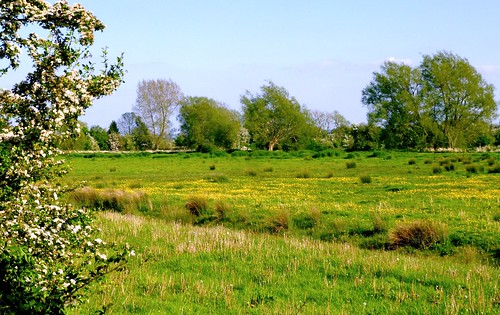
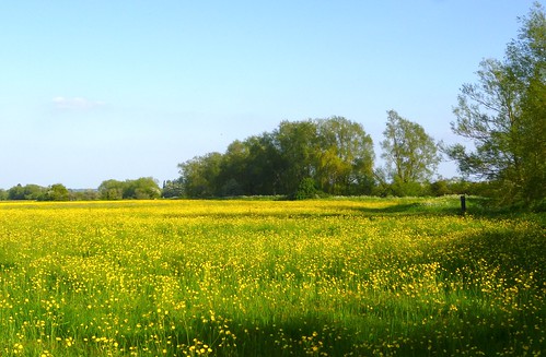
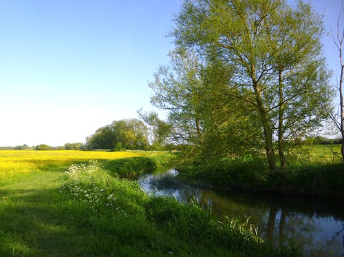
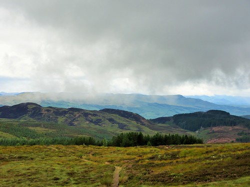
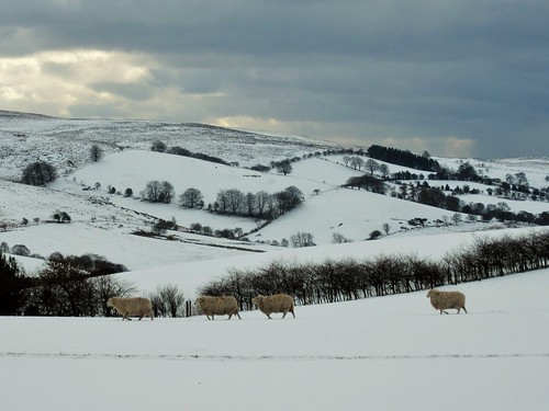
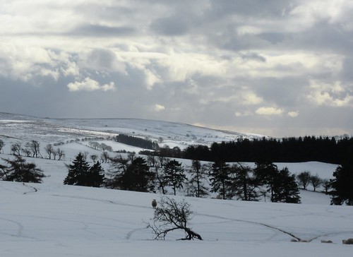
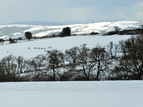
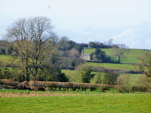
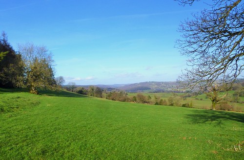
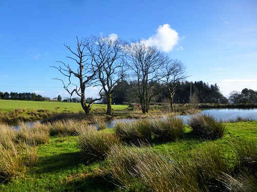
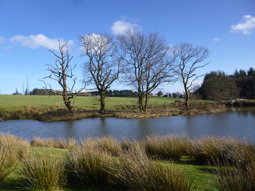
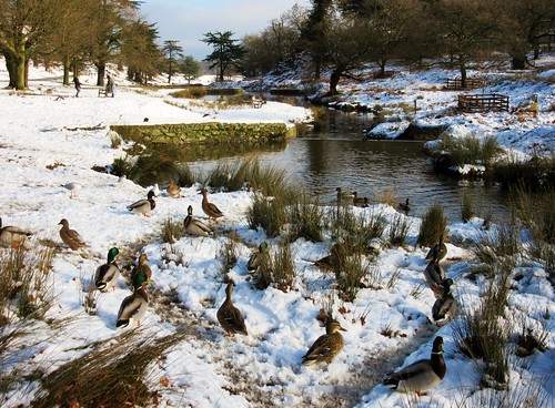
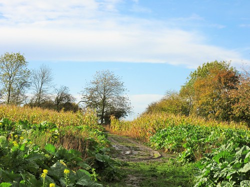
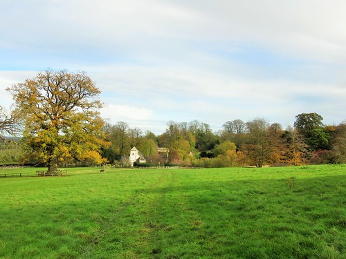
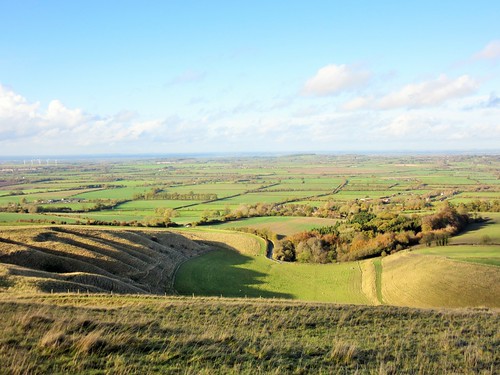
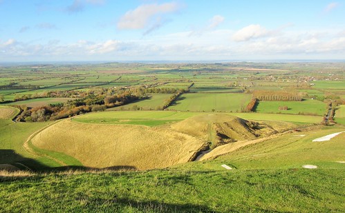
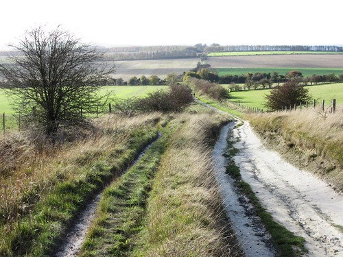
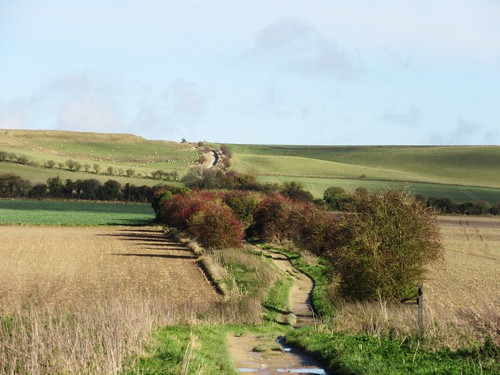
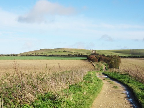
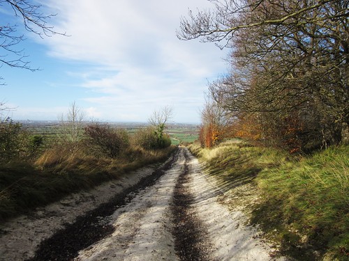
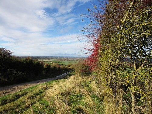
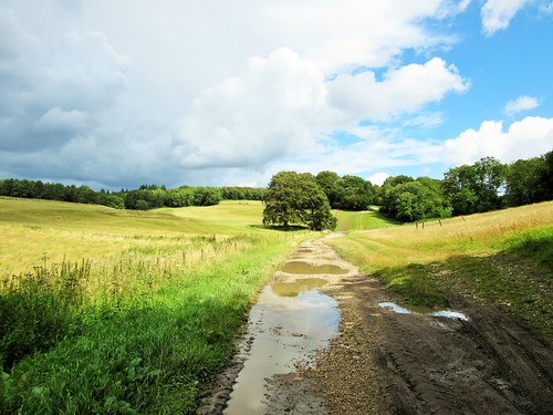
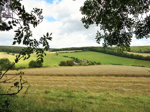
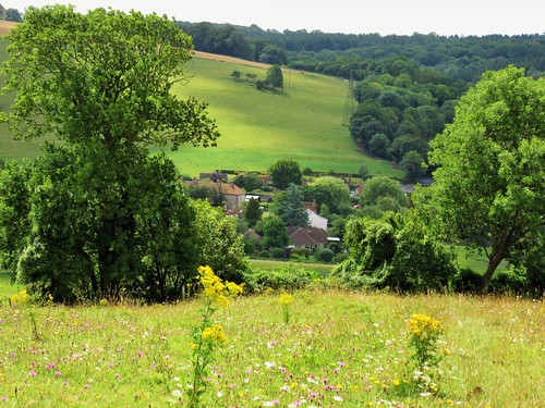
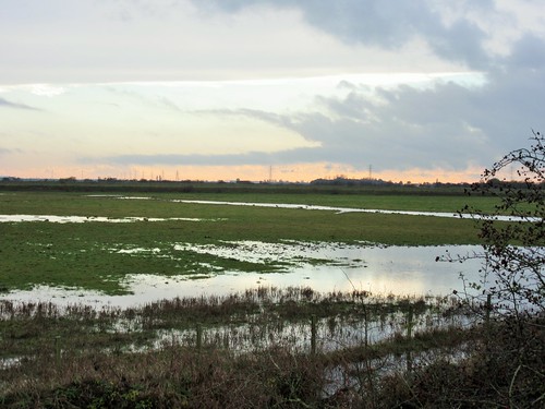
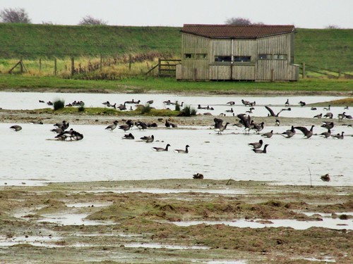
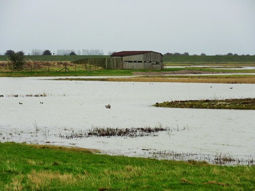
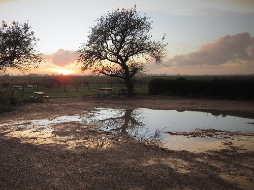
The infant River Thames joins Gloucestershire to Wiltshire at the outer edge of the Cotswolds, in low-lying gravelly country. Setting off along the towpath of the reed-choked old Thames & Severn Canal, we marvelled at how dozens of unsightly old gravel pits have been transformed into the wide, tree-hung lakes of the Cotswold Water Park. This is a really fine example of a conservation landscape; and down beyond the hamlet of Cerney Wick there’s another in the lush hundred-acre grassland of North Meadow.

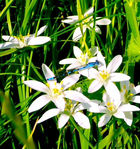
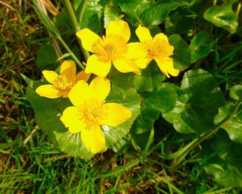
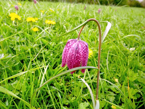
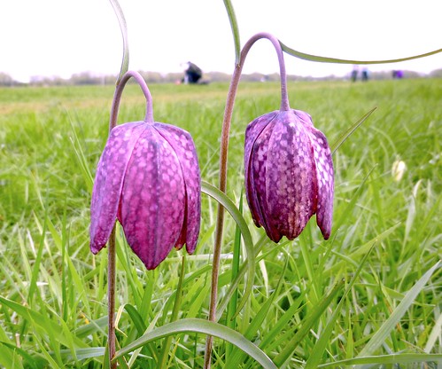
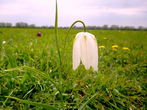
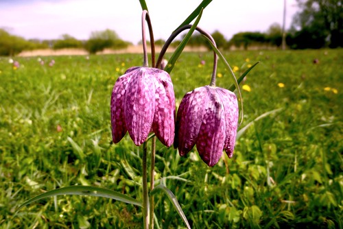
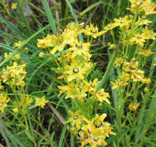
This is a beautiful wide hayfield, fringed with greening willows and filled with flowers; a habitat that comes into its own each springtime. Entering the meadow from the old canal, we walked among spatters of wild flowers – golden buttons of dandelions and buttercups, creamy yellow cowslips, the pale blues and pinks of milkmaids, which some call lady’s smock or cuckoo flower. And everywhere the large drooping heads of snake’s head fritillaries, singly, in pairs or in loose clumps, bobbing and trembling in the wind on their dark red stems.

We got down on our knees, as though in obeisance, to enjoy a close-up look at one of Britain’s rarest and most spectacular plants. Some of the downward-hanging flowers were white with green spots inside; the majority were a dusky, deep rose-pink, speckled within in pale pink and rich purple, like stained-glass bells filtering the sunlight. It was astonishing to see them in such numbers – over a million in this one large meadow.

Snake’s head fritillaries are particularly choosy about where they colonise. They are nationally scarce – but not here. North Meadow, meticulously managed by Natural England, is home to 80% of the entire British population of these remarkable flowers. The Thames, no wider than a stream, dimples through the meadow, its waters slow and thick with nutritious earth particles which are spread across the land by winter floods. The silt-enriched grass is left uncut until midsummer or later, by which time the fritillaries and all the other plants have had time to set the seeds of the next generation.

A slice of lemon and lavender cake (improbable but delicious) in the Fritillary Tea Rooms on the outskirts of Cricklade. And then a slow stroll back through the flowery meadows and along an old railway line where primroses grew thickly and the breeze carried hints of horses, cattle and that indefinable breath of spring in full flow.

Start & finish: Cotswold Gateway Centre car park, Spine Road, South Cerney, Glos GL7 5TL (OS ref SU 072971)
Getting there: Bus service 51 (Swindon-Cirencester). Road: M4 Jct 15; A419 towards Cirencester; B4696 towards South Cerney; in 200m, left into car park (free).
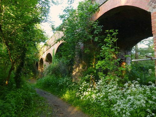
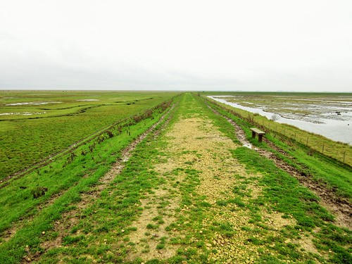
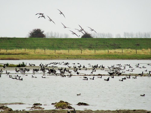
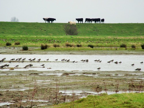
Walk (6½ miles, easy, OS Explorer 169. NB: Detailed directions, online map, more walks: christophersomerville.co.uk): Pass Cotswold Gateway info centre; path to canal (073970); right along towpath. In ¾ miles cross road and on (079960, ‘Cricklade’). At Latton Basin, right (088954) down road (white/green arrow). Bear right on track (yellow arrow/YA) past lock-keeper’s house and on beside old canal bed. In 450m cross bridge (087949); ignore immediate left turn into North Meadow. In 200m, go through gate; left through kissing gate/KG into North Meadow. Fork left and walk clockwise circuit of North Meadow (1¼ miles), returning to same KG (087947)). Through it; right though gate; left (‘Thames Path’/TP) along right bank of River Thames. In 500m, right along old railway (082947). TP leaves it in 350m (080949), but keep ahead along railway for ½ mile to go under viaduct (073954). In another 250m, right through KG (070956, YA) on path through fields. In 700m cross road (076959); over stile (YA); on to road. Ahead past Crown Inn to canal (079960); left for ¾ mile to car park.
Click on Facebook “Like” link to share this walk with Facebook friends.

Lunch: Old Boathouse Inn, Cotswold Gateway (01285-864111); Fritillary Tea Room, Thames Bridge, Cricklade (11-12, 18-19, 25-26 April)
Info: Cotswold Water Park (01793-752413 / 752730)
North Meadow: Natural England (01452-813982; naturalengland.org.uk). Fritillary updates – http://www.crickladeinbloom.co.uk/fritillary_watch.html

Gilbert White 9-day walk, 27 April-5 May: gilbertwhiteshouse.org.uk
satmap.com; ramblers.org.uk; LogMyTrip.co.uk

 Posted by at 01:27
Mar 282015


First published in: The Times Click here to view a map for this walk in a new window
picture picture picture picture picture picture picture picture
Facebook Link:
Tam-o’-shanters off to the Forest Community Trust at the tiny scattered hamlet of Abriachan on the hillside above Loch Ness. Nearly 20 years ago they bought a chunk of their local forest and moorland, where they’ve laid out, waymarked and maintained a superb network of footpaths that connect some fascinating sites and viewpoints over the surrounding hilly landscape. The start of the walk to Cairn na Leitire’s rocky peak is a forest play area complete with big wooden fort, tree house, bird hide, loos and playground – ideal for junior adventurers.

On a still, cool morning with a hint of rain in the air we left the play area and set out on the climb through pine forest and silver birch. A tiny toad as long as my little fingernail squatted on a rock, hoping in vain to avoid the sharp eyes of Jane. We crossed an undulating moor of bilberry with mats of pale green lichen and purple heather tufts. From the cairn on Carn na Leitire the views widened across the hills as far as the broad shoulder of Ben Wyvis rising into cloud some 25 miles to the north.

Thick curtains of rain rippled through the valleys parallel with our patch of upland, but miraculously seemed to be avoiding us. Then they changed course, and smacked us with all they’d got. Dripping wet, we took shelter in a shieling, a reconstruction of the kind of hut that local cattle-herders would have used in the summer months – circular, tiny, with stone foundations and turf sod walls under a heather-thatched roof. How smoky, smelly and conversational it must have been in there, with five or six people crammed tight together and a good peat fire blazing away.

We lingered in the shieling till the rain marched away eastwards. Then it was out and down into the forest, pressing on through downpours and bright sunshine interludes, with the stacked pine logs exuding pungent smells of resinous sap. The sun drew out the male scotch argus butterflies, chocolate brown with fiery orange embellishment to the trailing edges of their wings. Suddenly the tall damp grasses were full of them, restlessly fluttering, never perching for long, a brilliant display of colour and movement to brighten the homeward miles.

Start: Abriachan Forest Trails car park, near Drumnadrochit IV3 8LD approx. (OS ref NH 540353)

Getting there: A82 south from Drumnadrochit; in 6 miles, hairpin left (‘Abriachan’ – use turning circle on right). In 1½ miles pass Abriachan village hall on right; in 250m, fork left (‘Abriachan Forest Walks’). Pass Loch Laide; in 400m, by ‘Abriachan Forest Trust’ sign on left, left onto dirt road; in 350m, left into car park.

Walk (5½ miles, moderate, OS Explorer 416): Follow ‘Wee Tree House, Loch Laide’ sign past playground. At boardwalk junction, left to Tree House; return along boardwalk to T-junction. Left to hide on Loch Laide. Return past left and right turning; take next left. Beside wooden play fort, left to Bronze Age hunt reconstruction. Just beyond, left at junction. In 300m trail forks; go left (footprint waymark). At 542346 pass carved bench; at another carved bench, left (542344, ‘Carn na Leitire’). In 300m, at fork with ‘posts’ sculpture on left, bear right. Path swings anticlockwise round hillock. Pass post on left; in 50m, ignore path on right (544343) and continue on main path to cairn on Carn na Leitire (547345).

Continue on clear path across moor. At successive junctions (551341 and 554341) go left (‘Balchraggan’ fingerposts). In 800m pass The Shieling hut (558342); continue to T-junction. Right on forest track for ¾ mile to meet Great Glen Way (549337). Right along GGW for 1¼ miles to T-junction by forestry store (536345); right for ¾ mile to car park.

Refreshments: Picnic

Accommodation: Bridgend House, Village Green, Drumnadrochit, IV63 6TX (01456-450865, bestbandb-lochness.co.uk) – very friendly and obliging B&B.

Abriachan Forest Trust: 01463-861259, abriachan.org.uk

Abriachan Trails: Download map/instructions at walkhighlands.co.uk

visitscotland.com;satmap.com; ramblers.org.uk; LogMyTrip.co.uk

 Posted by at 01:01
Mar 212015


First published in: The Times Click here to view a map for this walk in a new window
picture picture picture picture picture picture picture picture
Facebook Link:
Parsonage Wood in the last throes of winter. Chiff-chaffs were sending out their two-tone spring call sign from beech trees as yet innocent of leaves. There were hard green buds at the finger-ends of the branches, however, and violets tightly coiled out of the chilly air among the tree roots. It was hard to believe that, ten minutes before, I’d stepped out of a tube train. Nothing here in the Buckinghamshire woods and fields at the end of the Metropolitan Underground line held even a breath of London.

Below the wood, Amersham Old Town lay along the River Misbourne’s shallow valley, a handsome old market town in red brick and terracotta tiling. My cheerful cousins Vicky and Tone were waiting for me there, along with my long-striding sister Lou. We climbed away up the far slope of the valley, through the corner of mossy Rodger’s Wood, and on by Quarrendon Farm where a sky-blue tractor made the only splash of colour in a muted palette of greys, reds and olive greens.

At Upper Bottom House Farm a horse came to sniff us over, nodding his long head sagely as though to say: Yes, I thought so, not an apple between you. ‘Apples?’ said Lou. ‘Listen, that’s a Buckinghamshire horse. He won’t accept anything less than a tarte tatin au coulis de calvados.’

Down in Chalfont St Giles we found the modest brick-and-timber cottage where in 1665 John Milton came in flight from the Great Plague of London. Here, blind and infirm, he finished his masterpiece Paradise Lost, while keeping his head down and his mouth shut – King Charles II had not long been restored to the throne, and Milton had been an enthusiastic supporter of the much-despised Commonwealth and its instigator Oliver Cromwell. What would the poet have made of the great juggernauts that now thunder past his front door? Doubtless he’d have consigned them with the fallen angels to the fiery lake of pitch.

The church of St Giles holds wonderful 14th-century frescoes of Creation, Eden and the Crucifixion, but they lay – frustratingly – behind locked doors. So we turned back along the South Bucks way, a muddy path through willow groves and along the gin-clear waters of the River Misbourne. Rain-pearled pussy willow buds, bluebell shoots and the ecstatic trilling of larks over the flint-strewn fields told us that spring was not stillborn, only temporarily suspended.

Start: Amersham station, Amersham-on-the-Hill, Bucks HP6 5AZ (OS ref SU 964982)

Getting there: Rail (Metropolitan tube or main line).
Road: M25, Jct 18; A404

Walk (9 miles, easy, OS Explorer 172): From station, left to main road; left under 2 bridges; immediately right (footpath fingerpost) along path beside railway. At road, left (962982); in 50m, left on path along upper edge of Parsonage Wood. Leave trees (960977); on down field path to St Mary’s Church and Old Amersham High Street (958973). Left to cross A355 (961972); in 50m, right (fingerpost) past Bury Farm, then under A413 (963969). Follow yellow arrows/YA, up through corner of Rodger’s Wood (968962). Half right across field to hedge corner (969961); on with Quarrendon Farm to your right; on along ridge edge of Day’s Wood. From waymark pole (974955), diagonally across field, through gate (974951); descend beside fence, through farmyard to Bottom House Farm Lane (976948). Right for 50m; left (fingerpost) up track; in 250m, left to road at Hill Farm House (978943). Forward (‘Chalfont St Giles’); follow road for ½ mile to crossroads (984938). Go over, and on for ½ mile to road in Chalfont St Giles (990935). (NB to visit Milton’s Cottage and avoid busy road – 50m before reaching village road, turn sharp right uphill (‘footpath’ fingerpost) past Scout Hut, then school, to descend to road opposite Milton’s Cottage – 989934).

From village road (St Giles’ Church opposite), turn left along lane (‘South Bucks Way’/SBW). In 300m pass gate; in 50m fork right (989938; YA). In 300m at Chalfont Mill (987941) dogleg left and right across lane, and on for ¾ mile (‘SBW’) to cross Bottom House Farm Lane (983953). In another mile, at waymark post (973964), bear right to cross River Misbourne (972965, YA), then left along river bank. In ½ mile, go under A413 (966969), then cross A355 (964971). Pass down right side of ‘Ambers’, through car park and up path to cross A416 (964972). On along field path beside river to end of field (961974). Right here, diagonally up across field (‘Martyr’s Memorial’). At far side, through hedge beside fingerpost (963975); left to Martyr’s Memorial. Back to fingerpost; right up field edge, into Parsonage Wood (963979). Keep same direction past waymark post (YAs), on through wood. At road (962982), right along path to return to Amersham station.

Click Facebook link to ‘like’ this walk

Lunch/accommodation: Saracen’s Head, Amersham HP7 0HU (01494-721958)

Information: High Wycombe TIC (01494-421892)
www.satmap.com; ramblers.org.uk; LogMyTrip.co.uk

 Posted by at 01:41
Mar 142015


First published in: The Times Click here to view a map for this walk in a new window
picture picture picture picture picture picture picture picture
Facebook Link:
The Sculpture Trail in the heart of the Forest of Dean was a pioneering project when it first opened in 1986. The artists’ brief was to respond to the Forest, an ancient mineral-rich woodland between Wye and Severn whose atmosphere is full of latency and ‘otherness’.

Some of those initial works have been absorbed organically by the place; twenty remain, with more planned, strung out along a winding path – a giant seatless chair on a hillock, charred boats in an old coal mine drain; a tall staircase to nowhere, then a whole oak tree felled, sawn and reconfigured into a neat jenga-stye pile. These artefacts in such a natural setting could be an intrusive annoyance, but somehow they work together to reinforce the air of secrecy and mystery that the Forest exudes so powerfully.

On a cold winter day under a blue sky netted with the bare limbs of oak, beech and silver birch we walked the circuit as far as the installation named ‘Cathedral’, a big stained glass window suspended between the pine trees and glowing with sunlight. From here we crossed the road that bisects the Forest and headed south past Speech House Lake among the Inclosures – areas where the growing trees were once fenced off against grazing animals. The Forest of Dean has its own laws and customs, enforced by traditional wardens known as Verderers, and Forest-born locals – the ‘Foresters’ – jealously guard their rights to graze their animals and to mine for coal, iron and stone as, when and where they see fit.

We followed forest paths and the trackbeds of old industrial railways between the trees to New Fancy Colliery, where the great spoil tip is now a greened-over hillock with a superb view from its summit across a purple and green ocean of treetops. The goshawks that hunt hereabouts were elsewhere today. But by the side of the homeward path we spotted what looked like a tight coil of rope, patterned with black diamonds – a male adder, still sunk deep in hibernatory half-consciousness as it waited for spring and the mating season.

Start & finish: Beechenhurst Lodge Visitor Centre, Speech House Road (B4226), near Coleford, Glos GL16 7EJ (OS ref SO 614121)
Getting there: Bus service 30 (Cinderford-Coleford). Road: Beechenhurst Lodge is on B4226 between Cinderford (A4151) and Coleford (A4136).
Walk (9 miles, easy, OS Explorer OL14): From Visitor Centre follow Sculpture Trail (leaflet map/guide available from Centre; blue-ringed posts/waymarks). From Sculpture 16, ‘Hanging Fire’ (624126), walk to B4226. Right for 100m; left into car park just east of Speech House Hotel. Ahead through gate (623122) into Cyril Hart Arboretum. Ahead for 150m to next gate; don’t go through, but turn right along path. In 400m, through gate (622118); left (SE) along Spruce Ride. In 300m, over a crossroads; in another 300m, right (627115) on path along left (east) shore of Speech House Lake. At end of lake fork left with ditch, then fence on left for 400m to T-jct (628109); right for 100m, then left for 300m to meet cycleway (628105). Path runs beside it for ½ mile to 6-way junction of tracks (631099). Right here along surfaced track. In 300m, right (630096, ‘New Fancy Picnic Site’); in 200m, fork left into car park. Follow ‘Viewpoint’ to summit lookout (629095).

Back to car park, and to road entrance (627095). Left along road for 150m; right through gate, and on west along trackway. In ½ mile descend to track (619097); left for 30m; at ‘Three Brothers’ sign, right (north) along rising grass track for nearly 1 mile. At junction, take 2nd right (618111) along waymarked ‘Gloucestershire Way’/GW. In 400m it forks left (618114, GW, yellow arrow/YA) off hard-surfaced track onto grassy/muddy ride. Continue north for 400m to cross stile (618119); left on path through trees, down to track; right to cross B4226 (take care!) to car park and Visitor Centre.

Lunch: Speech House Hotel on B4226, half a mile east of Beechenhurst Lodge (01594-822607; thespeechhouse.co.uk)
More info: Beechenhurst Lodge (01594-833057)
www.satmap.com; ramblers.org.uk; LogMyTrip.co.uk

 Posted by at 01:50
Mar 072015


First published in: The Times Click here to view a map for this walk in a new window
picture picture picture picture picture picture picture picture
Facebook Link:
It was a cold late winter’s afternoon over the Shropshire hills when I set off from the Bottle & Glass at Picklescott; so cold that the cows were in their sheds, making the air foggy with their soft silage-sweetened breaths. The broad lowlands of the great Shropshire and Cheshire plan stretched out green and sunlit as I climbed the lane from the village. But there was a frosting of white along the upper bulwarks of The Wrekin, fifteen miles off, and when I got out into the high fields I found that the slopes of Cothercott Hill were still blanketed in snow freshly dinted with boot prints.

I followed the bootmarks southwest up the broad nape of the Long Mynd where it rose from the lowlands. This enormous whaleback upland dominates the north Shropshire landscape from afar, a billowing presence full of hidden valleys known as ‘beaches’ which only sheep and walkers know. The sheep were still out in the fields, hardy endurers of the cold, staring incredulously as I trudged by, as though they had never seen a human before. It was wonderfully exhilarating walking, with the Welsh hills in the west white-capped and whirling with localised snowstorms, and a bullying north wind to shove me roughly on and up to the ancient Portway at the crest of Wilderley Hill.

Men have been travelling the ridgeway route know as the Portway for perhaps 5,000 years, traversing the length of the Long Mynd by way of this broad green thoroughfare. The Portway was white this afternoon, its black hedges knee-deep in wind-sculpted snow. My boots creaked and crunched in the drifts as I followed the old way south, with Breughelian vistas of black-and-white winter landscapes on either hand.

At last my homeward path diverged from the Portway, and I went slipping and sliding down through the fields towards Picklescott with the temperature dropping, the afternoon light draining and the cold nipping at my fingers. In the firelit bar of the Bottle & Glass, I found a cheerful party of walkers. It was their boot prints I had been treading in all the way round. A touch of Good King Wenceslas, we all agreed.

Start: Bottle & Glass Inn, Picklescott, near Shrewsbury, Shropshire SY6 6NR (OS ref SO 435994)

Getting there: M54, A5 to Shrewsbury; A49 towards Leominster; minor road to Picklescott from A49 at Dorrington.

Walk (4¾ miles, moderate, OS Explorer 217, 241; download map/guide leaflet at bottleandglass.co.uk): From Bottle & Glass, left to crossroads; right (‘Ratlinghope’); in 30m, keep ahead (not left). In 200m, right down ‘No Through Road’ (433995; ‘Humphrey Kynaston Way’/HKW; blue arrows/BA). In ¾ mile, where lane bends right and descends, left through gate (428005; HKW; ‘Walking With Offa’/WWO; BA). Bear slightly away from hedge on right, into dip, to go through bridleway gate (426007; HKW, WWO, BA). Right up hedge for 100m; diagonally left at hedge corner, across field to hedgebank with thorn trees (426009; Shropshire Way/SW – unmarked here). Left, and follow SW for ¾ mile along hedgebank, climbing up right side of conifer wood to crest (417000). From here aim for wood ahead. In another 400m, through double gate (424997; SW, WWO, BA); half left to road (413995).

Cross, and follow lane opposite (SW, WWO, ‘Darnford Walk’). In just over half a mile, at gate across lane, left through another gate (420985; WWO, HKW). Up to fence corner (BA); follow fence on right to gate at corner of wood (421988, HKW). Right through gate; follow hedge down to next gate (424990); left along farm drive. In 400m, right at road (428995); right again into Picklescott.

Lunch & Accommodation: Bottle & Glass, Picklescott (01694-751252; bottleandglass.co.uk): cosy, lively and friendly place

Info: Shrewsbury TIC (01743-258888)
visitengland.com; www.satmap.com; ramblers.org.uk; LogMyTrip.co.uk

 Posted by at 02:09
Feb 282015


First published in: The Times Click here to view a map for this walk in a new window
picture picture picture picture picture picture picture
Facebook Link:
The twin cherubs on St Arvans’ village fountain have been discharging streams of water – dried up these days – from their cast-iron urns for well over a century now. Distinctly underdressed, on this cold St David’s Day they looked and felt half frozen. We left them to their invisible pouring, and followed a wide grassy ride west across the fields to where the barns of Rogerstone Grange overlooked stud farm paddocks of horses in thick winter coats.

Field paths led us on through a broad, undulating landscape typical of these southernmost Welsh Borders. In the margins of Chepstow Park Wood a buzzard mewed like a frightened kitten as it side-slipped the dive-bombing attacks of a pair of angry crows. Turning back east through the conifer wood, all was still and windless, though the tree tops roared a hundred feet above our heads.

At the forest edge we sat on a bench and looked out across sunlit slopes and the first yellow-green buds of this year’s daffodils to a wide silver streak of the Severn Estuary. Then we plodged on along puddly lanes and paths to Gaer Hill, trenched with the concentric ramparts of a magnificent Iron Age hill fort. It was built by the Silures, dark-complexioned, curly-haired and famous for fierceness in battle.

With the flat, tree-encircled crowns of the Forest of Dean ahead we dropped downhill and went west to where the Wye Valley’s sheer limestone cliffs walled in their gorge. From the Eagle’s Nest lookout on Wyndcliff there was a spectacular view over the deserted village, ruined church and working farm of Lancaut, cradled in a great meander of the flood-reddened Wye. Then we plunged down the steep metal stairways and slippery, worn-away stone treads of the 365 Steps, a 19th century tourist attraction (I counted 306).

At the foot of the cliffs a last stretch through sunlit meadows brought us back to St Arvans, where the wintry afternoon sun had brought a touch of warmth to the fountain cherubs’ cold iron limbs, if not a rosy glow to their green-painted cheeks.

Start: The Piercefield Inn, St Arvans, Chepstow, Monmouthshire NP16 6EJ (OS ref ST 519963)

Getting there: Bus 69 (monmouthshire.gov.uk), Chepstow-Monmouth
Road – St Arvans is on A466 Chepstow-Monmouth road

Walk (8 miles, moderate, OS Explorer OL14.): From The Piercefield, left along A466. At right bend, ahead along Devauden Road. Left along Church Lane; right round east end of church; left and on through kissing gate (516965) and down hedged ride (yellow arrows/YA). At kissing gate in valley, ahead on broad grass ride. At Rogerstone Grange’s barns (507965), right along track to farm road. Right; immediately left (fingerpost, ‘Tewdrig Trail’/TT). In 200m, left through gate (506968, YA); on along edge of wood; through next gate (502968) and over stile beyond (499969, YA). Follow fence down to ford stream (496968, stile, YA). Follow hedge on right. At far end of field, right over stile (YA); left down hedge to ford another stream (492968, stile, YA). Aim right of Park House; cross stile into lane (489966, YA).

Along lane, then road. In 300m, right (488964, ‘Devauden’ fingerpost) into Chepstow Park Wood through metal barrier, and up forest road. In 100m fork right; follow forest road for 1½ miles. At sharp left bend (502974), bear right past 2 benches and leave wood to follow sunken lane to road (507978). Left; in 70m, right (fingerpost, YA), following TT across fields. In 700m, at third fence/hedge (513981), don’t go through gate ahead (YA), but go through gate on right (unwaymarked) and follow fence on left. Through gates on left of barn (515980, TT); on along drive. Opposite Gaer Hill Farm, left through ‘stepthrough stile’ (516979); bear right (anticlockwise) round field, following hill fort rampart on your right, to cross stile (518979, YA). Downhill by fence on right to cross road (520979). Ahead up ‘No Through Road’. In ¼ mile, right (522982) up drive, past Porthcasseg Farm and on (YAs) along grassy drive. Cross stile (529981, YA) and follow right-hand hedge to cross stile (YA) into Black Cliff Wood. Right here (531980, ‘Wye Valley Walk’/WVW) along upper edge of wood.

In ⅓ mile path bends right; in another 250m, at waymark post (528975), turn left downhill to Eagle’s Nest lookout. Return to WVW; left along it for 200m; at bend, turn left at waymark post (527974, YA, footprint symbol), steeply down the 365 Steps. At the bottom, bear right (fingerpost), following WVW past old quarry and on along track, with A466 50m below on left. In ¼ mile at waymark post (525972), WVW, footprint and yellow triangle all point uphill to right; don’t follow these, but fork left and continue on path parallel with A466 for 200m to cross minor road (523971, stile, fingerpost, YA). Aim up slope opposite to tall tree; on to road by cottage (519972). Left into St Arvans; left (516969) to Piercefield PH.

NB: 365 Steps have handrails but are steep, slippery, uneven!

Lunch: The Piercefield, St Arvans (01291-622614; piercefieldgwent.co.uk)

Info: Chepstow TIC (01291-623772)
visitengland.com; www.satmap.com; ramblers.org.uk; LogMyTrip.co.uk

 Posted by at 01:13
Feb 212015


First published in: The Times Click here to view a map for this walk in a new window
picture picture picture picture picture picture picture picture picture picture picture picture picture
Facebook Link:
Snow had fallen across Leicestershire overnight, and hundreds of people were out running and walking, sledging and sliding in the 800 open acres of Bradgate Park beyond the northern boundary of Leicester city.

I followed the path beside the icy pools and spillways of the River Lyn, where a couple were busy building a seated snowman on a park bench – they’d even brought a nose carrot and some coal eyes to make a good job of it.

Above the path sprawled the ruins of the great Tudor mansion of Bradgate House, its red brick towers and chapel set off handsomely against the pure white of the snow. Henry Gray, Duke of Suffolk, built it early in the Tudors’ reign, and here his eldest daughter Jane grew up, a distant heir to the throne through her mother.

Poor Jane! – strictly brought up, resentful over the ‘pinches, nips and bobs’ with which her parents disciplined her, she was shovelled onto the throne against her will when the boy king Edward VI died in July 1553, in an attempt to prevent Edward’s Catholic half-sister Mary acceding. The Privy Council deserted her, and within nine days Mary had been proclaimed queen. Jane was clapped into the Tower, and seven months later the 16-year-old was executed by beheading for a treason she had never intended.

Beyond the house young fallow deer was grazing, their spotted coats and white bellies well camouflaged against the russet winter-dry bracken and the snowy parkland. Up by Hallgate Hill Spinney beyond the steel grey waters of Cropston Reservoir, Scots pines stood tall, their ramrod trunks marbled and scaled like dragon skin.

Up on the crest of a knoll stood Old John Tower, a crenellated turret with a curious arched buttress alongside, making the shape of a giant beer tankard. It was built in 1784 by the Earl of Stamford; legend says he named it and added the ‘handle’ in memory of an old retainer who had been fond of a pint or ten.

A strong northerly blew like a fury up there. I sheltered in the arm of the buttress and savoured the prospect of forty miles of countryside transfigured by the beauty of newly fallen snow. Then I let the gale shove me off the tump, and all the way down to the ruined house in the valley once more.

Start: Bradgate Park car park, Newtown Linford, Leics LE6 0HB (OS ref SK 523098)

Getting there: Bus 120, Coalville-Leicester
Road – M1 Jct 22; A50 towards Leicester; follow ‘Newtown Linford’. In village, brown signs to Bradgate Park.

Walk (5 miles, easy, OS Explorer 246. NB: online maps, more walks at christophersomerville.co.uk): From car park, go through kissing gate to right of tall iron gates. Follow tarmac track for 2 miles, past Bradgate House ruin (534102) and Deer Barn café (539104) to gate into car park and Roecliffe Road (542114). Left along road for 100m; left (footpath fingerpost) up drive, then walled lane beside Hallgate Hill Spinney for 1 mile. Just before wooden hut opposite public toilet at Hunt’s Hill, left through kissing gate (525115); climb to Old John Tower (526112). Aim southward between Elder Plantation and Bowling Green Spinney in valley below; through gap in wall (530102), right to car park.

Lunch: Deer Barn café, Bradgate Park; or The Bradgate PH, Newtown Linford (01530-242239, thebradgate.com)

Accommodation: Mercure Grand Hotel, Granby Street, Leicester LE1 6ES (0116-255-5599, mercure.com) – large, comfortable city centre hotel.

Bradgate Park: 0116-236-2713, bradgatepark.org

Info: Leicester TIC (0116-299-4444)
visitengland.com; www.satmap.com; ramblers.org.uk; LogMyTrip.co.uk

 Posted by at 01:05
Feb 142015


First published in: The Times Click here to view a map for this walk in a new window
picture picture picture picture picture picture picture picture picture picture picture picture picture picture picture picture
Facebook Link:
A clear morning after a night of steady rain, with the sun diffusing a pearly light over the Vale of White Horse. Crossing the sodden paddocks on the outskirts of Woolstone, we caught a glimpse of the chalk-cut Horse herself, cavorting with dismembered limbs across her hilltop above the vale at full and gleeful tilt as she has done for 3,000 years or more.

By Compton Beauchamp church a pot-bellied Shetland pony tried to squeeze through the paddock gate behind us to join his long-legged cousins in the next field. From Odstone Farm – another tremendously handsome house of brick and chalk clunch – an old road took us south up the steep face of the downs to join the Ridgeway. The ancient track ran broad and pale along the crest between hedges of lipstick-pink spindle berries where scarlet bryony fruit hung tangled in long necklaces.

The great Neolithic tomb of Wayland’s Smithy lay beside the Ridgeway in a ring of tall beeches, its southern portal guarded by four immense, roughly-shaped boulders. The gold and silver trees, the weighty stones and the sigh of the wind made this a solemn place. Here the blacksmith Wayland would shoe the horses of travellers if they left a silver coin along with their steeds. Wayland, a figure from Norse mythology, was a murderer, rapist and drinker of blood from his enemies’ skulls, and something of his dark spirit seems to cling to the old tomb in the trees.

The Ridgeway forged on east, hollowed and slick with trodden chalk as it rose to the crest of Whitehorse Hill and the ramparts of the Iron Age camp built up here to command a 50-mile view north over the Vale. We stopped to stare at the enormous prospect, with the chalky squiggles that compose the White Horse entrenched in the turf at our feet. Once every hundred years, old tales say, the Horse leaps up and gallops across the sky to Wayland’s Smithy to be shod by the bloodthirsty blacksmith. Now that would be something to see.

Start: White Horse PH, Woolstone, Oxon SN7 7QL (OS ref SU 293878)

Getting there: Bus X47 (Swindon-Wantage)
Road – M4 to Jct 15; A419 towards Swindon; in 1 mile, right on minor road via Bishopstone to Ashbury; B4507 towards Wantage; in 2½ miles, left to Woolstone.

Walk (6 miles, moderate, OS Explorer 170. NB: online maps, more walks at christophersomerville.co.uk): Leaving White Horse PH, left for 150m; at right bend, ahead (‘Knighton’) across 2 fields. Dogleg left/right across Hardwell Lane (289875); on across fields (yellow arrows/YA) to cross road at Knighton (283873). On (‘Darcy Dalton Way’) to road at Compton Beauchamp (281871). Follow ‘To the Church’ past barns and church; across 2 paddocks (YA, red discs), then field edges (276876) towards Odstone Farm. Just short of farm, left (270863) up track; across B4507 (273860); up for ⅔ mile to the Ridgeway (280851). Left, following Ridgeway east past Wayland’s Smithy (281854) for 1½ miles to Whitehorse Hill. At summit, left through gate (301862, ‘Bridleway’) past NT sign to trig pillar. Fork right beyond on grass path to White Horse (301866). Left above Horse on path, down to cross Dragonhill Road at map board (298865, gate). Half left down to gate; over left-hand of 2 stiles; downhill with fence on right. At bottom, left to gate into road (294871); right across B4507, down to Woolstone.

Lunch/Accommodation: White Horse, Woolstone (01367-820726, whitehorsewoolstone.co.uk)

Info: Abingdon TIC (01235-522711)
visitengland.com; www.satmap.com; ramblers.org.uk; LogMyTrip.co.uk

 Posted by at 01:21
Feb 072015


First published in: The Times Click here to view a map for this walk in a new window
picture picture picture picture picture picture picture picture picture picture
Facebook Link:
A blustery, breezy sky over West Sussex, with marching rain clouds and brilliant blue intervals. The village of East Dean in a crook of the South Downs is all you want on such a day – as pretty as a picture, flint-built, with its simple cruciform Norman church, the snug little Star & Garter Inn, and a tree-hung pond from whose modest waters whelms the River Lavant.

In between spits of rain and windows of sunshine I climbed an old holloway sunk deep into chalk and flint, heading north for the dark ridge of the downs. A bench perfectly placed to look over the village carried a plaque inscribed:

‘Field, Coppice, Cottage & all I see
Vivified, hallowed by Memory.’
– A.E. West, Copseman and Countryman.

Who was A.E. West, with his dignified title of ‘Copseman’ and his nostalgic little couplet? No more than a shadow and a name to passers-by; but more than that to someone in East Dean, for certain.

Enormous clouds advanced over the ridge, heavy with rain, so purposeful and weighty that I found myself marvelling that clouds make no sound as they travel. As the thought came, so did an ogreish growl from the sky, and a blast of wind that beat at the beech trees and made their boughs twist and rattle.

From Pond Barn a flinty track took me up past green-roofed Postles Barn, its flint walls pierced with arrow-slit windows. I turned up the grassy slope of Brockhurst Bottom into Eastdean Woods where gleams of sun made silver pillars of the birch and pine trunks. The sky muttered again, a sulky rumble like a dyspeptic giant turning over in bed, and a squall of rain blotted out the light among the trees.

Up at the crest of the downs I bowled east along the South Downs Way, through ancient cross dykes or boundary banks, with a long prospect ahead of Bignor Hill curving into a blur of milky grey. There was something so vigorous and uplifting in this rainy stride along the old ridgeway that I felt I could have followed it for ever. Soon enough, though, it was time to turn aside and find the forest road through the beech woods that would carry me down to East Dean and the Star & Garter.

Start: Star & Garter Inn, East Dean, West Sussex, PO18 0JG (OS ref SU 904129)

Getting there: Bus service 99, Chichester-Petworth (pre-booking essential – 01903-264776, compass-travel.co.uk).
Road – East Dean is signposted off A285 (Chichester-Petworth).

Walk (7½ miles, easy, OS Explorer 121): Up road from Star & Garter to church (905132); through gate in NE corner of churchyard; left up sunken lane. In 100m leave trees; in 50m, bear right (904133, blue arrow/BA) up grassy holloway. In 200m, at top of section among trees (905135) footpath bears left, but keep ahead. In another 300m, bridleway bears left (904137, BA); fork right here (yellow arrow/YA, fingerpost) through wood for 400m to Pond Barn (904142).

Right over stile in bottom right corner of field; left at lane, then fork immediately right along gravel track. In 700m pass Postles Barn (911145); in 500m, bear left (917149) at fingerpost. ‘Restricted Byway/RB’ forks right, but fork left here (BA), trending slightly away from fence on left as you climb Brockhurst Bottom’s field slope to gate at edge of wood (916154). Ahead through wood (BAs), keeping same direction for ½ mile to reach South Downs Way (921163).

Right along SDW. In 1 mile pass first Cross Dyke shown on map (937159); in another ¼ mile pass second Cross Dyke (940158; resembles a hedge-bank on your left). In another 350m, where SDW re-enters trees (943155), turn right (‘RB, East Dean’) at fingerpost inscribed ‘Tegleaze’. Follow track south-west through woods (RB, purple arrows; then ‘Public Bridleway’ fingerposts). In 1¾ miles, just before ‘Shepherd’s Croft’ on map, main gravel track curves left at clearing (919144); but keep ahead on lesser track for 1½ miles back to East Dean.

Lunch/Accommodation: Star & Garter, East Dean (01243-811318, thestarandgarter.co.uk) – beautifully kept, welcoming village inn.

Info: Chichester TIC (01243-775888)
visitengland.com; www.satmap.com; ramblers.org.uk; LogMyTrip.co.uk

 Posted by at 01:14
Jan 242015


First published in: The Times Click here to view a map for this walk in a new window
picture picture picture picture picture picture picture picture picture picture picture picture
Facebook Link:
Frampton Marsh RSPB Reserve lies on The Wash, the great square estuary where the coasts of Lincolnshire and Norfolk meet. It’s a magical spot in winter for anyone who loves wild birds or walking. I tramped a circuit of the sea banks and reedbeds, seeing no-one, savouring the solitude and the enormous skies, while a rainy morning turned into a spectacularly sunlit afternoon.

‘Our resident glossy ibis is on the pools,’ advised the friendly Visitor Centre volunteers, ‘and look out for the rough-legged buzzard!’ I saw neither. But the pink-footed geese, winter visitors from the Arctic, were there in huge numbers, and squadrons of wigeon went racing by, whistling like corner-boys.

From concealment in a bird hide I spied on chestnut-headed pochard preening on mud islands. The ‘pop-pop’ of a wildfowler’s gun came from the marshes beyond the seabank, and suddenly the sky was full of dark little brent geese, a couple of thousand at least, flying low overhead in loose straggling vees, barking in tremulous voices like elderly hounds.

Up on the seawall a new world was revealed, mile after mile of green saltmarsh grazed by cattle, stretching away east to a streak of silver on the edge of sight where the sea lay low. The munching cows brought to mind Jean Ingelow’s epic poem The High Tide On The Coast Of Lincolnshire, about an aegre or mini-tsunami that overwhelmed these marshes in 1571, broke down the sea banks and drowned scores of people.

‘It swept with thunderous noises loud,
Shap’d like a curling snow-white cloud,
Or like a demon in a shroud.’

On the northern skyline rose Boston Stump, the 272-ft tower of St Botolph’s Church, seamark and beacon in this dead flat countryside, round which the dark waters had swirled during that historic disaster.

An ice-blue winter sky opened over Norfolk in the west, with a pink glow as a foretaste of sunset. Lines of geese hurried across the sky towards their evening roosts. The last sighting of the day was one of the best – a barn owl as pale as a ghost, beating along the furrows of a ploughed field on stiff wings, as careless of my nearby presence as though I had never been there at all.

Start: Frampton Marsh RSPB Visitor Centre, near Boston, Lincs PE20 1AY (OS ref TF 357390).

Getting there: Bus – CallCollect Service from Boston, Mon-Sat (0845-234-3344)
Road – Frampton Marsh is signed from A16 between Boston and Kirton. Non-RSPB members – £2 car park donation requested.

Walk (4½ miles, easy, OS Explorer 249. Leaflet map guide available at Visitor Centre. NB: online map, more walks at christophersomerville.co.uk): Reedbed Trail (1.2 miles, surfaced), Wash Trail (2.2 miles), Grassland Trail (2.8 miles). Walk as described: From Visitor Centre, follow road towards sea. By seat, left through gate (359388, ‘Hides’) on path past 360 Hide, Reedbed Hide and East Hide. Near East Hide climb steps to sea bank (367391, ‘The Wash’). Turn right along sea wall. In 1¼ miles, right through gate with white arrow/WA (360379); steps down; follow Cross Bank inland. At end (350384), WA and yellow arrows (YA) point left, but turn right (fingerpost). From gate (351387) follow ‘GMT’ YAs, WAs to road (356391); right to Visitor Centre.

Lunch: Hot drinks, snacks at Visitor Centre

Accommodation: White Hart Hotel, High Street, Boston (01205-311900, whitehartboston.com) – solid, old-style, friendly.

Frampton Marsh RSPB: Visitor Centre open 10-4 daily – 01205-724678, rspb.org.uk/framptonmarsh.
Birdwatching cruises on The Wash, April-Oct – 01775-764777; southhollandcentre.co.uk

Info: Boston TIC (01205-365954)
visitengland.com; www.satmap.com; ramblers.org.uk; LogMyTrip.co.uk

 Posted by at 01:12