Jan 172015


First published in: The Times Click here to view a map for this walk in a new window
picture picture picture picture picture picture picture picture picture picture picture picture picture picture picture
Facebook Link:
‘The peat fires!’ rhapsodised Sabine Barry Gould in his 1910 Book of Dartmoor. ‘What fires can surpass them? They do not flame, but they glow, and diffuse an aroma that fills the lungs with balm.’

It wasn’t the dream of a lungful of balm that lured so many 19th-century prospectors out into the wilds of Dartmoor, but the chance of turning a fat profit by distilling naphtha oil from the ‘black gold’ of the peat that blanketed the moors. Naphtha oil could be converted into candles and mothballs, as well as the spectrally flickering naphtha flares that lit the evening markets of country towns.

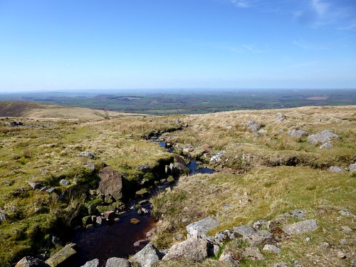
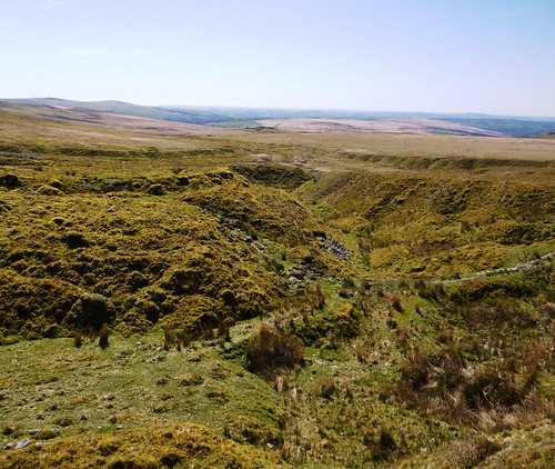
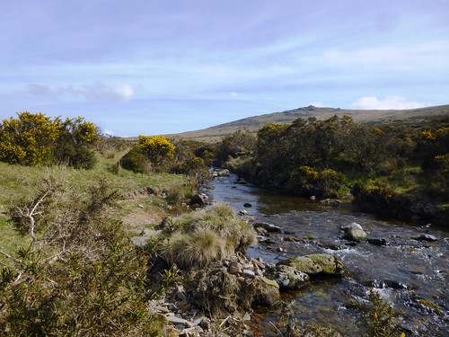
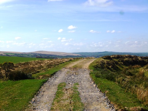
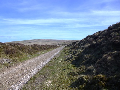
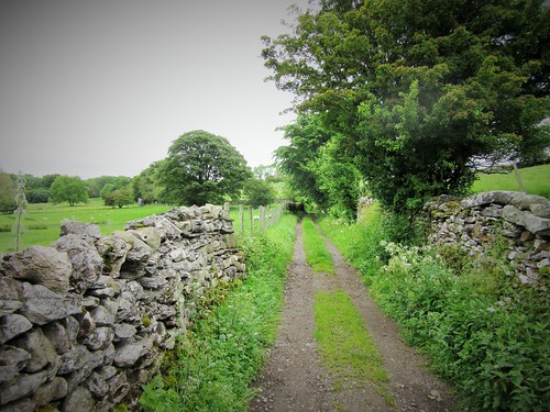
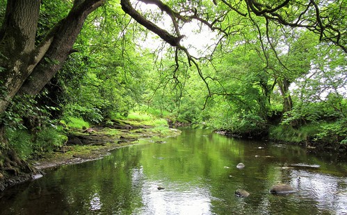
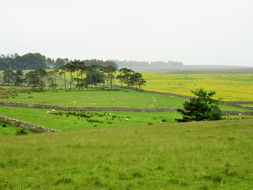
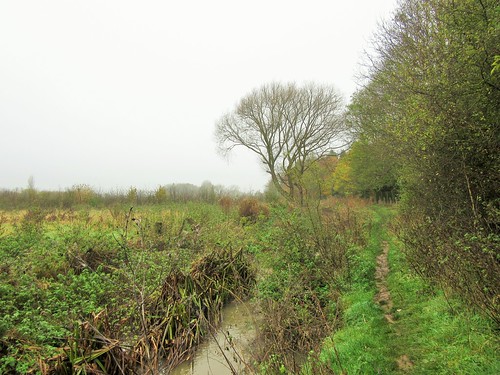
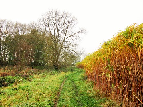
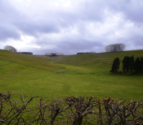
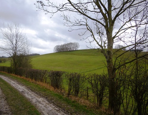
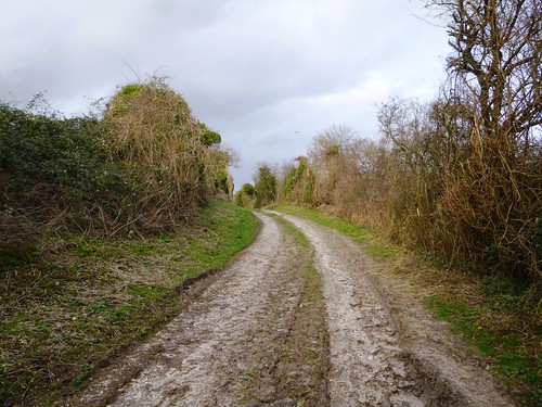
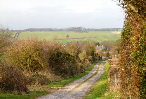
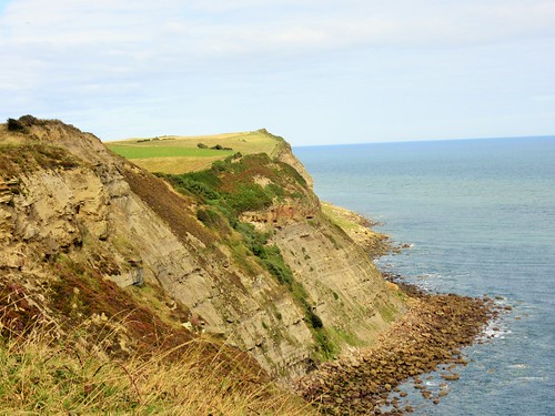
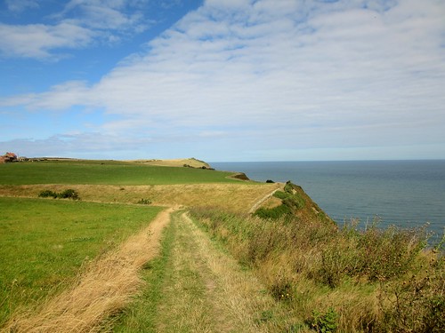
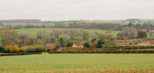
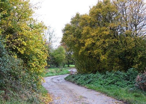
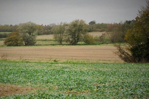
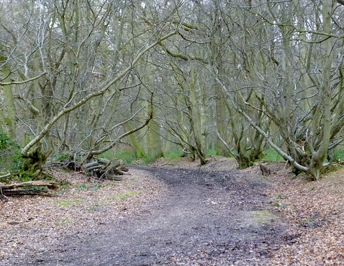
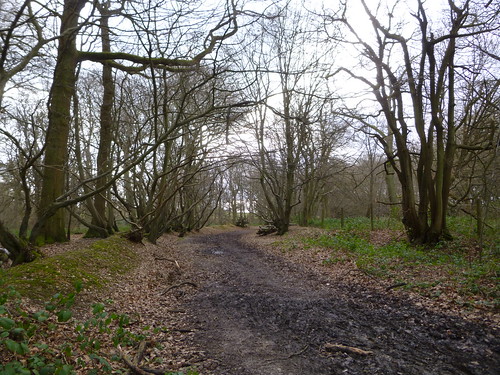
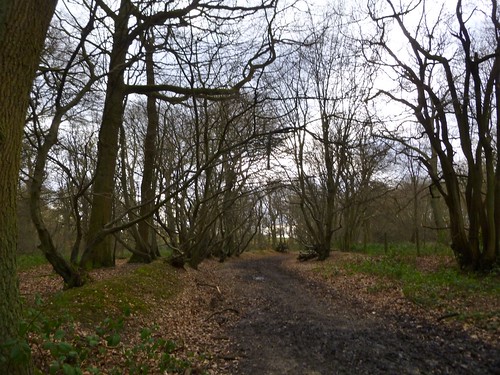
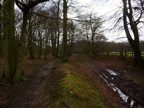
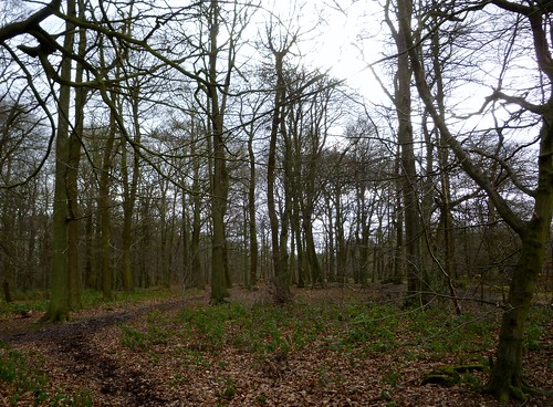
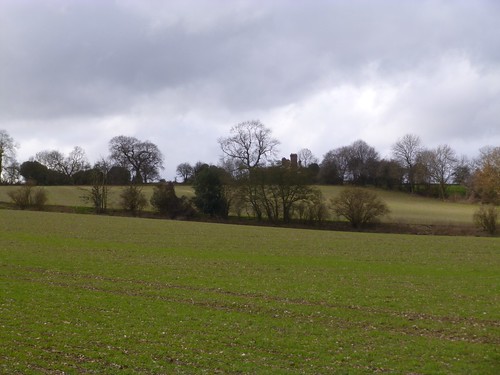
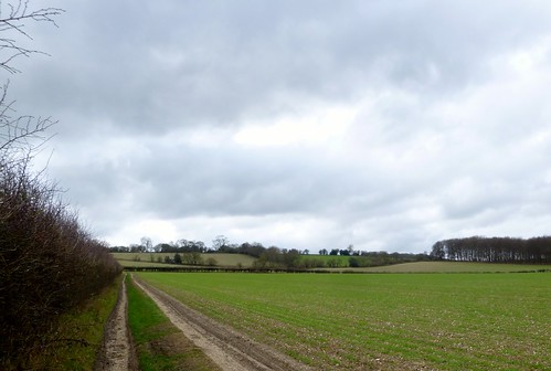
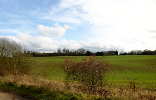
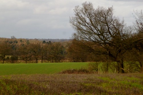
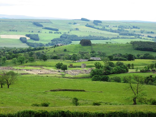
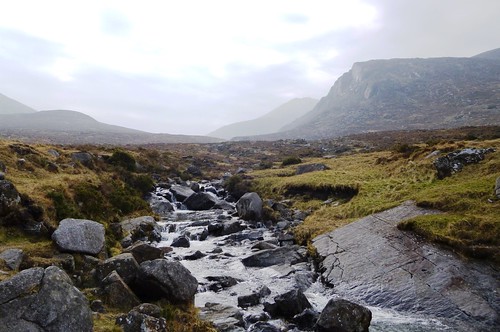
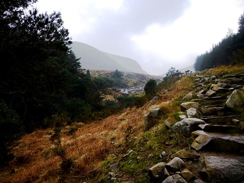
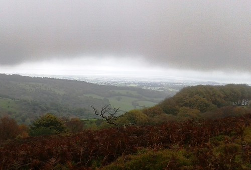
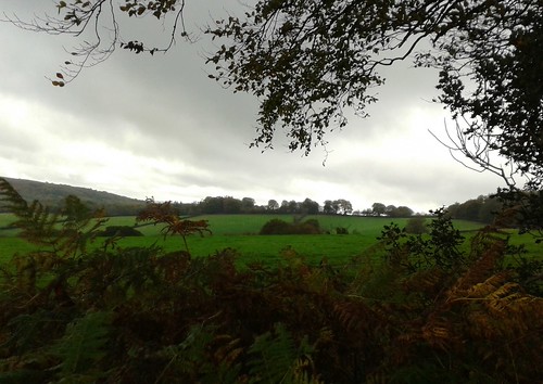
Following the trackbed of the horse-drawn tramway built in 1879 for the Rattlebrook Peat Works, we marvelled at the ingenuity and sheer muscle power that the moorland railway had demanded – the cuttings in the granite rock, the curves and embankments, the granite sleepers hand-bevelled for the rails. A couple of miles out from the Dartmoor Inn, we stopped and took in a mighty view, forty miles across the dun-coloured moor and green farmlands to a broad strip of cobalt Atlantic where the land met the eggshell-blue sky.

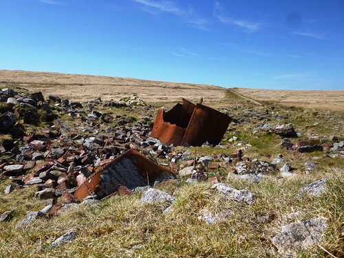
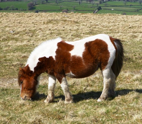
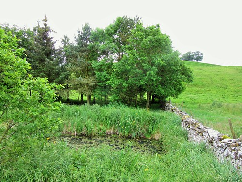
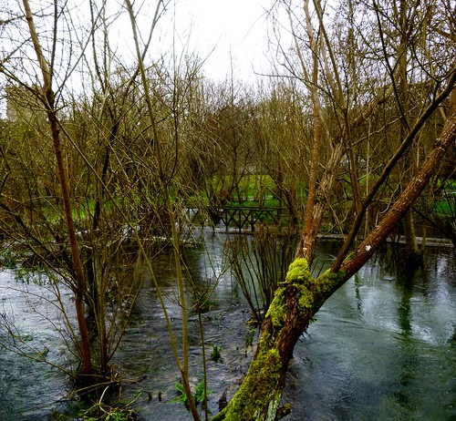
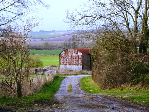
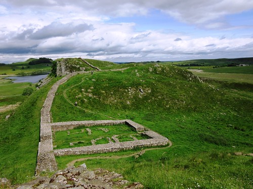
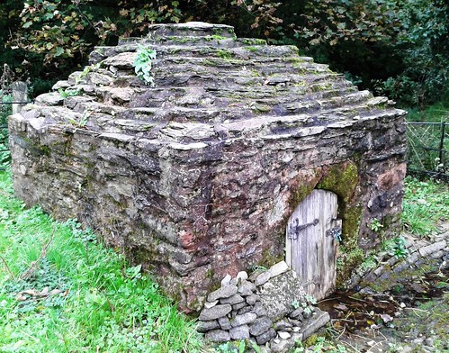
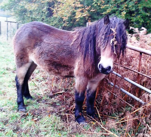
Moor ponies grazed the sunny slopes, their long manes and tails streaming wildly in the cold wind. At the end of the old railway line a hundred men once laboured to dig, dry and load the peat. Here we found a couple of tumbledown peat-drying kilns and two venerable rusty boilers.

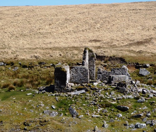
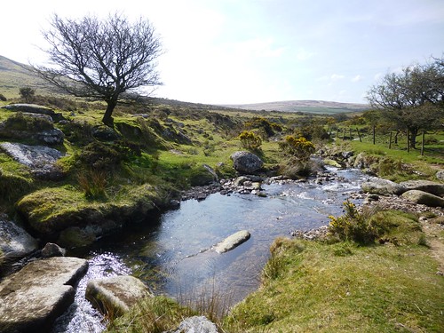
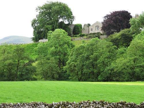
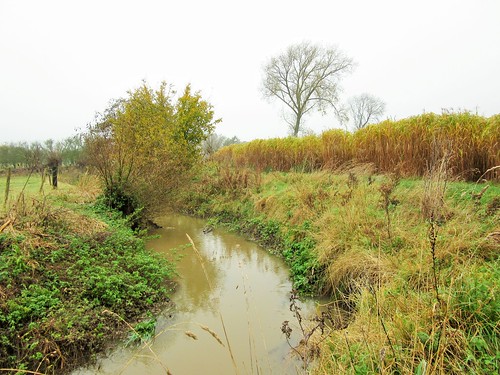
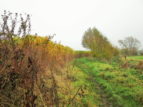
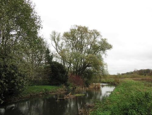
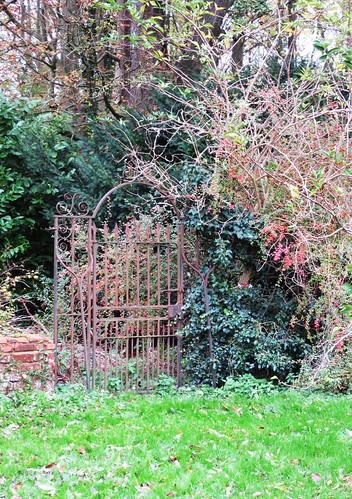
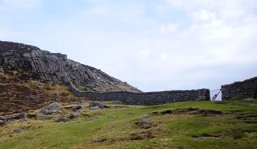
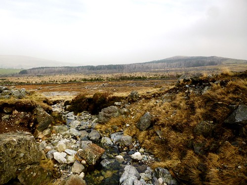
Nearby on the banks of the Rattle Brook stood the ruin of the aptly named Bleak House, home of the peat company’s caretaker. All around, the moor slopes had been combed into drainage channels for peat cutting. The ditches, like the ancient packhorse tracks we followed back to the Dartmoor Inn, were already half obliterated by the inexorably growing peat.

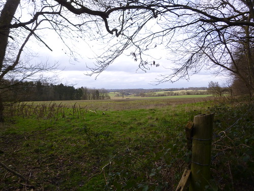
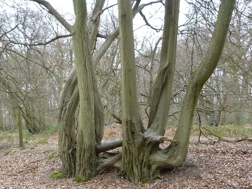
Tinning, quarrying, farming, peat cutting – man has tried them all in the wilds of Dartmoor and the land has swallowed all his endeavours. The meadow pipits, the moor ponies and the harshly calling ravens are the true masters of these moors.

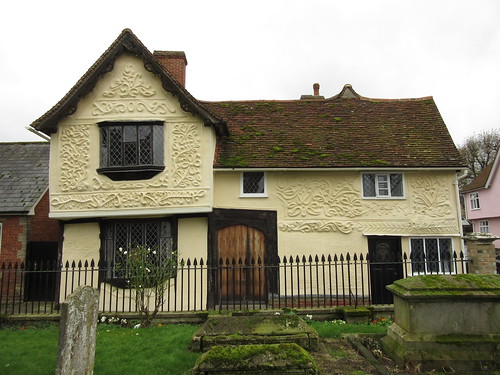
Start: Car park off A386 near Dartmoor Inn, Lydford, Okehampton, Devon EX20 4AY (OS ref SX 525854)

Getting there: Bus service 11, 118 (Tavistock-Okehampton)
Road: A30 past Okehampton, A386 towards Tavistock. In 4½ miles, 20m before Dartmoor Inn, left up narrow tarmac lane. Car park is beyond gate.

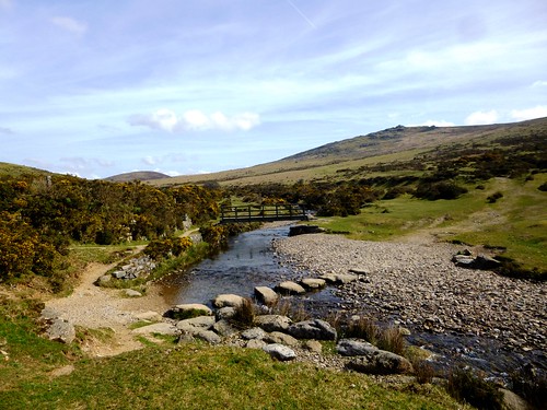
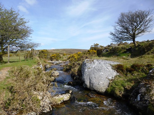
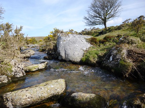
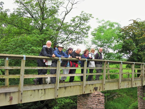
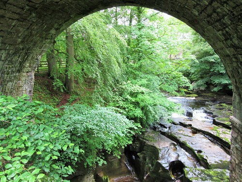
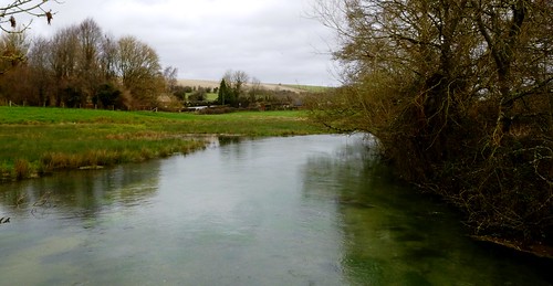
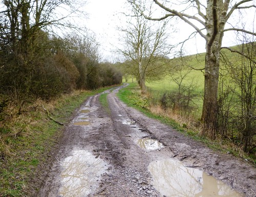
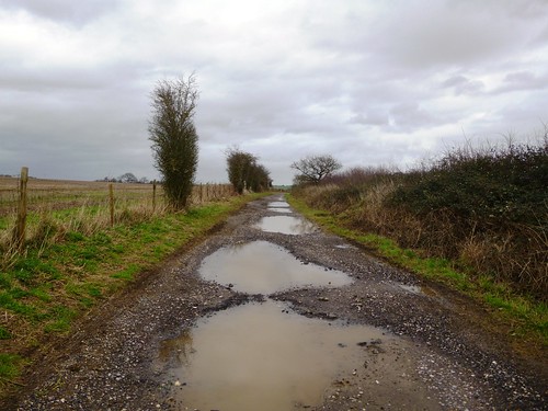
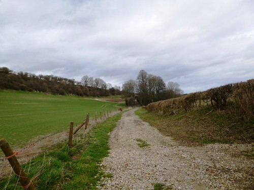
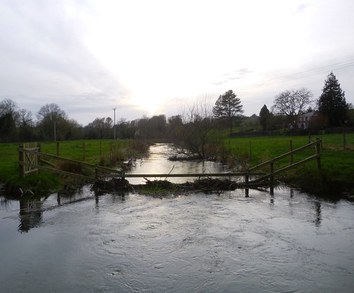
Walk (8 miles, moderate, OS Explorer OL28. NB: online maps, more walks at christophersomerville.co.uk): Follow stony track by left-hand wall to River Lyd stepping stones/footbridge (532857). Don’t cross; turn left beside river for a ⅓ of a mile. Where wall turns left (532863) keep ahead; in 50m, cross old tramway; on up path opposite. In 100m, right (533865) along higher tramway track, passing Great Nodden. In 1¾ miles, reach reversing point/turning circle on Coombe Down (546887). Hairpin back up to right; follow tramway track for 1½ miles to ruined kiln houses (560871). Just before ruin, right on boggy track for 500m. 100m before Bleak House ruin, cross Rattle Brook (560866); follow clear track, bearing away from brook. Pass Lower Dunna Goat tor; in another 250m, turn right/west (557861) on wide, well-walked bridleway path for 1¾ miles to River Lyd footbridge (532857), aiming to descend between Arms Tor and Widgery Cross. Ahead to Dartmoor Inn.

NB: Good boots, hill walking gear. Map, compass, GPS. Not advisable in heavy mist.

Lunch/Accommodation: Dartmoor Inn, Moorside, Lydford (01822-820221, dartmoorinn.com)

Info: Museum of Dartmoor Life, Okehampton (01837-52295, museumofdartmoorlife.co.uk) or Princetown Visitor Centre (01822-890414)
www.satmap.com; ramblers.org.uk; LogMyTrip.co.uk

 Posted by at 01:15
Jan 102015


First published in: The Times Click here to view a map for this walk in a new window
picture picture picture picture picture picture picture picture picture picture picture picture picture picture
Facebook Link:
We set off from Kirkby Stephen in a cheerful crowd – Heather and David Pitt, authors of splendidly illustrated walking books; Ann Sandell and Andy Bryan of Kirkby Stephen’s ‘Walkers Are Welcome’ scheme; and Chris and David Stewart, begetters of thousands of walks through their website walkingworld.com, along with their Parson Russell terrier Brough. It’s a lucky district that can boast such movers and shakers in the walking world.

Kirkby Stephen, a lively market town in eastern Cumbria where six walking trails meet, lies in fabulous hiking country carved by the River Eden and its tributary becks into dozens of fells and dales.

Today’s walk was a taster of the paths that surround the town itself. First off, a leisurely circuit of the Poetry Path with its hand-carved verses created ten years ago by poet Meg Peacocke and lettering artist Pip Hall. It was wonderful to see the rocks, stones and boulders carrying Meg’s pungent lines, ending with December’s haiku carved on three rock slabs beside the River Eden:

‘There sails the heron
Drawing behind him a long
Wake of solitude.’

Then we struck out westwards across the steeply dipping fields among mossy stone walls and staring sheep. The long, rising backs of the fells shouldered up into low cloud. A muted grey-green light lay over the land. We followed lanes narrowly walled in, talking of walking – the Pitts’ retracing of Alfred Wainwright’s long foot pilgrimages, the Stewarts’ amassing of vast numbers of expeditions on foot for less supercharged walkers to enjoy. What a splendour of walks these clouded hills contain, everyone agreed: a treasure-house to be unlocked with simple keys of GPS and internet, map and shoe leather.

We stopped to picnic by the Settle & Carlisle railway line. Brough turned up his nose at ginger parkin and Wensleydale cheese. After trying without success to dig his way to Australia, he settled for lying down and looking noble.

On the way back to Kirkby Stephen we found a red-brown shield bug in a bubble-bath of pale green eggs, a flock of sheep chin-deep in a golden wash of buttercups, a bulbous-bellied oak half a millennium old, and an emperor moth whose wings were camouflaged with the semblance of a scary, staring monster face. Not to mention the gold-and-blue parrots that flew up from the river as we approached Frank’s Bridge. Every day marvels, there for the looking in every field and holloway.

Start: Upper Eden Visitor Centre, Kirkby Stephen, Cumbria, CA17 4QN (OS NY 775087)

Getting there: Rail (thetrainline.com) to Kirkby Stephen (station 2 miles from town)
Bus – Service 563 (Penrith, Appleby)
Road – M6 Jct 38; A685 towards Brough

Walk (6 miles, easy, OS Explorer OL19): Walk south along A685. In 600m, right down alley beside No 2 (773082); left at end (‘Coast to Coast/CTC, Greenriggs’). Skirt Greenriggs farmyard (765078, arrows) and on. In 2nd field beyond farm, aim for far right corner (757075); follow CTC path to right to cross under railway (754074). Half right to field corner; bear right to road (749073). Left for 200m to T-jct; left for ¾ mile to A685 (757062).

Left; in 150m, right down A683. In 100 m, left (758061, ‘Nateby’). In 300m dogleg left and right through Easegill Head farmyard (761062). Through yard gate; bear right to gate in wall; across field and under railway (764062). Down field edge; in 300m, left across stile; down past lime kiln ruin and through gate to left of plantation (768066). At track, right; in 200m, left through gate (770064) to cross footbridge. Left round field edge; through kissing gate (772065, blue arrow/BA) and follow line of crags that trend away from the river. Up between fences to gate (BA); ahead to gate (BA) into green lane to B6259 (774069) in Nateby. Left; in 100m, fork right on walled lane (‘Bridleway’; ‘Pennine Journey’). In 450m path crosses disused railway (776074 – NB Poetry Path circuit can be made from here); in 450m ignore gate on left (778078, BA), and keep ahead for ¼ mile to descend to cross beck (780082). Follow River Eden along field edge; at field end, left (779087) on path to Frank’s Bridge (776087) and Kirkby Stephen.

Lunch: Nateby Inn, Nateby (01768-371588, nateby-inn.co.uk); many cafés/pubs in Kirkby Stephen.

Accommodation: King’s Head, Ravenstonedale, Kirkby Stephen, CA17 4NH (01539-623050, kings-head.com) – really comfortable, excellent stopover.

Poetry Path: Booklet guide available from Upper Eden Visitor Centre

Information: Upper Eden Visitor Centre (01768-371199); penninejourney.org.uk, walkeden.org, walkingworld.com

www.satmap.com; ramblers.org.uk; LogMyTrip.co.uk

 Posted by at 01:51
Jan 032015


First published in: The Times Click here to view a map for this walk in a new window
picture picture picture picture picture picture picture picture picture picture picture picture
Facebook Link:
‘Mackerel, love – you won’t get fresher!’ winked the fishmonger at Southwell’s Saturday market. Ten flavours of sausages to the left of him, a hundred colours of cotton reel to the right, and countless jokes in his arsenal. I saw that very face later in the morning, agelessly cheerful and knowing, where some unremembered mason had carved it seven hundred years ago on a bracing rib of the Chapter House in Southwell Minster.

Southwell is a snug, self-sufficient little Nottinghamshire town, full of gorgeous red-brick houses, with the spectacularly large and beautiful minster church as its pride and joy. There’s a warm honey glow to the stone, and a treasure of carvings still sharp in detail. Contorted faces peeped and grinned from the 14th century choir screen – a peasant riding a laughing king, a churl giving his bum a good scratch. In the Chapter House were leaves of oak and field maple, exquisitely fashioned, and a riot of tiny, boldly staring Green Men, some defaced by the sword cuts of Puritan zealots. Anyone who could greet such figures with outrage rather than laughter and wonder must surely be in need of a humour transfusion.

I came out of the Minster with a head full of marvels to find a chilly mist settling down across the Nottingham countryside. The Robin Hood Way trail led me out of Southwell along the track of an old railway that once brought coal and silk to the town – coal from the Nottinghamshire pits to burn, and silk to be spun in the big brick mill out at Maythorne beside the winding River Greet.

From Maythorne and its handsome old workers’ cottages I crossed into Norwood Park, once the private deer park of the Archbishop of York, now the haunt of golfers. On among stumpy apple trees, their boughs entwined with mistletoe, and south through the big open pastures and biofuel acres of the Brackenhurst Estate. Then a homeward plod across the misty plough, slipping and sliding among beet plants, with the shouts of Southwell’s Saturday footballers coming up from the pitches by the Potwell Dyke. I didn’t catch a glimpse of the twin towers of the Minster until they loomed magnificently out of the mist, right above my head.

Start: Southwell Minster, Southwell, Notts NG25 0HD (OS ref SK 702539)

Getting there: Bus route 100 (Nottingham-Southwell)
Road – Southwell is on A612 between Nottingham and Newark-on-Trent

Walk (6½ miles, easy, OS Explorer 271): From Minster, right down Church Street. At S-bend, bear left (703538); take right-hand of 2 paths (‘Potwell Dyke, Robin Hood Way/RHW’). In 300m, cross road (706539) and on. In 250m, cross Newark Road and on (708540, RHW). In 50m, dogleg right/left down Merrison Way. Follow RHW to A612 (710541). Left and left again along railway trail (RHW, Southwell Heritage Trail/SHT).

In 500m, at road, dogleg right/left past Caudwell’s Mill (707544), and on, following RHW on right bank of River Greet for 1¼ miles to Maythorne Mill (697557). Cross river (RHW, SHT); down road, across old railway (695554), on to Kirklington Road at Maythorne Cottages (692551). Dogleg right/left into Norwood Park. Along drive past golf course (yellow-topped posts). In 600m, at crossing of tracks (689546, fingerpost), bear half left through orchard, then between greenhouses, for 600m to cross Halam Road (690540). On across field; cross B6386 (690538) and on; cross next road (690537, fingerpost) and on to cross footbridge. Here path forks; take left fork along hedge. Cross Westhorpe Dumble stream (690534); on far bank keep ahead up slope, then along field edges. At a hedge (691529, RHW) dogleg right/left; on to road (691524). Left (RHW) to cross A612 (695525 – take care!).

Right for 150m; left (694523) along Hicking Lane between University buildings. Through wooden gates and on to second pair of gates (699524). Left; in 200m, opposite road on left, turn right through gate (698526, RHW), and on to road (700526). Right; in 70m, left (fingerpost, RHW) across field to waymark post (702529, RHW). Half right to hedge gap (704530). Left here with hedge on right, downhill past football field to path (702534). Right (yellow arrow) and left across Potwell Dyke; follow lane to Minster.

Lunch: Old Theatre Deli Café, Queen Street, Southwell (01636-815340)

Accommodation: Saracen’s Head Hotel, Southwell, NG25 0HE (01636-812701) – characterful, creaky and comfortable.

Local Trails: downloadable at southwellcouncil.com.

Info: Southwell TIC (01636-819038)
visitengland.com; www.satmap.com; ramblers.org.uk; LogMyTrip.co.uk

 Posted by at 01:33
Dec 202014


First published in: The Times Click here to view a map for this walk in a new window
picture picture picture picture picture picture picture picture picture picture picture picture picture picture picture picture
Facebook Link:
No wonder Cecil Beaton chose the Wiltshire village of Broad Chalke to make his home. Anyone with half an eye for setting and composition can appreciate the lure of a place like this – thatched houses, old stone and brick, a church amid it all, and the cradling downs rising on every side. A handsome settled spot beside the River Ebble – and what a charming name that is for the bubbling and eddying chalk stream that rushes through the village.

This grey afternoon a gale of wind tore the clouds over Broad Chalke. It hissed in the hedges and trembled the sere grasses along the flint trackway up Church Bottom. The wind-sculpted beech spinneys roared on the downland ridges high above. All colours were leached to subtle greens and greys. The air felt thick and cold on our faces. The aspect of the downs seemed instantly agreeable to the eye, the shapes of rounded shoulders, sloping sides and hollowed flanks recalling human rather than topographical form.

The sun made a cameo appearance, slipping out through a rent in the speeding clouds to strike silver out of the chalky tractor ruts. Up on the nape of the downs we met the Ox Drove, an ancient West Country trackway cut to ribbons by 4×4 drivers in recent times. A notice headed ‘Voluntary Restraint’ invited the off-roaders to desist for the common good, but the two-foot-deep ruts and extravagant puddles bore witness to the effect they’d already had.

We dodged and plodged a mile of the old highway, and then plunged down the steep green lane of Croucheston Drove to where two huge and rusty old barns stood by the track in a sheltered dip out of the wind. Up Bishopstone Hollow’s sunken lane under the pale grey powder-puffs of old man’s beard, and on with the gale in our faces once more by isolated Knighton Hill Farm among its singing shelter trees.

A tractor-marked path led away towards the valley of the Ebble, crossing vast flinty fields of young green wheat shoots. Over the brow of the hill and down a hollow hedge to where Broad Chalke lay snug below the race of wind and sky.

Start: Queen’s Head PH, Broad Chalke, Salisbury, Wilts SP5 5EN (OS ref SU 039256)

Getting there: Bus – Service 29, Shaftesbury-Salisbury
Road – Broad Chalke is signed off A30 at Fovant.

Walk (6½ miles, easy/moderate, OS Explorer 130. NB: online map, more walks at christophersomerville.co.uk): Follow ‘Bowerchalke’ road across Causeway Bridge, passing church. At right bend, keep ahead (‘Martin, Blandford’). At T-junction (042252) ahead up Church Bottom bridleway for 1½ miles to meet Ox Drove (052229). Left; in ½ mile, cross track to Knighton Hill Farm (059232) and continue (‘Byway’). In ½ mile, left (067232, ‘bridleway’) down Croucheston Drove green lane. In 1 mile, by second of 2 barns, left (067247, yellow arrow/YA) up Bishopstone Hollow to Knighton Hill Farm. Follow YAs past farmhouse (057242); at brick shed, dogleg right/left round shed (055242, YAs) and on along grassy ride between tree hedges. In 200m, right (054241, YAs on left) through hedge; over stile ahead; cross track; ahead across field, following arrow posts. In 700m, fork left (052247); follow arrows to stile (048248); down old hedge/ditch to stile (043250); right down to lane (043251); right into Broad Chalke.
Conditions: Deep, muddy ruts on Ox Drove!

Lunch/Accommodation: Queen’s Head, Broad Chalke (01722-780344; queensheadbroadchalke.co.uk) – cosy, friendly country pub.

Info: Salisbury TIC (01722-342860)
visitengland.com; www.satmap.com; ramblers.org.uk; LogMyTrip.co.uk

 Posted by at 01:47
Dec 132014


First published in: The Times Click here to view a map for this walk in a new window
picture picture picture picture picture picture picture picture
Facebook Link:
Robin Hood’s Bay is one of those coastal villages so intrinsically beautiful and full of character that it draws you back again and again. Mazy laneways tangle on either side of the precipitous main street. Cobbled or flagged, twisting and turning, plunging from one level to another by worn stone stairs, wriggling between tiny gardens, climbing and falling, framing views of sea and cliff under cooked archways – Fisherhead, Sunny Place and Bakehouse Steps, they seduced me into lingering long after I should have been away.

The tide had slipped in to cover the great scars or eroded rock layers that floor the bay in extravagant arcs. I turned my back on the red pantiled roofs of Robin Hood’s Bay at last and set out along the cliffs with a good stiff north-westerly breeze in my face. I hadn’t walked this stretch of the North Yorkshire coast in years, but I well remembered the jagged out-thrust of the headlands with their horizontal bands of mineral-bearing rock, and the black boulders that carpeted the tiny bays.

The map names held magic – Craze Naze and Clock Case Nab, Pursglove Stye Batts and Maw Wyke Hole. Angular names for angular places, where men wriggled into the most awkward of holes to win the fossilised wood which, properly shaped and polished, transformed itself into Whitby jet. A hard job for hard times – but as they told over-romantic visitors lamenting the mining scars, ‘You can’t eat scenery!’

The sun came through the mackerel sky and shone a silver shaft as thick as a searchlight beam on the sea where lobster pot buoys and flags were bobbing. A jaunty gang of jackdaws went chakkering off inland. Fulmars rode the thermals along the cliffs with upturned tails and slender wings stiffened at right angles to their bodies. I marvelled yet again at these seabirds’ precision of flight, every movement economical and as graceful as a dancer’s.

I passed the stubby white lighthouse on Whitestone Point and skirted Saltwick Bay with its fast-eroding sea stacks and gull-dotted rock pavements. The black skeleton of Whitby Abbey stood ahead on its cliff, forever haunted by the ghastly shade of Count Dracula – one of many scenes in his horror novel Dracula that Bram Stoker set in Whitby, to the delight of today’s nation of Goths who hang whey-faced around the town.

A wildly steep cobbled alley precipitated me from the abbey down to Whitby harbour. The town where Captain Cook learned his sea trade was under attack by jovial pretend pirates today, one of Whitby’s frequent festivals of fun. I dodged Bluebeard and Blackbeard and Short John Silver, and went off to find a fish pie with a nice sea view.

Start: Upper car park, Station Road, Robin Hood’s Bay, North Yorkshire YO22 4RE (OS ref NZ 949055)

Getting there: Bus 93, Whitby-Scarborough
Road: Robin Hood’s Bay (B1447) is signed from A171 Whitby-Scarborough road at Hawsker.

Walk (7 miles, easy/moderate, OS Explorer OL27. NB: online map, more walks at christophersomerville.co.uk): Right along B1447 towards village; on right bend, left along Mount Pleasant North (951055, ‘Cleveland Way’). From here, follow well-waymarked Cleveland Way to Whitby. Return by Bus 93, or taxi from Whitby railway station (£10-£15).

Conditions: Unguarded cliff edges; some steep flights of steps

Lunch: Duke of York, Whitby (01947-600324, dukeofyork.co.uk) – at bottom of 199 steps from St Mary’s Church

Accommodation: Victoria Hotel, Station Street, Robin Hood’s Bay YO22 4RL (01947-880205, victoriarhb.com) – a long-established hotel, characterful, helpful and friendly.

Info: Whitby TIC (01723-383636)
visitengland.com; www.satmap.com; ramblers.org.uk; LogMyTrip.co.uk

 Posted by at 01:44
Dec 062014


First published in: The Times Click here to view a map for this walk in a new window
picture picture picture picture picture picture picture picture picture picture picture picture
Facebook Link:
Cavendish lies perfectly arranged for a painter’s canvas. Why John Constable never got himself along here to capture the thatched and pink-faced cottages on the village green, and the flint tower of St Mary’s Church peeping over their shoulders, is a mystery. Even on this blowy winter’s morning under a scudding grey sky, the composition seemed flawless.

We passed crooked old Tumbleweed Cottage, half pink and half green, and turned down a path among poplars to cross the slow-flowing River Stour. Out in the fields a green bridleway led through gently rolling country, the meandering of the invisible Stour marked by grey and gold willows. Wide ploughed fields slanted up from the river, their crests bristling with hedge oaks. From this high ground we looked back to see Cavendish church tower poking up above the trees. Then it was down again over the sticky fields to a wandering green lane between banks of iron-rich, burnt orange soil across which burrowing badgers had spread their bedding.

On the outskirts of Clare the grounds and ancient flint buildings of the Priory lay very quiet and still. Opposite rose the castle mound with its tall fragment of Norman masonry. In 1865 local ‘detectorist’ Walter Lorking unearthed a gold cross and chain in the castle grounds. It had been lost there 500 years before by King Edward III, and contained a fragment of the true cross in a tiny compartment. Walter was more than happy to sell it to his Sovereign, Queen Victoria, for the rather appropriate sum of three gold sovereigns.

There was beautiful pargetting – ornate plasterwork – on many of the houses in Clare, and a host of scowling and howling Green Men to guard the doorway of the village church, the ‘cathedral of the Stour Valley’. I left my companions to linger among the antique shops of Clare, and hurried back to Cavendish along the high ground north of the river. The cold wind tousled me all the way, pouring out of a sky ridged with grey billows of cloud, a wintry ceiling for the furrowed ploughland below.

Start: George Inn, Cavendish, Suffolk CO10 8BA (OS ref TL805465)

Getting there: Bus service 236 (Haverhill-Sudbury)
Road – Cavendish is on A1092, between Long Melford (A134) and Haverhill (A143)

Walk (8 miles, easy, OS Explorers 196, 210. NB: Detailed directions, online maps, more walks at christophersomerville.co.uk): From George Inn, left (east) along main street. Opposite Bull Inn, right on path (fingerpost, yellow arrow/YA) to road (810464). Right across Pentlow Bridge; on along B1064. In 300m, on left bend, right (812461, ‘Bridleway’) along field edges. In ½ mile, through trees (805458) and on to Bower Hall. Just before first barn, left (800455) up field edge. 50m before hedge at top, right (803450, post with YA) across field to hedge end of green lane. Follow it (YA) to road (749449). Right downhill.

Just before reaching river, left by waterworks hut (797453, ‘Bridleway’) along green lane and field edges. In 1 mile, bridleway bends right (782449) to river bank (782451). Left here (‘Bridleway’) to road at Hickford Hill (777447). Right; in 200m, right across field (fingerpost) to cross river (775450). Fork left across meadow to cross weir (774451) and on. In 350m, opposite car park and castle mound, pass metal bridge on right, and in 50m turn left (770451) through stone gateway into Clare Priory grounds.

Returning through gateway, turn right and immediately left across footbridge into Clare village. Right to church (770455). Follow A1092 Cavendish road out of town. In 300m, left up Harp Lane (773454, fingerpost); pass sheds and keep ahead through trees, following ‘Stour Valley Path/SVP’, YAs and ‘Heritage Trail’ purple arrows/HT. Opposite Hermitage Farm (775463) bear right up field edge. At top, left through hedge (778464, HT) and on along field edge, aiming to pass roofs and outbuildings of Houghton Hall (785466). In another 600m, at field bottom, right (791468, SVP, HT, fingerpost). In 150m, left and right over 2 ditches (792466, SVP, HT) and on to road at Mumford Cottages (796468). Right; in 450m, right down field edge (SVP, HT, ‘Cavendish’). At bottom (802465), left through hedge (SVP); diagonally left across field; path beside graveyard into Cavendish.

Lunch: Plenty of cafés and pubs in Clare and Cavendish.

Accommodation: George Inn, Cavendish (01787-280248, thecavendishgeorge.co.uk) – smart, stylish, comfortable

Information: Sudbury TIC (01787-881320)
visitengland.com; www.satmap.com; ramblers.org.uk

 Posted by at 02:24
Nov 292014


First published in: The Times Click here to view a map for this walk in a new window
picture picture picture picture picture picture picture picture picture picture picture picture picture picture picture picture
Facebook Link:
Two skylarks sprang out of the stubble field as we climbed its gentle slope towards Poynders End. They ascended skywards, blithely singing as though it were baking April and not a cold and cloudy winter’s day. Such little incidents inject a welcome shot of joy into these gloomy months when all nature seems to have curled up and pulled the blankets over its head.

The sticky ochreous clay under our boots was studded with flints. We picked up one with a delicately bevelled edge – whether by man or natural process wasn’t easy to decide, but we stood looking out over the wide fields of north Hertfordshire and pictured the men who hunted here when it was all forest. Milo the mad spaniel, meanwhile, went on running in circles and pointing at pheasants flying overhead.

A string of old woodlands lies here on the upland. In the margins of Hitch Wood, twisted green-barked hornbeams pointed their witchy limbs along the trackway that took us south towards Stagenhoe. This lovely Palladian house, now a Sue Ryder care home, has had some notable tenants and owners, among them the 14th Earl of Caithness, a genial Victorian soul who would drink whisky with his tenants and whose Spanish wife, ‘massive and theatrical’, believed she was the reincarnation of Mary, Queen of Scots. Caithness’s son rented Stagenhoe to Sir Arthur Sullivan while he was composing the music for ‘The Mikado’ in 1881.

From the track though Stagenhoe’s grounds we caught a glimpse of St Paul’s Walden Bury at the far end of its long avenue, another splendid 18th-century house, childhood home of the late Queen Mother. We stopped to admire the gurning gargoyles and other stone-carved grotesques at All Saints’ Church, and then turned north again along the well-waymarked Chiltern Way, heading across wide fields and down a tree-hung lane at Langley End where a flock of jaunty yellow-cheeked siskins bounced and twittered in the branches overhead.

Out of bounds in a thicket at the crest of the last hill crouched the broken flint walls of Minsden Chapel. It was built in the 14th century as a staging post for pilgrims on their way to St Albans, but the Reformation swept away its raison d’être. Now it stands forgotten among the trees, a ruin haunted by the wraith of a monk who walks accompanied by a ghost of sweet music. Some claim to have seen the shades of men and women here, hiding in a phantom cart full of spectral barrels. An eerie place. We went quickly on down the hill, with something more substantial in our sights – the Rusty Gun pub, and a damn good lunch.
Start: Rusty Gun Inn, London Rd, St Ippolyts, Herts SG4 7PG (OS ref TL 199253).

Getting there: From A1(M) Jct 8, follow Little Wymondley, Todds Green, St Ippollits and Preston. At B656 cross roads, left for ⅓ mile to Rusty Gun PH.

Walk (5½ miles, easy, OS Explorer 193): From Rusty Gun, left along B656 for 150m. Left (‘Preston’, Chiltern Way/CW) on field track for nearly 1 mile. 300m beyond Poynders End Farm, right through hedge (190245, CW); clockwise round field edge, past reservoir to road (186245). Left (CW); at right bend, ahead down Hitchwood Lane. In 350m, at left bend, bear right on tarmac lane (188242, ‘Whitwell’) past houses, and follow path (yellow arrows/YAs) along right edge of Hitch Wood.

In ½ mile leave wood (187234); bear half right across field and along right edge of Pinfold Wood. Left past house, then right for 400m (186232, YA) along field edge, then left edge of Foxholes Wood. At post with 2 YAs, turn left (184229). Follow YAs with metal fence on right to drive beside Stagenhoe House gateway (186228). Left along drive for 70m; fork right down gravel track past lodge house with tall chimneys. Follow track on left edge of Garden Wood and on (ignore footpath fingerposts) to All Saints Church, St Paul’s Walden.

Go through iron gate on left (192223), through churchyard, past north side of church to gate into lane (CW). Left up lane past White House; right (CW) along path by fence, then field edge to B651 (194227). Left (CW) for 200m – NB nasty double bend; take care! Just past Stagenhoe gates, right (195228, CW) on track through trees. Leaving trees, don’t follow track round to right but keep ahead (YA) across field. Go between fence posts (YA); path across field to road (199234). Ahead (blue arrow/BA) on woodland path. Emerging from trees (200236), left on track (BA, ‘STOOP’). In 300m it swings right (199238); ahead here (BA) on grass path to road. Left (CW) past red brick Langley End; on down path (CW); in 50m, fork right (198239) to cross B651 (198241). Right along field edge; in 100m, left across field; up right side of Minsden Chapel Plantation to pass chapel ruins among trees (198246). Ahead across field over brow of hill; keep left of hedge; follow sunken lane to Rusty Gun.

Lunch: Rusty Gun (01462-432653, therustygun.co.uk) – good food and beer, produce shop
Information: Stevenage TIC (0300-123-4049)
visitengland.com; www.satmap.com; ramblers.org.uk

 Posted by at 01:36
Nov 222014


First published in: The Times Click here to view a map for this walk in a new window
picture picture picture picture picture picture picture
Facebook Link:
Hadrian’s Wall, its observation towers and guard-posts, the roads and townships that served it, form the most remarkable monument in Britain to those energetic, organised and life-loving invaders, the Romans. They wrenched our history so forcefully out of its former courses; and yet it’s the tiny details of their quotidian lives that fascinate us most.

How incredibly angry the tile-maker of Vindolanda must have been when that stupid pig walked all over the nice new clay flooring he’d left out to dry in the sun. A surviving tile from the spoiled batch, on display in Vindolanda’s museum just south of the Wall, carries the prints of the pig’s incurving toes, as sharp today as the hour they were dinted two thousand years ago. And here alongside are the hobnailed shoes and thong sandals of this Roman fort’s inhabitants, their nose-picks and knives and scribe-written birthday invitations; while outside lies the foundations of the town they lived and loved in, its houses, temples, wells and paved streets.

Walking the rushy meadows a mile or so to the south, I looked up at the thin line of the Wall as it rode the rollercoaster crags of the Whin Sill, the volcanic rampart that strides across the neck of Northumberland. A magnificent bull, muscled like a body-builder, lion-coloured and sporting a leonine mane, watched me cross the broad grassy ditch or vallum and turn east along the Wall.

The stepped path swooped me up the crests and down into hollows of the dolerite sill, passing the sites of the milecastles and turrets where conscripts from the Low Countries paced and shivered and looked out into the debatable lands to the north from where the wild Picts might come screaming at any moment. As I stared out from the Wall to the looming black line of Wark Forest, the blue humps of the Cheviot Hills beyond, it was all too easy to imagine those young men sulkily clutching their cloaks around them and wishing they were down in Vindolanda where the latrines ran with clean water and the stew came hot to the table.

The old house and barns of Hotbank Farm lay huddled on the slope of Hotbank Crags, their walls much patched with Roman stones. Here I left Hadrian’s Wall and headed across the vallum and down flowery meadow slopes, with Vindolanda spread below me in the evening sunlight.
Start: Vindolanda car park, near Bardon Mill, Northumberland NE47 7JN (OS ref NY 767664)

Getting there:
Bus – 685/85 to Bardon Mill
Road – signposted from B6318 at Once Brewed (north of A69, between Haydon Bridge and Haltwhistle at Bardon Mill).

Walk (8 miles, moderate – many short, steep slopes – OS Explorer OL53. NB: detailed directions, online maps, more walks at christophersomerville.co.uk): From Vindolanda car park, left along road; in 100m, left through gate, down track; in 400m, right (766660) on path (stiles, yellow arrows/YAs). NB After passing barn at Kit’s Shield (764659), negotiate tree blocking path! Skirt Layside (760659, YAs); on to road (756658). Left, then right along lane (‘Cranberry Brow’) for 1⅓ miles to road (735655). Right (fingerpost) on drive to Hill Top; on to road (730659). Right to cross B6318 (729663, stile, ‘Shield on the Wall’).

Path along field wall, then diagonally left across Roman Vallum ditch to Hadrian’s Wall (727669). Right along National Trail for 3 miles to Hotbank Farm (771680). Leave National Trail here; right down farm drive to B6318. Right along grass verge for 400m; left (770674, stile, ‘Vindolanda’) across field, aiming to cross stile on left of High Shield house (769672, YA). Left to stile (YA); down fields with fence on left. In 2nd field, fence trends away left, but keep a beeline ahead to stile and road at bottom (772665). Right to Vindolanda car park.

Conditions: Short, steep ups and downs on Hadrian’s Wall. Bulls, cows, calves may be in fields.

Refreshments: Vindolanda Café

Accommodation: Twice Brewed Inn (on B6318 near Bardon Mill), NE47 7AN (01434-344534; twicebrewedinn.co.uk) – very cheerful, walker-friendly stopover

Vindolanda: 01434-344277; vindolanda.com

Information: Northumberland National Park Centre, Once Brewed (on B6318 next to Twice Brewed Inn) – 01434-344396. Open weekends only in winter.
visitengland.com; www.satmap.com; ramblers.org.uk

 Posted by at 02:30
Nov 152014


First published in: The Times Click here to view a map for this walk in a new window
picture picture picture picture picture picture picture picture
Facebook Link:
The shapely hummocks of the Mourne Mountains stood muted and insubstantial under a cloud-blotched sky and a pale sun. Wrens sang in the flowering gorse bushes along the lane from Meelmore Lodge. The western face of the Mournes rose before us, the jagged profile of Slieve Meelmore and the rounder bulk of Slievenaglogh framing the hollow where the Trassey Track snaked in its long climb to the Hare’s Gap. Generations of quarrymen forged the track and its tributary paths to the granite quarries that floored and walled the industrial north of England in the 19th century.

The zigzag path rose steeply to where the flat saddle of the Hare’s Gap was seamed by the long dark line of the Mourne Wall. This remarkable construction of roughly squared granite blocks, built by hungry men in the early 20th century to earn themselves a crust, circles the high top of the Mourne Mountains for 22 miles, swooping up and down all the major peaks. Once across the wall we got a breathtaking prospect of the heart of the range, from the castellated crags of Slieve Bearnagh and the knobbed peak of Ben Crom overhanging its namesake reservoir to the long graceful nape of Slieve Donard, tallest of all.

Smugglers, ne’er-do-wells and travellers in a hurry used to cut across the high Mournes from the sea by way of a rough path known as the Brandy Pad. We followed it towards Slieve Donard along the slopes of Slieve Commedagh, through a high bleak landscape where meadow pipits fluttered and cheeped, and a solitary raven croaked a warning ark-ark-ark-ark to his mate invisible among the rocks.

Clouds built and melted, rain spat and subsided, and Slieve Donard pulled a shawl of thick mist over her head. Under the mountain we recrossed the Mourne Wall and went stumbling and splashing down towards Newcastle in the company of the Glen River, a noisy little chute of rapids and cascades. A walk in a Mourne heaven – nothing soft or accommodating about it, everything stark, hard and beautifully wild.

Start: Meelmore Lodge, Trassey Road, near Bryansford, Co Down, BT33 0QB (OSNI ref SB 305307).

Getting there: Mourne Rambler bus service in the summer (mourne-mountains.com).
Meelmore Lodge is signed off B180 Newcastle-Hilltown road. Car park: £4/day (coins)

Walk (7 miles, moderate/strenuous, OSNI 1:25,000 Activity Map ‘The Mournes’. NB: online map, more walks at christophersomerville.co.uk): From car park, left up stony lane (‘Mountain Walk’ sign on wall). Through right-hand of 2 gates; follow lane to cross field wall (308302). Left (‘Mourne Way’) for 500m; right up stony Trassey Track. In 1 mile track crosses river and bears right; but keep ahead here, steeply up to cross Mourne Wall at Hare’s Gap (323287). Left at cairn along Brandy Pad path for 1½ miles to cairn on saddle between Slieve Commedagh and Slieve Beg (342278). Bear left at cairn, under The Castles crags. At end of crags (348277), fork left, up to cross Mourne Wall (350279). Descend beside Glen River. In 1½ miles, pass Ice House (364295). In 200m at dirt road/concrete bridge, descend left bank of river. In 400m, right across bridge (379299); descend right bank. In 350m, left across Donard Bridge (372302). Descend left bank; through Donard Park into Newcastle.

Conditions: Some steep parts; slippery underfoot in woods. Walking stick advisable. Dogs on leads.

Refreshments: Meelmore Lodge café (028-4372-5949); Villa Vinci, Newcastle (028-4372-3080).

Accommodation: Slieve Donard Hotel, Newcastle BT33 0AH (028-4372-1066; hastingshotels.com); Meelmore Lodge hostel/camping, 52a Trassey Road, Bryansford BT33 0QB (028-4372-6657; meelmorelodge.co.uk)

Information: Newcastle TIC (028-4372-2222); walkni.com; discovernorthernireland.com; walksireland.com;

 Posted by at 01:33
Nov 082014


First published in: The Times Click here to view a map for this walk in a new window
picture picture picture picture picture picture picture picture
Facebook Link:
A grey cool day had hung low cloud over the Somerset coast and capped the Quantock Hills with mist. A stodge of red mud sucked at our boots in the ferny old lane that rose from West Bagborough up the steep south face of Lydeard Hill. A ghostly hoot and a frantic heartbeat of chuffing from far below tracked the progress of a train, rattling along the West Somerset Railway and leaving fat white gouts of smoke to dissolve in the breeze.

Up on the brackeny back of Lydeard Hill we found ourselves just under the mist line. A giant view opened northwards over the coastal plain to the silver coils of the River Parrett snaking into the low-tide mud flats of the Severn Estuary. Steep Holm and Flat Holm islands lay black and two-dimensional, as though cut from slate. The Welsh shore ran away westward, the grey whaleback of the Mendip Hills barred the northward horizon twenty miles off, and at our feet opened a steep, nameless little valley, a Quantock combe full of golden treetops.

A pink horse came ambling past. ‘Oh,’ laughed his rider, ‘he should be white, but he loves rolling in all this red mud!’ We followed a ridge path down to Bishpool Farm, richly scented with applewood smoke and lying in a red and green valley. A little girl came out among barking dogs at Lambridge Farm to watch us go by. We rounded Gib Hill and followed a bridleway up through the woods to the summit of Cothelstone Hill. Some British chieftain lies here under a round barrow, lord of a hundred-mile prospect – Blackdown, Quantock, Mendip, Exmoor, Cotswold and Wales.

We stood to savour it all, then plunged down the mucky bridleway through Paradise woods to Cothelstone where the red sandstone church, model farm and Elizabethan manor house huddled together in a beautiful cluster under the hill. St Agnes Well lay under a corbelled cap by the road, its dimpling water efficacious in curing infertility and vouchsafing virgins a glimpse of their future husbands. We trailed our fingers in the spring, and then made west across handsome parkland where black cattle stared stolidly from under the trees.

A high-banked lane, a last glimpse of broad Taunton Vale from a bridleway, and we were back in West Bagborough in time for tea at the Rising Sun.

Start: Rising Sun Inn, West Bagborough, Taunton, Somerset TA4 3EF (OS ref ST 171334)

Getting there: West Bagborough is signed off A358 Taunton-Williton road between Combe Florey and Crowcombe.

Walk (7½ miles, moderate with some ups and downs, OS Explorer 140): Up lane beside Rising Sun, through gate; on uphill for ⅔ mile. At top of hill, path forks; right here (174344; ‘Restricted Byway’) through gate. Three paths diverge; follow left-hand one. In 100m go over path crossing and on east over Lydeard Hill for ½ mile. Into woods (183343, yellow arrow/YA). In 200m, track curves right; left here (185341); in 100m, right through kissing gate. Keep ahead along ridge with hedge on right; in ½ mile, right through gate (194344, no waymark); follow hedge down to road (197342). Right past Bishpool Farm; in 50m, left through kissing gate (YA) and farmyard. Left through gate; right over stile (fingerpost); aim half-right down field to cross stream (200339). Track to road.

Right past Lambridge Farm; steeply up through gate (199337); pass to right of cottage. Up through gate (blue arrow/BA); up through next gate; follow hedge on left for ⅓ mile to go through gate into wood (195333, BA). In 100m track bends right; follow it up to road (193331). Right along road (take care! Left side is best!) for 300m. Just before road on right, turn left up bridleway through wood (190330, BA, ‘The Rap’ fingerpost). In 150m, at T-junction, left (189330); in 200m, fork left through gate (188328, ‘footpath’ arrow). Up through trees for 250m to fenced tumulus on ridge (188326). Left to stony knoll and viewpoint at summit of Cothelstone Hill (190327)

Bear right downhill on broad grass path. In 100m ignore fork to left. Down to pass animal pens on your right. In 200m, 2 gates on right (193324). Go through kissing gate beside left-hand one; turn right and immediately left to post with 2 waymark arrows. Right here; in 100m, at crossing of tracks (192323), bear left downhill on bridleway through Paradise Wood, keeping ahead over various track crossings (occasional BAs) for ¾ mile to road (185319). Ahead downhill in Cothelstone. In 150m, right (fingerpost) across footbridge (optional detour, signed right, to St Agnes Well). Follow path past back of Cothelstone Farm. Left through gate (182319, YA); through gate at churchyard corner; across parkland field. In ¼ mile, over stile in dip (178321); ahead to gate into woodland strip; cross road (175322, YA). Half right across field to stile (174325, YA) and fenced path to road. Ahead up road; in 200m, pass Pilgrim’s Cottages; in 150m, left (175329, ‘bridleway’) on bridleway for ¼ mile to road (171331). Right into West Bagborough.

Lunch: Rising Sun, West Bagborough (01823-432575, risingsuninn.info) – very cheerful, friendly pub with rooms

Accommodation: Rising Sun (see above), or Cothelstone Manor (01823-433480; cothelstonemanor.co.uk)

Info: Taunton TIC (01823-336344)

www.LogMyTrip.co.uk; www.satmap.com; www.LogMyTrip.co.uk

 Posted by at 01:22