Oct 252014


First published in: The Times Click here to view a map for this walk in a new window
picture picture picture picture picture picture picture picture picture picture picture picture picture picture picture picture
Facebook Link:
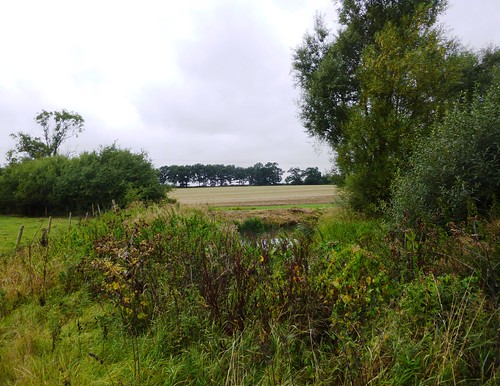
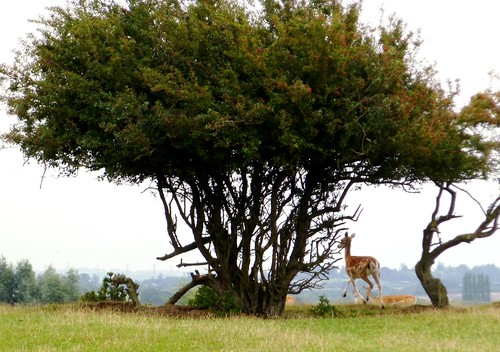
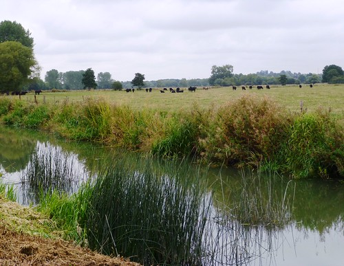
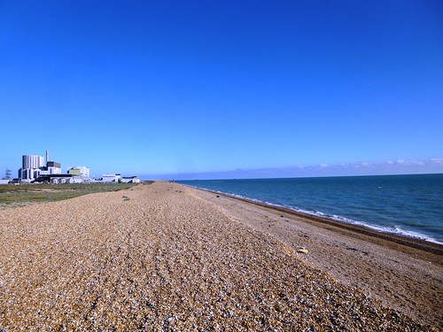
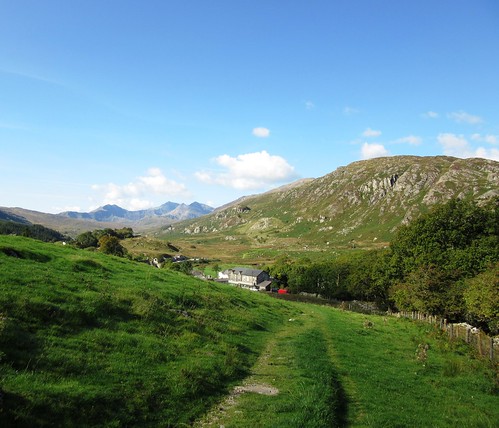
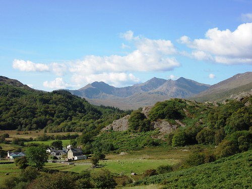
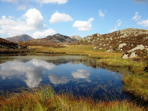
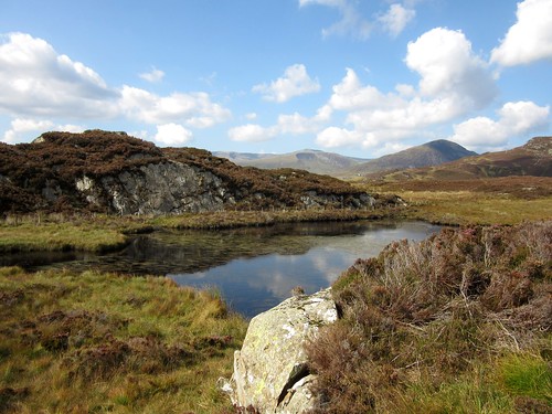
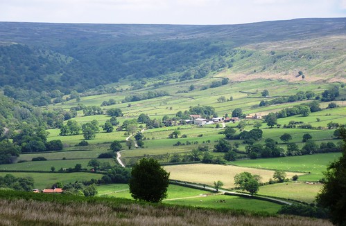
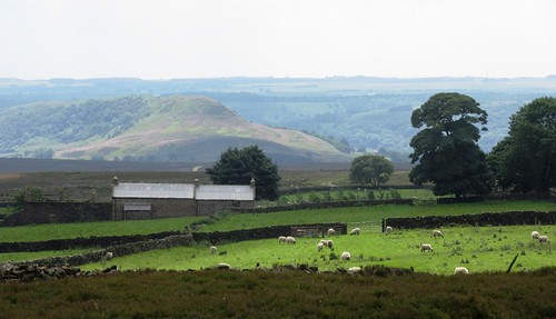
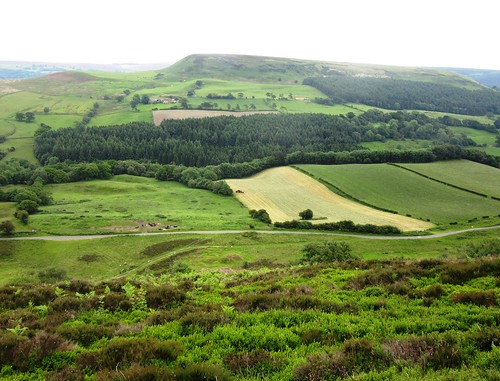
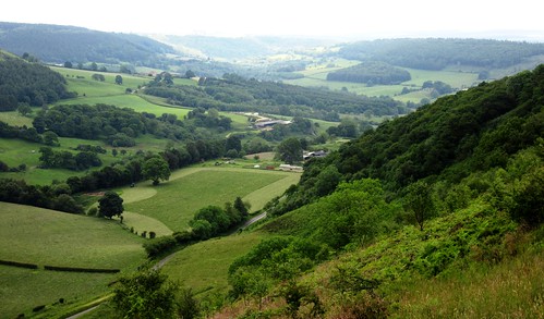
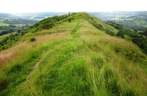
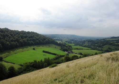
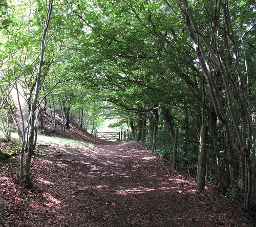
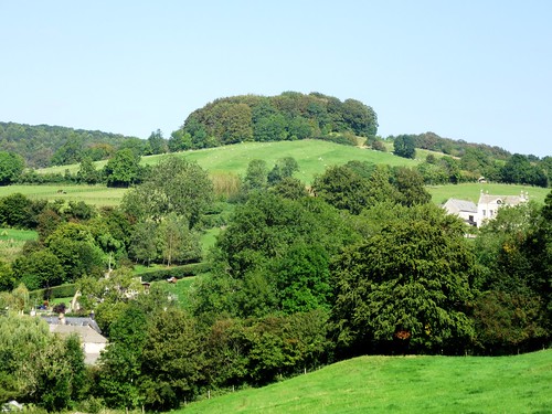
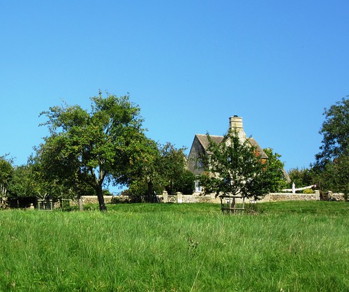
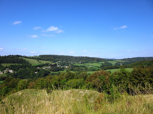
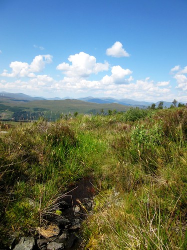
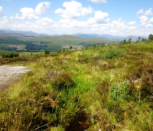
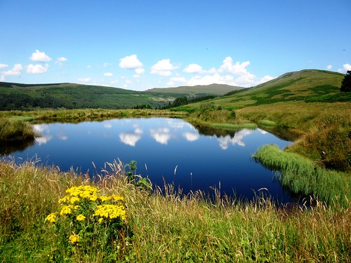
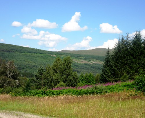
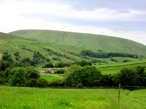
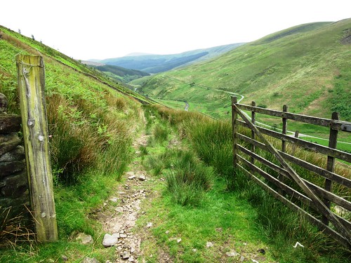
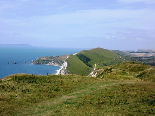
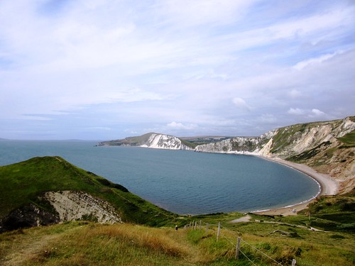
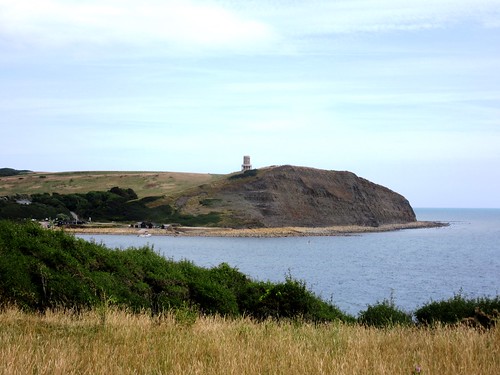
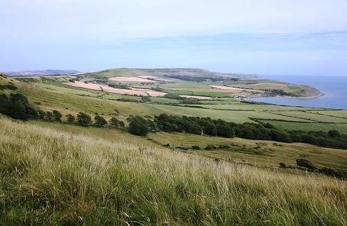
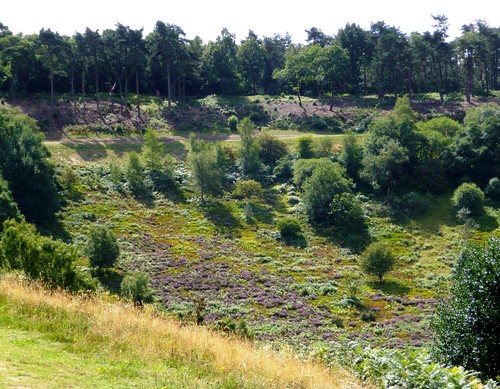
It was a murky old afternoon, with just one window of opportunity between two solid slabs of eastward-drifting rain. We pulled on our raingear and set out north from Steeple Claydon. A black hen, escaped from her pen, ran madly away across the furrows – good solid furrows several feet wide, remnants of medieval strip farming still imprinted on the land. This is low-rolling, cattle grazing country of modest ridges topped by trees, quintessentially Middle England, an unemphatic landscape whose subtleties unfold only slowly.

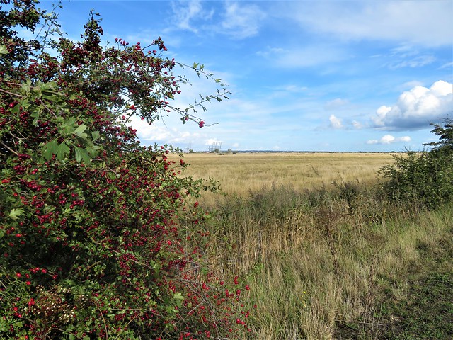
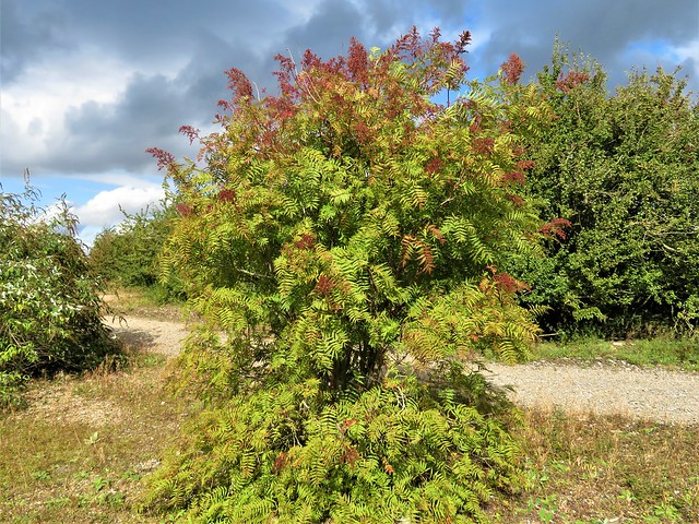
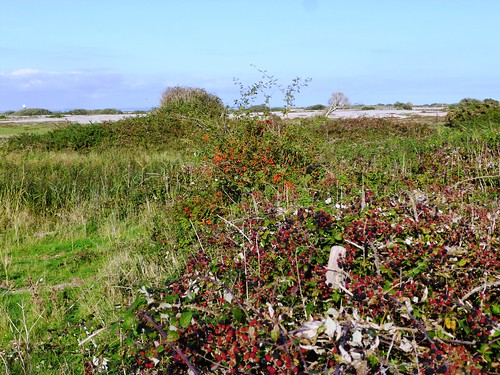
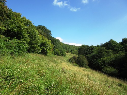
The stubble lay scattered with wheat grains, millions of them. The Victorian women and children who gleaned these fields after the harvest, scouring each row with beady eyes for the precious seeds, would have gathered almost every grain. As we walked along hedges bowed with little green crab apples and blackberries, I wondered when gleaners were last seen in the Buckinghamshire fields.

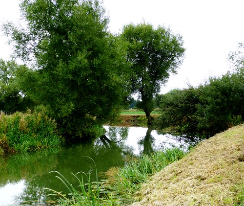
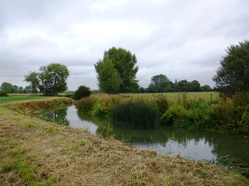
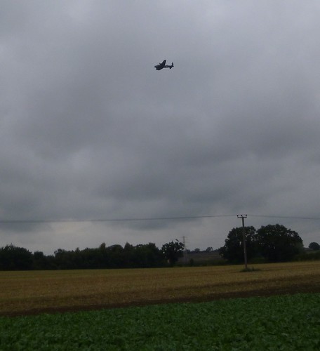
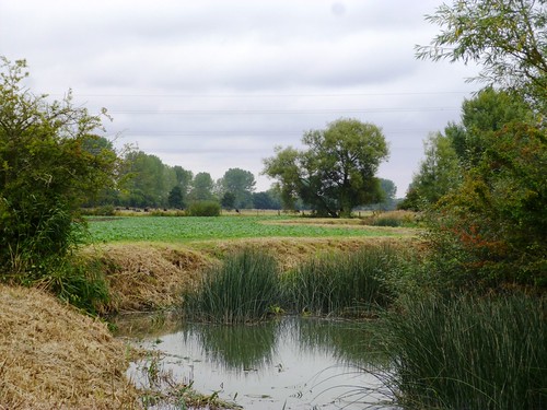
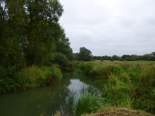
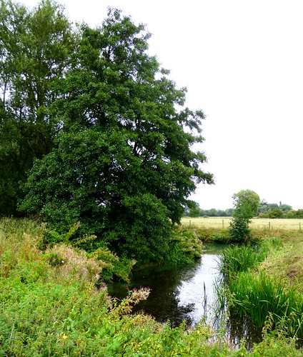
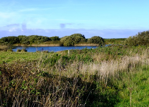
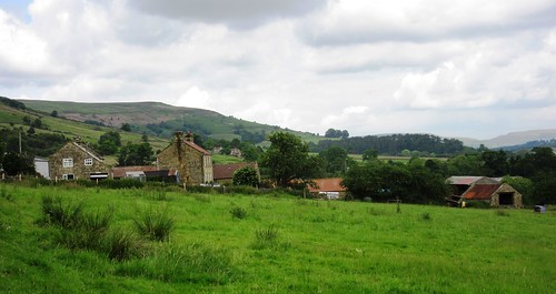
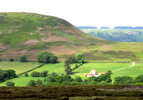
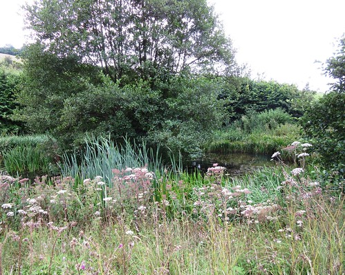
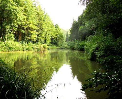
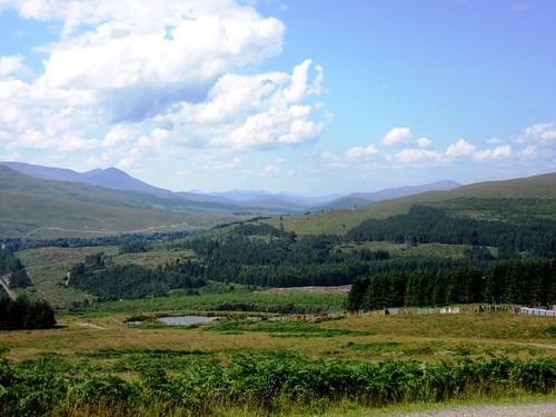
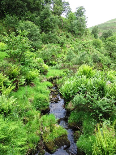
Kingsbridge Farm lay ahead, an angle of red tiled roof and a dark square of barn framed between a crab apple and a hawthorn either side of a five-barred gate – a view John Constable would have loved. We followed the green-grey Padbury Brook as it wound along field margins where the leaves of burdock hung in leathery sheaves like roosting bats. Suddenly a grinding roar filled the air. Looking up, we saw a Lancaster bomber trundling majestically across the cloudy sky like a plane in a dream.

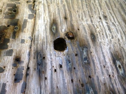
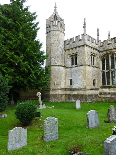
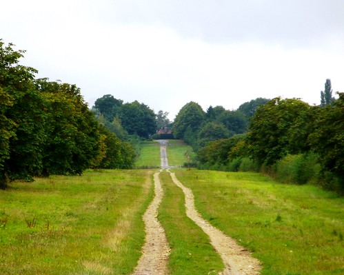
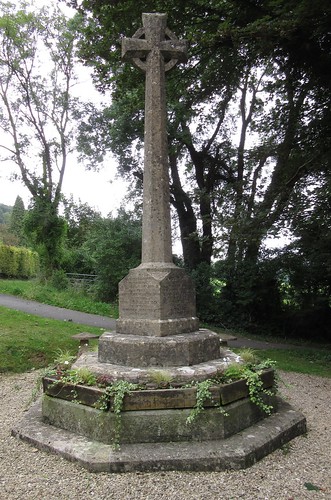
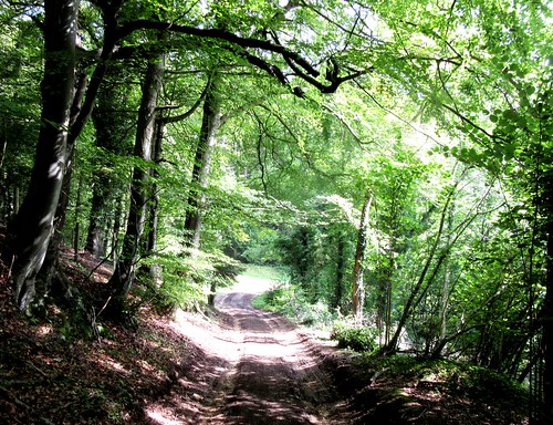
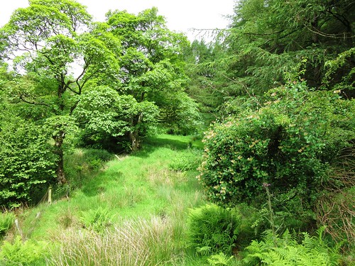
A green lane and a wonderful formal avenue, broad and tree-lined, brought us past immaculate gardens to Hillesden church, a building whose dignified beauty inspired the young George Gilbert Scott to become an architect. The pale oak of the ancient church door was bored deep with bullet holes. This quiet hamlet was the scene of a desperate confrontation in March 1644, when 2,000 Roundhead soldiers laid siege to the Royalist stronghold of Hillesden House. It ended with the owner, Sir Alexander Denton, clapped into the Tower of London (where he soon died), his lands confiscated, his family ruined and his house levelled.

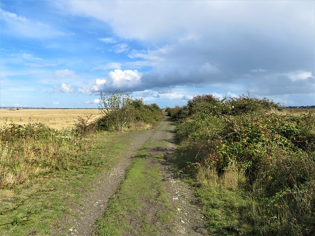
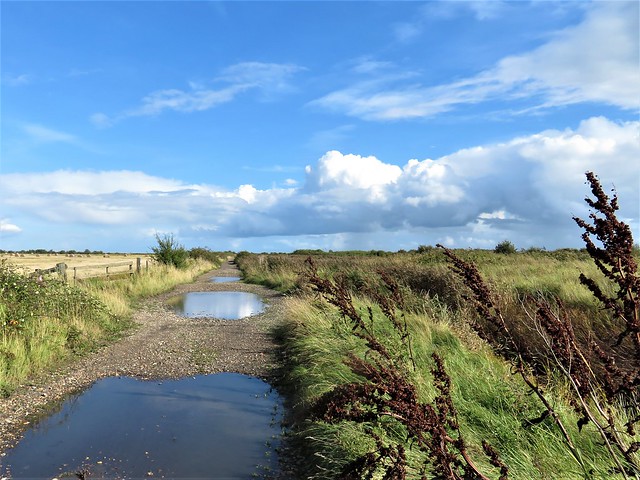
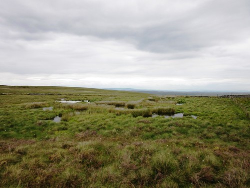
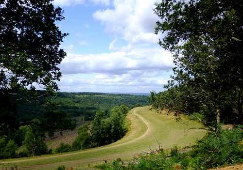
Out across the fields we followed a well-found farm track towards the red roofs and slender spire of Steeple Claydon, with rainclouds thickening overhead to hurry our homeward steps.

Start: Fountain Inn, West Street, Steeple Claydon, Bucks MK18 2NT (OS ref SP 698271)

Getting there: Bus – Service 18 (buckscc.gov.uk/transport), Bicester-Buckingham.
Road – Steeple Claydon is signposted from Padbury, off A413 (Winslow-Buckingham).

Walk (6 miles, easy, OS Explorer 192): From Fountain Inn, left along West Street. On right bend by Co-op, ahead along Meadoway; on beside recreation ground (fingerpost), past school and on for ⅓ mile (stiles, yellow arrows/YA) to cross road (702275, ‘Bernwood Jubilee Way’/BJW). Follow BJW across fields. In ¾ mile cross stream (705287); bear right to enter green lane; left across Padbury Brook at King’s Bridge (704288). Right over stile (BJW); follow left bank of Padbury Brook.

In 250m, right across brook (703290, BJW); continue along its bank. In ¼ mile go under power cables; in 100m, left (703295) away from brook. Don’t go right across ditch; keep ahead with hedge on right for 400m to junction of paths near lone tree standing apart from hedge (699296). Angle back left across field, then along green lane. In 700m, leave trees (701290); in another 200m, right across stile (702289, YA). Follow hedge on right; in 100m, right over stile along broad grassy avenue west for 1 mile. At end, pass Hillesden House gardens, then church (686288).

Just beyond church, left (‘Cross Bucks Way’); follow road, then farm track to Church-hill Farm. At first barn bear left (686283, waymark arrow); follow track for ⅓ mile to T-junction; right here (690282). In ⅓ mile, at T-junction with 3 gateways (693279), right along hedge, following YAs to cross Padbury Brook at Claydon Plank by 2 footbridges (694274). Ahead for 100m past pumping house; left through hedge; 2 kissing gates, then path to road (697272). Right to Fountain PH.

Refreshments: Fountain PH, Steeple Claydon (01296-730286) – friendly local; no food, but you can eat own picnic there. Also Phoenix Inn, Queen Catherine Road, Steeple Claydon (01296-738919).

Accommodation: Villiers Hotel, 3 Castle Street, Buckingham MK18 1BS (01280-822444; oxfordshire-hotels.co.uk) – smart, welcoming town centre hotel.

Information: Buckingham TIC (01280-823020)
www.LogMyTrip.co.uk; www.satmap.com;

 Posted by at 08:35
Oct 242014


First published in: The Times Click here to view a map for this walk in a new window
path to Cliffe Fort 1 haw berries and brambles beside the marsh track 1 haw berries and brambles beside the marsh track 2 sand quarry with Cliffe Fort beyond path to Cliffe Fort 2 path to the sea wall opposite Flamingo Pool cranes of London Gateway port seen across Flamingo Pool Flamingo Pool puddles on the marsh track to Cliffe

A sunny, breezy morning on the Kentish shore of the Thames Estuary, with big ships seen far off like ghost vessels gliding across the grazing marshes. The wind from the river whispered in the reeds, and a constant chatter of ducks from the fleets of water in the RSPB’s Cliffe Pools reserve spoke of the autumn gathering of wildfowl in enormous numbers.

Cliffe sits way out on a blunt estuarine peninsula. Here were the bleak marshes where Charles Dickens set the opening scenes of Great Expectations, and some of the old atmosphere still clings, the feeling of remote country, although central London lies only twenty miles upriver.

We set out along a causeway between the pools. Elder leaves were turning a dusky pink. A flock of goldfinches twittered in excitement as they darted between the seed feast of feathery ragwort heads and the shelter of hawthorn bushes.

Side paths through the scrub led to viewing stances on Flamingo Pool. No flamingos in sight; instead, a raft of coot bobbing on the wind-ruffled waves, a dozen lapwings on a muddle islet, and a flash of silver as a great crested grebe flicked a fish out of the water, tossed it up, caught it again and swallowed it with a shake of the head.

Out by the river we crossed the sea wall and followed a slippery clay path to where a miniature range of gravel alps rose beside a jetty. Diggers and conveyors clattered, and the air thrummed with the beat of marine engines as a rusty old Port of London dredger went steadily seaward down the Thames.

Beyond the workings crouched Cliffe Fort, grey and grim, built in the 1860s to deter a French invasion, now abandoned to scrub. Rusty rails leading out into the muddy estuary were all that remained of the experimental Brennan torpedo, a 19th century guided missile that might have dented a French ironclad if it had ever been put to the test.

Back on the sea wall we followed the long curve of the Thames. In the ooze of a creek a bar-tailed godwit stood on watch, a bulky wading bird with a great pink dagger of a bill, newly arrived from its Arctic summering grounds. Behind it the creek shores were lined with glasswort in autumn purple and crimson.

The homeward path lay across wide marshes over which a dense clot of black dots resolved itself into a whirling army of starlings. Sheep grazed stolidly, and in the distance a line of cranes at London Gateway port stood with heads raised like a herd of giraffes on high alert.

How hard is it? 5½ miles; easy; level tracks and paths

Start: Cliffe Pools car park, Cliffe, near Rochester ME3 7SX (OS ref TQ 723760). Car park free – closes at 4pm

Getting there: Bus 133 (Chatham, Rochester) to Cliffe
Road: A2, A228 (‘Grain’); B2000 to Cliffe; RSPB reserve signposted here (brown sign)

Walk (5½ miles): Pass noticeboard; left along lane. In 500m, just past ‘Pinnacle Trail’ sign on right, track bends left (725764). Fork immediately left on track. In ¾ mile at ‘England Coast Path’/ECP sign, left (715769); in 100m, right across sea wall (‘Saxon Shore Way’, yellow arrow). On between two blocks; path through scrub, then on. In ½ mile reach south side of Cliffe Fort (706766). Return to recross sea wall (715768); left along ECP. In nearly 1 mile, at metal gate with kissing gate (710775), fork right on track across marshes for 2½ miles back to car park.

Lunch/Accommodation: Six Bells, Church Street, Cliffe ME3 7QD (01634-221459, sixbellscliffe.co.uk)

Info: rspb.org.uk/cliffepools

 Posted by at 02:45
Oct 182014


First published in: The Times Click here to view a map for this walk in a new window
picture picture picture picture picture picture picture picture picture picture picture picture picture
Facebook Link:
Dungeness is one of the great uncommon landscapes of Britain, a vast sheet of pebbles – the greatest in all Europe – studded with tough fleshy and prickly plants, thronged with wild birds, a Kentish pampas that pokes a knobbly nose into the English channel. Dungeness is a great wilderness, but not unaffected by man – there are fishing boats and tarry fishermen’s huts, scattered bungalows, and the giant, pale grey boxes of a nuclear power station.

Our first encounter with the naked rambler was at the start of our walk, when he rose up in all his glory from the shingle bank beyond the power station, bade us good day and marched off past the scandalised beach fishermen of Dungeness. We soon forgot him as we followed a grassy path through the RSPB’s enormous 2,000-acre reserve whose pools, pastures and reed beds lie at the heart of the great shingle wasteland.

Swans sailed with nonchalant grace on the meres. ‘Look!’ exclaimed Jane suddenly. ‘Marsh harrier!’. The big bird of prey got up quite slowly from its stance in a field of stubble and flapped off low over the reeds, the sun glinting among its wing feathers. There was great complaining and loud lamentation among the shelduck and coots, and a party of teal sprang into the air and went away from the vicinity of the dark destroyer as fast as they could. We saw the harrier several times after that, quartering its territory like a king and causing commotion wherever it went.

Among the birds, the yellow-horned poppies, the wide stony wastes and the gentle whisper of the wind, it was easy to forget the strangeness that the nuclear power station and its marching columns of pylons brought to the scene. We turned for home with a two-mile trudge across the pebble sheet in prospect, and there were the ghostly grey boxes and the skeleton pylon army ahead, dwarfed under the blue bowl of the sky.

And here came the naked rambler once more, this time clad in the briefest of brief briefs. We exchanged greetings and he was gone like an Old Testament prophet into the wilderness, leaving us the plants, the birds, the pebbles and the blue sea horizon, with a blood-red sunset spreading in the west.

Start: Britannia Inn, Dungeness, TN29 9ND (OS ref TR 092169)

Getting there:
Rail – Romney, Hythe & Dymchurch Railway (rhdr.org.uk) to Dungeness
Bus service 11/11A/11B (stagecoachbus.com) from Ashford via Lydd.
Road – From Lydd (signposted off A259, Rye-New Romney), follow ‘Dungeness Nature Reserve’; then, near power station, ‘Britannia Inn’.

Walk (7½ miles, easy but pebbly!, OS Explorer 125. NB: online map, more walks at christophersomerville.co.uk): Follow boardwalk near black-and-white lighthouse to shore. Right past power station – hard-surfaced track by fence makes easier walking! In 1¾ miles, turn right inland by Lydd Ranges boundary tower (065167) on gravel road. In ½ a mile, road bends left – in 600m, pass roadway on left (057179). In 400m, right (054181, blue topped post, ‘Footpath No. HL33’). Follow grassy path through RSPB reserve. In ⅔ of a mile, keep ahead at 3-finger post (059184, ‘Hooker’s Pits’); follow bridleway blue arrows to road (063196). Right (‘footpath’ fingerpost), across shingle (occasional wooden posts) for 2 miles, aiming for black lighthouse. Cross road (083175); beyond old coastguard cottages, road to Britannia Inn.

NB: Last section across shingle is hard going! Keep to path – risk of unexploded ordnance!

Lunch: Britannia Inn (01797-321959) or Pilot Inn (01797-320314; thepilotdungeness.co.uk)

Dungeness RSPB Reserve: 01797-320588; rspb.org.uk/dungeness

www.LogMyTrip.co.uk; www.satmap.com;

 Posted by at 01:28
Oct 112014


First published in: The Times Click here to view a map for this walk in a new window
picture picture picture picture picture picture picture picture picture picture picture picture picture
Facebook Link:
Capel Curig on a cloudless morning, the sky upturned like a blue porcelain bowl above Snowdonia, the air as fresh as spring water, full of light and clarity. In the west Snowdon thrust up its crown of peaks round a shadowy hollow. Moel Siabod rose like a rocket to the south. What a morning for exploring the rugged uplands that lie north of Capel Curig, the walkers’ and climbers’ mecca in the mountains.

We crossed the stile by the chapel and were away up the fields with tumbled rocks and hillocks rising all round. A well-trodden path led through a mossy oakwood and out into a patch of sun-warmed bog myrtle. We picked a handful of the olive-shaped leaves and sniffed their sweetly spicy fragrance as we climbed on round a great bog in a rocky hollow, northwards towards the pass under the peak of Crimpiau.

‘Go on a bit down the other side, there’s a great view,’ the man in Capel Curig’s Moel Siabod café had urged us. We did so, and were rewarded with a wonderful prospect north-east over the blue waters of Llyn Crafnant framed in a cleft of hills. Back up to the pass, and a meandering climb up to the pale quartz rocks of Crimpiau’s summit. Snowdon stood up dramatically in the west, with Tryfan’s stegosaurus back arched to the sky alongside.

Mountains and uplands were all lit as though by a stage designer granting the dearest wish of every walker out in the hills today. ‘Tryfan,’ said a cheery man as we sat drinking it all in like thirsty travellers in a bar. ‘Up there yesterday, and couldn’t see a thing. Wayfinding was… interesting.’ He smiled. ‘Back to Bedfordshire tomorrow – worst place in the world if you love hills!’

A very rugged and rough path led south off the ridge and down past Llyn y Coryn gleaming in its dark peaty bed like a splash of mercury. A pair of mating dragonflies flew away, banking like biplanes. We descended through heather and gorse, with Snowdon and its cohorts beyond the double lakes of Mymbyr a feast for eyes and soul the whole way down.

Start: Car park behind Pinnacle Stores, Capel Curig, LL24 0EN (OS ref SH 721582)

Getting there: Bus – Snowdon Sherpa S2 (Llanberis to Bettws-y-Coed), S6 (Bangor to Bettws-y-Coed)
Road – Pinnacle Stores is at crossroads of A5 (Bettws-y-Coed to Bangor) and A4086 (Llanberis).

Walk (4½ and a half miles, strenuous, OS Explorer OL17. NB: online maps, more walks at christophersomerville.co.uk): Cross A5; stile beside chapel (‘Crafnant’ fingerpost). In 200m, between trees, ahead on stony path. Gate/stile into wood (725582); out of trees to gate/stile (729581); on to cross wooden footbridge (732581). Left (‘walking man’ waymark); on (stiles) for 1¼ miles, up to pass beside large boulder (738596). On downhill for 200m to Llyn Crafnant viewpoint (738598). Back to pass and boulder; right up path to Crimpiau summit (733596). Path descends south along ridge, aiming for figure-of-eight lakes (Llynnau Mymbyr). Llyn y Coryn soon in sight; keep left of lake (731591) to fence on saddle beyond (731590). Keeping fence on right, down to cross stile (730587). Steeply down to cross stile by stone wall in hollow (729586). Turn right between fence and stone wall; follow fence to cross 2 more stiles (727583). Steeply down to path (727582); right to Capel Curig.

Conditions: steep and rough in places

Lunch: picnic

Accommodation: Tyn-y-Coed Hotel, Capel Curig, LL24 0EE (01690-720331; tyn-y-coed.co.uk) – comfortable, helpful, walker-friendly

Info/maps/walk directions: www.eryri-npa.gov.uk; visitsnowdonia.info/walking-85.aspx

Snowdonia Walking Festival, 25/6 Oct: snowdoniawalkingfestival.co.uk

www.satmap.com; ramblers.org.uk; www.LogMyTrip.co.uk

 Posted by at 00:30
Oct 042014


First published in: The Times Click here to view a map for this walk in a new window
picture picture picture picture picture picture picture picture picture picture picture picture picture picture picture picture
Facebook Link:
The Inn at Hawnby stands perched high on a saddle of ground, even though it lies at the foot of steep lanes. That’s the nature of this southern corner of the North York Moors where every summit seems only to lead you to another higher crest, each dale bottom to precipitate you into one even lower. It’s steep green country, thickly wooded in the depths, bare heather moors forming the heights that separate one dale from the next. Within five minutes of leaving the inn I looked up to see Hawnby high above me; in another ten minutes the hamlet was gone, not to be seen again till the last few steps of this beautiful walk.

The land hereabouts, bitter in winters, is hard on its sheep and cattle farmers. The farms of Little and Low Banniscue had vanished as though they had never existed. At Crow Nest I found a roofless ruin in a zigzag tumble of yard walls. A boulder-strewn moor loud with the complaint of curlews and lapwings led me over a broad crest and down into the inbye fields of Bilsdale, startlingly green in the sunshine. Across the dale lambs cried and scampered in the fields around Carr Cote, where they were gathering the sheep for shearing. ‘Good weather for it,’ said the farmer at Helm House as he hauled hay bales from the field to be wrapped in netting and sealed for silage in a plastic skin. A golden labrador at Fangdale Beck thought so, too – he cavorted under his master’s hosepipe, shaking the water into rainbows and barking like a maniac.

I climbed up through bracken, then away across the purpling moor where red grouse chicks scuttered off, their mothers whirring short distances low over the heather as they shrieked, ‘Back! Back! Back!’ Up on the crest a broad yellow sand road led south past the lonely moorland farm of Low Thwaites towards the twin rise of Easterside Hill and Hawnby Hill.

Up on the thyme-scented summit of Hawnby Hill I sat by the conical cairn, looking down the precipitous slopes into Ryedale and picturing the Hawnby Dreamers. Three modest local men, Chapman, Cornforth and Hugill by name, fell asleep upon these moors one day in the 1740s, and dreamed identical dreams of repentance and salvation. They sacrificed their reputations, their livelihoods and the tied cottages they lived in to set out immediately and walk a hundred miles to hear John Wesley preach. To borrow Thomas Hughes’s words from Tom Brown’s Schooldays, Hawnby Hill is ‘altogether a place to open a man’s soul, and make him prophesy.’

Start: Inn at Hawnby, North Yorks YO62 5QS (OS ref SE 542898)

Getting there: Hawnby is signposted from Osmotherley (A19/A172, Thirsk to Middlesbrough).

Walk (10 miles, moderate, OS Explorer OL26): From Inn at Hawnby, follow ‘Osmotherley’. Round left bend, bear right (‘Laskill’). Cross stream; in 100m, left/north up track (547899, ‘Bridleway’, occasional blue arrows/BAs). In ½ mile, through wood; emerge through gate (546912); right up wall into next field; left by erosion scar to Crow Nest ruin (547914). Right through gate by ruin; follow sunken track, curving left away from ruin, east across moor for ⅔ mile to descend to gate (557919, waymark arrow). Follow wall down to Low Ewe Cote (561918).

Through farmyard and gate beyond; follow farm lane to cross road (564921). Through gate opposite (‘bridleway’) and on. In 250m, through wood; emerge (567924) and aim for gate with BA (567926). Follow BAs through fields, past Helm House farm (569934) and on along green lane (BAs) for ¾ mile. At Malkin Bower (570944) join road to Fangdale Beck. Opposite old chapel (570946, ‘Chapel Garth’), left down laneway, over footbridge; left through garden gate (BA). Bear right between buildings and through gate. Up laneway; through another gate (BA); follow wall on left, uphill through gate and up damp sunken lane. Through gate (566948) and on up, following track through bracken as it curves right, up to gate near skyline (563949).

Aim slightly left of communications mast across moor, keeping Fangdale Beck’s gully on your left. There is a faint, roughly cairned track, if you can find it! (If in doubt, make for communications mast and turn left (south) along moor road from there.) In ¾ mile reach line of wooden grouse butts (552954); follow them to left (west); where they end, continue same direction past prominent standing stone to meet broad, sandy moor road (548954). Left along this.

In ⅔ mile pass Low Thwaites farm house (543944); in 200m take right fork in track (543942), keeping ahead (south) for 1½ miles to road at Moor Gate (540917). Cross cattle grid, and turn right onto bridleway; bear immediately left up path past notice. At foot of steep upper slope of Hawnby Hill (539913), bear left up path to ridge (540910). Left (south) along ridge past cairn. Down slope; in bracken, path forks (542900); bear right here. In 50m, left over stile (542899, yellow arrow); follow fence on left down to Inn at Hawnby car park.

Refreshments: Picnic

Accommodation: Inn at Hawnby (01439-798202; innathawnby.co.uk); classy and characterful

Information: Thirsk TIC (01845-522755)

visitengland.com; www.satmap.com; ramblers.org.uk; www.LogMyTrip.co.uk

 Posted by at 02:00
Sep 272014


First published in: The Times Click here to view a map for this walk in a new window
picture picture picture picture picture picture picture picture picture picture picture picture picture picture picture picture
Facebook Link:
Back in 1985, a head-over-heels fan of Cider with Rosie, I spent a day exploring Slad with Laurie Lee as my guide. I’ve never forgotten the deep and amused affection that the author showed for the little South Gloucestershire village where he grew up. So it was a thrill to be back there in Lee’s centenary year, walking the recently opened Laurie Lee Wildlife Way which meanders – marked here and there with posts displaying Lee’s locally-inspired poems – through a succession of nature reserves cared for by the Gloucestershire Wildlife Trust. Click here for a map of Cider With Rosie sites

Below the path in ancient Longridge Wood ran the dark dingle of Deadcombe Bottom where lay the haunted house of the Bull’s Cross hangman – or so young Laurie and his friends believed. Up at the crest the poem ‘Landscape’ summoned images of a lover and a countryside melting into one another. But the stolid sheep among the harebells of Slad Slope munched on regardless.

On through Snows Hill wood, and down across a jungly hillside to a brook fragrant with spearmint. ‘My heart’s keel slides to rest among the meadows,’ said ‘Home From Abroad’ on the far bank. Up again to a long view over the roofs of Slad, and a poem about The Three Winds in Catswood. Here a tawny owl got up and flapped briskly away before me.

Through autumn gentians and ladies tresses on the steep flank of Swift’s Hill; and then the approach to Slad itself, past the field where Rosie Burdock and young Laurie exchanged cidrous kisses under that famous hay wagon. Past the tangle of trees in the valley bottom where Laurie’s friend Sixpence Robinson lived – ‘the place past the sheepwash,’ Lee remembered in Cider With Rosie, ‘the hide-out unspoiled by authority, where drowned pigeons flew and cripples ran free; where it was summer, in some ways, always.’

Past the pond where poor crazed Miss Flynn drowned herself, and up the lane to the L-shaped house where Lee and his seven siblings lived, laughed, fought with and finally left their scatter-brained, infinitely loving mother Annie. As her dreamy youngest son put it in his poem ‘Apples’, she too was fated to ‘welcome the ripe, the sweet, the sour, / the hollow and the whole.’
Start & finish: Bull’s Cross car park, near Slad, Glos GL6 7QS (approx.) – OS ref SO 877087)

Getting there: Bull’s Cross is on B4070, 1 mile north of Slad (signed from A419 in Stroud – M5, Jct 13)

Walk (6½ miles, moderate, OS Explorer 179. NB leaflet guide from Woolpack Inn, Slad, or download at gloucestershirewildlifetrust.co.uk):

Heading north from Slad, don’t take first path on right! At ‘Equinox’ poem at northern end of car park, ‘Wildlife Way’ arrow/WW points up B4070. In 100m, right (yellow arrow/YA) down lane. In 400m, through gate (882089); in another 350m, fork right off track (885088, YA on tree) on descending path. Pass end of lake, up across track (886087) and on up steep path rising to left. At top, cross bridleway (887087), through stone wall gap (YA) and on, down through grassland reserve. Stile (YA); cross field to bottom left corner and gate into Snows Farm Nature Reserve (889085).

Ahead down track through wood. At bottom, path bends right (892085, ‘Laurie Lee’/LL post, red arrow). Follow LL and WW southwest across grass slopes and through woods for 500m. Near Snows Farm cross brook (887081); on far bank, through gate; right (LL) along fence and through kissing gate. Don’t cross brook, but bear left over stile (YA, Wysis Way). Fork right in next field to cross stream by plank; fork right up slope and over stile; diagonally up across grassy field and into Catswood (886077). Right on path along lower edge of Catswood, and on into Redding Wood.

In a little over ½ mile, turn right along tarmac lane (880073). In 400m at bottom on right bend, left up steps (880070); follow path through Laurie Lee Wood Nature reserve (‘Trantershill Plantation’ on OS Explorer map). Through gate at top of wood (877068, with road below to right). Turn left past another gate, uphill on stony track. In 200m, pass ‘Field of Autumn’ poetry post on your right; at top of slope, with field gate on left, hairpin back right (879067), heading west over brow of Swift’s Hill Nature Reserve and down to road (875066). Left over cattle grid. Pass Knapp Farm; at left bend, right along drive (872067, ‘Upper Vatch Mill’). In 100m, right over stile (YA), and follow YAs across 3 fields for 600m to hollow lane (878071). Left to road at Furners Farm. Left past farm; on along stony lane.

In 10m, over stile (877072); on along green pathway through 2 fields and woodland corner. Cross stile on left into 3rd field (877076); follow hedge on left down to gate (877077). Pass village pond; left up lane. At top (874078), either left to B4070 (Lee’s childhood home – NB it’s a private house! – is down the bank on the left at junction, 874075) and on to Woolpack Inn, with church and school opposite; or turn right at top of lane to cross B4070 at war memorial (873079). Up lane opposite; at left bend, right (872079, fingerpost) along lower edge of Frith Wood Nature Reserve. In 200m fork left uphill; in 250m at top (874084), bear right to Bull’s Cross car park.

Conditions: Some short steep climbs; sticky/slippery after rain.

Lunch: Woolpack Inn, Slad (01452-813429)

Reading: Laurie Lee’s Selected Poems (Unicorn Press); Cider With Rosie (Vintage Classics)

2014 Centenary events: laurielee.org

Info: Stroud TIC (01453-760960)

visitthecotswolds.org.uk; www.satmap.com; ramblers.org.uk

 Posted by at 01:11
Sep 202014
 

It’s one hell of a climb to the pride of Mid Ross, the 1,046m crown of the great whaleback mountain called Ben Wyvis – too much, really, for this scorcher of a summer’s day.
First published in: The Times Click here to view a map for this walk in a new window
picture picture picture picture picture picture picture picture picture picture picture picture picture
Facebook Link:
But Little Wyvis, a couple of miles to the south-west, looked just the job at 764m, a good upward pull on a fine stony track, and no-one else to share the mountain with us.

Grasshopper ticked in the grasses, bees were busy in the wild thyme and bird’s-foot trefoil flowers. The thistles were out in royal purple, with dark green fritillary butterflies opening their black-and-burned-orange wings over the brushy blooms as they delicately sipped the deep-sunk nectar. Halfway up the mountain we stopped for a water break, and sat on a rushy bank to watch a meadow pipit perched on a fence post as it preened its speckled breast and dark wing coverts.

The zigzag track rose up the flank of Little Wyvis, the sun striking a million diamond winks out of its mica-sheathed rocks. We plucked juicy bilberries, sweet and sharp on the tongue, beautifully refreshing to the upward climber. The delicate white flowers of starry saxifrage dotted the acid-green sphagnum in the wet ditches along the track.

At the summit of Little Wyvis we found a little rocky cairn infested with scores of bees. Ben Wyvis rose to the north, a double hump with precipitous slopes facing in our direction. Through binoculars we saw the red and yellow dots of walkers sweltering in the sun as they struggled up the leg-twanging ascent. Rather them than us. Standing by the cairn we took in a truly stupendous view, from the lumpy mountains of Torridon way out west to the long sea lochs at Dornoch in the east, a vista of green mountains and steely waters that might fittingly have been labelled ‘Heart of Scotland’.

On the way down, two plump birds stood on a rock, staring us down. White patchy bellies, feathery feet, salt and pepper backs, and a bold red eyebrow on the male. A pair of ptarmigan, no less – my first ever sighting of these elusive birds of the high mountains. And just beyond them, a beautiful mountain hare motionless under a peat bank, his ears short and neat, his pelt ridged as though combed into dreadlocks. What a thrill.

Start: Car park on A835 Inverness-Ullapool road (OS ref NH 402639).

Getting there: A835 towards Ullapool from Inverness; 1 mile north of Garve, pass A832 turning; in another 1½ miles, car park signed on left just before bridge.

Walk (7 miles there-and-back, strenuous, OS Explorer 437. NB: online map, more walks at christophersomerville.co.uk): Cross A835 (take care!); left for 100m; right up roadway. In 50m, left past gateway post (ignore warning sign – it’s aimed at 4×4 drivers!). Follow gravel track. In ½ mile pass barn (407640); on through deer gate. In another mile, at 2nd gate, left up track (418640). In another ½ mile, track forks (422646); continue to right here, up zigzag track. In ¾ mile, just below summit at 700m, rough track goes left (427643); ignore this, and keep ahead upwards. Go through remains of fence, and on up to summit cairn (430645). Return same way.

Conditions: Clear track all the way. NB – this is a mountain walk with 650m of climb; take hillwalking boots, clothes, equipment.

Refreshments: Picnic

Accommodation: Aultguish Inn, By Garve, Ross-shire, Scotland IV23 2PQ (01997-455254; Aultguish.co.uk): cheerful, welcoming inn; also budget rooms and bunkhouse.

Info: Inverness TIC (01463-252401)

visitscotland.com; www.satmap.com; ramblers.org.uk

 Posted by at 01:51
Sep 132014
 

A cool and cloudy morning over the Forest of Bowland, the moorland heart of Lancashire.
First published in: The Times Click here to view a map for this walk in a new window
picture picture picture picture picture picture picture picture
Facebook Link:
As we walked the sheep pastures under the dun brown shoulder of Beatrix Fell, a curlew got up from its nest among the sedges and flew low past us. Its long downcurved bill quivered open to emit the familiar bubbling trill that haunts these northern hills. The sedgy field path brought us past a string of old stone farmhouses, then up the open flank of Dunsop Fell and out into open moorland.

In past times the Forest of Bowland lay under harsh laws of prohibition. The landlord’s tenants were made to pass their dogs through a silver hoop – any animal too big and powerful to scramble through would be destroyed as a potential poaching asset. Grouse shooting interests were paramount, and ramblers were strenuously discouraged. But times and tempers changed. When the Countryside and Rights of Way Act was passed in 2000, this enormous wheel of bleak and beautiful country was opened to all walkers for the first time in history.

Bowland is properly wild country, with plenty of surprises for walkers. Up at Dunsop Head we found the springs of Dunsop Brook overflowing with stored rainwater. We floundered along through soft, sloppy, sucking peat and moss. Jane went in knee-deep, emerging with a tremendous sucking sound as though the bog were smacking its lips over her like a tasty lollipop.

At last we reached firmer ground, where three birdwatchers were waiting. ‘See the male hen harrier?’ cheerily enquired their leader. ‘Flew right across where you were.’ But we’d been too preoccupied with our battle with the bog to spare a glance for anything else. ‘Yep, only three of them in Britain,’ the twitcher exulted. ‘We saw him, all right!’

Down in the hidden cleft of Whitendale, other ornithological celebrities are resident – a pair of breeding eagle owls, surprise incomers with six-foot wingspans, capable of taking out a young deer. We didn’t spot these beautiful strangers on the way back to Dunsop Bridge. But there were grey wagtails and herons, white-chested dippers and black-capped stonechats, and a crowd of jolly house martins hawking over the river, their white rumps and scarlet streaks a vivid splash of colour against the grey skies of evening.

Start: Dunsop Bridge car park, Lancs BB7 3BE approx. (OS ref SD 661501)

Getting there: Bus Service 10 (dalesbus.org), Clitheroe-Slaidburn
Road: M6, Jct 31a; B6243 (‘Clitheroe’) through Longridge; 1 mile past Knowle Green, left on minor road through Whitewell to Dunsop Bridge.

Walk (10½ miles, strenuous, OS Explorer OL41. NB: Detailed directions – highly recommended – online map, more walks at christophersomerville.co.uk): Right along road; just before bridge, right (‘bridleway’) along drive. Pass terraced houses (658507); in 100m, right (yellow arrow/YA) through kissing gate, up steps, over stile; ahead along fence. At ruined wall, half-left to Beatrix Farm (664514). 100m past farmhouse, left through gate. Blue arrow/BA points ahead, but follow 2 YAs (pointing left) along right bank of stream (YAs). In ½ mile, at bottom of Oxenhurst Clough, cross stream (671518). Follow YAs, with fence on right, to farm drive (674521); on past The Hey to Burn House (682528). Through driveway gate and on down to lane (685522).

Left for ¾ mile. Left up drive (694530, ‘Burnside Cottage’). Skirt Burnside Cottage through gates (690537); on up fellside beside stone wall (BAs). At top of wall (687540), through gate; bear right. 200m past conifer clump, path hairpins back left and climbs for 1 mile to Dunsop Head (676542).

NB! Deep, wet bogs across the path here! Bear left to stone wall on high ground to left of bogs; follow it to the right, to a fence curving away to left; follow this fence west, then north, keeping close to it, and treading with care, till you meet the wall again near a gate (675544).

From the gate, left along moor path (yellow-topped posts, arrows, cairns) for 1 mile, descending to Whitendale. By first stone wall of farmyard, left (662550, unmarked) on path with wall on right. In nearly 1 mile, horseshoe left across Costy Clough footbridge (659536). In 150m, right over stile, down to track; left for 500m; right across footbridge (654533), left along road for 2¼ miles to Dunsop Bridge.

Conditions: Deep, wet bogs at Dunsop Head. Hill-walking gear, boots, stick.

Refreshments: Picnic; Puddleducks tearoom, Dunsop Bridge (01200-448241)

Accommodation: Inn at Whitewell, BB7 3AT (01200-448222, innatwhitewell.com) – wonderful old inn; comfortable, welcoming, full of character; 2½ miles from Dunsop Bridge

Information: Clitheroe TIC (01200-425566)

visitengland.com; www.satmap.com; ramblers.org.uk

 Posted by at 01:41
Sep 062014
 

‘Please treat the church and houses with care,’ said the handwritten plea left pinned by the villagers of Tyneham to their church door in the dark days of the Second World War.
First published in: The Times Click here to view a map for this walk in a new window
picture picture picture picture picture picture picture picture picture picture picture picture picture picture picture
Facebook Link:
‘We have given up our homes where many of us lived for generations to help win the war to keep men free. We shall return one day,’ the note ended, poignantly, ‘and thank you for treating the village kindly.’
That return was to remain forever a dream. Evicted by the Army in 1943 so that their homes and lands could be used for training soldiers, the 40-or-so villagers of Tyneham and their 200 fellow parishioners never returned to the lonely valley in the Dorset downs. Lulworth Ranges absorbed the place and threw a cloak of inadmissibility over it. Nowadays only the school, church and great barn of Tyneham remain in good repair, open to the public on certain days (see below). Tyneham’s cottages and Post Office are empty shells whose former inhabitants stare from old photographs in the wall displays; the great manor house crumbles unseen and out of bounds among the trees.
We wandered around the skeleton village with dairyman Walter Candy, shepherd James Lucas and a ghostly host of pinafored children and hobnailed farmworkers at our elbow, then made for the grassy track that undulates along the crest of Whiteway Hill, with stunning views west along the chalky, fossil-filled cliffs of Dorset’s Jurassic Coast.
A breeze rippled the grassheads like an invisible hand stroking a head of newly-washed hair. We teetered down the steep slope below the ramparts of Flower’s Barrow hill fort, and had a quick, ecstatic plunge in the semi-circle of sea under the sloping cliffs of Worbarrow Bay. A stiff climb out of the cove and we were looking down on the Tyneham valley, its green slopes untouched by the intensive agriculture of the past seventy years, its trees concealing their secrets.
On past clumps of wild marjoram, so pungent when pinched that they made me gasp. The submerged rock ledges far below off Brandy Bay shimmered orange, black and jade green. In the sea haze the long wedge of Portland seemed not so much a peninsula as an island detached from the shore. A last look east to the much-quarried freestone cliffs under St Alban’s Head, and we were bowling back to Tyneham along the ridge of Tyneham Cap where sparrowhawks hovered on quivering wings, and a croaky old raven was teaching formation flying to this year’s youngsters.

Start: Tyneham car park, near East Lulworth, Dorset BH20 5DE (OS ref SY 882802)

Getting there: Tyneham is signposted from East Lulworth (B3070 from A352 near Wareham; or B3071 from Wool, 4½ miles west of Wareham on A352).

Walk: (8 miles, moderate/strenuous, OS Explorer OL15): From Tyneham church follow track north to top of down (882810; yellow marker posts/YM). Left along crest of down for 1 mile to Flower’s Barrow hill fort. Pass through first rampart; at Coast Path marker stone (866805), hairpin left (YM), steeply down to Worbarrow Bay. Steeply up and along Coast Path. Pass opposite Tyneham car park; in 500m, at gate/cattle grid (889798), fork right between YMs and on round edge of Brandy Bay. Halfway round Kimmeridge Bay, at ‘Kimmeridge View Point’ board and flagpole on right (904792), turn left up hedge. YMs to top of down (905802); left along crest of down. In 1 mile cross cattle grid/gate (889798); in another 400m, just beyond ‘Keep Back, Unstable Cliff’ notice (883797), fork right to Tyneham.

Conditions: Many ups and downs, some steep.

Opening: Lulworth Range walks and Tyneham are open weekends (9am Sat. to 8am Mon.) except 27/28 Sep, 15/16 Nov 2014. Also open for some school holidays and Bank Holidays. Info – Lulworth Range Control Office, 01929-404819;
gov.uk/government/publications/lulworth-access-times

Refreshments: Picnic

Information: Dorchester TIC (01305-267992; visit-dorset.com)
tynehamvillage.org; visitengland.com; www.satmap.com; ramblers.org.uk

 Posted by at 02:21
Aug 302014
 

Geologists say the Devil’s Punch Bowl is the sandstone roof of a giant cavern that collapsed after springs had hollowed it out; folklorists that it’s the imprint of the Prince of Evil’s arse when he landed there after a mighty jump from the Devil’s Dyke near Brighton.
First published in: The Times Click here to view a map for this walk in a new window
picture picture picture picture picture picture picture picture
Facebook Link:
Whatever its origin, this great green hollow in the Surrey Hills is packed with wildlife – slow-worms and lizards, butterflies and beetles, flowers and trees. We followed a path down under silver birches, through a boggy green dell and on across heathland of ling and bell heather gleaming purple in the strong midday sunlight.

A short climb to the tip of the Punch Bowl and we were walking the A3 London-Portsmouth trunk road – not the modern version, which has been buried far underground in twin tunnels since 2011, but the old road that was left abandoned. Where single-file traffic once queued and fumed, a wide green pathway now sweeps round the rim of the Devil’s Punch Bowl, subtly landscaped, edged with silvery grasses and wild flowers. Common blue butterflies opened their gorgeous wings to the sun, and a pair of clouded yellows enacted a crazy chase as we strolled the grass-grown track.

Just above the abandoned road runs another, an ancient highway that once linked the capital with the Royal Navy’s home port of Portsmouth. On a September day in 1786 three ruthless rogues murdered a sailor here for the price of his clothes. We found a memorial stone beside the track ‘erected in detestation of a barbarous Murder’, its reverse face bearing a faded inscription calling down a curse on anyone ‘who injureth or removeth this Stone.’

On Gibbet Hill nearby the three malefactors were hung in chains for all to see. It’s a haunted place, and a sensationally beautiful one, with a view that stretches out across the Sussex Weald from the South Downs to the ghostly towers of London 40 miles off. We sat to take it all in, then followed the National Trust’s ‘Hidden Hindhead’ walk through woods of oak and sweet chestnut coppice, up hollow chalk ways under bulbous pollarded beeches filtering green light, and back across an open heath where the wind was sweetened with pine resin and our finger ends grew purple with the juice of ripe little bilberries.

Start: Devil’s Punch Bowl car park, Hindhead, Surrey, GU26 6AG (OS ref SU 890358)

Getting there: Bus – Stagecoach (stagecoachbus.com) service 18, 19 (Aldershot-Haslemere)
Road – A3 or A287 to Hindhead; car park signed in village

Walk (5 miles, easy, OS Explorer 133. NB: Online map, more walks at christophersomerville.co.uk): From car park walk to viewpoint; right (‘Hidden Hindhead’/HH fingerpost). In 150m fork left through gate; immediately left (892358) down track into Devil’s Punch Bowl. In 350m, right (891361, yellow arrow/YA on post) down to cross stream (892363). Up slope, follow YAs across heath. In 250m go over path crossing (894364). In 400m, through kissing gate beside road on left (895367); right on gravel path to former A3; right along old road (896366) at lip of Devil’s Punch Bowl.

In 650m, on right bend, left (898360) up track through trees to cycle track; right for 300m to Sailor’s Stone (897358) on right. Return for 100m; right (‘Sailor’s Stroll’); follow cross symbol to Gibbet Hill viewpoint (900359). From here follow HH for 2½ miles back to car park.

Lunch: NT café, Devil’s Punch Bowl

Hidden Hindhead Walk and local info downloadable at nationaltrust.org.uk

Accommodation: Devil’s Punch Bowl Hotel, Hindhead GU26 6AG (01428-606565; devilspunchbowlhotel.co.uk)

Information: Guildford TIC (014983-444333);
visitsurrey.com; visitengland.com;
www.satmap.com; www.LogMyTrip.co.uk

 Posted by at 01:33