Aug 232014
 

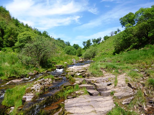
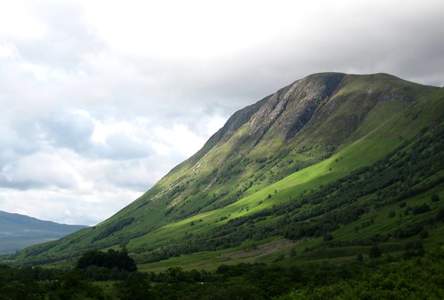
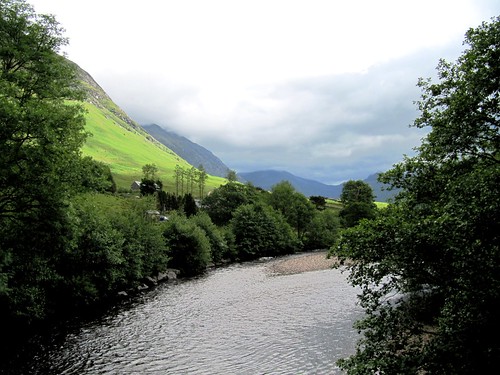
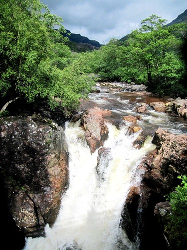
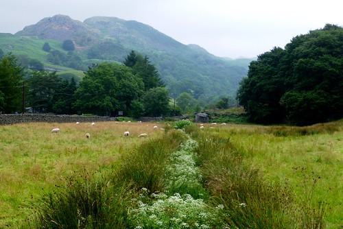
The Nant Bwrefwr came sparkling down from the heights of Craig y Fan Ddu, chuckling over its gleaming black and red rocks as though at the folly of walkers who’d bust a sweat climbing the Brecon Beacons on a glorious summer morning as hot and sunny as this.
First published in: The Times Click here to view a map for this walk in a new window
picture picture picture picture picture picture picture picture
Facebook Link:
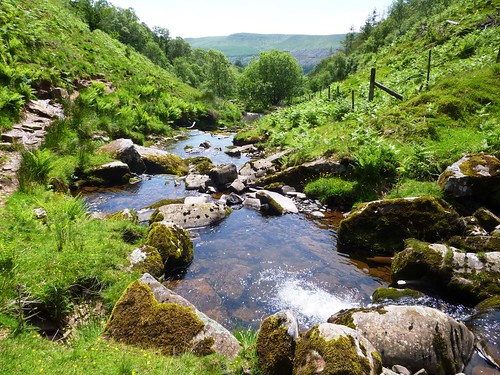
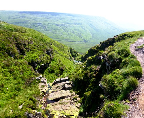
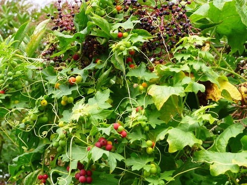
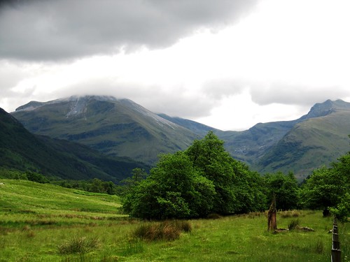
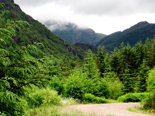
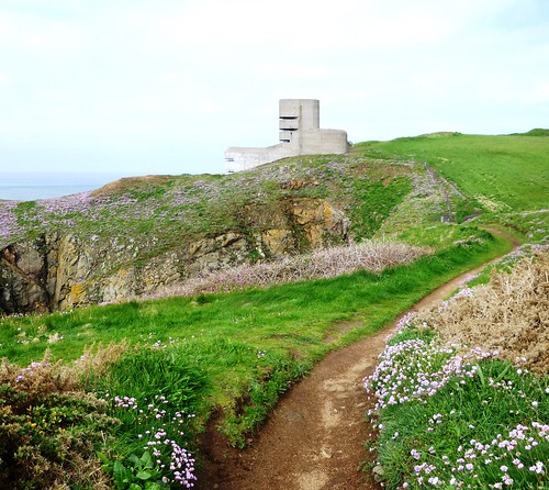
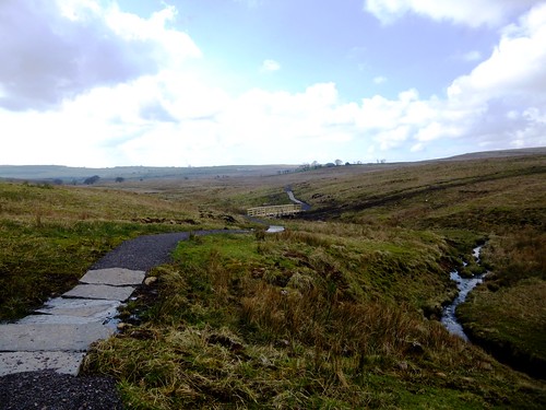
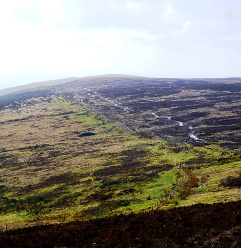
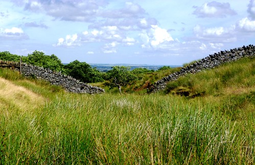
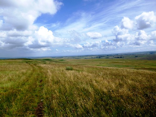
Wild thyme and tiny white flowers of heath bedstraw jewelled the sedgy grass as we went slowly up towards the ridge. Up there a wonderfully welcome breeze was blowing from the precipitous valley of the Afon Caerfanell. We circled the rim to where the infant river tipped over the edge and cascaded down through a clutter of dry boulders. Bog cotton trembled like trapped swansdown over the surface of a pool framed in sphagnum moss as green and cool as a freshly cut lime.

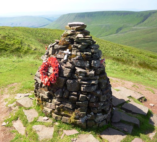
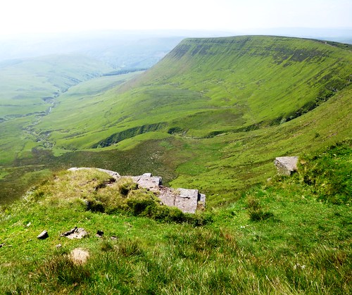
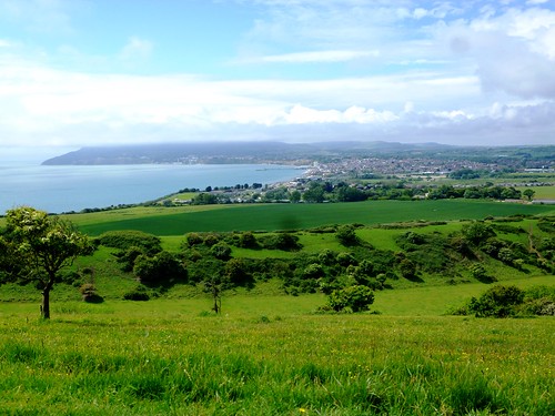
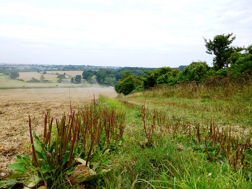
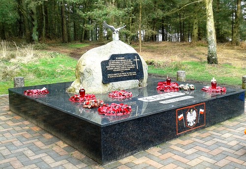
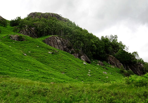
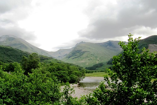
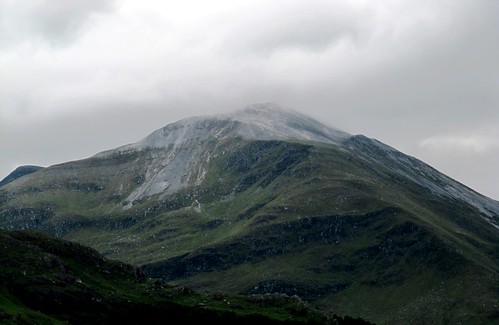
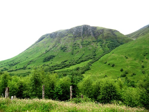
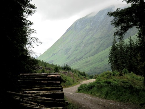
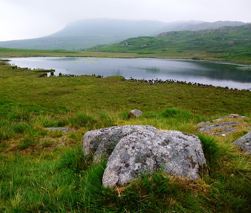
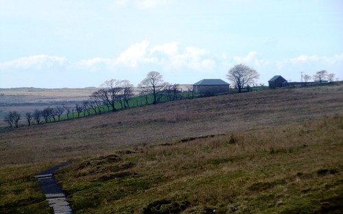
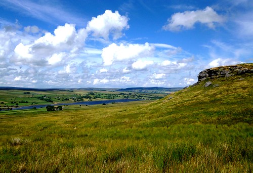
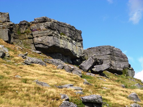
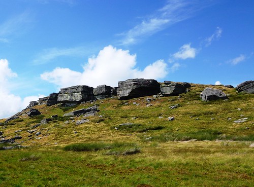
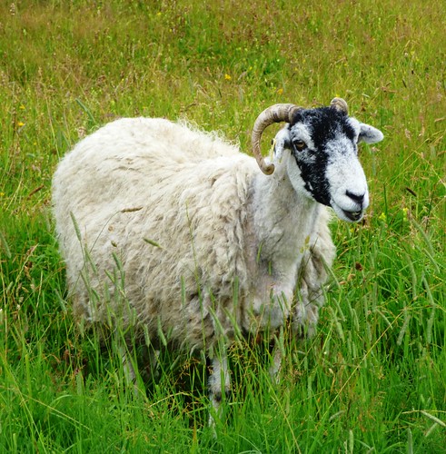
The flat high heads of Fan y Big and Cribyn looked over the moorland to the north-west. We went on along the cliffs, past shaggy hill ponies and newly shorn sheep, to the far side of the valley. Here two jumbles of weather-pitted aluminium and a memorial cairn marked the site of a wartime aeroplane crash. Five Canadian airmen – Sergeants Beatty, Hayes, Mittle and Yuill, and their skipper, Flight-Sergeant JB Kemp – died on 6 July 1942 when their Wellington bomber lost direction on a training flight in low cloud and slammed into this hillside. It couldn’t be a more peaceful place, looking south through the jaws of the cleft to the blue ridges of the South Wales valleys, one behind another till they merge into the sky.

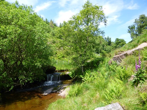
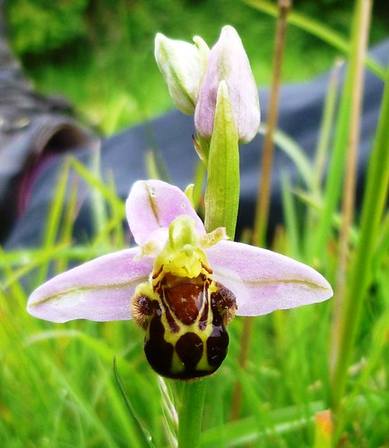
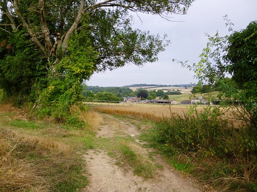
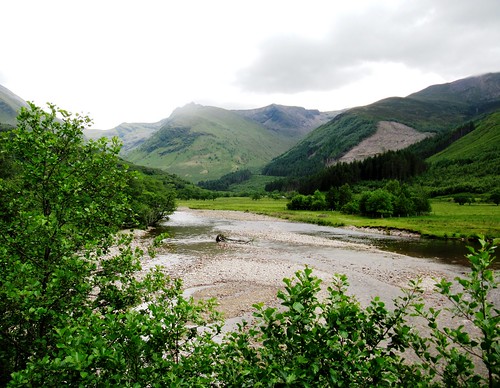
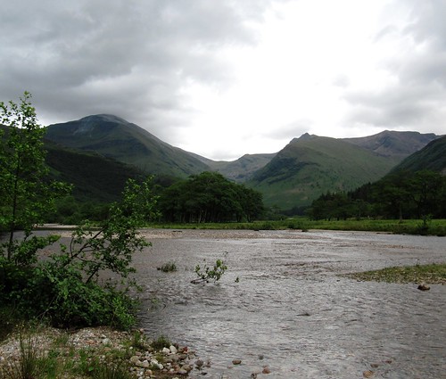
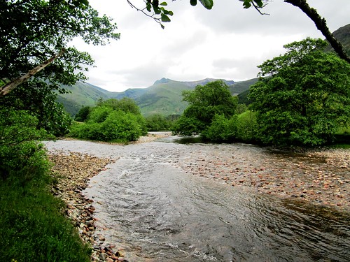
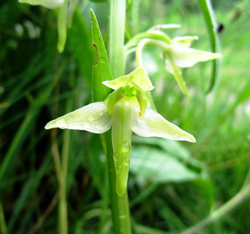
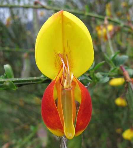
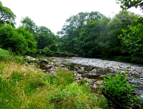
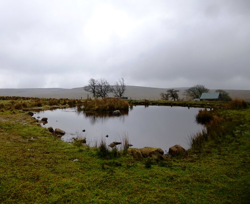
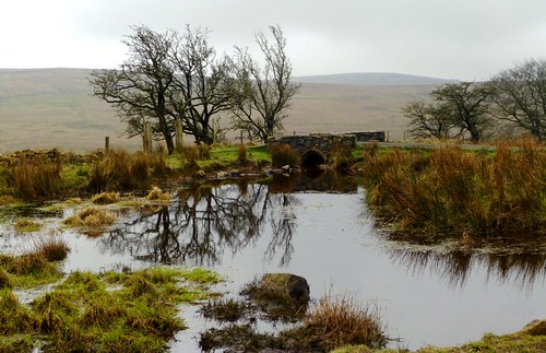
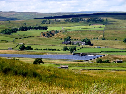
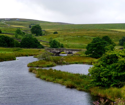
From the cairn at the end of the ridge we dropped steeply off the promontory, making across a grassy upland to descend beside the Afon Caerfanell. Following it down the valley and back to the car in clear hot sunlight we found orchids in the bogs, brilliant blue butterwort under the rocks, and a whole rake of families splashing and swimming and making the most of the cold waterfalls of the hastening, beautiful Caerfanell.

Start: Upper Blaen-y-glyn car park, near Pontstycill, Powys CF48 2UT approx. (OS ref SO 056176)

Getting there: From Merthyr Tydfil (A465, A470), follow ‘Pontstycill’ and ‘Talybont-on-Usk’. After 7 miles, just beyond road summit, left (signed) into car park.

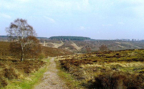
Walk (5½ miles, moderate/hard, OS Explorer OL12. NB: online map, more walks at christophersomerville.co.uk): Return across cattle grid, immediately right on stepped path, steeply up to ridge (054183). Where path flattens, bear right; follow rim of valley clockwise for 1½ miles to saddle at head of valley where Blaen y Glyn cleft descends (057206). Right on path to aeroplane crash memorial (062200). Steep path ascends on left of stream gully; right along top of Cwar y Gigfran crags to cairn (067192) Bear half right, steeply down; on across upland plateau to wall; right down to Afon Caerfanell (062183). Left over stile; follow riverside path. In ½ mile, just before valley bends left (east), turn right by footpath fingerpost across footbridge (061174). On through kissing gate; in 50m, left at junction; in another 50m, just before concrete footbridge, right up steep path between 2 streams. At top, where trees open to left, turn left on wider track, which bends right to car park.

Conditions: Several steep climbs and descents; boggy path by Afon Caerfanell.

Lunch: Red Cow, Pontstycill (01685-384828). Several pubs/tearoom in Talybont-on-Usk. Nearest tearoom (March-Oct): Old Barn, Ystradgynwyn (01685-363358), 1½ miles south of car park on Merthyr Tydfil road.

Info: Brecon Beacons National Park (01874-623366; breconbeacons.org)

visitwales.com; ramblers.org.uk; theaa.com/walks;
www.satmap.com; www.LogMyTrip.co.uk

 Posted by at 01:40
Aug 162014
 

‘Have you by any chance seen any elderflowers out?’ briskly enquired the elderly gentleman we met on the road under Bembridge Down.
First published in: The Times Click here to view a map for this walk in a new window
picture picture picture picture picture picture picture picture
Facebook Link:
‘I just need another twenty-six, you see,’ he said, as though that explained everything. Twenty-six? For what? Elderflower wine, a witchcraft potion, a very precise table decoration? All seemed possible on this afternoon of wonders in the Isle of Wight, with superannuated London tube trains clacking through the fields on the island’s beautiful old railway network, seldom-seen Cetti’s warblers shouting from the bushes on Brading Marshes, and botanical rarities jewelling the slopes of Bembridge Down.

Those bee orchids! How many had I seen in my life – half a dozen at the most? And here they were by the hundred in small selective patches, their prominent sepals like lipstick-pink propeller blades, their lower lips stamped with the semblance of a bumblebee’s large round bottom. We walked the secret valley below the down, reciting the flowers we saw like a litany: eyebright and yellow-wort, field madder and lady’s bedstraw, bird’s-foot trefoil and salad burnet – tiny blooms as striking to the eye as their names fell sweetly on the ear.

Up on top of the down the flint-and-brick stronghold of Bembridge Fort crouched low and hunchbacked behind grassy ramparts that might have been those of an Iron Age hill fort. Like the blocky grey gun emplacements out at sea in the Solent, the fort was one of ‘Palmerston’s Follies’, constructed at gigantic expense in the 1860s to deter the French from an invasion they never seriously intended to mount.

We strolled the cliff path among white campion flowers at the brink of Culver Cliff, taking in the view west over the sprawl of Sandown and the varicoloured crumbling cliffs beyond. Then it was down to the flint-speckled beach of Whitecliff Bay to explore the rock pools under tottering cliffs so unstable they seemed half molten.

High above Bembridge we passed an old windmill standing foursquare, sails to the wind, under its weather-boarded cap. Then the homeward path towards nightfall across the lagoon-streaked flatlands of Brading Marshes, where buttercups in their millions gilded the meadows and a sweetly whistling blackcap sanctified the willows of Centurion’s Copse as beautifully as any vespers ever sung.

Start: Brading station, Isle of Wight, PO36 0EB (OS ref SZ 609869)

Getting there: Red Funnel Ferry (0844-844-9988; redfunnel.co.uk), Southampton-Cowes. Rail or Buses (Routes 2, 3) to Brading station
Road: Station is signed off A3055 Ryde-Sandown road in Brading. Car park £1.50 all day.

Walk (7½ miles, easy, OS Explorer OL29): Back up road; in 50m, right (fingerpost/FP, ‘B1’). Through guardrails; in 50m, right (FP ‘B36’) to cross railway (610870). Ahead across Brading Marsh RSPB Reserve. In 300m, left (613868) along River Yar. Right across footbridge (616870). In 200m, right at T-junction of paths (615869), through kissing gate/KG and bear left along hedge. In 400m, at end of field, through KG; ahead to cross B3395 (616862; take great care! – bend!). Follow path (FPJ ‘BB44-Bembridge Down’) along valley, with fence on your right. In 700m, fence turns right (622859); keep ahead, and in 150m, bear left through bushes and up to Bembridge Fort.

Cross road (624860); walk circuit of fort ramparts; return down slope and bear left to cliff fence. Left along coast path to reach Yarborough Monument (633857 – Culver Haven Inn is adjacent). Follow Coast Path, keeping left of NT ‘Culver Down’ gate and notice, downhill and along Whitecliff Bay cliffs past chalet park. In 500m, turn right down steep access road (640863) to explore beach and rock pools and visit Tuppenny Café.

Back on Coast Path, continue for 300m; turn left inland (642865, FP) past Bembridge School info board. Follow yellow arrows/YAs and FP to Hillway Road (641868). Left; in 100m, right (FP ‘BB22’, ‘Bembridge Windmill’). In 300m, cross B3395 (639871, FP); keep ahead. In 150m, right at T-junction of paths, uphill to pass Bembridge Windmill (640875). In 30m, left through gate (FP ‘BB21, Brading’). Follow path west (stiles, YAs) for 1½ miles. In Centurion’s Copse, at 620869, follow main, well-trodden track as it turns right between old wooden gateposts and in 100m, turn right at ‘Woodland Secrets’ signboard (FP ‘BB23, Brading’ on your left). Cross River Yar footbridge (616870); retrace steps to Brading station.

Lunch: Culver Haven Inn, Culver Down (01983-406107); Tuppenny Café, Whitecliff Bay

Accommodation: Crab & Lobster Inn, 32 Forelands Field Road, Bembridge PO35 5TR (01983-872244, crabandlobsterinn.co.uk) – popular, lively, bustling place.

150 Years of IoW Railways: Celebrations 30 August 2014. Tickets (vintage transport, 1950s Day, etc.) from hovertravel.co.uk, iwsteamrailway.co.uk, local outlets

Info: visitisleofwight.co.uk www.satmap.com www.LogMyTrip.co.uk visitengland.com

 Posted by at 01:13
Aug 092014
 

A warm, muggy Hampshire afternoon, and harvest time in the downland fields around Tichborne.
First published in: The Times Click here to view a map for this walk in a new window
picture picture picture picture picture picture picture picture
Facebook Link:
Red and yellow monsters roared in the chalky fields, gobbling corn and peas off the stalks, vomiting the precious grains and globules into trailers and breathing out a musk of dust-clouds that drifted across the hedges. Bales of straw were excreted, ready-wrapped and stacked; the trailers rumbled through rutted gateways onto the lanes and jolted away to the silos, while the monsters swung round and attacked another strip of land.

In the lane we followed out of Tichborne and down to the Itchen valley, docks and nettle flowers hung sun-dried to a crisp. Bees busied themselves among sky-blue scabious flowers and sprigs of sharp-scented marjoram. The sun hid behind leaden milky clouds that leached the contrast out of the landscape colours, reducing all to pale ochres and olives. We turned south through Tichborne Park, a field away from the subdividing and reconnecting channels of the infant River Itchen, and came to the gates of Tichborne House, seat of the estate that once engendered a classic cause célèbre.

In the north chapel of Tichborne’s church lie generations of the Tichborne family. Some died full of years and honours; others fell victim as children to disease or accident. But the most famous Tichborne of all is absent – Roger Tichborne, 11th heir to the baronetcy, who drowned at sea in 1854. All Victorian England was scandalised and thrilled at the long-drawn-out trial of Arthur Orton, an Australian scallywag who laid claim to the Tichborne baronetcy by pretending to be the long-lost Roger. Orton ended up in jail and died a bitter man; his notoriety as the ‘Tichborne Claimant’ long outlived him.

I thought of the drowned heir and the Aussie chancer as we crossed the watercress banks and gravelly bed of the clear-running Itchen. Field edges and downland tracks led up towards Gander Down, along shady woodland paths, then out between wide cornfields where the harvesting monsters prowled. A snaky lane brought us back down to Tichborne with honeysuckle and bryony twined in the hedges, the woods in midsummer black along the ridges, the steamy sky heavy overhead and full of gathering flights of swallows. There was a feeling of stillness, a sense of all nature taking a deep breath before the great autumn movements of birds and the scurry of mammals and insects to fatten on hedgerow fruits before the onset of hungry old winter.

Start: Tichborne Arms, Tichborne, near Alresford, Hants SO24 0NA (OS ref SU 571304)

Getting there: Rail (thetrainline.com; railcard.co.uk) to New Alresford
Bus 67 (Winchester-Petersfield) to New Alresford.
Road – Tichborne is signed off A31 at New Alresford

Walk (6 miles, easy, OS Explorer 132): From Tichborne Arms, left up street. At left bend, right along track. In 500m, right at T-junction (567309) into valley. Cross road (572310); up track (‘Bridleway’); in 150m, right (573312; permissive bridleway, unmarked) along field edges, following ‘Itchen Way’. At gates of Tichborne House, cross stile (575305) and on along 3 field edges (yellow arrows/YA) to hedge gap onto road (580298). Right for 100m; right (‘Tichborne Arms’) across River Itchen. In 100m on right bend, left (579296, fingerpost) past Cheriton Mill (‘Wayfarers Walk’); on through fields for ⅔ mile to lane (581286). Right to Hill Houses (577284); fork right (‘Hill House’) along Restricted Byway. In ½ mile at barn, keep ahead (570284, ‘Bridleway’); in 150m, on next left bend, bear right through hedge (blue arrow) along path in woodland.

In 300m, leave woodland (565284); aim half right across open field for corner of hedge beyond dip (560283). Right here with hedge on left, through gate (561285); on along lane. In ½ mile pass big barn on left (564293); in 30m, left through hedge (stile, YA). Across field, through hedge; right along field edge (564296, ‘Restricted Byway’) for ½ mile to meet tarmac path (569302). Left past Old School House and stile into churchyard; follow hedged path to gravel track (570303); right to road, left to Tichborne Arms.

Lunch: Tichborne Arms, Tichborne (01962-733760; tichbornearms.co.uk)

Information: Winchester TIC (01962-840500; visit-hampshire.co.uk)
www.satmap.com www.LogMyTrip.co.uk visitengland.com

 Posted by at 01:17
Aug 022014
 

‘May 8 1916. Peeling Taters,’ wrote Bandsman Erskine Williams of 11th Division, British Expeditionary Force, on his postcard home from Brocton Camp.
First published in: The Times Click here to view a map for this walk in a new window
picture picture picture picture picture picture picture picture
Facebook Link:
‘This takes place before breakfast. I generally do some. Observe cascade of peelings -‘ and there he is in a funny little self-penned sketch, producing dutiful curls of potato rind. ‘Am well in health bodily,’ he goes on, ‘if not mentally … weather still very cold & wet.’

Bandsman Williams was one of half a million fledgling soldiers of the First World War who endured the hardships, boredoms and barracks humour of Brocton Camp as they trained for active service on the Western Front. Up to 40,000 at a time, mostly Britons or new Zealanders, were crudely housed and stodgily fed in the vast camp on Cannock Chase, a few miles north of Birmingham, as they learned the arts of marching, musketry, signalling and scouting, gas warfare and the use of the bayonet. Erskine Williams and his delightful little cartoons survived the war, but tens of thousands of those who passed through Brocton did not.

From the well-signposted grave of Freda, canine mascot of the New Zealand Rifles, we walked south along sandy paths over the broad heath of the Chase, a patchwork of heather, moor grass, bilberry, cowberry and crowberry with dark green leathery leaves. Sunk in the ground as hummocks and ridges were the remnants of Brocton Camp’s enormous infrastructure – trenches and rifle ranges, huts and stores and the little railway that everyone knew as ‘Tackeroo’.

Young roe bucks with prick-sharp antlers went bounding away with a flash of their white rumps as we approached the Katyn Memorial. The monument commemorates the 25,000 Polish soldiers, policemen and ‘intelligentsia’ murdered by the Russian secret police in 1940 on Stalin’s orders, many of them unearthed three years later in mass graves in Katyn Forest. Further south we found two peaceful, silent war cemeteries, one for Allied servicemen, the other for Germans who died in Britain during the two World Wars, neatly laid rank upon rank and side by side.

These were powerful places to stand and surmise, with sunlight slanting across the graves and blackbirds fluttering in the cemetery hedges. Walking back north up the hidden cleft of Sherbrook Valley, with the stream chuckling quietly under its bridges and slopes of birch and pine closing off the valley from the outside world, the mud, blood and slaughter that waited for the young trainees of Brocton Camps seemed utterly inconceivable.
Start: Coppice Hill car park, near Brocton, Staffs, ST17 0SS approx. (OS ref SJ 979191)

Getting there: From A34 (Stafford-Cannock), minor road to Brocton; right at village green, left uphill past Quarry car park entrance; in another 400m, left along lane (‘Coppice Hill’) to car park at end.

Walk (6 miles, easy, OS Explorer 244): Back along lane; in 50m pass ‘Heart of England Way’/HEW fingerpost on left; in 30m, left past parking space and on (‘Freda’s Grave’/FG) along grass path. At T-junction, right (FG); in 150m, pass FG on right (979189). At road, left. In 600m, at ‘Glacial Boulder’ parking space on right (980182), left past boulder and trig pillar; right along broad stony HEW. In 200m fork right; in 250m, right at path crossing (982177, ‘Two Saints Way’/2SW). Just before road, left (980176, 2SW, HEW) on pebbly path, straight ahead for ⅔ mile to road at Springslade Lodge tearoom (979165).

Left along tarmac lane (‘Katyn Memorial’) to memorial (980165). Return towards road; just before, left past posts along rising track for ⅔ mile, passing through car park (983159) and on along clear track to tarmac lane (985156). Right to Commonwealth War Cemetery (983155); return and pass German War Cemetery (986157). Follow roadway, then stony track (yellow arrows/YAs) ignoring side tracks through gates, for ½ mile to reach HEW (990166). Dogleg left/right across it and on (white arrows/WA) north up Sherbrook Valley. In ¾ mile, cross track to Pepper Slade (988178) and keep on (WA, ‘Long Route’). In ⅔ mile pass bridge with 2 pipes on right (985186). Pass WA, then YA on left; in another 50m, opposite WA, bear left – not sharp left, but following rising track (unwaymarked) leading back to car park.

NB Directions: download excellent directions for extended version of this walk at walkingbritain.co.uk

Lunch: Picnic, or Springslade Lodge tearoom (01785-715091)

Accommodation: Moat House Hotel, Acton Trussell, (01785-712217; moathouse.co.uk)

Brocton Camp Website: staffspasttrack.org.uk/exhibit/chasecamps

‘Bullets and Bandsmen’ : biography of Erskine Williams by his daughter Daphne Jones, illustrated with EW’s sketches (Owl Press)

National Trust WW1 commemorative Silent Walks: nationaltrust.org.uk/article-1355842842744/

Info: Cannock Chase Visitor Centre, Marquis Drive, WS12 4PW (01543-876741); visitcannockchaseco.uk; www.satmap.com www.LogMyTrip.co.uk visitengland.com

 Posted by at 01:51
Jul 262014
 

Well lathered in Avon Skin-So-Soft (kind to your skin, but also a proven defence against the bluidy midgies), Jane and I set out from Glen Nevis Visitor Centre on one of those West of Scotland mornings when the high tops have shawled themselves up in misty cloud after days of stair-rod rain, and only a fool, or a walker with X-ray Spex, is headed for the summits.
First published in: The Times Click here to view a map for this walk in a new window
picture picture picture picture picture picture picture picture picture picture picture picture picture picture picture picture
Facebook Link:
Ben Nevis would have been a temptation in any other conditions, but what’s the point of getting all the way up there if you can’t see your hand in front of your face, let alone the view from the highest point in the British Isles?

Luckily for us there was a tasty alternative at hand, a low-level circuit of the glen where the River Nevis pours seaward at the feet of the mighty Ben Nevis range from the mountainous heart of Lochaber. The river ran dimpling over pebbly shallows and round bushy islets in a tunnel of alder, sycamore and ash. Sandpipers darted upriver with silvery calls and a flash of white rump.

On our left hand the flank of Ben Nevis rose into smoking grey cloud, great purple buttresses cut with gullies where white strings of rain-swollen torrents came tumbling – Red Burn, Five Finger Gully, Surgeon’s Gully. The forward view showed the river winding from its gorge under twin rugged peaks streaked with pale quartzite – Sgùrr a’ Mhàim and Stob Bàn. This must be one of Scotland’s greatest low-level prospects.

We passed an ancient graveyard, a square of immaculate sward inside mossy walls, guarded by wonderful old beech trees, silent and peaceful. The squelchy path dipped past Highland cattle with ferocious horns and mild manners.

We crossed the roaring Lower Falls of the River Nevis and hit the homeward stretch – a forest track running north, its verges thick with heath bedstraw, crimson and emerald sphagnum, and lime-green rosettes of insectivorous butterwort, the royal blue flowers nodding above on hair-like stalks. Good smells of wet rock, water, earth and pine resin followed us back up the glen, as sunlight broke through across the northern hills and Ben Nevis shrugged its high shoulders free of the clinging cloud shawl at last.

Start & finish: Glen Nevis Visitor Centre, Glen Nevis, near Fort William, PH33 6ST (OS ref NN 123730) – NB car park £3 in pound coins

Getting there: Rail (thetrainline.com) to Fort William (1½ miles). Bus 41 from Fort William (summer). Road: A82 to Fort William; follow ‘Glen Nevis’ signs.

Walk (8 miles, easy, OS Explorer 392): NB: online map, more walks: christophersomerville.co.uk): From Visitor Centre follow river downstream to cross suspension bridge (123731). Right upstream along left bank of river. In 1 mile pass bridge to youth hostel (128718); keep on by river for 2½ miles to pass cottages at Polldubh (142687). In 350m pass sheep pens; bear right to road. Right to cross Lower Falls (145684); along road for 300m; left by bus stop opposite cottages (143684) on broad forest track. Follow it for 2¾ miles to pass West Highlands Way/WHW spur descending on right (122717). In 350m join main WHW route (121721; thistle symbols). Follow it to road; left, then right to Glen Nevis Visitor Centre.

Conditions: Riverside path is rocky, stumbly and muddy in places. Many streams to ford.

Lunch: Snacks in Visitor Centre; Ben Nevis Inn (01397-701227, ben-nevis-inn.co.uk – above Achintee House, across river)

Accommodation: Glentower Lower Observatory, Achintore Road, Fort William PH33 6RQ (01379-704007, glentower.com)

Information: Glen Nevis Visitor Centre (01397-705922, ben-nevis.com/visitor-center); visitscotland.com
www.satmap.com www.LogMyTrip.co.uk visitengland.com

 Posted by at 02:55
Jul 122014
 

The tiny narrow-gauge Ravenglass & Eskdale steam railway, known to all as ‘Ratty’, winds its way up from Ravenglass on the Cumbrian coast deep into Eskdale in the western flanks of the Lake District.
First published in: The Times Click here to view a map for this walk in a new window
picture picture picture picture picture picture picture picture
Facebook Link:
On a damp, steamy morning we set out from the Boot Inn to piece together three of the walks in Alfred Wainwright’s little booklet, ‘Walks from Ratty’, and make a good day in the hills.

St Catherine’s Church lay low and dusky pink beside the River Esk. In the churchyard we paid our respects to Tommy Dobson, Master of Eskdale and Ennerdale Foxhounds for 53 years until his death in 1910. His carved stone likeness, radiating humour and pugnacity, looked out from the graveslab, flanked by the heads of a fox and a hound.

We followed the glassy Esk through miniature gorges and past rocky rapids where grey wagtails bobbed rhythmically on the water-sculpted boulders, up to the graceful old packhorse span of Doctor Bridge. Above the nearby Woolpack Inn a gate led onto the brackeny hillside. High above, we found Eel Tarn spread under mats of water lilies and ruffles of wind – one of the quietest and loveliest spots in Lakeland.

The path led on over a wide upland of marshy ground and bracken. A pale smoky light lay on Eskdale. Ahead, Eskdale Fell hid its face in cloud. We squelched over wet ground full of golden stars of bog asphodel, and cross loud little Whillan Beck to come to Burnmoor Tarn, a steely oval in a hollow under great fells. We stripped off and went in, sliding over the pebbles into water full of peat-flecks, warm and silky on the skin.

We swam in lonely delight, before dressing on the tarn bank and making our way back down the old corpse road to Boot. Eskdale’s hay meadows gleamed pale green, and the shouts and whistles of the farmer at Gill Bank, busy training a young dog to muster the sheep, came faintly up to us from the fields around the farm.

Start: Dalegarth station, Ravenglass & Eskdale Railway, CA18 1TF (OS ref NY 174007)

Getting there: Rail – mainline service to Ravenglass (thetrainline.com); Ravenglass & Eskdale Railway (01229-717171; ravenglass-railway.co.uk) to Dalegarth station.

Road – Boot is signposted from Eskdale Green (minor roads from A595 at Duddon Bridge or Holmrook).

Walk (7 miles, moderate, OS Explorer OL6. NB: Online map, more walks at christophersomerville.co.uk): From Dalegarth station, left along road. At Brook House Inn (126008), right (‘St Catherine’s’) on stony lane to Eskdale Church (176003). Left along River Esk to Doctor Bridge (189007) and road (189009). Right for 200m; left before Woolpack Inn (yellow arrow, ‘Burnmoor, Wasdale Head’). Up track behind house, through gate (190011); up path through bracken with wall close on left. At gate/ladder stile (189014; ‘Boot, Woolpack’) don’t cross; continue uphill, leaving wall on left. By ruined house (188015) bear right and head north. Above house cross bog; bear right and go anti-clockwise round knoll, and on north. Skirt round left side of Eel Tarn (188019); right along north shore; at far side bear left/north (189021) towards Eskdale Fell, passing 2 lone trees. Cross Brockshaw Beck (190027); keep left of rock outcrops; descend to cross Lambford Bridge (188038). Bear right to Burnmoor Tarn (186043). Follow path back past (but not across) Lambford Bridge, down to Boot and Dalegarth Station.

Lunch/Accommodation: Boot Inn, Eskdale, CA19 1TG (01946-723711; bootinneskdale.co.uk); also Brook House Inn (01946-723288; brookhouseinn.co.uk), Woolpack Inn (01946-723230; woolpack.co.uk)

‘Walks from Ratty’ by A Wainwright – available from ‘Ratty”, £3

Info: Ravenglass TIC (01229-717278)
www.satmap.com www.LogMyTrip.co.uk visitengland.com

 Posted by at 01:39
Jul 052014
 

The slit opening in the cliff face above La Val de Rock lay half hidden behind a curtain of creepers.
Click here to view a map for this walk in a new window   Click here to view a Google gpx route
picture picture picture picture picture picture picture picture
Facebook Link:
Inside, a chilly tunnel led into blackness – just one of hundreds of half-forgotten bunkers and towers that bear witness to the occupation of Guernsey by the German military during the Second World War. Hitler intended the Channel Islands to be an impregnable bastion against Allied invasion, and the concrete fortifications of his Atlantic Wall still stand stark and massive round the island’s coastline.

We followed the undulating path along the south-western cliffs where a line of German observation towers stood looking out over a jade-green sea. Bedded on dark gold Guernsey granite among pink drifts of thrift, their flat-topped and futuristic profiles stared out blankly, Easter Island heads re-imagined by a Bauhaus architect.

A path through neatly drilled potato fields and a tangle of narrow flowery lanes brought us down to the broad stretch of Rocquaine Bay, where dark bars of rock and pebbles intersected the pale sands. Halfway up the beach we ducked into the Shipwreck Museum in the Martello tower of Fort Grey – tableaux, memorabilia, wreck salvage and stories heroic, tragic and hilarious from dozens of Guernsey shipwrecks down the centuries.

Out on L’Erée Headland, guide Gill Gerard was waiting for the tide to ebb far enough to usher a score of clients across the causeway onto Lihou Island. This tiny green strip of islet is the westernmost point of the Channel Islands, a beautiful but rugged world apart. Fishermen in rubber boots, ormering hooks at the ready, were searching the receding tide-line for the large, elusive shellfish called ormers that are a proper Guernsey delicacy.

We splashed and skidded across the weed-strewn causeway and made a circuit of Lihou under Gill’s expert guidance – the ancient ruin of St Mary’s Priory, sea beet and samphire, murders and wrecks, herring gulls on their nests and tales of seaweed-munching sheep. And at the westerly tip of the Lihou, a view to sum up the reality of island life – harsh shores, bare grazing, a lonely lighthouse warning off shipping, and a hungry sea eating inexorably into the granite rocks.

Start: Imperial Hotel, Rocquaine Bay, Torteval GY8 0PS (Perry’s Guernsey map guide – widely available locally – p.32, D2)

Getting there: Aurigny (aurigny.com), Flybe (flybe.com) or Blue Islands (blueislands.com) to Guernsey. Bus service 11, 91, 92, 93 (buses.gg) to Portelet Bay.
Road – follow ‘Pleinmont’ signs from Rue des Landes, adjacent to Guernsey airport. Park near Imperial Hotel.

Walk (8½ miles, moderate; Perry’s Guernsey map guide pp.32, 26, 20, 12. NB: Online map, more walks at christophersomerville.co.uk): Pass public WC; follow road to Fort Pezeries (B1). Follow coast path, climbing between outcrops. At top, right to German tower (B2). Cross grass to coast path; follow it to pass another German tower (C4). Halfway between this tower and Watch House seen ahead, turn left off coast path (D5) along wide gravel field track to reach Rue de la Trigale (D4). Right to Route du Crolier; left; in 200m, fork right past Rocque à l’Or house (C3). Pass La Seigneurie; fork right downhill (D3) to Imperial Hotel. North along beach past Fort Grey shipwreck museum (P26, A1) to turn left off Les Sablons (‘Lihou Island’; P20, B1) along La Rue du Brave to parking place opposite Lihou Island (P12, A5). Explore L’Erée Headland, then cross causeway (see below) to explore Lihou Island. Return to bus stop on Les Sablons (P20, B1); Bus 11, 91, 92, 93 to Imperial Hotel car park.

Conditions: Lihou causeway is only open at LOW TIDE for variable lengths of time. Please check first! – tel 01481-717200; gov.gg; local radio, press; notices at causeway.

Lunch: Guernsey Pearl Café opposite Fort Grey (01481-266404)

Accommodation: Bella Luce Hotel, La Fosse, St Martin’s GY4 6EB (01481-238764, bellalucehotel.com) – really comfortable, friendly and stylish.

Guide: Gill Girard (07781-104094; gillgirardtourguide.com)

Fort Grey Shipwreck Museum (01481-265036): Mon-Fri, April-Oct, 10-4.30
Pleinmont Observation Tower (01481-238205): Wed and Sun, April-Oct, 2-5

Info: visitguernsey.com; 01481-72352
www.satmap.com www.LogMyTrip.co.uk

Walk: Follow roadway past public WC, west to Fort Pezeries, then cliff path (marked) for 1½ miles past two German observation towers. Midway between second tower and Watch House ahead, left on gravel field track to Rue de la Trigale. Follow lanes down to Imperial Hotel. North up beach for 1½ miles to L’Erée Headland. Cross causeway to Lihou Island; back to main road; bus to Imperial Hotel car park.

 Posted by at 01:15
Jun 282014
 

You can’t walk long in Lincolnshire without becoming aware of how the county’s hundreds of village churches punctuate the flat horizons with their slender spires or square-topped towers.
First published in: The Times Click here to view a map for this walk in a new window
picture picture picture picture picture picture picture picture
Facebook Link:
The great swirling skies seem propped above the level land of Lincolnshire on these celestial staddle-stones.

We set out from Ruskington station to follow the Spires and Steeples trail northwards through a long line of villages. Big blue skies teemed with cloud over the fields of barley and rape. The hedges bowed to the earth under their weight of hawthorn blossom. In a pen on the outskirts of Dorrington some proper old-fashioned chickens strutted in black plumage with iridescent tails and splendid scarlet combs and wattles. A sculpture of writhing demons on the village green recalled the tale of how the Devil and his minions prevented the church from being built on an ancient pagan site.

By the time we got to Digby’s lovely Church of St Thomas, the sky was boiling with giant white cumulonimbus clouds and dramatic grey thunderheads. We admired the church’s gargoyles and grotesques inside and out; then we followed a winding county lane to Rowston with its remarkably slim tower and spire, and on across big open fields of beet and grass, peas and beans showing white and velvet black flowers.

In Scopwick the brook streamed with duckweed as it flowed under a succession of miniature bridges. Four tiny ducklings huddled under the river wall, queeping for their mother; but it was father who came to the rescue, resplendent with silky green head and chestnut flashes. The village is an ancient foundation; when the inhabitants ceremonially beat the bounds in bygone times, they would dig holes and upend the village boys in them to knock the parish limits into their young heads.

The Church of the Holy Cross stood locked and silent. Beyond it we found the small, beautifully kept war cemetery where young fliers from Digby aerodrome who met an early death are buried – Canadians and New Zealanders, mostly. Beside them lie five young Germans, four of them the crew of a single plane that fell in January 1943.

A rainstorm came sweeping across the fields to drive us on past immaculate little Blankney and into our homeward train at Metheringham, dripping wet and talking of all we’d seen.

Start: Ruskington station, near Sleaford, Lincs NG34 9ED (OS ref TF 083502)

Getting there: Rail to Ruskington
Road – Ruskington is on B1188, signposted off A153 Sleaford-Horncastle road

Walk (10 miles, easy, OS Explorer 272. NB: online maps, more walks at christophersomerville.co.uk): From Ruskington station, down station approach; ahead along road; round left bend, first right into Chestnut Street (‘Free Church’; ‘Spires & Steeples’ sign/SS’) At end, left along High Street. At end, bear right to cross road, leaving church on your left; ahead down laneway to left of old chapel (083511, SS). Right at end by barrier; in 50m, left up path to cross road (084512). On along pathway (SS), up side of playing field and on through fields. In 2nd field, fork left; in 3rd field, yellow arrow/YA points right (083524), but keep ahead here (SS on next telegraph pole). At road in Dorrington (082529) right past ‘demons’ sculpture; left across playing field to top left corner; right (SS) and on across fields (SS) to road in Digby (082548 – church to left).

Cross road by village cross; up road opposite with Red Lion PH on left. Follow this road north to Rowston. Round east end of church; immediately right (084564, SS) over stile and through farmyard. Keep left of barn; ahead for 500m over fields (SS) and through woodland to track (084570). Left to cross road; forward (SS) on track. In 400m track turns left; continue ahead here on grass path by hedge; in 100m, right across footbridge (079571, SS); on along hedge. In 150 m at hedge corner, bear diagonally left across field to pylon (075575). On across 2 fields (YAs); clockwise round 3rd field to road in Scopwick (07158). Left to church (Royal Oak PH is beyond).

Right up path beside church (SS). At T-junction of paths (070582, War Graves Cemetery to left), dogleg right and left (SS); on along wide grassy path. Follow SS north for 1 ¼ miles past Blankney Hall walled gardens to road (068600). Right; in 250 m, right (‘Blankney’); in 650 m, right (073605, ‘Blankney Walks’) for nearly half a mile, passing Beck’s Wood. Left (079607, fingerpost) past brick pump house; ahead across field; ahead (09611, SS) between woods to B1189 (078614). Right across level crossing; left to Metheringham station platform for return train to Ruskington.

Walk: Ahead along station approach, then road. Round left bend; first right (‘Spires & Steeples’/SS). At end, left to church; right across road; ahead down laneway by old chapel (SS). Right by barriers; left to cross road (084512, SS), ahead on path across fields to Dorrington (082529). Right past demon sculpture; diagonally left across playing field; right (SS) across field to Digby (082548). Pass Red Lion on left; follow road to Rowston. Pass church; right (084564, SS) through farmyard; north for 500 m to track (084570). Left across road; follow SS northwest across fields to Scopwick (071580). At church, right up path (SS); north for 1 and a quarter miles to raod at Blankney (068600). Right; right again (‘Blankney’) next right (073605, ‘Blankney Walks’). In half a mile, left (fingerpost) up track, across field, between woods to B1189 (078614). Right across level crossing to Metheringham station; train to Ruskington.

Lunch: Red Lion, Digby ( ); Royal Oak, Scopwick ( )

Accommodation: Finch Hatton Arms, Ewerby, Sleaford, postcode (01529+460363; website)

Spires & Steeples Trail: download leaflet guide at website.

Information: Lincoln TIC
www.satmap.com www.LogMyTrip.co.uk visitengland.com

 Posted by at 01:50
Jun 212014
 

Heavy cloud hung over Belfast. After a couple of days sightseeing in the city we were itching to get up high and cram some hilltop air into our lungs.
First published in: The Times Click here to view a map for this walk in a new window
picture picture picture picture picture
Facebook Link:
To the west of Belfast the cloud had cut the city’s heights off at the knees, but when we set off from the National Trust’s visit centre on Divis Mountain, the murk was already drifting clear of the tops.

NT Warden Dermot McCann filled us in on the network of walks the Trust has established up here, where all Belfast comes when it wants a good blow-through. ‘From Divis on a good day you can see, well … Cumbria and the Scottish coast across the sea, Belfast Lough, the Mourne Mountains, Donegal – and of course the whole of Belfast city laid out below.’

Divis is a wild place, amazingly so when you consider how close to the city it is. Moorland and blanket bog, bright with flowers in season, stretch off in all directions. The shoulder of Black Mountain shut Belfast away as we made our way up the hillside towards the summit masts on Divis Mountain. Meadow pipits flitted, crying chee-chee-chippit! Skylarks sprang up from sedgy clumps to climb their aerial staircases, tiny shapes fluttering frantically in a grey sky filled with their sweet continuous song.

From the summit of Divis the view was still a green-grey blur, but down at the trig pillar on the crown of Black Mountain we sat and took in the clearing prospect – Belfast Lough narrowing to push inland past the docks towards the crowded maze of the city centre, Cave Hill a dark ominous bulk hanging over the northern sector; a faint hint of the Ards Peninsula hills out west; and twenty miles away in the south the hunched back of Slieve Croob with the dramatic cones of the Mourne Mountains looking over its shoulder, palest grey against a white horizon. Of all the features in the city below us, the great yellow shipbuilding cranes Samson and Goliath and the silver ships’-prow shape of the Titanic Belfast museum stood clearest, picked out together in one concentrated beam of intense sunlight.

We followed the Ridge Trail southwest with Belfast on our left shoulder; then the whole city vanished like a dream once more as we turned for home across the boggy mountain under celestial lark song that had never let up the whole walk through.

Start: National Trust visitor centre, Divis Lodge, near Hannahstown, BT17 0NG (OS ref J273744)

Getting there: M1 south from Belfast, Jct 2. A55 past Andersonstown; in 1½ miles, left on B38 (‘Upper Springfield Road’). Just past Hannahstown, right (‘Divis & Black Mountain’); in ½ a mile, right opposite Long Barn car park (free parking) to NT visitor centre car park (moderate charge – coins).

Walk (6 miles, moderate, OSNI Discoverer 15; walk maps downloadable at nationaltrust.org.uk or walkni.com. NB: online map, more walks at christophersomerville.co.uk): Right along road through gate; left (‘Summit & Heath Trails’) up track. In ½ a mile at fork, follow ‘Summit Trail’. Just before circular butt (276755) right up rock-studded trail to Divis summit trig pillar (281755). Follow access road down to road (285749). Left; before masts, right (‘Ridge Trail’) up boardwalk, then gravel path to Black Mountain summit trig pillar (294748). On south-west along Ridge Trail (gravel, boardwalk, flagstones) for 2½ miles back to road (275745); left to NT centre.

Lunch: Picnic, or snacks at NT centre café.

Information: NT Visitor Centre, Divis Lodge (028-9082-5434; nationaltrust.org.uk/divis-and-black-mountain);
discovernorthernireland.com; walksireland.com

 Posted by at 02:24
Jun 142014
 

There aren’t many proper old upland hay meadows left in England, but the one at Low Birk Hat farm in Baldersdale is an absolute beauty.
First published in: The Times Click here to view a map for this walk in a new window
picture picture picture picture picture picture picture picture picture picture picture picture picture picture picture picture
Facebook Link:
That’s thanks to Hannah Hauxwell, the lone woman who farmed these fields in an entirely traditional way until her retirement in 1988, and also to Durham Wildlife Trust who took them on, renamed them ‘Hannah’s Meadow’, and continued the good work.

We stopped in to the sparse little exhibition in Hannah’s Barn below High Birk Hat farmhouse, and then followed the Pennine Way beside the meadow – not yet cut, its sweet vernal grass and sedges full of old hay meadow flowers such as yellow rattle, knapweed, moon daisies and blue powder puffs of devil’s-bit scabious. Miss Hauxwell became a TV start in the 1970s when a series of programmes followed her unadorned, narrow life through the seasons. A reluctant star, she never could quite understand what all the fuss was about. But what a wonderful treasure her decades of hard work left us in this Durham dale.

From Low Birk Hat the squashy, puddled track of the Pennine Way led us up and out onto Cotherstone Moor. A half gale from the west shoved us around like a ruffian, then got behind us when we left the National Trail and struck out east across the moor. Curlews and golden plover piped plaintively, a great crowd of starlings went swooping all together, and a red grouse planed away on stubby scimitar wings. Swaledale ewes among the sedges stared incredulously in our direction, then averted their gaze like a pew full of spinsters at the sight of something unspeakably shocking – a vicar in cycling shorts, perhaps.

On a wild open upland, unfenced for miles under a gigantic sky, we found an alternative loop of the Pennine Way and followed it back north. Above the path the flat-topped granite outcrop of Goldsborough stood proud of the moor – a miniature table mountain, whose sheer southern crags are only seen by sheep and walkers.

We lingered under the rocks, admiring their weather-cut striations and the brilliant purple heather lining their ledges, and then dropped back down over many stone stiles into sunlit Baldersdale and the homeward path. Lapwings creaked in the sedgy fields, oystercatchers zipped down the wind, and every blade of grass squeaked and sparkled underfoot.

Start: Balderhead Reservoir car park, near Romaldkirk, Co Durham, DL12 9UX approx. (OS ref NY 929187)

Getting there: On outskirts of Romaldkirk, right off B6277 Cotherstone road (‘Reservoirs’). In 4½ miles pass ‘High Birk Hat, Hannah’s Meadow’ sign on gate on left (933190) in another 250m, left through gateway to Balderhead Reservoir car park.

Walk (8 miles, moderate, OS Explorer OL31): Walk back to ‘Hannah’s Meadow’ gate; go through, and down lane (‘Pennine Way’/PW). At gate (933190), right to Hannah’s Barn exhibition. Return to PW; follow it past Low Birk Hat (936184), across Blackton Bridge (932182). Fork left (no waymark) across beck. At triple PW fingerpost (934181), right up stony track to road beyond Clove Lodge Farm (935177). Ahead; in 200m, right (PW) across Cotherstone Moor. In 1 mile, at Race Yate, cross stile in fence (942161, PW). In 100m, left off PW through gate (blue arrow/BA); follow grassy track (sometimes faintly marked on ground) east for 1⅔ miles. At gate where wall and fence meet, left (969164, BA) along Bowes Loop of PW. In ½ mile, at cross-wall by ruin (965171), go through left of two gates. In 20m fork left, aiming for crags of Goldsborough. Cross Yawd Sike (stream) by railed footbridge (960174); carry on below left slope of Goldsborough. At crest beyond (952178), fork left aiming for West Friar House Farm.

At road (948179, PW), left for 100m; right down drive to East Friar House. Down left side of byre (acorn, yellow arrow/YA); left over stile (946182, YA); follow PW/YAs west through fields and stone stiles to Low Birk Hat and car park.

Lunch: Picnic

Accommodation: Rose & Crown, Romaldkirk, Barnard Castle, Co. Durham DL12 9EB (01833-650213; rose-and-crown.co.uk) – really comfortable, efficient and helpful

Information: Middleton-in-Teesdale TIC (01833-641001); thisisdurham.com
www.satmap.com www.LogMyTrip.co.uk visitengland.com

 Posted by at 01:31