Mar 292014
 

Mist was hanging tattered curtains from the unseen rims of Glenariff as we drove up the twisting road from Waterfoot. First published in: The Times Click here to view a map for this walk in a new window
picture picture picture picture picture picture picture picture
Facebook Link:
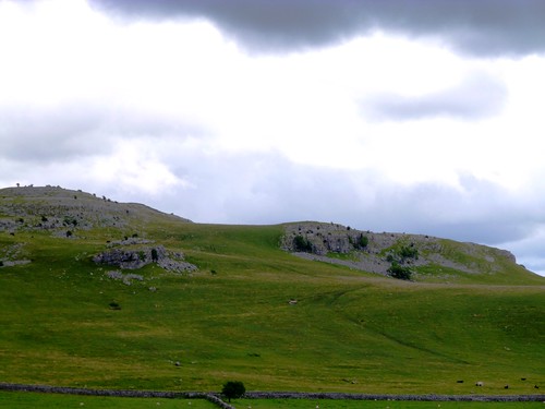
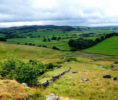
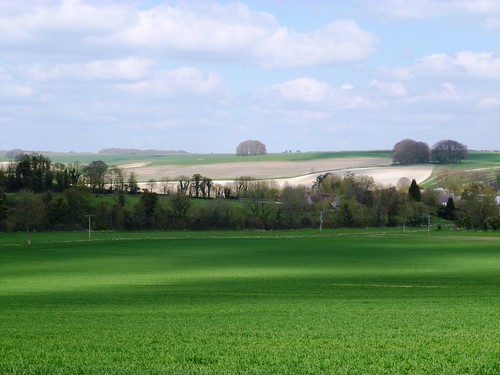
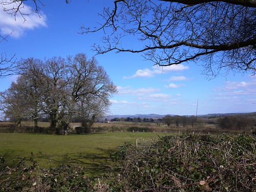
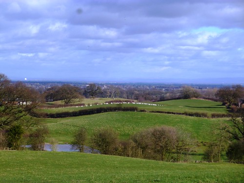
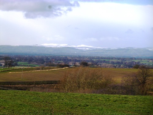
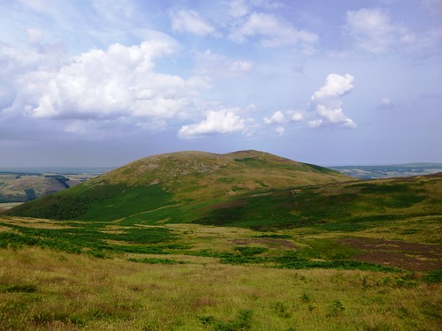
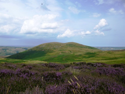
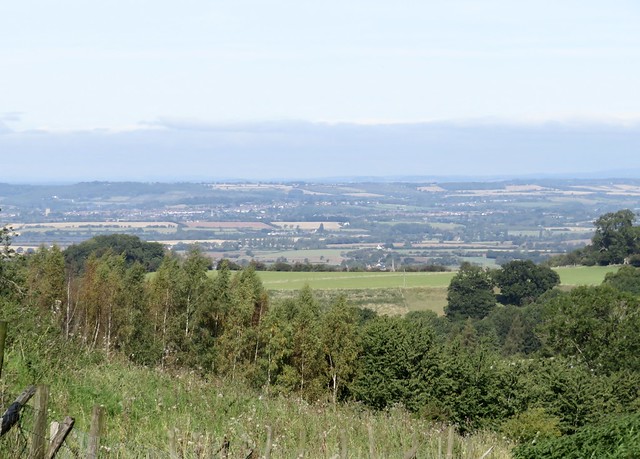
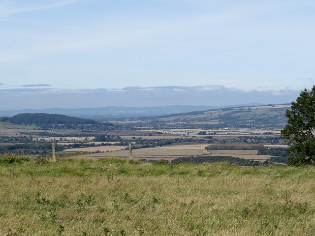
The glen’s waterfalls showed as white threads tangling into wind-blown ropes down tall chutes in the basalt cliffs. At the top of the glen the moorland village of Cargan lay in a hollow below mountain slopes that we sensed rather than saw.

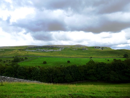
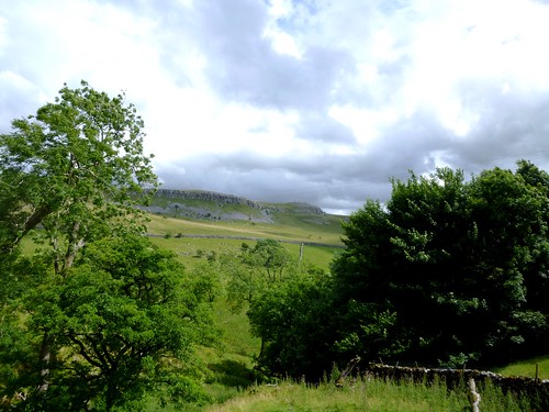
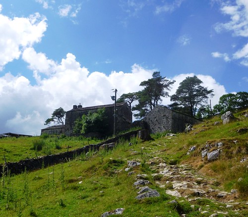
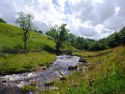
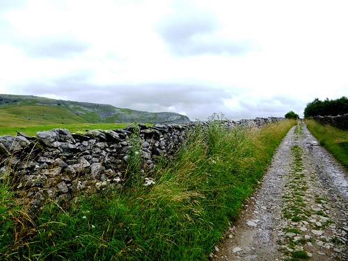
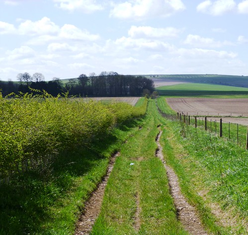
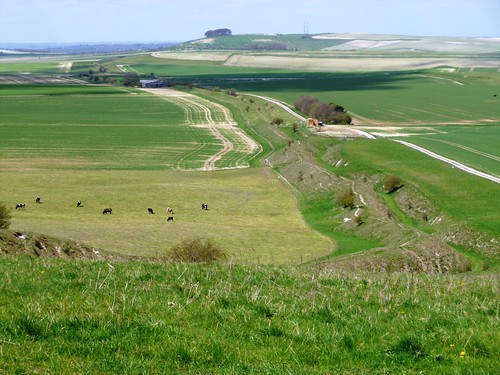
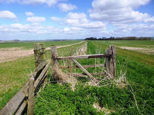
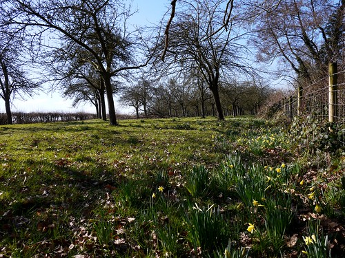
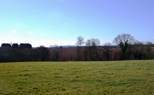
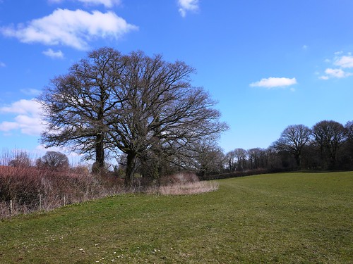
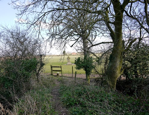
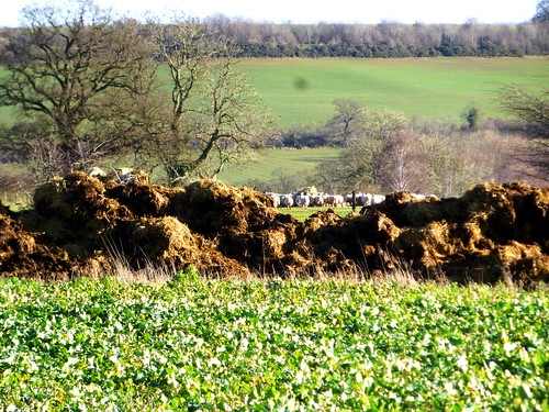
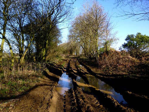
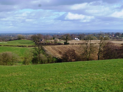
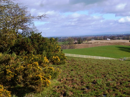
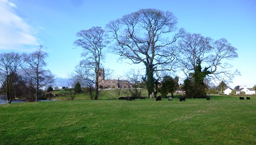
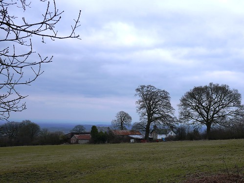
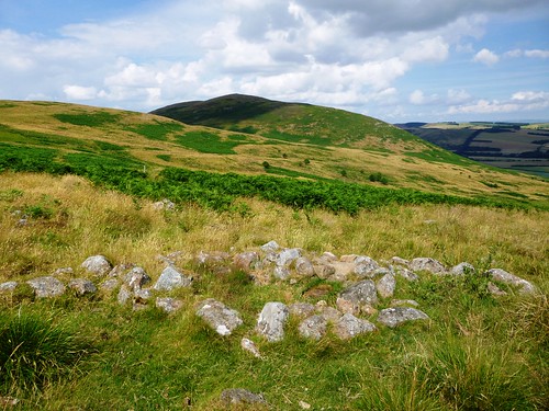
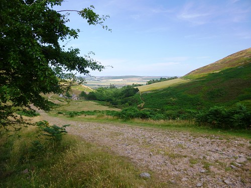
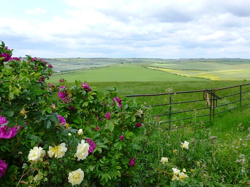
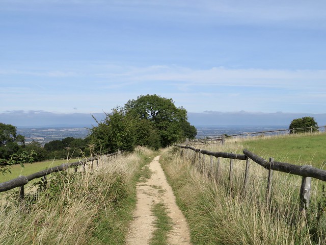
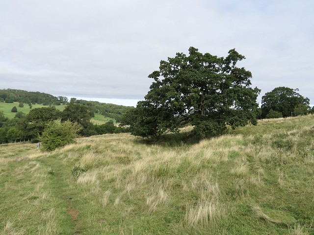
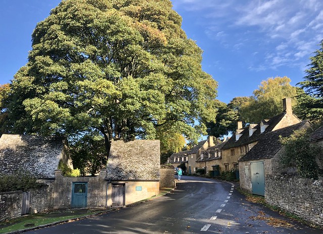
Along the road we walked from Cargan, cattle lay in the stone-walled fields, each cow preserving her own dry patch. We passed a rough-cut, square-topped standing stone half-hidden under an ornamental tree in a cottage garden, and turned along a lane that led past mountain farms towards Dungonnell Reservoir. Every farm gate held its black and white guardian collie, head cocked low and sideways, a picture of acute alertness and suspicion. Three magnificently horned sheep watched us across their field wall, stamping the grass and shaking mist-drops from their coats like dogs.

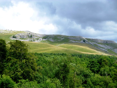
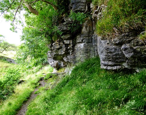
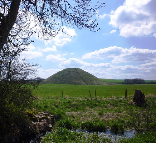
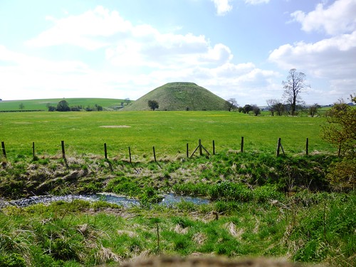
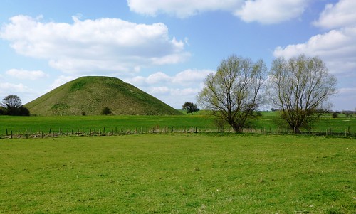
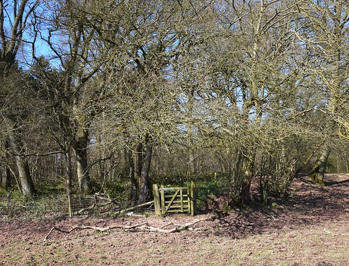
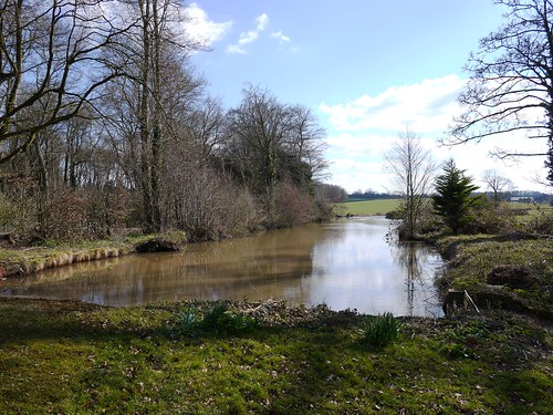
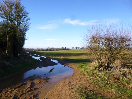
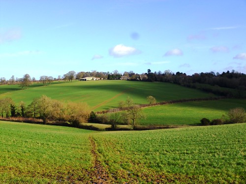
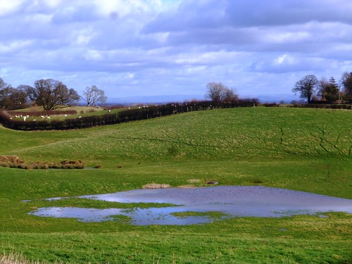
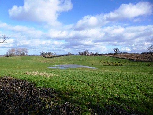
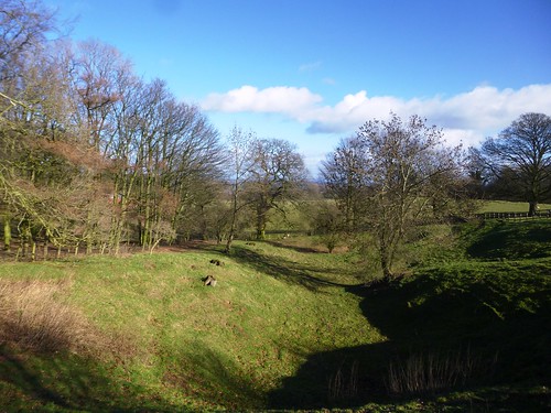
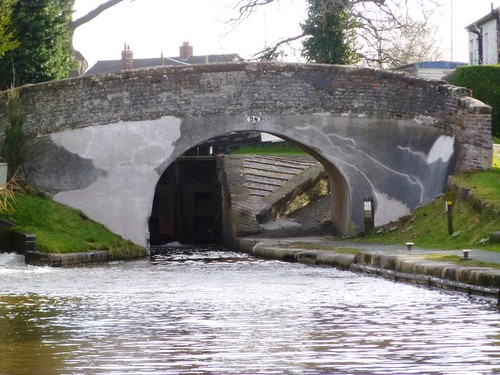
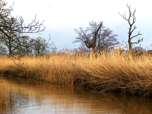
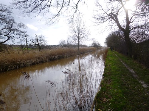
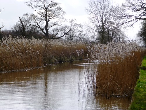
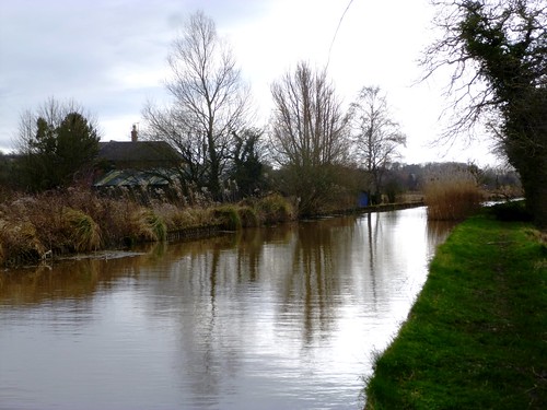
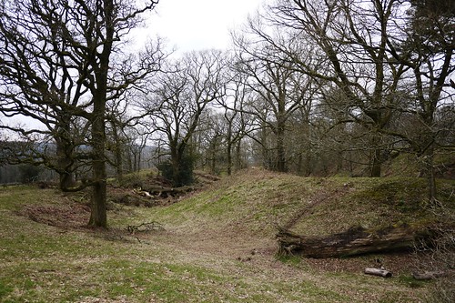
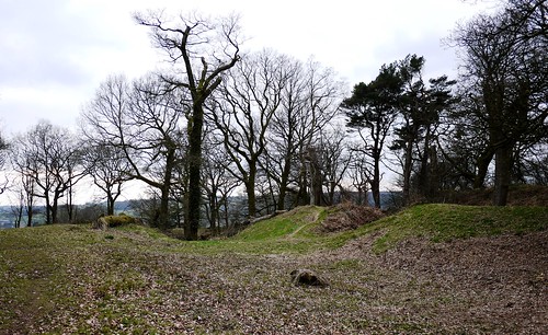
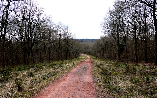
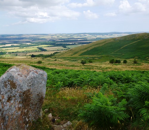
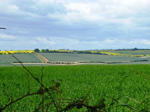
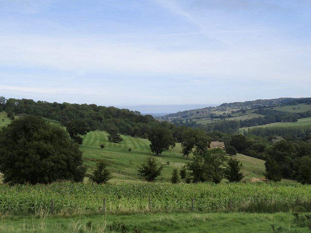
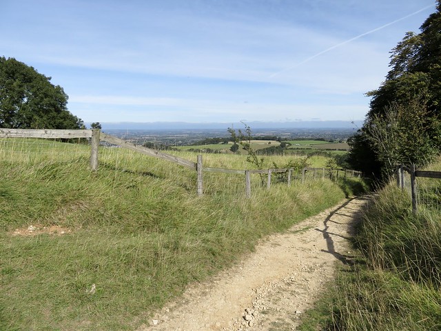
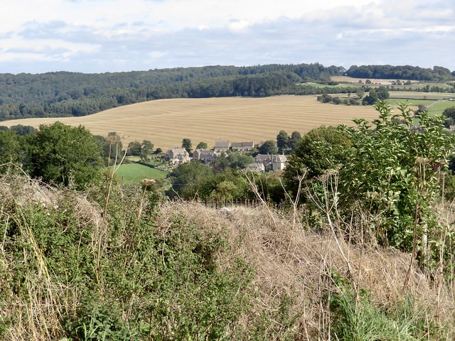
Dungonnell Reservoir, opened in 1971, lay curved in an elbow of low hills, its architecture suitably functional for the austere era it was built. Beyond the reservoir we left the road and crossed a strip of the Garron Plateau’s blanket bog, lushly sodden peat starred with pale pink marsh orchids. Down in Crockaharnan Forest all was still and dark among the long avenues of spruce, under which shone carpets of brilliant crimson and luminescent green sphagnum moss. Goldcrests squeaked in tiny voices among the treetops, and the mist trickled thin and milky between the pale trunks of the trees.

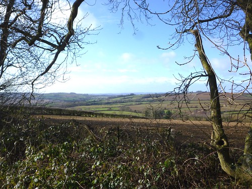
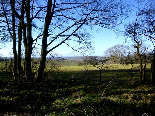
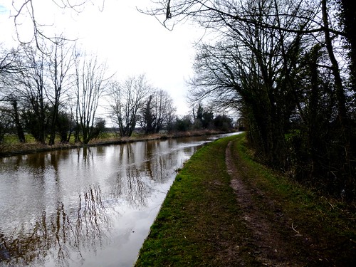
We crossed the road to Waterfoot, then the one to Cushendall, and were back in the foggy forest on a flint-surfaced path among horsetail plants, jointed and bristly like bright green bottlebrushes. A tiny brown frog sprang from stone to stone until it vanished in among the grass tussocks, where every sedge seed hung enclosed in the magnifying bowl of a water drop. It was an Antrim cloud-forest, seething soundlessly under the invisible slopes of Trostan mountain.

At the forest gate Artie O’Brien and his little Cairn terrier Zimba offered us a lift in their car along the mountain road and back to Cargan. Shall I confess that we took it? Well – I won’t tell, if Artie won’t. Zimba, you can keep your mouth shut, too.

Start: Cargan village, Glenariff, Co. Antrim, BT43 6RB (OSNI ref D 169189)

Getting there: Bus – service 150 (translink.co.uk/Services), Ballymena-Cushendun. Road – Cargan is on A43 Ballymena-Waterfoot road.

Walk (9½ miles, easy, OSNI Discoverer Sheet 9; downloadable map, directions at walkni.com; NB – online map, more walks at christophersomerville.co.uk): Head down street towards Ballymena. Left along Gortnageeragh Road. In 600m, round right bend; in 200m, left along Dungonnell Road (‘Dungonnell Walk’/DW waymark arrow) for nearly 3 miles. 400m past north end of reservoir, beyond notice-board on right bend, left (198185, DW) into forest. In ½ mile, left at T-junction (203194, DW); in 1 mile, reach A43 (191207). Right for 100m; left (DW) into forest. Follow DW to B14 at Essathohan Bridge (191217). Right beside road; left onto road, back across bridge (DW); in 200m, right over stile by gate (DW) into forest. In 400m, left at T-junction (187220, DW); in 1 mile, ahead along road (180206). In 2 miles, left (157187); in 700m, left (159180) along Legragane Road into Cargan.

Lunch: Greenhills pub/chip shop, Cargan (028-2175-8743)

Accommodation: Londonderry Arms, Carnlough, BT44 0EU (028-2888-5255; glensofantrim.com) – cheerful family-run hotel with sea views.

Info: walkni.com, nitb.comwww.satmap.com www.LogMyTrip.co.uk

 Posted by at 01:31
Mar 222014
 

Reginald Farrer of Ingleborough Hall, intrepid and dedicated Victorian plantsman, travelled all over the wild lands of China, Tibet and Upper Burma to collect seeds for the out-of-doors plant collection he established around his family home in the North Yorkshire village of Clapham. First published in: The Times Click here to view a map for this walk in a new window
picture picture picture picture picture picture picture picture picture picture picture picture picture
Facebook Link:
Some thought him mad, especially when he took to firing seed out of a shotgun to scatter it evenly along the crevices of Clapdale. It was a pleasing picture to have in the mind on our way up the cobbled lane that travels in tunnels and artificial stone-walled canyons through the grounds of Ingleborough Hall and on up to the limestone fells beyond.

The walled lane ran between the sullen grey cliffs of Robin Proctor’s Scar and the broad sunlit valleys to the south. We turned up the sloping fields and found the path up to Norber, a slanting upland where the retreating glaciers dumped hundreds of sandstone erratics – square boulders as big as tanks – on the limestone pavements 10,000 years ago. One boulder had been left delicately perched on limestone blocks like a barn on staddle-stones.

Pen-y-ghent’s lion face poked out of a welter of dark grey cloud ahead as we made for the lane up Crummack Dale in a spatter of rain. A great heavily-muscled bull lay beside the lane, but although he cocked his ears towards us he didn’t deign to turn his head. A grass track brought us up to the ridge at Long Scar, where the tremendous view encompassed Pen-y-ghent, the elongated purple back of Ingleborough ahead in the north, and away to the south the bulk of what we guessed to be Pendle Hill far off in Lancashire.

On the way down to Clapham we stopped off for a tour of Ingleborough Cave. It was an impressive moment when our young guide Sam blew out his candle and plunged us into the profoundest possible blackness. Candles were all those first explorers had to light their way in 1837 when they first ventured into this now famous tangle of caves and cramped passages. Brave as lions, or mad as hatters? Like Reginald Farrer, probably – a good stiff dose of both.

Start: National Park car park, Church Avenue, Clapham, N. Yorks LA2 8EF (OS ref SD 745692).

Getting there: Bus – Little Red Bus service 581 (01423-526655, littleredbus.co.uk); Malham Tarn shuttle service 881 (Sun, BH Mon, April – Oct)
Road – Clapham is signed off A65 Ingleton-Settle road

Walk (7½ miles, moderate, OS Explorer OL2): From car park, right up Church Avenue. Right by church (‘Austwick’ fingerpost) and on through tunnels. In ⅓ mile fork right (751694, ‘Austwick’). In another ⅔ mile, where wall angles in on left, turn left off walled lane over ladder stile (760692, ‘Norber’). Aim half right for far corner of wall; cross ladder stile (763695) and on to 4-finger post (766697). Left (‘Norber’) up to plateau and erratic boulders (766700).

Return to 4-finger post; left, down to wall; left along it. Right over wall by stone steps at marker pole on crest (768698); down to cross tumbled wall, on below Nappa Scars to gate/stile into Crummack Lane (772697). Left for 1¼ miles to Crummack. Through gate by farm drive entrance (771714); on past first fingerpost (‘Bridleway’). At second fingerpost, left (772715, ‘Sulber’) uphill on grassy track. In 300m it bends right (770716) and runs to right below scar. At crest (768719), meet track; left past cairn, down to go through gate in wall. On down to far left corner of wall (758716); left through gate and down walled lane.

In 200m, right over ladder stile; steeply downhill to ladder stile into stony lane in valley (757715); left to Ingleborough Cave Centre (754711). On beside beck; in 250m, just before gate across lane, right through another gate (753708, blue arrow/BA). Climb bridleway to Clapdale farm. Left (751709, BA) through farmyard; follow track back to Clapham.

Lunch: Reading Room Café, Clapham (01524-251144; claphambunk.com)

Accommodation: New Inn, Clapham, N. Yorks LA2 8HH (01524-251203, newinn-clapham.co.uk) – stylishly refurbished; friendly and comfortable.

Ingleborough Cave: 01524-2581242, ingleboroughcave.co.uk; tours £7 adults, £3.50 child).

Information: Ingleton TIC (01524-241049); yorkshire.com
www.ramblers.org.uk www.satmap.com www.LogMyTrip.co.uk

 Posted by at 01:57
Mar 152014
 

It was a brisk day over Wiltshire, brisker than you’d expect in early spring, with sheepy clouds scudding east and a cold nip under the blue sky. First published in: The Times Click here to view a map for this walk in a new window
picture picture picture picture picture picture picture picture picture picture picture picture picture picture picture picture
Facebook Link:
Avebury’s stones were warm, though, as I walked a circuit among them – rough and warm to the touch, huge and amiable with their rugged, bear-like shapes sparkling in the sunlight. Unfathomable, as always, the motives of those who in 2000 BC mounded the great circular bank and trench that encloses present-day Avebury village, pairing off one hundred sarsen stones in male and female couples, and building two smaller circles to touch each other within the greater ring.

How much labour must such a work have expended? How much organisation of that so-called “primitive” society? Our medieval ancestors feared the stones, toppling some and leaving others to fall. One 14th century surgeon-barber suffered the wrath of the stones for taking part in such vandalism; his skeleton was discovered under one of the largest in 1938, coins in his purse, scissors by his side. He’d been squashed flat as the great boulder slammed to earth before he could get out of the way.

Field paths led me out of Avebury through paddocks where horses grazed, flicking their tails against the early flies. A cock crowed at Durran Farm as I followed a stony track rising for miles to the roof of the downs. The rhythmic crunch of flints under my boots, the sunshine and cold wind and the twitter of sparrows in the hedges combined to give a soporific, trance-like feel to the morning.

Up at the crest of the hills I followed the old ramparted ditch of Wansdyke above the broad flanks of the downs, enormous fields of ploughland and spring wheat all in geometric lines and malleable curves of white and green. Wind in the hair, sun on the cheeks, fantastic exhilaration under a windy blue heaven as I strode out at the hub of a 50-mile view. But the true focus of this walk lay in the valley of the River Kennet below – the flattened thimble of Silbury Hill.

Down there I stood on the boulder-guarded mound of West Kennet Long Barrow and stared north at Silbury Hill. Why men constructed the long barrow around 3,500 BC with its five compartments and its mighty guardian sarsens is clear enough – the dead had to be honoured. But that 130-foot high, flat-topped hillock with its hidden core of concentric chalk-block walls: what was that about? We’ll never know – but we can imagine the feelings of awe that it invoked some 4,750 years ago when it first stood dazzling white and dominant between the rolling downs.

Start: Avebury village car park, Wilts, SN8 1RF (OS ref SU 100697)

Getting there: Bus service 49 (swindonbus.info), Swindon-Devizes
Road – Avebury is on A4361, 12 miles south of Swindon (M4, Jct 16)

Walk (11 miles, easy, OS Explorer 157): From car park, follow signs to stone circle. Walk the circuit of the stones; then follow minor road through village, passing church on right. Opposite Rectory gateway, right (099699) up lane; follow it to the left. Cross 2 footbridges; after second one, left (097698). Through gate (yellow arrow/YA); left along fence. Through gate (096696); immediately right through adjacent gate; up track past thatched cottage to cross road (095696). Pass noticeboard; follow tarred path to road opposite Rose Cottage (094695). Right for ⅓ mile; opposite farmyard, left (089692, ‘bridleway’) to cross A4361 (090691); on to cross A4 by Waggon & Horses Inn, Beckhampton (091689).

Down steps from inn car park; follow road round right bend. Opposite Butler’s Cottage, left (087688, ‘bridleway’) and follow track south for 1¾ miles to join stony track at 084688. In another 750m, just before Manor Farm cattle grid and gate, left (081652). In 150m, bear right and through gate (‘Mid Wilts Way’). Follow Wansdyke ditch and bank east. In 1 mile, a broad track comes in on right; 150m before a complex of gates where track converges with Wansdyke, turn left through makeshift gateway in fence (099647, ‘White Horse Trail’).

Left to fence; right along it, heading NE away from Wansdyke. In 1 mile dogleg right, then left through makeshift gate (109658); on with fence on right. In just over a mile, cross track and keep ahead past ruined barns (114675, ‘bridleway’) on grassy track. In 300m, left along track (114678); in 15m, right on hedged path; cross stile (YA) and follow left-hand hedge to cross road (110682). On (fingerpost) down fenced track. Cross stile, then follow fence. In ⅓ mile, under oak tree (105681, no waymark) left up field to West Kennet Long Barrow (105677) beyond skyline. Return to cross A4 (104684); take field path (‘Avebury’ fingerpost) to east of Silbury Hill. In 350m (103687), ignore stile on right, and go through gate and on beside river. At two-arch bridge, don’t turn right across it (101689), but keep ahead through gates (blue arrows) to cross A4361 to car park.

Lunch: Red Lion Inn, Avebury (01672-539266)

Info: Alexander Keiller Museum, Avebury Manor, shop etc – contact National Trust, 01672-539250; nationaltrust.org.uk/avebury
www.ramblers.org.uk www.satmap.com www.LogMyTrip.co.uk visitengland.com

 Posted by at 01:43
Mar 082014
 

Under a wall-to-wall blue sky, Dymock glowed in its best spring colours – mellow red brick, black-and-white timbering, rosy sandstone of the church, green pastures, and the dusky pink soil so characteristic of this corner of west Gloucestershire. First published in: The Times Click here to view a map for this walk in a new window
picture picture picture picture picture picture picture picture picture picture picture picture picture picture picture
Facebook Link:
A quiet rural landscape, seductive to the clutch of poets who lived hereabouts in the golden summer of 1914 – Lascelles Abercrombie and Wilfred Gibson, half-forgotten talents nowadays, and two iconic names of poetry, Robert Frost and Edward Thomas. It was while walking in these woods and fields that Frost persuaded Thomas to chance his arm at writing verse, and the hundred-odd poems that Thomas produced before his death in the Battle of Arras in 1917 proved some of the 20th century’s greatest.

Apart from poetical connections, Dymock and its sister village of Kempley have another claim to fame – the profusion of wild daffodils that colour the local road verges, field edges and woods in spring. Out in the fields between the two villages we followed the Daffodil Way past old brick farms and through woods and orchards where clumps of daffodils shook in the cold east wind – slender plants with delicate translucent sepals of creamy yellow, and puckered trumpet mouths that shone a rich egg-yolk gold in the sun. The warm weather had not yet melted the snow on the distant Malvern Hills; their peaks glittered white against the intense blue of the sky in the north.

St Mary’s Church stands a little apart from its parent village of Kempley, a modest Norman building in a daffodil-filled churchyard. The church contains the oldest timber roof in England, and some of its most wonderful wall paintings. Shadowy figures form the tableaux of an Easter play, and a Wheel of Life with cameos from birth through childhood and manhood to old age, infirmity and death. Here above the chancel are Christ seated in Judgement among cross-winged angels, while the Twelve Apostles look on with uplifted faces. It’s quite remarkable to think that some 900 years separate this rustic artist and those who admire his work today.

We tore ourselves away at last and followed the winding Kempley Brook down to Kempley Green. Nesting tits and finches sang loud in Dymock Wood, and an elderly farmer at Timber Hill Farm caught his over-eager sheepdog puppy up in his arms and wished us ‘Good afternoon’ as we made for Dymock and the distant white-capped Malverns.

Start: Beauchamp Arms, Dymock, Glos, GL18 2AQ (OS ref SO 701312)

Getting there: Bus: Stagecoach Service 132
(www.fachrs.com/download/132_bustimetable.pdf), Ledbury-Gloucester
Road: Dymock is on B4215 Newent-Ledbury road (M50, Jcts 2 or 3). Park near pub/parish hall.

Walk (10 miles, easy, OS Explorers 190, 189, OL14; map at kempleytardis.org.uk/walks; many ‘Daffodil Way’/DW fingerposts): Through churchyard gate beside Parish Hall; right along east end of church, then left along north side of churchyard. Through kissing gate/KG; bear left past corner of housing estate; cross left-hand of 2 footbridges (698315). On across stile (‘Daffodil Way’/DW); right along layby to cross B4215 (696316). Up lane opposite (DW). Path skirts Allum’s Farm (signs); through gate (689312); on through orchard (yellow arrows/YAs); through gate at far end (688309). Along field edge to road (688307). Right for ⅓ mile; right through KG (683306, DW); aim for right corner of conifer wood ahead. Cross 2 footbridges into wood (684309). Half right on path to follow wood edge. Out through KG; in again through next KG; follow path through Allums Grove (YAs), leaving wood through kissing gate (680313). Keep left of pond; on across footbridge; right through KG (678314); right along hedge and round field edge. Right over footbridge (676315); half left to cross stile (YA) and field to road (673316). Left to St Mary’s Church (670313).

Leaving church, left along road. At T-junction, ahead over stile (668311, DW). Cross field; through gateway with stream on left (666309); follow stream (YAs) for nearly a mile to road (663296). Left to T-junction; right (666293, ‘Upton Bishop’). In 50m, left (DW) over stile. Follow hedge round to right; over stile; follow hedge on right over stiles for 3 fields. Over footbridge (670288, YA); along back of shed at Moor House to farm track. Left over stile (DW); in 100m, right over footbridge (YA); half left, following YAs/footbridge up to road by house in Kempley Green (677289, DW). Right; in 100m, left and immediately right (DW), and follow YAs and ‘3 Choirs Way’ (3CW) waymarks across 4 fields into Dymock Wood (683286). Through wood (YAs, 3CW) for ⅔ mile to road (691286).

Right (DW) over M50. At T-junction, left (694284, DW). In 350m, left (DW) through KG; under M50; right through KG (YA); on beside motorway. At end of 2nd field, left (698289). Cross farm lane (699293, YA); on along field edge, then track past Boyce Court. Between gateposts to T-junction (703299). Right and left (DW); follow canal/stream, then field edges (YAs) to Dymock.

Lunch: Beauchamp Arms, Dymock (01531-890266; beauchamparms.co.uk) – excellent village pub-with-food

Kempley Daffodil Weekend (walks etc): 15-16 March 2014; daffs.org.uk, kempleytardis.org.uk/walks

www.ramblers.org.uk www.satmap.com www.LogMyTrip.co.uk visitengland.com

 Posted by at 01:33
Mar 012014
 

A beautiful winter morning, piercingly cold, under a blue porcelain sky spread across the gently undulating landscape where northernmost Oxfordshire runs hand-in-hand with Warwickshire. First published in: The Times Click here to view a map for this walk in a new window
picture picture picture picture picture picture picture picture picture picture picture picture picture picture picture picture
Facebook Link:
This is ironstone country, reflected in the burnt orange hue of the cottage walls in Sibford Gower. As we left the village, the low wintry sun washed the fields. Every leafless tree stood footed in a giant shadow. It was a morning to savour, and we felt more than ready for it – incessant rainstorms had been drowning the country for the past month, and another was forecast for this afternoon.

Green ranks of winter wheat squelched underfoot, and a stodge of puddles flanked every stile and gateway. We strode out with all the energy that a brisk wind lends, across stubble gleaming with sunlight in gold and cream. A flock of sheep lay at ease in a turnip field, slicing and chewing the sweet white flesh of the roots with their strong yellow teeth. Down in Epwell we leaned on the churchyard gate and admired the scene, everyone’s dream of an English village setting, the mellow stone church with centrally placed tower leading the eye along to a row of sunlit cottages.

Little hard green crab apples spattered the hedged path that took us on from Epwell over the fields to find the rutted thoroughfare of Beggar’s Lane. This ancient trackway runs under many names – Ditchedge Lane and Traitor’s Ford Lane are two more – connecting with other old green roads oriented from north-east to south-west, reputedly linking York and the west country at its extremities. Hereabouts it runs as a snaking lane 18 yards broad between hedges of oak and sycamore, devoid of leaves in this cold season, but with tiny scarlet buds on every twig as a promise of spring.

A horse came dashing by with a clatter of hooves and a splatter of divots, its rider’s crab-claw profile reddened with wind and weather. ‘Hope you don’t mind us cantering past,’ he called, ‘only it’s nice to give him practice at not shying at everyone he meets!’ We didn’t mind at all – it seemed a timeless image, the muddy horse and rider pelting along the ancient greenway, a moment snatched from any winter’s day in the past five thousand years.
Start: Wykham Arms, Sibford Gower, Banbury, Oxon, OX15 5RX (OS ref SP 352378). Park at pub – please give them your custom.

Getting there: Bus – Service 55A (www.stagecoachbus.com/), Stratford-upon-Avon to Chipping Norton
Road – Sibford Gower is signposted from B4035 between Lower Brailes and Swalcliffe

Walk (6 miles, easy, OS Explorer 191): From Sibford Gower follow road to Burdrop. Left (‘Swalcliffe’); in 100m, take footpath by Cubbs Cottage (358379); follow well-marked D’Arcy Dalton Way (DDW) north via B4035 for 1½ miles to road in Epwell (354403). Left past Chandlers Arms PH; on left bend, right (DDW) to road by church (352405). Left round right bend; left (‘Macmillan Way’/MW; fingerpost) up path. Through gate (MW); right to another gate (350404); don’t go through, but bear left up field edge to road (348401). Right for 50m; left (‘Beggar’s Lane’) across field, aiming for stile to right of communications tower (345401). Left (MW) along Beggar’s Lane to B4035 (344394). Right for 250m; left (MW) along Ditchedge Lane for 1¼ miles. Where lane begins to descend towards Traitor’s Ford, turn left (339373, yellow-top post, blue arrow) across field. 50m beyond Haynes’s Barn, left through hedge (342372, fingerpost); follow path (yellow arrows/YA) down to cross stream (345376), up far side to top of field (349378). Bear left along field edge; in 100m, right over stile (YA) into lane. Left; immediately right through gateway; follow lane into Sibford Gower.

Lunch: Wykham Arms, Sibford Gower (01295-788808; wykhamarms.co.uk) – well-kept, friendly pub.

Accommodation: Gate Hangs High Inn, Hook Norton (01608-737387; gatehangshigh.co.uk)

Information: Banbury TIC (01295-753752; visitnorthoxfordshire.com)
Crickhowell Walking Festival, Wales, 1-9 March: www.crickhowellfestival.com

www.ramblers.org.uk www.satmap.com www.LogMyTrip.co.uk visitengland.com

 Posted by at 01:11
Feb 222014
 

Last night this terrible winter tried to outdo its worst. First published in: The Times Click here to view a map for this walk in a new window
picture picture picture picture picture picture picture picture picture picture picture picture picture picture picture picture picture picture picture picture picture picture picture picture
Facebook Link:
We sat huddled by candlelight round the log fire of the Cholmondeley Arms in the throes of a power blackout across south Cheshire with hurricane winds sucking at the doors, rain lashing the darkness outside, and toppled trees cutting off the roads in all directions. Drama and chaos everywhere, and a cosy fatalism round the fireside. This morning, all change – gentle breeze, blue sky, cold sunshine, the hedges littered with broken branches, the fields streaked with silver fleets of flood water. ‘You could actually see the barn roof trying to lift off,’ said the farmer at Grindley Brook Farm as he cleared his drive of timber.

This countryside, a maze of small drumlin hills and kettle-hole lakelets, was shaped by the melting glaciers some 10,000 years ago. As we gained height up the hummocky ground around Hinton Bank Farm, we were treated to a wonderful panorama of the hills across the Welsh border, from the knobbly volcanic upthrust of the Breiddens in the south to the broad cones of the Clwydian Hills out west. Between them rose the high cliffs of the Berwyn range, painted dazzling white by last night’s terrific blizzards.

Storm-bedraggled sheep lay soaking up the temporary sunshine in the fields round Wirswall. This is rolling, bumpy, hard-riding country. I thought of Randolph Caldecott, the Victorian bank clerk and graphic genius who lived at Wirswall. As a child I loved his illustrations for favourite books such as The House That Jack Built and The Diverting History Of John Gilpin, full of broad-bottomed old gents courting pretty fair maids and getting tossed into ditches by stampeding nags.

We squelched and slithered across red mud fields from Wicksted Old Hall down to the glacial kettle-hole of Big Mere, where great crested grebes with glistening chestnut cheeks bobbed on the steel-grey water in pre-courtship practice. We passed Marbury’s pink sandstone church, sunlit on its knoll, and went on to Marbury Lock and a great arc of towpath beside the Llangollen Canal.

The copper-brown canal ran glinting between the inundated fields. Three hungry buzzards circled mewing over a waterlogged marsh, a flotilla of swans sailed as white as snow on the floods below, and green catkins hung from hazel twigs and wriggled in the wind like lambs’ tails, a whisper of spring somewhere beyond these winter storms.

Start: Horse & Jockey, Grindley Brook, Cheshire SY13 4QJ (OS ref SJ 522432) – park at pub; please give them your custom!

Getting there: Bus – Service 41 (shropshire.gov.uk/bustimes), Whitchurch-Chester.
Road – Grindley Brook is on A41 Chester road, just NW of Whitchurch

Walk (8 and a half miles, easy, OS Explorer 257. NB Detailed description – highly recommended! – online map, more walks at christophersomerville.co.uk): From Horse & Jockey cross A41 (careful!); follow Bishop Bennet Way/BBW left of garage; over canal, through railway arch; through gate on left (‘South Cheshire Way’/SCW). Aim for stile (SCW) just below Grindley Brook Farm. In next field, right through gate; on along hedge. At far end of field, left over stile (529435); right through gate (SCW) and follow sunken lane. In ¼ mile, where lane widens on left, turn left over stile (534434, SCW). Bear right onto track that skirts left of Hinton Bank Farm to cross A49 (538432, BBW).

Up drive opposite; skirt left of Hinton Old Hall’s half-timbered cottages (540433); on along green track, then sunken lane (SCWs) to road (544436). Left through Wirswall, past Wirswall Hall and BBW noticeboard. Don’t follow BBW to left, but continue along road. In 250m, on left bend, turn right (548441, fingerpost, SCW) along drive to Wicksted Old Hall. Bear left round Hall; over stile beyond (SCW); in next field, before reaching pump house, turn left across field (554439, SCW, ‘Marbury’ fingerpost). Over stile (SCW); aim just left of trees and pits ahead to go over stile (555442, SCW). Aim half left; turn left over double stile halfway down left-hand hedge (SCW). Across next stile (SCW); past grassy knoll of Buttermilk Bank; ahead down slope, aiming right of The Knowles house to cross stile (558450, SCW). On along right (east) bank of Big Mere; on (SCW, stiles) to road near Marbury church (562455).

Right for 150m; left (SCW, kissing gate/KG) along drive. Go between cottage and outbuildings (KGs, SCW); on along hedge to road (565459). SCW turns right here; but you cross road (KG, fingerpost) and walk up hedge to cross stile. Left (yellow arrow/YA) to cross stile between prominent tree and hunting stile (564462, YA). Down field slope to cross Church Bridge on Llangollen Canal (562464). Left along towpath for 4 miles to return to Grindley Brook.

Conditions: Some very boggy patches

Lunch: Horse & Jockey, Grindley Brook (01948-662723)

Accommodation: Cholmondeley Arms, Cholmondeley, Cheshire SY14 8HN (01829-720300; cholmondeleyarms.co.uk) – friendly, characterful pub in a former school

Information: Chester TIC (01244-405340);

www.ramblers.org.uk www.satmap.com www.LogMyTrip.co.uk visitengland.com

 Posted by at 01:00
Feb 152014
 

When the kids were tiny, a winter treat was a visit to the Greyhound Inn at Staple Fitzpaine to watch the morris men. First published in: The Times Click here to view a map for this walk in a new window
picture picture picture picture picture picture picture picture
Facebook Link:
On this cold midwinter day the old grey stone Somerset inn still smelt and felt much as we remembered it from back then, a rich and heady mix of open log fire, furniture polish, beer, good food and a whiff of muddy boots. But I’d forgotten how the church tower stood tall behind its trees in a prickly welter of crocketed pinnacles and the goat-faced, humpbacked gargoyles that are known in this part of the world as hunky-punks.

We went up the long farm track past Staple Park and Staple Lawns, then turned south through the woods and began to climb the escarpment of the Blackdown Hills. The silver grey clouds over the hills parted reluctantly enough, and I felt the lift of the heart that comes with the first honest sun of the year warming a face too long chilled by the east winds of winter. The countryside dipped and rose in waves of grey and cream-coloured stubbles and olive-green pastures rising to the leafless woods on Blackdown ridge.

A buzzard flew down and landed on an oak branch, and we stopped still to admire its speckled breast and fiercely hooked yellow beak. The path led on among the trees, gradually gaining height, with a grand view opening behind us across Taunton Vale for 30 miles to the long blue bar of the Mendip Hills on the northward horizon. We crossed a string of former commons, now partly overgrown with well-managed woodland, in other parts still lying open and pimpled with the tussocky nests of yellow meadow ants. Boggy ground had invaded the small fields around the ruined farm of Britty, and there were the mossy remnants of old cart lanes to follow up to the sandy heights of ancient Neroche Forest.

Saxon kings hunted Neroche, and so did the Norman lords who superseded them. But the broad summit of the range with its wide views to all quarters must always have been a valuable strongpoint. When Robert Count of Mortain, half-brother to William the Conqueror, came to construct a castle at the top of the forest, he founded it on a great ramparted fort that Iron Age tribesmen built up here.

We went up through enormous earthen ramparts to find the motte or castle mound and the ruin of its baileys and ditches among widely spaced oaks and beeches. Between the trees we looked south towards the green hills of East Devon, and then made for Staple Fitzpaine with Somerset’s flatlands and hill ranges spread out before us, a feast of West Country landscape lying waiting for spring.

Start & finish: Greyhound Inn, Staple Fitzpaine, Taunton, Somerset TA3 5SP (OS ref ST 264184)
Getting there: Bus – Stagecoach (stagecoachbus.com) service 99, Taunton-Yeovil
Road: Staple Fitzpaine is signed from Bickenhall, off A358 Taunton-Chard road (M5, Jct 25)
Walk (7 miles, easy, OS Explorer 128): From crossroads by Greyhound Inn, follow ‘Park Farm’ road. In 150m, on left bend, keep ahead (262182). In ½ mile pass Staple Park Farm; keep ahead (‘Bridleway’ fingerpost, blue arrows/BA) through gates on gravel track (‘East Deane Way’/EDW) and Herepath Trail/HP. Dogleg round Staple Lawns Farm. In Oakey Copse, turn left (245185) on broad bridleway. In 1 mile turn right up Underhill Lane (247173). In 300m, opposite cream-coloured house, left through kissing gate (247169, EDW). Ahead along grassy ride, keeping close to fence on left, following EDW and yellow arrows/YA. In 350m go through a gate (248166, EDW), cross a track, through another gate (YA) and keep ahead. In 200m dip to cross a stream beside a wooden railing with EDW arrow. Follow main track uphill to reach T-junction of tracks just below conifers. Left here (EDW, BA) on path, to meet track above Mount Fancy Farm (251163).

Turn right up track; left into wood through gate (EDW). Follow surfaced bridleway, then main path (EDW, HP) for ½ mile to Britty ruin (258160). Right (EDW, BA) along lane. In ¾ mile cross road and on (267159, EDW) into trees. In 150m, track bends left; in 400m, at 3-finger post (271161), turn right (‘Castle Neroche car park’) up track to castle ramparts. Return to 3-finger post; ahead downhill (BA) along Green Lane. At road, right (270167); pass drive, then in 10m right up lane past former chapel. Through V-stile; follow hedge round to left; through another V-stile; ahead through 4 fields by stiles to cross road (274174). Down Crosses Farm equestrian centre’s drive opposite (fingerpost with YA). Over stile by barn; over following gate; through boggy field. Follow path round to right; in 100m, left at fingerpost, through bushes; follow path over rough ground to Perry Hall (seen ahead). Cross farm drive (271179); through gate ahead (YA). In first field keep hedge on right; in 2nd and 3rd fields, hedge on left; cross stream in dip (270183); ahead to Staple Farm on skyline. At road (268184), left into Staple Fitzpaine.

Click on Facebook “Like” link to share this walk with Facebook friends.

Lunch: Greyhound Inn (good food, beer, cheer, smells) – 01823-480227; greyhoundinn.biz
More info: Taunton TIC (01823-336344)

www.ramblers.org.uk www.satmap.com www.LogMyTrip.co.uk visitengland.com

 Posted by at 07:35
Feb 082014
 

On a day like this, with strong sunshine and blue skies pouring across Northumberland, there isn’t a more welcoming range of hills in these islands than the Cheviots. Bosomy, rounded and dressed in brilliant green and purple, they seem to beckon, especially to walkers. First published in: The Times Click here to view a map for this walk in a new window
picture picture picture picture picture picture picture picture picture picture picture picture picture picture
Facebook Link:

In the farming hamlet of Akeld, just outside the regional capital of Wooler, stands a bastle, a rare reminder of a savage history. These old fortified farmhouses with their tiny windows, ‘upstairs’ doors and walls many feet thick date from the days when the Scottish Borders were aflame with cattle-thieving and murderous feuds. Back then, any man who wanted to live would barricade himself and his family into the upper floor of a bastle and hope to see out a siege.

Above Akeld a winding path led us away through bracken and heather across the hunched back of White Law. We dipped into a hollow, then climbed past the circular foundations of ancient beehive huts to the summit of Yeavering Bell. This high and handsome hill is the king of the north Cheviots, its knobbly brow encircled by a great wall – once ten feet thick, now scattered – and crowned with a cairn.

Up there we sat, catching our breath and savouring the view – the chequerboard plain stretched north at our feet, a steel-blue crescent of North Sea, and the rolling heights of Cheviot as they billowed away south into the heart of the range. Then it was down from the peak and on through the bracken to find the broad green road of St Cuthbert’s Way striding purposefully through the hills.

The hard rock outcrop of Tom Tallon’s Crag rode its heathery hilltop like a salt-brown ship pitching in a russet sea. We passed below the crag, then followed a grassy old cart track into the cleft of Akeld Burn. Suddenly all the birds of the air seemed to be flying about us – meadow pipits in undulating flight, kestrels and sparrowhawks hanging in their hunting stances, and a raven flapping with a disdainful cronk! out over the northern plains before us.

Start: Akeld, near Wooler, Northumberland, NE71 6TA approx. (OS ref NT 957297)

Getting there: Bus service 267 (havant-travel.info), Wooler-Berwick
Road – Akeld is on A697, 2½ miles west of Wooler. Park carefully beside green – please don’t obstruct entrances!

Walk (6 miles, moderate, OS Explorer OL16. NB: online map, more walks at christophersomerville.co.uk): Walk through farmyard; up track (blue arrow/BA). Pass to right of Gleadscleugh cottage (952290); through next gate; in 100m, right over stile (950288; yellow arrow/YA). Follow path, bearing right up left rim of stony Glead’s Cleugh*. Follow YAs on posts for 1¼ miles over White Law (943290) and down to stile and gate in fence under Yeavering Bell (932290). Path up to saddle to right of summit; at wooden palette marker (931294), left on path to summit cairn (929293). Follow path half left off summit, though scattered stone wall (928292); here fork right (YAs, ‘Hill Fort Trail’) to St Cuthbert’s Way/SCW at stile (923287). Left, following SCW for 1 mile. Pass Tom Tallon’s Crag; through gate in wall (933278); in 300m, at near corner of conifer plantation, turn left off SCW through gate (935277); follow track to Gleadscleugh. Right (951289, BA) on track to right of house; zigzag across burn; on by wall; follow yellow arrows to Akeld, passing bastle (958294) on your left.

* NB Cottage is Gleadscleugh, valley is Glead’s Cleugh, as written!

Lunch: Picnic

Accommodation: Red Lion Inn, Milfield, Northumberland, postcode (01668-216224; redlionmilfield.co.uk) – cheerful village pub with rooms.

Info: Wooler TIC (01668-282123); visitnorthumberland.com

Berwick-upon-Tweed Walking Festival, 5-7 April: 01669-621044; berwickwalking.co.uk

www.ramblers.org.uk www.satmap.com www.LogMyTrip.co.uk visitengland.com

 Posted by at 01:52
Feb 012014
 

The Norman invasion of 1066 must have been a devastating blow to the Saxon landowner who lent his name to today’s downland village of East Garston. First published in: The Times Click here to view a map for this walk in a new window
picture picture picture picture picture picture picture picture
Facebook Link:
Not only was Asgar – ‘Spear of God’ – severely wounded at the Battle of Hastings; he also lost his extensive estates on the Berkshire downs and his prestigious position as procurer of horses for King Harold, slain in the battle.

Asgar’s tradition, though, lives on hereabouts. These wide, rolling downs with their lush grass are still prime horse-training country. Strangely enough, though jumps and grass courses and railed gallops seemed everywhere, we saw not one actual horse all day as we tramped the downland tracks. Maybe they were indoors, taking it easy or in light training for the Cheltenham Gold Cup.

The first creature we saw was more exotic and certainly more unexpected than any horse – a marsh harrier, dark and enormous against the cloudy sky, balancing on long-wings as it quartered the Lambourn valley looking for unwary mice. Two red kites wheeled not far away, forked tails spread on the wind. When we were able to tear our gaze away from these dramatic sailors of the sky, it was to find ourselves in a dappling landscape of valleys whose farmhouses lay sunk in shelter trees among fields crisp with stubbles.

From Maidencourt Farm a gravelly track rose between thick hedges, climbing the face of the downs before dipping over to run down through the meadows to Whatcombe. A few humps and hollows showed where a medieval village had stood close to Whatcombe monastery, before history cleared both away. Now a beautifully-appointed stables stands in the hidden valley – stalls, barns, sheds and a great covered exercise ring.

Beyond Whatcombe it was ploughland and big skies all the way to South Fawley, another famous racing establishment. We went west under gently stirring shawls of cloud, ambling along a quiet road to nowhere. On Washmore Hill there was time to picnic and watch a sparrow pretending to be a stone in the furrows, so well camouflaged it was hard to distinguish bird from soil. Then we headed for home, south across a grassy gallop and down past lonely Winterdown Barn in its roadless hollow, down to the old thatched and timbered cottages of Asgar’s settlement once more.

Start: Queen’s Arms, East Garston, Berks, RG17 7ET (OS ref SU 366764)

Getting there: Bus service 4 (newburyanddistrict.co.uk), Newbury-Swindon
Road – M4 Jct 14, A338 to Great Shefford, left (‘Lambourn’) to East Garston.

Walk (8½ miles, easy/moderate, OS Explorer 158 and170): From Queen’s Arms, left along road, first left into East Garston, cross River Lambourn, and turn right along Lambourn Valley Way (fingerpost). In 50m, left up fence (368765) and follow ‘Permitted Path, Shefford’. At Maidencourt Farm (373761), left up stony track for 1 mile. Just beyond Furze Border thicket, fork right (376777, fingerpost) for three quarters of a mile to signal mast on Kite Hill. Ahead through hedge (388783, fingerpost); follow BAs for ½ mile down to Whatcombe (393789).

Right (BA) for 150m. Just past house, left before horseshoe-shaped pond (394789) up hedge. Left at top of garden (yellow arrow/YA); right up path in hedge (YA) and on with hedge on right. Nearing South Fawley, cross 2 paddocks (391799, stiles, YAs); cross stile on right into lane; left to T-junction (390802). Left (‘Eastbury, Warren Farm’) on tarmac lane, then stony track for 1½ miles to junction of tracks on Washmore Hill (367804). Pass a line of conifers on your right; just before a waymark pole on left, turn left along the side of a thicket.

In 700m, at T-junction of tracks (366797, ‘Restricted Byway’), turn left for 30m; then right on grassy path/track with bank and gallops on your left. In ⅓ mile, track bends right; in 150m, go left (363792, fingerpost) across field. Pass through wooden fence (364790, YA); keep same line ahead, crossing gallop (365788 – take care!) and grassland, aiming for left-hand of three trees on skyline. Recross gallop (366784 – take care!); descend to fingerpost (365783). Down across field, then through grassland down to track (365778). Left into East Garston. Just before first buildings, left (363772, fingerpost). At field end, right (365771, fingerpost) down fenced path to road. Left into village.

Conditions: Please look out and take care crossing gallops!

Lunch/Accommodation: Queen’s Arms Hotel, East Garston, Berks RG17 7EE (01488-648757, queensarmshotel.co.uk).

www.ramblers.org.uk www.satmap.com www.LogMyTrip.co.uk visitengland.com

 Posted by at 01:28
Jan 282014


First published in: The Times Click here to view a map for this walk in a new window
Looking north along the Cotswold Way Snowshill parkland Snowshill parkland 2 Snowshill parkland 3 looking north across the Vale of Evesham looking towards the southerly slope of Bredon Hill Cotswold Way looking north to the Vale of Evesham Snowshill steam train and viaduct Snowshill Arms Snowshill village street Chipping Campden morris aloft outside the Snowshill Arms Snowshill 2

In the early twentieth century Charles Paget Wade created a world for himself in his Cotswold manor and Arts & Crafts garden at Snowshill. His family motto was ‘Let nothing perish’, and he followed that dictum to the hilt as he collected over 200,000 objects – clocks, toys, chairs, musical instruments, craft tools, bicycles, suits of armour.

Snowshill manor, its garden and collection are curated by the National Trust these days. Setting off from Snowshill, we followed the Winchcombe Way down across a slope of coarse pasture into a valley of springs and streams. Sheep grazed among the thistles and scrub bushes where last autumn’s sloes and rosehips still hung. The light chakker of jackdaws made a tenor counterpoint to the harsh baritone cawing of rook in the parkland oaks.

Up on the opposite ridge we paused under a great spreading ash to look back across the valley to the manor and silver-gold cottages of Snowshill crowning their hilltop. A crunchy byway led north, with fine views opening east to the folly of Broadway Tower on its knoll. Then the path swung west, and suddenly we were contemplating thirty or forty miles of countryside laid out in the sunshine, the low-lying Vale of Evesham leading off past the broad dome of Bredon Hill to where a tsunami of bruise-coloured cloud marked the distant Malvern Hills and hazy blue hills beyond.

Now it was south again along the ridge track of the Cotswold Way, hurdling the bumpy slopes on pale oolitic limestone. I very stupidly picked and sampled a blackberry that somehow still clung to its bramble. After spitting out the rank, disgusting mess, I spent the rest of the walk picking seeds from my molars.

The mound and ditch of Shenberrow hill fort lay ahead, preserved from destruction by the plough thanks to the line of sturdy trees along its ramparts. Here at 997ft, the highest point in Gloucestershire, we stood looking across the plain at the outliers of the Cotswold Hills. A tiny steam train crept across the landscape, passing over a viaduct and away out of sight toward Cheltenham, leaving behind a dissolving trail of smoke and a mournful owlish hoot.

The homeward bridleway edged past ploughed fields of dark, iron-rich earth. Snowshill appeared ahead, having apparently shunted itself from its hilltop into a valley we hadn’t even noticed till then. A mystery we failed to unwrap as we spread out the map by the fire in the Snowshill Arms. In that cosy place with a pint of Donnington Best Bitter at our elbow – frankly, my dear, we didn’t give a damn.

How hard is it? 4½ miles; easy; field paths and well-marked trails

Start: Free overflow car park, Snowshill, Broadway WR12 7JU (OS ref SP 097340)

Getting there: Snowshill is signposted off B4632 in Broadway (A44, Evesham – Stow-on-the-Wold).

Walk (OS Explorer OL45): Left down road; at Snowshill Manor entrance, through gate (‘Winchcombe Way’/WW). Follow yellow arrows/YAs for ½ mile into valley, across stream, uphill (YAs) to byway (088345). Right (WW). In ½ mile through gate (089352); left through kissing gate (WW); in 200m, left along Cotswold Way/CW (087354). In 50m, ignore WW on right. Follow CW for 1½ miles to Shenberrow hillfort (080335). CW continues ahead, but turn left here (‘bridleway’). By Shenberrow Buildings barn, left (080333, ‘bridleway’). In 400m dogleg left/right (084331, WW); on across fields to road (091335). Right; in 550m, left at junction (093336) into Snowshill.

Lunch: Snowshill Arms (01386-852653, donnington-brewery.com)

Accommodation: The Lodge at Broadway, Keil Close, 2 High Street, Broadway WR12 7DP (01386-852007, thelodgebroadway.co.uk)

Info: Snowshill Manor (01386-852410, nationaltrust.org.uk)

 Posted by at 01:50