Oct 262013
 

Smoky shreds of mist came drifting in from the sea across the blue Cornish sky.
First published in: The Times Click here to view a map for this walk in a new window
picture picture picture picture picture picture picture picture picture picture picture picture picture picture
Facebook Link:
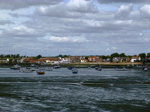
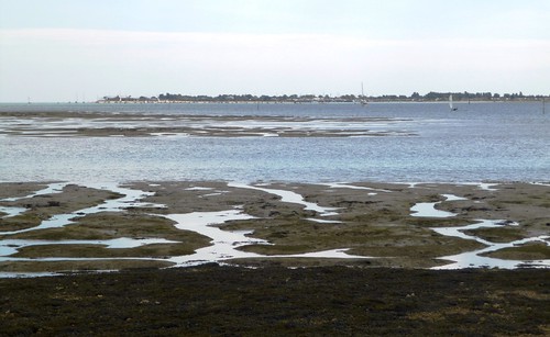
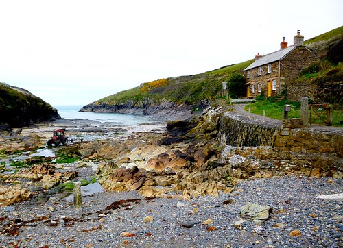
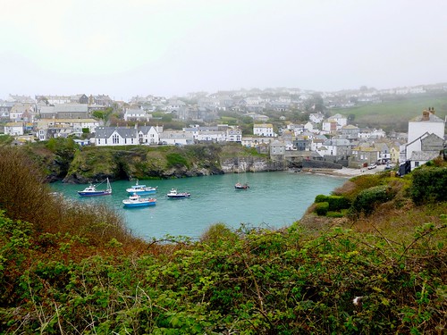
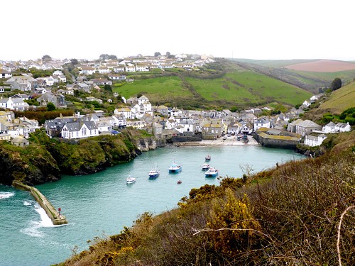
Herring gulls were circling with steely cries over Port Gaverne’s narrow rocky inlet. The persistent sea has cut the north Cornwall coast into dozens of these havens, where tiny fishing villages lie sheltered on a slip of a beach. Port Gaverne is one of the tiniest, no more than a hamlet, centred round its cheery hotel and a couple of boats.

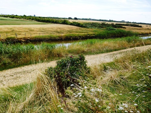
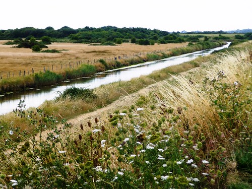
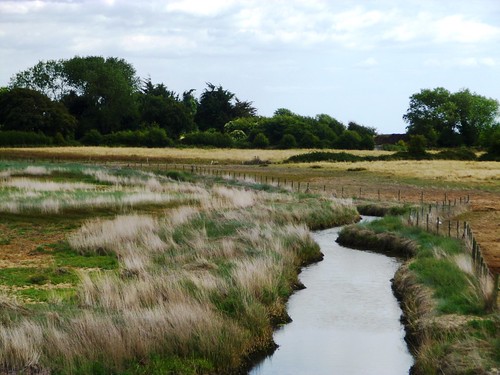
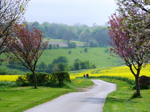
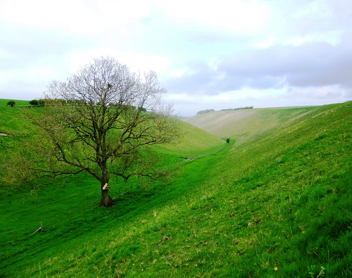
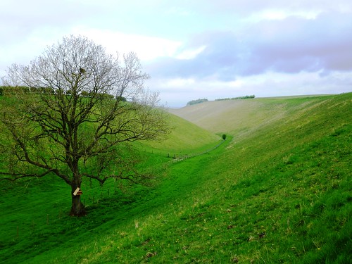
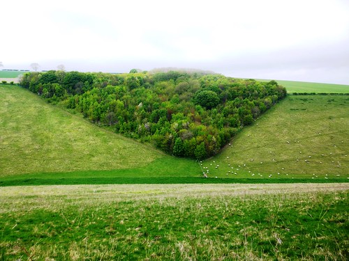
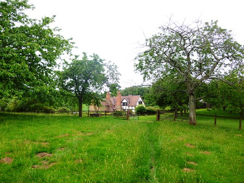
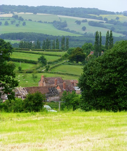
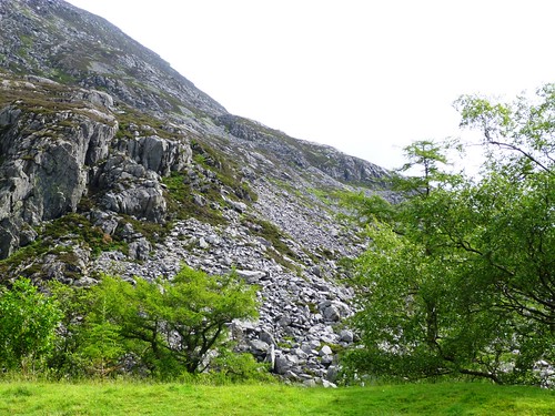
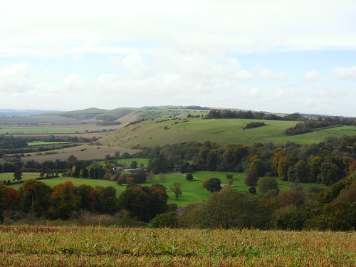
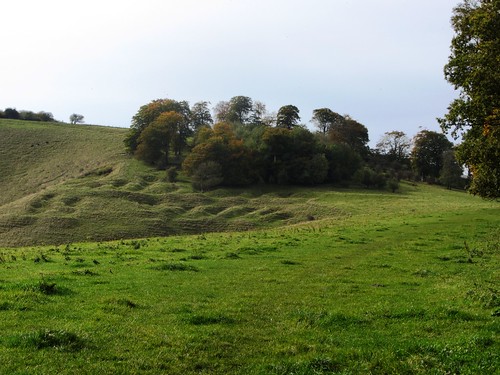
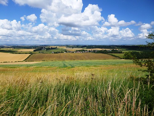
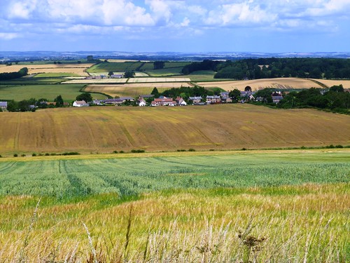
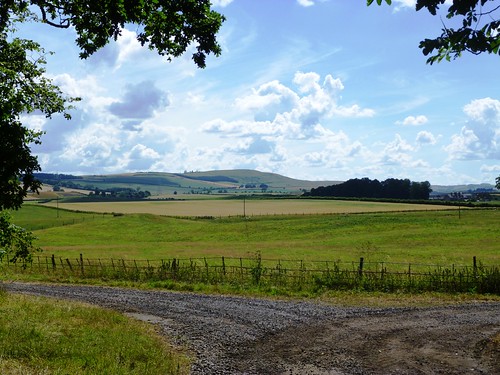
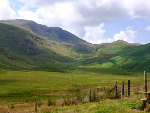
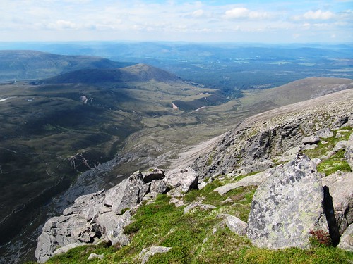
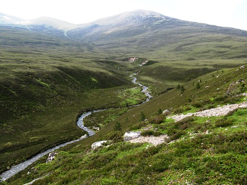
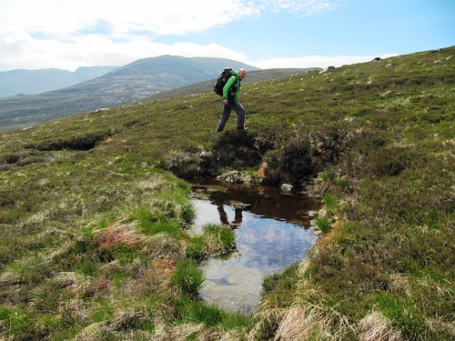
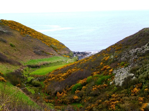
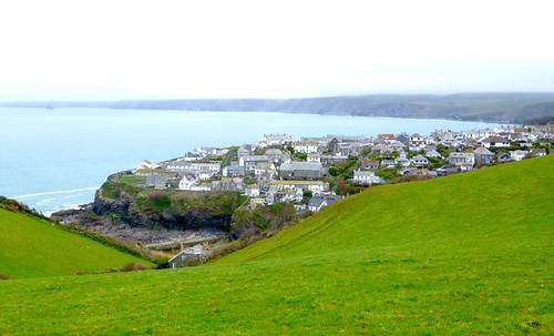
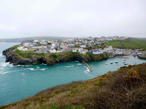
It was a steep climb out of the valley, a salutary early morning shock to the system. Fat white sheep cropped the wet fields around Trewartha, from where a stony lane lined with royal blue borage and the episcopal purple flowers of honesty dropped away to cross a stream in a boggy dell. I puzzled my way across and up to a viewpoint over Port Isaac’s huddle of houses caught in a downhill stampede between the slopes of the valley.

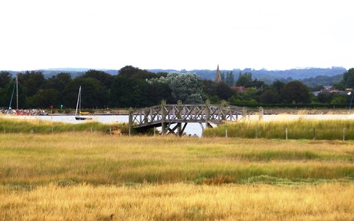
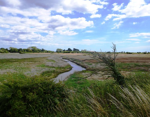
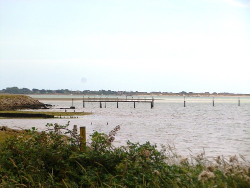
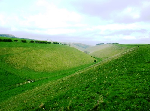
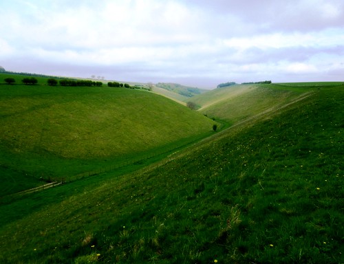
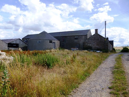
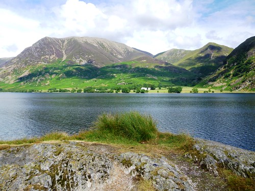
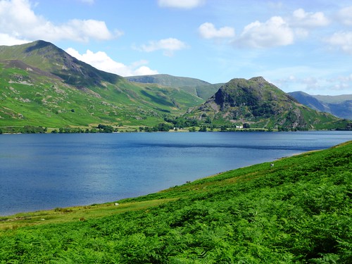
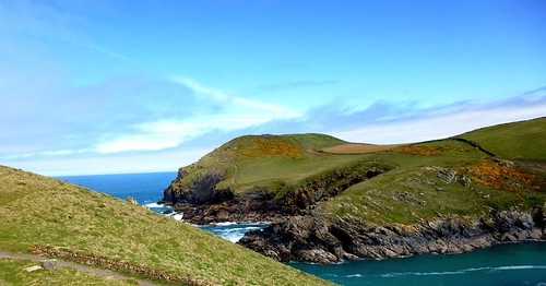
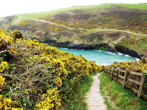
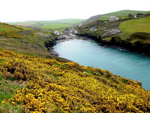
A high-banked lane headed north towards the sea, then a field path led into another deep dip and on over cattle pastures to Port Quin, a fishing haven even smaller and quieter than Port Gaverne. Suddenly I knew exactly where I was, though I’d not been here for more than 50 years. Oh, the power of childhood holidays! The steep upward lane, high-perched Doyden Hotel where the family had stayed, the castellated folly of Doyden Castle on its tump of headland where we’d walked a dewy circuit every morning! It all came rushing back from wherever such sounds and pictures and smells are stored all the while.

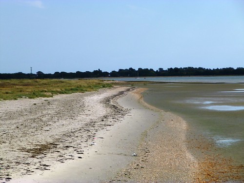
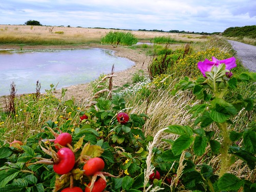
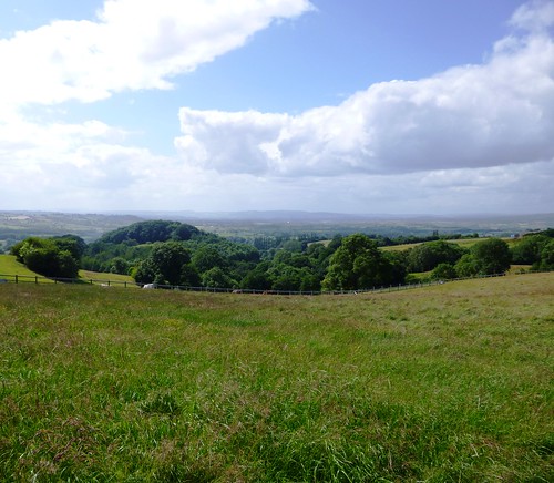
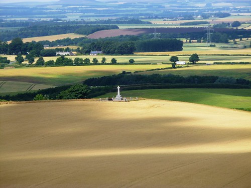
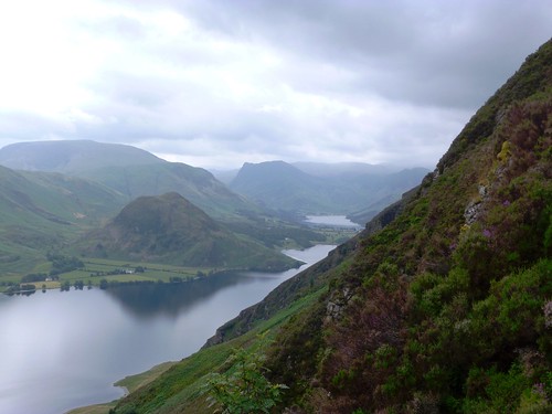
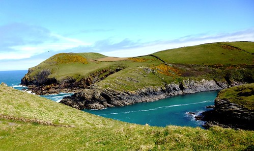
I walked up to the tower and sat with my back to the wind, looking round the long semi-circle of Port Quin Bay to the rock spires of The Rump and the big rugged lump of The Mauls island out in the sea. Yellow gorse, green headlands, black rock, blue sky, turquoise sea – elemental colours in absolute perfection.

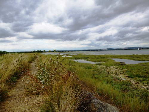
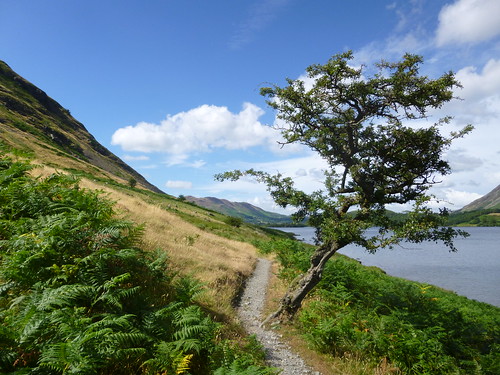
Mist began to steal in again, muting those sharp colours. I turned for home along the South West Coast Path, up and down innumerable steps, round rocky bays where the dark shapes of peregrines darted almost too quickly to be seen, and fulmars planed the air currents on stiff wings and glanced incuriously with their round black eyes as they passed me by.

Start: Port Gaverne, Port Isaac, Cornwall PL29 3SQ (OS ref SX 003808).

Getting there: Bus – Service 584 (westerngreyhound.com), Camelford-Wadebridge
Road – Port Gaverne is signposted off B3267 in Port Isaac (B3314 from A39 at Wadebridge)

Walk (8½ miles, moderate/hard, OS Explorer 106): In Port Gaverne follow ‘Port Gaverne Hotel car park’ sign. Pass car park; on over stile by gate (‘Trewetha ½’). In 150m, fork right (005806, yellow arrow/YA) up steep path. At top, right over stile (YA); up to road at Trewetha (005802). Left round bend; right (‘Footpath, Port Isaac’) down green lane to cross stream in boggy dell (000800). Left for 50m, bending right to meet walled lane by stone stile among trees. Right here; in 20m, fork left up walled path; up and through gate; on up lane. In 350m, on 2nd left bend, right over stile (997800, YA); follow hedge, then fence (YAs) right of Homer Park to road (996802).

Left for 50m; right (‘To The Coastpath’) along lane. In ⅓ mile, through gate (992807); left along field edge with wall on left, down to cross stream (991805, ‘Port Quin’). Right up path; at top, right and follow field edge round to left. In 200m, right (988808, YA) along field edge track. In ¾ mile, cross wall stile by gate; track bends right uphill, but keep ahead, down across field, aiming for distant house. Follow track (YAs); in ¼ mile, cross stile by house, down to road in Port Quin (973805). Ahead across bridge; round left bend, then right bend, up road; in 150m, right over stile (970805); follow Coast Path to Doyden Castle (967806).

Return along Coast Path via Port Quin and Port Isaac for 4 miles (steep!) to Port Gaverne.

NB: Boggy and confusing in dell below Trewetha; many hundreds of steep steps on Coast Path between Port Quin and Port Isaac.

Lunch: Picnic. Tea: Cafés in Port Isaac

Accommodation: Port Gaverne Hotel, PL29 3SQ (01208-880244; port-gaverne-hotel.co.uk) – cheerful pub with rooms

Information: Wadebridge TIC (01208-813725; visitcornwall.com)
www.ramblers.org.uk www.satmap.com www.LogMyTrip.co.uk

 Posted by at 01:46
Oct 192013
 

Click here to view a map for this walk in a new window
Walk Directions (7 miles, easy gradients, OS Explorer 245):

Through gate in car park fence (yellow arrow/YA); past church, along 2 field edges. Cross bridleway (349242, blue arrows); ahead with hedge on left, past Windmill Wood. Through gate under big ash tree (343250); through next gate at Hangman’s Stone and turn left (341252; no waymark), following field edge for ½ mile to road at Bendalls Farm (334249). Left, then right (336248, ‘Foremark Reservoir’) along roadway. In 300 m, by 3 tall wooden posts, right (336245) to reservoir edge (334244). Left for 500 m to Visitor Centre (336241); take path through woods (you soon pass a ‘Carver’s Rocks’ sign). In ¾ mile you cross a wooden stage over a pond in a dip (333229); fork left up bank to ‘Badger Path’ sign (334228); right up steps. At top (334226), right through car park; follow roadway as it curves left.

In 250 m, right through gate in fence (YAs); down stony path to Carver’s Rocks (331227; notice board). Follow path anticlockwise at feet of Rocks for 400 m, up to open area (331225). Ahead to cross it, and keep same direction along grassy path between blocks of trees. In 300 m, in a wet dell (333222 – an angle of fencing is shown on OS Explorer map), don’t bear right or take path past notice board, but keep ahead on lowest path to A514 (334222). Turn right on grassy path with hedge on left between you and road. In 200 m, left across stile, left to cross A514 (334220).

Ahead up Coal Lane. Just beyond entrance to coppice House Farm, left through hedge gap (336220). Ahead with The Oaklands wood on right; cross stile and keep ahead. Round right bend; in 70 m over the first of 2 stiles close together (339221). Follow field edge with fence and ditch on right; follow it round left angle; in another 100 m, through gateway in hedge (341224). In big open field, keep same direction for 150 m; then (342225) bear right (due east) for 300 m to B5006 (346225). Left along road for 400 m, passing side road on right, to reach brick house on right with outbuildings on left (349228). In another 50m, right through hedge and left along gravelled path (disused tramway). In 400 m go through stone tunnel (351232). In another 600 m, at brick mouth of next, longer tunnel (355237), up steps to turn left across tunnel mouth. In field beyond, aim for small brick building ahead (355239). Through gate, down to A514; left; first right to car park.

 Posted by at 01:58
Oct 122013
 

Wild plums, green and purple, hung heavy above the path as Jane and I began our circuit of Thorney Island, a narrow-necked peninsula suspended like a bulbous fruit from the inner shoreline of Chichester Harbour.
First published in: The Times Click here to view a map for this walk in a new window
picture picture picture picture picture picture picture picture picture picture picture picture picture picture picture picture
Facebook Link:
A memorable feature of my wife’s childhood in this low-lying coastal country had been the vee-shaped bomber planes from Thorney Island’s RAF base – long since closed – that would rumble overhead, low and dark in the sky.

Black-headed gulls screamed peevishly from the mud banks exposed at low water; oystercatchers piped, and curlews made their melancholy bubbling cry. Salt, mud, seaweed – the smells were of tidal country under a drying wind. As for the views, they widened over mud flats green with algae and weed, seamed with wriggling creeks known locally as rithes, out west to the low wooded coastline of Hayling Island. Inland, hissing beds of reeds lined the waters of the broad ditch romantically named Great Deep.

Sea lavender lay in purple mats on the salt marshes. Leopard-spotted comma butterflies alighted on fleabane flowers and opened their scalloped wings to the sun. From the seawall path, the army establishment that replaced Thorney’s RAF base in 1984 was so well hidden among the trees it might not have been there. The only clue as to where those great triangular bombers had taken to the skies was a grey smear of runway tarmac, long disused.

We watched a lovely old wooden sailing boat scudding down Sweare Deep under a white bulge of jib, the mainsail rattling up as the boat heeled into Emsworth Channel. By the time we had reached Longmere Point at the nethermost tip of Thorney, the tide had crept in to cover mud flats, shell banks and rithes in a rippling world of water that spread south towards the open mouth of Chichester Harbour.

St Nicholas’s Church at West Thorney, ‘the least known and altogether uttermost church in Sussex’, has stood here on the remote eastern coast of the island for 800 years. Wartime Allied and German servicemen share the graveyard, foes in life, brothers in death.

Under the seawall an unseen fish hunted the flood-tide shallows, dorsal fin and tail cutting the surface. Far to the east the spire of Chichester Cathedral glowed ghostly white in the evening sun, the South Downs ran in black and gold along the northern skyline, and from the marina moorings came the music of halyards blown by the wind against yacht masts, chinking and chiming like miniature bells.

Start: Sussex Brewers PH, 36 Main Rd, Hermitage, West Sussex PO10 8AU (OS ref SU 755057)

Getting there: A27/A259 to Emsworth. Park in village; follow A259 to Sussex Brewery PH

Walk (9 miles, easy, OS Explorer 120. NB: Online maps, more walks at christophersomerville.co.uk): Follow footpath down side of pub (fingerpost), then field edges south to boatyard. Right (755053, fingerpost) through Emsworth Yacht Harbour to sea wall. Left (753052, fingerpost) anti-clockwise round Thorney Island for 7 miles, passing Little Deep (752047), Great Deep (749040), Marker Point (746023), Longmere Point (768011), West Thorney Church (770025), Stanbury Point (770031) and Prinsted Point (766042). At foot of road above Thornham Marina (766051), turn left inland along Sussex Border Path past Thornham Farm for half a mile to cross Thorney Road (756051). Over stile (fingerpost), across field and opposite stile. Right (fingerpost) past stilt houses, and retrace path to Sussex Brewery PH.

Lunch: Sussex Brewery PH, Hermitage (01243-371533; sussexbrewery.com) – a really friendly, clean and welcoming pub.

Chichester Harbour Conservancy (01243-512301; conservancy.co.uk) – walks, information and much more.

Information: Chichester TIC (01243-775888; visitsussex.org)
yorkshire.com visitengland.com www.ramblers.org.uk www.satmap.com www.LogMyTrip.co.uk

 Posted by at 01:33
Oct 052013
 

A soft half-light day, muted and cool, lay over the Yorkshire Wolds.
First published in: The Times Click here to view a map for this walk in a new window
picture picture picture picture picture picture picture picture picture picture picture picture picture picture picture picture
Facebook Link:
We left the Wolds Inn at Huggate with chaffinch noise in our ears and David Hockney’s tree tunnels and swooping fields in our mind’s eye. Jane had returned from Hockney’s 2012 Royal Academy exhibition of landscape paintings fired with enthusiasm for exploring the folded East Yorkshire countryside, where in the early 1950s the Bradford boy had spent his summer helping out a local farmer with the harvest and learning to drink beer in Huggate’s village pub.

The long shallow hills of the Yorkshire Wolds dip and rise around Huggate in successive waves; a clichéd image, perhaps, but nothing better expresses the sense of frozen movement, the smooth roll and majestic length of these ridges of chalky ground. Our heads might have been filled with Hockney’s golden seas of corn, scarlet shadows and bright white farmhouses, but today all colours lay leached and subdued, soft greys and blues washing the sky, wheatfields and woods. A red tractor with white wheels moved shockingly bright against the shrouded landscape.

Up on the backs of the Wolds the impression is of walking in land that’s almost flat. I wouldn’t have been surprised to see the sea appear ahead. Then suddenly we were on the brink of Pasturedale, a hidden valley opening at our feet, a snaking crack in the earth. A steep chalky track brought us down the dale side into the valley, and we headed up the flat bottomed Frendal Dale and Tun Dale in a golden spatter of dandelions with the dark sides rising sharply to rims clear cut against the sky three hundred feet overhead.

At the top of Tun Dale we emerged onto the roof of the Wolds again. Great yellow rape and green wheat fields ran away to isolated farms and thick dark shelter belts of trees on the horizon. Down once more into the depths, into Horse Dale whose Access Land status gave us leave to wander the cleft among cowslips, speedwell patches and just-flowering bedstraws. Sparrowhawks were hunting the slopes, drifting and swinging across the wind blowing south down the dale, then finding a rigid stance a hundred feet in the air to hang and scan the ground.

At the head of the dale we joined the Yorkshire Wolds Way and followed it back towards Huggate’s church spire down an avenue of cherries frothing with pink and white blossom, brilliantly lit in a burst of sunshine come through at last.

Start: Wolds Inn, Huggate, East Yorks, YO42 1YH (OS ref SE 882550)

Getting there: Huggate is signed from A166 York-Driffield road

Walk (10 miles, easy, OS Explorer 294. NB: online map, more walks at christophersomerville.co.uk). From Wolds Inn, right; first right (‘Village only’). Descend beyond houses; left on Yorkshire Wolds Way/YWW (881557). Follow YWW for 3 miles via York Lane (867558), Pocklington Lane (866548) and Jessop’s Plantation (854543) to cross road at foot of Pasture Dale (850546). Follow Chalkland Way for 3 miles via Frendale Dale and Tun Dale, Waterman Hole (856569) and West Lands (866566) to go through gate at foot of Horse Dale (867561). Slant left up far side; follow east rim of Horse Dale (Access Land) for 1 mile, passing opposite diamond-shaped wood on far slope. Look for prominent tree on east rim; just beyond it; right through gate (883570); follow YWW back to Huggate.

Lunch: Picnic

Accommodation: Wolds Inn, Huggate (01377-288217; woldsinn.co.uk) – cheerful and welcoming; many David Hockney associations (just ask!).

Information: Beverley TIC (01482-391672, visithullandeastyorkshire.com);
yorkshire.com visitengland.com www.ramblers.org.uk www.satmap.com www.LogMyTrip.co.uk

 Posted by at 01:26
Sep 282013
 

Sparrows were chirping in a bright morning over north-west Worcestershire as we left the cheerful Tally Ho Inn and plunged out into a wide rolling landscape with the Herefordshire hills lumped blue and cloudy in the south-west.
First published in: The Times Click here to view a map for this walk in a new window
picture picture picture picture picture picture picture picture
Facebook Link:
A big dark hare sprang up almost underfoot and dashed away across a newly mown hayfield, yellow-green and stubbly. This was exhilarating walking, like striding across the backs of great solid waves.

Hanley Child lay at the foot of orchard slopes, a clutch of medieval houses and outbuildings, timber-framed under tiled roofs. By Town Farm sheep came bleating across a field, their phlegmy voices loud and manic. The farmer hurried to block their escape through the gate. ‘Out walking? Yes, it’s lovely round here. A hidden treasure – or so they tell me,’ he smiled wryly.

We descended a nettly and brambly bank to Stonyford, and took the track to Norgrove where cherries hung heavy in the orchard, their colours a spectrum from creamy yellow through tangerine to boot-polish crimson. Beyond the house lay tangled woods and the long, man-made lake of Kyre Pool, centrepiece of an 18th-century landscaped park, perhaps the work of Capability Brown. The multiform house dates back in part to Plantagenet times and looks out on gardens, lawns and pools.

In the adjacent church we found a very beautiful and simple 14th-century painting of a haloed saint, holding in her left hand a book or box, in her right an orb or perhaps a circle of light from a lamp. The red ochre figure is the preliminary sketch made by the artist; the brilliant pigments with which he embellished the saint have all faded or fallen away, and only this ghost of his first inspiration remains.

We turned for home by way of The Grove farmhouse with its early Dutch gable, and the old moat at Bannall’s Farm sunk in a thicket of oak and ash. The farm dogs barked us in and nuzzled us out, down the lane to Coppice House, and along the edges of barley fields. On the hill above Woodstock Bower a great silky-coated bull was roaring softly. ‘He won’t hurt you,’ reassured the farm worker who bounced up in his buggy. ‘He’s got a bad hip, that’s all, and the young heifers won’t leave him alone. I’ll walk you across the field, if you like,’ and he did so, with proper old-style courtesy.

Start: Tally Ho Inn, Broadheath, Worcs, WR15 8QX (OS ref SO 662655)

Getting there: Broadheath is on B4204 between Tenbury Wells (A456) and Clifton-upon-Teme

Walk (8½ miles, easy/moderate, OS Explorer 203): Over stile in left corner of Tally Ho’s car park as you face the road. Down field, aiming for lone tree at bottom. Up far slope, aiming right of bushy patch to right of Hill Farm. Follow hedge right to stile in corner (655654, yellow arrow/YA). Diagonally left to bottom left corner of field (stile/YA); diagonally down to gate at far bottom corner (652653). Left along lane (blue arrow/BA), through gate and on past Court Farm, Hanley Child; at fork, right to junction by Town Farm (648651).

Left; in 100m, right over stile; right along hedge to stile (YA); down jungly bank to road at Stonyford (645650). Left to cross river; in 150m, ahead through gate (fingerpost). Diagonally left through cherry orchard to gate near Norgrove house (639649). YA points left to bottom of orchard. Right over stile (YA), across bottom of garden, clockwise round lawns to go through gate at top left corner of garden. Diagonally left through adjacent gate; half left down slope; cross stile (637649, BA) into trees. At T-junction of paths, right for ⅓ mile to reach Park Pale track beside Kyre Pool dam (631649). Left across dam, follow track for ¾ mile to B4214 (629639).

Cross road; left along it for 200m; right (‘Kyre Park Gardens’) on minor road. In 350m, turn right for Kyre Church and Kyre Park Gardens, or to continue walk, turn left here (627635, fingerpost) along track by walled garden. Pass cottage (628633); on up left side of garden to cross footbridge. Left to recross B4214 (630633). Down drive opposite (‘Bridleway’); pass The Grove and keep ahead (635632) along rutted track (BA). At bottom of slope, left through gate (636634); aim half right across field (BA) to go through gate on far side (639636). Right along hedge, through gap; ahead across field, up next field’s hedge to pass moat (643638).

At Bannall’s Farm (644638), left down stony lane, following BAs. Through gate by Coppice House (643641); on through trees. In 150m, reach 2 gates; through right-hand one (643642); on by fence along bottom of garden. Through gate at end, and on through a series of horse gates. Climb bank; on along field edge, following BAs for nearly ½ mile. Nearing Woodstock Bower, path forks; take upper (left) one. In 150m, just before gate, left over stile (654642, YA); climb bank. Cross stile at top; follow wood edge round to right; cross stile, up bank to turn left over track at top of hill (656644, fingerpost). Cross fields, then drive; through gates (YAs) to cross road (657646; stile, fingerpost). Over field to Broach Cottage (660647); left up drive to cross road (659649, fingerpost). Follow hedge on right; right over stile in top corner (660651, YA); bear left clockwise round garden edge. Cross stile in top right corner; ahead between fence and hedge to road (662651); left to Tally Ho.

Lunch/Accommodation: Tally Ho Inn, Bell Lane, Broadheath, near Tenbury Wells (01886-853241; tallyhorestaurant.co.uk) – cheerful country pub with good clean rooms.

Info: Tenbury Wells TIC (01584-810136 or 01684-892289)
www.ramblers.org.uk www.satmap.com www.LogMyTrip.co.uk

 Posted by at 11:27
Sep 212013
 

Cwm Idwal is a very popular place and here was the proof in a procession of sturdy bare calves, red rolled-down socks, big boots and sticks clattering up the stone-pitched path towards Llyn Idwal lying hidden in its dark dramatic bowl of cliffs.
First published in: The Times Click here to view a map for this walk in a new window
picture picture picture picture picture picture picture picture picture picture picture picture picture picture picture picture
Facebook Link:
Soon we struck off the main path and followed a stony trod across bog feathery with cotton grass, then up the steep mountain cleft where Nant Bochlwyd came jumping down from rock to rock in a rush of foam and flying water. Up over the rim of the cleft we found Llyn Bochlwyd lying flat under the sombre cliffs of Glyder Fach, a wind-rippled mountain lake in a hollow of green bilberry, as quiet and lonely as could be.

The outline of Llyn Bochlwyd mirrors almost exactly that of Australia. We took great delight in walking the Gold Coast from Sydney to Cairns – so to speak – before making for the saddle of ground that looks down on Llyn Idwal lying as dark as tarnished copper 600 feet below. A sudden harsh rattle of alarm brought both our heads up, and there was a ring ouzel, a rarely seen mountain blackbird with a big white bib, alert on a rock as it waited for us to clear out of its high and wild territory.

A very steep rocky chute of a path landed us on the shore of Llyn Idwal, and from there we took the high road south, a slanting path rising under the tremendous crags of Glyder Fawr to reach a tumbled boulder field. Delicate starry saxifrages grew here, their white flowers powdered with bright scarlet dots of anthers. Along with royal blue butterwort and tiny green stars of alpine lady’s mantle, they made a really delightful mountain meadow to walk through before we descended the rough path to Llyn Idwal.

Some say that Prince Idwal the Bald was drowned here by his foster-father Nefydd the Handsome; others that the prince was cremated on its shores in 942 AD after falling in battle against the Saxon foe. We walked its gritty beach and looked our last on the Glyder cliffs, now wreathed in curls of mist, before turning down the homeward path in a whirl of flitting meadow pipits.

Start: Ogwen Warden Centre, Nant Ffrancon, Cwm Idwal car park, LL57 3LZ (OS ref SH 649603).

Getting there: Bus – Snowdon Sherpa (gwynedd.gov.uk) service S6
Road – on A5 between Capel Curig and Bethesda

Walk (4½ miles, hard, OS Explorer OL 17. NB: online map, more walks: christophersomerville.co.uk). Up stone-pitched path at left side of Warden Centre. In 350m path bends right (652601); ahead here on stony track across bog; steeply up right side of Nant Bochlwyd to Llyn Bochlwyd (655594). Right (west) on path for 400m to saddle (652594); pitched path to Gribin climbs to left, but you keep ahead, then very steeply down to Llyn Idwal (647596). Left along lake. At south end take higher path (646593) slanting up to boulder field; take care fording torrent at 642589!

Arriving face to face with a big 20-ft boulder (640589), go right down side of boulder, then left across rocky grass to find downward path (640590), steep in places, to Llyn Idwal and Visitor Centre.

Conditions: Steep and slippery in places; a strenuous hike for sure-footed and confident hill walkers.

Lunch: Picnic

Accommodation: Tyn-y-Coed Inn, Capel Curig (01690-720331; tyn-y-coed.co.uk) – really helpful, walker-friendly inn

Information: Ogwen Warden Centre (01248-602080) or Betws-y-Coed Information Centre (01690-710426); eryri-npa.gov.uk

Snowdonia Walking Festival (26, 27 October; snowdoniawalkingfestival.co.uk) – walks for all
www.ramblers.org.uk www.satmap.com www.LogMyTrip.co.uk

 Posted by at 01:18
Sep 142013
 

I’m sure Mary Poppins would declare Wootton Rivers ‘practically perfect’. The little Wiltshire village lies snug under the downs on the edge of the Vale of Pewsey, all thatched roofs and red brick.
First published in: The Times Click here to view a map for this walk in a new window
picture picture picture picture picture picture picture picture picture picture picture picture picture picture picture picture
Facebook Link:

Sparrows were chittering in the thatch as we walked out and up along a green lane to the roof of the downs under a milky blue sky.

Up there ran the ancient trackway known as Mud Lane – after all the recent rain we soon discovered why – flanked by old mossy woodbanks and overhung by big beech and ash, and holly trees as substantial as well grown sycamores. I became aware of a staring pair of eyes in the shadows of an oak, and made out the leafy face of the Green Man, venerable spirit of the greenwood, carved with wonderful skill into the stump of a broken-off bough. The artist had resisted the temptation to give the Green Man a jolly grinning countenance, and had instead provided him with an expression appropriate to his status as a woodland god – thoughtful, solemn and crafty.

Mud Lane ran out of the trees and over the nape of Martinsell Hill. The promontory down curled away like the flank of a great beast, dimpled with old pits that might have been medieval rabbit warrens, or maybe the clay delvings of the British potters that lived up here 2000 years ago, making their coarse grey Savernake ware for the Roman army. Nowadays cattle munch the downland grass, and walkers stop to sit with hands around knees and stare across the Vale of Pewsey to the far hills, one of southern England’s most breathtaking views.

Below Martinsell Hill we followed a track across the high ramparts of the Giant’s Grave, an Iron Age hill fort where autumn gentians trembled their glowing purple trumpet flowers in the wind. From here there was a view to challenge the Vale of Pewsey, more intimate but no less stunning, down into the secret cleft of Rainscombe where a fine Georgian house lay among gold, scarlet and green trees like a promise of earthly delights.

A slippery clay path bought us down into the Vale, and we followed the towpath of the Kennet & Avon Canal back to Wootton Rivers in the soft grey light of the autumn evening.

Start: Wootton Rivers village hall car park, near Marlborough, Wilts SN8 4NQ approx. (SU 197631)

Travel: Rail: Pewsey (two thirds of a mile from Pains Bridge on Kennet & Avon Canal)
Bus: Bookable Bus from/to Pewsey (not Sun, BH) from/to Royal Oak PH – 08456-525255, option 1
Road: M5 Jct 15; A346 through Marlborough; Wootton Rivers signposted to right in 3 miles

Walk (8½ miles, moderate, OS Explorer 157):
From car park, left past Royal Oak PH. In 200m pass ‘Tregarthen’; road bends right, but keep ahead (197634) up green lane. At top of rise (200642), left along field edge; right (‘Mid Wilts Way’/MWW) up head to Mud Lane trackway (198646). Turn right for 50m to find Green Man on left (ref SU 19840 64645), then return west along Mud Lane (occasional MWW). In 1 mile cross road by car park (183645); on across neck of Martinsell Hill, aiming between wood on right and spinney on left, to go through gate on skyline (177642). In 200m cross track (174642, ‘Oare Hill’ fingerpost); in another 300m, opposite stile on right, turn left off Mud Lane (171642) through hedge. Cross field, aiming for left-hand of 3 separate tree clumps. Pass to right of it (172637), on downhill with trees on right. At bottom corner of field, follow fence to right (170634, MWW) across Giant’s Grave (166632).

On down beside fence to corner of field (162629). Cross stile (MWW); left along hedge and across end of field. Through gate (161628, MWW), across green lane and on along right-hand field edge. Cross Sunnyhill Lane (161623, fingerpost); across field, through hedge gap (161621); diagonally left across next field to far fence (164618). Right to wired-up gate (164615); right along hedge for 50m, left across stile. Diagonally left across corner of field to cross stile into green lane (164616). Right to cross Pains Bridge (165612); east along canal towpath for 2½ miles. At Bridge 108 (198629), cross canal by lock to return to car park.

Lunch/accommodation: Royal Oak PH, Wootton Rivers, SN8 4NQ (01672-810322; wiltshire-pubs.co.uk) – friendly village local

Information: Devizes TIC (01380-734669)

www.ramblers.org.uk www.satmap.com www.LogMyTrip.co.uk

 Posted by at 01:11
Sep 072013
 

The granite cross of the Flodden Monument stood tall against a blue sky where white clouds were billowing like gunsmoke.
First published in: The Times Click here to view a map for this walk in a new window
picture picture picture picture picture picture picture picture picture picture picture picture picture picture picture
Facebook Link:

The image struck forcibly as we looked south to the long slope of Branxton Hill, across the valley bottom where nearly 60,000 Scots and English clashed 500 years ago. Fourteen thousand men were hacked and piked and bill-hooked to death in just two hours. The Battle of Flodden, fought on 9 September 1513, resulted in the wiping out of virtually all the nobility of Scotland – including the country’s dashing and intelligent king, James IV.

An excellent Battlefield Trail explores the site. Down the slope in the valley bottom we gazed up at what suddenly seemed a steep rise to where the Scots army had arrayed itself along Branxton Hill. How easy it must have looked to the Scottish pikemen as they started their charge downhill – a quick hop across the valley and they would be in among the English, as their king had wanted and expected ever since they had crossed the River Tweed a fortnight before.

But weeks of torrential rain had turned the innocent-looking valley to a treacherous sucking bog of mud. The 18-foot pikes the Scots carried were worse than useless; the English wielded 8-foot billhooks that chopped up both the pikes and their carriers. The valley became a slaughterhouse, and ten thousand Scottish nobles, knights and men – including my own ancestor, Sir John Somerville of Cambusnethan – died in an orgy of killing.

From the battlefield we walked a slow circuit through this rolling Border landscape – long shallow ridges of corn and pasture, farmsteads like tiny townships, and the handsome 18th-century mansion of Pallinsburn in a swathe of beautiful parkland. Sunlight poured down on us, yellowhammers wheezed in the hedges, and all seemed right with the world. It was strange to come out of the Pallinsburn trees and find oneself looking over once more at the granite cross on its ridge, the broad sweep of Branxton Hill beyond, and the fatal slope down which the flower of Scotland had charged to destruction in the quagmire of the killing fields below.

Start: Flodden Field car park, Branxton, Northumberland, TD12 4SN approx. (OS ref NT 892374)

Getting there: Branxton and Flodden Field are signposted off A697 at Crookham, between Milfield and Cornhill-on-Tweed

Walk (6 miles, easy, OS Explorer 339): Follow track to monument (890372). Ahead to hedge; left and follow ‘Battlefield Trail’/BT to bottom of slope; through gate; left to next gate (892370); right uphill (‘Viewpoint’) to notice board; left to road (897369, BT). Right along road for 150m; left through hedge and gate (BT), anti-clockwise round field to cross stream (899373). On over crest with hedge on right; at bottom, through gate (898375); right along hedge. At field end, right through hedge, left along track. At field end, over stile (902377) and through trees. Cross stile; across field to top left corner (904377) at Mardon. Left down lane to road (901381). Right round bend for 200m; pass Inch Cottage; left over stile (903382, ‘Inch Plantation’). Follow hedge to gate (904383, yellow arrow/YA) into wood. Leave wood by stile (904384); up slope to cross stile; ahead to gate onto A697 (904387).

Right for 150m (take care!); left (‘Crookham Eastfield’) along road to farm. Left between barns (908391); half left across 2 fields (YA); through gate; right (902391) along Pallinsburn House drive. Pass house; in 400m drive bends left (894391, YA), then right through gate. In 300m track turns left through Cookstead farm to reach A697 (890384). Right for 200m (take care!); left (888384, ‘Branxton’) down side of Crookham Westfield farm; over gate, down track to fence; left to corner of field (890379). Right over footbridge and stile, to road on left side of house (890378). Left up road; right at top (893375, ‘Flodden Field’) to car park.

Refreshments: Blue Bell Inn, Crookham (01890-820789; bluebellcrookham.co.uk)

Accommodation: Collingwood Arms, Cornhill-on-Tweed, postcode (01890-882424; collingwoodarms.com) – classy, extremely comfortable, relaxed atmosphere.

Battle of Flodden anniversary: flodden1513.com; flodden.net; The Battle of Flodden – Why & How by Clive Hallam-Baker (pub. Remembering Flodden Project)
www.ramblers.org.uk www.satmap.com www.LogMyTrip.co.uk

 Posted by at 01:04
Aug 312013
 

‘A grand hill in a beautiful situation with a character all its own and an arresting outline,’ says Alfred Wainwright of the fierce dark pyramid called Mellbreak.
First published in: The Times Click here to view a map for this walk in a new window
picture picture picture picture picture picture picture picture picture picture picture picture picture picture picture picture
Facebook Link:

That neatly sums up this formidable-looking but actually quite manageable hill that lowers like a grumpy, humped-backed monster over the western side of the long narrow lake of Crummock Water. Setting out from the Kirkstile Inn, the northern face of Mellbreak looked so dark, sheer and forbidding that we wondered how on earth we were to get up there. But once we’d reached the slippery screes that fan out down the mountain, it was easy enough – a bit of zig-zag, a lot of hard breathing and upwards effort, and we were standing proud at the northern summit cairn, 1300 feet higher and a lot sweatier than an hour before.

The view from the 1,668-ft northern peak of Mellbreak must be one of the best anywhere in the Lake District – back over Loweswater and north as far as the misty spread of the Solway Firth and the grey humps of Scotland’s Galloway hills; east across Crummock Water to the pink screes of towering Grasmoor; north to the great mountain spine of Red Pike, High Stile and High Crag; west to the long green ridge of Hen Comb and Loweswater Fell rising across the deep, unpopulated valley of Mosedale.

A steep, skeltering path dropped us into Mosedale. Down there a green track skirted the western flank of Mellbreak in wonderful isolation and silence. If Mosedale ever had farms, fields and folk, they are long forgotten. Here were swathes of bog grazed by Herdwick sheep, and watery dells full of orchids, sundews and flowering sedges, all caught in a cradle of shapely fells. ‘Dreary and wet’ was Wainwright’s sour summing-up of Mosedale. The Master wasn’t always right, was he?

Down on Crummock Water we turned north along the lake shore. What were the islet of Low Ling Crag and its tiny tombola beach of grey shaley stones created for, if not for swimming in the cool lake water on a hot summer afternoon? That’s what we did, and went on homeward with renewed springs to our heels.

On the grass verge outside the Kirkstile Inn sat a man with muddy hiking boots, a glass of beer and a very contented smile. ‘Oh,’ he winked as we went by, ‘it’s shocking, this is! Wish I was at work!’

Start: Kirkstile Inn, Loweswater, Cumbria CA13 0RU (OS ref NY 141209)

Getting there: Kirkstile Inn is signed from the Loweswater road, off B5289 (Buttermere-Cockermouth). Enquire at inn about local parking – official car parks at Maggie’s Bridge (134210) and Scalehill Bridge (149215).

Walk (6 miles, hard, OS Explorer OL4): From Kirkstile Inn fork right off left bend; immediately right (‘No Through Road’). Country lane south for ½ mile past Kirkgate farm. At gate, lane curves right (139202); ahead uphill between trees. On open fell, keep ahead to bottom of scree (141199). Bear left; zigzag up (steep, skiddy!) to north summit of Mellbreak (143195). Ahead into dip. In 500m path bears right to a fork, 50m before rock outcrop on main path (145190) Fork right here on faint path, steeply down to track in Mosedale (141186). Turn left (south) for 900m, to pass metal gate. Shortly afterwards track curves left and follows the lower line of the bracken; keep ahead here (144178), aiming for curved peak of Red Pike. In 350m, go through gate in fence on bank (146175); descend to turn left along track by Black Beck (146174). Pass 3 footbridges (152174; 155175; 156178) but don’t cross any of them. On reaching Crummock Water, bear left (north). Nearing north end of lake, in 1¼ miles, branch left (149197) up path through bracken which bisects angle with stone wall ahead. Reaching wall (148199), follow it to Highpark Farm. Turn right through gate in wall (145202); left through gate; on along stony lane. Cross Park Bridge (145205); fork left to Kirkstile Inn.

Refreshments: Kirkstile Inn (01900-85219; kirkstile.com)

Dinner/Accommodation: Bridge Hotel, Buttermere CA13 9UZ (01768-770252; bridge-hotel.com) – friendly, well-run family hotel

Guidebook: Family Walks In The Lake District by A Wainwright/Tom Holman, pub. Frances Lincoln

Info: Keswick TIC (01768-772645); lakedistrict.gov.uk
www.ramblers.org.uk www.satmap.com www.LogMyTrip.co.uk

 Posted by at 01:00
Aug 242013
 

The last time I had seen Andy Bateman of Scot Mountain Holidays he’d navigated a group of us off the high Cairngorm plateau by following a set of handwritten hints, in thick mountain mist and sub-zero temperatures, after a not-entirely-restful night spent in a self-dug snowhole in midwinter.
First published in: The Times Click here to view a map for this walk in a new window
picture picture picture picture picture picture picture picture picture picture picture picture picture picture picture picture
Facebook Link:

A fantastic feat, I’d thought at the time, but to a mountain expert like Andy, just another day at the office.

It was great to see him again, as trim and enthusiastic as ever. We set off from the Cairngorm ski area’s car park – a bright summer’s morning, this time – for a circuit of the unjustly neglected ‘lesser peaks’ that stand a little away from the classic Cairngorm corries and high tops. ‘Terminal moraine,’ said Andy as we followed a long rubbly ridge, ‘pushed up by a glacier on its way into these mountains.’ The moraine led to a rocky little gorge, Eag a’ Chait, the ‘notch of the wildcat’, a jumble of rough granite and sparkly mica schist where a meadow pipit fluttered and piped to lead us away from the nest.

Now came sightings of mountain hare, roe deer and a tiny grouse chick as we climbed a succession of three peaks, each steeper and higher than the last – Castle Hill, Creag a’ Chalamain and then the long stony back of Lurcher’s Crag. Up among the weather-sculpted rocks of its summit we sat to have our sandwiches and stare round at the view – south-west to the dark wall of buttresses under Sgòr Gaoith; east to the corrie scoops below Cairn Lochan and Stob Coire an t-Sneachda, the ‘corrie of the snows’; south through the extraordinarily steep and deep cleft of Lairig Ghru.

Beyond the jaws of Lairig Ghru jutted a great black crag. ‘John Brown told Queen Victoria it was called the Devil’s Point,’ Andy said. ‘He knew she’d ask him, and he couldn’t very well give her the proper translation from the Gaelic – the Devil’s Dick!’

We turned back through alpine meadows spattered with tiny pink flowers of dwarf azalea, paused for a drink of icy cold, peat-flavoured snowmelt water, and crunched back down the long track home.

Start & finish: Cairngorm Mountain car park above Glenmore Lodge, Aviemore PH22 1RB (OS ref NN 989061)

Getting there: Bus – Service 31 from Aviemore. Road – A9 to Aviemore; B970 to Coylumbridge; signs to Glenmore; continue up to road end.

Walk (8½ miles, strenuous , OS Explorer 403):
At top of car park, right down steel steps. Along lower car park to stone pillar (‘Parking Donations’ notice) and post (‘Allt Mhor Trail’). Path between them to bottom of gorge. Cross Allt a’ Choire Chais by footbridge (984071); up stone-pitched path. In 200m, just before lone Scots pine on right, turn left (984072) up pitched path. Follow crest of moraine ridge west for 1 mile before descending to Caochan Dubh a’ Chadha stream. Just before reaching it, turn right (974063) on peaty path through narrow Eag a’ Chait gully for ¾ mile. Where view ahead opens out, just before gate in fence on right (963066), turn left opposite last crag on left, up faint path through heather. Keep bank with rock outcrops on left, and ascend south to the ridge, then SW to summit of Castle Hill (958058). Now head SSE to craggy top of Creag a’ Chalamain (962053).

Path descends and heads right along Chalamain Gap towards Lairig Ghru cleft. In ½ mile, where path begins to descend and bear left into Lairig Ghru, look for small cairn on left (960046). Follow obvious path SE for 1 mile, at first at edge of Lairig Ghru, then steeply up over stony hillside to rocky summit of Lurcher’s Crag (969033). Leaving summit, continue south along left rim of Lairig Ghru to edge of plateau and sensational view (970028). Bear left along edge, then further left to contour the opposite hillside. Keep same contour for ½ mile to meet broad, well-maintained track on ridge of Miadan Creag an Leth-choin (977035). Left along it for 1¾ miles back to car park.

Click on Facebook “Like” link to share this walk with Facebook friends.

Conditions: steep, boggy and rough in places. For experienced, well-equipped hill walkers with stamina. Allow 5-6 hours.

Lunch: Picnic

Accommodation: Fraoch Lodge, Boat of Garten, PH24 3BN (01479-831331; scotmountainholidays.com) or Moorfield House, Boat of Garten, PH24 3BN (01479-831646; moorfieldhouse.com)

Scot Mountain Holidays: 01479-831331; scotmountainholidays.com

Weather and other info: Cairngorm Mountain (01489-861261; cairngormmountain.org)

www.ramblers.org.uk www.satmap.com www.LogMyTrip.co.uk

 Posted by at 01:21