Aug 172013
 

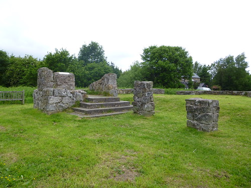
Fine old high jinks they had in former days on the hilltop of Cym-y-Bwch, the ‘Horns of the Buck’, just outside Oswestry where Shropshire looks west into Wales.
First published in: The Times Click here to view a map for this walk in a new window
picture picture picture picture picture picture picture picture
Facebook Link:
From Georgian into Victorian times, hotly contested horse races were held up here, competing for purses of golden guineas and the solid silver Sir Watkin Williams Wynn Cup. What with the drinking, gambling, pickpocketing and lewd behaviour that came to plague the occasion, the gentry stopped attending, and in 1848 the last races were run.

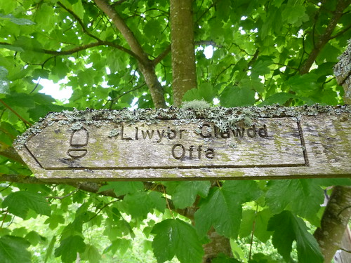
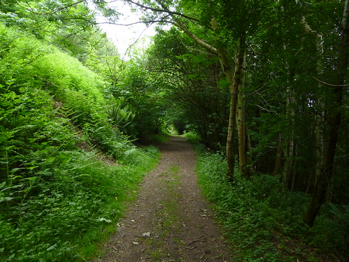
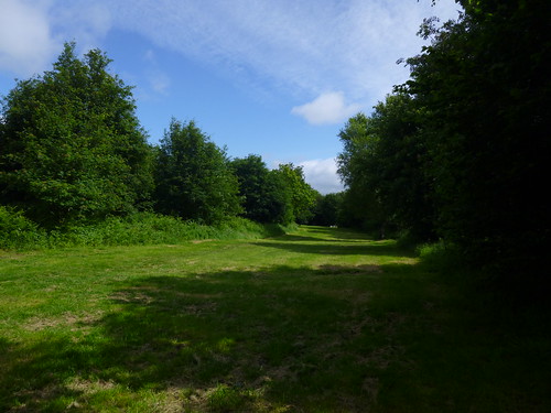
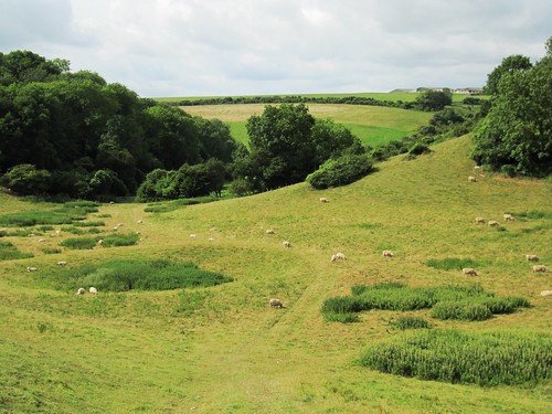
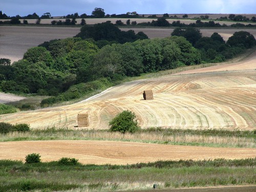
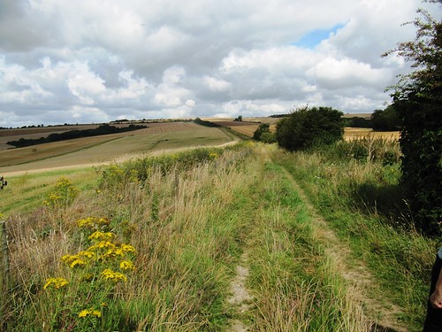
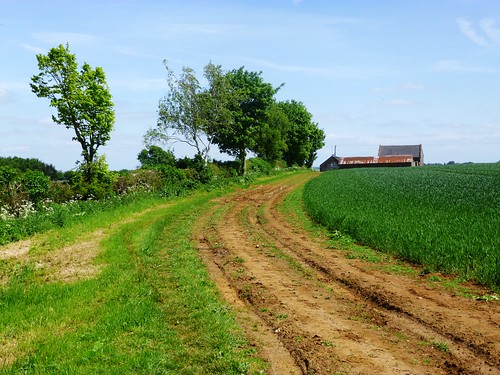
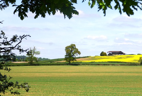
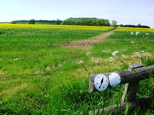
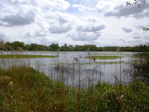
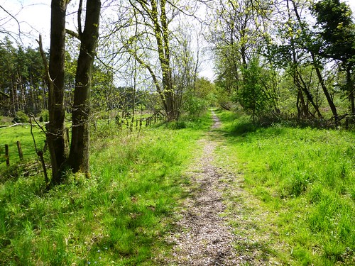
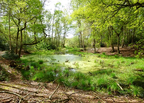
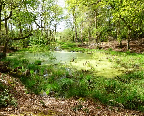
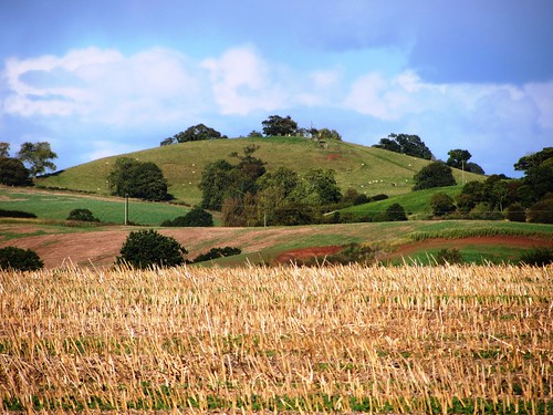
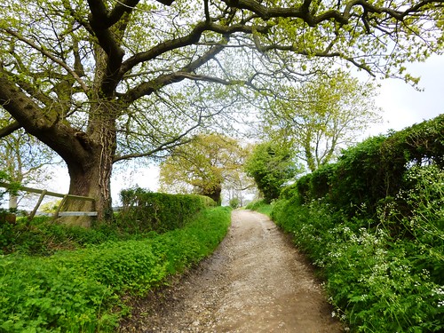
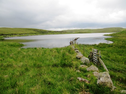
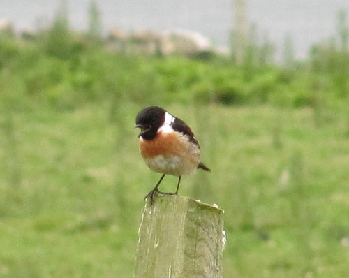
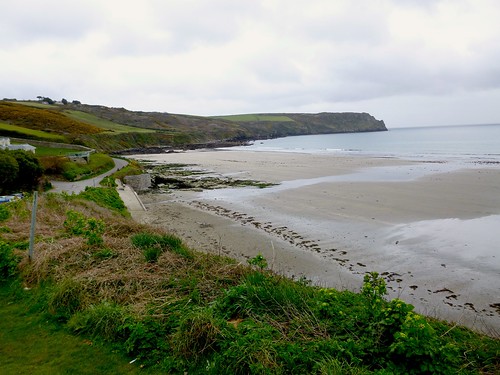
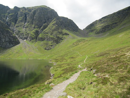
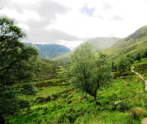
These days the old grassy figure-of-eight track is a favourite place to take a breather and walk the dog. The Offa’s Dyke Path National Trail runs through the Old Racecourse, and we followed its straight course along a thickly wooded scarp edge among firs that gave out a resinous, almost buttery smell. Tiny goldcrests flitted in the treetops. A brisk, blowy sky ran overhead, and huge views opened from the blue distances of the Cheshire plain to the Long Mynd and the Breidden Hills further south.

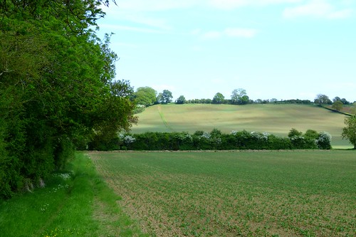
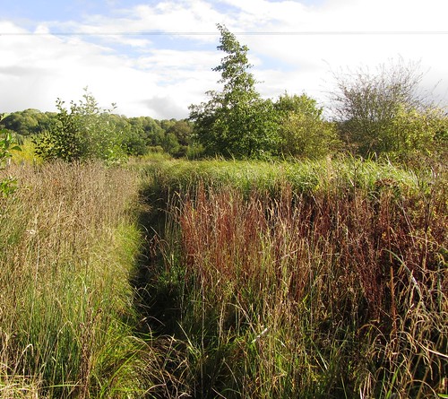
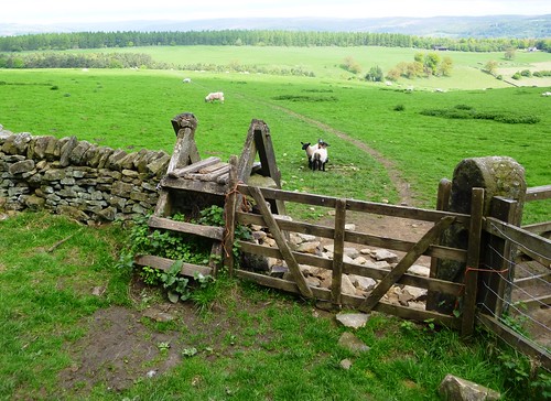
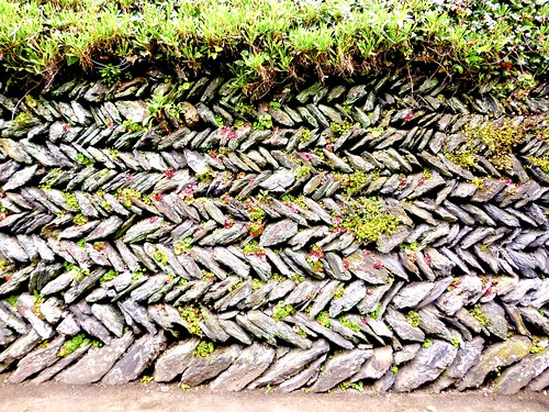
A tangle of steep lanes led out of the trees along the line of Offa’s Dyke. In the fields beyond Pentre-shannel farm we found the old rampart more than man-height, its earthen bank knitted with big oak and ash trees and burrowed to a grey tissue by rabbits that scampered for cover. By a cottage on a green lane we met a couple walking their sheepdogs ‘Oh,’ said the woman, ‘try Hafod Lane if you want lovely flowers and views.’

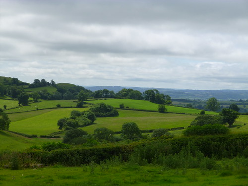
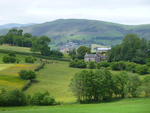
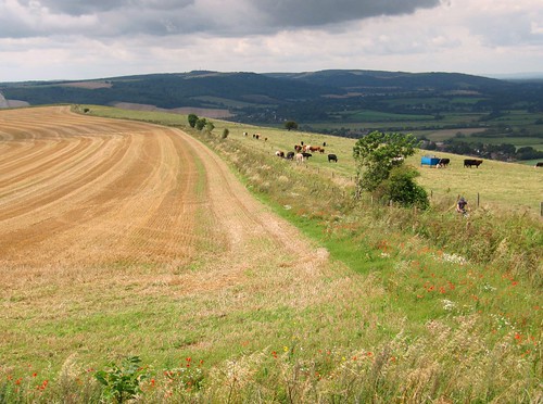
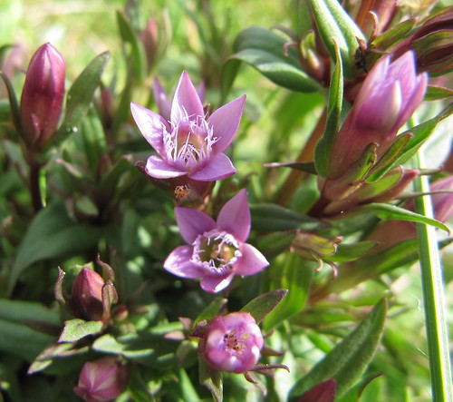
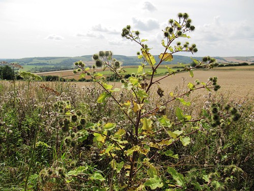
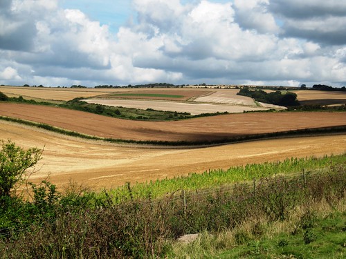
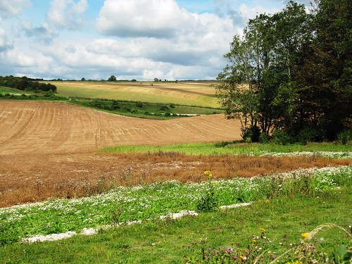
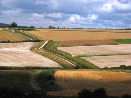
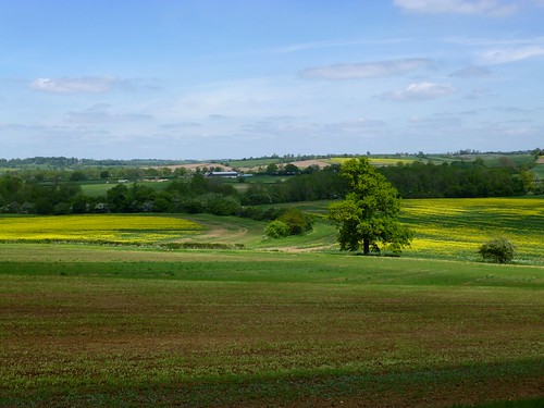
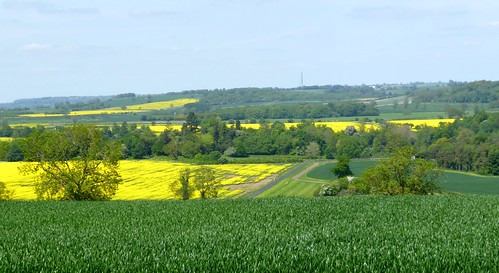
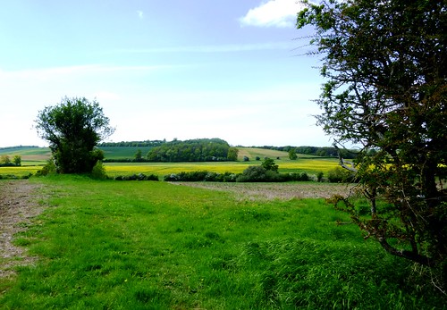
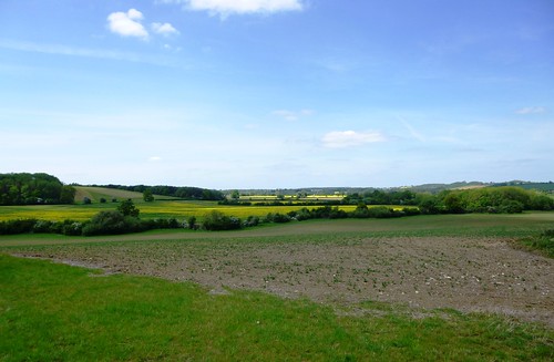
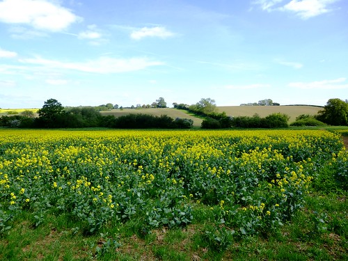
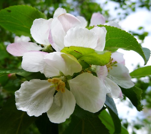
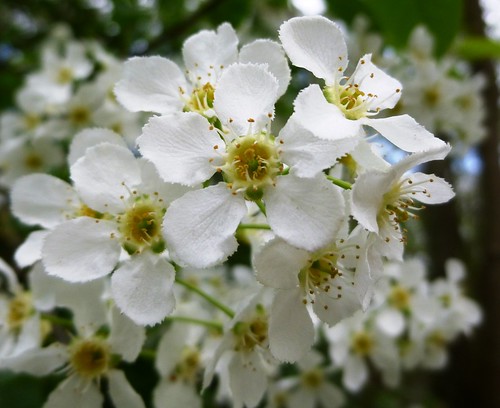
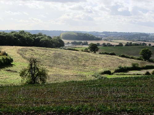
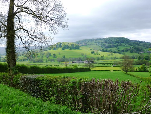
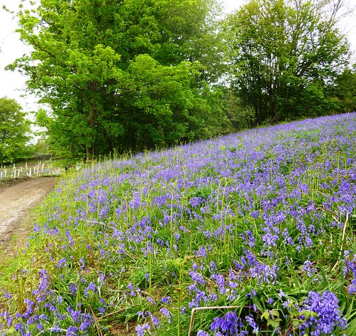
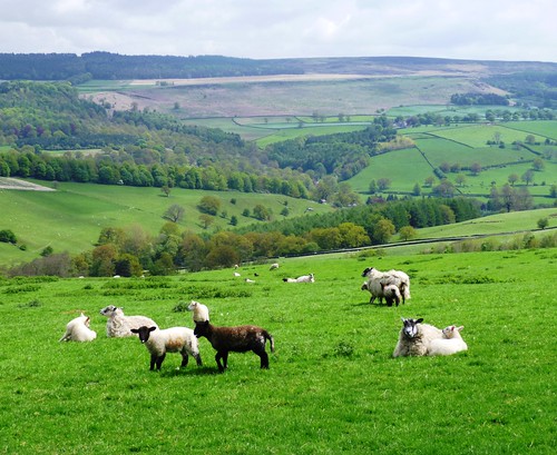
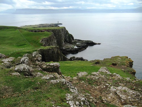
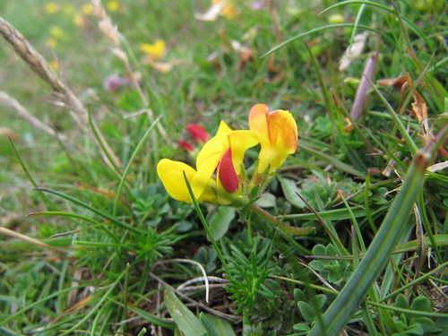
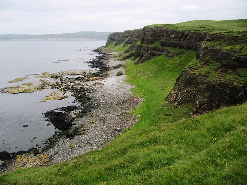
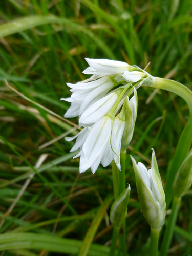
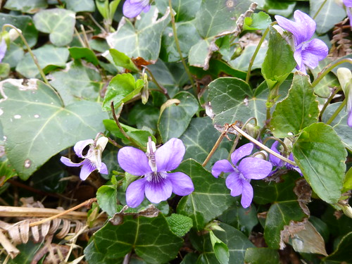
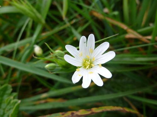
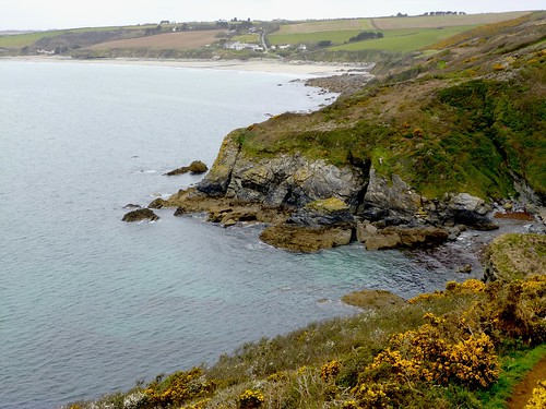
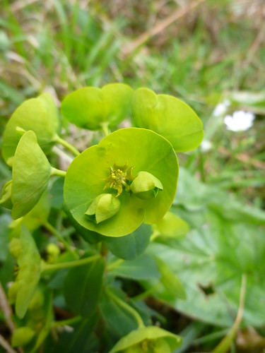
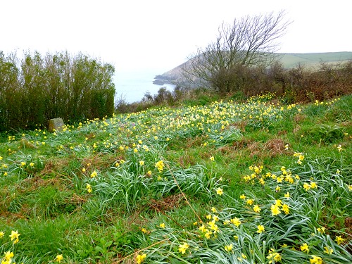
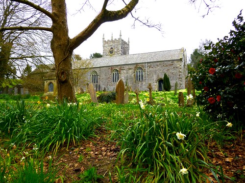
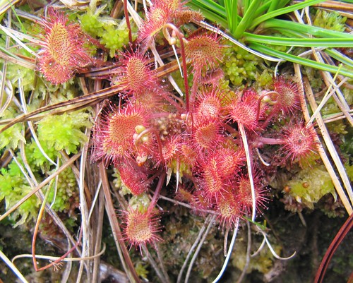
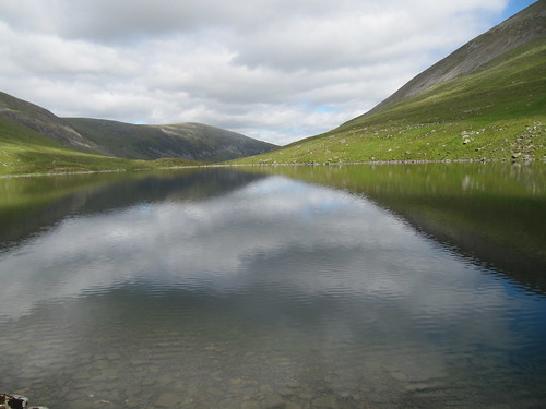
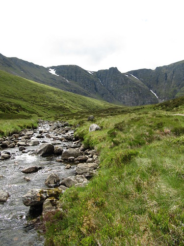
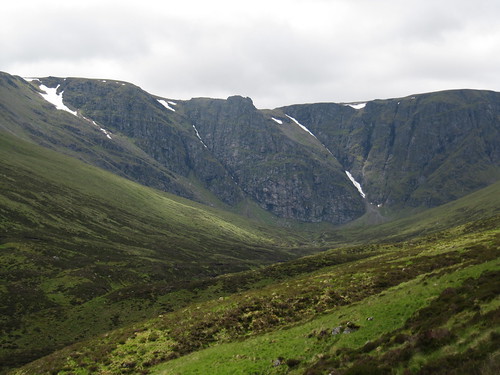
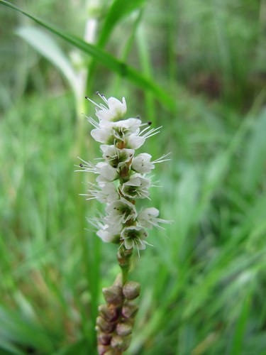
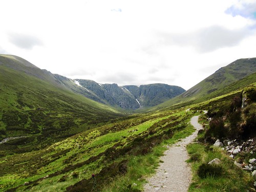
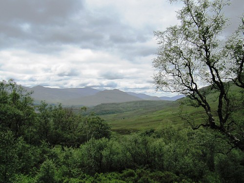
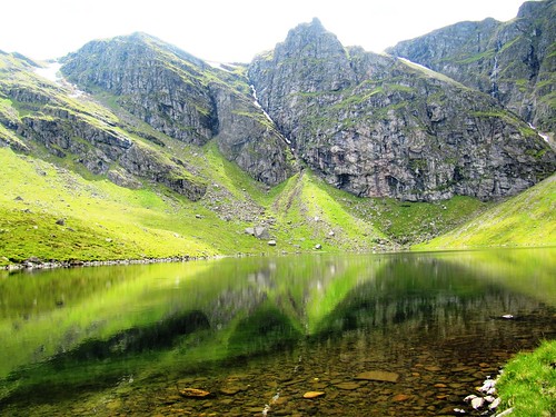
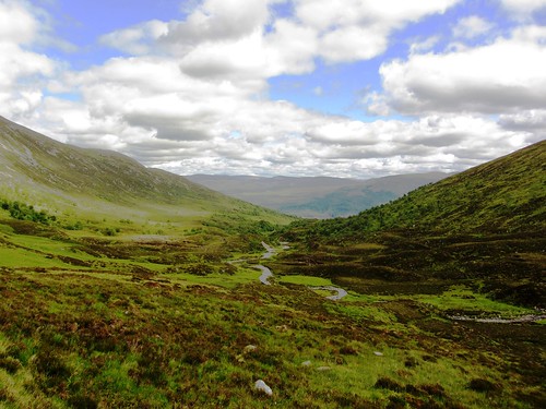
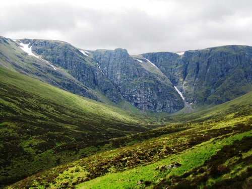
It proved a great piece of advice. The narrow lane runs round the flank of the knobbly hill of Mynydd Myfyr. We climbed between banks of frothy yellow crosswort, red campion, blue speedwell and little scarlet wild strawberries to a superb view west over green lumpy country towards the higher Welsh hills – a steeply folded landscape nurtured and shaped by sheep and cattle farming, but somehow retaining a smack of wildness.

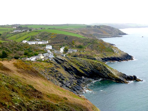
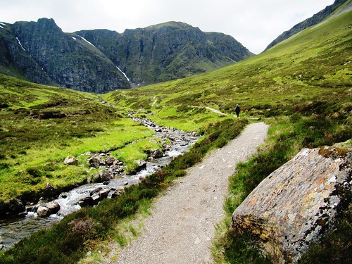
We found a path skirting the northern slope of Mynydd Myfyr. A lonely farm lay there, so deep in its cleft that only its roof showed until we were right on top of it. We crossed fields of lush grass and descended flower-bordered lanes, then headed back into the woods once more. A stiff climb, a shady tunnel of firs, and we were up at the Old Racecourse, on the Horns of the Buck, with the wind in our faces and a fifty-mile view to savour.

Start: Oswestry Old Racecourse car park, Shropshire, SY10 7HL approx. (OS ref SJ 258305).

Getting there: Signed to left off B4580 Rhydycroesau road, 2 miles west of Oswestry.

Walk (7½ miles, moderate, OS Explorer 240): Turn left along grass track of Old Racecourse to Janus Horse sculpture (257303). Left here along Offa’s Dyke Path/OD (yellow arrows/YA, OD acorn symbols) for 2 miles, passing Pentre-shannel farm (257279) to reach a lane (258274, ‘Trefonen ½ mile’). Leave OD and turn right to T-jct. Over stile (YA, ‘50’ logo), up hedge, through gate (254273). Aim a little right of white cottage opposite, crossing 2 fields (stiles, YAs) to green lane (250273). YA points right, but go left to road by cottage.

Left along lane for ¼ mile to junction just past New Barns (250269). Right here through gateway and up drive. Through gate, on along right side of barns; follow track across 2 fields to cross stile on right of gate (245268). Right up Hafod Lane round Mynydd Myfyr for a little over ½ mile; turn right over stile (243277, ‘footpath’) up hedge to stile (YA). Follow fence on left (YAs, stiles) to Pant-y-ffynon farm. Right into grassy drive (247277, YA), left along it. Through gate, immediately right over stile (YA); half left across field to cross stile to left of gate (249276, YA). In bottom right corner of next field, stile into lane.

Left; in 100m, right over 2 stiles close together (250277); half right across field to go through hedge gap a little to right of tall trees (249279). Keep parallel to the upper hedge, down to cross stile, right along track to road at Croesau Bach (247280). Cross road; bear right along lane opposite for ⅔ mile, down to bear left across bridge (256282). Follow Offa’s Dyke Path for ¼ mile back into Candy Wood. Where OD turns right (254286), go left along woodland track. At first fork after that, go left (YA); at next fork, go right (252288, YA) for 600m along bottom of wood with river on left. Track then rises steeply to rejoin OD (255298); left to Old Racecourse car park

Lunch: Picnic; or Barley Mow, Trefonen (01691-656889; offasdykebrewery.com)

Accommodation: Helen Gilbert, The Pentre, Trefonen, Oswestry, postcode (01691-653952; thepentre.com) – first class, friendly B&B; evening meal by arrangement.

Information: Oswestry TIC (01691-662753/662488)

www.ramblers.org.uk www.satmap.com www.LogMyTrip.co.uk

 Posted by at 01:51
Aug 102013
 

A perfect summer’s morning over West Sussex – blue heavens with huge white cumulonimbus clouds reaching up from the South Downs skyline, warm sunshine spreading across the countryside like butter, and wood pigeons sleepily cooing in the beech trees around Burpham.
First published in: The Times Click here to view a map for this walk in a new window
picture picture picture picture picture picture picture picture picture picture picture picture picture picture picture picture
Facebook Link:
‘Good morning!’ quoth a man in a pink and white striped shirt, with that very British crispness that means, ‘Glad to see you in our beautiful village, but don’t drop any sweet papers, will you? Thank you so much!’

The old valley track of Coombe Lane brought us up from the village to the downs, its elder bushes and guelder rose and spindle all beginning to come into fruit. The sun released warm, spicy wafts from tuffets of wild marjoram where meadow brown butterflies staggered, half drunk on the smell. A clump of thistles seethed with hungry goldfinches. Glimmering chalkhill blue butterflies clung to the nettles that grew along the chalky banks of pale grey soil, burrowed into a powdery tissue by rabbits. Two marsh harriers had come up from the marshy banks of the River Arun, and we watched them making long slow passes through the valley on their long dark wings.

The downland slopes were a maze of pale gold stubble fields where big straw bales lay doubled over like blankets in a giant’s linen cupboard. The view widened back south from Wepham Down to a flat gleam of the distant sea, the Isle of Wight lying long in a grey haze on the south-west horizon. Up on the roof of the downs the ramparts of Rackham Banks – a Bronze Age cross dyke, probably a boundary marker, and a hill settlement in a hollow – were spattered with scabious, knapweed and poppies. We sat idling there, the chalk-white South Downs Way ribboning east and west, the ground plunging away north to the Arun snaking through the Sussex lowlands among woods and pastures.

The ancient ridge track dipped to Downs Farm, a pretty old farmhouse marooned in a monstrous muddle of harsh modern barns and silos. Here we turn off south, dropping into a steep, silent and nameless valley where sheep nibbled the turf and red kites turned on the thermals with crooked wings and subtly balancing tails. Then a last stretch beside the Arun, past an old tree-grown moated site that might well be part of the burh or fortified village established here by Alfred the Great eleven hundred years ago. A timeless walk, where now and then join hands seamlessly.

Start & finish: Burpham village car park, West Sussex, BN18 9RR approx. (OS ref TQ 039089)
Getting there: Train (thetrainline.com; railcard.co.uk) to Arundel (2½ miles). Road: Burpham is signed off A27 just east of Arundel station
Walk (7 miles, moderate, OS Explorer 121): From car park pass George & Dragon Inn; right along village street. Follow it out of Burpham for ⅓ mile, round right bend; left up Coombe Lane (044090; fingerpost, blue arrow/BA). Keep to bridleway along valley bottom, climbing gently for 1½ miles to T-junction of tracks (061106). Two tracks diverge to left; take right-hand one of these, at right-angles to direction you’ve been walking, heading north. In just over 1 mile, at T-junction of tracks (056122, ‘Restricted Bridleway’), right for 20m, then left (‘bridleway’ fingerpost in right-hand hedge) on chalk track between hedges. In 300m, at 3-finger post (053123) fork right (BA) to South Downs Way at Rackham Banks (051125).

Left for ¾ mile. Just before Downs Farm, left (038125, ‘Restricted Byway’). In 100m fork right (‘bridleway’ fingerpost, BA). Keep fence on right. In ⅓ mile, through gate (041119, BA) and on, with fence on right, into valley. At bottom, right through gate (BA); bear left up path, climbing slope; through gate at top and on over track crossing (044114, yellow arrow/YA). Ahead through corner of wood (044110, YA), then right (BA) down track with wood on right, and on for ½ mile. Look out for gateway with BAs on right (040102), and take footpath just to right of it (YA) between fences, then steeply down to bottom of steps (039103). Left (BA). In ⅓ mile pass old quarry on left; in another 50m, right over stile (035099, YA); turn left, and follow fence on your left (stiles, YAs). In ¼ mile skirt right of old moat with trees (033094, YA). Ahead along river; in ⅓ mile climb left up bank (038089) into Burpham.
Click on Facebook “Like” link to share this walk with Facebook friends.

Lunch: George Inn, Burpham (01903-883131; gdinn.co.uk)
Info: Arundel TIC (01903-737838)

visitsussex.org; visitengland.com; www.ramblers.org.uk www.satmap.com www.LogMyTrip.co.uk

 Posted by at 06:22
Aug 032013
 

Runswick Bay, pride of the North Yorkshire coast, is an utterly charming, easel-friendly jumble of red-roofed, white-walled houses.
First published in: The Times Click here to view a map for this walk in a new window
picture picture picture picture picture picture picture picture
Facebook Link:
They stand piled in one corner of a perfectly semi-circular bay whose cliffs have been assiduously quarried and mined over the centuries. The steep green slopes are patched with the black scars of landslips and footed in pebbles of black, red, ochre, cream and chocolate, colours betraying the presence of a treasury of minerals. You can still pick up pieces of raw jet on the beach after cliff falls, not to mention the ammonites and remains of prehistoric reptiles for which these bays are famous.

This is a dangerous coast for contrary currents and winds. Runswick Bay’s lifeboat is not just there for show. The crew was always traditionally drawn from the local fishermen. On one occasion in 1901, all the able-bodied men of Runswick Bay – including the lifeboatmen themselves – were out at sea fishing when a storm blew up and threatened them. It was the women on shore who launched the lifeboat, and the old and infirm men of the village who clambered in and rowed it to the rescue.

Beyond Hob Holes caves we climbed a steep flight of stairs and were away along the cliffs, looking ahead to where Whitby Abbey stood in Dracula ghostliness on its headland, eight miles off as the fulmar flies. The red pantiled roofs of Kettleness hamlet rose high above the bulbous snout of Kettle Ness, eroded by alum mining to a blunt stump of land.

We skirted above landslip bays where dense undercliffs of heather and grass never see a human footfall, and turned back inland through fields corrugated with medieval ridge-and-furrow. The grassy foundations of a Roman lookout tower lay low on a hump of ground. The tower’s minders evidently came to a bloody end at the hands of German barbarian pirates; archaeologists unearthed their skeletons, together with that of their dog, crushed in the ruins.

Lapwings wheeled and tumbled over the meadows, brown hares scampered in the long grass. We followed the track of an old railway on a great curve through the fields, and dipped down through the trees to Runswick Bay once more, a shining strand scattered with sea-smoothed stones, tide-rinsed and gleaming in our fingers.

Start: Runswick Bay car park, N. Yorks, TS13 5HT (OS ref NZ 810160)

Getting there: Road – car park is signed from Cliffemount Hotel at Runswick Bank Top (signed as ‘Runswick’ from A174 Whitby-Loftus road)
Bus – Service 5 (getdown.org.uk), Whitby-Loftus

Walk (9 miles, moderate, OS Explorer OL27. NB: online map, more walks at christophersomerville.co.uk): Right along beach. In ½ mile, just past Hob Holes caves, right (815154, Cleveland Way/CW acorn symbol) up rock, then wooden steps to cliff top. Follow CW for 2¾ miles. At Tellgreen Hill headland, right inland (850145; ‘Lythe’ fingerpost). In 150m, yellow arrow/YA points ahead, but go right here to Overdale Farm drive (847143): ahead to road (840144). Right to Goldsborough (836147). Follow ‘Kettleness’; in 50m, right (‘footpath’) through farmyard; on through gate (YA) down green lane. Through gate (836148, YA); half left via Roman lookout tower mound (835151) to shed in field corner. Over stile (YA); down to chapel (833153); over 2 stiles to road; right into Kettleness.

Left along old railway track (832155) for 2½ miles. Beside Low House, right off railway (807151) on track down to beach (812156); left to Runswick Bay.

Lunch: Royal Hotel (01947-840215) or beach café, Runswick Bay.

Accommodation: Cliffemount Hotel, Runswick Bay (01947-840103; cliffemounthotel.co.uk) – welcoming hotel perched above Runswick Bay.

yorkshire.com; visitengland.com; www.ramblers.org.uk www.satmap.com www.LogMyTrip.co.uk

 Posted by at 01:43
Jul 272013
 

A gloriously sunny day was spread across the bean-green and rape-yellow fields of the Oxfordshire/Northamptonshire border.
First published in: The Times Click here to view a map for this walk in a new window

picture picture picture picture picture picture picture picture picture picture picture picture picture picture
Facebook Link:
At Thorpe Mandeville the sun bathed the dark gold stone walls of the Three Conies inn, ancient resort of drovers and packmen, as I made my way out of the village.

In the medieval wall paintings in St John the Baptist’s Church the infant Jesus rode the broad shoulders of St Christopher, the eyes of saviour and saint glowing like coals out of the faded pigments. I stopped in the churchyard to pay my respects at the granite memorial to Percy Honri, ‘The World’s Greatest Concertinist’, born in Thorpe Mandeville in 1874. Honri was so famous and successful a concertina player that he could afford to turn down a personal invitation from John Philip Sousa to join the great march composer’s band. He lies in a modest grave, returned in death to the place where his incredible journey began.

Out in the low-rolling countryside the overgrown trackbed of the Great Central Railway ran through fields of wheat and of pale, iron-rich earth. This is horse country; railed-off training gallops rollercoastered down the slopes, and a girl on a grey mare gave me ‘Good morning’ as she cantered by. In the early morning of 26 July 1469, it was the drumming of charging horse hooves that the hapless men on the crest of Edgecote Hill heard, long before they saw their enemies come bursting over the ridge towards them.

Images from BBC1’s The White Queen came vividly to mind. The Earl of Pembroke, trying to put down a rebellion by the Earl of Warwick against his master King Edward IV, had drawn his forces up on the hill, and had beaten off a strong attack already. But when Warwick’s rebels came thundering in from another quarter entirely, the King’s men threw down their weapons and took to their heels. A terrible slaughter ensued; some say 5,000 men or more died in the battle and its aftermath. Standing where Pembroke’s men had stood, I could see just how it had happened – they wouldn’t have had more than a minute’s warning of the nemesis sweeping down on them. I’d have run, that’s for sure.

I went on along the crest of the hill and down through fields of horned ewes to Upper Wardington, all mellow stone and green sward in the sun. The homeward path threaded fields where sheep stood on their hind legs nibbling the hawthorn hedges, blue dots of speedwell studded the headlands frothing with gypsy lace, and enormous harlequin views of green and gold unfolded to the south and west under the cloudless bowl of the sky.

Start: Three Conies PH, Thorpe Mandeville, OX17 2EX (OS ref SP 531447)

Getting there: Bus – Service 499, 508 (helmdon.com), Banbury-Brackley
Road – M40 Jct 11 (Banbury); A422 towards Brackley; in 1 mile, B4525 (‘Sulgrave Manor’); Thorpe Mandeville signposted in 2½ miles.

Walk (7 miles, easy, OS Explorer 206): From Three Conies PH, right along village street. By church gate, left through field gate (532449, ‘footpath’ fingerpost): up field edge. At top of churchyard, right through gate; across to top right corner of paddock; stile; across field to far right corner (528452). Through hedge onto Hill Farm drive; right through gate; follow hedge on your right past spring in hollow; on over ridge, down to cross disused railway (528456, Millennium Way; blue arrow).

Follow path north. In ⅔ mile, left up hedge (525465, Battlefield Trail/BT); over crest; down to cross stream (520465). Half right across field (BT); up right side of wood (BT); on through Edgecote Lodge farmyard (514467, BT). At end of farmyard, right across field; follow track (BT) past Douglas’s Barn (508465), across horse gallop, past Hill Barn (503466) to cross stile at meeting of 5 tracks (499464). Half left (BT) downhill; through double gateway (498462, BT); half right across meadow to kissing gate and path to Upper Wardington and Plough PH (495461).

Return to kissing gate; follow yellow arrows (YA) across fields. In 3rd field at top of rise, right down hedge (503462, YA); follow YAs. In 1 mile, cross stile (514452); bear right of stone barn to stile (black arrow/BLA); descend to disused railway (516452). Straight across; up far bank on path bearing right. At top, cross grassy ride; ahead on path into trees. In 10m, fork left through trees to cross stile (517451). Across 2 pastures (YA, stiles). At far side of 2nd pasture, follow path bearing right through trees. In 100m, fork left and over stile (522450, YA). Ahead across field, keeping right of telegraph poles. In far right corner, cross stile (523450, BLA); follow hedge on left to corner (526450); bear right to stile (528449). Cross road; cross field opposite (‘footpath’) to Thorpe Mandeville.

Lunch: Plough Inn, Upper Wardington (01295-750476; closed lunchtimes Mon-Fri, but groups welcome – please telephone); Three Conies, Thorpe Mandeville (01295-711025)

Accommodation: Brasenose Arms, Cropredy, Banbury OX17 1PW (01295-750244; brasenosearms.co.uk) – friendly pub, frequent live music

Battle of Edgecote Moor: battlefieldstrust.com

www.ramblers.org.uk www.satmap.com www.LogMyTrip.co.uk

 Posted by at 01:02
Jul 202013
 

Under the silver birch and oaks of Stow Bedon Covert, shallow ponds lay dotted across the peaty ground, their mirror-still dark water skinned across with pond weed and tufted with clumps of rushes.

First published in: The Times Click here to view a map for this walk in a new window
picture picture picture picture picture picture picture picture picture picture picture picture picture picture picture
Facebook Link:
They have lain here in the flat dry landscape of Breckland, south-west Norfolk’s great belt of sand and pebbles, since the end of the last glaciation 10,000 years ago – pingos, Ice Age holes where ice blocks melted and left a string of lakelets behind.

We followed the Great Eastern Pingo Trail as it wound between the pingos. They lay absolutely still, like pieces of polished sky dropped in among the trees. The trail snaked over former commons, now grazed for wildlife conservation. We passed a group of Highland cattle with extravagant horns who stared at us from their bower of apple blossom with utter indifference before resuming the grooming of their nostrils with long pale tongues.

This maze of pingos and flowery fields is just made for sauntering. At last we found ourselves on a country road that declined to a flint-pebble track and then a green lane where an avenue of big old oaks and willows formed a double guard of honour for travellers. Chiffchaffs chirped out their twin tone calls; wrens chattered, greater spotted woodpeckers rattled the hollow trees, and some unseen and unidentified sweet singer glorified a may-bush right beside us as we sat on a stump to take it all in.

We followed a sluggish little river, petrol-blue with peat iridescence, and came to Thompson Water, where a cramped little bird hide gave us an Attenborough’s-eye view of the reedy lake. A swan sat on her egg twenty feet away; another sailed with her six fluffy grey cygnets, oblivious of our presence. Over the water swallows circled like circus acrobats around a flight of hobbies, small dark raptors that zipped across the mere, every now and then hunching their heads between their legs to pick a dragonfly victim from their claws and crunch it in mid-glide.

The puddled track of the Peddar’s Way, an ancient high road through Breckland, brought us south past MoD ranges of sheep-grazed heaths and sombre blocks of conifers. Then we swung north along the track bed of the Great Eastern Railway’s old Thetford-Swaffham branch line, a homeward path by Breckles Heath and Cranberry Rough where the pingos lay thick with water violets. Along the way we discovered that crab apple blossom smells of roses. A day of wonders, truly.

Start: Great Eastern Pingo Trail car park on A1075 near Stow Bedon, Norfolk, NR17 1DP approx. (OS ref TL 941966).

Getting there: Car park is on A1075 Watton-Thetford road, on west side, 3 miles south of Watton.

Walk (7 miles, easy, OS Explorer 237. NB: online map, more walks at christophersomerville.co.uk): Walk away from A1075 to ‘Old Station Yard’ notice. Turn right through car park; on through kissing gate (‘Thompson Common nature reserve’). Cross boardwalk, and follow ‘Great Eastern Pingo Trail’/GEPT arrows through trees for ½ mile to road (934966). Left, and follow GEPT for 2 miles to pass Thompson Water and reach Peddar’s Way (913948). Left (‘Stow Bedon 7’). In 1 mile pass chicken farm on left to reach crossing of tracks (921933). Left off Peddar’s Way’/GEPT; follow fence on left for 500 m. At ‘Peddar’s Way Circular Walk’ arrow (926936), right down grassy ride; ahead to old railway line (928931). Left for 2¼ miles to car park.

Lunch: Chequers Inn, Thompson, IP24 1PX (01953-483360; thompsonchequers.co.uk)

Accommodation: Olde Windmill Inn, Great Cressingham, IP25 6NN (01760-756232; oldewindmillinn.co.uk)

Information: Watton & Wayland Visitor Centre, Wayland House, High Street, Watton IP25 6AR; tel 01953 880212; waylandtourism@aol.com; www.wayland-tourism.org.uk

www.ramblers.org.uk www.satmap.com www.LogMyTrip.co.uk

 Posted by at 04:28
Jul 132013
 

A brilliant blue day of wind, with big clouds sailing over Warwickshire, building and dissolving in towers of rain and blurry shafts of sunlight.
First published in: The Times Click here to view a map for this walk in a new window
picture picture picture picture picture picture picture picture picture picture picture picture picture picture picture
Facebook Link:
Jane and I were planning on a quick circuit of the fields and woods around Coughton, but we hadn’t reckoned with the seductive powers of Coughton Court. This handsome old house, seat of the staunchly Catholic Throckmorton family, was one of the centres of conspiracy of the Gunpowder Plotters in 1605.

The explosive old story, its heroes and villains twisted topsy-turvy by the distorting mirror of religion, held us spell bound. One peep down the secret alcove of the Tower Room into the deep, chilly refuge of the priest’s hole concealed there was enough to summon up all the desperation and paranoia of that mistrustful age.

Walking away from the grand old house, we crossed thick clay ploughland studded with flood-smoothed pebbles. Big centuries-old oaks in the hedges, rooks sailing with the wind, and lacy curtains of rain sifting sideways across the gently rolling landscape. We crossed the River Arrow, red with mud as it coiled lazily through the fields near Spernall, and went on over a little hill sown with thousands of young poplars and cherries, silver birch and sweet chestnut. These dense plantations of infant trees are a wonderful feature of this walk, an ambitious reseeding of William Shakespeare’s sadly diminished Forest of Arden.

We passed the neat brick house and the immaculately kept garden of St Giles Farm, and found ourselves forging through head-high rushes and reeds on a squelchy path with young aspen leaves quivering a translucent cherry-red against the blue sky. A group of buzzards rode the wind over Spernall Park Wood, their cat-like calls cutting across the continual, wind-generated susurration of the oaks on the knoll.

From Round Hill the path ran south with the Cotswold hills folding gracefully in sunlight far ahead, and then made west over the hump of Windmill Hill along an old green lane. Blackthorn, hawthorn, guelder rose and spindle spattered the hedges with their varying berry shades of crimson, pink and scarlet, and the sky raced vigorously overhead until we came back to Coughton.

Start: Coughton Court, Coughton, Warwickshire, B49 5JA (OS ref SP 082607). NB NT car park – non-members pay. If not visiting Coughton Court, park in Coughton village.
Travel: Road: Coughton Court is signposted in Coughton, on A435 between Alcester and Studley.
Bus: 26 Redditch-Stratford (stagecoachbus.com)
Walk (6 miles, easy, OS Explorer 220. NB – Detailed description (recommended!), online maps, more walks at christophersomerville.co.uk):

Starting from Coughton Court NT car park – Turn left (away from house) through gates and across overflow car park field. Through kissing gate (083608) to join Arden Way/AW.
Starting in Coughton village – go north along A435; pass car entrance to Coughton Court; turn right (‘Arden Way’/AW) across field to kissing gate at 083608. Turn left here along AW.

Both routes now keep ahead along field edge. At far end (082612; AW, Millennium Way/MW), right for 50m; then left through kissing gate (no waymarks). Cross field, through kissing gate (085615; AW, MW); on to cross River Arrow (086618). On to road by Spernall Church (087621). Ahead (AW, MW) to T-junction; right along road (MW) for 300m. Pass Rose Cottage on left; through kissing gate just beyond (089624, MW) and on, up and over a hill, following MW. On far side, under power lines (092626), a broad grass path forks right, but keep ahead here (MW yellow arrow on telegraph pole) with hedge on left, down to cross drive (095629). Through wicket gate (yellow arrow/YA); along edge of St Giles Farm garden; through another gate (MW) and on under power lines. Through gate on far side of field (095631, MW); cross stream and turn right off MW (YA) along rushy path, under power lines again to cross road (098630).

Through pedestrian gate (YA); on with wood on right. Through kissing gate; bear right between plantation and hedge (YA), then across field to corner of Spernall Park Wood (101626). Follow path round right-hand edge of wood. Where it curves into trees (104624), keep ahead down grassy ride, then through kissing gate. Keep ahead (YA) across a field, through kissing gate (106624); across next field, aiming to left of tree. In top left corner of field, turn right down steps onto lane (108623). Left for 150m; right through gate; left (YA) along hedge for 2 big fields, into trees (110618). Through gates; in 15m, right (YA) out of trees and along hedge. Follow field edge to go through kissing gate by a house (110613). Right down drive (‘Heart of England Way’) to road (109610). Right for 30m; left along green lane (AW) for 1½ miles to road (085603). Right to cross river by footbridge beside ford. In 200m, right (083604, ‘Coughton Court’) to car park.

Lunch: Picnic, or Coughton Court restaurant/tea room

Coughton Court: 01789-400777; nationaltrust.org

Information: Redditch TIC (01527-60806)
www.ramblers.org.uk www.satmap.com www.LogMyTrip.co.uk

 Posted by at 04:49
Jul 072013
 

A brisk wind was hurrying from the north over Derbyshire, pushing grey clouds down the long valley of the River Wye.
First published in: The Times Click here to view a map for this walk in a new window
picture picture picture picture picture picture picture picture picture picture picture picture picture picture picture picture
Facebook Link:
Looking back from the heights of Rowsleymoor Woods across the valley with its intense greens of pasture and hedges, the farther peaks topped with bushy spinneys under a sky of gunmetal grey and Chartres blue, I thought a palette of two or three colours could catch the whole scene.

A pair of mountain-bikers passed me, panting hard. I followed them across a common of peaty soil and pine trees cushioned with big tuffets of moss, and came out of the trees onto the wide green sheep walk of Calton Pastures. This open grassy upland looks more like the undulating, unfenced pastures of Eastern Europe than anything you’d expect to see in the compartmented farmlands of England. Alone in one corner stood an ornate gingerbread cottage with white bargeboard and elaborate window shutters – the Russian Cottage, built as a full-size copy of a model farmhouse given to the 6th Duke of Devonshire in 1855 by his good friend Czar Nicholas II, Emperor and Autocrat of All the Russias.

The Cavendish family, Dukes of Devonshire, are the power in the land hereabouts. Emerging from New Piece Wood I was overwhelmed by what must be the most striking of all views of their great mansion of Chatsworth House. The building rises beyond the River Derwent’s meadows, an enormous cube of windows and walls among formal gardens, its Emperor Fountain blasting a mare’s-tail jet of water a hundred feet into the air, the pepperpot domes of the 16th-century Hunting Tower rising among the trees beyond. Chatsworth owes a lot of its effect to the sombre wildness of the Peak District moors that back it to the east. A jewel of orderly civilisation in a wilderness setting was the effect that the 1st Duke of Devonshire was aiming for when he built the place in 1687-1707, and even today you can see exactly what he was after.

The 6th Duke was lucky to have the brilliant designer Joseph Paxton as his right-hand man in the mid-19th century when he rebuilt Edensor village just over the hill from the house (having cleared away the existing settlement because it was spoiling his view). I went to pay my respects at Paxton’s tomb behind St Peter’s Church; he lies a little down the hill from the Dukes that commissioned him to design their gardens and glasshouses and estate buildings. Then I went slowly back to Rowsley by way of the flat, wide and lovely meadows along the Derwent.

In 1849 Joseph Paxton designed a beautiful little station for a railway line that was to run up the Derwent valley past Chatsworth. The 6th Duke objected, the line was never built, and now Paxton’s station stands marooned among the retail outlets of Peak Village Shopping Centre in Rowsley – as fine a picture of Dignity and Impudence as you could hope to find.

Start: Walker’s Zone car park, Peak Village Shopping Centre, Rowsley, Derbyshire, DE4 2JE (OS ref SK 258660)

Getting there: Rowsley is on A6 Bakewell-Matlock road
Bus: ‘The Sixes’ (trentbarton.co.uk), Bakewell-Matlock; ‘Transpeak’ (highpeakbuses.com), Matlock-Buxton

Walk (9 miles, moderate, OS Explorer OL24): From Grouse & Claret Inn, right on A6 across bridge. Right up Church Lane (256658), which becomes stony lane. In 1¼ miles, at metal barrier, lane forks (244670). Take upward path to right of right-hand fork (BA, ‘Chatsworth’), following BAs through woods and across Calton Pastures for 1¼ miles to descend to wall at Calton Plantations (243286). Through gate; sharp right along wall (BA). In 200m bear left beside gate (244685). Cross pasture near Russian Cottage, following BA (‘Edensor, Chatsworth’). Through shank of New Piece Wood to gate (247689) and view of Chatsworth House. Half right to waymark post; ahead (YA) past Maud’s Plantation and aim for Edensor church spire.

From Edensor cross B6012 (251700); bear right on stony path to Palladian bridge (257702). Don’t cross, but turn right through meadows on Derwent Valley Heritage Way (DVHW). In nearly 1 mile, at mill ruin, right up bank to cross B6012 (258688); left past car park on path marked ‘Garden Centre, Calton Lees’, then minor road to Calton Lees. Left at junction (257682; ‘Rowsley’ fingerpost). By Calton Lees Cottage, left through gate (257680; ‘Rowsley’); follow wall, then DVHW arrows. At end of 2nd big meadow, right over stile (260667, DVHW); on to lane to Rowsley.

Lunch: Edensor Tea Cottage (01246-582315)

Accommodation: Devonshire Arms, Beeley, DE4 2NR (01629-733259; devonshirebeeley.co.uk)

Chatsworth House: chatsworth.org
www.ramblers.org.uk www.satmap.com www.LogMyTrip.co.uk

 Posted by at 15:39
Jun 292013
 

The bent arm of Rathlin Island lies off Ballycastle in North Antrim, not far from the Giant’s Causeway promontory of 37,000 hexagonal columns.
First published in: The Times Click here to view a map for this walk in a new window
picture picture picture picture picture picture picture picture picture picture picture picture picture picture picture picture
Facebook Link:
It’s the Causeway that gets the tourist crowds; Rathlin Island, rising five miles offshore beyond the lively tide rip of Sloch na Marra (‘Valley of the Sea’), retains a sense of dreamy loneliness that calls to any walker with an ounce of poetry in the soul.

We set out from the island jetty in company with Sean Mullan whose walking tour company is named, with Ronseal simplicity, ‘Walking & Talking In Ireland’. That’s exactly what we did all day – chatted and pontificated as we strolled the flowery island road between reed-fringed loughs, heading east and south through Rathlin, joking and speculating on any and every subject from Richard Branson (he was once rescued by the Rathlin boatman from a ditched balloon) to the mating habits of fulmars.

It was one of those dove-grey Irish days, softly and subtly lit under steamy clouds. Big spotted orchids lined the verges, meadow pipits swooped from post to post beside us, and Irish hares with short ears and long racehorse legs bounced gracefully across the small stone-walled fields. A strong breeze rippled the barred feathers on the backs of greylag geese foraging in a patch of bog. We followed the winding road south until it dipped to the remote little harbour of Ushet Port, nowadays sheltering no more than the roofless ruin of a kelp factory where seaweed was once processed. What a view those workers had as they toiled, out across the sound to the dramatic dark Antrim cliffs, round east to where the Mull of Kintyre runs a spine of hills along the sea horizon.

We sat among pink candytuft bursts of thrift, watching a fleet of stout-billed eider ducks sailing the inlet where seals lolled like fat boys about to burst out of their romper suits. There was no sound except the soft cooing of the eider drakes and a constant lap-lap of water against the orange lichen stains of the rocks.

At last we tore ourselves loose from the soporific spell of Ushet Port, and turned for the village along clifftops feathery with thrift and canary-yellow kidney vetch. There could hardly be a more peaceful island than Rathlin on a still summer’s afternoon such as this. Better go there sooner rather than later, though – 530 million barrels of oil have just been discovered under Rathlin Sound, and the jury is out on what’s going to happen next.

Start & finish: The Harbour, Rathlin Island, BT54 6RT (OSNI ref D146510)
Getting there: Bus – Service 172 (translink.co.uk) Coleraine-Ballycastle
Road – A2 to Ballycastle, then Rathlin Island ferry (booking essential; check timetable – 028-2076-9299; rathlinballycastleferry.com).
Walk (6 miles, easy/moderate, OS of Ireland Discoverer 5. NB Online map, more walks at christophersomerville.co.uk): Right along harbour past Boathouse Visitor Centre. Fork right past Kelp House ruin along shore road. At T-junction, right along main island road for 1¾ miles) to end of road at Ushet Port. Returning, in 200m left through gate into RSPB Roonivoolin reserve. Left along fence (‘Roonivoolin Walk,’ ‘Coastal Walk’, black/orange arrows). Where fence ends at cliff, right inland along fence (arrows). Descend into valley between telegraph poles, aiming for waymark post on saddle of ground. Follow waymarks and grassy track, keeping Ushet Lough on right, to reach road. Left to harbour.
Lunch: McCuaíg’s Bar (028-2076-0011), or picnic
Guided walks: Sean Mullan, Walking & Talking Ireland (074-745-9366; WalkTalkIreland.com). Other walking info: walkni.com
Rathlin Island info: rathlin-island.co.uk
Ballycastle TIC: 028-2076-2024; www.ireland.com

www.ramblers.org.uk www.satmap.com www.LogMyTrip.co.uk

 Posted by at 09:10
Jun 222013
 

The sleeping-bloodhound profile of Nare Head is veiled in sea fret, and it’s tempting to turn back into the comfortable warmth of the Nare Hotel and seek a nice deep armchair.
First published in: The Times Click here to view a map for this walk in a new window
picture picture picture picture picture picture picture picture picture picture picture picture picture picture picture
Facebook Link:
But hang the weather! Rather unbelievably, it’s my 200th ‘A Good Walk’ for The Times. On with the boots, then, and out along those misty, seductive cliffs …

From the summit of Nare Head we look back round the great sweep of Gerrans Bay. Portscatho’s houses across the bay are a sloping tumble of white. The sea sighs at the feet of the cliffs where fulmars and kittiwakes are sitting hopefully on nests precariously wedged into the narrowest of crevices. Sea campion, gorse in coconut-scented flower, bluebells half bloomed; self heal, celandine, big bush alexanders and tiny pink cranesbills; the whole power of early summer seems concentrated in brilliant colour along these rugged quartz-veined cliffs.

We walk on slowly over the headlands and round the caves – Rosen Cliff and Kilberick Cove (there’s a grey seal there, bobbing sleekly like a well-oiled Channel swimmer), Parc Caragloose and Manare Point, until we stand looking down on Portloe’s sprinkle of white fishermen’s cottages under grey slate roofs. The neat little slide of houses bends round the tight curve of the valley and down to the slipway with its handful of crab boats. Incredible to think that Portloe in Victorian times was a bustling, noisy, stinking pilchard town, catching and salting, packing and shipping the fish to market – notably to Catholic Italy and its Friday fasters. ‘Here’s a health to the Pope!’ they sang:

‘… may he live to repent,
And add just six months to the term of his Lent,
And tell all his vassals from Rome to the Poles,
There’s nothing like pilchards for saving their souls!’

We climb the narrow street, out into the steep fields behind the village. Trewartha Hall farm is scented rich and sweet with silage. The woods above Veryan are pungent with wild garlic. A pint and a sandwich in the New Inn and we’re set for the homeward road – a pretty lane between high hedge banks, a sloping valley full of bluebells and birdsong, and a last trudge along the rocky sands of Pendower Beach.

Start: NT car park, Carne Beach, near Veryan, TR2 5PF (OS ref SW 905383).

Getting there: Car park is 100m from Nare Hotel (signed off A3078 between Tregony and Portscatho).

WALK (9½ miles, moderate, OS Explorer 105. NB – online maps, more walks at: christophersomerville.co.uk): Follow South West Coast Path east for 3¼ miles to Portloe. Left up street, pass Ship Inn, cross stream (934394); in 100m, right (‘Veryan’). Pass houses; gate into field; cross field, then stone stile (932396, yellow arrow/YA); left to gate into lane. Follow YAs via Trewartha Hall farm and Trewartha to road (924397). Left; right across road, down ‘Roseland Nursery’ lane; on (YAs) along green lane, across field, through wood (920397). Half left down to stile (918396); forward past Veryan church to road. Left past New Inn; in 50m right (916395, ‘Portscatho’) along lane. In ¾ of a mile cross brook (906392), in 75m left up path, soon descending to Lower Mill (902389). Cross brook; along drive; at left bend, ahead through gate; path to Pendower Beach (898382); left on Coast Path to Carne Beach.

NB Coast path narrow, slippery, vertiginous in places

Lunch: Pub, cafés in Portloe and Veryan.

Accommodation: Nare Hotel, Carne Beach, Veryan-in-Roseland, Cornwall TR2 5PF (01872-501111; narehotel.co.uk) – solid, comfortable, friendly, family-run.

Guided walks: www.exploreincornwall.co.uk

Information: St Austell TIC (01726-879500); visitengland.com
www.ramblers.org.uk www.satmap.com www.LogMyTrip.co.uk

 Posted by at 01:38
Jun 082013
 

Long-horned Highland cattle put their heads up from the lush grazing in the floor of Aberarder Forest to peer through their luxuriant fringes and watch us go by.
First published in: The Times Click here to view a map for this walk in a new window
picture picture picture picture picture picture picture picture picture picture picture picture picture picture picture picture
Facebook Link:
Incurious beasts: it meant nothing to them that we were headed for one of the most fascinating nature reserves in Scotland. Creag Meagaidh NNR, centred around the great sombre cliffs and corries of the Creag Meagaidh range, is embarked on an ambitious programme to encourage the recolonisation of this rugged mountain landscape by the native flora and fauna that have been decimated by over-grazing, deforestation and other manifestations of the heavy hand of man.

We walked a rising path through woods of young birch, oak and alder, free to grow now that the sheep have been removed and the deer controlled. The boggy hill slopes were a silent riot of wood cranesbill’s purple-blue flowers, intensely blue milkwort, stubby white heath spotted orchids, the yellow Maltese crosses of tormentil, and the roll-edged leaves of insect-eating butterwort in lime-green sprays. Rocks along the path were inscribed with a phrase from a Sorley Maclean poem – ‘I saw the little tree rising, in its branches the jewelled music’ – and that fitted the growing trees, the flower-starred banks and the exuberant singing of chaffinches, meadow pipits and skylarks.

A tiny brown frog bounced away as Jane brushed against the sprig of heather he was using as a springboard. At the top of the rise the path left the trees and curved west across open moorland tufted with bog cotton. Below in the glen the Allt Coire Ardair snaked and sparkled in its rocky bed. Northwards rose the flattened pyramid head of Coire a’ Chriochairein, and round in the west hung the high, rubble-filled notch called The Window that marks the northern edge of cliff-hung Coire Ardair. A lichened rock lay by the way, the parallel lines in its flat surface gouged out ten thousand years ago by the glacier that formed the precipitous glen.

The top of the glen was blocked by a low barrier of heath and grass, concealing the moraine or mass of rock and rubble that the head of the glacier had pushed before it up the valley like dust before a broom. From its ridge we looked down to Lochan a’ Choire, suddenly revealed like a conjurer’s trick – a little glass-still lake under black, snow-streaked cliffs. I ran down and scampered a quick, slip-and-slide circuit of the lochan. Then we sat on a ledge of mica-sparkling rock and ate our sandwiches to the glide and plop of small fish – Arctic char, residents of Lochan a’ Choire since they were isolated up here in the great melt at the end of the last glaciation. May they thrive another 10,000 years in this most beautiful mountain nature reserve.

Start & finish: Creag Meagaidh NNR car park, PH20 1BX (OS ref NN 483873)

Getting there: Creag Meagaidh NNR car park is signposted on A86 between Spean Bridge and Kinloch Laggan

WALK (8½ miles, moderate, OS Explorer 401. NB: Online map, more walks at christophersomerville.co.uk): From car park follow red trail (otter symbol). In 500m pass to right of toilets/buildings (479876). Follow path on the level, then up steps; fork right at top (474879; ‘Coire Ardair’) on clear stony path for 3 miles to Lochan a’ Choire (439883). Return same way.

Conditions: Don’t forget the Avon Skin-so-Soft – infallible remedy against midges!

Lunch: Picnic

Accommodation: Spean Lodge, Spean Bridge, Inverness-shire PH34 4EP (01397-712004; speanlodge.co.uk) – exceptionally friendly and helpful; superb breakfasts

Creag Meagaidh NNR: 01528-544265; www.nnr-scotland.org.uk/creag-meagaidh

Info: visitscotland.com/natural
www.ramblers.org.uk www.satmap.com www.LogMyTrip.co.uk

 Posted by at 00:10