Mar 302013
 

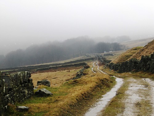
Snow flurries were scudding across the sedgy fell sides above Meltham as we started up Royd Lane towards the open moor.First published in: The Times Click here to view a map for this walk in a new window
picture picture picture picture picture picture picture picture picture picture picture picture picture picture picture picture
Facebook Link:
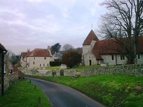
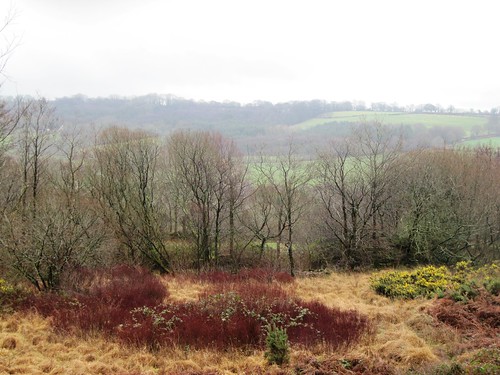
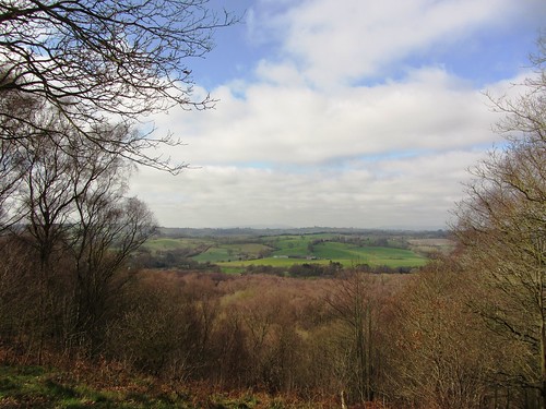
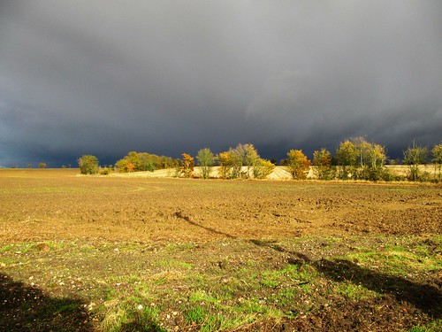
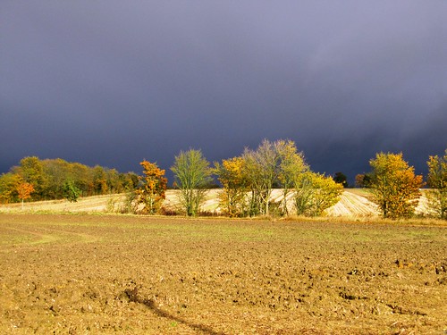
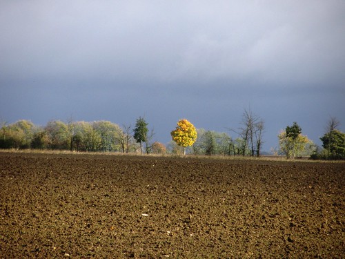
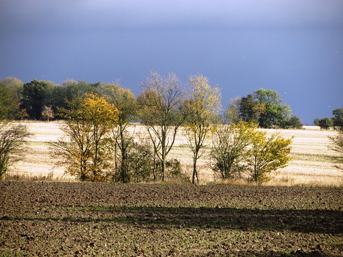
This part of West Yorkshire, the very northernmost tip of the Peak District National Park, is centred in ‘Last of the Summer Wine’ country; but if Compo, Clegg and Foggy had been out and about today, they’d have needed their caps and comforters. This was the Yorkshire Moors at winter’s end – bleak, harsh and compelling.

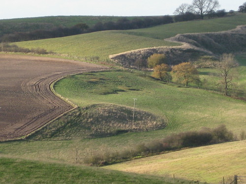
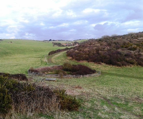
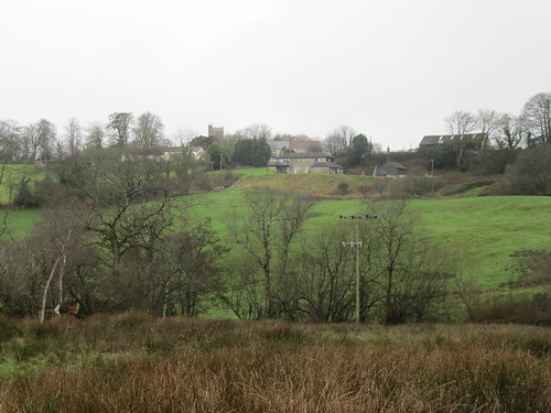
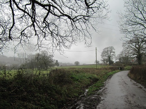
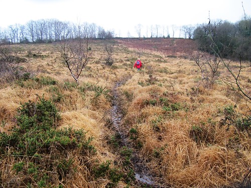
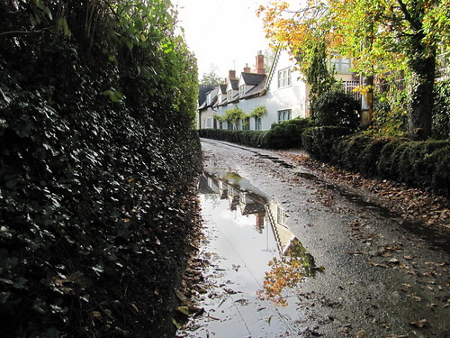
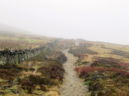
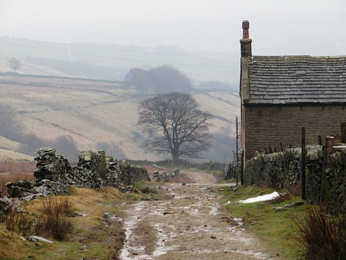
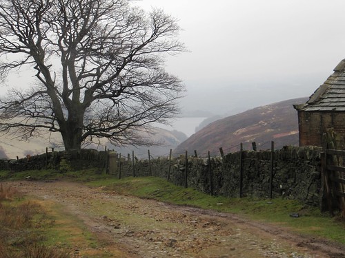
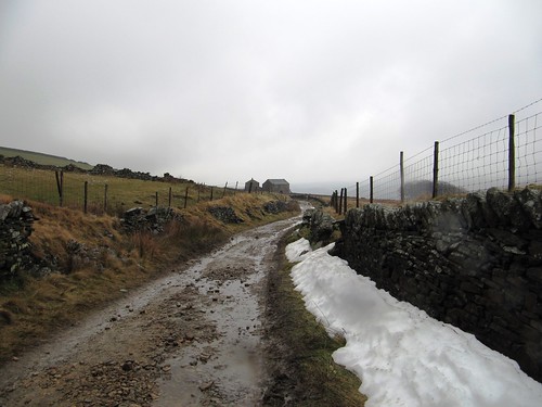
Royd Lane gave way to Magdalen Road, a noble name for a rugged old horse track that hurdles the low hill between Meltham and the twin reservoirs of Marsden Clough. Moor farms stood hunched along the lane, their windowless backs to the weather – Fox Royd, Upper Royd, Ash Royd. A ‘royd’ is a piece of land cleared of its roots, stones and trees for agriculture, but a lot of the royd land on these hills is going back out of keeping. One by one the hill farms are being abandoned in the face of pickings too slim to survive on.

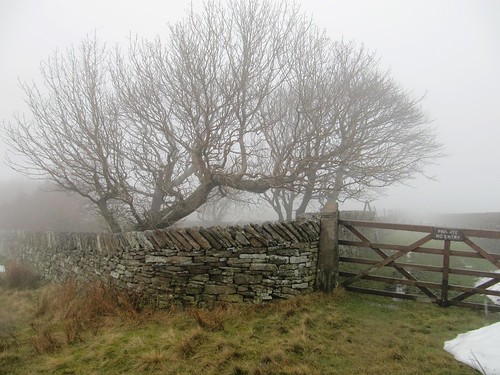
Curls of snow still lay in the lee of the stone walls. A stray bullock was wandering in the lane, but when he caught sight of us he plunged with a twang straight through a barbed wire fence and cantered off to join his chums.

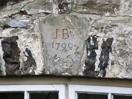
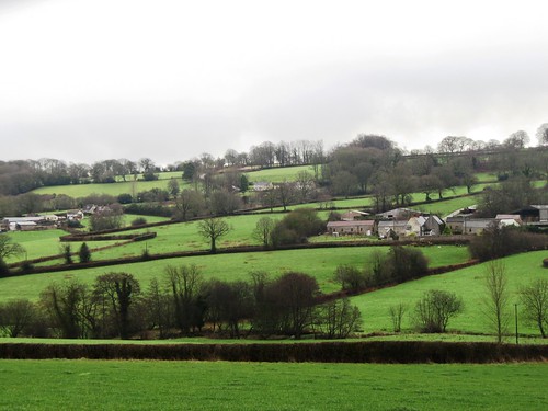
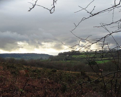
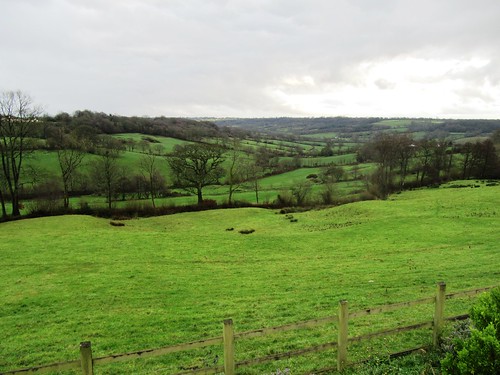
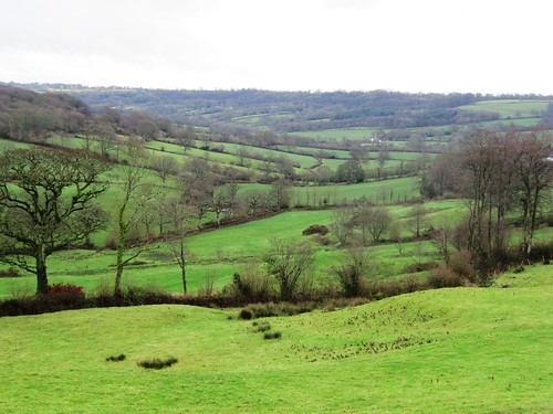
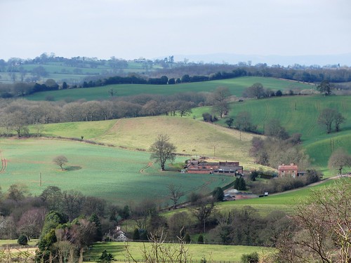
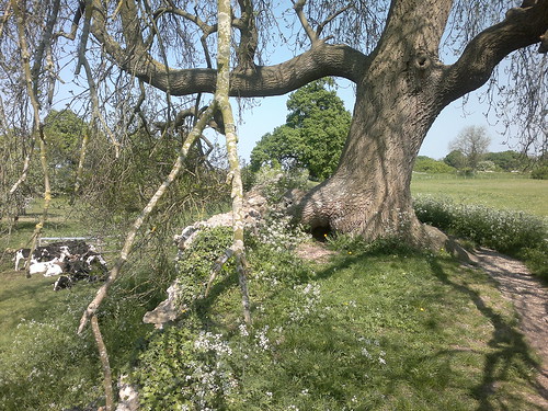
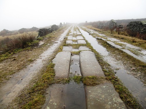
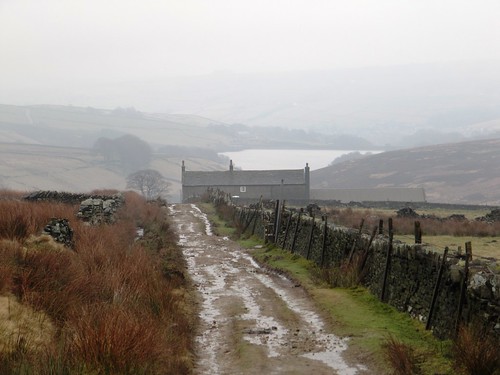
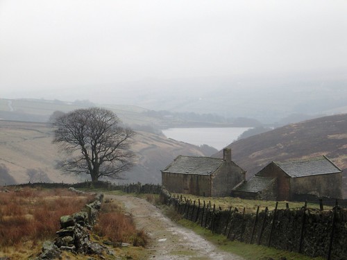
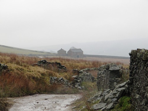
Beyond the Holmfirth road we dropped into Marsden Clough by way of Springs Road, a walled track whose beautifully cut sandstone paving-slabs had been grooved to guide the wheels of quarry wagons. Down along Nether Lane the stone-built farmhouse stood empty, solid old dwellings each in its own strip of fields – Goodbent, Bartin and Greaves Head.

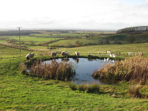
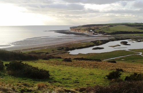
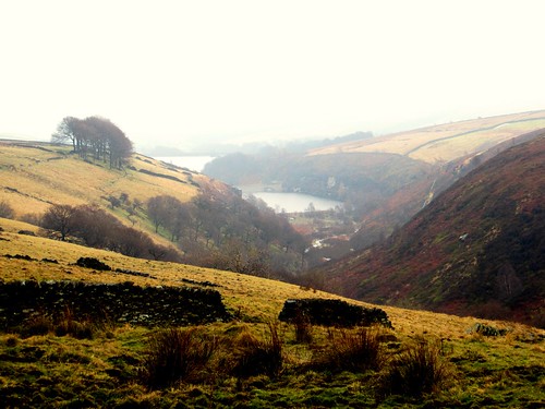
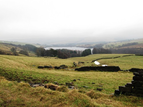
Our ancestors did not always build solidly and well. Before climbing out of Marsden Clough and on back to Meltham, we leaned on the wall and looked down over the twin waters of Bilberry and Digley Reservoirs. When the poorly constructed embankment of Bilberry Reservoir collapsed in February 1852, a fifteen-foot-high wall of water rushed down the valley and devastated Holmfirth, ‘throwing a four storey mill down like a thing of nought, tossing boilers about like feathers, and carrying amongst the wreck of houses, mills and other buildings, men, women and children.’

Rural tradition says that the cries of plovers are the lamentations of lost souls. The upper air was full of them today, wailing and piping us away from the lakes and that dark old tragedy.

START: Royd Road, off Holmfirth Road, Meltham HD9 4BE approx. (OS ref SE 104102)

GETTING THERE: Bus 335 (stottscoaches.co.uk, Holmfirth-Meltham), 911 (wymetro.com, Honley rail station-Meltham) to Royd Road bus stop (at foot of Royd Road)
Road – Royd Road is off B6107 Meltham-Holmfirth road on southern edge of Meltham.

WALK (6 miles, moderate, OS Explorer OL1, 288): Walk up Royd Road. In ½ mile pass Fox Royd; in 200m fork right (100094, ‘bridleway’ fingerpost), past Royd Farm and on for 1 mile to A635 (094078). Right; in 50m, left through gate, down track (Springs Road) for ⅔ mile. At gate with ladder stile (086073), don’t cross, but swing left along Nether Lane; follow it for ¾ mile past Goodbent Lodge and Bartin to Greaves Head farmhouse (098074). In another ½ mile, turn left (106075) up grassy lane, over stile by gate (yellow waymark). On up between walls to road (106077); left to cross A635 (103080); ahead for 1¾ miles along Harden Moss Road (track), then Royd Road to B6107.

LUNCH: Plenty of pubs/cafés in Meltham

ACCOMMODATION: Durker Roods Hotel, Meltham HD9 4JA (01484-851413; durkerroodshotel.co.uk)

INFO: Holmfirth TIC (01484-222444); yorkshire.com
www.ramblers.org.uk www.satmap.com www.LogMyTrip.co.uk
Click on Facebook “Like” link to share this walk with Facebook friends.

 Posted by at 01:26
Mar 232013
 

A blustery cold day at the start of spring, with bursts of snow racing across the Lincolnshire Wolds. First published in: The Times Click here to view a map for this walk in a new window
picture picture picture picture picture picture picture picture
Facebook Link:
Seen from afar as a modest green bar on the horizon, the Wolds loomed, close-to, as a considerable wall. This long whaleback of limestone and ironstone rises some 300 feet above the Lincolnshire plains, a height lent grandeur by the flatness of the surrounding landscape.

‘Tealby, Claxby, Normanby, Otby, Walesby, Risby’ said the map. So many ‘-by’s in this part of the world – the Norse word for a farmstead, denoting where 9th century Danish invaders settled and beat their swords into ploughshares (to some extent). Outside Tealby the Viking Way long-distance path handed me over to a footpath at the feet of the Wolds, running through Walesby and on through the wind-whistle fields. From Claxby I went steeply up the grassy escarpment, picturing the village’s founder, one Klakkr – rather a fierce fighter, I guessed, carrying the smack and clatter of swords in his name. Up in the wind on the wold top at Normanby, I rejoined the Viking Way and followed its horned helmet symbols down to lonely Otby on its ridge, then back to Walesby tucked into the valley below.

Walesby folk have not always dwelt in the vale. In the Middle Ages the village lay high on the Wolds, but when the Black Death arrived in 1348 the inhabitants fled their plague-blasted settlement and its church. I found snowdrops and daffodils growing on the ancient foundations of houses and fields around St Andrew’s – known to generations as the ‘Ramblers Church’. It became the focus of local walkers’ expeditions in the 1930s, when it stood in romantic ruins. Nowadays there’s a most beautiful stained glass window depicting a red-robed Christ beckoning across a cornfield to a trio of clean-limbed young ramblers of the old school, while a brace of 1950s cyclists waits to attract his attention.

Medieval masons carved a jostle of cheeky, coarse-featured faces among the stone foliage of the nave pillars. I took some snaps and had a chuckle, then followed the Viking Way on along the ridge. Near Walesby Top a herd of 40 red deer watched me pass. The flock of pedigree Lincoln long-wool sheep at Risby – hefty beasts with a llama-like hauteur – stared through their floppy fringes as if mesmerised. And I stared back beyond them, out west to the edge of sight, where an apocalyptic sunburst sent Blakean shafts from blackening clouds to pick out the two towers of Lincoln cathedral on their ridge some twenty miles away.
Start & finish: King’s Head, Tealby, Lincolnshire LN8 3YA (OS ref TF 156905)

Getting there: Tealby is on B1203 near Market Rasen (A46, Lincoln-Caistor)

Walk: (10 miles, moderate, OS Explorer 282): From King’s Head, left to T-junction; right up street. In 200m (156907), up Church Lane to B1203. Left for 50m; right on Viking Way/VW (fingerpost). In 2nd field, fork left (152911; fingerpost) across fields to Catskin Lane (142917). Forward for ⅓ mile; right (136919) on footpath (fingerpost) into Walesby. Follow VW out of village; right (130924; ‘Mill House Farm’). Left at fork (129926; ‘Byway’); in ⅓ mile, left off VW (127931); follow ‘Byway’ for 1¼ miles to road (113942) into Claxby. Right up Normanby Rise; in ⅓ mile, right by reservoir (118948; footpath fingerpost), up side of wood, through 3 gates to road (123949). Right past Normanby church; follow VW. After 3 fields, leave VW (125936); ahead (fingerposts, yellow arrows) to valley bottom. Left (130930; fingerpost) to end of paddock (133933); uphill to Otby House drive (139935). Right to road; right into Walesby. From crossroads by village hall (134924) follow VW for 1¾ miles past Ramblers Church (138924), Risby Manor and Castle Farm to Tealby.

Lunch: King’s Head, Tealby (01673-838347; thekingsheadtealby.co.uk)

Accommodation: Advocate Arms, Queen Street, Market Rasen (01673-842364; advocatearms.co.uk) – stylish and very welcoming

Info: Lincoln TIC (01522-873256); visitlincolnshire.com
www.ramblers.org.uk www.satmap.com www.LogMyTrip.co.uk
Click on Facebook “Like” link to share this walk with Facebook friends.

 Posted by at 01:44
Mar 162013
 

It’s a rare pleasure to find a place as well set up for four-seasons walking as East Dean. First published in: The Times Click here to view a map for this walk in a new window
picture picture picture picture picture picture picture picture
Facebook Link:
The immaculately kept East Sussex village lies just inland of the Seven Sisters cliffs at the heart of superb coast-and-countryside landscape. Walkers know they’ll be welcome at the cosy old Tiger Inn and the Hiker’s Rest teashop on the village green, the hub of a network of footpaths. I chose a circuit that would thread woodland, downs and cliffs together, and set out early from the Tiger into a red dawn.

‘Morning!’ said a woman by Friston duckpond, her breath smoking in the cold air. ‘Saw you yesterday up on the downs, didn’t I? Hope you enjoy your walk.’ Down in the valley below, ancient Friston Place lay low, pink-faced and many-gabled among beech trees where rooks were cawing lustily. Building low, I noticed, portent of a rainy summer.

Friston Forest sighed gently in the morning wind. A great spotted woodpecker rattled a hollow tree, a pair of racehorses went drumming by like ghosts in the mist on Friston Hill. Sunk in the woods, the medieval rectory and church at West Dean gleamed in dew-wet flint. A long flight of steps, the crest of a hill, and I was looking down over one of England’s classic views – the extravagant snake bends of the Cuckmere River sinuating its way seaward through a dead flat littoral between great curves of downland. Coastguard cottages stood isolated at the brink of the Cuckmere Haven cliffs, their tall chimneys silhouetted against a pale wintry sea.

Foxhole Farm, all flint walls and brick-red roofs, lay tucked into a fold of the downs. Beyond the farm the South Downs Way ribboned east along the furrowed brows of the Seven Sisters. Far ahead, the promontory cliff of Belle Tout displayed an elliptical grimace of white chalk like the baleen plates in the mouth of a right whale. At the feet of the cliffs fresh falls of chalk lay scattered, staining the shallows a milky white.

It was hard to tear myself away from this captivating stretch of coast, but my way lay inland, funnelling up Gap Bottom past the old farming hamlet of Crowlink. A last trudge over the downs through a stolid crowd of curly-faced sheep, and I was dipping down the steep slope towards East Dean with a pint of Tiger’s Claw in my sights and a head full of wonders to sort through.

Start: Tiger Inn, East Dean, near Eastbourne, East Sussex BN20 0DA (OS ref TV 556978).

Getting there: Bus 12, 12A (buses.co.uk), Eastbourne-Brighton.
Road: East Dean village is signposted off A259 Eastbourne-Seaford.

Walk (8 miles, easy/moderate, OS Explorer 123):
From Tiger Inn, right up side of village green; cross road, up path opposite (556979, fingerpost). At Friston church (551982) cross A259; take path just to left of Jevington road (yellow arrow); cross stile; right (‘footpath’ post) along woodland edge. Cross field (551985); cross lane by stile and gate (550987); cross next field, into woodland (550989). Left on path parallel to lane (‘West Dean’ post). Follow lane where it bends left around Friston Place (548990). In 100m, opposite entrance to Friston Place, right (547989; blue arrow; ‘West Dean’) on bridleway through woods. Keep straight ahead, following red arrow posts for a while, then cycleway signs, but always in same direction, ignoring all side tracks. In just over a mile, cycleway turns left (531996), but keep ahead down slope, past white house and on to West Dean. Right past church (525997) to T-junction; left along South Downs Way (SDW), over track, up 200+ steps to cross wall stile at top (521996; superb view over Cuckmere Haven!). Follow SDW down to cross A259 by Visitor Centre (520995).

Through gate (SDW); bear left up slope through another gate (SDW). Follow SDW for 2½ miles along cliffs. By National Trust sign ‘Crowlink’ (538968) bear inland to pass Crowlink hamlet. Opposite laneway on left, go right through open gateway (545975). Up to cross stile; keep same line up to brow of hill; pass clump of thorn trees, then on (car park 200m on your left) to go through kissing gate (551976). Aim down right side of triangular woodland; keep ahead (not right!) across stone wall stile (554977); down field slope to path by wall; left down to field; right through gate by NT ‘Crowlink’ sign into East Dean.

Lunch: Tiger Inn, East Dean; Golden Galleon, Exceat (01323-892247)

Accommodation: Tiger Inn B&B, (01323-423209; beachyhead.org.uk) or Beachy Head Cottages (01323-423878; beachyhead.org.uk). Superb country pub; classy self-catering

Information: Eastbourne TIC (01323-415450); visitsussex.org
www.ramblers.org.uk www.satmap.com www.LogMyTrip.co.uk
Click on Facebook “Like” link to share this walk with Facebook friends.

 Posted by at 01:18
Mar 092013
 

Wrapped like lifeboatmen, we left the Half Moon at Clayhidon to explore the steep valleys under the Blackdown Hills. First published in: The Times Click here to view a map for this walk in a new window
picture picture picture picture picture picture picture picture picture picture picture picture picture
Facebook Link:
No-one else was out braving the rainy winter morning; we had this beautiful green corner of the mist-shrouded East Devon countryside entirely to ourselves.

From the sedgy fields below Clayhidon we looked back to see the houses and church tower of the lonely hamlet stretched out along their ridge. The air struck damp and cold, pearling in our hair and in the stiff coats of the dogs who barked us into and out of Cordwent’s Farm. Grey veils of rain drifted through the valley below the farm, softening the stark outline of the skeleton woods and dripping from the leafless oaks in the hedges. It was a morning of steaming breath, dewdrop noses and many sniffs. At Barne Farm three glossy black horses with white foreheads looked over a gate, shaking the rain from their forelocks as they watched us go by along Applehayes Lane. Lines of raindrops edged the long gleaming leaves of hart’s-tongue ferns, and the nettle-like yellow archangel plants were already beginning to bud – testimony to the mild climate in this sheltered, south-westerly corner of England.

Down in the flat bottom of the Culm Valley the River Culm chuckled over rapids in its red earth bed. Against the sombre brown of bracken and black of the trees, scarlet shoots of dogwood and yellow bursts of gorse flowers made splashes of colour to brighten the late winter day. A cock pheasant, betrayed by the white flash of its neck collar, scuttled away through the sodden grass and squelching hoof-pocks. In a barn we found an ancient Ford Popular, its pop-eyed headlamps and elongated mouth of a radiator grille giving it the expression of a shocked schoolmarm in mid-shriek.

The rain slackened and went away eastwards, leaving a crack of duck-egg blue overhead. The first primroses of the year made a sulphurous splash in the hedges of Ashculme Farm. We climbed the slope of Clayhidon Turbary, an old common where the villagers once cut peat for their fires and furze for their animals’ winter bedding. Half an hour later we were out of muddy clothes and steaming boots, and in by the Half Moon’s fire. Proper job, as they say hereabouts.

Start & finish: Half Moon Inn, Clayhidon, Devon EX15 3TJ (OS ref ST 161155)
Getting there: 5 miles south of M5 Jct 26 (‘Wellington’), via A38, Ford Street and Hunter’s Lodge
Walk (5 miles, easy, OS Explorer 128): Leaving Half Moon Inn, left along road. In 150m, right (162157; fingerpost/FP) up steps. Follow yellow arrows/YA past Smith’s Farm. Left along track; in 100m, through gateway (164157) and right down fence. Cross stream (165156), up through gate and woodland (YAs) to track (166154). Right; in 100m, left (FP) up farm track. Through gate, past horse ring and on (hedge on left). Through double gate; on to angled corner of hedge ahead (170155); aim ahead for house and barn at Applehayes. Down left side of barn to Applehayes Lane (173155). Right for 700m, passing Barne Farm. At foot of lane, at house marked ‘Shepherds Hill’, right up path (171149; FP). In 100m, left along fence and follow path downhill. In 250m, left (YAs) downhill through bracken. Bear to right of wet woodland to go through gate; right through next gate, and left through one below (YAs); down hedgebank to lane at Bellett’s Farm (170145).

Right for 600m; left at T-Junction by Parish Hall (164143). In 150m, left (164142; FP) through gate opposite Clayhidon Mill and follow path on right bank of River Culm (YAs) for ¼ mile to Bridgehouse Bridge (160141). Cross lane, and on. In 2nd field, after 100m bear up bank and through gate on right (YA). Clockwise round field to YA on post, halfway up far hedge. Cross footbridge and stile; on up hedge to lane (155142). Right; in 20m, left over stile and on with hedge on right. Above Gladhayes Farm, in 2nd field bear right through gate and left along hedge. Through gate (150143, YA); down green lane. In 50m, straight ahead through gate and on past barn, down track to tarmac lane (149144); left downhill to road (148142).

Right for ½ mile, passing Tanhouse Farm (148147). Bear right at Middle Ashculme Farm (147149, FP); pass barn and keep ahead (don’t fork left through stockyard!); through 2 gates and follow concrete farm track. At end of 2nd field, right (148152, FP) across stream, through neck of scrub woodland and on up field (YA). Left through gate. Round left side of barn and over stile (151152, YA) in right-hand corner of field (NB very muddy hereabouts!). Up field to gate into trees (YA); cross green lane (152152) and on up slope of Clayhidon Turbary. Don’t try to follow footpath that bears right as shown on OS map, but follow clear path up to ridge and gate into lane (FP). Don’t go through the gate, but turn left along grass path by hedge. Through gate at end (155153, YA); up bank; through gate to left of barn; on through gate; lane to cross road (158154). On along bridleway (FP). Bear right around Glebe Barn, back to Clayhidon.

Lunch: Half Moon Inn, Clayhidon (01823-680291; halfmoondevon.co.uk) – excellent village pub
More info: Tiverton TIC (01884-255827); visitdevon.co.uk
www.ramblers.org.uk www.satmap.com www.LogMyTrip.co.uk
Click on Facebook “Like” link to share this walk with Facebook friends.

 Posted by at 01:46
Mar 022013
 

The view from the sandstone peak of Kinver Edge on this brisk, sunny morning was utterly sensational. First published in: The Times Click here to view a map for this walk in a new window
picture picture picture picture picture picture
Facebook Link:
It was all there, spread at our feet like butter on a green and lumpy pancake – the Worcestershire plains stretching away south-east, the quarried prow of Titterstone Clee and the amorphous lump of Brown Clee standing up far to the west, and dead in the south the pale blue humps of the Malvern range floating on a surf of mist.

Eventually we tore ourselves away and went south along the ridge, following the broad pebbly track of the Staffordshire Way as it wound between the mossy tree trunks, with tremendous views over the precipitous drop of Kinver Edge’s west flank. A side path brought us down through conifers, and on along a green lane by the balustraded Italianate tower of Blakehall House. Two horses with beautiful feathery legs went snorting impatiently by – ‘Irish cobs,’ said their owner, ‘they don’t like to stand still!’

Just here, hidden in the ground somewhere under our boots, ran the 3-mile complex of Drakelow Tunnels, ghost-haunted by local reputation, the remnants of a Second World War ‘shadow factory’ built well away from the bombed-out Black Country to manufacture Rover aircraft engines. Climbing back to Kinver Edge, we fancied we could hear the hollow boom of the tunnels. A northward stretch past the well-concealed cave called Nanny’s Rock – once home to a ‘cunning woman’ who could cure your ailments and tell your fortune – and we were dropping down towards the remarkable cliff dwellings of Holy Austin Rock Houses.

Burrowed into the rich red sandstone, their outer surfaces smoothed into house walls, windows and doors cut out, floors quarry-tiled, the Holy Austin houses have been dwellings since time out of mind, certainly since pre-Reformation days when resident Augustinian hermits gave them their name. At the turn of the 20th century Rose and Harry Shaw raised 10 children here – mostly boys, so boisterous that Mrs Shaw would banish them outside during the day. J.R.R. Tolkien knew the place, and it may have prompted him to imagine the tunnel homes of Hobbiton. The children playing Bilbo Baggins and Smaug the dragon around the rock houses this afternoon certainly seemed to think so.

Start & finish: National Trust car park on Compton Road, just west of Kinver, DY7 6DL approx (OS ref SO 836836)
Getting there: Bus 228 (networkwestmidlands.com) Stourbridge-Kinver. Road: Kinver is off A458, 3 miles west of Stourbridge.
Walk (4½ miles, moderate, OS Explorer 219): From NT car park, cross clearing with oak tree. Uphill to right – not path with red arrow, but with post labelled ‘Car Park’. At top of slope (834835), left (‘Viewpoint’ fingerpost, ‘Staffordshire Way’/SW) up path and steps to viewpoint (836834). Right (south) along SW (red and orange waymarks). In ¾ mile, go through barrier (829822). By seat, North Worcs Path/NWP continue ahead (fingerpost); but bear left downhill here (angled yellow arrow/YA). In 150m, right (831822, YA) on track through conifers. In 300m, 5 paths meet (831820) – there’s a seat on your right and a post pointing left to a path marked ‘Woodpecker, Nuthatch Trails’. Take path immediately to right of this one – i.e. straight ahead. In 200m, through barrier (831818; ‘No cycling, no horses’); in 250m, ahead (‘Cookley 1) to road in Blakeshall (831813).

Turn right; in 30m, right along green lane with houses on left, to road (829812). Right; in 50m, fork right on sandy track past lodge of Blakeshall House. On along sandy track. In 500m, right through barrier (825812; NWP), along path through conifers. In 500m, in a dip, right through barrier (825817; NWP). At top of slope. left through barrier (828817; YA, NWP, ‘Coal Tit Trail’). In 200m, at grassy reservoir (828819), right; in 30m, left (YAs, NWP). In 300m NWP meets SW at fingerpost (829822). Left here down slope; in 50m bear right (north) keeping parallel with SW above and passing Nanny’s Rock cave (830826). In another ⅓ mile (832831), ahead over crossing of tracks (not left downhill, or right up steps), up slope ahead, over brow and down to path crossing. Fork left (orange waymark). In 400m fork right (‘Rock Houses’/RH post); follow RH to car park. Rock Houses (836836) are just beyond.
NB Excellent directions of a very similar walk at walkingbritain.co.uk

Lunch: Bell & Cross PH, Holy Cross, Clent DY9 9QL (01562-730319; bellandcrossclent.co.uk)
Holy Austin Rock Houses Tea Rooms: 11-4, Thurs-Sun
Holy Austin Rock Houses: 2-4 Thurs, Fri; 11-4 Sat, Sun
More info: nationaltrust.org.uk/kinver-edge; enjoystaffordshire.com
www.ramblers.org.uk www.satmap.com www.LogMyTrip.co.uk
Click on Facebook “Like” link to share this walk with Facebook friends.

 Posted by at 01:21
Feb 232013
 

Wind and rain were set to bear down on the low-lying Essex countryside this morning. We clapped on all sail and scudded away out of Great Bardfield, stopping only to admire the handsome red façade of Brick House.First published in: The Times Click here to view a map for this walk in a new window
picture picture picture picture picture picture picture picture picture picture picture picture picture picture
Facebook Link:
Here in the early 1930s the artist Eric Ravilious came to live and paint the village and the subtly undulating farming country in which it lies. Anyone who walks these fields will recognise the modesty and honesty of Ravilious’s local landscapes, the way a fence or a row of posts draws the eye to the curves and lines of the land. Like the Impressionists, this lively and life-loving man found his inspiration in quiet countryside.

The warm red brick and half-timbered houses of Great Bardfield, the outlying farms and fields and stream dips, give an impression of timelessness. We followed a bridlepath east through broad Essex fields. At Great Lodge stood a square-sided, slit-windowed brick barn, built in the 1540s for Anne of Cleeves as part of her divorce kiss-off from King Henry VIII. Here Ravilious painted a Frisian bull, head lowered, chained by the nose in a memorable attitude of animal strength in human bondage.

In the margins of the beetfields big white swallow-tailed scarecrow kites jerked in the wind like shimmying ghosts. An intense sun turned distant trees into burning bushes of gold against a wall of slate-coloured storm cloud driving down from the north. The squall drove us to hide in a prickly hedge, then into the stable barn at Hunt’s Farm where we waited it out in the company of three politely inquisitive horses.

A red fox with a black-tipped tail went cantering off across the paddocks as we emerged. Beyond the farm the rest of the party, soaked through and chilled, set back to Great Bardfield. But I hadn’t yet had my fill of Ravilious country, and took to a skein of lanes hardly wide enough to admit a car. Between the dapple of brilliant sun shafts flickering through the hazels and the gleam of puddles it was hard to see my way.

The homeward path lay across meadows and under hissing poplars, below the white sails of Gibraltar Mill on its ridge and past the gently thundering sluice of Great Bardfield’s watermill, a coda to this walk through the countryside that so enchanted Eric Ravilious. The artist died on active service with the RAF in 1942, and his muted and intimate landscapes have subsequently gained a fame they never achieved in his short lifetime.

Start: Vine PH, Vine Street, Great Bardfield, Essex, CM7 4SR (OS ref TL675305)

Travel: Bus: Service 9, 10 (firstgroup.com) from Braintree.
Road: Great Bardfield is on B1057, between Finchingfield (B1053) and Great Dunmow (A120)

Walk (7 miles, easy, OS Explorer 195): Take road signed ‘Braintree’. Opposite church, left along Bendlowes Road (678303, ‘playing field’); immediately right (‘Bridleway’) on path among trees. Follow this (blue arrows/BA) for 1¼ miles (keeping ahead where track bends left for Bluegate Hill at 683299) to pass Great Lodge (695291). Continue to Park Hall. Don’t fork right through farmyard, but keep ahead (701287) with cottage on right. In 250m track forks right, but keep ahead past BA on electricity pole. At end of field (706287), left up hedge. In 200m, right through hedge (705289, BA); on to Hunt’s Farm. Right down drive to road (708289); left for 400m; at triangular junction, right (710292); in 400m, fork left (714293, ‘Redfants Manor Farm’). Follow lane past farm (714296); follow yellow arrows/YA past pig field on left. At end of field (711301), right for 30m; left through hedge and over wire (YA). Keep ahead (same direction) across field, then along its edge (709302) with plantation on right. Aim left of line of poplars and row of stables, and cross field to foot of lane at Ashwell Hall gates (707302). Cross lane and keep ahead along muddy track (YA). In 300m, fork left (705303), walking round edge of field on your left to reach road (703300) and turn right..

In 200m at junction (701302), Great Bardwell is signed to left, but keep ahead (‘Wethersfield’). In 600m, left at T-junction (698306; ‘Walthams Cross’); in 400m, by Chiefs Farm (695306), right past Whinbush Farm. In 350m, left over stile (694309, fingerpost, YA). Dogleg right and left round field edge; into next field (YA); across it, through hedge by stream (690309, YA); across next field and footbridge (689310, YA) into big field. Half right across field for 150m; at bushy reservoir tank (688311), bear more left (due east), aiming for electricity pole in a corner of the field. Just before you reach it, pass a YA in a hedge gap (686311). Ahead with hedge on left; across 2 fields, following electricity poles, to enter woodland strip by waterworks (682311; YA). On along next field edge (YA). At The Watermill, left at house (680311); in 50m, right past sheds and along green lane. In 500m, right across footbridge (676309, YA) to road; left into Great Bardfield.

Lunch: The Vine PH, Great Bardfield (01371-811822; thevine-greatbardfield.com)

Accommodation: Bucks House, Great Bardfield CM7 4SR (01371-810519; buckshousebandb.co.uk) – art-filled and comfortable

Great Dunmow TIC: 01371-872406/876599; visitessex.com

Ravilious In Pictures: A Country Life by James Russell (Mainstone Press)
www.ramblers.org.uk www.satmap.com www.LogMyTrip.co.uk
Click on Facebook “Like” link to share this walk with Facebook friends.

 Posted by at 02:28
Feb 162013
 

We’d been longing for a day like this – bright cold sunlight, wall-to-wall blue sky across the Hampshire/Berkshire border, the recently rain-sodden ground frozen hard underfoot on Silchester Common.First published in: The Times Click here to view a map for this walk in a new window
picture picture picture picture picture picture
Facebook Link:
The low sun struck glitters out of the frost crusts in the red bracken clumps. We descended towards a wooded stream valley, watching squirrels playing kiss-chase in the birch tops, and turned along a bridleway that threaded the edge of Pamber Forest.

The ancient woodland, a fragment of the once-mighty Royal Forest of Windsor, lay faintly whispering, its leafless limbs still a month or two short of any hint of leaf-break. Distant cars murmured like waves on a beach. We followed a ruler-straight old woodbank, and went on out of the forest to the frost-sparkled lane at Latchmere Green where the daffodil buds were just beginning to swell. In the fields beyond, hoof pocks left by cattle in the mud were skinned over with white ice. The animals themselves, Highland beasts munching at a rich-smelling hay feeder, looked round at us through thick ginger fringes that completely hid their eyes.

The woodland boundary near beautiful old Clapper’s Farm was labelled ‘Park Pale’ on our Explorer map. Back at the beginning of the 13th century the Lord of Silchester Manor gave King John a palfrey in exchange for the right to create a deer park inside a pale, an earthen bank topped by a fence. It was cunningly designed so that wild deer could get in but couldn’t jump back out. Opposite Clapper’s we made out the medieval fishponds and the moated site where the Parker or keeper of the park had his fine residence. What status the Parker enjoyed back then – far more than any of today’s gamekeepers.

Field paths brought us back to Silchester by way of the remarkably complete flint walls of the Roman settlement of Calleva Atrebatum. Gridded streets, houses, shops, baths, an ancient Christian basilica and a steep-sided amphitheatre that could hold 3,500 seated spectators have all been excavated here. Stories say that Aelle, Saxon King of Sussex, sacked the place around 500BC, sending sparrows with flaming tails to set fire to the town. There were no sparrows in Calleva today, but we stopped by an oak to watch a treecreeper with curved back and beak picked hibernating insects from their refuge in the bark cracks – a fate perhaps as terrifying for today’s spider as a roaring Saxon warrior’s axe-blow for a cowering Callevite 1,500 years ago.

Start & finish: Calleva Arms, Silchester, Hants RG7 2PH (OS ref SU 627621)
Getting there: Bus 14 (stagecoachbus.com) Basingstoke-Tadley. Road: M4 Jct 11; A33 (‘Basingstoke’); in 300m, B3349 to Spencers Wood. Left to Beech Hill, Stratfield Mortimer and Silchester. Car park on village green.
Walk (6½ miles, easy, OS Explorer 159): Leaving Calleva Arms, left along Dukes Ride. In 150m, ahead (‘Brenda Parker Way’) along footpath. In ½ mile at foot of slope (618616), left for 700m to path crossing (621610; Pamber Forest noticeboard through gate opposite). Left across footbridge; ahead on bridleway for ⅓ mile to cross road (624607). Over stile opposite and on. In 250m path follows forest edge. Cross footbridge and keep ahead (yellow arrow) beside young plantation. At far end (630603), right down hedge; left at bottom to cross stile onto road in Latchmere Green (632600). Left to T-junction (634601); left up Ash Lane; in 150m, right over stile (fingerpost). Grass track for 500m to edge of Bramley Frith Wood (640603). Cross stile/gate into wood; in 30m, left across plank footbridge and follow field edge with ditch on left. In ½ mile, through gate and onto road (647608).

Right to T-junction (650610); left along Clapper’s Farm Road for ½ mile (NB gate into moated site on left). Pass Clapper’s farmhouse; at next right bend, ahead through kissing gate (651616, fingerpost). Cross footbridge; follow edge of north Copse, then ‘permissive path’ and ‘Silchester Trail’/ST signs through fields for ⅔ mile to road at St Mary’s church (643622). Right past pond; left through churchyard and 2 successive kissing gates (yellow arrows). Right (644624, ST); in 150m, left through 2 kissing gates (ST). (NB To view Roman amphitheatre, go through kissing gate/ST in 100m). Walk anti-clockwise half-circuit of Calleva Atrebatum Roman walls. On far side, cross end of track that bisects the site (637625) and keep ahead. In another 100m, right through gate (636624); on for ½ mile to cross road (629623). Ahead for 100m to cross another road; ahead for 50m; left to Silchester car park.

Lunch: Calleva Arms, Silchester (0118-970-0305; thecalleva.com) – popular, cosy, friendly; last orders 2pm.
Silchester Trail: hants.gov.uk/rh/walking/silchester-trail
Pamber Forest: hwt.org.uk
Silchester Roman Town: reading.ac.uk/silchester/

Tourist Information: visit-hampshire.co.uk
www.ramblers.org.uk www.satmap.com www.LogMyTrip.co.uk
Click on Facebook “Like” link to share this walk with Facebook friends.

 Posted by at 04:17