Dec 222012
 

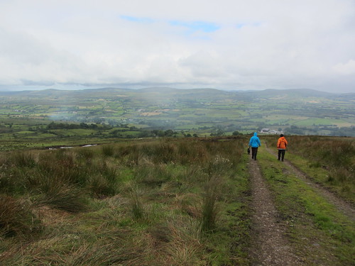
The three young horses had been made skittish by this morning’s sharp wind, and they jostled each other and leaped off the ground as we crossed their field on the outskirts of Woburn.First published in: The Times Click here to view a map for this walk in a new window
picture picture picture picture picture picture picture picture picture picture picture picture picture picture picture picture
Facebook Link:
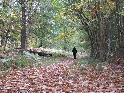
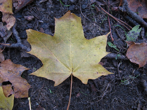
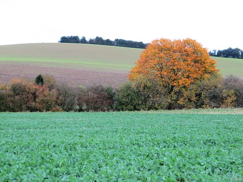
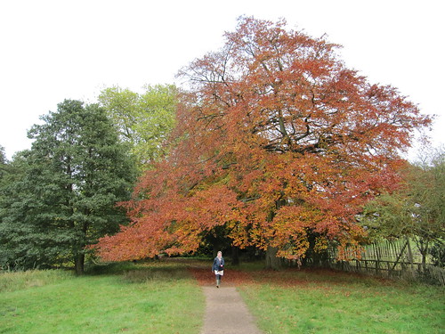
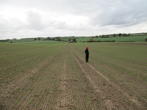
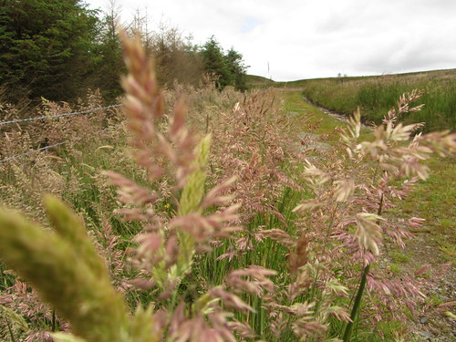
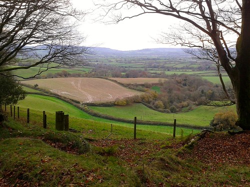
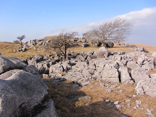
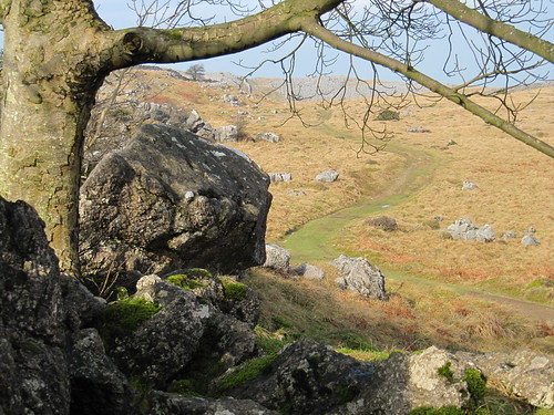
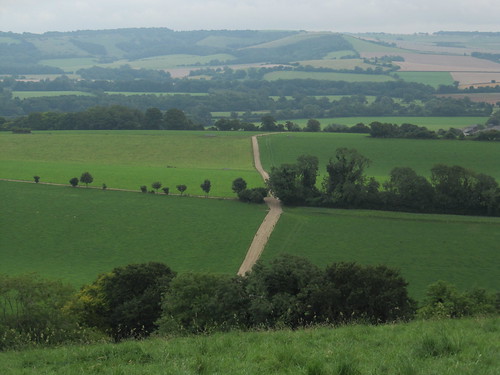
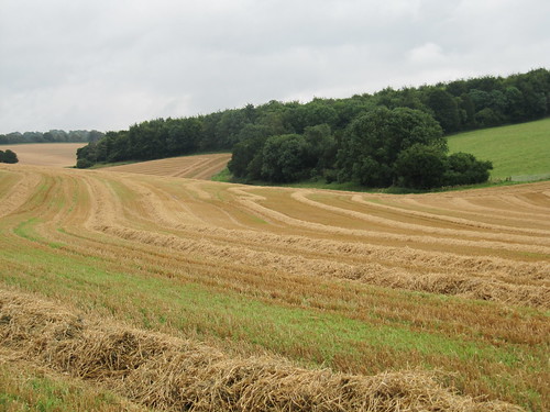
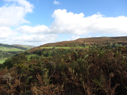
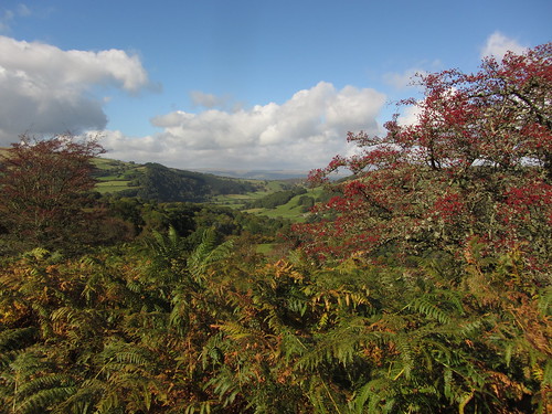
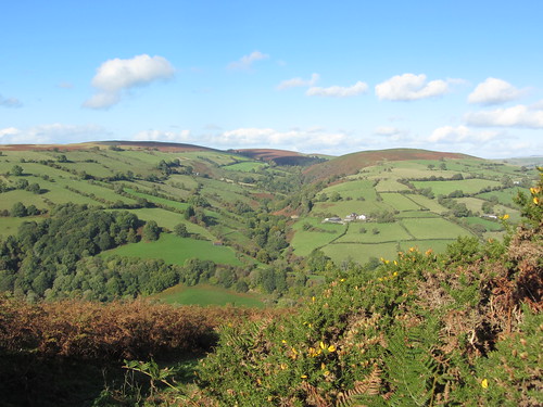
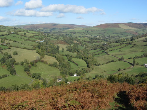
There was a bite in the Bedfordshire air and a nip in our fingers today, with winter stealing in across the wooded countryside on a tide of gold and crimson.

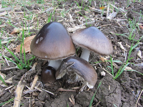
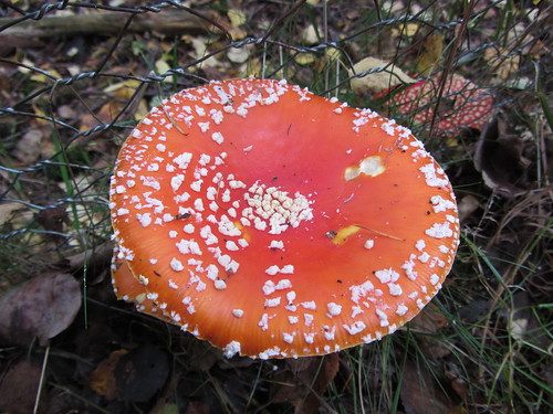
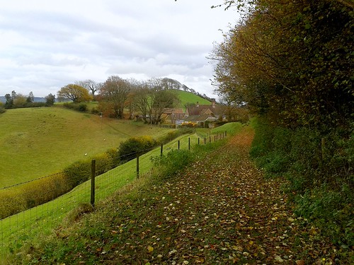
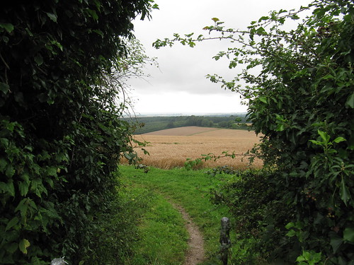
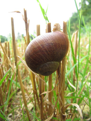
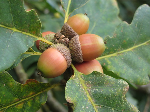
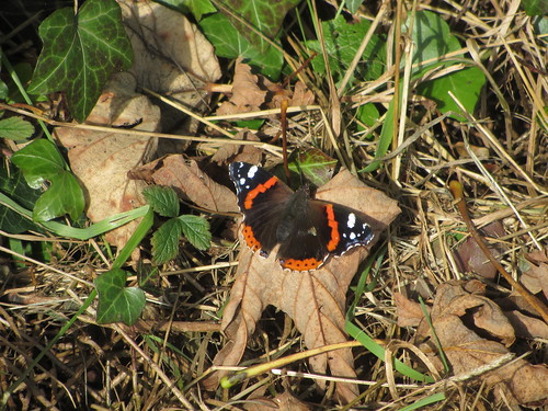
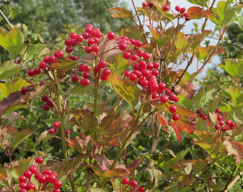
Enormous fungi sprouted in the thick clay of the ploughed fields. Along the way in Little Brickhill Copse and Buttermilk Wood – names redolent of the traditional brick-making and dairying of this low-rolling county – the scarlet caps of fly agaric, spotted white, gleamed in the shadows under the silver birch and pine trees. How many unsuspecting infants must have been tempted by those sweetie-resembling but deadly fungi; likewise the dense crowds of bell-caps called ‘granny’s cakes’ that clustered so invitingly on the cut tree stumps. No wonder our forebears warned their children off the winter woods with tales of gingerbread houses and wicked old witches.

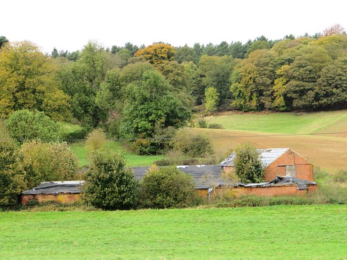
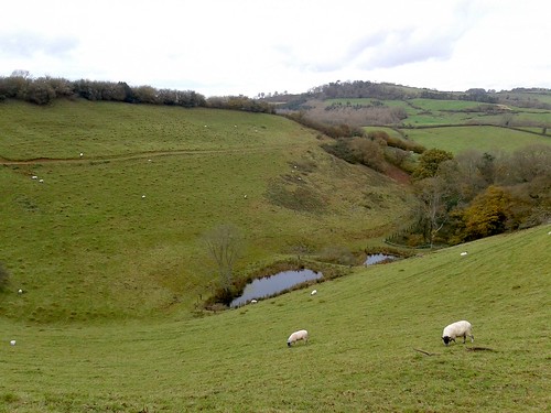
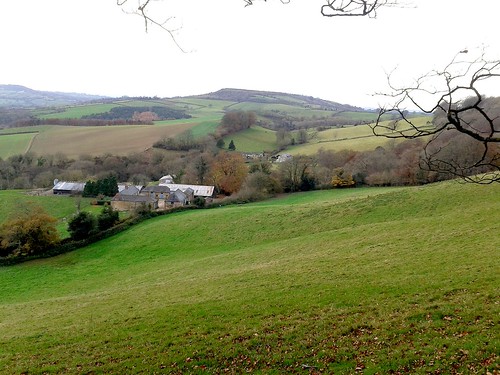
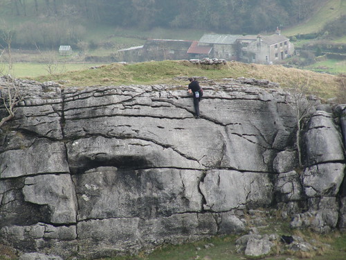
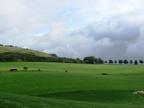
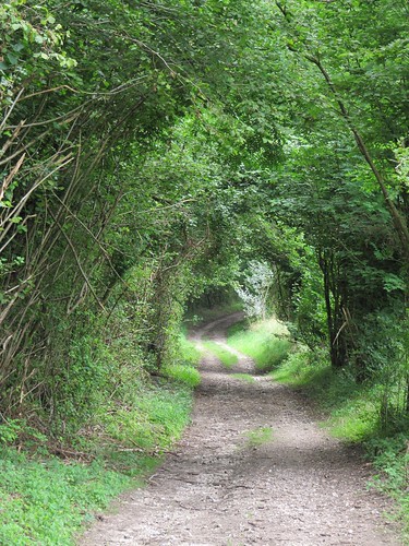
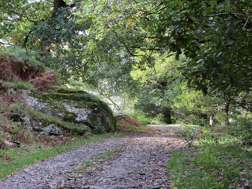
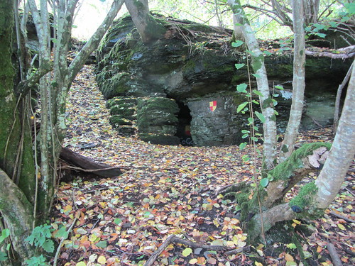
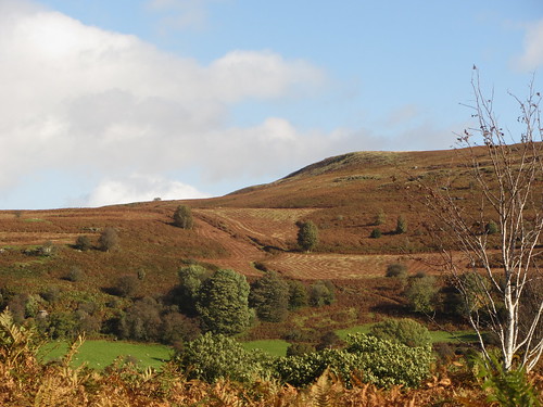
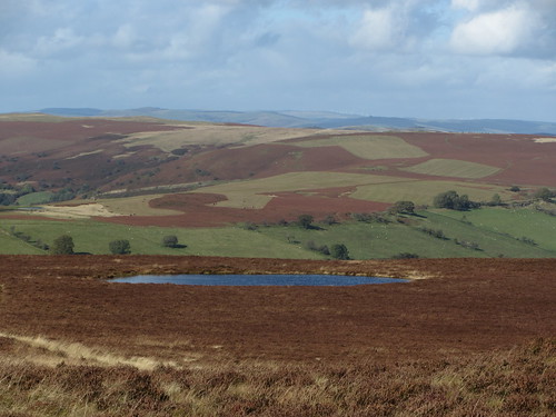
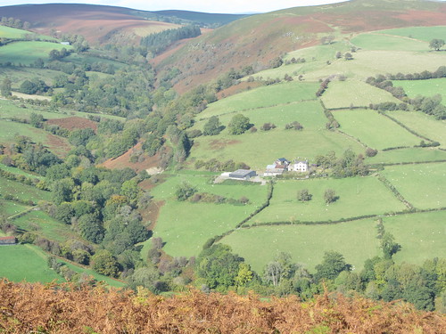
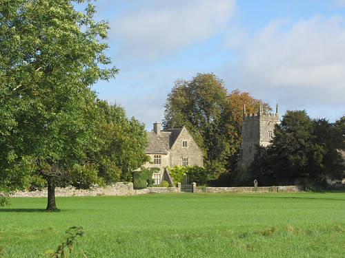
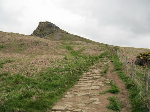
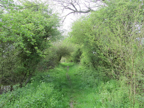
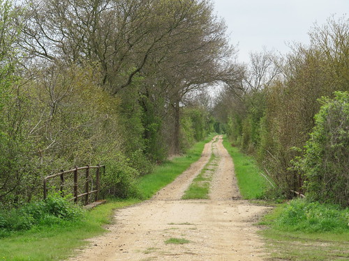
We passed Hundreds Farm and went through woods of sweet chestnut, oak and birch where a golden rain of falling leaves slanted across the path and the iridescence in the pools betrayed the presence of iron in the greensand rock below. Then suddenly we were out of the trees and striding across open fields of grass tussocks. In one prairie-like pasture a crowd of young bullocks frolicked past with the wind in their tails, and we took refuge beside an old thorn tree in the centre of an ancient moated platform until they had cantered away.

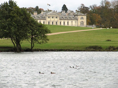
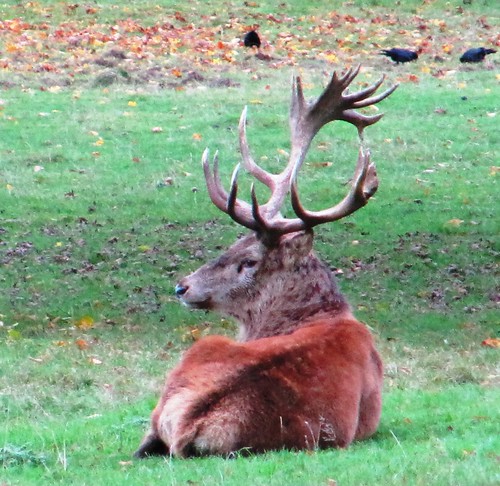
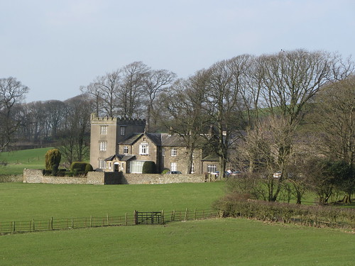
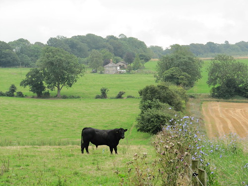
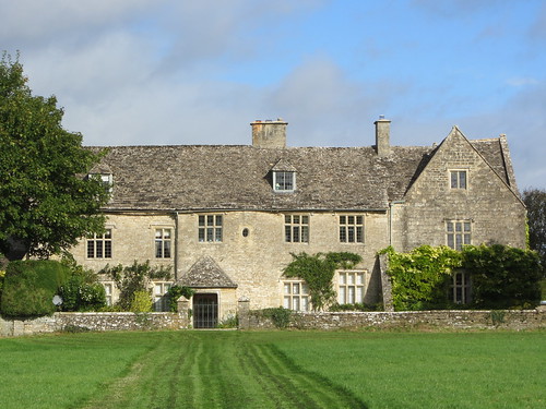
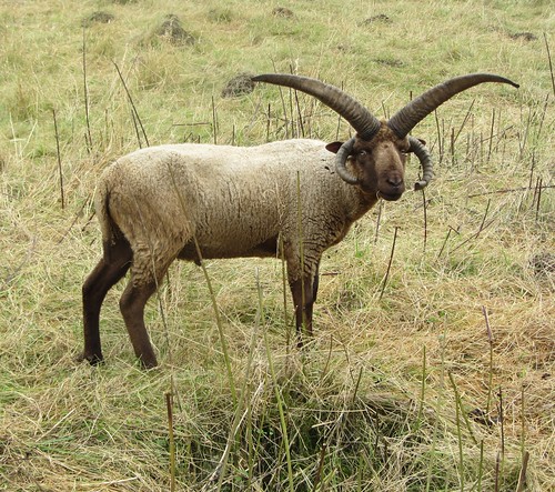
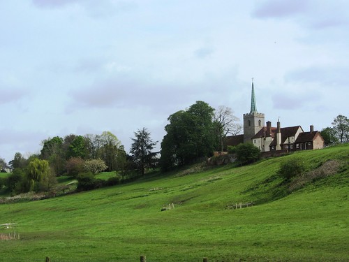
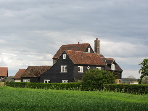
The peerage sucked its aristocratic teeth when the 13th Duke of Bedford opened his ancestral house of Woburn Abbey to the public in 1955, but the pioneering stately home proved a roaring success. We strolled the broad acres past the big white-faced pile of the mansion and on through the deer park. Woburn’s famous herd of Père David’s deer, rescued from the brink of extinction by the 11th Duke, cropped the grass unconcernedly; and three magnificent red stags lay in close company, occasionally lifting their great heads to roar in a reminder that the rutting season was well and truly under way.

Start: Woburn High Street, Beds, MK17 9PX (OS ref SP949331)

Travel: Bus Service 10 (babus.org.uk), Leighton Buzzard to Milton Keynes
Road – M1 Jct 12, then follow brown signs via Eversholt.

Walk (7½ miles, easy, OS Explorer 192):

Walk north up High Street (A4012, Bedford direction). Pass A4012’s right turn to Bedford; in another 10 m, left (948334, fingerpost) along fenced path. Across fields through gates (black arrows/BLA, ‘Woburn Walk’/WW, yellow-topped posts/YTP). In 3rd field, go half left to top left corner (941333, YTP). Left for 30 m past pond; right across footbridge (YTP); across field and through hedge gap (940333), on through hedge to left of Horsemoor Farm (937333). Left (WW) for 50 m; right (BLA) up woodland path and ahead for ½ mile to Hundreds Farm (928332).

NB: If diversion round reservoir works is still in place, follow taped path through woods from 935333 to 930333; turn left here (3-finger post) to Hundreds Farm.

Pass Hundreds Farm, following BLAs and YTPs. By notice ‘To 10th Tee, Club House’, keep ahead on sandy path. By notice ‘To 6th Tee’ fork left on woodland path, soon passing BLA post. Cross track (924328) and on to road (925327).

Cross; right along path parallel to road (fingerpost). Ahead for 100 m; then left (‘Circular Walk’/CW, arrows and WW). On along woodland path. In ⅓ mile join Greensand Ridge Walk at junction of tracks (926321); ahead for nearly 1 mile to road (933311). Right along verge for 250 m; left along minor road (933308, ‘Potsgrove’) past house. In 50 m, left through kissing gate (fingerpost), across fields and through gates (BLA). NB There may be frisky bullocks running in these fields! In 2nd field, aim past old moat (939313), to turn left through kissing gate in hedge beyond a line of disused fence posts (942313). North up field edge with fence on left. In 300 m (943316), BA points half right across field, but don’t go too far right! Better to keep ahead up fence/hedge to end of field, then turn right to kissing gate half way along top hedge (944319). Go through; right (BLA) along hedge to YTP (945318); half left (BLA) across field to YTP (948319). Ahead across corner of next field; left across ditch (949320) and walk north over next field, aiming for small treetop on its own in a dip. At YTP (949324), right along hedge. Follow farm track round left bend; in another 20 m, left through holly hedge (952323) and on along raised bank; then follow hedge as it bends right (951324) and descends to A4012 (952326).

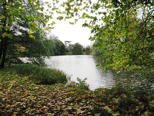
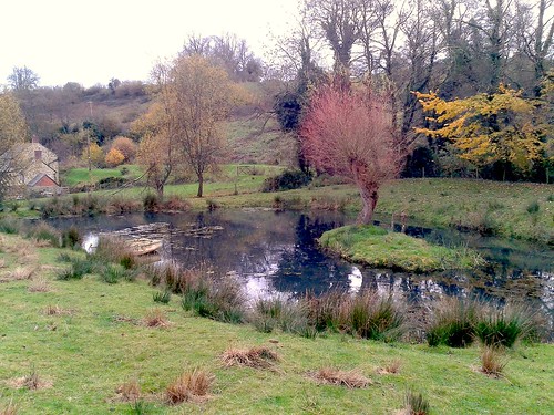
Cross road; go left of Ivy Lodge (CW fingerpost); on along fenced path for ⅓ mile to deer gate (957326). Bear left (‘public footpath’ fingerpost); follow track (YTPs) left of Shoulder of Mutton Pond (959330) and Horse Pond (960331). Bear left round Park Farm; ahead through gate (959333; BLA, ‘Camping Centre’). In 150 m drive bends right (957333, ‘Camping Centre’); keep ahead here on path among trees for ⅓ mile, past Upper Drakeloe Pond to road (952333). Left to A4012 (949331); right into Woburn.

NB: Section from Potsgrove lane to A4012 unsuitable for dogs – cattle running free!

Lunch/Accommodation: Longs Inn, Bedford Street, Woburn MK17 9QB (01525-290219; longsinn.co.uk).

Woburn Abbey: 01525-290333; woburn.co.uk/abbey

Info: 01908-614638; destinationmiltonkeynes.co.uk
www.ramblers.org.uk www.satmap.com www.LogMyTrip.co.uk

 Posted by at 09:04
Dec 152012
 

They were getting ready to clip the sheep in Lisnaharney glen, and we had to look sharp to avoid a woolly stampede as we walked through the farmyard at Eskeradooey.First published in: The Times Click here to view a map for this walk in a new window
picture picture picture picture picture picture picture picture
Facebook Link:
County Tyrone hill farmers work hard for slim rewards, but the man leaning over the gate had spare time and humour enough to invite us to help him with the shearing. It would have been great fun, but Jane and I were headed for the hills along with our friend Inga and her old chum Harry, a crazy-coated and toothless terrier some 20 years young. He scampered and ran all day, fossicking and questing through the rushes and grass, as keen as a puppy. What an example to us all!

The mountain road over the pass behind Eskeradooey is a stony and ancient highway, coursing south to north against the grain of the east-west Sperrin Hills. The view from the saddle is utterly spectacular – back south to the green lowlands around Omagh, north across the deep cleft of the Owenkillew Valley to the billowing uplands of the central Sperrin range, bulges of hills with gallopingly musical names – Mullaghasturrakeen and Mullaghclogher, Craignamaddy and Mullaghbane. Inga, a resident of County Donegal, was able to point out a tiny cone in the north-west, clear against the sky, and confirm that it was indeed Mount Errigal, the highest peak in Donegal, forty miles away.

Harry sniffed over the ruins of an ancient Chrysler that some bright sparks had driven up the old mountain road and failed to drive away again. It could have been The Professionals circa 1978, judging by the cut of the old wreck’s jib – flash, chrome-rich and cheap, just the sort of motor that CI5 agents Doyle and Bodie loved to corner in with a squeal of Firestones and a burst of .357 Magnum fire. Other hard men had hung out at the pass in times past, too – the pair of flat-topped domes that rise out of the bog here are dubbed the Robber’s Table, though no-one seems sure of the identity of the ‘rapparee’ or robbing rogue to whom the name refers.

Harry and his consort decided to turn back. We waved them goodbye and went on down into the Owenkillew Valley past farmsteads under orange-rusted tin roofs, abandoned in overgrown gardens – testament to the difficulty of getting a viable living nowadays out of these pared-to-the-bone mountain farms. ‘You can’t eat the scenery,’ say the farmers – but what scenery, the magnificent beauty of the rolling Sperrins that enfolded our path back across Curraghchosaly Mountain and down to the long green glen of Lisnaharney once more.

Start & finish: Gortin Glen Forest Park car park, near Omagh, Co. Tyrone – NB £3.50 cash (OS ref H 485822)
Getting there: Bus: Ulsterbus 403 from Omagh. Road: Signposted off B48 Omagh-Gortin road.
Walk (7½ miles, moderate, OSNI Discoverers 12, 13. NB: Online map, more walks: walkni.com, christophersomerville.co.uk): Return from car park to B48; left for 100m; right up Lisnaharney Road. In 1¼ miles pass side road on right marked ‘Lisnaharney Public Right of Way’/PRW); in another ½ mile, turn right (‘Eskeradooey PRW’). In 200m, right to farmyard at end of lane. Between buildings and farmhouse bear left up stony lane for 1⅓ miles, past Robber’s Table/RT and down to road. Right (‘RT’) for nearly ½ mile; right up track (‘Lisnaharney PRW’, ‘RT’) past Curraghchosaly Mountain and down to road. Left for 1¼ miles to B48 and forest car park.
Lunch: Picnic
Accommodation: Mullaghmore House, Old Mountfield Road, Omagh (028-8224-2314)
More info: Omagh Tourist Office (028-8224-7831); discovernorthernireland.com
www.ramblers.org.uk www.satmap.com www.LogMyTrip.co.uk

 Posted by at 01:08
Dec 082012
 

Setting out from Beaminster to climb Lewesdon Hill, the highest point in Dorset at 279 metres, is a baffling task. Which hill is which?First published in: The Times Click here to view a map for this walk in a new window
picture picture picture picture picture picture picture picture
Facebook Link:
There are so many knolls, hillocks and knobbles in the billowing green countryside that enfolds snug little Beaminster. The Wessex Ridgeway Trail connects most of the best, though, and so we entrusted ourselves to its steep and muddy course.

With the deliciously rich smell of decomposing beech leaves coming from underfoot, and a blowy sky of silver and blue-grey overhead, we climbed away west along the Wessex Ridgeway up the green tump of Gerrard’s Hill to the windwhistle spinney of storm-battered beeches at the summit. Chart Knolle farmhouse lay below, perfectly positioned and beautifully maintained on its saddle of ground between two deep valleys. Stoke Knapp’s farmhouse a little further on was a sad contrast, silent and empty at the roadside with windows blank and slates beginning to slip.

A green lane skirts the flank of Lewesdon Hill, rising gently and running between huge old beeches in mossy hedgebanks. From the lane we followed a leaf-smothered cartway up through the woods to Lewesdon’s top. Here we sat and gazed south to folded hills cradling a long slip of tarnished-silver sea. Iron Age folk ramparted Lewesdon’s summit, Romans fortified neighbouring Waddon Hill, and looking from the roof-tree of Dorset, the sense is of an ancient landscape with a history that any imaginative watcher could unfold.

A steep path brought us down from the peak of Lewesdon through the beechwoods, with glimpses between the silvery trunks out west to the top of Pilsdon Hill, flattened and spectacularly embanked by the Durotriges tribe more than 2,000 years ago.

Stoke Abbot was a maze of dark gold hamstone houses under thatch. Beyond the village we took to the ancient green road of Long Barrow Lane, slanting down across the fields to a puzzle of paths in the boggy stream bottom of Little Giant Wood. Nearing Beaminster, we walked under an evening sky dramatically smeared with a fiery glow of scarlet and gold. As we came through a meadow I glanced up and saw a dozen horses blackly outlined on a ridge, grazing companionably in the last light of day – a sight essentially unchanged since the Durotriges rode this land.

Start: Beaminster Square, Dorset DT8 3AW (OS ref ST 481014)

Travel: Bus Service 47 (firstgroup.com), Bridport-Yeovil
Road: Beaminster is on A3066 between Crewkerne and Bridport

Walk: Down Church Street past Beaminster church (479013), on along Shorts Lane. In 400m cross lane end (475014); across next field to Stoke Road (473014); left, then right in 30m (fingerpost) along Halfacre Lane. In 100m, left (472014 ‘Wessex Ridgeway Trail’/WRT) through stile; half-right across field to barn (470014). Through gate; left (WRT) around field edge. Through gate (‘Beaminster Ramblers Millennium Walk’/BRMW); down through woodland (‘Chart Knolle’). Cross footbridge (467012; BRMW); steeply up to stile on skyline. On over stiles (WRT) to top of Gerrard’s Hill (460012).

Down to Chart Knolle farmhouse (456014); on west (‘Stoke Knapp’, WRT) through fields to Stoke Knapp farm (445015). Cross B3162 (fingerpost); on along Lewesdon Hill Lane (green lane). In 600m pass National Trust sign on left (439014); in another 250m, just before blue arrow, turn left (437014) past National Trust sign and information board up broad woodland track to Lewesdon Hill summit (438012). Follow track steeply downhill southwards off summit. In 600m it descends as a bridleway to T-junction of tracks; right to gate into roadway (437005). Left for 50m; right through gate (yellow arrow); half-left across 2 fields, then left to cross B3162 (440003).

Follow lane (‘New Inn’). At Brimley Cottage lane bends left (445003); keep right of cottage (fingerpost) down path and through gate (‘Jubilee Trail’/JT). Follow hedge on right for 200m; where it bends right towards a field gate (447003) keep ahead down slope, through kissing gate (448003, JT). Along boardwalk, through kissing gate (JT). Half left up field slope, passing to left side of house (449003). Cross 2 fields to sunken lane (451003), left to road, right into Stoke Abbott.

Follow road through village, past New Inn; in 100m, right (454008, fingerpost) along fenced path. Through gate (JT); on down slope. Left through gate (JT); cross stream; left along stream to recross it (JT). Bear left with stream on left, passing Horsehill Farm to descend and bear right through gateway (459005, JT). In 50m, left to cross stream (JT); follow path with stream on right to gate (JT); across field to shed where you cross farm track (463005). Ahead through wicket gate (JT); right along grassy Long Barrow Lane.

In 550m, dogleg left (466002, JT), then right in field (fingerpost). Descend to cross stream (469000). In 100m, DON’T turn right to cross another footbridge, but keep stream on right, bearing away from it half-left to gate from wood into field (470000, JT on reverse side). Half left across field to far top corner; cross stony lane (472001, JT) and next field. Through gate; left (473002, JT, blue arrow) along lane. In 350m, on through gate’ in another 100m, lane ends at gate (475006). Continue ahead (ignore lower path that forks right towards cottage). Cross field on upper path; through 2 gates in succession (477009). Follow fence to gate (479010, BRMW) and lane into Beaminster. At T-junction, right to town centre.

Walk: (7 miles, moderate, OS Explorer 116 – NB: Detailed directions (essential!), online map, more walks: christophersomerville.co.uk).

Church Street past Beaminster church (479013); Shorts Lane, then well-waymarked Wessex Ridgeway Trail and Beaminster Ramblers Millennium Walk west for 3 miles via Stoke Road (473014), Higher Barrowfield Farm (470014), Gerrard’s Hill (460012), Chart Knolle farmhouse (456014), Stoke Knapp farmhouse/B3162 (445015), and Lewesdon Hill Lane. At 2nd National Trust sign, left up track to Lewesdon Hill summit (438012). South for 600m to farm roadway (437005); field path to cross B3162 (440003). Follow waymarked Jubilee Trail for 3½ miles back to Beaminster via Brimley Cottage (445003), stream crossing (448003), road (451003) through Stoke Abbott. 100m past New Inn, right (454008, fingerpost); follow Jubilee Trail past Horsehill Farm (459005); on via Long Barrow Lane (463005-466002) and stream crossing (469000). Gate into field (470000); across field, lane (472001), field to lane (473002), left and follow JT to Beaminster.

NB: Mudproof and waterproof footwear!

Lunch: New Inn, Stoke Abbott (winter hours: closed Sunday evening, all Monday). Tel: 01308-868333

Accommodation: Bridge House Hotel, Beaminster DT8 3AY (01308-862200; bridge-house.co.uk)

Information: Bridport TIC (01308-424901)
www.ramblers.org.uk www.satmap.com www.LogMyTrip.co.uk

 Posted by at 01:53
Dec 012012
 

On a still morning of clearing skies over east Cumbria, the fields around Lupton lay quiet and green, soaked in overnight rain.First published in: The Times Click here to view a map for this walk in a new window
picture picture picture picture picture picture picture picture picture picture picture picture picture picture picture picture
Facebook Link:
A shepherd was calling a high-pitched summons from Newbiggin Crags. We watched his flock with their nosebands of white wool scampering towards him up the dark gorsy flank of the big limestone hill that overlooks the valley.

Beyond the chattering ford of Lupton Beck we climbed a steep track into the Access Land of Newbiggin Crags. The limestone pavement of this gently domed upland is cracked into deep grykes or channels, interspersed with naked clints of palely grey rock as rough to the touch as elephant hide. We followed an old quarry track up beside a stone wall with grand views spreading on all sides – north to the green shoulder of Scout Hill, west to Whitbarrow and the fells of south Lakeland, east towards the bulky hills of the north Pennines, and south-west to a gleam of Morecambe Bay with Black Combe hanging over it like a recumbent giant.

You’re a bit of a fool if you rush past a prospect like this. We sat to admire it under a misshapen holly in a rock garden of pin mosses and crusty, pale green lichens. Then we followed a flock of meadow pipits, swooping ahead with thin little squeaks, down into a broad, breezy upland of grass where a pair of shepherds fed their sheep as their dogs circled warily – a scene from the Hungarian plains rather than anything particularly English in character.

Newbiggin Crags form one of a pair of limestone domes. Hutton Roof Crags rise immediately to the south, a sprawling hill with a dwarf forest of juniper bushes clothing its northern flank. We pinched the hard green juniper berries as we climbed, but they were holding back their gin-and-tonic scent for a summer season.

Two free-climbers were scaling the block-like cliffs of The Rakes as we went past and down through Blasterfoot Gap towards the neat grey line of Hutton Roof village. The homeward path led through a bluebell wood, past Pickle and Sealford farms, and back by square-built old Lupton Tower and across the Lupton Beck meadows, where tiny black-legged lambs in plastic thermal macs went tottering and bleating after their newly-delivered mothers.

START: Plough Inn, Lupton, Nr Kirkby Lonsdale LA6 1PJ (OS ref SD 554812)

GETTING THERE: M6, Jct 36; A65 towards Kirkby Lonsdale; Plough Inn on A65 in 1½ miles.

WALK (7 miles, moderate, OS Explorer OL7. NB: Detailed directions (highly recommended!), online maps, more walks: christophersomerville.co.uk):
From Plough Inn, right (Kirkby Lonsdale direction) for 50m; right (‘Lupton Beck’) down track to cross beck (552809). Stony lane to Puddlemire Lane (547809). Cross road; diagonally right up track by stone wall. In 150m, stony lane hairpins back to left from track (546809); climb steep path that bisects these two, to meet old quarry track (545809). Left for ½ mile to meet stone wall (548803); right uphill by wall for 300m to meet crossing wall; left through gate (546800). Follow grassy track south, then SW, keeping crags on your right, for ⅔ mile to meet wall again (548793). Bear left downhill with wall on right for ⅓ mile to meet Limestone Link (LL) footpath just before road, at gate on right (549789).

Left along LL to cross road (552789; ‘Hutton Roof’ fingerpost). Follow path (it diverges to right from LL) up over Hutton Roof Crags for 1¼ miles, descending Blasterfoot Crags to rejoin LL on outskirts of Hutton Roof village at crossing of tracks beside house marked ‘1874’ over the door (569784). Turn left uphill on LL, along wall past house. In 250m, right over stile (568785; yellow arrow/YA), through wood to lane by church (569788). Right to crossroads with road sign.

Through gate opposite; bear half left across field to Pickle farmhouse (571791). Left through gates (YAs); right along drive. Through gate by house, on over ladder stile (YA). Descend to Sealford Lane at Sealford Farm (573794). Over stile opposite (‘Lupton Bridge’ fingerpost; YA); bear left across field parallel to stream at bottom (crossing sheep wire halfway if in place). Keep curving left to cross stile by tree in far top corner of field (571798; YA). Cross next field, aiming for Badger Gate Farm; on by stiles and gates (YAs) to road by farm (565801). Right across bridge, follow road to Greenlane End. At sharp right bend (561806), left for 100m; right through stile (fingerpost) and follow YAs across fields to footbridge over Lupton Beck (552809). Right up lane to Plough Inn.

CONDITIONS: Paths can be muddy/slippery, especially on limestone pavement of crags.

REFRESHMENTS/ACCOMMODATION: Plough Inn, Lupton (01539-567700; theploughatlupton.co.uk) – comfortable, relaxed and welcoming.

INFORMATION: Kendal TIC (01539-735891); golakes.co.uk
www.ramblers.org.uk www.satmap.com www.LogMyTrip.co.uk

 Posted by at 01:56
Nov 242012
 

It was one of those close, steamy mornings when the chalk down country of Hampshire sits very still under a cap of grey vapour, the downs themselves muted into pale hummocks against a leached-out sky. First published in: The Times Click here to view a map for this walk in a new window
picture picture picture picture picture picture picture picture
Facebook Link:
Someone was pruning a fruit tree behind one of Exton’s garden walls; the snip-snip of secateurs followed us out of the silent little village like the chipping of two flints.

The South Downs Way took us gradually up between blackberry hedges towards the wooded promontory height of Beacon Hill, the chalk grassland of its steep flanks a pale washy green that suddenly shone a rich olive colour as the hidden sun lowered a beam through the murk. The clouds shredded like mist, exposing a painter’s palette sky of forget-me-not blue and mackerel streaks of black and silver. The Beacon itself, a stark iron cresset on a pole with a plaque commemorating the Diamond Jubilee, commanded a wonderful view east over the woods and fields of the Meon Valley.

A potholed country road squirmed along the ridge between the whaleback of Beacon Hill, a National Nature Reserve famous for its summer flowers and butterflies, and the open hull of the Punch Bowl, a steep and secluded dry chalk valley. Tarmac soon gave way to flint and clay in the green lane that carried us by the humps and bumps where the medieval village of Lomer once stood. The creation of fenced-off sheepwalks in Tudor times caused many a downland village to lose its corn-growing and cattle fields, and Lomer was probably one of these.

A big black bull stood in the field beyond Lomer Farm, staring into space and chewing on unfathomable thoughts. Along the shallow valley charmingly called Betty Mundy’s Bottom the stubbles ran in parallel zigs and zags. Pungent, lung-clearing wafts came from the freshly creosoted gates around Betty Mundy’s Cottage where, peering through the hedge, I glimpsed an enormous bronze horse’s head balanced delicately on its muzzle in the grass.

Further along, near St Clair’s Farm, we passed through a plantation of young Northdown Clawnuts, walnut trees not yet mature enough to produce the sweet-tasting nuts that grow twice the size of a conventional walnut. We put in a mental marker to come back in an autumn ten years from now, and bring a good-sized basket with us.

In Corhampton Forest two roe deer leaped before us across a clearing in three or four graceful bounds. We found a flinty lane and followed it past black sheep bleating at the foot of the Punch Bowl, through a quiet valley and back to Exton.

Start & finish: Exton village, Southampton, Hants SO32 3NT (OS ref SU 612208). NB Please don’t park in Shoe Inn’s tiny car park!
Getting there: Exton is signposted off A32 Fareham-Alton road at Meonstoke/Corhampton
Walk (7 miles, moderate, OS Explorer 132): Leaving Shoe Inn, turn right to corner; right (‘South Downs Way’/SDW) past Exton House; in 200m, right (611209) along Church lane. In 100m, left (SDW); follow SDW across fields for nearly a mile to road (603220). Right (SDW) to junction (598226). Ahead and round sharp right bend; then left past entrance to Beacon Hill NNR (598227). Follow road for 250m; at right bend (597230) keep ahead along stony track. At Lomer Farm, left on SDW between buildings (591237); in100m, left (‘Wayfarer’s Walk’/WW). Pass ‘Footpath Only’ sign, and on. In ¼ mile, go through field entrance; left here (YA) down hedge, then right (586232) along bottom of field with Rabbit Copse on left. At end of field (583228), keep ahead up stony track (WW, YA). At T-junction, left (WW); in 100m, left over stile (WW); half-left across field to gate (580224, WW) and through shank of woodland. Right (WW) to go through gates; left to bottom of field; right (580222) along Betty Mundy’s Bottom. Pass Betty Mundy’s Cottage (578221) following WWs, and on along valley. In ⅓ mile at crossroads of tracks, turn left off WW up field edge (578214, YA). Ahead for 300m to cross Sailor’s Lane (582213); ahead into tunnel of trees of Corhampton Forest. In ½ mile path diverges to right (589210), but keep ahead up open slope. In 100m, left (‘Footpath’, YA); in 150m, right (591211, YA). In 500m cross Beacon Hill Lane (595209); ahead down stony lane into Exton. In ¾ mile at T-junction (608207), keep ahead; round left bend, and follow road to Shoe Inn.
Click on Facebook “Like” link to share this walk with Facebook friends.

Lunch: Shoe Inn (01489-877526; theshoeinn.moonfruit.com) – lovely riverside pub
More info: Alton TIC (01420-88448); visit-hampshire.co.uk
www.ramblers.org.uk www.satmap.com www.LogMyTrip.co.uk

 Posted by at 01:53
Nov 172012
 

The Seven Stars sits next to one of the most appealing churches in Wales, dedicated to St Cewydd (a rainmaker, like St Swithun).First published in: The Times Click here to view a map for this walk in a new window
picture picture picture picture picture picture picture picture picture picture picture picture picture picture picture picture
Facebook Link:
Not so long ago the Seven Stars at Aberedw lay closed down, boarded up and despaired of by all and sundry. These days it’s a thriving little place – a testament to how a tiny mid-Wales community and a lively-minded landlord can rally round a moribund pub and breathe life into it once more.
The Seven Stars sits next to one of the most appealing churches in Wales, dedicated to St Cewydd (a rainmaker, like St Swithun). Inside, a glass case displays the two flutes of William Williams, church flautist in Victorian times – he’d also play for dancing, seated in the timber framed porch while the local swains and damsels footed it on the church green.
With such bucolic images as sauce for the day, we set off into a big blowy morning. Enormous clouds marched east across blue sky fields, with sunbursts at their trailing edges. A stony track beyond the River Edw took us up the tiers of a giant natural amphitheatre, a curved hillside of stepped cliffs facing north-west across the Edw’s valley. Here in the winter of 1282 Llywelyn ap Gruffydd, last true prince of Wales, spent his final night on earth in a dark slit of a cave among the hazels, a fugitive from the might and wrath of King Edward I. Next day Llywelyn was caught and killed, his severed head was paraded in London, and Welsh hopes of freedom were snuffed out with the prince evermore to be known as ‘Llywelyn the Last’.
We contoured the curved valley on a green grassy path, then climbed to the broad back of Llandeilo Hill, a sombre sea of dark heather beyond which the graceful peaks of the Brecon Beacons, Pen y Fan and Cribyn, rose pale and ghostly in the south, with the long prows of the Black Mountains low on the south-east horizon. Everything lay marinated in beautiful sunlight – hills, farms, the sloping green fields and fox brown hilltops overlooking the Edw. We passed the low stone cairn that marks the grave of Twm Tobacco – maybe a hanged felon, maybe a much-loved pedlar, depending on who’s relaying the tale – and went steeply down through the bracken with its sheep farms and ancient oak groves.. A muddy path along the Edw among incurious long-horned cattle, and we were heading up the road towards the Seven Stars in the last sunshine of the day.

Start: Seven Stars Inn, Aberedw, Builth Wells, LD2 3UW (OS ref SO 080474)
Travel: Aberedw is signed off A470 Talgarth-Builth Wells just beyond Erwood.
Walk: (7½ miles, moderate, OS Explorer 188. NB: detailed instructions – highly recommended! – online maps, more walks at christophersomerville.co.uk): From Seven Stars pub, right along road past church to cross River Edw (085471). In 50m, fork right up ‘No Through Road’ lane. In 100m, hairpin right up track, through gate and on up track. In ⅓ mile, pass a ruined farmhouse (085467). In another 100m track forks; bear left and follow the grassy stony track, ignoring side tracks. In 250m, track forks again (087465); go right, and follow this track anticlockwise round curve of hillside. In ⅓ mile go under power lines; in another 100m, turn right uphill on track (092464). At top of rise, ahead for 150m; then left along grassy bridleway (094462).
Follow edge of ridge for ⅔ mile; then veer east away from ridge (100472) to meet bridleway at Glannau Pool (104471). Left (blue arrow/BA); follow BAs for nearly ½ mile to Twm Tobacco’s Grave (109475); small cairn). Keep ahead (white arrow on green disc) for 250m; hairpin back to left (112476) along lower track. In ⅓ mile, just past triangular pond on right, bear right on path (106478) past pond and on downhill. Follow this path down through bracken for ⅓ mile to T-junction of tracks (108482). Left downhill to go through gate; follow right-hand side of field downhill and through gate to 3-way junction of tracks (108484). Left here, down through Pentwyn Farm to road (106487). Left for 1 mile. Pass white-painted Glan Dwr house on left; right here to cross river (094478). In 20m, left through gate; in 30m, left across stile (yellow arrow, fingerpost) and follow riverside path (very boggy!). In ⅔ mile where path forks (086473), keep left beside river across field to stile in onto road (085471). Right into Aberedw.

From Seven Stars, right along road – cross River Edw (085471). Fork right up lane; in 100m, right up farm track. In ⅓ mile, pass ruined farmhouse (085467). On up track; in 100m fork left; in 250m fork right (087465); follow track round hillside for ⅓ mile. Under power lines; in 100m, right (092464) uphill. At top, left along bridleway (094462). It follows ridge edge for ⅔ mile, then bends right to Glannau Pool (104471). Right (blue arrows); in ½ mile, pass Twm Tobacco’s Grave cairn (109475); in another 250m, hairpin back left (112476) on track. In ⅓ mile, right (106478) past pond; downhill for ⅓ mile to T- junction of tracks (108482). Left downhill through gates to 3-way track junction (108484); left down through Pentwyn Farm to road (106487). Left for 1 mile; right across river (094478). Left through gate; left across stile (yellow arrow, fingerpost); follow boggy riverside path for ¾ mile to road (085471). Right to Aberedw.
NB Conditions: riverside path is very boggy! Drier alternative between the two bridges is by road.
Lunch/accommodation: Seven Stars Inn, Aberedw, Builth Wells, LD2 3UW (01982-560494)
Info: Builth Wells TIC (01982-553307); visitwales.co.uk; tourism.powys.gov.uk
www.ramblers.org.uk www.satmap.com www.LogMyTrip.co.uk

 Posted by at 02:01
Nov 032012
 

The village of Somerford Keynes, all mellow golden walls and handsome old houses, is a south Cotswold nugget set in the limestone uplands of the Gloucestershire/Wiltshire border.
First published in: The Times Click here to view a map for this walk in a new window
picture picture picture picture picture picture picture picture
Facebook Link:
My early knock at the door of the Baker’s Arms found the landlord still at his morning ablutions, but he kindly agreed through a lather of shaving foam to let me park.

There are about 150 worked-out and flooded gravel pits in this flat countryside. Together they form the Cotswold Water Park’s jigsaw of wildlife reserves and water-sporting lakes. Threading its way through the watery maze wriggles the infant Thames, five miles from its source. I found it just outside the village, a hand-span deep and narrow enough to jump over, running as clear as glass over a stony bed between margins of cress leaves, mint and sky-blue brooklime.

The lakes around Neigh Bridge Country Park and Lower Mill estate were full of Canada goose gabble and coot honks. A great crested grebe sailed through the sun dazzle on the water, its ear-like twin crests raised as it stared me out, and a kingfisher shot low over the river in a streak of dragonfly blue. Soon enough I left the Thames to continue its London-bound sinuations, and turned north between the lakes. The gusty west wind flicked at the white poplar leaves in the hedges, a shivering coat of silver against a rushing grey and blue sky.

The path ran through the grounds of the Cotswold Community, once a pioneering centre for the therapeutic treatment of emotionally troubled boys. Recently closed, it’s now occasionally used for the training of police dogs. ‘We’re just about to practise a riot,’ said a laid-back policeman I met among the abandoned houses. How bizarre it was to hear angry shouting and swearing, the barking of dogs and the crack of firearms drifting across the fields. But all soon faded away as I followed the mazy path between busy sand quarries, landscaped lakes and dark ploughlands.

Coming back across the fields into Somerford Keynes the trees and grass glowed against slate-grey clouds with that unearthly emerald light that heralds an autumn rainstorm. By the time it had crept up on the village, though, I was snug by the fire in the Baker’s Arms.

Start & finish: Baker’s Arms, Somerford Keynes GL7 6DN (OS ref SU 018954) – please ask to park, and please give pub your custom! Alternative start: Neigh Bridge Country Park car park, GL7 6DN (just south of Baker’s Arms, ref 018947)
Getting there: Bus 93 (andybus.co.uk/bustimetables), Cirencester-Malmesbury. Road: A429 Malmesbury or A419 Cricklade; B4040, B4696, then minor road.
Walk (6½ miles, easy grade, OS Explorer 169. NB: Online maps, more walks: christophersomerville.co.uk): From Baker’s Arms turn left along village street. In 100m, left on gravel drive past former stables with fox weathervane. Bear right by gates (‘Church, Poole Keynes’); follow wall on left. By church gate, left through kissing gate; follow yellow arrow (YA) across field. Through kissing gate (015954, YA), across footbridge; ahead across field. At far side (013953), left on Thames Path/TP. Follow it to cross Neigh Bridge (015949, TP); continue to car park (018947 – alternative starting place). Left under height barrier; left along road for 200m; right down Mill Lane (020949). Cross Spine Road West at bottom (take great care!); ahead down lane (‘Lower Mill Estate’). Follow TP along lane past estate gates; in ¼ mile bear right across footbridge (027942); on along TP with River Thames on left for nearly a mile. Just before ‘Heavy Plant Crossing’ notice and double kissing gates, leave TP to turn left across Thames (036941; fingerpost, YA).

Ahead on fenced path with field on right. In 400m, path curves right out of trees (039943); cross a track, and keep ahead on gravel road between lakes for ⅔ mile to cross Spine Road West (036952 – take great care!). Pass gate with dog notices (it is a public right of way); on up drive through disused Cotswold Community complex (see below). Beyond complex, path crosses stile by metal gate (033959, YA); ahead along green lane for ⅓ mile, passing lake on left, to reach junction with fenced path (034963) – NB end of green lane is overgrown! Left along fenced path through gravel quarries. In 350m, at T-junction with lake ahead (031963), turn right past banded trail marker post. Continue for ⅔ mile, following lake edge, then on (YAs), through woodland and across fields, to reach road (023965). Cross road, then footbridge; right around field edge and on, keeping a road close on your right, to gate and stile onto road (021964). Left for 75m; right over stile; follow right-hand hedge for ¼ mile to stile, where you cross a road (016962). Follow wide grass path curving through field opposite. Pass ‘Somerford Keynes’ fingerpost; cross stile (015957, YA). Half left across field; over stile (017956, YA); follow right-hand field edge to gate into lane (018956). Left to road; right to Baker’s Arms.

NB – Cotswold Community complex occasionally used for police dog training – look out for notices. Green lane at junction with fenced path through gravel quarries (034963) may be overgrown. Paths can be wet!

Click on Facebook “Like” link to share this walk with Facebook friends.
Lunch: Baker’s Arms, Somerford Keynes (cosy and cheerful) – 01285-861298; thebakersarmssomerford.co.uk.
Accommodation: Lower Mill Estate (01285-869489; lowermillestate.com) – classy lakeside self-catering.

Cotswold Water Park: 01793-752413; waterpark.org
More info: Cirencester TIC (01285-654180); visitcotswolds.co.uk
www.ramblers.org.uk www.satmap.com www.LogMyTrip.co.uk

 Posted by at 03:00
Oct 132012
 

A pale grey, windy sky streamed south over the North York Moors. Well wrapped against foul weather, Jane and I followed a bowed but sprightly old lady up the lane to Aireyholme Farm.
First published in: The Times Click here to view a map for this walk in a new window
picture picture picture picture picture picture picture picture
Facebook Link:
Cows lowed, a spade scraped on a stone floor and barn doors banged. Captain James Cook would have recognised the sounds that echoed round the buildings; it was here that the farm foreman’s son spent his boyhood in the 1740s, dreaming of the sea and faraway places.

Roseberry Topping was a whalehead of a hill above Aireyholme Farm back then. Now it takes the shape of a tsunami wave in a classical Japanese painting, a convex green back rising to tip suddenly over at the summit in a great vertical cliff face of rugged broken rock. It was a giant landslip in 1912 that sent the western half of the hill crashing and sliding into ruin.

A yellowhammer in the hedge broke out with a wheezy request for ’a-little-bit-of-bread-and-no…. cheese!’ We followed a zigzag path, well patched with stones, steeply up to the crest of Roseberry Topping and one of the best views in the north of England – the long escarpment of the Cleveland Hills pushing out their ship-prow profiles one behind the other into the great wide vale of the River Tees. A mess of chimneys lazily emitting coils of smoke showed where Teesside lay, still a heartbeat of industry in the north-east.

We followed the Cleveland Way down off the hill and up again to skirt the edge of sombre dark Great Ayton Moor, all the way south to where the thick sandstone needle of the Captain Cook monument rose on its ridge. ‘A man in nautical knowledge inferior to none, in zeal, prudence and energy superior to most,’ eulogised the inscription. ‘Long will the name of Capt. Cook stand out among the most celebrated and most admired benefactors of the human race.’

We drank to that in bottled water as we sheltered under the obelisk and watched the moors and hills smoking under a rolling sea of cloud.

Start & finish: Great Ayton Station, TS9 6HR (OS ref NZ 574108)

Getting there: Rail (thetrainline.co.uk) to Great Ayton
Road: Great Ayton is on A172 between Gainsborough and Stokesley. Follow High Street, then Station Road for 1 mile to station.

Walk (5½ miles, hard, OS Explorer OL26. NB: online map, more walks – www.christophersomerville.co.uk): From station, cross bridge; on up road. Left at White House Farm down lane (577110); in ⅓ mile, nearing Aireyholme Farm, left over stile (578115; ‘footpath’); over next stile; ahead with wood on left. Ignore stile on left; over stile in corner of field (576115); right on path towards, then up Roseberry Topping. From summit (579126) follow Cleveland Way/CW pitched path east, down and up to gate at edge of plantation (588127); right (blue, yellow arrows) on CW for 1¾ miles to Captain Cook monument (590101).

Face back the way you came up CW, and take next path to left, aiming to go between 2 prominent gateposts. Follow path (yellow arrows) down through Ayton Banks Wood; cross track near bottom (585104); continue down out of trees to angle of wall on right (584104). Right along sunken lane. In ½ mile, nearing Dikes Lane, left down stony track (578108; ‘Fir-Brook’); in 200 m, right through gate; cross field to farm track (576107); left to station.

Conditions: Steep climbs up to Roseberry Topping and Captain Cook monument. Steep descent through Ayton Banks Wood.

Lunch: Picnic

Accommodation: Chapters Hotel, Stokesley, N Yorks TS9 5AD (01642-711888; chaptershotel.co.uk) – welcoming place with good food.

Information: Gainsborough TIC (01287-633801); yorkshire.com
www.ramblers.org.uk www.satmap.com www.LogMyTrip.co.uk

 Posted by at 02:22
Oct 062012
 

A cool afternoon in East Hertfordshire, cloudy and threatening rain, but that didn’t worry the Saturday regulars in Wareside’s cosy Chequers Inn.
First published in: The Times Click here to view a map for this walk in a new window
picture picture picture picture picture picture picture picture
Facebook Link:
‘The Doom Bar’s beautiful just now,’ they advised me, solicitously ensuring I had the right pint before resuming talk of fishing, the whereabouts of herons’ nests and other local gossip with the easy familiarity of people who’ve known one another for a long time. Hmmm. Stay curled in the old leather sofa reading the paper and testing the bitter, or venture out into the spattery countryside? Well – a short walk, then …

The disused branch railway line to Buntingford crossed the River Ash just east of Wareside, its hazels and horse chestnuts framing a picture-perfect view of a beautiful medieval farmhouse and the thin verdigris-green spire of St John the Baptist’s Church, together on their ridge at Widfordbury. A pair of partridges took off and shot away low to the ground with a characteristic wooden-sounding whirr of stubby wings. Edible snails three times the size and coarseness of other gastropods were out crawling in the rain-wet grass among olive-green pheasant egg shells fractured and raided by greedy magpies. A collie dog in the field ahead ran madly in circles, and a blackcap opened its beak at the end of a willow branch and poured out a sweet scribble of song. This damp afternoon was to everyone’s taste but humans, it seemed.

The green tunnel of Upper Crackney Lane turned away from the broad Ash valley and climbed a shallow slope to lonely Little Blakesware Farm with its weatherboarded barns and big old farmhouse of whitewashed brick. A flicker of movement in a young ash tree, and I stood still to watch a female pied flycatcher dealing with a tangled beakful of wings, legs and insect bodies.

The path led on through flowering beanfields, lent a touch of exoticism by the veined petals with pink streaks and velvet black blotches. This was wide open countryside, low swells of ground half concealing ancient farmsteads under a sky of rolling dark cumulus clouds. The path dipped by steps to cross a dark wooded cleft carved forty feet deep in the chalky soil by the Nimney Bourne stream in its winter rages.

At Baker’s End a young golden Labrador leaped up to give my face a wash with a lolling pink tongue. A mighty ash coppice stool in Buckney Wood sprouted eight poles, each as thick as an individual tree. I passed Legge’s Cottage with weatherboarded walls and ecclesiastically peaked windows, and went down a hedge-banked lane towards Wareside and the Chequers Inn as another spring shower swept across the fields.

START & FINISH: Wareside village hall car park, Ware, Herts SG12 7QY (OS ref TL 396156).

GETTING THERE:
Rail: (thetrainline.com) to Ware, taxi from there (3 miles)
Bus: Centrebus M4 (intalink.org.uk) from Ware.
Road: A10, A1170 to Ware; B1004 Widford road to Wareside; village hall car park near Chequers Inn.

WALK (5 miles, easy, OS Explorer 194. NB: Online maps, more walks at: christophersomerville.co.uk):

From car park cross B1004; left for 50 m; ignore first footpath on right and take next one off road, 20 m further on (‘Public Footpath 32, Hunsdon 2’). Follow Hertfordshire Way/HW across River Ash (399156). Beside next bridge (400155) turn left along old railway footpath (HW); follow it for ½ mile to B1004 (406158). Cross road; right along pavement to next bend; left (408159, HW) through gate. Follow path past horse chestnut trees, on across field. Cross stile at far side (414162); left up shallow valley, keeping trees and ditch close on right. In 200m, bear diagonally left (413164, yellow arrow/YA) up to corner of Upper Crackney green lane (413165). Right along it for ½ mile.

200m past Little Blakesware Farm, turn left at post with 3 arrows (410172) for ⅓ mile to crossing of lanes among trees (404172). Right for 20 m, then left (YA) on path just inside woodland. In 300 m, bear left up steps (YA) and on along field edge. In 150 m, turn right down steps (YA) and cross Nimney Bourne stream by footbridge (400170; purple arrow/PA). Up to bear right through 2 gates (PA) and along green lane for 300 m to road in Bakers End (397171).

Left for 50 m; ignore ‘Public Byway’ sign on right; in another 30 m, turn right up lane with ‘No Through Road’ sign (NB not ‘Public Footpath No 12’!). In 300 m, opposite Castlebury Farm, fork left (393171; ‘public footpath’ fingerpost); in 50 m keep ahead across footbridge (YA) and along field edge for 300 m to reach Buckney Wood (390169). Keep ahead (YA); in 100 m, ahead at YA post for 300 m. Fork left (388166) past Legge’s Cottage; in 300 m cross road (390163); carry on through kissing gates (HW); on with hedge on right. Keep straight ahead, through kissing gates, for ½ mile to road at Reeves Green (393156). Right for 100 m; left (fingerpost) on green lane to Chequers Inn.

LUNCH: Chequers Inn (01920-467010) or White Horse Inn (01920-462582), both in Wareside.

INFORMATION: Hertford TIC (01992-584322)
www.ramblers.org.uk www.satmap.com www.LogMyTrip.co.uk

 Posted by at 04:08
Sep 292012
 

A mile or so out of Longformacus, the bare-chested man up the ladder at Rawburn farm looked happy enough as he painted his gable in the sunshine.
First published in: The Times Click here to view a map for this walk in a new window
picture picture picture picture picture picture picture picture
Facebook Link:
‘Morning! Beautiful day!’ he called to us as we went by, with all the joyful emphasis of an outdoors man freed at last from a week’s rain-induced incarceration. The Lammermuir Hills sparkled in sunlight today, washed clean of the summer’s dust, a multicoloured Brian Cook landscape of squares, rectangles and rhombus shapes in green and mauve, gold, black and brown. Grouse shooting is a staple economy hereabouts in the Scottish Borders, and the grouse need heather in every stage of growth from tender green edible shoots to tough old bushes for cover. Hence the patchwork quilt aspect of these low-rolling hills.

‘See the hooks on these water avens fruit?’ enquired our long-term chum Dave Richardson, musician and naturalist, bending low over a clump of nodding, bell-shaped flowers. ‘They’ll hitch a ride on some animal, spread the seeds more widely.’ The roadside verges were thick with summer flowers, the hedges bright with great purple bursts of wood cranesbill.

Up by Watch Water reservoir we sat laughing over old times and watching sand martins flickering over the water from their holes in the sandy banks of the lake. Canada geese crouched on the brink, cuffing the water over themselves with stiff jerks of their wings. A pair of lapwings took off to dive-bomb a marauding black-backed gull. From the open moor beyond there were huge views all round the patchwork hills – long empty skylines of the kind a walker craves as soul food. With a strategically hunched shoulder I found I could even blot out the distracting whirl of the inevitable wind farm.

The Dye Water winds down to Longformacus through a valley so beautiful you’d hesitate to put it on a chocolate box for fear of being thought fanciful. High over the river stands the ancient promontory fort of Wrunklaw. We climbed to the medieval farm ruins inside the horseshoe-shaped earthen ramparts and stood there, sniffing the breeze and taking in incomparable views around the rolling Lammermuirs. A last stretch climbing and descending along the snaking Dye Water and we were heading down into Longformacus, with the tall cone of Dirrington Great Law, quilted in green and purple, a beacon to guide us back into the village.

Start & finish: Longformacus, Duns, Berwickshire, TD11 3PG (OS ref NT692572)
Getting there: Longformacus is signposted on a minor road between Duns (A6105) and Gifford (B6355)
Walk (8½ miles, easy/moderate grade, OS Explorer 345. NB: Online map, more walks: christophersomerville.co.uk): From Longformacus bridge follow Southern Upland Way/SUW up signposted road to Watch Water reservoir. On past Scarlaw farm (653565). In ⅓ mile, right off SUW at fingerpost (647561; ‘Dye Cottage’) on track over moor, down to cross Dye Water (650581). Right through gate past Dunside Cottage; follow track along left (north) river bank. In 300m through gate; follow base of cliff. In 300 m, aim up slope, through gate. Follow fence on cliff edge for 2 fields; descend to riverside and on, following occasional blue Scotways/SW arrows. (Detour – steep scramble up to Wrunklaw fort.) Just beyond Wrunklaw, up bank and through gate (SW) and on with fence on left. Follow path into dip and up shoulder of Sinclair’s Hill. At telegraph pole with SW, bear right with plantation on left; follow SW down to Manse Road; left into Longformacus.

Click on Facebook “Like” link to share this walk with Facebook friends.

Lunch: Picnic
More info: Eyemouth TIC (01890-750678); visitscottishborders.com; surprise.visitscotland.com
www.ramblers.org.uk www.satmap.com www.LogMyTrip.co.uk

 Posted by at 02:37