Sep 222012
 

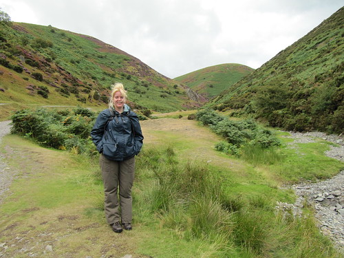
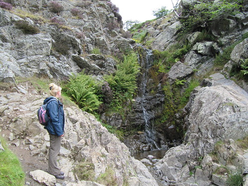
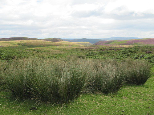
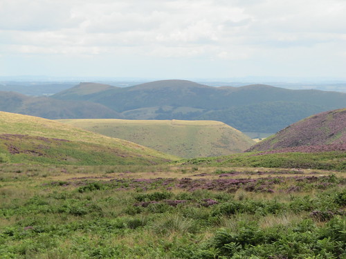
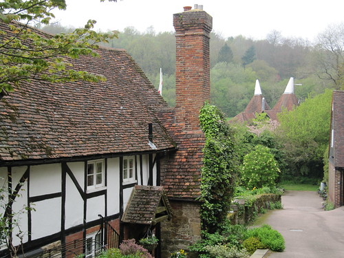
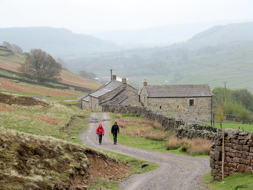
A cold North Somerset wind blew like a trumpet across the Mendip Hills as we set out from Chelynch. First published in: The Times Click here to view a map for this walk in a new window
picture picture picture picture picture picture picture picture

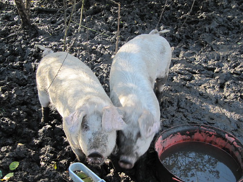
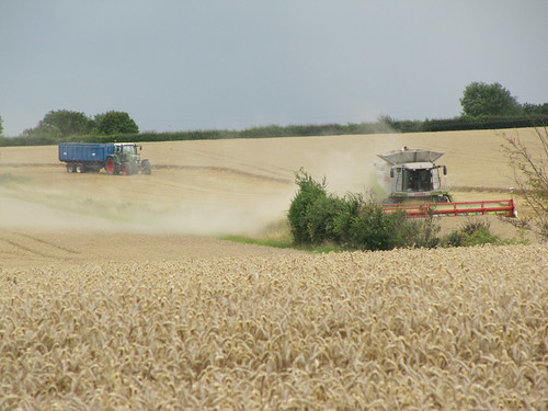
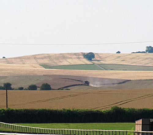
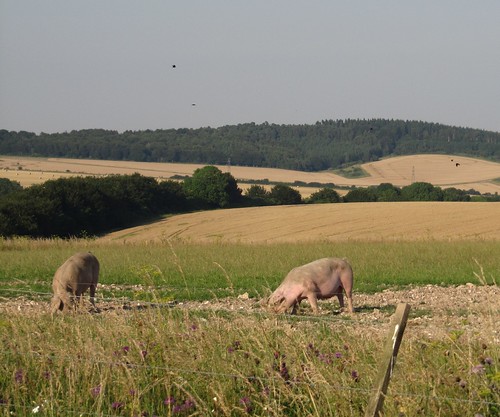
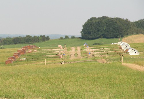
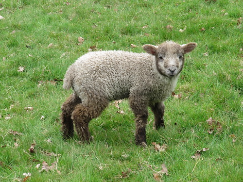
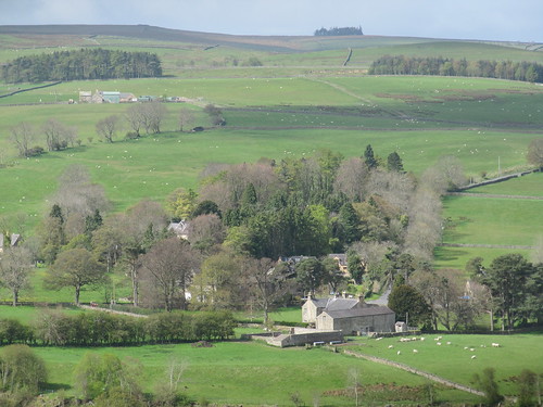
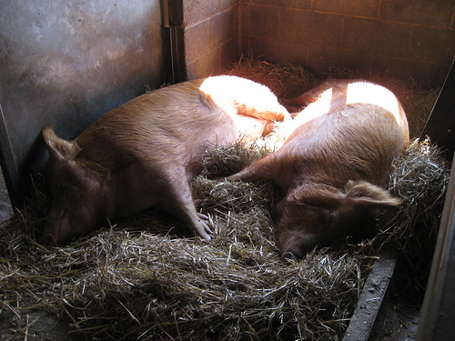
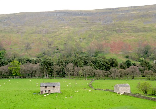
It’s all farming country round here. A couple of porkers came snuffling to the gate at Newman Street Farm, and a bunch of peahens fled down the lane, their speckly grey and white bodies bent forward as they scurried between the hedges like plump little old ladies heading for a bring-and-buy.

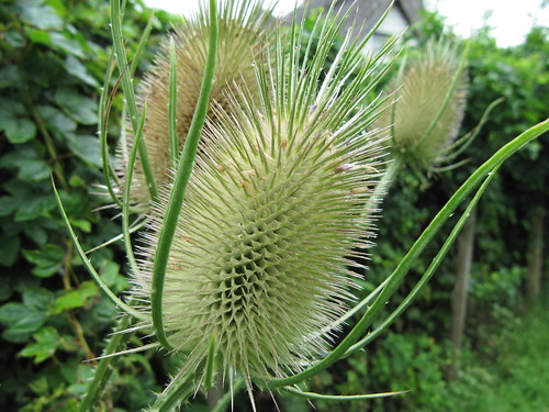
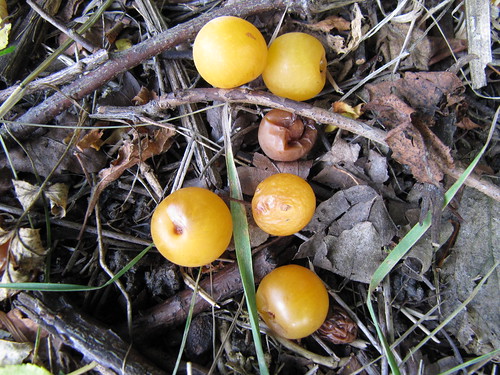
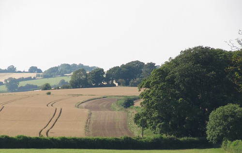
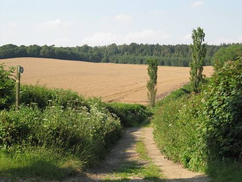
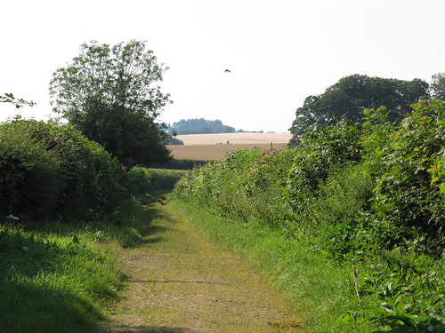
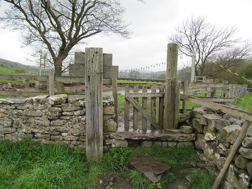
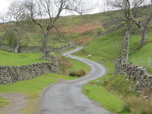
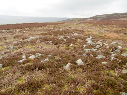
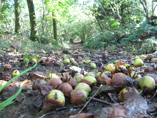
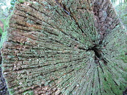
We crossed the fields by way of proper Mendip stone stiles, big slabs of limestone a farmer can hop over but a sheep can’t. Three Ashes Lane took us west in a tunnel of trees where fallen crab apples littered the trackway, already rotting from blotchy green to soft toffee browns and blacks.

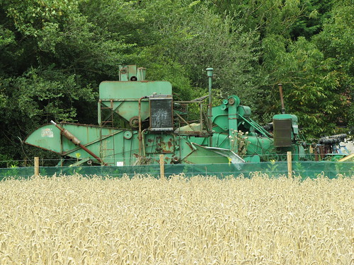
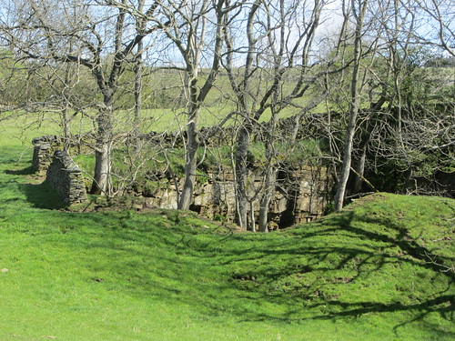
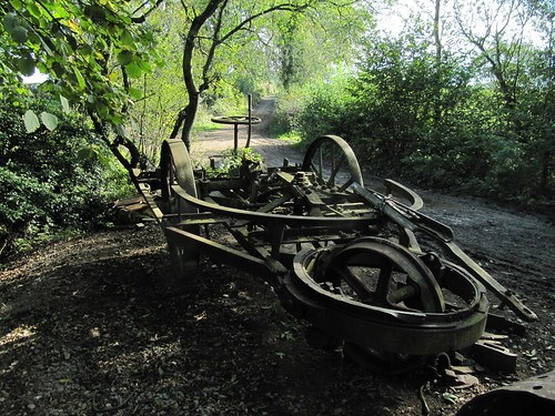
At a dip in the lane stood a mighty cast-iron contraption, all bolts and cogs and great spoked wheels. ‘It’s an early kind of cultivator,’ explained its owner, emerging from a shed under the hazels. ‘You’d have a steam traction engine at either side of the field, hauling this thing from one to the other and back again on a rope as it ploughed the soil.’ How cumbersome such a monster looked to our modern eyes; but how our forefathers must have blessed its power, its capacity to spare them sore bones and wrenched muscles, back in the dawn of mechanised agriculture.

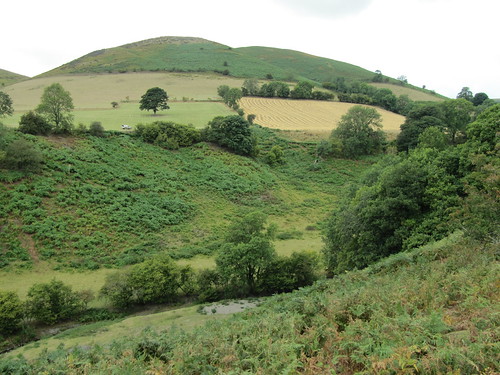
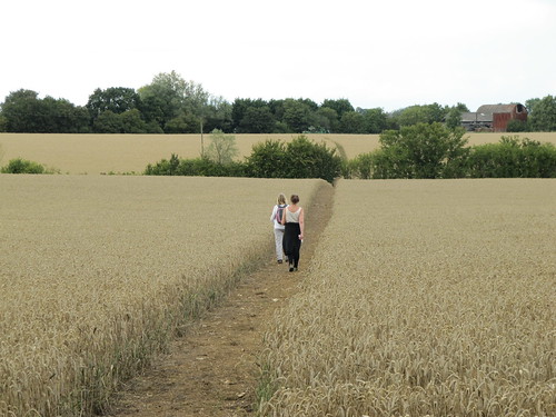
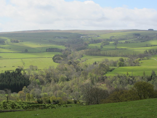
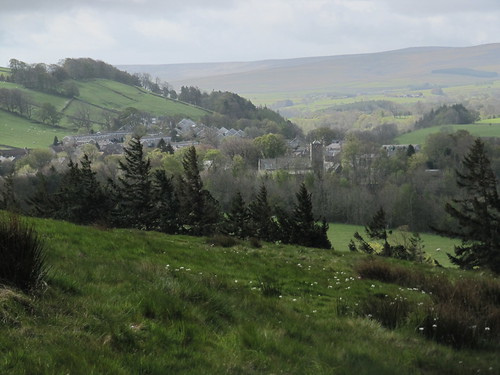
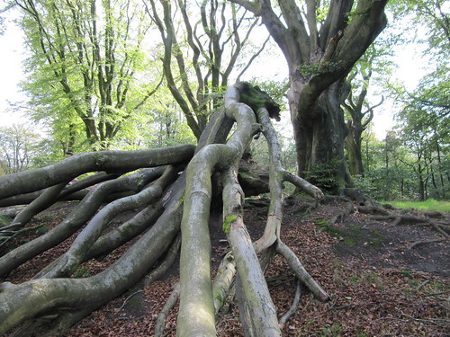
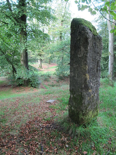
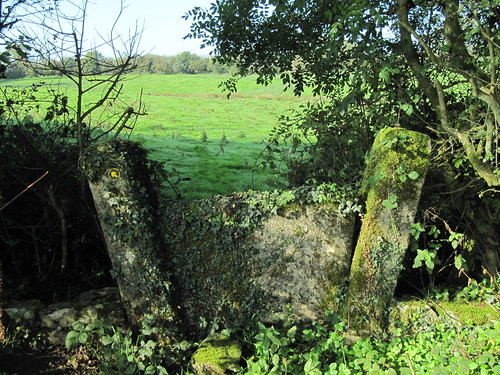
At a junction of lanes we turned south down the Fosse Way. The military highway where Roman soldiers marched and grumbled is now a beautiful leafy lane, cutting across the grain of the Somerset landscape. In Beacon Hill Wood we veered away from the old road and up through a giant’s graveyard of fallen beech boughs to where a standing stone rose at the apex of the hill, already ancient when the legionaries marched by.

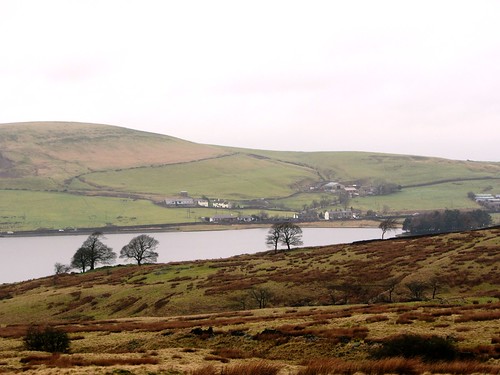
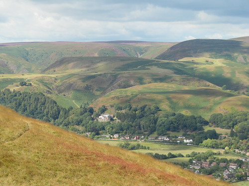
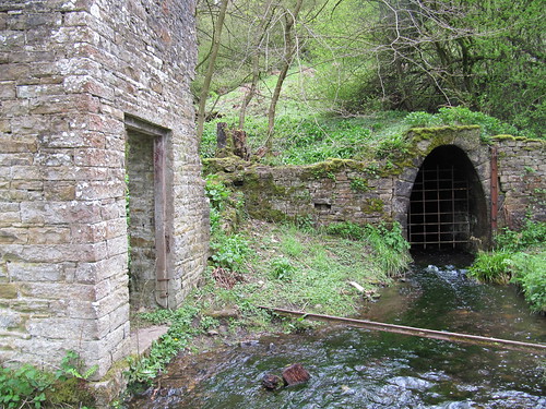
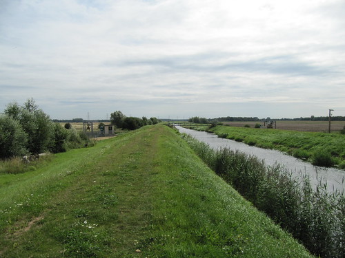
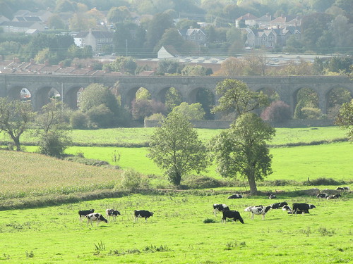
Near Shepton Mallet the graceful curve of the Charlton Viaduct, pierced by 27 arches, carried the trackbed of the long-defunct Somerset & Dorset Railway across the infant River Sheppey. Walking back over Ingsdons Hill to Chelynch I thought of the miserable journeys I’d endured along that line, sulking back to school after the holidays – and the joys of watching the clots of steam float by the window as the S&D wafted me home at each term’s end. Happiest days of my life? Well – some of them were.

Start & finish: Poacher’s Pocket PH, Chelynch, Shepton Mallet, Somerset BA4 4PY (OS ref ST 649439)
Getting there: A37 (Bristol) or A367 (Bath) towards Shepton Mallet. 200 m after they merge (2 miles from Shepton Mallet), left at top of Long Hill (signed ‘Wagon & Horses’) along Old Frome Road. In 1¼ miles, right at Wagon & Horses PH (signed ‘Doulting’) to Poacher’s Pocket PH in Chelynch.

Walk (6½ miles, easy/moderate, OS Explorer 142. NB – Online map, more walks: www.christophersomerville.co.uk): From Poacher’s Pocket, left; pass top of King’s Road; in 20 m, left over stile (fingerpost). Across field and next stile; path across field to corner of hedge (649443); right over stone stile. Cross field to Newman Street farm lane (652444); left to T-junction (648450). Right to first crossroads (649455); right to cross Old Frome Road (652455; fast! take care!); through gateway opposite and on (yellow arrow/YA). Through hedge by 2 tall trees; keep same line to cross stone stile (654458; YA). Left with hedge on left; over stile; through narrow woodland strip; over stile. Diagonally right through 3 fields (stiles). In 4th field, left over stile (657462); down to gate into Three Ashes Lane (658464). YA points ahead, but turn left along lane. In ⅓ mile, cross road (652464) and on along lane. In 200 m lane curves left, then right (650464); ignore both gates here, and continue along lane, then same direction along field edges for ⅔ mile to T-junction with Fosse Way (639466). Left to cross Old Frome Road (638461; take care!). Left for 70 m, then right through Beacon Hill Wood; continue along Fosse Way to road (636451). Left to T-junction; right; in 200 m, left (635449) along Fosse Way for nearly 1 mile. Pass barn on right (632437); in 200 m, left up steps, over stone stile (631435; green arrow, East Mendip Way/EMW). Cross field, then Bodden Lane (634436); on up Ingsdons Hill (EMW). At summit (638437), ahead along EMW for ⅔ mile to road (647439); right into Chelynch.

NB: Click on Facebook “Like” link to share this walk with Facebook friends.

Lunch: Poacher’s Pocket Inn, Chelynch (01749-880220) – good food and friendly atmosphere
More info: Shepton Mallet TIC (01749-345258); visitsomerset.co.uk
www.ramblers.org.uk www.satmap.com www.LogMyTrip.co.uk

 Posted by at 02:34
Sep 152012
 

A cool misty Lancashire day, with the sky as close-fitting as a grey cloth cap over Rossendale and its tributary valleys. First published in: The Times Click here to view a map for this walk in a new window
picture picture picture picture picture picture picture picture

A cheery milkman met us on the lane from Lumb to the moors, chinking two bottles in his hand. ‘G’morning – y’all right?’

The Pennine Bridleway ran as a hedged lane, winding and twisting past farmhouses and isolated cottages, all the buildings and field walls of the same dark sandy stone blotched with the green lichen so characteristic of these moors. Over the uplands a silence lay, broken by a crow call, a faint whistle of wind in the sedges, and the expressive fluting of a blackbird in the valley far below. As always when looking down from these moors, it was hard to relate today’s smokeless factory chimneys, silent mills and empty terraced streets to the roar and rattle, smog and human movement of half a century ago in these once-industrial valleys.

The bridleway led on through deeply hollowed miniature canyons worn down by centuries of boots, hooves and farm wheels. Many old tracks tangle and ramify across the moors – limers’ gaits along which laden carts jolted to bring lime fertilizer to the acid fields, packhorse routes and colliers’ trods, a superb network for riders and walkers exploring the Rossendale uplands. At an old stone cross we swung west, crossing the sedgy moorland fields with glimpses north to the steely waters of Clowbridge Reservoir and the slopes of Nutshaw Hill.

Down at Goodshaw we found Kathy Fishwick – an old acquaintance and a key-holder of the remarkable Goodshaw Chapel. This ancient Baptist foundation looks like a house, and in fact it is one – a house of the Lord. Every square inch inside is crammed with high-sided box pews with hard benches and a good view of the minister’s desk. Goodshaw Chapel could easily hold a congregation of three or four hundred. It frequently did so in times past, when the faith followed the wool and cotton trade. In 1760 the chapel-goers came singing over the hills, bearing these pews on their backs to furnish their new prayer house, which formed the heart of the community for the next two hundred years.

We bade Kathy goodbye and went on up steep-sided Folly Clough with its old millrace relics, out and over Swinshaw Moor where larks laid claim to each sedge clump in song and the black peaty pools reflected the racing sky.

START: Millennium Green, Lumb, Lancs, BB4 (OS ref SD 838250)

GETTING THERE: Bus 273 (Burnley-Bolton), 482, 483 (Burnley-Bury) – rossendalebus.co.uk
Road: M66 to Rawtenstall; A681 (‘Bacup’); in Waterfoot, left on B6238 (‘Burnley’); in 2¼ miles, park at Lumb Millennium Green.

WALK (6 miles, moderate, OS Explorer OL21. Online maps, more walks: christophersomerville.co.uk):
Follow Pennine Bridleway/PBW north. In 1¼ miles Rossendale Way/RW joins PBW beyond Near Pastures (840268). In 500 m PBW turns right (841273), but keep ahead. At stone cross (838276) RW turns left across moor for 1⅔ miles, descending to road in Goodshaw Chapel (815267). Left to pass chapel on left (815263). Ignore footpath fingerpost beside chapel; in another 70 m, left up tarred path, through gateway (815262). Diagonally right on path; through gate by wood (816261); down through squeeze stile; on down walled lane (yellow arrow/YA). At bottom (816259), left past metal barrier, up grassy track in steep-sided valley on left bank of beck (YAs). In 400 m cross beck; in 200 m bear right up steps (820261), past farm at top. Right through kissing gate (822261); ahead down farm drive. In 350 m, left through stone kissing gate (820259; YA). Follow path up gully, past trees onto moor. In ½ mile, at edge of Swinshaw Moor Access Land (827256), YA points diagonally left; but keep ahead beside wall, then fence. Cross stile; on to waymark post with 3 YAs (832254). Ahead with wall on right past wind generator; then with wall on left. Through metal gate; skirt cottages (835252); down farm drive to Lumb.

NB: Very muddy in parts; steep, awkward path beside beck (816259 – 820261); some sheep-wire hopping may be necessary.

REFRESHMENTS: Picnic; or Hargreaves Arms, Lumb (01706-215523; thehargreavesarms.co.uk)

ACCOMMODATION: Ye Olde Boot & Shoe, Millar Barn Lane, Waterfoot, BB4 7AU (01706-213828; yeoldebootandshoe.co.uk) – very cheerful, helpful, walker-friendly inn.

INFORMATION: Rawtenstall TIC (01706-226590); visitlancashire.com


Extract from the diary of William Frank Bramhill (1913-1997), courtesy of his son Will Bramhill:

‘I experienced many happy days there too… I can remember going with  Uncle Walter over the moors, and the long and enjoyable climb up from the Rossendale valley and down into Edenfield. Sometimes he would take his son Jim and I just to the top of the moor and we would sit for hours looking down into the valley towards Rawtenstall or northward towards Crawshawbooth. I got to love that valley… after all I had spent best part of my young years in it. The abject poverty of it all was hidden from the top of the moor… one could only see the smoking chimneys of the various cotton mills and from that height you could not see the pollution on the small stream that a little further down the valley became the Irwell.

Being in the valley and in the mills was different however… there was no beauty there… only constantly roaring machinery, the click clack of the looms and the swishing of countless leather straps over huge wheels… to a little boy all very frightening… what stayed in my memory most was the grey faces of the workers… pinched faces… no smiles… clogs, shawls, a seven day week for thirty bob (£1.50)… or a workhouse… the houses consisted of small cottages… one up and one down… if you can think of the latest television play ‘Sam‘ you get the true atmosphere… pint mugs… well scrubbed deal topped tables, rocking chairs and the kitchen range with its water boiler at the side from which you drew your hot water for washing… outside toilets… which were nothing better than a huge bucket slung under a well scrubbed wooden seat… the buckets emptied once weekly when a special horse drawn vehicle would come around the houses during the small hours to empty what became known as the ‘midnight soil‘. At such times the smell was appalling and lingers over fifty years in the memory.

In 1959 when visiting the valley one sensed but little change. I visited Edna, she was Walter‘s sister… older now of course but with the same pinched haggard face. I do not think I would have liked to have been an adult in those years… life must have been very hard… and we were supposedly a great Empire… the richest nation in the world… at £1.50 per week one couldn‘t say they were rich could they? Crawshawbooth had changed very little… unless it was that one noticed the absence of clogs which used to be worn by both male and female… now shoes were worn… once such luxuries were only for wedding days and funerals… the black shawls had gone but the faces were the same.’

www.ramblers.org.uk www.satmap.com www.LogMyTrip.co.uk

 Posted by at 02:13
Sep 012012
 

‘I’d really love to see some heather out in full bloom,’ sighed my daughter Ruth over the telephone from her London office. First published in: The Times Click here to view a map for this walk in a new window
picture picture picture picture picture picture picture picture picture picture picture picture picture
Facebook Link:
Scotland? No – too far. How about the Long Mynd, then? That great sandstone whaleback, rising near the Welsh Border in west Shropshire, is a blanket of purple heather and green bracken in this late summer season. Sounds good – let’s go!

The flanks of the Long Mynd are burrowed with steep, twisting stream valleys – ‘beaches’ or ‘batches’ on the west side of the whaleback, ‘hollows’ on the east where we began our walk on a gorgeous morning. Beautiful Cardingmill Valley abuts the tourist centre of Church Stretton and is always crowded, but once we had turned aside up Lightspout Hollow we had the narrow cleft almost entirely to ourselves. The hollow’s waterfall, spectacular after rain, was today no more than a splash and trickle down its slippery black shute of mosses and liverworts.

Up above the fall, Lightspout Hollow opened out into a green sea of bracken where meadow pipits swooped away with their characteristic inconsequential cheeping. The summit of the Mynd lay in a wash of heather, purple and brilliant enough in the sunshine to bring a huge grin to Ruth’s face. ‘That’s it!’ she said to herself. We paused on the crest to gaze out at the lumpy quartzite extrusions of the Stiperstones, famous for their association with the Devil and his minions, standing dark and threatening on the western skyline. Then we plunged down the long cleft of Ashes Hollow under high hillsides scarlet with bilberry leaves, turning colour to let us know that autumn was not too far around the corner.

Ruth strode out far below me, her golden twist of hair bobbing in the bracken. We chose a pathside rock to sit and nibble ginger oatcakes and mini-cheeses, an unbeatable combo with wind and a spatter of rain to put an edge on our appetite. Then it was on down the hollow, half in and half out of the stream, to pass Ashes (a strong candidate for the world’s most perfectly sited cottage) and reach the foot of the cleft.

Steeply up and steeply down to Town Brook Hollow, the reservoir at its mouth so green and still I took it to be part of the trees it reflected with mirrored perfection. On round the flank of Burway Hill, and back up Cardingmill Valley to the Chalet Pavilion for a well-earned cuppa and a tooth-melting slice of Carding Mill Crunch.

Start & finish: Cardingmill Valley top car park, Church Stretton, SY6 6JG (OS ref SO 441949)
Getting there: Rail (thetrainline.com; railcard.co.uk) to Church Stretton. Bus: Long Mynd & Stiperstones Shuttle (April-Sept, weekends + BH Mon; shropshirehillsaonb.co.uk).
Road: Cardingmill Valley signposted from Church Stretton (A49, Shrewsbury-Ludlow)

Walk (7 miles, moderate/hard grade, OS Explorer 217. NB: Online maps, more walks: christophersomerville.co.uk): From top car park, up track. In ⅓ mile, left up Lightspout Hollow (436951; red-topped posts/RTP). Climb to right of waterfall (431950); above it, follow RTP and yellow arrows/YA. Where path forks, go left (YA post); follow path to car park (421954). Cross road; ahead on bridleway (Jack Mytton Way). Over brow of hill to ‘Priory Cottage’ post with arrow pointing ahead (‘Ride UK’). Left here over knee-deep heather to cross road (421946). On along path (‘Little Stretton’) down Ashes Hollow. In 2 miles cross stream at Ashes house (439926). Over stile (YA) and on. Through camping ground, over stile to road (441920). Left over stile by Ashes Cottage gate (fingerpost); steeply up along narrow hillside path. In ⅔ mile descend to B5477 Ludlow Road (445930). Left up bridleway (fingerpost) into woods. In nearly half a mile leave woods by houses on left (448936); turn left (‘Public footpath to Town Brook Hollow’) up steps; at top, right and steeply down to reservoir at foot of Town Brook Hollow (447938). Right up slope (‘Cardingmill’, YA) to cross road (448942). Down fenced path (‘No Parking’); up Cardingmill Valley to car park.
Conditions: Some steep steps and paths between Little Stretton and Town Brook Hollow
Lunch/tea: Chalet Pavilion tearoom (NT), Cardingmill Valley (01694-725000) – delicious home baking
Cardingmill Valley: nationaltrust.org.uk/carding-mill-valley-and-shropshire-hills
More info: Church Stretton TIC (01694-723133); shropshiretourism.co.uk
www.ramblers.org.uk www.satmap.com www.LogMyTrip.co.uk

 Posted by at 02:25
Aug 252012
 

On one of those peerless late summer afternoons we left our table by the stream in the garden of the Queen’s Head at Fyfield, full of potted shrimps. First published in: The Times Click here to view a map for this walk in a new window
picture picture picture picture picture picture picture picture picture picture picture picture picture picture picture
Facebook Link:
Hath Essex anything to show more fair? White clouds rolled evenly across the gently swelling countryside of bean fields and pastures where small black cattle grazed intently. The path ran above ditches full of fluffy pink hemp agrimony, where comma butterflies displayed their tiger-striped wings with deeply scalloped edges. Lampett’s Farm lay backed in among its trees with red tiled roof, tall chimneys and whitewashed walls, a rural picture of perfection. The barley fields rustled in a rising wind, and pigeons scooted like Spitfires at unaccustomed speed before it.

In a tunnel of trees we found the Three Forests Way, an old green lane running broad and direct through the cornfields, past the weatherboarded barns at Green’s Farm and on by ploughlands where starlings and seagulls rose in their segregated flocks and wheeled, brightly lit by the sun against slate-grey rainclouds that were quickly running up on us from the west.

We hustled on into the shelter of Butthatch Wood and the path to St Botolph’s, the church in the fields. Branches weighed down with wild plums and bullace hung by the way, and we pulled handfuls of the sharp and succulent little fruits, yellow, scarlet and purple.

St Botolph’s stands solitary in the fields, sole marker of the original site of Beauchamp Roding village. How strange it is to find a large flint-built parish church, solid and stately, footed in the beanfields all alone. Inside, the massive old rood beam still spans the chancel arch, resting on two corbels with carved figures – one an angel with widespread wings, the other a jolly, if demonic, porcine lion (or leonine pig) with a squashed-in snout, some medieval mason’s bit of fun.

We moved on through cornfields edged with mauve drifts of mallows. In the hedges, blackberries hung intertwined with wild hops whose leaves and buds were sticky to the touch, pungent in the nostrils. At Shellow we passed fishing lakes where a young boy was in the act of landing a carp, his upper body strained tensely backward in counterbalance to the bow of his rod as the big fish flapped and splashed just out of reach of the landing net.

A last stretch beside the snaking River Roding, half choked with spikes of purple loosestrife, and a glimpse of a children’s tea party laid on a blue and white check cloth under a tree at Miller’s Green.

Start: Queen’s Head PH, Fyfield, Essex CM5 0RY (OS ref TL 570069)

Getting there: Bus 46 and 146 (Chipping Ongar – Fyfield) – harlowride.co.uk
Road: M11 Jct 27, A414 to Chipping Ongar, B184 to Fyfield.

WALK (7½ miles, easy, Explorer 183)
From Queen’s Head, right along B184 (‘Dunmow’). In 30 m, left (fingerpost/FP), diagonally left across field; left through hedge gap (569072; green arrow ‘Epping Forest Countrycare’/EFC). Keep hedge on right for 4 fields (stile, yellow arrow/YA) to reach a cross path by stile. Right (565072; EFC); then bear left through jungly bit to meet gravel byway (565075; ‘Three Forest Way’ on map, unmarked on ground). Left (red arrow), following byway for ¾ mile past Malting Farm and Green’s Farm to road at Claydon’s Green (566086). Dogleg left and right across road and on (FP) along hedge. Through next hedge gap; left, with hedge on left, aiming for right side of Butthatch Wood. In 150 m ignore YA pointing right; in another 50 m, right (567090, YA) to wood (569093); follow its nearer edge (YAs). At top end of wood, left (YA); in 50 m, right (570096) across 2 fields. Halfway across 2nd one, 100 m before barn, turn right (570100) on path; through hedge and on (YA) to B184 (574099). Left for 200 m; opposite end of road (‘Woodend’), turn right (576100, ‘St Botolph’s Church’) down stony lane to church (578097).

Return up lane. 150 m from church, right (578099; YA) towards pink house. At road, right (581099); in 50 m, left (FP) and follow field edge with hedge on left. In 500 m, at field end with footbridge on left, bear right (587098) across field, then on with hedge on left, aiming for 5 tall poplars in far hedge, with house on their right. Aim left of poplars, ignoring kissing gate on left, to YA post in far corner (589092). Pass it, and turn right along lake; through car park, past ‘Birds Green Fishery’ notice; follow drive to road (589089). Left to cross Shellow Bridge; immediately right (FP) along field edge with River Roding on right. Along right edge of copse (588088; YA); bear half left and follow posts and YAs for ⅔ mile across fields to road at Miller’s Green (589078).

Right for 200 m; at sharp right bend, ahead down drive (588077; FP). Keep right of house, with hedge between you and it, across grass, past YA and on. Bear round right side of field (Essex Way/EW); in 50 m, right across bridge (588075). Cross field to post; left to road (EW, YA). Left, round sharp left bend; right (586071, EW) across fields for 700 m to road (580068). Left for 50 m; right (FP), keeping left of house and following grassy path. In ¼ mile, dogleg right and then left (576070) through hedge (YAs). Pass some weatherboarded houses; cross EFC path (green arrow) and continue across River Roding (573070). On far side, 2 YAs; follow left-hand one, with hedge soon on your right. At road (571071), left to pub.

LUNCH: Queen’s Head, Fyfield (01277-899231; thequeensheadfyfield.co.uk) – deservedly popular village watering hole

INFO: Chelmsford TIC (01245-283400); visitessex.com
www.ramblers.org.uk www.satmap.com www.LogMyTrip.co.uk

 Posted by at 07:40
Aug 112012
 

The view from Boveridge Farm was all you’d want on a beautiful summer’s day – the gentle swell of the Dorset Downs, the snaky blue line of a fence or chalky track cutting across the hill, trees throwing ink-black shadows along the hedges. First published in: The Times Click here to view a map for this walk in a new window
picture picture picture picture picture picture picture picture
Facebook Link:
I stood admiring the prospect, then shifted my stance – a couple of steps to the side for a new perspective. Now I could see a blood-red slash of earth across the tree-crowned hill, and the shadows had assumed the look of sharp-tipped tentacles, reaching out into the fields with a whisper of menace. Two paintings in an exhibition, both of the same subject, separated by fifty years and a generation – The View from Boveridge Farm, 1992, by Tim Nicholson, and Boveridge, painted by the artist’s mother E,Q. Nicholson in 1943, at the height of the Second World War.

Artists have been visiting and settling around Cranborne Chase for a century or more. Elisabeth Frink, Stanley Spencer, Lucian Freud, Henry Lamb and various members of the arty Nicholson family are among those who found room to breathe and mighty inspiration in this great expanse of forest and downland at the meeting place of Hampshire, Wiltshire and Dorset. Salisbury and South Wiltshire’s summer exhibition of the work of Cranborne Chase artists past and present, ‘Circles and Tangents’, set me off exploring the landscape around Cranborne, across the border in Dorset, that inspired the Nicholsons.

Cranborne was an English idyll on a hot afternoon, with sun on the brick walls and children running home soaking wet from paddling in the River Crane. The cornfields began on the edge of the village, from where I looked back through a hedge gap over Cranborne’s roofs, some red-tiled, some thatched, in their wooded bowl of ground. Up at Boveridge Farm tractors roared in dusty fields. I caught immediately what Nicholson mother and son had represented so magically – the essence of downland, a working landscape of dull gold barley, crop and stubble, beautiful but far from twee or cosy.

A green lane packed with butterbur and the drooping purple bells of comfrey led me through Stone Hill Wood and on by Boulsbury Farm, a self-contained huddle of farmhouse and barns where mallow flowers grew through an old hay turner. In Stony Lane I got a wave from a girl in a red singlet at the helm of a giant new tractor. All the farming world was out and double-busy in this harvest weather; but at Alderholt Bridge all was cool and still, with the millstream gurgling under the nearby mill.

Here EQ Nicholson lived during the war, entertaining the likes of Lucian Freud and John Craxton, and painting all she could see. Her picture The Stream at the Mill House showed willow branches reaching like fingers across the blue mill stream; Craxton’s Alderholt Mill stood old and strong against a stormy sky, the wall of the mill race sinuating below. If I’d been a painter I’d have wanted to capture the scene here, too – red brick against blue sky, bottle-green water bubbling, and a proper sense of place.

Start: Inn at Cranborne, near Wimborne, Dorset BH21 5PP (OS ref SU056133)
Getting there: Bus 97 (Dorset Community Transport), Fordingbridge – Alderholt – Cranborne (0871-200-2233).
Road – A338 to Fordingbridge, B3078 to Cranborne.
Walk: (8 miles, easy, OS Explorer OL22 and 118; detailed instructions – essential! – more walks, online map: christophersomerville.co.uk):
From Inn at Cranborne, right along Wimborne Street. Follow ‘Damerham’. After 2 bends turn right down Penny’s Lane (057134) past recreation ground. In ¼ mile pass concrete trough and turn left (060133) up field edge and on for 350m to road (061136). Right for 40m; left through gates and keep straight ahead along track through Burwood for ⅔ mile to road (062145). Left; in 100m, right up path (fingerpost/FP, yellow arrows/YA). In 100m, cross stile (062147); left over gate; right up fenced path. At top, bear right to road (062150); right. Between barns, just before tree surrounded by staddle stones, left (064150) past Boveridge Farm. On (YA) along green lane.

At gate into Stone Hill Wood, bear right (066156, YA) along wood edge. At top of rise, bear left (069155) and follow deeply rutted track. In 200m it becomes hard-surfaced track. In another 200m (072156) keep ahead (not right) at fork, soon descending. At T-junction at wood edge (074156), ahead through hedge. Left for 100m; right across field, up to stile in far hedge (077159, FP). Forward along track to pass Boulsbury Farm. Just past farmhouse, right at fork (079163). At Boulsbury Cottages (082162) fork left along tarmac lane. In ¼ mile, round right bend; in another ¼ mile road bends sharp left; keep ahead here (089161; bridleway FP; cycle trail blue arrow/BA) in tunnel of trees. Cross road at Four Corners (093159, BA); on along Stony Lane under power lines for ½ mile.

Arriving at Ashley Park Farm complex and stables (097153), left past Manor Farm House; on along lane for 600m. At T-junction (103154), right for 20m; left along hedge (FP) on path in tunnel of trees. At road (106155), right, and follow tarmac lane to Hill Farm. Pass farm nameboard; in 100m, right over stile (108155; FP, YA) and follow stiles and YAs. After 3rd field cross footbridge (109152); on along lower edge of next field with hedge on right. At post with YAs (110151), forward with hedge on right and stream beyond. At the end of this long field, ahead through hedge. Cross jungly bit to reach T-junction of paths (114148). Right (YA) and keep ahead between hedge and fence for 300m. At kissing gate (116146) fork right across field. Through chain-link stile, then the following kissing gate (118145)). Keep ahead (YA) through trees to road at Alderholt Bridge (120143). Right past Alderholt Mill. Continue along road (take great care!) for 300m. Pass Little Thatch on right, and take next right along farm drive (118140; ‘No Through Road’). Pass cottages at Alderholt Park (113133); on through High Wood for ½ mile to reach B3078 (112125). Left to Churchill Arms PH and bus stop (across road).

Walk: Inn at Cranborne – Burwood (062125) – Boveridge Farm (064150) – Stone Hill Wood (066156) – Boulsbury Farm (079163) – Boulsbury Cottages (082162) – Four Corners (093159). Stony Lane – Ashley Park Farm (097153) – road at South End (103154) – Hill Farm (108155) – field path just to north of stream and lakes to Alderholt Bridge and Mill (120143). Alderholt Park (113133) – High Wood – B3078 opposite Churchill Arms PH, Charing Cross, Alderholt (112125).
Refreshments: Churchill Arms, Alderholt (01425-652147)
Lunch/accommodation: Inn at Cranborne (01725-551249; theinnatcranborne.co.uk) – very friendly place
Circles and Tangents Exhibition: Salisbury and South Wiltshire Museum (until 29th September) – The King’s House, 65 The Close, Salisbury, Wiltshire, SP1 2EN (01722-332151; museum@salisburymuseum.org.uk) – Cranborne Chase painters, sculptors, potters etc., past and present
Information: Fordingbridge TIC (01425-654560); Salisbury TIC (01722-342860)
www.ramblers.org.uk www.satmap.com www.LogMyTrip.co.uk

 Posted by at 06:13
Aug 042012
 

If you are going to be a champion of this country’s heritage and the survival of all that’s best about it, Kent seems the ideal place to have as your bedrock.
First published in: The Times Click here to view a map for this walk in a new window
picture picture picture picture picture picture picture picture
Facebook Link:
Two contrasting but quintessentially English fighters for freedoms are celebrated on this walk through the Garden of England: Octavia Hill, one of the founders and pioneering visionaries of the National Trust, and Sir Winston Churchill – now, what did he ever do for us?

Octavia Hill’s large, calm eyes, generous mouth and determined chin show to advantage in the portrait that features in the National Trust’s leaflet guide to the Centenary Trail they have set up in her honour. We picked up the leaflet from the Toy’s Hill car park dispenser and set off through the bluebell woods on a misty day, with the Weald of Kent lying veiled in thick dove-grey air. Octavia Hill lived locally in Crockham Hill, and her gift of property at Toy’s Hill in 1898 was one of the first made to the infant NT. Since then a big swathe of these lovely wooded hills has been acquired by the Trust, a slice of England to be safeguarded for ever by the organisation that most of us take for granted and for whose existence all of us should thank our lucky stars.

Twisty old beech pollards, warty and knobbled, stood in the mossy banks of the bridleway, their multiple smooth-skinned arms shooting skywards. Tiny hornbeam and ash suckers grew among them, rooted in rotting tree debris still evincing the terrible destruction of 1987’s Great Storm over southern England.

On Toy’s Hill village notice board a poster in a child’s huge wobbly writing advertised ‘Purfyoom For Sale’. We followed Puddledock Lane, a deep holloway in the soft greensand with sublime misted views out across the woods and fields of the Weald, past fields of fat white lambs and a cow pasture where a fox went slinking across the grass between utterly oblivious cattle. Chartwell was a huddle of red tiled roofs and white-capped oasts sailing in a frothy pink sea of apple blossom. Here in the big red Victorian house Winston Churchill painted his depressions away, walked the gardens, lived surprisingly modestly, and looked out on a view of meadows and wooded ridges as supremely English as any call-to-arms wartime leader could desire in the way of inspiration.

Beyond Chartwell we followed a mesh of beech-shaded country lanes to Crockham Hill, where Octavia Hill lies under a yew tree in the churchyard. On through buttercup meadows to high-perched Froghole Farm, all half-timbering, red tiles and oast caps, and then a final bluebell path over Mariners Hill to descend to Toy’s Hill once more.

START & FINISH: Toy’s Hill NT car park, Chart Lane, Toy’s Hill, near Westerham, Kent TN16 1QG (OS ref TQ 469517).

GETTING THERE:
M25 Jcts 6 or 5; A25 Sevenoaks-Westerham; turn off in Brasted on minor road through Brasted Chart; car park on right, just before Toy’s Hill.

WALK (6 miles, moderate, OS Explorer 147):

Go up steps behind information board; follow Olivia Hill Centenary/OHC waymarks through woods. In 300 m at junction, turn left (468514/OHC); at lawn area below (469513) bear left down tunnel of hollies to road (470513). Right past phone box along Puddledock Lane. In ⅔ mile pass foot of lane by ‘Windswept’ house (462509); in 100 m, right over stile (fingerpost, OHC) on fenced path to Chartwell. Pass oasts and Herdsman’s Cottage; up lane to road (453513). Left; in 50 m, right up Mariners drive (fingerpost). In 200 m at sharp right bend, ahead through gate (453510, OHC); in 275 m, at 3-way fingerpost, bear left down lane and on down green lane. At crossroads near Coachmans bear right (451507, OHC) on lane for ½ mile to Crockham Hill.

At B2026 (442506; Royal Oak PH on your left), turn right; in 50 m, right past school and church. Go through gate (444507, OHC); on across fields for ⅓ mile to Froghole; at top of long flight of steps, left (449509) along lane past Froghole Farm to B2026 (448513). Right here up steps (OHC) and follow OHC through woods and over Mariners Hill for ½ mile. In trees again near road at Chartwell, watch for left turn uphill (453514, OHC) on path. In ¼ mile, descend to cross road at Chartwell entrance gates (453519).

Ahead along bridleway (OHC). In ¼ mile cross road (456522, OHC) and on for ⅔ mile to French Street. At road, right (459527, OHC) along road for ½ mile past Frenchstreet Farm. At a fork, left uphill (463521, OHC) into Toy’s Hill Woods. Follow track (ignore side turns) and OHC past site of Weardale House (468518). In 100 m, fork left; in another 20 m, right (OHC) to car park.

LUNCH: Royal Oak, Crockham Hill (01732-866335, westerhambrewery.co.uk); NT Restaurant at Chartwell (01732-863087).

ACCOMMODATION: King’s Arms, Westerham, Kent TN16 1AN (01959-562990; oldenglishinns.co.uk/westerham)

Chartwell (NT): 01732-868381; nationaltrust.org.uk/chartwell/

Octavia Hill Centenary Trail: Leaflets at Chartwell and Toy’s Hill car park.

NT Octavia Hill photo competition to celebrate her love of green places (closes 31 August) – nationaltrust.org.uk/yourspace.
www.ramblers.org.uk www.satmap.com www.LogMyTrip.co.uk

 Posted by at 02:53
Jul 282012
 

It was a fantastically blowy morning over the Northumbrian moors.
First published in: The Times Click here to view a map for this walk in a new window
picture picture picture picture picture picture picture picture picture picture picture picture picture picture
Facebook Link:
The night before, safely tucked up in a cosy bed at High Keenley Fell Farm high on its ridge, I’d heard the gale roaring like a monster in the larches and over the farm roofs. But down here in Allendale Town, sheltered in the cleft of its deep green dale, the wind was sounding more of a continuous, mighty sigh in the racing heavens over Allendale.

Up on the fellside to the north of the compact little town, I looked over to a great rise of stone-walled fields topped with broad dun-coloured moors and the upraised fingers of a couple of industrial chimneys. It’s all sheep and cattle around here now, but back in the day Allendale Town was a noisy, two-fisted settlement of 6,000 people, most of them employed in the lead mines up on the moors. The chimneys poured out noxious and toxic sulphur fumes, brought through nearly a mile of stone-lined flues from the dale’s big smelting mills. Allendale’s lead business all came sliding to a stop in the late 19th century, and these days you couldn’t find a quieter dale in these lovely northern hills.

Late-flowering cowslips and milkmaids danced crazily in the wind as I followed the hillside path past Housty and Stone Stile farms towards Catton. The spine-tinglingly poignant bubble of curlew calls came from the fields, and I caught a flash of white as the stout wading birds with their long down-curved bills settled themselves among the sedges with an ecstatic shiver of sabre-shaped wings.

Catton lay silent around its village green. In the fields beyond, fat lambs ran riot, one actually prancing on top of its mother’s back as she lay imperturbably chewing the cud. Below Old Town a bridge crossed the shallow, peat-brown River East Allen in its sheltered little gorge. Before following the riverbank path back to Allendale, I paused, leaning on the parapet and watching two white-breasted dippers bobbing on midstream stones while a flycatcher swooped out, up, over and back to its branch above their heads with a beak full of insect fodder.

Start & finish: Allendale Town square, Northumberland NE47 9BD (OS ref NY 837558)

Getting there: Bus 688 (Hexham-Allendale)
Road: Allendale Town is on B6295 between A69 (Hexham-Haydon Bridge) and A689 (Stanhope-Alston)

WALK (7 miles, moderate, OS Explorer OL43. NB Online map, more walks: christophersomerville.co.uk): From Allendale town square turn left (Hexham direction) along main road (pavement). In ¼ mile, cross Philip Burn (841562); in 50 m, right up side road by ‘Dene Croft’. In 100 m, left up walled path, (842564; fingerpost ‘Housty’); in 100 m, left over ladder stile (fingerpost). Follow yellow arrows/YA across fields to Housty. Keep left of house and over stile (836572; YA); follow drive to road (834575). Right for 200 m; left (836576; fingerpost ‘Stone Stile, Catton’). Skirt left of barn, over stile (YAs); bear half-left down field; through gate (833577; no YA). Bear right through next gate (no YA); bear left down to cross wall by stone step stile; cross Catton Burn footbridge (832578). Bear right up wall; in 100 m, left over ladder stiles, through fields and farmyard (YAs) to road in Catton (829577).
Right; in 50 m, left by ‘Catton 2000’ stone seat, down lane. Cross footbridge (827577; YA) and follow green lane (YAs) for ½ mile, past Pasture House to cross road (818578; fingerpost). Turn right through gate (fingerpost ‘Old Town, Bishopside’; YA) across field above Struthers; then follow wall (step and ladder stiles) for ¼ mile to Old Town (814579). Through yard (YAs) and on across fields (YAs, stiles) to road (812581). Turn left downhill; descend Colliery Lane to cross River East Allen at Oakpool bridge (808577). Turn left (fingerpost ‘Allendale Town’); don’t bear right up waymarked field path, but keep ahead past front of Oakpool Farmhouse and on along track, then path, on right bank of river, over footbridges, through house garden at Bridge Eal (818573, YAs) to turn left across river on B6295 by weir (831566). Turn right along left bank (fingerpost ‘Allendale Town’), sticking close to river. In 1 mile, opposite cricket pavilion, bear left up walled lane (836560) to road; left to town square.

Refreshments: King’s Head PH, Allendale (01434-683681); Forge Studios tearooms (01434-683975; allendaleforgestudios.co.uk)

Accommodation: High Keenley Fell Farm (01434-618344; highkeenleyfarm.co.uk) – very comfortable, good food and stunning view

Information: Hexham TIC (01434-652220); visitnorthumberland.com
www.ramblers.org.uk www.satmap.com www.LogMyTrip.co.uk

 Posted by at 10:39
Jul 212012
 

Olympic fever grips Great Britain – but truth be told, here in windy London it’s Sunday morning and everyone’s yawning. First published in: The Times Click here to view a map for this walk in a new window
picture picture picture picture picture picture picture picture
Facebook Link:
Where can Games-goers in need of a few hours’ escape find a decent walk in varied surroundings that’s only a hop, skip and jump away from Olympic Park? Opting for the bustle of markets and the open atmosphere of London’s waterways, we set off in search of breakfast at a market stall, a chat with the animals in the city farm and some quality idling by canal and river.

A bracing wind blows as we leave Liverpool Street Station. The huge blankness of the city’s plate-glass canyons is given a human face by the busker on the forecourt steps, who causes an eddy in the tide of heedless passers-by as he belts out a hoary old Quo number. We mosey round the earring and shawl stalls in the covered shed of Old Spitalfields Market to a gentle blur of reggae, buying nothing, slowly waking up.

On a Sunday you can smell Brick Lane long before you get there – curry, chilli, salsa, roasting beef and goat. The street market assaults the eyeballs with titfers and tomatoes, fish and fascinators, bread and chairs, sandwiches, socks and sun-specs in more colours than the good Lord ever made. A young girl stands, passionately and wildly singing ‘St James’s Infirmary’. How the staff at Beigel Bake pack so much salt beef into their fresh bagels is a minor miracle, but it makes the kind of breakfast you know is going to last you till sundown.

Beyond in the city farm I have a great old time hanging over the palings with a stick, scratching the scurfy back of a Tamworth Ginger sow. ‘Eee-eee,’ says the lady, ‘eee, don’t stop.’ Her friend lies spark-out on a pile of straw, a giant slab of blubber in a fuzz of red hair.

Regent’s Canal’s towpath takes us lazily towards the Thames in company with tinies in pushchairs, runners, strollers and dogs mad to get into the swim. Water tumbles over weirs and spurts with a sleepy hiss through rotted lock-gates. Among the towers of Tower Hamlets lie the waterside cottages of Hackney Village, all white-painted windowsills and cascades of aubretia. A pair of swans harvests reeds for a mid-canal nest off Mile End Park.

Approaching the river, the colossi of Canary Wharf and the space-rocket nose of the Gherkin rise pale and ghostly. There is the smack of tidal waves, a stiffening of the breeze and a tang of the sea. It’s wonderful to swap the stillness of the canal for the salty vigour of the Thames, to push upriver into the wind towards the cosmopolitan heart of the city once again, and to recall that never-to-be-forgotten Diamond Jubilee armada of boats filling Old Father Thames from shore to shore.

Start & finish: Liverpool Street Station
Getting there: Central, Circle, Hammersmith, Metropolitan tubes
Walk (8 miles, easy, OS Explorer 173, London A-Z pp 40-2, 54-6. NB – Online map, more walks: christophersomerville.co.uk):
Liverpool Street Station – Bishopsgate – Brushfield Street – Old Spitalfields Market. Commercial Street – Hanbury Street – Brick Lane. Bethnal Green Road – Squirries Street – Warner Place – Hackney Road. City Farm – Haggerston Park – Audrey Street – Goldsmith Row. Regent’s Canal to Limehouse Basin. Thames Path to St Katharine Docks. Mansell Street – Whitechapel High Street – Commercial Road – Old Spitalfields Market – Liverpool Street.

Food: Beigel Bake, Brick Lane (0207-729-0616) – salt beef, cream cheese, fish: you name it, it’s here in a fresh-baked bagel
More info: Old Spitalfields Market www.visitspitalfields.com; Brick Lane Market www.visitbricklane.org; Regent’s Canal http://www.bertuchi.co.uk/regentscanal.php; Thames Path www.walklondon.org.uk
www.ramblers.org.uk www.satmap.com www.LogMyTrip.co.uk

 Posted by at 07:51
Jul 142012
 

A huge milk-and-pearl sky arched over north Norfolk, with a strong wind blowing the smells of river water and stubble dust across the flat fen country south of Kings Lynn. First published in: The Times Click here to view a map for this walk in a new window
picture picture picture picture picture picture picture picture
Facebook Link:
The swish and whine of lorries on the A10 soon faded as I set out from Setchey Bridge into a landscape that might have been made for a Dutch old master – the broad flood-banks of the River Nar, solitary willows and oaks breaking the disc of the skyline, fat cattle and sheep dewlap-deep in grass, the farms isolated, each with its sprawl of barns and dark scribble of shelter trees.

A haunting, roadless landscape with never a contour in it. The flood-bank path climbs just two metres in the five miles between Setchey and Pentney Abbey – a bit of a mountain, in Fenland terms. A flat land, but far from empty. Farmers dragged clouds of streaming gulls behind their ploughs, rooks by the hundred made crooked swirls over the corn stubbles. Big old willows, unpollarded for decades, hissed in the wind, their leaves turned inside out and flickering like so many white eyes. A swan with a broken wing drifted helplessly upriver before the wind, and I saw the black shape of a marsh harrier sailing over a wood with casual flaps of its long flexible wings.

Beyond a clattering sand and gravel pit the river shrank to a silver thread, meandering east towards the tall grey fortress of Pentney Abbey’s 14th-century gatehouse. This wide flat countryside was fat farmland for the Benedictine community at Pentney. Now the gatehouse stands alone, its battlements tottering, the elaborate tracery of its windows bricked up. Howling heads decorate the structure – a demon, a slyly smiling face, and a puff-cheeked king blinded by his own low-slung crown. An eerie stronghold carved with indecipherable admonitions out of the unfathomable past.

Below the gatehouse I crossed the Nar and followed Pentney Drove into a country of sandy soil and black peat. Shouldham Warren’s sandy rides led between loose stands of fir and silver birch, riddled with the rabbit burrows that gave the plantation its name. Out into the soft pearly light again, and back by the hamlet of Wormegay and the long-dry thistly ditch of Little River. Sheep cropped the rich grass, the willows seethed, and I walked with the energy you plug into on such a blustery, racing day.

Start: Setchey Bridge, Setchey, Norfolk PE33 0AZ (OS ref TF 636134)

Getting there: Setchey is on A10 (Downham Market – King’s Lynn). Park in layby just south of Setchey Bridge.

WALK (11 miles, easy, OS Explorer 236):
Right across bridge, right along north bank of River Nar for 4½ miles. Nearing Pentney Abbey gatehouse, pass footbridge (698121 – don’t cross!); on to gatehouse (703121). Return to cross footbridge. In 200 m, keep ahead away from river (698119, ‘Nar Valley Way’/NVW). In 300 m go round left bend; in another 100 m (695117) don’t bear right with paved track! but keep straight ahead on grass path by green electricity box, down left side of poplar plantation. In ⅔ mile cross drain (685113) with Mere Plot Farm visible on left; ahead on grass path into Shouldham Warren. In 125 m, left (684113, NVW); follow sandy ride ahead for ⅔ mile to car park (679104). Right past roofed noticeboard, up sandy ride (red/yellow, then red top posts) for ¾ mile. Leaving forest, cross Black Drain (674114); forward to Church Lane gravel road (670119). Right to St Michael’s Church (674120); return up Church Lane to road in Wormegay (664118). Left through village. On western edge, cross bridge (658118); right through gate (NVW). Follow NVW to River Nar (647134); left to Setchey. At garden wall near bridge, bear left, and follow wall to A10 and layby.

LUNCH: Picnic

ACCOMMODATION: Dial House, Railway Road, Downham Market PE38 9EB (01366-385775; dialhousebnb.com).

MORE INFO: King’s Lynn TIC (01553-763044); visitnorfolk.co.uk
www.ramblers.org.uk www.satmap.com www.LogMyTrip.co.uk

 Posted by at 02:15
Jul 072012
 

As we drove into Reeth at seven in the evening the quoits players were out on the village green in front of the Black Bull, getting in their game before the forecast rain arrived. First published in: The Times Click here to view a map for this walk in a new window
picture picture picture picture picture picture picture picture
Facebook Link:
The solid clink of the hefty horse-shoe quoits, the joking voices of the players and the sunset view beyond the pubs and houses of Reeth to the high bare bulk of Harkerside Moor were just as Dales as could be.

Next day, looking out of the big windows in the Burgoyne Hotel above the green, we saw that the weatherman had got it plumb to rights – mizzling, drizzling rain moving through Swaledale. But what the hell? Jane opted for a coffee pot and laptop morning, and I got into everything waterproof I could find and went out into the damp day. The rain didn’t deter the blackbirds from doing their Eleanor Farjeon stuff among the wet gardens of Reeth, nor the hatless, coatless, careless schoolchildren carrying out a survey of the village with incredible cheerfulness in the drizzle.

In the meadows along the River Swale, rain-pearled Swaledale sheep watched me go by, their curly horns twisted each side of their heads like a wartime telephonist’s hairdo. Swallows dipped low over the wide Swale, and the barking of a dog up at Riddings Farm high on the fellside came clearly down to me. I found a lane in the hamlet of Healaugh that took me up round the back of Calver Hill, out onto the moor where everything except the creaky-voiced lapwings was silent and still in the rain seething in from the west.

Out on the moor an ancient hut circle lay pinpointed on the Explorer map with the OS’s customary accuracy. It measured just seven strides across. Who knows how many inhabitants it sheltered from the rain all those thousands of years ago?

The path dipped over the saddle and wound down into remote Arkengarthdale, the dale sides scarred with creamy mounds of lead-mining spoil, the moor tops empty and magnificent. By West Raw Croft and East Raw Croft I found the homeward path, through narrow stone stiles and along the rushing Arkle Beck. It never stopped raining all day; and I wouldn’t have missed one moment of it.

Start and finish: Reeth village green, near Richmond, N. Yorks DL11 6SZ (OS ref NZ 039993).

Getting there: Bus Service 30 (Richmond-Keld).
Road: A1; A6136 or A6108 to Richmond; A6108 (‘Leyburn’), B6270 to Reeth.

Walk (8 miles, moderate, OS Explorer OL30. NB: online maps, more walks: www.christophersomerville.co.uk):
From Reeth village green, take alleyway just to right of chapel, beside Holmlea. At T-jct opposite Heatherdale Bungalow (038991), right along lane. In ¼ mile, left down walled lane (034991, ‘Harkerside & Grinton’). At River Swale, right (034990) along bank path. Pass end of Reeth swing bridge (032989 – don’t cross!); on along north bank of Swale. In ¾ mile, right (021988; ‘meadowland, single file’) to B6270 (020991). Left into village.

By three stone troughs, right up lane (019990). Steeply up to Thirns farmhouse (012995). Tarmac end; forward on stony lane. In about 200 m, fork right uphill (010996) on a clear stony track. In 150 m, wall on right makes right-angle turn uphill. In another 50 m (008997) look for small cairn of stones on right; fork right here up grassy track between angle of wall and lower stony track. Follow grassy track (fairly clear, occasionally cairned) for 1 mile, over saddle (004004), past hut circle (005006 – detour) to meet a stony track (004009). Right for ½ mile to road (010015). Right; in ½ mile, left down gravel track (018012; fingerpost) to West Raw Croft farm (023016).

Don’t follow stony track in front of house, but keep right of wire fence, through gate. Bear half right up field, aiming for right end of line of trees. Through stone stile (yellow blobs/YB); follow stone wall on your left. At end of field go through gate (025012); over stream, past rock with YB; on through 2 more stiles, then left down farm track (027008, ‘Fremmington’ fingerpost) to cross Arkle Beck. Up farm track; bear right to go through gate just to right of Castle Farm House (030008; YB). Cross garden in front of house; through opposite gate/stile; on through fields by stiles (YB).

In ¼ mile, nearing Arkle Beck, follow ‘bridleway’ sign uphill (035005). In 250 m go through stone wall (037004); in another 250 m, through another wall (039003) and slant right downhill to track below. Turn left along it, through gate; follow fence on right downhill above Arkle Beck. At bottom, right through stile (040997; fingerpost); left along field path parallel with Arkle Beck. Through wall gaps and stiles for ½ mile to B6270 (042992); right across Reeth Bridge into Reeth.

Conditions: Moor path over Calver Hill is not advisable in mist

Refreshments: Picnic: many pubs, cafés in Reeth

Accommodation: Burgoyne Hotel, Reeth (01748-884292; theburgoyne.co.uk) – immaculately kept and run

Information: Reeth National Park Centre (01748-884059); yorkshire.com
www.ramblers.org.uk www.satmap.com www.LogMyTrip.co.uk

 Posted by at 02:53