Jun 302012
 

Rain, rain, rain. For goodness sake, Clerk of the Weather, give it a rest, will you? Ah, here we go … half a day of respite, tentatively forecast. Right, where’s the boots? Quick, now – down to the east Devon coast, to the steep green valleys around beautiful, tucked-away Branscombe. First published in: The Times Click here to view a map for this walk in a new window
picture picture picture picture picture picture picture picture
Facebook Link:
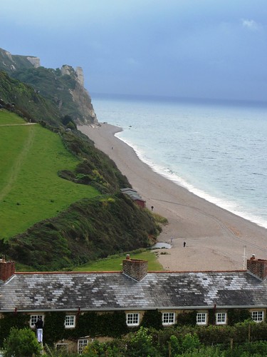
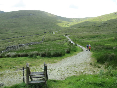
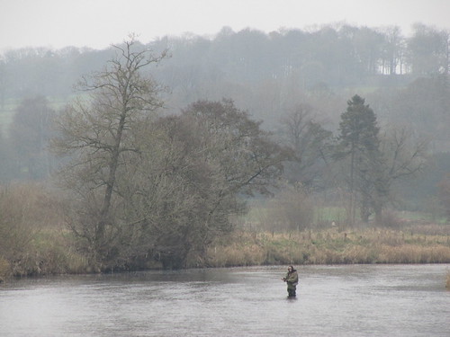
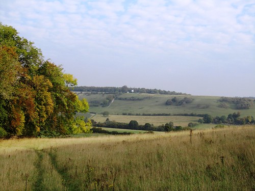
There was scarcely another soul out on the South West Coast Path as we climbed west away from the pebbly beach at Branscombe Mouth. At the top of West Cliff we stopped and stared back at the majestic eastward view – the long grey skirt of the beach with its lace hem of surf, the towers and spires of Hooken Cliffs, and the giant landslips that had exposed white chalk faces above jungly undercliff ledges of fallen rock, tier upon tier, poised to crumble in their turn onto the foreshore 400 feet below. The cliffs of this dynamic coast seem massively weighty and immobile, yet they are forever slipping and sliding seaward.

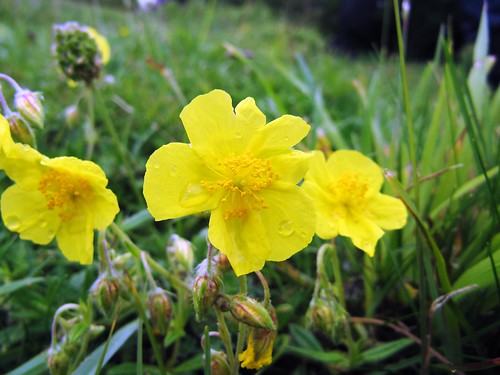
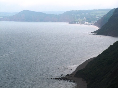
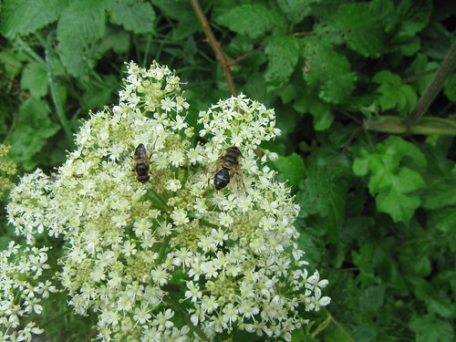
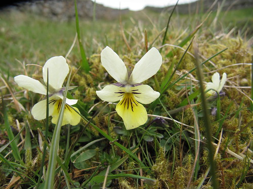
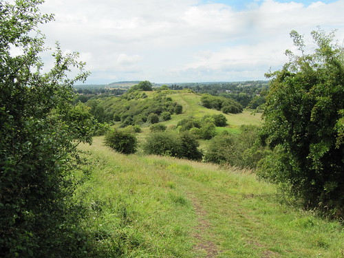
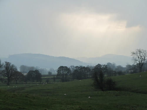
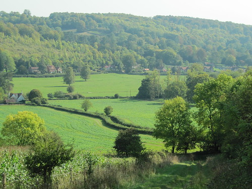
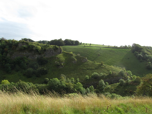
Wild flowers grow here in generous variety – pyramidal orchids, yellow rockrose with crumpled petals, royal blue spikes of viper’s bugloss, the weird-looking bell flowers of psychoactive henbane with petals varicosely veined in purple. Out on Berry Cliff the forward view showed great red cliffs of sandstone, Sidmouth a huddle of houses shining white in a rare shaft of sun, and the Devon coast trending south and west in a sweep of rain-washed blues and pinks.

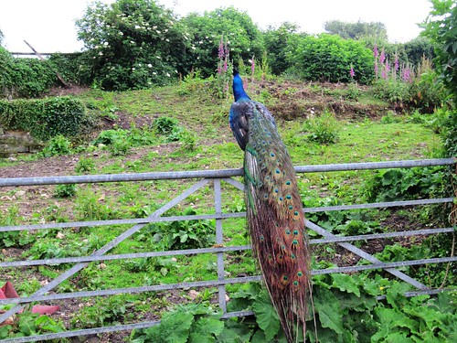
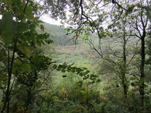
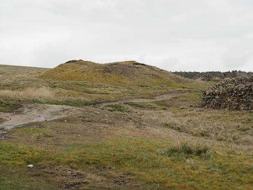
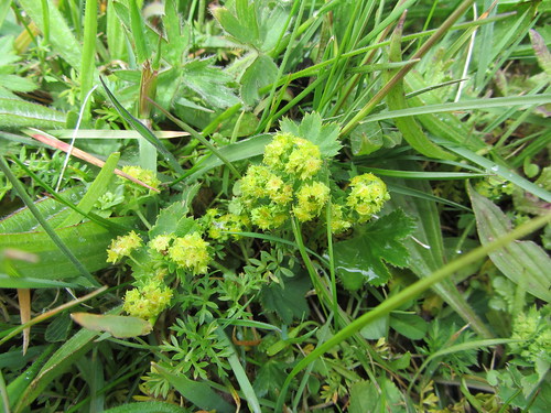
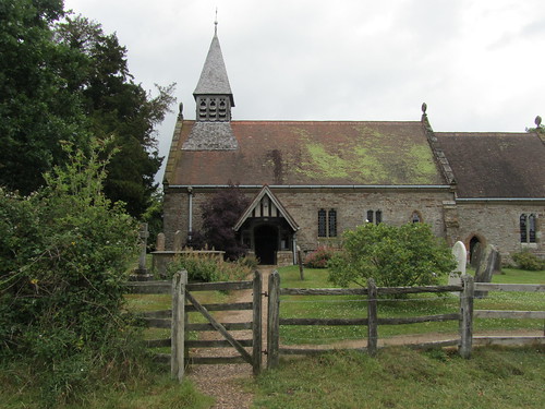
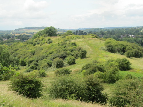
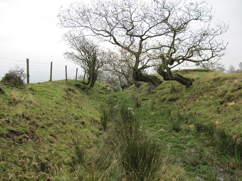
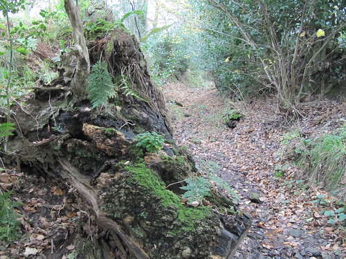
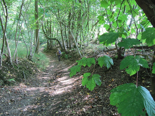
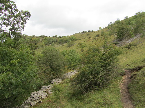
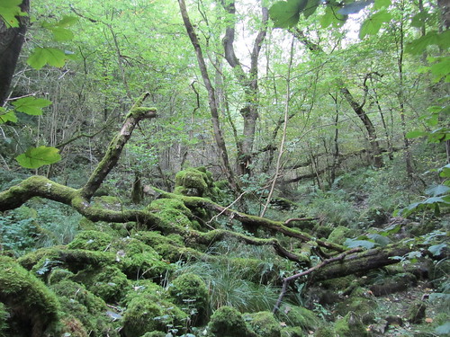
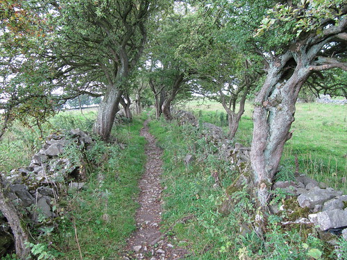
From the grassy ramparts of Berry Camp hill fort we turned inland past Berry Barton where peacocks stepped fastidiously through the farmyard muck. Steeply down to Cotte Barton, steeply up again and over the ridge; rollercoaster country where the path swung through wet woods past houses ancient and modest, modern and brash. The sky lowered and spat every so often, the flowery hillsides wept streamlets and sprouted rain-pearled yellow flags and intense blue trails of brooklime. A soaking wet walk, and a sensationally beautiful one.

Back at the Old Bakery in Branscombe, home-made leek and potato soup was on the bubble. Treacle tart, too? Sure. Clotted cream with that? As Brian Ferry said – you can guess the rest …

Start & finish: Branscombe Mouth car park, Branscombe, Devon EX12 3DP (OS ref SY 207882)
Getting there: Bus – 899 Coasthopper (Seaton-Sidmouth, jurassiccoast.com). Road – Branscombe is signposted off A3052 Exeter-Lyme Regis

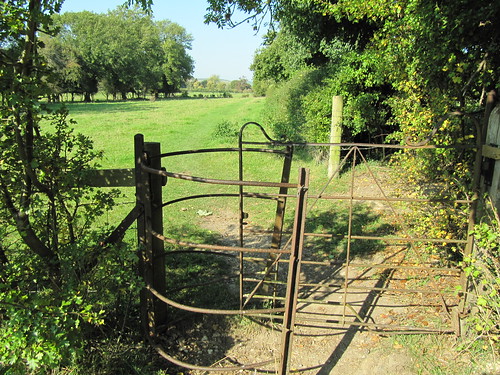
Walk (5 miles, moderate/hard grade, OS Explorer 115): From car park go to sea front; fork right up track past Sea Shanty Café. Through kissing gate (‘Coast Path/CP, Weston Mouth’); on across 2 fields; steeply up to your left to go through kissing gate (205882); up steps, and follow CP through woods for ¾ mile. By a gate, left (192883; fingerpost); follow CP along Berry Cliff. In ⅓ mile, pass through kissing gate (187882; yellow arrow/YA) at western end of Berry Camp rampart; in another 300m, at 4-finger post (184883; ‘Berry Barton’), hairpin back to right across field. In 300m, left at stone-walled kissing gate (187884; fingerpost) up farm lane to road at Berry Barton (184887). Left for 150m; right through gate (183888; no YA); immediately right through adjacent gate (no YA); on above Berry Barton farmhouse. In 150m, left at YA; follow hedge and YAs over ridge and down at edge of trees (NB very steep and slippy!) to road near Cotte Barton (186890).

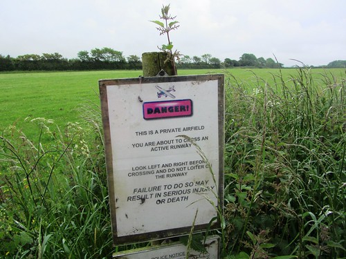
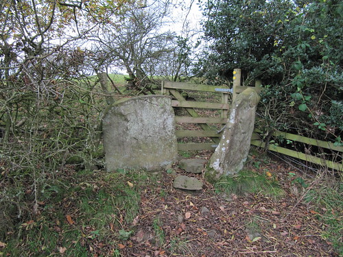
Left for 100m; right past fingerpost, through wicket gate at left side of house, and up path through scrub and long grass (beware nettles!) to edge of field (185892). Right to fence; left along it, soon crossing through and continuing up fence/hedge to cross airstrip (186893; warning signs, take care!) and then Northern Lane (186894). Go through gate opposite (‘Bridleway, Hole House’); follow green lane for ⅓ mile down to Hole House (191894). Bear left past front of house and down lane; in 50m, right over stile (fingerpost). Follow contour of hillside ahead, then steeply down to cross brook by footbridge (193894). Right (YA) along hillside path for ¼ mile, rising to gate into road (196891). Right; in ¼ mile, right at staggered crossroads (198882) to Branscombe Forge and Old Bakery. Back to crossroads; right along lane (‘Branscombe Mouth, Coast Path’). Follow path through fields to Branscombe Mouth and car park.

Branscombe Mouth car park – Coast Path west for 1⅔ miles. 300m past west rampart of Berry Camp, right (184883) across fields; up farm lane (187884) to Berry Barton (184887). Left along road for 150m; right over fields past house; left (YA) over ridge, steeply down to road at Cotte Barton (186890). Left for 100m; right past house, up hillside; over airstrip (186893) and Northern Lane (186894). Green lane opposite for ⅓ mile to Hole House (191894). Left down lane; in 50m, right over stile (fingerpost); along hillside, down to cross brook (193894); right along hillside for ¼ mile to road (196891). Right to crossroads in Branscombe (198882); right to Forge and Old Bakery. Back to crossroads; right (‘Branscombe Mouth’) to car park.

Conditions: Some paths very steep, slippery, narrow. Walking stick/pole, shoes with good grip advised.

Lunch: Old Bakery, Branscombe (01297-680333) – excellent home-made food
Accommodation: Mason’s Arms (01297-680300; masonsarms.co.uk) or Great Seaside B&B (01297-680470; greatseaside.co.uk), Branscombe
Info: nationaltrust.org.uk/branscombe-bakery-mill-and-forge/
Sidmouth TIC (01395-519333); visitdevon.co.uk
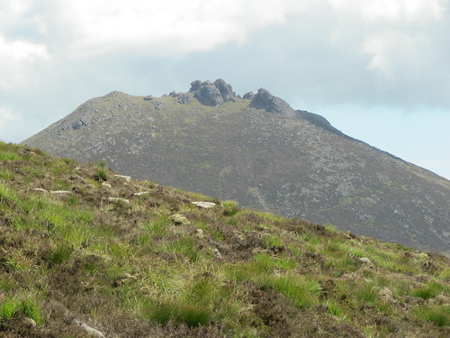
Subscriber Walks: Enjoy a walk with Christopher Somerville in the Mourne Mountains, Co. Down, N. Ireland, 8 July. Email timespluspartners@newsint.co.uk to book. Tickets £10.
www.ramblers.org.uk www.satmap.com www.LogMyTrip.co.uk

 Posted by at 01:39
Jun 232012
 

A beautiful day of blue sky and cold wind over County Down. ‘OK, what we’ll do,’ offered Fiona Mullan of Mountain Sojourns, ‘is head up Doan.
First published in: The Times Click here to view a map for this walk in a new window
picture picture picture picture picture picture picture picture
Facebook Link:
That’s a good wee scramble, and it’s right in the heart of the Mournes so there’s brilliant views of all the main peaks.’
The Mournes are manageable mountains; they extend an invitation rather than a threat. We were lucky to have Fiona as a companion. She’s been in outdoor activities all her life, she’s cheerful and funny, and she knows these famous but under-walked mountains as well as anyone.
The stone-rubbled path led gently up a slope of short grass spattered with heath bedstraw, heading for the Mourne Wall, a 22-mile long monument to the hungry men of the 1900s. They built it across the main summit to demarcate the Mourne catchment area, and it stands as a guide for anyone roaming here. At the Wall stile we stopped to stare over the crescent of Lough Shannagh lying low, the long back of Slieve Binnian looming over Silent Valley Reservoir, the ragged granite castle of Bearnagh’s summit, and mighty Donard in the east with a pimple of cairn on top, looking out on a broad sweep of sea. In the foreground rose the horse’s neck and craggy head of Doan, our aiming point.
Down into the hollow of the hills, a slog among eroded peat hags and a climb up the nape of Doan. A scramble by boot and finger tip up a rough granite outcrop and we were sitting pretty with our sandwiches at the peak, absorbed in a great cartwheel panorama of mountains, lakes, sea and sky.
Back at the Mourne Wall once more and looking down on Lough Shannagh, we made out a slip of sandy beach and a pair of tiny figures swimming out from shore. ‘Hmm,’ said Jane, ‘I envy them. What a gorgeous place to cool off!’
Back beyond the Wall we struck up the broad green flank of Ott Mountain, walking the grass with a soft swish of boots. A trackless uphill pull under lark song up to the summit cairn, a heap of chunks of striped and contorted shale and quartz. A quick glance back to the rugged head of Doan, and we were bowling downhill on the homeward stretch.

Start & finish: Ott/Blue Quarry car park, Mourne Mountains (OSNI ref J280278).
Getting there: Bus – Mourne Rambler (http://www.mourne-mountains.com/mournes/information/), May-August
Road: A2 to Newcastle; A50 towards Castlewellan; left on B180 (‘Bryansford, Hilltown’). In 3 miles (5 km), left (‘Kilkeel, Silent Valley, The Rock’). In 3½ miles (5.5 km) park in Ott/Blue Quarry car park on right
Walk (5 miles, moderate/hard grade. OS of Ireland 1:50,000 Discovery Sheet 29; 1:25,000 Activity Map ‘The Mournes’): Cross road, over stile, follow stony path. In 200 m fork right, uphill to Mourne Wall in saddle on skyline (OS ref 290265). Stile across wall; left of 2 paths, aiming for Doan ahead. In ½ mile pass white stone heap; fork right into dip; up spine of Doan. At top, pass left of first craggy outcrop; bear right up to second outcrop. Keep to left side of it; scramble to top (302262). Return to Mourne Wall stile; recross; aim half left up rough ground to Ott Mountain summit cairn (284270); descend to car park.

Lunch: Picnic; or Meelmore Lodge, signposted off B180 (028-4372-5949; www.meelmorelodge.com)
More info: Newcastle Tourist Office (028-4372-2222); www.mournelive.com
www.discovernorthernireland.com

Subscriber Walks: Enjoy a country walk with our experts. Mourne Mountains, Co. Down, N. Ireland, 8 July. Email timespluspartners@newsint.co.uk to book. Tickets £10.
www.ramblers.org.uk www.satmap.com www.LogMyTrip.co.uk

 Posted by at 01:44
Jun 162012
 

It pelted down overnight – not that we cared, snug in one of the most welcoming guesthouses in West Wales. First published in: The Times Click here to view a map for this walk in a new window
picture picture picture picture picture picture picture picture
Facebook Link:
Glangwili Mansion lies tucked into a cleft of the wooded hills north of Carmarthen. If you’re going walking – or biking, or kayaking, or just exploring the hills and forests – the gentle and humorous guidance of owners George and Linda Reid is just the ticket. ‘Alltwalis, that’ll be great on a day like this,’ said George on his doorstep, looking heavenward at grey skies. ‘Plenty of shelter, and great views down in the Aeron Valley.’

A green lane rose from Alltwalis, its mossy banks trickling with flood streams, under a canopy of oak and hazel leaves where the last of the rain was pattering. Up at the crest of the hill it was all green folds and wooded slopes, running away into a thin grey haze on all sides. One of those mornings to be either in by the fire, or out among the elements. At Cefn-maes the farmer went haring over his wet pastures on a quad, his sheepdog frisking before him. Beyond the farm we skirted a stretch of rushy ground, half heather moor, half black peat bog, hedged with wild cherry bushes whose dark red fruits hung heavy with glassy raindrops.

The woodland path we followed into the Nant Aeron’s secret valley was edged with straw-filled droppings the size of croquet balls, far larger than anything a native British animal could possibly produce. Oval footprints eighteen inches across were dinted deep into the narrow track. We looked at each other. It couldn’t be … could it?

The path descended past little wooden cabins perched among the trees, down to where there were glimpses of another world in the valley bottom – lily pools, gardens and lawns, an open-topped meeting place, flags with the ‘Om’ symbol. ‘Subramanium Temple, Sri Ranganatha Temple,’ said the notice on the gate. A big scarlet shed by the track marked the terminus of both droppings and dish-sized footprints. Who would have guessed it? Elephants in Cwm Aeron, and Hindu prayers arising under Pengraigygigfran.

A single-track lane led out of the valley. We picked wild strawberries from the hedge and savoured their sweet tang as we climbed past Llwyncrychyddod. On the hill above Alltwalis we stopped to watch three ravens mobbing a kestrel. Barking harshly, tumbling and feinting, they drove it north and out of sight down into the valley of the elephants.

Start & finish: Mason’s Arms PH, Alltwalis, Nr Carmarthen, SA32 7EB (OS ref SN 445318)

Getting there: Bus (www.arrivabus.co.uk) service 41 (Llandysul-Carmarthen)
Road: M4, A48 to Carmarthen; A485 towards Lampeter passes through Alltwalis

Walk (5½ miles, moderate, OS Landranger 185):
From Mason’s Arms, right along A485; in 50 m, first right. Past houses, fork right through gate (444318; yellow arrow/YA); bear left up grassy incline, through gates (YA) and on up for ½ mile. At top, through gates (YA) at Gwarcwm (441323). Ahead along road for 100 m; right (fingerpost) on track to Cefn-maes (436326). Ahead through farmyard; at barn bear right; in 20 m left over stile; along fence, then over field to gate (YA). Across next field, over stile (432329, YA); on with hedge on right and moor on left, over stiles (YA) for ⅓ mile to cross stile with left and right YAs (426329). Left along forest track.

In 150 m, don’t go through gate, but bear right (‘Coach Park’). In 30 m at gate (425327), fork right off track (YA) on woodland path (YAs) to reach stony forest road crossing (424326). Left; in 200 m, bear right (YA) down path for ½ mile to tarmac road (420321). Fork right downhill, then left at temple entrance along valley road. In a little over a mile, left beside field gate up lane (423306). In 250 m, beside entrance to Llwyncrychyddod (424307), keep ahead on tarmac lane (bending left), not stony lane (ahead). Follow lane (tarmac, then rough) up for ½ mile to barn by gate (428313). On with hedge/fence on left, over crest of hill for ½ mile. Cross gate (434317); on down overgrown green lane, skirting obstructions to reach Pant-y-llyn (436318). On along road to Gwarcwm; return down green lane to Alltwalis.

Lunch: Mason’s Arms, Alltwalis (01559-384044)

Accommodation: Glangwili Mansion, Llanllawddog, Carmarthenshire (01267-253735; www.glangwilimansion.co.uk) – wonderful secluded location, really comfortable; very helpful hosts.

Information: Carmarthen TIC (01267-231557); www.visitwales.co.uk
www.ramblers.org.uk www.satmap.com www.LogMyTrip.co.uk

 Posted by at 04:31
Jun 092012
 

‘There was snow on them thar hills this morning!’ said the cheerful man we passed in the street at Wearhead. He was right, too: we’d woken to what they call a ‘lambing storm’, a sudden late spring fall of snow on a streaming north wind.
First published in: The Times Click here to view a map for this walk in a new window
picture picture picture picture picture picture picture picture
Facebook Link:
Now though, a couple of hours later, it was all gone, melted away from the fells of Upper Weardale like a dream. West Durham lay in sunshine, though sharp white showers were already regrouping on the northern horizon.

A rough hillside grazed by inquisitive horses brought us up out of the dale bottom to the fell tops where lambs ran crying to the ewes and icy little balls of hail came battering round our ears. The squall whirled away south, revealing a wide bowl of moorland hills with stone-built farms scattered all down the dale sides.

The upland birds were in full nesting flow – lapwings tossing about the sky like paper kites, curlews trilling in the sedges, redshanks called pic! pic!, and golden plover standing with heads held high, piping to mates or rivals, a bright ‘S’ of white feathers outlining their shapes, their backs shimmering gold in gleams of sun.

Lark song filled the air directly overhead as we found a high track between banks of mountain pansies, some entirely of rich purple, others with lower lips of yellow, and one or two a creamy yellow all over. The old lane wound among the spoil heaps of Weardale’s long-defunct lead mining industry, hummocks of green and red mosses and lichens where we picked up glittering gems of semi-opaque purple fluorspar. The walled track slanted down the dale side through more humpy mining ground where a young semi-wild foal looked shyly over her mother’s back.

From the grey stone settlement of St John’s Chapel we climbed once more into a succession of unimproved, unspoiled hay meadows. There aren’t many communities of proper hay meadows left in this country, and these – carefully nurtured by the farmers and monitored by North Pennines AONB – are the glory of the dale for their wild flowers. Green froths of lady’s mantle, clovers, mauve heads of wood cranesbill, cowslips going over, yellow rattle not yet come in – there they all were, ready to burst into their full colourful pomp come June. Another snow flurry came whipping across Weardale, and we told ourselves we’d be back.

Start and finish: Wearhead, near A689 bridge (OS ref NY858395).

Getting there: Bus 101 (Cowshill-Stanhope)
Road: Wearhead is on A689 between Stanhope and Alston

Walk (6 miles, moderate, OS Explorer OL31. NB: Online map, more walks: www.christophersomerville.co.uk):
From Wearhead Bridge, head north up A689 (Alston direction). Just before phone box, go right (bridleway fingerpost) along laneway. Bear left over stile (‘Valley Crest’), on up steep path, curving right and aiming for notch in skyline. Through gate at top (861397); aim left of house; stone stile (fingerpost) onto road. Right; in 50 m, left (863397; fingerpost) up stony lane past Newfield and Halliwell House for nearly a mile to crossing of walls by mine spoil heaps (868408). Turn right along Sedling Rake track for 1 mile, past wood to road junction (884405). Right; in ¼ mile, left (882401; ‘bridleway’) down walled moor track.

In ½ mile, at second crossing wall (886394), bear right along wall, down to go through gate (884391). Down beside wall; over next crossing wall (883390; no stile – scramble over wooden barrier); diagonally left aiming right of farmhouse (883388). Through stile left of gate; through gate below; diagonally left down to lane (884386). Sharp right up lane; opposite Top Byre Cottage (880390), right up field path, keeping close to wall on left (path narrow in places) for 3 fields to cross road (878392). On up drive opposite (fingerpost), past Allercleugh farm house and buildings (873394) with hay meadows on your left. In field by High Whitestones, follow permissive footpath diagonally down across field; left down walled lane to Whitestones farm (869394). Through gate (yellow arrow/YA) and down to cross road (869393). Ahead through stone stile (fingerpost) and garden; through gate (YA). Aim half right across field to upper end of wall; behind it, go through stile and gate (YA); down beside wall, then down steps, through stile (YA) and along alley to road in West Blackdene (867391). Cross River Wear; right along Weardale Way to Wearhead Bridge.

NB. Unsuitable for dogs – sheep country!

Refreshments: Picnic (village shop in Wearhead)

Accommodation: Low Cornriggs Farm, Cowshill, Weardale, Co. Durham (01388-537600; www.cornriggsfarm.co.uk) – fabulous home cooking and warm welcome.

More info: Durham walks/accommodation: thisisdurham.com
North Pennines AONB – events, guided walks, etc: 01388-528801; www.northpennines.org.uk. More guided walks: 0191-372-9100; durham.gov.uk/countryside

Breast Cancer Care’s Pink Ribbon Walks:
0870-145-0101; www.pinkribbonwalk.org.uk. Marble Hill Park, London, 16 June
Subscriber Walks: Enjoy a country walk with our experts. Next walks: Tibbie Shiel’s Inn, Selkirkshire, Scotland, 10 June; Mourne Mountains, Co. Down, N. Ireland, 8 July. Email timespluspartners@newsint.co.uk to book. Tickets £10.
www.ramblers.org.uk www.satmap.com www.LogMyTrip.co.uk

 Posted by at 02:28
Jun 022012
 

Gentlemen in cream linen jackets and white hats, ladies in floral dresses fluttered by the solitary zephyr to stir a baking hot summer morning in the southern end of Windsor Great Park.
First published in: The Times Click here to view a map for this walk in a new window
picture picture picture picture picture picture picture picture
Facebook Link:
Lord, what a beautiful day! The Royal Landscape (Savill Gardens, Valley Gardens and Virginia Water) looked absolutely at its peak, the Savill Gardens especially. Their many decades of scrupulous landscaping, planting and pruning were bursting out in this Diamond Jubilee weather in a carefully crafted ‘sweet disorder’ of rhododendrons – purple, pink, orange, peach, white, mauve. The gardens, created in the 1930s, only occupy 35 acres of ground, but I could happily have lost myself all day following the trails to the Hidden Gardens and the intensely scented Rose Garden, through Spring Wood and Summer Wood, past the coot sailing in the Obelisk Pond and the flood of psychedelic colour from the senetti magenta in the Queen Elizabeth Temperate House.

At last I tore myself away, paused in the Savill Building for a glass of lemonade that hardly touched the sides going down, and set out through the glades and lawns of Windsor’s wider Great Park. This is one of England’s oldest parks, founded by William the Conqueror and embellished over a thousand years by his successors. After the beautifully sculpted formality and simmering heat of the Savill Gardens, it was like throwing off a heavy cloak to wander in the shade of the oaks and sweet chestnuts, past Cow Pond (a unique Baroque water feature, recently restored from dereliction), and to see what artless nature had scattered in the grass – bluebells, milkmaids, red campion, buttercups.

Up at Snow Hill, King George III in green bronze looked out from his seat on a pawing horse over the Great Park, where the Long Walk ran arrow-straight between newly mown verges towards the distant towers and battlements of Windsor Castle nearly three miles away. Back south through the woods and down beside the wide empty polo field, and a final saunter through hilly Valley Gardens and along the tree-lined banks of Virginia Water, that vast man-made lake, in a blue simmering haze of heat so arcadian I might just have dreamed the whole walk up.

Start & finish: Savill Gardens car park, Englefield Green, Berks TW20 0XD (OS ref SU 977707)
Getting there: Train (www.thetrainline.com; www.railcard.co.uk) to Egham (2½ miles). Road: Savill Gardens (car park: about £5 cash) signposted from A30 (M25 Jct 13)
Walk (7½ miles, easy grade, OS Explorer 160): Start with circuit of Savill Gardens (adult £8.50, senior £7.95, child 6-16 £3.75, family of 4 £21; includes leaflet map). Return to car park; leaving Savill Building, left (north) along tarmac track. In 300m, ahead past ‘No Cycling’ notice (977710). In 400 m, left past end of Cow Pond. Left on track from pond’s left (west) edge; in 300 m, right (972715) up tarmac drive. In half a mile pass pink lodge (976722); through gates (press button); over Spring Hill to equestrian statue on Snow Hill (967727). Left (south) on grassy ride for ½ mile into trees. In 250 m, 7 tracks meet (967717); left on gravel path bisecting 2 tarmac drives. In 400 m, at 5-way junction (971715), right on gravel path; on beside Smith’s Lawn for 1 mile. Just before bridge over Virginia Water, bear left (966695; ‘Lakeside Walk’). Follow along shore for 1½ miles; left past Totem Pole (980696); follow ‘Savill Gardens’ to car park.

Lunch: Savill Building restaurant (01784-485402)
More info: theroyallandscape.co.uk; thecrownestate.co.uk/windsor

Breast Cancer Care’s Pink Ribbon Walk:
0870-145-0101; www.pinkribbonwalk.org.uk: Marble Hill Park, London, 16 June
www.ramblers.org.uk www.satmap.com www.LogMyTrip.co.uk

 Posted by at 02:45
May 262012
 

‘Heavy rain showers’ smiled the weatherman at 7 o’clock in the morning. ‘Some of them prolonged…’
First published in: The Times Click here to view a map for this walk in a new window
picture picture picture picture picture picture picture
Facebook Link:
The sky was freighted with rollers of rain cloud, but I spied intense silver gleams among them. Anyway, a drop of rain never hurt anyone, did it? I waited out a shower that glistened the red roofs and half-timbered walls of Henley-in-Arden, and struck out east into the country of the Forest of Arden.

The Forest that Shakespeare knew and made immortal had shrunk from its former expanse between the rivers Tame and Avon by the time he explored it as a boy. But it was still a wild place. The Romans barred it in with boundary roads, but they never built through the forest or tamed it. Nowadays Arden is a rolling mixture of pasture and cornfields, old hedges, fine solitary trees and thick clumps of woodland, more of a mosaic than a single impenetrable wilderness.

Well-marked paths carried me through this rich farmed Warwickshire landscape, past houses done up and furnished with paddocks, horses and new plantations of broadleaved trees. One reminder of the region’s deep-rooted industrial heritage lay threaded through the countryside – the sinuous, narrow course of the Stratford-upon-Avon Canal. Once the carrier of bricks, blocks, iron and coal to Brummagem, now its cargo consists of white-bearded gentlemen in sailor caps cruising at ease under the alders.

On densely wooded Yarningale Common I lost my way, but it didn’t matter – all paths hereabouts seem to lead to Valley Farm and the fields once more. At Peacock Farm the rain caught me a sharp smack, and I sheltered under a sycamore’s big leaves till the weather had rumbled and rolled off elsewhere. As soon as the sun came out, so did the insects, and the swallows after them, hawking low over the wet hayfields, some dilatory farmer’s regret.

By Lowsonford’s Church of St Luke, a squat ark of red brick stabilised with massive buttresses, I took to the road. Beyond the humpy canal bridge and barrel-roofed lock keeper’s cottage, the Fleur-de-Lys Inn trumpeted its famous pies. Well, you can’t ignore that sort of thing. The pub delights in the tale of a Frenchman who chopped up an English spy and sent him back to England baked in a pie with a pastry fleur-de-lys on top. I heard that after I’d wolfed my own Matador Pie, and had an interesting moment or two.

The homeward path was along the Heart of England Way, beautifully waymarked and clear to follow. A field full of colts staring hard like B-Boys; the enormous Tudorbethan rebuild of Holly Bank Farm; showers in huge blocks tumbling through the sky; the rain-slicked mound of Beaudesert Castle outside Henley. A wonderful walk, in all – nothing dramatic, but everything to do with England on a rainy summer’s day.

Start & finish: Henley-in-Arden station, B95 5JH (OS ref SP 148659).

GETTING THERE: Rail (www.thetrainline.com; www.railcard.co.uk) to Henley-in-Arden. Bus service X20 (Birmingham-Stratford), Flexibus 517 (Wootton Wawen-Redditch).
Road: M40 Jct 16; A3400.

WALK (8 miles, easy/moderate, OS Explorer 220):
From Henley station to High Street, right to church; left down Beaudesert Lane. At end (153660), forward along brick-walled path. Follow yellow arrows/YAs along side of Beaudesert Castle earthworks. Pass school; at path junction turn right down side of school. Cross road; up lane; cross playing field and climb steps. Follow YAs to cross Edge Lane (160658). Take right-hand of 2 gates; halfway across field, don’t turn right, but keep ahead (YA). Over stile and field, to next stile. Right (163658, YA) in tunnel of trees. In 50 m, left over stile (YA). Ahead across fields (YAs) for ⅔ mile to cross road by Church Farm (173660). Up green lane (YA; ‘Church’). Pass to right of church (174660); cross lane and on (YAs) through fields to cross Stratford Canal (179658).

In field beyond, left along hedge next to canal. At end of field, left over stile (182659); aim away from canal for far upper corner of field (183660). At post with arrows, uphill with hedge on left; follow YAs past rugby pitches to stile (186659). Ahead (arrow) through trees along north side of Yarningale Common to road (189658). Left, then left down Yarningale Lane. In 30 m, right (YA) up bank through right-hand of 2 sets of barriers, on up through trees. In 100 m at top of rise, right along grass ride. In 50 m through barrier (YA) and take middle of 3 paths, to left of oak tree, going downhill. In 100 m path bears right to road. Left to Valley Farm (182661). Right past YA on post; don’t fork immediately right, but keep ahead. Ignore stile with YA; ahead into green lane. Follow this for ⅓ mile; just before left bend (196663), left over stile (YA). Along hedge, through kissing gate (YA); follow path over 2 fields to farm drive just right of Peacock Farm (194667).

Left past farmhouse. Follow BA through kissing gate and along green lane. In 350 m cross stream (195670); in another 200 m, through kissing gate (196671, BA). YA and BA are to your right, but keep ahead for 20 m, then left along field edge. Through kissing gate; diagonally across next field to hedge, right along it for 2 fields (YA). In 3rd field follow fence on right over crest, down to road by chapel (190676). Left along road to cross canal; right past Fleur-de-Lys pub (188678) in Lowsonford.

At phone box on crossroads, left (186680; YA; Heart of England Way/HEW) up road. Now follow well-marked HEW for 1 mile to Coppice Corner Farm drive (175677), left across old railway and down to road (174673). Right round bend; left (HEW) to cross Holly Bank Farm drive (173672). Go through hedge gap; diagonally left across field; through kissing gate and up hedge. Follow HEW for 1½ miles by Hungerfield Farm (165669) and Edge Lane (163667) to cross Beaudesert Castle ramparts (155661) and descend to Henley-in-Arden.

LUNCH: Fleur-de-Lys Inn, Lowsonford (01564-782431; www.fleurdelys-lowsonford.com) – try the pies!

ACCOMMODATION: Henley Best Western Hotel (01564-794551; www.bestwestern.co.uk) – very friendly and helpful.

Subscriber Walks: Enjoy a country walk with our experts. Next walk: Tibbie Shiel’s Inn, Selkirkshire, Scotland, 10 June. Email timespluspartners@newsint.co.uk to book. Tickets £10.

Breast Cancer Care’s Pink Ribbon Walks:
0870-145-0101; www.pinkribbonwalk.org.uk. Petworth House, West Sussex, 26 May; Cholmondeley Castle, Cheshire, 9 June; Marble Hill Park, London, 16 June

Info: Warwick TIC (01926-492212); www.visitcoventryandwarwickshire.co.uk
www.ramblers.org.uk www.satmap.com www.LogMyTrip.co.uk

 Posted by at 04:11
May 192012
 

Young men and women in white helmets and blue jumpsuits were throwing themselves over the Falls of Bruar like salmon in reverse.
First published in: The Times Click here to view a map for this walk in a new window
picturepicture picture picture picture picture picture picture
Facebook Link:

I stood on the brink of the flood-sculpted gorge and watched them leap from a ledge under the none-too-tender persuasion of their gung-ho instructor, plummeting down to smack into a pool 30 feet below.

What would the 4th Duke of Atholl, one of the grandest of 18th-century Highland Lairds, have made of such forward behaviour on his estate? He suffered a bit of teasing from Robert Burns after the poet visited the Bruar Water in 1787. Burns was dismayed at the bareness of the moorland that enclosed the famous falls, and composed The Humble Petition of Bruar Water to give His Grace a respectful push in the silvicultural direction:

‘Would then my noble master please
To grant my highest wishes,
He’ll shade my banks wi’ tow’ring trees,
And bonie spreading bushes.
Delighted doubly then, my lord,
You’ll wander on my banks,
And listen mony a grateful bird
Return you tuneful thanks.’

These days, forests of larch, silver birch and Scots pine shade the Falls of Bruar, and a good stretch of mountainside beyond. I crossed the upper of two ornate bridges over the roaring falls, and found a woodland path that climbed steadily up towards the open moor. Roe deer fled away between the pines, and a red squirrel lingered at the end of his branch to watch me out of his territory.

The track left the trees, running for miles on the fringe of the wide moorlands around Glen Banvie. Ahead the rugged blue profiles of Carn Liath and Beinn a’ Ghlo stood tall and seductive on the eastern skyline. Then it was back into the forest, down to Old Blair and the ancient ruined kirk of St Bride. John Graham of Claverhouse, ‘Bonnie Dundee’, was buried here in July 1689 after dying of the wounds he received while leading his Highlanders to victory over Government troops at the Battle of Killiecrankie a few miles away.

A stretch across the beautiful parkland of Blair Castle, a final mile through the forest, and I was crossing the Falls of Bruar once more – the only river in creation to address its owner in prideful verse:

‘Here, foaming down the skelvy rocks,
In twisting strength I rin;
There, high my boiling torrent smokes,
Wild-roaring o’er a linn:
Enjoying each large spring and well
As Nature gave them me,
I am, altho’ I say’t mysel’,
Worth gaun a mile to see.’

Start & finish: Falls of Bruar car park, Bruar, near Blair Atholl, Perthshire PH18 5TW (OS ref NN 820660)

Getting there:
At junction of A9 and B8079, at Bruar, 3 miles west of Blair Atholl

Walk: (11½ miles, moderate, OS Explorers 386, 394): Follow Falls of Bruar Walk (signed behind House of Bruar) to cross Upper Bridge (820669). Path returns down opposite bank. In 350 yards, at seat in clearing, 2 paths fork left (820666). Follow left-hand path to T-junction (826666); left up forest road. In ⅓ mile, fork left on grassy track (824670; post with red arrow). Follow it for 3¾ miles north through Glen Banvie Wood, then south-east down Glen Banvie to enter Whim Plantation (853677); descend to tarmac road (868667). Right past Old Blair; walled road to T-junction on avenue (864665). Left; follow road for 1¼ miles to enter woodland. In 200 yards, at 5-way junction, hairpin back right (843660). In ¼ mile follow track round left bend (846663). Continue for 1¼ miles through forest to pass through gateposts (827666); in 100 yards, left (‘Falls of Bruar’); cross Lower Bridge (819664); return to car park.
NB Steep unguarded drops beside falls!
Click on Facebook “Like” link to share this walk with Facebook friends.

Lunch: Picnic.

Accommodation: Moulin Hotel, Moulin, Pitlochry (01796-472196; www.moulinhotel.co.uk)

More info:
www.athollestates.co.uk; www.visitscotland.com/surprise

Ballater Walking Festival, 19-25 May – 01339-755467; www.royal-deeside.org.uk/RDnews/walkweek
Breast Cancer Care’s Pink Ribbon Walks: 0870-145-0101; www.pinkribbonwalk.org.uk. Next walks: Petworth House, West Sussex, 26 May; Cholmondeley Castle, Cheshire, 9 June
Subscriber Walks: Enjoy a country walk with our experts. Next walk: Tibbie Shiels Inn, Selkirkshire, Scotland, 10 June. Email timespluspartners@newsint.co.uk to book. Tickets £10.
www.ramblers.org.uk www.satmap.com www.LogMyTrip.co.uk

 Posted by at 01:27
May 122012
 

The fly fisherman stood waist deep in Skirden Beck, so intent on his line that he didn’t look up as I went by. First published in: The Times Click here to view a map for this walk in a new window
picture picture picture picture picture picture picture picture
Facebook Link:
The fields along the river lay half flooded by the morning’s cloudburst over the Forest of Bowland, but if either anglers or walkers cared about getting wet around the knees they’d never go out of doors in this famously moist corner of Lancashire. Bowland is green and lush, its moors wide and wild, its lowlands around Sawley and Bolton-by-Bowland smelling as rich as damp fruit cake after a shower. ‘Right slutchy, the fields,’ remarked a woman I met in the lane near Bolton Mill, and that just summed it all up.

Beyond the grey stone huddle of Bolton I followed the shallow Skirden Beck up its valley – sheep country, with bleak farmhouses of grey-green stone on the ridges and the beck running below a steep cliff it had bitten out of the fields in flood times. The stony farm tracks rose around Hungrill and Lower Laithe, their banks studded with ancient holly trees neatly pollarded by the teeth of countless generations of sheep. Through the hamlet of Holden with its little scatter of houses, and on up across a succession of sheep pastures by stone stiles and tiny wicket gates, with Swaledale ewes flouncing off in a fluster across the wet grass as though I was the first human they had ever clapped eyes on.

The map told me what should have been out there in front, the magnificent prow of Pendle Hill, famous for witches and wandering preachers. But the afternoon sky, while not actually raining, was so thick with moisture that the great hill lay half in sight and half on the edge of fancy, a silky grey whaleback like something in a dream.

On top of the ridge I dropped down into the deep-sunken holloway of Rodhill Lane. It was a stony, narrow stumble down to the old Methodist chapel on the outskirts of Sawley, half-hidden in the lane behind a screen of hollies and hazels. The evening sky stretched in bands of lemon-peel yellow and silver over the Skirden Valley, and Pendle shaped itself out of the gloom in the south like a promise for another day.

Start & finish: Spread Eagle Inn, Sawley, Clitheroe, Lancs BB7 4NH (OS ref SD 777466)
Getting there: Bus (www.traveline.info) Service C2 Clitheroe-Sawley. Road: Sawley is signed from A59 Clitheroe-Gisburn road
Walk (6 miles, moderate, OS Explorer OL41):
From Spread Eagle Inn, left along road; cross bridge; right through wicket gate (775466; fingerpost). Follow stiles, yellow arrows/YA, traffic cones (!) through fields. In 5th field cross Holden Beck footbridge (780480) and on (YAs). In ¼ mile, field narrows between 2 woodlands (779486); keep close to right-hand wood. Through kissing gate where paths diverge (781488); ahead across ridge by tree and base of ancient cross, down to sheepfold (782490). Through stile with gate (YA); ahead along drive to cross road near bridge in Bolton-by-Bowland (784493). Over stone stile (fingerpost); continue along left bank of Skirden Beck. Through gate; half right through next gate; follow escarpment edge. Pass house to your left and aim for another ahead. Cross stile in its garden fence (782502); cross lawn; cross stile by gate onto road. Left along grass verge for ¼ mile; right off road past farmhouse (780499; fingerpost); through kissing gate (YA); down field with hedge on right. Cross Bier Beck (778499); aim half right for kissing gate (777500; YA); bear right up track.

Before you reach Hungrill Farm, hairpin back left at nearest corner of walled paddock through first of 2 gateways (777502), ignoring a white arrow pointing on along track towards farm – your southward path is marked by a white arrow on the inner jamb of the gate. Keep on left bank of stream; in 300m, turn right across it at stony crossing (776499). Ahead to cross stile (776497). Follow hedge on left; through gate; on to cross stile and descend steps to road in Holden (775495).

Left round corner; in 100m, right (‘Lane End’). Cross mill stream; left through gate; don’t go through next gate on left with fingerpost, but go up house drive as far as a gate. Right here (774497) up laneway on right of house; through wicket gate (YA); on up fenced path. Over wooden stile; cross grassy lane by stone stiles (772494; YAs). Follow left fence uphill; through gate in hedge (770492; YA); up field, then through wicket gate and over stile (769491). Follow gully uphill; through gate; on over stile to left of Lower Laithe barn (768490). Through next 2 gates (766488 and 766486); diagonally right to cross stile near fence on top of ridge. In 100m cross stile (764482; YA); left along sunken, stony Rodhill Lane. Descend for ½ mile past Rodhill Gate (768477); ahead down drive to cross cattle grid (770476). Farm drive bends left past house, but you keep ahead, passing wooden gate on right (blue arrow). Ahead through field gate; ahead with hedge on left. In 100m, left through gate; right along hedge to cross footbridge over stream (771474). Up steep bank; follow fence to Lawson House farm hedge (772471). Follow footpath signs and arrows right through gate, and on up hedge; then hairpin back left, descending towards barn. Through gate; right past end of barn (arrow); ahead with fence on right. Through gateway (773470) and on. 30m up from far left corner of next field, cross stile (773467); ahead through trees for 20m; left past ‘Rod Hill’ sign. Through gate (YA); descend ramp; forward along lane. Left at bottom to road (774467); right over bridge into Sawley.

Click on Facebook “Like” link to share this walk with Facebook friends.
Lunch/Accommodation: Spread Eagle Inn, Sawley (01200-441202; www.spreadeaglesawley.co.uk); Coach & Horses, Bolton-by-Bowland (01200-447202; www.boutiquedininghouse.co.uk)

More info: Clitheroe TIC (01200-425566)
www.visitlancashire.com

Readers’ Walks: Come and enjoy a country walk with our experts! Dates, info etc.: http://www.mytimesplus.co.uk/travel/uk/1867/times-walks.
Next walk: Lindisfarne, Northumberland, 13 May

Breast Cancer Care’s Pink Ribbon Walks:
0870-145-0101; www.pinkribbonwalk.org.uk. Next walks: Scone Palace, Perthshire, 12 May; Blenheim Palace, Oxfordshire, 19 May
www.ramblers.org.uk www.satmap.com www.LogMyTrip.co.uk

 Posted by at 02:25
May 052012
 

The sun had just risen over Hatchet Wood as we left the Frog Inn, pursued by the raucous ‘Get-up-and-at-’em!’ of Skirmett’s alarm-cock.
First published in: The Times Click here to view a map for this walk in a new window
picture picture picture picture picture picture picture picture
Facebook Link:
Blackthorn and field maple, bramble bushes and wayfaring trees edged the track that climbed Elmdown to reach the skirts of Great Wood. Here we sat on a fallen beech, its trunk rotted and eaten by insects into bare sinews of black and brown, to watch two red kites circling and talking to each other with staccato, kitten-like mews.

The long, narrow valley of the Hamble Brook, running north-to-south to meet the River Thames near Marlow, is thick with beautiful mature Buckinghamshire woodland, easy to get lost in if you don’t keep your wits (and your Satmap GPS device) about you. Roe deer haunted the trackways of Great Wood, slipping away into the shadows as soon as glimpsed. Between beech trunks streaming with dusty sunlight we caught glimpses of the crossed sails of Turville Windmill, high and mighty on a sharp-cut ridge. Great tits went chasing through the pines, and at the edge of the wood a burst of feathers edged with blue and black showed where a jay had come to a sudden full stop – fox, peregrine or shotgun.

We emerged at last from the woods to a superb prospect over Hambleden and its valley – pale chalky green-and-white of ploughed fields, green pasture in squares and lozenges, the hanging woods above, and the red brick walls and tiled roofs of the village clustered round the grey church half hidden among its trees. If you ever have to illustrate ‘essence of rural England’ to a Martian, here’s the view.

Down among the half-timbered Arts & Crafts gables, terracotta chimneys and flint cobble walls of the village, a herd of pedigree cattle stood under a massive beech. I put my hand over the fence, and one of them licked it with a pale muscular tongue as abrasive as sandpaper. Out along the Hamble valley, red kites had gathered over the pastures; we counted 18 in the air at the same time, their red, white and chocolate forms brilliantly lit in strong sunlight. Under these fork-tailed guardian angels we followed the field paths back to Skirmett.

Start & finish: Frog Inn, Skirmett, Nr High Wycombe, Bucks RG9 6TG (OS ref SU775902)
NB: Alternative start: Hambleden (more parking). If starting from Frog Inn, please ask permission, and please give inn your custom!

Getting there: M40 Jct 5, and minor roads via Ibstone; or A4155 (Henley-on-Thames to Marlow) to Mill End, then minor road.

Walk (9 miles, moderate, OS Explorer 171) NB: Many unmarked paths in woods. Use these detailed instructions, and take Explorer map/GPS/Satmap to help you!:
From Frog PH, right along road (take care!). Round right bend (776899; ‘Hambleden’), then left bend. In 30 m, right (775898) over stile, up hill path. At top of rise, follow path to right along ridge. In ¾ mile it curves right to top of ridge (766897), then begins to descend (footpath sign on tree). In 200 m, at fork with footpath sign, keep downhill. In 200 m path forks (766900); keep ahead, (not left downhill). In 150 m, where track bends sharp left along bottom of wood (766901) keep ahead, forking immediately left (yellow arrow/YA) across open field. Through woodland to road (765905). Left for 100 m to bend, left (‘bridleway’) along wood bottom.

In 1¼ miles, just before green ‘Bridleway Users’ notice and wooden railings (757891), left uphill (YA) through Gussetts Wood. Cross stile (758889) and field to road junction (758887). Ahead downhill for ¼ mile. At Upper Woodend Farm, left (578883; bridleway fingerpost) up driveway (ignore ‘Private Road’ notices). In 150 m, before gate, right (759882; bridleway blue arrow/BA) down hedged green lane between fields. In 150 m cross footpath (760881); continue on bridleway. In ¼ mile it re-enters wood (762878); follow it as a hollow way, then a path, close to wood edge. Follow path and hollow way down to major track crossing in wood bottom (767877). Go over crossing (uphill) on path which bends right.

Now follow ‘Shakespeare’s Way’/SW arrows. In 500 m pass a yew grove and fork right (772875; white arrow/WA on tree). In 100 m fork left (SW). In 300 m, reach track crossing (773872); turn left out of wood, on path across field and down left side of wood (SW) to track at bottom (778871). SW crosses it, but you turn right (WA on tree) on bridleway which bends immediately left to run inside wood edge. Follow BAs. In ¾ mile path bends right (782860); go left here (bent BA) on bridleway. In 50 m, left (YA) on path. Descend to cross road (783864) into Hambleden.

Cross churchyard; leave by far left (NW) corner; follow road. In 100 m, right through kissing gate/KG (783867; fingerpost). Cross 3 fields (KGs), then hedged path past Pheasant’s Hill, then 4 fields (KGs) to road at Colstrope Farm (782881). Forward to bend; forward here along Chiltern Way/CW (782882; ‘bridleway’). Cross road at The Hyde (781887); forward on CW (YA) for 5 fields (KGs) to road (777899). Left, then right to Frog Inn.

Lunch: Stag & Huntsman Inn, Hambleden (01491-571227; www.thestagandhuntsman.co.uk)
Lunch/accommodation: Frog Inn, Skirmett (01491-638996; www.thefrogatskirmett.co.uk) – friendly, cheerful and helpful place

Information: Henley-on-Thames TIC (01491-412703)
Readers’ Walks: Come and enjoy a country walk with our experts! Dates, info etc.: http://www.mytimesplus.co.uk/travel/uk/1867/times-walks.
Next walks: Lindisfarne, Northumberland, 13 May; Scottish Borders, 10 June; Northern Ireland, 8 July

Breast Cancer Care’s Pink Ribbon Walks:
0870-145-0101; www.pinkribbonwalk.org.uk. Next walk: Scone Palace, Perthshire, 12 May.
www.ramblers.org.uk www.satmap.com www.LogMyTrip.co.uk

 Posted by at 03:52
Apr 282012
 

Excited youngsters were scooting around the old railway station at Miller’s Dale, learning to ride their bikes on a Sunday afternoon in the safe surroundings of the Monsal Trail while their mothers went quietly frantic. ‘Tom! Tom! Just wait there, please!’ ‘But Mum, I can do it, look…!’
First published in: The Times Click here to view a map for this walk in a new window
picture picture picture picture picture picture picture picture
Facebook Link:
The Peak Park have done a wonderful conversion job on the old railway line through the canyon-like dales between Buxton and Bakewell. It’s hard to credit that passenger and goods trains once rattled under the sheer limestone cliffs and hanging woods where cyclists, walkers and riders now disport themselves. Once we had dropped down the bank into adjoining Monk’s Dale, the leisure crowds melted away and we had the snaking dale and its slippery stone path to ourselves.

Monk’s Dale is just one of dozens of narrow clefts in the limestone countryside of Derbyshire’s White Peak. You’d never know the dale was there at all until you were on its brink. Down in the depths a long damp wood of ash and oak carried us north, until we turned aside to climb the walled lane of the Pennine Bridleway between weather-twisted thorn trees, up to the roof of Wormhill Hill. Up here the whole feel of the country changed dramatically, from a prospect hemmed in by towering cliffs to huge views over rain-swept countryside squared by stone walls and dotted with sheep.

Over the crest beyond Old Hall Farm, a monstrous limestone quarry was soon hidden by screening trees. Fat white rams cropped the pastures with their characteristic, impatient jerks of the head. At Mosley Farm a trio of young sheepdogs came out in a rush to sniff us over. Then it was down the zigzag path into Chee Dale, another stunning view suddenly revealed at the brink of the gorge – sheer pale grey cliffs thick with jackdaws, dreadnought prows of limestone jutting into the dale where handsome arched viaducts carried the old railway line across the River Wye.

Narrowly avoiding death by hurtling cyclist (where’s your bloody bell, boy?) we turned along the Monsal Trail, through lamp-lit tunnels and over bridges where daredevils were abseiling into the depths, until the old station at Miller’s Dale appeared once more around the bend.

Start & finish: Millers Dale car park, near Tideswell, Derbys SK17 8SN (OS ref SK 138733)

Getting there: Bus: Service 68 (Buxton-Castleton) to Miller’s Dale car park; 65, 66, 193 to Millers Dale on B6049, just below.
Road: A6 (Buxton-Matlock); B6049 to Miller’s Dale. Turn up side road (‘Wormhill’) to car park (moderate charge).

WALK (7 and a half miles, moderate, OS Explorer OL24):
Left up road for 100 m; right over stile (140734; fingerpost). Through gate; left into Monk’s Dale. Valley floor path for 1 and a half miles to road (131753). Left; in 50 m, left up steep path; follow ‘Pennine Bridleway’/PBW. At top of rise, right at T-junction (129747) along walled lane to road (122745). Right for 50 m; left (PBW) into Old Hall farmyard. Left (‘bridleway’) through gate. Pass old barn on right; through left-hand of 2 gates; on with wall on right. Keep ahead through hunting gates for two thirds of a mile to road (110746). Follow PBW for 1 and a quarter miles to Mosley Farm (115730). Through farmyard (‘footpath’ signs); just beyond, left through gate (PBW); descend into Chee Dale; left, and follow Monsal Trail to Miller’s Dale car park.

NB: Slippery path in Monk’s Dale!

Lunch: Picnic; or Red Lion, Littleton (01298-871458; www.theredlionlitton.co.uk)

Accommodation: George Hotel, Tideswell (01298-871382; www.tght.co.uk);
Ravenstor Youth Hostel, Miller’s Dale (0845-371-9655; www.yha.org.uk/hostel/ravenstor)

Readers’ Walks: Come and enjoy a country walk with our experts!
Holy Island, Northumberland 13 May; Scottish Borders 10 June; Northern Ireland 8 July. Info: http://www.mytimesplus.co.uk/travel/uk/1867/times-walks.
www.satmap.com www.LogMyTrip.co.uk

 Posted by at 01:16