Apr 142012
 

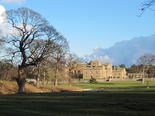
A sleepy noon in Coleshill, with a pure blue sky spread across this quiet corner of the Oxfordshire Cotswolds.
First published in: The Times Click here to view a map for this walk in a new window
picture picture picture picture picture picture picture picture
Facebook Link:
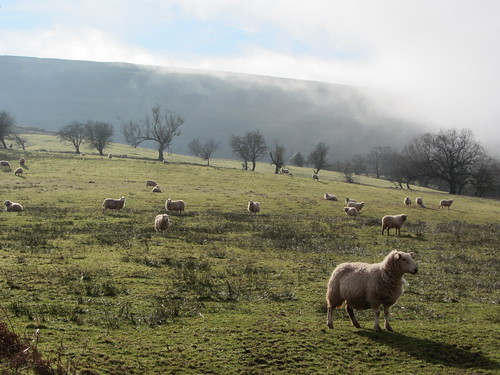
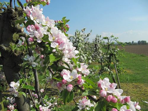
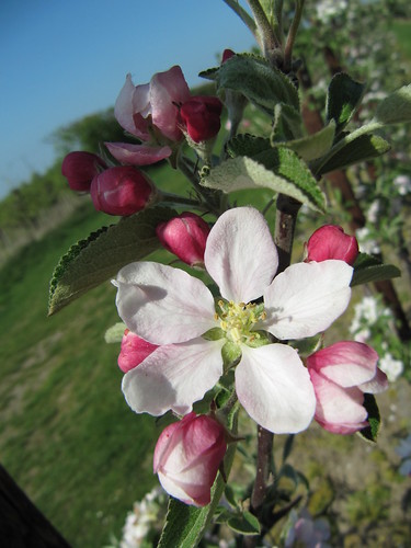
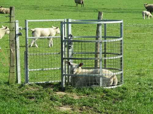
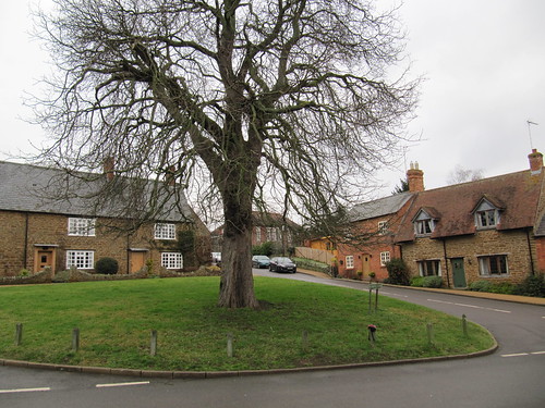
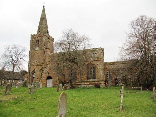
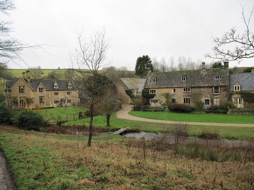
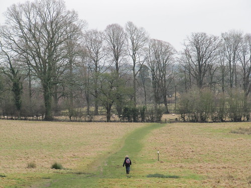
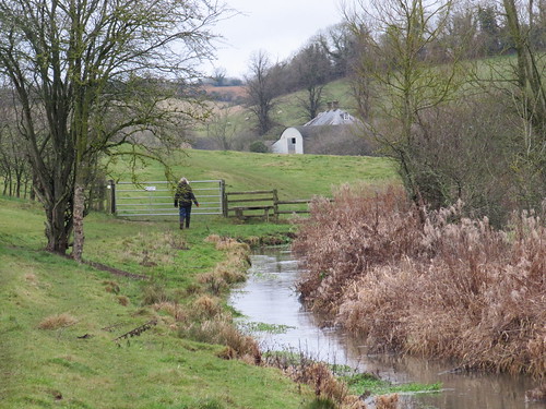
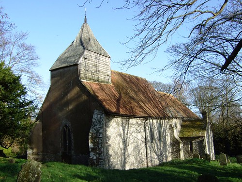
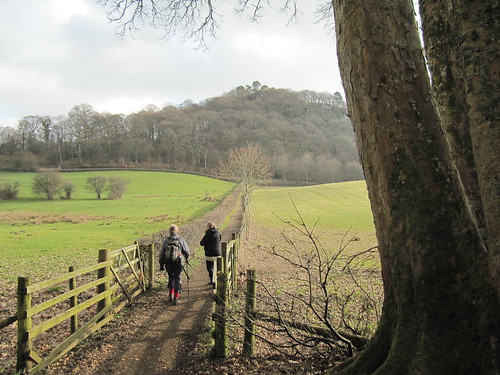
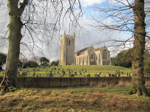
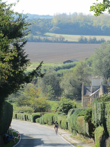
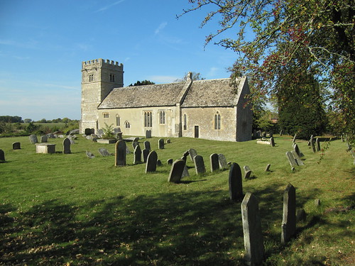
National Trust-maintained Coleshill couldn’t be more gorgeous if it tried, a village and church of beautiful purple-grey stone. ’We’re not in Kansas now, Toto,’ myself said to me as I passed the mellow old Radnorshire Arms, the village green and Estate Office, and set out across the green acres of Coleshill Park. Every newly planted oak boasted its own hand-built wooden cattle guard, and the cattle themselves lazily chomped under spreading trees. A couple in pot sunhats, reclining under an ancient oak with their picnic hamper, completed this Rousseau landscape of peace and plenty.

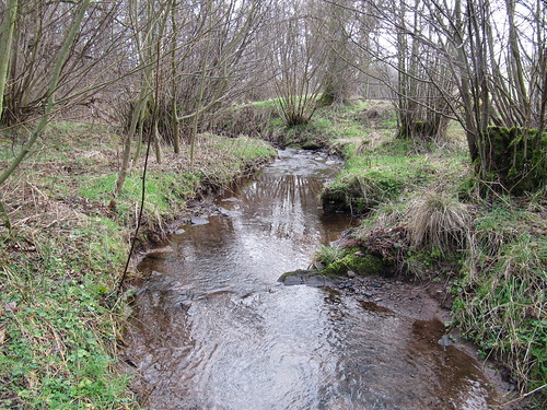
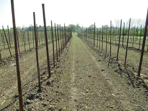
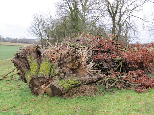
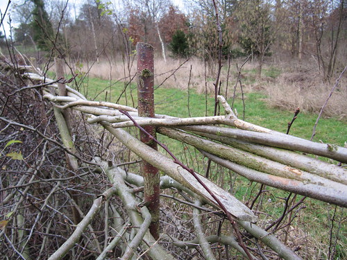
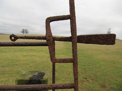
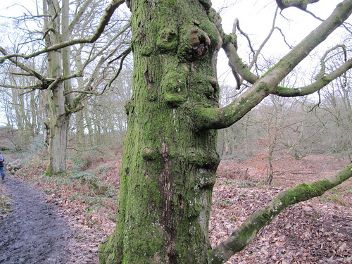
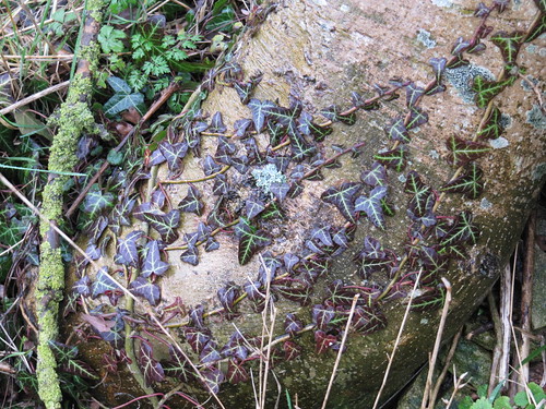
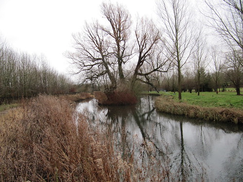
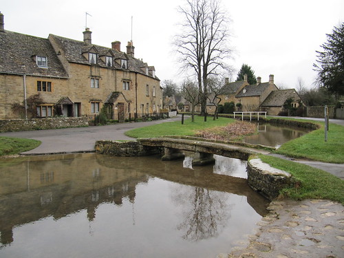
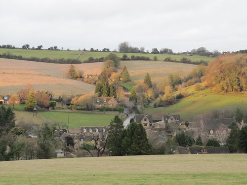
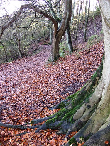
A rusty outmoded harrow like a troll’s bedsprings lay in the hedge. Old overshot hazels sprouted from their coppiced boles in the skirts of Flamborough Wood. I followed a lane rubbly with chunks of red brick and pale limestone between the pasture fields to Great Coxwell – another immaculate collection of colour-washed houses, some under thatch, along a narrow street.

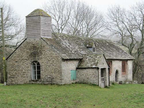
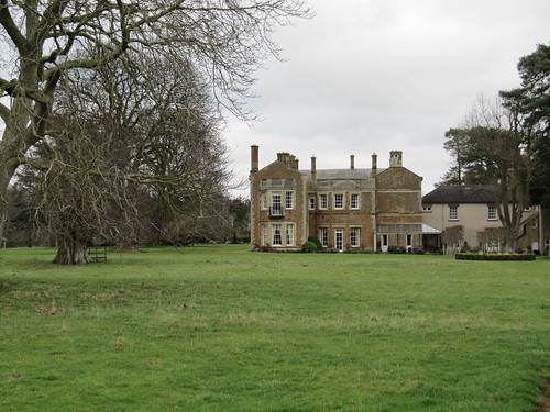
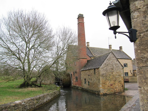
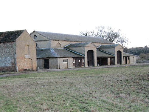
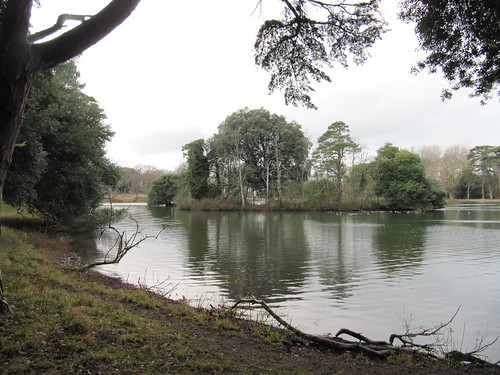
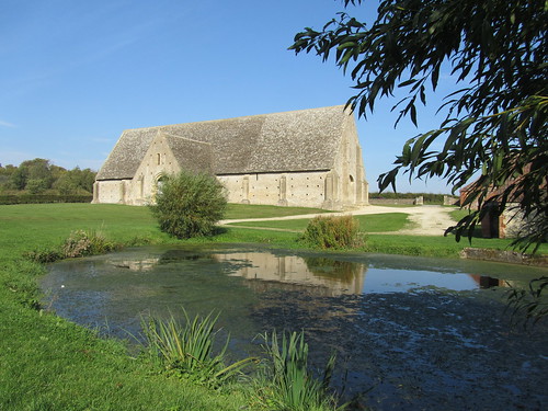
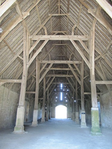
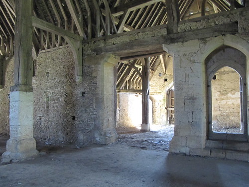
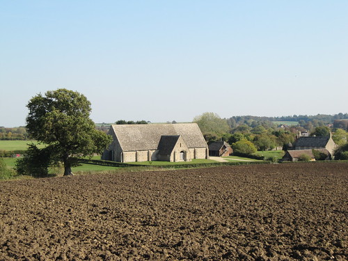
Out at the edge of the village I came to the Great Barn. A name to live up to, a drum-roll of a name. The barn was built of creamy stone in the 13th century to store the produce of a grange or outlying farm of Beaulieu Abbey. I stood and watched it sail on its duckpond reflection – a ship of the harvest bulwarked with gabled doorways and spread aloft with intricate timbering that upheld a huge roof of stone.

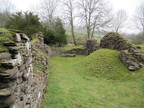
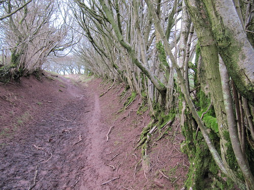
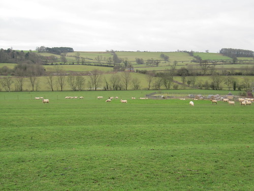
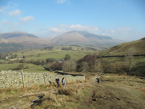
Two buzzards went planning over the bluebell clump at the crest of Badbury Hill as I approached the old hill fort. Its ramparts have been partially ploughed in the couple of millennia since it was last inhabited, but the sections that lay in the shelter of the trees stood tall enough to distinguish. A family was picnicking in the fort, their children playing on a rope swing that whirled them away from the ramparts to fly in a circular swoop out over the ditch and back to earth again.

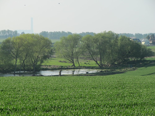
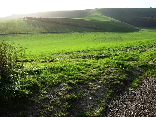
The dappled light under the sycamores gave way to full sunshine and a tremendous view north across the wide valley of the upper Thames. Was this the prospect that greeted King Arthur when he brought his British forces to contest mastery of the kingdom with Anglo-Saxon invaders some time around 500 AD? Some say that Badbury is the ‘Mount Badon’ of semi-legend, site of the siege at which Arthur slew 960 foes with his own sword Excalibur, securing peace in Britain for a generation.

Ahead of me a little lad went trailing his family on the path to Brimstone Farm and Coleshill. Something of the stirring old story was running in his imagination, judging by the way he swung his plastic Excalibur and laid armies of nettle-heads low in the dust.

Start & finish: Radnor Arms PH, Coleshill, Oxfordshire SN6 7PR (OS ref SU 237938)

Getting there
Bus: Service 65 (swindonbus.info), Witney-Swindon
Road: M4 (Jct 15); A419, A361 to Highworth; B4019 (signed ‘Faringdon’) to Coleshill

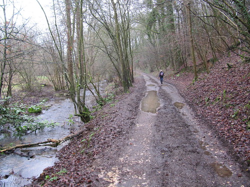
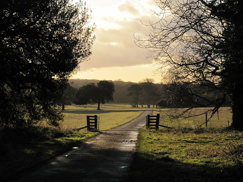
Walk: (6½ miles, easy, OS Explorer 170): Leaving Radnor Arms, right downhill. Left opposite church (‘village shop’); in 150 m, pass Estate Office notice; on through 2 gates (236936; yellow arrows/YA). Follow path across fields of Coleshill Park (stiles, YAs). In ¾ mile, bear left (246930; YA) along edge of Flamborough Wood. At Ashen Copse Farm cross track (250934); ahead past barn (YA). Diagonally right across 2 fields (stiles, YAs) to track (255934); follow this round right bend; on between fields. Near Great Coxwell, cross stiles (264934; YA) and on. At field end follow ‘Footpath To River’; in 30 m, left over stile to road (268933). Left up village street for nearly ½ mile; then right (269940; fingerpost) past Great Barn. Over stile; right (YA, ‘Circular Route’) round field edge. In 250 m, right through kissing gate (266941; ‘Circular Route’); follow path to cross B4019 (264945). Left on path parallel to road inside field (National Trust arrow). At field end, forward through car park (262945). Ahead through gate (‘Badbury Clump’); follow path ahead beside fort ramparts; on for ¾ mile, down slope (ahead over cross-tracks), out of trees (256951), forward to Brimstone Farm. Cross farm lane (251952; YA); take track ahead through gates past left end of cattle yard. In 30 m, left (YA) over stile, through woodland belt, then across 2 fields (YAs, stiles) and along green lane. Through end of Fern Copse (244945); on for ½ mile to road (237940). Left; fork immediately right to Radnor Arms.

Radnor Arms (237938) – path through Coleshill Park – corner of Flamborough Wood (246930). Ashen Copse Farm (250934) – path east for 1 mile to Great Coxwell (268933). Great Barn (269940) – corner of woodland (266941) – cross B4019. Badbury Hill – path through Coxwell Wood to Brimstone Farm (251952). Path SW for 1 and a quarter miles, passing end of Fern Copse (244945) to Coleshill.

Click on Facebook “Like” link to share this walk with Facebook friends.

Lunch: Radnor Arms, Coleshill (01793-861575; radnorarmscoleshill.co.uk) – busy, friendly, cosy.

Great Barn: Great Coxwell (NT): Open daily (50p entrance)

Information: Faringdon TIC (01367-242191); www.visitsouthoxfordshire.co.uk

Readers’ Walks: Come and enjoy a country walk with our experts! Dates, info etc.: http://www.mytimesplus.co.uk/travel/uk/1867/times-walks. Next walks: Holy Island, Northumberland, 13 May; Tibbie Shiels Inn, Scottish Borders, 10 June; Northern Ireland, 8 July
www.satmap.com www.LogMyTrip.co.uk

 Posted by at 03:23
Apr 072012
 

Two tiny terriers came barking to the fence of the Bull’s Head Inn at Craswall as we pulled on our boots in the lane.
First published in: The Times Click here to view a map for this walk in a new window
picture picture picture picture picture picture picture picture
Facebook Link:
The Bull’s Head is a little gem, a lost-and-gone pub full of character in a remote cleft of the hilly border country where Powys frowns down on Herefordshire.

A pale sun was trying its best to draw aside the blankets of mist that the Black Mountains had pulled across their shoulders overnight. Celandines and daffodils were struggling out in the roadside verges, chaffinches burbled, catkins hung long and yellow from the hazels – everything spoke of spring just around the corner.

Craswall’s modest Church of St Mary crouched in its ring of trees. Inside, everything was plain and simple – a tiny gallery, beams shaped and bevelled by some nameless medieval village carpenter, hard upright pews. The sunken grassy hollow on the north side was an arena for cockfights not so long ago, and Craswall boys would play fives against the church wall.

We followed a bridleway through sheep pastures, heading north to cross the infant River Monnow in a dell under alders and low-growing oaks. The dogs of Abbey Farm barked us in and out of the farmyard. Down in the cleft beyond, sunk deep into grassy turf banks, lay the silent and time-shattered ruins of Craswall Priory. The Order of Grandmont monks ran it in medieval times with a severe rule and harsh discipline. They could not have chosen a bleaker or more remote spot to build their refuge, or a more beautiful one to a modern walker’s eyes. The curved apse still holds its rough altar, sandstone sedilia and triple piscina complete with stone bowls and drain holes. Over all is a profound sense of peace, and an echo of melancholy.

Up on the ridge we strode out. Suddenly the mist curtain shredded away and a stunning view lay ahead – the great steep prow of Hay Bluff and the upturned boat keel of its long south-going ridge, towering 700 feet above us but completely hidden until now. We stood and stared, entranced, before turning back to follow old green lanes that led down to Craswall over a succession of rushing mountain fords.

START: Bull’s Head PH, Craswall, near Hay-on-Wye, Herefordshire HR2 0PN (OS ref SO 278360).

GETTING THERE: A438, B4351 to Hay-on-Wye. Follow B4350 west out of town; on outskirts, left up Forest Road (‘Capel-y-ffin’). In 2½ miles fork left (‘Craswall 4’). Park at Bull’s Head, Craswall.

WALK (6 miles, moderate, OS Explorer OL13):
With phone box behind you, descend road with Bull’s Head on your right. Just beyond Craswall Church (281363), right off road; immediately left (blue arrow/BA; ‘Monnow Valley Walk’/MVW). Follow BAs along hillside for nearly 1 mile; ford River Monnow (276375); aim across field to far top corner (275378); on through gates to Abbey Farm (274379). Left down drive to Craswall Abbey ruins (273377); on up drive to road (268373). Left; in 300 m, right (271370; ‘bridleway’ fingerpost/BFP). Follow BA and MVW through fields for nearly 1 mile. Through gates, over stile at caravans (257374; BA); on through gate on skyline (255373). On for ¼ mile through 2 gates; at 2nd one (251373, at Brecon Beacons National Park boundary) turn left up end of larch plantation. At top of wood, left along its south side. Pass Coed Major on left (256371), down to cross stream (257369), and follow green lane/path through gates. In ⅔ mile it becomes metalled lane. At gate (268363), right (BFP) for 50 m; left (BFP) on bridleway through gates. In ¾ mile, at post with 2 BAs (278357), left to road; left to Bull’s Head.

REFRESHMENTS: Picnic; or Bull’s Head, Craswall (01981-510616; thebullsheadcraswall.co.uk) – characterful old pub; open Fri+Sat, 12-3, 7-late; Sun 12-3. Parties of 10+ at other times by arrangement.

ACCOMMODATION: Pandy Inn, Dorstone HR3 6AN (01981-550273; pandyinn.co.uk) – lovely friendly pub, fabulous wooden chalet for B&B.

HAY-ON-WYE FESTIVAL: 31 May-10 June (hayfestival.com)

INFORMATION: Hay-on-Wye TIC (01497-820144; visitherefordshire.co.uk)

Readers’ Walks: Come and enjoy a country walk with our experts! Dates, info etc.: http://www.mytimesplus.co.uk/travel/uk/1867/times-walks. Next walks – Lake District, 8 April; Holy Island, Northumberland, 13 May
www.ramblers.org.uk www.satmap.com www.LogMyTrip.co.uk

 Posted by at 02:24
Mar 312012
 

The Upchurch peninsula sticks up from the North Kent coast into the wide tidal basin of the Medway Estuary.
First published in: The Times Click here to view a map for this walk in a new window
picture picture picture picture picture picture picture picture picture picture picture picture picture picture picture
Facebook Link:
This is one of those outposts, remote and full of character, yet amazingly close to London, that one stumbles upon with a thrill of discovery – especially at this time of year when the apple orchards are in full blossom.

Under the 700-year-old roof of St Mary’s Church at Newington the damned bared their teeth in the agonies of Hell while angelic trumpet blasts summoned the righteous from their coffins – the vivid events of Judgement Day depicted by a medieval fresco painter, as admonitory as a slap on the backside. From the candy-striped flint and ragstone tower of St Mary’s we followed a path north over the green upland of Broom Down to Lower Halstow, neatly tucked along its creek beside the great marsh and mud expanse of the Medway estuary.

Black-headed gulls screeched around a brace of beautifully restored Thames barges moored at Halstow Quay. On the seaward horizon the big blue cranes on the Isle of Grain dipped with majestic slowness like giraffes stooping to graze. A wind scented with salt and mud blew stiffly inland to rustle a million pink and white apple blossoms in the orchards around Ham Green.

Up the seaward edge of the peninsula we went, past the old coasting craft-turned-houseboats lying belly down in Twinney Creek, a curl of smoke rising from a home-made tin chimney. Then inland past the orchards around Frog Farm, the tiny shoulder-high apple trees frothing with blossom and already beginning to hum with hoverflies and early bees. The tremulous, bubbling cries of a curlew came from the saltmarshes behind us as we followed the narrow lanes through Ham Green and on by the fishing lakes.

As we passed through Upchurch, the village cricket team in well-washed whites was walking out onto Hollywell Meadow. In Chaffes Lane a bunch of lads puzzled over the oily innards of an old scooter. A flat-capped man who must have seen off at least eighty winters gave us a wink as he shuffled into the side door of the Crown Inn, and in St Mary’s Church an effigy of the Green Man spewed a mouthful of flowers like a promise of spring.

Start & finish: Newington Station, Newington, Kent ME9 7LQ (OS ref TQ 859650)
Getting there: Train (www.thetrainline.com; www.railcard.co.uk) to Newington. Road: M25 (Jct 2), M2 (Jct 5); A249 towards Sittingbourne; A2 towards London for 1½ miles. Park near Newington station.

Walk (7 miles, easy, OS Explorer 148): Down Station Road; in 20m, opposite No 41, left along alleyway; left along Church Lane. Under railway; on to crossroads (861653) with Church of St Mary the Virgin to right. From crossroads, ahead (‘Lower Halstow’) down Wardwell Lane. In 200m on right bend, left (861655; footpath fingerpost); on through valley by footbridges and stiles. At foot of slope (860660), bear left up slope, aiming left of pylon; cross left-hand of two stiles. Follow path under power lines, over Broom Downs to road at Lower Halstow (859669). Left; immediately right along path with stream on left; in 300m, left across footbridge; right at end of alley to T-junction (859672), with Three Tuns PH and St Margaret’s Church to right.
Across junction by pub; pass ‘Private – No Parking’ sign, then ‘Moorings’ house to reach Halstow Wharf. Continue along Saxon Shore Way/ SShW past Halstow and Twinney Creeks for 1½ miles to Shoregate Lane (850691). Inland (SShW) for ¼ mile to Ham Green Farm (847688). Right along road; in 20 m, left (SShW) on track through orchards, past riding stables (SShW) to road (844683). Left (SShW); in 250m, right (SShW) across field; through kissing gate (843679) with lake on right. SShW bears right here, but turn left (‘public footpath’ arrow) along hedge; cross paddocks into housing estate at Upchurch. Left to T-junction; right up The Street, past The Crown PH and St Mary’s Church (844675).

Opposite Post Office, left down Chaffes Lane. In 200m, left opposite Bradshaws Close (844672). Take right-hand of two footpaths (stile, ‘footpath’ fingerpost), across paddocks by kissing gates for ⅓ mile. At far side of paddocks, right over stile (846667); bear left around paddock. On far side, left over a stile (847666, yellow arrow) down path to road (848665). Right to crossroads with Breach Lane (851663). Through a kissing gate opposite; aim for pylon, then keep same line over fields and through an orchard to its top right corner (853658). Left over stile, across field, then between paddocks to cross road (854655). Continue same line across large field; under railway (856650); ahead to A2 in Newington; left to Station Road; left to station.
One of 25 walks in Walks In The Country Near London (new edition) by Christopher Somerville, just published by New Holland.

Lunch: Three Tuns, Lower Halstow (01795-842840)
Church keyholders (NB Please contact several days in advance of your walk in order to avoid disappointment): St Mary’s Church, Newington – Rev Liz Cox (01795-844241; rev.liz.cox@btinternet.com); St Margaret’s Church, Lower Halstow, and St Mary’s Church, Upchurch – Rev Jacky Davies (01795-842557; jackytd@halstowmillhouse.eclipse.co.uk)
More info: Sittingbourne TIC (01795-417478); www.visitkent.co.uk
Readers’ Walks: Come and enjoy a country walk with our experts! Dates, info etc.: http://www.mytimesplus.co.uk/travel/uk/1867/times-walks. Next walk: Lake District, 8 April
www.satmap.com www.LogMyTrip.co.uk

 Posted by at 01:23
Mar 242012
 

A late winter sky of chilly blue lay over Northamptonshire, lending a glow to the deep orange ironstone of Badby’s houses.
First published in: The Times Click here to view a map for this walk in a new window
picture picture picture picture picture picture picture picture picture picture picture picture picture picture picture picture
Facebook Link:
Children were rushing to school as we set off out of the village, and we heard their playground squeals as we followed the Nene Way through green fields. Mention of the River Nene usually brings a picture to mind of the broad, mud-choked tideway that empties into the Wash, but here a hundred miles away the Nene crawls below overshot willows, an infant stream narrow enough to jump across.

Trees shaded the golden houses of Newnham along the village green. The path ran through the churchyard where the arcaded memorial to Eric Newzam Nicholson of the 12th Lancers (died 1917 ‘in the service of his country’) stood wrapped in creepers and ivy tendrils, looking out of its thicket over classic English countryside of sheep pastures corrugated by medieval ploughing, wooded ridges and well laid hedges.

Rooks cawed in the oaks around the farming enclave of Little Everdon with its handsome buttery gold houses. Three fields away, hounds were singing. In the lane we met 4-year-old Grace, dolled up in immaculate jodhpurs and just about big enough to stay on board Stumpy, her Shetland pony. Grace was not happy. ‘She wanted to follow the hounds,’ explained her mother, ‘but she couldn’t really have kept up.’ Grace cracked a watery smile as Stumpy bore her away home.

There were big views all round from the summit of Everdon Hill. Storm-battered cedars and wide gleams of water heralded Fawsley Park, the two slender arms of its man-made lake cradling the estate church on a knoll – another dream of settled tranquillity in the heart of England.

The peaceful woods of the Fawsley Estate provided a refuge and haven for Joseph Merrick, the Elephant Man, during the late 1880s, in the last stages of the mysterious affliction that grotesquely distorted his face and body. Travelling from London in a private railway carriage to avoid the public consternation caused by his appearance, Merrick stayed in the gamekeeper’s cottage as the guest of Lady Louisa Knightley. Walking back to Badby we pictured the outcast man in these bluebell woods, free to stroll among the trees, pick flowers and feel at ease for the only time in his life.

Start & finish: Windmill Inn, Badby, Northants NN11 3AN (OS ref SP 559589)

Getting there: Bus – Service 200 (www.stagecoachbus.com) Banbury-Daventry
Road: M1 Jct 16, A45 towards Daventry, B4037 to Badby

Walk directions: (7½ miles, easy, OS Explorer 207): From Windmill Inn, left through Badby. Opposite Maltsters Inn, right down Court Yard Lane (560592). Follow well-waymarked Nene Way for 3 miles via Newnham to road at Little Everdon (594580). Forward; in 150m Nene Way goes left (595579), but keep ahead on road to Everdon, past church and on. At top of village, left (‘Fawsley’). In 100 m, right (590576; fingerpost, black arrow/BLA); follow BLAs for 1 mile to cross road near Westcombe Farm (573573). Through gate, up field to gate (570572); follow BLAs to road (566570). Right, round bend to Fawsley Church (565568); return to bend; left on Knightley Way (KW). Follow KW for 1 mile through Fawsley Park and inside west edge of Badby Wood (559580). Leaving wood (559584), aim diagonally right across field; follow KW to Badby Church (560587). Right to Windmill Inn.

Lunch: Romer Arms, Newnham (01327-702221; www.charleswells.co.uk); Plough Inn, Everdon (re-opening shortly; check online)

Accommodation: Windmill Inn, Badby (01327-311070; www.windmillinn-badby.com)

Info: Daventry TIC (01327-300277)

Readers’ Walks: Come and enjoy a country walk with our experts! Dates, info etc.: http://www.mytimesplus.co.uk/travel/uk/1867/times-walks. Next walk: Lake District, 8 April
www.ramblers.org.uk www.satmap.com www.LogMyTrip.co.uk

 Posted by at 02:52
Mar 172012
 

People have been doing the Waterfalls Walk since the days of stovepipe hats and crinolines, and this steep, tree-hung circuit of the two moorland rivers that rush together in Ingleton village to form the River Greta continues to be one of Yorkshire’s prime outdoor attractions.
First published in: The Times Click here to view a map for this walk in a new window
picture picture picture picture picture picture picture picture
Facebook Link:
I’d always assumed that any walk so popular must be a bit tame – but not at all. The twin gorges of the River Twiss and Doe may be well-trodden, but they’re far from commodified. The combination of thick woods, waterfalls, churning narrows and thread-like paths exerts as much magic on today’s walkers as it did on Victorian holidaymakers in search of swoonsome thrills.

Setting off from Ingleton along the narrow path that shadows the River Twiss, we were almost at once enclosed in the dark walls of a gorge, with the river running fast among mossy stones splashed with dipper droppings. Beside the path lay a money tree, its hide as scaly as a lizard’s with tens of thousands of copper coins hammered into the boughs for luck. The trail climbed the wall of a canyon above swirling holes where the south-going river chased round and round before escaping, sculpting semi-circular hollows in the rock walls with a continuous swallow and gurgle. Its cold breath and smell of stone and earth came up to us as we crossed the gorge on lattice footbridges under which the peat-charged water sluiced as dark and frothy as a gush of porter.

A roe deer went bounding up the bank, its white scut bobbing a warning. A long view upriver showed Pecca Falls crashing down a staircase of slippery rock steps. Beyond the cascade the trail left the trees and followed a curve of the Twiss. A wonderful view opened ahead towards Thornton Force, pride of the walk, descending a series of rapids before hurling itself in a 50- foot freefall into a smoking pool. Above this thunderous weight of water we followed a walled lane into the mist. Unseen and offstage, sheep bleated, a farmer whistled and a quad went puttering over an invisible field by Twisleton Hall.

Below the farm the River Doe echoed and hissed in its own steep walled canyon, leaping down towards Ingleton and its confluence with the Twiss through S-shaped channels carved through the shale by the force of water alone. We crossed above potholes boiling with toffee-coloured bubbles, and skirted backwaters where the surface lay marbled with scarcely moving patterns of foam. Below the white wall of Snow Falls the path snaked past another money tree and on through mossy old quarry workings, to emerge at the foot of the gorge with the church and houses of Ingleton lying beyond, as muted and dreamy looking as any faded Victorian lithograph.

Start & finish: Waterfalls Walk car park, Ingleton, N. Yorks LA6 3ET (OS ref SD 693733)
Getting there: Bus – Service 80 (Lancaster-Ingleton), 581 (Ingleton-Settle). Road – M6 Jct 34 (A683, A687) or Jct 36 (A65) to Ingleton. Waterfalls Walk is signed in village.

Walk (4½ miles, moderate/strenuous, OS Explorer OL2): From car park follow waymark arrows up River Twiss, along lane via Twisleton Hall farm (702751) and down River Doe.
Conditions: Continuous slippery paths and steps.
NB – Online map, more walks: www.christophersomerville.co.uk.

Refreshments: Frumenty & Fluffin teashop, Main Street, Ingleton (01524-241659)
Accommodation: Croft Gate, Chapel-le-Dale, Ingleton (01524-242664; www.croft-gate.co.uk) – quiet, friendly and immaculate B&B
Waterfalls Walk: Open 9 a.m. daily; £5 entrance/car park pp; £11 family; complimentary leaflet guide
More info: Ingleton TIC (01524-241049); www.visitingleton.co.uk; www.yorkshire.com
Readers’ Walks: Come and enjoy a country walk with our experts! Dates, info etc.: http://www.mytimesplus.co.uk/travel/uk/1867/times-walks. Next walk: Lake District, 8 April
www.satmap.com www.LogMyTrip.co.uk

 Posted by at 01:46
Mar 102012
 

They’ve seen a few winners at the Hollow Bottom; a few losers, too. The walls of this famous horse-racing pub in the north Gloucestershire Cotswolds are hung with jockeys’ silks, snapshots of grinning owners, racing mementoes and photos of our four-legged, long-faced chums in action.
First published in: The Times Click here to view a map for this walk in a new window
picture picture picture picture picture picture picture picture picture picture picture picture picture picture picture picture
Facebook Link:
It’s a great place to stay the night if you’re after local atmosphere, because this is horse country nonpareil. If we saw one horse on our walk through the Cotswolds’’ most delectable corner, we saw a hundred.

After a night of rain the woods were full of cold mist above the valley where Naunton lay, a dream of rich gold stone houses and snowdrop gardens. Horses in blue blankets cropped the paddocks. Every hawthorn twig held a line of raindrops suspended, each drop reflecting a miniature world of inverted trees and walls. Up on the roof of the Cotswolds it was a wintry scene of sombre beauty, all bright colours leached away by the mist. A group of bullocks grazing at a mountain of silage in an isolated barnyard turned their muddy faces towards us as we walked by. ‘Hey, hey!’ soothed a hawk-faced little man leading a nervously shying colt along the lane, gentle authority in each of his gestures.

The sky began to clear as we came down towards Upper Slaughter. The view broadened to reveal wide upland fields dipping to hidden valleys. The horizons rolled with smoking cloud, and a weak sun came through to frost the lichen-encrusted ash trees with cold silver light.

Upper Slaughter is everyone’s Cotswold dream made manifest – a gorgeous manor house with peaked gables, mullioned windows and tall chimneys, the church high on a bank like a ship on a billow, the whole village scented with apple wood smoke, a mellow fantasy. In Lower Slaughter the channelled waters of the River Eye ran under a diminutive stone footbridge. The plain red brick chimney of the old mill came as a relief to the eye after so much beautiful gold stone.

In a green lane beyond we stopped to hear a song-thrush fluting his twice and thrice repeated phrases from the hedge. The lane took us twisting down to follow the River Windrush in its tightly curving valley. Goldcrests swung in the treetops – gold seemed to be the theme today. We skirted the skittish horses beyond Lower Harford Farm, and came up over the hill and down towards Naunton with evening blackbird song echoing through the valley below.

Start and finish: Black Horse PH, Naunton, Glos GL54 3AD (OS ref SP119235)

Getting there: Road – M5, Jct 11a; A40, A436, B4068 towards Stow-on-the-Wold, Naunton signposted on left. Park in village street.

Walk directions (9 miles; easy/moderate; OS Explorer OL45): From Black Horse PH, right; in 50m, right up lane; in 150m, right (‘Wardens Way’/WW) on bridleway for ¾ mile to road (126243). Turn right through gate (WW) along field edges next to road. At T-junction (133242) continue along hedge; at field end, left to cross road (134241, WW). On along track opposite; in 300m, right through gate by barn (136243; blue arrow) and on (WWs) for ¾ mile to B4068 beside houses (149241). Left (WW – take care!) for 350 m; right (152242, WW) along driveway for ⅔ mile to Upper Slaughter. Follow road to The Square; left down to road; left (155232) for 150 m; right (156232, WW) down walled path. Follow WW through fields to Lower Slaughter. At road, right (164226) past mill; cross stone footbridge, up lane opposite.

At T-junction, cross road and keep ahead along green lane (161222; ‘Macmillan Way’/MW). In ⅓ mile cross road (157219); on across field (MW); through hedge, left (153218); follow MW into Windrush Valley. At path junction, right (151213; ‘Windrush Way’/WiW). Cross river; in 150 m, right (148213; WiW) through Aston Farm and on through fields and woods for ¾ mile. Leave wood (139220); in 250 m, through gate (138221); take left fork downhill. WiW for ¾ mile to road by Lower Harford Farm (129225). Left (WiW); in 100 m, right through gate (WiW). At foot of slope, left along valley bottom. At end of 3rd field, through gate (119226); right across brook; up slope to waymark post; on through gate (118227). Ahead to cross B4068 (117231). Down track opposite; in 100 m, right down path by fence; cross river, pass dovecote; right along lane to Naunton village street (116234). Right to Black Horse.

Lunch: Picnic; or Black Horse Inn, Naunton (01451-850565; www.theblackhorsenaunton.co.uk)
Old Mill, Lower Slaughter (01451-820052, oldmill-lowerslaughter.com) – really good tearooms; scrumptious flapjack!

Accommodation: Hollow Bottom Inn, Guiting Power, GL54 5UX (01451-850392; www.hollowbottom.com); famous horse racing pub, refurbished rooms, warm and friendly – especially around Cheltenham Festival races (13-16 March this year).

Info: Stow-on-the-Wold TIC (01451-870083); www.visitcotswolds.co.uk
www.ramblers.org.uk www.satmap.com www.LogMyTrip.co.uk

 Posted by at 01:08
Mar 032012
 

Some walks just grab you so hard that you know you’ll be back to enjoy them again, if not sooner then later.
First published in: The Times Click here to view a map for this walk in a new window
picture picture picture picture picture picture picture picture
Facebook Link:
It was a good five years since I’d last set off from Alfriston, but nothing had changed in this lovely corner of East Sussex. The same clear-cut line of the South Downs above the village, running down to their final embrace of the coastal flatland; the same eccentric old carvings in the Star Inn’s frontage; even identical late winter weather, a cold blue sky arched over Alfriston, calling me up to the hills.

A covey of partridges burst whirring out of the root crops as I went up the flinty, half-frozen path onto the roof of the downs. Views were wide and wonderful – the North Downs a grey-blue line 30 miles to the north, the green billows of the South Downs riding up and away into the west, Alfriston lying with its stumpy church spire and tiled roofs like a village in a Brian Cook book jacket, all flat angles in bright brick reds, acid greens and indigos. The cold air stung my nostrils and smoked my breath. Descending to pass below the Long Man of Wilmington, I saw that spiders had strewn the ancient chalk-cut giant with a maze of cobwebs, so that the 200-ft figure sparkled as though encased in diamonds on its steep hillside.

Frost clung in tight curls to the muddy ruts of the path that led through the woods to Folkington. Elizabeth David lies in the churchyard under a gravestone carved with aubergines, peppers and cloves of garlic. Celebrity chefs are twenty to the teaspoonful nowadays, but she was the first, a post-war culinary pioneer who introduced beige British tastebuds to snazzy foreign flavours, a shock from which we’ve never recovered.

A snaking old track brought me south to Jevington with its cheerful Eight Bells pub and thousand-year-old church tower built like a fortress against Viking marauders. A Saxon Christ adorns the wall, victorious over a puny, wriggling serpent. Crossing the downs on the homeward stretch, I marvelled at how a corner of countryside with such a vigorous and bloody history – Viking and French raids, coastguard battles with the smuggling gangs, Second World War bombs and doodlebugs – has settled to a tranquillity as smooth as the applewood smoke rising from Alfriston’s chimneys into the blue Sussex sky.

Start & finish: The Willows car park, Alfriston, East Sussex BN26 5UQ (OS ref TQ 521033)
Getting there: Train (www.thetrainline.com; www.railcard.co.uk) to Eastbourne; bus 126 to Alfriston. Road: Alfriston signed off A27 (Brighton-Eastbourne), 5½ miles after A26 Newhaven roundabout.

PLEASE NOTE: The Wealdway Path between Folkington and Jevington will be closed for six months from 1 April 2012 for work by the Water Authority

Walk (8½ miles, moderate, OS Explorer 123):
From The Willows car park (521033), follow footpath by wall on right of coach park. Cross stile; right to cross another; right along river bank; left across White Bridge (522031) to road. Cross road; take footpath on right of house. In 20 yards up steps; on up hedged path. In 100 yards, left through hedge (525031 – South Downs Way/SDW marker post); diagonally right on path across field; through hedge; across next field to cross stile onto SDW (532033).

Right to cross road; follow SDW uphill past Windover Reservoir to go through gate into Access Land (538035). SDW continues ahead, but turn left along fence over ridge; in 30 yards, right along track, through gate and on for a mile, passing Long Man of Wilmington (542034) where you join the Wealdway path. At The Holt, through gate into wood (551040); right along track for ½ mile to St Peter’s Church, Folkington (559038). Bear right (as you approach church) along Wealdway for just over a mile to T-junction of track; left (561021 – ‘Wealdway’ arrow) to road; right through Jevington, passing Eight Bells pub (563017).

Continue for 100 yards to left bend; take path on right of road to St Andrew’s Church (562015). On up SDW for 2/3 of a mile to Holt Brow (553019). SDW turns right here, but keep ahead for one and a quarter miles through Lullington Heath NNR, passing Winchester’s Pond (540020), to fork (533020). Keep ahead (‘Litlington’), down to road (523021). Left past Litlington church. Just before Plough & Harrow pub, right (523017 – ‘Vanguard Way’) to Cuckmere River; right along bank for 1 mile to Alfriston.

Click on Facebook “Like” link to share this walk with Facebook friends.
Lunch: Eight Bells, Jevington (01323-484442; 8bellsonline.co.uk); Plough & Harrow, Litlington (01323-870632; www.ploughandharrowlitlington.co.uk)
More info: Eastbourne TIC (01323-415450); www.visitsussex.org
Family Support Work sponsored walk: Alfriston-Wilmington-Alfriston (7 miles), Easter Monday, 9 April – info 01273-425699; www.familysupportwork.org.uk
www.ramblers.org.uk www.satmap.com www.LogMyTrip.co.uk

 Posted by at 02:59
Feb 252012
 

I hadn’t seen Fi since we were trainee teachers together, down in Somerset when Noah was a lad, but her energy and spirit were instantly familiar when we met up at Keswick’s Theatre by the Lake.
First published in: The Times Click here to view a map for this walk in a new window
picture picture picture picture picture picture picture picture
Facebook Link:
What a day for walking, as cold as anything, with high cloud over the Lake District and lemon-yellow sunlight streaming across the crumpled faces of Skiddaw and Blencathra. It was wonderful to be kicking up showers of leaves in Cockshot and Castlehead Woods like teenagers, chattering away as you do when you have a few decades to catch up on.

Up by Springs Farm the chaffinches were trying out short explosive phrases in the silver birch coppice. A stony lane led us up beside a loud little stream with the big dark bulge of Walla Crag looming ahead, its crown feathery with larches. “An eminence of intermingled rocks and trees,’ pronounced Wainwright (Book 3) in my hand, ‘of moderate elevation, yet steep, romantic, challenging.’ We passed Rakefoot Farm, its chimneys pushing up columns of woodsmoke behind a screen of leafless sycamores, and turned uphill and out onto the open fellside leading up towards Walla Crag. A ‘braided path’ as Fi described it, an in-and-out tangle of footways beside the wall, with a sensational view spreading behind us northward towards hollow-shouldered Blencathra and the rising waves of the Skiddaw range, the sun picking out the monoliths of Castlerigg stone circle in the foreground.

‘Dear thoughts are in my mind
And my soul soars enchanted,
As I hear the sweet lark sing
In the clear air of the day.’

So sang Fi as we crunched the ice in the puddles and followed the braided path along the edge of the crag. A quick stop in a sheltered hollow out of the clear (but bloody cold) air for oatcakes and mango chunks, and we were at the summit cairn admiring the deep glacial scratches in the rocks and looking out over the islands and bays of Derwent Water. Clouds went marching through the valleys beyond, but all the tops to the west were clear.

On along the escarpment with an incomparable view southward towards the jostling hills enclosing Borrowdale, the peaks of Great Gable, Scafell Pike and Glaramara dipping in and out of the cloud sea like so many dark topsails. Then a steep skelter down the fellside among juniper bushes, and we turned back along the stumbly path under Falcon Crag. It was a vigorous, noisy walk back to Keswick along the lake-shore with white horses pawing at the little pebbly bays, and a rising wind roaring in the pines and shivering the water of ditches jellied with frogspawn as if to blow the last of the winter clean away.

Start: Lakeside car park, Keswick, Cumbria CA12 5DJ (NY 265229)
Travel: Bus 554 (Carlisle), 555 and 556 (Lancaster, Carlisle) to Keswick (www.stagecoachbus.com);
Road: M6 to Jct 40, A66 to Keswick

Walk directions: (6½ miles; moderate; Explorer 0L4): Past theatre to lake; left; in 100 m, left (fingerpost) along path. Over path crossing, up through Cockshot Wood. Cross field, then B5289 (269226). Bear left, fork immediately right uphill. Up and over Castlehead Wood; path to road (272229). Right, past Springs Farm; follow signed path through Springs Wood (‘Castlerigg, Walla Crag’). In ½ mile, left over footbridge (283222) to road. Right; at Rakefoot fork right; follow path (‘Walla Crag’) over footbridge and steeply up beside wall. Near top, wall is broken by railings; right through gate here, left along crags to summit cairn (277213). Continue for 150 m; stile through wall; don’t turn right along wall, but head ‘inland’ on path heading for Bleaberry Fell. In 300 m, bear right across beck on path along edge of escarpment. Follow this over Falcon Crag for ⅔ mile to meet wall (272198). Right downhill to gate; right along path towards Keswick for ¾ mile. At wall of Great Wood (271210), right uphill; left on footbridge across beck and fork left downhill on woodland path. In 200 m, ahead over path crossing. Continue to car park (272214); follow slip road down to cross B5289; down steps; follow path. In 50 m, left at footbridge to lake shore (270213); right along shore path for 1½ miles to car park.
NB: Online maps, more walks: www.christophersomerville.co.uk

Lunch: Picnic; or Stalls Bar, Theatre by the Lake (01768-772282)
Accommodation: Littlefield, 32 Eskin Street, Keswick CA12 4DG (01768-772949; www.littlefield-keswick.co.uk) – quiet, welcoming, walker-friendly.
Guidebook: Wainwright’s Pictorial Guide to the Lakeland Fells, Book 3 (Frances Lincoln)
Information: Keswick TIC (01768-772645); www.golakes.co.uk)
www.ramblers.org.uk www.satmap.com www.LogMyTrip.co.uk

 Posted by at 01:47
Feb 182012
 

In 1776, 22-year-old Thomas Coke inherited the Holkham Estate – 30,000 acres of sandy, salty, windblasted and flinty land along the North Norfolk coast.
First published in: The Times Click here to view a map for this walk in a new window
picture picture picture picture picture picture picture picture picture picture picture picture picture picture picture picture
Facebook Link:
The young owner dedicated himself with a passion to improving the agriculture of this barren countryside. By the time he died in 1842, hugely famous as a breeder of sheep and cattle, grass and turnip pioneer and all-round agricultural reformer, he was known simply and universally as ‘Coke of Norfolk’.

On a glorious sunny afternoon, the tall column of the Coke Monument glowed brilliantly in strong winter sunlight among the bare trees of Holkham Park. Guarded by stone sheep and long-horned cattle, embellished with bas-reliefs of sheep shearers, horses and dogs, diggers and planters of seed, the inscription named Thomas Coke ‘Father, Friend and Landlord’, and declared: ‘Of such a man contemporaries needed no memorial. His Deeds were before them: His Praise in their hearts.’

Grand sentiments, and a grand artificial landscape to wander through, a gentle forest of old sweet chestnuts and beeches in which a long lake lay like a dark jewel. Pink-footed geese honked and chattered as they rested on the water. On a green knoll the Church of St Withburga caught the westering sun and threw it back dazzlingly from windows and flint cobble walls. Across the lake lay the grand Palladian palace of Holkham Hall, severely built of yellow brick by Thomas Coke’s uncle, the Earl of Leicester. Fallow deer roamed its parkland, their big branchy antlers occasionally clashing as they grazed close together.

From this miniature land of content the trail extended into the southern half of Holkham Park with its more agricultural feel – big open fields of beet, carrots and winter wheat, bounded by conifer belts and pheasant coverts. Coke of Norfolk would have appreciated the Holkham of today, a subtle balance of commercial and utopian landscapes.

Thomas Coke took a barren countryside and made it tremendously productive, literally sowing the seeds of North Norfolk’s agricultural success. Human beings are not the only beneficiaries of this transformation. The pink-footed geese that come from Iceland and Greenland to winter on the Norfolk coast spend each day in the fields, feeding on sugar beet fragments, before flying seaward at dusk to roost on the marshes and mudflats. That’s where I found them towards nightfall, gabbling and jostling in their hundreds, a seething carpet of big rustling birds. I watched them from a hide, entranced, as the sky turned apple green, then gold and pink, before darkening to the indigo of night.

Start: Holkham, North Norfolk NR23 1RG (OS ref TF 892440)
Getting there: Coasthopper Bus (01553-776980; www.coasthopper.co.uk), King’s Lynn-Cromer
Road: On A149 between Brancaster and Wells-next-the-Sea

Walk directions: (6½ miles from Holkham or 8½ miles with hide extension; easy; OS Explorer 251): Up Holkham Hall drive, through gateway (892435); right, following Farm Walk (red posts) to Coke Monument (884436). Ahead to lake; right (anti-clockwise) round lake (Lake Walk, yellow posts) via St Withburga’s Church (878436). At T-junction at foot of lake (880427), left past Ice House, right along The Avenue to pass Obelisk (884420). In 300 m, left (883416; Park Walk, green posts) back to gateway at Holkham.

Hide extension: Start walk from car park at north end of Lady Anne’s Drive (891448; £5 all day, coins or card). To reach easy access bird hide (883452, signposted) turn left on forest track beyond car park.

Lunch/accommodation: Victoria Hotel, Holkham (01328-711008; www.holkham.co.uk/victoria) – superbly friendly, warm and genuinely welcoming
Tea: Rose Garden Teashop, Holkham (01328-711285)
Information: Holkham Estate (01328-710227; www.holkham.co.uk); Wells-next-the-Sea TIC (01328-710885; www.visitnorfolk.co.uk)
www.ramblers.org.uk www.satmap.com www.LogMyTrip.co.uk

 Posted by at 01:55
Feb 112012
 

Dunbar lies on the rugged East Lothian coast, round the eastward curve from Edinburgh.
First published in: The Times Click here to view a map for this walk in a new window
picture picture picture picture picture picture picture picture
Facebook Link:
The town’s most famous son, John Muir (1838-1914), was a hugely influential pioneering conservationist, founding the National Parks movement in his adoptive America. Muir acknowledged as a lifelong inspiration the wild coast ‘around my native town of Dunbar by the stormy North Sea’.

Today lay cold and still, a pearly January morning with sea light slanting across wide freshwater marshes, shaggy dunes of pale green marram grass and long tan-coloured sands. The red sandstone houses of Dunbar crowded to their headland across Belhaven Bay, backlit by the sun. Its muted glow picked out the details of the volcanic lumps and bumps that litter this low-lying East Lothian coast – the hollow-backed cone of North Berwick Law, triangular Traprain Law, and out in the Firth of Forth the flat wedge of the Isle of May and the white rectangle of the lighthouse on the looming dark face of the Bass Rock, rising from a white collar of breaking waves.

Stefan Sobell, Dave Richardson and I strolled the dunes away from the town, talking of citterns (Stefan makes them, Dave plays them) and bitterns, holy fools and godwits. A small brown bird with a dark head and yellow bill went hopping among the empty snail shells of the dunes. ‘Twite?’ – ‘Yep.’ A plump little bird with dark green legs and a china-white belly stooped and probed the mud of the Tyne estuary among a crowd of grey plover. ‘Greenshank?’ – ‘Yep.’

To landward lay the long dark bar of coniferous Hedderwick Hill Plantation, cover and concealment for birds of prey. Suddenly one was overhead – ‘Peregrine!’ – a little dark hunter flying with quick wingbeats round a flock of two hundred knot. The waders formed themselves into a dense, defensive ball of birds; then one of their number panicked and made a break, quitting the safety of numbers in a desperate dash towards the open sea. Pursuer and prey chased out over the firth, the knot managing to keep out of the peregrine’s clutches with a series of last-second jinks and swerves. ‘Who’ll win?’ I asked Dave. ‘The one that’s got more fuel on board,’ was his reply.

Wartime tank traps leaned at the edge of the trees, green-topped and crumbling. Beyond them rose the candlesnuffer turrets and fantasy roofs of Tyninghame House, a Mad King Ludwig extravaganza of a country pile. In a mossy forest hollow we ate our ham, mustard and spelt bread sandwiches, and headed back along the John Muir Way. Would Dunbar’s famous native son have enjoyed the morning’s walk in our company? I’d like to think so.

Start & finish: Linkfield car park, John Muir Country Park, West Barns, Dunbar, East Lothian – nearest postcode EH42 1XF (OS ref NT 652785)
Getting there: Train (www.thetrainline.com; www.railcard.co.uk) to Dunbar (2½ miles by John Muir Way coast path). Bus X6 or X8 Edinburgh-Dunbar (www.firstgroup.com). Road: A1 to Dunbar; follow brown ‘John Muir Country Park’ signs to car park.
Walk (5½ miles from car park, 11 miles from Dunbar station, easy, OS Explorer 351):
From Dunbar station walk down to Dunbar Castle; then follow coast path (‘John Muir Way/JMW’) for 2 miles to cross footbridge (657784) into John Muir Country Park. In ⅓ mile (653787) bear right off JMW.
From here (or from car park) follow shoreline for 2¼ miles, NW to Tyne estuary (642800) then inland along shore, then edge of Hedderwick Hill Plantation to cross footbridge (640788). Join/rejoin JMW here; follow it along shore for ¾ mile; leave JMW where it angles sharp right along estuary basin at noticeboard (627784). Left here for 300m, then left again (628781) along field edge, following ‘Hedderwick Hill’ fingerposts. In ¾ mile at right bend (639787), go left to recross footbridge (640788); follow JMW back to car park/Dunbar.

Click on Facebook “Like” link to share this walk with Facebook friends.

Lunch: East Links Park Tearoom (01368-863607)
More info: Dunbar TIC (01368-863353); www.visitscotland.com/surprise
John Muir Trust: 01796-470080; www.jmt.org
www.ramblers.org.uk www.satmap.com www.LogMyTrip.co.uk

 Posted by at 02:07