Feb 042012
 

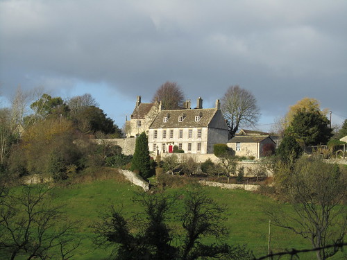
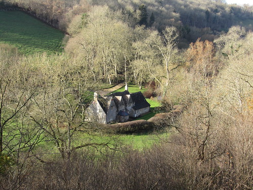
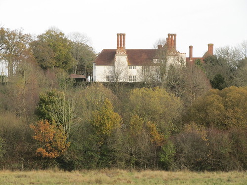
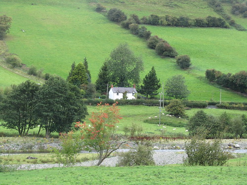
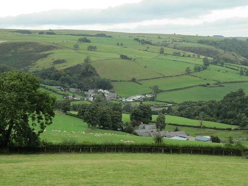
Kingston lies shut away in a tangle of high-banked lanes, a South Hams village that retains a vigorous social life in and out of the holiday season.
First published in: The Times Click here to view a map for this walk in a new window
picture picture picture picture picture picture picture picture
Facebook Link:
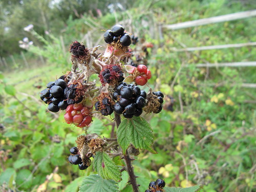
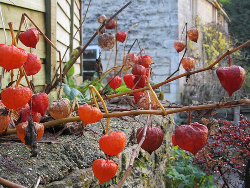
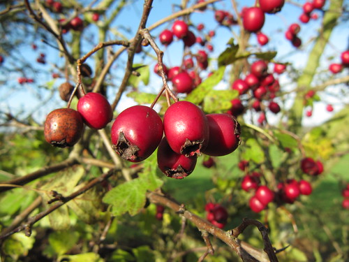
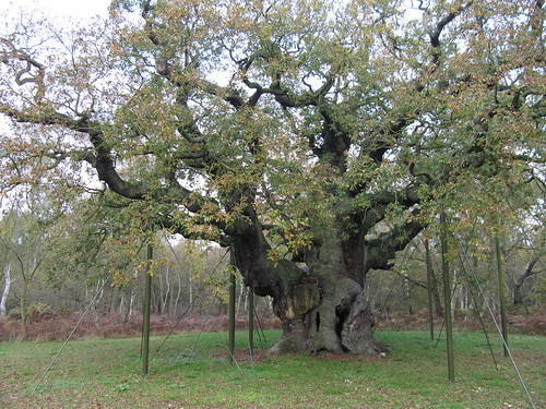
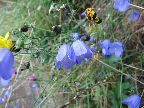
Crockers and Terrys lie companionably in the churchyard of St James the Less, our starting point for a walk along the coast of this isolated region of south Devon. In the ferny banks an astonishing treasury of flowers had responded to the mildness of this winter – herb robert, celandines, primroses, red campion and snowdrops all blooming together.

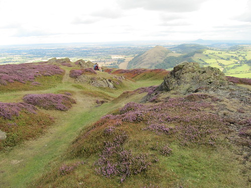
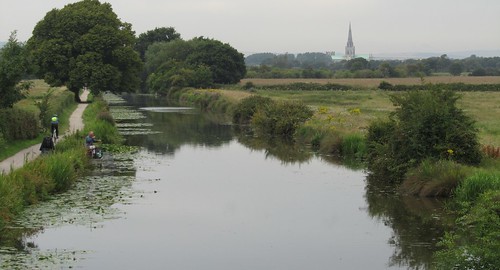
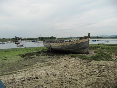
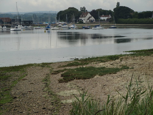
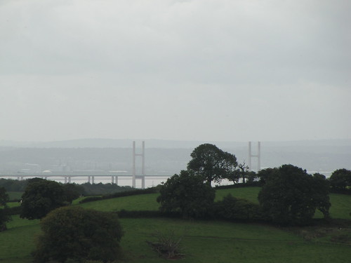
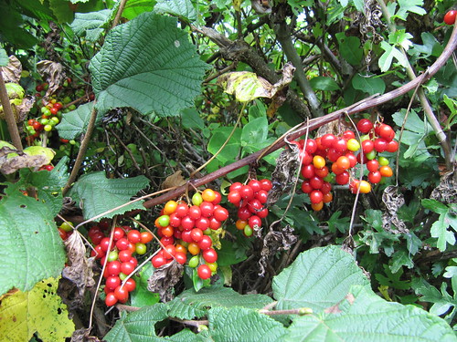
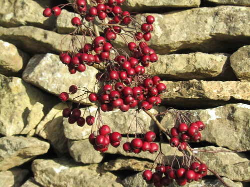
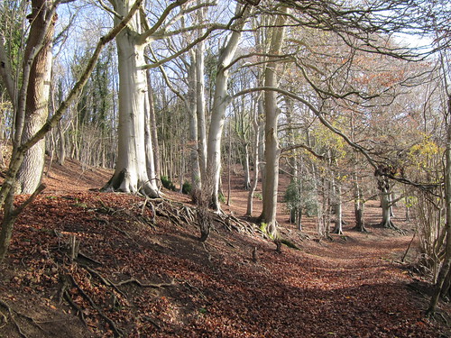
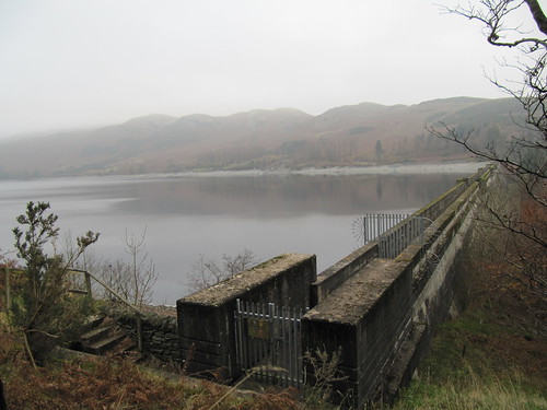
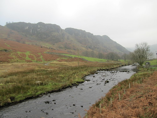
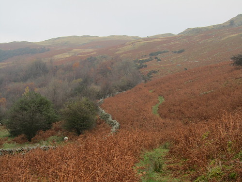
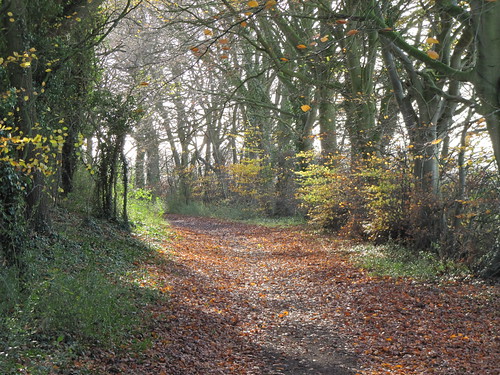
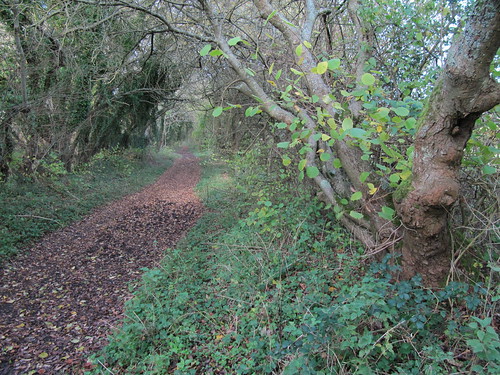
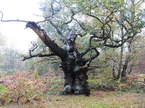
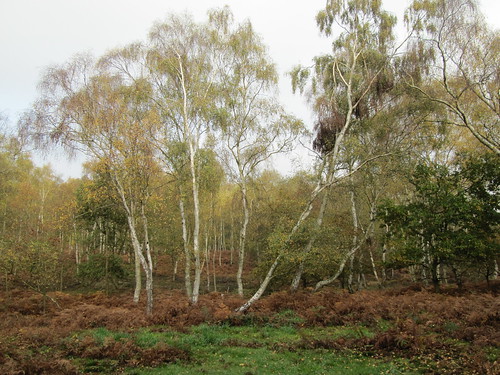
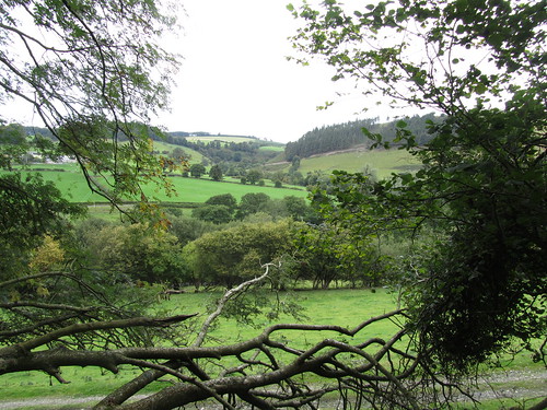
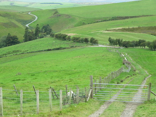
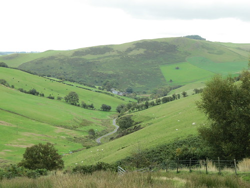
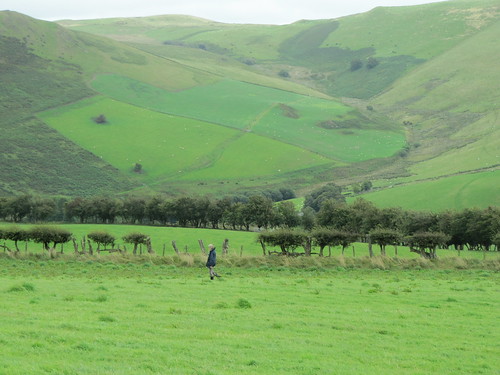
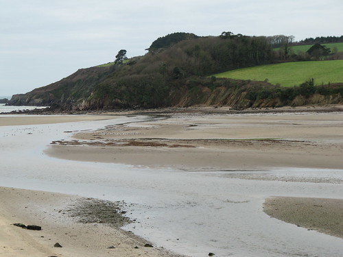
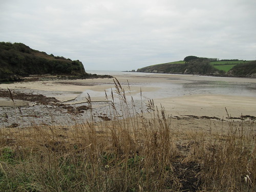
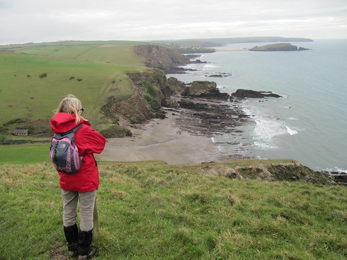
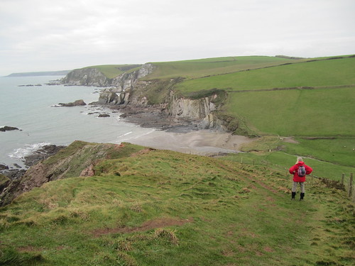
Between the leafless, wind-streamed trees of Furzedown Wood we caught glimpses of the tide-ribbed, dull gold sandflats and milky turquoise water of the Erme estuary, a snaking channel that reached its mouth between wooded headlands of black rock. Out on the coast a low wind brought a breath of winter in from the sea. The water lay slate-coloured under a grey sky streaked with pearly patches. Contorted cliff faces fell hundreds of feet to secret beaches and coves floored with tight-packed parallel lines of rock scars. A little back from the edge ran the path, swooping a couple of hundred feet into the green grassy dips, then soaring back up and over a succession of headlands.

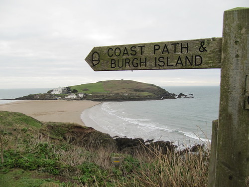
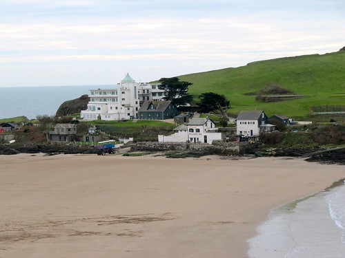
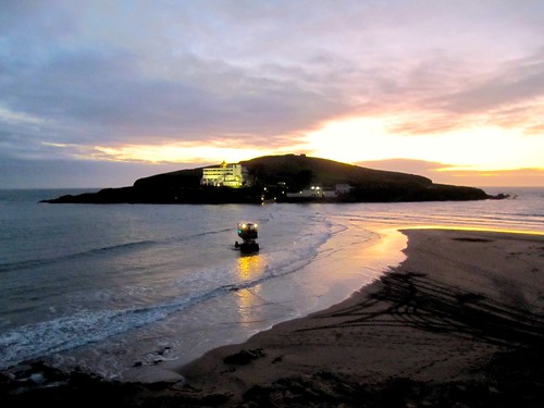
It was heady walking, with the sea-monster shape of tidal Burgh Island as an aiming point ahead. The island’s Art Deco hotel gleamed in the muted winter light, an exotic morsel much picked over by guests both actual and apocryphal – Noel Coward, Winston Churchill, The Beatles and M. Hercule Poirot among them. We descended to the shore in Bigbury-on-Sea opposite Burgh Island’s other hostelry, the tiny old Pilchard Inn. Jane opted to cross the sandy causeway for a bowl of soup and a bit of a sit-down there, while I set off back to Kingston through the switchback fields and stream valleys of the hinterland.

By the time I’d fetched the car and negotiated the narrow lanes back to Bigbury-on-Sea, the tide had risen to cover the causeway. I watched as Jane came ashore on Burgh Island’s tall blue sea tractor, riding in state like Queen Suriyothai on her war elephant.

The Dolphin in Kingston is one of those pubs that draws you in on a cold winter’s night – a combination of lamp-lit windows, the promise of a pint and a plate of food, a cosy setting and the flicker of a real good fire. It was great to get the weight off our muddy feet and settle down there with the wind and rain shut out, the map spread on the table and a great day’s walking to chew over at leisure.

Start & finish: Dolphin Inn, Kingston, Bigbury, Devon TQ7 4QE (OS ref SX 636478)
Getting there: M5, A38 to Ivybridge turn; minor road to Ermington; A3121, A379 to Modbury; minor road to Kingston.

Walk (9 miles, strenuous, OS Explorer OL20): From Dolphin Inn, left past church. At crossroads, right (‘Wonwell Beach’). In ¼ mile, just past dogleg, left (632481; ‘Wonwell Beach’); follow fingerposts and yellow arrows/YAs over fields for ¾ mile, down through Furzedown Wood to road by Erme estuary (620478). Left for 150m; left up steps (‘Coast Path, Bigbury-on-Sea’). Follow coast path for 5 miles to Bigbury-on-Sea (if tide allows, cross sands causeway – 651442 – to Pilchard Inn – 648440).

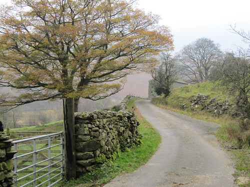
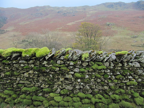
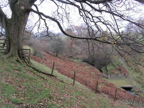
Climb Parker Road; at top, through gate (653446; arrow, fingerpost/FP). On across fields; at end of 3rd field (658448), left downhill with fence on right (FP, ‘Ringmore’). Follow YAs, crossing lane at 656453, to Ringmore. At road, ahead to T-junction by church (653460). Right, then left up side of church. In 150m, left through kissing gate (653461; ‘Kingston’ FP). Diagonally right across field and through gate; follow YAs through gates and fields, turning left (650463) to descend to stream in valley. Bear right (648463) along stream, crossing it at ruined Noddonmill (649465); on (YA) along left bank of stream, into wood (very muddy!). In ¼ mile, steeply uphill out of trees; anti-clockwise round field to far right corner (645471; FP). Right along farm track. Round left bend, and turn right (644473; FP) across field to lane (643474). Left (YA) for 50m; right (FP) and follow YAs along field edges and through woodland to road (637476). Right to T-junction in Kingston (636477); right, then left to Dolphin Inn.

NB – Online map, more walks: www.christophersomerville.co.uk. Click on Facebook “Like” link to share this walk with Facebook friends.
Lunch: Pilchard Inn, Burgh Island (01548-810514; soup and baguettes only; if marooned by high tide, return ashore on Sea Tractor – £2– check times/tides in advance); Journey’s End Inn, Ringmore (01548-810205).
Accommodation: Dolphin Inn, Kingston (01548-810314); low beams, fires, good cheer – a community hub.
More info: Totnes TIC (01803-863168); www.visitdevon.co.uk
www.ramblers.org.uk www.satmap.com www.LogMyTrip.co.uk

 Posted by at 04:09
Jan 282012
 

It’s not often that I have the pleasure of a weekend’s walking with my London-dwelling daughter Ruth.
First published in: The Times Click here to view a map for this walk in a new window
picture picture picture picture picture picture picture picture
Facebook Link:
We’d fixed our sights on Shropshire and the Caradoc Hills, and today was exactly the kind of bright day we’d been hoping for, with a buffeting wind sending cloud shadows and floods of sunlight chasing across the land.

Climbing the steep slope to Three Fingers Rock from the secret valley under Helmeth Hill was all sweat and effort, but once we’d got up there it was as though we had been lent the keys of Heaven. How else to describe the pure exhilaration of this moment when the view and the wind burst on you in a single instant? We scrambled up to perch on the rocky Fingers and gaze round, gasping.

The ancient volcanic upthrust of the Caradoc Hills with its naked rock outcrops stretches north like a recumbent dinosaur, the double-humped back of Caer Caradoc and Little Caradoc dropping to a low neck before rising again northward into the long domed head of The Lawley. A mile to the west rolls the great rounded whaleback of the Long Mynd, and squeezed between them lies Church Stretton, Shropshire’s own alpine village. Up on the breezy spine of the Caradocs you feel you could lob a pebble straight down the chimney of Dudgeley Mill a thousand feet below.

We strode north on the short mossy turf of the ridge. Near the summit of Caer Caradoc the marbled wall of a volcanic dyke merged with the ramparts of an Iron Age hill fort, fabled scene of the last stand of Prince Caradoc or Caractacus against the all-conquering Romans.

A last linger over the immense view – the roll of the Long Mynd, the sharp cone of the Wrekin rising out of the Shropshire plains, The Lawley a mere hummock in the foreground – and we were bowling downhill over Little Caradoc. The homeward path was a tangled and a squelchy one by lost orchards, abandoned coppice groves and the mossy yard of tumbledown Hill House where abandoned dishes lay among wind-tumbled roof tiles. A climb over the bracken-smothered common of Hope Bowdler Hill among witchily twisted elder trees, and a descent to Hope Bowdler with the Shropshire fields and woods spread out for contemplation at our feet.

Start & finish: St Andrew’s Church, Hope Bowdler, near Church Stretton, SY6 7EN (OS ref SO 476924)
Getting there: Train to Church Stretton (1½ miles – www.thetrainline.com; www.railcard.co.uk). Road: A49 to Church Stretton; B4371 to Hope Bowdler. Park (neatly, please!) near church.

Walk (6 miles, hard grade, OS Explorer 217): Right along B4371; in 100m, left up driveway (475925; yellow arrow/YA). In 30m, bear left (‘Church Stretton, Gaerstones’) on path under trees and through fields for ⅔ mile, to kissing gate on left onto B4371 (468932). Right for 40m; right up farm track (‘Hope Bowdler, Gaerstones Farm’) past Gaerstones Farm. In ⅓ mile cross stile (472937; blue/orange arrow); in 50m, left over stile (YA), left along fence, then down track through wood for ⅓ mile. At bottom, right along track (471943). In 50m, bear left up green track; immediately sharp left, and straight up steep slope, crossing kissing gate (471944) to reach Three Fingers Rock (471947). On along spine of hills for ⅔ mile to Caer Caradoc summit (478954).

Steeply down, on over Little Caradoc (481960) and down to turn right along fence (483963). In ¼ mile, where it doglegs right and left (484960), cross stile (YA); ahead through bracken, aiming halfway down fence on far side of field, past YA post. Turn left past ruined Hill House (484957) to roadway below. Just before reaching it, turn right past ‘footpath’ post; on along grass path with hedge on right. In ¼ mile, over stile (484953; YA), and on with fence on left. At cross fence, over stile (483951; YA) and cross track, aiming towards Battle Stones rocky peak ahead. Descend with fence on left; at bottom, cross stile (484948; YA); down through trees and over stream. Up path, then over brackeny wet hillside, aiming for Battle Stones. Cross wired-up stile (485946; YA, ‘Access Land’); turn right along grass track, with hedge on right and brackeny Willstone Hill on left. In ¼ mile cross stile (481945); in 200m, sharp left at ‘Ride UK1’ post, diagonally left up hillside, aiming for rock outcrops. At saddle (482942) don’t go left, but keep ahead on grassy bridleway through bracken across Hope Bowdler Hill for 1 mile, down to B4371 in Hope Bowdler (478927). Right to church.

NB – Click on Facebook “Like” link to share this walk with Facebook friends.

Lunch: Royal Oak, Cardington SY6 7JZ (01694-771266; www.at-the-oak.com)
Accommodation: Raven Hotel, Much Wenlock TF13 6EN (01952-727251; www.ravenhotel.com) – comfortable, friendly hotel in the heart of walking country
More info: Shrewsbury TIC (01743-281200); www.shropshiretourism.co.uk

Walking With Offa: 12 walks with pubs in Shropshire AONB. Info/booklets – 01588-674095;
www.shropshirewalking.co.uk/walking-with-offa; Twitter @ShropHillsAONB
www.ramblers.org.uk www.satmap.com www.LogMyTrip.co.uk

 Posted by at 03:33
Jan 212012
 

The world has changed its bearings a bit since JMW Turner’s day, but the artist’s wonderful smeary 1828 painting of Chichester Canal records a scene almost unchanged in nearly two centuries.First published in: The Times Click here to view a map for this walk in a new window
picture picture picture picture picture picture picture picture
Facebook Link:
Turner depicts the setting sun about to touch the western horizon, a fabulous orb providing a dreamy, lemon-yellow backlight for Chichester Cathedral’s landmark spire. A spectral schooner, black and skeletal, lies anchored on the newly-completed canal, a broad silver highway linking sea to city.

It was Turner light today, wintry and indistinct, as we set out from Chichester, seawards along the canal into the flatlands of the Selsey peninsula. We strolled slowly, at first against the tide of Selsey’s commuters jogging and cycling along the towpath towards the city, then in backwaters of post-rush-hour calm. A grey heron stood stock still among the reeds, allowing us to inch forward to within touching distance before it shook its umbrella wings open with a clap and hauled heavily off upstream.

A century has passed since the last barge brought goods to Chichester up the canal. The waterway lies quiet now, a haunt of solitary fishermen intent on their long roach poles. A sharp right-angle bend at Hunston bridge where Turner perched to make his painting, and the canal made purposefully west through low-lying pastures and ploughlands towards the convoluted shores of Chichester Harbour. This muddy, meandering inland sea has many snaking creeks and widely separated peninsulas; silting and land reclamation had choked off the channel that led to Chichester long before the canal was cut as a remedy.

Down in Chichester Marina, boats with aspirational names lay snugged down for winter: Glowing Jade, One Life, Day Dreamer, Flight of Fancy. Between the white walls of the yachts a pair of young Swallows (or Amazons) scudded round in a rubber dinghy. We turned inland, walking the muddy shore path through Salterns Copse. The name stands as a memorial to the salt-making industry that flourished here in the 18th century. The shallow salterns – manmade pools with clay bottoms – held seawater, reduced to brine by the sun, then boiled and dredged for the precious salt crystals. The high cost of coal, taxes and transport put an end to the salterns just before the opening of the Chichester Canal, which might have saved them.

Halyards chinked in the morning breeze, and black-backed gulls screeched like fishwives over their tideline pickings. A quick sandwich in the dappled river light of the dark-panelled bar in the Crown & Anchor at Dell Quay, and we followed the winding Fishbourne Channel towards the distant line of the downs, with Chichester spire pricking the low grey sky away in the east.

Start: Chichester station, Chichester PO19 8DL (OS ref SU 859043)
Finish: Fishbourne station (835050)
Getting there: Train (www.thetrainline.com; www.railcard.co.uk) to Chichester. Road: A27 from Southampton or Brighton
Walk (7 miles, easy grade, OS Explorer 120): From Chichester station head out of town along A286. In 100m, left (‘Chichester Canal’); cross canal (859041) and follow towpath for 1¼ miles to Poyntz Bridge at Hunston (865023). Follow path to road; right; in 50 m, right again along left bank of canal. In ⅔ mile keep ahead at Crosbie Bridge (854019); in another mile at Cutfield Bridge (842013), right across canal; left along road on right bank to Chichester Marina. Right here along Salterns Way footpath (835010, fingerpost), keeping marina on left to reach open water (829014). Right (fingerpost); immediately left on permissive path through Salterns Copse and on along harbour edge to Dell Quay Road. Left to Crown & Anchor PH (836028). Right along Fishbourne Channel, keeping close to shore. After nearly 1 mile cross sluice to 3-way fingerpost (841041). Left along harbour. In 300 m, take left of 2 kissing gates; cross stream; boardwalk, then left (fingerpost) along stream. In 100 m, right past pond (838045) up Mill Lane to A259 in Fishbourne. Left for 300 m; cross road, and right up Salthill Road (835047) to Fishbourne station.

Click on Facebook “Like” link to share this walk with Facebook friends.

Lunch: Crown & Anchor, Dell Quay (log fires, wood-panelled bar, superb estuary views): 01243-781712; www.crownandanchorchichester.com)
More info: Chichester TIC (01243-775888);
www.ramblers.org.uk www.satmap.com www.LogMyTrip.co.uk

 Posted by at 02:55
Jan 142012
 

Suffolk is the land of beautiful parish churches, par excellence.
First published in: The Times Click here to view a map for this walk in a new window
picture picture picture picture picture picture picture picture
Facebook Link:
So much money was poured out by well-to-do medieval wool-masters intent on glorifying the Lord and saving their own souls (and showing the neighbours how well they were doing, a pleasing by-product of piety) that every village possesses a miniature masterpiece. Setting out on a sunny morning from Fressingfield, we stopped to admire the handsome knapped flint of the south porch of St Peter & St Paul’s Church, and the carved bench-ends within – maidens with flowing hair, priests and beasts, their faces hacked off by Puritan zealots, but their intrinsic beauty complete.

We walked out into one of those wide, flat-seeming, entirely agricultural Suffolk landscapes whose subtler curves hide shallow valleys. Farm and barn roofs made red squares against the dark blocks of copses, under a sky of fat silver clouds lumbering their way across the blue. The handsome old houses of Viponds Farm and Willow Farm faced their ploughlands square-on. But neighbouring Church Farm, extant on the map, had vanished under the stiff Suffolk clay as though it had never been.

Weybread’s Church of St Andrew with its cylindrical Saxon tower boasted wonderful carved corbels of angels, lions and a leafy-faced Green Man. South of Weybread the landscape changed abruptly from wide open arable fields to steep, intimate grazing valleys, cut with streams, their oaks full of the sleepy cawing of rooks. Near Syleham Hall we leaned on a gate, munching bread and cheese, speculating on what a land of milk and honey this must have been in medieval times with its castles and halls, moats and farms, priories and abbeys and marvellous new churches.

It was the De La Poles, Earls of Suffolk, kinsfolk and friends of the Plantagenet kings, who built Wingfield’s gorgeous church, a stately ship of flint that today dominates a tiny hamlet – the De La Pole Arms, a couple of cottages, and a 14th-century college for priests that stands beside the church in disguise as a Georgian farmhouse. Inside the church De La Poles and Wingfields lie in effigy, exquisitely carved, their weathered old faces full of character.

From tiny Wingfield we joined the cornfield paths once more, making east for Fressingfield. The sun came out, putting a pale dazzle on the fields and spotlighting the scarlet necklaces of bryony berries strewn with such careless grandeur by nature across the skeletal winter hedges.

Start: Fressingfield village car park, near Harleston, Suffolk IP21 (OS ref TM 263773)

Getting there: Bus – Sat only, but convenient times for the walk. Service 40 Diss – Norwich (01379-647300, www.simonds.co.uk).
Road – A143 to Harleston, B1116 to Fressingfield.

WALK (8½ miles, easy, OS Explorer 230):
Leave car park beside hooped barrier; turn left to bollards, right to road opposite church. Left to T-junction; right (‘Diss, Wingfield’) past shop. In 250 m, right (256773) down hedged path immediately after entrance to Post Mill Lane. Follow field edge (yellow arrows/YAs) with hedge on right into valley bottom, across footbridge (251778) and up following field edge. Near end of field, right through hedge (249781, fingerpost, YA), diagonally left across field to far left corner, then through hedge gap to cross Dale Road (248784). On with hedge on right (fingerpost). In 150 m, ignore YA pointing right; continue, to cross next field and on down track for 1 mile to Weybread Church (241801).

From church return down track for 200 m; right (242799, fingerpost) over stile. Across field, through gate and shank of woodland; across footbridge, on and over stile (238798). Up field edge, with hedge on left) for ⅓ mile to Greengate Farm (236794). Left over stile, right up drive to road (233793). Left; in 100 m, just before Boundary Cottage, right across footbridge and stile, and on (fingerpost). Aim slightly left for electricity pole; bear left here, following poles to hedge and on across 2 fields to cross road (231786). Cross stile and on (‘Waveney Valley Way’). In 2nd field, YA points you right (230781); at field corner, left (229781, YA) and on with hedge right for ½ mile to road at Goulder’s Farm (229772). Down Church Road to Wingfield Church, College and De La Pole Arms PH.

Opposite pub, left (230768) through churchyard, then tunnel of trees; on along field edge. At end of field bear left (232768) and on along embankment. In 300 m go through hedge (234770); right down field edge, left (YA) on fenced path. In 500 m, at next hedge on left (239772), go through it and turn left with hedge on left. Walk clockwise round edge of this big field (YA at top) towards Abbey Farm. Beside gazebo, left (239776, fingerpost) into orchard. Dogleg right and left, through wicket gate and on through 2 paddocks (stiles). In field beyond, aim diagonally left to stile (240778); don’t cross it, but turn right across field to stile (241777, fingerpost) onto road. Left for 100 m, before left bend, right through hedge (fingerpost). On over field, into dip, over footbridge (245776), up hedge, through shank of woodland (247774). On over fields to road (250773); left into Fressingfield.

Click on Facebook “Like” link to share this walk with Facebook friends.

LUNCH: Fox & Goose, Fressingfield (01379-586247; www.foxandgoose.net; NB closed Mondays); Swan Inn, Fressingfield (01379-586280; www.fressingfieldswan.co.uk); De La Pole Arms, Wingfield (01379-384545; www.delapolearmswingfield.co.uk) – three cosy, friendly pubs.

Try this website for further walks in Suffolk: https://walksinsuffolk.wordpress.com

INFORMATION: Southwold TIC (01502-724729; www.visitsuffolk.com)
www.ramblers.org.uk www.satmap.com www.LogMyTrip.co.uk

 Posted by at 01:01
Jan 072012
 

Shirenewton sits pretty on its low ridge, a well-cared-for village of flower gardens and neat stone houses.
First published in: The Times Click here to view a map for this walk in a new window
picture picture picture picture picture picture picture picture
Facebook Link:
Why such a small South Wales borders settlement on the road to nowhere in particular should be hemmed in by four pubs is a matter for conjecture, but here in the land of songful devotion a thirsty walker can only hymn the Lord for His munificence.

The children of Shirenewton and neighbouring Mynydd-bach were squealing fit to burst in their schoolyard as we set out into the tight, tumbled countryside of green hillsides and wooded valleys. Looking back from the heights of Itton Common, we found the prospect had broadened to lay the Severn Estuary open to view – the stork-like white gateway piers of the Old Bridge, a leaden gleam from the river, and the long line of the north Somerset hills beyond.

It was one of those steamy days when the rain threatens, but never definitely arrives. We could see a faint gauze of rain rippling up the estuary, obscuring the English shore. The faintest of sprinkles came to us on the wind, along with the barking of a couple of collie dogs and the fruitless commands of their distant owner. They circled us, fulfilling the genetic imperative of sheepdogs as they tried to herd us where we didn’t want to go. ‘Ah, leave ‘em – stupid sheep – up on their hind legs, eh? – what’ll they think of next?’ yapped the collies to each other as their master hauled them away with an apologetic grin.

Between the plough rows of the fields, little round buttons of fungi punched up pale caps crazed across with dark zigzag cracks. Down in the lanes near Coetgae Wood the hedges were thick with fruit – elderberries in dangling clusters turning from green to black, scarlet hips and crimson haws, blackberries green, red and indigo on the one stalk, and necklaces of deep orange bryony berries as plump and tempting as a witch’s redcurrants. The open-handedness of nature, so casually stringing the countryside with wonderful colours, shapes, and means of sustenance for winter-bound creatures, struck home for the ten thousandth time.

There must be a fabulous gardener at Little Pant-y-cosyn on the way back to Shirenewton. The cottage flowerbeds were still bright with late-flowering geraniums. From the turn of the drive we looked back at the parent farmhouse of Pant-y-cosyn, three-storeyed and many-windowed, a house built for farm servants and big families back when Welsh Border farms were self-contained communities. A few steps more and we were staring down across the twin bridges of the Severn, over into rainy England, another country.

Start & finish: Tredegar Arms, Shirenewton, Monmouthshire NP16 6RQ (OS ref ST 479936)

Getting there: Bus – Service 63 (Chepstow-Cwmbran) to Shirenewton Road Junction
Road – M4; M48 Jct 2; A466 (‘Chepstow’); in 1 ¾ miles, left (B4235) to Shirenewton

WALK (6 ½ miles, moderate, OS Explorer OL14):
Leaving Tredegar Arms, right (‘Chepstow’). Pass Tan House PH and bear left downhill. In 150 m on right bend, fork left over stone stile (482938; fingerpost); cross field, aiming between houses. Over stile (yellow arrow/YA); on to cross lane (484941); left down green path (‘Chepstow Road’). Cross B4235 by Carpenter’s Arms PH (485942); on down track opposite. At bottom it curves left, but keep ahead down grass path, through gate, over stream and uphill, keeping right of Roughet’s Wood. Through gate at corner of wood (486947), through next gate and the following one, keeping trees on left. Beyond next gate, right (483952) along hedge; left at field corner to barn (485954). Diagonally left over next field to cross stile (484957, YA). Down right side of wood to cross road (481958). Footpath down 2 fields to cross stile to crossroads (479960) at Rhyd-y-fedw Green.

Go over, up lane past Pyotts Cottage and on for ½ mile past Coetgae Wood. 250 m past wood, left (471964; fingerpost) down Coed-llifos Farm drive. In 100 m, right along plantation edge. In 100 m pass barn on right (469965). Don’t go left or right here, but aim ahead down rubbly slope to tarmac lane with barns on left. Follow lane to right. Keep right of house, through gate; down field slope, through gate (467963); down next field, into wood. Across footbridge (466961), up path, over gate (wired up); up field slope to far right corner; left down grassy lane, through Pant-y-cosyn farmhouse gate (465959). Ahead between house and shed; on up drive for ½ mile to cross B4235 (466952).

Up bridleway opposite (fingerpost) to T-junction (466949); left past Marls Farm to road (464946). Left for 100 m, right across mouth of side road (‘Earlswood’); over stile (fingerpost). Down field, over stile; left over stile into lane (463944). Right past Upper Argoed Farm. At crossroads (462943), hairpin left (bridleway sign). In 100 m, right over stile fingerpost). Down field slope past lone tree; through gate immediately below beside another tree (463940). Cross dirt track; keep ahead up field slope, bisecting field, to top corner (left of a gate); bear left through neck of woodland (463939). Through gate; cross field to gate on skyline (464937); right along gravelled lane (not sharp right along footpath!). In 100 m lane bends right; keep ahead here on grassy green lane for ⅓ mile, down to road (469932). Left to junction opposite golf clubhouse (474934); left to Shirenewton.

NB: A walk for those who can find their way confidently with map/compass/GPS. Detailed directions (essential!), online map, more walks: www.christophersomerville.co.uk

Lunch: Tredegar Arms, Shirenewton (01291-641274; www.thetredegararms.co.uk)

Information: Chepstow TIC (01291-623772);
Shirenewton Community Council: http://www.shirenewtoncc.org.uk
www.ramblers.org.uk www.satmap.com www.LogMyTrip.co.uk

 Posted by at 17:14
Dec 242011
 

In theory you might find a prettier and cosier spot than Castle Combe as a starting point for a cold winter day’s walk, but in practice? No chance.
First published in: The Times Click here to view a map for this walk in a new window
picture picture picture picture picture picture picture picture
Facebook Link:
So I informed myself, anyway, as sloth fought with sense on the doorstep of the warm and cheery Castle Inn. Once out under the blue Wiltshire sky, wandering among the gables and tall chimneys, mullioned windows and Cotswold stone roofs of medieval cottages and woolmasters’ fine houses, everything was just perfect. The sun struck gleams from the creamy oolitic walls, and sparkled in the ripples of the By Brook as it gurgled under miniature bridges along the village street.

I batted my cold hands together and followed the Macmillan Way down the valley, walking between whitethorn hedges where redwings were stripping the berries. The woods were full of dark brown bracket fungi with white frilly edges, like Belgian chocolates scattered prematurely by a careless Father Christmas. A grove of tall old beeches stood in their own crisp litter, their roots gripping the slope like arthritic fingers, the sun painting the smooth trunks in silver verticals.

Two men were burning tree cuttings in a pall of blue smoke. ‘Just waiting for the fire to die down so we can cook a bit of breakfast,’ one said. ‘Yeah, proper smoky bacon,’ added his mate with dreamy relish.

A snarl of speeding cars on the main road at Ford, and then the green rutted lane of the Old Coach Road where express four-in-hand stagecoaches once jolted from Bath to Chippenham at 8 miles an hour. Today? One girl walking her dog, a couple of rabbits, and a millennium of ghostly travellers at my elbow.

The high-perched stone houses of North Wraxall looked down from their ridge as I followed a lane that crossed the Romans’ Fosse Way high road and slipped over into the valley of the Broadmead Brook. A muddy old bridleway led back east toward Castle Combe beside the twisting brook, past a low clapper bridge whose big decking slabs were supported on sturdy, moss-jacketed piers. Yellow-streaked siskins flocked in the alders, chittering as they picked at the seed cones, and the dipping sun sent a few last bars of silver slanting across the water from which an evening steam was already rising.

Start & finish: Castle Inn, Castle Combe, Wilts SN14 7HN (OS ref ST 842772)
Getting there: Bus 35 (www.wiltshire.gov.uk) from Chippenham. Road: M4 (Jct 18); signed from B4039 to village car park.

Walk (7½ miles, moderate grade, OS Explorer 156): From Castle Inn continue down village street. In 300m pass South Cottage; left over footbridge (841768); right, and follow Macmillan Way (MW arrows) along east bank of By Brook for 1 mile to mill at Long Dean. Here bear right on bridleway (851756; MW, ‘Ford’), ascending for 300m to go through gate. In 200m, left over stile (846754; MW) on hillside path to stile into road (845750). Left to A420 (843748). Right through Ford; past church, right (841749) up Old Coach Road. Where tarmac ends (838751), ahead for 1 mile to road (822747). Right through North Wraxall. Pass church; right up road (818750; ‘Castle Combe’). In ⅓ mile, below power lines, left over stile (817757; fingerpost, yellow arrow/YA)’ follow YAs across 2 roads and over fields for ¾ mile to road by house (812770). Bear right here (fingerpost), along bridleway beside wood, to a road (813771). Right; in 150m fork left (fingerpost) along bridleway through Broadmead Brook valley. In ½ mile, at road (823769), left for 100m, then right (bridleway fingerpost). In nearly ½ mile, beside brook, go through gate (829773); pass (but don’t cross) clapper bridge; in 30m, right over stile (YA); on beside brook for ¼ mile to road at Nettleton Mill (833775). Right through tall iron gate; on to reach golf course. Right along concrete roadway; left across bridge (838776); right, and follow ‘public footpath’ signs, then a wall into Castle Combe.
NB – Online map, more walks: www.christophersomerville.co.uk. Click on Facebook “Like” link to share this walk with Facebook friends.

Lunch: Castle Inn, Castle Combe (rambling old inn of nooks & crannies): 01249-783030; www.castle-inn.info
More info: Chippenham TIC (01249-665970); www.visitwiltshire.co.uk
www.ramblers.org.uk www.satmap.com www.LogMyTrip.co.uk

 Posted by at 01:42
Dec 172011
 

First-time guests at the hospitable Mardale Inn in Bampton should take heed – the bar game of Nails is not for the faint-hearted, nor the over-refreshed.
First published in: The Times Click here to view a map for this walk in a new window
picture picture picture picture picture picture picture picture
Facebook Link:
It involves a massive tree stump, a sharp hatchet blow, a flat-headed nail, and more hand/eye co-ordination than I usually possess. As things turned out, a lucky whack put me in the winner’s enclosure, and I was able to set out for Haweswater reservoir next morning with my fingers still attached to my person.

A quiet, still, cold winter day, with distance and incipient mist laying a milky gauze across the east Cumbrian fells, muting the fiery red of the bracken to a soft fox-brown and melding ridge-line and sky together. The long curve of Haweswater lay flat in its cleft, its water stained yellow with the reflections of larches and shirred by cats-paws of wind too slight to feel on the cheek.

A bridleway through mossy woods brought me down to Naddle Farm where the farmer, his sheepdog and shepherd’s crook all jolted up the fellside together on a spluttering quad. I crossed Naddle Beck and climbed a stony track into bare moorland. A solitary, sinewy old thorn tree stood at the crest, bent nearly double by the blasts of many hundred winters. On over an upland of sphagnum and pale moor grass, and down into narrow Swindale, with a memorable view of Swindale Beck snaking in extravagant curves through neat green inbye fields and a swathe of dun-coloured bogland under craggy red dale sides.

Swindale is a lonely dale, where farming is as hard as the landscape is beautiful. Few make their way here, even to walk – it is a little outside the Lake District’s charmed inner circle. A scatter of stone-built barn and farmhouses, a muck-spreader parked on the road verge, Swaledale ewes in the bracken and the chattering rumble of the beck over its dipper-whitened stones, all enclosed by a mighty half-moon of crags at the dale head.

I could happily have idled away the short winter afternoon under Swindale’s enchantment, but already the light was draining out of the day. A green track took me up under Trussgap Brow, then across a squelchy moor to Tailbert Farm. A teeter along the rim of Tailbert Gill’s precipitous little cleft, and I was walking the old concrete track back towards Haweswater with the rocky jaws of Swindale closing behind me.

Start and finish: Burnbanks car park, Haweswater, Cumbria postcode (OS ref NY508161).
Getting there: M6 to Jct 39; A6 through Shap; left at north end of Shap through Bampton Grange and Bampton towards Haweswater. At Naddle Gate (510162) road bends left to cross Naddle Bridge; keep ahead here (‘No Through Road’) to car park in Burnbanks (507161).

Walk: (8½ miles, moderate, OS Explorer OL5): From Burnbanks car park, follow footpath (Naddle Farm’) through woods to road (510160). Right across Naddle Bridge; follow road (‘Hawsewater Hotel) to dam for reservoir views (503155). Return along road, in 250m right up bridleway (506156; fingerpost) through woods to descend to Naddle Farm (509153). Right along house; follow Swindale’ across beck (510152); up fellside on stony track. In ½ mile at ridge, ahead through metal gate at junction of walls (516151); ahead across moor on path, aiming for peak dead ahead. Descend to road in Swindale (521142); right up dale. In ¾ mile pass a dam; in another 100m, left across Swindale Beck (515132). Forward for 100m (very wet!) to turn left up green track. Attop ahead over crossing of tracks (528140); bear right, ???? with wall below, across wet moor for ⅔ mile to corner of wall (534123).

Ahead over moor for ¼ mile to road (537144). Left to Tailbert Farm (534145). Right along back of farmhouse; through gate (yellow arrow); ahead along westrim of Tailbert Gill to meet concrete road(534152). Left for 2¼ miles to road(510159); right across Naddle Bridge; left

Click on Facebook “Like” link to share this walk with Facebook friends.

Lunch/accommodation: Mardale Inn, St Patrick’s Well, Bampton, Cumbria CA10 2RQ (01931-713244; www.mardaleinn.co.uk). Friendly inn at the heart of its community.
Information: PenrithTIC (01768-867466); www.golakes.co.uk
www.ramblers.org.uk www.satmap.com www.LogMyTrip.co.uk

 Posted by at 02:02
Dec 102011
 

The ruddy-faced man in Stockbridge High Street (flat cap stuck with fishing flies, Barbour, cord breeches, brogues, black Labrador strictly to heel) might have been posed there by Central Casting this crisp blue winter’s morning.
First published in: The Times Click here to view a map for this walk in a new window
picture picture picture picture picture picture picture picture
Facebook Link:
The long, linear Hampshire village is famous for outdoor pursuits in the surrounding countryside, most especially fishing. Stockbridge straddles the Test, England’s best trout fishing river bar none. Jane and I hung over the bridge watching the olive green fish sinuating with the water weed. Then we struck out across the roof of Houghton Down, following flinty trackways that might well predate the Romans.

Brilliant scarlet rosehips and bryony berries, blush-pink spindle, the soft bloom of unfrosted sloes, crimson haws – the thick hedges flanking the old green roads of the downs were bursting with fruit. Among the bare branches moved darting flocks of fieldfares, russet-breasted thrush cousins over from Scandinavia for the winter, busy gobbling as many berries as they could get down their handsomely spotted necks.

A quick nasty smack of the A30, and we continued our high course along the green lanes. Two horses came cantering towards us, the riders grinning as they passed, their weatherbeaten faces cracking into multiple lines like a brace of kindly sea captains. In a trackside copse a wartime pillbox crumbled silently, its cheap utility bricks scalloped by rain and wind into artistic-looking hollows.

Shuffling through drifts of beech leaves, we followed the snaking track down off the ridge into Houghton, as quiet as a chapel on Sunday. The Test gurgled and chuckled under its footbridges, a mazy system of backwaters and sidestreams spreading a net of water through the shallow valley. The sun struck late colours out of the trees along the river – crimson dogwood, acid green willow, yellow birch, vivid against the smeary pearl of a wintry sky.

At Blacklake Farm a tiny terrier, trembling with eagerness, pushed his face through the garden fence and begged us unavailingly to take him along. We turned for home along the disused Sprat & Winkle railway line, now the Test Way footpath. A final detour through the rushy acres of Common Marsh, and we were walking the black peaty banks of the Marshcourt River, with Stockbridge church spire and hot buttered teacakes in Lillie’s Bakery as twin aiming points.

Start and finish: High Street, Stockbridge, Hants SO20 6HF (OS ref SU 357351)
Getting there: Bus (www.stagecoachbus.com) – 68 (Winchester) or 78 (Salisbury). Road – A30 from Winchester or Salisbury

Walk: (7½ miles, easy, OS Explorer 131): West (Salisbury direction) along Stockbridge High Street (A30). Cross River Test; up hill; at right bend (350352), left up Roman Road. At turning circle, ahead on paved path, then green lane. In ⅔ mile, rejoin A30 (339354); ahead for 200m (take care), then left (337353, ‘Byway’) on stony roadway for 1 mile. At road (323344), left (‘Byway’) along green lane. In ¾ mile, left at bench (322331) on green lane down to Houghton. (NB To reach Boot Inn, left on path by recycling bins).

At road, right (342321); in 300m, left (341319; fingerpost, ‘Monarch’s Way’). Cross River Test and pass Blacklake Farm. In another ⅓ mile, left (350316) along Test Way. In 1⅓ miles, left through gate (354336; NT sign); bear right across Common Marsh beside Marshcourt River. At north end of Common Marsh, through gate (355347); path to Stockbridge.

Lunch: Boot Inn, Houghton (01794-388310)
Tea: Lillie’s Bakery, Stockbridge (01264-810754)

Accommodation: Three Cups Hotel, Stockbridge, Hants SO20 6HB (01264-810527; www.the3cups.co.uk) – beamy, low-ceilinged, warm, friendly.

Information: Winchester TIC (01962-840500); www.visit-hampshire.co.uk
www.ramblers.org.uk www.satmap.com www.LogMyTrip.co.uk

 Posted by at 01:02
Dec 032011
 

When it comes to Sherwood Forest, there’s only one name on everyone’s mind. Who cares if England’s philanthropic hero really existed or not?
First published in: The Times Click here to view a map for this walk in a new window
picture picture picture picture picture picture picture picture
Facebook Link:
Robbing the rich, helping the poor, tossing his friends into streams and whacking his foes into submission – Robin Hood (or Wood, or Locksley, or Fitzooth) is the nearest we’ve got to a national saint, better than that milk-and-water St George by a long chalk. We all love jolly, carefree Robin, and we all want to be on his team, frolicking in the greenwood with the Merrie Men.

A select band of Times readers set off from Sherwood Forest’s Visitor Centre, the beauty of the autumnal forest and the gentle pace of the walk soon loosening all tongues. Karen and Lynn had come all the way from Bedford, their first time in Sherwood. ‘Absolutely beautiful,’ was the verdict. ‘We weren’t expecting it to be so open – you think of a forest as trees close all round, don’t you?’

It’s true – our psyches have been stocked since childhood with Grimm’s fairy tale forests, deep, dark and dangerous. Yet the thousand acres that remain of the old Sherwood Forest are more of a mosaic – open ground, broad grassy, rides, farmland, clearings, patches of heath and wetland.

Sherwood’s famous veteran oaks really are huge; bulbous old giants with troll faces and knotted limbs, blasted, cracked, hollowed, yet still defiantly sprouting leaves. It’s reckoned each one hosts more wildlife than a whole forest of commercial conifers. Under them we found Granny’s Cakes generously spilled – fly agaric fungi, deadly and beautiful in glossy scarlet sprinkled with sugary white.

‘Lincoln Green? They made the dye with a mixture of woad and weld,’ quoth our walk leader David Wenk, adding modestly ‘ – or so I’m told. Now, a bit of a historic thrill up ahead!’ It was a memorial cross marking the burial place of the headless corpse of King Edwin of Northumbria, after his death in battle in 633AD – a strange image on this peaceful morning.

We ascended the gentle dome of Hanger Hill, known to Robin Hood and his contemporaries as Thyngehoe – perhaps a Norse ‘thing’ or meeting mound, surmised David. With the wide views, and our voices carrying far down the slope, we could well believe it.

A slug of hot chocolate and a nibble of lebkuchen and we went on under silver birches whose turning leaves, acid green and yellow, glowed against the sombre Scots pines. Tiny tots came pelting past, absorbed in their own greenwood fantasies.

Nearing the Visitor Centre once more, we came by the Major Oak, a salutary presence to end the walk. Old enough to have sheltered Robin Hood himself, the ancient oak with its craggy rind and soft heart leans on wooden crutches like a veteran of a thousand-year war.

Start and finish: Sherwood Forest Visitor Centre, Edwinstowe, Notts NG21 9HN (OS ref SK 627677)

Getting there: Rail – (www.trainline.com; www.railcard.co.uk) to Mansfield (7 miles). Bus – 10A from Mansfield. Road – M1 Jct 28; A38 to Sutton-in-Ashfield; A 6075 to Edwinstowe; B6034 to Sherwood Forest Visitor Centre. Car park £3

Walk (6 miles, easy, OS Explorer 270): From Visitor Centre follow Greenwood Walk and Birklands Ramble (signed) for ⅓ mile. Just beyond ‘Major Oak/Fairground’ signs, keep ahead (621676, blue arrow) on bridleway (‘Clipstone’ fingerpost). In ¾ mile pass path on left (‘Edwinstowe’). In another 300m, at T-junction (606676), left along wide ride. Right beside A6075; in 250m, bear right away from road on Robin Hood Way/RHW (604663, green arrow). In ⅓ mile, fork right (600665, RHW). In 600m pass memorial cross on left (593666). In another 300m, at corner of forest, cross track; ahead for 100m, then right at junction (591667; white arrow on tree; RHW).

In 1 mile at T-junction (599681) dogleg left, then right off RHW, on track heading NNE past Thyngehoe (summit of Hanger Hill – unmarked). In 250m track forks (600684); don’t go right, but keep ahead along ride. In 600m cross RHW (606686); ahead through barrier. (‘Sherwood Forest, Edwinstowe YHA, Dukeries Trail/DT’). Fork immediately right on bridleway (horseshoe signs). In ¾ mile at junction, left (617679, DT). Path forks immediately; don’t go right up slope, but keep ahead to Major Oak (621679); RHW to Visitor Centre.

Lunch, information and green peaked hats: Sherwood Forest Information Centre (01623-823202; www.nottinghamshire.gov.uk/sherwoodforestcp)
Accommodation: Forest Lodge Hotel, Edwinstowe, Notts (01623-824443; www.forestlodgehotel.co.uk
English Country Walks (David Wenk): 07932-953174; www.englishcountrywalks.com
www.LogMyTrip.co.uk www.ramblers.org.uk www.satmap.com

 Posted by at 03:44
Nov 262011
 

Llanarmon Dyffryn Ceiriog – The little village with the big name lies in a cleft of the Berwyn foothills, a corner of north-east Wales not exactly unknown, but out of the main tourist stream by quite a long way.
First published in: The Times Click here to view a map for this walk in a new window

picture picture picture picture picture picture picture picture

Facebook Link:

Leaving The Hand Inn, we found a sky of luminescent silver patches and grey clouds drifting over Llanarmon Dyffryn Ceiriog. The little village with the big name lies in a cleft of the Berwyn foothills, a corner of north-east Wales not exactly unknown, but out of the main tourist stream by quite a long way. The valley of Afon Ceiriog winds between bulgy slopes of sheep pasture and high moor tops, with forested ridges marching against the sky – wonderful walking country, especially on a bright and blustery day such as this.

They would have flooded the valley in 1923, drowning Llanarmon DC and its neighbouring villages, if ex-Prime Minister Lloyd George hadn’t headed a massive Welsh protest against a scheme the locals saw as being for the benefit of foreigners, specifically the brewers of Warrington. ‘The English are taking the Water out of Wales and turning it into Ales,’ was the clunky, but effective, slogan that helped kill off the scheme. We gave thanks for that as we halted at a gateway in the long lane leading up to the hilltops and looked down over Tregeiriog village nestling deep and dry at the foot of a wooded cleft, picturesque Wales encapsulated in one perfect view.

Harebells trembled in royal blue clumps, yarrow’s tiny white blooms massed in wide flowerheads. A clutch of young pheasants scuttered ahead, wheezing plaintively. Up near the ridge we turned west into the wind along the Upper Ceiriog Way, a rutted and puddle old track surfing the uplands. Ahead stood the crests of the Berwyn Hills, a sombre brown wave breaking from the west in a wall of 700 ft cliffs revealing themselves slowly as we advanced – Moel Sych and Cadair Bronwen flanking Cadair Berwyn, the summit of the range at 2,723 ft (830 m). The last time I was up there it had been in a rainy mist so thick I’d had to turn back. Today the cloud army was marching north-east, well clear of the peaks.

We stopped in a sheltered hollow for a cup of tea, and then went down the old hill track to the farm at Cyrchynan-Uchaf. House and barns lie sunk into the head of the valley in a very lonely spot. Two chained dogs barked us in and out, their sore-throat complaining soon overlain by the bleating of sheep as we topped the hill beyond and looked down on Llanarmon DC once more.

Start & finish: The Hand Inn, Llanarmon Dyffryn Ceiriog, Clwyd LL20 7LF (OS ref SJ157328)

Getting there: Bus: Service 60, 64, 65 from Oswestry and Chirk (01978-266166)
Road: A5, A483 to Oswestry, B4679 to Glyn Ceiriog, B4500 to Llanarmon DC

WALK (6 miles, moderate, OS Explorer 255):
From The Hand, right along road (‘Oswestry’). By plantation on right, fork left through gate (161326, yellow arrow/YA). Track past stone building (YA). Through gate, across hillside, over stile, across field and through gate (165328). Ignore ‘footpath closed’ notice; right over stile, left along fence above Ty’n-y-fedw. At gate (166329) white/red arrow (WRA) points right. Don’t go through gate; keep fence on your left, into and along lower edge of wood (WRA), then across field to gate (176335). Right up lane. In 100 m, tarmac forks left; but keep ahead up stony lane. In ½ mile cross road (171327); on up lane. Cross stream with wood on left (172323), in 100 m, right along broad rutted Upper Ceiriog Way track for 2 miles to road (146309). Left; over stile by gate; diagonally left over field to gate. Boggy stretch joins track curving right along hillside. Through gate (144310); descend track to Cyrchynan-Uchaf farm (145314). Bear right across road-head, up through farmyard (vociferous but chained dogs!); right round barn, through gate (145315), up cart track. It rises through gates (follow YAs) to join another track at hill crest (151320). Follow YAs down hill slope. At bottom, through left-hand of 2 gates (155323), down green lane to road. Left to Llanarmon DC.

NB: No dogs – sheep country. Online map, more walks: www.christophersomerville.co.uk

Lunch and accommodation: The Hand Inn, Llanarmon DC (01691-600666; www.thehandhotel.co.uk) – a warm, friendly inn, very helpful to walkers, with own walks booklet for sale.

Information: Llangollen TIC (01978-860828); www.visitwales.co.uk

www.ramblers.org.uk www.satmap.com www.LogMyTrip.co.uk

 Posted by at 01:55