Nov 192011
 

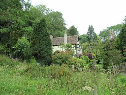
A misty morning over Hampshire, with pigeons throatily cooing in the oaks at Totford. Fine breakfast smells and a cheerful clatter of dishes came from the Woolpack Inn’s steamy kitchen.
First published in: The Times Click here to view a map for this walk in a new window
picture picture picture picture picture picture picture picture
Facebook Link:
A green lane hung with haws and sloes led us away east. The early sun had not yet got a grip on the countryside; the flinty chalk of the track was slippery with dew, and the elder and spindle leaves along the lane trembled with coruscating droplets, winking a million messages from the hedges. Everything lay still, a silence broken by bursts of wren chatter and the swish of our boots through wet grass and docks.

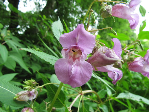
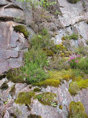
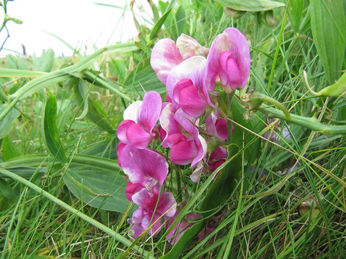
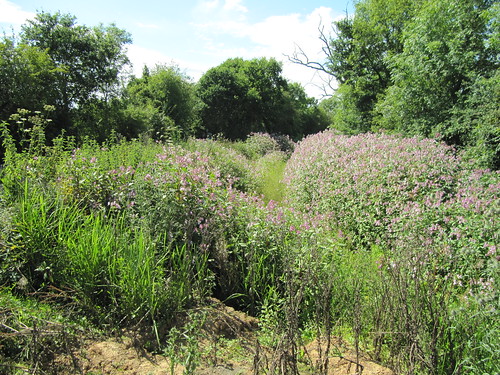
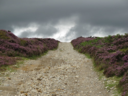
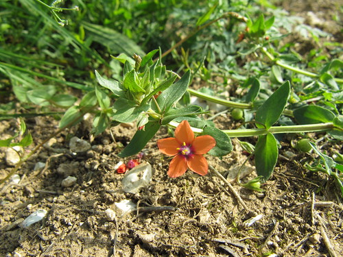
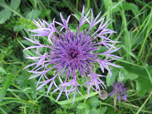
The Three Castles Path, entirely unwaymarked but clear to follow on map and ground, wound through woods of sycamore and yew, then out into a broad landscape full of the kind of flowers – brilliant red pheasant’s eye, dusky purple fumitory, restharrow, corncockle, scarlet pimpernel – that I thought had been long since blasted out of the cornfields by agrichemicals.

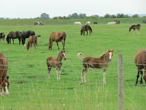
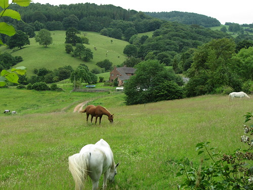
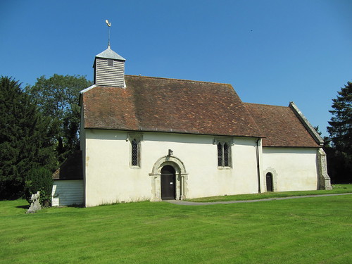
By Barton Copse two young girls on ponies came riding by, straight-backed and serious-faced, with a polite ‘Hello’ apiece. What a countryside these lucky children can wander safely through, all ancient wood pastures, pheasant coverts and well signposted bridleways. Someone obviously looks after it all very carefully, as with the lovely little Church of St James at Upper Wield with its Romanesque south door, traces of medieval wall paintings and elaborate marble tomb of Sir William Waloppe Esq (d. 1617), Marshal of the Town of Calais, who ‘served against ye Moores for Ye Kinge of Portingal’.

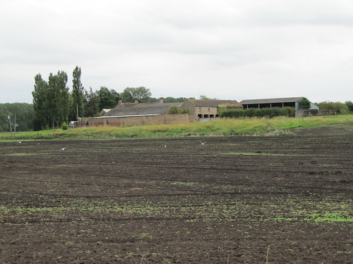
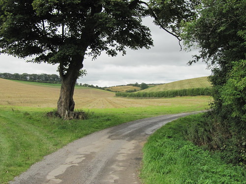
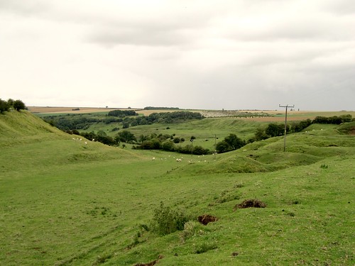
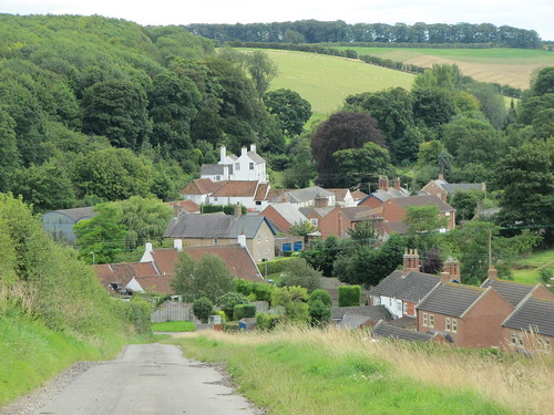
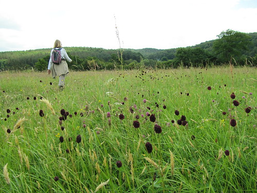
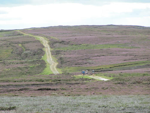
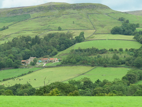
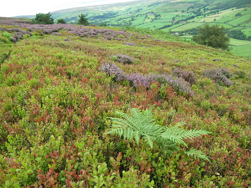
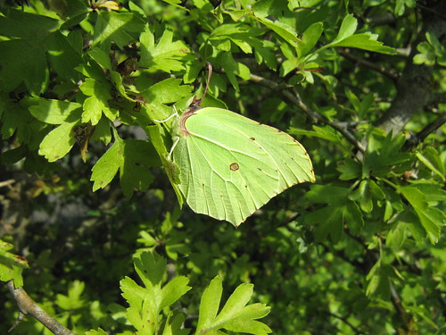
What place on earth could be calmer or more beautiful than Upper Wield on a sunny morning? Horse paddocks and barley fields took us away, down uncultivated fields where the wild flowers had been left to riot, then onto the great old green highway called the Ox Drove. Hedges of blackthorn and elder thirty feet thick, red admiral and peacock butterflies on the stones, and a green tunnel of trees to funnel us back through the fields to Totford.

Start & finish: Woolpack Inn, Totford, Alresford, Hants SO24 9TJ (OS ref SU571380).

Getting there: M3 Jct 7; A33 ‘Winchester’; in 5 miles, left via East Stratton and past Northington (signed) to Totford on B3046. If parking at Woolpack, please ask permission, and give pub your custom!

Walk: (9 miles, easy, OS Explorer 132): Restricted Byway (RB) beside Woolpack (‘Wayfarers Walk’/WW). In ¾ mile, beside barn, right (581384; WW) up farm road. At top, dogleg right and left round bend; in 20 m, left (582376; RB) through wood. Left at road (591371). In ½ mile, right (595377; ‘Godsfield Farm’). In 250 m, left (597375, RB) for 2¼ miles, passing Godsfield Copse, then Armsworth Hill Farm, Wield Wood and Barton’s Copse. After 1 more field, left beside houses (628387) past church and barn; over 2 stiles (yellow arrows/YA); follow fingerposts, dogleg left and right, then ahead (stile, YA) to road (625390). Left; past Wield Wood Farm drive (621390); in 20 m, left (fingerpost in right hedge) through gate (‘WW’). Down alleyway ahead, on over stile, through windbreak (618391), over field. Through hedge (613392; fingerpost); down narrow field past Bangor Copse, ahead along field edge to YA post (609395). Through hedge; left along Ox Drove (RB). In 1 mile cross 2 roads (595388) and on; in ¾ mile, round right bend (582384) to farm road. Left past barn (RB); return to Totford.

Lunch/accommodation: Woolpack Inn, Totford (01962-734184; www.thewoolpackinn.co.uk)

Info: Winchester TIC, The Guildhall (01962-840500); www.visit-hampshire.co.uk

www.ramblers.org.uk www.satmap.com www.LogMyTrip.co.uk

 Posted by at 01:24
Nov 122011
 

The flatlands of East Yorkshire, south of Driffield around the River Hull, are really tremendously flat – former ‘carrs’ or wet lowlands, now drained and intensively farmed, but retaining the bleak and magnetically compelling atmosphere that large tracts of level wet country always seem to possess.
First published in: The Times Click here to view a map for this walk in a new window
picture picture picture picture picture picture picture picture
Facebook Link:
Nineteenth century drainage made this a fertile arable region, and 20th-century intensive agriculture reaped the rewards. Farms lie scattered across the carrs, which still obstinately continue to flood in some winters.

This superabundance of water feeds the city of Hull to the south, courtesy of Tophill Low Water Treatment Works, handsomely built with its two big reservoirs after the Second World War. The twin fleets of water at Tophill Low, and the scrub woodland and grassland that have been developed around them, make a superb resource for bird-watchers – and walkers too.

I started my walk in the Tophill Low Nature Reserve, making a leisurely circuit of the ‘O’ and ‘D’ reservoirs, ducking in and out of the hides to scan the waterfowl through binoculars – cormorants with wings akimbo, greylag geese flapping their wings in mid-preen, peewits with crests erect and wheezy complaining calls, tufted duck anchored in line astern. The waterworks gave off a strong whiff of old-fashioned industry with their cast-iron control wheels, tanks, sluices and stern admonitory labels – ‘Raw water bypass valve – must not be operated without written authorization from the Director of Operations.’

Musing on raw water, an image at once potent and sinister, I let myself out of the reserve through a gate and entered the wide, flat landscape of Watton Carrs. Fields of wheat and grass, heavy dark woods, drains, ditches and lonely farms. I passed the walled barnyard and poplar-sheltered house of Standingholme Farm, and the big battery sheds at Decoy House. Here wildfowlers once lured wild duck to the catch-net with the cries of tethered decoy birds, back when the carrs were a floody fenland and their inhabitants struggled for a hand-to-mouth living.

South to Easingwold Farm along the edges of bean and potato fields, on through thistly sheep meadows to find dozens of horses cropping the pasture around Wilfholme Landing. The River Hull sinuated north and south, a slow green flow edging the perimeter of Tophill Low Nature Reserve. I petted the soft muzzle of a chestnut mare, passed the time of day with a couple of young riders, and made my way back up a tunnel of trees where a sparrowhawk in brilliant orange, black and white flickered like a dream of beauty and wildness before me.

Start: Tophill Low Nature Reserve car park, near Driffield, E. Yorks YO25 9RH (TA073485)

Getting there: Tophill Low is signposted from A164 (Driffield-Beverley) at Watton. Follow ‘Nature Reserve’ signs to car park.

WALK (6 ½ miles, easy, OS Explorer 295):
Facing parking/permit ticket machine, go left through gate, then right round ‘D’ Reservoir. At north end (077495), right; in ¼ mile, through gate (079499, yellow arrow/YA); left over footbridge (YA), along field edge. In ⅓ m, at corner of poplar plantation, left through kissing gate (073501, YA); right along farm drive. Pass Decoy House farm (064497), in 250 m, left (fingerpost) down 3 field edges to cross road (065485). Up Easingwold Farm drive (fingerpost); over stile; bear left, then right between barn and farmhouse, over stile and on with fence on left. In 100 m fence curves gently left; in another 50 m, it turns sharp left; keep ahead here, curving right to go through gate near pylon (063478). Left along Starberry Drain. At top of slope at Wilfholme, through gate (062473); immediately left through gate (blue arrow); left along River Hull. Through gate; in 100 m, fork left at Nature Reserve sign (064473), away from river along right bank of drain. Continue for ¾ m to road (070483). Right into Tophill Low water treatment works. Right along road (brown ‘Tophill Low’ Reserve sign). Round left bend; in 100 m, by wheel on concrete plinth, right across footbridge. At ‘O’ Reservoir embankment, right (070481) to make circuit of reservoir and hides. Back on waterworks road, right to car park.

LUNCH: Picnic

ACCOMMODATION: Star Inn, Nafferton, near Driffield, YO25 4JW (01377-255548)

TOPHILL LOW NATURE RESERVE: www.yorkshirewater.com/tophill

Information: Beverley TIC, 34 Butcher Row (01482-391672); www.visithullandeastyorkshire.com
www.LogMyTrip.co.uk
www.ramblers.org.uk www.satmap.com

 Posted by at 01:42
Nov 052011


First published in: The Times Click here to view a map for this walk in a new window
picture picture picture picture picture picture picture picture
The last time I found myself at the Harbour Inn, I’d sat back in the sunny garden at noon and rejoiced as follows: (a) it was a beautiful morning, (b) there was a gorgeous walk up the River Severn in prospect, and (c) it was the first day of the rest of my life (I’d just given up teaching after ten years at the chalk face). Now here I was a load of years later, setting out once more up the hill past Arley station. Around the hanging flower-baskets wreathed a whiff of train smoke – the Severn Valley Railway’s gleaming green GWR locomotive 7812 Erlestoke Manor had just pulled out with the 10.54 for Bewdley.

Up through a grove of young ash and poplar trees, their long-stalked leaves helicoptering in the wind, and on through horse paddocks to Pound Green where a flock of sheep quietly grazed the village green. A short sharp shock of the B4194, and I was walking through the cool green shade of the Wyre Forest. Six thousand acres of this ancient hunting forest stretch west of Birmingham along the Severn and the borders of Worcestershire and Shropshire, a resource and refuge for families, mountain bikers and walkers.

Today’s cloudy sunlight lit patches of purple heather, showing where the trees had encroached on old heaths. Golden bursts of St John’s wort and the pink ‘fairy fingernails’ of centaury lined the woodland path that ran easily down to Dowles Brook. The little river rushed sparkling round its bend in the heart of the forest, a sibilant guide that carried me east to the brink of the Severn.

The broken abutments of the Wyre Forest’s own long-abandoned branch railway line rose mid-river like relics of a vanished civilization. I turned upstream and idled the three miles back to Arley and the Harbour Inn past riverbank houses and purple drifts of meadow cranesbills, looking across the river to the brambly embankment of the Severn Valley Railway. A mournful owl hoot, a clatter of wheels on the mighty cast-iron bow of Victoria Bridge, and Erlestoke Manor went thundering over the river with a flash of polished brass and an evanescent plume of smoke.

Start & finish: Harbour Inn, Arley DY12 3NF (OS ref SO765800)

Getting there: Rail: Severn Valley Railway (01299-403816; www.svr.co.uk) to Arley.
Road: A456 to Bewdley, B4194 towards Kinlet; in Buttonoak, right (‘Pound Green, Arley’). Follow ‘Arley Footbridge’ to car park beyond Harbour Inn.

WALK (7½ miles, easy, OS Explorer 218):
Up road past Arley station. On right bend, left (762795); fork right past pond, off gravel road and up bank. Take middle of 3 paths uphill between trees. At top, through metal kissing gate (761792), up field, right at top past houses to road (758788). Right for 20 m; left (fingerpost) down field to bottom right corner (755789). Over stile (yellow arrow/YA), left to road in Pound Green (755785). *Forward to B4194 (753780); left for 250 m (NB Keep to left-hand grass verge, take care!). Cross road at St Andrew’s Church (755779); right (fingerpost); follow YAs into Wyre Forest (756778). In 350 m, at 5-way meeting of tracks (758775), ignore track on left and fainter track ahead; take next one on right, a stony roadway, down towards Dowles Brook. Towards bottom, join concrete track; just before foot of slope, left (758768) on dirt track. In ¾ of a mile cross brook, in another 200 m, left through gate (772764, ‘Geopark Way’). Follow to road (777763). Right for 100m; left to River Severn. Left for 3 miles to Arley.

* NB David Pickering adds:

You can avoid the road walking from Pound Green and on the B4194 by continuing on the path just inside the forest from Pound Green (755785) to the Button Oak pub (751781), cross the B4194, then go through gate to L of pub, ahead on path for 100 yards, then L onto forest tracks which cross a small valley and meet up with your route at 758775.

Refreshments: Harbour Inn, Arley (01299-401204)

Accommodation: Menzies Stourport Manor, Stourport (01299-289955; www.menzieshotels.co.uk)

Info: Bewdley TIC (01299-404740); www.visitworcestershire.org
www.ramblers.org.uk www.satmap.com
www.LogMyTrip.co.uk

 Posted by at 01:42
Oct 222011
 

‘I award this walk,’ wrote Peter Barton in his wonderful guidebook Walking in Torridon, ‘the Golden Rose for its beauty, variability and grandeur.
First published in: The Times Click here to view a map for this walk in a new window
picture picture picture picture picture picture picture picture
Facebook Link:
I have walked widely in the Torridon region and have been to the summits of all its mountains, but I still rate this walk the loveliest of all.’

Powerful words. You could go a long way on them; all the way out to Torridon in westernmost Scotland in my case, spurred there by the promised magic of mountain, loch and wide empty country. I was lucky enough to be walking with Jim Sutherland of the Nine One Six mountain adventure company, who with his co-author Chris Lowe has updated what’s certainly the best guidebook a hillwalker in the sublime Torridon region could want. The weather might have been better (wind and rain – what’s new in west Scotland?), but at least it kept the damned midgies at bay, and it didn’t interfere with our enjoyment of the day at all.

Inveralligin village lies isolated on the north shore of Upper Loch Torridon, a sea loch under beautiful towering hills. The walk started with a mountain view of impossible majesty: the three summits of the Beinn Alligin horseshoe standing tall and formidable to the north, and across the racing whitecaps of the loch a dark uplift of ridges, corries and peaks centred on Beinn Damph. On a sunny day that prospect could easily have you trapped like a fly in a silken web; but not with half the North Sea trying to reach the Atlantic in the form of rain on a tree-shaking easterly.

We got down to the loch shore and were soon in the shelter of big beeches and limes, walking seaward with the rain at our backs. On a promontory beyond Torridon House stood a little church and a tall Celtic cross to the memory of a Victorian Laird of Torridon, Duncan Darroch. His tenants thought well of their landlord; after his death a hundred of them escorted his body over the mountains to its burial, a courtesy normally reserved for a clan chief. From the headland in the loch, more mountain heads revealed themselves: Sgurr Ruadh, the Red Peak; Beinn Liath Mhor, the Big Grey Mountain; Sgurr an Lochan Uaine, the Peak of the Green Lakelet.

Inveralligin lay beyond, a handful of white houses scattered along the shore, a tiny pier stacked with creels. There are communities even more remote than this along the coasts of western Scotland, but on this wild day we could have been well on the way to the end of the earth. A Golden Rose of a walk: Peter Barton had it just right.

Start & finish: Beinn Alligin car park, Torridon (OS ref NG 869576)

Getting there: Follow Inveralligin signs from Torridon village (on A896 between Kinlochewe and Shieldaig). Car park on left, 2½ miles west of Torridon.

Walk: (7½ miles, easy, OS Explorer 433): From car park, right along road, down to loch shore. Right along loch. In ¾ mile, fork left (870572, ‘Stables Cottage’); follow track past houses. Left in front of Stables Cottage (868573); over stile and on to pass track to church (863572). Continue to Inveralligin. Fork right by phone box; right along upper road (837579) to car park.

Refreshments: Torridon Stores Café (01445-791400) – try those amazing cakes!

Accommodation: Kinlochewe Hotel, by Achnasheen, IV22 2PA (01445-760253; www.kinlochewehotel.co.uk)

Nine One Six mountain guiding: 01520-755358; www.nineonesix.co.uk.

Walking In Torridon by Peter Barton, updated by Chris Lowe and Jim Sutherland (pub. Cicerone – www.cicerone.co.uk) – Walk EW7.

Info: www.visitscotland.com/surprise
www.ramblers.org.uk www.satmap.com
www.LogMyTrip.co.uk

 Posted by at 04:37
Oct 152011
 

A blowy day on the western shores of Lancashire, with a bruised sky of slate purple and grey over the Irish Sea and the wind driving miniature sandstorms northward up the great 20-mile beach that edges the Sefton Coast.
First published in: The Times Click here to view a map for this walk in a new window
picture picture picture picture picture picture picture picture
Facebook Link:
I was glad to be walking with the wind and sand at my back, as well as the spatters of rain that chased in from time to time.

Old friends were there to greet me down on Crosby beach – one hundred of them, naked as jaybirds, straight-faced and straight-backed, standing at attention and staring out to sea. Crosby loves its Iron Men – no-one here calls Antony Gormley’s wonderful beach installation by its official name, ‘Another Place’. Rusting and corroding at the whim of salt water and scouring sand, adorned according to locals’ fancy – a painted bikini here, a swimming hat there – each of these identical iron casts of the artist’s body now possesses its own subtly-developing individuality.

The Sefton Coast lies between the estuaries of Mersey and Ribble, a flat shore where the sea can recede a mile or more on a low tide. This enormous beach is separated from the built-up hinterland of footballers’ palaces and golf-course resorts by an unbroken line of sandhills, a fabulous place to walk sandy paths among vividly coloured plants – crinkly yellow evening primrose and yellow-horned poppy, powder-blue sea-holly with prickly leaves, pale blue stars of sea aster, thickets of wild roses and the beautiful pink bonnets of everlasting pea.

It’s a busy seascape off the coast – skeletal sea-marks, whirling wind turbines on Burbo Bank, big container ships and ferries threading Crosby Channel’s sandbanks. Off Formby Point crowds of sanderlings with snowy bellies and long black bills gathered as the sandbanks rose clear of the ebbing sea, and out over the water a swirling cloud of dunlin formed a solid black mass that swerved across the sky.

I threaded the paths of Raven Meols Hills nature reserve, adrift in a green sea of sandhills, and strode north along mile after mile of firm beach sand towards the distant blur of Southport. A last stretch among the brilliant orange berries of sea buckthorn in Ainsdale Dunes, and I made for the train at Ainsdale Station, windblown and tousled, tired and exhilarated by all that space, salt air and solitude.

Start: Waterloo station, Crosby, Lancs, L22 0NA (OS ref. SD 320980)

Finish: Ainsdale station, PR8 3JP

Getting there:
Trains from Liverpool or Southport (www.merseyrail.org)
Road: M6 Jct 26, M58, A565

WALK (14 miles, easy, OS Explorers 285, 275):
From Crosby station, left along South Road. Right beside Marina, through dunes; right (311979) along beach or promenade. In 1¾ miles at coastguard station (299005), ahead along Sefton Coastal Footpath. In 1 mile, at ‘Pebble’ Sculpture (296021) cycle track bends inland, but keep ahead along shore. At Hightown (297039) path veers inland to run beside railway line. In 1 mile path crosses River Alt (294056) and turns left; in 200 m, left at path crossroads (293058, ‘Cabin Hill, Ravenmeols’). At Cabin Hill Nature Reserve sign (287052, yellow arrow) bear right. At path crossing by wind generators, left (284055; white arrow) through dunes to shore; right for 5 miles. At railings with Ainsdale Beach noticeboard, head for yellow marker (‘Dunes Trail’). Follow white-topped posts inland (east) for 500 m; then turn left (north), following posts to Ainsdale Discovery Centre (297126). Ahead along road; right bend; over roundabout (301127); ahead (‘Shore Road’) to station.

NB: Walk can be shortened (Hightown Station 4½ miles, Formby station 8 miles)
Online map, more walks: www.christophersomerville.co.uk.

Lunch: Picnic

Ainsdale Discovery Centre: 01704-570173;
http://www.ribblecoastandwetlands.com/att_ainsdale_discovery_centre

Information:
Southport TIC (01704-533333; www.visitsouthport.com); www.seftoncoast.org.uk
www.ramblers.org.uk www.satmap.com
www.LogMyTrip.co.uk

 Posted by at 01:14
Oct 082011
 

Nothing glows like the skin of a nice ripe cider apple – unless it’s the cheeks of a nice ripe cider drinker.
First published in: The Times Click here to view a map for this walk in a new window
picture picture picture picture picture picture picture picture
Facebook Link:
You’re likely to meet your fair share of both on the Somerset Levels around this time of year, when the windfalls are lying on the ground and so are unwary samplers of the fruit of the orchard.

My friends Alan and Joy have the best of both worlds when it comes to views from their house on the ridge in Panborough village – the long green whaleback of Mendip rising on the north, and a few steps to the south a glorious prospect over the Levels, great flat grazing moors dented with old flooded peat diggings, bristly with reedbeds, their meadows divided by watery ditches known as rhynes. Down on the moors we found Dagg’s Lane Drove and walked its puddled course south over Westhay Moor in a tunnel of willows, while Megan the sheepdog went bouncing after sticks in the lush grass verges.

Centuries of peat digging have provided Westhay Moor with exactly what wild birds need – open fleets of sheltered water, wet alder woods, reedbeds to hide and nest in, seeds and insects to feed on. We were here a little too early in the afternoon to witness Westhay’s most famous spectacle, the dusk sky dance of a million wintering starlings which floats a thickening and lengthening veil of densely packed birds across half the sky. But from one of the hides we watched a mysterious large bird – not a great northern diver, not a great crested grebe – splashing and diving, lone lord of its reedy pool. A slight movement beyond a screen of alder boughs, and five well-grown cygnets with their parent swans sailed gracefully out of sight.

Turning back up Parson’s Drove, we watched a leaden block of rain marching east across the Levels, with a most brilliant rainbow stamped in a perfect arc across it. Such moments mark a walk indelibly in the memory.

Up on the ridge again we followed the lane through Mudgley, past Land’s End and Wilkins’s cider farm. I’ve spent a few drowsy afternoons in that fragrant dark cider shed watching Roger Wilkins draw a drop of sweet, a drop of dry from his barrels, blending them into a nectar to suit one’s particular palate. Temptation? You just bet. But Roger must have been elsewhere this evening. We walked on, vowing to return, heading along the sloping fields towards home, with the Levels glinting below and Glastonbury Tor intensely sunlit on the south-west horizon, washed in pure cidrous gold, a Somerset Shangri-la.

Start & finish: Panborough Inn, Panborough, near Wedmore, Somerset BA5 1PN (OS ref ST 471456)
Getting there: Bus (www.webberbus.com) Service 670 (Wells to Burnham-on-Sea). Road: On B3139 between Wells and Wedmore.
Walk (6½ miles, easy grade, OS Explorer 141): From Pan borough Inn, right up B3139 for 100m (careful! blind bend!). Hairpin back left up drive; bear right by house (yellow arrow/YA) along farm road. In 250m, through gate (469457); left (YA) to bottom of field. Right over stile by trough (468456; YA); keep hedge on left, cross next stile; left to cross footbridge (467455); aim halfway along end of next field for stile into North Chine Drove (466454). Right for ⅓ mile; left (461454; blue arrow/BA) down Dagg’s Lane Drove. Cross North Drain (459448); in another ½ mile, right (457440) past Viridor Hide on grass path for ½ mile to London Drove (450437). Left to road (448432); right for ⅓ mile past Peacock Farm; next right up Parson’s Drove (442432; ‘restricted byway’) for 1¼ miles to North Chine Drove (449451).
Left for 300m; right through metal walkers’ gate (445450, YA). Follow field edge, over footbridge (446453), right through gate in hedge; left up hedge for 3 fields (YA) to road (446456). Right through Mudgley for ½ mile. Just past Wilkins’s cider farm on right (454456), left (YA, ‘Moor View Cottage’) up path. In 150m, right over stile (454458). On into dip ahead; follow same contour of hill with hedge on left for ⅓ mile. Near Batch Farm, take right-hand (lower) of 2 gates (459458, YA). Cross field to Dagg’s Lane. Left up lane; opposite farm (460458), right over stile. Follow hedge to next stile, and follow field hedge to lane (464458). Forward past houses; left at end (465458, YA) up old lane, which soon bends right and downhill; but keep ahead (level) here on green lane (watch your step! some holes!) for ⅓ mile back to Panborough Inn.
NB Online map, more walks: www.christophersomerville.co.uk. Click on Facebook “Like” link to share this walk with Facebook friends.
Lunch: Panborough Inn: 01934-712554; www.panboroughinn.co.uk
Wilkins’s Cider Farm, Mudgley, BS28 4TU (01934-712385; www.wilkinscider.com): 10-8 Mon-Sat, 10-1 Sun.
Westhay Moor Nature Reserve: http://www.somersetwildlife.org/westhay_moor.html
More info: Wells TIC (01749-671770); www.visitsomerset.co.uk
www.ramblers.org.uk www.satmap.com
www.LogMyTrip.co.uk

 Posted by at 00:52
Oct 012011
 

In a cleft of the north Lincolnshire wolds sits Rothwell, a neat little village of estate houses with tall gables and fancy brickwork.
First published in: The Times Click here to view a map for this walk in a new window
picture picture picture picture picture picture picture picture
Facebook Link:
You could drive past on any of the nearby main roads and never know Rothwell was there at all, so low and modest is its stance in this wide-rolling landscape of sheep pastures and iron-rich ploughlands.

As I left Rothwell and began the gentle climb to the high wolds, sparrows chattered in the hedges and an amorous pigeon in a copper beech insisted, in a throaty murmur, ‘I lo-o-ove it – do you?’ The long driveway to Rothwell Top farm was fenced with traditional wooden palings. Fat white sheep cropped the fields that rose to a crown of woods sighing and tossing in the strong westerly wind. The slopes of the valley folded one beyond the other, giving the land a billowy look – neat, ordered, settled country. Shooting country, too. Partridges rocketed low over the grass, and young pheasants ran away with a rocking and rolling gait like a file of drunken sailors on speed.

Rothwell Top sits on the crest of the wolds, solid and brick-built round its farmyard. The path led on through big fields sibilant in the wind – tangles of oilseed rape crackling, thistles and docks whispering, barley heads rustling together. Great curtains of dense rain moved grandly across the wolds a mile or two north, but none fell on me.

At Acre House I turned aside down the hidden cleft of Nettleton Beck. All that’s left of the valley’s former ironstone mining and chalk quarrying is lumps and bumps, distorting the smooth grass of the valley sides like trolls’ knees under a green blanket. In a tangle of trees half-way down I found a series of arched tunnel mouths, filled in with bricks, driven into the soft hillside – poignant memorials to a once-thriving local industry.

I turned east, up and out of the valley, through a bog where water mint lent a pungent smell to my pinching fingertips. Up an old cart track, across the roof of the wolds once more, and down to Rothwell – church tower, then red roofs and white houses coming into view until the whole deep-sunk village lay spread at my feet.

Start: Blacksmith’s Arms, Rothwell, nr Caistor, LN7 6AZ (OS ref TF151996)

Getting there: On eastern outskirts of Caistor, take B1225 (‘Rothwell’). In ¾ mile, left to Rothwell.

WALK (8½ miles, moderate, OS Explorer 282):
From Blacksmith’s Arms, cross road, right up Beckside. In a ¼ mile, right through gate (151992; bridleway, blue arrow/BA). Follow tarmac drive (BAs, ‘Footpath’) for 1½ miles to Rothwell Top Farm (139978); on to B1225. Left for 300 m; right (134972; BA, fingerpost) on field path for 1 mile. At gate near Acre House, right (117969; ‘footpath’ fingerpost; ‘Viking Way’/VW). Aim diagonally right, down and across Nettleton Beck valley. 50 m before first cross fence/hedge, VW at corner of hedge on right points to kissing gate (120971, VW). Follow VW down valley on right bank of beck, into woodland (123982, VW). Pass mine entrances; follow VW and yellow arrows for another ¾ mile. Pass reservoir; right (117995; ‘bridleway’) up track, passing ruined farm. On to cross B1225, then Rothwell Road (133001); on for 4 fields/nearly 1 mile. At wooden gatepost in hedge gap on right, turn right (147009; 4-finger post; bridleway, ‘Lindsey Loop’) for nearly a mile to Rothwell.

LUNCH: Blacksmiths Arms, Rothwell (01472-371300; www.blackiespub.co.uk) – friendly folk, filling food.

ACCOMMODATION: Advocate Arms, 2 Queen Street, Market Rasen LN8 3EH (01673-842364; www.advocatearms.co.uk) – cheerful restaurant-with-rooms.

INFORMATION: Lincoln Visitor Information Centre, 9 Castle Hill (01522-545458); www.visitlincolnshire.com
www.ramblers.org.uk www.satmap.com
www.LogMyTrip.co.uk

 Posted by at 02:11
Sep 242011
 

A cool day over Staffordshire, with blue chinks in a milky, almost static sky.
First published in: The Times Click here to view a map for this walk in a new window
picture picture picture picture picture picture picture picture
Facebook Link:
Down in the thickly wooded Churnet Valley, Oakamoor was full of vigorous white-maned ramblers greeting each other with the easy familiarity of those who’ve walked for decades in company: ‘Now then, Stan! How do, Bet! Got your legs on today, then!’ Strangely enough, we saw neither hide nor hair of any of them again. It was as though the woods and streams of the Churnet Valley had swallowed them all alive.

Oakamoor is a centre for walkers these days, a peaceful little town where the Churnet rushes down a stepped weir and under the bridge. It’s hard to picture the industrial past here, the copper and iron manufactories, the steam and furnaces, clangour and fumes. Now the once-blackened houses stand pink-faced among their trees. We climbed the lane out of the village, and were soon high over the cleft of Cotton Dell in quiet woods that might never have echoed to hammer or axe.

At Side Farm a kennel full of foxhounds greeted us the best way they knew how, with fierce howls and contradictorily wagging sterns. Tall foxgloves and flimsy wands of yellow-flowered wall lettuce fringed the lane, which yielded to a side path and sudden, tremendous view west over ten miles of Staffordshire hills and woods. We passed Rock Cottage, a handsome pink stone folly with a giant sandstone boulder for an end wall, and came across Whiston Golf course to find a pint and a sandwich in the snug little Sneyds Arms.

The flowery old green lane of Ross Road brought us down the valley slopes to find the Staffordshire Way shadowing the extravagant meanders of the River Churnet in the dale bottom. These riverside meadows are a wanderer’s dream in late summer: head-high meadowsweet, grasses and Himalayan balsam to walk through, every flower-head and grass stalk a holding pen for jewel-coated beetles, snails and spiders, and the chuckle of the river as a lazy guide.

East Wall Farm, handsome in red brick, lay at ease in the roadless valley. Before tackling the woodland paths homeward we leaned on a gate and savoured the scene: geese and ducks on the pond, bean sticks and marrow patch in the garden, smoke trickling from the chimney. A tenant of East Wall in Victorian times, returning through a crack in time, would find – give or take a tractor and a plastic tub or two – not too much changed in this view of the farm he knew.

Start & finish: Oakamoor car park, Oakamoor, Staffs (OS ref SK053447).

Getting there: Bus (www.firstgroup.com) Service 32A Uttoxeter-Stoke.
Road: A52 Stoke-on-Trent-Ashbourne; B5417 to Oakamoor. Cross bridge, 1st left (‘Ramblers Retreat’) to car park.

WALK (7 ½ miles, moderate grade, OS Explorer 259):
Recross bridge; left by Cricketer’s Arms; right by Lord Nelson PH, up road. In ¼ mile on left bend, ahead past gate (055454; ‘Orchard Farm, footpath’). Up steps to left of house; on up walled lane. At gate into wood, right (057457, yellow arrow/YA). In 150 m fork left (YA; ‘Moorland Walk’/MW). In 350 m pass Weaver Walk waymark, go through stone gateway (059460). Ignore left fork; keep ahead over crest and along hillside lane (MW) above Side Farm (059464). At cattle grid enter Access Land (055469); in 100 m look out for post on left with 2 YAs pointing ahead. Hairpin back left here up track through bracken; through squeeze stile at top (054470). Ahead by wall for 2 fields; left (YA) along walled path to road (052466). Right past Rock Cottage; left (fingerpost, YA) across field, through wall gap, over stile in wall opposite (049466). Keep ahead with trees on left. On through fields with wall on right; cross Whiston golf course to road (041471). Left to A52 at Sneyds Arms PH (037472).
Left up road for 200 m; left down Ross Road (036471) for ¾ mile, past Eavesford Farm, to join Churnet Way/CW (031460). Cross railway (030459) and River Churnet. Ignore right fork in meadow beyond. Keep ahead across stream; left along Staffordshire Way (SW/CW). In ¾ mile at East Wall Farm, aim right of buildings; cross stile (035448; SW/CW) and go uphill with fence on left. Follow farm drive; in 200 m, fork right (037447; CW/SW) through Hawksmoor Wood to B5417 (039442). Left for 150 m, right by bus shelter (CW/SW); through Sutton’s Wood to road in Stoney Dale (045440). Right (SW) for 200 m; at summit of road, left up lane (SW). In ½ mile pass huge sycamore; in another 50 m, left over cattle grid along drive (052438). In 10 m, left along walled lane, through gate into wood (SW). Keep ahead, steeply down Moss’s Banks. Cross 2 forest tracks in quick succession, and keep ahead on steep path down to lane (053441). Left to road (053442); right to car park.

NB: Online maps, more walks: www.christophersomerville.co.uk

Lunch: Sneyds Arms, Whiston (01538-266171) – small, snug, friendly.

INFO: Stoke-on-Trent TIC (01782-236000); www.churnet.co.uk; www.enjoystaffordshire.com
www.ramblers.org.uk www.satmap.com
www.LogMyTrip.co.uk

 Posted by at 01:17
Sep 172011
 

A gorgeous sunny day, and a jolly crowd leaving the Onslow Arms at Loxwood to embark in the good ship Zacharaiah Keppel for a cruise on the Wey & Arun Canal.
First published in: The Times Click here to view a map for this walk in a new window
picture picture picture picture picture picture picture
Facebook Link:

What a transformation! Only a few years ago this 23-mile rural waterway, built in the early 19th century to provide the missing transport link between London and the South Coast, lay tangled and forgotten among the woods and fields of the Sussex/Surrey border.

I set off along the towpath beside the olive-green canal, picturing its sleepy working life. The railways stole its modest trade – coal, lime fertiliser, timber, horse dung, corn – and in 1871 a rather mournful-sounding Act of Abandonment closed it. A century of slow decay ensued, of leaking water and encroaching vegetation. Then in the 1970s, local enthusiasts began to unearth and restore London’s lost route to the sea. It has taken 40 years and untold sweat, but the dream is coming true – you can boat three miles of the Wey & Arun already, from Drungewick Lock past Loxwood to the fabulously named Devil’s Hole.

A shady path under the willows, with few birds singing in the noon heat. Triffid-like, towering umbrella leaves of giant hogweed, green reeds whispering, a soporific midday trance over the still canal. I left the Wey & Arun, turning north past the big creamy cattle at Drungewick Hill Farm into a stretch of cool woodland, then across wide clover fields full of drowsily buzzing bees. There was time for a pint in the Sir Roger Tichborne pub at Alfold Bars, and a read of the extraordinary story, displayed on the pub wall, of Arthur Orton, the Tichborne Claimant, This 19th-century chancer almost got his hands on the Tichborne baronetcy, and the land and money that went with it, before he was unmasked and thrown in prison.

Out into a rolling landscape. The donkey at Tokens Farm came up to the gate to have his dusty muzzle patted. Woods, cornfields and a shady bridlepath where a big dog fox went trotting before me, swinging his black-tipped brush. In Gennet’s Wood I picked up the old canal once more, choked with a pink froth of Himalayan balsam, and followed it until water began to gleam in the bottom of its overgrown channel. A scurry of concrete-pouring contractors at Southland Lock, a burst of purple loosestrife around the Devil’s Hole, and I was spinning out the final half-mile along the Wey & Arun in the sunshine of a sleepy afternoon.

Start & finish: Onslow Arms PH, Loxwood, W. Sussex RH14 0RD (OS ref TQ 041311)
Getting there: Bus (www.arrivabus.co.uk) Service 44 Guildford-Cranleigh
Road: Loxwood is on B2133 between Alfold Crossways (A281 Guildford-Horsham) and Wisborough Green (A272 Petworth-Billingshurst). Car park down track beyond Onslow Arms car park.
Walk (7½ miles, easy grade, OS Explorer 134): Follow canal towpath east for 1½ miles; cross Drungewick Aqueduct (060309). Left over bridge; along road; at top of hill, left (060312, fingerpost), skirting right of Drungewick Hill Farm. Farm track into trees, where path forks (058312); ahead (not right) here. In 150 m, right (fingerpost) past pond. In 150 m, keep ahead (not left) at fingerpost (056312). In 100 m, left (fingerpost) along wood edge track. In 150 m, track curves left (056314), but keep ahead (fingerpost) for 400 m to cross Loxwood Road (055318).
On along bridleway (fingerpost) for ½ mile. At wood edge, left (056326); in 100 m, right off bridleway on footpath (fingerpost) into fields. In 300 m pass pond; left along stony track; in 50 m, right (054329, fingerpost) along fenced path. In 200 m, through gate; cross field and on (053332; gate, fingerpost) into trees. In 100 m cross track, and on (fingerpost). In another 100 m you reach a 4-way crossing (052334, 4-finger post). Here you cross a north-south bridleway and continue south-west along the Sussex Border Path (SBP). To do this, go left for 5 m, then right along SBP.
Follow SBP for 1 mile to Alfold Bars and Sir Roger Tichborne PH. Left at B2133 (037333); in 100 m, right down Oakhurst lane. Follow SBP for ¾ mile past Oakhurst Farm (033328) into Gennets Wood. At track crossing by a pond (028325), left off SBP (bridleway fingerpost) to follow towpath of overgrown Wey & Arun Canal for 1⅓ miles back to Onslow Arms.
NB – Online map, more walks: www.christophersomerville.co.uk. Click on Facebook “Like” link to share this walk with Facebook friends.

Lunch: Onslow Arms, Loxwood (01403-752452; www.onslowarmsloxwood.com) or Sir Roger Tichborne PH, Alfold Bars (01403-751873; www.thetichborne.co.uk)
More info: Horsham TIC (01403-211661); www.visitsussex.org
Wey & Arun Canal Trust: 01403-752403; www.weyandarun.co.uk
www.LogMyTrip.co.uk
www.ramblers.org.uk www.satmap.com

 Posted by at 02:46
Sep 102011
 

Brilliant sun on the high ridges of the North York Moors, a flush of purple heather up the heights of Farndale, and Low Mill’s handful of houses slumbering in a Saturday morning hush.
First published in: The Times Click here to view a map for this walk in a new window
picture picture picture picture picture picture picture picture
Facebook Link:
The River Dove, shallow and copper-brown, went sparkling in a tunnel of alders through the meadows I followed upstream to High Mill. These fields, cropped close and green by blackface sheep, will be a riot of wild daffodils in spring.

‘You are only 3 fields away from the Daffy Caffy,’ said the notice on a gate. ‘Can you smell the bacon? We have the kettle on.’ A very hard sell; one I couldn’t resist. A tiny curly terrier stood sentinel on the Daffy’s doorstop. He was an interested spectator as I made short work of the world’s best bacon sandwich and a cup of tea. Care to lick my greasy fingers? Well – don’t mind if I do.

I climbed grassy fields full of eyebright, then on up through black hummocks of coal mining spoil. It’s always an astonishment, looking down one of these quiet and seemingly utterly rural dales, to remember what smoky and clangourous hives of industry they once were, their lead, iron and coal prised out and processed by men who lived as a tribe apart.

Up on the moor’s rolling back, distant walkers appeared to be wading shin-deep in a purple sea. ‘Never seen the heather bloom like this,’ said a man in very short shorts. ‘Every year it’s like a miracle, and this one in particular.’

The old moor track called Westside Road rides the spine of the long north-south upland of Rudland Rigg, a broad stony upland way just made for a good step-out. I rattled along, watching slate-grey clouds rolling along the wide horizons, blotting up the colours from the adjacent dales and stretching their shadow west across the Vale of York.

Bright sunshine had cracked out of hiding and bathed the moors in rich gold and purple by the time I’d got down off Rudland Rigg into the fields of Lower Farndale. Black thunderflies reeled above the grass, amorously clasped two by two to claim membership of the Yard-High Club, and the silly sheep stopped and stared like shocked spinsters, as they’ve always done and will do until Farndale is under the sea once more.

Start: Low Mill car park, near Kirkbymoorside, N. Yorks YO62 7UY (OS ref SE 673952)

Getting there: From Kirkbymoorside (on A170 Pickering-Helmsley), follow ‘Gillamoor’ and ‘Farndale’. In Gillamoor, right at T-junction; in 1 mile, left (‘Farndale’) to Low Mill.

WALK (9½ miles, moderate, OS Explorer OL26):
Take footpath next to car park (‘High Mill’). Cross River Dove, left along river (yellow arrows/YAs) to High Mill and Daffy Caffy (668971). Up lane to Church Houses and Feversham Arms PH; or to continue walk, left over stile (YA). Along river for 100 m, left over footbridge, right up 2 fields (‘Low Bank’) to road (664970). Right; ahead at junction (‘Dale End’). Just past Monket House, left through gate (660972; ‘Bransdale’), up track through spoil heaps. Ignore left fork (655971); continue for nearly 1 mile to crossing of wide tracks with motorcycle prohibition notices (641974). Left (south) along Rudland Rigg for 3¼ miles to road (659927).

Ahead across cattle grid; in ¼ mile on right bend, left (662920; ‘footpath’) through wood to gate (665923, YA). Aim ahead to angle of tumbledown walls; right along path, which bends left to cross Harland Beck (667925). Through gateway; bear left along wall parallel to beck. At gate (666927), don’t go through; bear right up wall and through fence gap (YA). Follow wall up through gate, on up through another gate (YA) to stony lane (668930). Left to Harland Farm. By farm gate, right up wall through successive gates (YAs). Left over ladder stile (668933), right beside wall (YA). At wall end, forward through heather (aim for post); continue along clear path, bending left to run parallel with Farndale. In ¾ mile, pass YA on pole (667944); in 150 m pass tall cairn; then fork right downhill. At bottom of slope, right through gate (666946, YA). Down through wood, then gate (667947, YA). Down through next gate to cross road (668948). Down 3 fields (fingerpost) to road; forward to Low Mill.

Click on Facebook “Like” link to share this walk with Facebook friends.

LUNCH: Daffy Caffy, High Mill (01751-430363; 9-5, Fri-Sun, May-Sep; daily, March-April); or Feversham Arms PH, Church Houses (01751-433206; www.fevershamarmsinn.co.uk).

ACCOMMODATION: King’s Head, Kirkbymoorside, N. Yorks YO62 6AT (01751-431340; www.kingsheadkirkbymoorside.co.uk) – very friendly and helpful.

MORE INFO: Pickering TIC (01751-473791); www.discovernorthyorkshire.co.uk

Coast Along for WaterAid, 10 September: 250 sponsored UK coast path walks! www.coastalongforwateraid.org www.LogMyTrip.co.uk
www.ramblers.org.uk www.satmap.com

 Posted by at 01:06