Sep 032011
 

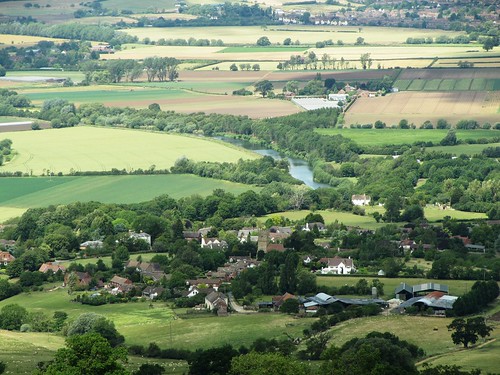
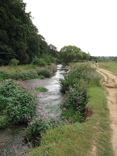
The River Stour in its serpentine windings, its floods and drought trickles, has smoothed out a beautiful shallow valley where Essex and Suffolk meet to stare at each other across their common boundary, the river itself.
First published in: The Times Click here to view a map for this walk in a new window
picture picture picture picture picture picture picture picture
Facebook Link:
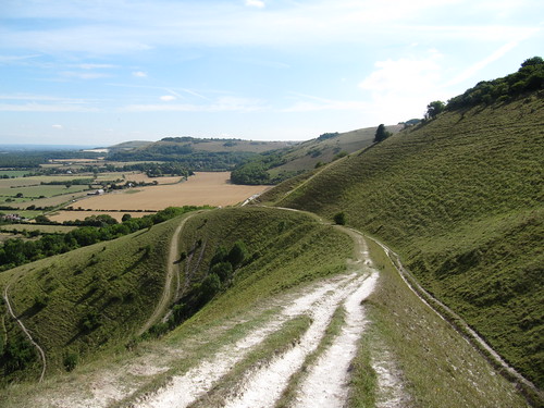
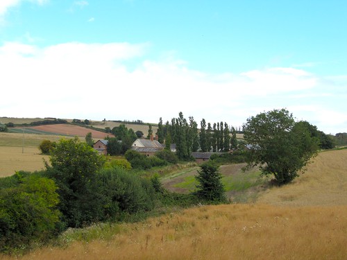
This is cornfield country, broad and gently undulating, well wooded and prosperous, where a pheasant’s life is uninsurable and the medieval timber-framed houses are lovingly and expensively restored.

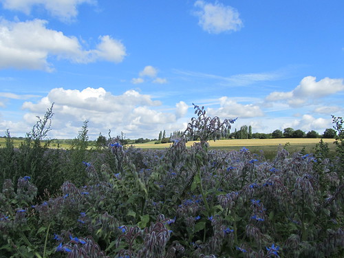
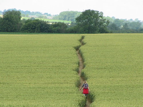
The Henny Swan stands by the Stour, an old country pub now smartened up, the object of sunny afternoon boat trips from nearby Sudbury. We set out past handsomely thatched Henny Cottage and on up the lane to Middleton among the clustered, dusky yellow buttons of tansy. Young goldfinches with scarlet cheeks and crossed tail feathers bounced in the holly trees. Fields of wheat lay creamy gold under the sun, the crop coursing in matt and sheen before the wind. A landscape with a dip and swing to it, where rolls of straw from already harvested fields lay like giant cotton reels among the stubbles in fields whose headlands were blue with borage flowers.

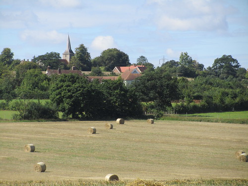
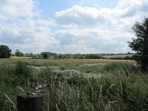
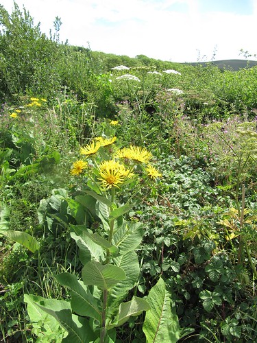
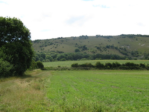
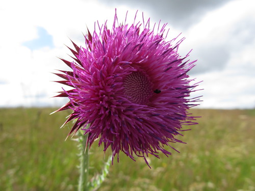
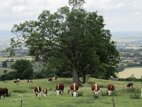
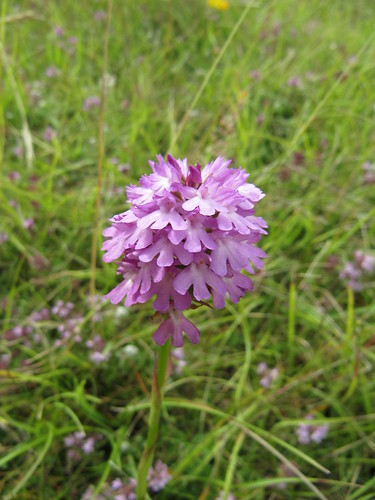
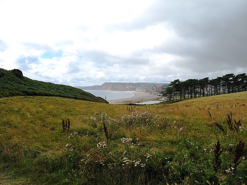
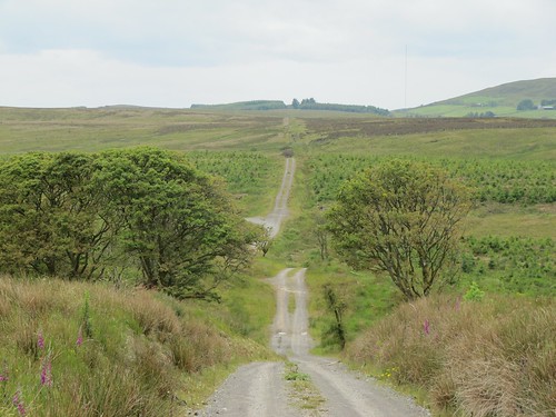
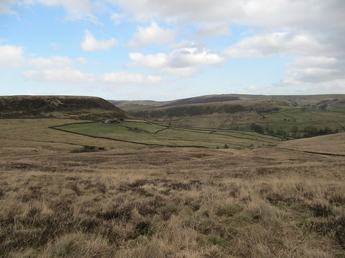
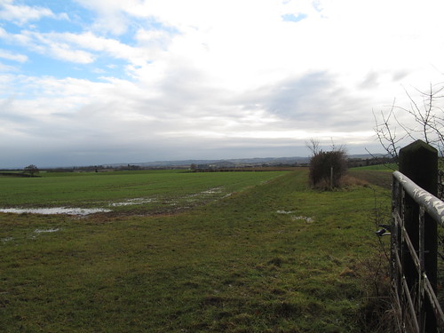
On a tump near Middleton we halted and sat to take in the view down a valley of cut grass dotted with oaks, on over distant barley fields to the stumpy broach spire of Great Henny church on its ridge, the focal point round which this walk revolves. Pink blooms of centaury shook in the wind, and a young deer sprinted across the grass. A quintessentially English view, the sort you fight and die for.

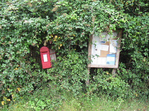
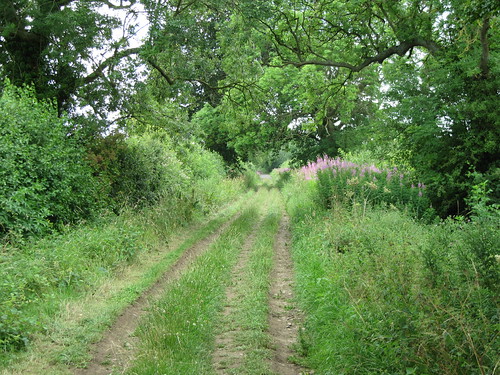
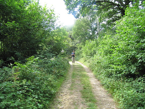
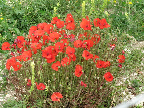
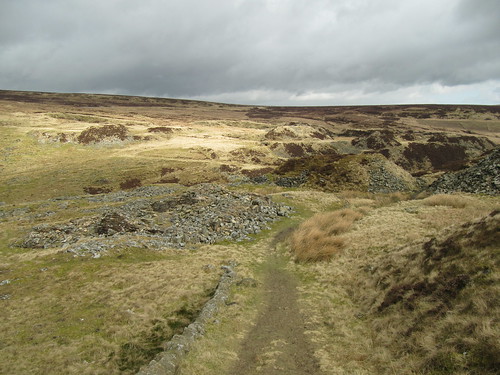
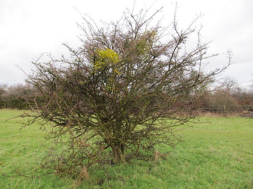
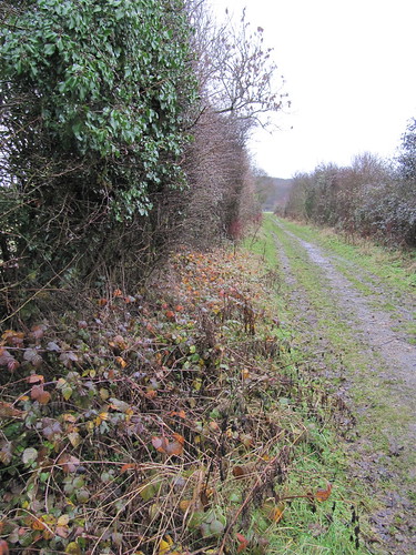
A rutted old byway carried us southwest between hedges of field maple, hazel and elder, its sandy banks burrowed by rabbits into miniature landslips of orange ochre. At The Ryes a little scarlet George V postbox leaned in the hedge, framed in brambles but freshly painted. This is carefully warded and kept countryside, the hedges newly planted with quince and whitebeam, the field headlands left unploughed as seedbeds for wild flowers.

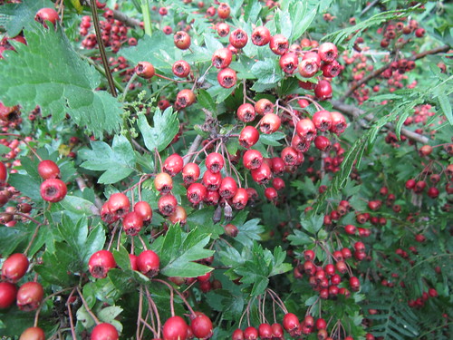
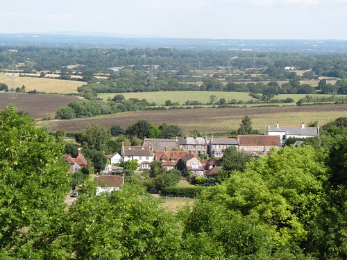
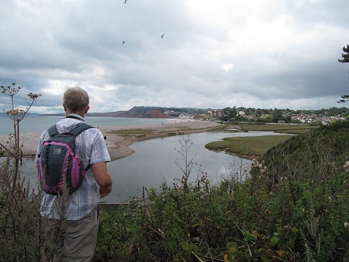
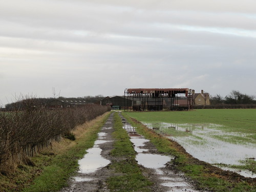
‘Come and help yourselves!’ invited a woman picking greengages and plums from her hedge in Great Henny. We walked on with mouths full, down by Fenn Farm with its vociferous (but friendly) dogs, by Twinstead with its Victorian fantasy church. On across the barley, round by Great and Little Hickbush, and down again to the dreamily winding River Stour and the beer garden of the Henny Swan.

Start: Henny Swan PH, Henny Street, Sudbury CO10 7LS (OS ref: TL879385)

Getting there: A12 to Colchester, B1508 to Bures, left (‘Lamarsh’, then ‘Sudbury’) to Henny Street.

WALK (6½ miles, easy, OS Explorer 196):
Leaving Henny Swan PH, left along road (Sudbury direction); in 100 m, left (‘Middleton only’). In ¼ mile, on right bend, left (875386; ‘bridleway’). In 300 m, by footbridge, right (875383, yellow arrow/YA) along field edge. In 300 m follow it to left; in 70m, right (872384) to meet St Edmund’s Way (868385). Right (YA). In 150 m, keep forward (‘Stour Valley Path’, YA) for 700 m to top of rise. Left on public byway (868393, red arrow) for ¾ mile to road by cottages (859385). Right to T-junction (858384); left for 500 m; by ‘Great Henny’ sign, left (858380) up Old Rectory drive (fingerpost). In 150 m, at gate, right (859380, ‘bridleway’) to road (861378). Left; in 400 m, pass side road (‘Church’); on next bend, right (fingerpost) down Fenn Farm drive. Keep right of house (864374; raucous dogs, but not unfriendly!), on downhill between hedges, past YA at bottom (ignore). Ahead for 250 m to T-junction of paths (863372). Left (blue arrow), on under 2 sets of power lines. Just before road at Twinstead church, left (862367, YA) on grassy track. At hedge end, on across field. In ¼ mile pass pylons; down slope, through bushes; left along hedge, through gap (870368). Right with hedge on right, round field edge to road (873369). Left; cross stream; in 100 m, right (873371), following field bank and power lines to Great Hickbush Farm. By farm hedge, left to drive (878371); left to road (874374). Right; round right bend; in 200 m, left (876377; fingerpost) across field to road (875382); right to Greathouse Farm and valley road (880382). Left to Henny Swan.

LUNCH: Henny Swan PH (01787-269238; www.thehennyswan.co.uk)

INFO: Colchester TIC (01206-282920; www.visitessex.co.uk)

Coast Along for WaterAid, 10 September: 250 sponsored UK coast path walks! www.coastalongforwateraid.org www.LogMyTrip.co.uk
www.ramblers.org.uk www.satmap.com
Click on Facebook “Like” link to share this walk with Facebook friends.

 Posted by at 04:44
Aug 272011
 

Hovering above the Severn Gorge, I stared down in fascination at sailing barges on the river, covered carts and trains of packhorses in the narrow hillside lanes, horse-drawn wagons in a huge quarry, and scenes of primitive iron-making and smelting going on in every nook and cranny.
First published in: The Times Click here to view a map for this walk in a new window
picture picture picture picture picture picture picture picture
Facebook Link:
This was Ironbridge around 1800 – a beautiful scale model of it, anyway, in the Museum of the Gorge, and there in the centre was the world’s first cast-iron bridge itself, spanning the 2-inch wide River Severn.

It’s 25 years since Ironbridge was declared a UNESCO World Heritage Site. If you’re going to explore the famous bridge, the Severn Gorge and the streams and mineral-rich hills that gave Ironbridge its global fame – not to mention the ten museums, housed in superbly restored warehouses and manufactories, that collectively tell the tremendous tale – there’s no better way than on foot. Make sure to leave plenty of time to move round the museums, and to stop in the woods and flowery meadows along the way to ponder the extraordinary, world-shaking Industrial Revolution of which this lovely Shropshire dale was the birthplace.

I crossed the gracefully braced bow of the Iron Bridge and followed the tree-lined railway path along the south side of the thickly wooded gorge. Jackfield Tile Museum was full of bright colours: tiled bathrooms, pub bars, floors, nurseries. At Coalport China Works I watched a woman hand-painting china with infinite skill and delicacy – not all the industries in the gorge have been consigned to history. There was a dash down the Tar Tunnel, a subterranean brick-lined passage whose walls weep natural bitumen. Then I climbed high through the woods, along the rim of the gorge and down to Coalbrookdale.

It was Abraham Darby of Coalbrookdale, pioneer and man of vision, who made the fame and fortune of Ironbridge. Down in Coalbrookdale’s Museum of Iron I stood and gazed at the very furnace in which, in the New Year of 1709, he succeeded in smelting iron with the use of coke. The cast-iron he created was cheap, strong and made of local materials, and it kick-started the Industrial Revolution.

Within a century Darby’s invention would shape and drive the world. Railway engines, boilers, saucepans, Agas, fireplaces and pokers – they all sprang from this humble brick cradle. I walked back to Ironbridge through the woods with the incredible story still thundering round my head.

Start & finish: Ironbridge Gorge long-stay car park, TF8 7DQ (OS ref SJ665037).

Getting there:
Train (www.thetrainline.com; www.railcard.co.uk) to Telford
Bus – 88, 88A, 99, 99A (www.arrivabus.co.uk) from Telford
Road – M52 to Telford, and follow signs to Ironbridge.

WALK (7 ½ miles, moderate/hard, OS Explorer 242):
Right along road to Museum of the Gorge (668036). On to cross Iron Bridge (672034). Left (‘Jackfield’, red arrow/RA) through car park. Severn Valley Way/SVW to Coalford. At level crossing gates (685031) follow Tile Museum. At Museum (686029) fork left down Church Road (SVW). At Salthouses (690028) follow yellow arrows/YAs past houses and Maws Craft Centre (691027). Left at Boat Inn across river (693025). Cross railway bridge; right down steps to Tar Tunnel. Return across railway bridge; left along canal to Coalport China Works (695024). Left along road; just before Shakespeare Inn, right (‘Silkin Way’) onto Silkin Way. Left; in 200 m, right (695027) up steps; steeply up beside Hay Incline. At top, left on path into meadows. In 100 m, fork left to pass left of house with tall chimney. Forward to pass along hotel terrace (YA). At end of terrace, left downhill (YA) through woods for ⅓ mile to roadway (697036). Left past Blists Hill Victorian Town entrance to road. Left (‘Silkin Way’) for ¼ mile. Just before tunnel, bear left, then right over tunnel to cross road (693032). Path up into woods (‘Ironbridge via Wood’). In 150 m, right up steps (‘Ridge Path’, green South Telford Way/STW arrows). Follow STW/Ironbridge for ¾ mile. Beyond 2 meadows bear left downhill (682037, ‘Wesley Road’) for 250 m. Then bear right uphill (681036; ‘Benthall View’). In 100 m, left (‘Madeley Bank’) to cross road (679038). Up Harris’s Lane; keep ahead to Beech Road (677041). Left; in 100 m, right (‘Woodside’) and follow Ironbridge Way/IW. In 200 m, right (676042) then left (footpath fingerpost) to join road. In another 30 m, beyond bus shelter, left (677044) on tarmac path beside green. At roadway at edge of housing estate (675044) dogleg left and right; continue on gravel path across meadows (‘Woodlands for Health’/WFH; YA). In 100 m WFH forks right, but keep ahead with Dale Coppice on left. In 200 m path bends right; left here (671046, RA) through kissing gate, down through Dale Coppice. Ahead at path junction (‘Woodside CBD’). Pass picnic place on left; descend steps; at foot of steps bear left (670047); in 50 m, bear left (‘Wellington Road’) down steps to pass chapel (668046). Right to road; cross into Museum of Iron (678047).

From Museum, back to road; right along it; in ¼ mile, cross (670043) and go up Paradise (lane). In 50 m left up steep lane (fingerpost). In 100 m at crossing of lanes, diagonally right (fingerpost on left) on upward path, up steps; on up Lincoln Hill. At top of steps, right (671041; ‘Ironbridge’). In 200 m, fork right (669039, ‘Ironbridge’) on path, then lane downhill (RAs) to road. Right to car park.

Conditions: Many steep steps in woods

Refreshments: Pubs/Cafés in Ironbridge, Coalport

Accommodation: Telford Hotel, Sutton Hill (01952-429977; www.qhotels.co.uk) – comfortable, friendly, amazing views.

INFO: Ironbridge Gorge Museums (01952-433424; www.ironbridge.org.uk). Passport tickets (1 year unlimited access to 10 museums): £14.75 child/student; £18.25 60+; £22.50 adult; £61.50 family.

Coast Along for WaterAid, 10 September: 250 sponsored UK coast path walks to join! www.coastalongforwateraid.org

www.ramblers.org.uk www.satmap.com www.LogMyTrip.co.uk
Click on Facebook “Like” link to share this walk with Facebook friends.

 Posted by at 05:07
Aug 202011
 

First published in: The Times Click here to view a map for this walk in a new window
picture picture picture picture picture picture picture picture
Facebook Link:
In the car park of the Pig In Muck at Claybrooke Magna I found a carload of cheerful chaps packing clinking bags of booze into a pink minibus. Whither away? ‘To Birmingham – it’s my stag night tonight. Go-karting, and then the dogs!’

I wished them good luck, and set out into the bright, breezy day. If you’re looking for a walk in the heart of rural Middle England, Leicestershire’s hard to beat, and Claybrooke Magna’s pretty typical of the county’s villages – red brick, neat, friendly, set in low-lying countryside that’s half pasture and half arable, rich in handsome houses and horse paddocks.

Claybrooke Hall stood solid and brick-faced on the outskirts of Claybrooke Parva among parkland lime trees, their trailing skirts of leaves raised to head height by the nibbling teeth of generations of cattle and horses. St Peter’s Church, on ancient foundations, is built of pale sandstone so soft that the fearsome scowls of its gargoyles have weathered to expressions of mild enquiry. ‘JST’ carved his initials into the east wall on a summer’s day in 1883, one among hundreds of graffiti.

I turned north through fields hump-backed with medieval ridge-and-furrow, butterfly-haunted hay meadows and cornfields flushed with poppies. An old biplane with a gracefully rounded snout went grunting across a blue sky puffed with giant white cumulus clouds. Fields of rye-grass flattened by big winds and rains; fields of dry-rustling oats enclosing dark ranks of potato plants. The horses at high-perched Hill Farm stared me through. Nearing Frolesworth I paused to admire a flock of pink-snouted Charmoise Hill sheep buddied up with some chubby Polled Dorsets – whose wool ‘goes to make coffins’, a notice enigmatically informed me.

A long westward path, sinuating like a dark snake through the corn, and I was walking the bushy tracks of Fosse Meadows nature reserve among Lammas meadows full of flowers, bird chatter and the cries of little kids let off the leash. The hedges were hung with brilliant purple flowers of bittersweet, the long yellow stamens protruding like woodpecker bills. From a hide I watched swallows over a pond, banking after midges in tight curves like fighter aces.

At Claybrooke Lodge I turned along a stretch of the Fosse Way, a broad stony track between thick old hedges. History rang at every footfall along this ancient British trackway that the Romans appropriated to forge a ruler-straight highway from Exeter to Lincoln. A field of bright blue linseed, a sky full of larks, and a pair of young lovers playfully smacking each other as they preceded me down the bridleway to Claybrooke.

Start & finish: Pig In Muck PH, Claybrooke Magna, NE Hinckley, Leics, POSTCODE (OS ref SP489889)

GETTING THERE:
Bus – Centrebus (http://www.leics.gov.uk/j0499_ptu_timetables_service_58.pdf) Service 58, Mkt Harborough-Hinckley.
Road – A5 (Lutterworth-Hinckley; at High Cross, right to Claybrooke Magna. Park near Pig in Muck PH.

WALK (6 miles, easy grade, OS Explorer 233):
From Pig in Muck PH, left along Main Road. Pass village hall; in 200 m, left along Back Lane (492886). In 200 m, right along Holly Tree Walk (‘Leicestershire Round’/LR). Follow LR and yellow-topped posts/YP through fields to Claythorpe Parva. At road, left (496880), right through churchyard, left along lane to road (498879). Cross bend; left along bridleway (‘Claybrooke Mill’). Follow YPs and blue arrows/BAs for ¾ mile to mill (499891). Cross yard, up bank, cross mill leat. Fork left (LR circular symbol) across field beyond. Cross Frolesworth Lane (499893); follow LR/YP for nearly 1 mile to road in Frolesworth (502907). Left for 50 m; on right bend, keep ahead through Manor Farm yard (‘Sharnford 2’). Follow yellow arrows/YA and YP west for ¾ mile to cross Foss Way (491911). YA points ahead over field; cross River Soar; ahead on path through Fosse Meadows reserve. In 150 m at meeting of gates, keep straight ahead through kissing gate (489912) onto duckboard trail. In 150 m, bear right through kissing gate; ahead across field with hedge on your right; through kissing gate to rejoin LR (487911). Diagonally left over field to YP. Follow LR and YPs to Fosse Way (486905) at gate of Claybrooke Lodge Farm. Right along stony Fosse Way for over ½ mile. At gate across track, left (481897; YP, BA) across field to YP. Follow YP/BA to road. Left to Pig In Muck PH.

LUNCH: Pig in Muck PH, Claybrooke Magna (01455-209524); friendly local.

ACCOMMODATION: Greyhound Inn, Lutterworth (01455-553307; www.greyhoundinn.co.uk); family-run and full of character.

INFO: Hinckley TIC, Hinckley Library (01455-635106); www.goleicestershire.com
www.ramblers.org.uk www.satmap.com www.LogMyTrip.co.uk
Click on Facebook “Like” link to share this walk with Facebook friends.
Coast Along for WaterAid, 10 September: 250 sponsored UK coast path walks to join! www.coastalongforwateraid.org

 Posted by at 03:35
Aug 132011
 

A dip in the sea not long after dawn, an early morning drive into the South Downs, and I was away from Fulking as the newly risen sun cast an oblique light along the downland escarpment behind the village.
First published in: The Times Click here to view a map for this walk in a new window
picture picture picture picture picture picture picture picture
Facebook Link:
Beans rattled dry and black on their stalks, and the soil lay pale and cracked in this drought summer. To the north rose the downs, a 300-ft rampart of turf facing the agricultural lowlands, dull olive patched with white chalk scrapes and dark green scrub. Near at hand a yellowhammer in the hedge wheedled for ‘a-little-bit-of-bread-and-no-cheeeese!’

The fields stretched breathless and still in an early morning already gathering heat. Up on the downs, though, something was in motion. I stopped and stared as a crowd of bullocks went thundering down the slope, kicking up clouds of powdery chalk dust, mad with delight at the headlong sensation.

In Longlands Wood, a green wilderness of beech and oak, the swearing of a discontented jay broke the stillness. The pastures around Tottington Manor were full of dark chocolate cattle, cows and bull calves slowly grazing together, every muzzle a quivering maze of flies. I leaned over the gate, scratching a couple of handy backs, and then made for the downs. Steeply up through the trees on Tottington Mount, until at the crest I could stop and look back across the flatlands 300 feet below – downland slopes and woods leading out to the matt steel eyes of gravel pits and the great flood plain of the River Adur. A few more minutes and I was at the crest of the downs, looking south through beautiful curving valleys to the hazy grey vee of the sea.

Three young sparrowhawks hung in the air in line abreast, hunting the downs under the tutelage of their parent birds. I turned east along the ancient track of the South Downs Way, a white chalk thread drawn snaking through the turf. What fantastic elation, heading into the penumbra of the sun in this high place among drifts of scrambled-egg toadflax and white campion, passing broad headlands full of poppies and moon daisies left by the farmer around the margins of his barley fields. By the time I got to Perching Hill the sky ahead over Devil’s Dyke was already dotted with hang gliders, and before I dropped back down the escarpment to Fulking I stood and watched them circling like mythical heroes near the sun.

Start & finish: Shepherd & Dog PH, Fulking BN5 9LU (OS ref TQ 247113)
Getting there: Fulking signposted from A281 (Henfield-Brighton) and A2037 (Henfield-Upper Beeding)
Walk (6 miles, moderate/hard grade, OS Explorer 122): Leaving Shepherd & Dog, right along road; in 50 m, by fountain, left through gate (fingerpost); right along hedge. Through kissing gate; diagonally left across 2 fields by stiles. At gate, over stile (245116); left along stony lane. In 20m at left bend, bear right (fingerpost) diagonally over field, under power lines. Cross track to Perching Manor (yellow arrow/YA) and on. At far corner, cross footbridge (241120, YA post); left along edge of woodland. Cross footbridge, stile; on over 2 fields with hedge on left. At end of 2nd field, over stile and footbridge, and on. At track junction (234121, fingerpost), dogleg left, then right; follow field edge with hedge on left. At field end, left across footbridge (fingerpost). Through thicket; emerge to skirt house (231119). At end of trees, left across footplank (fingerpost); right along hedge. Cross track (225120); over stile (fingerpost) and follow hedge to stile into Longlands Wood (fingerpost). Follow path for 400m to path crossroads at 4-way fingerpost (219122). Left for 250m to leave trees (gate); follow track to Tottington Manor. Just before barn, left through gate (fingerpost). Right to cross road (215115). Right for 30m; left up track into trees (‘bridleway’; blue arrow/BA). Up path between fences to gate; continue uphill, curving right round Tottington Mount. At top of climb, aim for post on skyline; left here (217106, BA) to road. Left on South Downs Way (SDW) for 1½ miles, passing Youth Hostel and communications masts and continuing to pass under power lines (242109). In another ¼ mile, in a dip, through a gate (246109); left down cleft (YA post). In 250m, sharp left (249111, YA post); steeply down to Fulking.

Lunch: Shepherd & Dog PH, Fulking (01273-857382; www.shepherdanddogpub.co.uk) – lovely old walker-friendly pub
More info: Brighton TIC (01273-290337); www.visitsussex.org
www.ramblers.org.uk www.satmap.com www.LogMyTrip.co.uk
Click on Facebook “Like” link to share this walk with Facebook friends.

 Posted by at 01:54
Aug 062011
 

A E Housman was probably sublimating when he wrote in ‘A Shropshire Lad’ of lying with a girl in summertime on Bredon Hill.
First published in: The Times Click here to view a map for this walk in a new window
picture picture picture picture picture picture picture
Facebook Link:
He wasn’t really that sort of chap, by all accounts. Jane and I would have got pretty wet if we’d tried it under the troubled sky that the weather forecaster was glooming over today, with rain showers scudding in from the Bristol Channel. But you just can’t abandon an expedition up Bredon, however ominous the forecast. The hill tugs at you like an impatient companion – Housman got that right. And everything turned out bright and breezy anyway, as it happened.

Above the village of Elmley Castle we climbed smooth parkland fields past tremendous storm-shattered old oaks. Up the back slope of the hill past the high, bracken-smothered earthworks of Elmley Castle itself – the Norman castle’s stones were recycled to mend Pershore Bridge in Tudor times. Up through ancient woods full of the tall spikes of pungent woundwort and lace-like enchanter’s nightshade (fabulous name). Up to the ridge that curls round the edge of Bredon Hill’s 900-ft escarpment, and along to the flowery ramparts of a sprawling Iron Age hill fort.

There’s no exhilaration on earth like striding the walls of a hill fort with the wind bashing you and a 50-mile view to stun you speechless. Cotswolds in the east, Malverns in the west. South to Oxenton Knoll, down which they used to roll a fiery wheel to see if the new year would bring good luck. North-west to the Clents and the far-off Clee Hills that so enchanted Housman – a Worcestershire lad, in unromantic fact. The larks he wrote about were up on Bredon Hill today, and so were masses of wild flowers: yellow and white lady’s bedstraw, mats of wild thyme, rockroses with papery yellow petals; harebells, scabious, a single pyramidal orchid in the ditch between the ancient fort’s ramparts.

Up at the summit of the hill we found the Banbury Stone, shaped like a crusty old elephant couchant, and the grim little tower called Parson’s Folly that a local squire built for himself. One more gaze round the best view in the Three Counties, and we were bowling back down the slopes to Elmley Castle and the neat parlour of the Queen Elizabeth inn, everyone’s dream of a proper country pub.

Start & finish: Queen Elizabeth PH, Elmley Castle, Worcs WR10 3HS (OS ref SO 982411)

Getting there: Bus service 565 Evesham-Worcester. Road – M5, Jct 9; A46 (‘Evesham); just after junction with B4078, left to Elmley Castle.

WALK (7 miles, moderate grade, OS Explorer 190):
From Queen Elizabeth PH into churchyard. Keeping church on right, follow wattle fence to cross foot of pond (982410). Cross stile (yellow arrow/YA), follow field edge round 3 angles. In 500 m, just before corner, turn right over plank bridge and stile (985405). Aim for far left corner of parkland field (985402). Left over stile and footbridge; right (blue arrow/BA) through metal gate and up grassy track. In 100 m, right across footbridge (984401). Don’t fork left up bank, but keep ahead on clear dirt track. In 400 m cross footbridge (981400); bear left (BA) uphill. Keep fence on right, up through woods to T-junction of tracks at top of hill (974395). Right beside wood; keep to ridge track, ignoring side tracks. At end of wood, keep ahead with fence on left (967403, BA) for ¾ mile to pass Elephant Stone and Parson’s Folly (957402). Continue beside wall to enter trees. In 100 m, on right bend with BAs, turn even sharper right (952398, YA) down through trees, over gate stile and on down slope. Follow YAs on posts for ¼ mile to gravel drive (952405); left downhill for 2 fields, then right (949408; ‘Private Estate – footpath’) along stony track (YAs) for ½ mile. At water trough, left (957411, YA) downhill with fence on left. At kissing gate (954415) leave fence and fork a little right; follow hedge on right down to road (953418); right into Great Comberton.
At top of hill by ‘Pershore, Bredon’ road sign (954420), ahead along footpath (fingerpost) to enter churchyard. Right along wall to road; right for 50 m past Bredon House; left (955420; ‘Elmley Castle 1½’) on footpath through fields (YAs). After nearly a mile, ignoring all side tracks, reach a bridleway (970418; BAs left and right). Right for 30 m; left through kissing gate (YA) and on. After 3 more fields, pass through kissing gate (976416); in 4th field, keep to right hedge; in 100 m, right over stile (YA). Follow YAs for 3 more fields and through farmyard. Through 2 gates to left of barn; right behind barn to road (980413); left to Queen Elizabeth PH.

Conditions: Many stiles, some tall and awkward

LUNCH: Queen Elizabeth PH (01386-710419) – proper country pub

INFO: Evesham TIC (01386-446944); www.visitworcestershire.org
www.ramblers.org.uk www.satmap.com www.LogMyTrip.co.uk
Click on Facebook “Like” link to share this walk with Facebook friends.

 Posted by at 05:12
Jul 232011
 

Blues and folk, cream teas, own bakery, story-telling, art exhibitions, and a perfect setting by the River Otter at the edge of a village of cob and sandstone cottages under thatch.
First published in: The Times Click here to view a map for this walk in a new window
picture picture picture picture picture picture picture picture
Facebook Link:
No wonder Otterton Mill café is as popular in summer as a cold beer on a hot day. We could have squeezed there in for a pre-walk cuppa, but the call of riverbank, estuary and rugged red cliffs was too strong on this beautiful afternoon along the South Devon coast. We crossed the three old arches of Otterton Bridge instead, and walked off downriver along the slow-flowing Otter.

This is flat green river country bounded by low hills, the Otter running shallow and red over ridges of shillets that trailed green hanks of weed, rippling silkily like mermaid hair. ‘Have you seen the grey mullet?’ enquired a fisherman. ‘In the shallows, look.’ There they were, a long shoal sinuating with the stream. ‘I’m going to attempt to catch one – but they’re pretty shy.’ He flicked a lure into the water and drew it wobbling and flashing past the noses of the unmoving mullet.

We crossed the river and went on beside ripe wheatfields glistening in the sun. Down at the river mouth a pebble spit has almost closed off the Otter’s estuary from the sea. Gulls called mournfully over the piled roofs of Budleigh Salterton, wetsuited youngsters shrieked the echoes out of caves, and surf sighed on the stony ridge – essence of the sounds of summer.

The dusty coast path led north along cliffs striated and weather-bitten, their strata dipping eastward in a mighty curve through the white sprinkle of Sidmouth, the tall red triangle of Dunscombe Cliffs and a far white smudge of chalk at distant Beer Head. Fulmars and kittiwakes planed along the line of the cliff edge, and the dark purposeful shape of a peregrine went dashing by at head height. Inland, a bare field of pigs rooted among pink stones, seagulls whirled, and a farmer in a red tractor got his straw bales organised in a newly harvested field.

Above Smallstones Point we pulled up to stare across the great layered rock stacks in Ladram Bay, lambent and crimson in the late sun – a famous view, one that always delivers a pure jolt of delight. One more glance along the pink and white coast, and we headed along green lanes through the stubble fields towards Otterton and that well-earned cream tea.

Start & finish: Otterton Mill, Otterton, S. Devon EX9 7HG (OS ref SY 080851)

Getting there: A3052 (Exeter – Sidmouth); B3178 at Newton Poppleford (‘Budleigh Salterton’). In 3 miles, Otterton signposted at Brick Cross. Park in village.

WALK (6 miles, easy grade, Explorer 115):
From Otterton Mill cross River Otter bridge; left along riverbank footpath. In two thirds of a mile don’t cross Clamour Bridge: continue on right bank to cross next bridge (075830, ‘Ladram Bay, Coast Path’/CP). Don’t turn right immediately along river; keep ahead on road for 100 m, then right (CP) on path to coast. Follow CP arrows to left along cliffs for 2 miles. At ‘Otterton half a mile’ fingerpost (094848), ahead for 50 m to view Ladram Bay; return and follow path (soon green lane) inland. Left at gate of Monk’s Thatch to road (089849). Left for 100 m; right along Lea Lane (‘Unmetalled Road’). Just after right bend, keep ahead (085847; black arrow) to road in Otterton (085852). Left; follow lane past church to village.

LUNCH: Otterton Mill (01395-568521; www.ottertonmill.com)

MORE INFO: Budleigh Salterton TIC (01395-445275); www.visitdevon.co.uk
www.ramblers.org.uk www.satmap.com www.LogMyTrip.co.uk
Click on Facebook “Like” link to share this walk with Facebook friends.

 Posted by at 04:36
Jul 162011
 

Up on the border between Co. Tyrone and Co. Donegal we parked the car and set out – Martin Bradley, Jane and I. Martin, Tyrone’s countryside officer and a man who knows his bog myrtle from his sphagnum moss, had told us of an ancient path he thought he’d spotted, unsuspected and little walked, hurdling the high bogland of this western corner of Northern Ireland.
First published in: The Times Click here to view a map for this walk in a new window
picture picture picture picture picture picture picture picture
Facebook Link:
As soon as we’d cleared the plantations and were walking north in open country, there was no mistaking The Causeway – a broad strip of trackway running straight as a die out of the Donegal uplands and into those of Tyrone. There’s nothing quite so enticing as the sight of an ancient track making a bee-line from one horizon to the other. It beckons you to follow where millennia of feet of hooves, cart wheels and sled runners have forged the straight way.

Huge views unfolded as we walked The Causeway, east to the rounded profile of the Sperrin Hills, north-west to the hills of Donegal and the faint and far blue shark-tooth of Mt Errigal, 30 miles off. What was The Causeway, in Martin’s opinion? A pilgrim path or a trade route? ‘Well, I think it could be at least two thousand years old, maybe older – perhaps Iron Age. See how well kept it’s been in the past, with stone culverts and proper ditches? It’s always been well used.’

It certainly has. Stories from the Second World War tell how the ration-hit farming families of West Tyrone were kept supplied with milk, meat, butter and other delights, courtesy of illicit cross-border consignments along The Causeway from the Republic of Ireland. Now the bog is invading the old track, spreading it with bedstraw, orchids and tormentil.

Down in the valley below we turned along a country lane to find a clandestine Mass Altar in Mellon’s Glen, the ancient church and graveyard of St Caireall, and the gently bubbling holy well where St Patrick once stopped to refresh himself. The wild uplands and small valleys of Wet Tyrone hold a secret round every corner; all you need to find them is a good pair of boots and a wealth of curiosity.

Start: Causeway Hill, Shanaghy Road, near Killeter, Co. Tyrone (OS of Northern Ireland ref: H163750)
Finish: St Patrick’s Well, Magherakeeel

Getting there: (2 cars): From Castlederg (B72 or B50) follow Killeter signs. From Killeter, follow ‘St Patrick’s Well, St Caireall’s Church’.
Leave one car opposite holy well; continue in other car to T-junction; left on Shanaghy road for 3 miles (5 km). Opposite small quarry with double gates on right, turn left along rough track past ‘Give Way’ sign. In 150 m park on bend by barrier (‘Causeway Hill’ waymark).

WALK (6 miles/8 km; easy but boggy; OS of N. Ireland 1:50,000 Sheet 12):
Yellow arrow points right, but you go left past barrier. Follow The Causeway for 3 and three quarter miles (6 km). At foot of lane (yellow arrow), left along country road. At ‘Mellon’s Glen’ signboard, detour left through gate. In 50 m, right at cross-inscribed stone to Mass Altar. Return and continue along road. At T-junction, left and left again up Magherakeel Road. Pass lime kiln and St Caireall’s Church to return to St Patrick’s Well.

LUNCH: Picnic

ACCOMMODATION: Marian McHugh, Glen House, 30 Aghalunny Rd, Killeter BT81 7EZ (028-8167-1983) – offers drop-off and pick-up at start and finish of walk.

GUIDED WALKS: Martin Bradley (028-7131-8473; 079-2678-5706; Martin 839@btinternet.com)

MORE INFO: Omagh TIC (028-8224-7831); www.discovernorthernireland.com
www.ramblers.org.uk www.satmap.com www.LogMyTrip.co.uk
Click on Facebook “Like” link to share this walk with Facebook friends.

 Posted by at 04:24
Jul 092011
 

I’ve used the little weather-resistant guides published by Frances Lincoln in various locations, and learned to trust them. So setting out from Seathwaite (the Duddon Valley one, not the one under Scafell Pike) with Norman and June Buckley’s guide, Walking with Wordsworth in the Lake District, promised a great afternoon’s walking in the river valley that Wordsworth explored as a boy and immortalised in his River Duddon sonnets.First published in: The Times Click here to view a map for this walk in a new window
picture picture picture picture picture picture picture picture
Facebook Link:
Not that it was easy to step from the Newfield Inn (cheerful fire, friendly folk, snoring dogs) into the spit and bluster of a wet old day. The Tarn Beck rushed noisily under its hazels and alders. The tops of the Seathwaite Fells were misted over, the trees dripped and the road was slick with water rills. The half-gale pushed me along northwards, past whitewashed Tongue House and up a stony path onto the open moor between High Tongue and Troutal Tongue.

The Duddon’s vale is full of tongues – high rocky knolls that give the valley a wild character unique in the Lake District. Along the wet grasses the golden busbies of bog asphodel shivered to the wind in their tens of thousands. What rhymes with asphodel? Wordsworth would have found something to encapsulate the damp shimmer of buttery bronze up here in the wind and rain.

Gradually the weather relented: the mist shredded off the Seathwaite Fells, revealing their high spine against patches of intense blue sky. The rain-swollen River Duddon came leaping and churning through a dark slit of a gorge, to jostle in a surge of bubbles under the single arch of Birks Bridge.

I lingered on the bridge, listening to the crashing of the river, then turned downstream. Pied wagtails bobbed on the rocks. A whinchat squeaked and clicked up the bank. The path rose and fell, a tricky stumble among slippery tree roots and rocks. One moment the Duddon was sluicing over flooded stepping stones at my elbow; the next it was hissing between rock walls 200 feet below.

I threaded a cathedral-like pine forest, skidded across a scree slope of red and grey boulders, and recrossed the roaring Duddon to follow its east bank down to Seathwaite. On the outskirts of the village I passed a pebbly strand where a couple of boys were skinny-dipping in the rampant river, risking life and limb as country boys have done since Noah – let along William Wordsworth – was a lad.
Start & finish: Newfield Inn, Seathwaite, Cumbria, LA20 6ED (OS ref SD 227960)

Getting there: M6 to Jct 36; A590, A5092, A595 to Duddon Bridge; Ulpha & Seathwaite signposted from here.

Walk (5½ miles, moderate grade, OS Explorer OL6): Newfield Inn – church (229961) – fork right (232967, ‘Coniston’) – left in 300m – cross footbridge by Tongue House (236074) – path north, left of Worm How and Troutal Tongue to road (234983) – left across Birks Bridge (234993) – left along riverside. Soon path climbs right (white arrows) to top of knoll. Same line descending (NB Indistinct path; beware rocks, roots and mud!) to woodland section by river. In 2/3rds of a mile, ford Wet Gill by logs (229979); over stile; path climbs (YA) behind crag; descends to cross scree (224966). Left to cross Duddon by stone bridge (224963); right through gate; riverside path to cross Tarn Beck (225960); left to Newfield Inn.

Conditions: Riverside path between Birks Bridge and Seathwaite is slippery and tricky underfoot – roots, stones, mud. Allow plenty of time. Boots essential; stick helpful.

Lunch: Newfield Inn, Seathwaite (01229-716208) – meals noon-9 daily.

Reading: Walking with Wordsworth in the Lake District by Norman and June Buckley (Frances Lincoln).

Info: Broughton-in-Furness TIC (01299-716115; www.lakedistrictinfomation.com)
www.ramblers.org.uk www.satmap.com www.LogMyTrip.co.uk

 Posted by at 03:45
Jul 022011
 

Where Staffordshire, Cheshire and Derbyshire rub up against one another, it’s beautiful walking country. Wild moors, steep little valleys, sparkling rivers, lonely sheep farms and villages – the western edge of the Peak District has them all.First published in: The Times Click here to view a map for this walk in a new window
picture picture picture picture picture picture picture
Facebook Link:
We didn’t really know the area well, but we didn’t need to; a random jab of the thumb on the map alighted on the hilltop settlement of Flash, and we were in for an absolute treat of a walk.

In spite of its racy name, Flash is a modest place. In 1820 Sir George Crewe judged this moorland hamlet ‘dirty, bearing marks of Poverty, Sloth and Ignorance’. Nowadays the New Inn’s sign proudly proclaims it the ‘highest village pub in the British Isles, 1518 feet’. The views from here across the Staffordshire moors are immense, a curve of green meadows rising to sombre uplands of bracken and heather, their skyline broken by jagged, wind-sculpted sandstone tors.

This morning the sky raced blue and silver, trailing thick grey belts of rain. The wind shoved us impatiently away from Flash, scurrying us up and over Wolf Edge with its canted rock outcrop. A dip on a rubbly path through dark heather and we were skirting Knotbury Common where peewits creaked and tumbled like toy stunting planes. The road to high-perched Blackclough farm lay gleaming with water and humpy with rain-pearled sheep.

Blue sky now, glints of sun and a big boisterous wind. Huge grassy spoil heaps and an ancient industrial chimney marked the long-defunct colliery at Danebower. We dropped down the steep, winding valley of the infant River Dane, a lovely green dell with a flagstone path across rushy bogs, the hills tightly enclosing the river which sparkled and gushed over step-high falls it had shaped in its sandstone bed. By the twin bridges at Pannier’s Pool the Dane dashed in cascades through a miniature gorge, a perfect picnic spot.

We crossed the open moor, its walls as loosely assembled as Connemara stone walls, and came down to Gradbach bridge. A handsome cream-washed house with a circle of crocuses on the lawn; a Methodist chapel beyond, very plain and dignified; the stone-built bridge over the rushing river. Simple and perfect, this whole assembly.

Back through pony paddocks and sheep pasture where a Swaledale ram with tremendous curly horns followed us a good step of the way. Then a last stretch where the wind, now at our backs like a comrade rather than in our faces like a bully, pushed us all the way up the lane to Flash.

Start & finish: New Inn, Flash, Staffordshire SK17 0SW (OS ref SK 025671)
Getting there: At Rose & Crown, Allgreave (on A54 Buxton-Congleton), take side road (‘Quarnford’) to Flash.
Walk (8½ miles, moderate, OS Explorer OL24): With your back to the church, take lane that forks right past New Inn. In 150m, right (fingerpost, yellow arrow/YA) to pass houses; right (YA) up field, aiming for post. Continue over wall stiles (YAs). In ¼ miles, left (024676; YA) past stone outcrop and over Wolf Edge. Aim for fence; follow it down to road (020681). Left; in 100m, right up farm lane. Opposite Knotbury farm, right through gate (017682; fingerpost) on gravel track that bears left over Knotbury Common, down to road (015689). Left over cattle grid; up road past Blackclough farm. Follow track north beside wall for ½ mile to walk through Reeve-Edge and Danebower quarries. Descend to cross stream by stepping stones (014699; YA). Up bank and turn left (fingerpost, ‘Dane Valley Way’/DVW). Follow track nearly to road, then slant left downhill by chimney (010700). Path by River Dane (stiles, YAs, DVW) for ¾ mile to the two bridges at Pannier’s Pool (009685).

Here DVW crosses bridge; but you keep ahead on right bank of river on permissive path under Three Shires Head. In ⅓ mile ignore YA pointing left; continue uphill on main track to road at Cut-thorn (002681). Forward past house; left over stile (‘Access Land’). Follow wall, then path over moor. In ¼ mile, just short of gate in wall ahead, fork left to cross stile (998683). Follow left-hand of two YAs by fence, following track as it curves left across Robin’s Clough stream and runs south over moor. In ¾ mile follow track past house and down to road at Hole-edge (001671). Right past Bennettshitch house. In 100m, left off road (fingerpost), steeply down to road by Methodist chapel (001664).

Left across River Dane; round left bend; immediately left (fingerpost) past Dane View House. Through gate (fingerpost) and follow path with wall on left for ¾ mile through 6 walls. Just before corner of 7th wall, by a ‘Peak & Northern Footpath Society’ notice on pole (009671), turn right downhill. In 200m, left at another PNFS notice (‘Flash’); aim across fields to pass Wicken Walls farm (014672). Ahead with wall on left; down across stile; steeply down rocks to river (016672). Cross footbridge (‘Flash’); steeply up bank, over stile; bear right up path which curves to left with wall on right (YAs). Follow path to drive of Axe Edge Green farm (020672). Right for 100m; left up to road (021671); left to Flash.

NB – Detailed directions (recommended!), online map, more walks: www.christophersomerville.co.uk. Click on Facebook “Like” link to share this walk with Facebook friends.

Lunch: New Inn, Flash (01298-22941) – open daily evenings, Fri-Sun lunchtimes and evenings (no food, BYO sandwiches); or picnic by Pannier’s Pool.
More info: Leek TIC (01528-483741; www.visitpeakdistrict.co.uk)
http://tourism.swale.gov.uk/isleofsheppey.htm
www.ramblers.org.uk www.satmap.com www.LogMyTrip.co.uk

 Posted by at 02:21
Jun 252011
 

A rainy morning over the Bedfordshire lowlands, with scents of wood smoke on the wind. A flock of bluetits led us south from Houghton Conquest, flitting from one hedge to the next.
First published in: The Times Click here to view a map for this walk in a new window
picture picture picture picture picture picture picture picture
Facebook Link:
We left them for heavy clay fields where every hawthorn spray dangled a row of trembling rain globes. It was hard enough work plodding through the ploughlands, but once up on the green breast of the Delectable Hills we scooted forward with the wind in our sails and House Beautiful in our sights.

It was the local tinker’s son John Bunyan who dreamed up House Beautiful and the Delectable Hills in the 1670s, as he gazed from his native plain to the hills that filled the southern view. The greensand chalk ridge that looks down on Bedford may only be a couple of hundred feet high, but in this low-lying countryside it rears up to dominate the prospect. In between spells of ecstatic non-conformist preaching and dark periods in Bedford Jail for spreading sedition, Bunyan worked the local scene into the backdrops of his Christian polemic masterpiece The Pilgrim’s Progress. The rolling, tree-topped hills stood right on his southern doorstep; and there at their crown rose Houghton House, model for ‘House Beautiful’ with its great red walls and rows of sun-reflecting windows.

We found House Beautiful a haunting, hollow shell. This former hunting lodge of the Countess of Pembroke, embellished by Inigo Jones and visited by kings and courtiers, gazed blank-eyed across the fields, its rooms pooled with rainwater. We lingered in the porch, looking out on the prospect, watching slaty rainclouds and white cumulus chasing from the Midlands towards East Anglia. The heart-aching pull of a grand house in ruin is hard to explain, but it exerts strong magic all right.

Siskins with canary-yellow throats and cross little eyebrows bounced in and out of the bushes as we followed the ridge lane into King’s Wood. Bluebells carpeted the floor of the ancient woodland, a nature reserve these days. Down the slippery track, out across ridge and farrow fields, and back towards Houghton Conquest in gleams of weak sunshine.

In the fields near the village an elderly black Labrador greeted us with a Capstan Full Strength bark of 60-a-day hoarseness. ‘Silly old fool, aren’t you?’ murmured his owner. I think she meant the dog.
Start & finish: Royal Oak PH, Houghton Conquest, MK45 3LL (OS ref TL 047416)

Getting there: Rail (www.thetrainline.com) to Flitwick (5 miles). Bus service 42, Grant Palmer (www.grantpalmer.com). Road: Houghton Conquest signed from A6, 4 miles south of Bedford.

Walk: (4½ miles, easy, OS Explorers 208 and 193): From Royal Oak PH, left along High Street; left along Rectory Lane. Just before Old Rectory, right (045412, ‘Houghton Conquest Meadows, King’s Wood’). Through kissing gate, turn left. Beside 7-barred metal gate, right (045411); follow fenced path, then yellow-topped posts and ‘Marston Vale Timberland Trail’ signs for 1½ miles across fields and up past Houghton Park House to entrance to Houghton House ruin (040392). Visit House; return to drive entrance. Right for 50 m, then left (yellow-topped post, ‘Greensand Ridge Walk’). Follow farm track into King’s Wood (045394); permissive path down to bottom of wood (045405). Through gate; right (arrows); through kissing gate; ahead along bottom edge of coppice. In 200m, left through gate (047406, arrow); follow arrows to right of Old Rectory, back to Houghton Conquest.

Lunch: Royal Oak, Houghton Conquest (01234-740459 – open 4 pm-11, Mon-Fri; 12-11 Sat, Sun); or picnic at Houghton House.

Information: Bedford TIC (01234-221712); www.visitbedford.co.uk

www.ramblers.org.uk www.satmap.com www.LogMyTrip.co.uk

 Posted by at 01:03