Jun 182011
 

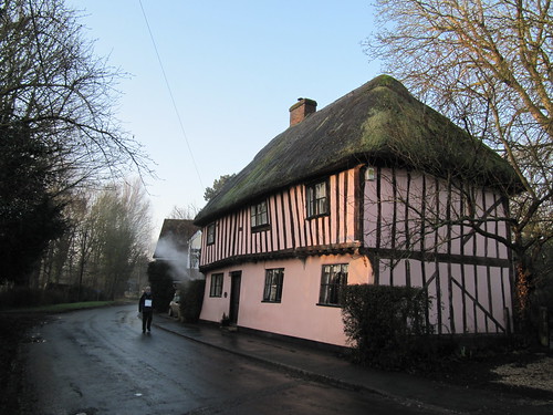
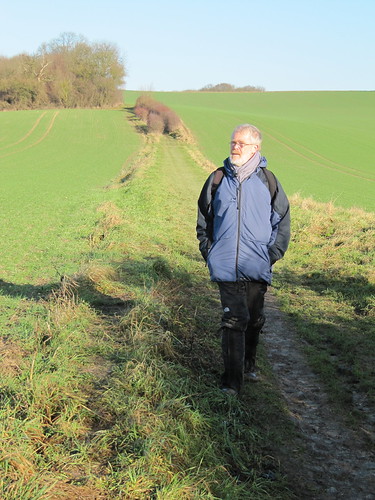
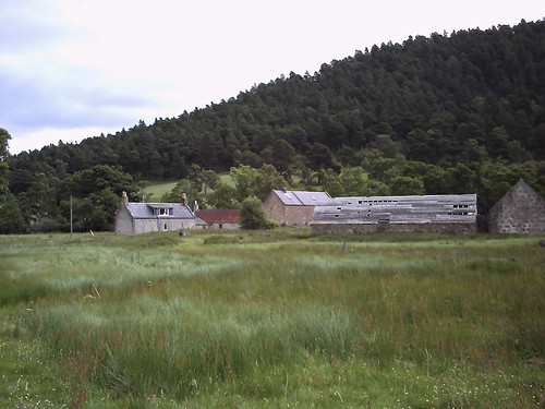
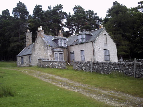
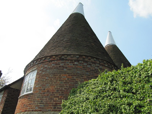
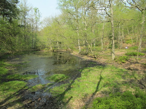
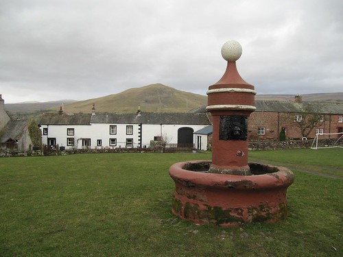
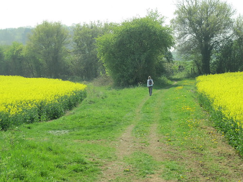
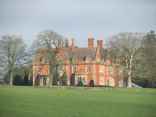
At nine o’clock on this brisk sunny morning a miasma of mist lay over the fens and fields of Cambridgeshire. Chaffinches sang tentatively in the hedges of Hildersham and hopped on the thatched roof of medieval Mabbutts house
First published in: The Times Click here to view a map for this walk in a new window
picture picture picture picture picture picture
Facebook Link:
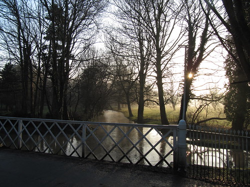
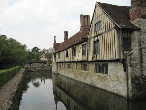
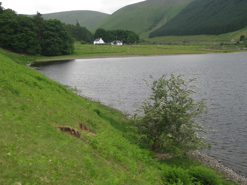
The rain-swollen River Granta, usually a modest infant trickle hereabouts, went powering under the lattice bridge in the village centre like a bully trying out his muscles in the playground.

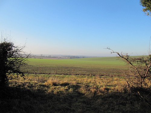
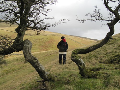
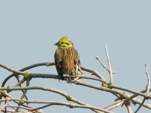
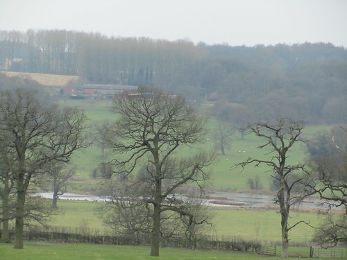
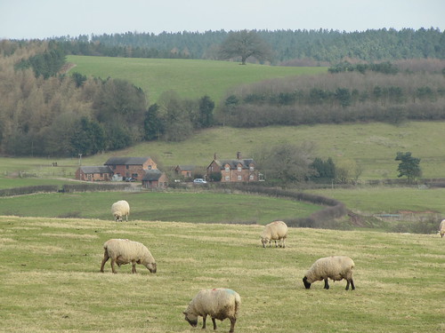
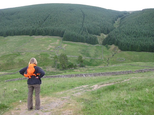
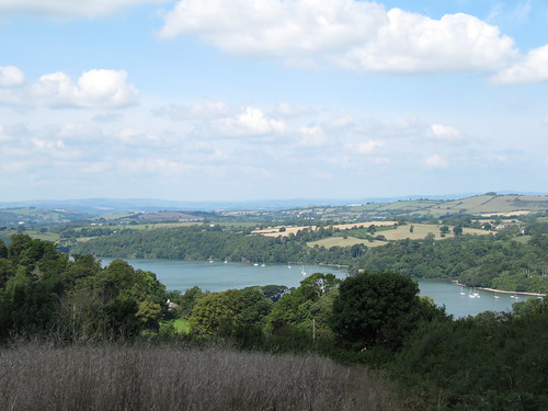
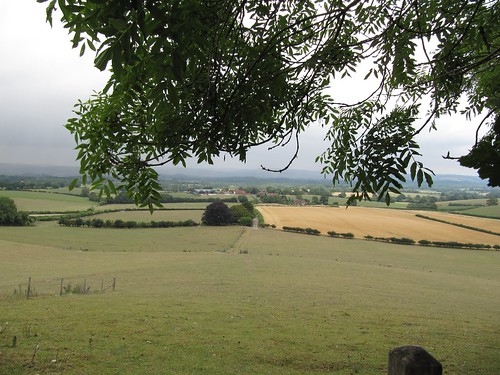
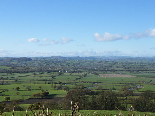
Above the village in the wide fields to the north, larks sang ecstatically. The country rolled with an oceanic swell, brown furrows of ploughland, green billows of wheat, crowned with long dark windbreaks. This south Cambridgeshire landscape seems entirely open under its great swirling skies, but it rolls into hidden valleys you don’t suspect until you are actually on them.

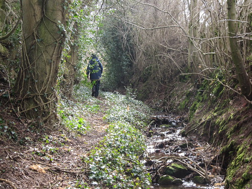
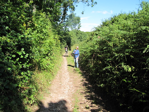
Up on the ridge we turned east along a green road, engineered 2,000 years ago by the Romans to connect their forts of Godmanchester and Cambridge with Colchester. During the Middle Ages the old road became so busy with packhorse trains carrying wool that it acquired the title of Worsted Street. But some called it Wolves Street, an older and wilder name.

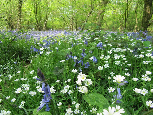
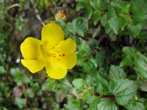
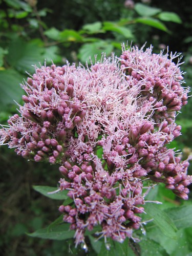
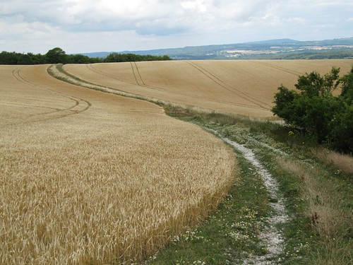
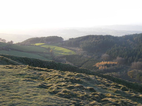
All the land around Wolves Street ~`has been ploughed and scoured clean of native chalk grassland turf. But the long green strip of the Roman road retains its herb-rich, flowery sward between sheltering hedges. Here in spring and summer flourishes a wonderful natural garden – fragrant marjoram and thyme, scabious, dwarf thistle and St John’s Wort, foodplants for a riot of butterflies and insects that you won’t see in the neighbouring arable fields.

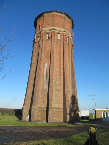
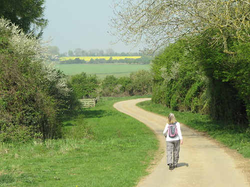
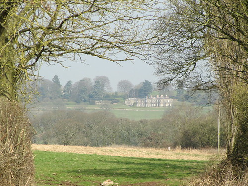
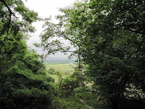
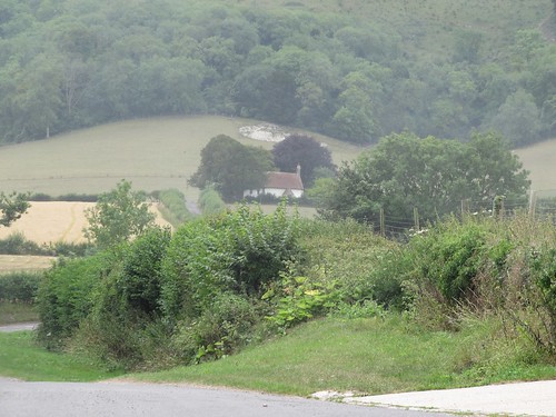
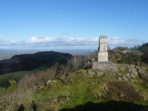
This morning the old highway lay half flooded and bare, a silver thread between hedges heavy with drops of last night’s rain, as if dipped in molten glass and instantly frozen. Where the even more ancient track of the Icknield Way crossed the Roman road, we struck out heavy-footed over ploughed fields to reach the tall water tower on Rivey Hill, dodecahedral and ribbed with slim buttresses. There was a wonderful view to savour as we turned back west, looking towards distant Cambridge and the misty flatlands, before we slipped and slid downhill into Linton. A valley path led homeward between horse paddocks and on under the onion dome of Hildersham’s windmill; and the floody River Granta ran close at hand, tugging and surging under willows, rushing its cargo of twigs and bubbles before us into Hildersham.

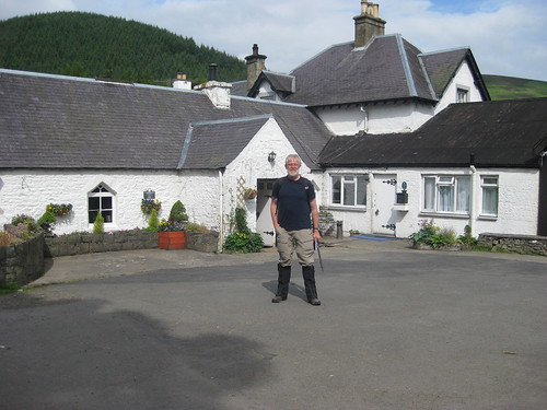
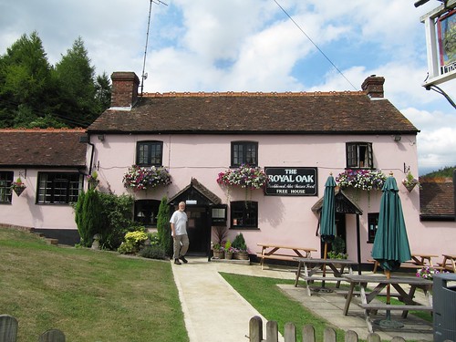
Start: Pear Tree Inn, Hildersham, Cambs, CB21 6BU (OS ref TL543484)

Travel: Bus – 13A, 13B, X13 Cambridge-Linton (www.travelineeastanglia.org.uk)
Road – Hildersham is signed off A1307, 2 miles west of junction with A11 near Cambridge

Walk: (7 miles, easy grade, OS Explorer 209): From Pear Tree Inn, left up street; over crossroads (547489, ‘Balsham’). In 350m, left (549492, ‘bridleway’) on track for ¾ mile to meet Roman road (548505). Right for almost 2 miles, crossing minor road (561498) to cross B1052. In another 200m, opposite noticeboard, right (yellow arrow/YA) across 2 fields to B1052 (572486). Left for 200 m; on left bend, ahead to pass water tower (568480). Right (blue arrow) past Rivey Wood. At bench (562480), left downhill to road in Linton (560473). Right; left down Symonds Lane; pass Granta Leys; first right down lane (‘Icknield Way’) to cross River Granta. Pass bowling green; right (‘Roman Road Walk’). At end of playground, left up to kissing gate (556471, YA). Ignore stile on left; go through gate. On between horse paddocks; cross drive at Little Linton Farm; follow YAs back to Hildersham.

Refreshments/Accommodation: Pear Tree Inn, Hildersham (01223-891680; www.peartreecambridge-bb.co.uk)

Information: Cambridge TIC (0871-226-8006 – local rate);
www.visitcambridgeshire.org

2011 Gower Walking Festival: 4 – 19 June; www.mumblestic.co.uk

www.ramblers.org.uk www.satmap.com www.LogMyTrip.co.uk

 Posted by at 03:10
Jun 112011
 

At last, after days of rain over Scotland, a beautiful sunny morning of wind and high cloud and patches of brilliant blue sky.
First published in: The Times Click here to view a map for this walk in a new window
picture picture picture picture picture picture picture
Facebook Link:
Around Balmoral Castle the River Dee ran broad and sparkling, and the hills cradling the royal retreat were brushed green and gold with bright sunlight.

A couple of miles downriver I made my way through the fields around Abergeldie, climbing over and wriggling under tall ladder stiles, following rickety fences and 4 x 4 tracks knee-deep in heather through the lonely valley that separates the rocky knolls of Creag Ghiubhais (‘hill of the fir-trees’) and Creag nam Ban, the Hill of the Women. The unaccustomed sunshine had called out the butterflies; meadow browns in clouds, leopard-spotted fritillaries, and a beautiful royal blue creature that moved too erratically for me to fix its name for sure. I surprised a buzzard on a field wall; it stared round at me as if it had never seen a human being before, then jumped up and flapped with stiff wing-beats over the trees.

Near the silent buildings at the Mill of Cosh I turned onto a stony track and made for the hills. These 4-wheel-drive roadways have proliferated all through the Highlands, and they are a wonderful asset for walkers. But they haven’t succeeded in keeping a population in the remote back country hereabouts. Beside the track the house of Loinveg stood shuttered among its shelter trees. Beyond lay the great dun-coloured bowl of Glen Girnock, the Girnock Burn snaking through its marshy bottom, heathery hills encircling it. Not a sheep, not a cow. Complete silence, a cold wind, and the exhilaration of striding out in empty moorland with a stunning view ahead to the dark cliffs of Lochnagar.

I passed a tiny stone-built whisky still, some long-forgotten amateur distiller’s illicit pride and joy, and came to the abandoned farmstead of Bovaglie, windows boarded, ornate garden gate swinging in the wind, an eerie and haunted place. A final high stretch looking west into the heart of the Grampian Mountains, and a descent through a pine forest bearded with trailing lichens, down to the road and the broad Dee Valley once more.

Start & finish: Parking bay near Abergeldie Cottages, near Balmoral (OS ref NO 287948)

Getting there:
A93 Braemar-Ballater; at Balmoral, B976 (‘East Deeside’). Cross River Dee; follow B976. Pass sign on left to Clachanturn; next right (unmarked); just past right bend, parking bay on right.

Walk: (8½, moderate, OS Explorer 388): Up driveway opposite, past Abergeldie Cottages and on up grass track. Dogleg left and right (289947); continue uphill, with stone wall and trees on right, to forestry fence. Right; follow fence down; cross 2 ladder stiles (291949); follow fence for ¾ mile, descending beside B976. Pass 2 locked gates; on through trees for 400 yards. At next locked gate by road (304958), hairpin back to right up grassy track through trees, then through open heather for ⅔ mile, passing between Creag nam Ban and Creag Ghiubhais, to meet tumbledown fence (310949). Left along it for ¾ mile to Mill of Cosh; right on stony track (320953). Follow track for 3 miles past Loinveg and Bovaglie. In another mile, right at junction (290923). In ⅓ mile, where track begins to descend, right at track crossing (285925). Stile into forest (286929); at fork in ¼ mile (286934) keep ahead (left); down to Khantore (288938); road to Balnacroft (285944); right to car.

NB: Faint track skirting Creag Ghiubhais – some heather wading!

Lunch: Picnic

Info: Ballater TIC (01339-755306); www.royal-deeside.org.uk

2011 Gower Walking Festival: 4 – 19 June; www.mumblestic.co.uk

http://www.logmytrip.co.uk/

 Posted by at 19:06
May 282011
 

The sun beamed on bean rows and potato ridges in the gardens we passed on our way out of Borough Green.
First published in: The Times Click here to view a map for this walk in a new window
picture picture picture picture picture picture picture picture
Facebook Link:
If Kent is the Garden of England, the stretch of idyllic countryside round this village on the northern edge of the Weald is a particularly lush corner of the vegetable plot. The trees are thriving well, too – there are enough deep pockets of forest left to give a flavour of how dense and green the sprawling old Wealden wildwood must have been before the Kentish ironmasters began stripping the ancient forest for charcoal.

A tangle of bluebell woods runs down the twisting Basted valley, skirting the old millpond with its white-browed coots and delicately stepping moorhens. There were mills all down the River Bourne here, all gone now in favour of fabulous new houses. We walked the woodland paths past long-forgotten watercress beds, then climbed a flinty track onto the roof of the downs, with heat-hazed views over rolling, darkly wooded country. Near the triplet oasts at Yopps Green – how long since they last dried a load of hops? – we turned onto a bridleway and came down off the ridge to Ightham Mote.

A dream of a moated Elizabethan manor, Ightham Mote contains a far older hall house, dark panelled and timbered. This ‘vile and papisticall house’, as it was styled in a Catholic-bashing report of 1585, is truly a place of secrets, of concealed passages and priest’s holes. Tales say that Ightham Mote is haunted by a Grey Lady, the ghost of Dame Dorothy Selby, who gave away the Gunpowder Plot by warning her cousin not to attend Parliament on 5 November 1605, and was walled up alive in the house as a punishment. It never happened like that – but who can stop a good gothic yarn?

We could have stayed all afternoon at Ightham Mote – most of the visitors seemed set to do that. Tearing ourselves away at last, we climbed steep Raspit Hill and followed the path over an overgrown common and into Oldbury Wood. One of the largest Iron Age hill forts in Britain lies hidden in the wood, its earthen ramparts rooted with oak and sweet chestnut. The invading Romans captured it from the Belgae warrior tribe in 43AD as they advanced towards the Thames – perhaps ‘with extreme prejudice’, if the burned defences and mounds of slingshots excavated here tell a true tale.

Picturing the mayhem, we followed the ancient trackway through the silent, tree-smothered old fort and out into the late afternoon sun.

Start & finish: Borough Green & Wrotham station TN15 8BG (OS ref TQ 609574)
Getting there: Train (www.thetrainline.com; www.railcard.co.uk) to Borough Green & Wrotham station. Road: M25 (Jct 5), M26 (Jct 2a); A20 to Wrotham Heath, A25 to Borough Green.
Walk (8½ miles, moderate grade, OS Explorer 147): From Borough Green and Wrotham Station (609574), turn right over the railway. On the following right bend, keep ahead along Borough Green’s High Street (with National Westminster bank on your right). Cross A25 at the end, and continue along Quarry Hill Road (‘Church’). Opposite the church, turn left (608572, ‘footpath’ fingerpost) and follow the footpath south out of Borough Green, crossing a couple of roads and keeping the same direction, to descent through woods to a road near Basted mill pond (607563). Turn left past the pond.
You pass a Southern Water pumping station on your right, and at the foot of Plough Hill fork right (607557) through the woods along the valley bottom. At Winfield Lane (606550) turn right uphill for 100 yards (100 m); then turn left over a stile (fingerpost) and on through an orchard. Cross a river and continue up a stony lane between orchards for two-thirds of a mile to the road in Yopps Green (602542).
At Yopps Green turn left along the road past the three oasts. Opposite White Beam house turn right (602540; concrete bridleway marker) along a bridleway. Keep heading west over crossing paths for a third of a mile (0.5 km) to a T-junction of paths at the top of a rise (596539). Turn right (‘bridleway’) for a third of a mile (0.5 km) through woods to A227. Cross the road (591541); bear left through a gate and along a bridleway (fingerpost). In 200 yards (200 m) bear half-right over a crossing of paths (591539) and continue along the wooded ridge. Follow the path downhill beside a hedge; at the bottom, turn right along a lane (589534) to reach the road at Ightham Mote (584534).
To continue the walk, keep on between the house (on your right) and the lake (on your left). Bear left at the end, then through gates and right up the road for a third of a mile (0.5 km), passing Mote Hill Cottage on your right (583538). In 100 yards (100m) bear left (‘bridleway’) up a woodland track for ½ mile (0.8 km) to cross a road (580546). Climb steeply uphill (‘bridleway’). At the top the path doglegs left and right to reach a crossing bridleway (579547). Turn left for 50 yards (50m), then right (blue arrow) down steps and on northwards across the wooded land of Raspit Hill for a good half-mile (almost 1 km). Pass ponds to reach A25 (579555). Turn right for 200 yards (200m), cross the road with great care to the central reservation, then on to a bus stop at the far side. Fork right here past a National Trust ‘Oldbury Hill’ notice, on a bridleway that rises through the trees.

The bridleway soon levels out. Follow it north for a quarter of a mile (400 m) to a 5-way junction of tracks (582560). Bear half-right (‘bridleway’) and follow this bridleway, crossing various paths, for another quarter of a mile (400 m) to a T-junction at the northern edge of the trees (584564). Right down a bridleway here to follow Oldbury Lane to the A25 (592565). Cross and go down Sevenoaks Road opposite. At A227 turn left, then right up Tycewell Lane opposite the George and Dragon Inn (595566). In 150 yards (150m) bear right up a path just before an oast (fingerpost). In 200 yards (200m), at the top of a bank (598566), bear left along a fence. Just before the A227, turn right along a path (599570), under power lines and across a minor road (602570). Continue along the path for a quarter of a mile (400 m). At a housing estate turn left, then right up Tilton Road. By a ‘Staley Avenue’ sign, keep ahead up a short path. Turn right at the end, then left up Quarry Hill Road (607571) to return to the station.

Lunch: Mote Restaurant, Ightham Mote (01732-811314); George & Dragon Inn, Ightham (01732-882440).
Ightham Mote (NT): 01732-810378, ext. 100)
More info: Sevenoaks TIC (01732-450305); www.visitkent.co.uk

 Posted by at 01:43
May 142011
 

A cold wind over Cumbria, the smell of snow in the air and an overnight dusting of it across the fells around Dufton.
First published in: The Times Click here to view a map for this walk in a new window
picture picture picture picture picture picture picture picture
Facebook Link:
The last time I was here, walking the Pennine Way with my father, there had been no snow dust of white hairs in my beard or hair. We’d had a hell of a day stumbling over Cross Fell in thick mist, but I had retained an affection for the trim little farming village in its neat green dale where we’d stayed the night – £2.50 apiece for B&B.

A cup of coffee in the Tea-by-the-Way Café at Dufton, a saunter round the long village green, and Jane and I were ready for the hills. Goldfinches were tentatively cheeping in the leafless sycamores of the stone-walled lane up the Pur Gill’s cleft, and that wonderful bubbling cry of curlews, so hauntingly evocative, came down from the moors where they would be pairing up for nesting and rearing. Spring was evidently moving in curlew blood, but its green fingers hadn’t yet stirred any response in the trees or wayside plants of these high Pennines.

Looking back above Purgill House, we saw Dufton cradled in green inbye land, the wide vale of the River Eden beyond, and standing magnificently on the western skyline the humpy backs of the Lakeland fells. We watched a snow shower moving across the landscape in Blakean shafts of sunlight, trailing a white hem that clung to the highest peaks and ridges in the thinnest of skins.

Once we had skirted the sharp cone of Dufton Pike and turned up a narrow side dale towards the moors the green road we were following became rocky and dark, and the sides of the dale slop4ed thick with tumbled boulders and charcoal-coloured slack. Lead-miners had burrowed the cleft into a warren of pitch-black levels, and their smelting kilns and spillways and spoil hummocks lay all around. Above the desolation made by those long-gone delvers in the dark, lay the high moor, where we found a stone-built shooting box on the bank of cold, steely and half-frozen Great Rundale Tarn. Coming unexpectedly over the skyline, I shocked a pair of Canada geese who were sailing in the tarn, contemplating connubiality; frantic honking and splashing signalled their displeasure.

It was too damn cold to hang about. We turned about, put our heads down into the buffeting half-gale and pushed back downhill, the fifty-mile view before us blurred by wind tears. We turned along the beautiful wooded valley that lies like a secret behind the nape of Dufton Pike, and were soon back on to the Pennine Way and bowling down to Dufton.

Start: Dufton car park, near Appleby-in-Westmorland, Cumbria POSTCODE (OS Ref NY690250)

Road: Dufton is signposted from Appleby-in-Westmorland (A66).

Walk: (8 ½ miles, moderate, OS Explorer OL19): Right along road from car park, round left bend; on following right bend by Old Dufton Hall, ahead on stony lane (‘Pennine Way’/PW). In 150 m at foot of slope PW forks left; but keep right here (‘bridleway’) up walled lane for 3 ½ miles, passing Purgill House (696257) and mine workings of Threlkeld Side, to reach shooting box by Great Rundale Tarn (729283). Return for 2 miles past mines. Under Dufton Pike, right over wall stile at yellow-topped post (704268), down to another post, over stile and right along track through Great Rundale Beck valley (yellow arrows). At clapper bridge (692273), left on PW to Dufton.

Conditions: Upper moors can be cold, wet and inhospitable – dress appropriately!

Lunch: Stag Inn, Dufton (01768 351608; thestagdufton.co.uk); Tea-on-the-Way Café, Dufton (01768 352334)

Accommodation: Brow Farm B&B, Dufton, CA16 6DF (01768-352865; browfarm.com)

Information: Appleby-in-Westmorland TIC (01768-351177);

www.ramblers.org.uk www.satmap.com www.LogMyTrip.co.uk

 Posted by at 02:36
May 072011
 

The rolling landscape where Gloucestershire shades into Oxfordshire is thickly woven with footpaths and studded with villages of mellow gold stone.
First published in: The Times Click here to view a map for this walk in a new window
picture picture picture picture picture picture picture picture
Facebook Link:
In this north-east corner of these delectable hills you can walk in classic Cotswold countryside, but without those camera-clicking Cotswold crowds. However, if you would like to hook up with a merry bunch of fellow-walkers … then 21 May is the date for your diary. That’s when thousands will be converging on Blenheim Palace for the Breast Cancer Care charity’s annual Pink Ribbon Walk – 10 or 20 miles (you choose) through gorgeous countryside to raise money and awareness, to hear and share stories, and to have a damn good party into the bargain.

On a brilliant day of blue sky and balmy weather Jane and I set out to explore this overlooked corner of the Cotswolds. From Stonesfield, as pretty as a picture among its trees, the Oxfordshire Way took us up among big yellow fields of oilseed rape where yellowhammers in the hedges wheedled for a-little-bit-of-bread-and-no-cheeeeese. An invisible lark poured out song like the trickle of a brook. Views were big and broad, with a heat haze softening the dark green of spinneys and windbreak woods.

Down in the valley of the River Evenlode, swallows skimmed the stone-tiled roofs of Fawler. Dark Lane led us between hedges carefully tended by the Friends of Wychwood Hedge-laying Group, up a cowslip-spattered valley to Finstock. On through the environmentally-friendly farmland of Wilcote Farm with its generous field headlands and vigorous patches of yellow archangel. All around lay evidence of a countryside loved and cared for, its wildflowers and birds given the elbow-room they’re so often denied in more rapaciously farmed regions.

At North Leigh we went into St Mary’s Church to admire the north chapel with its fan vaulting and richly carved 15th-century alabaster tomb of Sir William Wilcote and his wife Elizabeth. Over the chancel arch hung a splendid medieval Doom painting, the Saved and the Damned all naked and prayerful, with a coal-black Devil and his red-faced acolytes jeering the Damned into eternal fire. Outside, all seemed a dream of peace – horses cropping the meadows near Holly Court Farm, the smooth gurgle of the Evenlode round its meandering bends, and the splashing and laughter of picnicking families by the river as we made our way back up the old cart track to Stonesfield.

These Oxfordshire Cotswolds really are beautiful country. I wish I could be a fly on someone’s trainers on 21 May. The Pink Ribbon walkers are going to have the most amazing day of it.

Start & finish: near St James’s Church, Stonesfield OX29 8PT (OS ref SP 394171)

Getting there: Train (www.thetrainline.com; www.railcard.co.uk) to Charlbury.
Bus (www.stagecoachbus.com) service S3 (Charlbury-Oxford).
Road: Stonesfield is signed off A44 Woodstock-Chipping Norton.

Walk (8½ miles, easy, OS Explorer 180): Park in ‘square’ (actually a triangle!) by St James’s Church, Stonesfield. With your back to church, bear left along High Street. Opposite Methodist chapel, left down walled lane (‘bridleway’). At bottom, cross road and go up stony bridleway (390173; ‘Oxfordshire Way/OW’). In 400m, ahead over crossroads along tarmac lane. In another 400m pass end of woodland belt. Road bends right by Hall Barn Farm Cottages, but keep ahead here (383177; blue arrow/BA) through gate (OW) and on down right side of hedge. In ½ mile, at crossing of bridleways, left off OW (375180) on bridleway (BA) descending to Fawler. Left along road. Opposite bus stop, right down lane (372170; ‘Finstock 1’ fingerpost). Cross under railway and over River Evenlode. Follow path on far bank and through shallow valley. Keep ahead at ‘Right of Way’ arrow among trees (368166); on up Dark Lane to Finstock.
Right past Plough Inn (362161); left up side of Plough (fingerpost) on path on right side of pub car park. On (yellow arrow/YA) through kissing gate, up field edge. At far end, through kissing gate (362159); don’t turn right here, but keep ahead with hedge on left. Path doglegs left and right, then crosses field; through Ramsden Mill Longcut woodland strip (364156); on along wide field paths to road (367151). Left for 20m; right (‘Wychwood Way’/WW fingerpost) through Holly Grove wood. At end of wood (372143), on along hedgeside track (YA) for 2 fields to turn left along North Leigh Lane. In 300m pass footpath diverging to left (374136; fingerpost); on next bend, bear left (‘WW’ YA) along path in tunnel of trees. In 400m, right along End Farm drive (379134); in 20m, left (‘Church ½’ fingerpost) across fields (kissing gates, YAs) to St Mary’s Church, North Leigh. (NB For Woodman Inn or Mason’s Arms, turn right from church to top of hill, then right to pubs).
Continuing walk from church – left along road; in 20m, left (‘bridleway’ fingerpost) along farm drive. In 400m, right over stile and down hedge; cross brook (385140), through gate and up fence to road (386143). Left for 50m; right down Holly Court drive (‘Bridleway, Ashford Bridge 1’). At buildings bear right to T-junction (386147); left and continue, following BAs by brook for ½ mile to road near Ashford Bridge (385154). Right to crossroads by bridge; right (‘East End, Hanborough’), following path on right bank of Evenlode (‘Stonesfield 1½’ fingerpost). Under railway; on to kissing gate; aim across meadow to cross footbridge (383164). Up cart track opposite; at road, forward to Stonesfield ‘square’

Walk as described covers only part of Pink Ribbon Walk.
Lunch: Plough Inn, Finstock (01993-868333; www.theplough-inn.co.uk); Woodman PH (01993-881790) or Mason’s Arms (01993-882005), North Leigh.

Breast Cancer Care (www.breastcancercare.org.uk) Pink Ribbon Walks 2011 at Scone Palace, Perthshire (14 May); Blenheim Palace, Oxfordshire (21 May); Cholmondeley Castle, Cheshire (4 June); Petworth House, West Sussex (11 June). Info: 0870 145 0101 or www.pinkribbonwalk.org.uk

Isle of Man Walking Festival 2011: 15-20 May (01624-664460; www.visitisleofman.com)
Llanelli Festival of Walks, Carmarthenshire: 27–30 May 2011, www.llanelliramblers.org.uk

www.ramblers.org.uk www.satmap.com www.LogMyTrip.co.uk

 Posted by at 02:11
Apr 302011
 

‘Thy word is a lantern unto my feet and a light unto my path.’ Cheering words for a walker, the text that encircles the lych arch of St Swithun’s Church at Cheswardine.
First published in: The Times Click here to view a map for this walk in a new window
picture picture picture picture picture picture picture picture
Facebook Link:
Not that Jane and I had any need of lantern or light – the temporal sort, any way – on this gloriously clear morning of blue sky and crisp weather along the borders of Shropshire and Staffordshire. A casual, car-borne passer-through might dismiss such low-rolling green farming landscape as modest, even dull. But tracing out a circuit from the footpaths on OS Explorer 243, we found we’d lucked into a most beautiful walk in unsuspected country.

Puce-faced Cheswardine Hall looked down on us from its ridge; dozens of windows under the arched eyebrows of Gothic gables. Ice skinned the puddles, frost bearded the grass. The dark red sandstone soil lay studded with pebbles smoothed by ancient seas. A pale sun rode in a milky sky over a countryside carefully farmed and carefully maintained, where waymarks and stiles pointed out our path across fields of young wheat. Spinneys of sweet chestnut and oak rose here and there, and out of one of them we startled a pair of greylag geese with a tremendous brouhaha of panicky honking and sawing of powerful wings.

Below Lipley Farm a wonderful folly of a barn conversion was in process – a crow-stepped wall reminiscent of a German civic square at one end, a slender mock church tower at the other, and a thatched cottage pinched between them. By contrast, Chipnall Mill in its tangled dell on the banks of Coal Brook was no more than a pile of moss-green timbers, a broad millpond the only clue to its centuries of working life. From the ridge beyond we got wonderful views across the stream valley, out to far wooded hills of the blue A.E. Housman kind.

‘Roman Villa’ said the map as we neared the hill-top hamlet of Hales. Hummocks and a curving ditch in a field edge were all that remained. Among the neat estate-built cottages we caught the rich scent of newly cut pine from Hales’s sawmills. Down to the flooded fields around Coal Brook to watch greylags flying as solid and steady as cargo planes, then up a hedged green lane and a mossy holloway to the opposite ridge.

Down again through the wet hazel woodland of Lawn Drumble, and a last stretch beside a field of elephant grass growing for the biofuel furnace – a strangely exotic, tiger-striped finale to a green and pastoral, a thoroughly English country walk.

Start & finish: St Swithun’s Church, Cheswardine, Salop TF9 2RS (OS ref SJ 719299)

Getting there: Cheswardine is signposted off A529, south of Market Drayton

Walk: (7½ miles, easy, OS Explorer 243): Down Church Lane to T-junction (723302). Take track on right of Cheswardine Hall gates (fingerpost), past Marsh House; on across fields (kissing gates, yellow arrows/YAs) for 1 mile. Cross Moss Lane (737311), along Lipley Farm drive (fingerpost). Opposite house, right over stile (YA); skirt silage clamp; at bottom of field, over stile (YA). Bear left across field in front of cottage with tower, aiming for top left corner of field (740318). Cross lane (stiles, YAs); dogleg round field, right across stile (740320). Diagonally left across field: cross 2 stiles to right of Chipnallmill Farm (737322); down to gate (YA). Cross Coal Brook beside Chipnall Mill ruin; up through gate above to farm lane (736327); left along it for 1⅓ miles to Hales.

At road (719338), ahead for 170 m to T-jct; left. In ½ mile, pass Lloyd Cottage on left bend; right (719330) here down farm lane, through gate by stables; follow lane for ⅓ mile to recross Coal Brook (714329). Up green lane, then wet holloway (YAs) to Johnson’s Wood Farm (713324 – the more northerly of 2 named thus on Explorer map). Keep right of farm buildings; cross stile (YA); follow drive. Left at road; right (712316; fingerpost; ‘Cheswardine Park Farm’) between houses and along farm drive. In 100 m, left (fingerpost) across field, aiming between two woods. Along wood and field edges (YAs), through edge of Lawn Drumble (715307), on with fence, then wood on your left, into Cheswardine.

Lunch: Wharf Tavern, Goldstone, TF9 2LP (by canal, 1 mile from Cheswardine): 01630-661226; www.wharfcaravanpark.co.uk/wharf-tavern
NB Red Lion, Cheswardine (01630-661234) open evenings Mon-Fri, lunchtime and evenings Sat-Sun; Fox & Hounds, Cheswardine (01630-661244) open evenings Tue-Thur, lunchtime and evenings Fri-Sun.

Accommodation: Four Alls Inn, Woodseaves, TF9 2AG (01630-652995; www.thefouralls.com) – 3 miles from Cheswardine.

More information: Market Drayton TIC (01630-653114);
www.shropshiretourism.co.uk

www.ramblers.org.uk www.satmap.com www.LogMyTrip.co.uk

 Posted by at 05:28
Apr 232011
 

Tibbie Shiels Inn stands beautifully positioned on the narrow isthmus that separates the Loch of the Lowes from its bigger sister, St Mary’s Loch.
First published in: The Times Click here to view a map for this walk in a new window
picture picture picture picture picture picture picture picture
Facebook Link:
James Hogg, the Scottish Borders shepherd-poet born in the nearby Ettrick Hills, would call into the inn from time to time around the turn of the 19th century. Hogg, who left school at 7 years old, was often dismissed as a rough-arsed yokel, a ‘boozy buffoon’ and a bit of an oaf. But today a handsome statue of the man looks past the inn towards the Captain’s Road, a stony old track that carried Jane and me up into the hills on a blowy morning.

The rounded hills bulged on all sides, dotted with circular stone sheepfolds, evidence of the sheep farming that once dominated these borderlands. The old pens down by the Crosscleuch Burn lay so neatly walled into compartments they could have been built as an example of good practice. But there’s little shepherding as James Hogg would have recognised it in the back hills today.

In a roadless valley beyond Earl’s Hope we found Riskinhope Hope, once the home of a shepherd and his family, now a hollow square of stone walls under tattered shelter pines. We sat and munched our sandwiches, trying to imagine life in this isolated cleft with only the trickle of the sike and bleating of sheep to break the silence.

Up on the ridge beyond the views were immense, out over sombre brown hills under an enormous sky. We followed an old grassy track down towards the main farm of Riskinhope, still flourishing in the green valley of the two sister lochs, its farmer striding with stick and dog among his flocks.

Along the lochside path grew monkeyflowers, broad yellow trumpets spotted with scarlet. There were early purple orchids and ragged robin, butterworts and milkmaids, mint and thyme – a floral carpet laid alongside the Loch of the Lowes. Here is a scene of absolute stillness, caught by James Hogg in his poem ‘Caledonia’:

‘Sweet land of the bay and wild-winding deeps
Where loveliness slumbers at even,
While far in the depth of the blue water sleeps
A calm little motionless heaven.’

The Ettrick shepherd helped his lifelong friend Sir Walter Scott to collect ballads for the latter’s hugely successful 1802 collection Minstrelsy of the Scottish Border. Hogg, a lifelong fiddle-player and singer, later lamented that setting the old Border ballads down in print had killed them off as a living oral tradition. I hope his shade attends the music sessions that flourish at Tibbie Shiels Inn. It would give the old shepherd pleasure to find out just how premature his judgement was.

Start & finish: Tibbie Shiels Inn, St Mary’s Loch, Selkirkshire TD7 5LH (OS ref NT 240205)
Getting there: Signposted off A708 (Yarrow-Moffat).
Walk (5 miles, moderate, OS Explorer 330): Follow Southern Upland Way/SUW waymarks up Captain’s Road (waymarked ‘Ettrick via Captain’s Road’) for 3 miles via Thirlestane Burn crossing (247200), Earl’s Hill, Riskinhope Hope abandoned farm (250183) and on for ⅔ mile. On ridge, opposite end of forestry down on your left, pass SUW post; in 400m, on Pikestone Rig, come to 2 SUW posts 20m apart (244176). Descend to lower post (yellow arrow/YA pointing left); bear right here on clear grass path, down to Riskinhope Farm. Through gate in fenced field; down through lower gate; ignore YA pointing ahead past farm, and bear right through trees along lochside path for 1 mile to Tibbie Shiels Inn.

Lunch/accommodation: Tibbie Shiels Inn (01750-42231; www.tibbieshiels.com)
Tea: Glen Café, St Mary’s Loch (01750-42241;
https://sites.google.com/site/glencafestmarysloch/home )
More info: Selkirk TIC (01750-20054); www.visitscotland.com/surprise
www.ramblers.org.uk www.satmap.com www.LogMyTrip.co.uk

 Posted by at 04:40
Apr 162011
 

Goliath lay at ease in Churston station, lazily jetting steam and curls of smoke into the cloudless blue South Devon sky.
First published in: The Times Click here to view a map for this walk in a new window
picture picture picture picture picture picture picture picture
Facebook Link:
We stood watching – Jane, her sister Susan and I – mesmerised by the sounds and smells of childhood. ‘She’ll stay there till she’s ready to go,’ was the Zen-like observation of the man on the bridge. When the little black tank engine finally moved off, chuffing and clanking, her place at the platform was taken by Lydham Manor, resplendent in Great Western Railway green, simmering like a kettle and emitting mournful hoots like an owl on the boil.

Out beyond the village we found stony Combe Lane rising gently, a hollow way through unseen fields. Buildings, cars and the trains of the Dart Valley Railway had all been whisked out of sight and earshot in a fold of the landscape, and we walked in a tunnel of blackthorn bushes and coarse-leaved elm suckers bursting with finch song. It wasn’t until we were standing tiptoe on the fence at the crest of the hill like inquisitive kids (it must have been the Goliath effect) that we caught our first glimpse of the Dart estuary, a blue gleam between wooded hills, a scatter of yachts, a sprinkle of civilisation around Torbay, and the jagged granite vertebrae of Haytor sticking out of the back of Dartmoor on the northern horizon a dozen miles off.

Beyond Higher Greenway and tree-cloaked Oakham Hill we followed a permissive path near the narrow estuary, south along a hillside where Long Wood clung steeply above the river. A hoot and a rapid panting from down by the Dart betrayed Goliath’s progress along the waterside line. A gap in the trees allowed a peep over the river, a jade-green snake between dark woods and fields of deep red Devon soil. ‘I-think-I-can, I-think-I-can!’ fussed invisible Goliath.

Down and out of the woods, descending paths to emerge on the River Dart opposite the Royal Naval College, huge in red brick, all towers and ranks of windows on its hill. Trundling ferries churned the estuary between Kingswear and Dartmouth, opposing nests of tight-packed houses, blue, pink, white, yellow on the steep, as pretty as a picture. As we walked between river and railway towards Kingswear, Lydham Manor came hissing past in a cloud of pungent coal smoke, every carriage window filled with faces, an escapist grin across every one.

Start: Churston station, Dart Valley Railway TQ5 0LL (OS ref. SX 894563)
Finish: Kingswear station TQ6 0AA (OS ref SX 881510)
Getting there: Train (www.thetrainline.com; www.railcard.co.uk) to Paignton; Dart Valley Railway (01803-555872; www.dartmouthrailriver.co.uk) to Churston.
Road: A379 Paignton-Dartmouth; Churston station signed in Galmpton.
Walk (5 miles, moderate, OS Explorer OL20): Leaving Churston station, left across railway; left down Greenway Road. In ⅓ mile, left past Manor Inn. Up hill; left along Kennel Lane; cross railway; right along Combe Lane (‘Greenway Walk’/GW). In ⅔ mile at top of rise among trees, right (blue arrow, GW) along hedged lane. Cross stile; follow hedge/fence for ⅓ mile. Just before gate of Higher Greenway, left (‘permissive path’; Dart Valley Trail/DVT) into Long Wood. Steeply downhill; follow track (white, blue arrows). Where DVT turns steeply downhill to right by wooden frame, keep ahead. In 1 mile path hairpins right; descend to bear left across stream (DVT). Follow DVT for ½ mile to cross A379; on along roadway; in 400m, right (DVT) down path; cross road and railway; left along estuary to Kingswear station.
NB – Online maps, more walks: www.christophersomerville.co.uk
Lunch: Royal Dart Inn (01803-752213), Ship Inn (01803-752348; www.shipinnforecast.com), Kingswear
More info: Dartmouth TIC (01803-834224; www.discoverdartmouth.com)
www.ramblers.org.uk www.satmap.com www.LogMyTrip.co.uk
Llanelli Festival of Walks, Carmarthenshire: 27–30 May 2011

 Posted by at 05:00
Apr 092011
 

The Royal Oak sits snug, tucked down out of sight in a steep cleft of the Sussex Downs a few miles north of Chichester.
First published in: The Times Click here to view a map for this walk in a new window
picture picture picture picture picture picture picture picture
Facebook Link:
It’s hard to prise the regulars out of this delightful walker-friendly pub, especially Shagger Shepherd. Old Shagger hasn’t left the place since 1680, when he was shot dead in the bar for stealing sheep. He’s been seen by many since then, and photographed by landlord Dave Jeffery. If you should meet Shagger, don’t offer your hand – it’ll go straight through him.

On a steamy, showery morning we set out from the Royal Oak up a broad flinty track through woods of yew and fern beech on Philliswood Down. The pale sun struck gold out of the grass hummocks of the Devil’s Jumps – five Bronze Age bell barrows in a row, lined up with the rising sun at midsummer solstice. Out of the trees on the open downs, the ancient track of the South Downs Way stretched into the distance along the ridge, a ribbon of pale grass and rutted chalk. The view opened out dramatically, pastoral lowlands stretching away north from the foot of the downs escarpment, and a southward prospect of snaky cornfields and woods dipping to a hazy hint of sea.

We turned off the South Downs Way with its hurtling cyclists, and dipped steeply down a woodland path through the yews on Didling Hill. There are still enough sheep in the pastures below to get Shagger Shepherd shot all over again, but long gone are the great days of Sussex Downs sheep farming. Back then the shepherds in broad-brimmed hats and thick cloaks would give thanks in the little chapel of St Andrew, known far and wide as the Shepherds’ Church, in its lonely stance by the lane to Didling.

In one of the diminutive, iron-hard oak pews we sat out a quiet ten minutes, overseen by the fiercely moustached Green Man carved on the pulpit. Then we walked on through timeless farming landscape, from mellow, red-tiled Didling to neat little Treyford. Back up a stiff old track round Mount Sinai to the roof of the downs under clearing skies, and on through rolling barley fields. Obliterated by the green and gold corn lies the herb-rich sward where Sussex Downs shepherds once stood in all weathers, solitary men with their chins on their crooks, ever alert for bloat and scab, rough winds and rustlers.

Start & finish: Royal Oak Inn, Hooksway, near Chichester PO18 9JZ (OS ref SU 815162)
Getting there: Hooksway is signed off B2141 between Petersfield and Chichester. Park at Royal Oak – but please ask permission, and give them your custom!
Walk (6 miles, moderate grade, OS Explorer 120): From Royal Oak turn north-east up broad track, the middle one of 3 (red arrow/RA, ‘Restricted Byway’). At crossing of tracks on Philliswood Down, keep ahead on South Downs Way (824169). In ¾ mile, leave the trees; in 300m turn left (837174; ‘bridleway’, blue arrow/BA) to descend Didling Hill. In ¼ mile, on left curve, turn right up bank (833177; yellow arrow/YA on post) to descend steep woodland path. On down road to pass Didling church (835181). In Didling, keep ahead (‘Ingrams Green’); in 150m, left (837185; YA, fingerpost) through Manor Farm farmyard. Cross stile; follow YAs through hunting gates and along hedges for ½ mile. Cross stile; down through trees, over stream (827187); keep ahead (fingerpost, YA) to road on bend in Treyford. Right (ahead) to T-junction (824188). Left; on left bend, ahead through farmyard (fingerpost). Follow stiles and YAs into field with earthworks. At bottom left corner, cross stile; right (823185; ‘bridleway, BA) along bridleway between fences for ½ mile. At crossing of bridleways, ahead (BA); at next hedge crossing, left (815188; ‘Public right of way’; purple arrow/PA on fingerpost in bush); up trackway between hedges. In 150m, left (PA) up steep track through Mount Sinai wood. In 250m, ahead across track (PA); at top of incline, ahead (816183; ‘Restricted Byway’, PA). In 350m, at junction of paths, cross wide chalk track (815179) and keep ahead on grassy path through trees. In 600m, descend to trackway (816173). Ahead (‘Public right of way’, fingerpost). In 50m, ahead through gate (‘bridleway’, BA); cross field and follow bridleway to Hooksway.

Lunch: Royal Oak, Hooksway (roaring fires, resident spectre, good beer and food): 01243-535257; www.royaloakhooksway.co.uk
More info: Tourist Information Centre, 29a South Street, Chichester (01243-775888, www.visitchichester.org);
www.ramblers.org.uk www.satmap.com www.LogMyTrip.co.uk

 Posted by at 05:12
Apr 022011
 

Lord, what a beautiful Welsh Borders day; one of those fabulous cold winter afternoons when the sky is untroubled blue, the air’s as clean as a whistle, and you just know that from the heights of the Shropshire/Powys border you could see for a hundred miles.
First published in: The Times Click here to view a map for this walk in a new window
picture picture picture picture picture picture picture picture
Photo’s: Andy Harrison
Facebook Link:
Absolutely the day to explore the three peaks of the Breidden Hills, then, with my godson Andy Harrison, enthusiastic walker and geologist.

‘It’s always amazed me,’ mused Andy at the summit of Moel y Golfa, ‘how you can have three hills so close, but so totally different in geology. Where we’re standing is what’s left of a huge volcanic body that erupted about 450 million years ago. Then Middletown Hill,’ – he pointed across to a smooth rounded dome – ‘is the tuff, the ashes and waste, chucked out by the volcano. And that rough crumpled hill to the north, Breidden Hill itself – it’s dolerite, a tongue of magma that pushed out from the volcanic chamber and cooled.’

We gazed across the green plain where the River Severn lay in meanders and oxbows of brilliant enamelled blue, out to Cadair Idris nearly 40 miles off on the coast of west Wales, to the whaleback of the Wrekin, to the minuscule bump of Helsby Hill forty miles to the north and the shallow ridge of the Long Mynd and Wenlock Edge to the south. Here was my hundred-mile view, and food for speculation, too, in the blocky stone pillar on the summit of Moel y Golfa. Its inscription eulogised the Romany Chell or leader Uriah Burton, (‘Big Hughie’) – ‘a fighter for the weak, good to the poor, never beaten in fisty cuffs, a man who led his people into the twentieth century’. What more fulsome obituary could anyone want?

We dipped and swooped up to the Rodney pillar on Breidden Hill, ‘erected by subscription of the Gentlemen of Montgomeryshire’ in 1787 to honour Sir George Brydges Rodney, Admiral of the White. What on earth might Admiral Rodney and Big Hughie have found to say to each other, supposing they had ever met? Maybe they’d have blacked one another’s eye and then shared a glass of something convivial – so we speculated, anyway.

Whether anyone of note is buried in the Iron Age fort on Middletown Hill, neither history nor grand monuments relate. But the third of the Breidden summits gave Andy and me a last prospect over the Midlands and Welsh Borders, bathed in evening sunlight and looking good enough to eat.

Start & finish: Middletown car park, near Breidden Hotel, Middletown, Powys SY21 8EL (OS ref SJ 301125).

Getting there:

Train (www.thetrainline.com; www.railcard.co.uk) to Welshpool (5 miles)
Bus: X75 (www.tanat.co.uk) Welshpool-Shrewsbury
Road: M50, M54, A5 to Shrewsbury; Middletown is on A458 Welshpool road. Car park beyond Breidden Hotel.

Walk (6½ miles, hard, OS Explorer 240): From car park turn left along A458. In 100 yards take tarmac track on left of road. In 100 yards, cross road (298123); up path to right of house; in 70 yards left through gate (yellow arrow/YA) and up slope of field to cross stile (296124). Path hairpins to right and climbs. In 200 yards, sharp left (297125, YA), steeply up through trees, aiming for ridge (occasional YAs). Once there (293127 approx), bear left along ridge to Romany monument (291125) on Moel y Golfa. Continue along crest of ridge, then scramble down rocks; on down through trees, soon following white arrows, for a good half-mile. Where track steepens and bends left on Golfa Bank, look for cairn of stones on right, turn right here (285117) on level path through trees. In 200 yards fork right (fingerpost) to house and road (284121). Left along road for ¾ mile; then left (292130), following bridleway up to crossing of paths at New Pieces (293134). Continue on bridleway; in ¼ mile, at footpath crossing, left (295137, YA), up and over saddle to T-junction of paths. Right to forest road (296141). Left; in 250 yards fork right; through gate, and zigzag left and right up to Rodney’s Pillar (295144).

Bear right off summit from pillar, steeply down grass path (YA), through fence in dip (297143); on east (YA). In a couple of hundred yards, through kissing gate; on down into valley. At saddle under Brimford Wood (303144) bear right (YAs) down to cross track (blue arrows); on down to cross stream (305142 – very muddy!). In 30 yards right through gateway; on with hedge on left, to follow lane to Belle Eisle Farm (307137). Right along road; in 50 yards, left to skirt Belle Isle Cottage; fork right (YAs) up very steep path to saddle between Bulthy Hill and Middleton Hill (308135). Right to summit of Middletown Hill (305133). On down to saddle between Middletown Hill and Moel y Golfa (301131). Ignore YA pointing ahead, and turn sharp left, steeply down to A458 and Breidden Hotel.

Conditions: steep, muddy; not waymarked throughout; for confident map and GPS/compass walkers

Lunch: Breidden Hotel (01938-570250; http://www.ukpubfinder.com/pub/35028)
– Chinese, Thai and English cooking

Accommodation::
Old Hand & Diamond Coedway (01743-884379;
www.oldhandanddiamond.co.uk
More info: Welshpool TIC (01938-552043); www.visitmidwales.co.uk
www.ramblers.org.uk;
www.satmap.com
www.LogMyTrip.co.uk

 Posted by at 01:24