Mar 262011
 

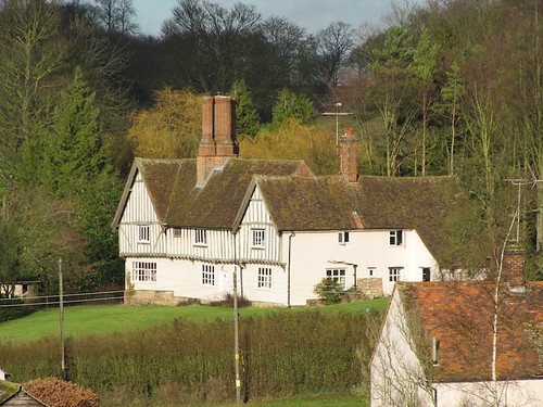
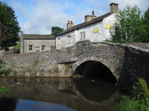
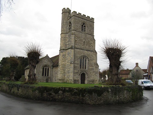
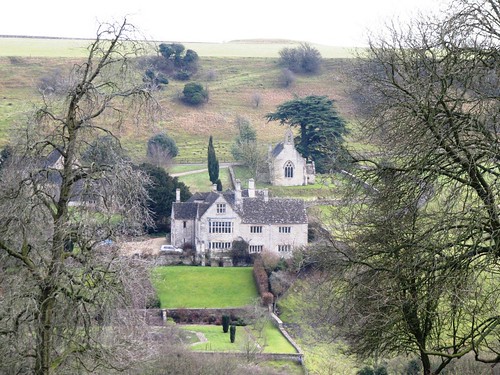
A golden afternoon after rain, with the sun spread like a layer of butter across the rich Cotswold stone of Chedworth’s houses.
First published in: The Times Click here to view a map for this walk in a new window
Facebook Link:
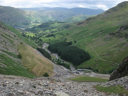
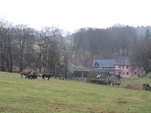
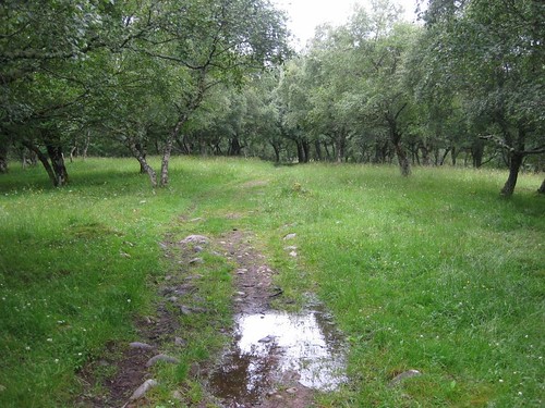
Old and new together, they huddled along the lane, sending columns of sweet-smelling applewood smoke vertically into the still air in the hollow. Up in Chedworth Woods above the village we turned down through ancient hazel coppice and came by Chedworth Roman Villa.

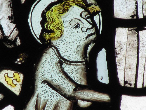
What a moment that must have been on a workaday afternoon in 1864 when a gamekeeper, digging out his hideaway ferret from a rabbit burrow, unearthed fragments of ancient pottery and faded mosaic tiles. He told his employers, they passed on news of the find, and piece by piece the remains of one of the largest and finest Roman villas in Britain were excavated from the skirts of the wood – hot sauna, cold plunge pool, sacred spring, servants’ quarters, latrines, corridors. Also a dining room with a glorious mosaic floor celebrating the Four Seasons – Winter cloaked, hooded and clutching a bare tree, Spring plump and comely with a bird in the hand.

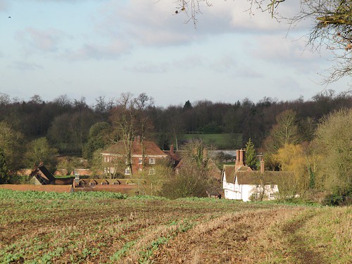
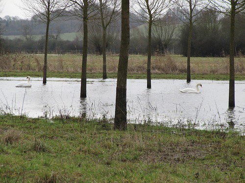
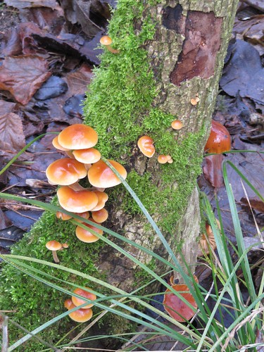
Jane’s sharp eyes noticed a big edible snail inching through the leaves, its canary-yellow foot wrinkled like an old man’s lips. These snails have been living here for 2,000 years, ever since the conquerors introduced them as delicacies for the pot. What a fabulous quality of life those Roman law-givers and road-builders enjoyed. Were they insecure in their luxury houses, aware of being envied and hated by the locals? Or were they like popular uncles, jolly and sybaritic, givers of great parties? Did they give a damn either way? Musing on that, we followed the wood edge down to the lovely cluster of buildings at Yanworth Mill, then swung up again through the trees.

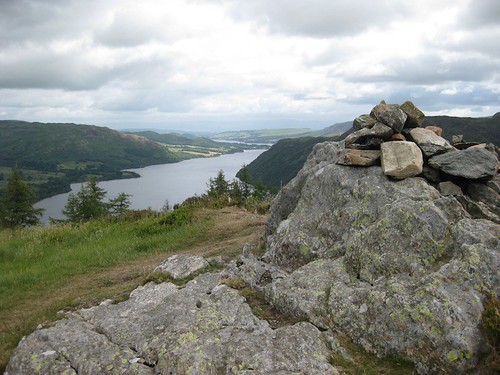
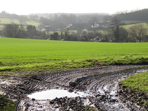
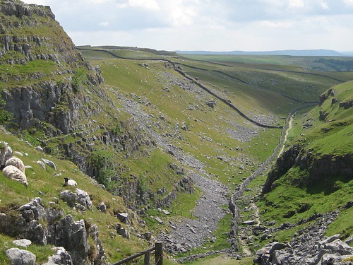
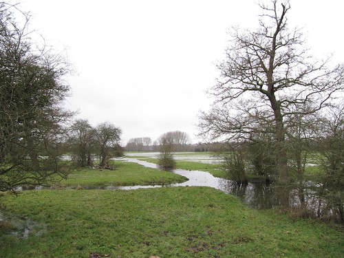
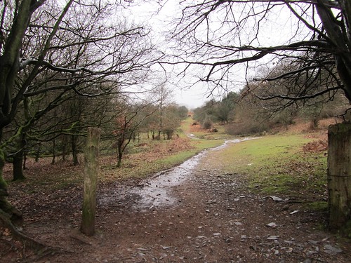
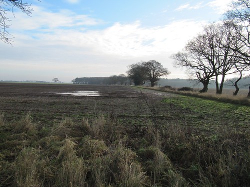
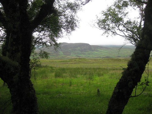
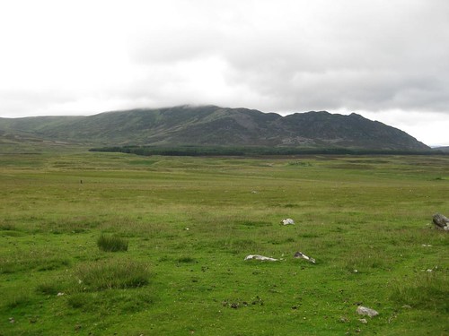
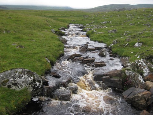
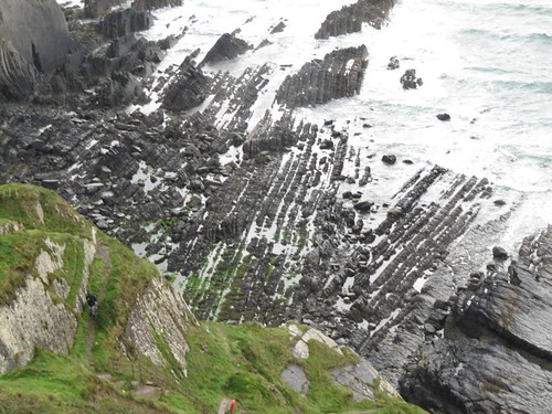
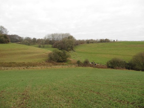
Out onto the roof of the Cotswolds, tramping enormous fields of winter wheat; a steep descent by hedges hung with withered bryony berries into the roadless valley of Listercombe Bottom; up again by a wonderful old stone barn at Greenhill Farm, filled with the winter’s firewood. On across a field where a rangy wire-haired lurcher crouched, furtively eating a young rabbit.

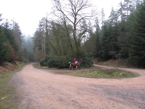
‘A lovely afternoon you’ve picked for it,’ smiled the rider of a skittish glossy black hunter in the paddock at New Barn. ‘Go across, he won’t hurt you.’ Nor did he. Huge wild weather clouds were building on the southern skyline, but we beat them back to Chedworth by a short head. Old Winter from the mosaic in his cloak and stout leggings would have outfaced the blast, for sure.

Start & finish: Seven Tuns PH, Chedworth GL54 4AE (OS ref SP 052121)
Getting there: Bus – 864 (Cotswold Green: 01453-835153) Tue, Wed, Fri.
Road: signed from A429 (Northleach-Cirencester).
Walk
(7 miles, easy/moderate, OS Explorer OL45): From Seven Tuns, right
along road. In 100m, left by Corner Cottage. At top of slope, right
(‘Roman Villa, footpath only’), over stile. Bear left to cross
stile; through plantation (053125, yellow arrow/YA, Macmillan
Way/MW). Ahead through gate at top; on into Chedworth Woods. In ¼
mile, right at post (051132, MW, ‘Roman Villa’). Pass Roman Villa
(053134); continue to ‘Give Way’ at crossroads (056135). Right
through green gates; continue for just over a mile. Through gates at
Yanworth Mill; in 30m, right up footpath (072130, fingerpost) through
woods (YAs, fingerposts). At edge of trees (066127), aim half left
for pole; on to 3-finger post; don’t turn right, but keep ahead to
pole by gate. Cross road (065123, fingerpost); ahead into Listercombe
Bottom. Through hedge on descending path to bottom of dip (064120).
Over crossroads of paths, and look for YA; make for fingerpost on
skyline. Diagonally left across field; over stile (YA); cross next
wall; right (066117) along broad walled ride to join Monarch’s Way
(MoW) at crossroads (065115). Ahead downhill, following lane down and
then up to cross road at Bleakmoor (063110). Right up lane by Emma’s
Cottage; in 50m, ahead; then swing left across disused railway. Track
bends right to cross Fields Road (058109, fingerpost). On across
paddocks (MoW), round New Barn (MoW) to cross road (049108). Aim half
left (fingerpost, MoW); follow blue arrows/MoW across 4 fields. At
end of 4th field (037103), right on Macmillan Way; follow it for 1
mile past Setts Farm to cross road (050117). Follow track opposite
into Chedworth.

Online map, more walks: www.christophersomerville.co.uk

Lunch:
Seven Tuns PH, Chedworth (01285-720242;
http://www.youngs.co.uk/pubs-more.asp) – wonderful gem of a characterful country pub
Chedworth Roman Villa (NT): 01242-890256;
www.nationaltrust.org.uk/main/w-chedworthromanvilla;
www.chedworthromanvilla.com
More info: Cirencester TIC (01285-654180); www.visitcotswolds.co.uk
www.ramblers.org.uk;
www.satmap.com
www.LogMyTrip.co.uk

 Posted by at 01:06
Mar 122011
 

‘That’s Glenridding Dodd.’ Mark Hook pointed out of the dining room window at Moss Crag guesthouse. ‘It’s a shame people don’t go up there from Glenridding any more.
First published in: The Times Click here to view a map for this walk in a new window
picture picture picture picture picture picture picture picture
Facebook Link:
The Victorians did, and they knew a good view when they saw one. It’s a beautiful little fell. And here’s how you can link it up with Sheffield Pike …’

In the Lake District it’s handy to have a B&B host who knows the local fells inside out. Within five minutes Mark had pencilled out the route on my map. It didn’t seem too fearsome, even though some of the contours looked a little close-packed for comfort. After all, if Victorian ladies and gentlemen had managed it in their crinolines and well polished high-lows …

Half an hour into the walk I paused to catch my breath, not for the first time. If our genteel ancestors really did ‘ascend’ Glenridding Dodd (it was always ‘ascending’, never ‘climbing up’) by this 45° channel of rubbly stones, they must have been made of stern stuff. In an era when high fells like Helvellyn and Scafell Pike were still considered Alpine in difficulty, Glenridding Dodd was a worthy objective for a family ‘ascent’. Up at the summit of the Dodd, a towering lump of rock scabbed with pale outcrops, I saw what they had perspired to see, a fabulous prospect down the southern length of Ullswater.

Nowadays, with better boots and weatherproof gear, we nonchalantly tackle mountains all over the world. Celebrity mountaineers and their TV heroics can make the humbler fells of Lakeland seem unworthy of attention. Alfred Wainwright wouldn’t have had any truck with such notions. He commends the modest delights of Glenridding Dodd to his disciples, and points approvingly towards the scrambly crag-top climb up the ridge of Heron Pike to the tarn-spattered moor leading to Sheffield Pike.

With a travel-stained copy of the Master’s ‘Guide to the Eastern Fells’ in hand, I negotiated the steep and rugged pathway, splashed between the peaty tarns and stood by the cairn on Sheffield Pike, lord of a most superb view – north up Ullswater, east to the long line of the High Street ridge, west into the great green clefts under Glencoyne Head, and south to the blade-like profile of Helvellyn, standing dark and threatening like a lead weight against the clouds.

Wainwright hated the lead mines whose remnants scar the upper end of Glenridding. But I enjoyed the descent through those incredible banks of multi-coloured spoil, hanging in the sky like the sword of Damocles over the former smelting mills dwarfed at their feet.

Start & finish: Glenridding car park, CA11 0PD (OS ref NY 386170)

Getting there:

Bus: 108 (Penrith – www.stagecoachbus.com), 208 (Keswick, summer only – www.albatravelcumbria.co.uk), 517 (Windermere, summer only – www.stagecoachbus.com)
Road: A592, beside Glenridding Bridge.

Walk:
(7 miles, hard, OS Explorer OL5): From car park follow signs to Traveller’s Rest, PH (382170). 100 yards past pub, right (‘Greenside Road’). Fork left (‘Greenside Mine’); past 2 terraces, through gate at cattle grid, right up zigzag path; in 100 yards, right (yellow arrow) up steep stony track to wall at saddle (378175). Don’t go through gate; follow wall to right; in 150 yards, right up track to summit of Glenridding Dodd (381175).

Return to gate; don’t go through, but keep ahead, with wall on right, along path (grass, then stones). Steeply up ridge of Heron Pike, then across boggy grass for ¼ mile to summit of Sheffield Pike (369182).

From summit aim west for long ridge of mine spoil. Cross Swart Beck by footbridge (359179); left along mine track; steeply down to mine buildings. Just before buildings, right (364174; ‘Red Tarn, Helvellyn’). In 200 yards, left across Glenridding Beck; left along hillside path for almost a mile. At fork by big boulder with wall, left downhill; follow wall; through gate by ladder stile (376167). Down stony path; cross Glenridding Beck by Rattlebeck Bridge; Traveller’s Rest; car park.

NB: Very steep path up to saddle below Glenridding Dodd, and up ridge of Heron Pike. Boots, fell-walking gear, stick advisable. A walk for fit, energetic fell-walkers. Not recommended in mist.

Online map, more walks: www.christophersomerville.co.uk.

Lunch: Traveller’s Rest Inn, Greenside Road (01768-482298).

Accommodation and advice: Moss Crag Guesthouse, Glenridding CA11 0PA (01768-482500; www.mosscrag.co.uk).

Info: Ullswater TIC, Glenridding car park (01768-482414; www.golakes.co.uk)

www.ramblers.org.uk;
www.satmap.com.
www.LogMyTrip.co.uk.

 Posted by at 02:52
Mar 052011
 

‘Is it really Essex?’
Jane’s amazement was easy to understand. Essex just isn’t associated with scenes like this. Thatched, colourwashed, timber-framed houses line Ashdon’s village street; the River Bourn courses dimpling under diminutive brick bridges; gentle farmlands rise all around.
First published in: The Times Click here to view a map for this walk in a new window
picture picture picture picture picture picture picture picture
Facebook Link:
A place that wears its ‘Best Kept Village’ trophies up on its walls, with pride, for all to admire. Go to the Thames Estuary shore of Essex to have your prejudices confirmed (or challenged – but that’s for another walk); but come to the north-west corner of England’s most maligned county to have them scattered to the four winds. Here are rolling green hills, catkin-laden copses and delectably-situated medieval hall houses enough to delight any country walker with all five senses alert.

Children’s shouts drifted from the village school playground as we climbed past beetfields with flapping scarecrows to the crest where Ashdon windmill raised its white sails. Crossing the ridge to walk the descending field path into Steventon End, we gazed ahead at what must be the most perfect juxtaposition of two houses in all Essex – the beautiful half-timbered Tudor house of Ashdon Place, pink-washed, sheltered under a wooded slope; and beyond it the mellow red brick Waltons, its ranks of windows flashing back the sun, every inch an early Georgian country house, but with an Elizabethan hall buried inside it.

The way led through the Waltons parkland, where drifts of winter aconite with yellow hairdryer hoods and ruffs of green grew under the trees. Six chestnut foals watched us with wary curiosity from a paddock. Out among huge wheat and bean fields, their hedges white with old man’s beard, we crossed the wide roof of the hill and came down by Bowsers End with its farmhouse standing quiet among willows.

Back in Ashdon’s little sub-hamlet of Church End we found the lumps and bumps of a former village abandoned at the time of the Black Death, its remnants a couple of old cottages and a crooked, timber-framed old Guildhall. Here stands All Saints, one of those rural Essex churches cobbled together over the centuries out of bricks, flints, timber chunks, blocks of limestone. A splendid mishmash with round porthole windows on high, the whole building a bit skew-whiff and out of kilter. And in one of the south windows a few fragments of delicate, ancient glass – leaves and flowers, angels’ faces, wings, hands, and a wight with mournful countenance and golden, curly hair.

Start & finish: Rose & Crown, Ashdon, Saffron Walden CB10 2HB (OS ref TL 587421)
Getting there: Bus: Four Counties Buses (01799-516878;
www.cambridgeshire.gov.uk) Service 59 (Haverhill-Clavering)
Road: Bartlow, then Ashdon, signed from A1307 Cambridge-Haverhill at Linton

Walk
(5½ miles, easy grade, OS Explorer 209): From Rose & Crown take
road opposite (‘Radwinter’). In 200m, left up Kates Lane. In
100m, left (fingerpost); at top of bank bear right past bench
(589421; yellow arrow/YA) and follow YAs (Harcamlow Way on map). At
next bench don’t turn right; keep ahead to Ashdon Windmill
(595425). Left along road. Don’t take first 2 paths on right (black
fingerposts); keep on round bend and turn right on path (concrete
fingerpost) diagonally across field, aiming to left of buildings
below. Cross road in Steventon End (593429); up drive (fingerpost),
past Waltons house and on. Through shank of woodland; at its end,
sharp left (591434; no waymark) on bridleway along its north edge.
Cross road (584432; NB blind bend! take care!). Down lane
opposite; follow it for ½ mile. Opposite Aulnoye, left (580437,
‘bridleway’) up wood edge and on for nearly a mile to Bowsers
End. Sharp left here (568431, fingerpost) along broad footpath. In ⅔
mile pass woodland; through gate; in another 150m, left over
footbridge (577424, YA). Cross stile; aim half left for bottom left
corner of wood; cross stile with waymark here (579423). Up steps to
lane; right; at top of hill, right (581422; fingerpost) past cottage
and along farm track. In 50m, left through hedge (YA); right along
field edge past Hall Farm to road (580417). Cross; down lane to All
Saints Church (581415). On far side of church pass to left of
Guildhall; bear left past gate. In 20m, left at crossing of paths;
follow fence past east end of church and on to gap in hedge (582415).
Diagonally left across big field to far bottom corner (585418). Left
to road by village museum; right to Rose & Crown.

NB – Online map, more walks: www.christophersomerville.co.uk

Lunch:
Rose & Crown, Ashdon (01799-584337); Ashdon village museum (tea and WI cakes!)
Ashdon village museum (01799-584253): Open 2-5; Sun, Wed, BH Mon, Easter to end Sept; Sep-Christmas, Sun only.

More info: Saffron Walden TIC (01799-524002); www.visitessex.com
www.ramblers.org.uk;
www.satmap.com

 Posted by at 01:02
Feb 262011
 

Show me a more photogenic or perfectly set village in the Yorkshire Dales than Malham, and I’ll personally jump with a pair of water wings from the top of Malham Cove.
First published in: The Times Click here to view a map for this walk in a new window
picture picture picture picture picture picture picture
Facebook Link:
This gorgeous sunny morning laid special glory on the neat stone cottages, the bird-haunted gardens and the stone bridges across Malham Beck. I was already entranced as I struck out through the pastures on the paved path to Janet’s Foss. ‘Nice day for a walk,’ said the farmer mending his field wall in outsize flat cap and rubber boots. ‘Lord, didn’t the rain half come last night! We could do with it, mind. Going up Gordale? That’s quite a climb. Lovely day for it, though – wish I was coming with you!’

In a narrow, tree-shaded cleft the waterfall of Janet’s Foss sluiced down a mossy slide in twin tails of white water. Beyond the foss the jaws of Gordale Scar opened – steep slopes rising to sheer crags of jagged pale grey limestone 500 feet tall. The Scar is a vast cave, burrowed out by raging floodwaters at the end of the last Ice Age. The roof collapsed, leaving a giant chasm twisted into the body of the Dales.

‘We’re not sure about the climb,’ ruefully opined a couple, returning crestfallen from the depth of the Scar. But it proved a sheep in lion’s clothing, an upward scramble beside a jutting cataract and through an upper chamber choked with striated boulders where another fall tumbled in lacy folds from a crack in the dark walls overhead. No wonder Gothic painters and poets loved Gordale Scar – in those awe-inspiring depths it’s only natural to picture the Devil creating the chasm with a thunderous stamp of his cloven hoof.

At the top of the gorge I came out into wide, windy uplands striped with stone walls and pale terraces of naked stone, where Malham Tarn lay flat and steely. Here I turned back along the Pennine Way, through the high cleft of Dry Valley to reach the crazed limestone pavement at the rim of Malham Cove. The eerie metallic squeak of a peregrine echoed from the enormous amphitheatre of the Cove, a towering limestone cliff, all that remains of an ancient waterfall higher than Niagara. As a coda for this walk of natural extravagance and superlatives, it couldn’t have been better.

Start & finish: Buck Inn,
Malham, N. Yorks BD23 4DA (OS ref SD 901627).

Getting there:

Train: (www.thetrainline.com; www.railcard.co.uk) to Gargrave (7 miles)
Bus: Dales Bus (http://www.dalesbus.org/malham.html) service 210, 211 from Skipton
Road: Malham is signed off A65 at Gargrave, between Skipton and Settle.

Walk (7½ miles,
moderate/hard, OS Explorer OL2): Leaving Buck Inn, right for 30m,
left by Malham Smithy across beck, right along far bank. In ¼ mile,
left past Mires Barn (902624, ‘Janet’s Foss’) on path by
Mantley Field Laithe and Janet’s Foss (911633). At road, right; in
200m left (913635, ‘Gordale Scar’) to Gordale Scar. At first fall
(915641), climb to left of fall (see note, below). In upper chamber,
climb on left side to top. Ahead to cross wall stile (914643); keep
ahead with wall on right. Pass tree; in 100m, path bears away from
wall for ½ mile to meet road wall (906652). Right along wall for ¼
mile to Street Gate (905656). Left over wall stile; ahead to road
sign; right (National Trust notice: ‘No Cars’) on gravel road for
⅔ mile to gate (898664). Left on Pennine Way/PW (fingerpost) over
ridge to car park (894658). Right along road for 50m; left (PW,
‘Malham Cove’) on path to Comb Hill (892648). Down Dry Valley
(894646 – marked ‘Watlowes’ on OS Explorer); right across
limestone pavement on rim of Malham Cove (897641). At far side,
through wall by kissing gate and down steep steps to foot of cliff
(897639); follow path back to Malham.

NB: Online maps, more walks: www.christophersomerville.co.uk.

Please note: Slippery sections include Janet’s Foss, Gordale Scar, Dry Valley, Malham Cove limestone pavement. Many steps down Malham Cove.

Gordale Scar: Moderate rock scramble by fall; plenty of hand and foot holds. NO experience needed – but if in doubt, don’t do it! Climb at your own risk. Signposted detour from road at Gordale Bridge to top of Malham Cove.

Lunch: Buck Inn, Malham (01729-830317; www.buckinnmalham.co.uk)

Accommodation: Buck Hall, Malham (01729-830332; www.beckhallmalham.com)

More info: Skipton and Craven TIC, Coach Street, Skipton (01756-792809); www.yorkshiredalesandharrogate.com;

www.ramblers.org.uk;
www.satmap.com.

 Posted by at 00:33
Feb 192011
 

It was a bleak and blowy winter’s day over north-west Berkshire, with a sky full of those bruised-looking clouds that foretell a hell of a lot of rain before you’re much older.
First published in: The Times Click here to view a map for this walk in a new window
picture picture picture picture picture picture picture picture
Facebook Link:
Even the charms of Cuddington – thatched houses of silver-gold stone, an excellent village shop and a gorgeous church on a knoll – couldn’t hold us. We longed to be out in the subtle, low-rolling landscape, walking off sloth, that insidious old enemy, before the Clerk of the Weather should spy us.

The River Thame was bubbling full of snowmelt floods. It raced under its flimsy footbridge and lapped into the fields around Old Mill. Out along the Thame Valley path swans paddled in the flooded aspen groves, and a big red kite went balancing over them, adjusting crooked wings and forked tail to each nuance of the wind.

The whole land lay muted, still and beautiful. This was a countryside swept and sailed through by winter. Giant old oaks stood stark and bare in the fields of winter wheat. The close-shaven hedges guarded ditches brimming with brown water. The field paths clogged and bogged us so that we wore two pairs of boots apiece, our Brasher Supalites encased in huge clown boots of mud and flood-scattered straw.

Up at Eythrope Park the river surged with a soft roar under the bridge beside a fabulous fantasy house of carved wood, fishtail tiles and Tudor chimneys. The splendidly individualistic Alice de Rothschild had it built in the 1870s as the lodge for her nearby country house, The Pavilion. She laid her hand decisively on the stable block along the drive, too, with lashings of half-timbering, bright red brick and candlesnuffer roofs.

Long paths through parkland and fields brought us up to the church and manor house at Upper Winchendon, down again over ridges and silent little dells to church and manor at Nether Winchendon. What a contrast to the garish gloriosities of Eythrope, these settled and graceful old compositions of house, church, gardens and trees. If you wanted to show visitors from Xiaoquandong the essence of England, you’d probably show them Nether Winchendon.

Back across the eddying, still rising Thame; back over the fields to beat the rain into Cuddington by a short head, with the lights of the Crown shining through the dusk like welcoming beacons at the harbour mouth.

Fact File

Start: Crown Inn, Cuddington, Bucks HP18 0BB (OS ref SP 738111)

Travel: Rail (www.thetrainline.com;www.railcard.co.uk) to Haddenham (2 miles)

Bus: Service 110 (www.arrivabus.co.uk), Aylesbury-Thame

Road: Cuddington is signed off A418 between Aylesbury and Thame

Walk (9 miles, easy grade, OS Explorer 181): From Crown Inn,
down Upper Church Street. By church, left down Tibby’s Lane. Past
cottage, left (yellow arrow/YA), then right along hedge. Cross River
Thame (737120). Right by Old Mill; follow Thame Valley Walk for 2
miles to Bridge Lodge (767135). Left up drive (‘Bernwood Jubilee
Way/BJW’; blue arrow/BA). Right by Beachendon Cottages (‘Swan’s
Way’); left by Eythrope Park gate (770140; fingerpost). Follow
Swan’s Way for 1 mile to North Lodge (760151). Left (BA) for ½
mile. At post 100 m before drive, right (754148; no arrow) up bank;
YAs to cross road (752150; fingerpost). Though trees; right along
drive, and follow it for ½ mile. On right bend, left through gate
(745156); YAs across 3 fields, heading south for ⅓ mile to newly
planted avenue (744150). Left up avenue. Pass pond on right; in 50 m,
aim right of church to bottom right corner of wood (745145). Through
gate; left and over stile; right across field (YA) to cross road in
Upper Winchendon (744141; fingerpost). Pass to right of cottage; over
stile; along top of bank to stile/YA (746139); bear half right across
field; follow stiles/YAs for 1¼ miles across fields (743133 –
742129 – 741125) to Old Mill. Right along drive (BJW) to road
opposite church in Nether Winchendon (733122). Left past Manor Farm;
in 50 m, left (731120; fingerpost) on paved footpath for ¾ mile to
Cuddington.

NB: Online maps, more walks: www.christophersomerville.co.uk.

Refreshments: Crown Inn, Cuddington (01844-292222;
www.thecrowncuddington.co.uk) – warm, friendly, welcoming.

Information: Aylesbury TIC, off Market Square (01296-330559);
www.visitbuckinghamshire.org

www.ramblers.org.uk;
www.satmap.co.uk.

 Posted by at 05:31
Feb 122011
 

Mist on the Quantock Hills, the gentle clop of hooves on a bridleway, and a trickle of birdsong among the big old oaks and the cathedral-high firs of Great Wood.
First published in: The Times Click here to view a map for this walk in a new window
picture picture picture picture picture picture picture picture
Facebook Link:
In Ramscombe car park, deep in the heart of the wood, I got my bearings and a bit of background information from the pictorial notice-board. I didn’t need a pee, as it happened, but if I had done so there was a public convenience not too far away; also a picnic table, and a place for a football kickabout. Nothing out of the ordinary for a wood managed by the Forestry Commission; just an excellent example of it.

The broad, hard-surfaced track, waymarked and well-drained, led away up Rams Combe and out onto the moor where sheep were grazing and a pair of Exmoor ponies with winter-shaggy manes and tails cropped the icy grass. Along the ridge I followed the broad old packhorse way called The Drove, looking out on heavy cloud billowing like smoke over far sunlit pastures. At pink-faced Quantock Farm horses with steaming nostrils trotted excitedly after a little quad bike, from whose tray the farmer shovelled out bundles of hay.

Down into Great Wood again with one eye on the map, following signposted bridleways and waymarked footpaths, dipping into the forest along unmarked permissive paths here and there. Out at Adscombe into open country; back among the trees at Friarn Cottage on a mossy bridleway fragrant with pine resin that brought me curling down the slope to Ramscombe once more.

Nothing about the atmosphere of Great Wood scowls, ‘You’re here on sufferance, so watch your step.’ Nowhere growls, ‘Keep out!’ On the contrary – the public facilities tell you you’re welcome, and the rest of the forest says it’s fine if you’re there, no-one’s going to bother you, walk or bike or ride at your pleasure. That’s what we expect from our Forestry Commission woodland, and that – by and large – is what we get. Public loos, car parks, picnic tables, cleared paths and bridleways, waymarks, good information on site and online; can their continuation really be guaranteed to the same high standard under private management? One thing’s for sure: any new lessee neglecting that tradition of maintenance for the public good, or curtailing the public access we all enjoy, is likely to reap a pretty impressive whirlwind.

Start & finish: Ramscombe car park, Great Wood, Nether Stowey (OS
ref ST 166378)
Getting there: M5 Jct 24, A39 towards Minehead. Ramscombe signposted 1½
miles before Nether Stowey. Forest road starts at Adscombe Farm. In ⅓
mile pass Great Wood Camp (178375); in another mile, sharp right
bend; Ramscombe car park in 100m on right.
Walk
(5 miles, easy grade, OS Explorer 22): Walk back to bend; ahead (‘No
Vehicles’) on track for ⅔ miles to gate; ahead to road at
Crowcombe Combe Gate (150375). Left for 200m; left (‘Triscombe
Stone’) along The Drove. In ½ mile, in dip, left through gate
(166369; bridleway). 100m before Quantock Farm, right through gate
(blue arrow/BA). Up field hedge; through gate (BA); down to drive
(160369); right for ⅓ mile to re-enter woods. In another ¼ mile,
ahead off drive on right bend (166365, BA) on grass ride to
T-junction (168365). Descend left; in 200m, ahead across track, down
to bottom (169370). Right (Red Trail marker post) to valley road by
house (173373); right for ⅓ mile. Opposite Great Wood Camp Activity
Centre, left off road up slope (BA; ‘Quantock Greenway’/QG). In
50m take lower footpath for 250m to cross track (179378, QG). Follow
wood edge; through gate (QG); left up field edge to road (180381).
Left for 400m; by Friarn Cottage, left up track (178383; bridleway).
In 100m fork left at gate. Follow this track for ⅔ mile. At top of
long rise, right through gate (168380); immediately left on track
with hedgebank on left. Descend for 200m to go through gate (166380);
follow track down to car park.
NB –
Online map, more walks: www.christophersomerville.co.uk
Lunch:
Rose & Crown Inn, Nether Stowey (01278-732265);
www.roseandcrown-netherstowey.co.uk
More
info
: www.forestry.gov.uk;
tel 01278-732319
www.ramblers.org.uk;
www.satmap.com

 Posted by at 05:25
Feb 052011
 

The Shotley Peninsula lies east of Ipswich on the Suffolk Coast, a tongue of low-lying farmland that separates the broad estuaries of Stour and Orwell.
First published in: The Times Click here to view a map for this walk in a new window
picture picture picture picture picture picture picture
Facebook Link:
Down at Pin Mill this cold and frosty morning the full tide of the Orwell slapped the wall of the Butt & Oyster, putting me in mind of summer days in its dark, atmospheric bar, idly watching sunlit ripples reflecting on the ceiling. A great pub for being lazy and watching the boaters scooting around in the shallows outside, or strolling down to inspect the tottery old barges, fishing smacks, houseboats and coasters that have found their long home down here, moored deep in Suffolk mud.

Up across the Shotley road we walked the margins of flat winter wheat-fields under a huge mackerel sky. Boats and rain pools were skinned with thin ice, and hoar frost whitened the few dried leaves still trembling on the big field oaks. By Broomfield Covert the headland was crowded with soft prickly sweet chestnut shells, each one neatly eviscerated by squirrels. Every so often a far and faint bleep! bleep! came across the Orwell from the east, where Felixstowe container port lay hidden by the slight roll of the peninsula fields.

A beautiful sight greeted us at the road – the mellow brick arch and pinnacles of Erwarton Hall’s gateway, with the square red face and mullioned windows of the hall itself rising beyond. Anne Boleyn’s uncle Sir Philip Calthorpe lived here, and stories say that King Henry VIII would have himself rowed round here from London to dally with his red-haired temptress while the royal bargeman waited patiently in the River Stour below.

Nobbled and gnomish oaks lined Erwarton Walk, all ancient and weather-blasted like a procession of gnarled old Ents with skinny arms akimbo. We passed half-timbered Shotley Hall hidden behind trees, and came to the cottages and church at Church End on their knoll overlooking the Orwell. Now the port of Felixstowe stood in full view, its cranes hump-backed like skeleton camels, a giant vessel the size of a city block moored alongside.

St Mary’s Church is an extraordinary gem in a very remote setting, a mish-mash of medieval styles with brick, ragstone and knapped flint, its tall and dignified interior covered with a beautiful hammerbeam roof, its chancel a shock of pure 18th century baroque with dark panelling and dramatic altarpiece. Ranks of wartime submariners and seamen lie in its graveyard, German and British side by side.

Down on the seawall we turned upriver. Brent geese and swans, pochard and tufted ducks, lapwings and curlew, turnstones and dunlin – a cornucopia of winter wildfowl.

Start: Pin Mill pay-and-display car park, Chelmondiston,
Suffolk, IP9 1JW (OS ref TM 205379)

Travel: Road – A14, A137 (‘Ipswich Docks’); B1456 (‘Shotley’); Pin Mill signed to left in Chelmondiston.

Bus – Ipswich Buses (0800-919390; www.ipswichbuses.co.uk) Service 202

Walk (8 miles, easy grade, OS Explorer 197): From car park, right up lane; in 30 m right over 2 stiles; diagonally left up field, then lane. Facing church (204373), right to cross B1456. Down right side of former Red Lion PH, now closed (fingerpost); follow field edge for ¼ mile to 3-finger post (204368); right (‘footpath’). At next post, left. In 30 m, ahead past next fingerpost, following line of oaks to corner of Broomfield Covert (209365). Right (‘bridleway’) along wood edge to Crouch House (211361). Left along drive; in 50 m at right bend, ahead through wicket gate; pass New Covert and follow Warren Lane to Erwarton Gateway and Hall (223352). Sharp left up Erwarton Walk (unnamed; fingerpost) to B1456 (225356). Cross (take care!); left up field edge; at top, right, and follow yellow arrows. Dogleg right and left; in another 150 m, ahead at 3-finger post (229359) to path T-junction (232359). Left to road; right to Church End. Pass church (237360); ahead down lane to T-junction (239362); right (‘footpath’) to sea wall (245361), left for 3½ miles to Pin Mill.

More info on Shotley Peninsula Tours: http://www.shotleypeninsulartours.com

Refreshments: Butt & Oyster PH, Pin Mill (01473-780764;
www.debeninns.co.uk/buttandoyster)
– famous, characterful waterside pub

Accommodation: Hill House, Wades Lane, Shotley, Ipswich IP9
1EW (01473-787318; www.wrinchfarmstay.co.uk)
– extremely helpful and welcoming B&B.

Information: Ipswich TIC (01473-258070);
www.visit-suffolk.org.uk
www.ramblers.org.uk;
www.satmap.com

 Posted by at 05:37
Jan 292011
 

Native wild cats are rarer than hen’s teeth in the Highlands of Scotland, but they have their haunts near the village of Newtonmore, in the Spey valley between the Cairngorm and Monadhliath Mountains. This is prime hiking country. The gardens and shop windows of Newtonmore are full of brightly coloured ceramic cats, and the village’s excellent walking advice office is known as the Wildcat Centre. Scarcely surprising, then, that the superb waymarked walking circuit that skirts Newtonmore has been styled ‘The Wildcat Trail’.
First published in: The Times Click here to view a map for this walk in a new window
picture picture picture picture picture picture picture
Facebook Link:
A country lane led me out of Newtonmore, up a grassy bank through groves of gnarled old silver birches, to a ridge track waymarked with prowling little wild cats. To the north and east the view was properly wild, the jagged peaks of Creagh Dubh and Creag Mhor standing high over rolling moors and sedgy ground. South and east across Strathspey, the piled mountains of Cairngorm hid their heads in smoky streams of clouds, as far south as the hills guarding Drumochter Pass.

I walked through newly planted woodland of aspen and silver birch, down to the former crofting township of Strone where one family now works the land that supported eight households a century ago.

The Wildcat Trail led beside the crashing white falls of the Allt Laraidh, down to cross the road and railway in Newtonmore, and on beside the rushing shallows of the River Spey. This is a mighty salmon river, untamed and unspoiled, veering as it pleases into new courses, unleashing huge boulders from its glacial banks, flooding or dwindling unaffected by man and his attempts at control. The freshwater marshes along the river have been declared a Site of Special Scientific Interest to safeguard the salmon, the lampreys that prey on them, the otters and the freshwater pearl mussels that thrive here.

I threaded the quiet woodlands and lush damp meadows beside the village golf course. The River Spey swept away south, and I followed its tributary River Calder, up on a narrow ledge over a gorge of black and green rocks where the river thundered and frothed.

Walking down Glen Road into Newtonmore I thought of the village’s good fortune in its beautiful setting, and gave thanks for the stroke of inspiration that created this wonderful trail.

Start & finish: Wildcat Centre, Main Street, Newtonmore, PH20 1DD (OS ref NN 716991)
Getting there:
Rail (www.thetrainline.com, www.railcard.co.uk) to Newtonmore.

Road: A9 to Newtonmore.

Walk: (6½ miles, moderate, OS Explorer 402): Cross Main Street; up Glen Road; round left bend; right opposite Neadaich house (714992) up tarmac track. In 300 m, go between cottage and barn (714995); over stile; left up fence. Left through gate at top; up hillside path; right at ridge (713998) on track through kissing gate.
Follow Wildcat Trail symbols (‘WT’) for 2/3 mile; descend to cross burn (721003). Up track for 50 m; right (WTs) across rocky upland, down beside Allt Laraidh stream to A86 (729999). Right on path (WT) by road for 1/3 mile. Beside first house across road (‘Tari Mara’), cross A89 (724996); down roadway (WT), across railway, to River Spey (727993). Bear right along Spey, then River Calder for 2½ miles to Calder Bridge (706987). Cross A86; left through gate; along River Calder. Pass Banchor graveyard; up bank; left (705990) above Calder gorge for 2/3 mile to road (703997); right into Newtonmore.

Lunch: Pantry Tearoom, Newtonmore (01540-673783).

Accommodation: Greenways B&B, Newtonmore PH20 1AT (01540-670136)

Scottish Wildcat Association:
www.scottishwildcats.co.uk
Wildcat Trail: leaflet guide with maps, from Wildcat Centre, Main Street, Newtonmore (01540-673131;
http://www.newtonmore.com/visitor guide/activities/walking

Info: Aviemore TIC http://white.visitscotland.com

www.ramblers.org.uk www.satmap.com

 Posted by at 07:40
Jan 222011
 

A brisk, blowy, blustering day on the North Devon coast, with a scudding grey sky and big Atlantic waves racing onshore to smash against the wicked black rock teeth of the cliffs. I actually felt the ground quake beneath me as I pushed north into the wind along the line between sea and land, wondering whether leaving the warmth and light of the Hartland Quay Hotel had been a good idea after all.
First published in: The Times Click here to view a map for this walk in a new window
picture picture picture picture picture picture picture
Facebook Link:
Tides are strong and cross-currents treacherous out at Hartland Point, where the Devon coast cuts at right angles from north to east on its outer entrance to the Bristol Channel. Curved and contorted bands of sandstone, ground by the sea into upturned razor edges, lie just below the surface – they have brought thousands of sailing ships to grief down the years. I paused by the lighthouse on the point and took a last breathless prospect of dark sky, dark sea and black rock before heading inland along the high-hedged lanes so characteristic of this part of the world.

In the shelter of the lanes the wind, roaring high overhead, scarcely trembled a leaf. The loom of the ground shut away the hiss and crash of sea against rocks. I threaded the deep holloways past farms with Betjemanic names – Blagdon and Blegberry, Berry and Wargery – with the sounds of trickling water and tentative robin song for company.

In the ridge-top village of Stoke, master craftsmen down the centuries have beautified St Nectan’s Church. I admired the Tudor panelling of the rood screen, all slender ribs and exquisite floral detail, and the roof with its coruscating stars and carved bosses. Then it was out and on along the field lanes, dropping down to the cliffs and the roar of the wind once more.

The great waterfall at Speke’s Mill Mouth was a lace veil blown to rags, the floor of the cove a seethe of white foam among black rock scars. Above the green shark’s tooth of St Catherine’s Tor a raven was struggling unavailingly to fly north, kept at a standstill in mid-air by the counterblast of the wind. I put my head down and shoved on, a midget in motion among the huge forces of nature. Later, sitting in the warm bar of the Hartland Quay Hotel, I found my cup of tea tasted salty – legacy of all the sea wind and spray absorbed by my beard on this wild and entrancing walk.

Getting there: M5 to Jct 27; A361 to Bideford; A39 towards Bude. ¼ mile beyond B3237 Clovelly turning, bear right on minor road to Hartland and Hartland Quay.

Walk (7½ miles, moderate/hard grade, OS Explorer 126): South West Coast Path/SWCP (fingerposts, acorn symbols) north to Hartland Point. Just before radar station, inland. In 100 m, ahead (‘bridleway, Blegberry’) past Blagdon Farm; bridleway for 3/4 mile to road. Right to Blegberry Farm. Left (‘unmetalled road’); green lane for ½ mile to road. Ahead past Berry Farm, across Abbey River; road up to Stoke. Left; immediately right up lane by Rose Cottage. In 200 yards pass ‘Unsuitable for Motors’; keep ahead for a good half-mile. At Wargery, right to road at Kernstone Cross; right (‘Kernstone’) for 450 m to T-junction; left through gate (‘Speke’s Mill Mouth’) on grass path; SWCP north to Hartland Quay Hotel.

NB – Online maps, more walks: www.christophersomerville.co.uk

Conditions
Beware strong wind gusts on exposed cliff tops! Many steps, many climbs and descents. Allow 3-4 hours.

Lunch: Hartland Quay Hotel (01237-441218;
www.hartlandquayhotel.co.uk) – friendly, characterful and welcoming.

More info Bideford TIC (01237-477676);
http://www.visitdevon.co.uk/site/areas-to-visit/north-devon-and-exmoor;
www.ramblers.org.uk;
www.satmap.com

 Posted by at 12:08
Jan 152011
 

On a cold dewy morning we set off from the Hunter’s Hall Inn, a cheerfully chattering crowd of friends delighted to be up and away from post-Christmas lethargy. The wide south Cotswold fields were heavy with meltwater, their winter wheat flattened like a giant’s crewcut by weeks of lying under snow. Hereabouts the Gloucestershire landscape revolves around a network of delectable hidden valleys, snaking unseen a hundred feet below the upland fields.
First published in: The Times Click here to view a map for this walk in a new window
picture picture picture picture picture picture picture pictureFacebook Link:
Down in Hay Bottom we met a trio of superbly disdainful llamas being led reluctantly across a footbridge. They dug in their widespread horny front toes, resisting until a coaxing word from their owner melted their intransigence. ‘People just love to go walking with them,’ said the llama leader. ‘They’ve got lovely natures – haven’t you, Two Tone?’ Two Tone fluttered a pair of eyelashes a Fifties starlet would have killed for, and nuzzled our hands with his baby-soft lips.

We climbed through Church Covert to reach the closed and wooden-shuttered Church of St Bartholomew, all alone and lonely on its ridge. Nearby rose a little round tuffet of rough grass surrounded by a ditch – all that remains of some Norman lord’s motte-and-bailey castle, commanding a deep cleft carved through the oolitic limestone by the Little Avon river. Diminutive settlements shelter here, gorgeous in golden stone – the close-clustered farmhouses and barns of Newington Bagpath, the battlemented Georgian mansion of Lasborough House, and between them the sloping gardens of medieval Lasborough Manor, a Jilly Cooper dream of gables and tall chimneys. We stopped at the lip of the escarpment to gaze and speculate – ‘Oh, there’s Rupert Campbell-Black eyeing up the au pair!’ – before dropping down the parkland slopes into the woods along Ozleworth Bottom.

Frozen lakes where we skimmed twigs across the ice; muddy sloshes through half-melted ruts; a zee-zee-zee of long-tailed tits in the fir tops; the sense of winding deeper into secret country. A quick halt for rum-laced hot chocolate and bickies (New Year Resolutions come into force tomorrow, we decided); then a stiff climb up through the trees to reach Scrubbett’s Lane and the gambolling pigs of Scrubbett’s Farm. ‘The black ones are Hampshires,’ explained the farmer when we met her in the lane, ‘and those gingery ones are Durocs from New England. They love dashing about all over the place –must be happy, I suppose!’

Back at the Hunter’s Hall we stripped off scarves and gloves, ditched the muddy boots and sat down to lunch nearly 20 strong. A cheery warm pub, a lowering afternoon outside and a good post-walk glow – ye canna whack that, man.

Start & finish: Hunter’s Hall Inn, Kingscote, near Tetbury GL8 8XZ (OS ref ST 814960)
Getting there: Hunter’s Hall is on A4135 Dursley-Tetbury road (M4 Jct 18/17, M5 Jct 14/13)
Walk (5½ miles, easy/moderate, OS Explorer 168): Leaving Hunter’s Hall front door, right along A4135; cross mouth of side road; right into field; follow left-hand of 2 fingerposts across field. On far side, through hedge (814956; yellow arrow/YA); in 50 m, where fence bears left, continue downhill (YA) with wall on right. At end of wall, bear half left across slope to go through gate (813953; ‘public right of way’); up woodland track to road; left past St Bartholomew’s Church (815948). Immediately right (fingerpost); pass motte (816947); bear left along track by wall. In 200 m, though gate; bear left up to continue along edge of escarpment. In ¼ mile, descend; cross Lasborough House drive (819938); through gate; follow grass track below house, on into wood in valley bottom (816935). Follow valley-bottom path for 1¼ miles, passing ponds (815934) and a flat area with a pond at far end (809930). Continue, soon passing through a gate along Ozleworth Bottom. At next gate/stile, where path slopes downward (798929), don’t go through gate, but bear sharp right up slope to go through gate with waymark (799931). Steeply up woodland path. In 300 m, meet gravelled track on bend; bear right uphill along track for ½ mile to Scrubbett’s Lane (808936). Left to pass Scrubbett’s Farm, then pass left turn to Bagpath (807946). In 200 m, right over stile (807949; fingerpost); cross field (YAs) and road (810952). Descend to cross footbridge (812954); up through gate; follow track to Hunter’s Hall.

NB – Online maps, more walks: www.christophersomerville.co.uk

Lunch: Hunter’s Hall Inn (860393; www.huntershallinn.co.uk) – very friendly staff, good walker’s grub

Cotswold Camelids (walks, picnics with llamas) – 07910-294802; www.cotswoldcamelids.com

More info: Tetbury TIC (01666-503552); www.cotswolds.com

www.ramblers.org.uk; www.satmap.com

 Posted by at 00:00