Oct 022010
 

First published in: The Times Click here to view a map for this walk in a new window
picture picture picture picture picture picture picture
Facebook Link:
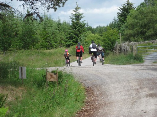
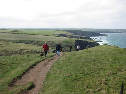
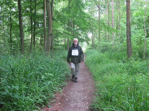
Foggy moors and misty mountains aren't the only places where a walker can do with a little helping hand from technology. The rolling, heavily wooded Wealden country where Kent and Surrey join hands with Sussex, for example, is beautiful for walking, but baffling enough. What with tree-shrouded tracks, mazy field paths and ancient holloways tunnelling through the hedges, Jane and I were glad of the direction-finding miracle called Satmap – not to mention the ever-reliable OS Explorer.

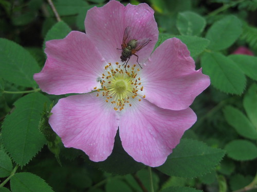
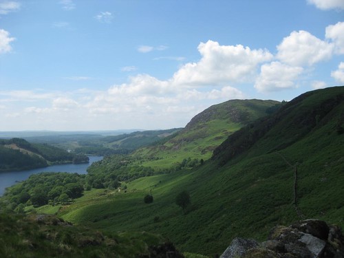
Among the beeches and oaks of the North Sussex Weald, bramble flowers screened old iron-working ponds and pits, reminders of a time when these deep woods smoked and roared with industry. The only man-made sound today was the hoot and ‘chuff-chuff’ of a steam locomotive on the Bluebell Railway just beyond the trees. We wandered north through buttercup fields, skirting Fen Mill Place with its wonderful meadows of wildflowers – moon-like marguerites, red bursts of campion – and newly planted hedges of maple, rose and blackthorn. How good to see someone putting time, thought and money into enhancing the biodiversity of this countryside.

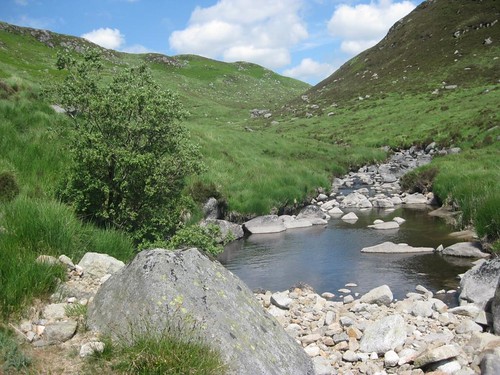
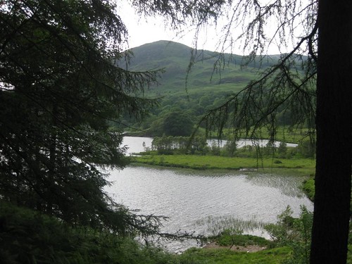
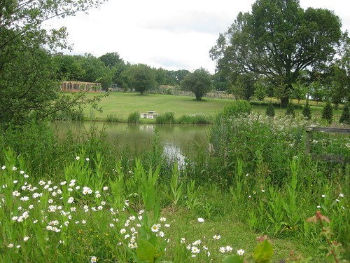
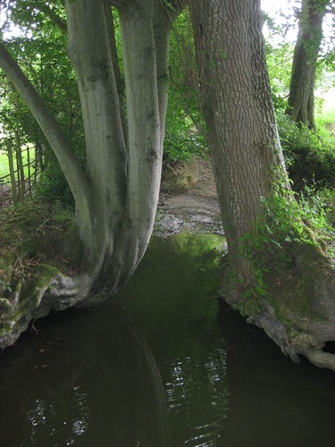
Splashing sounds came from a pond just beyond Fen Mill. Carp? Pike? Young otters? We couldn’t tell, but it was a great way to spend half an hour, craning between the trees and watching the dragonfly-haunted water while a squirrel in the oak canopy kept his beady eyes on us.

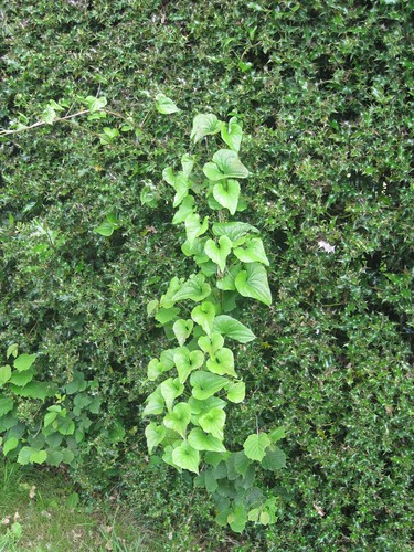
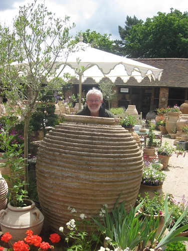
From Crawley Down we went south down a sunken lane whose banks had been burrowed into fans of sticky yellow clay dimpled with rabbit paw-prints. Holly hedges were hung with long strings of the shiny, heart-shaped leaves of bryony. It was quite a shock to come back to civilization in the form of Pots & Pithoi Pottery, a fabulous place where giant earthenware vessels stood out under flowery trellises as if waiting for a visit from Ali Baba.

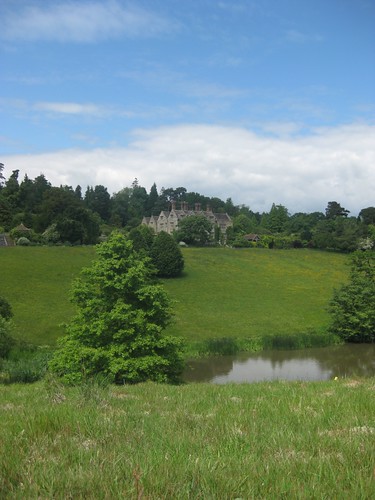
A cake and a cuppa here fired us up for the last few miles, through the birch and heath of Selsfield Common, round the parkland of Gravetye Manor – all silver-grey stone and ranks of mullioned windows under tall brick chimneys, high and handsome above its lake. ‘Forsyte Saga country,’ murmured Jane as she gazed, and that exactly summed it up.


Start & finish: Kingscote Station, Bluebell Railway, near East Grinstead (OS ref TQ 367657); or Forestry Commission car park, Minepit Wood (360350).

Getting there:

By train/bus: Kingscote Station from Sheffield Park (TN22 3QL) or Horsted Keynes (RH17 7BB) by Bluebell Railway (www.bluebell-railway.co.uk); or by Bus 473 from East Grinstead Station (www.thetrainline.com). By road: Kingscote Station signposted off B2110 East Grinstead – Turners Hill (NB no parking at station). FC car park ½ mile further.

Walk: (7½ miles; moderate, OS Explorer 135. NB – GPS or Satmap are helpful): FC car park – from bottom right corner, right on gravel path; it bends left to follow power lines east. In ⅓ mile cross gravelled roadway (364350; house on right); continue, trending left away from power lines; in 150 yards, forward at double fingerpost to road (368351). Left (‘High Weald circular walks’), passing right turn to Kingscote Station (fingerpost) to cross road (365355; fingerpost). Keep left of Tickeridge Farm buildings; through 2 gates, across field, through kissing gate, across brook. Keep hedge on right (fingerpost, stiles) for ¼ mile to cross B2110 (363362).

Left for 50 yards, right up drive (‘Mill Wood’); in 20 yards, right (fingerpost). Following ‘High Weald Landscape Trail/HWLT’ and footpath fingerposts, skirt round Fen Place Mill. By gate on left marked ‘Private’, HWLT turns right; but keep ahead (fingerposts). Pass pond (360369); right through kissing gate (fingerpost). Cross field; left on West Sussex Border Path (357372) for ½ mile. Left up Sandhill Lane (349372); in ¼ mile, right (footpath fingerpost); in ⅓ mile, left at T-junction (349362) to pass Pots & Pithoi Pottery and reach B2110 (NB Metrobus 84/684 stops here).

Cross road and on (fingerpost); cross stream (353357); right (fingerpost) on track to recross stream. Left up field edge; follow fingerposts under power lines (351355), along field edges and sunken lanes for ¾ mile to 3-way fingerpost on NW edge of Selsfield Common (348346). Left here; in 10 yards pass another fingerpost; ahead (east) across Selsfield Common. Through kissing gate; through grounds of Selsfield Place, through kissing gate; follow grass and flint ride to Vowels Lane (354345). Left to next corner; right up drive (‘Moatlands’); left (fingerpost) through trees to skirt Moatlands. Path descends for ¼ mile to T-junction (360341); right past Old Moat house. Over stile, diagonally up field slope opposite Gravetye Manor. Aim for far right corner of field; cross stream; left (363336, HWLT) on path. Left at field corner; right across lake bridge (363339); up path to drive by Manor gates (363341). Follow drive, in 300 yards bear right (HWLT) past Home Farm; on into Bushy Wood. In 200 yards, right (HWLT) down ride; under 2 sets of power lines; then in 20 yards, left, and retrace steps to car park.


NB: Detailed directions (highly recommended!), online map, more walks: www.christophersomerville.co.uk.

Tea and Cakes: Pots & Pithoi Pottery, on B2110 near Turners Hill (01342-714793; www.postandpithoi.com)

More info: East Grinstead TIC, Library Buildings, West Street (01342-410121; www.visitsussex.org) www.ramblers.org.uk; www.satmap.com


 Posted by at 00:00
Sep 252010
 

First published in: The Times Click here to view a map for this walk in a new window
picture picture picture picture picture
Facebook Link:
On a morning of sun and cloud over Lancashire, I found Dave and Jan Lovelady and their golden Labrador Annie waiting outside the Dog & Partridge Inn at Tosside, on the borders of Gisburn Forest. We set off along Bailey Lane into the forest, Dave riding his Countryman mobility scooter with its special wide tyres for off-road terrain.

A fit-looking, cheerful man in T-shirt and shorts, Dave’s disability isn’t obvious. He suffers from multiple myeloma, an incurable cancer of the plasma. There’s not an ounce of self-pity in the man, even after two bone marrow transplants and intensive chemotherapy. ‘With the first chemo,’ he said as we moved along the orchid-studded track, ‘I couldn’t even walk across the room. But I’d force myself to get to the mirror, I’d grit my teeth, I’d look myself in the eye, and I’d go: “Come on, Dave!”’

The problem for Dave is bone pain, and acute fatigue. He can be pole-axed for a day by one session of emailing – let alone the effort required to go out on a scooter walk. ‘We laugh about it,’ says Jan, ‘- well, sometimes …’

It’s Gisburn Forest the couple make for whenever Dave is up to it – ‘Our favourite place in all the world.’ The forest is well known to mountain bikers and walkers for its rough routes and challenging slopes. But it’s also handily suited to mobility scooters, with dozens of miles of criss-crossing forest roads, wide and level.

Gisburn Forest is not all conifer battalions. We came to a high viewpoint on Tennel Hill where the ground sloped away to the gleam of Stocks Reservoir and a far prospect west towards the long hilltops of the Forest of Bowland. ‘Oh, there they are! So beautiful!’ murmured Dave, gazing at the sun-brushed fells as if he’d catch and hold them.

‘Disability affects the whole family,’ Jan noted as we turned back. ‘Just because Dave can’t walk himself any more, why should that stop the family from enjoying going out for a walk with him?’

‘There are more disabled access paths nowadays,’ said Dave, ‘and you can hire a scooter in some places for a few quid – Bolton Abbey, for example. But there should be more! If you’re a disabled walker, ask what’s available in your area – and if there’s nothing, don’t give up, but ask for it to happen!’

It was an eye-opening and humbling experience, this walk with such a positive and determined couple. ‘I’m still me!’ as Dave says, smiling. ‘It’s the same person who was running around before – just in a different cage, that’s all.’


Start & finish: Dog & Partridge PH, Tosside, Lancs BD23 4SQ (OS ref SD 769561)

Getting there:

Train (www.thetrainline.com; www.railcard.co.uk) to Long Preston (5 miles).

Little Red Bus (http://www.littleredbus.co.uk/) every 2 hrs approx to/from Settle

Road: A65 (Skipton-Settle) to Long Preston; B6478 (‘Slaidburn, Clitheroe’) to Tosside (5 miles). Please ask permission to park, and give pub/café your custom!

Walks: (various lengths, easy, Explorer OL41; downloadable maps at www.forestry.gov.uk/northwestengland

Mobility access: pick your own mobility-friendly trail from several in Gisburn Forest. Dave, Jan and I followed Bailey Lane to Geldard Laithe (753584) – 4 miles, there and back

Fully mobile walkers: Hundreds of possibilities – devise your own round walk.

Online maps, more walks: www.christophersomerville.co.uk.

Lunch/accommodation: Dog & Partridge, Tosside (01729-840668; www.dogandpartridgetosside.co.uk) – pub, café, bike shop, B&B.

More info: Contact Dave Lovelady ormskirkdave@aol.com; www.justgiving.com/davelovelady to exchange info on mobility access.

Mobility access, Tramper hire in Bowland:

http://www.forestofbowland.com/wrc_access_for_all

Clitheroe TIC: 14, Market Place (01200-425566; www.forestofbowland.com/visiting)

www.ramblers.co.uk; www.satmap.com.

 Posted by at 00:00
Sep 182010
 

First published in: The Times Click here to view a map for this walk in a new window
picture picture picture picture picture picture picture
Facebook Link:

A warm day of sun and cloud over Galloway, the forgotten corner of south-west Scotland. Finch and warbler song echoed in the woods of alder and silver birch along the Water of Trool. A good squirt of Avon Skin-so-Soft, incomparable deterrent to the bluidy midges, and we were off along the river with the high hills of Galloway cut sharply against white cumulus and blue sky, the crumpled-bed profile of Mulldonoch standing tall across Loch Trool, the grey-green teeth of Cambrick Hill beyond.

Up beside the roughly squared lump of Bruce’s Stone we gazed across the head of the loch to the slopes where Robert Bruce’s ragged guerrillas had whipped the mail-clad asses of the English in 1307, rolling great boulders down on them and charging the demoralised remnants into flight. The tumbled hills around Glen Trool lay in mild sunshine today, as peaceful as could be. We crossed a miniature gorge of black rock walls by way of Buchan Bridge, and followed a hill path through the bracken into the lonely side cleft of the Gairland Burn.

The Galloway hills hold many secret places, especially in these foothills of the wonderfully named Range of the Awful Hand. You’d never suspect it from down in Glen Trool, but a string of beautiful peat-dark lochs with white quartzite sand beaches lies above the Gairland’s glen. The hillside track led us up among boggy patches jumping with tiny green and yellow frogs, upstream beside the glassy oxygenated waters of the burn. We skirted steely dark Loch Valley and climbed beside ancient animal pens of massive boulders to reach imperial blue Loch Neldricken, its waters bright with bogbean, its white and salmon-pink beaches etched in crescents under the shoulder of The Merrick.

‘Ony sauchle o’ a body can write a book,’ a local shepherd growled to rural writer Rev C.H. Dick at the turn of the 20th century, ‘but it tak’s a man tae herd The Merrick.’ Looking at the great whaleback of Galloway’s highest mountain, we saw exactly what he meant.

Down in Glen Trool once more we crossed the head of Loch Trool and turned back along a swooping path through the forest. Cuckoos made call and response across the sunny valley, and the loch waters sparkled as though a generous, invisible hand had scattered diamonds there.

Start & finish: Car park at foot of Loch Trool (OS ref NX 297791)

Getting there:

Bus 359 (Newton Stewart-Ayr) to Glentrool village (www.dumgal.gov.uk)

Road: A714 Newton Stewart-Girvan. In 8 miles, right to Glentrool Visitor Centre. Follow ‘Bruce’s Stone’; in 1½ miles, right (‘Start of Loch Trool Trail’) to car park.

Walk: (5½ miles, or 10 miles inc. upper lochs; moderate, OS Explorer 318): Follow woodland path past ‘green waymarks’/GW sign. NB: GWs are posts with green bands; they carry white waymark arrows (on their reverse sides) for clockwise walkers!). In ½ mile enter conifer forest; in 200 yards, look for GW on left; climb track to road (402799). Right past Bruce’s Stone car park (416804); descent rough road to cross Buchan Bridge (418804); fork left and continue (GW; ‘Gairland Burn’). In 200 yards, at right bend (420805), Loch Trool Trail continues along road.

For Gairland Burn and upper lochs extension, go through gate and up hillside path (‘Loch Valley, Gairland Burn’). Follow track to Gairland Burn; continue up left bank. Near top, cross side burns (436818); keep near Gairland Burn to Loch Valley. Keep left of loch, then follow stone wall by burn up to Loch Neldricken. Return to gate near Buchan Bridge; rejoining Loch Trool Trail by turning left along road (GW).

In ⅓ mile cross Gairland Burn and continue; go through gate, and in 150 yards bear right off road (430801; ‘National Cycle Network 7’). Follow path to cross burn (430800); forward up side of forestry (‘Southern Upland Way/SUW’); left along SUW beside Loch Trool for 1¾ miles, to cross Caldons Burn footbridge and reach T-junction (399789) with SUW post, GW post and a blue post marked ‘7 Stones’. Bear right here to footbridge and car park.

NB: Online maps, more walks: www.christophersomerville.co.uk

Lunch: Picnic

Loch Trool Visitor Centre (01671-840302): light meals, maps, Avon Skin-so-Soft midge repellent!

Accommodation: Creebridge House, Newton Stewart DG8 6NP (01671-402121; www.creebridge.co.uk)

More info: www.visitscotland.com/gold

 Posted by at 00:00
Sep 112010
 

First published in: The Times Click here to view a map for this walk in a new window
picture picture picture picture picture picture picture picture
Facebook Link:

Early morning over the Leicestershire wolds, cold and foggy, with a Sunday morning slumber over the golden stone village of Hungarton. Rose Cottage, Pear Tree Cottage, Lilac Cottage: they snoozed, one and all. The cat-like gargoyle on the tower of St John the Baptist’s church lifted a silent howl into the mist as I slipped out of the village past grazing horses and over a kale field, my boots already clotted with dark clay soil. Sheep came running up to lick my fingers with their stiff tongues and butt my knees gently with their woolly foreheads.

The 15th-century moated manor of Ingarsby Old Hall, its house and barns beautiful in rich gold and pale silver oolitic stone, presides in isolation over a field of hummocks and hollows, seamed across with deep old trackways – all that’s left of the deserted village of Ingarsby, the property of the Canons of Leicester Abbey in medieval times. In 1469, in the middle of a wool boom, the abbey enclosed and hedged the land for sheep, forcing the crop-growers of Ingarsby to abandoned their homes and fields. It was a ghostly place to wander, the grassy humps sparkling with dew and buttered with sunlight cutting through the mist.

Ingarsby is one of half a dozen abandoned medieval villages in this rolling corner of Leicestershire. From Ingarsby I followed a slowly plodding horse across fields trenched with the ridge-and-furrow of strip farming, up to Quenby Hall. This magnificent red-brick Jacobean pile, a palace in the wolds, is a different and more showy order of architecture from the domestic enclave of Old Ingarsby. The village of Quenby lay reduced to a patch of ridge and furrow in the smooth, lawn-like parkland. Beyond, the abandoned settlement of Cold Newton was an echo of the Ingarsby model, all slopes, humps and slanting house platforms.

From this haunted landscape of abandonment I followed the gentle green valley of the Queniborough Brook. A bedlam of cawing from the rookery in Carr Bridge Spinney; seven horses nosing an ancient oak tree at Bell Dip Farm; the handsome pale stone Baggrave Hall on a knoll above its still lake. The park still carried faint ridges of the vanished fields of Baggrave village. There is deep poignancy in such landscapes. But the well-laid hedges around Waterloo Lodge Farm, and the beautifully looked after sheep in the homeward fields, were proof that not all the old agricultural traditions are gone from this countryside.


Start & finish: Black Boy Inn, Hungarton, Leics LE7 9JR (OS ref SK 690075)

Getting there: Train (www.thetrainline.com; www.railcard.co.uk) to Leicester (7 miles). Bus (www.rutnet.co.uk): Rutland Bus Rural Rider 5, 6, 11 (Sat. and Wed.) to Black Boy, Hungarton. Road: Hungarton signposted off A47 at Houghton-on-the-Hill, between Leicester and Uppingham

Walk (8½ miles, moderate, OS Explorer 233): Black Boy Inn – Hungarton Church – south by lane and field paths to Ingarsby Old Hall – road/footpath triangle through Ingarsby deserted village, back past Old Hall (685053). Bridleway for 1½ miles by Quenby Hall to road (713064). Footpath north through Cold Newton deserted village; ahead to road (717077). Follow Queniborough Brook NW (Carr Bridge Spinney, Hall Spinney) past Baggrave Hall to road (698091). Baggrave Park; Waterloo Lodge Farm; past Watson’s Spinney; south across fields to Black Boy Inn.

NB – Detailed directions (highly recommended!), online map, more walks: www.christophersomerville.co.uk

Lunch: Black Boy Inn, Hungarton (0116-259-5410; www.theblackboyhungarton.co.uk)

Accommodation: Nevill Arms, Medbourne (01858-565288; www.thenevillarms.net) – delightful, friendly village inn

More info: Leicester TIC (0844-888-5181; www.goleicestershire.com)

www.ramblers.org.uk; www.satmap.com

Coast Along for WaterAid: Sponsored walks day, 11 September (info 01225-526149; www.coastalongforwateraid.org)

 Posted by at 00:00
Sep 042010
 

First published in: The Times Click here to view a map for this walk in a new window
picture picture picture picture picture picture picture picture
Facebook Link:

A fantastically blowy morning in Northumberland, with a light milky fret over the vale of the River Till. Across the sunlit farmlands the Cheviot Hills stood up proud on the southern skyline, rounded and bosomy, fold behind fold, an eye-catching patchwork of green and orange. Climbing the country lane from Doddington up to the moors, I kept turning round for another stare.

A noble view; perhaps that was why our distant ancestors chose Doddington Moor as the site for so many of their stoneworks. Practical ones such as field enclosures and settlements, ritual creations in the form of stone circles, and most notably a scatter of mysterious cup-and-ring markings, rounded depressions the size of a tea-cup surrounded by a doughnut ring, gouged in the surface of flat rocks. Northumberland is rich in cup-and-ring sites; and Doddington Moor is one of the best places to find them.

I followed a hill track past Wooler Golf Club, and on past a congregation of droopy-horned bullocks who jostled up to stand and stare like rude young men in a pub. The path led me around a vast field of oats that sung and hissed in the wind, and then by map, compass and the pricking of my thumbs to stumble suddenly on a fine cup-and-ring marked rock, a sandstone slab dimpled with man-made hollows that looked east towards the coastal hills. Was it sited here to face the rising sun? There’s no telling now; but the slab still holds its power and presence.

Harebells trembled in the wind, which fought me like a foe past the tattered, seething firs of Kitty’s Plantation. ‘Stone Circle (rems. of)’ said the map, and here it was: a big rough king-stone the size of a man, crusted with lichens and deeply grooved by rain and weather, lording it over a circle of recumbent stones. Once again, no why or wherefore; once more an unqualifiable potency in this high bleak place.

I followed an escarpment path, smacked and elbowed by great blasts of wind. Before descending into Doddington village once more, I sheltered by lonely Shepherds Cottage on the brink of the moor and tasted that mighty Cheviot prospect to the full. Whoever lives here is monarch of what must be one of the finest views anywhere in Britain.

Start & finish: Parking place on B6525 in Doddington, Northumberland (OS ref: NT 999324).

Getting there: Bus Service 464 (Wooler – Berwick-on-Tweed) – www.glenvalley.co.uk

Road: A697 to Wooler; B6526 to Doddington. Parking for 3 cars just beyond foot of lane marked ‘Wooler Golf Club’.

Walk: (4 miles, moderate, OS Explorer 340): Climb lane. At ‘Welcome to Wooler Golf Club’ notice, ahead along dirt road for 3/4 mile. Left through gate (NU 016334; ‘Weetwoodhill’); path south to crossing of fences (015327). Through gate; left over stile; left through gate; aim for right corner of plantation to find cup-and-ring stones in 250 yards, beyond lip of slope (018327). Return to cross stile; left past Kitty’s Plantation (013322) and stone circle (013317) to reach gate (012313). Don’t go through; right by fence for 350 yards. By gate (009313), bear right uphill on track. Left along escarpment to fence. Descend to cross stile; path to Shepherd’s House (005316). Don’t follow track behind house; keep ahead on path along escarpment, soon aiming for large farm below. Cross stile (001320); yellow arrows downhill to lane. Left into Doddington.

NB: Last section from 012313 (gate beyond stone circle) is through thick bracken. This walk is for confident walkers with map, compass, GPS.

Online maps, more walks: www.christophersomerville.co.uk

Lunch: Picnic

More info: Wooler TIC, The Cheviot Centre, 12 Padgepool Place (01668-282123); www.visitnorthumberland.com

www.ramblers.org.uk; www.satmap.com.


 Posted by at 00:00
Aug 212010
 

First published in: The Times Click here to view a map for this walk in a new window
picture picture picture picture picture picture picture picture
Facebook Link:

A breezy, blustery day on the North Cornwall coast, and a Sunday morning hush over Padstow. A herring gull with a crab claw in its beak stood on the harbour wall, observing me with pale, unfriendly eyes. Up on the coast path to Stepper Point the westerly wind pushed and smacked, shoving roughly, tossing the yellow heads of alexanders vigorously enough to make a hiss that almost drowned the sulky roar of the incoming tide in the mouth of the Camel Estuary.

There was salt on my tongue, and a fish-belly glint of dull silver on the sea. It was fantastically exhilarating walking in such a wind, like fighting a boisterous but essentially friendly troll.

Up on Stepper Point the old daymark tower whistled quietly to itself. Here, stories said, the women of Padstow had paraded in their red cloaks to frighten off the French. What a sight they’d have made on a morning like this, billowing scarlet before the gale sailed them all away over the estuary. Picturing that, I leaned on the wind and plodded west down the black line of the coast, looking ahead along many miles of foam-battered cliff. The rabbit-nibbled turf was spattered with thousands of pale blue stars, the petals of late-flowering spring squill. Grassy knolls over the sea shook white bells of sea campion, and in a sheltered hollow, unbelievably, I found a bank of primroses still in bloom.

Skirting an enormous blowhole in the cliffs near Trevone, I pushed on to Harlyn, where the thought of breakfast suddenly occurred. Well, brunch, then – a cheeseburger with relish and mustard from the ‘Food for Thought’ kiosk overlooking Harlyn Bay. Completely delicious, but just what the doctor wouldn’t have ordered. ‘You say that,’ observed the lady of the van, ‘but we have a doctor who’s a regular customer – and he tells his patients to eat here too!’

I was tired of fighting the wind, and just as well; I had it at my back now. I sauntered like a man in no sort of hurry past sleepy Trevone, through a hamlet too small to have a name, and on among the clucking bantams and stolidly chewing lambs of Trethillick. The wind dropped to a sigh in the hedges, and the sun came striding through the clouds to bathe Padstow and the estuary in pure gold.


Start & finish: Padstow TIC, Red Brick Building, North Quay, Padstow, Cornwall PL28 8AF (OS ref SW 920755)

Getting there: Train (www.thetrainline.com; www.railcard.co.uk) to Bodmin Parkway.

Bus (http://www.carlberry.co.uk/rfnlistr.asp?L1=PAD001&op=D) 397 from Truro; 555 from Bodmin Parkway; 556 from Newquay; 557 from St Columb Major.

Road: A30, A39; B3274

Walk (9 miles, moderate, OS Explorer 106): Pass Shipwright’s Arms; up path (‘Coast Path, Hawker’s Cove’); follow Coast Path arrows/acorns for 6 3/4miles to Harlyn, and nearly back to Trevone. At kissing gate (887757 – marked ‘Playing Field’on Explorer map), right (footpath sign) up field edge. Dogleg left/right; left along upper field edge to road (893755); left to road in Trevone. Left for 50 yards; right at left bend (fingerpost) by Hursley house; through gateway, across 2 fields. In 3rd field, left across stream; on past buildings, over stile at bend of lane; on across fields to lane (905758); right to Trevillick. Right, then left; over stile; cross 2 fields to road (910757). Right to Padstow.

NB – Online map, more walks: www.christophersomerville.co.uk

Lunch: ‘Food for Thought’ kiosk, Harlyn; or Harlyn Inn (01841-520207; www.harlyn-inn.co.uk)

More info: Padstow TIC (01841-533449); www.visitcornwall.com

www.ramblers.org.uk; www.satmap.com

Coast Along for WaterAid: Sponsored walks day, 11 September (info 01225-526149; www.coastalongforwateraid.org): one of the walks is around Trevone!

 Posted by at 00:00
Aug 072010
 

A cold sunny morning among the peerless estate villages of south Oxfordshire. If you’re looking for red tiles, spreading chestnut trees, gravelled drives and leafy lanes, here’s the spot. On our way out of Ardington, Jane and I passed cottages sunk in fabulously pretty gardens.
First published in: The Times Click here to view a map for this walk in a new window
picture picture picture picture picture picture picture
Facebook Link:
From the field track we looked back to admire the mellow brick frontage of Ardington House among its trees, with the stumpy spire of the church crouched alongside like a curate at the elbow of a squire.

Glossy horses galloped the trackways, and hares chased each other in circles over the milky grey ploughlands. We crossed the shallow, chalk-bedded Ginge Brook, and followed the deep canyon it had cut for itself between the thatched and whitewashed cottages of East and West Ginge. A sunken track climbed south to the roof of the downs, crossing the puckered green scar of Grim’s Ditch. Iron Age folk dug the ditch and mounded its rampart around 300 BC, but what for is anyone’s guess. Anglo-Saxon settlers took it to be the work of giants and named it after their god Grim.

The ancient downland track of the Ridgeway could predate Grim’s Ditch by three thousand years or more. We followed its rutted course along the crest of the downs, looking out over many miles of sunlit Oxfordshire, to reach the tall stone cross that commemorates Robert Loyd Lindsay, Lord Wantage. A Crimean War hero (he won the first VC of the campaign in 1854), Lindsay was a founder of the British Red Cross and a great local benefactor.

If the woods on Lord Wantage’s Lockinge estate hereabouts were laid out, as stories say, in the formation employed by his troops at the Battle of the Alma, it’s hard to make out on the ground. But there’s no mistaking the order, neatness and good taste he brought to the building of the estate village of East Lockinge below the downs. On the immaculately kept village green stands a beautiful bronze statue of Best Mate, winner of the Cheltenham Gold Cup in three successive years, who was trained in the village and on the gallops nearby.

On the duckpond near Ardington, coot were feeding their crimson-faced chicks beak to beak. A blackbird sang in a horse chestnut tree, and all really did seem right with this particular corner of the world.

Start & finish: Boar’s Head Inn, Ardington, Wantage, Oxon OX12 8QA (OS ref SU 432883)

Getting there: Train (www.thetrainline.com; www.railcard.co.uk) to Didcot (8 miles); Bus service 32 Wantage-Didcot (www.thames-travel.co.uk). Road: Ardington signposted off A417 Wantage-Didcot road

Walk (7 miles, moderate, OS Explorer 170): From Boar’s Head Inn, right; past Ardington House entrance, right through arch; path to road. Right; cross brook; ahead past barns (437879). At gate, left (437875; blue arrow) to cross Ginge Brook (444875). Right by brook for 2/3mile to road in East Ginge (446866). Dogleg right and left (‘bridleway’); track for 1 mile, past Upper Farm, to Ridgeway (445851). Right for 1 1/3miles to monument (424844). Right downhill on footpath to track crossing (424846). Take track to right of one marked ‘No Public Right of Way’, down right side of field; follow it for 1¾miles past Chalkhill Barn and Bitham Farm to road (425873). Left through East Lockinge, passing West Lockinge turn; by ‘Lockinge’ village nameplate, right (425878; yellow arrow) across bridge; follow path. Where it forks, left (‘permissive path’) to road; left, then right to Boar’s Head.

NB – Detailed directions, online map, more walks: www.christophersomerville.co.uk

Lunch and accommodation: Boar’s Head Inn (friendly and comfortable): 01235-833254; www.boarsheadardington.co.uk

More info: Wantage TIC, Vale & Downland Museum, Church Street (01235-760176); www.visitsouthoxfordshire.co.uk

www.ramblers.org.uk; www.satmap.com

 Posted by at 00:00
Jul 242010
 

First published in: The Times Click here to view a map for this walk in a new window
picture picture picture picture picture picture picture
Facebook Link:

A lovely day over the western Dales, with plenty of hot sun and those big drifting white clouds that herald a beautiful afternoon. ‘And going to get even better,’ prophesied the lady walking her terrier through Barbon village. The green bulk of Barbon Low Fell stood on the eastern skyline like an invitation, and I couldn’t resist its summons.

The woods of pine, beech and chestnut above Barbon Beck were drowsy with insect hum and shimmer. Speckled wood butterflies opened their cream and brown wings on warm stones, hoverflies hung suspended as if on invisible wires, and the beech leaves cradled flies in gorgeous glossy jackets of enamelled green.

Leaving the trees, I looked ahead up the remote high-sided cleft of Barbondale, one of the least walked and loneliest dales. Its green flanks rose to open moor tops shot with cloud shadows under the blue and white sky. Giant convulsions of the earth’s crust hundreds of millions of year ago ripped the Great Pennine Fault through here, shoving Lake District gritstones on the west of Barbondale 8,000 feet into the air, while pushing the east side limestones up on end. Hence the steep west side of Barbondale, and the more weathered, rounded and ragged limestone tops to the east of the dale where I was headed.

At Blindbeck Bridge a couple of young girls were playing in the beck. The smell of their picnic fire, thick and sweet, drifted across the stream. The scent of the fire and the girls’ shouts and laughter followed me along the sedgy old bridleway up the fellside to Bullpot Farm. The limestone hereabouts has been eaten by rain, frost and floods into thousands of holes, cave and underground passages, some with witchy reputations. Did a bull fall down one of the potholes near Bullpot Farm, drawn there by a maleficent hag?

From the solid old house, tucked down in its cleft among shelter trees, I followed a moor road edged with bilberry and heath bedstraw, then a grassy fellside track that wound up and over the shoulder of Brownthwaite to a jaw-dropper of a view. From this high point you look west over the tight grey huddle of Kirkby Lonsdale, out to the sea in Morecambe Bay, round to the fells of southern Lakeland, more sharply cut and mountainous than anything the Dales can show.

The view owns grandeur, vast scale and intimate rural detail in one sweep. Incredible that anyone could be crass enough to site a windfarm here. But that’s the plan. If built, the Longfield Tarn development will insert a clutch of white, whirling, 350-ft-high turbines smack in the middle of this perfect prospect.

The rough cobbled lane of Fellfoot Road carried me most of the way back to Barbon. I could have taken a short cut across the meadows. But the afternoon felt timeless; a walk to spin out as long as I wished.


Start & finish: Barbon Inn, Barbon, Cumbria LA6 2LJ (OS ref SD 629824)

Getting there: Barbon is signposted from A683, 3 miles north of Kirkby Lonsdale

Walk (8 miles, moderate, OS Explorer OL2): From Barbon Inn, right up road. Beyond Barbon Church, left (fingerpost) to cross Barbon Beck (631825); follow roadway round right bend and on. In ¼ mile on left bend, keep ahead (635826, blue arrow) through gate. Follow bridleway to Blindbeck Bridge. Right along road (656828); cross bridge; in 50 yards, left (654826, ‘Bullpot’); follow bridleway 1 mile uphill to road at Bullpot Farm (662815). Right for ½ mile. Above Gale Garth, right (657809, fingerpost, yellow arrow/YA) up green moor track for 1¾ miles by Brownthwaite Pike to road (641793). Right; at foot of steep slope, opposite ‘Wandales Lane’ fingerpost, right (635794) along stony Fellfoot Road for 1¼ miles to road (634810). Left; opposite Fell Garth, right through gate (632646, ‘Barbon’). Cross fields through gates (YAs); cross Whelprigg drive (632812); aim for far left corner of big parkland meadow; through gate (632817); follow track (YA) through gate into Low Bank House farmyard (631818). Before buildings, right through squeeze stile; aim for far left corner of field; through stiles to road (639819). Right for 150 yards; through Underfell driveway gate (631821); through 2 more gates (YAs) into lane (631822). Left; in 30 yards, right over stile; cross field back to Barbon.

NB – Online map, more walks: www.christophersomerville.co.uk

Lunch: Barbon Inn (01524-276233; www.barbon-inn.co.uk)

More info: www.landscapefirst.com

Kirkby Lonsdale TIC: (01524-271437); http://www.visitcumbria.com/sl/kirklon.htm

www.ramblers.org.uk; www.satmap.com

National Parks Week: 26 July-1 August (www.nationalparks.gov.uk)

 Posted by at 00:00
Jul 172010
 

First published in: The Times Click here to view a map for this walk in a new window
picture picture picture picture picture picture picture
Facebook Link:

Sometimes you just have to go with the flow. Jane and I arrived in Carmarthenshire determined to puzzle out an original walk around Carreg Cennen Castle. But then we found that Carreg Cennen was infuriatingly positioned at the junction of three OS Explorer maps. And once we’d visited the café-shop and picked up the county council’s superb leaflet of walks based on the castle itself, we simply thanked our lucky stars and set out into the day, a gloriously sunny one under a full blue summer sky spread all across the southern hills of Wales.

Among green waves of lowland slopes, the jagged walls of Carreg Cennen Castle rose like a dark island. We walked down the path through the oakwood of Coed y Cennen in a bubble of birdsong, crossed the shallow brown river, and climbed southward up a stony track with a most magnificent view of the castle clinging to the very lip of its 300-ft crags. Out at the top into a wide, sedgy upland, with a prospect to the distant humps of the Preseli Hills forty miles off in the west.

A flock of sheep lay panting like woolly steam engines under a rowan tree. From the moorland road we turned back towards the castle, dipping into dells formed by the collapse of underground caverns. Whole trees grew in the depths, their canopies on a level with the rim of the hollows. Down there under a bank of orchids we found a shadowy cave mouth spewing forth a broad gush of water – the infant Loughor river, destined for greatness in its broad estuary twenty miles away. On we went through damp bogland, bright with pink beaks of lousewort and the trembling blue flowers of insect-digesting butterwort, a beautiful wetland full of frogs and spiders.

Back at Carreg Cennen we roamed over the castle, its towers and baileys. Steps led to a sinister twist of a passage, rough-floored and pitch black. By the light of Jane’s torch we followed its course below the castle, bending and slithering until we crouched at the very heart of the crag. Not a lamb’s cry or child’s shout penetrated the rock. The original purpose of this black chamber in Carreg Cennen is obscure. But one couldn’t help picturing a desperate man of the garrison crouching there, waiting with beating heart for a victorious enemy, screwing up his courage in the dark to kill or be killed.

Start & finish: Carreg Cennen Castle car park, Trapp, Llandeilo, Carmarthenshire, Wales SA19 6UA (OS ref SN 666193)

Getting there: Train (www.thetrainline.com; www.railcard.co.uk) to Ffairfach (3½ miles). Road: From Llandeilo, A483 (‘Ammanford’); left at crossroads in Ffairfach; right after bridge to Trapp; don’t cross bridge, but keep ahead to Carreg Cennen.

Walk (3½ miles, moderate, OS Explorers OL12, 178, 186; NB Excellent map leaflet at castle): From shop/café follow Carreg Cennen Circular/CCC fingerposts (red castle symbols) past castle, through wood, across Afon Cennen (675193). Follow CCC and Beacons Way/BW up stony path for 3/4 mile to road (673180). Right to cross cattle grid; in 200 yards, right across stile (671177; CCC); follow CCC and yellow arrows (YA) to pass source of Loughor River (668178). Continue (YA, CCC) to Llwyn-bedw; down field to cross Afon Cennen (666188); stile and steep path (YA) to road at Pantyffynont. Left; in 300 yards, right (665191; CCC) across field to car park.

NB – Online map, more walks: www.christophersomerville.co.uk

Lunch: Carreg Cennen café (01558-822291); Cennen Arms, Trapp (01558-822330)

Accommodation: Cawdor Hotel, Llandeilo (01558-823500; www.thecawdor.com) – friendly boutique hotel

More info: TICs at Llandeilo (01558-824226), Carmarthen (01267-231557);

www.discovercarmarthenshire.com; www.ramblers.org.uk

National Parks Week: 26 July-1 August (www.nationalparks.gov.uk)

 Posted by at 00:00
Jul 032010
 

It was one of those Peak District days you can only dream of: a gauzy blur of sunlight over moors and pastures, enough bite in the wind to fill the blood with oxygen, and the great reservoirs of Ladybower and Derwent winking cheerfully to fishermen and walkers alike. ‘I’ve been absolutely longing for this,’ Jane said, looking up at the Derwent Moors, ‘a day up somewhere high and wild.’
First published in: The Times Click here to view a map for this walk in a new window
picture picture picture picture picture picture picture
Facebook Link:
The broad moor paths glittered with mica, their sandy gritstone pebbles rumbling quietly under our boots as we climbed to Whinstone Lee gap and a most stupendous view up Ladybower Reservoir, a long blue tongue caught in the lips of the hills. The wind blew like a mad thing, making the tears fly from our eyes as we followed a dark stone wall north towards the tors of Derwent Edge. Wheel Stones and White Tor, they stood out in drama on the skyline, piled towers of rocks shaped and slit by wind and frost.

We passed a shallow pool full of mating frogs, the males piggyback on the females in a bubble-bath of spawn. Climbing across Access Land through trackless heather up to the Edge tested our leg muscles and lungs, but once up there in the wind and sun we grinned like fools at a thirty-mile view streaming away in all directions, a magically spinning topography.

Red grouse whirred like clockwork projectiles across the heather, landing with a plump bounce to give out their manic giggle of a call, followed by a staccato go-back! go-back! go-back! Warning calls, I thought. ‘No,’ said Jane, ‘that’s definitely a party animal’s shout: Where’s-the-action? Where’s-it-at?

A paved path led north up the length of Derwent Edge, and we followed it past the outcrop of Dovestone Tor where weathering had sculpted a pair of monstrous lovers’ heads, for ever petrified, their protruding lips fated never to touch. Beyond stood the Cakes of Bread, flat folds of stone like giant piles of pancakes. It was quite a wrench to leave these outlandish stones, but a great wide moor was beckoning to the north-west, a dun and black blanket of utterly empty country.

The moors are the antithesis of virgin country. The hand of man lies emphatically on them. Through deforestation, sheep grazing, mining and abandonment they have been stripped to the barest of elements – heather, moor grass, rock, water. By rights they should be dismal, frightening places. But for a walker in search of huge horizons, of absolutely nothing between him and his Maker, they are sublime. Descending the rough lane to Ladybower Reservoir and the long walk home, I felt like a man in the company of friends.

Start & finish: Ladybower Inn, Ladybower Reservoir, Bamford S33 0AX (OS ref: SK 205865). NB Please ask permission to park, and give the inn your custom!

Getting there:

Bus: 51A, 241, 242 (www.travelsouthyorkshire.com) from Sheffield, Castleton, Bakewell, Chesterfield

Road: Ladybower Inn is on A57, at its junction with A6013 on Ladybower Reservoir.

Walk: (9 miles, hard grade, OS Explorer OL1):

From Ladybower Inn climb steep path to north-east. At top of incline, don’t fork left; keep ahead, to descend almost to A57 at Cutthroat Bridge (213875). Turn left uphill, then left (west) along bridleway for 1 mile to Whinstone Lee gap (198874). Path splits in 5 here; take marked bridleway to right of National Trust ‘Whinstone Lee Fields’ sign, following wall north along fell side. In ¾ mile pass ‘Derwent, Moscar’ sign (198884); aim half right uphill across trackless Access Land to White Tor on ridge (198888). Left along ridge track for 1⅓ miles by Dovestone Tor to Bradfield Gate Head. 200 yards before trig pillar on Back Tor, left at stone marker pillar (198907) on stony path going NW over moor. In 1 mile (185912) join wide grassy track on Green Sitches. Go through ruined wall; in 100 yards fork left (182911); almost immediately left again, aiming for fingerpost (180905). Follow ‘Ladybower’ and ‘Footpath’ fingerposts, with tumbled wall as guide, past plantation (182903) and on for ¾ mile to Lanehead Farm (184892). Descend (yellow arrow) to road at Wellhead (184887).

Left on lakeside track for 1⅔ miles to bridge (195865). Left fork uphill between houses becomes hillside track, descending to Ladybower Inn.

Refreshments: Ladybower Inn (01433-651241; www.ladybower-inn.co.uk), or picnic on Derwent Edge

NB – Online maps, more walks: www.christophersomerville.co.uk.

www.visitpeakdistrict.com/walkingfestivals (5 walking festivals in the peak district in 2010)

www.ramblers.org.uk

 Posted by at 00:00