john

Feb 062021


First published in: The Times Click here to view a map for this walk in a new window
picture picture picture picture picture picture picture picture picture picture
Facebook Link:

The sun had broken through at last, rolling away a cold blanket of mist to reveal the Wiltshire Downs and their subtle undulations. We stepped out under a blue sky, hearing horse hooves pounding along an unseen gallop in the hollow where Manton Stables lay hidden.

This wide open downland is horse and cattle country, the gallops tending to stretch along the tops, the cattle grazing the dry valleys below. A very fine Charolais bull, contentedly recumbent, kept a lazy eye on us as we passed on our way to the Devil’s Den.

Neolithic men raised the huge stones that form the structure of this passage grave. After the end of the last glaciation, these sarsens – ‘saracens’ or foreign stones – lay scattered all across the downs, easy pickings for the builders of Stonehenge and other ancient monuments.

We followed a wide path west through a shallow valley where a great congregation of lichen-stained sarsens delineated the curve of the hollow. Local people, seeing their resemblance to an enormous flock of sheep in bedraggled fleeces, named these clustered stones the Grey Wethers. Cows moved slowly among them, and a handsome ginger-and-white Simmental bull licked one ruminatively for the minerals it contained.

Sarsen stone is composed of sandstone bound together with a glassy silica. In his book ‘The Stonemason,’ Andrew Ziminsky calls it ‘diamond-hard, tougher even than granite.’ Nonetheless, three centuries ago in his ‘Palaeographia Britannica,’ antiquarian William Stukeley warned masons not to build with sarsen; ‘It is always moist and dewy, and rots the furniture.’

We shadowed the river of stones up the valley, then took to the ancient downland tracks that are the pride and joy of Wiltshire’s walkers. The Herepath (a Saxon word for ‘warpath’) led to the Ridgeway, a high road of braided ruts with a stunning view westward over many miles of downs and wooded valleys gilded by the afternoon sun.

Sarsens lay alongside the Ridgeway, and sarsens bounded the White Horse Trail, another venerable downland track that led us homeward between leafless hedges. A yellowhammer perched high on a bush, its breast sulphurous in the sunlight, and fieldfares flew over with vigorous wing thrusts, flocking together for protection and company in obedience to an age-old winter instinct.
How hard is it? 7½ miles; easy; downland paths and tracks

Please only walk within your Tier area, or enjoy this as an armchair walk till restrictions lift. And please consider others when you park.
gov.uk/government/publications/the-countryside-code 

Start: Gravel Hill car park, Downs Lane, near Fyfield, Wilts SN8 1PL (OS ref SU 159700)

Getting there: Follow ‘Manton House & Hollow’ on A4 (Calne-Marlborough) between Fyfield and Manton. Car park 1 mile on left.

Walk (OS Explorer 157): Follow gravelled trackway west. In 700m left through gate (153703); on through field, with fence on left. In 500m, left (149701) down slope beside fence; left through gate (150698) to Devil’s Den stones (152697). Return to gate; on along grass track through Grey Wethers valley. In 1 mile path curves right to metal gate (137706). On with fence on right to corner of Wroughton Copse (138711); left down slope; left along Wessex Ridgeway/Herepath (133710). In 300m cross gallop (130709); bear right for 550m to stile onto Ridgeway National Trail (127714). Right for 1 mile; right onto White Horse Trail/WHT (125729). In ⅔ mile fork right at copse (132723), cross track and on (WHT). Through wood (135720), then grassy track (WHT). In 600m, left on Wessex Ridgeway/Herepath (143714); in 100m right (‘Byway’) to car park.

Info: uksouthwest.net/wiltshire/fyfield-down; satmap.com; ramblers.org.uk

The Stonemason by Andrew Ziminski (John Murray)

 Posted by at 01:29
Jan 302021


First published in: The Times Click here to view a map for this walk in a new window
picture picture picture picture picture picture picture picture picture picture picture picture
Facebook Link:

A beautiful day was promised over the eastern fells of the Lake District, with light easterly winds and plenty of blue sky. So it turned out, as we set off from the tiny village of Dockray to make a circuit of the craggy outlier of Gowbarrow Fell.

In the pastures around Parkgate Farm they were training an excitable young sheepdog in the business of gathering his charges. The flock swerved and fled across the field like a shower of white iron filings impelled by the black-and-white magnet of the dog. He yapped shrilly, they bleated high and low, the farmer shouted and whistled. Gradually the noise faded as we crossed Riddings Beck and turned up Gowbarrow’s steep rocky slope.

The fell rises in a graceless lump of green-grey rocks and fox-brown bracken to the east of Dockray. Norsemen named it ‘Windy Hill’, but all was still today under the winter sun. ‘More deer than trees’ was a late 17th century description of this private hunting ground for the lords of the Greystoke estate. Gowbarrow is still a wild place today, a hummock of moorland, rock, heather and boggy ground.

Views as much Alpine as Cumbrian opened to the south as we gained height on the steep stony path, a view of Ullswater’s lake and wooded shores. Beyond rose the long hummocky ridge of High Street, where the sun was causing the last curls of early mist to shred away in the clear air.

Up we went, a stony ascent by rocky steps and tree roots. Sparkling streamlets descended beside the path with a tinkling sound like distant sheep bells. A meadow pipit, disturbed from a mossy bog pool, darted up and away with snipe-like jinkings and a sharp chip! chip! of complaint. Near the top of the fell the gradient eased and the path ran over a wide heather moor to reach the trig pillar on Airy Crag at 1,579 feet.

The view from here was superb in unbroken sunshine, Ullswater trending northeast towards the flat plain of the Eden Valley and the rise of the North Pennine fells beyond, Great and Little Mell lumping in the northern foreground and a big crumple of high fells towards Helvellyn in the south west.

Down a well-trodden path, clockwise round the hump of Gowbarrow, to reach the lake shore level and a woodland path to Aira Force.* The waterfall that Wordsworth and countless other poets admired came bouncing and sluicing in white water down a black rock chute slick with mosses and liverworts. A fine spectacle to mark the homeward path through woods of alder and silver birch, along the fellside and back to Dockray in the last of the afternoon sunlight.
*NB spelling = Airy Crag; Aira Force

How hard is it? 5 miles; strenuous; steep climb to Airy Crag; many trip hazards on paths; many steps at Aira Force.

Start: Royal Hotel, Dockray, Penrith CA11 0JY (OS ref NY 393216)

Getting there: Dockray is on A5091 (Glenridding-Troutbeck)

Walk (OS Explorer OL5): Cross A5091; follow lane beside Dockray House (‘Aira Force’). Cross Riddings Beck at Millses (397217); in 200m through gate; left (399216, ‘Airy Crag’) through gate. Steeply up beside stone wall to Airy Crag trig pillar (408218). Keep ahead clockwise on clear path for 2¼ miles to footbridge over Aira Beck (401203). Don’t cross; turn right up right bank to Aira Force (399205). Cross lower footbridge; up steps; right to recross upper bridge. Path north on right bank to Millses and Dockray.

Lunch/Accommodation: Royal Hotel, Dockray (01768-482356, the-royal-dockray.co.uk) – friendly, characterful village inn.

Info: Penrith TIC (01768-867466); visitlakedistrict.com; satmap.com; ramblers.org.uk

 Posted by at 01:33
Jan 232021


First published in: The Times Click here to view a map for this walk in a new window
picture picture picture picture picture picture picture picture picture picture picture
Facebook Link:

Horses in thick winter coats were cropping the paddocks at Berrow Green on a still, cold Sunday morning. Low sunlight crept across the fields, dispersing the last of the early mist, causing the horses’ breath to steam and the post-and-rail fences to cast long skeletal shadows of themselves on the frosty grass.

This country to the west of Worcester is all ups and downs, steep little slopes rising to wooded ridges and falling away into stream clefts where the winter sun doesn’t linger. Walking south from Berrow Green we had the Malvern Hills head-on in front of us, the north end of the range forming an unfamiliar hunchback lump in contrast to the usual prospect of a miniature line of mountains, elegantly extended and rising from the Midland plain.

The woods on Berrow Hill were smoky grey, patched with apricot where the last of the leaves had not yet blown away. On a rise of ground Easinghope Farm stood in solid red brick next to its weatherboarded barn. Seventy black-faced ewes in the farm paddock scuttled away, to stop all together and stare as we went by.

Moss and grass grew in the centre strip of narrow Easinghope Lane. A horse and rider went clopping slowly by. Five fat white turkeys came gobbling and squawking to the gate at Hawksnest Farm, their little pink eyes all agog. We pulled up to admire the eastward panorama over the Worcestershire lowlands, then descended into the steep valley of Bannersbrook.

Treecreepers squeaked their needly calls as they searched for insects hidden in crevices of the oaks and sweet chestnut trees. A trickle in a ferny hollow marked the outpouring of the intriguingly named Nipple Well, perhaps a remedy for mastitis in days gone by.

A sharp climb on slippery oak leaves, and we were up on the ridge of Ankerdine Common with a wonderful view west over the sunlit curves of the Terne Valley. Then down again through the trees to scatter the young ewes in the river pastures around Horsham Farm.

Above the homeward path a pair of redwings perched on the topmost twigs of a young oak, displaying the handsome arch of their pale eyebrows, as the short day’s sun slipped down towards the western woods.

How hard is it? 5¼ miles, moderate; field and woodland paths

Start: Admiral Rodney Inn, Berrow Green, Martley WR6 6PL (OS ref SO 748583)

Getting there: Berrow Green is on B4197 (signed ‘Martley’ from A44 Worcester-Bromyard)

Walk (OS Explorer 204): From pub, right along road. In 150m, left (Worcestershire Way/WW). Follow WW (well waymarked) for 1¾ miles to Ankerdine Common car park (737567) and on down to road (735564). Right uphill. In 200m, left (735566, ‘Sunningdale, Private Road’). In 50m fork left downhill through woods (yellow arrows/YA, green tree markers) to drive (733572). Right to Horsham Farm. Through gate at Lower Horsham Farm (734577); bear right (YA); through gateway (circular ‘public footpath’ waymark). Just past pond, right (gate, YA). In 150m, dogleg right/left (736578, stile, YA); in 15m, right (YA) up hill. In 100m, dogleg right/left (stile, YA). In 150m, through gate in lower field corner (738578). Ahead (fence on left); left at corner of Tinker’s Coppice (740578, YA). Uphill; at top of slope, right (742578, rails, YA) through copse to road (743578). Left; in 100m, right (fingerpost) down fence to stile onto road (745578). Left; right at corner; in 100m, left (fingerpost) across paddock; left (748578) on WW to Berrow Green.

Lunch/Accommodation: Admiral Rodney, Berrow Green (01905-886181, admiral-rodney.co.uk)

Info: Worcester TIC (01905-726311); satmap.com; ramblers.org.uk

 Posted by at 01:49
Jan 162021


First published in: The Times Click here to view a map for this walk in a new window
picture picture picture picture picture picture picture picture picture picture
Facebook Link:

Across the Low Weald of Kent the sun was flooding paddocks and pastures with a rich wash of gold. It was one of those cold bright winter days when you can dream of spring, even though there isn’t a flower to be seen.

We set off from Dunk’s Green along footpaths dry and crunchy over the underlying greensand. Out in the fields it was a different matter. Brooks and ditches brimmed with winter rain, and every step brought a squelch and squirt underfoot.

On the outskirts of Plaxtol Spout a flock of siskins flirted among the alder cones they were feeding on. Beyond lay Old Soar Manor, a jumbled old structure with a very ancient building attached – a knight’s dwelling, built some seven hundred years ago by one of the local Culpeper family, of solid red ragstone with tiny arrow-slits in the walls.

Walking on, we wondered what this bowl of country might have looked like seven centuries ago. When did today’s immaculate apple and fruit orchards make their appearance, and when did money begin to lay out these manicured lawns and plant such immaculate hedges?

Up in Hurst Wood the ways were rutted and muddy, the views sublime. Winter had stripped away the leafy screens of the trees to reveal long wooded ridges in the distance, all painted in muted greys and blues by the low afternoon light.

We passed the smoke and small flames of a clearing where a forester was coppicing sweet chestnut, and descended green lanes to handsome red-and-white Yotes Court.

This lovely house was built in the last days of the Commonwealth by James Master, a gentleman whose expenses book still survives. What he spent his wealth on gives a good idea of who he was – a man of leisure, a hawker and rider, a gambler and cock fighter. A wide reader, too, and quite a dandy – his boot tops of sea-green silk were each embellished with a yard of costly lace.

The countryside where his house stands is embellished, too. Our homeward path lay past apple orchards and raspberry cages, shaven pastures and perfectly shaped hedges, among which the mellow brick farms and white-capped oasts sat ensconced like so many plump and satisfied judges after dinner.

How hard is it? 7¼ miles; easy; muddy in woods

Start: Kentish Rifleman, Dunk’s Green, Tonbridge, Kent TN11 9RU (OS ref TQ 613527)

Getting there: Bus 222 (Wrotham – Tunbridge Wells)
Road – M26, Jct 2a; A25 Borough Green; follow ‘Plaxtol’, then ‘Dunk’s Green’

Walk (OS Explorer 148): From pub, right along road. In 250m, left (615527, fingerpost/FP) to cross road (613433, FP). Bear left to stile/road (611534); right into Plaxtol Spout. Right (611537, ‘The Street’, ‘Crouch’). In 200m right (612538, FP). In 650m path approaches Old Soar; fork left (618541, arrow) to road (619540). Left; in 400m, right (‘West Peckham’); in 200m, left (624543, FP) into woods. In 200m, right (626543,); in 400m, right (628541); in 50m, left (white arrow). In 150m fork right (630540) to T-junction (631538). Left; in 150m, opposite gate, right (631540) down path, eastward for 1 mile to road (646539) in Swanton Valley. Dogleg left/right and on; just before Yotes Court, right at junction (650535) for ⅔ mile to road (641533). Right; in 15m fork left. In 400m fork left (636533). In 600m cross Gover Hill crossroads (631530); bridleway downhill to junction (630524); right, following Greensand Way for 1¼ miles to Dunk’s Green.

Lunch: Kentish Rifleman, Dunk’s Green (01732-810727, thekentishrifleman.co.uk) – takeaways available (ring to check).

Accommodation: Bull Hotel, Wrotham TN15 7RF (01732-789800, thebullhotel.com)

Info: visitsoutheastengland.com; satmap.com; ramblers.org.uk

 Posted by at 02:01
Jan 092021


First published in: The Times Click here to view a map for this walk in a new window
picture picture picture picture picture picture picture picture picture picture picture
Facebook Link:

The Berwickshire coast of south-east Scotland is a rugged one, all sharp-nosed headlands and lumpy sea stacks. On a windy January morning the promontory cliffs of St Abb’s Head looked bleak and exhilarating, just the place for a post-Christmas blow-through.

Yellow buds of winter aconite were struggling out under the trees at the National Nature Reserve car park. ‘And snowdrops, look!’ exclaimed our son George. Long-term resident of tropical Australia, he was revelling in the sights and sensations of this proper winter’s day.

Wrapped up to the eyes, we set out along the coast path above cliffs of volcanic rock so tumbled and jagged that the outcrops resembled shattered castle walls. A greenish wash of guano slathered the rocks, though the seabirds responsible were long gone to their winter quarters further south.

Grey seals had pupped on the secluded beaches of dusky red sand, and we caught glimpses of the adults offshore as they dived like fat Olympic swimmers after shoals of fish.

This was weather to make our expat son gasp and grin. The gale pushed and shoved us like an invisible thug. The dried sea pinks of last summer nodded wildly at the cliff edge, and cold blasts of wind feathered out the whitecaps on the sea into a heaving grey mass.

The path led into a sheltered green valley for a few minutes’ respite before climbing up the flank of Kirk Hill and into the wind again. Here on the slope in 643AD Aebbe – a Northumbria princess in flight from the unwanted attentions of King Penda of Mercia – founded a nunnery. When St Cuthbert of Lindisfarne came visiting, he spent his nights in prayerful immersion, up to his neck in the sea. A hard man for tough times.

Just below the summit stood a lighthouse and the whitewashed cottages where its keepers once lived through wind, sun and wild weather. The walled garden where they grew their greens lay abandoned beyond.

From the viewpoint above a magnificent view unfolded, west along mudstone cliffs stacked and folded towards the Firth of Forth and the distant hump of North Berwick Law, east over the fishing villages of St Abbs* and Eyemouth among their volcanic headlands.
*NB St Abb’s Head has an apostrophe, St Abbs village doesn’t.

George spread his arms and stood flapping like a scarecrow, delighting in the grey sea and wild sky, while I chased after the hat which the wind had snatched off my head and flung far away.

How hard is it? 5 miles, moderate; hilly coast path

Start: St Abb’s Head NNR Visitor Centre car park, St Abbs, near Eyemouth TD14 5PL (OS ref NT 913674) – £3

Getting there: Bus 235 from Berwick-upon-Tweed.
Road: A1 (Berwick – Haddington); B6438 at Reston to Coldingham and St Abbs.

Walk (OS Explorer 346): From Visitor Centre follow ‘Path to St Abb’s Head’ signs; then ‘Lighthouse Loop’ (purple arrows) to lighthouse (914692) and topograph beyond. Left along road. At north-west end of Mire Loch, left (908690) on Mire Loop (yellow arrows). At lower end of loch, right (913685) up stony track to road (912684). Ahead, following road back to car park. Left along B6438 to St Abbs harbour, and return to car park.

Lunch: Old School Café, Ebba Centre, St Abbs (01890-771413, @EbbaCentre) – excellent home cooking and baking, warm welcome all year round. Book ahead if in group of 5+

Accommodation: Home Arms, High St, Eyemouth TD14 5EY (01890-751316, thehomearms.com)

Info: St Abbs Visitor Centre (01890-771672, stabbsvisitorcentre.co.uk)
St Abb’s Head NNR Centre (01890-771443 nts.org.uk) – open 30 March–31 Oct.
satmap.com; ramblers.org.uk

 Posted by at 01:00
Jan 022021


First published in: The Times Click here to view a map for this walk in a new window
picture picture picture picture picture picture picture picture picture picture
Facebook Link:

Where overnight rain had been sluicing through the Thames Valley, winter sunshine as clear and sweet as honey was now pouring across the grey and gold stone houses of Kelmscott.
William and Jane Morris spent their summers at Kelmscott Manor from 1871 onwards. William, the Father of the Arts & Crafts movement, found the obscure Oxfordshire backwater a balm for the soul. ‘Heaven on earth,’ he called Kelmscott. It became a rather more earthy paradise for Jane, who conducted a passionate affair at the manor with pre-Raphaelite painter and poet Dante Gabriel Rossetti.

We found the manor confined in a winter jacket of scaffolding. Sulphur-yellow quinces had dropped over the garden wall. They rolled along the lane we followed down to the rain-charged River Thames.
Rooks in their dozens went up cawing from the trees along the river, a broad highway of contrary tides whose main flow pushed downstream at running speed, while backwaters eddied and spun in opposing directions. On the graceful curve of Eaton footbridge we stopped to admire the strength and surging power of the water, then turned east through wide green meadows whose medieval furrows each held a miniature lakelet of rainwater.

The little church of St Michael & All Angels at Eaton Hastings benefited from the proximity of the Arts & Crafts powerhouse of Kelmscott Manor. We found a William Morris west window showing three ultra-romantic archangels with flowing locks and androgenous countenances. In the north chancel window Edward Burne-Jones created a stormy St Michael, heavy-eyed and morose, a striking characterisation.

The Thames lay distant as we walked on through the fields. The brimming ditches were lined with crack willows and ash trees distorted, bowed and twisted out of shape. A rowdy gang of winter thrushes roistered among the hawthorns, raucously exclaiming to one another as they stripped the branches of their crimson fruits.

A pair of sturdy old stone bridges spanned the bifurcated Thames at Radcot. A skirmish here in 1387 between the forces of King Richard II and Henry Bolingbroke saw 800 men flee into the marshes and drown, but there were just three deaths by fighting – Sir Thomas Molyneux, a varlet, and a boy. History records that the knight was treacherously stabbed, but one would like to know more of the misfortunate varlet, not to mention that wretched child.

Such strife seemed far away as we strolled the Thames Path back towards Kelmscott. On the bank we passed a young woman in a bathing suit. She had been swimming in the cold and flooded river with the help of a stout rope and a strong companion. Pink from head to toe, she glowed with health and vigour. ‘The swans were scary,’ she confided through chattering teeth, ‘but I loved it!’

How hard is it? 7 miles, easy field and riverside paths.
Start: Plough Inn, Kelmscott, Lechlade GL7 3HG (OS ref SU 249991)
Getting there: Kelmscott is signed off A17 (Lechlade-Faringdon)
Walk (OS Explorer 170): Passing stump of cross and Plough Inn on your right, fork left along road. In 150m, right (250990, ‘Kelmscott Manor’). Ahead beside manor (‘Radcot Bridge’). In 150m, right on Thames Path (253988). In ½ mile, left across footbridge (247985). Through left-hand gate beyond cottage; left along field edges (National Trust green arrows) for 1 mile to road (263985). Ahead past Eaton Hastings church; follow D’Arcy Dalton Way east for 1¾ miles through fields (kissing gates, stiles) to A4095 at Radcot (286994). Left across 2 bridges; right (285995) on Thames Path for 3 miles to Kelmscott.
Lunch/accommodation: Plough Inn, Kelmscott (01367-253543, theploughinnkelmscott.com)
Info: sal.org.uk/kelmscott-manor; satmap.com; ramblers.org.uk

 Posted by at 01:34
Jan 012021


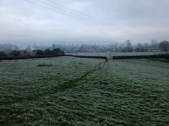
New Year’s Day. We looked out to see a good thick frost on the garden. The hill slope beyond lay whitened, the woods dark along the ridge, the sky leached colourless.

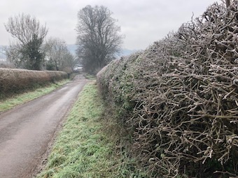
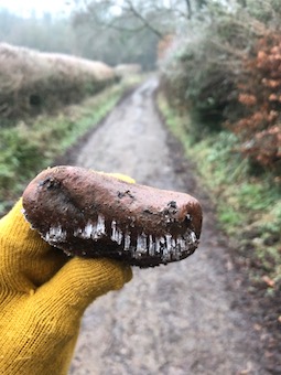
In the lane the severely trimmed hedges were covered in a thin film of frost. Trees stood black and skeletal. Breath steamed as we went up the steep incline of Stony Sleight, a rubble of pebbles brought downhill by rain floods littering the skiddy red limestone. Jane picked up a water-smoothed stone along whose rim the dripping water had frozen overnight into a line of tiny glassy stalactites, like the teeth in a T Rex jaw.


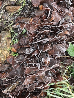
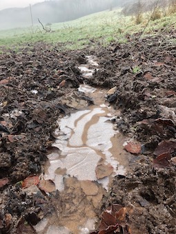
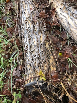
Beech leaves lay blackened in clots, each leaf edged with a lace of crusted ice. Interwoven strands of ivy wrapped a cut tree branch, the frost covering giving the whole composition the look of an artwork. The earth of tractor ruts was frozen hard, and the brown water in the ruts themselves was skinned over with panes of white ice, the two colours swirled together like a coffee and vanilla ice cream. I broke through a pane with my boot, the crunch and crack reminding me of the magic that frost and ice brought to walks in childhood.


On the way down from the hill towards the village we crossed fields still whitened, where the frost was rising from every blade of grass and fallen leaf to form a misty miasma in the valley. Ice in the hoof pocks left by cattle was melting, so that what had been a crunching walk ended as a squelching one.


 Posted by at 20:32
Dec 262020


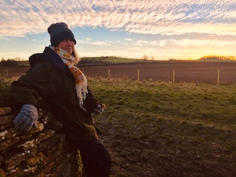
We left the house on Christmas morning as the first crack of light was spreading in the east. Down empty roads and muddy lanes running with water, to a little parking space where the puddles were iced over. The first time this year I’d pulled on hat, scarf, thick gloves, thermals and padded winter coat.

Across a racing stream on a footbridge slippery with frost, and up a frozen grass slope to the long barrow darkly silhouetted on the skyline against a sky already broadened into a peach coloured dawn, the blue above streaked with dozens of drifting horsetails of cloud.

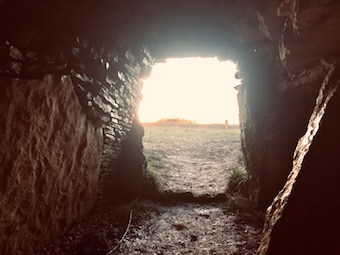
I wormed my way into the cold, damp stone passage that led back for 30 feet or so into the artificial hillock of the barrow. The floor where I knelt was wet and muddy, the stones hard against my back. At the entrance a big ammonite embedded in one of the kerbstones. Looking out, the view was south-east up a gentle slope to a wood on the skyline.

It was a half-hour wait, with the invisible sun lighting up the higher features of the village in the valley, church tower and fine tall buildings, the golden light gradually creeping down the slope behind the houses, and crowds of rooks becoming agitated and vocal at the sunrise they could already see from their vantage points fifty feet in the air.


At last the moment came as the first shallow arc of the sun rimmed the hill, spinning like a ball, its intense light diffused behind the ivy-thickened skeletons of the trees. The clouds gleamed, the peachiness of the sky leached into pale blue, and a finger of dazzling sunlight approached down the sloping field, entered the passage, and lit up the back wall of the burial chamber in an unbroken wash of light as bright as polished silver, as it has done at every winter solstice since the architects of the barrow aligned it so precisely 5,000 years ago.


 Posted by at 21:25
Dec 192020


First published in: The Times Click here to view a map for this walk in a new window
picture picture picture picture picture picture picture picture picture picture
Facebook Link:

One dark night long ago the huntsman at Alfoxton Manor was eaten by his own hounds, so says the tale. He got up from his bed to quell a dogfight in the kennels, and they didn’t recognise him in his nightshirt.

Setting off from Holford on a glorious winter day of blue sky above the Quantock Hills, we stopped to admire the old dog pound beside the path to Alfoxton. What a pity those hungry hounds hadn’t been safely penned up behind its stout stone walls.

William and Dorothy Wordsworth came to roost at Alfoxton (then ‘Alfoxden’) in the summer of 1797. Nearby lived their new best friend, Samuel Taylor Coleridge.
We passed the manor house, solid and white among beautiful beech and oak woods. Coleridge and the Wordsworths walked daily over the hills and through the deep wooded combes of Quantock, ‘three people, but one soul’, as Coleridge put it. Rumours spread that the three strangers were spies for Napoleon, and the Wordsworths had to leave their Eden in the Quantocks, never to return.

Along the drive missel thrushes with spotted throats were busy raiding the cherry trees whose scarlet fruits dangled at the end of long stalks. The birds darted from tree to tree with their characteristic muscular wing thrusts and direct, purposeful flight.

Red deer hinds went trotting springily across the paddocks among the horses. The Quantock Greenway path wound at the foot of the hills, with breathtaking views opening northwards over the Bristol Channel, its tides stained a milky mulberry hue by the mud of many estuaries. As we gained height we made out the upturned hull shape of Steep Holm island, the white lighthouse on neighbouring Flat Holm, the long spine of Mendip running inland, the far coast of Wales in a blur of distance – and on the shore below, the giant’s geometry set of Hinkley Point C nuclear power station, still laboriously a-building.

Up on the top the wind blew cold. We followed wide grassy bridleways where hill ponies with ground-sweeping tails cropped the verges. A fantastically exhilarating ramble, east along the ancient green trackway evocatively titled The Great Road, then slanting steeply down to join the homeward path in the depths of Hodder’s Combe with its skein of rustling brooks and springs.

‘Upon smooth Quantock’s airy ridge we roved
Unchecked, or loitered ’mid her sylvan coombs*.’
*Wordsworth’s spelling.

That’s how Wordsworth remembered those happy Quantock days in ‘The Prelude’, and it neatly summed up our day, too.
How hard is it? 6 miles; moderate, some short climbs; moorland and valley tracks, some muddy; streams to ford
Start: Holford Bowling Green car park, Holford, Bridgwater TA5 1SA (OS ref ST 154410)
Getting there: At Holford (A39, Bridgwater-Minehead) follow lane by Plough Inn (brown sign ‘Combe House Hotel’) to car park.

Walk: Left along valley road. Follow ‘Quantock Greenway’/QG (green arrows), and ‘Coleridge Way’/CW (quill symbol) for 2 miles. Cross Smith’s Combe stream (132422, signposted); continue on QG, CW. Pass conifer plantation; in 150m, sharp left (129423, fingerpost, blue arrow/BA) up bridleway. In 450m at top of slope, left at track crossing (127420). Follow broad green bridleway south for 1 mile, keeping ahead over all track crossings, to Great Road trackway (132407, fire beaters). Left; in ⅔ mile, descend across widespread track crossing (141410); in 150m, fork right beside trees (BA, ‘No Vehicles’). In 300m cross track (145408); descend into Hodder’s Combe. Ford streams (144403); left along far bank for ¾ mile to car park.
Lunch: Plough Inn, Holford (01278-741652, holfordvillage.com)
Accommodation: Combe House Hotel, Holford TA5 1RZ (01278-741382, combehouse.co.uk)
Info: quantocks.com; satmap.com; ramblers.org.uk

 Posted by at 01:27
Dec 122020


First published in: The Times Click here to view a map for this walk in a new window
picture picture picture picture picture picture picture picture picture
Facebook Link:

Railway, road and river all wriggle close together through the Ribble Valley at Long Preston. Lumpy fells flank the elongated village on the east, and we were headed up there on a peerless day of unbroken blue sky over the western fringes of the Yorkshire Dales.

We watched a train of thirty thundering goods wagons crawl its way through Long Preston station. Then we made for Scaleber Lane and a long, gentle climb northwards with the midday chimes sounding below. The stone walls along the lane were hip height, giving views over undulating pastures where somnolent cattle dozed out the day.

We crossed Long Preston Beck in its rocky bed and went upstream. A pair of scarlet crab claws lay unexplained on the bank – someone’s esoteric picnic, or a titbit let drop by a far-wandering gull? A kestrel floated overhead, pursued by a crowd of tiny birds; perhaps it would fancy a crab snack.

Stepping stones across Bookil Gill Beck brought us to Langber Lane, an old walled lane running confidently north. In Langber Plantation a tree creeper inched up a pine trunk, snicking insects out of their hiding places behind the pink bark scales. Stonechats and whinchats bobbed on the walls beyond, their heads ceaselessly turning, spying out the land for food or danger.

Pale knobbly ramparts of limestone appeared ahead, Warrendale Knotts and Attermire Scar. Below them Stockdale Beck cut through the outcropping strata, tumbling in long hissing tails of white water down tall steps of limestone in a water-delved gorge.

From the heights another walled way, Lambert Lane, ran south through sheep pastures to meet Edge Lane, the old hill road from Long Preston over to Settle. Today in warm sunshine the gritstone walls and the sandy track sparkled cheerfully. In proper old-time winter weather the bumpy and winding hill road must have been a fearsome prospect for drovers and benighted travellers.

Edge Lane rose to the heathery heights of Hunter Bark, highest point on the old road. We stood and stared round at the 50-mile view – Ingleborough flat-topped in the northwest, the long green stretch of the Craven lowlands running away west, and down in the southwest the hummocks of the Bowland Fells and the grey upturned hull of Pendle Hill, all under a sky of unblemished china blue.

Start: Long Preston railway station, near Settle BD23 4RY (OS ref SD 834579)

Getting there: Rail to Long Preston. Bus 580, 581, 582 (Settle).
Road – Long Preston is on A65 (Settle-Skipton)

Walk (8½ miles; easy; field paths, walled lanes; OS Explorer OL2): Up B6478; cross A65 into Church Street; left at church. In 200m, right (836583, ‘Langber Lane’) up Scalehaw Lane. In 700m cross Long Preston Beck (842586); left beside beck. Pass New Pasture Plantation; cross Bookil Gill Beck (840592). Don’t cross next footbridge, but fork right through gate and uphill, heading to right of skyline barn. In ¾ mile ford Bookil Gill Beck (847600); left on Langber Lane track for 1½ miles to road (841623). Left; in 200m, left at Scaleber Bridge through wicket gate (841626, ‘Scaleber Wood’) to view Scaleber Force. Back to road; left; in ½ mile, left (835630, ‘Pennine Bridleway’/PB, ‘Lambert Lane’). In ⅔ mile, left at road (828625, ‘PB Long Preston’). In 150m fork left beside wood (828624); follow Edge Lane for 2¾ miles to road in Long Preston (834583). Right; at A65, left. Right down Greenbank Terrace; left on footpath (834581) to B6478; right to station.

Lunch/Accommodation: Golden Lion, Duke Street, Settle BD24 9DU (01729-822203, goldenlionsettle.co.uk)

Info: Settle TIC (01729-825192, visityorkshire.com); satmap.com; ramblers.org.uk

 Posted by at 01:52