john

Dec 052020


First published in: The Times Click here to view a map for this walk in a new window
picture picture picture picture picture picture picture picture
Facebook Link:

It’s a short slope, but a steep one, up from the south Cotswold village of Uley to the hillfort of Uley Bury high above. But the puff is worth the effort.

Up there, walking a circuit of the ramparts on a cold, clear afternoon, it was a regal view. We looked down to Uley and Dursley tucked neatly under their wooded slopes, and out west across a patchwork of fields seven hundred feet below to the River Severn sweeping round a mighty bend, with the Forest of Dean, the pointed cone of the Sugar Loaf and the lumpy backs of the Welsh hills rising beyond.

This is what the Dobunni tribe might have been after when they built their great rectangular fort across the hill top some 2,000 years ago – a commanding prospect of the country from an impregnable position, guarded by slopes so steep that no enemy could steal up and rush them by surprise. We strolled and stared, looking west to the whaleback hill of Cam Long Down where we were headed.

The rubbly yellow track of the Cotswold Way carried us down through beechwoods where the leafless trees gripped the ferny banks with roots like talons, then swept up the grassy nape of Cam Long Down. From the crest of the hill we saw Gloucester some 20 miles to the north in a pool of sunlight, the Cathedral floating high over the city under an enormous tangled sky, a view John Constable would have caught majestically in a blur of blues and greens.

We roller-coasted on over the hummock of Peaked Down, then descended southward with a superb backdrop of three eminences in the landscape – the upturned bowl of Downham Hill, the humpy back of Cam Long Down, and the squared-off ramparts of Uley Bury coming into view.

At Wresden Farm a horse with two white socks grazed a lush meadow from which he lifted a muzzle green with grass juice to watch us go by. The lane that brought us back to Uley ran between thick old hedges, its surface floored with knobbly lumps of metal scattered among the stones, the leavings of some long-gone forge. Polished by the scouring of hooves and boot soles, they made the old track shine silver, like a pathway to an enchanted tower in some untold Cotswold fairy tale.

How hard is it? 5½ miles; moderate, some short steep sections

Start: Old Crown PH, Uley, near Dursley, GU11 5SN (OS ref ST 792986)

Getting there: Bus 65 (Stroud-Dursley)
Road – Uley is on B4066, between Dursley (A4135) and Stroud (A46/A419)

Walk (OS Explorer 167): Cross B4066; path beside church; in 100m, right (‘Cotswold Way Circular Walk’/CWCW) to kissing gate. Up slope, then left along wood edge to gate (789988, CWCW). Up through trees to gate; climb rampart of Uley Bury (788990), left/clockwise round hillfort for 1 mile. At north corner (788992), left to B4066; left onto Cotswold Way/CW. Descend and follow CW for 1¼ miles via Hodgecombe Farm (783992), then over Cam Long Down. On over Peaked Down; back along southern edge to rejoin CW (770992). South on CW for 300m to cross road (771988). On for ¾ mile past Coldharbour Farm (770986) to lane near Wresden Farm (774980). Left (east) via Newbrook Farm for ½ mile. At road by Angeston Grange (782982), ahead; on right bend, ahead on path (785982) to Uley.

Lunch/Accommodation: Old Crown, Uley (01453-860502, theoldcrownuley.co.uk) – great village pub; booking advisable.

Info: Nailsworth TIC (01453-839222)

visitengland.com; satmap.com; ramblers.org.uk

 Posted by at 01:45
Nov 212020


First published in: The Times Click here to view a map for this walk in a new window
picture picture picture picture picture picture picture picture picture picture picture picture
Facebook Link:

The Otter Estuary is a remarkable place. Long and thin, it penetrates the English Channel on the outskirts of Budleigh Salterton. This is a place for binoculars and sharp eyes, where wintering birds in their tens of thousands have arrived just now to feed on the invertebrate life of the muddy tideway and marshes.

On this wild, blustery and sunny day it was easy to see why there’s concern for this East Devon coast on account of climate change and rising sea levels. The sandstone cliffs with their sandwiched layers of ancient pebbles are crumbling, the estuaries of Otter and neighbouring Exe eroding.

The sea, flecked with wind-driven whitecaps, was stained a rich red by the sandy mud and rock it had sucked away. It was an extraordinary sight, and a salutary one.

We followed the coast path inland up the Otter Estuary, where the last of the pale blue sea asters starred the saltmarsh and sandpipers pattered fastidiously on the muddy banks. The path in its tunnel of bushes was spattered scarlet with rosehips, crimson with hawthorn peggles and indigo with over-ripe blackberries. A flock of linnets went skimming up the hedge. Inland the ground rose in those steep green slopes so characteristic of the south Devon landscape.

Bright gold buttons of tansy flanked the path into East Budleigh. You can hardly escape the village’s connection with its most celebrated son, Sir Walter Raleigh, born just down the lane. We found a fine statue of the poet-courtier-colonist in doublet and padded hose outside the church where his parents lie buried, and a fine pint of beer and sandwich in the pub that carries his name.

West of East Budleigh ramifies a network of old-style country lanes, high-banked, stony and thick-hedged. From the gate onto bracken-smothered Shortwood Common we had a superb view east along the red and white cliffs of the Jurassic Coast, round the great curve of Lyme Bay as far as the distant hump of the Isle of Portland.

A ferny stretch of old railway path, the swift transition of a golf course, and we were walking down to Budleigh Salterton in a clifftop tunnel of gorse. Before us the wind whistled on, rocking the gorse, clearing the sky to china blue, and whipping up a lacy surf on the red sea shallows.

Start: Lime Kiln car park, Granary Lane, Budleigh Salterton EX9 6JD (OS ref SY 073820)

Getting there: Bus 58 (Exeter)
Road: Budleigh Salterton is signed from A3052 (Exeter-Sidmouth)

Walk (9 miles, easy, OS Explorer 115): Up Otter Estuary on Coast Path. In ⅔ mile pass bridge (075830); in ½ mile, ahead at fork (075839, ‘Otterton’); in 250m through left-hand gate (077841, yellow arrow/YA) on raised path. In 450m cross track (074844, YA); on to road (072844). Left; in 300m cross B3178 (070844); up Lower Budleigh – Middle Street – High Street. Opposite Sir Walter Raleigh PH, down Hayes Lane (066848). In 450m, opposite electricity substation, left (062849) up stony lane. In 200m, on over crossroads (061846); downhill to Hayeswood Lane (062845). Right for ½ mile. 150m beyond right bend, left (054842, kissing gate, fingerpost) on path; in 200m, stile/YA (053840) onto Shortwood Common.

Turn right; don’t go further right, but keep ahead (YA) south across common for 300m, descending to Shortwood Lane (052837, ‘Country Road’). In 250m, at gate on left (052835), sharp right downhill. At road, left (049833). In 100m, right (049832, ‘Permissive Cycleway’). In 250m, right along old railway (047830). In 600m, pass below B3178 (045825); in 300m, under next bridge (043823); in 200m hairpin back left (042821, ‘Castles Lane’) to road (043823). Right; in 200m, fork left (044821); follow lane (‘West Down Beacon’). At golf course, keep ahead (white sticks, YAs, ‘Coastal Path’) for ⅓ mile to coast (045811). Left to Budleigh Salterton.

Lunch: Sir Walter Raleigh PH, East Budleigh (01395-442510)

Accommodation: The Long Range, Vales Rd, Budleigh Salterton EX9 6HS (01395-443321, thelongrangehotel.co.uk)

Info: pebblebedheaths.org.uk; visitsouthdevon.co.uk; satmap.com; ramblers.org.uk

 Posted by at 01:19
Nov 142020


First published in: The Times Click here to view a map for this walk in a new window
picture picture picture picture picture picture picture
Facebook Link:

If I could just bottle a day like this and sell it, I’d be a millionaire and the lucky purchaser need never fear the onset of winter again. A sky of enamel blue lay over the Sussex Weald, and the views from the hilly lanes around Chelwood Common were twenty-mile prospects, out across the green and gold of the Wealden woods to the soft grey line of the South Downs clamped against the southern horizon.

Cyclamen made delicate pink half moons in the verges at Aggons Farm, and the holly hedges were thick with crimson berries and hung with scarlet necklaces of bryony.

The woods of Chelwood Common were running with water, their paths sodden, their rain-carved dells loud with the chatter of streams. Out in the open we passed Chelwood Farm, all red brick gables and tall chimney stacks, and in the fields beyond disturbed a herd of twenty-five roe deer feeding by Maskett’s Wood. They turned and fled into the trees, each animal’s movements mirrored by its companions as though one hundred-legged creature were scampering away.

Not so long ago Sheffield Forest was a hubbub of rural activities – charcoal burning, clay digging, coppicing, iron smelting in primitive bloomeries. If tree trunks were too heavy for horses to drag away to the sawmill, they’d be cut into planks on the spot in a hand-dug sawpit. A pair of sawyers would work with a great long saw between them, the upper man known as the ‘top dog,’ his colleague down in the sawpit as the ‘underdog.’ Searching for these old sawpits and bloomery hearths, we found only bumps and hollows – the forest had long swallowed them.

A snaking track led us down and across a damp valley, where the Annwood Brook flowed through a string of beautiful lakes.

Before taking the soft and squelchy homeward path we lingered under the trees at Sheffield Mill pond, watching the wind ripple the reflections of beech trees burnished gold and acid green by the declining sun of this perfect day.

Start: Coach & Horses Inn, School Lane, Danehill RH17 7JF (OS ref TQ 411287). Please ask permission to park, and give the pub your custom!

Getting there: Bus 270 (East Grinstead – Brighton)
Road: Coach & Horses is signed from Danehill on A275 (between Sheffield Park and Chelwood Gate)

Walk (7½ miles, woodland and field paths, OS Explorer 135): Up Coach Lane; cross road, on between gateposts. At Willowlands (418285) ahead through trees (yellow arrows/YA). In 400m, nearing Chelwood Farm, left (422286, stile, ‘Public Footpath’) across paddock. Follow YAs to lane (425286). Left; in 250m, just before road, right (electricity pole on left) across footbridge (427287), then through trees. In 200m, leave wood by stile (428286); left to cross stile without footboard. In 450m, opposite Maskett’s Farm, right on green lane (431283, stile, fingerpost). Follow YAs for ¾ mile to Bell Lane (430272).

Right; in 300m, right past barrier and ‘Sheffield Forest’ sign (429269). Follow forest road. In nearly 1 mile cross stream (421265); in 400m, cross another in valley bottom (421262); right at junction. In 250m on left bend, right downhill (419262) on grassy path. In 500m, fork right (416258, 3-finger post) across Sheffield Mill dam; up lane to road (409259). Right; in 250m fork right at Portmansford pond (409262); through gate to right of Rose Cottage. Follow squelchy path (YAs). In 600m pass between lakes (412267, YAs).

In 100m fork left; duckboard across stream; right to cross stile (422268). Keep right (YAs) along fence for 2 fields into wood (414271, stile, YA). Right to stile out of wood; left along field edge (YA) to stile next to gate (417272). At junction, ahead. In 200m at pond, ahead through gate (418274, YA) and on. In 600m pass Allins Farm (419278); in 700m, left over stile (419284, fingerpost, YA, ‘Paths to Progress’). Follow YAs across stream, up to lane (418285); left to Coach & Horses.

Conditions: Wet, muddy walk

Lunch: Coach & Horses (01825-740369, coachandhorses.co). Booking advised. – currently closed due to Covid

Accommodation: Griffin Inn, Fletching TN22 3SS (01825-722890, thegriffininn.co.uk) – fully Covid compliant

Info: Ashdown Forest Centre (01342-823583, ashdownforest.org)
satmap.com; ramblers.org.uk

 Posted by at 01:03
Nov 072020


First published in: The Times Click here to view a map for this walk in a new window
picture picture picture picture picture picture picture picture picture picture picture picture picture picture picture picture picture picture picture picture picture
Facebook Link:

A strong cold breeze was blowing off the Durham moors down Weardale, and clouds jostled with blue sky on the skyline to north and south. We peeked in the windows of Westgate’s remarkable Methodist Chapel, its pews massed in a thicket of curlicued and painted ironwork. Primitive Methodism was a strongly held faith here in west Durham, whose lead miners and pack horsemen led rough and uncertain lives.

A footpath led north from the village up a steep-sided cleft where the Middlehope Burn came jumping and sparkling down over rocky steps and ledges. We followed upstream to a wide bend of the burn; here the remnants of Low Slitt* lead mine lay scattered.
*spelt variously Slitt or Slit – Slitt seems to be the most frequently used

A waterwheel pit for pumping out the mine, the great stone base where a hydraulic engine lifted buckets of lead ore from the workings, deadly little culverts you could fall into in a twinkling, and a washing floor on a promontory near the river, where little boys with heavy bucker hammers smashed rocks and sluiced the fragments to release the precious ore.

We scrambled up a steep bank to a round reservoir, and stood there looking across the old mine to the hush or gash in the fellside where great torrents of water were released to tear away the turf and expose the vein of lead beneath. Mine tips lay above at the edge of the moor, a fleet of green whalebacks grown grassy with a nap as sleek as velvet.

Today this is a scene as peaceful and lonely as can be – great sweeps of daleside, empty save for the dotted sheep, a couple of isolated farms, the ruin of a barn or two, all under an enormous sky.

We found a stony lane that led up to the walled fellside track of Springsike Road, boggy with dark mud and patches of rush. Sheep called, the wind blew, hidden streams trickled. Everything seemed simplified and straightforward up here between the dale pastures and the moors.

Wheatears flirted on the wall tops, their white rumps flashing as they flew away. Mountain pansies purple and white, wild thyme tussocks and autumn gentians grew by the way. A long walled bridleway brought us easily down into Weardale again and we sauntered back to Westgate beside the peaty River Wear, as clear and brown as molten toffee.

Start: Hare & Hounds, Westgate, Weardale DU3 1 RX (OS ref NY 908381).

Getting there: Bus 101 (Bishop Auckland)
Road: Westgate is on A689 (Stanhope-Alston).

Walk (6¼ miles, moderate hill walk, OS Explorer OL31): Left along A689; first right; in 200m, left (‘Slitt Wood’). Follow path north beside Middlehope Burn. In ½ mile at Slitt Mine site (906392), left up bank by info boards to dam/pool above (904392). Right around dam; at stile (904393) bear right on path with wall on left. In 250m cross stile (904396); in 300m, right over wall stile (905399). In 150m, left up rough rocky lane (904400). At top, right (901399) along Springsike Road walled lane. At road (893407), left uphill. In ½ mile road bends left (885405); in ¼ mile, left (882401, fingerpost) along walled bridleway. In 1 mile at road, left (886387); in 150m, right (888387, fingerpost), half right down to drive. Right to road (886385); left; in 400m, right between house and shed (889382). Cross River Wear (888381). Left on Weardale Way for 1½ miles; left across river (909380) into Westgate.

Conditions: Springsike Road can be wet/muddy

Lunch: Hare & Hounds, Westgate (01388-517212, hareandhoundswestgate.blogspot.com

Accommodation: Westgate Manor, Westgate DL13 1JT (01388-517371, westgatemanor.co.uk)

Info: Durham Dales Centre, Stanhope (01388-527650); thisisdurham.com; satmap.com; ramblers.org.uk

 Posted by at 02:19
Oct 312020


First published in: The Times Click here to view a map for this walk in a new window
picture picture picture picture picture picture picture picture picture picture
Facebook Link:

The first knockings of autumn were making themselves heard in the whistle of cold wind and rustle of falling leaves along the Wylye valley.

From the creeper-hung Royal Oak at Great Wishford we followed a flinty track up a downland spine between stubble fields, the view opening out over the steep scrubby slopes and curving valley of Penning Bottom. Tiny green and orange crab apples, as hard as marbles, lay across the path, and the banks of the sunken lane were scarred with pale grey chalky spoil and showers of white flints kicked out by burrowing rabbits.

Ahead on the ridge lay the long dark bar of Grovely Wood. Great Wishford’s relationship with this ancient piece of forest is long-standing. The village enjoys the right every 29 May, Oak Apple Day, to gather wood from Grovely, a custom that can only be upheld through a ritual entry of the villagers into Salisbury Cathedral for the purpose of shouting ‘Grovely, Grovely, Grovely … and all Grovely!’

Grovely is a beautiful wood of sweet chestnut, hazel, oak and handsome specimen conifers. Fine old beech trees, well spaced, form glades where little else grows, and there was a cool and solemn atmosphere as we traversed these green, cathedral-like spaces.

Two ancient ways twist through Grovely Wood – a ridgeway that might have been used as a thoroughfare for as long as 7,000 years, and Grim’s Ditch, a defensive earthwork built by Iron Age Britons. Norsemen, coming across the earthwork nearly 1,000 years after its creation, named it after Grimr, their conception of the Devil.

At a place where ancient ridgeway and demonic ditch entwined, we left Grovely Wood and descended into a valley of billowing ploughland, where yet another of Wiltshire’s ancient tracks, the Ox Drove, ran a snaking course. A much-weathered milestone in the verge bore witness to the importance of this old byway to riders and coach travellers of bygone days. We puzzled out its eroded lettering: ‘VI Miles from Sarum – 1759.’

We found a path between fences where stonechats perched, wheezing ‘wheesh-chat! wheesh-chat!’ Their dark heads and white canonical collars gave them a rather severe air, offset by their cheerful buff waistcoats.

Back through the murmuring trees of Grovely Wood, and down a long flint track towards Great Wishford, its thatched roofs and chequered flint-and-freestone walls cradled in a tree smother of red, gold and green.

Start: Royal Oak PH, Great Wishford, Salisbury SP2 0PD (OS ref SU 078355)

Getting there: Bus 2A (Devizes-Salisbury)
Great Wishford is signed from A36 (Salisbury-Warminster) at Stoford

Walk (6½ miles; easy, downland and woodland tracks; OS Explorer 130): From Royal Oak, under railway; right up track (‘Public Bridleway’). In ½ mile at gate (070353), ahead along fence. In ½ mile enter wood (062351), bear left along inner edge, follow track for ¾ mile to road (055344). Right; in ½ mile at edge of wood, fork left (048341, No Through Road, Monarch’s Way, blue arrow). In ½ mile at Grovely Farm, left (044335); fork immediately right along wood edge. In 600m leave trees (046329), ahead to valley bottom; left (047327) along Ox Drove track. In ⅔ mile at junction, left (057324, ‘Restricted Byway’); in 20m, left at milestone for 2½ miles – up fenced path, through Grovely Wood, down to Great Wishford. Under railway (080351), left; right down South Street to church (081355); left to Royal Oak.

Lunch: Royal Oak PH, Great Wishford (01722-790613, royaloakgreatwishford.com) – open all day, Thursday-Sunday

Accommodation: The Old Post House, Great Wishford SP2 0NN (01722-790211, theoldposthouse.co.uk) – cosy B&B, Covid compliant

Info: Salisbury TIC (01722-342860), visitwiltshire.co.uk; satmap.com; ramblers.org.uk

 Posted by at 01:07
Oct 242020


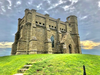
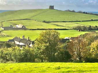
Abbotsbury lies on the Dorset coast a little inland of Chesil Beach, the notorious shingle bar on which hundreds of ships and thousands of seafarers came to grief in days of sail. On stormy days the waves pound the bar with a menacing roar, but today all was still and calm under a cloudy sky as we set out among the rich gold stone cottages of Abbotsbury with their grey thatched roofs.

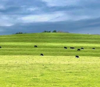
How did Blind Lane earn its name? An old holloway floored with flint and dark iron-rich stone, it led away up the hill behind the village. Black cattle grazed the strip lynchets or terraced scars left by medieval ploughing.

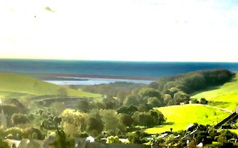
It was an exhilarating walk westward at the rim of the down, shoved along by a strong easterly wind. Neolithic long barrows and Bronze Age round ones pimpled the turf. The gorse-smothered Iron Age ramparts of Abbotsbury hill fort stood remarkably well preserved. Ahead opened the dramatic seascape and landscape of the Jurassic Coast, its cliffs faced with gold and white as landslips reveal the underlying strata. Further round Lyme Bay the colours darkened to the greys and blacks of the tottering cliffs beyond Lyme Regis, some of the most unstable land in these islands.

Down the single sloping street of West Bexington, and back east into the wind along a beach of pebbles mumbled so small by the sea that they resembled coarse sand. Ahead the long curve of Chesil Beach terminated in the sloping wedge of the Isle of Portland with its squared-off cliffs, quarried for freestone since Roman times.

A short sharp climb inland across a corrugation of lynchets to reach St Catherine’s Chapel on its round hill, with a superb view down over Abbotsbury and its mighty medieval tithe barn. Spinsters in fading hopes of securing a man would climb to the chapel and pray:

‘A man, St Catherine!
Please, St Catherine!
Soon, St Catherine!’

The coda was then whispered:

‘Arn-a-one’s better than narn-a-one!’


 Posted by at 17:07
Oct 242020


First published in: The Times Click here to view a map for this walk in a new window
picture picture picture picture picture picture picture picture picture picture
Facebook Link:

After a morning of downpours, rags of blue sky and great anvil-topped thunderheads of cloud were contesting the heavens over the Chiltern Hills.

This part of south Buckinghamshire is gloriously rich in woodland, perfect for a walk among autumn scents and colours especially after rain, when the black earth of the forest floor smells rich and every turning leaf gleams as though polished up for parade.

Horses flicked raindrops from their tails in paddocks still wet and glistening. Green lanes and hedge paths led us through the beech woods where squirrels leaped among the twigs, shaking down showers of raindrops. We walked pathways paved with fallen beech leaves, gold and lemon.

Two big woods, Common Wood and Penn Wood, are the particular pride of the neighbourhood. These are ancient woodlands, where Roman ironmakers collected wood for their furnaces, Saxons and medieval Londoners hunted deer, and Georgian chair-makers and wheelwrights harvested the beech-wood for their specialist trades.

Now they lie open for walkers, crisscrossed with permissive paths dedicated by Penn Estate. In Common Wood hornbeam and hazel, holly and oak made variegated patterns among the predominant beech, against a sky where thunder grumbled and rain showers came pattering by. We found tiny creamy fungi on stout black stalks, with gills as delicate and transparent as mother of pearl.

The path branched north towards Penn Wood past the rough pasture of Farther Barn Field, where a bunch of British White cattle with shiny black noses lay chewing the cud on the dry patches of ground they had reserved when the rain began. One cow had a pair of magpies perched on her back; she seemed entirely at ease with them.

Up in Penn Wood a patchy blue sky was breaking overhead as we turned for home. By the path a purple leaf beech, encased in a stout tree guard, carried a plaque. It had been donated by Prince Charles and planted in 2000 by Earl Howe, to commemorate the successful campaign waged by determined locals to prevent the wood being ‘developed’ as a golf course.

A strange and welcome irony, since it was Earl Howe’s ancestor who had enclosed the common here in 1855 and deprived the local commoners of their immemorial rights.

Start: Winchmore Hill, Bucks HP7 0PH (OS ref SU 933949)

Getting there: Bus 73 (Amersham)
Road: Winchmore Hill is signed off A404 between High Wycombe and Amersham

Walk (5½ miles, woodland paths, OS Explorer 172): From left corner of playground on village green, follow ‘Chiltern Way’/CW. In 300m cross road (929949); follow CW among trees. In 500m, left along tarmac road (927945); in 300m, on left bend (926942), CW forks right. Leave trees; anticlockwise round field edge, down to road (923939). Right; left up Noaks Lane; in 40m, right (922939, CW) along Penn Bottom. In 300m, right off CW up field (918940); through Brook Wood; cross road (919946) into Common Wood. Left along wide ride, forking right in 250m (‘Penn & Common Wood Long Trai). In 1 mile, in clearing with slatted ‘Common Wood’ notice board 50m on left, right downhill (904953, red stripe post) through Gravelly Way Plantation. Cross road (906959) into Penn Wood past gate (info board on right). Follow broad ride east for 1 mile to junction (921959); right to road; left into Penn Street. At junction, ahead (‘Amersham’); in 30m, left by The Cottages (923957, fingerpost); follow yellow arrows for ¾ mile across fields, through Priestlands Wood to Winchmore Hill.

Lunch/Accommodation: Potters Arms, Winchmore Hill HP7 0PH (01494-726222, pottersarms.co.uk) – lunch booking advisable

Info: High Wycombe TIC (01296-382415); satmap.com; ramblers.org.uk

 Posted by at 01:19
Oct 172020


First published in: The Times Click here to view a map for this walk in a new window
picture picture picture picture picture picture
Facebook Link:

A bright, windy morning after overnight rain in this finger of land where Staffordshire, Shropshire and Cheshire eye each other across a muddle of county boundaries. ‘Loggerheads’ is an old country word for ‘idiots’ – something to ponder as we set out from the village into the ancient thickets of Burnt Wood.

Here a tuberculosis sanatorium once stood. The patients were often wheeled outside in their beds to breathe the fresh air of the forest that was thought to alleviate their symptoms.

It was a peaceful stroll under the old oaks with their tangled understorey of holly. Patches of heath, flushed purple with heather, gave way to a brackeny track bordered by silver birch and richly golden gorse.

A stony lane led south out of the trees, between pastures where rams had marked the rumps of dozens of fat ewes with orange and blue raddle. Over in Wales the abrupt, wave-like peaks of the Berwyn ridge rose on the western skyline, an eye-catching counterpoint to the gentle roll of the Staffordshire countryside.

At Park Springs Farm three guinea fowl took fright at our approach. With a volley of unearthly whirring screeches they ducked their heads and scuttled off like a gaggle of old ladies in bulky grey cloaks.

A deep-sunk lane buttressed with great slabs of sandstone led past The Nook farm. The barns bore diamond patterns in their gables, some anonymous bricklayer’s careful work in a previous generation. Red-bodied darters hovered and settled on the wooden paddock fence, and the last of this year’s swallows went zigzagging above the lane, fuelling up for the long migration flight to Africa.

In the wooded dell of Lloyd Drumble there was a trickle of water under the sycamores. Along the lane to Hales the hedges were full of rosehips the size and lustre of cherry tomatoes. Over a gate we caught a glimpse of the slope where a Romano-British villa once stood, with a view of trees and far hills that can’t have changed greatly in 1500 years.

From the little hamlet of Hales, Flash Lane led north past Blore Farm, its red brick ornamented with black corners. The path wound back to Loggerheads via the outskirts of Burnt Wood, where plump black sloes hung in the hedge and crab apples bobbed at the end of laden boughs.

Start: Loggerheads PH, Loggerheads, Market Drayton, Staffs TF9 4PD (OS ref SJ 738359)

Getting there: Bus 164 (Market Drayton – Hanley)
Road – Loggerheads is on A53 (Market Drayton – Stoke-on-Trent)

Walk (6½ miles, easy, OS Explorer 243): Left along A53; in 70m, left (Kestrel Drive). In 500m, left (Woodpecker Drive, 735355); on into wood. In 150m, over crossways. In 300m, left at junction (734349). In 700m, at 8-way junction (739351), take second track on right. In ¼ mile, ahead through bushes to stony track (742349). Right. In ¾ mile, leave trees over stile (739339); in 75m, left over stile; along hedge. At field bottom, through gate (738336); ahead to gate; left along track. In 300m at Knowleswood (737332), right up track. In 250m, left (734332); in 350m, right (734329) passing The Nook (732329) and Keeper’s Lodge (727334). In 1¼ miles in Hales (719338), right up Flash Lane. In ½ mile, keep right of Blore Farm buildings (721346, ‘Short Walk’). In 200m, left through hedge (723347, stile, ‘Newcastle Way’) for 1 mile to A53 (736359). Right to Loggerheads pub.

Lunch: Loggerheads PH (01630-296118, theloggerheadspub.co.uk) – the Loggerheads PH advises booking.

Accommodation: Four Alls Inn, Market Drayton TF9 2AG (01630-652995, thefouralls.com)

Info: Market Drayton TIC (01630-653114); satmap.com; ramblers.org.uk

 Posted by at 01:34
Oct 102020


First published in: The Times Click here to view a map for this walk in a new window
picture picture picture picture picture picture picture picture
Facebook Link:

The village of Dent is wholly charming, all cobbled streets, narrow ways, stone-built houses and cosy, welcoming pubs. Sunk in its green dale below the Cumbrian fells, it’s a natural magnet for walkers on the long-distance Dales Way and the field paths and walled lanes that swoop up and down the hillsides.

A road past whitewashed cottages led us to the village green and the foot of Flinter Gill. A stony lane rose steeply under trees, its stream bouncing down to sluice across the Dancing Flags. This pavement of square flagstones was set in the streambed by the village weavers of times past; they would lay out their cloth here and stamp it to thicken the fabric.

Just above stood the twisted hollow trunk of a wishing tree – three times ‘deiseal’ or clockwise through the hole and you would gain your heart’s desire, but woe betide anyone foolish enough to pass through ‘widdershins’, the other way about.

Higher up, the lane passed High Ground Barn. Here in the cool and quiet of the old barn we found a collection of venerable farm and household implements – chaff cutter, horse rake, tilt cart, mangold slicer. Alongside hung black and white photos of the backbreaking work of the old-time farms – forking hay, washing and shearing sheep, stone walling, peat cutting.

Up at the crest of the fell we joined Occupation Lane, a perfect example of a Pennine walled lane, its rutted course ribboning up and down across the fellsides. From here we had a majestic view – across Dentdale to the great dun-coloured whaleback of Aye Gill Pike, the valley rising gently in beautiful lowland green pasture to the flattened pyramid of Great Knoutberry closing the eastern sky line.

Ahead rose the long back of Middleton Fell. A thousand feet higher than us, a shepherd on a quad bike steered for the ridge. As we neared the Barbondale road we could hear him yelping commands to his dog, high and clear on the windy air.

We descended a field track past Combe House with its carefully tended garden, then on down to the Dales Way in the dale bottom. Following it back to Dent, we saw a kingfisher streak along the water, a momentary scintillation of blue and orange above the peat-brown river.

Start: St Andrew’s Church, Dent LA10 5QL (OS ref SD 705870)

Getting there: Bus S1, S3, S4, S5 (Dent-Sedburgh); westerndalesbus.co.uk
Road: Dent is signed from Sedbergh, on A684 (M6, Jct 37)

Walk (7 miles, field paths and hill tracks, OS Explorer OL2): From south door of church, ahead down alley. Pass George & Dragon on your left; opposite Mill Cottage, right to village green. Left (704869, ‘Flinter Gill’) up lane. In ¾ mile pass bench; right (698859, ‘Keldishaw’) along Occupation Lane walled lane. In 1½ miles, right along road (680862); in ¼ mile, left (683864, ‘Underwood’) on green track across fields (occasional yellow arrows/YA). In 2nd field, path swings left to run below trees. On past Combe House (681875); follow YAs across beck to Tofts farm (682879). Down drive. In 200m, where concrete gives way to stone, sharp left (685879, YA below). Diagonally down field past ruin; down track to field bottom and road at Raw Bank (684883). Left; in ¼ mile, right (681885, ‘Dales Way’); right along river on Dales Way for 2¼ miles to Church Bridge (707872); right into Dent.

Conditions: Dales Way slippery and stumbly with tree roots in places.

Lunch/Accommodation: George & Dragon, Dent LA10 5QL (01539-625256, georgeanddragondent.co.uk) – cosy, friendly village inn.

Info: Kendal TIC (01539-735891); visitcumbria.com
satmap.com; ramblers.org.uk

 Posted by at 02:00
Oct 022020


The River Severn’s estuary was at a fantastically low tide as we crossed the ‘new’ bridge on a day of no cloud whatsoever. Looking seaward through the stroboscopic flicker of the bracing wires, we could see the tidal outcrop of the English stones fully exposed and slathered in red mud. Downriver, the little hump of Denny Island off Portishead stood marooned in a huge desert of sand. Other sand and mud banks lay around the widening tideway like beached whales. Unwary strangers might even suppose you could cross the five miles from the English to the Welsh bank on foot and do no more than bespatter your spats. And maybe you could, if you were able to walk on water while negotiating quicksand, slow mud, sudden drops, fathomless pools, and the second highest tidal range in the world sneaking round the corners to cut you off.

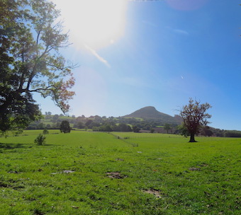
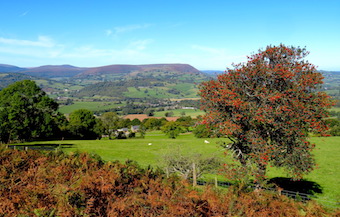
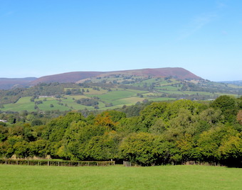
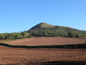
Over in Wales we hightailed it to Llanfihangel Crucorney, a placename whose sound put the immortal walking writer John Hillaby in mind of ‘a toy train scampering over points’. LC lies in the River Monnow’s valley that forms the eastern boundary of the Black Mountains and Brecon Beacons. It’s a great jumping off point for walks westward into those mountains, but today we were aiming east to climb The Skirrid (Ysgyryd Fawr, the ‘big split one’), a tall hill that lies north-south with its head cocked and spine raised like an alert old dog.

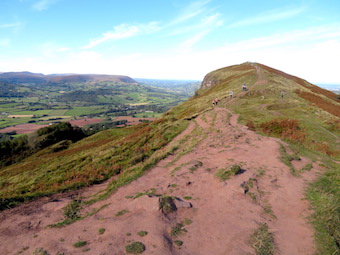
The Skirrid is made of tough old red sandstone lying in a heavy lump on top of thin layers of weaker mudstone – hence its history of slippage and landslides. We came up to it in cold wind and brilliant sunshine across fields of sheep, skirting its western flank through scrub woods, gorse bushes blooming yellow and holly trees in a blaze of scarlet berries, with the dark purple crags of the northern end hanging over little rugged passes of landslide rocks fallen in a jumble.


The ascent is short, steep and stepped, but it’s the sort of ‘starter mountain’ that families with six-year-olds can manage. Many were out – mums, dads, children, students, ‘maturer’ folk such as us, all hurrying to revel in this one-in-a-thousand day before the threatened reintroduction of lockdown in Wales should come into force.


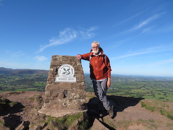
Once at the peak in this unbelievably clear weather we gasped to see the landscape laid out in pin-sharp detail a thousand feet below and fifty miles off – Malverns, Black Mountains; farmlands rising and falling towards Gloucestershire and the Midlands; the slanting tabletops of Penyfan and Cribyn over in the Brecon Beacons; Cotswolds, Mendip, Exmoor; and the south Wales coast trending round into far-off Pembrokeshire.

Nearer at hand a grey streak of softly glimmering sea showed the tide rising in the Severn Estuary past Brean Down’s promontory, the slight disc of Flat Holm and the hump of her sister island Steep Holm, their lower edges lost in mist so that they looked like floating islands in some fabulous sea.


 Posted by at 19:43