Apr 302022


First published in: The Times Click here to view a map for this walk in a new window
Mells - St Andrew's Church and Mells Manor countryside near Mells 1 countryside near Mells 2 Fussell's Ironworks 1 Fussell's Ironworks 2 Mells Stream, entering Vallis Vale De La Beche's Unconformity - golden Jurassic oolitic limestone capping grey Carboniferous limestone 1 De La Beche's Unconformity - golden Jurassic oolitic limestone capping grey Carboniferous limestone 2 Fussell's ironworks - arches

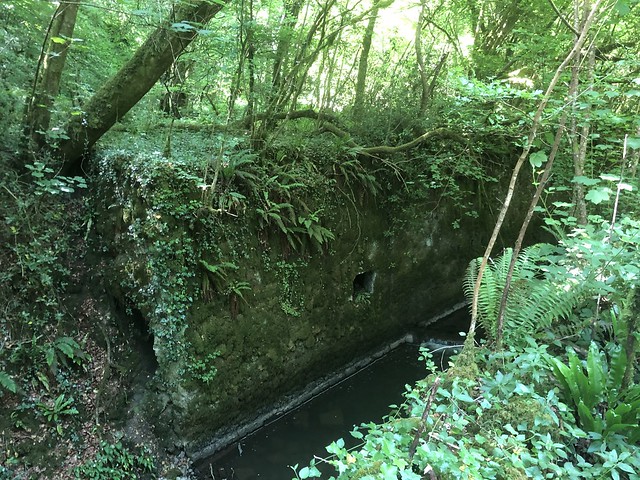
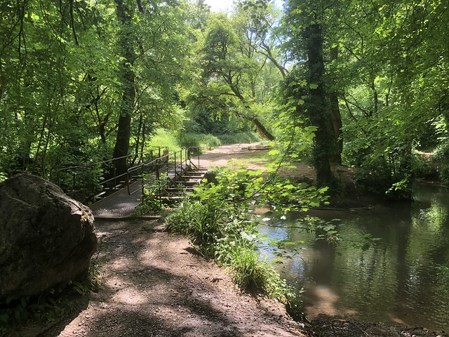
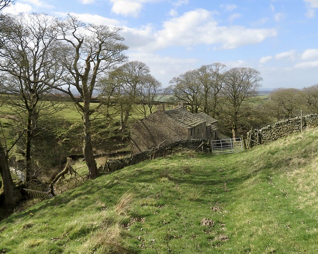
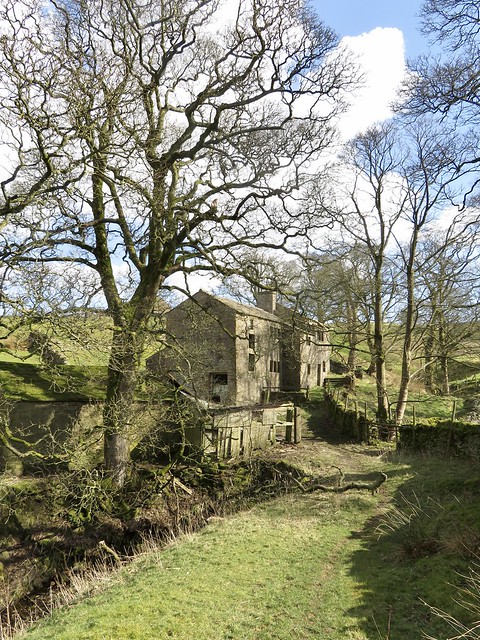
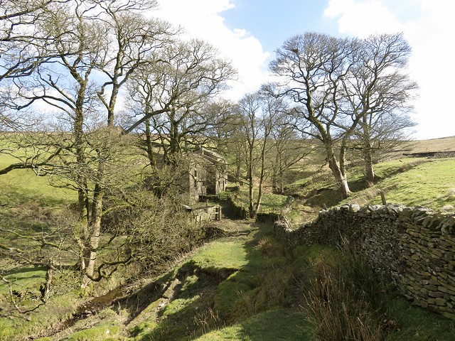
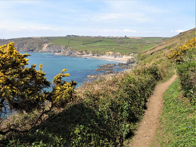
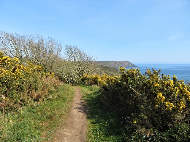
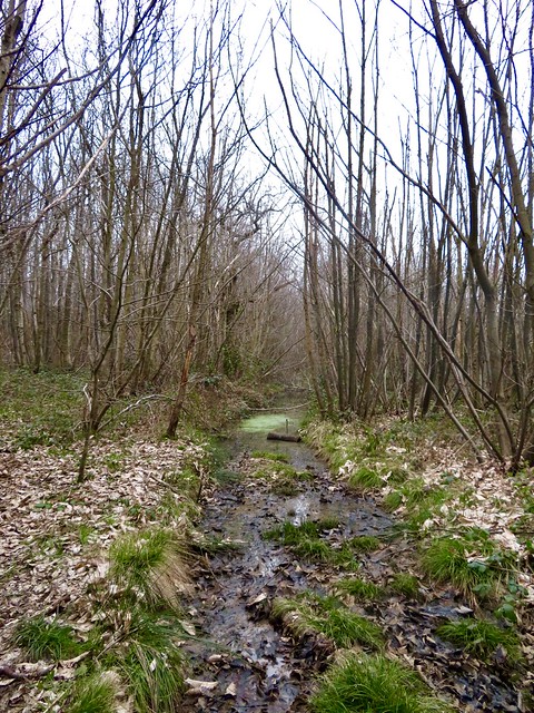
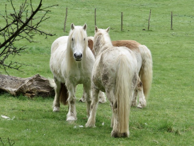
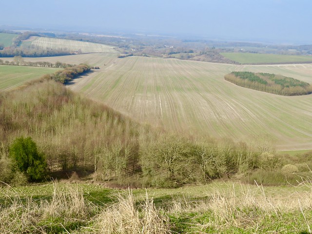
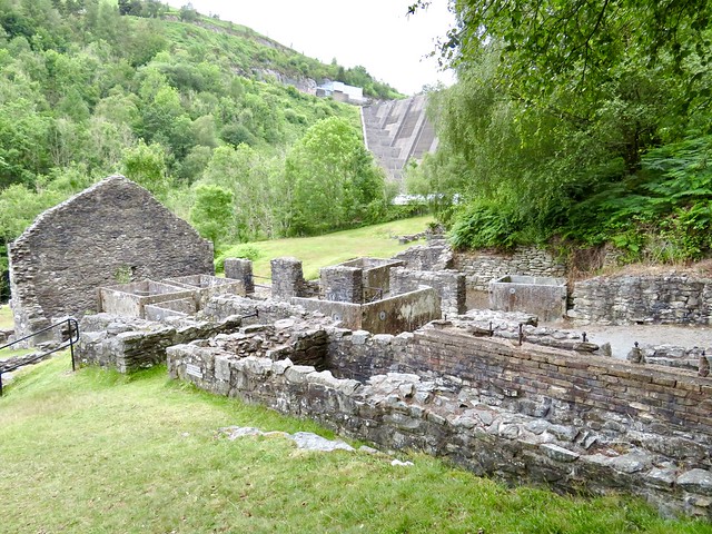
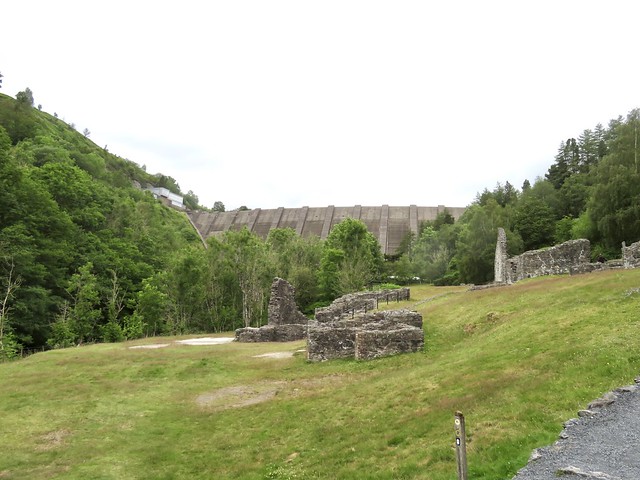
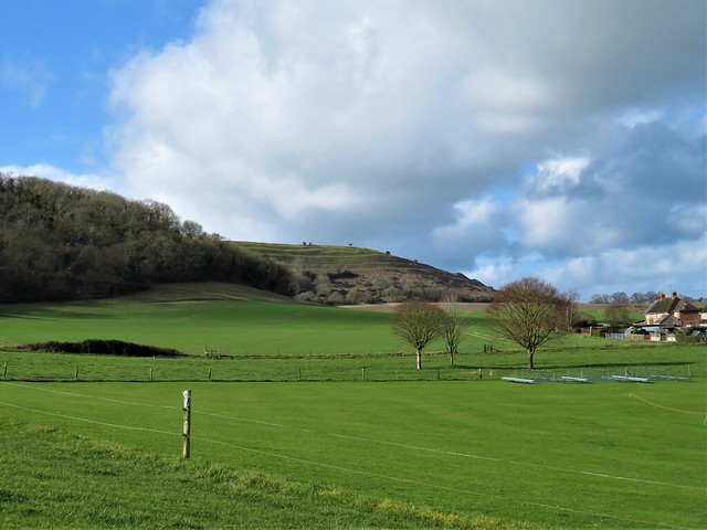
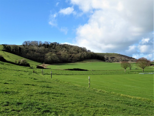
There was a feeling of eternal spring on this glorious sunny morning in the Arts & Crafts village of Mells. Toddlers played in the Mells Stream. Even the cattle in the fields looked fabulously clean. We followed a bridleway eastward through Wadbury Valley, past hollows and great stone walls pierced with round and square holes, arches, deep sluices of channels, side falls and rapids – the remnants of the once-mighty Fussell’s ironworks that brought prosperity and industrial clatter to the green valley from the 1740s onwards.

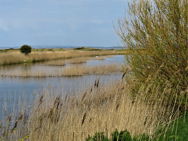
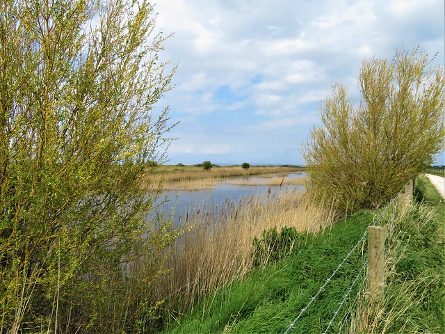
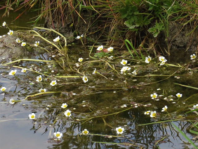
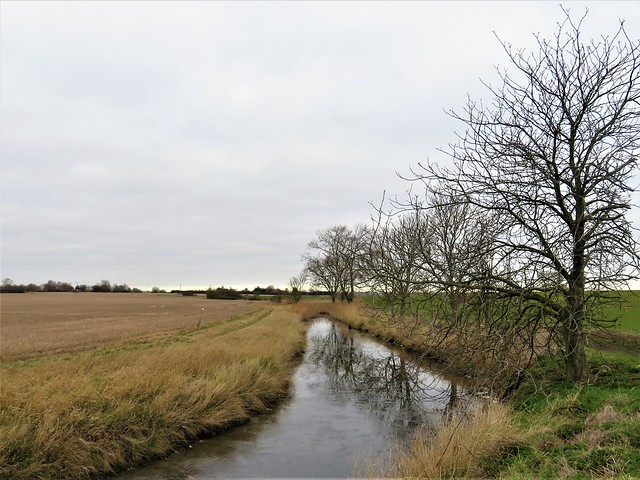
A baby chaffinch squatted on a hazel branch, its parent hovering in mid-air like a humming bird as she crammed insect morsels into its open beak. A nuthatch perched upside down on a sycamore trunk, head bent back as it glanced this way and that. The river curved and forked, dwindled and swelled, while from the tangle of foliage and ferns came a constant stream of warbler and wren song.

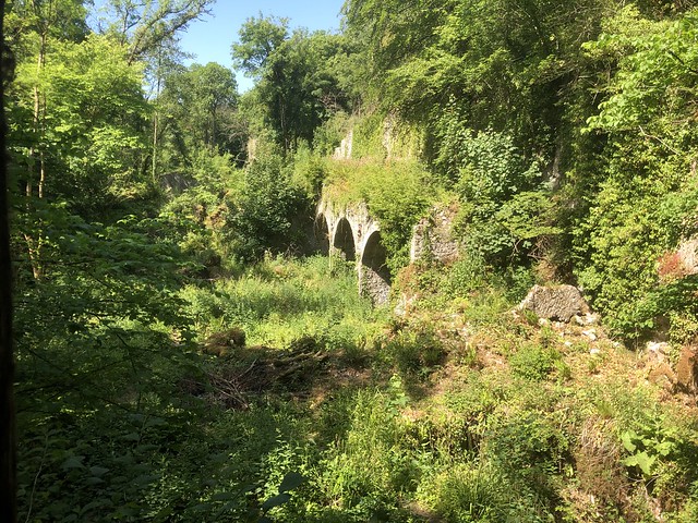
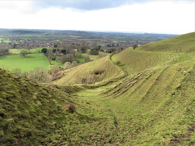
Children splashed in the shallows. At Bedlam a boy with a shrimping net showed us his catch – two big crayfish six inches long, scuttling in and out of the light round the bottom of his bucket, claws extended in front of them. Beyond Bedlam the river swung off into Vallis Vale, past caves with twisted rock strata.

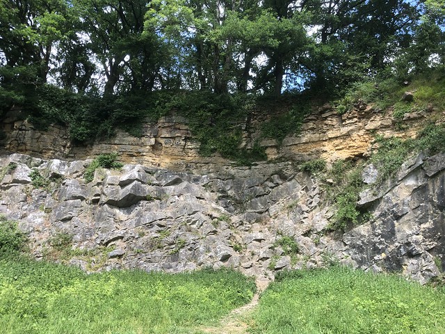
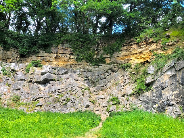
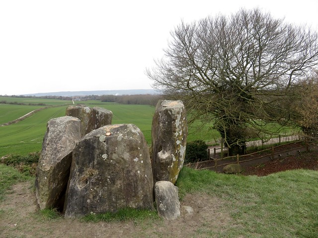
We were lucky to stumble upon De La Beche’s Unconformity. It lay behind a screen of bushes on an unmarked path, one of 19th-century UK geology’s landmark sites, a lightbulb moment of understanding about how the world was really made. A thick layer of yellow Jurassic Inferior oolitic limestone lies horizontally on top of a steeply inclined grey mass of Carboniferous limestone, fitting onto it like a cap. Yet there’s a gap of 170 million years between the two depositions. Unconformities like this helped pioneering geologists like Henry De la Beche to understand that the material that composes rocks was not laid down in one slow, smooth process, but a series of upheavals, collisions and erosion.

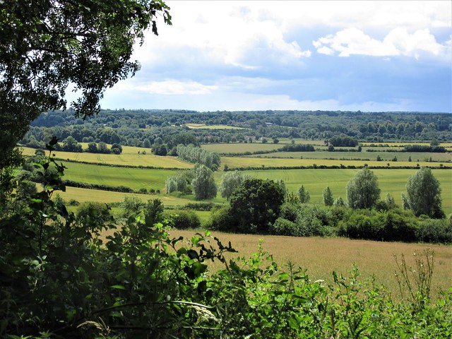
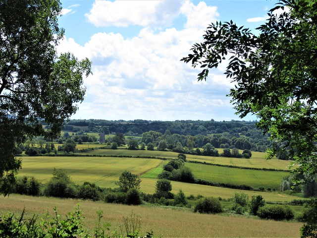
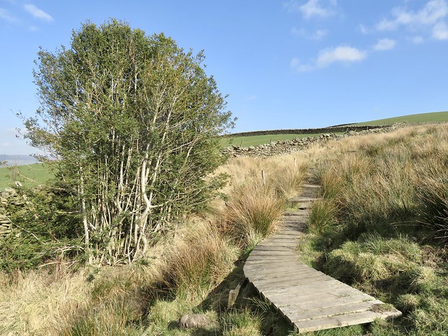
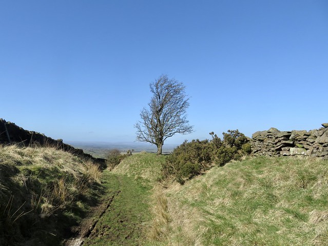
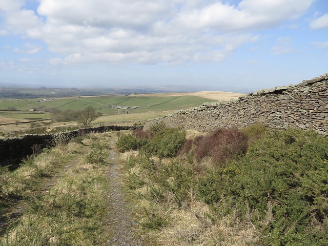
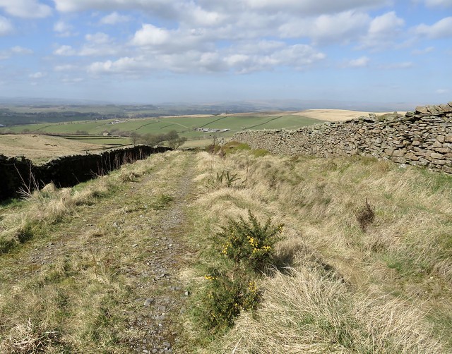
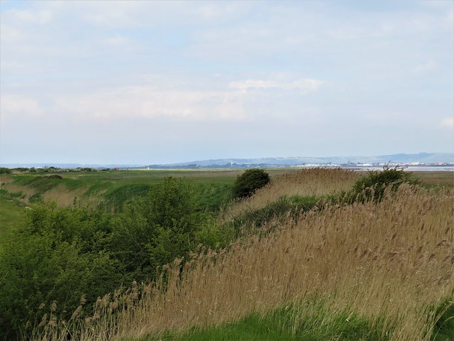
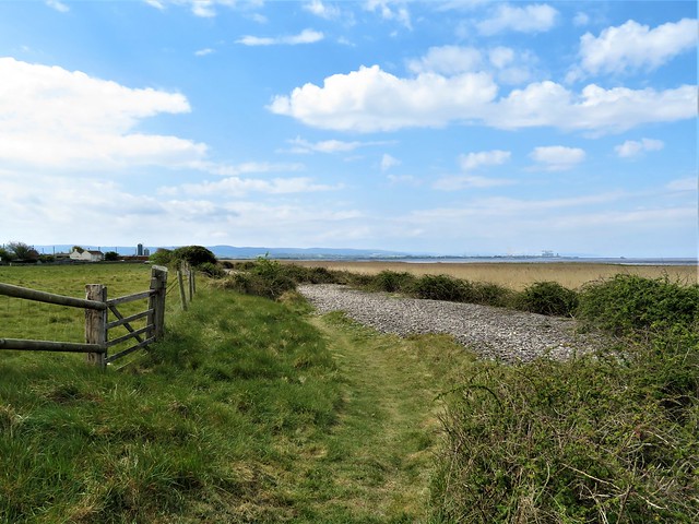
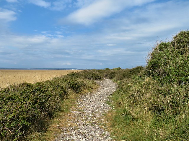
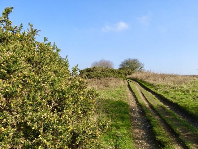
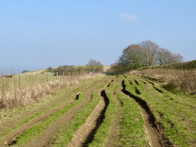
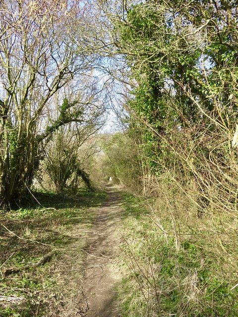
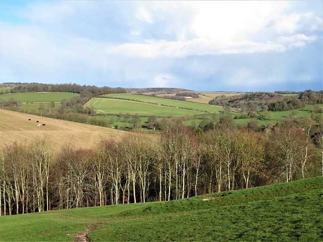
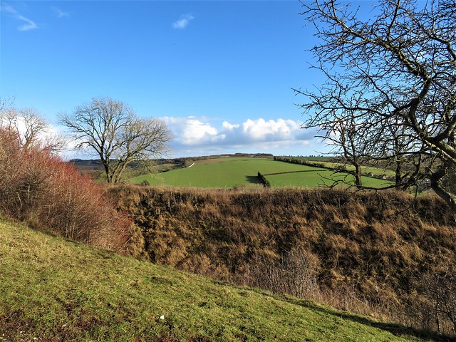
We wandered back along the East Mendip Way to Bedlam. Here we climbed up out of the valley and over a green ridge to find the long straight track of the old Frome-Radstock railway line, now the Collier’s Way cyclepath. We followed it west on a high embankment where the rusty old rails accompanied us, saplings growing up between them, concrete sleepers piled aside.

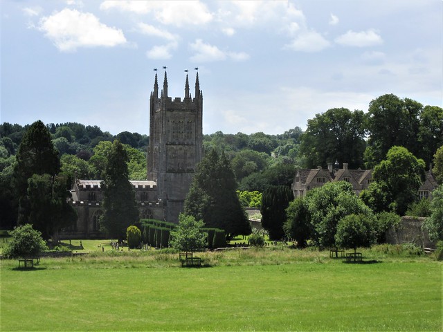
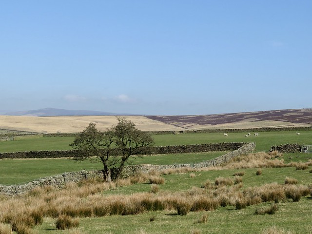
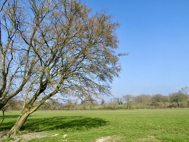
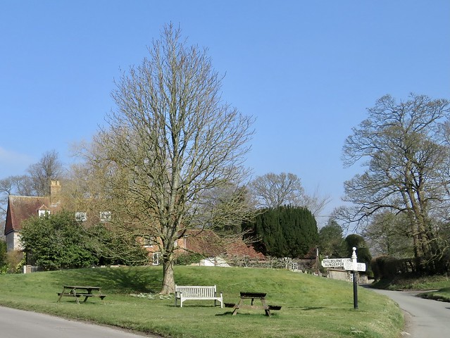
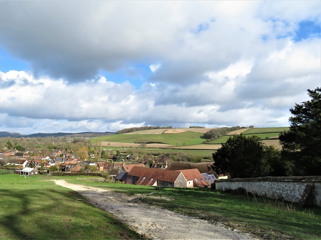
A short road section along Conduit Hill, and we were walking a wheatfield path toward the tower of Mells church, seemingly adrift in a sea of corn and newly mown grass.
How hard is it? 8 miles; easy; riverside and old railway paths

Start: Talbot Inn, Mells, Frome BA11 3PN (OS ref ST 728492)

Getting there: Bus 184 (Frome-Midsomer Norton)
Road: Mells is signed from A362 near Buckland Dinham, between Frome and Radstock.

Walk (OS Explorer 142): Left along street past shop. Left (730490, ‘Great Elm’). In 250m right (733490, bridleway) along Wadbury Valley beside Mells Stream. In ⅔ mile fork right (743491, ‘Wyvern Way’). In ⅓ mile join East Mendip Way/EMW (748491); follow past Bedlam for ⅔ mile. Where EMW turns right over bridge (755491), turn left; in 50m cross open space; keep ahead (narrow, unsigned path) through bushes to old quarry/De La Beche Unconformity (756492). Return along EMW; in ¼ mile, right across river in Bedlam (754495); up roadway to road (752495). Dogleg right/left across; stile (fingerpost), field path, then road; left along Colliers Way cyclepath (751498). In 1½ miles, left at Conduit Bridge (730506) along road. In 650m on left bend, ahead (728500); field paths to Mells.

Lunch/Accommodation: Talbot Inn, Mells (01373-812254, talbotinn.com)

Info: mellsvillage.co.uk

 Posted by at 01:36
Apr 232022


First published in: The Times Click here to view a map for this walk in a new window
On the Pennine Way near The Mount Stanridge Clough Lane 1 view from Stanridge Clough Lane towards the moors the walls, the moors, the hills around Earby Descending Dodgson's Lane, looking towards Oak Slack farm 1 Descending Dodgson's Lane, looking towards Oak Slack farm 2 In Fiddling Clough 1 In Fiddling Clough 2 In Fiddling Clough 3

The old Lancashire mill village of Earby, tucked under the western edge of the West Pennine Moors, is facing a lot of challenges, like other similar post-industrial settlements in this part of the world. But the Red Lion pub is still proud to eschew a food service in favour of specialising in well-kept beers, and the Youth Hostel (now Earby Holiday Hostel) does a lively trade.

The wind-torn sycamores were budding out as we climbed the stone walled track of Stanridge Clough Lane to the upper ground of Bleara Moor. You have to grab with both hands a day like today with unbroken blue sky, the east wind bringing cries of young lambs and the bubbling calls of curlew. The sun spread its cheerful buttery light across upland moors and valley pastures, a reminder of just how long and dreary winter had been.

When in 1965 John Hillaby came walking the just-opened Pennine Way a few miles eastward, he found the first section across the gritstone moors a muddy purgatory. But there were moments of rare delight, too, expressed by Hillaby in his classic account Journey Through Britain. The tumbling flight of courting lapwings in their aerial dances today recalled Hillaby walking into a lapwing kindergarten not far away. ‘In the air they play with the wind, toying with it, rolling over … then they settle down on their nests with a little shiver of ecstasy.’

In the black trickling sykes or peat moor streams, frogs set up their insistent mating calls: ‘Breddit, breddit, breddy-eddy-eddit.’ All over Blears Moor and Thornton Moor, nature was tuning up for the grand symphony of spring.

We descended the rough hill road of Dodgson’s Lane to pass Fiddling Clough where the farmstead lay pinched in the narrow stream cleft, abandoned, already sinking back into the ground. A former tenant, John o’Ned’s, once held a grand opening of his new henhouse for all the neighbourhood, including a contest involving eating hot dumplings from a greasy plate without benefit of cutlery. They knew how to have fun in them days.

Past Fiddling Clough and Oak Slack farm we met the Pennine Way and followed it down smooth green sheep pastures for the final couple of miles back to Earby.

How hard is it? 7 miles; easy; hill paths

Start: Car park, Victoria Road, Earby, BB18 6US (OS ref SD 907468)

Getting there: Bus 280, Preston-Skipton
Road: Earby is on A56 (Colne-Skipton)

Walk (OS Explorer OL21): left to Water Street, right; left up Red Lion Street, on up Mill Brow Road. In 600m at bench on left, fork right (918468, ‘bridleway’) for 600m to meet Stanridge Clough Lane (919461). Left. In 600m pass Higher Verjuice ruin (925458); left along wall. In 700m, left down Dodgson’s Lane (932460). In 650m at gate in dip, ahead through gate (929466); aim left of barn, right of farmhouse ruin (926469). Cross stream; continue to cross Wentcliff Brook (925472) and up to Oak Slack Farm (924474). Cross drive; up field to stone stile (923576); ahead (923478, The Mount garden, stile). Half left to footbridge (925481); left down Pennine Way to Brown House (918484). Left through farmyard between cattle sheds; through gate; follow right-hand fence, then stream on right to Booth Bridge (914478). Cross drive; path up plantation, then fields to Batty House Farm (914473). Follow drive to T-junction (913468); right past Red Lion into Earby, or left to Holiday Hostel.

Lunch: Punch Bowl, Skipton Rd, Earby BB18 6JJ (01282-843017, thepunchbowlearby.co.uk)

Accommodation: Earby Holiday Hostel, Birch Hall Lane, Earby BB18 6JX (0779-190-3454; earbyhostel.co.uk)

Info: visitpendle.com

 Posted by at 01:21
Apr 162022


First published in: The Times Click here to view a map for this walk in a new window
Looking down on Vault Beach Coast path approaches Vault Beach small copper butterfly looking back on Gorran Haven coast path winds towards Vault Beach the lone house on Vault Beach descending to Vault Beach Vault Beach common lizard pretends it's a log looking back to rugged promontory coast path through the gorse Caerhays Castle behind Porthluney Cove

Looking back from the coast path as we climbed out of Gorran Haven, we saw the old pilchard-fishing port as a tumble of solid stone houses, whitewashed under grey slate roofs. A bold swimmer in a red bathing dress was just stepping gingerly into the icy green shallows of the harbour.

A massive L-shaped granite breakwater spoke of the village’s past; the present lay in plain view along the clifftops opposite, a flotilla of modern houses with glass walls looking seaward.

The path ran south to Maenease Point along banks of primroses. An astonishing display of violets, too, thickly carpeting the slopes in shades ranging from deep purple to the palest blue. White elbowed into the colour contest in the shape of stitchwort, fat-bladdered sea campion, and the hanging bells of three-cornered leek.

A flowery coastal spring walk in a thousand, up and down along the cliffs by way of flights of steps that soon had my knees complaining. A catamaran idled past with a faint putter of engines, while further out to sea a little scarlet trawler lay at work under a swirling cloud of herring gulls.

It was a day for walking slowly, stopping often to look at what was happening right under our noses. Congregations of St Mark’s flies had just hatched, the large black males trailing their legs like seaplane skids as they circled the flowering gorse bushes in jerky flight, the females crouched motionless below on the bright yellow petals.

A great black-backed gull, the bully of the coastal skies, emitted harsh barks like an over-excited terrier as it showed an intruding buzzard out of its territory. In the gorse a great outbreak of twittering among the goldfinches feeding there, followed by a deathly silence, gave warning of a kestrel that floated in slow circles over the slopes, head down as it looked for the ultraviolet scent trails left by voles, or the sudden movements of small birds.

The cliff path skirted the long curve of great sand at Vault Beach, a young couple with their dog the only occupants this morning. Just beyond the bay we crossed through the bushy rampart of The Bulwark, an Iron Age earthwork built to seal off the outer extremities of Dodman Point’s blunt-nosed promontory.

From the big granite cross that makes a seamark out at the tip of the headland we looked south to misted lines of cliffs, south as far as the long bar of the Lizard, north to Nare Head and the slanted sea stack of Gull Rock. On the northern skyline marched the Cornish Alps, tall conical spoil-heaps of the declining china clay industry, their dazzling whiteness now greening over.

More steps, more clifftop rambling. An ice-cold paddle in the surf on deserted Hemmick Beach, then on past the jagged rock pinnacles at Lambsowden Cove, and down through the sycamore woods to the broad sands of Porthluney Cove under the battlemented walls of Caerhays Castle.

How hard is it? 5 miles; moderate coast walk; some steps and steep sections

Start: Gorran Haven, near Mevagissey PL26 6JG (SX 013416)

Finish: Caerhays car park, Porthluney Cove PL26 6LY (OS ref SW 974413)

Getting there: Bus 471/23 (St Austell)
Road – Gorran Haven is signposted from Mevagissey (B3273. from A390 at St Austell)

The Walk (OS Explorer 105): At Gorran Haven harbour, turn right and follow South West Coast Path for 5 miles to Porthluney Cove. Return by pre-arranged taxi (Mevagissey Cars, 07513-774529, £16 approx.)

Lunch: Caerhays Beach Café, Porthluney Cove (01872-501115)

Accommodation: Llawnroc Hotel, Chute Lane, Gorran Haven PL26 6NU (01726-843461, thellawnroc.co.uk)

Caerhays Castle: visit.caerhays.co.uk

Info: visitcornwall.com, southwestcoastpath.org.uk

 Posted by at 01:09
Apr 092022


First published in: The Times Click here to view a map for this walk in a new window
shore path to Steart Point scrub full of birdsong coastal reedbeds 1 coastal reedbeds 2 brackish water-crowfoot view across the reedbeds to the Severn Estuary signpost at the Tower Hide Tower Hide at Steart Point Tower Hide at Steart Point 2 coastal scrub and reedbeds, looking to Mendip Hills misty shape of Steep Holm island in mid-estuary looking west along the coastal path from Steart Point coastal path towards Steart Point

Where the Severn Estuary merges with the Bristol Channel is a moot point, but the tidal water is always full of energy, swirling in purple and chocolate at high tide, then retreating with the ebb to expose vast sand and mud flats.

Off Steart Point the turbid River Parrett enters the tideway. At low tide the mud flats here stretch two miles out into the estuary, a haven for feeding birds. But flood tides are another story. The mud and sand are swallowed up, the Bristol Channel brims, and inundation can threaten the farmland and small settlements along the coast and far inland.

We set off at low tide along the coast path from the scattered hamlet of Steart. The dimpled miles of mud flats gleamed. The distant island of Steep Holm appeared marooned in mud and sand. In the southwest the Quantock Hills stood beyond the giant cranescape of half-finished Hinkley Point nuclear power station, while in the east rose the green whaleback of Brent Knoll and the long spine of the Mendip Hills.

The shoreline path ran on rabbit-riddled sands, turf and crunchy pebbles. A pale yellow bloom on one of the coastal fields turned out to be a solid mass of cowslips. Wild birds were everywhere – greenfinches and linnets on the bramble stems, shelduck assiduously hoovering the mud for crustaceans with sideways sweeps of their bright red bills, and a reed warbler complaining with unending chittering in the reedbeds.

At Steart Point a tall hide looked out across this remote landscape of flat fields, far hills, upstart knolls and tidal flats. From here the River Parrett Trail led back inland, the mud-slimed banks of the Parrett shining silver in the sun and wind. Here the Wildfowl & Wetland Trust had been working with Environment Agency to create anti-flooding buffer zones with flood banks built to encourage new saltmarsh to grow to the seaward – a bold initiative that works with nature rather than trying to strongarm it into submission.

We followed the trail down to where a breach has been cut in the Parrett’s defences. New mud, marsh, reedbeds and creeks show the effectiveness of the work. Pochard cruised a big pool where three herons stood on one leg apiece and regarded us with grave suspicion.

A grassy path led back to the shore. The morning mist shredded away to reveal the hills of South Wales far across the rising tide, and a flight of golden plover flickered low over the rapidly vanishing mudflats where the Parrett met the sea.
How hard is it? 6 miles; easy; shore paths

Start: Steart car park, Steart, Bridgwater TA5 2PX (OS ref ST 276459)

Getting there: A39 (Bridgwater-Minehead); at Cannington, right (‘Hinkley Point’, then ‘Steart Marsh’). Pass Steart church; car park in 500m on left (gate).

Walk (OS Explorer 140): From car park follow green lane north to sea wall (274460). Right (‘Steart Point’) for ⅔ mile. At Steart Point, right past tall hide (283467); right (‘Wall Common’). In 150m, left (kissing gate/KG); follow River Parrett Trail/RPT. In 700m at Manor Farm, ahead along road (278462); by Dowells Farm, left (276458, KG, RPT) to river wall; left to breach and hide (280454). Return to KG; dogleg left/right along river wall (‘Steart Gate, Polden Hide’), following RPT. Pass turning to Steart Gate car park (267454); in ½ mile, signpost ‘Polden Hide 0.71’ points left (261449), but keep ahead to cross road. On between 2 marker stones on grassy path to shore (254451); right (‘Steart’) to car park.

Lunch: Picnic

Accommodation: Malt Shovel Inn, Cannington TA5 2NE (01278-653880, themaltshovelinn.com)

Info: wwt.org.uk/steart-marshes (01278-651090)

 Posted by at 01:01
Mar 262022


First published in: The Times Click here to view a map for this walk in a new window
salt marshes of Paglesham Pool, looking to Wallasea Island 1 salt marshes of Paglesham Pool, looking to Wallasea Island 2 Plough & Sail, Paglesham Eastend fertile fields around Paglesham drainage ditch alongside Paglesham Creek grave of William 'Hard Apple' Blyth, churchwarden, grocer and smuggler shellfish station, Paglesham Pool Paglesham boatyard on the River Roach 1 houseboat and jetty on River Roach, Paglesham Waterside Roach Valley Way across the fields to Paglesham Churchend

The Plough and Sail out at Paglesham Eastend must be one of Essex’s remotest pubs, an end-of-the-road inn catering for locals and the odd inquisitive outsider who ventures this far.

Large, curiously-shaped old houses and widely scattered farms shelter (or hide, it sometimes appears) behind thickets of trees. Paglesham was a notorious haunt of smugglers back in Georgian times, and some of these handsome abodes were built from the proceeds, so local history asserts – notably the tall red-brick Cupola House with its outsize observation turret offering a gull’s-eye view of coastguard activity on the nearby River Roach.

A muddy path took us across flat fields of spring wheat and mouldering stubble where tottering Dutch barns and towering stacks of straw bales were the only upstanding features. At Paglesham Churchend we came to St Peter’s Church, where a rickety stone tomb enclosed the mortal remains of William ‘Hard Apple’ Blyth, churchwarden and grocer by day, smugglers’ ringleader by night.

Hard Apple cut a fantastic figure in his 18th century heyday, keeping hold over his ruffian gang by deeds of prowess such as wrestling bulls, munching wine glasses and drinking a keg of brandy at a sitting. Ferrying contraband, outwitting and outsailing the Revenue in his cutter Big Jane, Hard Apple used the tower of St Peter’s as a hiding place for smuggled goods. Occasionally apprehended, always slipping through the net, he died at the age of 76 in the odour of sanctity, uttering his final words: ‘I’m ready for the launch.’

Beyond Churchend we found the marshy bank of Paglesham Creek, a broad muddy tidal outlet. Oystercatchers and curlew made their plaintive piping calls from the great tangle of saltmarsh on Wallasea Island RSPB reserve across the river. We walked the flood-wall path towards the distant sea, watching shifting clouds of geese and ducks swirling over the far horizon. Flotillas of wigeon paddled across the creek, and a flight of dunlin switched direction, all together in one instant, passing so close that we could hear the whir of their wings.

Down at the tip of the Paglesham peninsula we paused before turning for home to contemplate a remarkable case of historical bathos. On this spot in 1870 Coastguard Watch Vessel No 7, downgraded and neglected, was finally broken up. Some forty years earlier, as survey ship ‘HMS Beagle’, she had carried Charles Darwin across the world on the voyage of discovery that gave rise to his epoch-making Theory of Evolution. Quite a claim for a forgotten hulk on this obscure stretch of a muddy Essex creek.

How hard is it? 5¾ miles; easy; field and river wall paths

Start: Plough & Sail PH, Paglesham Eastend, Rochford SS4 2EQ (OS ref TQ 944922)

Getting there: Bus 60 from Southend-on-Sea
Road: M25, Jct 29; A127 to Southend-on-Sea; A1159 to Rochford; follow ‘Great Stambridge’ and on; Paglesham signed from Ballards Gore.

Walk (OS Explorer 176): Walk up left side of Plough & Sail (‘To The Coast’), past Cobblers Row and on (yellow arrows/YAs). At Well House (944926) left along road. In ½ mile at East Hall Farm, right (936926, fingerpost) to skirt buildings. Follow YAs across fields for ¾ mile to Paglesham Churchend. Pass church (926930); on past houses; on bend, right (924931) onto field track (YAs). In 700m, right (924936) along Paglesham Creek flood wall. In 2¾ miles at pillbox, turn right (953925) along River Roach to boatyard and jetty (948921); right to Plough and Sail.

Lunch: Plough & Sail, Paglesham, Eastend (01702-258242, theploughandsail.co.uk)

Accommodation: Holiday Inn, 77 Eastwoodbury Crescent, Southend-on-Sea SS2 6XG (01702-543001, ihg.com)

Info: Southend-on-Sea TIC (01702-212534), visitessex.com

 Posted by at 01:14
Mar 192022


First published in: The Times Click here to view a map for this walk in a new window
Caradoc Hills from Earl’s Hill

A rain-spattered morning gave way to a brighter sky over the Welsh Borders. From the pastures south of Shrewsbury rose thickly forested Pontesford Hill, a double hump leading up to the Iron Age ramparts at the grassy crown of Earl’s Hill.

A long stony track led up the flank of Pontesford Hill, steepening through pine and oak woods and the slender white stems of silver birch. The track was littered with fragments of pine branches torn loose by winter storms, among which lay little heaps of scales dropped from larch trees by feasting grey squirrels.

We stopped to watch one at his work forty feet above our heads. He sat upright, intense and efficient, balanced by his fluffed out tail, nibbling energetically at a cone held in his paws, neatly picking out the nutritious seeds and letting the scales fall spinning to the ground.

Rocks and tree roots offered slippery footholds as we went up to where the tattered trees of Pontesford Hill give way to the grassy slope of Earl’s Hill. Shropshire Wildlife Trust have plans to remove the failing conifers planted on Pontesford Hill in the 1960s and to restore a sheep-grazed sward for wild flowers and butterflies, an exciting prospect.

A great Iron Age hill fort encloses the elongated top of Earl’s Hill, and from here we gazed round a breath-taking 360o panorama, north to the Cheshire plain and its sandstone ridge, west to the Welsh hills, and south towards a rise of ground where the jagged outcrop of the Stiperstones broke the skyline. The big isolated hump of the Wrekin lay to the east, while away in the southeast the furrowed flanks of the Caradoc Hills were dramatically sunlit under a dark wave of cloud.

A broad tongue of grass led steeply off the hill and down into woods where celandines were beginning to show their miniature golden suns beside the path. At a mucky crossing of tracks, more slurry than solid ground, we turned northeast through sunny Oaks Wood and down to the rushing Habberley Brook in its dell below the cliff face of Earl’s Hill.

A path led downstream, crossing and recrossing the stream before heading for Pontesbury across shaggy pastures. Some of the wildlife ponds at Earlsdale carried a paper-thin skin of ice, and the afternoon sun put a shimmer on the water of those pools as yet unfrozen.

How hard is it? 4¾ miles; moderate; hill and woodland tracks, muddy in woods.

Start: Pontesford Hill car park, near Pontesford, Salop SY5 0UH (OS ref SJ 409057)

Getting there: Bus 552/553, Shrewsbury-Bishop’s Castle
Road – ‘Pontesford Hill’ is signed from A488 at Pontesford, between Shrewsbury and Minsterley

Walk (OS Explorer ): Pass bollards, up main track. In 350m, left up steps (408055, ‘Summit’); steeply up to summit trig pillar on Earl’s Hill (409048). Ahead, steeply downhill to stile (406043); right (‘Walk 17’). At foot of slope, left (405044, gate, ‘Ride UK’). In 500m at path crossroads (406039, gate), left (blue arrow/BA). In 200m, half right across field to gate/footbridge (409041, yellow arrow/YA, ‘Chris Bagley Walk’). Path through Oaks Wood. In ¾ mile at top of wood (417046) path curves left and descends; at bottom, right; immediately left (415048, BA, ‘Ride UK’) down to cross footbridge (415051). Right (BAs); in 250m, cross stream (416052, BAs); in 100m recross (416053, YA). Up to kissing gate/KG; keep ahead, following YAs and keeping Earlsdale ponds on your right, across fields to car park.

Lunch: Picnic; or Mytton Arms, Habberley SY5 0TP (01743-792490 – ring first for details!)

Accommodation: Prince Rupert Hotel, Butcher Row, Shrewsbury SY1 1UQ (01743-499955, princeruperthotel.co.uk)

Info: shropshirewildlifetrust.org.uk

 Posted by at 01:11
Mar 122022


First published in: The Times Click here to view a map for this walk in a new window
Stones of Coldrum Long Barrow Boggy course of the old Pilgrim's Way ancient yew overhangs the Pilgrim's Way 1,000-year-old Church of Our Lady of the Meadows, remnant of depopulated village of Dode bare ploughland along the Weald Way primrose path above the 1,000-year-old Church of Our Lady of the Meadows Horses at Great Buckland Farm, shaggy for winter chanting at the Coldrum Stones Daphne laurel, spurge laurel, in White Horse Wood

A cold day over the North Downs of Kent at the cusp of the seasons, with winter proving reluctant to move over in favour of spring. Along the lane on Holly Hill snow drops still hunt their heads, grubby at the end stage of their flowering. But dog’s mercury had spread its green leaves and tiny blooms all over the floor of Greatpark Wood, and among the silver birch and pines we heard a familiar introit to spring, the tentative tsip-tsap, tsip-tsap of a newly arrived chiffchaff.

Sweet chestnut coppice forms a large part of these woods on the chalk and greensand escarpment, the long-unattended shoots grown house-high and as thick as individual tree trunks. The toothed spearblade leaves of last autumn, crisp and grey, shuffled underfoot as we dropped down to the valley road and hop fields at Great Buckland.

From the Weald Way path in Tranquil Wood we looked down on the red tiled roof and flint walls of the thousand-year-old Church of Our Lady of the Meadows. The village of Dode was depopulated and abandoned during the Black Death plague of 1349, but its humble little church still stands under the wooded hillside.

The Weald Way, doughy with dark mud, forged south through hazel and chestnut coppiced tangled with lianas like thickets in a fairy tale. Fat green buds were bursting from hawthorn twigs, and sheaves of green shoots showed where bluebells would soon be carpeting these woods.

At the southern edge of White Horse Wood we crossed the wet ditch of an ancient ridgeway and dipped sharply down the face of the escarpment among yew trees. At the foot of the slope ran another ancient route, the Pilgrim’s Way path that brought penitents and not-so-penitents (Chaucer’s adventurers among them) to the shrine of St Thomas Becket at Canterbury.

A pilgrim shrine that predates Becket’s by perhaps four thousand years stood on a knoll in the field beyond. The great uprights of Coldrum Long Barrow form the centrepiece of a circle of recumbent standing stones. Joss sticks were smouldering in the turf, and a pagan celebrant stood singing to the stones, a stick in either upraised hand.

We left her to her devotions and went quietly away to join the Pilgrim Way and the homeward path.

How hard is it? 7 miles; easy; one short climb with steps; muddy in woods.

Start: Holly Hill car park, Meopham, Gravesend DA13 0UB (TQ 670629). NB Closes at 5 pm.

Getting there: M20, Jct 3; A227 Gravesend road; car park signed from White Horse Road, 1 mile east of Vigo Village.

Walk (OS Explorer 148): From Holly Hill car park, left along road. Beyond Holly Hill House, fork right (670634) past metal barrier. In ⅔ mile, left (673643, blue arrow/BA). At road, right (670642); in 150m, left (670644, ‘Vigo, Harvel’). 150m past Great Buckland Farm, left (668641, ‘Tranquil Wood’, ‘Weald Way’/WW). In ⅔ mile, at gate on right (662634) don’t go right (WW), but keep ahead (WW, ‘BA NS 246’). At road, left (659632). In 350m, on right bend, left (658629, WW) along field edge, then follow YA 235. At road (656623) dogleg right/left (WW) into Whitehorse Wood. In ½ mile (654616), descend escarpment. At Pilgrim’s Way/North Down Way/NDW, right (653613); in 50m left (’Coldrum Long Barrow’). Follow path to Coldrum Long Barrow (654607). Return to NDW; right for 1½ miles to road (671624); ahead to car park.

Lunch: The Villager Inn, Vigo Village DA13 0TD (01732-822305, villagervigo.com)

Accommodation: Bull Hotel, Wrotham TN15 7RF (01732-789800, thebullhotel.com)

Info: Sevenoaks TIC (01732-450305)

 Posted by at 06:06
Mar 052022


First published in: The Times Click here to view a map for this walk in a new window
Ancient track along the downland ridge near Inkpen Hill 1 path up the grazing slopes of Ham Hill Ancient track along the downland ridge near Inkpen Hill 2 grazing slopes of Ham Hill 1 path up the grazing slopes of Ham Hill 2 Ham village green grazing slopes of Ham Hill 3 path down the rolling chalk slopes below Inkpen Hill Mount Prosperous, sometime home of agricultural reformer Jethro Tull 22 red kites wheeling over the fields near Ham View north from the slopes of Inkpen Hill Green lane to Inkpen

Early mist was sifting away from the Wiltshire downs as we laced our boots on Ham village green. Snowdrops showered the banks of the lanes with white, and wild garlic and celandines were peeping out.

The sun swept up the last of the mist, diffusing a clear light over the hills. A heavy distant thumping, like giants of the upper air pushing their wardrobes around, came from Salisbury Plain where big guns were firing.

Larks sang over the big prairie fields of winter wheat as we started up the steep path to the top of the downs. A raven went tumbling in a barrel roll to impress its mate below. Up on the height of Inkpen Hill a thirty-mile view showed the sheep-nibbled downs and rolling arable fields of the Wiltshire/Berkshire border, patterned this way and that by the plough.

A sunken lane ran east just below the ridge, an ancient trackway sheltered by the lie of the land. Ploughed fields rose to the crest. A pair of partridges went skimming low across the dark furrows, their short wings downcurved for maximum gliding power.

Ahead we caught a glimpse of the ominous T-bar of Combe Gibbet, especially built in 1676 so that the hanged bodies of murderers George Broomham and Dorothy Newman could be displayed as an awful warning to the world at large.

We slanted steeply back down the slope towards a round spinney of dark green conifers set in the pale chalky ploughlands 400 feet below. A prospect that might have been placed specifically for the palette of Eric Ravilious.

Down in the green lane through the fields we found a squirrel skull by the path, as thin and white as paper, its two outsize incisors bright orange. Hips and haws in the hedges were still plump, and we puzzled how they could have evaded the hungry birds of winter.

From Inkpen village Bitham Lane ran west, a flinty holloway in a tunnel of trees. Just before turning off it for Ham, a glimpse to the north showed the handsome country house of Mount Prosperous set in parkland where white horses grazed under a cedar.

Here in the early 1700s Jethro Tull came to live and farm, and it was in these fields that he experimented with a brainchild of his, the horse-drawn seed drill. Tull and his inventions soon ushered in the great agricultural movement that saw muscle power replaced by machinery on the farms, a first seismic shock of the Industrial Revolution that would soon shake the whole world.

How hard is it? 6 miles; easy; one short, steep climb

Start: Crown & Anchor, Ham, Marlborough SN8 3RB (OS ref SU 331630)

Getting there: Bus 20 (Hungerford-Marlborough)
Road – Ham is signed off A338 (Hungerford-Marlborough)

Walk (OS Explorer 158): South along road (‘Buttermere, Andover’). In 500m opposite Manor Farm, left (332625, ‘Mid Wilts Way’/MWW on pole). In ½ mile, right across field (339626, MWW). At foot of down, left on track (340622). In 200m, right (342622), gate, MWW), half left up steep path to gate (344620). Half left to ridge track (346619). Left. In ¾ mile at ring of 6 beech trees, just before dip with fingerpost, left (358621, stile, arrow). 50m past Wigmoreash Pond, left (359622) steeply downhill. Gate at bottom (357623); path north for 1 mile to road (356638). Right; in 250m, left at Inkpen Church fingerpost (357639) past Bitham Farmhouse. On along byway. In 1½ miles, opposite Mount Prosperous gates and drive on right, left (334641) across fields for ⅔ mile to road (333632). Right into Ham.

Lunch/accommodation: Crown & Anchor, Ham (01488-503040, crownandanchorham.co.uk)

Info: Hungerford TIC (01488-692419)

 Posted by at 01:02
Feb 262022


First published in: The Times Click here to view a map for this walk in a new window
Clywedog Reservoir from the hillside path 1 Brintail lead mine ruins, with Clywedog dam in distance Clywedog Reservoir from the Scenic Trail 1 Llyn Clywedog dam Clywedog Reservoir from the Scenic Trail 2 Brintail lead mine ruins, with Clywedog dam in distance 2 Clywedog Reservoir from the hillside path 2 Clywedog Reservoir from the hillside path 3

Forty years had passed since last I looked on Llyn Clywedog’s great dam wall. My father had figured in the sketch I made in my notebook that day, a slim 60-year-old in a checked shirt and walking boots, contemplating the enormous concrete structure that seemed to bulge outward as it towered above him.

Nothing much had changed since then, though the dam, like me, had got older and greyer. Seen from the close-grouped ruins of Brintail lead mine at the foot, I could see the ominous bulge was an optical illusion that made the buttressing ribs appear to converge nearly 300 feet overhead. Just as well, since this massive barrier is all that prevents 11,000 million gallons of water roaring down to Llanidloes and the River Severn.

I wandered round the shattered old structures of the lead mine – ore processing mills, crushing houses, square tanks and a deep stone-lined slot where a waterwheel once revolved. By the time the Brintail mine closed in 1884 the miners had worked four seams, each one deeper than the last – sweaty, hard and dangerous labour.

Up the winding road at the dam viewing wall a couple of hundred school children craned over and exclaimed. It was a splendid view, for sure, the dark water snaking between tall green hills and the arc of the dam curved below.

Glyndŵr’s Way led up a hillside of bracken to where a signpost to the Scenic Trail caught my eye. ‘So there you are,’ said a man with a lurcher. ‘You can get along here easy, and it’s a nice view across the water to enjoy. Well, I never tire of it, anyway.’

I followed the path along a hillside, then through a crest of tattered larches and along the narrow nape of a wooded promontory, its brackeny flanks falling sharply to the lake on either side. Out at the point the water lapped in shallow wavelets on a tiny beach of fine grey shingle that looked across to a crumpled spine of hills.

The return path ran along the north shore of the promontory through larch groves where the trunks were sheathed in moss and crusty grey lichens, with globules of sap glinting among their roots. A paddleboarder came by, absorbed in conversation with his partner and dog in a kayak alongside. I let them drift ahead, content to hear their splashes and banter fade slowly out to silence.

How hard is it? 5 miles; easy; hill and lakeside paths

Start: Brintail Mine car park, Llyn Clywedog, Llanidloes SY18 6NU (OS ref SN 914867)

Getting there: Llyn Clywedog and Brintail Mine are signed off B4818 near Llanidloes (A470, Newton-Llangurig)

Walk (OS Explorer 199): From Brintail Mine car park, follow Glyndŵr’s Way/GW downhill, cross river to Brintail Mine (914869). Return to car park; up road, and follow GW for ⅔ mile up zigzag road to café and viewing wall (911869). In another 300m GW forks right on left bend (909871); follow it uphill to cattle grid (907871). Right (kissing gate/KG, ‘Scenic Trail Alternative Start Point’), following hill path. At end of larch grove on crest, left downhill (909876); path along promontory spine to far point (916882). Return along north shore. In ⅔ mile at fingerpost and kissing gate fork right (907878, ‘Long Trail’) along lake shore. In 600m turn left up steps (901875, GW). Follow GW up bank to road at Ty Capel (904872). Left to cattle grid (907871); retrace GW route to car park.

Lunch/Accommodation: Unicorn Hotel, Long Bridge Street, Llanidloes SY18 6EE
(01686-411188, unicornllanidloes.co.uk)

Info: llanidloes.com, visitwales.com
@somerville_c

 Posted by at 01:25
Feb 192022


First published in: The Times Click here to view a map for this walk in a new window
neolithic ramparts of Hambledon Hill Hambledon Hill from the valley at Shroton 1 Hambledon Hill from the valley at Shroton 2 looking back over Shroton from the path to Hambledon Hill looking back to the walled track from Hambledon Hill the ramparts of Hambledon Hill 1 the ramparts of Hambledon Hill 2 walking up onto Hod Hill ramparts of Hod Hill looking into the valley from the ramparts of Hod Hill

Some call it Shroton, others Iwerne Courtney. Whatever about the name, it’s a pretty little village of chalk, flint and thatch that lies among the undulating downland of Blackmore Vale.

Snowdrops spattered the hedge roots and daffodils were still hiding their waxy yellow petal heads as we set out from the village up a white chalk track streaming with the morning’s rainfall. Huge gunpowder clouds came rolling up from the southwest across a sky of pure blue.

A yellowhammer with a sulphurous head was practising his spring flirting with a drab female in a bramble bush, and larks went up singing from the sheep pastures. There was a hint of spring in the air, though not in the wind, still wintry enough to bring tears to our eyes.

Soon the massive ramparts of Hambledon Hill came over the skyline. Neolithic people mounded them round the long L-shaped crest of the hill, and crossed them with linking causeways, a vast undertaking 5,000 years ago. Human skulls were ceremonially laid at the bottom of the ditches.

We walked the circuit of the ramparts among sheep remarkably white and healthy-looking after a winter on the hilltops. Through smooth green pastures far below curved the River Stour, its course marked by patches of flooding.

A hailstorm came pattering across as we turned south along a field track, the ice pellets bouncing off the grass and piling up in the ruts. We ducked into a barn and waited out the shower among bales of straw, then followed a rollercoaster path steeply down and sharply up again to the heights of Hod Hill.

It was the Durotriges tribe that walled in this hilltop, some two thousand years after the earthworks were raised on Hambledon Hill across the valley. The invading Romans chased the Durotriges away in 43 AD after a brief bombardment with ballistae – several of these iron catapult bolts have been found up here.

We crossed the plateau through Roman and British ramparts, both sets of fortifications still prominent on the ground. Beside the path at the far side of the hill grew hazels heavy with catkins, and scarlet shoots of dogwood.

Down in the valley below we turned for home along a rutted track, walled with brick, flint and hard chalky clunch. A buzzard wheeled overhead, the edges of its wings silvered by a sun already sunk behind the rim of the western hills.

How hard is it? 6 miles; moderate hill walk; downland tracks and field paths
Start: St Mary’s Church car park, Shroton, near Blandford Forum, Dorset DT11 8RF (OS ref ST 860124) – £1 honesty box for parking
Getting there: Bus X3 (Shaftesbury – Blandford Forum)
Road – Shroton/Iwerne Courtney signposted off A350 (Shaftesbury to Blandford)
Walk (OS Explorer 118): Right along road; left (‘Child Okeford’); in 100m, left (859126, stile, ‘White Hart Link’ /WHL, ‘Wessex Ridgeway’/WR). Track uphill; at gate, right (WR). In ⅔ mile at trig pillar, right (848123), anticlockwise round Hambledon Hill ramparts. Back at trig pillar, ahead; in 250m, ahead at fingerpost (849120, ‘Steepleton Iwerne’). In 900m right at barn (855116); down to cross road (855112). Through gates opposite; up track; in 150m fork right (855111) up to gate (NT- ‘Hod Hill’), Half left across Hod Hill for 700m. Through outer ramparts (858103); left on lower path. In 250m, right through gate (860105, NT); left on track down to road (861111). Follow WHL for 1 mile back to Shroton.
Lunch: The Cricketers, Shroton DT11 8QD (01258-268107, thecricketersshroton.co.uk)
Accommodation: The Fontmell, Fontmell Magna, Shaftesbury SP7 0PA (01747-811441, thefontmell.co.uk)
Info: shroton.org; visit-dorset.com

 Posted by at 04:32