Feb 122022


First published in: The Times Click here to view a map for this walk in a new window
looking north across Colebrook Lake path among the heathland of Finchampstead Ridges 1 bracken and pines on Finchampstead Ridges path among the heathland of Finchampstead Ridges 2 path among the heathland of Finchampstead Ridges 3 frozen leaves in the bracken of Finchampstead Ridges path among the heathland of Finchampstead Ridges 4 winter sunlight on the paddock fencing reedbeds of Grove Lake Grove Lake 1 wintry glints on the Blackwater River Grove Lake 2

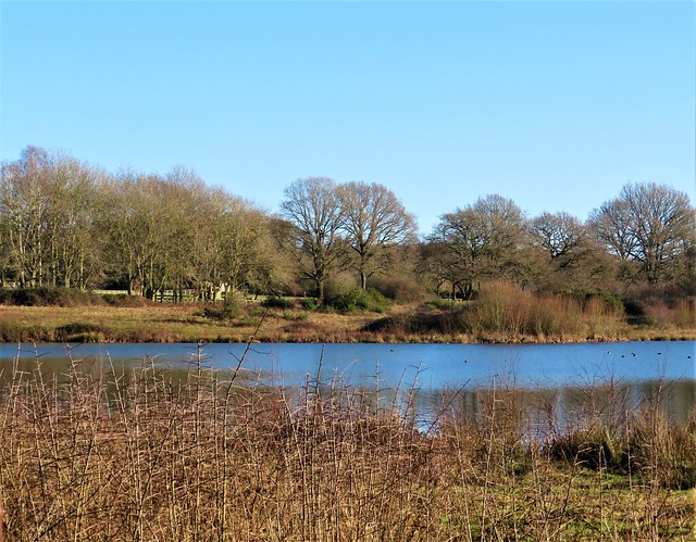
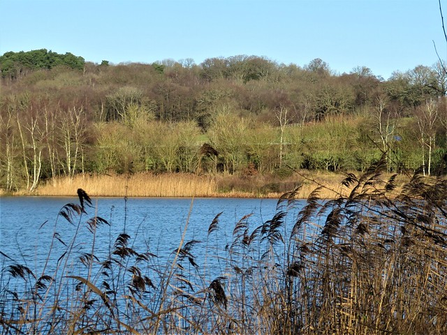
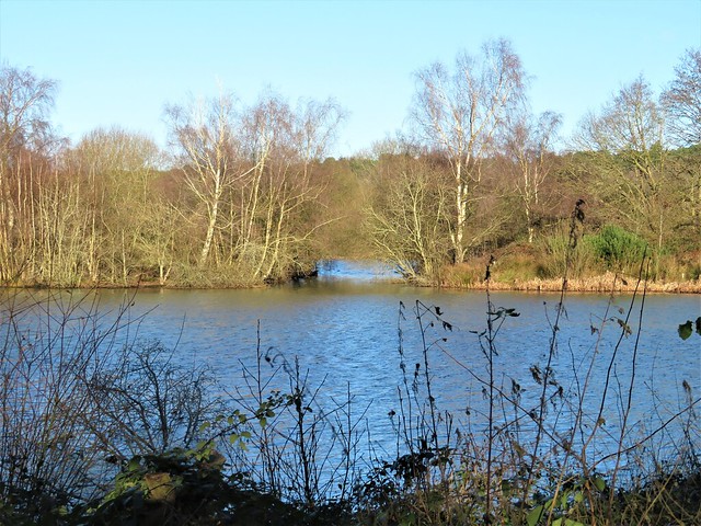
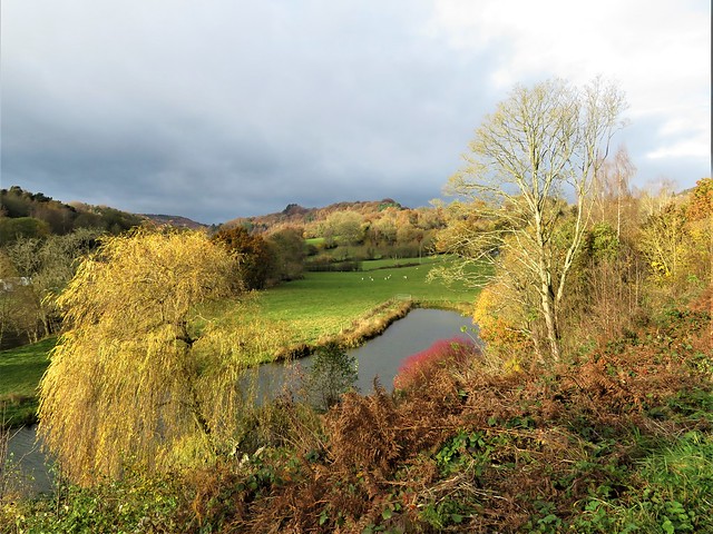
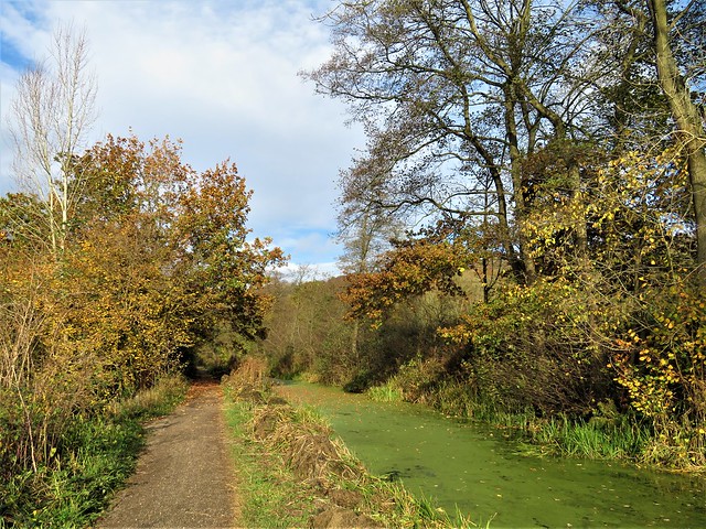
A cold morning nipping at the nose and fingertips, and a clear blue sky fitted like a bowl over East Berkshire. The paths between Moor Green Lakes were a stodge of dark mud, but the open fleets of water winked and glittered in the low winter sun.

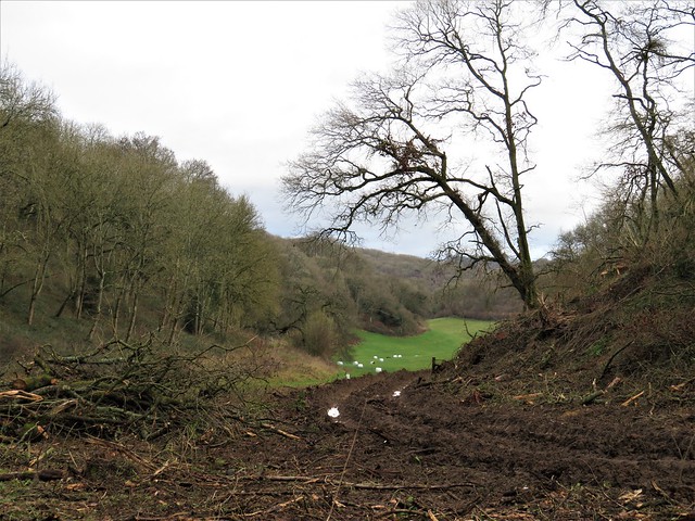
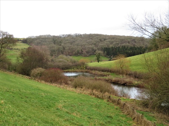
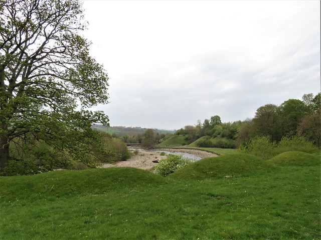
Wintering wildfowl love these flooded gravel pits, packed with food and secure from disturbance. A dozen cormorants stretched their wings to dry on the stony ridge of Plover Island. Chestnut-headed wigeon with ginger foreheads sailed together in a silent company, while the white flanks of tufted duck showed up bravely in the sunlight, the brilliant gold of their eyes only revealed in our binocular lenses.

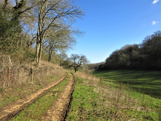
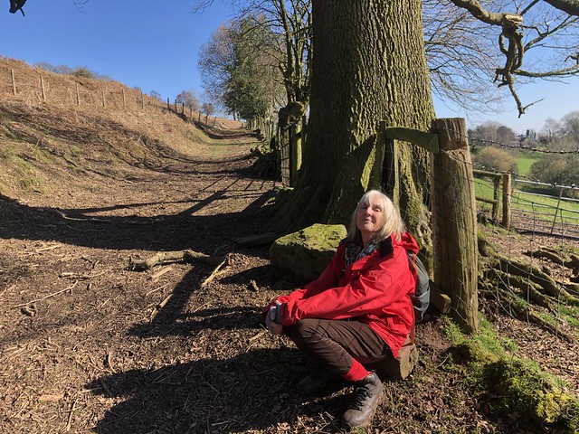
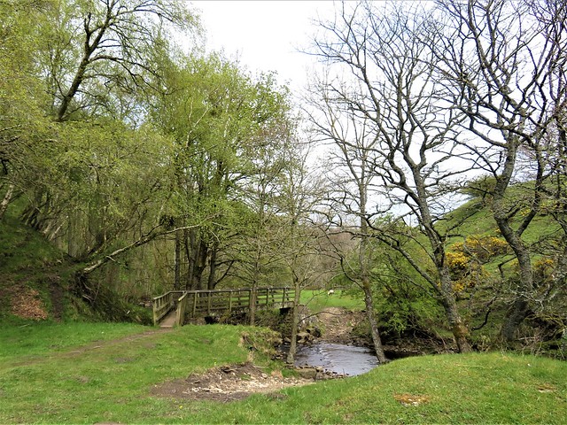
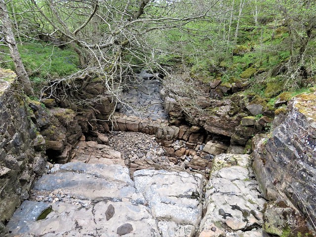
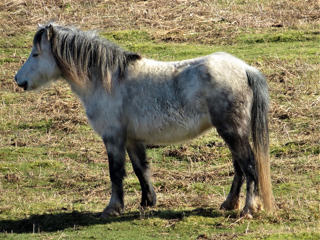
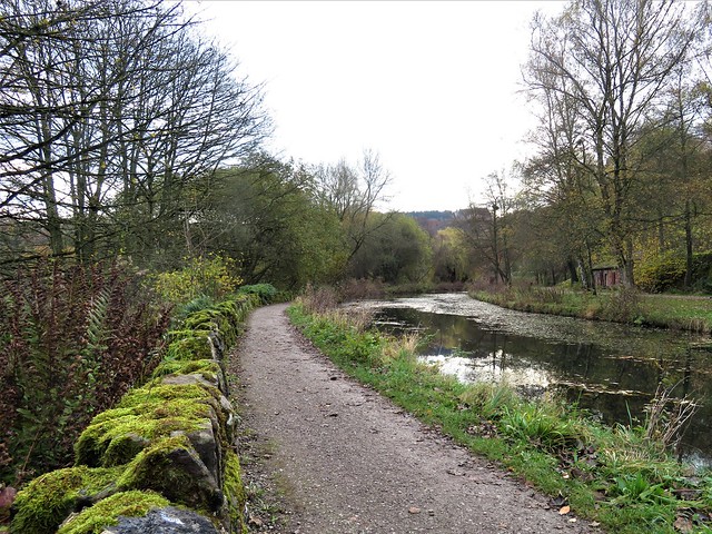
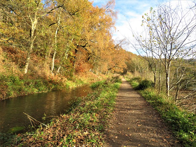
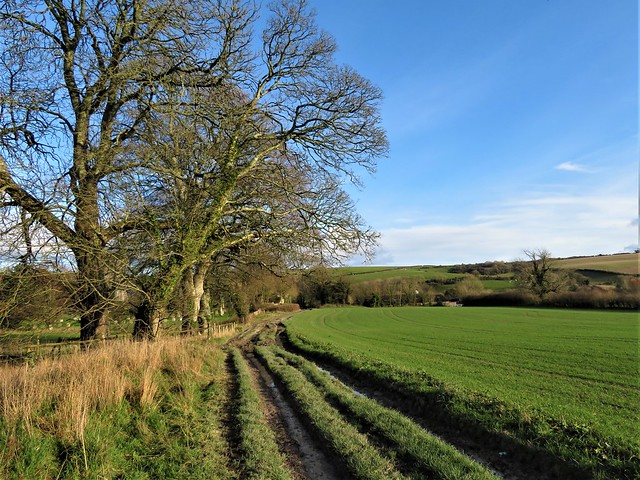
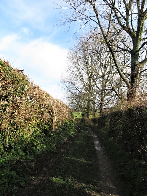
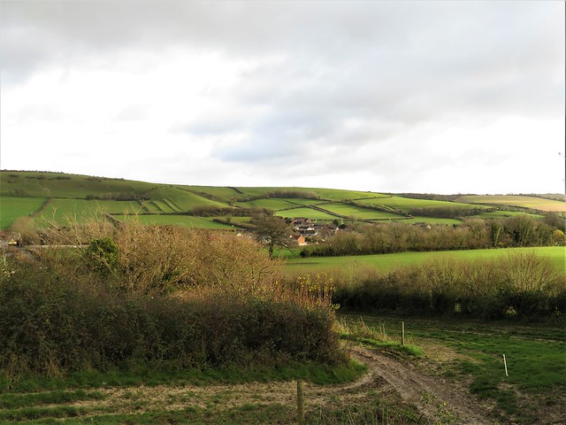
We followed the chuckle and swish of the fast-flowing River Blackwater past contorted willows and leafless hazel whips where catkins were dangling. Soon we had left behind the eternal background screeching of black-headed gulls on the lakes, and were headed north past a paddock where a horse in a quilted winter jacket patterned with zebras snorted out twin jets of steamy breath as it gave us the sideways eye.

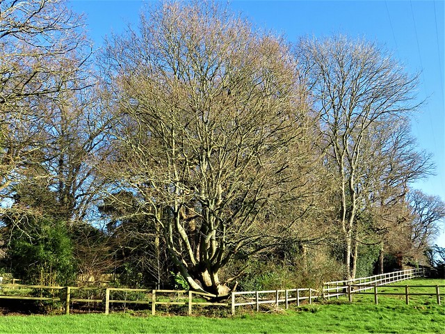
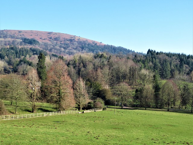
Among rhododendrons, berried hollies and tall pines in the tangled grounds of Ambarrow Court we passed a frosty hollow where a huge Victorian mansion once stood. During the Second World War the Royal Aircraft Establishment took over the house and conducted top secret research here into early forms of radar.

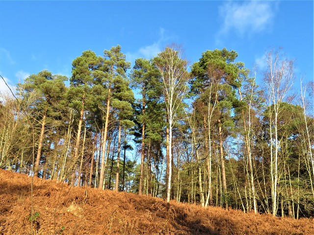
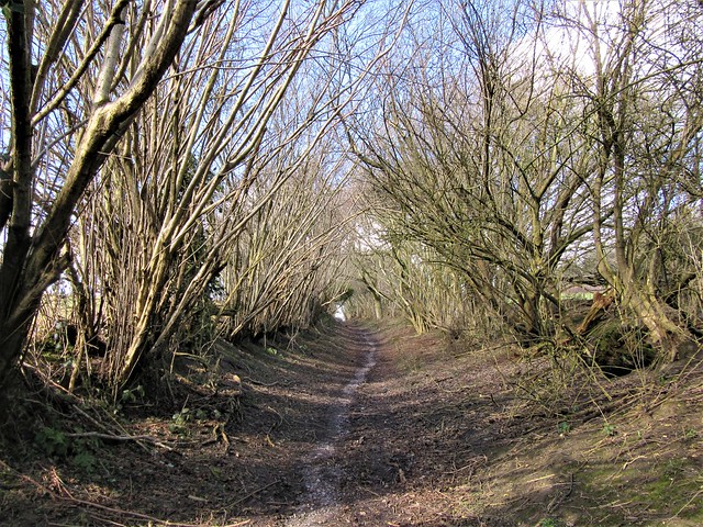
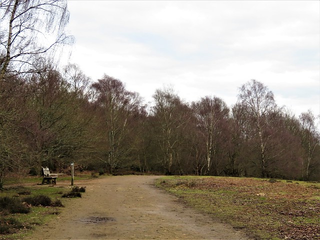
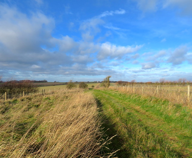
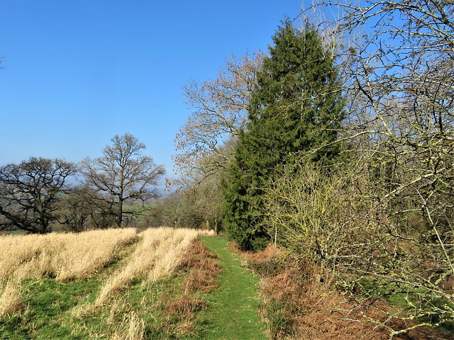
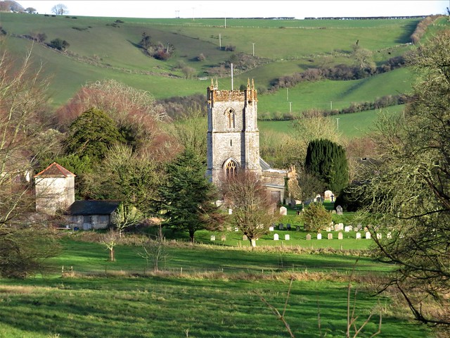
The railway line from Reading to Aldershot runs dead straight through the pinewoods beyond, and we followed a trackside footpath up to the station at Crowthorne, its windows extravagantly gabled like a Bavarian hunting lodge.

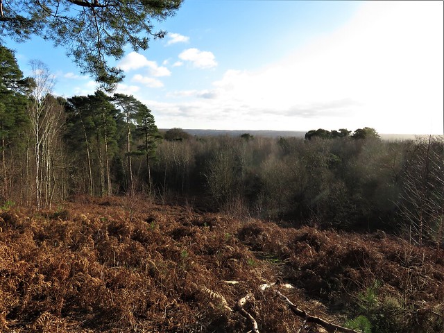
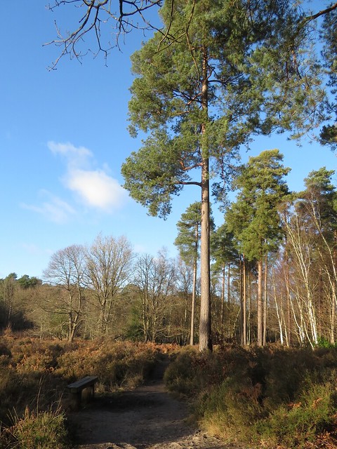
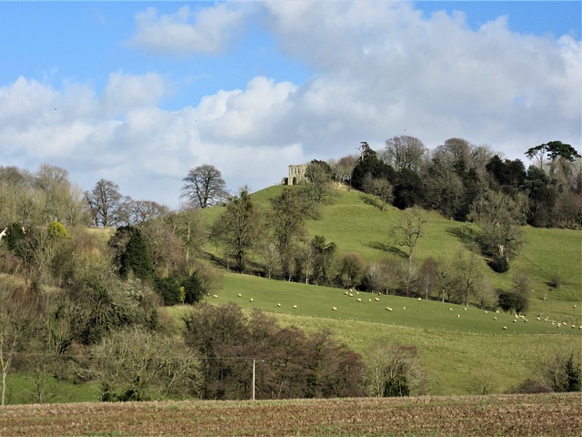
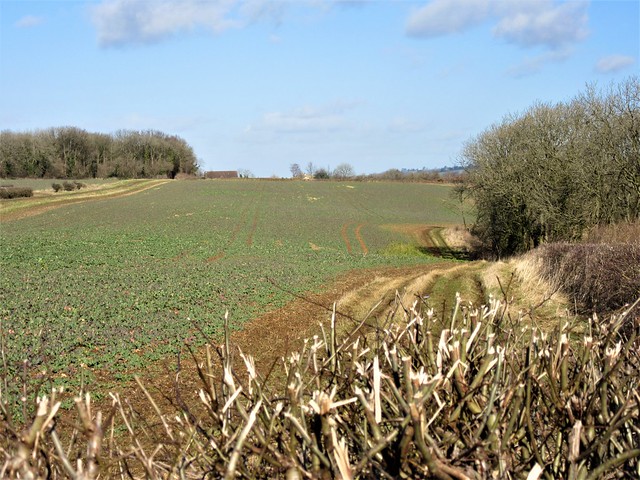
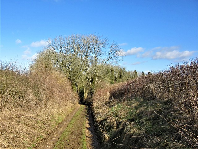
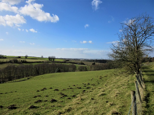
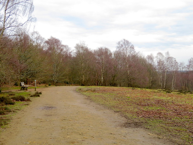
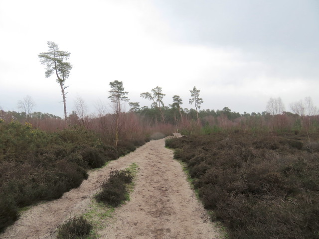
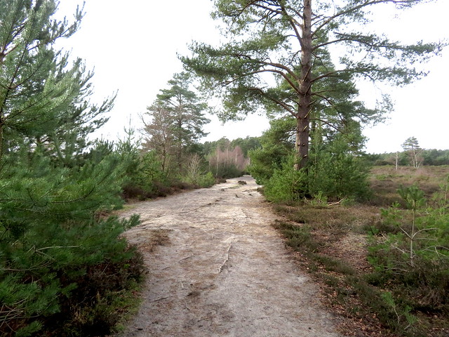
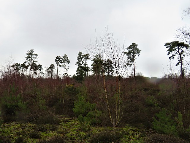
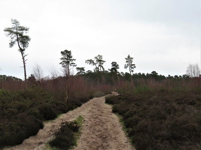
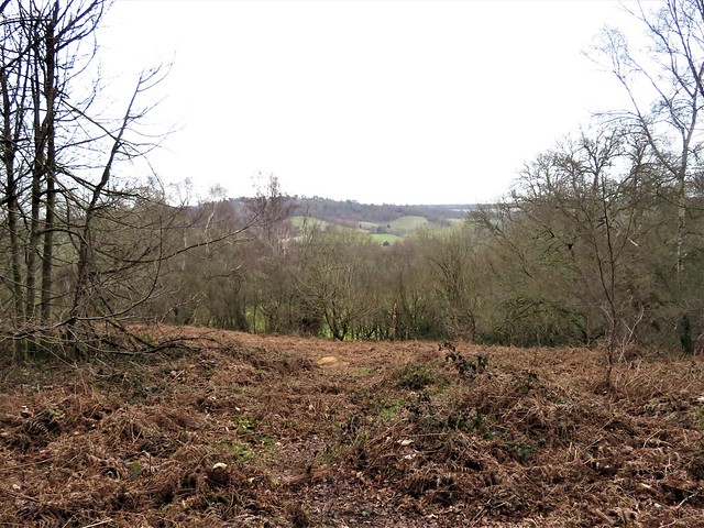
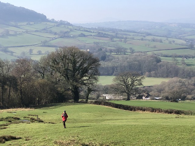
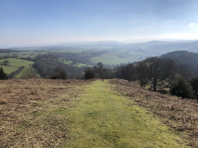
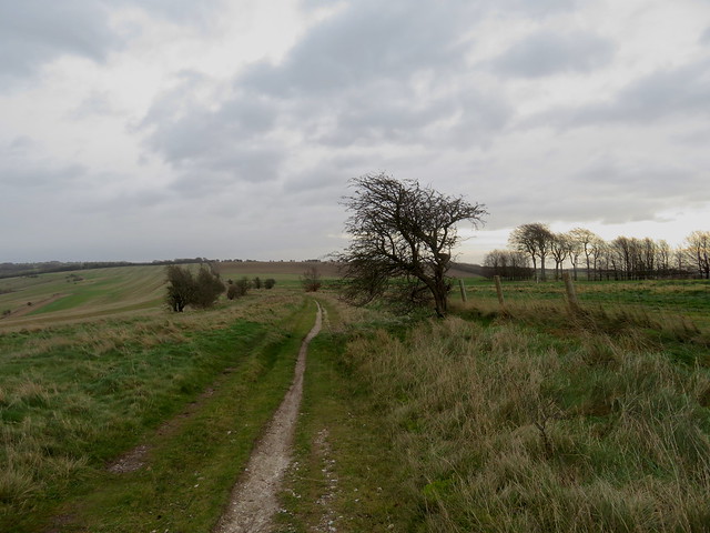
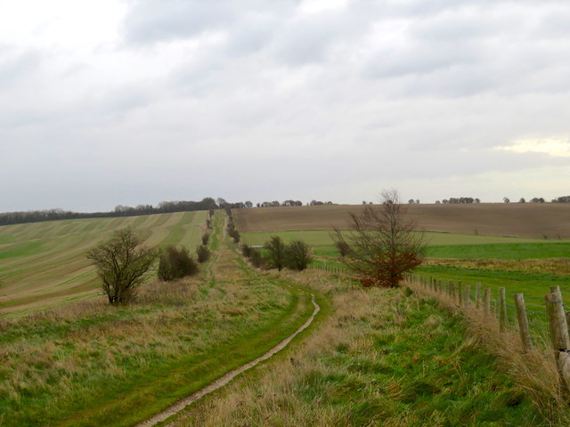
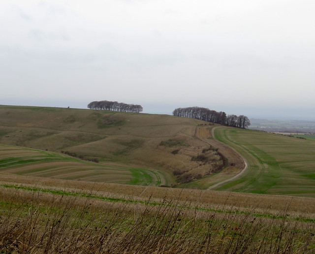
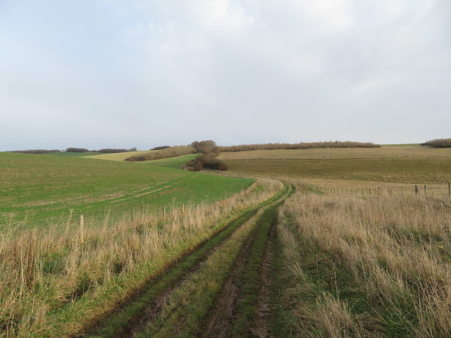
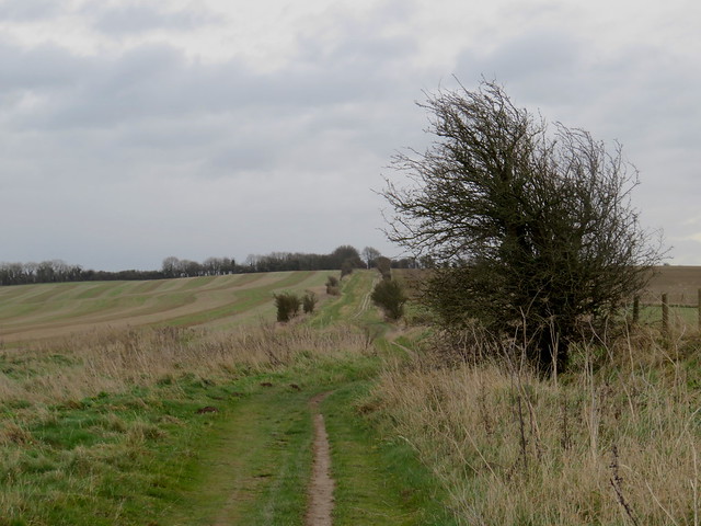
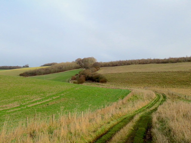
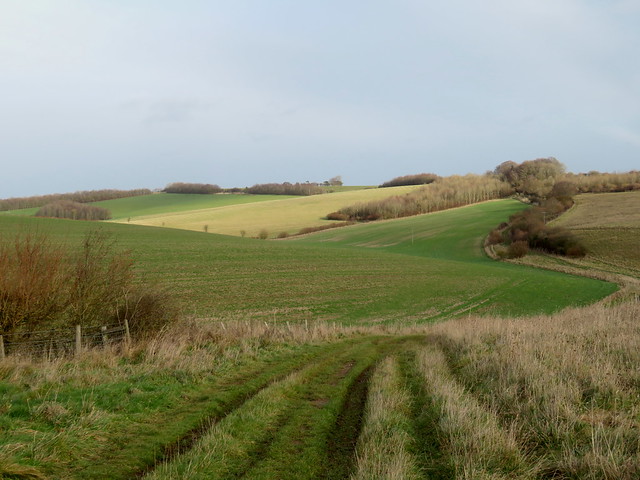
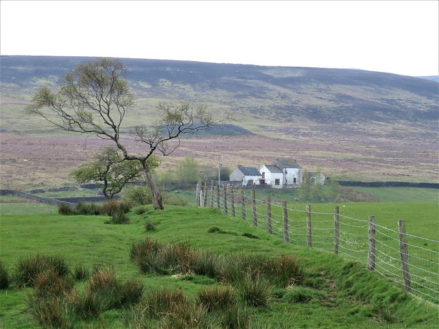
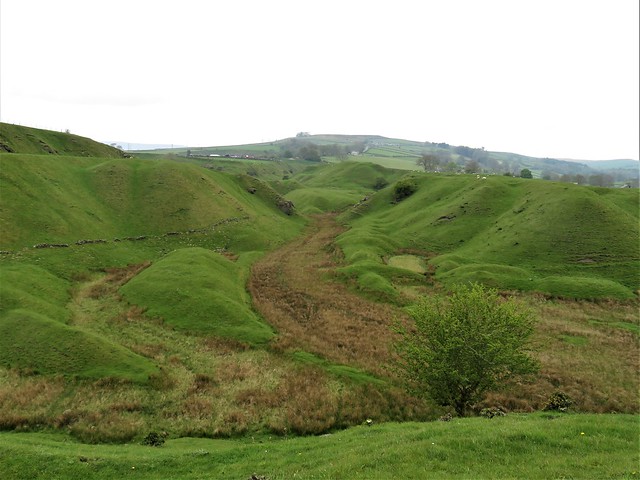
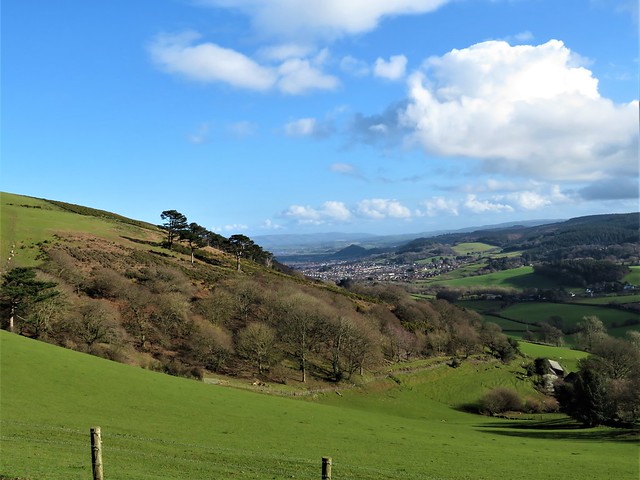
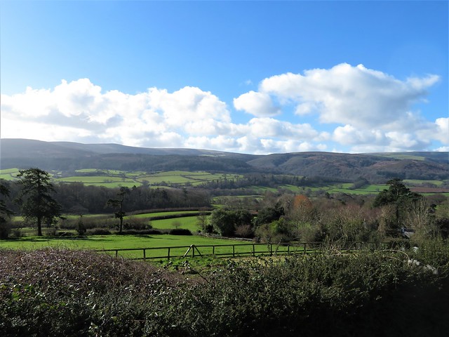
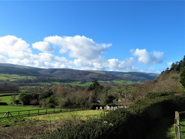
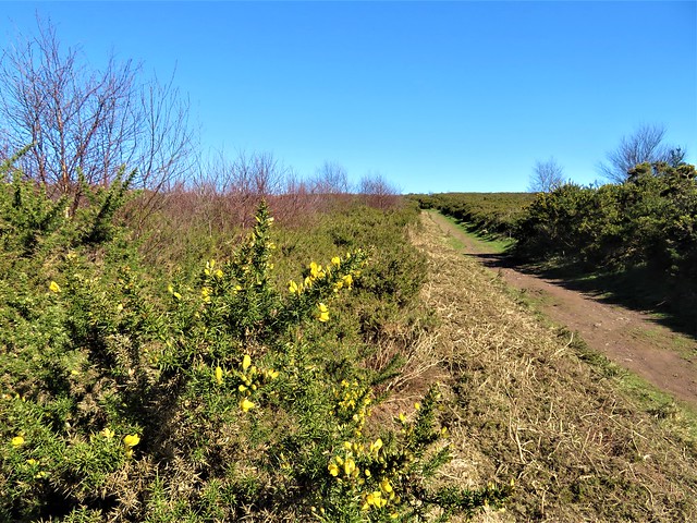
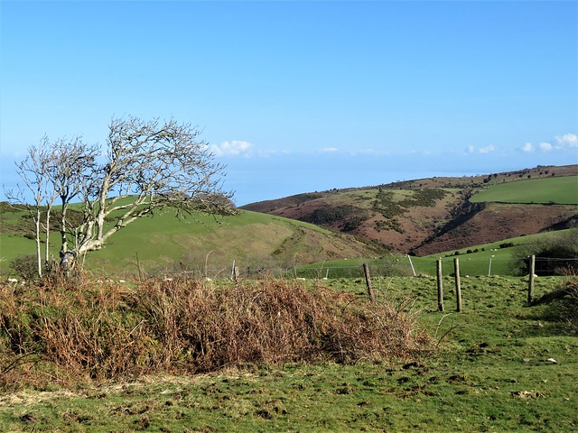
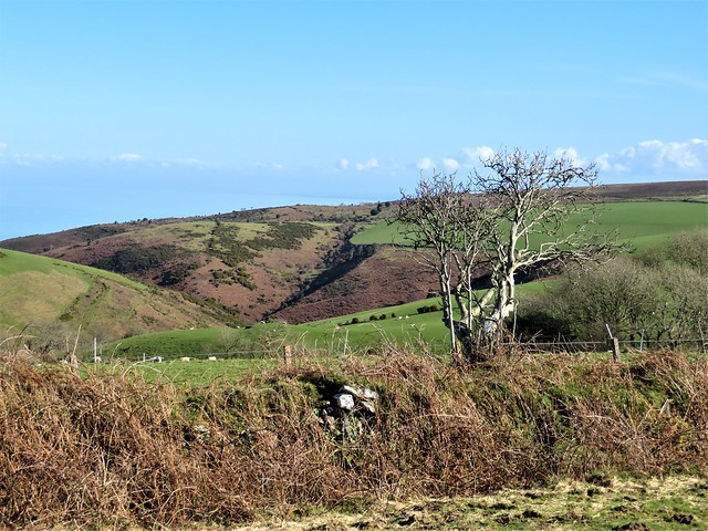
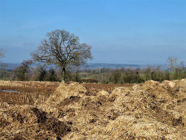
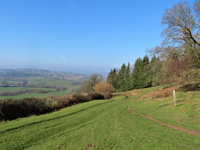
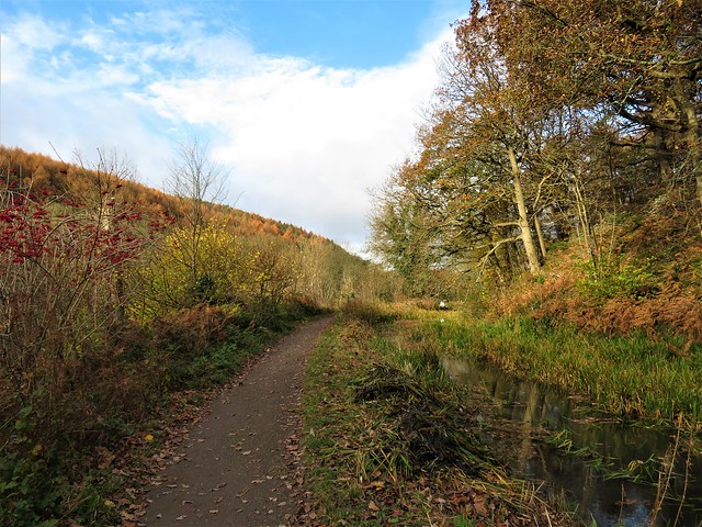
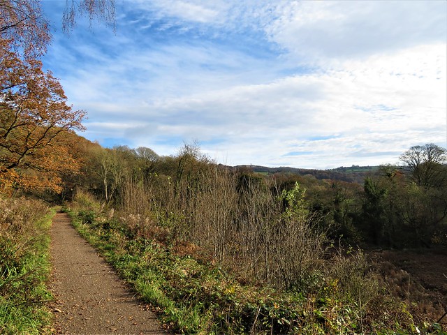
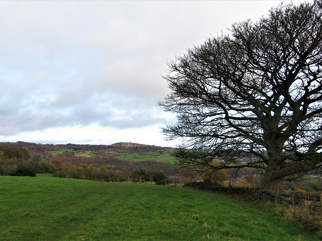
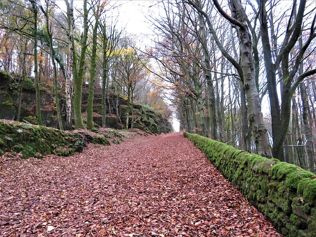
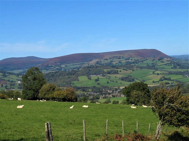
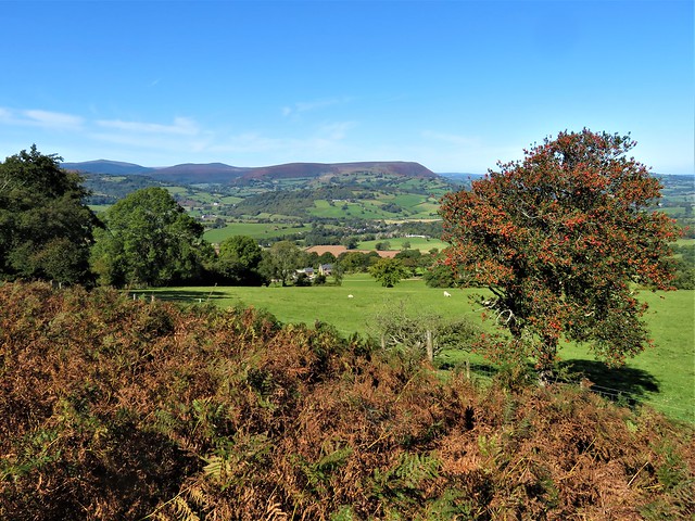
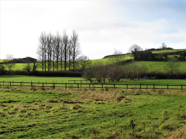
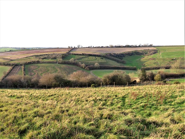
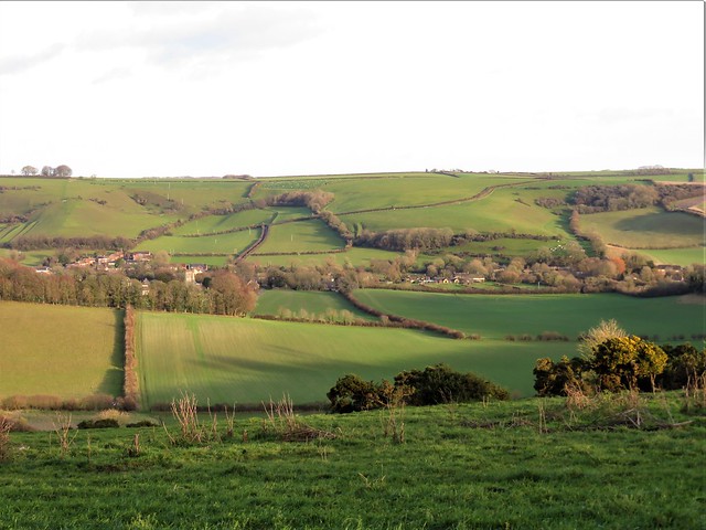
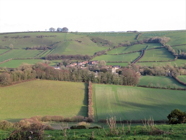
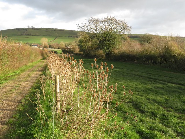
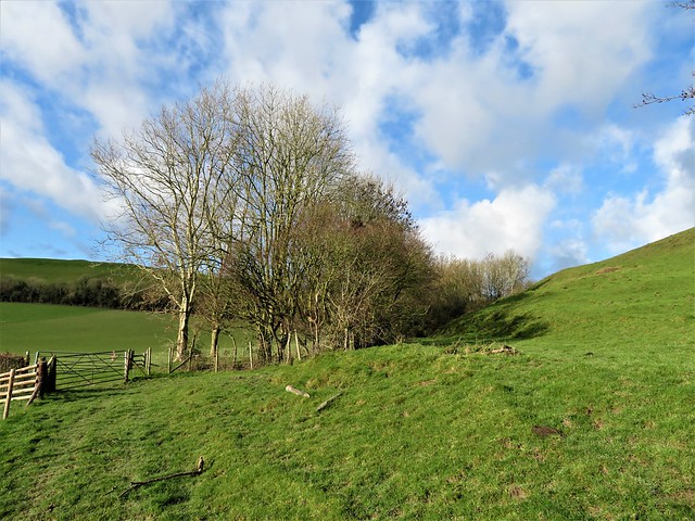
Beyond Crowthorne a byway led through more coniferous woodland, before cutting south in a beeline for the heathy heights and hollows of Finchampstead Ridge. Here on sandy soil glinting with mica chips we stood under the tall pines of a spinney at the edge of the ridge, looking out over thickly wooded country.

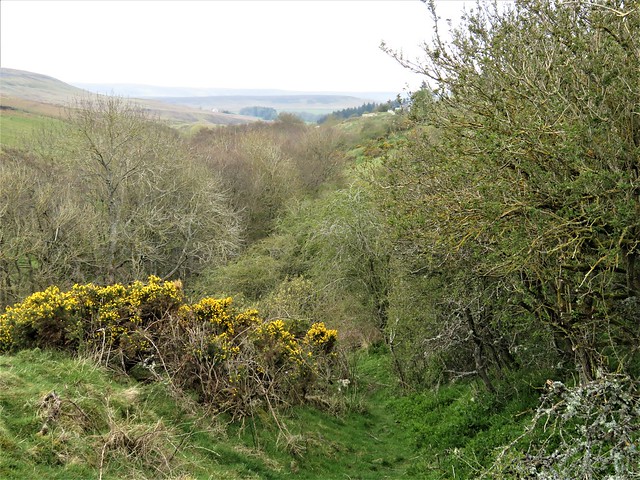
Here was the place to breathe in the cold air of a winter afternoon scented with pine resin, the landscape before us a blur of bright sun striking through the misty exhalations of the forest.

How hard is it? 5¾ miles; easy; lakeside and woodland tracks

Start: Moor Green Lakes car park, Finchampstead, RG40 3TF (OS ref SU 806628)

Getting there: Train to Crowthorne
Road – car park is 1 mile southwest of Crowthorne (A321 Sandhurst-Wokingham)

Walk (OS Explorer 160): Head towards lakes. In 700m, left (806621), following Blackwater Valley Path/BVP). In 1 mile just before road, left through barrier (819619). In 450m cross road (821623). At next road, right (822627); ahead on path (‘Ambarrow Court’). Cross A371 (824627, take care!). Through car park; ahead between metal bollards. At path T-junction, left; in 50m, left (red marker). In 50m, right at fingerpost to railway (827627). Don’t cross; left beside line; in 250m, right across railway (825630). Left beside line to road at Crowthorne Station (823638). Left to roundabout (821637); take Restrictive Byway/RB opposite. In 800m, left at 6-finger post (814641, RB). In 200m, left (813641, RB) for 700m to road (811634). Right; on bend, head past NT notice (‘FPC’). Follow path to left; head for bench at spinney viewpoint (809633). Descend path on right to track crossing (808632), left. In 400m pass metal barrier (810630); right down lane to road (809627); right to car park.

Lunch: Tally Ho, Fleet Hill, Eversley, RG27 0RR (0118-973-2134. brunningandprice.co.uk/tallyho)

Accommodation: The Kingsley at Eversley, Reading Road, Eversley RG27 0NB (0118-907-6322, thekingsley.co.uk)

Info: Moor Green Lakes Group (mglg.org.uk)

 Posted by at 01:26
Feb 052022


First published in: The Times Click here to view a map for this walk in a new window
View of Winner Hill and remnants of the Upper House, Alderley 1 Snowdrops at Hillesley Somerset Monument from the drive to Splatt Barn newly trimmed hedges near Splatt Barn Monarch's Way approaches Long Coombe 1 Monarch's Way approaches Long Coombe 2 Monarch's Way descends Long Coombe spring ponds in Long Coombe 1 spring ponds in Long Coombe 2 Cotswold Way between Kilcott Mill and Alderley 1 Cotswold Way between Kilcott Mill and Alderley 2 Cotswold Way between Kilcott Mill and Alderley 3 View of Winner Hill and remnants of the Upper House, Alderley 2

A windy winter’s day in south Gloucestershire, the sun a nacreous ball behind fast-driving clouds. The recent mild weather had encouraged a couple of daffodils to raise their heads along the crooked lanes at Hillesley, a village tucked down in a fold of the Cotswold escarpment. Hillesley’s Fleece Inn is owned and run by the community, an excellent initiative that has kept the place alive.
As we climbed the squelching muddy path through the trees behind the village, I spotted a solitary celandine among the hart’s-tongue ferns. At the top the prospect opened out into a landscape typical of these southern Cotswolds, an undulating upland with snaking valleys invisible from on high. On the ridge ahead rose a tall column with an elaborate cap, built in 1846 in honour of Lord Robert Somerset, one of Wellington’s bravest Peninsula War officers.
A crowd of tiny animated birds rushed past with a swish of wings – goldfinches, feebly twittering, forming a little cloud that balled and elongated like a miniature murmuration of starlings. We left them to their winter manoeuvres and turned aside down the roadless declivity of Long Coombe, where rosettes of primrose leaves were showing in the shelter of hedge roots.
Spring pools shivered in the wind on the grassy slopes. Down in the steep-sided valley at the bottom, green lamb’s-tail catkins bobbed along the neatly laid hedges around Lower Kilcott. A pair of buzzards swung out of a spinney, the pale ‘headlights’ on their wings lit by the sun. Above them, a pair of parallel con trails drew themselves lazily and soundlessly across a patch of blue in a sky rapidly darkening from the southwest.
At Kilcott Mill we joined the Cotswold Way, a mud-bath that took us slithering up the valley. Under a coppiced hazel a squirrel had dug out the last of its nut hoard (or someone else’s), and nipped the crowns off each one to get at the kernel, leaving a scatter of empty shells like miniature scalped skulls on the bank.
Beyond Alderley in a spit of rain we turned along the homeward path to Hillesley, passing the magnificent Cotswold stone mansion of Rose Hill with its ranks of windows and stalk-like chimneys. A tractor grunted up the nearby lane, carrying a bale of hay on its praying mantis arms for the sheep whose rain-pearled fleeces were suddenly silvered by a low ray of sun escaping from the clouds.

How hard is it? 6½ miles; easy but muddy; field and woodland paths, country lanes.
Start: Fleece Inn, Chapel Lane, Hillesley GL12 7RD (OS ref ST 770896)
Getting there: Bus 84 (Yate–Wotton-under-Edge).
Road – Hawkesbury Upton is signed from A46 Bath-Nailsworth road; Hillesley is signed from Hawkesbury Upton.
Walk (OS Explorer 167): From pub, left; at bend, ahead up footpath via Mear’s Plantation. At top, right to Splatt’s Barn (770888); south along drive for ½ mile. At road, left (771880); fork left on Monarch’s Way for 1¼ miles via Long Coombe to road at Lower Kilcott (786892). Left; in ½ mile pass Kilcott Mill; in 150m, right off road (779897). In 200m, left on Cotswold Way for nearly 1 mile to road at Alderley (770910). Right (‘Tresham’); in 150m cross road (771909); follow Cotswold Way for ⅔ mile to road by Elmtree Farm (768916). Left; in 200m cross road (766916). Follow marked detour past Lacys; in field beyond, left (764916) on path south (passing east of Park Farm, west of Rose Hill school) for 1¼ miles to Hillesley.
Lunch: Fleece Inn, Hillesley (01453-520003; thefleeceinnhillesley.com)
Accommodation: Swan Hotel, Wotton-under-Edge GL12 7AE (01453-843004, swanhotelwotton.com
Info: nationaltrail.co.uk/cotswold-way

 Posted by at 01:50
Jan 292022


First published in: The Times Click here to view a map for this walk in a new window
The path through Blackheath Forest 1 The path through Blackheath Forest 2 The path through Blackheath Forest 3 The path through Blackheath Forest 4 ancient oak in Blackheath Forest IMG_5788 IMG_5787 IMG_5786 IMG_5800 IMG_5798 IMG_5795 IMG_5794 IMG_5792 IMG_5789

Chilworth station on a cold, cloudy winter’s afternoon, the little train disappearing clickety-clack down the line and our feet itching for a good step-out among the Surrey Hills.

This region of upland heaths and open commons was thought wonderfully remote and wild when arty folk from London began to venture down the railway in late Victorian times. In Chilworth and neighbouring Blackheath they left a legacy of gorgeous Arts & Crafts houses, with tall brick chimneys, wonky walls, and upper storeys hung with mellow red tiles.

In the banks of Sample Oak Lane the coppiced hazels were already hung with catkins, and the very first green spear blades of bluebell leaves were pushing up through the moss in the outskirts of Blackheath Forest. Two robins sprang up from a beech log and battled furiously breast to breast in mid-air, wings winnowing and thorn-like beaks ajar, each intent on making this patch of breeding territory its own.

The path climbed gently through hummocks and hollows, at one moment a stodge of dark peaty mud, the next a pale sandy strip in the heather. Leafless bilberries made a geometric green tangle through which dogs went pattering, drawn by scents unfathomable to mere humans.

We topped out on open ground of sombre colours – heather, moss, bronze-hued bracken and tall pine trees, all bedded on the greensand ridge that underlies this landscape. Nightjars and Dartford warblers nest here in summer, but today the rooks and red kites had the airways to themselves.

Rain came spattering across the heath, then a pale watery sun drifted from the clouds and turned the pine trunks pink. We passed an ancient oak, a knobbed and twisted old monster with limbs flung wide, and turned back west past a cottage deep in the trees on an acre of grass, as snug and lonely as any of Grimm’s woodcutter’s abodes.

At Blackheath the cricket field lay battened down, its gabled pavilion shut. Handsome houses with railed porches and neat gardens lined the road, where a fingerpost pointed to ‘This Way, That Way, Somewhere Else’.

A bridleway led over the heath and down a deep, dark holloway towards Chilworth. In a beautifully laid hedge a little flicker of movement caught the eye – a goldcrest, its forehead embellished with gold, a tiny bright bird as plump as a dormouse, intent on picking sustenance from the bare twigs with a bill almost too miniscule to see.

How hard is it? 5½ miles; easy woodland and heath tracks.

Start: Chilworth railway station, near Guildford GU4 6TT (OS ref TQ031472)

Getting there: Rail to Chilworth. Bus 32 (Guildford).
Road: on A248, signed from Shalford on A281, south of Guildford.

Walk (OS Explorer 145): From station, down Sample Oak Lane. In ⅓ mile, fork left by shelter labelled ‘Brantyngeshay’ (032467, fingerpost/FP). In 100m fork left (blue arrow/BA) on bridleway. In 300m dogleg right/left past Blackheath Common signboard (035465, BA). Keep ahead over cross-tracks (occasional BAs and FPs). In ½ mile, at another Blackheath Common signboard (043462), left on broad track.

In 150m fork right (045461, BA) through trees. In ½ mile at wide clearing (050460), fork right past ‘Beth Edwards’ bench. In 250m, sharp right at 1 Lipscombe Cottage along drive (053458), soon a woodland path. In 300m cross track (049458). In 200m pass cottage (046458, stile, ‘Fox Way’/FW). At Candleford Cottage, right (044457, FP, FW) for ⅔ mile to Blackheath village.

At right hand side of cricket field, left (036461) on track to road (033462). Left; at crossroads, right (‘That Way’); in 100m, left (032463, ‘Bridleway’ fingerpost) on bridleway, keeping ahead over side tracks. In ¼ mile, just beyond ‘Tangley Way’ house, fork left (028464) ‘Downs Link’).

In ⅔ mile, at Deer’s Leap Cottage on left (020465), right on lane past Great Tangley Manor Farm. In ⅓ mile, at T-junction (025469, FP), left beside wall to A248 (025471). Right to station.

Lunch/accommodation: Percy Arms, Chilworth GU4 8NP (01483-561765, thepercyarms.net)

Info: surreyhills.org; Guildford TIC (01483-44433)

 Posted by at 01:38
Jan 222022


First published in: The Times Click here to view a map for this walk in a new window
Looking back from lower slopes of Garway Hill 1 Looking back from lower slopes of Garway Hill 2 Jane on Garway Hill view east from upper slopes of Garway Hill twisted old thorn tree on Garway Hill

The white tips of snowdrops were peeking in the graveyard of St Mary’s Church at the gates of Kentchurch Court. This fine old dwelling, half stronghold and half house, tucked down behind trees in a corner of the River Monnow’s broad valley, has been in the possession of the same family since before the Norman Conquest.

We got a glimpse of a castellated turret as we followed the lane south beside the Monnow, the river hurrying its grey waters through the valley and away towards Monmouth. Sheep grazing the riverside pastures were decked in their winter plumage of dusky pink from foraging in the rich red mud.

Garway Hill lay squarely ahead, a bald crown above a collar of leafless trees. We found a path that skirted the southern slopes of the hill, ascending gradually through green fields with a fine view opening across the valley, slopes and skyline all softened in the haze the sun had drawn up from fields and woods lying cold and damp with winter.

At Little Adawent the proper climb began, a steep grassy path rising through bracken past mossy seeps of water and wind-twisted thorn trees. Overhead, a solitary skylark sang its little crested head off.

Garway Hill has a witchy reputation. A local man once suffered the misfortune of having his wife stolen by the fairies, so stories say. He waited till the wee folk under Garway brought her forth to dance, then snatched her away and ran with her to the top of the hill. As soon as he reached the summit the spell was broken, she awoke from her enchantment and the fairies went away to find another playmate.

You couldn’t get a less fantastical structure than the prosaic brick shelter at the top of Garway Hill. But the views today were magical, anyway, west to the conical Sugarloaf, the whaleback Skirrid and the long spine of the Black Mountains, east to the Malverns and the Cotswold Hills, all dreamy and insubstantial in the cloudy air.

Families were picnicking around the shelter, their junior mountaineers dashing about. A white pony followed us off the hill, before thinking better of his choice and turning aside towards a couple trailing the scent of peppermint.

A green lane took us back down to lower ground, where in the pastures along the homeward path new-born lambs would soon be calling in their feeble, treble voices, to the counterpoint of phlegmy contralto from their anxious mothers – a whisper in the inner ear from faraway spring.

How hard is it? 7½ miles; moderate; short, steep climb up Garway Hill.

Start: Bridge Inn, Kentchurch, HR2 0BY (OS ref SO 410258)

Getting there: Kentchurch is signposted from A465 (Abergavenny-Hereford) at Pontrilas.

Walk (OS Explorer 189): From Bridge Inn, right; ahead (‘Garway’) at junction; in 800m, right past St Mary’s Church (420257, ‘Garway’). In ¾ mile, left off road (424248) following waymarked Herefordshire Trail (gates, stiles, yellow arrows/YA) across fields. In 1 mile, by gate on right (438243, ‘Little Adawent’), bear left away from wall, up broad grass track to summit shelter of Garway Hill (437251). Aim for gate on left of radio mast (440255); green lane downhill; in ⅓ mile at phone pole (441261, ‘Herefordshire Trail), right to road. Left; at junction, ahead (443264, ‘Bagwyllydiart’). In 100m, left (443266, YA) across fields, skirting right hand edge of Burnt House Wood and on for 1½ miles (YAs) to road at Bannut Tree Farm (423263). Left to Kentchurch.

Lunch: Bridge Inn, Kentchurch (01981-241158, thebridgeinnkentchurch.com)

Accommodation: Temple Bar Inn, Ewyas Harold HR2 0EU (01981-240423, thetemplebarinn.co.uk)

Info: visitherefordshire.co.uk

 Posted by at 02:13
Jan 152022


First published in: The Times Click here to view a map for this walk in a new window
Bright sky across the Lambourn Downs The Ridgeway on the Oxfordshire Downs 1 The Ridgeway on the Oxfordshire Downs 2 view from the Ridgeway over Childrey Warren 1 The Ridgeway on the Oxfordshire Downs 3 old trackway near Stancombe Farm 1 The Ridgeway on the Oxfordshire Downs 4 view from the Ridgeway over Childrey Warren 2 old trackway near Stancombe Farm 2 old trackway near Stancombe Farm 3 old trackway near Stancombe Farm 4 looking west from the track near Sheepdrove Farm

A cold and blowy midwinter’s morning over the chalk downs where Oxfordshire meets Berkshire. The racehorses exercising near Sparsholt Firs blew steamy breaths, and a brisk south-westerly wind shook the hawthorns and shivered the puddles along the upland tracks.

We squelched through mud as pale and glutinous as pancake batter to reach the grassy track of the ancient Ridgeway across Hackpen Hill. Long views opened across downland fields clipped and stubbled for winter, with leafless beech spinneys, rounded by the wind, standing along the ridges.

A redwing flew up into a bush and then straight and level across the stubble, displaying a dusky red flash along its flanks. Berries not yet plucked by the birds hung wrinkling in the thorn trees through which the strong breeze came whistling.

The roll of the land hid the depths of the dry chalk valley to the north. Down there at Childrey Warren archaeologists recently made an extraordinary discovery. Among the remains of 26 people, buried some two thousand years ago, they found the skeleton of a woman placed in a bizarre ritual position, legs splayed, hands on head, feet amputated and placed beside her. Beneath her body lay another, that of a new-born baby.

We walked on along the Ridgeway, speculating on all the births, deaths and ceremonies this 5,000-year-old track must have seen. Bygone travellers took their lives in their hands when they set out in winter along the Ridgeway, where after prolonged rain the mud could lie deep enough to trap or even drown the unwary. Today a spattered trouser leg was the worst inconvenience we faced.

Down in the vale the clustered houses of Letcombe Bassett lay below chalk slopes corrugated and hollowed by the storms and floods of millennia. The Ridgeway dipped and rose, a broad green ribbon, to reach Gramp’s Hill. Here we turned down a farm road, southward into a sheltered valley where the wind dropped to a gentle sigh in the sycamores.

A flock of fieldfares, slim grey cousins of the redwings, flew purposefully across the way with cackling cries. Beside the path pale green catkins jigged on hazel twigs and dried heads of cow parsley nodded stiffly, animated by the wind.

The rutted track snaked up again to pass the rusty barns and sheds at Stancombe Farm. Opposite, by contrast, lay the organically farmed, immaculately kept domain of Sheepdrove Farm – a dewpond with a duck house, tree plantations with permissive paths, new hedges, wildlife corridors. An agricultural landscape ahead of the curve, as wildlife-friendly farming begins its journey to becoming the norm across our countryside.

We turned for home through the Sheepdrove fields. Jackdaws congregated raucously in the trees, and half a dozen red kites went sideslipping over a beanfield, their chestnut backs glowing in the low winter sun.

How hard is it? 6½ miles; easy; clear downland tracks

Start: Sparsholt Firs car park, near Lambourn, OX12 9XB (OS ref SU 344851)

Getting there: Sparsholt Firs is on B4001 between Lambourn and Wantage

Walk (OS Explorer 170): Walk east along Ridgeway. In 1¾ miles on Gramp’s Hill, right along road (370840). Beyond Parsonage Hill Barn keep ahead on grassy track (367834). In ¼ mile, at ‘Ridgeway closed to motor vehicles’ sign, fork right (367830). In nearly 1 mile pass Stancombe Farm entrance on right (356820); in ½ mile at red barn, right (349816, ‘Byway, No Through Road’). In 700m by houses (346823), keep left on grassy byway; in 1½ miles at B4001 (341845), right to car park.

Lunch/Accommodation: Greyhound Inn, Letcombe Regis, Wantage OX12 9JL (01235-771969, thegreyhoundletcombe.co.uk

Info: nationaltrail.co.uk, sheepdrove.com

 Posted by at 01:15
Jan 082022


First published in: The Times Click here to view a map for this walk in a new window
Moorland farm above Bollihope Burn steep climb up from Bollihope Burn Harehope Quarry crinoids in the car park - Frosterley marble River Wear at Frosterley lane near Bridge End gravelly flood banks of River Wear velvety delvings of the old Frosterley quarries bridge over Bollihope Burn old tramway near Frosterley 'Frosterley marble' in a stream bed

Looking round the Chapel of the Nine Altars in Durham Cathedral, you can’t help but be struck by the beautiful floors and columns of ‘Frosterley marble’, dark polished limestone speckled with white fossils.

Frosterley lies in Weardale, upriver from Durham. The village is proud of its celebrated product. There’s a great unpolished lump of the stuff in the car park, formed 325 million years ago and covered in circular fossils of sea lilies with delicate rays.

From Frosterley we followed the Mineral Valley Walk as it rose to run round the rim of an old quarry. Sunk below the level of the fields were big lumpy spoil heaps, delvings and trackways, their awkward angles all smoothed and softened by the grass that covered them in a green velvet nap. Looking down on this from the striated limestone crags of the former quarry faces, it was hard to imagine the thunderous noise, the dust, the hard labour and raw surroundings of a hundred years ago.

Beyond the quarry we turned down the gorge of the Bollihope Burn on a former railway track. A red grouse scuttled away in a panic. The path squeezed between adjacent rock faces where streaks of dusky red hinted at the presence of iron. Across the burn some hopeful lead miner had driven a speculative adit, a tunnel leading from a crude hole into utter darkness.

A flight of steps led up to open sheep pastures, hillside farms and a glimpse of long ridges of moorland beneath a cloudy sky. Then we dropped back down beside the Bollihope Burn, looping back to Frosterley along the rim of Harehope Quarry, another huge subterranean moonscape now repurposed as an ecological education centre. Field classrooms, wildlife ponds, summerhouses and a wind turbine have taken over from heavy machinery, rubble mountains and polluted pools.

On the way we crossed the dry bed of a stream. There below the footbridge were great slabs of Frosterley marble, dark rock smoothed by water and patterned with an intricate jumble of white fossils. It was remarkable to think of the journey this ancient seabed deposition made in medieval times, cut and shaped to rise in polished glory in the cathedral of the Prince Bishops twenty miles away across the hills.

How hard is it? 5½ miles; easy; field paths, old trackways

Start: Frosterley car park, Frosterley DL13 2QW (OS ref NZ 026370)

Getting there: Bus: 101 (Stanhope – Bishop Auckland)
Road – Frosterley is on A689 between Wolsingham and Stanhope

Walk (OS Explorer OL31; Frosterley Walks leaflet downloadable at durham.gov.uk/media): Right along A689. Left (‘White Kirkley’) across River Wear. In 150m, left (022367) beside chapel (‘Mineral Valleys Walk’/MVW). In ½ mile, right at kissing gate (029365, MVW); keep fence on right round quarry rim. Through gate (027362); down slope; right (MVW) to road (025360). Left (MVW); by bridge, right (026360, stile, MVW) along Weardale Way/WW. In ¾ mile pass (don’t cross) bridge (020354); in 40m, right up steps; right at top to gate. Left up fence; in 150m, right (020356) on field track to road (025360). Right; in 150m, left (026360, stile) on WW. In 700m, by footbridge on right, ahead (033361, stile, ‘Permissive Path’); in 150m, left along WW (035360). In 500m at gate WW turns right (039363); left down road. In ½ mile at level crossing, don’t cross (036368); bear left on path. In 600m, right to cross railway (030368); ahead on lane to Frosterley churchyard (026368) and Front Street.

Lunch/Accommodation: Bonny Moorhen, Frosterley DL13 2TS (01388-526867, facebook.com/thebonnymoorhen)

Info: Durham Dales Centre, Stanhope (01388-527650), thisisdurham.com; northpennines.org.uk
Harehope Quarry: 07807-002032, harehopequarry.org.uk

 Posted by at 01:34
Dec 252021


First published in: The Times Click here to view a map for this walk in a new window
view above Wydon Farm view from Selworthy towards Exmoor view from Selworthy towards Exmoor 2 gorse by the moor track above Selworthy Combe trig pillar and cairn on Selworthy Beacon cairn on Selworthy Beacon 1 cairn on Selworthy Beacon 2 looking seaward from Selworthy Beacon easterly view from the South West Coast Path easterly view from the South West Coast Path 2 path near Wydon Farm homeward path maize mud moor pony homeward path towards Selworthy

Above the thatched cottages of Selworthy, the whitewashed tower of All Saints Church looked out across a wide green valley to the high undulating skyline of the Exmoor hills. A perfect view for a perfect winter’s day of blue sky and brisk wind.

A buzz like that of an angry wasp showed where someone was busy cutting wood in Selworthy Combe. The path rose through the trees between banks of tiny trumpet-shaped mosses. A robin perched on a post, puffing out his red breast and trilling a silvery call, quite unafraid as we passed within touching distance.

A brook came rustling down over neat little log spillways, its soft rich chuckle accompanying us all the way up through the oak and holly groves to the moor above. A contrast as abrupt as a knife cut, abandoning the shelter of the woods for the open moor where a biting wind ruffled the seas of heather and gorse running away to the horizon.

The National Trust and Holnicote Estate take great care and trouble over these 12,000 acres of upland, moor and combes. The woods are sensitively managed, the farms well run, and the hundreds of miles of footpath properly signposted.

We followed a broad bridleway through the gorse to the cairn on Selworthy Beacon. From here the view was mighty, over the rolling Exmoor hills, east and west along the curved cliffs of the Somerset coast, and out north across a Bristol Channel as pale as ice to the misty shores of South Wales under a long triple bar of cloud.

Above us only sky, as blue as delicate porcelain. We skirted a harras of Exmoor ponies, long tails billowing in the wind, and struck east along the South West Coast Path with the sea at our left elbow. A long cattle train of belted Galloway heifers went gadding and lurching along the skyline at a clumsy canter, delighted to be out in the open air.

The coast path led between sheep pastures through wind-stunted gorse bushes as stout as trees. A solitary bee buzzed among the gold gorse flowers, first raider of the year.

We turned inland and dropped down to Wydon Farm, hidden in a cleft so steep that, like Lucy in ‘The Tale of Mrs Tiggy Winkle,’ it looked ‘as though we could have dropped a pebble down the chimney.’

The homeward path lay along high-banked farm lanes. Tiny lambs bleated in quavering voices for their mothers, and a little egret stepped fastidiously along a streamlet, searching with gimlet eyes for any morsel to assuage its winter hunger.

How hard is it? 5½ miles; moderate hill walk, very well waymarked

Start: All Saints Church car park (£1 donation), Selworthy, Minehead, Somerset TA24 8TR (OS ref SS 920468)

Getting there: Selworthy is signed off A39 (Minehead to Porlock)

Walk (OS Explorer OL9): Left along road; right by church and follow ‘Selworthy Beacon’ fingerposts for 1 mile to Selworthy Beacon (919480). At cairn/trig pillar, left for 100m; right down to South West Coast Path (917481). Right along SWCP; in 1½ miles, right (938476, ‘Wydon ½’ fingerpost). In ½ mile at Wydon Farm, right (938470) on road. In 400m fork right (939466, ‘Hindon’). At Hindon Farm, left (933466) up track to road (931464). Ahead; in 300m, right (932461, ‘Selworthy Beacon’). At East Lynch Farm fork right (929462, ‘bridleway’). In 100m fork right again; in 50m, left (927463, stile, ‘public footpath’). Along fence to stile (935464); half right to road (923466); left into Selworthy.

Lunch/accommodation: Ship Inn, Porlock TA24 8QD (01643-862507, shipinnporlock.co.uk)

Info: nationaltrust.org/selworthy

 Posted by at 01:57
Dec 182021


First published in: The Times Click here to view a map for this walk in a new window
Wintry landscape of the Derwent Valley Cromford Canal 1 Leawood pump house 1 Leawood pump house and Cromford Canal bridge on the Cromford Canal Cromford Canal 2 cast iron bridge on Cromford Canal Cromford Canal 3 Cromford Canal towpath Cromford Canal 5 Derwent Valley landscape beech leaves smother the incline on the Cromford & High Peak Railway dark mouth of the catch pit on the Cromford & High Peak Railway

A mix of bruise-coloured cloud and patches of wintry blue sky roofed in the High Peak of Derbyshire. Here in the Derwent Valley the A6 road, the Cromford Canal, the Midland Railway and the Cromford & High Peak Railway all crowd together along the shallow-sided gorge cut through the limestone and sandstone by the snaking Derwent.

We crossed the Midland line and the fast-flowing Derwent, and turned east along the old canal. Sir Richard Arkwright built mills and massed workers’ housing in this damp green valley in the 1770s, after his clever invention of the water frame allowed unskilled workers to spin cotton without ceasing. With the canal bringing in raw cotton and taking the textiles away for sale, the Derwent Valley ruled the cotton world for a few decades.

This morning all was quiet along the Cromford Canal, the loudest sounds the musical squeaking of dabchicks as they dived with a neat plop below the scatter of golden oak and birch leaves on the surface.

Beside the canal rose the tall chimney of Leawood pump house, built in 1849. Its severe classical style recalled an era when even a humble shed for a water pumping engine needed to be raised to glory by a dignity of architecture proper to Prosperity and Progress.

We passed through an echoing tunnel and emerged to find a pair of swans posed on the canal like a picture postcard, one daintily selecting specific morsels of greenstuff from the surface, the other preening breast and neck in a cloud of down. Ahead on the skyline a sunlit quarry cliff was topped by a tall obelisk like a lighthouse, the stark Crich Stand memorial to the dead of the First World War.

At Whatstandwell we crossed the Derwent and took to narrow stone-walled lanes that rose up the southern slopes of the valley. From Watergate Farm tucked low in its hollow we climbed past farms and sheep pastures, descending at last through a beechwood carpeted with bronze-coloured leaves to the steep incline of the horse-drawn Cromford & High Peak Railway.

Near the bottom a black cave mouth opened beside the track – a catch pit, into which breakaway wagons could be diverted as they hurtled down the incline at over 100 mph. Peering into the catch pit, we saw the crumpled remains of one such truck, a salutary reminder of how danger once went hand-in-hand with working men’s employment.

How hard is it? 5½ miles; easy; towpath, hill paths, lanes

Start: High Peak Junction car park, near Cromford DE4 5AA (OS ref SK 314560)

Getting there: Bus TP2 from Cromford
Road – car park is off Lea Road, signed off A6 between Cromford and Whatstandwell.

Walk (OS Explorer OL24): Follow ‘High Peak Junction’ across River Derwent and railway. Left along left bank of canal (‘Ambergate’). Pass pumping house; in 150m, right across canal (316556, ‘Ambergate’) and on for 1¾ miles to Whatstandwell (332544). Right on A6 across river; on right bend, across stile ahead (330544, yellow arrow/YA, ‘Derwent Valley Walk’/DVW). Up to cross road and on (squeeze stile). In 150m, left (330545, YA) up steps. Follow DVW and YAs. In ½ mile, at gate (322541), don’t go through; turn right downhill (‘Midshires Way’/MW, ‘Cromford’) to Watergate Farm (322544). Cross drive; follow MW up fields to walled lane (320546); left (MW). At Whatfield Farm (319547) up right side of buildings (MW); on for 500m to cross B5035 (316551). Follow lane (MW) for 1 mile to High Peak Trail incline (304562). Right to car park.

Lunch/Accommodation: Greyhound Hotel, Cromford DE4 3QE (01629-823172, thegreyhoundatcromford.co.uk)

Info: visitpeakdistrict.com

 Posted by at 13:47
Dec 112021


First published in: The Times Click here to view a map for this walk in a new window
view north from foot of The Skirrid 1 fabulous barn, Llanvihangel Court view north from foot of The Skirrid 2 view north from foot of The Skirrid 3 view north from foot of The Skirrid 4 Skirrid peak from western side 1 Skirrid peak from western side 2 Skirrid peak from western side 3 path to the peak 1 path to the peak 2 Skirrid peak from northwest 1

The River Severn’s estuary was at a fantastically low tide as we crossed the ‘new’ bridge on a day of no cloud whatsoever. Looking seaward through the stroboscopic flicker of the bracing wires, we could see the tidal outcrop of the English stones fully exposed and slathered in red mud.

Downriver, the little hump of Denny Island off Portishead stood marooned in a huge desert of sand. Other sand and mud banks lay around the widening tideway like beached whales.

We were heading to Llanvihangel Crucorney, a placename whose sound put the immortal walking writer John Hillaby in mind of ‘a toy train scampering over points’. Llanvihangel Crucorney lies in the River Monnow valley that forms the eastern boundary of the Black Mountains and Brecon Beacons. It’s a great jumping off point for walks westward into those mountains, but today we were aiming east to climb The Skirrid (Ysgyryd Fawr, the ‘big split one’), a tall hill that lies north-south with its head cocked and spine raised like an alert old dog.

The Skirrid is made of tough old red sandstone lying in a heavy lump on top of thin layers of weaker mudstone – hence its history of slippage and landslides. We came up to it in cold wind and brilliant sunshine across fields of sheep, skirting its western flank through scrub woods, gorse bushes blooming yellow and holly trees in a blaze of scarlet berries, with the dark purple crags of the northern end hanging over little rugged passes of landslide rocks fallen in a jumble.

The ascent is short, steep and stepped, but it’s the sort of ‘starter mountain’ that families with six-year-olds can manage. Many were out – mums, dads, children, students, ‘maturer’ folk such as us.

Once at the peak in this unbelievably clear weather we gasped to see the landscape laid out in pin-sharp detail a thousand feet below and fifty miles off – Malverns, Black Mountains; farmlands rising and falling towards Gloucestershire and the Midlands; the slanting tabletops of Penyfan and Cribyn over in the Brecon Beacons; Cotswolds, Mendip, Exmoor; and the south Wales coast trending round into far-off Pembrokeshire.

Nearer at hand a grey streak of softly glimmering sea showed the tide rising in the Severn Estuary past Brean Down’s promontory, the slight disc of Flat Holm and the hump of her sister island Steep Holm, their lower edges lost in mist so that they looked like floating islands in some fabulous sea.
How hard is it? 6½ miles; strenuous short climb, some stumbly parts.

Start: Skirrid Mountain Inn, Llanvihangel Crucorney, Abergavenny NP7 8DH (OS ref SO 326206)

Getting there: Bus X3 (Hereford-Abergavenny)
Road – Llanvihangel Crucorney is on A465 (Abergavenny-Hereford)

Walk (OS Explorer OL13): Opposite church, lane (gateposts) to cross A465. Down drive; right at wall (325204); follow Beacons Way/BW arrow waymarks. Pass wood-framed barn; in 100m, right (328202, BW, gate). Follow BW across fields to lane at Pen-y-parc (336192). Right; beyond ‘Steppes’ house, left (332191, stile); follow BW to foot of Skirrid (333186). Right on path along west side of Skirrid to rejoin BW at southern foot of mountain (327169). Follow BW up to Skirrid summit (331183). Return; in 200m, sharp left beside hollow (331181); path descends to north foot (333185). Retrace BW back to lane at Steppes (332191). Left; in ½ mile, opposite Llwyn Franc, right (325190, gate, fingerpost ‘Crossways’). Follow hedge on right to gate/stile (325192). Half left across field, crossing Great Llwyn Franc drive (324193); on down to Crossways House (323200) and Llanvihangel Crucorney.

Lunch/Accommodation: Skirrid Mountain Inn, Llanvihangel Crucorney (01873-890258, skirridmountaininn.co.uk)

Info: Abergavenny TIC (01873-853254, visitwales.com)

 Posted by at 01:32
Dec 042021


First published in: The Times Click here to view a map for this walk in a new window
leaving Sydling St Nicholas along the rutted path of the Wessex Ridgeway Norden Hill from the River Frome valley 2 winter shadows in the lane near Cattistock Norden Hill from the River Frome valley 1 wintry fields near Maiden Newton view west from Wessex Ridgeway toward Frome Valley looking back east over Sydling St Nicholas 2 looking back east over Sydling St Nicholas 1 Sydling St Nicholas church rustic fence by Sydling St Nicholas churchyard teasels by the path to Sydling St Nicholas muddy lane to Sydling St Nicholas path up Middle Hill Lankham Bottom and the flank of Middle Hill 1

Sunk deep in the green downland valley of the River Frome lies Maiden Newton, a sprawling village, with its church tower upstanding yet far below the skyline. Dorset dialect poet William Barnes caught the scene in his poem ‘The Fancy Feäir’:

‘The Frome, wi’ ever-water’d brink
Do run where sholvèn hills do zink,
Wi’ housen all a’cluster’d roun’
The parish tow’rs below the down.’

We found the brink of the shallow, gravel-bottomed River Frome well watered, and well muddied too. It was a squelch and a splosh up the riverside path to Cattistock. Sir George Gilbert Scott designed Cattistock’s church with a remarkable tall tower. It beckons you into the crooked street of the village that William Barnes called ‘elbow-streeted Catt’stock.’

Cattistock has kept its village amenities intact – church, post office, cricket field, Fox & Hounds inn, and an active pack of fox hounds. We heard them give tongue from their kennels as we headed east up the chalk grassland slopes of Lankham Bottom.

The low angle of the winter sun made relief models of the field boundaries on the downs, their shadows stark against the green slopes. The tattered old hawthorns that marked out the path were in full crimson berry, and mistle thrushes dashed among them like busy Christmas shoppers, never pausing for more than a moment.

Up at Stagg’s Cross we braved the rushing traffic tide of the A37, then sauntered along a forgotten old strip of road where moss grew through the tarmac and down across the pastures to where Sydling St Nichols unravelled along its watercress stream.

Ancient Court House Farm and tithe barn lay together alongside a church guarded by fat-cheeked gargoyles choking on their waterspouts. As we sat in the church porch a terrier came wriggling up, very keen to find out what was in our sandwiches (it was ham and mustard).

The Wessex Ridgeway hurdled us back across the downs, a broad and muddy old track in a sunny green tunnel of trees that rose to the ridge and fell away west towards Maiden Newton. The western sun turned all the clipped hedges to gold, and over the invisible sea beyond the hills to the south a strong clear coastal light silvered the base of clouds slowly building out there.

How hard is it? 8½ miles; easy downland tracks; some muddy and puddled stretches.

Start: Maiden Newton railway station, Dorchester DT2 0AE (SY 598979)

Getting there: Rail to Maiden Newton; Bus 212 (Dorchester-Yeovil)
Road: Maiden Newton is on A386 (Crewkerne-Dorchester)

Walk (OS Explorer 117): Down Station Road; left at junction. In 100m, right past church; left (597979, ‘Wessex Ridgeway’/WR, ‘Frome Valley Trail’ fish arrow waymark). In ¾ mile, right at road (590988); in 650m under railway; left at junction (592993). In 100m, left (‘Macmillan Way’); fork left in Cattistock churchyard; ahead up street. Just beyond Post Office, right by Rose Cottage (591998, ‘Staggs Cross’); follow bridleway to pass Manor Farm. On up Lankham Bottom; in 700m by metal gate on right, half left (604000) past post, up slope to gate (606002). On to gate onto road (612005); right to cross A37 (613004). Follow old road; left at junction (620002); in 600m, right (626001, gate with shackle) across 2 fields; left along farm track (628998). In 200m, right (630998, stile) to junction (630994); keep ahead; in 100m, right (kissing gate, ‘Breakheart Hill’). Left down east end of church; cross stile; right on track for 550m to meet Wessex Ridgeway (627993). Left; follow WR for 2 miles back to Maiden Newton.

Lunch/Accommodation: Fox & Hounds, Cattistock DT2 0JH (01300-320444, foxandhoundsinn.com)

Info: Dorchester TIC (01305-267992)

 Posted by at 01:52