Nov 272021


First published in: The Times Click here to view a map for this walk in a new window
Quainton windmill and village, looking to the Chilterns from Simber Hill Somnolent cattle on Simber Hill view from Simber Hill Oving church from Matthew's Way On Quainton Hill Descending Conduit Hill towards Fulbrook deserted medieval village Top of Quainton Hill view from Simber Hill 2 view from Simber Hill 3 Sir Richard Winwood (d. 1688) and wife Anne (d. 1694), in Quainton church view from Simber Hill 5 Quainton Mill and village, looking to the Chiltern Hills

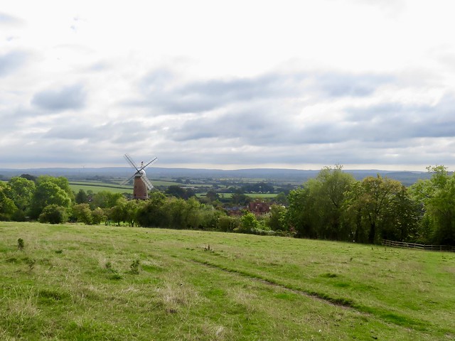
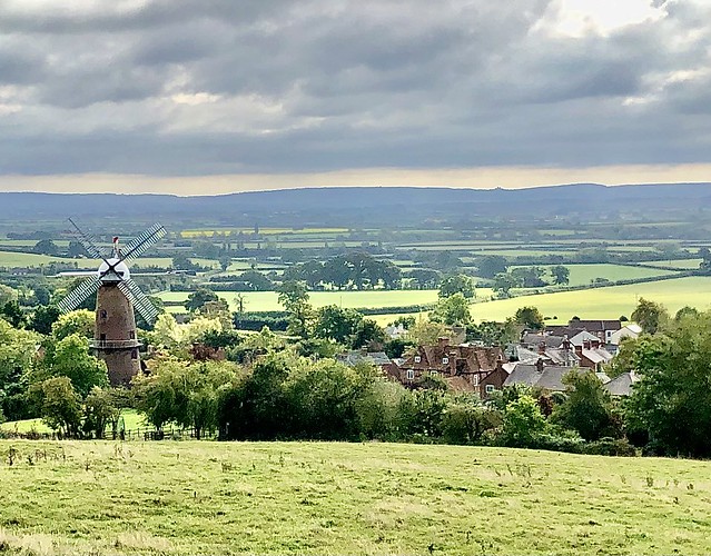
At Quainton in the Buckinghamshire lowlands, the sails and white cap of a windmill overlook the sloping village green. On a cold cloudy afternoon, jolly chat and laughter came spilling from the George & Dragon.

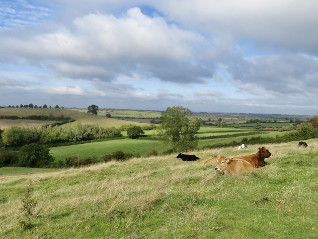
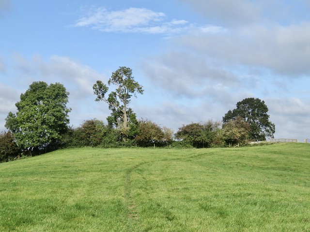
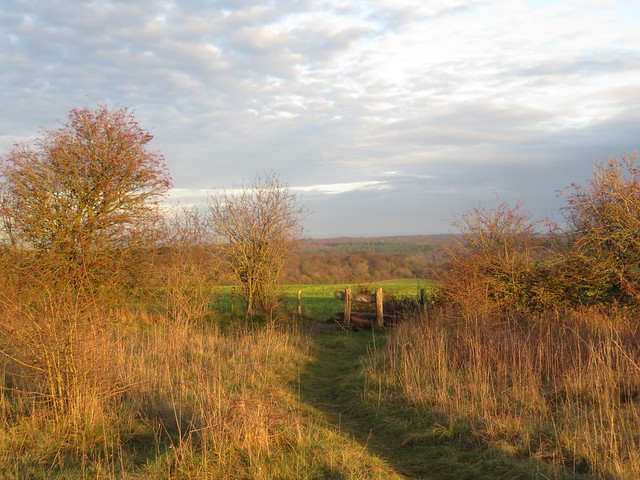
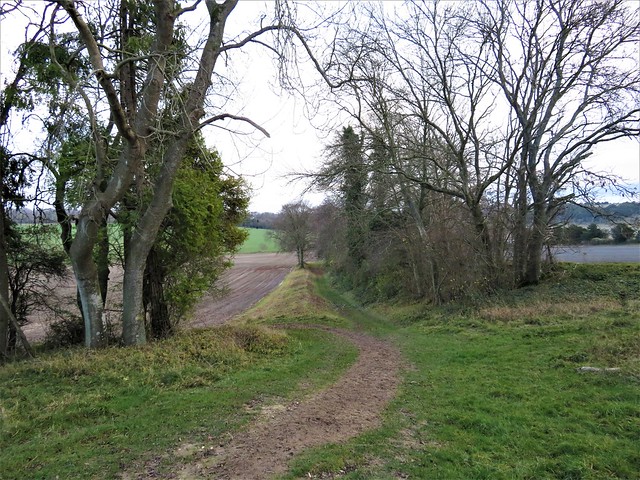
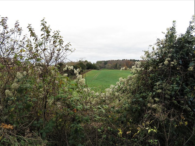
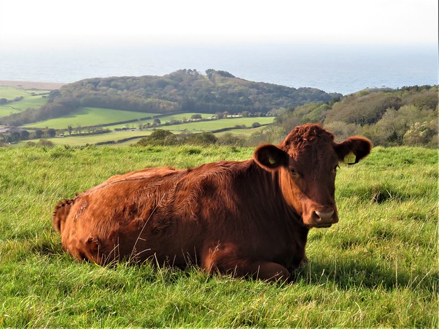
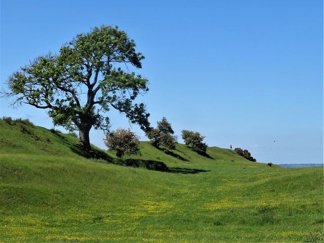
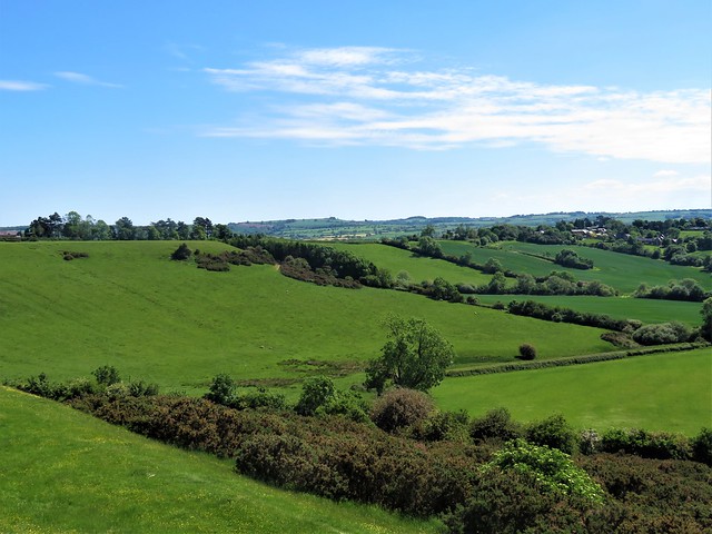
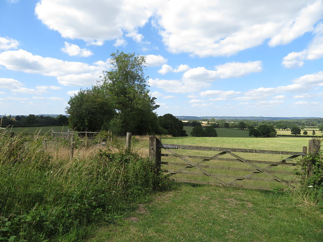
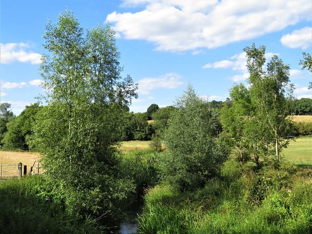
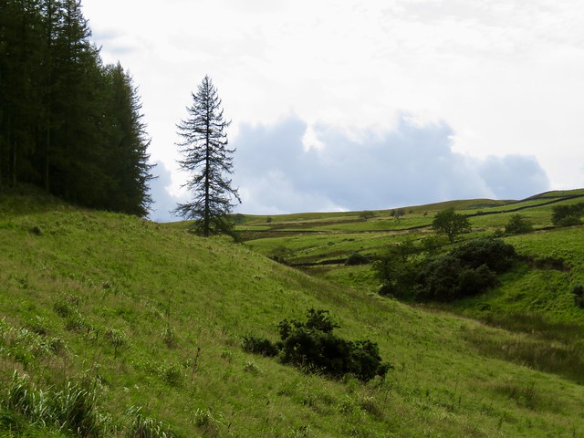
Leaving the village on the North Bucks Way, we climbed the nape of Simber Hill. Somnolent cattle lay chewing the cud with eyes half closed in what looked like a state of transcendental bliss.

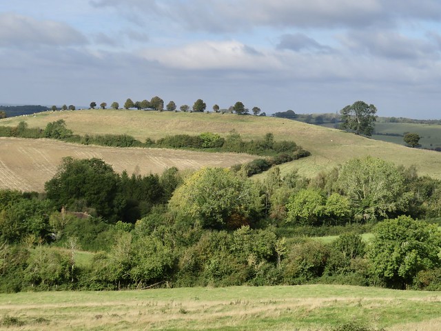
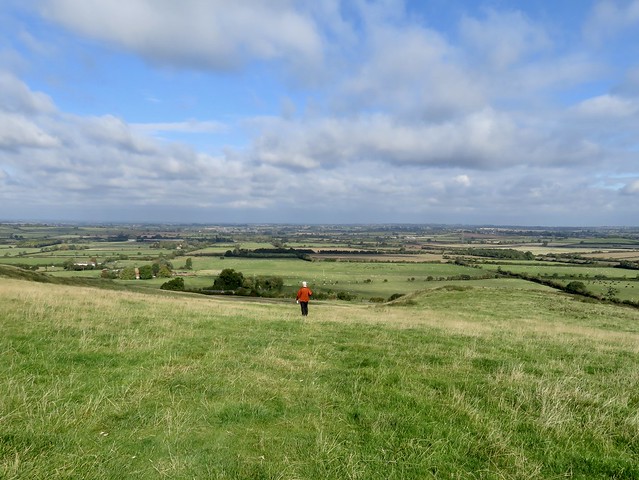
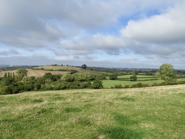
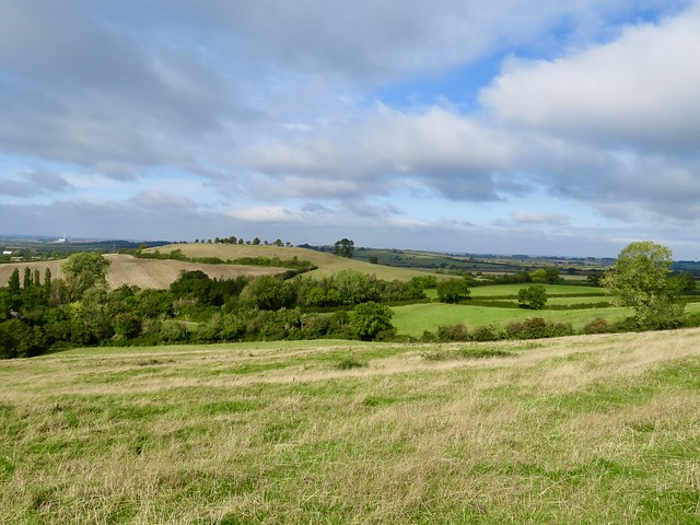
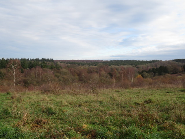
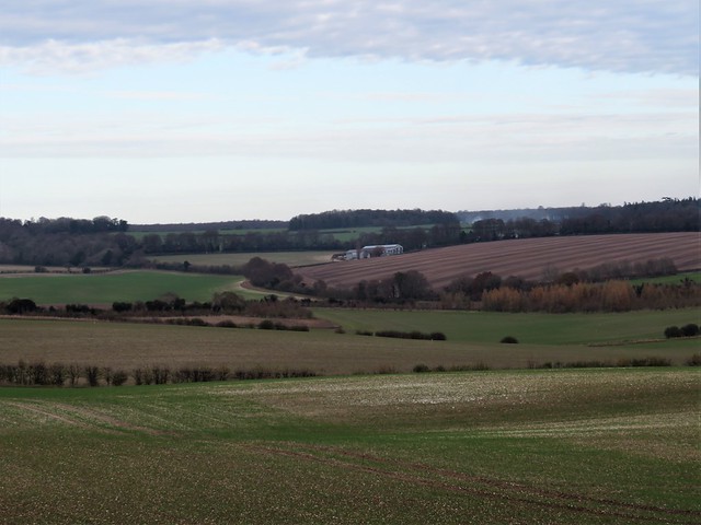
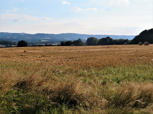
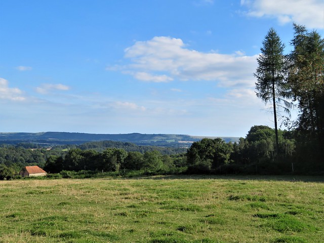
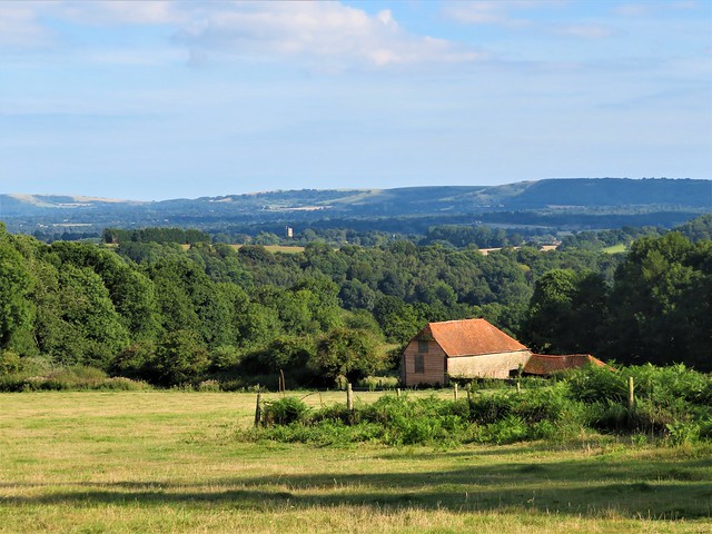
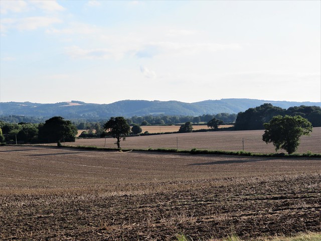
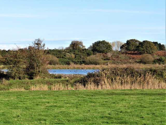
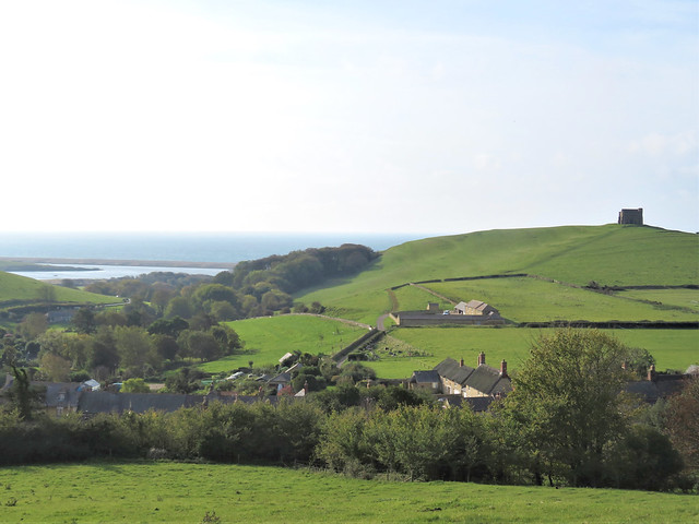
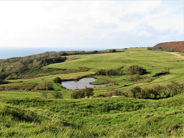
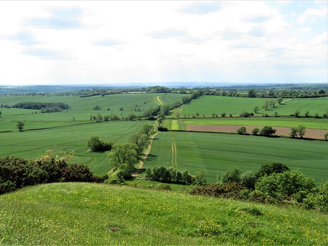
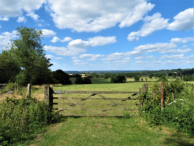
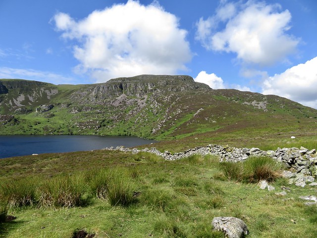
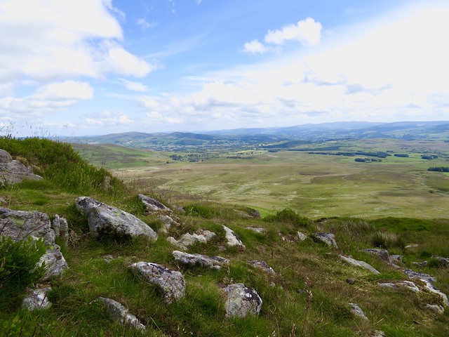
From Quainton Hill beyond, the views were remarkable, south to the long dark barrier of the Chiltern Hills, west and north over lower ground where whaleback hills rose from pasture striped with hedges. These green undulations looked beautiful from up here.

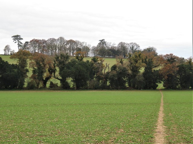
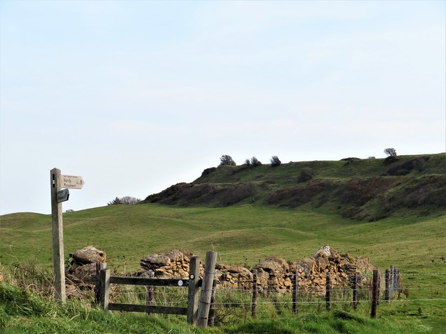
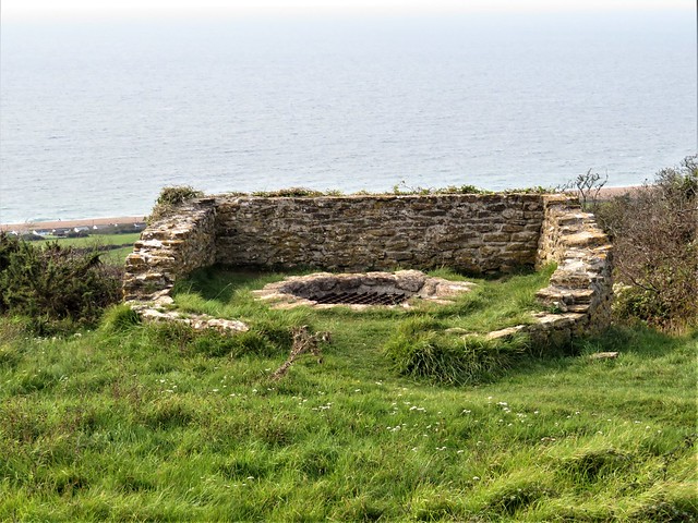
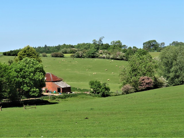
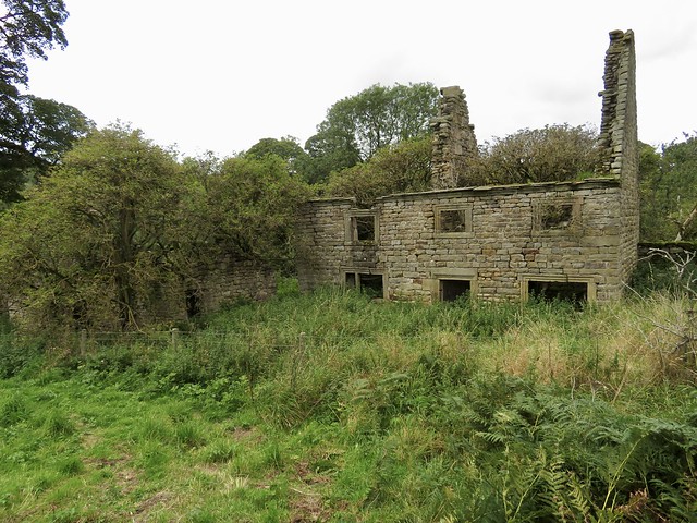
Down at the foot of Conduit Hill we passed between the shallow hummocks of Fulbrook, one of several deserted medieval villages hereabouts. Fulbrook probably lost most of its population during the Black Death pandemic of 1349, and the Duke of Bedford finished the job eighty years later when he converted the land into a deer park.

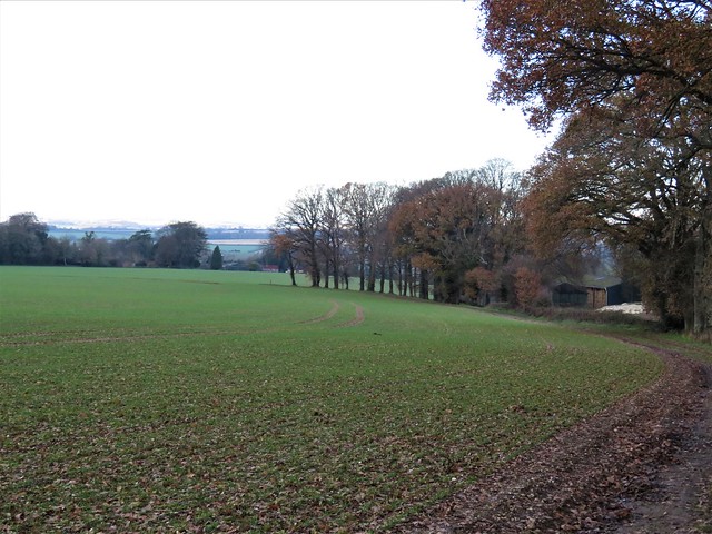
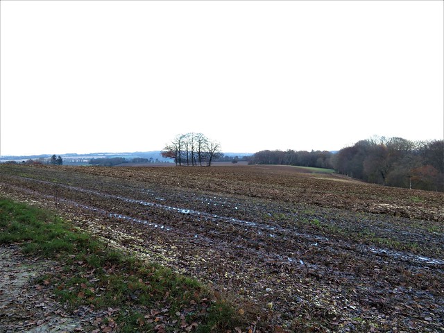
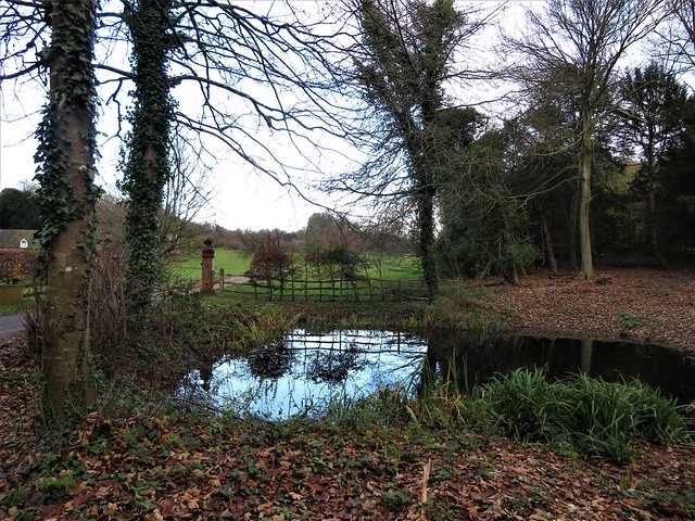
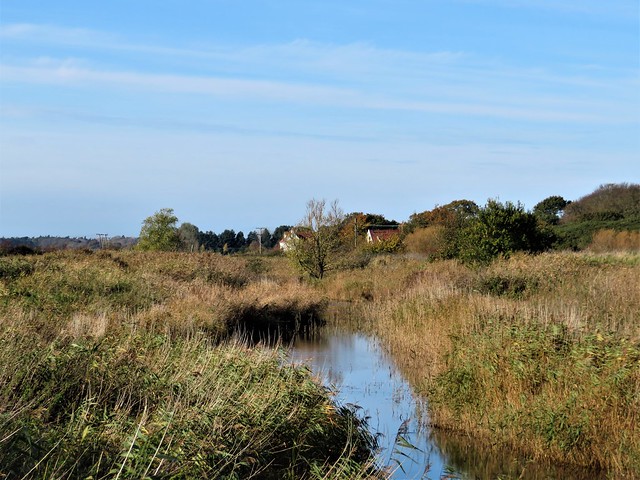
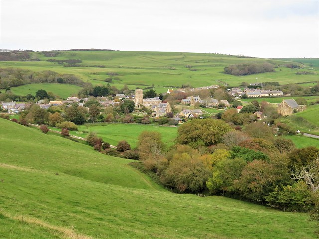
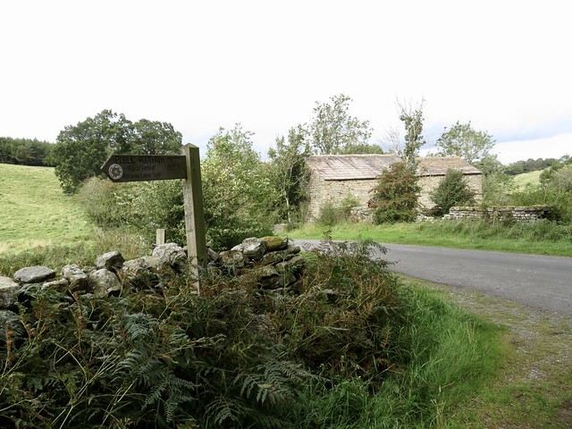
We followed a path across tussocky pasture and fields of dark grey plough to reach the road to North Marston. In a lane below the church we found a covered well with an old-fashioned pump. A sculpture of a boot stood attached to the stone trough.

Towards the end of the 13th century the rector of North Marston was Sir John Schorne, a renowned healer and miracle worker famed for capturing the Devil and imprisoning him in a boot. Sir John discovered the holy well during a deadly drought, and its water was said to cure gout and toothache. Judging by the agonised expression and contorted body of the rector’s icon at the well, he himself might have suffered from both afflictions.

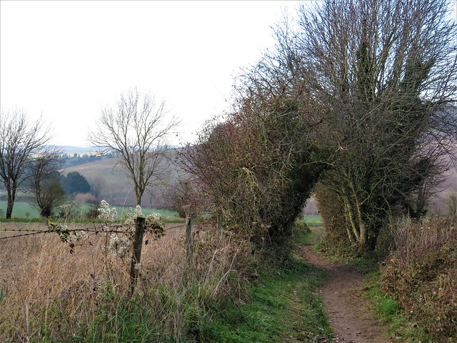
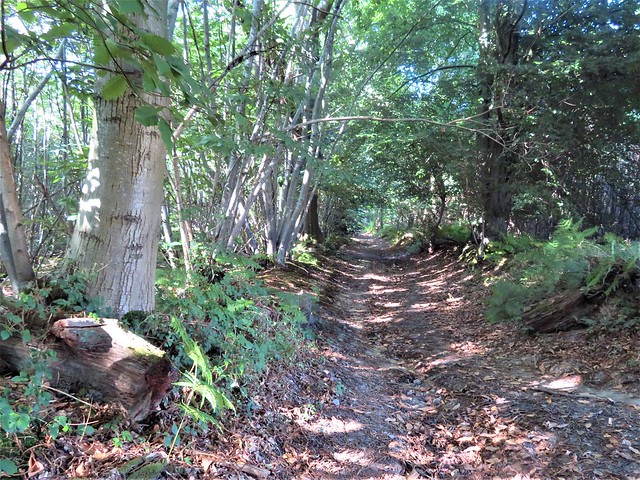
The homeward path followed Matthew’s Way, a rural route dedicated to the memory of ‘a very special little boy’. His round infant face looked out of a photo placed beside the way, and we carried that image in our heads across the sheep pastures.

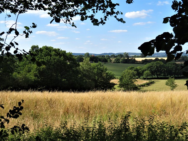
Under the grey cloud cap the western sky showed a crack of silver. As we approached Quainton a brown hare sprang up and darted away over the corrugations of medieval ridge and furrow, a lithe wild shape in this well-ordered landscape.
How hard is it? 7½ miles; easy; well marked field paths

Start: Village green, Quainton, Bucks HP22 4AR (OS ref SP 747201)

Getting there: Bus 16 (Aylesbury – Marsh Gibbon)
Road: Quainton is signed from A41 (Aylesbury – Bicester) at Waddesdon

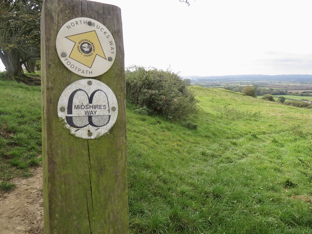
Walk (OS Explorer 192): At top of green, left. By playground, right (745202); follow North Bucks Way north towards Quainton Hill. In ¾ mile, at top of rise with gate and blue arrow on right (750215), left to skyline gate; fork right down Conduit Hill. Cross road (752225); half right, following Outer Aylesbury Ring/OAR) across fields. In ½ mile, under power lines, right (761228, kissing gate/KG); aim for shed and stile to road (764228, OAR). Left into North Marston. In ¾ mile, right at T-junction (774228); fork left in front of Pilgrim PH; follow lane to church (777227). From south gate, right; left along Schorne Lane; fork left by well (777225). In 30m, right (KG),;follow well-marked Matthew’s Way for 2¼ miles across fields to Carter’s Lane (765202). Right; in 400m at Quainton Dairy, left (764205) on farm drive, passing Denham Hill Farm (759204), gates of Ladymead Farm (758202) and Denham Lodge (753204). Cross cattle grid; in 100m, left to road (751202); right into Quainton.

Lunch: George & Dragon, Quainton HP22 4AR (01296-655436, georgeanddragonquainton.co.uk)

Accommodation: The Lion, Waddesdon HP18 0JB (01296-651227, thelionwaddesdon.co.uk)

Info: visitbuckinghamshire.org

 Posted by at 03:31
Nov 202021


First published in: The Times Click here to view a map for this walk in a new window
lovely evening light on the homeward path field edge path beyond Ashley wet fields and furrows near Ashley old sunken lane towards Beacon Hill pond on the Roman road from Winchester to Old Sarum twisty green lane near Beacon Hill view from Beacon Hill towards Farley Mount Paulet St John's monument to his horse Beware Chalk Pit. winter trees of Farley Mount chalky fields near Forest Extra - what an intriguing name! dogwood's spectacular leaves and flowers hedges thick with old man's beard field path to Ashley

You couldn’t find a better place than Farley Mount Country Park for children and dogs to run about and kick up the leaves on a cold winter’s day. Bright pink spindle berries lent a touch of colour to the pale grey winter woods. A young wolfhound came up with a five-foot-long stick in his jaws, winking his toffee-colour eyes sideways at us as though to say, “Aren’t I the clever boy?”

In a shallow valley north of the woods we turned along a grassy farm track between rolling fields of beet and wheat stubble. In the hazel hedges crimson stalks of dogwood sprouted green-white flowers and deeply creased leaves turning dark mauve.

Nearer the silos and sheds of intriguingly named Forest Extra a dead starling lay in the grass verge of the lane, wings outspread. Last night’s rain had coalesced into evenly spaced droplets all over the water-resistant feathers, like raindrops on a newly proofed coat.

A pale path of chalky mud led over the winter wheat. On the opposite slopes starlings perched on the backs of fat sheep that grazed among the vines of Chalk Vale Vineyard.

The hamlet of Ashley and its castle mound lay hidden among trees beyond a stout wall. King John stayed here often while hunting, a guest of William Briwere, described by contemporary chronicler Roger of Wendover as an ‘evil adviser’ to the king.

In the fields beyond, large old beech trees, stripped of leaves, raised their graceful domed heads against the grey sky. We dropped down to the valley bottom and the Roman road from Winchester to Old Sarum, these days a narrow lane as straight as a die. From here a good track rose up the flank of Beacon Hill, running through groves of twisty yews.

At the crest of the down we stopped to take in a 40-mile prospect of downs and woods, ribbed ploughland and smooth grazing. By the homeward path rose a white steeple, raised in 1733 by Paulet St John to honour the horse he named Beware Chalk Pit.

Steed and rider had jumped a hedge while out foxhunting and tumbled into a chalk quarry 25 feet deep. Miraculously, both escaped unscathed, and rode to triumph in the Hunter’s Plate handicap the following year. Huzzah!

How hard is it? 9 miles; easy; woodland and farmland tracks, some muddy

Start: Hawthorn car park, Pitt Down, near Sparsholt SO21 2JG approx. (OS ref SU 415292)

Getting there: Sparsholt is signed from B3049 (Winchester–Stockbridge). Follow ‘Farley Mount’ from here.

Walk (OS Explorer OL32): Facing away from road, from left corner of car park follow forest road north. In 250m, at barrier, follow main roadway to right. In 300m, left up forest road (417294). In ½ mile, leave trees (418303); in ⅔ mile, left in valley bottom (418313). In 1 mile pass Forest Extra (403319); in ¾ mile, left off road past gate (390319, arrow) on well-trodden field path. In ⅔ mile at far side of 4th field, up steps through hedge (384311); left (yellow arrow) along field path. In 1 mile, descend to valley track (397301); right to road (399296); right. In ½ mile, hairpin back left across field (390297; blue arrow, then green arrow; ‘Clarendon Way’/CW). Follow CW for 1½ miles across Beacon Hill (detouring right to horse monument at 403290) to road (408293). Cross onto path; in 50m, through gate; fork left on CW at edge of trees to car park.

Lunch: Plough Inn, Sparsholt SO21 2NW (01962-776353, the.littlepubgroup.co.uk)

Accommodation: The Old Vine, 8 Great Minster St, Winchester SO23 9HA (01962-854616, oldvinewinchester.com)

Info: Winchester TIC (01962-840500)

@somerville_c

 Posted by at 01:01
Nov 132021


First published in: The Times Click here to view a map for this walk in a new window
mine reservoir, Gonamena, near Minions tin mining landscape at Gonamena, near Minions tin mine ruins near Minions old tramway above the Phoenix mine side track to the old tramway Quarry pond below The Cheesewring The Cheesewring, Stowe's Hill Stowe's Hill and The Cheesewring The Hurlers and the tin mine pumping house, Minions The Pipers, turned to stone for bagpiping on the Sabbath The Hurlers, with Stowe's Hill and The Cheesewring beyond old tin mine pumping house at Minions

On Bodmin Moor stand sixty or so stout lads, all turned to stone for daring to play at hurling on a Sunday. As for an impious pair of music-makers who blew their bagpipes on the sacred day – why, there they are alongside, struck to stone for ever more.

Cornwall is full of Neolithic monuments and hoary legends, but the three conjoined stone circles of The Hurlers and their attendant pair of Pipers are tremendously impressive in their flattish moorland setting at the edge of the old tin mining and granite quarrying village of Minions.

From the Hurlers we made north across the moor to scramble among a clitter of boulders to the top of Stowe’s Hill, an abrupt bump in this wild landscape. Up at the summit, the winds and frosts of millennia have weathered the coarse granite into tors or piles of slabs, tremendously undercut, so smoothed and shaped that they seem more like artistic installations than natural features.

Most photogenic of all is The Cheesewring, a stack of wedges piled up as the result of a boulder-chucking contest between St Tuc and Giant Uther – so some say.

We skeltered down the hillside through a quarry of black cliffs where jackdaws glided in and out of the cracks that held their nests. From the quarry mouth a wriggle of former tramways led away. We followed one past a pair of ominous pit shafts, dark bushy holes chuting straight down and away from the upper world.

Below lay the site of the Phoenix mine, out of which six hundred Victorian workers dug tin, copper and manganese. Ruined sheds lay around the feet of a tremendous black stone engine house, from which a great red chimney pointed like a finger in the sky.

We dropped down into the valley and up a scrubby hillside to join the broad, firm track-bed of another old industrial railway. It was a three-mile walk back to Minions, trudging a circle round the waist of Caradon Hill past massive mine ruins, deep quarry canyons with rain-sculpted flanks, and unexpected corners of green leaves and trickling streams.

You could spend all your time walking the delectable coasts of Cornwall, and never even dream that these extraordinary and historic landscapes lie just inland – the other side of the county’s coin.

How hard is it? 6½ miles; moderate moorland walk; a little rock scrambling at The Cheesewring.

Start: Hurlers car park, Minions, Liskeard PL14 5LE (OS ref SX 260711)

Getting there: Bus 74 (Liskeard)
Road – Minions is signed off B3254, Liskeard (A38) – Launceston (A30)

Walk: From car park follow track to The Pipers twin stones (257713), then The Hurlers stone circles (258714). Head north to climb Stowe’s Hill to The Cheesewring granite tor (258724). Descent right (east) side to track through quarry (259723) and on. Pass two fenced mine shafts (260722); in 50m, left down to old tramway (262722). Right; in ¼ mile, fork left at granite marker post (264719) to cross road (265717). Stiles, yellow arrows (YA) to road (267716). Left; in 100m, right (gate) down to cross stream (268715). Don’t turn left (YA), but climb slope to disused railway (269712); left. In 1¼ miles, just past spoil heap (279701), bear left on track to Tokenbury Corner car park (280697). Right on old railway. In ¾ mile pass engine house and chimney; through arch (269698). In ½ mile, just past reservoir in a dip on right, fork left (264701) into dip. At ‘Private’ gate, left across granite stile (263703); right on green track to Minions.

Lunch/Accommodation: Cheesewring Hotel, Minions (01579-362321, cheesewringhotel.co.uk)

Info: Liskeard TIC (01579-349148)
@somerville_c

 Posted by at 01:56
Nov 062021


First published in: The Times Click here to view a map for this walk in a new window
Sweet chestnut coppice, Fittleworth Wood classic West Sussex countryside near Fittleworth, looking to the South Downs 3 classic West Sussex countryside near Fittleworth, looking to the South Downs 2 classic West Sussex countryside near Fittleworth, looking to the South Downs sweet chestnut, hazel and holly flank the lane to Fittleworth Wood rough grassland near Limbourne Farm ploughed fields near Fittleworth, with South Downs beyond 3 field path between Little Bognor and Fittleworth ploughed fields near Fittleworth, with South Downs beyond harvest fields near Fittleworth, with South Downs beyond 2 harvest fields near Fittleworth, with South Downs beyond

A warm afternoon still gilding the backs of the South Downs, but growing cool in the shade of the trees of Hesworth Common. The downs hung halfway up the southern sky, a long and gradually undulating spine of tar-black woodland and dull gold fields. Baby rabbits were playing ‘statues’ in the verges of the stony lane that led past the back gardens of Fittleworth and on among the sweet chestnuts of Fittleworth Common. 
 
A green lane zigzagged north through the bracken undergrowth of Walters Plantation. Approaching Limbourne Farm the hedges were thick with the white bugle mouths of convolvulus and netted over with hop bines. We squeezed the sticky hop buds as we passed, and carried their pungent oily smell away at our finger ends.
 
Beyond the farm we entered the dense plantation of Fittleworth Wood. Properly maintained coppice of sweet chestnut is rare enough; there’s little call these days for the laths and battens, the hurdles and staves for which country craftsmen once harvested the chestnuts. But here in Fittleworth Wood the path ran between coppiced trees at every stage from tender new growth to mighty poles fifty feet tall – a beautiful sight with the sun filtering in thick bars of watery green light between the saw-edged leaves.
 
Near the edge of the wood a tiny Jack Russell pattered up to press its cold nose against my fingers, savouring the hop aromas as appreciatively as any real ale connoisseur. Beyond the trees lay hay meadows and the mellow red roofs and brick walls of Springs Farm, its peeping windows framed in sprays of buddleia.
 
If chestnut coppices are generally neglected nowadays, the commons where local folk once grazed their pigs and cattle have largely become overgrown with trees. We turned west through the luxuriant ash, oak and holly of Lithersgate Common, and south on a path that edged Bognor Common’s thickets of silver birch and rowan.
 
Down through Little Bognor, another picture-book straggle of beautifully kept old houses along a millpond stream, then on south through open fields. The powdery pink soil smoked in our wake, water-smoothed pebbles from some ancient river rolled under our boots, and the long arm of the downs stretched ahead as though to fence off the valley from the outside world.
 
How hard is it? 5½ miles; easy underfoot; careful navigation needed in woods
 
Start: Hesworth Common car park, Fittleworth, West Sussex RH20 1EW (OS ref TQ 007193)
 
Getting there: Bus Service 1 (Worthing-Midhurst)
Road – Car park signed off B2138 on west outskirts of Fittleworth.
 
Walk (OS Explorers 121, 134): Left/southeast (Serpent Trail/ST), parallel with B2138. In 200m, left to B2138 (009192). Right; in 50m, left past wooden barrier. Fork left on path. In 300m cross road (011191); on to Fittleworth Common. At wooden post bear right (014190), parallel with and then alongside northern boundary fence, to cross A283 (018190 – take care!).  By pond, right (fingerpost/FP); in 50m, left up bank (black arrow/BLA) on path through pinewood. 
 
In 150m bend right; in 150m, left (020191, bridleway fingerpost/BF) on broad bridleway. Pass Limbourne Farm sheds and silo (020193); in ½ mile, enter Fittleworth Wood (022201). In 100m pass footpath turning on left (FP); in another 100m take 2nd turning on right (022203, unmarked fork). Continue uphill. In 300m turn right (024206, blue arrow/BA). In 50m, left (BF); in 150m, right (BF, bench), steeply down bank. At bottom, follow BA uphill and on for 250m to top of wood (027210). Out of wood through gate; on to top left corner of field (027212); left (4-finger post) through gate; half left down across field. Follow lower edge of field below Springs Farm to drive (025213); follow it for 400m to road (021213).
 
Left; pass track to Warren Barn; in 15m, right (FP, stile) on path through trees of Lithersgate Common. Pass 3-finger post; in 200m, at next 3-finger post, right (019211). In 15m fork left down past pond. Follow ST for 550m to enter Mitfords Copse (013211); in 200m, descend to path crossing (011211). ST turns right; you go left/south-west (FP). In 300m, cross road (009209); down road opposite through Little Bognor. At far end of village pass ‘The Potting Shed’ on right; in 100m, left over stile (004204, FP, ‘Dyers Cottage’).
 
Follow YA past Dyer’s Cottage and on. Follow field edge downhill; in 100m, left (BLA, 006202) into wood. At end of trees, keep ahead to 3-finger post (005200); left to corner of hedge; half left across field past lone tree with FP to enter trees (008197). At kissing gate, half right across paddock to gate (BLA). Follow path to road; right to A283 (009194).
 
Right round bend (take care!); cross into Church Lane; right up path (FP) beside A283. At Scout hut, up left side of building; keep ahead to B2138 (008192); right to car park

Lunch/Accommodation: Angel Inn, Petworth GU32 0BG (01798-344445, angelinnpetworth.co.uk)

Information: Arundel TIC (01903-737838)

 Posted by at 01:53
Oct 302021


First published in: The Times Click here to view a map for this walk in a new window
Southwold Beach Sandlings Walk towards Southwold Southwold from the marshes Ferry cross the Blyth bronze autumn bracken on Busscreek Marshes fleets of water on Busscreek Marshes water tower on Southwold Common Easton Marshes Buss Creek and Easton Marshes 2 Buss Creek and Easton Marshes 1. Sandlings Walk approaching Southwold old wind pump on Reydon Marshes Gun Cliff, Southwold

Southwold at the cusp of autumn and winter; a trim little resort out on the Suffolk coast, its tight lanes packed with bookshops, cake shops and bric-a-brac emporia. The lighthouse, sited well inland, towered over the town like a guardian nanny in a white cloak.
On the seafront promenade the Sailors Reading Room, built to offer Victorian seafarers an alternative to the demon booze, was packed with photos, drawings, models and mementoes of bygone ships, shipmen and the sea. Below the white railings of the prom a beach of pebbly sand and an orderly rank of beach huts led north to the skeletal finger of Southwold’s pier, its line of neat pavilions and shelters lending it the air of an old-fashioned railway station miraculously suspended above the shingly grumble of the North Sea.
Beyond the pier the fast-crumbling cliffs extended in a low pink arc. We turned inland along the reedy ditch of Buss Creek, the dimity charm of the town instantly exchanged for rough grazing marshes and scrub woodland.
A wild babbling in the sky heralded the approach of a great crowd of barnacle geese, all yapping like excited puppies as they came in to land, the clean white of their heads and breasts in contrast to the sober grey-black of their backs. Further on behind the town on Botany Marshes, the water of the creek lay mirror-still. The flanking reeds were trapping the wind, tossing their feathery heads with a loud hissing, every empty seed cone glistening in the strong afternoon sunlight.
A scuffling in the grass drew our attention. A rabbit was scampering along the seabank nearby, pursued by a stoat, a lithe streak of ginger. The rabbit bounded up the slope and into its hole so adeptly that the stoat seemed baffled, and soon undulated off in search of other prey.
We turned south and crossed the Bailey Bridge that spans the narrow tidal reach of Southwold harbour, its outflowing water olive-green and wrinkled. Beyond lay the church tower and roofs of Walberswick, neighbour and rival to Southwold. Feathery grasses made a ground haze of silver on Robinson’s Marshes as we headed for home by way of the rowing boat ferry that links the twin communities. The jolly ferryman sculled us over the tide, and we strolled back along Southwold promenade with nothing more noble on our minds than a nice pint of the town’s famous Adnams ale.

How hard is it? 5 miles; easy, level walking
Start: Southwold Pier car park, 27 North Parade, Southwold IP18 6LT (OS ref TM 512769) – £6 all day.

Getting there: Bus 146 from Norwich.
Road: Southwold is on A1095, signed from A12 between Blythburgh and Wangford
Walk (OS Explorer 231): Turn north from car park; in 50m, left (513769, fingerpost) on path across marshes. Cross A1095 (504769); on across Botany and Busscreek Marshes to Bailey Bridge over River Blyth (495759). Right across bridge; follow cycleway. In ½ mile, just before Heath House, left (492750, bridleway fingerpost). In ¼ mile, left at road (496748); in 150m, left (‘Bird Hide’). At hide (497750), right (yellow arrow). Follow ditch on right for 250m to gate and steps (500748); left along bank to West Harbour and Walberswick ferry (501749). Cross harbour; ahead (‘Sandlings Walk’) for ⅔ mile to Queen’s Road (508758). Right across green to Gunhill Cliff (509757); left along promenade for ¾ mile to car park.
Lunch/accommodation: Crown Hotel, High Street, Southwold IP18 6DP (01502 722275; thecrownsouthwold.co.uk)
Info: thesuffolkcoast.co.uk; exploresouthwold.co.uk
Walberswick ferry: runs on demand. Adults £2, children under 5 free, under 18 £1. Check timetable first! – walberswickferry@gmail.com, walberswickferry.com

 Posted by at 01:50
Oct 162021


First published in: The Times Click here to view a map for this walk in a new window
St Catherine's Chapel from the hill above Abbotsbury 1 St Catherine's Chapel from the hill above Abbotsbury 2 Iris foetidissima or Stinking Iris What a gem! A Devon Red Ruby cow on the ridge above Abbotsbury. view from the ridge looking north from the ridge path ramparts of Abbotsbury hill fort field mushroom near the hill fort old limekiln above West Bexington Abbotsbury from the hill near St Catherine's Chapel 1 St Catherine's Chapel Abbotsbury from the hill near St Catherine's Chapel 2

Under a clearing sky and a brisk wind we set out among the cottages of Abbotsbury with their walls of deep golden stone under grey-green thatch. Chicken, duck and goose eggs were for sale at the farm in Rosemary Lane.

Stony, sunken Blind Lane led away uphill between horse pastures. From here we looked back over Abbotsbury and its steep guardian hill topped by St Catherine’s Chapel, the shingle bar of Chesil Beach enclosing the long inlet of The Fleet, and the leonine form of the Isle of Portland with its long back and tail sloping down into the dull sea. Half a dozen dark lumps lay beyond, giant container ships at anchor off Weymouth.

Up over the corrugations of medieval strip lynchets to the ridge, where the South Dorset Ridgeway ran out west along a bracken-brown bar of downland parallel to the sea. An ancient ceremonial landscape where Neolithic long barrows and Bronze Age round barrows lay side by side. The tribal leaders of 3,000 years were laid to rest on this high eminence overlooking land and sea.

On the ramparts of Abbotsbury hillfort a female stonechat sat on a gorse tip, her breast a soft buff pink, a bold dark stripe through her eye. Looking west from here we had a grand prospect of the Jurassic Coast all round the great curve of Lyme Bay, with the crumbling cliffs of Golden Cap shining a rich gold in the muted late-year light.

A cobbled green lane descended to West Bexington between hedges bright with fruit – hard red blackberries, shiny black dogwood berries, the burnished scarlet of hawthorn peggles, and old man’s beard draped over the stone walls.

The single street of West Bexington sloped down to the seafront, where beach fishermen cast their heavy leads in hopes of bass or codling. We turned east into the wind and crunched along a beach of pebbles almost as small as sand. Pale leaves of sea kale like elephant ears grew on the scrubby maritime sward, along with thrift flowers now dry and silvery.

On the seaward side of Abbotsbury we climbed steeply across strip lynchets to reach St Catherine’s Chapel, massively buttressed in thick dark gold stone on its hilltop. In medieval times the maturer maidens of Abbotsbury would make an annual pilgrimage to offer a fervent prayer in the chapel on the hill:
‘A man, St Catherine,
Please, St Catherine,
Soon, St Catherine!’
… following that with: ‘Arn-a-one’s better than narn-a-one, St Catherine!’

Flora: blackberries, dogwood berries, hawthorn peggles (berries), old man’s beard
Birds: female stonechat

How hard is it? 8½ miles; moderate; downland tracks, shore path, short steep climb to chapel

Start: Abbotsbury car park, Rodden Row, Abbotsbury DT3 4JL (OS ref SY 578853) – £1 per hour, signposted in village.

Getting there: Bus X53 (Weymouth-Axminster)
Road: Abbotsbury is on B3157 (Weymouth-Bridport)

Walk (OS Explorer OL15): Cross B3157; up Rosemary lane; left on Back Lane. In 150m, right beside Spar House up Blind Lane (578854, ‘Hill Fort’). In 600m, through gate (574859, yellow arrow), then another (blue horse). At ridge, left (571863, gate, ‘West Bexington’). Follow ‘South Dorset Ridgeway’ and ‘Bexington’ signs for 2¾ miles to West Bexington seafront (531864). Left along shore path, then road for 2¼ miles to road end (560846). Ahead along lower edge of car park. Follow ‘Coast Path’ signs for ⅔ mile to 3-finger post; right (568847, ‘Swannery’). In ½ mile, left at stone marker (575845, ‘St Catherine’s Church’). Steeply uphill to chapel (572848); downhill into Abbotsbury.

Lunch/Accommodation: Manor House, West Bexington, Bridport DT2 9DF (01308-897660, manorhousedorset.com).

Info: Bridport TIC (01308-424901)

 Posted by at 01:47
Oct 092021


First published in: The Times Click here to view a map for this walk in a new window
picture picture picture picture picture picture picture picture picture

The track to Burrough Hill ran through pastures corrugated by medieval ridge-and-furrow, and rubbed to billiard table smoothness by sheep. On this hot cloudless afternoon they lay in any shade they could find, ewes sweltering in heavy fleeces, lambs panting like little steam engines at three breaths a second.

The ramparts of Burrough Hill’s splendid Iron Age hill fort stood ahead, an undulating line of turf-covered stone whose hollows spoke of millennia of weathering, trampling and quarrying. We walked the circuit, pausing at the topograph to spy out the hazy towers of Leicester, the red brick smear of Melton Mowbray and the charmingly named Robin-a-tiptoe Hill.

The path led steeply down the north face of the fort, past a crowd of young bullocks too hot and sleepy to follow us, and on through the cool avenue of ash and beech in Rise Hill Spinney. A seat placed for the northward view was presented by two foresters, Jack Atton and Terry Darby, who spend nearly twenty years in the 1980s and 90s planting the trees that now cover these hillsides.

Turning south, we followed the Leicestershire Round long distance path through the parkland of the Dalby Estate, looking back to where Little Dalby Hall peeped from a collar of trees. A short sharp climb led to uplands characteristic of these Leicestershire Wolds, broad corn fields and plough, the hedges dotted with pink spindle berries, where the dip and roll of the land hid the nearby fort on Burrough Hill.

Did Mrs Orton, farmer’s wife, produce the world’s first Stilton cheese in this parish in 1730? Certainly they claim she did in nearby Somerby, where the village pub is named after the pungent delicacy. But should you fill the hollow in your truckle of Stilton with crusty port? That debate is still open.

Beyond Somerby we skirted the rim of a dry valley where ridge-and-furrow plunged down the flanks, testament to the exploitation of every bit of land by our hungry medieval ancestors. Under a pearly evening sky we made for the ramparts of Burrough Hill, now in full view ahead once more. The homeward path skirted the hillfort, a green track through thickets of gorse above which rooks flocked on their homeward flight.

Flora: spindle berries
Birds: rooks (nothing prettier, sorry!)

How hard is it? 6 miles; easy; well-marked field paths

Start: Burrough Hill car park, Burrough Road, Somerby, Leics LE14 2QZ (SK 766115)

Getting there: Bus 100 (Syston-Melton Mowbray)
Road – Car park signed off Somerby-Burrough on the Hill road (signed from A606 Oakham-Melton Mowbray)

Walk (OS Explorer 246): Up signed track to Burrough Hill. Clockwise round ramparts via topograph. At north side near cut tree trunks (761121), descend past yellow-topped post/YTP to gate (763122, YTP, yellow arrow/YA) and on. In 450m, ahead through wood (767124, ‘Leicestershire Round’/LR). In ⅔ mile, at T-junction, right (775126, Dalby Hill Path’) and follow YTPs. In 300m up steps (775123); diagonally across field; follow LR/YTPs) for 1 mile to road in Somerby (778106). Right; in 200m, right (776105, ‘The Field’) to cross road (775107). On across fields (‘Public Footpath to Borough on the Hill’). In 400m at kissing gate, right (771108); follow fence on your right (YAs) round top of dry valley. Descend to cross stream (763107); aim for pole on knoll, then to left of house with prominent window. Right at road (758109); in 50m left (YTPs) across fields. In ¾ mile at YTP with LR arrows (756119), right past Burrough Hill to car park.

Lunch: Stilton Cheese Inn, Somerby (01664-454394, stiltoncheeseinn.co.uk)

Accommodation: Admiral Hornblower Hotel, High Street, Oakham, Rutland LE15 6AS (01572-723004, hornblowerhotel.co.uk)

Info: leicscountryparks.org.uk

 Posted by at 01:46
Oct 022021


First published in: The Times Click here to view a map for this walk in a new window
picture picture picture picture picture picture picture picture picture picture

A sunny afternoon over Penshurst, the blue sky silvered with lazily drifting clouds. The village houses of mellow brick and Kentish weatherboard held enough olde-worlde charm to spark nostalgia for JRR Tolkien’s mythical Shire. I popped into the Forge Stores, with its round wooden hobbit-hole frontage, and was tempted to ask for a flask of mead and a pouch of Longbottom Leaf along with my chocolate bar.

An embanked lane led west between bracken slopes, sloe bushes heavy with shiny dark fruit and hedges a-twitter with flocks of pink-breasted linnets. This is beautifully maintained countryside, giving off a whiff of money well spent, of care taken and forethought applied. Field ditches have been properly dug and cleaned, new plantations of cherry, hazel and hawthorn established, hedges allowed to bulk out as food and cover for wildlife.

Along the valley stretched a line of Second World War pillboxes, the derelict old strongpoints sprouting ivy and elder. We crossed the sluggish River Eden, where silver dace flicked with a tiny splash into the sheltering shade of alder roots as our shadows loomed over the bridge railings. There was a whisper of wind and a shiver of leaves in the poplar groves. A straggle of straws and leaves along the way showed where last winter’s floods had drowned the path as they encroached on these low-lying fields.

This part of Kent is famous for its hops, witness the cluster of former oasts or drying kilns that stood at Salman’s Farm like red-habited nuns under white coif caps. Beyond on a slope vines had been planted, the grapes in bunches hanging from wires stretched at shoulder height. We sat on a bench to eat our picnic, looking down the rows and imagining the harvest. Regent grapes for a nice rosé, said the adjacent notice. That would do.

Twisted hornbeams and hollies reflected a sombre light in Russell’s Wood. Beyond in Yewtree Wood a gaggle of children shouted and swooped, walking the plank along the smooth recumbent trunks of enormous old beeches that had been thrown in storms long gone and forgotten.

At Wat Stock Farm on the homeward path we sat on a bank and listed to squirrels crunching the last of the hazelnuts in the hedge behind us. Back at Penshurst young men and women were jumping with much ado into and out of the river. The walk ended with a stroll across the sward in front of 14th-century Penshurst Place, an extravagant architectural mishmash of brick, stone, chimneys, gables and arches all picked out in the low sun of late afternoon.

How hard is it? 5½ miles; easy; field paths and lanes
 
Start: Penshurst Place parking field, Penshurst TN11 8DG (OS ref TQ 530440) 

Getting there: Bus 231, 233 (Lingfield-Tunbridge Wells)
Road: Penshurst is signed from A26 (Tonbridge-Tunbridge Wells)

Walk (OS Explorer 147): Down Penshurst Place drive; right along village street. Past Forge Stores, right along The Warren (525436). In 1 mile at Salman’s Farm, through kissing gate/KG (512432); right up track; left, and keep ahead (yellow arrow/YA). At T-junction in Russell’s Wood, right (507430, YA, ‘441’). Opposite Oakenden house, right (501428, YA, stile), then right through KG, across fields; through Yewtree Wood. On west edge of wood cross stile (502435, YA); on to road (501436). Right; pass Sliders Barn; in 150m, right along drive (503439); follow Eden Valley walk for 1½ miles to Penshurst. Left at B2176 (525439); in 200m, right (525440, KG) through grounds of Penshurst Place to car park.
 
Lunch/Accommodation: Leicester Arms, Penshurst TN11 8BT (01892-871617, theleicesterarms.com)
 
Info: Penshurst Place – 01892-870307, penshurstplace.com

 Posted by at 02:54
Sep 252021


First published in: The Times Click here to view a map for this walk in a new window
picture picture picture picture picture picture picture picture picture picture picture picture picture picture picture picture

When Squire William Danby of Swinton Park saw his tenants go hungry during a farming slump in the early 19th century, he did something about it – namely, he paid them a shilling a day to construct a scaled-down Stonehenge in the wilds of his North Yorkshire estate.

In the woods above the yurts, treehouses and tepees of Swinton Bivouac’s glamping grounds we found the henge, an oval of massive blocky stones enclosing a ring of trilithons or stone portals. If there’s something conscience-tweaking about the back story of the Druid’s Temple, there’s also something laughable about the structure in a Spinal Tap sort of way. Squire Danby tried to recruit a hermit to live on site, speak to no-one and let hair and beard grow free – but none of the candidates, however hungry, proved willing to tackle that job.

A cold wind blew from the sombre moors to the west as we followed the Ripon Rowel long distance path down into the valley of Pott Beck. Behind in the east the long ridge of the North York Moors, twenty miles off, lay pink and grey under a cloudy sky.

The path ran round a rim of forestry above Low Knowle Farm house, barns and byres all stone-built, old and tight-knit against the weather in their hollow.

With the spillway from the dam at Leighton Reservoir twinkling near at hand, we turned away along a path through rough pastures of rushes and clumps of harebells where blunt-faced rams stared us out as we passed. Healey village lay along its hillside beyond the River Burn, the coffee-coloured stone houses running east to the church’s tall spire.

At Broadmires Farm the house stood all of a piece with the byre, a tradition of architecture hereabouts stretching back to the longhouses that the Norse settlers built in these dales a thousand years ago.

By the chattering Sole Beck a grey wagtail bobbed on a stone, its yellow belly catching a glint of sun through the leaves. Climbing the homeward path through the birch woods above the chattering Sole Beck, we came to Lobley Hall, a grand name for a ruinous house three hundred years old. Elders choked the living room, buddleia reached out of the chimneys.

‘KW 1698’ was carved into the lintel above the doorway. Whoever KW was, the builder of Lobley Hall certainly commanded a beautiful view of beck, hillside and woodland in this lonely daleside cleft.

How hard is it? 5 miles; field and woodland paths, muddy in places

Start: Swinton Bivouac car park, High Knowle Farm, Knowle Lane, Ripon HG4 4JZ (OS ref SE 180787) – £3

Getting there: From Masham (A6108) follow ‘Fearby’. On far side of village, sharp left to cross River Burn. Right, and follow ‘Swinton Bivouac, Druid’s Temple’ to car park.

Walk (OS Explorers 298, 302): Walk to Druid’s Temple (175787, signed), and return to top of Bivouac drive. Left (‘Burgess Bank’, ‘Ripon Rowel’/RR); follow well waymarked RR clockwise for 2 miles via Knowle Plantation (175791), Burgess Bank (168793), Broadmires Farm (178798) to road (183798). Ahead; in ¼ mile RR turns left (187801, ‘Healey’), but keep ahead (‘Swinton’). In 500m ford Sole beck (192799); in 150m, right (kissing gate, yellow arrow/YA). Follow YAs for ½ mile to pass Lobley Hall ruin (191793). In another 150m ignore YA on right; continue on left bank of Sole Beck to cross road (186787). From here follow RR waymarks back to car park.

Lunch/Accommodation: Swinton Bivouac café and lodges (closed January) – 01765-680900; swintonestate.com)

Info: Harrogate TIC (01423-537300): yorkshire.com

@somerville_c

 Posted by at 01:57
Sep 182021


First published in: The Times Click here to view a map for this walk in a new window
picture picture picture picture picture picture picture picture picture

Arenig Fawr, ‘Great High Ground’, the summit of a curving ridge at 2,802 ft (854 m), stands at the eastern edge of the National Park, some way apart from the more celebrated peaks of Snowdonia.

Other than the beauty of Arenig Fawr’s own surroundings, the special attraction of the summit is that from it you can see an unbeatable panorama of the mountains of North Wales spread out all round you. First, though, you need a clear day on those tops, not so common in this part of the world.

Three times over the years we’d had Arenig Fawr in our sights, and three times we’d been rained off. Now here we were at the foot of the track on a beautiful morning. The well-found track led us across thistly hillsides to our first sighting of Llyn Arenig Fawr, a sheet of wind-stippled water, steel-blue in the shadow of a tall corrie of dark crags with pink screes chuting down towards the lake.

By the dam a little one-room bothy, immaculately clean, offered basic shelter – a wooden plank bed, a fireplace still warm from the previous night’s occupants, a kettle, a broom, a bottle of chilli sauce, and naturally The Bible in both English and Welsh. Judging by the ecstatic comments in the visitors’ book, walkers love this spartan refuge beside the lonely lake.

From the bothy the track steepened beside the corrie, a good old puff upwards on a path whose rocks sparkled in the sunshine. A couple of fences to hop and we were out into a wild upland, the path undulating through boggy patches and curving across slopes before turning up loose screes and rocky steps towards the ridge.

The slope of the climb hid the conical summit of Arenig Fawr till we were nearly there. Up at the trig pillar we found a stone-walled shelter and a poignant memorial to the eight-man crew of a USAF Flying Fortress bomber, killed when their plane crashed here on a night training flight in 1943.

The promised mountains stood clear and dramatic all round – the dinosaur spine of the Clwydian Hills and the four billows of the Berwyns to the east, Cadair Idris looming like a hunchbacked beast in the southwest, and away to the northwest the shoulders and pointed head of Snowdon just brushing the gathering cloud.

How hard is it? 7¼ miles there and back, 1720ft/530m climb. Strenuous mountain expedition for fit, sure-footed walkers, properly clothed and shod.

Start: Car parking space just east of Arenig, near Bala, LL23 7PA approx. (OS ref SH 846395)

Getting there: Arenig is signed off A4212 (Trawsfynydd-Bala). Drive through hamlet; car parking space is another ⅔ mile on left, opposite gate signed ‘Farmland’.

Walk (OS Explorer OL18): Through gate, follow track for 1½ miles to Llyn Arenig Fawr. Cross ladder stile by bothy (850379); follow path, gentle gradient at first, then a rocky and steep climb from 400m at bothy to 600m at fence (‘Y Castell’ on map). Cross fence (842373); up to cross second fence 40m beyond corner where you join it (839374). From here on, path rocky and stumbly – watch your step! Path bears right round rocky outcrops, then makes long leftward curve across slope. In ½ mile path bends right and climbs (832372), a few cairns mark it from here. Near the summit, aim for a prominent post above, then the trig pillar at 2,802ft/854m (827369).
Return same way.

Lunch: Picnic

Accommodation: Bothy at Llyn Arenig Fawr (mountainbothies.org.uk); or Plas Yn Dre, 23 High St, Bala LL23 7LU (01678-521256, plasyndre.co.uk)

Info: walkingbritain.co.uk; snowdonia.gov.wales
@somerville_c

 Posted by at 01:50