Feb 252023


First published in: The Times Click here to view a map for this walk in a new window
Arthur's Stone neolithic tomb near Dorstone 1 descending to Dorstone from Arthur's Stone 1 descending to Dorstone from Arthur's Stone 2 looking west near Llan Farm 1 looking west near Llan Farm 2 twisted thorn tree on Merbach Hill trig pillar on Merbach Hill Arthur's Stone neolithic tomb near Dorstone 2

A glorious cold and sunny winter’s morning in Herefordshire. The sparrows were tuning up for mating season in the holly hedges around Dorstone in the Golden Valley, but the nip in the air said that winter was not yet quite over and done with.

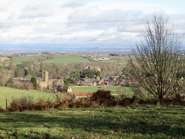
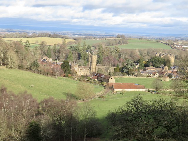
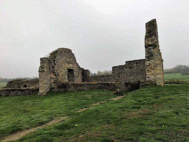
The squat stone tower of St Faith’s Church, more suited to a fortified farmhouse than a house of God, recalled medieval times along the Welsh Borders when village folk at the mercy of Welsh or English marauders were often in need of such a refuge.

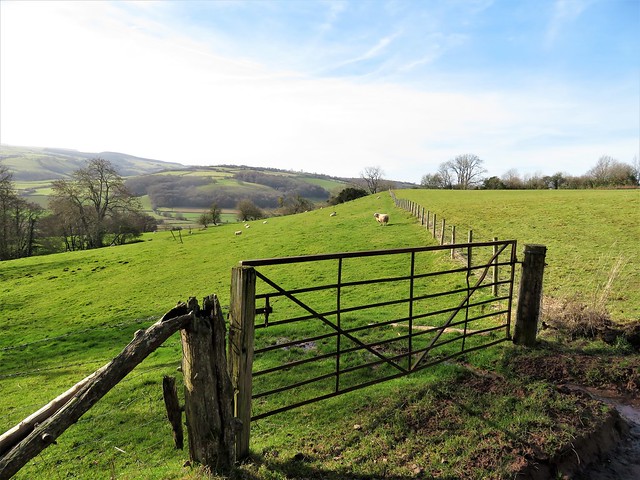
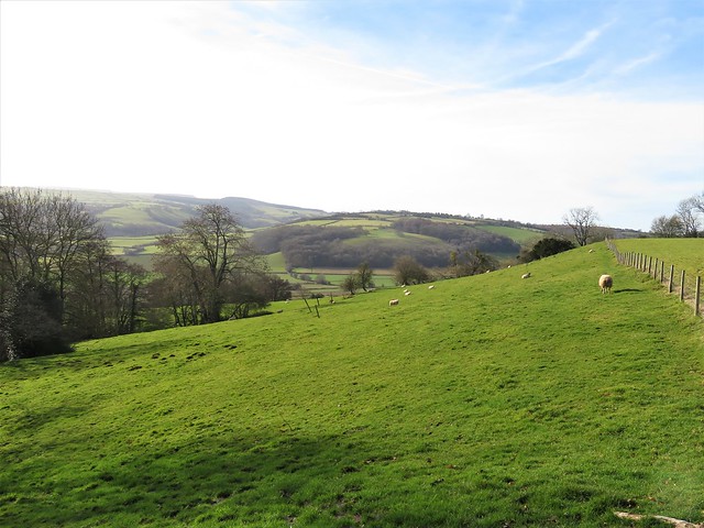
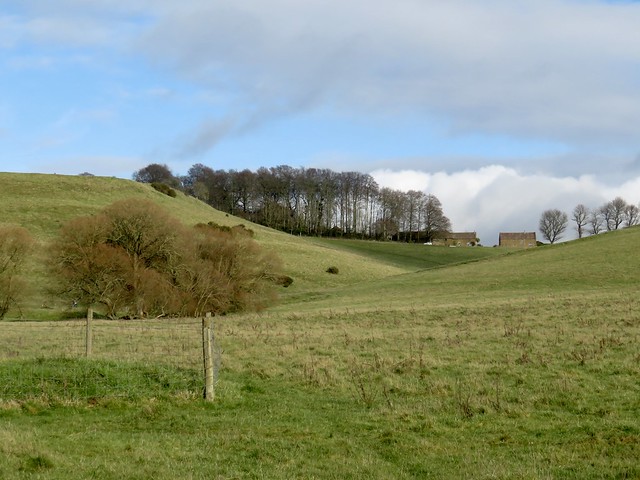
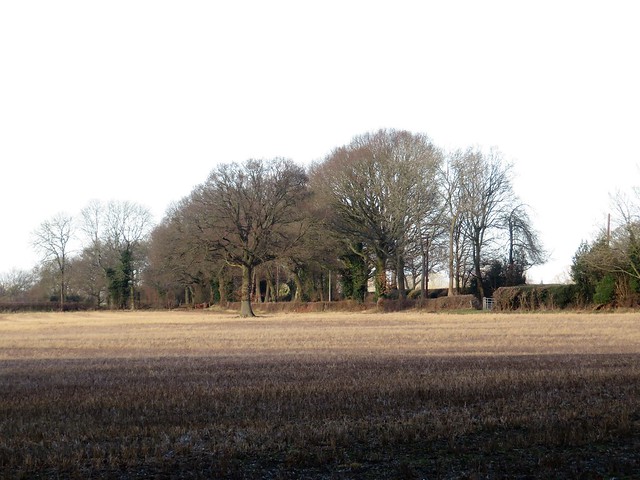
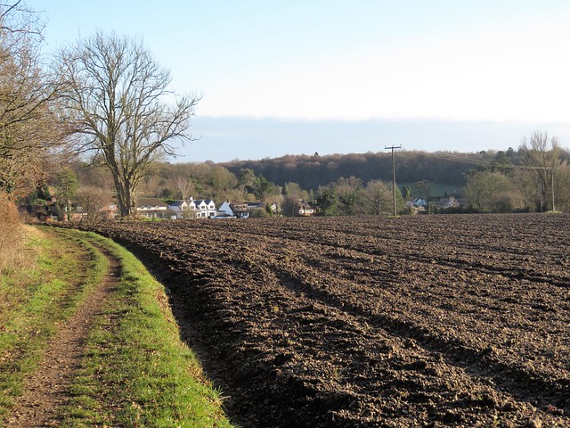
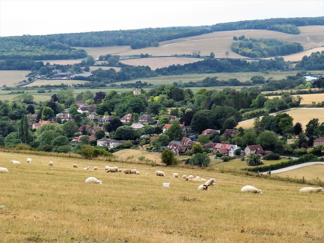
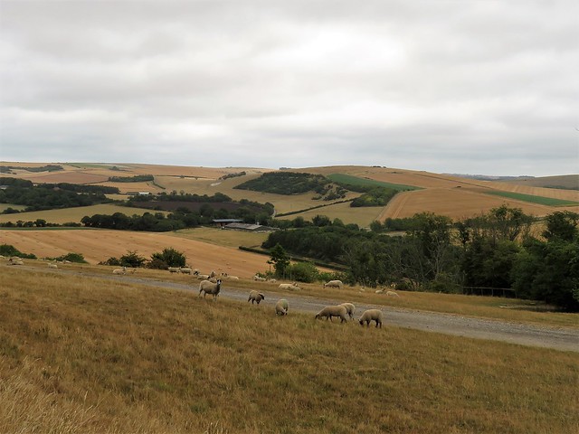
In the steep fields north of Dorstone the barns at Llan Farm were stuffed with hay bales, the shed packed with wintering cattle who stamped and blew as I went by. The ewes, heavy with unborn lambs, were still out in the pastures, their fleeces stained with the dusky red Herefordshire mud.

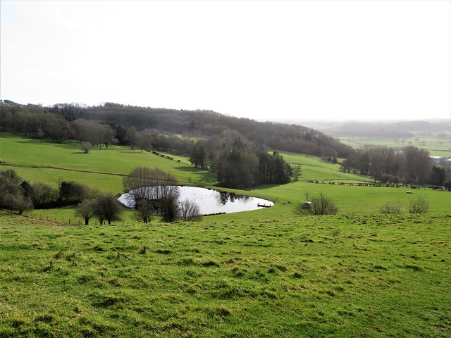
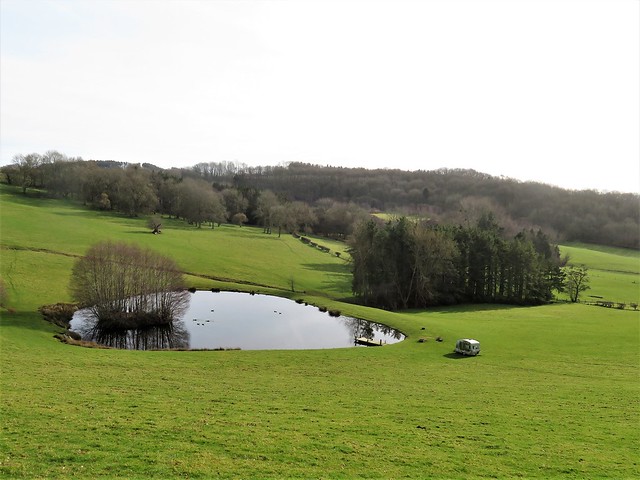
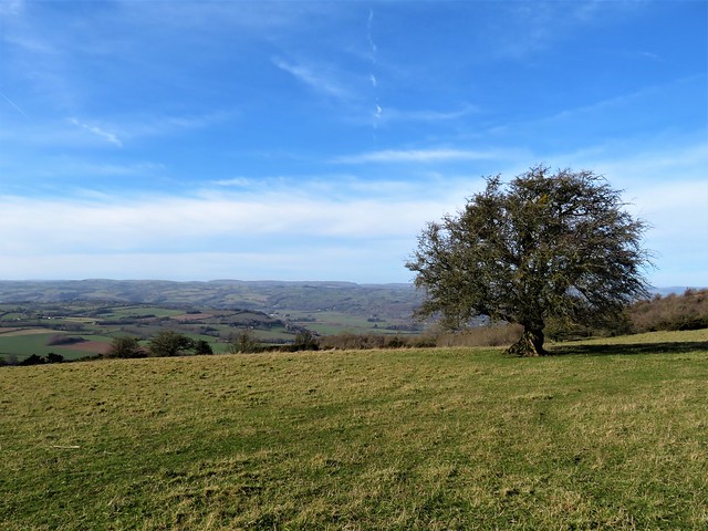
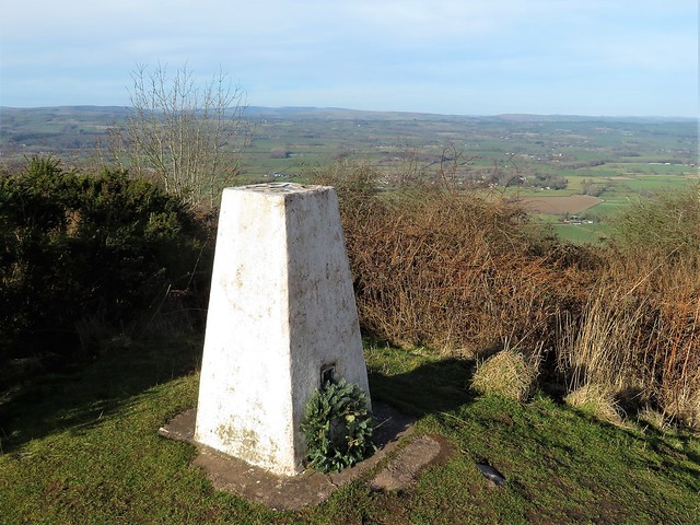
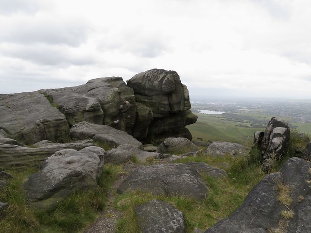
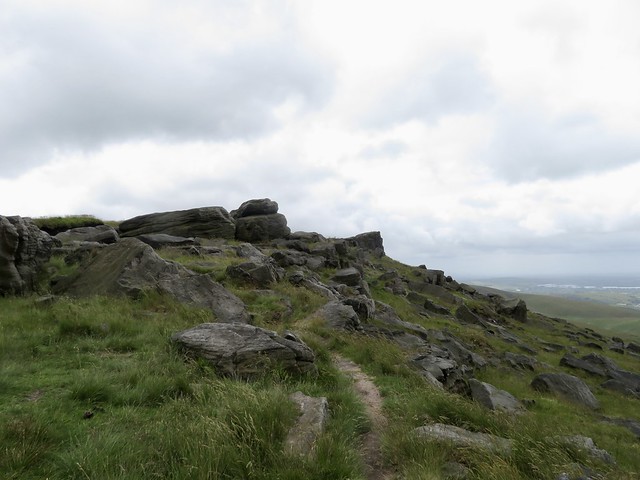
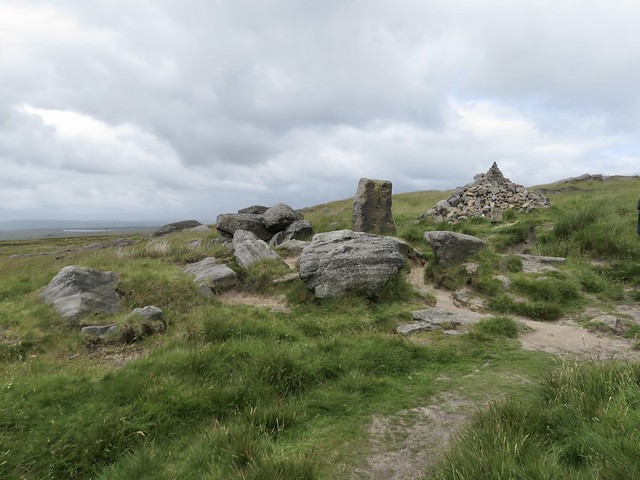
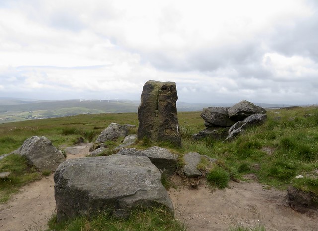
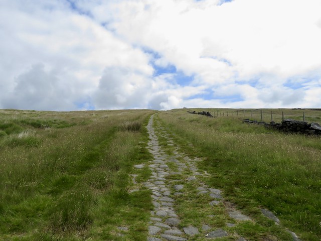
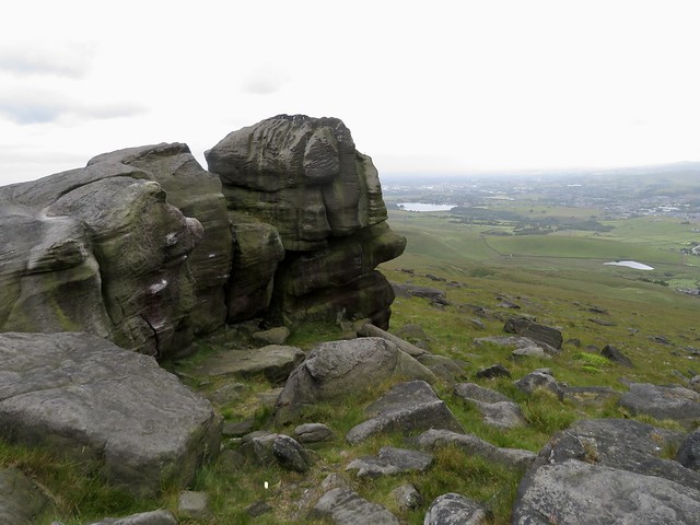
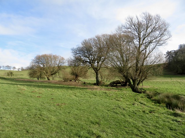
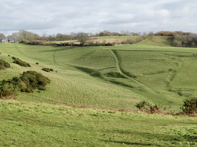
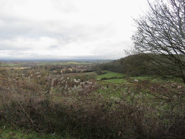
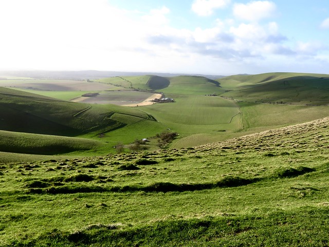
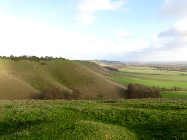
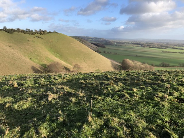
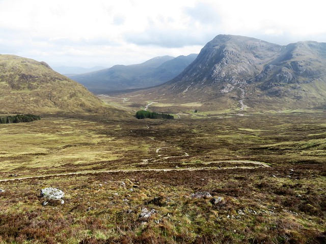
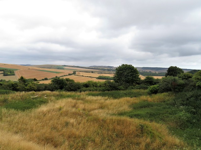
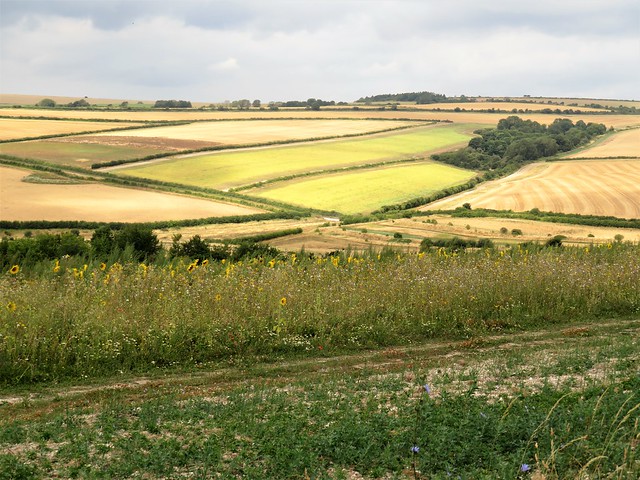
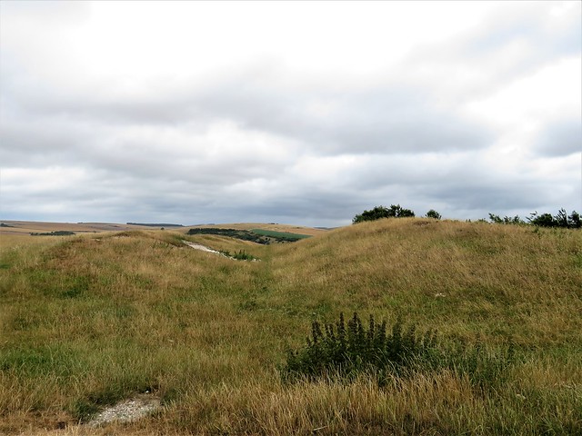
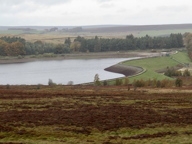
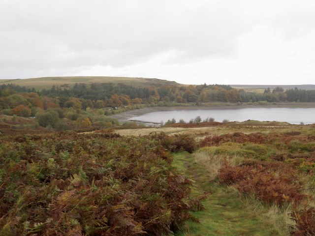
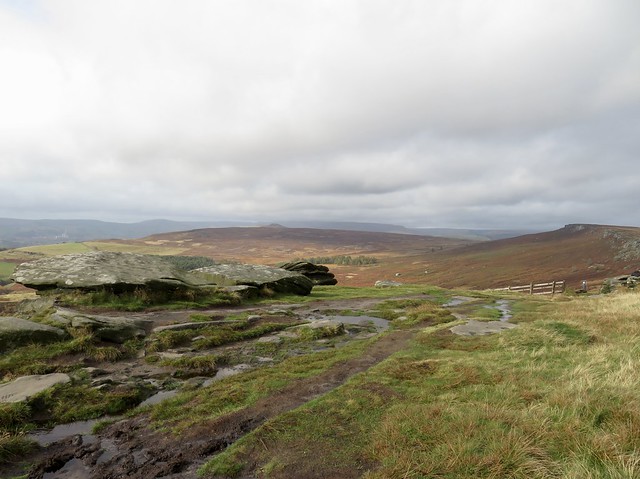
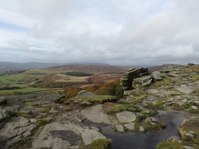
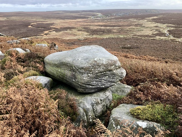
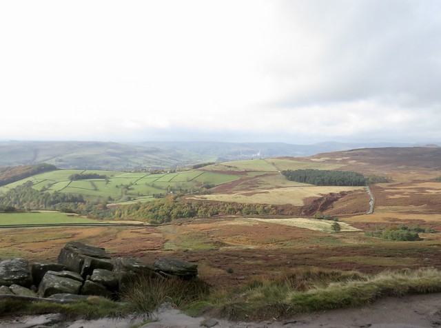
Up at the top of the climb the tangled bracken on Merbach Hill glowed fox brown in the sunlight. A tremendous view opened to all quarters, a patchwork of green farmlands running east to the distant Malvern Hills, south and west to the long ridgebacks of the Black Mountains, sailing against a streaky sky like Phoenician ships with outward-jutting prows.

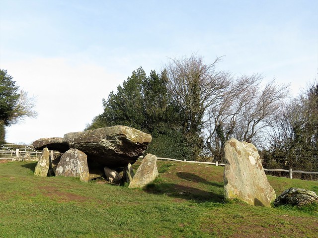
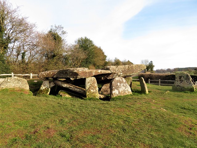
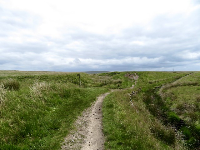
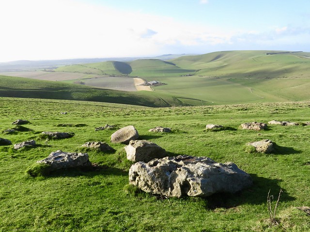
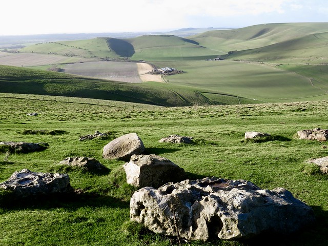
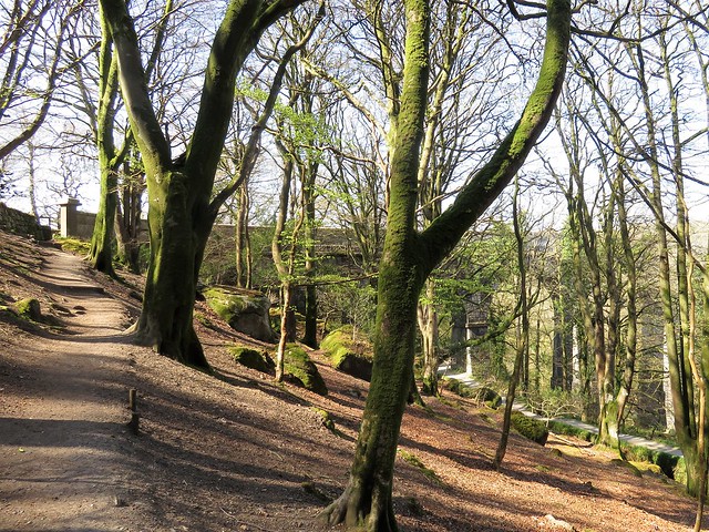
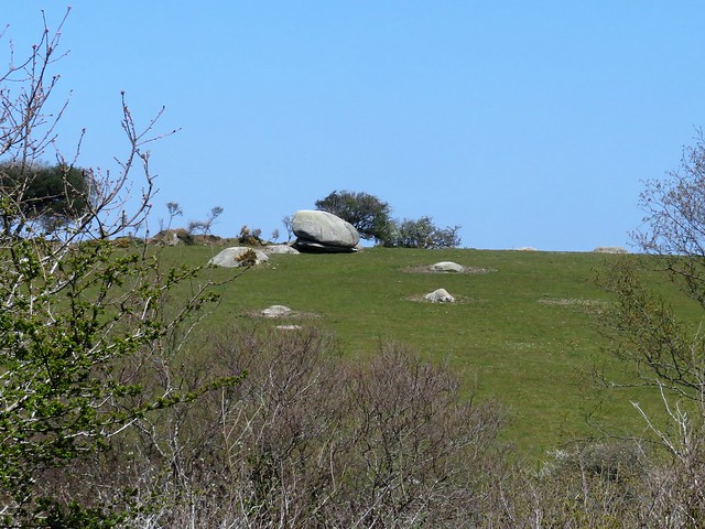
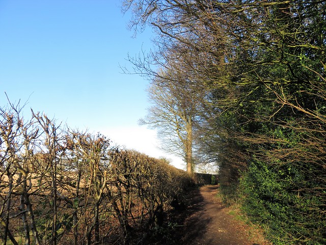
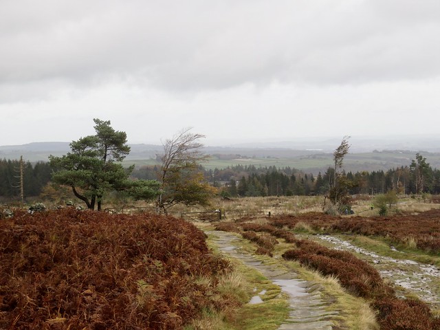
You can’t just turn away from a view like that on a day like this. I sat on the summit and gazed my fill. Then I found a tangly path among the old quarry humps and thorn trees on the hill, leading to a skein of snowdrop-spattered tracks and lanes that landed me by the remarkable 5,000-year-old monument of Arthur’s Grave.

The split capstone of this ancient tomb, twenty-five tons of solid sandstone, was dimpled with hollows. Cup marks incised for inscrutable purposes by the tomb builders – or the dents made by the elbows of Giant Arthur as he fell in kingly combat here? I hoped the tiny boy I spied playing hide and seek in Arthur’s Grave was being told both tales, and many more, by his mother watching near the fence.

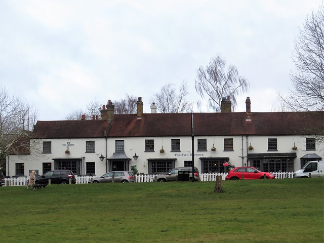
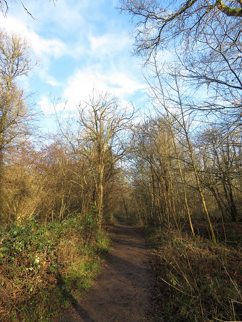
I hopped over the stile behind the monument and followed the old path down the hill to Dorstone, where the Pandy Inn had a log stove hot enough to warm a frozen giant, let alone a weary walker.

How hard is it? 5¾ miles; easy/moderate; field paths.

Start: Village car park, Dorstone, Hereford HR3 6AN (OS ref SO 315415)

Getting there: Bus T14 (Hereford); Sundays, Bus 39A
Road: Dorstone is on B4348 between Hereford and Hay-on-Wye

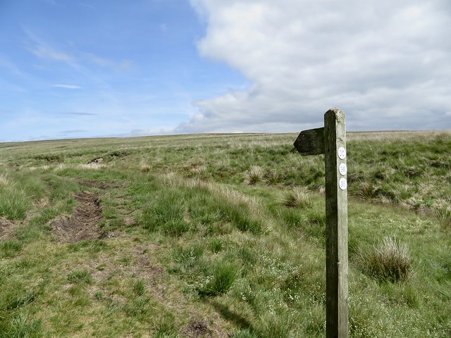
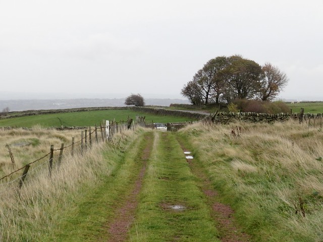
Walk (OS Explorer 201): Pass village green, phone box and church. Cross B4348 (315418); on beside recreation ground; cross brook, then old railway (315421). Far left corner of field; cross Spoon Lane (315424, yellow arrow/YA). Far left corner of field; left (315426) on Llan Farm drive. In 100m right (stile, arrow); bypass farmyard to cattle shed (314428). Right up track; cross Scar Lane (312433); on up fields (YAs, stiles) to Arthur’s Stone Lane (312437). Left; on right bend, ahead (310439) on stony track (hedge on left) for 900m to Merbach Hill trig pillar (304447). Right on path through bracken; in 150m at Wye Valley Walk post, ahead to gate (310448). Right along fence; in 250m, left (310445, gate, blue arrow) on green lane. In 500m, ahead down road (315443); in 400m at Hollybush Cottage, right (319441, fingerpost). Cross stream; up by wood; at gate on left (319440), right up slope to stile (319439). Ahead/south to Arthur’s Stone Lane (319431); left to Arthur’s Stone (319431); right (stiles) down field path to Dorstone.

Lunch: Pandy Inn, Dorstone HR3 6AN (01981-550273, thepandyinn.co.uk)

Accommodation: Zakopane House BG&B, adjacent to Pandy Inn (pandyinnbandb.co.uk)

Info: visitherefordshire.co.uk

 Posted by at 06:15
Feb 212023


First published in: The Times Click here to view a map for this walk in a new window
Blackstone Edge - one troll whispers in another's ear 1 Gritstone outcrops of Blackstone Edge 1 the Aiggin Stone and its cairn The Aiggin Stone at Blackstone Edge cobbled Roman road leading to Blackstone Edge Blackstone Edge - one troll whispers in another's ear 2 footpath fingerpost by Rishworth Drain Green Withens Reservoir - municipal architecture in the middle of nowhere fingerpost pointing the way to Baitings Reservoir - but ignore it!

Around Blackstone Edge the gritstone moors roll away, breezy uplands that are a godsend to anyone bent on getting out of the former manufacturing towns of Lancashire and Yorkshire for a good day in the open air.

From White House Inn we crossed the road and followed the broad stony track of the Pennine Way. The path surface had broken down under millions of footfalls into sand and quartz, a creamy, honeyed hue, the components of gritstone disassembled once more after three hundred million years of clinging together.

A short cobbled section of Roman road led up to the Aiggin Stone, a medieval waymark pillar set up to guide benighted or mist-beguiled travellers. From here the Pennine Way rose to Blackstone Edge, a classic gritstone ridge with cliffs jutting westward like ships’ prows. Wind-distorted boulders stood at the edge, weathered to resemble stacks of black pancakes or gossiping trolls, their rough sandy bodies studded with specks of white quartz like globules of fat in coarse salami.

The narrow, stumbly path headed south down a long slope into the rushy declivity of Redmires and Slippery Moss. ‘Standing knee deep in this filthy quagmire,’ Alfred Wainwright wrote with mordant humour in his 1967 Pennine Way Companion, ‘there is a distinct urge to give up the ghost and let life ebb away.’ But thing have changed since Wainwright’s day. Nowadays it’s a dry-shod walk on a path of flagstones salvaged from the floors of redundant textile mills.

Beyond Slippery Moss the M62 cuts the moor with a roar and rush. We turned away to follow a trickling leat of water across the peat and heather to Green Withens Reservoir, a classic of municipal sandstone architecture, built in the 1880s in the middle of nowhere to supply Wakefield with water. From here the path ascended the dimpled face of Green Withens Edge before meeting Rishworth Drain and curling back towards the Aiggin Stone.

As we came level with Rishworth Drain a big bird of prey, its pale wings tipped with black, came flapping easily along the waterway. ‘Hen harrier!’ we exclaimed on the same breath. We watched spellbound as it launched itself downwards and pounced into a grass tuffet, then resumed its flight having missed its grab. Hen harriers are wonderfully efficient hunters, but even they have their off days, it seems.

How hard is it? 7½ miles; moderate; moorland tracks. Pick a fine day.

Start: White House Inn, Blackstone Edge, Halifax Road, Littleborough OL15 0LG (OS ref SD 969178)

Getting there: Bus 587 (Rochdale-Halifax).
Road – White House Inn is on A58 (Littleborough-Sowerby Bridge)

Walk (OS Explorer OL21): Cross road; follow Pennine Way/PW, then path beside Broad Head Drain. In 800m, left through gate (970169); up cobbled road to Aiggin Stone (974170). Right on PW (gate, National Trail acorn), southward by Blackstone Edge and Redmires. In 1¾ miles PW turns right to cross M62 (984147); don’t cross, but keep ahead with motorway on your right; then follow path on right of leat (986148) to Green Withens Reservoir (991160). Right along two sides; 100m beyond far end, right beside leat (991165). In 150m, left across leat. Follow path across moor, up Green Withens Edge; near the top, left on crossing track (991169). In ½ mile at Rishworth Drain (986172), fingerpost points right (‘Baitings Reservoir’); but keep ahead here. In 700m left across footbridge by pool (982176); bear back left on rutted Old Packhorse Road to Aiggin Stone; retrace steps to White House Inn.

Lunch: White House Inn, Blackstone Edge (01706-378456, thewhitehousepub.co.uk)

Accommodation: Premier Inn, Newhey Road, Rochdale OL16 3SA (0333-321-8449, premierinn.com)

Info: moorsforthefuture.org.uk; yorkshire.com

 Posted by at 04:59
Feb 112023


First published in: The Times Click here to view a map for this walk in a new window
Looking north over Montacute from Hollow Lane footpath 1 Liberty Trail descends a ferny holloway Willows along the Witcombe Valley brook 1 Looking north over Montacute from Hollow Lane footpath 2 lumps and bumps of abandoned medieval village of Witcombe Looking north over Montacute from Hollow Lane footpath 3 GV of wintry country from Ham Hill folly tower on St Michael's Hill Willows along the Witcombe Valley brook 2 Witcombe Valley

The Celtic tribe known as the Durotriges were expert builders of hilltop forts. The stronghold they dug and mounded on Ham Hill is a remarkable structure. It encompasses more than two hundred acres of south Somerset hilltop within a huge L-shaped enclosure of steep-sided double ramparts. On this windy winter morning the views were sensational, taking in dozens of miles of low-lying farmland bounded by blue and grey hill ranges – Mendip, Blackdown, Quantock and the Dorset downs. The local sandy limestone, known as hamstone, is a glorious deep gold, much prized by builders down the centuries.

A hungry buzzard wheeled and mewed overhead as I followed the brambly ramparts south off the hill through lumps and delvings of many centuries of quarrying. At the foot of the ridge lay the quiet green valley of Witcombe, where mown paths led north again past the grassy outlines of a medieval village, abandoned when sheep farming became more profitable to landlords than the arable husbandry of the peasants.

On the far side of the ridge I found a path edged with emerging daffodils. Last autumn’s beechmast crackled underfoot as I dropped downhill towards Montacute. The village lay below in clear wintry sunshine, a perfect composition, church tower, cottages and great Elizabethan mansion all glowing in golden hamstone.

A quick pint of Palmers and a bowl of leek-and-potato soup in the conversational, dog-friendly Phelips Arms, and I made for the tree-smothered tump of St Michael’s Hill beyond the handsome old Cluniac priory gatehouse on the western edge of Montacute.

‘Mons Acutus, Mont Aigu’ – the abrupt profile of the hill gave its name to the village. Legend says that the Devil appeared in a dream to Tostig, standard bearer to King Cnut, ordering him to dig on the hill. A blacksmith was told to get on with it, and promptly unearthed a life-size crucifix of pure black flint.

The Norman castle built on the summit was replaced by a chapel, itself supplanted in 1760 by a phallic folly tower of hamstone. I climbed the steep holloway to the summit and got a memorable prospect over sunlit lands where Blakean shafts of rain radiated out of the clouds as though to spotlight hidden treasure below in the gleaming floods of winter.

How hard is it? 5 miles; easy, but steep climb up St Michael’s Hill

Start: Ham Hill Country Park, near Stoke-sub-Hamdon TA14 6RL (OS ref. ST479168)

Getting there: Country Park signed from Stoke-sub-Hamdon (signed off A303 between Ilchester and Ilminster)

Walk (OS Explorer 129): Return to road. Left; pass right fork (478166); in 100m right to fingerpost (‘Monarch’s Way’/MW); left, following uppermost path (MW) for ¾ mile to T-junction (485159). Right downhill (‘Liberty Trail’). Near bottom, left (486154, ‘Witcombe Lane’); up valley; across road (492163). Follow footpath (fingerpost) above Hollow Lane; in 500m left along Hollow Lane (497166) into Montacute. Left down South Street (499168); at church and King’s Head PH, left (497169). Through gate; right (‘Hedgecock Hill’); follow MW up St Michael’s Hill. In 200m fork right (494168); in 50m right through gate; left up steep holloway, then path to summit tower (494169). Return down path; at purple arrow fork right; path descends to field. Ahead; in 100m sharp left (494170, purple arrows) downhill. Through gate; keep ahead; left beside stream. In 200m right (491169, stile, MW); in 30m left; follow track. In 250m, gate onto open ground (489169). Follow wood edge; in 700m right (481166, gate); right past circular stone; fork left on MW to car park.

Lunch/accommodation: Phelips Arms, Montacute TA15 6XB (01935-822557, phelipsarms.co.uk)

Info: friendsofhamhill.org; visitsouthsomerset.com; nationaltrust.org.uk/montacute

 Posted by at 03:50
Feb 042023


First published in: The Times Click here to view a map for this walk in a new window
White Horse on Milk Hill Sarsen stones on Milk Hill Wansdyke Sarsen stones on Milk Hill 2 view west from Milk Hill looking east along the downs from the summit of Knap Hill 1 looking east along the downs from the summit of Knap Hill 2

It was one of the mightiest winds I’d ever encountered, and it tore across the Wiltshire downs from the west like a mad thing. I was smashed in the face and shoved around as I climbed the flank of the Neolithic long barrow called Adam’s Grave, and when I got to the top the blast of the wind sent me staggering sideways.

Maybe it was the unquiet ghost of Giant Adam, mythical occupant of the 5,000-year-old tomb, or maybe the bellicose spirits of the Anglo-Saxon warrior slain in a great battle here in 592 AD; but something up here was stirring the air into a maelstrom. My eyes were so blurred with wind tears I could hardly take in the magnificent view across the Vale of Pewsey, its brilliant green pastures and glittering floodwater lit up by the low winter sun.

I turned full face into the wind and battled along the slope of Walkers Hill. People with their backs to the gale came scudding by, hair and coat tails flapping, cheeks beaten red, gasping and nodding their complicity in outfacing the weather.

A turn of the hill brought the Pewsey White Horse into view, a slender-legged beast 180 feet tall with an elongated nose and a cropped tail twitched high. Farmer Robert Pile of Alton Barnes down in the vale below cut it out of the turf in 1812, and his handiwork has survived the two intervening centuries pretty well.

A crowd of fifty starlings went rushing across the slope, wings rigid, surfing the wind as one entity. I turned uphill past hissing gorse bushes and went east along the old bank and ditch of Wansdyke, a great groove thirty feet deep in the landscape. Wansdyke runs for sixty miles between the Hampshire Downs and the British Channel, but no-one knows the purpose of the Dark Ages folk who built it so tall and strong.

A broad green trackway took me down into the shelter of the valley once more. Beyond stood Knap Hill with its ceremonial ramparts and dimpled crown. I let the wind propel me up to the crest. There I revolved, soaking up the view of sun-gilded downland, marvelling at the energy of our ancestors who made their mark so forcefully all over these chalk hills of the west.

How hard is it? 4¾ miles; easy; downland tracks.

Start: Pewsey Downs car park, near Alton Barnes, SN8 4LU approx (OS ref SU 116637)

Getting there: On minor road between Alton Barnes and East Kennett (signed off A4 near Avebury)

Walk (OS Explorer 157): Cross road; through gate; immediately left through gate; follow clear grass path to top of Adam’s Grave (113634). Turn back across dip; bear left on path, passing above White Horse (107637) and on (‘Mid Wilts Way’/MWW; ‘White Horse Trail’/WHT). In 500m pass gorse patch on right; beside lone tree on left (101638), bear right uphill past another lone tree. Bear right to gate (101639, MWW, WHT); on to next gate; bear left with fence on right. In 450m, right through gate (102645, MWW, WHT); follow fence on right. In 200m through gate (103646); right along Wansdyke for 1 mile to T-junction (118648). Right on rutted track for ¾ mile to Pewsey Downs car park. Through car park, past stones and barrier; in 100m, left (117636, gate, fingerpost); fork right up Knap Hill. Half left off summit (122636) down to gate (123639); sharp left back to gate and car park.

Lunch: Barge Inn, Honey Street, Pewsey SN9 5PS (01672-851222, thebargeinnhoneystreet.uk)

Accommodation: Circles Guest House, 15 High St, Pewsey SN9 5AF (07769-018643, circlesbandb.com)

Info: visitpewseyvale.co.uk

 Posted by at 01:51
Jan 282023


First published in: The Times Click here to view a map for this walk in a new window
River Great Ouse near Stantonbury Wharf Great Linford Manor Great Linford Manor Park River Great Ouse near Stantonbury Wharf 2 Grand Union Canal near St Peter's Church 1 ruins of St Peter's Church 1 ruins of St Peter's Church 2 Grand Union Canal near St Peter's Church 2

A misty winter morning in north Buckinghamshire, with white wraiths rising from the many waters of the Ouse Valley – the Grand Union Canal, a mosaic of gravel pit lakes, and the River Great Ouse itself, fatly curling through its meadows. The cold seething air lent a feeling of insubstantiality to the creamy limestone pavilions of square-built Great Linford Manor in its landscaped park. We headed across the dewy grass to the Grand Union Canal and turned west along the leaf-strewn towpath.

Ripples, Dancing Ducks, and Eye of Horus lay moored to the bank, snugged down for winter. The narrowboats that chugged by were helmed by neatly bearded men of responsible demeanour, a world away from the randy rapscallions that skippered the working boats in the Grand Union’s Victorian heyday.

Such was their reputation, anyway. Rogues or respectable folks, they carried Britain’s commerce up and down the country. Today the canal is all about leisure cruising, the brightly painted narrowboats lending a splash of colour to this morning’s wintry shades of olive green water and ashy grey willows.

At Stantonbury Wharf gravel barges used to load up for the journey down the canal to London. From here we headed across the fields to where the ruins of the Norman Church of St Peter stood above the humps and bumps of the abandoned medieval village of Stantonbury. Rustic rumour had it that village and church had been cursed to ruin by a werewolf. The true cause was more prosaic but just as definite – the local lord replaced his tenants with sheep in Tudor times, and the peasants of Stantonbury were ejected from their homes.

Beyond the church and the hollows where the manor house once stood, we rejoined the Grand Union Canal and followed it down to the new estate of Stantonbury Park before setting back along an old railway path.

Squirrels dashed among the bare branches and a slender grey heron stood as still as a statue as we went by. All was very quiet in the winter afternoon. It was hard to believe that the city of Milton Keynes with its quarter-million people lay just beyond the ash trees and willows that lined our homeward path.

How hard is it? 4½ miles; easy; field paths, canal towpath

Start: Milton Keynes Arts Centre car park, Great Linford Manor Park, Milton Keynes MK14 5DZ (OS ref SP 851422)

Getting there: Bus 21 CMK (Newport Pagnell–Lavendon)
Road: Great Linford is signed off St Leger Drive (off V8 Marlborough Street)

Walk: From car park, pass between pavilions. Bear left of Manor House in front of you, then right to pass Manor House. Follow parkland paths to right, parallel with Grand Union Canal, to bridge (854425). Cross canal; left down steps to towpath; right along towpath. In 1¼ miles at Stantonbury Wharf, under bridge (846424); in 200m bear right on cycle path through fields. In 500m, at St Peter’s Church ruin (836427), left through gate at southwest corner, past information board. Follow grass path up open ground to canal (836424). Right along towpath for nearly 1 mile to go under Bridge 72 (832413). Right up steps, right across canal, past New Inn. In 100m cross road; down steps; along Swan Way multi-user path. In 1¼ miles, just before bridge over canal, right (847422, ‘Great Linford’ fingerpost) down to path through park; back to Arts Centre car park.

Lunch: Nag’s Head, 30 High Street, Great Linford MK14 5AX (01908-607449, nagsheadmk.com)

Accommodation: Swan Revived Hotel, High St, Newport Pagnell MK16 8AR (01908-610565, swanrevived.co.uk)

Info: destinationmiltonkeynes.co.uk

 Posted by at 07:50
Jan 212023


First published in: The Times Click here to view a map for this walk in a new window
Higher Tramway through the Luxulyan Valley woods Treffry Viaduct in the woods 1 path to the top beside Treffry Viaduct Treffry Viaduct in the woods 2 old winding gear for the incline in the woods railway through Luxulyan Valley eratic boulder off the Saints Way Treffry Viaduct spans the Luxulyan Valley

Birdsong was loud in the trees of the Luxulyan Valley on a morning of brilliant sunshine. Among the mossy trunks of oak and beech the giant legs of an aqueduct stepped across the ravine, a scene from a post-apocalyptic dream.

All over Cornwall, the landscape goes hand-in-hand with the architecture of long-dead industries, most notably here in the twisting valley that winds down towards the china clay port of Par. When Joseph Treffry built the structure that served as aqueduct and viaduct across the Luxulyan Valley in 1839-42, it was just one piece in a great jigsaw of tramroads, watercourses and railways this powerful engineer and industrialist created to link up his copper and tin mines and granite quarries with the ships and quays he operated down on the coast.

Nowadays the Luxulyan Valley is a showpiece of beautiful woodland where liverworts and mosses thrive in the stonework of Treffry’s redundant tramways and water gurgles seductively along his abandoned leats.

From the eastern end of the viaduct we followed the granite setts and rusted rails of the Higher Tramway beside the ferny channel of Carmears Leat, then down a long steep incline. Wagons of coal for the steam engines that pumped out the mines were drawn up this tremendous slope; tin ore rattled down in the opposite direction, heading for the port.

At the foot of the incline a chalky grey lane shadowed a tangle of railway lines along the flat valley bottom where glossy horses grazed and the stream beds sparkled with chips of mica. A swift blast of traffic fumes and noise at the level crossing in St Blazey, and we were heading away and up through quiet beechwoods on the Saints Way path.

Dark Ages pilgrims and holy wanderers used this ancient route across the Cornish peninsula to shorten the perilous sea journey from Ireland to the Continent. The Way led us north across undulating farmland with glimpses of the sea and of the Cornish Alps, pyramidal china clay tips, once dazzling white, now greening over.

Soon a run of stone arches, pale grey and ghostly, floated into view above the trees of the Luxulyan Valley, and we dropped down to cross the Treffry Viaduct in woodland now hushed with the approach of nightfall.

How hard is it? 5 miles; easy; woodland, farmland tracks; many stiles on homeward leg.

Start: Black Hill car park, Luxulyan PL24 2SS approx (OS ref SX 059572)

Getting there: Luxulyan Valley is signposted from Luxulyan (signed from A390 at St Blazey, A391 at Lockengate).

Walk (OS Explorer 107, interactive map at luxulyanvalley.co.uk): Up steps by info boards; right along leat; in 30m, left up woodland path to Treffry Viaduct (057571). Left; in nearly 1 mile, at foot of incline (070563), ahead along lane. Follow lane; then from Ponts Mill (073561) follow old railway track south to A390 in St Blazey (071551). Right; in 100m, right (‘Luxulyan’). In half a mile, right (062553, ‘Saints Way’/SW) up woodland path. In 100m bend right along edge of woodland. Follow SW (cross logo, yellow arrows/YA) past Nanscawen (060554), Great Prideaux (058558), Trevanney Farm (056566) and on across fields for 1½ miles. Descend into valley. Just before bridges, right off SW (053574, YA). In 50m cross stile into field; in 100m, left at cross-paths to gate onto old tramway (055573). Right across Treffry Viaduct and retrace outward route to car park.

Lunch: King’s Arms, Bridges PL30 5EF (01726-850202, kingsarmsluxulyan.org)

Accommodation: Old Vicarage, Luxulyan PL30 5EE (01726-858753, tovl.co.uk)

Info: Friends of Luxulyan Valley (luxulyanvalley.co.uk)

 Posted by at 05:13
Jan 142023


First published in: The Times Click here to view a map for this walk in a new window
wintry plough and hedge, approaching Belsize near Chipperfield 1 Two Brewers Inn, Chipperfield Homeward path through Woodman's Wood near Chipperfield frosty stubble field near Chipperfield green lane approaching Belsize near Chipperfield winter trees near Chipperfield wintry plough and hedge, approaching Belsize near Chipperfield 2 winter trees near Chipperfield 2

A grey, cold and blowy day in south Hertfordshire, with the sky set to clear towards the end of the short winter’s day. We started out across the wide recreation ground at Chipperfield, where the village was going about its business – walls being mended, fences put right, young voices yelling in the school playground and a man mowing the damp green circle of the cricket field.

Chipperfield Common was a tangle of holly and laurel under pine, oak and silver birch. A natural saddle between two stems of an old oak had been polished black and shiny by the feet of countless climbing children.

A track sticky with the characteristic dark mud of winter led south by Hillmeads Farm where a horse snickered and hooves rattled on a hard track somewhere out of sight. This corner of Hertfordshire gives the impression of secret country, where farmhouses and barns lie hidden in clefts between two low ridges or behind a humpbacked wood.

Beyond Commonwood we joined the Chiltern Way path and caught a glimpse of red brick Great Sarratt Hall, surely the model for ‘Sarratt’, the training school and interrogation centre for well-bred spies that John Le Carré nicknames ‘the nursery’ in his George Smiley novels.

Irresistible, the thought of Old Craw the profane Australian lecturing the ‘monsignors’ and ‘your Graces’ in the bowels of the hall, or Jim Prideaux and his sniper’s rifle creeping through Rosehall Wood to take out the mole and traitor Bill Haydon.

In a field among horses in winter coats, we were struck still and silent by the spectacle of two foxes racing past, a vixen pursued by a big dog fox with a white tip to its tail. They crossed the field at an easy canter, the vixen slipping through the hedge and the dog turning away as though entirely satisfied with his entertainment.

Below Rose Hill Farm a tractor was cutting the leafless hedges into a wildlife-friendly A-shaped profile, well before nesting season. A jay gave out its harsh tearing complaint of a call from a copse before swooping away low to the ground with strong quick wing beats and a flash of white rump.

A gleam of weak sun slipped between the clouds, a crack of ice blue broadened across the sky, and instantly the hazels and field maples along the homeward path were a-twitter with goldfinches and long-tailed tits, making the most of the last hour of daylight.

How hard is it? 5½ miles; easy; waymarked trails

Start: Village green car park, Chipperfield, Hemel Hempstead, Herts WD4 9BS (OS ref TL 045015)

Getting there: Bus 352 (Watford-Hemel Hempstead)
Road: Chipperfield is signed from A4251 in Kings Langley (M25, Jct 20)

Walk (OS Explorers 182, 172): Cross recreation ground, keeping left of old chapel. Head south across Chipperfield Common. In 500m at far side, ahead through barrier (042011, ‘Sarratt Parish Footpath’). In 250m at lane, ahead (042008, ‘Commonwood’) past Hillmeads and on. In 150m fork left (042005); at road by Dellfield House dogleg right/left; up steps (043001, ‘Sarratt Green); on to road at Old Forge (040999). Dogleg right/left; follow Moor Lane for 400m, right (037997, ‘Chiltern Way’/CW). Follow well marked CW for 2¼ miles via Rose Hall Farm (031005), road at Bragman’s Farm (027006), right/left dogleg at Newhouse Farm (022007, ‘Flaunden’), road at Flaunden (018009), T-junction at Black Robins Farm (020011) and Lower Plantation. At Holly Hedges Lane (024016), right on Hertfordshire Way/HW for 1½ miles back to Chipperfield.

Lunch/Accommodation: Two Brewers, Chipperfield WD4 9BS (01923-265266, chefandbrewer.com)

Info: visitherts.co.uk

 Posted by at 05:56
Jan 072023


First published in: The Times Click here to view a map for this walk in a new window
Buchaille Etive Mòr from the Devil's Staircase 1 Buchaille Etive Mòr from the Devil's Staircase 2 white lousewort beside the path Looking across the Allt a’ Mhain stream towards Buchaille Etive Mòr Buchaille Etive Mòr (r.) and Stob a' Ghlais Choire (l.) from the Devil's Staircase 1 Looking down Glen Etive flanked by Buchaille Etive Mòr (r.) and Stob a' Ghlais Choire (l.) Buchaille Etive Mòr (r.) and Stob a' Ghlais Choire (l.) from the Devil's Staircase 2

There’s an air of menace, faint but definite, that clings to the Pass of Glencoe as the road from Fort William threads it between the jagged ridge of Aonach Eagach and the massive, troll-like faces of the Three Sisters of Glencoe. These volcanic mountains are dark and precipitous, giving the impression of hanging threateningly over the road even on a crisp winter day with clear sky and glassy visibility. That haunted feeling may derive from the notorious 1692 Massacre of Glencoe, when dozens of members of the local MacDonald clan were murdered by soldiers billeted in their houses or died of exposure as they fled through a snowstorm to hide in the mountains.

A couple of miles down the glen the mountains draw further back from the road and the atmosphere lightens as the glen broadens. Here we set off from the packed car park at Altnafeadh for a morning’s saunter up the Devil’s Staircase. All right, maybe not exactly a saunter, but certainly not the grim unrelenting grind we’d been led to expect of this ancient cattle droving pass that climbs to the ridge between Glencoe and Kinlochleven.

It was soldiers working as navvies who converted the old hill track into a paved military road in 1752, hauling stones and equipment up and down the zigzag path on the mountainside. They detested the job, and named the road the Devil’s Staircase accordingly. Today a pale sun struck glints of pink and gleams of mica out of the granite rocks. Where the Allt a’ Mhain stream sluiced across, the water rush had scrubbed and smoothed the rocks to a beautiful smooth orange, a very intense colour.

It was one of those ‘watch your step, take the next zig and zag as they come, how long to the top?’ slogs up the Devil’s Staircase, but at last the path smoothed out at the bealach. Here we turned off the West Highland Way onto a narrow stony track that rose across slippery slabs and squelchy black bog to the modest cairn at the summit of Stob Mhic Mhartuin, 400 metres above the floor of Glencoe.

From here the southward view over the glen burst out in all its glory. Twin mountains stood opposite, their volcanic history written in their crumpled faces, Buchaille Etive Beag on the right looking east across the tight-squeezed glen of Lairig Gartain at her big sister Buchaille Etive Mòr. Snow streaked the gullies on Buchaille Etive Mòr, and a party of hikers were outlined against a smoky grey sky as they inched their way towards the summit. A really magnificent view, worth every step of the hike up the Devil’s Staircase.

How hard is it? 3½ miles; moderate hill climb of 418m/1,371ft; stony track to the pass, then hill track to Stob Mhic Mhartuin. Check the weather (mwis.org.uk); choose a clear day for the best views; hill-walking gear advisable.

Start: Altnafeadh car park, Ballachulish, Glencoe PH49 4HY (OS ref NN 221563)

Getting there: Bus 914 (Fort William-Glasgow) – ask to alight at Altnafeadh.
Road: Altnafeadh is on A82 between Glencoe and Kingshouse Hotel.

Walk (OS Explorer 384): From A82 turn north up West Highland Way/WHW, keeping to left of forestry. Climb 259m/850ft up the Devil’s Staircase zigzags to the bealach or pass at 548m/1,797ft. Just before big cairn (216575) at bealach, left off WHW on clear path that becomes rocky, boggy and steep in places. In ½ mile it bends left to climb to summit of Stob Mhic Mhartuin (707m/2,319ft). Return the way you came.

Lunch/Accommodation: Kingshouse Hotel, Glencoe, Ballachulish PH49 4HY (01855-851259, kingshousehotel.co.uk)

Info: visitscotland.com

 Posted by at 05:10
Dec 242022


First published in: The Times Click here to view a map for this walk in a new window
Burpham from the downs Downland view near Upper Barpham farm 2 Downland view near Upper Barpham farm 3 Downland view near Upper Barpham farm 1 Downland view near Norfolk Clump Downland view near Norfolk Clump Downland view near Norfolk Clump 3 earthworks on Wepham Down

Writers love Burpham. Hawk-faced poet and novelist John Cowper Powys lived here early in the 20th century; Mervyn Peake, author of bizarre fantasy Gormenghast, between the wars. Their Gothic imaginings ran free over the green ramparts of the Saxon burh or fortified settlement beside the River Arun, the leper’s squint in the ancient church of St Mary, and the place high on The Knell beyond where a highwayman’s corpse was gibbeted in 1771.

The reedy sound of the church organ followed us away from St Mary’s on this cloudy Sunday morning. We found the old track that led over a rise towards The Knoll with a fine view westward towards Arundel Castle, huge and solid against its trees.

Handsome beechwoods have grown on the downs since Jack Upperton met his comeuppance. This wretched man, a landless labourer well into his sixties, robbed the local postman, but made two stupid mistakes – he was recognised through his disguise, and he spent the proceeds conspicuously. The total take? One pound. For this paltry sum Upperton was hanged, his body tarred and displayed in chains on the down till it rotted away.

Among the beeches of Upper Wepham Wood two youngsters were playing chase round an Eeyore house of sticks. A brace of well-seasoned riders went trotting by with ramrod backs and leathery weather-beaten faces. Conifers scented the cold air with a bracing pinch of resin as we turned along the track to Upper Barpham farm with its large old thatched barn.

In the neighbouring pasture donkeys cropped the grass over the furrows and bumps of the medieval manor and church that once stood here. From the track beyond there was a beautiful view into a deep downland cleft where the farmstead of Lower Barpham lay beside its own field of lumps and hollows. Dispossessed by the change from arable to sheep farming in Plantagenet times, most of the villagers of Barpham had already quit the settlement when the Black Death arrived in 1348 and wiped out those that remained.

A high ridge track, creamy white with chalk, brought us back towards Burpham with superb views towards Arundel Castle and the sea. A pair of red kites scoured the downs, and goldfinches flitted before us through the hedge along the way.

How hard is it? 5½ miles; easy; woodland, downland tracks.

Start: Burpham car park, near Arundel BN18 9RR (OS ref TQ 040088)

Getting there: Rail to Arundel (2 miles)
Road – Burpham is signed off A27 at Arundel railway station. Car park behind George Inn.

Walk (OS Explorer 121): Left past village hall; along fenced path; in 200m left across field, steps to road (040086); right. Right at road (044085); in 40m left (blue arrow/BA) up track. In 500m ahead at junction (048082, gates). In dip, left (049077, fingerpost); in 25m right (BA, Monarch’s Way/MW) uphill. At top over track crossing; on to road (051077); left (BA, MW) through woodland. In ¾ mile, left in dip (062081, BA); in ⅔ mile pass Upper Barpham (067088) to cattle grid (view over Lower Barpham to right). Left at cattle grid(BA); fork right through gate on broad stony track across downs. In ¾ mile at crossroads, right pass metal post (062012) on track which bends left. In ⅔ mile beside Norfolk Clump, ahead (055093, yellow arrow) for 1 mile down to road (044085). Right; in 100m, left (‘Wepham Green’). At West Barn, right to stile; left to gate, steps and road (041088). Right to car park.

Lunch: George Inn, Burpham BN18 9RR (01903-883131, georgeatburpham.co.uk)

Accommodation: The Town House, High Street, Arundel BN18 9AJ (01903-883847, thetownhouse.co.uk)

Info: burphamvillage.co.uk

 Posted by at 00:38
Dec 172022


First published in: The Times Click here to view a map for this walk in a new window
Looking south from Stanage Edge to the White Peak 1 green lane from Fulwood Road Redmires Reservoirs 1 Redmires Reservoirs 2 looking east down the Long Causey approaching Stanage Edge Looking south from Stanage Edge to the White Peak 2 layered gritstone outcrop overlooking Redmires Reservoirs Sheffield Water Board boundary stone at Redmires Reservoirs gritstone boulder with cross-bedding at east end of Stanage Edge cranberries beside the Long Causey Looking south from Stanage Edge to the White Peak 3

After a day of torrential rain, a cold blowy morning had broken over the Dark Peak. Grey clouds rolled east like cannon smoke, and there was a muted light over the moors of the South Yorkshire/Derbyshire border. Neatly built walls of chapel-black gritstone lined the green lane we followed uphill between sheep pastures.

A gate led onto the open moor at Rud Hill, the winding path a glinting trickle of water among bracken and rocks as the moors disgorged yesterday’s rain. There was something bracing and exhilarating about tramping this watery path with the blustery wind in our faces and the three slit-grey eyes of the Redmires Reservoirs coldly winking below.

Down beside the reservoirs it was astonishing to note how far their water levels had fallen during the past summer of drought. These water stores were built up here in the 1830s and 40s after an outbreak of cholera in nearby Sheffield had claimed more than 400 lives. Drinking-water unpolluted by sewage was desperately needed in a city that had doubled in size since 1800 but still relied on medieval drainage.

We stopped to watch a flock of fifty mistle thrushes descend to strip a rowan of its orange berries, then turned along the stony upland track of the Long Causey. Roman soldiers laid it out, packmen and their horses crossed the moors along its cobbled roadway. Today it was runners and walkers who passed the trackside verges where the bright scarlet fruit of cranberry added a dash of colour to the sombre grey of the stone and the foxy brown of the moors.

Stanage Pole stood tall among its rocks, a waymark for travellers since medieval times. Here we crossed from South Yorkshire into Derbyshire. The Long Causey dipped to Stanage Edge and a tremendous southward view across an undulating green valley to where the landscape rose towards the limestone uplands of the White Peak.

The homeward way led along Stanage Edge, a gritstone cliff filled with landscape dramas in its own right. The finely layered rocks had been weathered into faces, towers, animal shapes, stacks of pancakes. Helmeted climbers’ heads popped up over the edge, children jumped yelling off the rocks, and the wind blew everyone inside out. What a wonderful natural playground, halfway between the earth and the clouds.

How hard is it? 7½ miles; easy gradients, but watch your step; stumbly rocks, boggy patches, rough moorland paths.

Start: Fulwood Lane car park, near Norfolk Arms Hotel, SN10 4QN (OS ref SK 285840)

Getting there: Bus 258 (Sheffield)
Road – Fulwood Lane is beside Norfolk Arms, Ringinglow Road, S11 7TS

Walk (OS Explorer OL1): Right along Fulwood Lane. In ⅔ mile at right bend, ahead (277845, ladder stile) on green lane (permissive path). In 400m, through gate onto moor (273845); boggy but clearly trodden path with occasional waymark posts. In 1 mile descend from White Stones (261845 approx) to stile (258849). Left across bridge; left up stony Long Causey (257851). In ¾ mile pass Stanage Pole (247844); in 500m, left along Stanage Edge (241843 – watch your step!) for 1¼ miles to trig pillar (251830). Bear a little left; in 200m drop down through rocks on right (253830); left on path to Upper Burbage Bridge (259830). Left along road (path on left verge). In 1¼ miles opposite forestry plantation on right, left (279834, gate) on moor path. In 400m, just past white ‘gate’, fork right (278838, waymark post) to wall stile (280840). Diagonally across field; stile; across field, keeping right of wall, to Fulwood Lane (285842). Right to car park.

Lunch/Accommodation: Norfolk Arms, Ringinglow Road (0114-230-2197, norfolkarms.com)

Info: peakdistrict.gov.uk

 Posted by at 01:22