Sep 242022


First published in: The Times Click here to view a map for this walk in a new window
looking north-west from The Roaches ridge path south end of The Roaches gritstone outcrops 1 south end of The Roaches gritstone outcrops 2 Tittesworth Reservoir and the country south-west of The Roaches south end of The Roaches gritstone outcrops 3 path to the ridge Doxey Pool the ridge path, looking north lush vegetation on the permissive path into the Black Brook valley Ramshaw Rocks view from the permissive path into the Black Brook valley

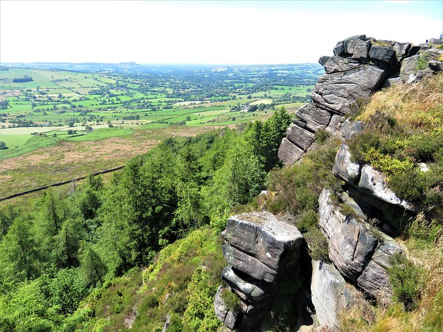
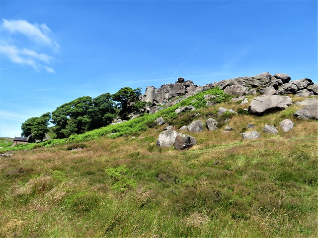
A Sunday morning over the Staffordshire Moorlands, the gritstone outcrops of the Roaches standing out along their ridge against the blue sky, and dozens of climbers already spidering up the inclines and sheer cliffs above.

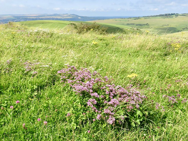
The Roaches are a famous climbing playground, and no wonder. Their gritstone is harsh, abrasive stuff to which a shoe or a hand can safely adhere, and the view from the top over the rolling Staffordshire landscape is sensational. Today it was mostly youngsters climbing in bright reds and blues, their belts clinking with bundles of clips.

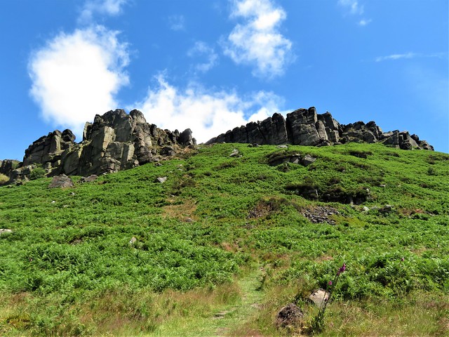
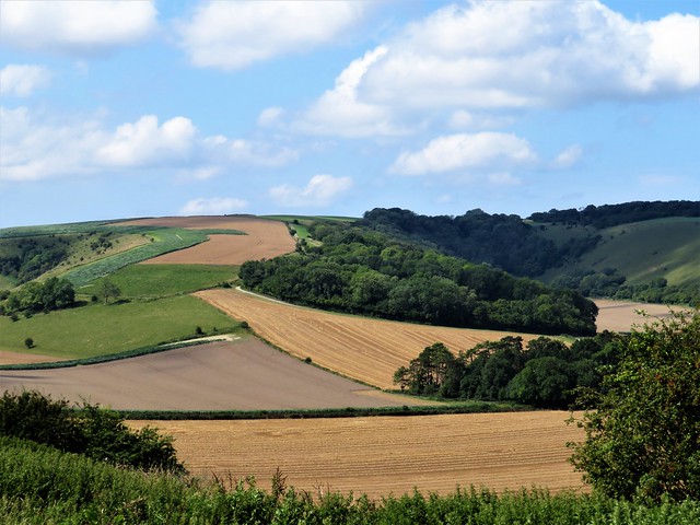
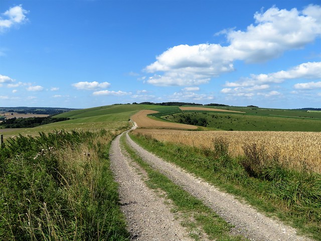
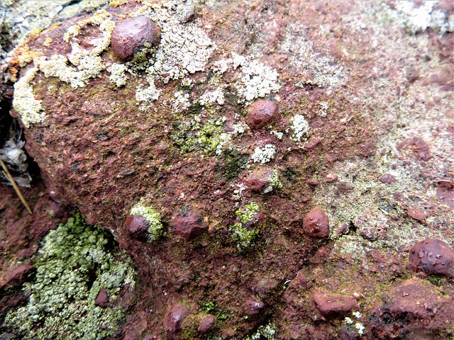
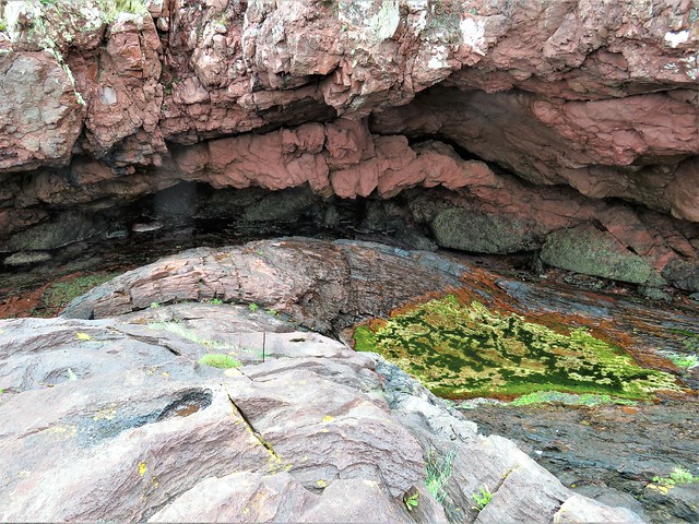
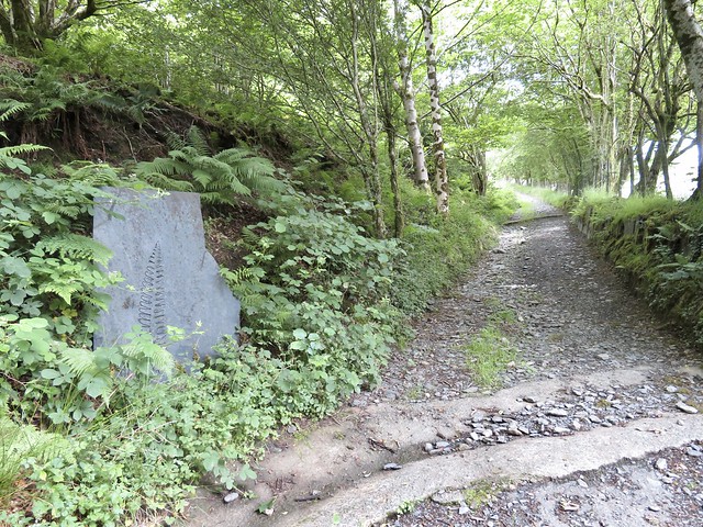
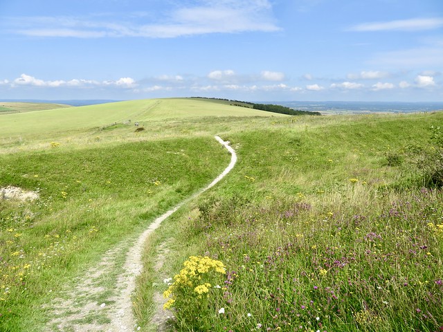
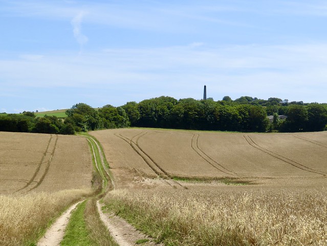
We followed the path among the rocks and up a rough stairway to the ridge. The Roaches rise abruptly from the surrounding countryside. They look formidable from below, and it’s a shock to find yourself so quickly up there, walking on the tops of their gnarled old heads. Part of their grim appeal is the blackness of their aspect, but flakes broken off reveal a cheerful red flush to the rock that lies below.

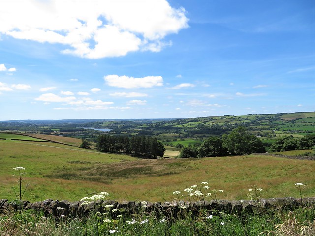
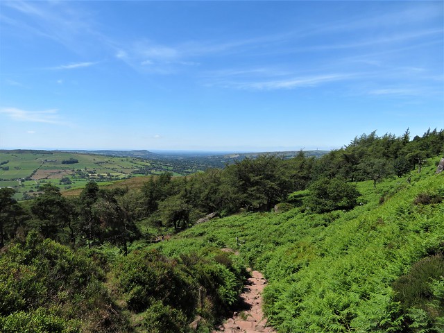
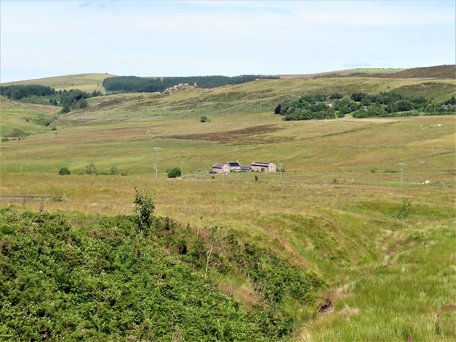
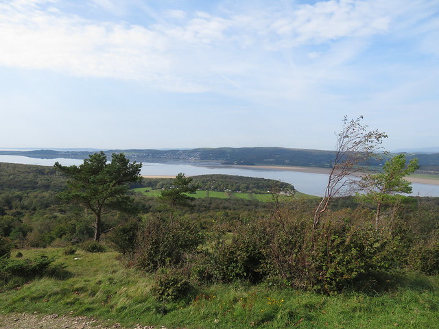
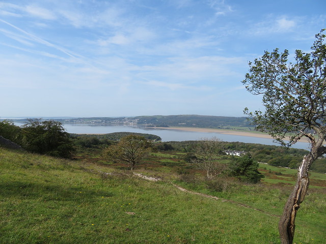
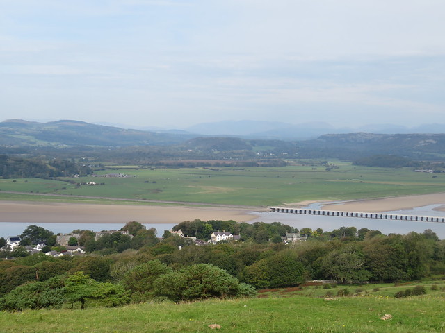
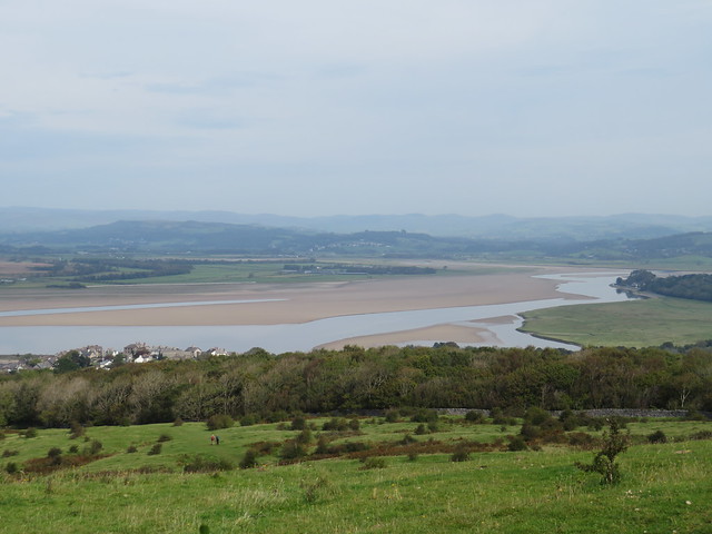
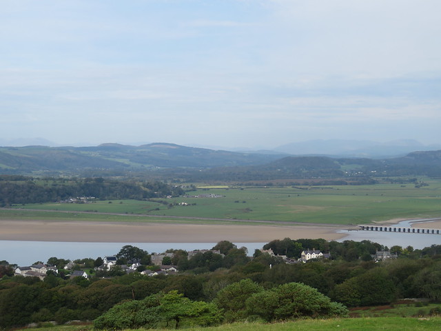
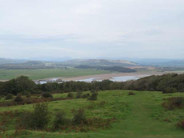
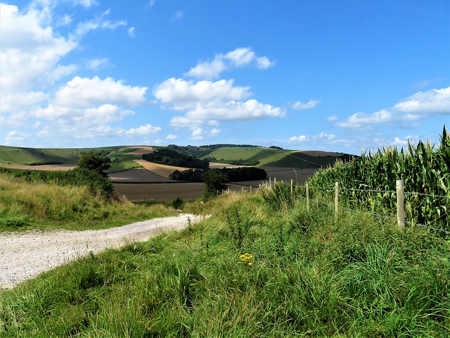
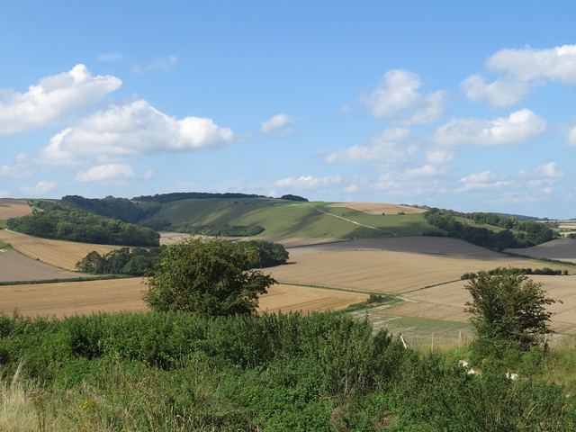
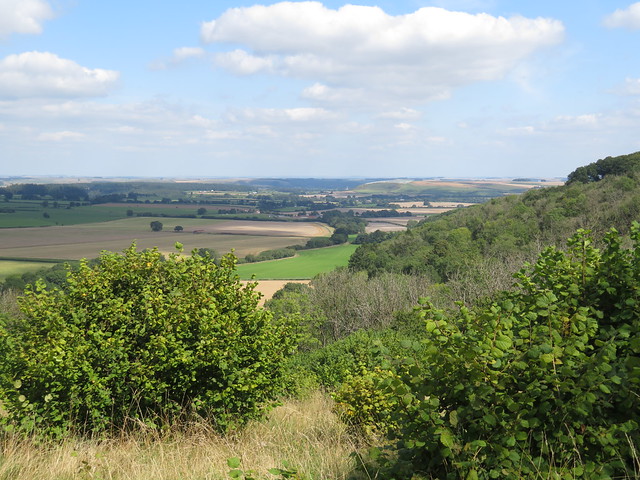
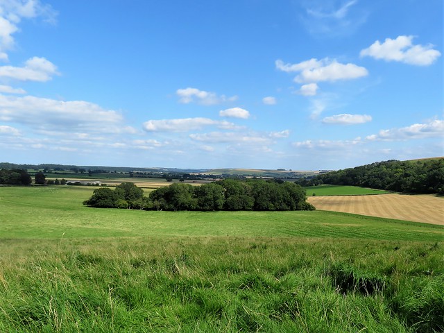
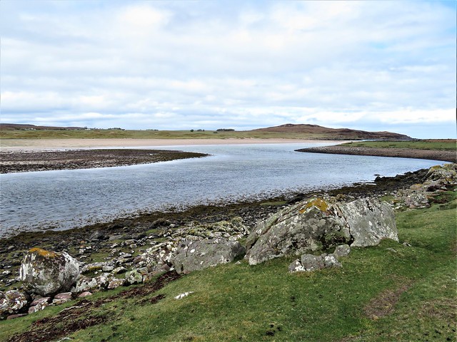
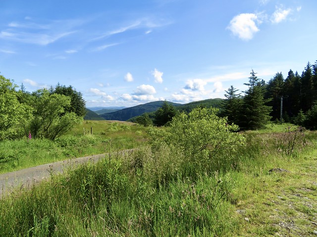
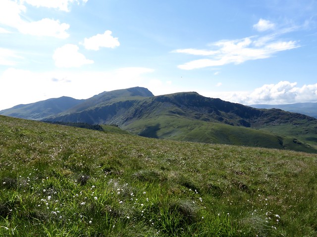
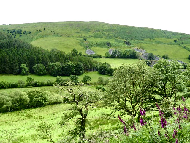
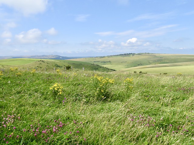
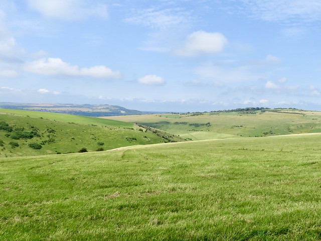
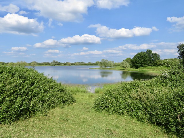
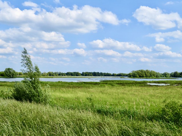
We stopped to admire the view over Tittesworth Reservoir, all the way southwest to where the lonely whaleback of the Wrekin topped the horizon forty miles off. Then we headed north into a cold wind.

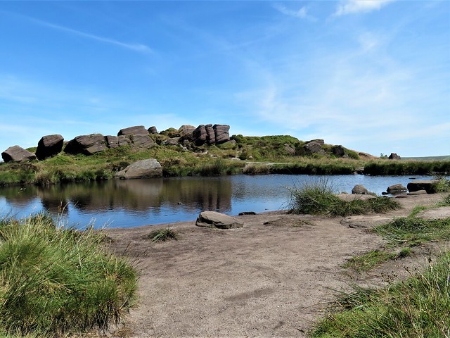
Doxey Pool was dimpled with rings as pond skaters darted sideways across the surface. Down in the peaty depths the hag Jenny Greenteeth waits to lure young men to their doom. Where does such a story originate? Maybe from the ogreish profiles that imagination conjures up on the weathered gritstone tors that cradle the pool.

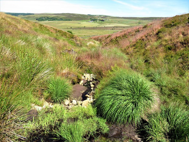
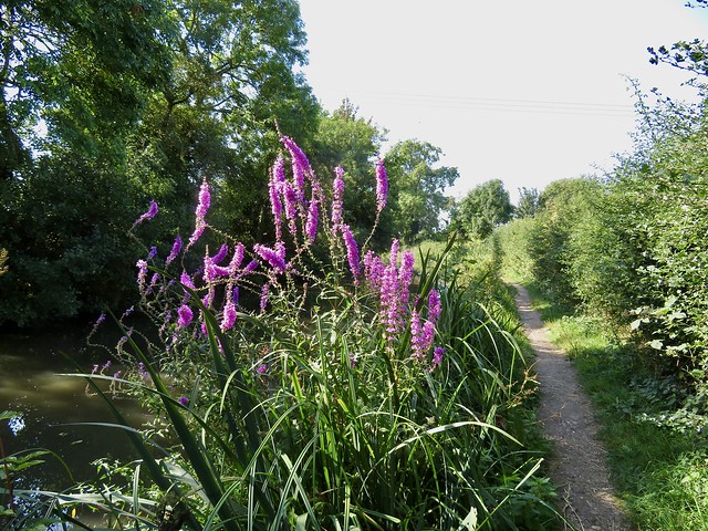
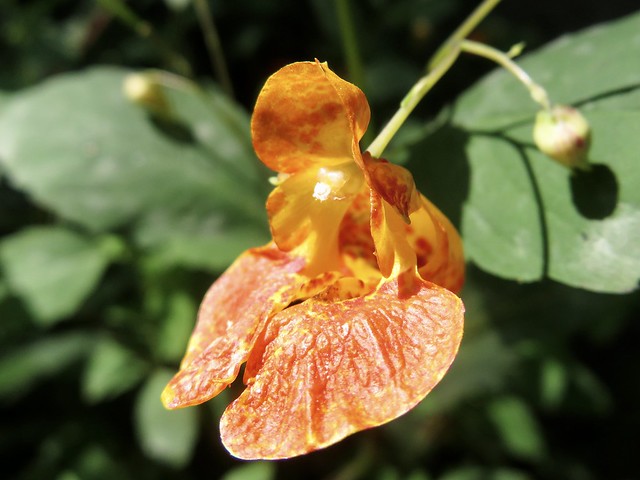
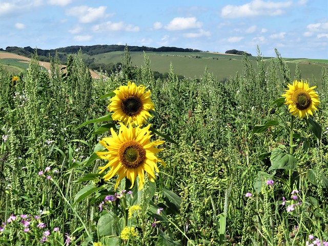
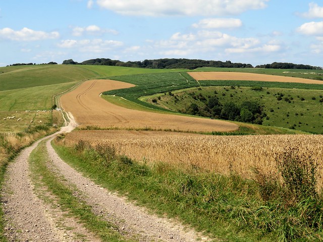
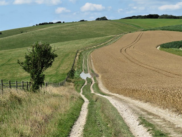
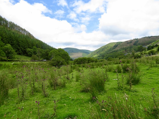
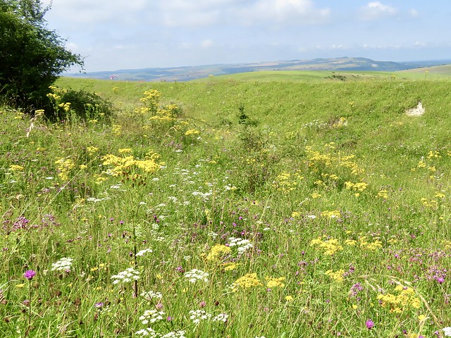
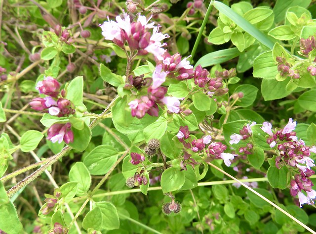
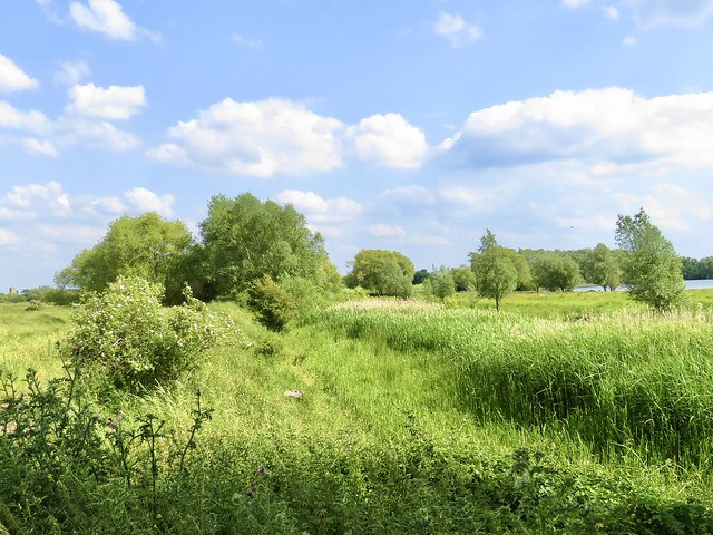
Beyond Doxey Pool we turned along a permissive path down a hillside shimmering with seedy grasses. A meadow pipit escorted us with admonitory cheeps. The last of the bilberries still hung among the leaves, and we plucked the shiny black fruit to savour the sweet/sharp juice that stained chins and finger ends.

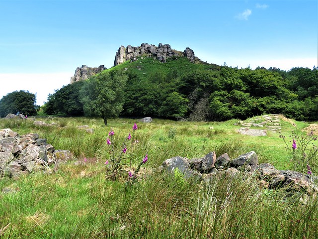
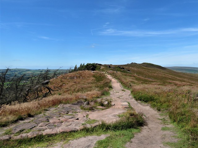
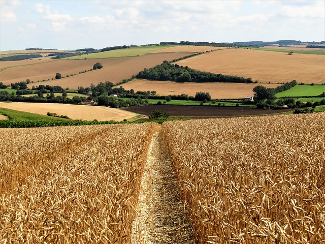
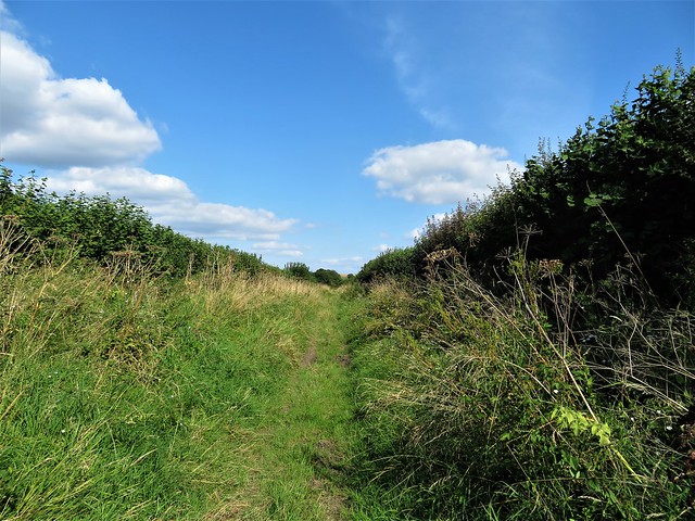
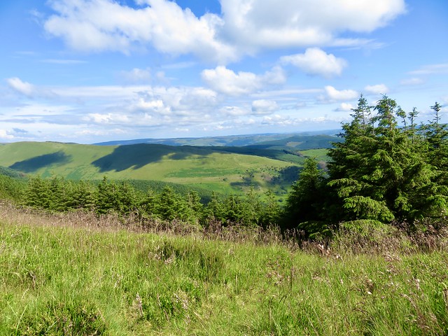
The homeward path led through beautiful meadows and cow pastures, with the crusty tors of Ramshaw Rocks on the skyline and the hedgehog hump of Hen Cloud ahead. We scrambled up there for a final view round the compass, before descending in afternoon sunshine among climbers and walkers full of chatter about the great day they’d all had.

How hard is it? 4 miles; moderate; short sharp climbs, uneven steps.

Start: Parking laybys, Roaches Road, Upper Hulme, ST13 8UA (OS ref SK 007615)

Getting there: A53 (Leek–Buxton); turn off at sign (‘Upper Hulme, Ye Olde Rock Inn’); in 150m fork left; parking bays in 1 mile.

Walk (OS Explorer OL24): 200m north of Windygates Farm drive, right through gate (006619); half left towards hut. Through gate (006620); right; in 100m left up through rocks. In 550m at T-junction, left uphill (005625, wooden fence); up rough steps; left along ridge path. Pass Doxey Pool (004628); in 350m, right over wall by wooden fence (003631). Permissive Path to road (007633). Right in 150m, right (fingerpost). At Shawtop Farm gate (009631), left (footpath sign); through fields (arrows, Access Land symbols). In 250m at gate on right (011629), keep ahead along drive, past Hencow Farm (013627, gates, yellow arrows/YAs). On through fields. At blue-topped arrow post, right (013625) and on (kissing gate, footbridge). In 300m cross stream (014622); up, keeping fence on left. In 300m fence turns left downhill (012620); ahead here through 2 gates; left down wall to cross Well Farm drive (011619). Gates, YAs down to cross stream; up to arrow post (011618) Right to saddle (009619); left up Hen Cloud (009615); return; left to road.

Lunch/Accommodation: Three Horseshoes, Blackshaw Moor, ST13 8TW ()1538-300296, 3shoesinn.co.uk)

Info: Leek TIC, Wed-Sat (01538-395530)

 Posted by at 07:45
Sep 172022


First published in: The Times Click here to view a map for this walk in a new window
Stratford-upon-Avon Canal near Wootton Wawen 1 Stratford-upon-Avon Canal near Wootton Wawen 2 Stratford-upon-Avon Canal near Wootton Wawen 3 Stratford-upon-Avon Canal near Wootton Wawen 4 Stratford-upon-Avon Canal near Wootton Wawen 5 Stratford-upon-Avon Canal near Wootton Wawen 6 Stratford-upon-Avon Canal near Wootton Wawen 7 Stratford-upon-Avon Canal near Wootton Wawen 8 monkey flower Stratford-upon-Avon Canal near Wootton Wawen 9

A hot late summer’s day in the Midlands, a hard blue sky overhead and the Warwickshire fields parched and pale. Cheery walkers slathered themselves in Factor 50 and set off under sunhats from the crowded View Café terrace just outside Wootton Wawen.

The sheep were too hot to budge from their shady patch under a sycamore tree as we walked among them towards the Stratford-upon-Avon Canal. Limp and still, the olive green water carried a greasy sheen winking with sunspots. Bees hummed soporifically around tall spikes of purple loosestrife, and passing narrowboaters could scarcely raise the energy for a wave.

A pair of swans came sailing by, two magnificent white yachts fore and aft of their dowdy brown dinghy of a cygnet. We crossed a cast-iron aqueduct and trudged on along the towpath in a pleasant stupor of sun and insect hum.

Bridge 49 hove up at last, its central railings ingeniously split to allow passage to a barge towrope without the necessity of unhitching the horse. We crossed the canal and set out across sun-baked pastures where tan coloured cattle stood in a bunch for coolness, fifty tails in motion as they whisked away the flies. A crowd of goldfinches, the liveliest elements in this heat-dazed landscape, foraged for thistle seeds with excited squeaks.

Beyond Kington Grange the path ran south, a wide view opening ahead over broad acres of well wooded Warwickshire countryside around Edstone Hall. Here was the setting for local Squire William Somerville’s epic poem of 1735, ‘The Chase’.

‘With airs soft-warbling, my hoarse-sounding horn
Invites thee to the chase, the sport of kings.’

Hunting, drinking and writing jingling verse were Somerville’s pleasures, and he ran through all his money indulging his lust for fun and a full glass. Dr Johnson damned him with faint praise: ‘His subjects are commonly such as require no great depth of thought or energy of expression … (but) he writes very well for a gentleman.’

We turned for home through the muddy pathways of Austy Wood where the canopy of larch, oak and ash filtered the sunlight to a cool dapple among myriad dried stalks of bluebells. As we crossed the last beanfield a dust-devil appeared, a miniature tornado that jinked in a spiral across the furrows, wrapping its invisible self in a veil of powdered soil before collapsing as mysteriously as it had arisen.

How hard is it? 6 miles; easy; canal towpaths, field and woodland paths

Start: The View car park, Hill Farm Marina, Stratford Road, Wootton Wawen, Warwicks B95 6DE (OS ref SP 160622)

Getting there: Bus X20, X50 (Stratford-upon-Avon to Henley-in-Arden) to Hill Farm Marina
Road: The View is signed from A3400 (Stratford-Henley)

Walk (OS Explorer 220): From kissing gate in top corner of car park, follow mown path across 2 fields to cross Stratford Canal at Bridge 54 (156627). Right (‘Monarch’s Way’/MW) along towpath for 1¾ miles. At Bridge 49, right across canal (172647); right over stile (yellow arrow/YA); half left across field to bottom left corner (173645). Ahead on field path to road (181643). Right past Cherry Pool Farm and Kington Grange. Opposite 2 Kington Cottage, right (182641) along lane. In nearly 1 mile, right at Cutler’s Farm (179628, MW, blue arrow). In 600m through gate into Austy Wood (MW); in 40m, left on woodland path (174629, YA). In 500m leave wood (171626); on along field path for ⅔ mile to A3400 (162622). Cross (take care!); right to bus stop; left to car park.

Lunch: The View Café (01564-627280, theview-eat.co.uk)

Accommodation: White Swan, Henley-in-Arden B95 5BY (01564-792623, thewhiteswanhotel.com)

Info: Henley-in-Arden Heritage Centre (01564-795919)

 Posted by at 01:32
Sep 102022


First published in: The Times Click here to view a map for this walk in a new window
Arnside from the Kent Estuary view north from Arnside Knott west over Kent Estuary towards Grange-over-Sands 2 view north from Arnside Knott west over Kent Estuary towards Grange-over-Sands view north from Arnside Knott over Kent Viaduct towards south Lakeland fells 3 view north from Arnside Knott over Kent Estuary towards south Lakeland fells view north from Arnside Knott over Kent Viaduct towards south Lakeland fells 2 view north from Arnside Knott over Kent Viaduct towards south Lakeland fells Arnside from the Kent Estuary 2 looking west along Kent estuary from Grubbins Wood towards Blackstone Point looking west along Kent estuary from Grubbins Wood towards Blackstone Point 2 looking west along Kent estuary from Grubbins Wood towards Blackstone Point 3

A rich scent hung over Arnside, the smell of the sea and of new mown hay. They were raking the fields on one side of the station, while on the other the tide was going out along the Kent Estuary towards the sandy immensities of Morecambe Bay.

We climbed up a walled lane away from the little resort town, peaceful green paths leading into Red Hills Wood. ‘Beautiful bluebells here in spring,’ confided the dog-walking lady we met on the path, ‘and you should just see the wild daffodils down at Far Arnside.’

From the crest of Arnside Knott we got a most sensational view. Huge sprawling sands were uncovering themselves as they slid free of the sea’s grey blanket, the River Kent a sinuous coil of silver, its seaward movement seen as a writhing snake among the tan and mauve sandbanks. To the north and west, beyond a green apron of marshland fringing the estuary, stood the rugged profiles of the Furness Fells and the outlying fells of south Lakeland. The fingers of other peninsulas reached their long tips out into the margin of the great sands.

We crossed the grassy top of Arnside Knott among juniper, yew, gorse and brambles. A solitary walker inched like an ant far below, dwarfed by the sands he was striding on. A topograph gave further clues about the distant peaks and ridges to the north – Helvellyn and Striding Edge, Skiddaw and Bowfell, Coniston Old Man and the westward hump of Black Combe – all these in view from the Knott’s modest elevation of 770 ft.

Down at Park Point we found a slanting ledge of rock from which to scramble down onto the shore. Jane went barefoot on the ribbed sand while I clambered over the limestone rubble in boots, looking for fossils. Rounding Blackstone Point we found the outgoing Kent’s channel suddenly near at hand, with a fine view up the estuary to the centipede legs of Arnside’s railway viaduct.

We reached the resort in time for an ice cream with the tide still ebbing. Arnside was a busy port till the 1850s, when the building of the viaduct caused the harbour to silt up. Then tourism took over, a new source prosperity for the little town with the mighty views.

How hard is it? 6½ miles; moderate; woodland and shore paths

Start: Arnside railway station, Cumbria LA5 OHJ (OS ref SD 461788)

Getting there: Rail to Arnside. Bus 551 (Kirkby Lonsdale).
Road: Arnside (B5282) is signed from Milnthorpe on A6 (M6, Jct 36)

Walk (OS Explorer OL7): From station, left along road. Pass Milnthorpe turn; in 100m, right (‘Silverdale Road’ fingerpost). Right at Silverdale Road (459783). In 200m left (457784, ‘Arnside Knott’). In 150m, left (456784, ‘High Knott Road’); bend left by ‘Windrush’; in 250m, right (457783, ‘The Knott’) through Red Hills Wood. Through kissing gate onto open ground (456780); head uphill to bench and gate (456776). Follow main path to another bench and on, soon descending. Round sharp left bend (452772); down through gate in wall (452770). Ahead on path outside trees. At Hollins Farm, right (451766, ‘Far Arnside’). At road, right (450764, ‘Park Point’); ahead through holiday park. At Shore Close fork right (‘Bridleway); at Knott Drive fork left. Follow woodland path back to Arnside.
Low tide option: Descend to shore just north of Park Point (437769); shore path back to Arnside.

Conditions: Woodland path from holiday park is stony and stumbly; shore option is for low or falling tide.

Lunch/Accommodation: Fighting Cocks, The Promenade, Arnside LA5 0HD (01524-761203, fightingcocksarnside.co.uk)

Info: Arnside AONB Centre (01524-761034)

 Posted by at 01:27
Sep 032022


First published in: The Times Click here to view a map for this walk in a new window
golden wheatfields leading to Cold Kitchen Hill speckled wood butterfly looking back from the path to Cold Kitchen Hill path towards Cold Kitchen Hill Woodcombe Bottom from Cold Kitchen Hill looking from Cold Kitchen Hill towards Bushcombe Bottom and Woodcombe Bottom pheasant crop on Cold Kitchen Hill wheatear on the path ridge track on Cold Kitchen Hill 1 ridge track on Cold Kitchen Hill 2 ridge track on Cold Kitchen Hill 3 looking east from Whitecliff Down east from the foot of Whitecliff Down green lane back to Longbridge Deverill

Strong morning sunlight threw into prominence the lumpy shapes of house foundations and sunken lanes, all that remains of the medieval village of Hill Deverill.

In the green lane that led west towards the Wiltshire downs, a bench had been placed in the shade of a field maple. ‘Bob Hembury,’ said the memorial plaque. ‘He loved to walk this lane every day with his dog’. A man and a place summed up with perfect simplicity.

At the roots of a coppiced hazel badgers had dug out the multiple entrances to their subterranean city, throwing back the pale chalky earth in showers as though miniature shells had exploded there.

A side lane led up between wheat and barley fields onto the rolling back of Cold Kitchen Hill. In pre-Roman times it was Col Cruachan, the ‘wizard’s hill’, perhaps in deference to the spirits of the Neolithic long barrow that lies at the crest of the down. A wonderful bronze brooch was unearthed here, a rider on a capering horse, his clubbed hair bouncing behind him.

At the crest of Cold Kitchen Hill a magnificent view unfolded, a great semi-circle of undulating downs patterned in green, tan and grey, folding in steep hollows to the level farmland below. The ridge track ran west, a white streak ribboning away through dull gold wheatfields past the iron cresset of a Jubilee beacon, with King Alfred’s Tower at Stourhead a pointed finger raised on the distant skyline.

Steep-sided Bushcombe Bottom sank out of view, a green basin down whose flanks the bushes and trees appeared to be sliding towards an invisible plughole. We followed the track through grasses awash with the pale purple fronds of bartsia, looking down into the horseshoe of Woodcombe Bottom three hundred feet below.

Down through a nameless wood of old oak and beech, its floor thick with the dried-up seed heads of last spring’s bluebells, and out at the bottom to turn along the homeward track at the foot of the downs.

In a grassy meadow by the path a rough square block of stone carried the names and dates of Joan and Bernard Russell. No other clues about them, but they, like Bob Hembury and his dog, must have loved this beautiful corner of countryside.

How hard is it? 6¾ miles; easy; green lanes, downland tracks, muddy in parts.

Start: George Inn, Longbridge Deverill, Warminster BA12 7DG (OS ref ST 869408). Please ask parking permission, and give them your custom.

Getting there: Bus 57 (Warminster-Mere)
Road: Longbridge Deverill is on A350 (Warminster-Shaftesbury)

Walk (OS Explorer 143): Right along A350, in 100m, right (‘The Deverills’). In 500m, past ‘Stonewold’, right (868403, fingerpost/FP) up field. At top, 2 opposing gates (865404); through right-hand gate along lane. In 700m at crossroads, left (859402, ‘Restricted Byway’, bridleway FP) up hedged lane. In ½ mile, right through gate (860395); in 100m, over rusted-up gate; fork left (ignore ‘Permissive Path’) up to gate (858395, yellow arrow). Up field to FP (858394); on past tree clump. In 300m, successive gates (854391, FP); on past barrow mound (847383), Cold Kitchen Hill trig pillar (846382) and beacon cresset (841391). In another 900m on Whitecliff Down, keep ahead (834386), following fence on left. In ½ mile, track curves sharp right away from fence (827389), round top of Woodcombe Wood. In 250m fork left (828391, gate, FP, ‘Mid Wilts Way) through trees. At bottom of slope, through gate (828399); right (orange arrow, ‘Byway’) along path/lane at foot of downs for 3¼ miles back to Hill Deverill, then Longbridge Deverill.

Lunch/Accommodation: George Inn, Longbridge Deverill (01985-840396, the-georgeinn.co.uk)

Info: visitwiltshire.co.uk

 Posted by at 02:05
Aug 202022


First published in: The Times Click here to view a map for this walk in a new window
Achnahaird Bay 1 Achnahaird Bay 7 Achnahaird Bay 2 Achnahaird Bay 3 Achnahaird Bay 4 Achnahaird Bay 5 Achnahaird Bay 6 Garvie Bay 1 Camas a' Bhothain ejecta studded with papilli from the asteroid collision 1.2 billion years ago stromatolite in the middle foreground - Europe's oldest life form otter at play otter at play 2 drinker moth caterpillar? Stac Pollaidh beyond the Garvie bridge

The rugged peninsula of Coigach in north-west Scotland is famous for its wild beauty and its geological treasures. Peter Drake, sea fisherman and our companion on this walk, was a prime mover in establishing the 45-mile Coigach Geotrail round the shores of the peninsula.

Orange bladder wrack lay draped on the slabs of ancient red sandstone fringing Achnahaird Bay. Cast up here we found a knob of Lewisian gneiss, banded in pale and dark grey, three thousand million years old. This rock was formed when the Earth’s crust had not even properly solidified.

On the grassy headland an otter was leaping and bounding, a lithe shape full of energy, suffused with joy in its own existence. Later we saw it rolling on its back in the bay, crunching up a fish held between its front paws.

In the bay of Camas a’ Bhothain stood a ruined salmon bothy. Beyond ran a layer of rock in red-grey sheets pressed close together. ‘The oldest inhabitants of Coigach,’ stated Peter. This very finely layered limestone is a stromatolite, a structure created by microbes that clung to rocks around the shore of a lake some thousand million years ago. It represents the earliest form of life yet discovered in Europe.

On the shore beyond the bay, a smear of red rock told a dramatic story. Around a billion years ago an asteroid measuring half a mile across slammed into the planet at 25,000 miles per hour, a dozen miles away from where we stood. The shock of the impact liquidised the Earth’s crust in the vicinity and spattered it far and wide in a splash of ejecta or molten rock.

Stuck in the ejecta we found greenish fragments of the asteroid itself, and a sprinkling of tiny globules like acne on a teenage face – the spherical lapilli or droplets of molten rock that cooled and hardened as they fell out of the sky from the massive volcanic cloud which billowed up above the site of the strike.

We rounded the corner of the peninsula and found ourselves staring at an eastern skyline clouded but magnificent – the mountains of Inverpolly, horizontally striped sandstone some thousand million years old, all that’s left of the landscape that lay here before the giant glaciers of the Ice Ages scraped most of it away. Cloud filled Inverpolly and streamed in a thin gauze from the tall butte of Stac Pollaidh and the twin horns of Suilven. It was a magnificent spectacle to accompany the homeward hike over bog and heather.

How hard is it? 6½ miles; moderate; rough boggy walking, with boulders and slippery rocks underfoot in places

Start: Loch Raa car park, Achnahaird IV26 2YT approx. (OS ref NC 021123)

Getting there: Bus 811 (Ullapool-Achduart)
Road – Achiltibuie is signed off A835 Elphin-Ullapool road; Loch Raa car park is about 2½ miles north of Achiltibuie.

Walk (OS Explorer 439; downloadable trail map and notes at visitcoigach.com): From Loch Raa car park, head north along west side of Achnahaird Bay, either on shore or along sheep path near cliffs. In 1¼ miles cross deer fence (023142; stile). Follow coast to salmon bothy ruin in Camas a’ Bothain (029145). Continue across neck of Rubha a’ Choin peninsula (034146). Along rocky beach; up headland and turn right to cross deer fence (038142). Continue south down Garvie Bay, then along west bank of river to road bridge (040129). Right for 1½ miles to car park.

Lunch: Picnic from Achiltibuie Stores (01854-622496); Summer Isles Hotel (01854-622282; summerisleshotel.com)

Accommodation: Acheninver Hostel (comfortable sleeping pods) – 07783-305776; acheninverhostel.com

Info: visitcoigach.com; nwhgeopark.com; visitscotland.com

 Posted by at 06:30
Aug 132022


First published in: The Times Click here to view a map for this walk in a new window
Aberllefenni - fence of slates Sarn Helen Roman road on the way down to Aberllefenni view from the ridge Cadair Idris from the ridge 1 Cadair Idris from the ridge 2 looking north from the ridge looking east from the ridge bridge at Aberllefenni view from the path at Aberllefenni 1 slate miners' chapel, Cwm Ratgoed rush fields of Cwm Ratgoed looking down towards Cwm Ratgoed start of the path from Aberllefenni slate mine spoil heaps, Cwm Ratgoed view from the path at Aberllefenni 2

A sunny midday with steamy clouds lifting over the hills of mid-Wales. The slopes around Aberllefenni were littered with screes of broken stone, evidence of the former occupation of this village where the dark blue slate has been mined since medieval times.

Slate is still processed here – slate from as far away as China – but Aberllefenni lies as quiet as can be these days. In the neighbouring valley of Cwm Ratgoed, once the scene of intense quarrying activity, sheep cropped the slopes among the mine levels. Each tunnel mouth spouted a fan of spoil, as though giant rabbits had been burrowing.

The trackbed of an old tramway led past slate workshops, cottages and a chapel, all in ruins, all of black slate blocks. The mine manager’s house, Ratgoed Hall, overlooked the workings from its garden eminence. There was a tremendous poignancy to these stark mementoes of vanished industry in the peaceful green valley.

From Cwm Ratgoed we started on a long, steady climb through the forestry of Ffridd Newydd. The path led steeply up between larch and pine, the banks either side thick with star mosses, lichens and the green platelets of liverworts kept moist by the trickling hill streams.

Sunlight filtered through the tall bare trunks of the conifers and fell in bars across the path, but there were no far views until we’d reached the ridge above the forest. There one of the finest panoramas in Wales burst on us all of a sudden, many scores of miles of hills and mountain peaks, with the centrepiece immediately to the south-west, a wonderful prospect of Cadair Idris in full sunlight.

The mountain lay so big and so close it came as a physical shock after being so long enclosed among the trees. Its two shadowed corries gave it the aspect of a blunt-headed creature peeking over its shoulder. It was an awe-inspiring sight, one that commanded attention until the path dipped, the forestry rose and Cadair Idris lay hidden once more.

The old Roman marching road of Sarn Helen dropped us by easy degrees back down to Aberllefenni’s rubbly slopes, its stone slides and spoil banks, and a great square cave mouth that led into the old slate mine, a dark door into the hillside high above.

How hard is it? 8 miles; demanding walk, with long upward climb on forest path

Start: Bus stop/layby at crossroads on north edge of Aberllefenni, near Corris, SY20 9RU approx. (OS ref SH 771100)

Getting there: Bus 34 (Machynlleth)
Aberllefenni is signed from A487 (Machynlleth – Dolgellau) at Corris

Walk (OS Explorer OL23): Uphill on lane (‘Unsuitable for caravans’). In 150m, left up stony track (yellow arrow/YA, fern carving). In 500m round left bend (775104); in 400m, fork right down to valley road (774107). Dogleg right/left (YA); follow YAs along track. In 1 mile pass Ratgoed Hall (730121). In 400m track bends left towards Dolgoed (779125). Don’t go through gate, but bear left along fence to another gate; down to ford river opposite Ceiswyn (778125). Left (YA); follow track to enter forest (777123). In 400m, hairpin back right up path (777119) past fire-beater stand. In 200m cross rough forest roadway; on up track, then path to cross another forest track (775124). On up steep path. In ¾ mile, at top of climb, you reach open grassy area. Steeply up left on faint zigzag path to fence and ladder stile (768134). Ahead (waymark post) downhill for ⅔ mile to moor road (758134). Left for 2¾ miles to Aberllefenni.

Lunch: Picnic

Accommodation: Gwesty Minffordd Hotel, Tal-y-llyn, Tywyn LL36 9AJ (01654-761665, minffordd.com)

Info: visitwales.com

 Posted by at 01:34
Aug 062022


First published in: The Times Click here to view a map for this walk in a new window
Staithes village, harbour and cliffs Cliffs and scars  between Staithes and Port Mulgrave 1 Cliffs and scars  between Staithes and Port Mulgrave 2 Staithes harbour at low tide Cliffs and scars  between Staithes and Port Mulgrave 3 Staithes harbour and cliff Staithes village, harbour and cliffs What Staithes is proud of! Looking back at Staithes Staithes harbour and cliffs

A cold, cloudy day on the coast of North Yorkshire as we went down a twisty street between the closely packed houses of Staithes. The fishing village where in the 1740s young James Cook began to dream of running away to sea is a tumble of red roofed houses and steep little laneways.

A couple of cobles – local fishing boats with pointed prow and stern, Norse style – lay in the low-tide mud of Staithes harbour, a scoop of defensive walls facing the North Sea between dramatically striated cliffs with razor edge profiles.

From the cliffs above, we got a wonderful view over the many-coloured houses of the village and the rugged coast marching away north-west towards the distant giant’s geometry of industrial Teesside.

The massive buildings of Boulby mine, just inland of Staithes and still extracting rock salt and natural fertilisers, stood witness to the mineral riches that have been dug for centuries from these varicoloured cliffs – alum, potash, coal, jet and iron ore.

Below the cliffs, wide rock pavements ran out seaward, the sea roaring softly at their outer extremities. Fulmars and rock pigeons swooped with the thermals. Bands of ironstone and smeary greys of mudstone lined the cliffs, the harder ironstone outcropping in sharp-featured knobbles and crags.

At Port Mulgrave a steep path led downhill from the line of clifftop houses as far as a seat. The landslips of this unstable coast have destroyed the former hair-raising descent by ladder and rope down the lower half of the cliff. On the dark rocky shore below, a famous fossil-hunting spot, three or four cobles lay on the scars beyond a line of home-built fishermen’s huts. The crumbly cliffs stood guard all round, walling off this little world apart where a great ironstone mine once fed the blast furnaces of Teesside.

Past a terrace of former miners’ cottages with outside privy sheds, and out beyond Hinderwell across deep little stream gorges in dense woodland of sycamore and hazel. A nuthatch with a slate-blue back, buff waistcoat and dashing black eye stripe scuttled head nethermost down an oak trunk, searching the bark for insects. We topped out of the woods and crossed sheep pastures corrugated with medieval ridge-and-furrow, heading north towards Staithes where a pale blue sky hung over the invisible sea.

How hard is it? 5½ miles; strenuous in parts, steep woodland valleys

Start: Staithes car park, Staithes TS13 5AD (OS ref NZ 782185)

Getting there: Bus X4 (Middlesbrough-Whitby)
Road – Staithes is signed off A174 (Guisborough-Whitby)

Walk (OS Explorer OL27): Follow ‘Footpath to village.’ At harbour, right up Church Street; follow Cleveland Way/CW for 1¼ miles to Port Mulgrave (Optional detour – by first houses/796177, fingerpost points left down steep path to seat and viewpoint over shore. Return same way). In 200m, right/inland off CW (799175). At churchyard, left to cross A174 at Hinderwell (791169). Ahead down close; ahead up laneway; right along terrace. Follow alleyway, then footpath (fingerpost, yellow arrows/YA) across fields into woodland (785167). Down to cross Dales Beck. Keep same direction up, over and down to cross Borrowby Dale (781166). At foot of steps, right up woodland path to gate (781167). Half right across field; right (YA) past Plum Tree House (780171). On (YAs) across fields. At ‘Borrowby’ fingerpost cross 2 stiles (779175); follow right-hand hedge down to cross Dales Beck (780176). Right (‘Staithes’) up bank, past Seaton Hall to A174 (782180). Left to roundabout; right into Staithes.

Lunch: Cod & Lobster Inn, High Street, Staithes TS13 5BH (01947-840330, codandlobster.co.uk)

Accommodation: Captain Cook Inn, Staithes Lane, Staithes TS13 5AD (01947-840200, captaincookinn.co.uk)

Info: Whitby TIC (01723-383636); yorkshire.com

 Posted by at 01:52
Jul 302022


First published in: The Times Click here to view a map for this walk in a new window
flowery ditch of The Caburn hill fort 1 chalk track leading to The Caburn hill fort flowery ditch of The Caburn hill fort 2 flowery ditch of The Caburn hill fort 3 at the top of Caburn Bottom flowery ditch of The Caburn hill fort 4 wild marjoram growing in Bible Bottom looking down towards Oxteddle Bottom and Bible Bottom Wall butterfly

On a warm midday the half-moon shapes of paraglider sails – green, pink, yellow and rainbow – were wheeling in cloudy air off Mount Caburn. Looking south from the summit of the Iron Age ceremonial enclosure, we watched the paragliders swooping this way and that against a backdrop of the silvery sinuation of the River Ouse as it carved its way seaward through the chalk rampart of the South Downs.

The diminutive brick-and-flint estate cottages of Glynde lay neatly stretched below. A tufted path, jumping with grasshoppers, had led us up from the village, a straight course between fields of dusty ripe barley, the bearded seed heads hanging low. In a tin cattle trough a meadow pipit was bathing ecstatically, throwing up sparkling showers of water drops.

Wild flowers dotted the chalk grasslands of Mount Caburn – eyebright, tall yellow spikes of agrimony, red bartsia, and masses of wild marjoram where wall butterflies with dark spots and bars on their yellow wings were basking in the sun.

The 2,500-year-old ditch round the hilltop enclosure was spattered with blue flowers – scabious, harebells and viper’s bugloss – among which flitted blue butterflies. The same theme of chalk grassland flowers and butterflies continued all along the path that dropped down a slope of Access Land into a tangle of dry flat-bottomed valleys.

In Oxteddle Bottom faint foundations in the grass showed where winter sheds for plough oxen stood in medieval times. Bible Bottom’s enclosure was too well camouflaged under grass and wild vegetation to make out. We picnicked on a bank of marjoram, the bushy pink flowers exuding an oily pungency.

It was a scene straight out of an Eric Ravilious painting. Sheep were grazing these valleys as they have done for centuries. Although a Sussex shepherd of past times might have blinked at the sight of the farmer puttering up the slope of Bible Bottom on a quad, little else has changed here over the years.

Up on the nape of the downs we turned for home as views opened up to the north over the broad hedged lowlands of the Sussex Weald, a vista in total contrast to the billowing downs to the south. We threaded between Bronze Age burial mounds and old chalk quarries before turning off down the long path to Glynde, with the dimpled green wall of the South Downs beyond.

How hard is it? 5½ miles; easy; downland footpaths

Start: Glynde railway station, Lewes, East Sussex BN8 6RU (SO ref TQ458087)

Getting there: Rail to Glynde; bus 125 (Lewes – Eastbourne)
Road: Glynde is signed off A27 Lewes-Eastbourne

Walk (OS Explorer OL25): From station, left; in 300m left (457090, Ranscombe Lane); in 40m, right (gate, yellow arrow/YA) on field path for ¾ mile to ridge. At gate in ridge fence (445093), left to The Caburn (444089). Return towards gate; 100m past outer ditch of hillfort, left (444091) on path down Caburn Bottom. At bottom, ahead (440097) along Oxteddle Bottom. At pond, right-hand gate (437099, permissive path); in 300m bear left; cross stile (437101). Follow fence on left; in 400m, chalk path (433101) up to gate (431101). Ahead (YA) to post (430100, YA); right. In ¾ mile at Southerham Farm notice, kissing gate (442105); past waymark post, then wood on left. In 200m pass dewpond; before stile, right along fence (447105). In 300m fork left (466103), up to stile; on with fence on right. In ½ mile, left at gate on right (445093); retrace steps to Glynde.

Lunch: Little Cottage Tea Rooms, Ranscombe Lane, Glynde BN8 6ST (01273-858215, littlecottagetearooms.co.uk)

Accommodation: Ram Inn, Firle BN8 6NS (01273-858222, raminn.co.uk)

Info: glynde.co.uk
@somerville_c

 Posted by at 02:40
Jul 232022


First published in: The Times Click here to view a map for this walk in a new window
lush landscape of Fen Drayton Lakes 1 lush landscape of Fen Drayton Lakes 2 lush landscape of Fen Drayton Lakes 3 lush landscape of Fen Drayton Lakes 4 lush landscape of Fen Drayton Lakes 5 lush landscape of Fen Drayton Lakes 6 beautiful bellflowers amid the lush landscape of Fen Drayton Lakes lush landscape of Fen Drayton Lakes 7 lush landscape of Fen Drayton Lakes 9

It took a noisy age for the car to crunch down the obscure gravelly byroads leading to Fen Drayton Lakes Nature Reserve. Once out along the trails that weave among these former gravel pits, there was bird squeal and chatter from every thicket and reed bed.

Dunnocks chip-chipped away in the dogrose hedges, coot squawked from the reedy fringes of Ferry Lagoon, and a blackcap unwound its melodious string of a call from a hiding place in the branches of a massive, many-stemmed willow.

The RSPB sees that the trail paths are well mown, and the grass and undergrowth are kept flattened by the boots of thousands of birdwatchers and strollers. This sunny afternoon, gravelly patches were smeared over by bright yellow stonecrop flowers. A new hatch of damselflies made the most of the hot sunshine, their electric blue needle shapes hovering delicately over nettle beds and grass for a second or two, then vanishing, to rematerialize three feet away

A stretch of paths led us beside the sinuous Great Ouse, where a bare-chested lad proudly helmed his hired river cruiser. Glossy brown cattle munched dewlap-deep in dense grass pasture, flicking their tails rhythmically against the flies. A spotted dog stood guard over a pair of fishing poles while its master caught forty winks in the shade of an umbrella.

We turned off along the banks of a navigation drain thick with yellow water lilies. From the reeds on Swavesey Lake a grasshopper warbler issued a song like the buzz of a fisherman’s reel. With distant cuckoo calls as a farewell we left the lake reserve and headed for Amen Corner.

In times past the fen village of Swavesey had more than its share of religious Nonconformists. Primitive Methodists, Ranters, Quakers, and a raft of Baptists – Unitarians, Trinitarians, Particular and Strict, among others. After their clandestine meetings further out in the wilds, many of these dissenters would gather at the piece of ground called Amen Corner, just outside the village boundary, for a final prayer and a last ‘Amen’.

Today a peaceful little Nonconformist graveyard lies here, next to the village allotments. We set course past Swavesey windmill, topped with an exotic onion dome, and were back among the lakes of Fen Drayton in time to hear the evening chorus from briar and bush, and to watch crook-winged common terns diving headfirst into the meres for their last catch of the day.

How hard is it? 4½ miles; easy; well maintained, level paths

Start: RSPB Fen Drayton car park, Holywell Ferry Road, Fen Drayton CB24 4RB (OS ref TL 343699)

Getting there: Fen Drayton Reserve is signposted off Fen Drayton Road between Fen Drayton and Swavesey (A14, Jct 24)

Walk (OS Explorer 225; trail map downloadable at rspb.org.uk/fendraytonlakes): From car park, left along Holywell Ferry Road (track). In 500m, right (342704, ‘Riverside path’). In ¾ mile, just before footbridge, right (352701, ‘Trails’). In 300m, left across Covell’s Drain, right along embankment. At gate, left (353696, ‘Swavesey’). In 400m cross busway (356695; take care, buses drive fast!) In 700m at Amen Corner cemetery (359690), right past Swavesey Windmill (353688). In ⅔ mile cross roadway (350686) and on. In ⅔ mile cross bends of a farm road and keep ahead on footpath (341686). In 200m, right (339686, ‘Public Byway’). Keep ahead where track bends right (340690). In 100m pass car park and on. In 650m recross busway (339696). In 500m, right (339700, ‘Car Park 250m’) to main car park.

Lunch: Picnic

Accommodation: Golden Lion, Market Hill, St Ives, Cambs PE27 5AL (01480-412100, thegoldenlionhotel.co.uk)

Info: Fen Drayton Lakes RSPB Reserve (01954-233260, rspb.org.uk/fendraytonlakes)

 Posted by at 01:52
Jul 162022


First published in: The Times Click here to view a map for this walk in a new window
Coast path near Kingsdown The beach at Kingsdown coast path along the cliffs between Kingsdown and St Margaret-at-Cliffe 1 path over the downs coast path along the cliffs between Kingsdown and St Margaret-at-Cliffe 2 St Margaret’s at Cliffe 1 Coast path, looking to the Dover Patrol memorial 1 St Margaret’s at Cliffe 2 Coast path, looking to the Dover Patrol memorial 2 St Margaret’s at Cliffe 3

A glorious day of blue sky over the coast of East Kent. At Kingsdown the white chalk cliffs shone in clear light polished and sharpened by sea and sunshine. Along the pebbly shore stood old iron winches, rusted into immobility by salt-laden water and winds. Decades have passed since the village fishermen used them to haul their boats up the steeply shelving beach.

We climbed the steps at the end of Oldstairs Bay and set out on the cliff path with a stiff north breeze pushing us along. A kestrel balanced on the wind, infinitely fine adjustments of wings and body keeping it in place. Looking back, we saw a line of white cliffs curving east beyond the murky waters of Pegwell Bay, Ramsgate’s buildings lying low along the shore, the red roofs of Broadstairs cresting their rise of ground beyond.

The green sea heaved gently below, reflecting a light clear enough for us to pick out the coast of France some twenty miles off – field shapes, woods, radio masts and a long pale line of sandy beaches. Air balloons, stringbag aeroplanes, greasy swimmers and long-range shells from coastal guns – all have crossed that narrow stretch of sea, but never an invading army for the past thousand years.

One dastardly enemy of England did launch a deadly stroke against the capital from these Kingsdown cliffs – arch-villain Sir Hugo Drax with his ogre’s-teeth and sweaty ruin of a face. Lucky for all of us that James Bond was on hand to frustrate his knavish tricks and redirect the London-bound Moonraker rocket to plunge to its destruction in the sea.

Ian Fleming, Bond’s creator, had a holiday home at St Margaret’s-at-Cliffe, just along the coast. We came by the spot where Fleming had Drax’s men collapse the cliff onto 007, near a tall obelisk commemorating the brave Great War deeds of the Dover Patrol. Just beyond we found a magnificent view over the tight, cliff-encircled bay that cradles St Margaret’s, and a zigzag of steps running down to the pebbly shore.

The homeward path led across inland fields sown with winter cereals, a landscape of long parallel valleys and tufts of woodland, with the sea diminished to a green backdrop caught in a vee between one slope and the next.

How hard is it? 6¾ miles; easy; cliff and field paths

Start: Cliffe Road, Kingsdown CT14 8AH (OS ref TR 380482).

Getting there: Bus 82 from Deal
Road: Kingsdown is signed off A258 between Walmer and Dover.

Walk (OS Explorer 138): Coast Path south for 2¾ miles to St Margaret’s-at-Cliffe. ½ mile past Dover Patrol monument, left down steps to shore (369446; yellow arrow). Right to seafront. Up road beside Coastguard PH (368445). On right bend, ahead up steps (367444, fingerpost/FP). Fork right at top to road (366444); right, in 150m, fork left on Hotel Road. In 100m, left (368445, FP) up steps; on up Cavenagh Road; on up grass path (FP) to The Droveway (366448). Right; follow road for ⅔ mile to Bockhill Farm. 150m beyond farm, left at path junction (372455). Keep ahead up field margin path; in 600m it bends sharp left, through kissing gate; in 100m, right down tarmac track (367459, cycleway No 1). In 400m pass tall pole on left (368464); in 100m, left through hedge; half right on path across field. In 1 mile keep left of houses (373478) to road (374481). Left; right down Upper Street into Kingsdown.

Lunch: Coastguard PH, St Margaret’s, CT15 6DY (01304-853051, thecoastguard.co.uk)

Accommodation: Five Bells, Ringwould CT14 8HP (01304-364477, fivebellsringwould.co.uk)

Info: Dover TIC (01304-201066)

 Posted by at 03:40